Embed Size (px)
Citation preview

APPENDIX G
CULTURAL RESOURCES INVENTORY,
SHPO AND TRIBAL CONSULTATION

CULTURAL RESOURCES REPORT COVER SHEET Author: Mini Sharma, Jason Allen, R. Todd Baker, and Stephanie Butler Title of Report: Cultural Resource Inventory for the Grove Field Airport, Clark County,
Washington
Date of Report: March 2010 County (ies): Clark Section: 26 Township: 2N Range: 3E
Quad: Lacamas Creek Acres: 16.1
CD Submitted? Yes No PDF of Report? Historic Property Export Files? Archaeological Site(s)/Isolate(s) Found or Amended? Yes No TCP(s) found? Yes No Replace a draft? Yes No Satisfy a DAHP Archaeological Excavation Permit requirement? Yes # No
Please submit paper copies of reports unbound.
Submission of PDFs is encouraged.
Please be sure that any PDF submitted to DAHP has its cover sheet, figures, graphics, appendices, attachments, correspondence, etc., compiled into one single PDF file.
Please check that the PDF displays correctly when opened.
DAHP Archaeological Site #:

Cultural Resources Inventory for the Grove Field Airport Improvement Project,
Clark County, Washington
Prepared for: WH Pacific, Inc Prepared by: SWCA Environmental Consultants 434 NW Sixth Ave., Suite 304 Portland, OR 97209-3652 503-224-0333, fax 503-224-1851
March 2010

SWCA Environmental Consultants 434 NW Sixth Avenue, Suite 304
Portland, Oregon 97209-3652 503-224-0333
www.swca.com
Lead Federal Agency Federal Aviation Administration
County: Clark County Legal Location: T2N, R3E, Section 26
USGS 7.5-minute quad: Lacamas Creek, WA Type of Project: Intensive Surface Survey and Limited Subsurface Probing
Results of Survey and Subsurface Probing: Positive Field Notes: On file at SWCA, Portland Office
SWCA Project Number 14597
March, 2010
Cultural Resources Inventory for Grove Field Airport SWCA Project No. 14597
i
Cultural Resources Inventory for Grove Field Airport SWCA Project No. 14597
ii
CONTENTS
INTRODUCTION .......................................................................................................................... 1 Project Area Description ......................................................................................................... 2 Environmental Setting ............................................................................................................. 6
ETHNOHISTORIC BACKGROUND ............................................................................................. 7
LITERATURE REVIEW ..............................................................................................................10 Archaeological and Historic Site File Search ........................................................................ 10 Archaeological Predictions.................................................................................................... 12
METHODS .................................................................................................................................. 12 Archaeological Fieldwork ...................................................................................................... 12 Historic Properties Inventory ................................................................................................. 19
INVENTORY RESULTS ............................................................................................................. 20 Archaeological Sites.............................................................................................................. 20 Aboveground Structures ....................................................................................................... 24
CONCLUSIONS AND RECOMMENDATIONS........................................................................... 24
REFERENCES CITED................................................................................................................ 25
Appendices A. Archaeological Site Forms B. Historic Property Inventory Forms
Figures
1. Grove Field Airport project location map. ....................................................................... 3 2. Grove Field Airport layout plan....................................................................................... 4 3. Grove Field Airport project direct APE. .......................................................................... 5 4. Overview of section of runway proposed for improvement, facing east. ........................ 6 5. Open grass-covered field west of NE Delp Road, facing west..................................... 13 6. Open area between wooded areas, facing west-southwest......................................... 13 7. View inside wooded area, facing east. ......................................................................... 14 8. Grove Field Airport project area of potential effect with shovel probes. ....................... 17 9. Base of excavation of SP-16. ....................................................................................... 18 10. Location and approximate boundaries (yellow line) of Site 14597-1............................ 21 11. Location and approximate boundaries (yellow line) of Site 14597-2............................ 22 12. Overview of northwestern portion of APE, including site 14597-1. .............................. 23 13. Overview of southern portion of project area, facing east. ........................................... 23
Tables
1. Previous Inventories in the Vicinity of the Project Area................................................ 11 2. Previous Resources in the Vicinity of the Project Area ................................................ 12 3. Summary of Shovel Probes Excavated in the Direct APE ........................................... 15

INTRODUCTION
SWCA Environmental Consultants (SWCA) has conducted a cultural resource inventory for the proposed Grove Field Airport Improvements Project in southeastern Clark County, Washington. The 31-acre project area (Figure 1 and Figure 2) is located on private property and property owned by the Port of Camas-Washougal. On behalf of the Port of Camas-Washougal (the port) and the Federal Aviation Administration (FAA), WH Pacific, Inc., is assisting the port in designing the improvements. These improvements proposed by the port include rotating, extending, and widening the runway; making related taxiway improvements; and relocating or tunneling Delp Road. This report documents the results of SWCA’s cultural resource inventory.
Under contract with WH Pacific, SWCA performed an archaeological and aboveground resources survey to assist in compliance with FAA regulations, the City of Camas Archaeological Resource Preservation Ordinance, and Washington state laws protecting significant cultural resources. Because the FAA is partially funding the project, it is the lead federal agency in review of cultural resources. The project is considered to be a federal undertaking as defined by the National Historic Preservation Act of 1966, as amended (NHPA), and thus any cultural resources present are subject to requirements of Section 106 of the NHPA. As the lead federal agency, the FAA is also responsible for consultation with Native American tribes, which may include consultation with the Cowlitz, Warm Springs, Grand Ronde, and Siletz tribes and confederations of tribes. SWCA’s study included a review of historic maps and documents on file at the Washington Department of Archaeology and Historic Preservation (DAHP) to identify any known cultural resources, previous surveys, or areas with potentially significant historic-period resources. Fieldwork consisted of an intensive pedestrian survey and limited subsurface probing in order to identify any subsurface archaeological deposits.
The background reviews and records search identified numerous surveys and previously recorded cultural resources in the project vicinity, but none within the project’s area of potential effects (APE). Subsurface probing resulted in the identification of two prehistoric archaeological sites. Both sites are recommended to be not eligible for listing in the National Register of Historic Places (NRHP), and no further archaeological investigations are recommended for these resources. Five historic-period structures were identified within either the direct or indirect APE. All five are recommended to be not eligible for listing in the NRHP, and no further work is recommended. The two sites and five structures were recorded in compliance with DAHP standards and the requirements of Section 106 of the NHPA (Appendix A and Appendix B).
One of the improvements proposed by the port includes the construction of a tunnel in the location of Delp Road (Figure 3). In the event that Delp Road is tunneled, the depth of the tunnel will be approximately 23 feet and will impact native soils. Therefore, SWCA recommends having an archaeological monitor during the excavation of the proposed tunnel.
SWCA Historic Preservation Specialist Jason Allen and Archaeologists Mini Sharma, R. Todd Baker, and Kelsey Brethower conducted the field studies. Stephanie Butler served as the Principal Investigator. All field notes and photographs are on file at the offices of SWCA under project 14597.
Cultural Resources Inventory for Grove Field Airport SWCA Project No. 14597
1

Project Area Description
The direct APE is defined as those portions of the project area that are likely to be physically affected by ground disturbance associated with the proposed undertaking, based on five alternative plans proposed by WH Pacific (Figure 3). The direct APE includes those areas that
Cultural Resources Inventory for Grove Field Airport SWCA Project No. 14597
2

Figure 1. Grove Field Airport project location map.
Cultural Resources Inventory for Grove Field Airport SWCA Project No. 14597
3

SWCA Environmental Consultants434 SW Sixth Ave., Suite 304Portland, OR 97209www.swca.com503-224-0333
Sources:National Agricultural Inventory Project. USDA, Aerial Photography Field Office, Salt Lake City, Utah. 2007. Accessed Online. [http//www.apfo.usda.gov]. Engineering drawing, W&H Pacific.
P:\1
4000
\145
97_G
rove
Fie
ldA
irpor
t\GIS
\MX
D\1
4597
_AE
RIA
L_O
VE
RV
IEW
_WIT
H_E
NG
INE
ER
ING
_OV
ER
LAY.
mxd
Portland Metro Area
VancouverWashougal
Project Area
Figure 2. Grove Field Airport layout plan.
Cultural Resources Inventory for Grove Field Airport SWCA Project No. 14597
4

Cultural R
esources Inventory for Grove F
ield Airport
5SW
CA
Project N
o. 14597
Figure 3. Grove Field Airport project direct APE.

will be directly affected by the proposed runway and taxiway expansion, the paths of the proposed realignments of NE Delp Road, and the portion of NE Delp Road (as it is currently aligned) that will be re-graded or tunneled beneath NE Delp Road beneath the expanded runway and taxiways. The indirect APE was defined to include those historic buildings whose immediate setting will be substantially altered by either the runway/taxiway development, the realignment of NE Delp Road, the tunneling of NE Delp Road, or some combination of the three.
The project area is located just north of Camas, in southeastern Clark County, in the SE¼, SW ¼, and NW ¼ of Section 26, Township 2 South, Range 3 East, Willamette Meridian (see Figure 1, Figure 2, and Figure 3). The project area is on the west side of Highway 500 along the existing Grove Field Airport (Figure 4). The project area is primarily on a flat terrace approximately 1.9 kilometers (km) (1.2 miles) northeast of Lacamas Lake at an elevation of between 122 and 125 meters (m) (400–409 feet), approximately 61 m (200 feet) above Lacamas Lake. A portion of the APE follows the path of NE Delp Road, where it descends into a hollow created by the outfall of a small pond located to the northeast.
Figure 4. Overview of section of runway proposed for improvement, facing east.
Existing runway is to the right , existing taxiway is to the left.
Environmental Setting
The project area lies north of the border between the Puget Trough and Willamette Valley physiographic provinces (Franklin and Dyrness 1988). These provinces form a broad, low basin between the Cascade Range and Coast Range that is bisected by the Columbia River. In the project vicinity, the oldest exposed geologic strata—the Skamania volcanics—are Lower Oligocene breccias and tuffs composed of basalt and andesite. The Skamania volcanics are
Cultural Resources Inventory for Grove Field Airport SWCA Project No. 14597
6

overlain by the Miocene Columbia River basalts that blanketed much of the Northwest (Trimble 1963). The Pliocene-age Troutdale Formation sandstone and conglomerate are in turn overlain by Pleistocene gravel deposits (Allen 1984; Trimble 1963). These gravels consist of volcanic rocks, primarily Columbia River basalt, but also smaller amounts of quartzite, jasper, and other silicates, that were deposited by as many as 40 catastrophic late-Pleistocene floods, the last of which occurred approximately 13,000 years ago. The flood waters, which have been estimated at 1,000 feet deep in places, flowed up Lacamas Creek, scouring the volcanic hills and depositing the gravel (Mullineaux et al. 1978; Trimble 1963). These Pleistocene deposits are overlain by recent alluvium.
Most of southern Clark County, including the current project area, is within the Western Hemlock zone (Franklin and Dyrness 1988). This vegetation zone is characterized by subclimax Douglas fir (Pseudotsuga menziesii), climax western hemlock (Tsuga heterophylla), and western red cedar (Thuja plicata). Subclimax Douglas fir is the dominant species in most of western Oregon and Washington due to extensive logging and/or burning of other types of trees in the past 150 years. Other species present in smaller numbers include grand fir (Abies grandis), Sitka spruce (Picea sitchensis), and western white pine (Pinus monticola). Hardwoods such as alder (Alnus sp.) and bigleaf maple (Acer macrophyllum) are generally associated with riparian areas or disturbed locations (Franklin and Dyrness 1988).
Sediments within the project area are identified only as fill land. Approximately two-thirds of the project area is mapped as fill land, which consists of areas that have been “filled artificially with earth, trash, or both, and then smoothed over” (McGee 1972:13). Subsurface investigations for the current project identified buried, intact sediments on the eastern portion of the project area, indicating that this area was minimally filled (i.e., capped by a thin deposit of fill) or not at all.
ETHNOHISTORIC BACKGROUND
The project area is within the territory historically occupied by native Chinookan and Cowlitz people. Available ethnographic information indicates that Chinookan people lived in winter villages of large, gabled-roof, cedar plank houses, which were located on high ground to avoid seasonal flooding. Most of the year was spent at specific resource locations (i.e., salmon fisheries or berry and root patches) where people lived in temporary structures that consisted of cattail mats laid over a light framework. Waterways provided food, travel, and trade. Fish were the primary source of food; five species of salmon, sturgeon, steelhead trout, eulachon, and herring were all eaten fresh and smoke-dried for storage and winter consumption. Both sea mammals (such as sea lions, seals, and porpoises) and land mammals (namely deer, elk, bear, and various small mammals) were hunted for food, skins, bone and antler (for tool production), and blubber (for oil). A variety of roots (largely wapato, camas, and bracken fern) and berries (chiefly salmonberry, cranberry, strawberry, and huckleberry) were collected as an important part of the native diet (Hajda 1994; Silverstein 1990).
The Cowlitz are an interior Salishan-speaking group that occupied numerous villages from the Cowlitz River near present day Mossyrock, southward to within a couple of miles of the Columbia River (Irwin 1994). The Cowlitz were divided into two main groups: the Lower Cowlitz and the Upper Cowlitz, or Taidnapam. The Lower Cowlitz occupied villages near the Columbia River northward to Mossyrock, and the Upper Cowlitz lived in villages east of
Cultural Resources Inventory for Grove Field Airport SWCA Project No. 14597
7

Mossyrock and moved to higher elevations at the Cascade Crest and along the Tieton River, east of the crest, during warmer weather (Irwin 1994).
In winter, the Cowlitz lived in cedar longhouses near well-known fishing streams. Winter days were spent making baskets, sewing clothing, and carving (Irwin 1994). In the spring, families moved to the prairies to dig up wapato and camas bulbs, which provided starch for their diet, and they also traveled to the mountains to seek game and berries. Men would hunt both large and small game, and women would gather huckleberries, blueberries, and blackberries. During resource gathering excursions, the Cowlitz would occupy temporary camps (Irwin 1994).
The Cowlitz traveled by both trail and river to participate in trade with neighboring tribes. On the rivers they used snub-nosed canoes capable of negotiating rapids. Their trade items included slaves, horses, various plant and meat foodstuffs, pelts, hides, and baskets. They also exchanged goods through gaming, horse racing, and powwows. Cowlitz baskets, known for being water-tight, were also an important trade item (Irwin 1994).
In the middle of the nineteenth century, Native American and Euro-American relations deteriorated as U.S. immigrants began to lay claim to Cowlitz territorial lands. The Cowlitz chiefs attempted to work with the U.S. government to establish a nationally recognized Cowlitz territory, and two treaties were negotiated in the mid 1800s. But, as with many treaties, the U.S. Congress failed to ratify the first one. In 1855, during a second treaty session with Washington territorial governor Isaac Stevens, the Cowlitz refused to accept a document that would eliminate their rights to traditional homelands and that would force them to settle on coastal Quinault reservation lands. The collapse in negotiations led to the confiscation of all Cowlitz lands by the U.S. government. In 1906, a Cowlitz chief named Atwin Stockam sued the federal government to retrieve land for his tribe, a dispute with the U.S. government that is ongoing (Irwin 1994).
In 1946, the efforts of the Cowlitz to retrieve traditional lands were discussed with the newly established U.S. Indian Claims Commission; in 1951, the Cowlitz filed a land claims petition against the U.S. government. Twenty-two years later, the commission found in favor of the Cowlitz Indian Tribe, agreeing that the U.S. government had taken a total area of 1.66 million acres of traditional land without any compensation. The settlement offer put forth by the U.S. came to about 50 cents per acre and throughout the last two decades, the Cowlitz tribe has continued their efforts to gain formal recognition as a sovereign tribe from the U.S. government (Irwin 1994).
Native peoples on the lower Columbia River were the first in Oregon to be influenced by European contact due to their proximity to ocean-going vessels. As a result, these groups were among the first to be decimated by introduced diseases, especially a series of annual malaria outbreaks between 1830 and 1833, which killed 75 to 90 percent of the native population in the Portland basin (Hajda 1994). Native American populations also underwent major cultural changes during this time due to the introduction of European goods and the resulting emphasis on trade. Because of this early contact, historic roads from early traders and explorers exist, but few anthropological studies were conducted prior to considerable cultural displacement (Berreman 1937).
Cultural Resources Inventory for Grove Field Airport SWCA Project No. 14597
8

The earliest Euro-American presence in this area was during the early decades of the nineteenth century, following the first ascent of the Columbia River by Lieutenant William Broughton of the Royal Navy in 1792 and the passage of the Lewis and Clark Expedition in 1805–1806. These early explorations opened the area for fur-trapping, with the Pacific Fur Company, North West Company, and eventually, the Hudson’s Bay Company (HBC) each establishing a presence along the Columbia River. After 1821, the HBC dominated trade in the Northwest, initially from their headquarters at Fort George (near present-day Astoria), and after 1824, from their headquarters at Fort Vancouver. Although settlement of the areas along the Columbia and Willamette rivers began soon after Fort Vancouver was established, most Euro-American settlers (aside from the Methodist missionaries who settled at Champoeg) were HBC retirees who had married Native women and had chosen to remain in the area. Although the vast majority of these French Canadian retirees were expected to return to Canada under the terms of their employment, Chief Factor John McLoughlin allowed them to remain, and many settled in the area now known as French Prairie, along the Willamette River in northern Marion County, Oregon (Carey 1971).
During the 1840s, a dramatic increase in immigration took place, largely by Americans who came to the area with the intent to settle the land, unlike the earlier HBC men, who were British subjects who initially came for trade. The number of new settlers increased many-fold after the adoption of the Organic Laws by the Oregon Provisional Legislature in 1843. This act included a provision for the claiming of up to 640 acres of land free of charge to anyone who would settle and improve it. Passage of this act was immediately followed by large-scale immigration on land over the Oregon Trail and by sea around Cape Horn in 1844 and subsequent years. The first lands to be claimed were those with ready access to water (especially along the Willamette and tributary rivers), as well as prairie lands that were largely free of timber and therefore more readily farmed. Lands that required more preparation, either through draining or clearing, tended to be claimed later, mostly beginning in the 1850s, which meant they were claimed under the provisions of the Donation Land Act of 1850 (Robbins 1997).
The community of Fern Prairie, located approximately 0.5 mile north of the project area, was established in the 1870s as a small center serving the many local farms. A post office was established there in 1878, with Pinkney Blair as the first postmaster. In 1883, Camas was founded 5 miles to the south, and the following year the Fern Prairie post office was closed in favor of Camas (Columbian 2008). The area was dominated by farms from the mid nineteenth century until the mid twentieth century. Agricultural products included hay, corn, and potatoes, sold primarily at first at Washougal and later at Camas (Columbian 2008). During the twentieth century, the local grange became the center of community life, as was common in agricultural communities. The Fern Prairie Grange No. 866 was organized in 1928 and incorporated in 1930 (Washington State Grange 2006). The grange hosted social events and community meetings, and it supplied the local farmers with a venue to discuss agricultural issues and practices. Since the 1950s, many of the farms have been subdivided, and many smaller housing developments have been constructed, effectively turning Fern Prairie into somewhat of a bedroom community for Vancouver and Camas-Washougal, though agriculture is still the chief local industry.
The Grove Field Airport was founded in 1946 by Ward Grove, for whom it is named. Grove was a pilot and a long-time resident of Camas. In 1990, the grass landing field was paved (Grove Field Airport 2006).
Cultural Resources Inventory for Grove Field Airport SWCA Project No. 14597
9

Cultural Resources Inventory for Grove Field Airport SWCA Project No. 14597
10
A review of General Land Office (GLO) cadastral survey maps indicates the project area is located on land that was originally a portion of the Donation Land Claim (DLC) settled by Bazeleel L. and Mary E. Gardner. It is unclear when they settled their 320-acre claim; however, it is clear that they were present on the land before 1857, the date of the survey of their property (GLO 1863; Von Vleet 1857). Further, it is unclear why, given the provisions of the Donation Land Act of 1850, under which authority the land was claimed, they did not claim the full 640 acres available to married settlers. The Gardners do not appear in the 1860 census in either Washington or Oregon, and no information is available on them from the Genealogical Forum of Portland’s extensive Provisional and DLC Records.
According to an 1888 map of Clark County, the land within the APE was at that time owned by R. Blair, presumed to be Rufus Blair, a farmer born in 1848 in Missouri (Habersham 1888). According to census data from 1880 (assuming this is the same R. Blair as that indicated on the 1888 map), Blair lived at this property with his wife, Evalena, who was born in 1846 in Missouri, and his brother, Hannibal, who was born in 1856 in Missouri and employed in 1880 as a schoolteacher (US Bureau of the Census 1880). Nothing else is known of them, and they do not appear in next available census data, from 1900. After 1900, the property was further subdivided, and the first of the houses now located within the APE were built in the 1930s. Continued development occurred in the 1950s, 1970s, and within the last decade, as houses near and within the APE appear during those periods. Details on relevant parcels are presented below with the descriptions of the identified historic properties (see Field Investigations – Historic Properties Inventory).
LITERATURE REVIEW
Prior to fieldwork, a professional archaeologist from SWCA conducted an archival search at the DAHP to determine if known prehistoric or historic archaeological sites are present within or near the projects area. In addition to this records search, copies of various historic maps, on file at SWCA, were examined to determine the potential for historic-period archaeological resources.
Archaeological and Historic Site File Search
A search of the DAHP geographic information system (GIS) database indicated that no cultural resource inventories had been previously conducted within the direct APE, and no cultural resources had been identified in the direct APE. Eight cultural resource inventories had been previously conducted within a 1-mile radius of the project area (Table 1). These studies were all block surveys conducted between 1995 and 2007 for development projects.
Three archaeological sites had been previously recorded within a 1-mile radius of the project area (Table 2). These sites consist of one historic debris scatter (45CL737), one prehistoric lithic scatter (45CL658), and one prehistoric permanent campsite (45CL116). The sites have not been evaluated for NRHP eligibility.

Cultural R
esources Inventory for Grove F
ield Airport
11SW
CA
Project N
o. 14597
Table 1. Previous Inventories in the Vicinity of the Project Area
DAHP# Survey Principal Investigator, Year, Affiliation
Location
Methods Results Distance from Project Area
1347250 Archaeological Predetermination Report of Fire Station Headquarters Area Alexander Gall, 2005, Archaeological Services of Clark County
Clark County Sec. 26/43, T2N, R3E Camas and Lacamas Creek Quads
Surface: pedestrian survey at 10 m transects. Sub-surface: three shovel test probes
Negative 0.1 mi southeast
1348989 Archaeological Predetermination Report of Gurnik Short Plat Dana Holschuh, 2007, Archaeological Services of Clark County
Clark County Sec. 36, T2N, R3E Camas Quad
Surface: pedestrian survey at 10 m transects. Sub-surface: 10 shovel test probes
Negative 0.5 mi southeast
1344348 Archaeological Predetermination Report of Parcel Divide David DeLyria and Peter Bryant, 2003, Archaeological Services of Clark County
Clark County Sec. 36, T2N, R3E Camas Quad
Surface: pedestrian survey meandering transects. Sub-surface: six shovel test probes
Negative 1.0 mi southeast
1345334 Archaeological Predetermination Report of Construction of High School David DeLyria and Christina Aucutt, 1999, Archaeological Services of Clark County
Clark County Sec. 35, T2N, R3E Camas Quad
Surface: pedestrian survey at 50 m transects. Sub-surface: 50 shovel test probes
Positive: sub-surface prehistoric lithic scatter
0.9 mi south
1346712 Archaeological Predetermination Report of Subdividing Residential Lots Alexander Gall, 2005, Archaeological Services of Clark County
Clark County Sec. 35, T2N, R3E Camas Creek Quad
Surface: pedestrian survey meandering transects. Sub-surface: 22 shovel test probes
Positive: surface lithic isolate
1.0 mi south
1346794 Archaeological Predetermination Report of Subdivision of Lots Andy Hudson, 2005, Archaeological Services of Clark County
Clark County Sec. 35, T2N, R3E Camas Creek Quad
Surface: pedestrian survey at 10 m transects. Sub-surface: three shovel test probes
Negative 1.0 mi south
1344394 Archaeological Predetermination Report of Subdividing Residential Lots David DeLyria and Todd Miles, 2004, Archaeological Services of Clark County
Clark County Sec. 35, T2N, R3E Camas Creek Quad
Surface: pedestrian survey meandering transects. Sub-surface: three shovel test probes
Negative 1.0 mi south
1334428 Archaeological Walk-Over Reconnaissance and Cultural Resource Survey of Sunset Summit 1995, Woodward and Associates
Clark County Sec. 2, T1N, R3E Camas Quad
Surface: pedestrian survey at 2-3 m transects. Sub-surface: eight shovel test probes
Positive: surface prehistoric lithic scatter site 45CL428
1.0 mi south
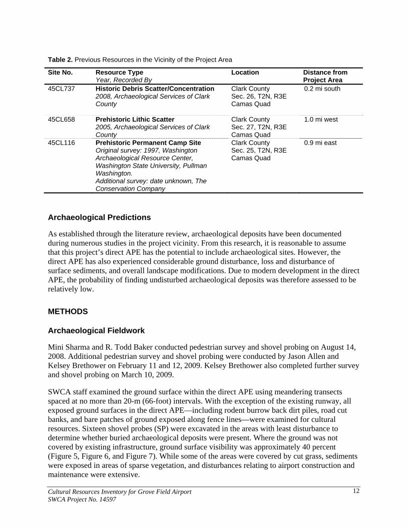
Table 2. Previous Resources in the Vicinity of the Project Area
Site No. Resource Type Year, Recorded By
Location Distance from Project Area
45CL737 Historic Debris Scatter/Concentration 2008, Archaeological Services of Clark County
Clark County Sec. 26, T2N, R3E Camas Quad
0.2 mi south
45CL658 Prehistoric Lithic Scatter 2005, Archaeological Services of Clark County
Clark County Sec. 27, T2N, R3E Camas Quad
1.0 mi west
45CL116 Prehistoric Permanent Camp Site Original survey: 1997, Washington Archaeological Resource Center, Washington State University, Pullman Washington. Additional survey: date unknown, The Conservation Company
Clark County Sec. 25, T2N, R3E Camas Quad
0.9 mi east
Archaeological Predictions
As established through the literature review, archaeological deposits have been documented during numerous studies in the project vicinity. From this research, it is reasonable to assume that this project’s direct APE has the potential to include archaeological sites. However, the direct APE has also experienced considerable ground disturbance, loss and disturbance of surface sediments, and overall landscape modifications. Due to modern development in the direct APE, the probability of finding undisturbed archaeological deposits was therefore assessed to be relatively low.
METHODS
Archaeological Fieldwork
Mini Sharma and R. Todd Baker conducted pedestrian survey and shovel probing on August 14, 2008. Additional pedestrian survey and shovel probing were conducted by Jason Allen and Kelsey Brethower on February 11 and 12, 2009. Kelsey Brethower also completed further survey and shovel probing on March 10, 2009.
SWCA staff examined the ground surface within the direct APE using meandering transects spaced at no more than 20-m (66-foot) intervals. With the exception of the existing runway, all exposed ground surfaces in the direct APE—including rodent burrow back dirt piles, road cut banks, and bare patches of ground exposed along fence lines—were examined for cultural resources. Sixteen shovel probes (SP) were excavated in the areas with least disturbance to determine whether buried archaeological deposits were present. Where the ground was not covered by existing infrastructure, ground surface visibility was approximately 40 percent (Figure 5, Figure 6, and Figure 7). While some of the areas were covered by cut grass, sediments were exposed in areas of sparse vegetation, and disturbances relating to airport construction and maintenance were extensive.
Cultural Resources Inventory for Grove Field Airport SWCA Project No. 14597
12

Figure 5. Open grass-covered field west of NE Delp Road, facing west.
Figure 6. Open area between wooded areas, facing west-southwest.
Cultural Resources Inventory for Grove Field Airport SWCA Project No. 14597
13

Figure 7. View inside wooded area, facing east.
Observations made during the pedestrian survey indicated that much of the project area has been disturbed. The southern portions of the project area closest to the existing runway have been disturbed by heavy machinery. Construction of septic drain fields, or possibly culverts, has also contributed to the overall disturbance of the site area. Several areas were covered by imported road gravel. The northern and eastern portions of the project area were covered by concrete for the runway and associated hangars, and so no natural sediments were visible. Portions of the southern area, south of the tree line fringing the existing runway, and a low-lying open field to the west across from NE Delp Road, appeared to have been subjected to the fewest impacts from previous construction, and sediments exposed in numerous rodent burrows consisted of gravel-free silt loam. Modern debris was observed on the ground surface across the project area. Two small (less than 3 cm) chert flakes were identified on the ground surface in the northwest portion of the project area. As described in detail below (see Inventory Results), this location was designated site 14597-1 following the excavation of several shovel probes in the immediate vicinity.
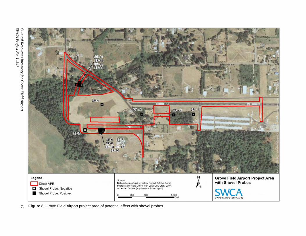
To supplement the pedestrian survey of the ground surface, SWCA excavated a total of 16 SPs within the direct APE; four SPs were excavated on August 14, 2008, 10 SPs were excavated on February 11 and 12, 2009, and two SPs were excavated on March 10, 2009 (Table 3; Figure 8). All SPs measured approximately 50 centimeters (cm) in diameter at the surface, and were excavated to a maximum depth of 50 cm below surface (cmbs) (Figure 9). All sediments were screened through a ¼-inch mesh hardware cloth, and all SPs were backfilled upon completion.
Cultural Resources Inventory for Grove Field Airport SWCA Project No. 14597
14

Cultural R
esources Inventory for Grove F
ield Airport
15SW
CA
Project N
o. 14597
Table 3. Summary of Shovel Probes Excavated in the Direct APE
No. Date Type1 Depth (cmbs)
Sedimentary Description Finds Comments
SP-1 8/14/08 Sampling 50 0–30 cmbs, dark brown (7.5YR 3/3) silt loam A-horizon with inclusions of <5% angular pebbles by volume consistent with crushed road gravel 30–50 cmbs (and continuing to base of excavation), reddish brown (5YR 5/3) clay loam B-horizon with inclusions of <1% angular pebbles by volume
None Some sparse modern debris and garbage.
SP-2 8/14/08 Sampling 50 Same as SP-1 None Some sparse modern debris and garbage.
SP-3 8/14/08 Sampling 50 Same as SP-1 None Some sparse modern debris and garbage.
SP-4 8/14/08 Sampling 50 Same as SP-1 None Some sparse modern debris and garbage.
SP-5 2/11/09 Sampling 50 0–50 cmbs, dark brown (7.5YR 3/3) cobbly loam with some inclusions of charcoal Homogeneous soil/sedimentary unit (no observable strata)
None Burned root encountered at 25 cmbs.
SP-6 2/11/09 Sampling 50 Same as SP-5 1 red/orange mottled chert flake at 15 cmbs
--
SP-7 2/11/09 Radial from SP-6
50 Same as SP-5 None Abundant large cobbles encountered at 35 cmbs.
SP-8 2/11/09 Radial from SP-6
50 Same as SP-5 None --
SP-9 2/11/09 Radial from SP-6
50 Same as SP-5 1 red with tan/white striations chert flake at 15 cmbs
--
SP-10 2/11/09 Radial from SP-6
50 Same as SP-5 None --

Table 3 (continued). Summary of Shovel Probes Excavated in the Direct APE
No. Date Type1 Depth (cmbs)
Sedimentary Description Finds Comments
SP-11 2/12/09 Exploratory 50 0–10 cmbs, dark brown (7.5YR 3/3) clay loam with cobbles and <10% charcoal inclusions 10–20 cmbs, dark yellowish brown (10YR 4/6) mottled clay loam 20–50 cmbs, dark brown (7.5YR 3/3) clay loam with cobbles
None SP-11 was positioned between two surface finds (small chert flakes) in order to explore the possibility of associated subsurface deposits. Abundant large cobbles encountered at 50 cmbs.
SP-12 2/12/09 Exploratory 50 0–50 cmbs, dark brown (7.5YR 3/3) clay loam with cobbles Homogeneous soil/sedimentary unit (no observable strata)
1 gray/black w. red striations chert flake at 15 cmbs
SP-12 was positioned immediately south of two surface finds.
SP-13 2/12/09 Radial from SP-12
50 Same as SP-12 None Large roots encountered at 15 and 30 cmbs, abundant large cobbles encountered at 20 cmbs.
SP-14 2/12/09 Radial from SP-12
50 0–30 cmbs, very dark brown (7.5YR 2.5/3) clay loam with cobbles 30–50 cmbs, dark brown (7.5YR 3/3) mottled clay loam
1 red chert flake at 15 cmbs
Dense roots encountered; abundant large cobbles encountered at 20 cmbs.
SP-15 3/10/09 Radial from SP-6
50 0–25 cmbs, dark brown (7.5YR 3/3) silty clay loam with abundant rootlets 25–50 cmbs, dark brown (7.5YR 3/4) silty clay loam with cobbles
None --
SP-16 3/10/09 Radial from SP-6
50 Same as SP-15 None --
Cultural R
esources Inventory for Grove F
ield Airport
16SW
CA
Project N
o. 14597
1 Types of Shovel Probes: Sampling = Shovel Probe excavated to sample an area in which subsurface deposits might exist, Exploratory = Shovel Probe excavated near location of surface artifacts in order to explore the possibility of associated subsurface deposits, Radial = Shovel Probe excavated around a Shovel Probe from which cultural material was positively identified in order to define subsurface site boundaries.
Cultural R
esources Inventory for Grove F
ield Airport
17
Figure 8. Grove Field Airport project area of potential effect with shovel probes.
SWC
A P
roject No. 14597

Figure 9. Base of excavation of SP-16.
Sediments in SP-1 to SP-4 consisted of a dark brown (7.5YR 3/3) silt loam A-horizon to a depth of approximately 30 cmbs. The A-horizon contained inclusions of less than 5 percent angular pebbles by volume, which is consistent with crushed road gravel. Below 30 cmbs, and continuing to the base of excavation at 50 cmbs, the sediments transitioned into a reddish brown (5YR 5/3) clay loam representing the B-horizon, which contained inclusions of less than 1 percent angular pebbles by volume. No significant cultural materials were identified in SP-1 to SP-4.
Sediments in SP-5 to SP-10 consisted of a dark brown (7.5YR 3/3) cobbly loam with some inclusions of charcoal. No observable strata were present from 0 to 50 cmbs. One chert flake was identified in SP-6 at 15 cmbs, and one chert flake was identified in SP-9 at 15 cmbs. Sediments in SP-15 and SP-16 consisted of a dark brown (7.5YR 3/3) silty clay loam A-horizon to a depth of approximately 25 cmbs. The A-horizon contained abundant rootlets. Below 25 cmbs, and continuing to the base of excavation at 50 cmbs, the sediments transitioned into a dark brown (7.5YR 3/4) silty clay loam representing the B-horizon, which contained a few small and medium cobbles. As described in detail below (see Inventory Results), the location of SP-6 to SP-10, SP-15 and SP-16 was subsequently designated Site 14597-2.
Sediments in SP-11 to SP-14 exhibited a more variable soil-stratigraphic record. Sediments in SP-11 consisted of a dark brown (7.5YR 3/3) clay loam A-horizon with cobbles and less than 10 percent charcoal inclusions from 0 to 20 cmbs. The lower half of this layer was a dark yellowish brown (10YR 4/6) mottled clay loam. Below 20 cmbs, and continuing to the base of excavation at 50 cmbs, the sediments transitioned into a dark brown (7.5YR 3/3) clay loam with cobbles representing the B-horizon. Sediments in SP-12 and SP-13 consisted of a homogenous dark
Cultural Resources Inventory for Grove Field Airport SWCA Project No. 14597
18

brown (7.5YR 3/3) clay loam with cobbles but no observable stratigraphic variation from 0 to 50 cmbs. Sediments in SP-14 consisted of a very dark brown (7.5YR 2.5/3) clay loam with cobbles A-horizon to a depth of approximately 30 cmbs. Below 30 cmbs, and continuing to the base of excavation at 50 cmbs, the sediments transitioned into a dark brown (7.5YR 3/3) mottled clay loam. One chert flake was identified in SP-12 at 15 cmbs, and one chert flake was identified in SP-14 at 15 cmbs. As described in detail below (see Inventory Results), the location of SP-11 to SP-14 was subsequently designated Site 14597-1.
Historic Properties Inventory
On October 20, 2008, and February 11, 2009, SWCA Historic Preservation Specialist Jason Allen conducted a reconnaissance-level survey of historic buildings and structures within the APE for direct and indirect effects. Buildings identified as 50 years old or older were documented and photographed. A total of five properties were identified as having historic-period structures, and all five were recorded and photographed. Washington historic properties inventory forms were completed for each (see Appendix B), and all five are recommended to be not eligible for listing in the NRHP. The buildings at 522 NE 257th Avenue (garage), 708 NE Delp Road, and 623 NE 257th Avenue are within the APE for direct effects. The buildings at 615 NE 257th Avenue and 828 NE Delp Road are within the APE for indirect effects.
The earliest available map indicating that the Blair property had been subdivided is dated 1943. This map indicates that at that time the lands now associated with 708 NE Delp Road and 828 NE Delp Road were owned by John Johnson, and that these structures were built in 1936 and 1931, respectively (Metsker Maps 1943). A review of available census data indicates that by 1920, Johnson was living at the property with his wife and two sons (US Bureau of the Census 1920). Johnson and his wife were Swedish immigrants, John having immigrated in 1892 and naturalized in 1896, and his wife, Leana, having immigrated in 1885 and naturalized in 1887. At the time of the 1920 census, John and his son Axel worked at the Camas Water Flume, which served the paper mill in Camas. At that time, Johnson’s other son, George, worked at the paper mill itself. By the time of the 1930 census, Johnson lived with his wife and two young grandchildren, and he worked at the paper mill (US Bureau of the Census 1930). Given the known dates of his occupation of the property (1920–1943), and given the construction date of the houses (1936 and 1931), it is believed that the houses was built by John Johnson, although it is unclear who occupied which house (Clark County 2008). Both houses have been substantially altered, and neither retains sufficient integrity to be considered eligible for listing in the NRHP.
The above-mentioned 1943 map indicates that at that time the lands now associated with 623 NE 257th Avenue and 615 NE 257th Avenue were owned by C.G. Tweedt (Metsker Maps 1943). The structure at 623 NE 257th Avenue was built in 1950, and the structure at 615 NE 257th Avenue was built in 1942. C.G. Tweedt is believed to be Christ J. Tweedt, born in Idaho in 1882 and indicated in 1930 census records as living near Fern Prairie with his wife Ethel (born in 1885), son Kenneth (born in 1909), and daughter Carol (born in 1914). He is listed as a farmer. It is not clear whether he lived on this property or not, as he is indicated in the 1943 map as owning more than one non-contiguous property on this road. It is possible, though unconfirmed, that Tweedt lived in one of the two houses. A 1961 map indicates that these properties were then owned by S.J. Andrews, about whom nothing else is known (Metsker Maps 1961). The property has since been acquired by the Port of Camas-Washougal.
Cultural Resources Inventory for Grove Field Airport SWCA Project No. 14597
19
Cultural Resources Inventory for Grove Field Airport SWCA Project No. 14597
20
The garage at 522 NE 257th Avenue is recommended to be not eligible for listing in the NRHP because it appears to be a remnant of an earlier farmstead or domestic complex. No other structures on the property predate 2000, the construction date of the large house that shares the parcel with the garage. The garage itself has no outstanding design qualities, has no known association with important events or people, and does not appear to have any potential to yield important information not to be found in the documentary record. The garage has also lost integrity, as the windows have been removed and the openings boarded over, and the north elevation exhibits mismatched siding, likely the result of some repair in the past.
The 1943 map indicates that W.B. Wilson owned the property now including the garage. Nothing is known of Wilson, and he does not appear in the last available census information (1930). The next available map is dated 1961, and indicates that at that time the property was owned by Wayne Scott. Again, Scott does not appear in the census information, and nothing further is known of him. The date of construction of the garage appears, based on design and materials, to have been ca. 1950. Given this assessment, it is likely that the garage is associated either with Wilson’s or Scott’s residency on the property.
INVENTORY RESULTS
Archaeological Sites
Pedestrian survey and subsurface probing resulted in the identification of two prehistoric archaeological sites, site 14597-1 and site 14597-2 (Figure 10 and Figure 11). Both sites have been recorded on Washington archaeological site forms (see Appendix A).
Site 14597-1 is a sparse lithic scatter at the base of a steep slope adjacent to and north of an unnamed drainage, approximately 76 m (250 feet) south-southwest of NE Delp Road (Figure 12). The adjacent drainage to the south contained flowing water at the time of the survey. Four SPs were excavated at the site, and four chert flakes were found during the pedestrian survey and shovel probing (see Figure 10). One red chert flake (S-1) and one tan chert flake (S-2) were found on the ground surface; the other two flakes were found during shovel probing and consisted of one gray/red chert flake found at 15 cmbs (6 in) in SP-12 and one red chert flake found at 15 cmbs in SP-14. Based on the spatial relationship between the surface finds and the results of the shovel probing, the site measures approximately 13.4 m (44.0 feet) north-to-south by 20.4 m (66.9 feet) east-to-west. The drainage immediately adjacent to and south of SP-12 (see Figure 10) effectively defines the southern limits of the site and precludes additional shovel probing in this area. Site 14597-1 lacks any specific surface or subsurface features, and no intact stratified deposits were observed. None of the artifacts identified at this site are temporally diagnostic. Based on these observations, the site is unlikely to yield additional, significant information relevant to furthering our knowledge of prehistory in and around project area. Therefore, SWCA recommends site 14597-1 is not eligible for listing in the NRHP.
Site 14597-2 is a sparse lithic scatter located in an open, grass-covered field approximately 0.2 km (0.1 mile) south of NE Delp Road (Figure 13). Seven SPs were excavated at the site, and two chert flakes were identified, one each in SP-6 and SP-9, both at 15 cmbs (see Figure 11). No artifacts were found on the surface during the pedestrian survey. One red/orange chert flake was found in SP-6, and one red chert flake was found in SP-9. Based on the results of the shovel

Cultural
Resources Inventory for G
rove Field A
irport 21
SWC
A P
roject No. 14597
Figure 10. Location and approximate boundaries (yellow line) of Site 14597-1.

Cultural R
esources Inventory for Grove F
ield Airport
22
SWC
A P
roject No. 14597
Figure 11. Location and approximate boundaries (yellow line) of Site 14597-2.

Figure 12. Overview of northwestern portion of APE, including site 14597-1.
View is to the south, showing unnamed drainage passing through the ravine.
Figure 13. Overview of southern portion of project area, facing east.
Photograph taken from near site 14597-2
Cultural Resources Inventory for Grove Field Airport SWCA Project No. 14597
23

probing, the site measures approximately 15.5 m (50.9 ft) north-south by 12.5 m (41.0 ft) east- west. Site 14597-2 lacks any specific surface or subsurface features, and no intact stratified deposits were observed. None of the artifacts identified at this site are temporally diagnostic. Based on these observations, the site is unlikely to yield additional, significant information relevant to furthering our knowledge of prehistory in and around project area. Therefore, SWCA recommends site 14597-2 is not eligible for listing in the NRHP.
Aboveground Structures
Five historic-period buildings were identified during the historic structures survey, a 1936 1½-story brick house with two outbuildings at 708 NE Delp Road, a 1950 ranch-style house at 623 NE 257th Avenue, a ca. 1950 three-bay garage at 522 NE 257th Avenue, a 1942 World War II–era cottage with one modern outbuilding at 615 NE 257th Avenue, and a 1931 1½-story vernacular residence with one outbuilding at 828 NE Delp Road. All five of these properties were recorded on Washington historic property inventory forms (see Appendix B), and all are recommended as not eligible for listing in NRHP, with no further work recommended.
CONCLUSIONS AND RECOMMENDATIONS
SWCA completed a cultural resource records review, pedestrian survey, and subsurface probing for the proposed 31-acre Grove Field Airport Improvements Project. This study resulted in the identification of two archaeological sites, site 14597-1 and 14597-2, and five historic-period aboveground structures. The archaeological sites, 14597-1 and 14597-2, have an absence of features and no intact stratified deposits; no temporally diagnostic artifacts were located. The sites are unlikely to yield additional, significant information relevant to furthering our knowledge of prehistory in and around project area. Therefore, SWCA recommends that both archaeological sites are not eligible for listing in the NRHP (Code of Federal Regulations Title 36 Part 60.4 [a-d]). Washington historic properties inventory forms were completed for each of the historic-period aboveground structures, and all five are also recommended to be not eligible for listing in the NRHP.
One of the improvements proposed by the port includes the construction of a tunnel in the location of Delp Road (see Figure 3). In the event that Delp Road is tunneled, the depth of the tunnel will be approximately 23 feet and will impact native soils. Therefore, SWCA recommends having an archaeological monitor at all times during the excavation of the proposed tunnel.
In conclusion, no further cultural resource investigations are recommended for the proposed Grove Field Airport Improvements Project, except for archaeological monitoring during the tunneling of Delp Road. However, if additional unanticipated prehistoric or historic-period cultural resources are encountered during the project, all ground-disturbing activity in the vicinity of the find should be halted and the DAHP, concerned tribes, and Clark County should be notified to ensure compliance with relevant state and federal laws and regulations and to evaluate the discovery and recommend subsequent courses of action. SWCA may be retained to coordinate cultural resource monitoring and unexpected discovery efforts.
Cultural Resources Inventory for Grove Field Airport SWCA Project No. 14597
24

REFERENCES CITED
Allen, John Eliot 1984 The Magnificent Gateway: A Layman’s Guide to the Geology of the Columbia River
Gorge. Timber Press, Forest Grove, Oregon.
Berreman, Joel 1937 Tribal Distribution in Oregon. American Anthropological Association, Menasha,
Wisconsin.
Carey, Charles H. 1971 General History of Oregon through Early Statehood. 3rd ed. Binfords and Mort,
Portland, Oregon.
Clark County 2008 Clark County Property Information Center. Online database. Available at:
http://gis.clark.wa.gov/applications/gishome/property/index.cfm?action=account&CFID=197675&CFTOKEN=d55748948880f417-0AA3F55B-1372-4173-F7E1D6B8006B0794&jsessionid=f030dc1524e04fff05697784d5766066e1e1.
Columbian (Clark County, Washington) 2008 Fern Prairie. Available at: http://www.columbian.com/history/fernprairie.cfm.
Accessed September 2, 2008.
Franklin, Jerry F., and C. T. Dyrness 1988 Natural Vegetation of Oregon and Washington. Reprinted. Oregon State University
Press, Corvallis. Originally published 1973, General Technical Report PNW-GTR-008, U.S. Department of Agriculture, Forest Service, Pacific Northwest Research Station, Portland, Oregon.
General Land Office (GLO) 1863 Plat of Township 2 North, Range 3 East, Willamette Meridian. Microfiche. On file,
U.S. Bureau of Land Management, Oregon State Office, Portland.
Grove Field Airport 2006 Airport Information. Available at: http://www.cwaagrovefield.com/page.php?pid=14.
Accessed August 28, 2008.
Habersham, R.A. 1888 Map of Clarke County, Washington Territory. On file, Fort Vancouver Regional
Library, Vancouver, Washington.
Cultural Resources Inventory for Grove Field Airport SWCA Project No. 14597
25

Hajda, Yvonne P. 1994 Notes on Indian Houses of the Wappato Valley. Northwest Anthropological Research
Notes 28(2):177–188.
Irwin, Judith W. 1994 The Cowlitz Indians in Cowlitz Corridor. Available at:
http://www.cowlitz.org/history/dispossessed.html. Accessed September 8, 2008.
McGee, Dale A. 1972 Soil Survey of Clark County, Washington. U.S. Department of Agriculture, Soil
Conservation Service, Washington, D.C.
Metsker Maps 1943 Metsker’s Atlas of Clark County. Charles F. Metsker, Portland, Oregon, and Tacoma,
Washington.
1961 Metsker’s Atlas of Clark County. Charles F. Metsker, Portland, Oregon, and Tacoma, Washington.
Mullineaux, Donald R., Ray E. Wilcox, Walter F. Ebaugh, Roald Fryxell, and Meyer Rubin 1978 Age of the Last Major Scabland Flood of the Columbia Plateau in Eastern
Washington. Quaternary Research 10:171–180.
Robbins, William G. 1997 Landscapes of Promise, The Oregon Story 1800-1940. University of Washington
Press, Seattle.
Silverstein, Michael 1990 Chinookans of the Lower Columbia. In Northwest Coast, edited by Wayne P. Suttles,
pp. 533–546. Handbook of North American Indians, Vol. 7, William C. Sturtevant, general editor. Smithsonian Institution Press, Washington, D.C.
Trimble, Donald E. 1963 Geology of Portland, Oregon and Adjacent Areas. Geological Survey Bulletin 1119.
U.S. Government Printing Office, Washington, D.C.
U.S. Bureau of the Census 1880 Manuscript Population Census of the United States. Tenth Census of the United
States. Washington Territory, Clark County, Enumeration District 23. Available at: http://www.proquest.com/products_hq/census/default.shtml. Accessed October 23, 2008.
1920 Manuscript Population Census of the United States. Twelfth Census of the United States. State of Washington, Clark County, Fern Prairie Precinct. Available at:
Cultural Resources Inventory for Grove Field Airport SWCA Project No. 14597
26

Cultural Resources Inventory for Grove Field Airport SWCA Project No. 14597
27
http://www.proquest.com/products_hq/census/default.shtml. Accessed October 23, 2008.
1930 Manuscript Population Census of the United States. Thirteenth Census of the United States. State of Washington, Clark County, Fern Prairie Precinct. Available at: http://www.proquest.com/products_hq/census/default.shtml. Accessed October 23, 2008.
Washington State Grange 2006 Washington State Grange: The People’s Voice of Washington. Available at:
http://www.wa-grange.org/local_granges.htm. Accessed September 4, 2008.
Von Vleet, Lewis 1857 Notes on the Survey of the Land Claim of B.L. Gardner, Township 2 North, Range 3
East, Willamette Meridian, Claim No. 43. Available at: http://www.blm.gov/or/landrecords/survey/yNoteView1_2.php?D0002WA0224002250. Accessed August 28, 2008.

Appendix A Archaeological Site Forms

STATE OF WASHINGTON
ARCHAEOLOGICAL SITE INVENTORY FORM
*Mandatory Information for Official Smithsonian Number designation. Revised 10/2008
Smithsonian Number:
*County: Clark
*Date: 2/23/2009 *Compiler: SWCA Environmental Consultants
Location Information Restrictions (Yes/No/Unknown): Yes
SITE DESIGNATION
Site Name:
Field/ Temporary ID: 14597-1
*Site Type: Pre Contact Lithic Material
SITE LOCATION
*USGS Quad Map Name: Lacamas Creek
*Legal Description: T2N R 3 E/W: E Section(s): 26
Quarter Section(s): SW1/4 of SW1/4 of SW1/4 of NW1/4
*UTM: Zone 10, NAD 83 Easting 545744 Northing 5052979
Latitude: Longitude: Elevation (ft/m): 400-409 ft (122-125 m)
Other Maps: Type:
Scale: Source:
Drainage, Major: Columbia River Drainage, Minor: Lacamas Creek River Mile: N/A
Aspect: East Slope: None
*Location Description (General to Specific): Site 14597-1 is located just west of the Grove Field
Airport in southern Clark County, approximately 3.4 km (2.1 mi) north of the City of Camas. It is
located at the base of a steep slope near an unnammed drainage at 922 NE Delp Road. The site is
approximately 2 km (1.2 mi) east of Lacamas Lake.
Approach (For Relocation Purposes): From I-5 North take WA-14 East via Exit 1A towards
Camas and travel east approximately 19 km (12 mi) and take Exit 12, the WA-14 Business Loop,
toward Camas. Keep right at the fork in the ramp and merge onto NW 6th Avenue. Travel
approximately 1.6 km (1 mi) until you reach NE Adams Street. Turn right on NE Adams Street and
travel approximately 0.2 km (0.1 mi) until you reach NE 3rd Avenue. Turn left onto NE 3rd Avenue
and travel approximately 0.5 km (0.3 mi) until you reach NE Garfield Street/WA-500. Turn left onto

ARCHAEOLOGICAL SITE INVENTORY FORM Smithsonian Number: ______________
Page 2 of 12
*Mandatory Information for Official Smithsonian Number designation. Revised 10/2008
NE Garfield Street/WA-500 and travel approximately 0.6 km (0.4 mi) until you reach NE Everett
Street/WA-500. Turn right onto NE Everett Street/WA-500 and travel approximately 3.8 km (2.4
mi) until you reach NE 3rd Street. Make a sharp left onto NE 3rd Street and travel approximately
0.8 km (0.5 mi) until you reach NE Delp Road. Make a slight right onto NE Delp Road and travel
approximately 0.3 km (0.2 mi) until you reach 922 NE Delp Road. The site at this location
approximately 76 m (200 ft) south of NE Delp Road at the base of a steep slope near an unnamed
drainage.

ARCHAEOLOGICAL SITE INVENTORY FORM Smithsonian Number: ______________
Page 3 of 12
*Mandatory Information for Official Smithsonian Number designation. Revised 10/2008
SITE DESCRIPTION
*Narrative Description: Site 14597-1 is a very sparse lithic scatter located at the base of a steep
slope near an unnamed drainage, approximately 76 m (250 ft) south of NE Delp Road in Camas,
Washington. Four shovel probes (SPs) were excavated at the site, and a total of four chert flakes
were found during the survey and shovel probing; one in SP-12, one in SP-14, and two on the
surface during the pedestrian survey. Both of the subsurface artifacts were found 15 cm (6 inches)
below the surface. The site is located along a proposed new road alignment.
*Site Type: Pre Contact Lithic Material
*Site Dimensions
*Length: 13.4 M *Direction: N-S x *Width: 20.4 M *Direction: E-W
*Method of Horizontal Measurement: GPS Unit
*Depth: 15 CM * Method of Vertical Measurement: Shovel Probing
*Vegetation (On Site): Grasses, holly, vine maple, and coniferous trees
Local: Tsuga heterophylla Regional: Tsuga heterophylla
Landforms (On Site): Base of a steep slope near an unnamed drainage Local: Terrace
Water Resources (Type): Lacamas Lake Distance: 2 km( 1.2 mi) Permanence: Permanent
CULTURAL MATERIALS AND FEATURES
*Narrative Description: In total, four artifacts were found at site 14597-1. Two artifacts were found
on the surface during the pedestrian survey and two artifacts were found during subsurface probing.
Two of the four flakes, one red chert flake (S-1) and one tan chert flake (S-2), were found on the
surface; the other two flakes were found during shovel probing and consisted of one gray/red chert
flake found at the 15-cm (6-in) level in SP-12 and one red chert flake found at the 15-cm (6-in) level
in SP-14. The site is recommended as not capable of yielding additional, significant information able
to further knowledge of prehistory of the region and is, therefore, recommended as not eligible for
listing in the NRHP.
*Method of Collection(s): The artifacts were not collected; they were photographed and placed
back in the hole during backfilling.

ARCHAEOLOGICAL SITE INVENTORY FORM Smithsonian Number: ______________
Page 4 of 12
*Mandatory Information for Official Smithsonian Number designation. Revised 10/2008
*Location of Artifacts (Temporary/Permanent): N/A
SITE AGE
*Component: Prehistoric Unknown *Dates: Unknown *Dating Method: N/A
*Phase: Unknown Basis for Phase Designation: N/A
SITE RECORDERS
Observed by: SWCA Environmental Consultants
Address: 434 NW Sixth Avenue, Suite 304, Portland, OR 97209-3652
*Date Recorded: 2/11/2009
*Recorded by (Professional Archaeologist): Jason Allen
*Affiliation: SWCA *Affiliation Phone Number: 503-224-0333
*Affiliation Address: Same as above *Affiliation E-mail: [email protected]
Date Revisited: N/A Revisited By: N/A
SITE HISTORY
Previous Work (Done on Archaeological Site): None
LAND OWNERSHIP
*Owner: Ronald and Verla Cowan
*Address: 922 NE Delp Road
Camas, WA 98607
*Tax Lot/ Parcel No: 175491000

ARCHAEOLOGICAL SITE INVENTORY FORM Smithsonian Number: ______________
Page 5 of 12
*Mandatory Information for Official Smithsonian Number designation. Revised 10/2008
RESEARCH REFERENCES
*Items/Documents Used In Research (Specify):
Berreman, Joel 1937 Tribal Distribution in Oregon. American Anthropological Association, Menasha, Wisconsin.
Clark County 2008 Clark County Property Information Center. Online database. Available at:
http://gis.clark.wa.gov/applications/gishome/property/index.cfm?action=account&CFID=197675&CFTOKEN=d55748948880f417-0AA3F55B-1372-4173-F7E1D6B8006B0794&jsessionid=f030dc1524e04fff05697784d5766066e1e1.
General Land Office (GLO) 1863 Plat of Township 2 North, Range 3 East, Willamette Meridian. Microfiche. On file, U.S.
Bureau of Land Management, Oregon State Office, Portland.
Grove Field Airport 2006 Airport Information. Available at: http://www.cwaagrovefield.com/page.php?pid=14.
Accessed August 28, 2008.
Habersham, R.A. 1888 Map of Clarke County, Washington Territory. On file, Fort Vancouver Regional Library,
Vancouver, Washington.
Irwin, Judith W. 1994 The Cowlitz Indians in Cowlitz Corridor. Available at:
http://www.cowlitz.org/history/disposessed.htm. Accessed September 8, 2008.
Metsker Maps 1943 Metsker’s Atlas of Clark County. Charles F. Metsker, Portland and Tacoma.
1961 Metsker’s Atlas of Clark County. Charles F. Metsker, Portland and Tacoma.
ARCHAEOLOGICAL SITE INVENTORY FORM Smithsonian Number: ______________
Page 6 of 12
*Mandatory Information for Official Smithsonian Number designation. Revised 10/2008
USGS MAP
*Quad Name: Lacamas Creek
*Series: 7.5 min
*Date: 1990
*INSERT 7.5 MIN USGS MAP
SEE ATTACHED USGS MAP
SKETCH MAP
*Sketch Map Description: See Addendum
*INSERT SKETCH MAP
SEE ATTACHED AERIAL PHOTO/SKETCH MAP
*Legend: Known Boundary Symbology:
Possible Boundary Symbology:
Other Symbols (Other Than USGS):
*INSERT LEGEND
*Scale: See Addendum
*North Arrow (Magnetic/True North):

ARCHAEOLOGICAL SITE INVENTORY FORM Smithsonian Number: ______________
Page 7 of 12
*Mandatory Information for Official Smithsonian Number designation. Revised 10/2008
PHOTOGRAPH(S)
*Photograph Description(s): Red chert flake from SP-14

ARCHAEOLOGICAL SITE INVENTORY FORM Smithsonian Number: ______________
Page 8 of 12
*Mandatory Information for Official Smithsonian Number designation. Revised 10/2008
Photograph Description(s): Grey/black chert flake from SP-12

ARCHAEOLOGICAL SITE INVENTORY FORM Smithsonian Number: ______________
Page 9 of 12
*Mandatory Information for Official Smithsonian Number designation. Revised 10/2008
*Photograph Description(s): Red chert flake from surface

ARCHAEOLOGICAL SITE INVENTORY FORM Smithsonian Number: ______________
Page 10 of 12
*Mandatory Information for Official Smithsonian Number designation. Revised 10/2008
CONTINUATION/ ADDENDUM SHEET
Label all additional pages by corresponding headings.
(e.g. Site Description, Site History, Research References)

ARCHAEOLOGICAL SITE INVENTORY FORM Smithsonian Number: ______________
Page 11 of 12
*Mandatory Information for Official Smithsonian Number designation. Revised 10/2008
CONTINUATION/ ADDENDUM SHEET: 7.5-MINUTE USGS MAP
14597-1
Source: USGS 7.5 Minute Topographic Quadrangle: Lacamas Creek WA, 1971.
P:\1
40
00\
145
97
_Gro
veFi
eldA
irpo
rt\G
IS\M
XD\s
crat
ch\S
iteA
rea1
_24
kTop
o.m
xd -
3/2
/200
9 @
3:2
1:5
1 P
M
Legend
Site
APE
Site 14597-1
0 0.25 0.50.125Miles

ARCHAEOLOGICAL SITE INVENTORY FORM Smithsonian Number: ______________
Page 12 of 12
*Mandatory Information for Official Smithsonian Number designation. Revised 10/2008
CONTINUATION/ ADDENDUM SHEET: AERIAL PHOTO/SKETCH MAP

STATE OF WASHINGTON
ARCHAEOLOGICAL SITE INVENTORY FORM
*Mandatory Information for Official Smithsonian Number designation. Revised 10/2008
Smithsonian Number:
*County: Clark
*Date: 2/23/2009 *Compiler: SWCA Environmental Consultants
Location Information Restrictions (Yes/No/Unknown): Yes
SITE DESIGNATION
Site Name:
Field/ Temporary ID: 14597-2
*Site Type: Pre Contact Lithic Material
SITE LOCATION
*USGS Quad Map Name: Lacamas Creek
*Legal Description: T2N R 3 E/W: E Section(s): 26
Quarter Section(s): SE1/4 of NW1/4 of NW1/4 of SW1/4
*UTM: Zone 10, Nad 83 Easting 545861 Northing 5052724
Latitude: Longitude: Elevation (ft/m): 400-409 ft (122-125 m)
Other Maps: Type:
Scale: Source:
Drainage, Major: Columbia River Drainage, Minor: Lacamas Creek River Mile: N/A
Aspect: East Slope: None
*Location Description (General to Specific): Site 14597-2 is located just west of the Grove Field
Airport in southern Clark County, approximately 3.4 km (2.1 mi) north of the City of Camas. It is
located in an open-grass covered field at 622 NE 257th Avenue. The site is approximately 2 km
(1.2 mi) east of Lacamas Lake.
Approach (For Relocation Purposes): From I-5 North take WA-14 East via Exit 1A towards
Camas and travel east approximately 19 km (12 mi) and take Exit 12, the WA-14 Business Loop,
toward Camas. Keep right at the fork in the ramp and merge onto NW 6th Avenue. Travel
approximately 1.6 km (1 mi) until you reach NE Adams Street. Turn right on NE Adams Street and
travel approximately 0.2 km (0.1 mi) until you reach NE 3rd Avenue. Turn left onto NE 3rd

ARCHAEOLOGICAL SITE INVENTORY FORM Smithsonian Number: ______________
Page 2 of 11
*Mandatory Information for Official Smithsonian Number designation. Revised 10/2008
Avenue and travel approximately 0.5 km (0.3 mi) until you reach NE Garfield Street/WA-500. Turn
left onto NE Garfield Street/WA-500 and travel approximately 0.6 km (0.4 mi) until you reach NE
Everett Street/WA-500. Turn right onto NE Everett Street/WA-500 and travel approximately 3.8 km
(2.4 mi) until you reach NE 3rd Street. Make a sharp left onto NE 3rd Street and travel
approximately 0.5 km (0.3 mi) until you reach NE Delp Road. Make a slight right onto NE Delp
Road and travel approximately 0.3 km (0.2 mi) until you reach 622 NE 257th Avenue. The site is
at this location approximately 0.2 km (0.1 mi) south of NE Delp Road in an open-grass covered
field.

ARCHAEOLOGICAL SITE INVENTORY FORM Smithsonian Number: ______________
Page 3 of 11
*Mandatory Information for Official Smithsonian Number designation. Revised 10/2008
SITE DESCRIPTION
*Narrative Description: Site 14597-2 is a very sparse lithic scatter located in an open, grass-
covered field, approximately 0.2 km (0.1 mi) south of NE Delp Road, at 622 NE 257th Avenue in
Camas, Washington. Seven shovel probes (SPs) were excavated at the site resulting in the finding of
two chert flakes, one in SP-6 and one in SP-9; no artifacts were found on the surface during the
pedestrian survey. Both of the artifacts were found 15 cm (6 in) below the surface. The site is located
along a proposed new road alignment.
*Site Type: Pre Contact Lithic Material
*Site Dimensions
*Length: 15.5 M *Direction: N-S x *Width: 12.5 M *Direction: E-W
*Method of Horizontal Measurement: GPS Unit
*Depth: 15 CM * Method of Vertical Measurement: Shovel Probing
*Vegetation (On Site): Grasses, blackberry, and coniferous trees
Local: Tsuga heterophylla Regional: Tsuga heterophylla
Landforms (On Site): Flat grass-covered field Local: Terrace
Water Resources (Type): Lacamas Lake Distance: 2 km( 1.2 mi) Permanence: Permanent
CULTURAL MATERIALS AND FEATURES
*Narrative Description: In total, two artifacts were found during subsurface probing at site 14597-2
No artifacts were found on the surface during the pedestrian survey. One red/orange chert flake was
found at the 15 cm (6 in) level in SP-6 and one red chert flake at the 15 cm (6 in) level in SP-9. The
site is recommended as not capable of yielding additional, significant information able to further
knowledge of prehistory of the region and is, therefore, recommended as not eligible for listing in the
NRHP.
*Method of Collection(s): The artifacts were not collected; they were photographed and placed
back in the hole during backfilling.
*Location of Artifacts (Temporary/Permanent): N/A

ARCHAEOLOGICAL SITE INVENTORY FORM Smithsonian Number: ______________
Page 4 of 11
*Mandatory Information for Official Smithsonian Number designation. Revised 10/2008
SITE AGE
*Component: Prehistoric Unknown *Dates: Unknown *Dating Method: N/A
*Phase: Unknown Basis for Phase Designation: N/A
SITE RECORDERS
Observed by: SWCA Environmental Consultants
Address: 434 NW Sixth Avenue, Suite 304, Portland, OR 97209-3652
*Date Recorded: 2/11/2009
*Recorded by (Professional Archaeologist): Jason Allen
*Affiliation: SWCA *Affiliation Phone Number: 503-224-0333
*Affiliation Address: Same as above *Affiliation E-mail: [email protected]
Date Revisited: Revisited By:
SITE HISTORY
Previous Work (Done on Archaeological Site): None
LAND OWNERSHIP
*Owner: Dale E. and Leta L. Anderson (Trustees)
*Address: 622 NE 257th Avenue
Camas, WA 98607
*Tax Lot/ Parcel No: 175536000
RESEARCH REFERENCES
*Items/Documents Used In Research (Specify):
Berreman, Joel
1937 Tribal Distribution in Oregon. American Anthropological Association, Menasha, Wisconsin.
Clark County 2008 Clark County Property Information Center. Online database. Available at:
http://gis.clark.wa.gov/applications/gishome/property/index.cfm?action=account&CFID=197675&CFTOKEN=d55748948880f417-0AA3F55B-1372-4173-F7E1D6B8006B0794&jsessionid=f030dc1524e04fff05697784d5766066e1e1.

ARCHAEOLOGICAL SITE INVENTORY FORM Smithsonian Number: ______________
Page 5 of 11
*Mandatory Information for Official Smithsonian Number designation. Revised 10/2008
General Land Office (GLO) 1863 Plat of Township 2 North, Range 3 East, Willamette Meridian. Microfiche. On file, U.S.
Bureau of Land Management, Oregon State Office, Portland.
Grove Field Airport 2006 Airport Information. Available at: http://www.cwaagrovefield.com/page.php?pid=14.
Accessed August 28, 2008.
Habersham, R.A. 1888 Map of Clarke County, Washington Territory. On file, Fort Vancouver Regional Library,
Vancouver, Washington.
Irwin, Judith W. 1994 The Cowlitz Indians in Cowlitz Corridor. Electronic Document, available,
http://www.cowlitz.org/history/disposessed.htm, accessed September 8, 2008.
Metsker Maps 1943 Metsker’s Atlas of Clark County. Charles F. Metsker, Portland and Tacoma.
1961 Metsker’s Atlas of Clark County. Charles F. Metsker, Portland and Tacoma.

ARCHAEOLOGICAL SITE INVENTORY FORM Smithsonian Number: ______________
Page 6 of 11
*Mandatory Information for Official Smithsonian Number designation. Revised 10/2008
USGS MAP
*Quad Name: Lacamas Creek
*Series: 7.5 min
*Date: 1990
*INSERT 7.5 MIN USGS MAP
SEE ATTACHED ADDENDUM USGS MAP
*Sketch Map Description:
*INSERT SKETCH MAP
SEE ATTACHED ADDENDUM AERIAL PHOTO/SKETCH MAP
*Legend: Known Boundary Symbology:
Possible Boundary Symbology:
Other Symbols (Other Than USGS):
*INSERT LEGEND
*Scale:
*North Arrow (Magnetic/True North):

ARCHAEOLOGICAL SITE INVENTORY FORM Smithsonian Number: ______________
Page 7 of 11
*Mandatory Information for Official Smithsonian Number designation. Revised 10/2008
PHOTOGRAPH(S)
*Photograph Description(s): Red chert flake from SP-6

ARCHAEOLOGICAL SITE INVENTORY FORM Smithsonian Number: ______________
Page 8 of 11
*Mandatory Information for Official Smithsonian Number designation. Revised 10/2008
*Photograph Description(s): Red chert flake from SP-9

ARCHAEOLOGICAL SITE INVENTORY FORM Smithsonian Number: ______________
Page 9 of 11
*Mandatory Information for Official Smithsonian Number designation. Revised 10/2008
CONTINUATION/ ADDENDUM SHEET
Label all additional pages by corresponding headings.
(e.g. Site Description, Site History, Research References)

ARCHAEOLOGICAL SITE INVENTORY FORM Smithsonian Number: ______________
Page 10 of 11
*Mandatory Information for Official Smithsonian Number designation. Revised 10/2008
CONTINUATION/ ADDENDUM SHEET: 7.5-MINUTE USGS MAP
#014597-2
Source: USGS 7.5 Minute Topographic Quadrangle: Lacamas Creek WA, 1971.
±
P:\1
40
00\
145
97
_Gro
veFi
eldA
irpo
rt\G
IS\M
XD\s
crat
ch\S
iteA
rea2
_24
kTop
o.m
xd -
3/2
/200
9 @
3:1
5:2
3 P
M
Legend
#0 Site
APE
Site 14597-2
0 0.25 0.50.125Miles

ARCHAEOLOGICAL SITE INVENTORY FORM Smithsonian Number: ______________
Page 11 of 11
*Mandatory Information for Official Smithsonian Number designation. Revised 10/2008
CONTINUATION/ ADDENDUM SHEET: AERIAL PHOTO/SKETCH MAP

Appendix B Historic Property Inventory Forms

Johnson, John HouseHistoric Property Inventory Report for
at 708 NE Delp Rd, vicinity of Camas, WA 98607
Field Site No.: 14597-1 OAHP No.:
Historic Name: Johnson, John House Common Name:
County
Plat/Block/Lot
#47 B.L. Gardner DLC
Acreage
1.91
Supplemental Map(s)Tax No./Parcel No.
175503-000
Property Address: 708 NE Delp Rd, vicinity of Camas, WA 98607
LOCATION SECTION
Comments:
Quadrangle Coordinate ReferenceSectionTownship/Range/EW 1/4 Sec 1/4 1/4 Sec
Owner Address:
708 NE Delp Rd.
Field Recorder: Jason M. Allen
Owner's Name:
Liehr, Larry L.
City/State/Zip:
Camas, Washington 98607
National Register District/Thematic Nomination Name:
Local District:
Date Recorded: 10/20/2008
Classification: Building
Within a District? No
Contributing?
Comments
IDENTIFICATION SECTION
National Register Nomination:
DESCRIPTION SECTION
Plan: Rectangle
Other (specify):
Style
Historic Use: Domestic - Single Family House
Current Use: Domestic - Single Family House
Structural System: Balloon Frame
No. of Stories: 1.5
Changes to plan: Intact
Changes to original cladding: Slight
Changes to windows: Intact
Changes to interior: Unknown
Changes to other:
Resource Status
Form/Type
View of John Johnson House, view to the west. taken 10/20/2008
Photography Neg. No (Roll No./Frame No.): 14597_1_708_NE_Delp_1.JPG
Comments: East (front) elevation
Survey Name: Grove Field Airport
Clark LACAMAS CREEK26 SW NET02R03E Acquisition Code: UnknownSpatial Type: PointZone: 10
Northing: 5052793Easting: 546044Sequence:
Tudor - Cottage
Survey/Inventory
Single Family
Page 1 of 3 Printed on 3/4/2009 11:08:32 AM

Johnson, John HouseHistoric Property Inventory Report for
at 708 NE Delp Rd, vicinity of Camas, WA 98607
Cladding Roof MaterialFoundation
NARRATIVE SECTION
Architect:
Engineer:
Date Of Construction: 1936
Property appears to meet criteria for the National Register of Historic Places: No
Property is located in a potential historic district (National and/or local): Unable to Determine
The John Johnson House, located at 708 NE Delp Road, is recommended to be not eligible for listing in the National Register of Historic Places. The house does not exhibit any clear associations with the broader patterns of history, is not associated with any significant historical persons, does not exhibit any distinctive or unusual stylistic or design characteristics, and is unlikely to yield any additional information not available in the documentary record.
A review of General Land Office (GLO) Cadastral Survey maps reveal that the property on which the house at 708 NE Delp Road now exists was originally a portion of the Donation Land Claim (DLC) settled by Bazeleel.L. and Mary E. Gardner. It is unclear when they settled their 320-acre claim, however, it is clear that they were present on the land before 1857, the date of the survey of their property (GLO 1863; Von Vleet 1857). Further, it is unclear why, given the provisions of the Donation Land Act of 1850, under which authority the land was claimed, they did not claim the full 640 acres available to married settlers. The Gardners do not appear in the 1860 census in either Washington or Oregon, and no information is available on them from the Genealogical Forum of Portland’s extensive Provisional and Donation Land Claim Records.
According to an 1888 map of Clark County, the property was at that time owned by “R. Blair,” presumed to be Rufus Blair, a farmer born in 1848 in Missouri (Habersham 1888). According to census data from 1880 (assuming this is the same R. Blair as that indicated on the 1888 map), Blair lived at this property with his wife, Evalena (born 1846 in Missouri) and his brother, Hannibal (born 1856 in Missouri, employed in 1880 as a schoolteacher) (US Bureau of the Census 1880). Nothing else is known of them, and they do not appear in next available census data from 1900.
The next available map, dated 1943, indicates that at that time the land was owned by John Johnson (Metsker 1943). A review of available census data indicates that by 1920, Johnson was living at the property with his wife and two sons (US Bureau of the Census 1920). Johnson and his wife were Swedish immigrants, John having immigrated in 1892 and naturalized in 1896, and his wife, Leana, having immigrated in 1885 and naturalized in 1887. Both John and his son Axel worked at the time of the 1920 census at the Camas Water Flume, which served the paper mill in Camas. At that time, his other son, George, worked at the paper mill itself. According to the 1930 census, Johnson lived at that time with his wife and two young grandchildren, and worked at the paper mill (US Bureau of the Census 1930). There are two houses dating to the 1930s on the property that belonged to Johnson at that time, the other being 828 NE Delp Road, somewhat to the northwest of the subject property. Given the known dates of his occupation of the property (1920-1943), and given the construction date of the house (1936), it is believed that the house was built by John Johnson, either for himself or for a family member, such as his son (Clark County GIS 2008).
Statement of Significance
Description of Physical Appearance
The John Johnson House is a 1.5-story single-family house built on a poured concrete foundation. The house has a sige-gabled roof with a centered, gabled rear projection (likely original) and a gabled front projection at the south side of the east elevation. The house is clad with face-laid, common bond brick that exhibits a fair amount of efflorescence, as well as some past repair work, including repointing. On the east (front) elevation, the projecting gable at the south includes a large, segmental-arched window with a rectangular art glass window in the gable peak. The front door, which is located behind the projection, is accessed through a segmental-arched entryway, located to the north of the window, and supported at the north by a brick pier. This brick pier appears to have been replaced, as the bricks are not laid with the face out as the rest of the house, but in a normal common bond. To the north of the doorway are two 1-over-1wood sash windows with header course lintels, both of whioch show signs of sagging, as do most of the 1-over-1 windows on this house. The north elevation features a single 1-over-1 wood sash windows at the east, and a paired 1-over-1 wood sash window at the west. A single 1-over-1
Study Unit Other
Roof Type
Builder:
Property potentially contributes to a historic district (National and/or local):
Brick - Stretcher Bond Asphalt / Composition - ShingleConcrete - Poured
Architecture/Landscape Architecture
Gable - Side Gable
Page 2 of 3 Printed on 3/4/2009 11:08:33 AM

Johnson, John HouseHistoric Property Inventory Report for
at 708 NE Delp Rd, vicinity of Camas, WA 98607
Clark County GIS2008 Clark County Property Information. Online Searchable database, available, http://gis.clark.wa.gov/applications/gishome/property/index.cfm?action=account&CFID=197675&CFTOKEN=d55748948880f417-0AA3F55B-1372-4173-F7E1D6B8006B0794&jsessionid=f030dc1524e04fff05697784d5766066e1e1
General Land Office (GLO) 1863 Plat of Township 2 North, Range 3 East, Willamette Meridian. Microfiche. On file, U.S. Bureau of Land Management, Oregon State Office, Portland.
Habersham, R.A.1888 Map of Clarke County, Washington Territory. On file, Fort Vancouver Regional Library, Vancouver, Washington.
Metsker Maps 1943 Metsker’s Atlas of Clark County. Charles F. Metsker, Portland and Tacoma.
U.S. Bureau of the Census 1880 Manuscript Population Census of the United States. Tenth Census of the UnitedStates. Washington Territory, Clark County, Enumeration District 23. Available at:http://www.proquest.com/products_hq/census/default.shtml. Accessed October 23, 2008.
1920 Manuscript Population Census of the United States. Twelfth Census of the United States. State of Washington, Clark County, Fern Prairie Precinct. Available at:http://www.proquest.com/products_hq/census/default.shtml. Accessed October 23, 2008.
1930 Manuscript Population Census of the United States. Thirteenth Census of the United States. State of Washington, Clark County, Fern Prairie Precinct. Available at:http://www.proquest.com/products_hq/census/default.shtml. Accessed October 23, 2008.
Von Vleet, Lewis 1857 Notes on the Survey of the Land Claim of B.L. Gardner, Township 2 North, Range 3 East, Willamette Meridian, Claim No. 43. Available at: http://www.blm.gov/or/landrecords/survey/yNoteView1_2.php?D0002WA0224002250. Accessed August 28, 2008.
wood sash window is located in the gable peak. The northwest corner of the house, between the main body of the house and the rear projection, is infilled with a recent ground-level deck. The south elevation is similar to the north elevation, except at the east, where the south side of the forward projection features an exterior brick chimney flanked by small fixed windows. A pair of brick pillars supporting an iron gate are located in the front yard.
To the north of the house is a small, single-car detached garage with a concrete foundation, asphalt-shingled front-gabled roof with exposed rafter ends, and stucco siding. The door is located on the east elevation, and is constructed of beaded vertical tongue-and-groove wood. Both the north and south elevations feature paired, fixed wood framed windows. To the north of this is a second, more recent (ca. 1985) garage/shop building. This building has a side-gabled roof and three vehicle bays with roll-up steel doorsacross the east elevation and an entry door at the south at the south of the east elevation. This modern garage/shop is sided with T-1-11 plywood siding.
Major BibliographicReferences
Page 3 of 3 Printed on 3/4/2009 11:08:33 AM

View of John Johnson House, Detached Garage. View to the south.
taken 10/20/2008
Photography Neg. No (Roll No./Frame No.): 14597_1_708_NE_Delp_2.JPG
Comments: East (left) and north (right) elevations.
View of John Johnson House, Modern shop/garage. View to the southwest.
taken 10/20/2008
Photography Neg. No (Roll No./Frame No.): 14597_1_708_NE_Delp_3.JPG
Comments: Northeast elevation. MODERN.
Printed on 3/4/2009 11:08:33 AM
Additional Photos for: Johnson, John House at 708 NE Delp Rd, vicinity of Camas, WA 98607
View of taken
Photography Neg. No (Roll No./Frame No.):
Comments:
View of taken
Photography Neg. No (Roll No./Frame No.):
Comments:
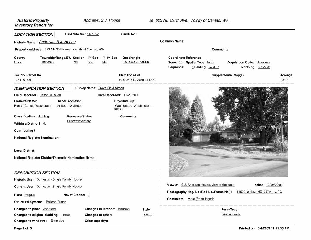
Andrews, S.J. HouseHistoric Property Inventory Report for
at 623 NE 257th Ave, vicinity of Camas, WA
Field Site No.: 14597-2 OAHP No.:
Historic Name: Andrews, S.J. House Common Name:
County
Plat/Block/Lot
#25, 28 B.L. Gardner DLC
Acreage
10.07
Supplemental Map(s)Tax No./Parcel No.
175478-000
Property Address: 623 NE 257th Ave, vicinity of Camas, WA
LOCATION SECTION
Comments:
Quadrangle Coordinate ReferenceSectionTownship/Range/EW 1/4 Sec 1/4 1/4 Sec
Owner Address:
24 South A Street
Field Recorder: Jason M. Allen
Owner's Name:
Port of Camas Washougal
City/State/Zip:
Washougal, Washington 98671
National Register District/Thematic Nomination Name:
Local District:
Date Recorded: 10/20/2008
Classification: Building
Within a District? No
Contributing?
Comments
IDENTIFICATION SECTION
National Register Nomination:
DESCRIPTION SECTION
Plan: Irregular
Other (specify):
Style
Historic Use: Domestic - Single Family House
Current Use: Domestic - Single Family House
Structural System: Balloon Frame
No. of Stories: 1
Changes to plan: Moderate
Changes to original cladding: Intact
Changes to windows: Extensive
Changes to interior: Unknown
Changes to other:
Resource Status
Form/Type
View of S.J. Andrews House, view to the east. taken 10/20/2008
Photography Neg. No (Roll No./Frame No.): 14597_2_623_NE_257th_1.JPG
Comments: west (front) façade
Survey Name: Grove Field Airport
Clark LACAMAS CREEK26 SW NET02R03E Acquisition Code: UnknownSpatial Type: PointZone: 10
Northing: 5052772Easting: 546117Sequence: 1
Ranch
Survey/Inventory
Single Family
Page 1 of 3 Printed on 3/4/2009 11:11:55 AM
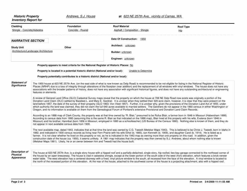
Andrews, S.J. HouseHistoric Property Inventory Report for
at 623 NE 257th Ave, vicinity of Camas, WA
Cladding Roof MaterialFoundation
NARRATIVE SECTION
Architect: unknown
Engineer: unknown
Date Of Construction: 1950
Property appears to meet criteria for the National Register of Historic Places: No
Property is located in a potential historic district (National and/or local): Unable to Determine
The 1950 house at 623 NE 257th Ave. (on the east side of what is now known as Delp Road) is recommended to be not eligible for listing in the National Register of Historic Places (NRHP) due to a loss of integrity through alterations of the floorplan (rear addition) and the replacement of all windows with vinyl windows. The house does not have any associations with the broader patterns of history, does not have any association with significant historical figures, and does not have any outstanding architectural or engineering features or elements.
A review of General Land Office (GLO) Cadastral Survey maps reveal that the property on which the house at 708 NE Delp Road now exists was originally a portion of the Donation Land Claim (DLC) settled by Bazeleel.L. and Mary E. Gardner. It is unclear when they settled their 320-acre claim, however, it is clear that they were present on the land before 1857, the date of the survey of their property (GLO 1863; Von Vleet 1857). Further, it is unclear why, given the provisions of the Donation Land Act of 1850, under which authority the land was claimed, they did not claim the full 640 acres available to married settlers. The Gardners do not appear in the 1860 census in either Washington or Oregon, and no information is available on them from the Genealogical Forum of Portland’s extensive Provisional and Donation Land Claim Records.
According to an 1888 map of Clark County, the property was at that time owned by “R. Blair,” presumed to be Rufus Blair, a farmer born in 1848 in Missouri (Habersham 1888). According to census data from 1880 (assuming this is the same R. Blair as that indicated on the 1888 map), Blair lived at this property with his wife, Evalena (born 1846 in Missouri) and his brother, Hannibal (born 1856 in Missouri, employed in 1880 as a schoolteacher) (US Bureau of the Census 1880). Nothing else is known of them, and they do not appear in next available census data from 1900.
The next available map, dated 1943, indicates that at that time the land was owned by C.G. Tweedt (Metsker Maps 1943). This is believed to be Christ J. Tweedt, born in Idaho in 1882, and indicated in 1930 census records as living near Fern Prairie with his wife Ethel (b. 1885), son Kenneth (b. 1909), and daughter Carol (b. 1914). He is listed as a farmer. It is not clear whether he lived on this property or not, as he is indicated in the 1943 map as owning more than one property on this road. In addition, given the construction date of the house (ca. 1950), it seems unlikely. A 1961 map indicates that the property was then owned by S.J. Andrews, about whom nothing else is known (Metsker Maps 1961). Likely, he or an owner between him and Tweedt had the house built.
Statement of Significance
Description of Physical Appearance
The house at 623 NE 257th Ave. is a single story house with a hipped roof and a partially-detached, single story, hip-roofed, two-bay garage connected to the northeast corner of the house by an open breezeway. The house is clad in asbestos shingle, except at the lower portion of the south side of the west (fron) elevation, which features a brick-veneer water table. The west elevation has a centered doorway with a fixed, vinyl picture window to the south, all recessed from the face of the elevation. A vinyl window is located to the north of the recessed portion of this elevation. At the rear of the house, attached to the southwest corner of the house is a projecting attachment, also with a hipped roof.
Study Unit Other
Roof Type
Builder: unknown
Property potentially contributes to a historic district (National and/or local):
Shingle - Concrete/Asbestos Asphalt / Composition - ShingleConcrete - Poured
Architecture/Landscape Architecture
Hip
Page 2 of 3 Printed on 3/4/2009 11:11:55 AM

Andrews, S.J. HouseHistoric Property Inventory Report for
at 623 NE 257th Ave, vicinity of Camas, WA
General Land Office (GLO) 1863�Plat of Township 2 North, Range 3 East, Willamette Meridian. Microfiche. On file, U.S. Bureau of Land Management, Oregon State Office, Portland.
Habersham, R.A.1888�Map of Clarke County, Washington Territory. On file, Fort Vancouver Regional Library, Vancouver, Washington.
Metsker Maps 1943 Metsker’s Atlas of Clark County. Charles F. Metsker, Portland and Tacoma. 1961 Metsker’s Atlas of Clark County. Charles F. Metsker, Portland and Tacoma.
United States Bureau of the Census 1930 Manuscript Population Census of the United States. Thirteenth Census of the United States. State of Washington, Clark County, Fern Prairie Precinct. Available at:http://www.proquest.com/products_hq/census/default.shtml. Accessed October 23, 2008.
Von Vleet, Lewis 1857 Notes on the Survey of the Land Claim of B.L. Gardner, Township 2 North, Range 3 East, Willamette Meridian, Claim No. 43. Available at: http://www.blm.gov/or/landrecords/survey/yNoteView1_2.php?D0002WA0224002250. Accessed August 28, 2008.
Major BibliographicReferences
Page 3 of 3 Printed on 3/4/2009 11:11:56 AM
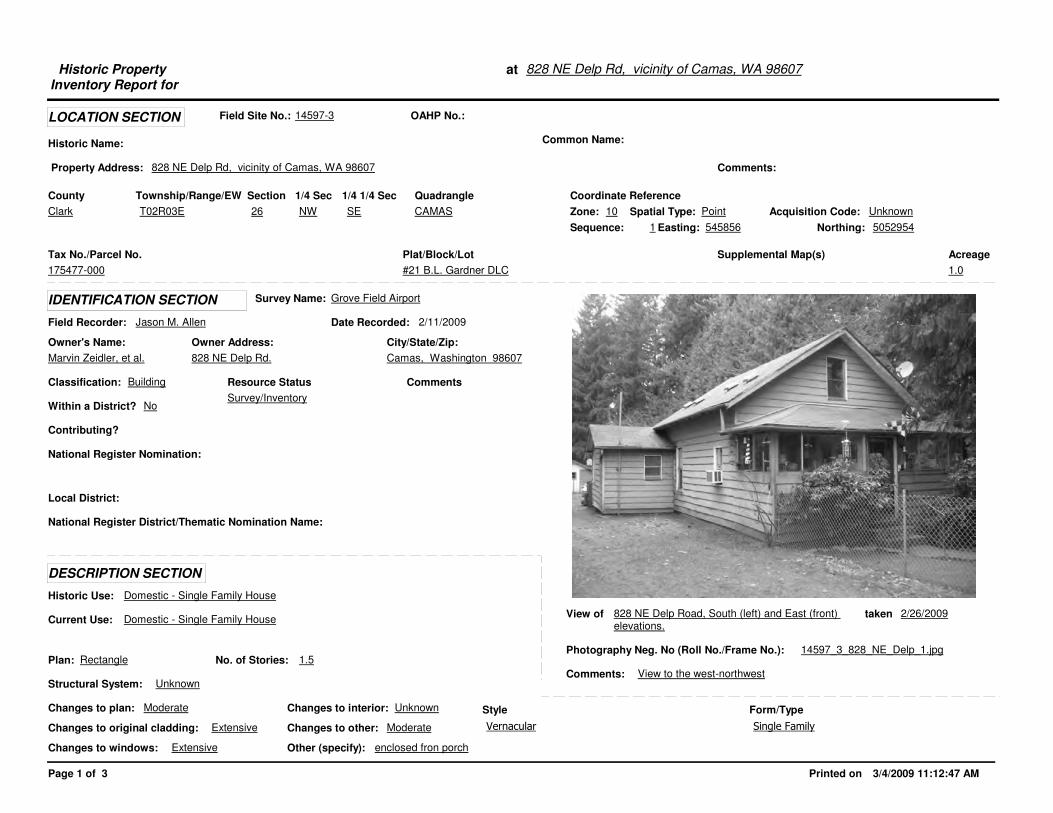
Historic Property Inventory Report for
at 828 NE Delp Rd, vicinity of Camas, WA 98607
Field Site No.: 14597-3 OAHP No.:
Historic Name: Common Name:
County
Plat/Block/Lot
#21 B.L. Gardner DLC
Acreage
1.0
Supplemental Map(s)Tax No./Parcel No.
175477-000
Property Address: 828 NE Delp Rd, vicinity of Camas, WA 98607
LOCATION SECTION
Comments:
Quadrangle Coordinate ReferenceSectionTownship/Range/EW 1/4 Sec 1/4 1/4 Sec
Owner Address:
828 NE Delp Rd.
Field Recorder: Jason M. Allen
Owner's Name:
Marvin Zeidler, et al.
City/State/Zip:
Camas, Washington 98607
National Register District/Thematic Nomination Name:
Local District:
Date Recorded: 2/11/2009
Classification: Building
Within a District? No
Contributing?
Comments
IDENTIFICATION SECTION
National Register Nomination:
DESCRIPTION SECTION
Plan: Rectangle
Other (specify): enclosed fron porch
Style
Historic Use: Domestic - Single Family House
Current Use: Domestic - Single Family House
Structural System: Unknown
No. of Stories: 1.5
Changes to plan: Moderate
Changes to original cladding: Extensive
Changes to windows: Extensive
Changes to interior: Unknown
Changes to other: Moderate
Resource Status
Form/Type
View of 828 NE Delp Road, South (left) and East (front) elevations.
taken 2/26/2009
Photography Neg. No (Roll No./Frame No.): 14597_3_828_NE_Delp_1.jpg
Comments: View to the west-northwest
Survey Name: Grove Field Airport
Clark CAMAS26 NW SET02R03E Acquisition Code: UnknownSpatial Type: PointZone: 10
Northing: 5052954Easting: 545856Sequence: 1
Vernacular
Survey/Inventory
Single Family
Page 1 of 3 Printed on 3/4/2009 11:12:47 AM

Historic Property Inventory Report for
at 828 NE Delp Rd, vicinity of Camas, WA 98607
Cladding Roof MaterialFoundation
NARRATIVE SECTION
Architect: unknown
Engineer: unknown
Date Of Construction: 1931
Property appears to meet criteria for the National Register of Historic Places: No
Property is located in a potential historic district (National and/or local): No
The house is recommended to be not eligible for listing in the National Register of Historic Places (NRHP) due to an irretrievable loss of integrity. Alterations to the home include replacement of the original wood siding with modern wood fiberboard siding, replacement of original wood sash windows with aluminum sash windows, enclosure of the front porch, and a single-story rear addition that more than spans the width of the house, extending beyond the original width by some 8 feet. The rear addition in total expands the original footprint by some 300 square feet.
A review of General Land Office (GLO) Cadastral Survey maps reveal that the property on which the house at 708 NE Delp Road now exists was originally a portion of the Donation Land Claim (DLC) settled by Bazeleel.L. and Mary E. Gardner. It is unclear when they settled their 320-acre claim, however, it is clear that they were present on the land before 1857, the date of the survey of their property (GLO 1863; Von Vleet 1857). Further, it is unclear why, given the provisions of the Donation Land Act of 1850, under which authority the land was claimed, they did not claim the full 640 acres available to married settlers. The Gardners do not appear in the 1860 census in either Washington or Oregon, and no information is available on them from the Genealogical Forum of Portland’s extensive Provisional and Donation Land Claim Records.
According to an 1888 map of Clark County, the property was at that time owned by “R. Blair,” presumed to be Rufus Blair, a farmer born in 1848 in Missouri (Habersham 1888). According to census data from 1880 (assuming this is the same R. Blair as that indicated on the 1888 map), Blair lived at this property with his wife, Evalena (born 1846 in Missouri) and his brother, Hannibal (born 1856 in Missouri, employed in 1880 as a schoolteacher) (US Bureau of the Census 1880). Nothing else is known of them, and they do not appear in next available census data from 1900.
The next available map, dated 1943, indicates that at that time the land was owned by John Johnson (Metsker 1943). A review of available census data indicates that by 1920, Johnson was living at the property with his wife and two sons (US Bureau of the Census 1920). Johnson and his wife were Swedish immigrants, John having immigrated in 1892 and naturalized in 1896, and his wife, Leana, having immigrated in 1885 and naturalized in 1887. Both John and his son Axel worked at the time of the 1920 census at the Camas Water Flume, which served the paper mill in Camas. At that time, his other son, George, worked at the paper mill itself. According to the 1930 census, Johnson lived at that time with his wife and two young grandchildren, and worked at the paper mill (US Bureau of the Census 1930). There are two houses dating to the 1930s on the property that belonged to Johnson at that time, the other being 708 NE Delp Road, somewhat to the southeast of the subject property. Given the known dates of his occupation of the property (1920-1943), and given the construction date of the house (1931), it is believed that the house was built by John Johnson, either for himself or for a family member, such as his son (Clark County GIS 2008).
Statement of Significance
Description of Physical Appearance
The house at 828 NE Delp Road is an altered, 1.5-story vernacular home with associated ca. 1950 garage and carport. The roof of the main mass of the house is front-gabled with overhahnging eaves and exposed rafter ends, clad in asphalt shingles. The siding is recent artificial wood fiber boards oriented horizontally. The windows, while retaining their original size, shape, and locations, have all been replaced with aluminum sash windows. The full-width, hipped-roofed front porch has been enclosed with aluminum fixed and slider windows. The rear addition to the house appears to have been built in two phases, the earlier of the two likely consisting of a simple shed-roofed attachment to the first-floor rear of the house. On the south end of this, what appears to have been a second build-event created a southern extension of this attachment with some extension to the east, resulting in a small, gabled roof, the gable facing the south. The foundation of the house is concrete.
Study Unit Other
Roof Type
Builder: unknown
Property potentially contributes to a historic district (National and/or local):
Wood - Hardiplank Asphalt / Composition - ShingleConcrete - Poured
Community Planning/Development
Gable - Front Gable
Page 2 of 3 Printed on 3/4/2009 11:12:47 AM

Historic Property Inventory Report for
at 828 NE Delp Rd, vicinity of Camas, WA 98607
Clark County GIS2008 Clark County Property Information. Online Searchable database, available, http://gis.clark.wa.gov/applications/gishome/property/index.cfm?action=account&CFID=197675&CFTOKEN=d55748948880f417-0AA3F55B-1372-4173-F7E1D6B8006B0794&jsessionid=f030dc1524e04fff05697784d5766066e1e1
General Land Office (GLO) 1863 Plat of Township 2 North, Range 3 East, Willamette Meridian. Microfiche. On file, U.S. Bureau of Land Management, Oregon State Office, Portland.
Habersham, R.A.1888 Map of Clarke County, Washington Territory. On file, Fort Vancouver Regional Library, Vancouver, Washington.
Metsker Maps 1943 Metsker’s Atlas of Clark County. Charles F. Metsker, Portland and Tacoma.
U.S. Bureau of the Census 1880 Manuscript Population Census of the United States. Tenth Census of the UnitedStates. Washington Territory, Clark County, Enumeration District 23. Available at:http://www.proquest.com/products_hq/census/default.shtml. Accessed October 23, 2008.
1920 Manuscript Population Census of the United States. Twelfth Census of the United States. State of Washington, Clark County, Fern Prairie Precinct. Available at:http://www.proquest.com/products_hq/census/default.shtml. Accessed October 23, 2008.
1930 Manuscript Population Census of the United States. Thirteenth Census of the United States. State of Washington, Clark County, Fern Prairie Precinct. Available at:http://www.proquest.com/products_hq/census/default.shtml. Accessed October 23, 2008.
Von Vleet, Lewis 1857 Notes on the Survey of the Land Claim of B.L. Gardner, Township 2 North, Range 3 East, Willamette Meridian, Claim No. 43. Available at: http://www.blm.gov/or/landrecords/survey/yNoteView1_2.php?D0002WA0224002250. Accessed August 28, 2008.
The ca. 1950 detached garage is located to the east of the house, directly in front of it. The garage is sided with the same fiberboard material found on the house. It has a gabled roof, oriented roughly north-south (opposed to the orientation of the nearby house), and has a single vehicle door and a single entry door, both on the east elevation. At the south end of the garage is an incorporated carport supported by square posts.
Major BibliographicReferences
Page 3 of 3 Printed on 3/4/2009 11:12:47 AM

View of 828 NE Delp Road, west (left) and south (right) elevations
taken 3/26/2009
Photography Neg. No (Roll No./Frame No.): 14597_3_828_NE_Delp_2.jpg
Comments: View to the Northeast
View of taken
Photography Neg. No (Roll No./Frame No.):
Comments:
Printed on 3/4/2009 11:12:47 AM
Additional Photos for: at 828 NE Delp Rd, vicinity of Camas, WA 98607
View of taken
Photography Neg. No (Roll No./Frame No.):
Comments:
View of taken
Photography Neg. No (Roll No./Frame No.):
Comments:

Historic Property Inventory Report for
at 615 NE 257th Ave, vicinity of Camas, WA 98607
Field Site No.: 14597-4 OAHP No.:
Historic Name: Common Name:
County
Plat/Block/Lot
#30 B.L. Gardner DLC
Acreage
0.39
Supplemental Map(s)Tax No./Parcel No.
175486-000
Property Address: 615 NE 257th Ave, vicinity of Camas, WA 98607
LOCATION SECTION
Comments:
Quadrangle Coordinate ReferenceSectionTownship/Range/EW 1/4 Sec 1/4 1/4 Sec
Owner Address:
29809 NE Ammeter Rd
Field Recorder: Jason M. Allen
Owner's Name:
Edward F. Pallamounter, et al.
City/State/Zip:
Washougal, Washington 98671
National Register District/Thematic Nomination Name:
Local District:
Date Recorded: 2/11/2009
Classification: Building
Within a District? No
Contributing?
Comments
IDENTIFICATION SECTION
National Register Nomination:
DESCRIPTION SECTION
Plan: Irregular
Other (specify):
Style
Historic Use: Domestic - Single Family House
Current Use: Domestic - Single Family House
Structural System: Balloon Frame
No. of Stories: 1
Changes to plan: Extensive
Changes to original cladding: Extensive
Changes to windows: Extensive
Changes to interior: Unknown
Changes to other:
Resource Status
Form/Type
View of 615 NE 257th Avenue, view to the northeast taken 2/11/2009
Photography Neg. No (Roll No./Frame No.): 14597_4_615_NE_257th_1.jpg
Comments: house, west (front) and south (side) elevations
Survey Name: Grove Field Airport
Clark CAMAS26 SW NET02R03E Acquisition Code: UnknownSpatial Type: PointZone: 10
Northing: 5052735Easting: 546121Sequence: 1
Ranch - World War II Era Cottage
Survey/Inventory
Single Family
Page 1 of 3 Printed on 3/4/2009 11:13:44 AM

Historic Property Inventory Report for
at 615 NE 257th Ave, vicinity of Camas, WA 98607
Cladding Roof MaterialFoundation
NARRATIVE SECTION
Architect: unknown
Engineer: unknown
Date Of Construction: 1942
Property appears to meet criteria for the National Register of Historic Places: No
Property is located in a potential historic district (National and/or local): No
The house at 615 NE 257th Avenue is recommended to be not eligible for listing in the National Register of Historic Places due to an irreversible loss of integrity. The house has been heavily altered through the replacement of all original siding with modern T-1-11 plywood siding, the expansion of the house through construction of rear additions that more than double the original footprint, the replacement of all windows in the house with modern vinyl windows, and the replacement of the front porch rails.
A review of General Land Office (GLO) Cadastral Survey maps reveal that the property on which the house at 708 NE Delp Road now exists was originally a portion of the Donation Land Claim (DLC) settled by Bazeleel.L. and Mary E. Gardner. It is unclear when they settled their 320-acre claim, however, it is clear that they were present on the land before 1857, the date of the survey of their property (GLO 1863; Von Vleet 1857). Further, it is unclear why, given the provisions of the Donation Land Act of 1850, under which authority the land was claimed, they did not claim the full 640 acres available to married settlers. The Gardners do not appear in the 1860 census in either Washington or Oregon, and no information is available on them from the Genealogical Forum of Portland’s extensive Provisional and Donation Land Claim Records.
According to an 1888 map of Clark County, the property was at that time owned by “R. Blair,” presumed to be Rufus Blair, a farmer born in 1848 in Missouri (Habersham 1888). According to census data from 1880 (assuming this is the same R. Blair as that indicated on the 1888 map), Blair lived at this property with his wife, Evalena (born 1846 in Missouri) and his brother, Hannibal (born 1856 in Missouri, employed in 1880 as a schoolteacher) (US Bureau of the Census 1880). Nothing else is known of them, and they do not appear in next available census data from 1900.
The next available map, dated 1943, indicates that at that time the land was owned by C.G. Tweedt (Metsker Maps 1943). This is believed to be Christ J. Tweedt, born in Idaho in 1882, and indicated in 1930 census records as living near Fern Prairie with his wife Ethel (b. 1885), son Kenneth (b. 1909), and daughter Carol (b. 1914). He is listed as a farmer. It is not clear whether he lived on this property or not, as he is indicated in the 1943 map as owning more than one property on this road. However, given the construction date of the house (ca. 1942), it seems possible. A 1961 map indicates that the property was then owned by S.J. Andrews, about whom nothing else is known (Metsker Maps 1961).
Statement of Significance
Description of Physical Appearance
The house at 615 NE 257th Avenue is a single-story, side-gabled home with substantial alterations. The roof is clad in asphalt shingles, and a tall stovepipe extends from the south side of the front (western) slope. The entire house has been reclad in T-1-11 plywood siding, and the windows have all been replaced with modern vinyl windows, including a graden window installed on the south elevation. The rear of the house has had major alterations in the form of what appear to be two major additions, together more than doubling the original footprint. In the southeast corner of the house is an addition with a low-pitched roof, descending toward the south. In the center of the rear of the house is an east-facing cross-gable that may be original to the house. Extending off the north side of the crossgable is another addition, this one extending beyond the north wall of the original portion of the house. The entire house is set upon a concrete foundation. To the east of the house is a large, modern garage with siding that matches the house.
Study Unit Other
Roof Type
Builder: unknown
Property potentially contributes to a historic district (National and/or local):
Wood - T 1-11 Asphalt / Composition - ShingleConcrete - Poured
Community Planning/Development
Gable - Side Gable
Page 2 of 3 Printed on 3/4/2009 11:13:45 AM

Historic Property Inventory Report for
at 615 NE 257th Ave, vicinity of Camas, WA 98607
General Land Office (GLO) 1863 Plat of Township 2 North, Range 3 East, Willamette Meridian. Microfiche. On file, U.S. Bureau of Land Management, Oregon State Office, Portland.
Habersham, R.A.1888 Map of Clarke County, Washington Territory. On file, Fort Vancouver Regional Library, Vancouver, Washington.
Metsker Maps 1943 Metsker’s Atlas of Clark County. Charles F. Metsker, Portland and Tacoma. 1961 Metsker’s Atlas of Clark County. Charles F. Metsker, Portland and Tacoma.
United States Bureau of the Census 1930 Manuscript Population Census of the United States. Thirteenth Census of the United States. State of Washington, Clark County, Fern Prairie Precinct. Available at:http://www.proquest.com/products_hq/census/default.shtml. Accessed October 23, 2008.
Von Vleet, Lewis 1857 Notes on the Survey of the Land Claim of B.L. Gardner, Township 2 North, Range 3 East, Willamette Meridian, Claim No. 43. Available at: http://www.blm.gov/or/landrecords/survey/yNoteView1_2.php?D0002WA0224002250. Accessed August 28, 2008.
Major BibliographicReferences
Page 3 of 3 Printed on 3/4/2009 11:13:45 AM
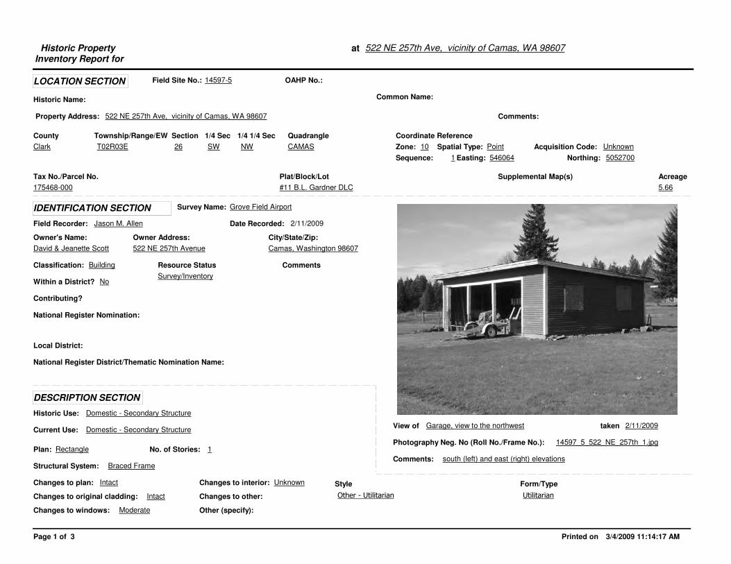
Historic Property Inventory Report for
at 522 NE 257th Ave, vicinity of Camas, WA 98607
Field Site No.: 14597-5 OAHP No.:
Historic Name: Common Name:
County
Plat/Block/Lot
#11 B.L. Gardner DLC
Acreage
5.66
Supplemental Map(s)Tax No./Parcel No.
175468-000
Property Address: 522 NE 257th Ave, vicinity of Camas, WA 98607
LOCATION SECTION
Comments:
Quadrangle Coordinate ReferenceSectionTownship/Range/EW 1/4 Sec 1/4 1/4 Sec
Owner Address:
522 NE 257th Avenue
Field Recorder: Jason M. Allen
Owner's Name:
David & Jeanette Scott
City/State/Zip:
Camas, Washington 98607
National Register District/Thematic Nomination Name:
Local District:
Date Recorded: 2/11/2009
Classification: Building
Within a District? No
Contributing?
Comments
IDENTIFICATION SECTION
National Register Nomination:
DESCRIPTION SECTION
Plan: Rectangle
Other (specify):
Style
Historic Use: Domestic - Secondary Structure
Current Use: Domestic - Secondary Structure
Structural System: Braced Frame
No. of Stories: 1
Changes to plan: Intact
Changes to original cladding: Intact
Changes to windows: Moderate
Changes to interior: Unknown
Changes to other:
Resource Status
Form/Type
View of Garage, view to the northwest taken 2/11/2009
Photography Neg. No (Roll No./Frame No.): 14597_5_522_NE_257th_1.jpg
Comments: south (left) and east (right) elevations
Survey Name: Grove Field Airport
Clark CAMAS26 SW NWT02R03E Acquisition Code: UnknownSpatial Type: PointZone: 10
Northing: 5052700Easting: 546064Sequence: 1
Other - Utilitarian
Survey/Inventory
Utilitarian
Page 1 of 3 Printed on 3/4/2009 11:14:17 AM

Historic Property Inventory Report for
at 522 NE 257th Ave, vicinity of Camas, WA 98607
Cladding Roof MaterialFoundation
NARRATIVE SECTION
Architect: unknown
Engineer: unknown
Date Of Construction: ca. 1950
Property appears to meet criteria for the National Register of Historic Places: No
Property is located in a potential historic district (National and/or local): No
The garage at 522 NE 257th Avenue is recommended to be not eligible for listing in the National Register of Historic Places because it appears to0 be a remnant of an earlier farmstead or domestic complex. No other structures on the property predate 2000, the construction date of the large house which shares the parcel with the garage. The garage itself has no outstanding design qualities, has no known association with important events or people, and does not appear to have any potential to yield important information not to be found in the documentary record. The garage has also lost integrity, as the windows have been removed and the openings boarded over, and the north elevation exhibits mismatched siding, likely the result of some repair in the past.
A review of General Land Office (GLO) Cadastral Survey maps reveal that the property on which the house at 708 NE Delp Road now exists was originally a portion of the Donation Land Claim (DLC) settled by Bazeleel.L. and Mary E. Gardner. It is unclear when they settled their 320-acre claim, however, it is clear that they were present on the land before 1857, the date of the survey of their property (GLO 1863; Von Vleet 1857). Further, it is unclear why, given the provisions of the Donation Land Act of 1850, under which authority the land was claimed, they did not claim the full 640 acres available to married settlers. The Gardners do not appear in the 1860 census in either Washington or Oregon, and no information is available on them from the Genealogical Forum of Portland’s extensive Provisional and Donation Land Claim Records.
According to an 1888 map of Clark County, the property was at that time owned by “R. Blair,” presumed to be Rufus Blair, a farmer born in 1848 in Missouri (Habersham 1888). According to census data from 1880 (assuming this is the same R. Blair as that indicated on the 1888 map), Blair lived at this property with his wife, Evalena (born 1846 in Missouri) and his brother, Hannibal (born 1856 in Missouri, employed in 1880 as a schoolteacher) (US Bureau of the Census 1880). Nothing else is known of them, and they do not appear in next available census data from 1900.
The next available map indicating land ownership is dated 1943, and shows the owner at that time to have been W.B. Wilson. Nothing is known of Wilson, and he does not appear in the last available census information (1930). T^he next available map is dated 1961, and indicates that at that time the property was owned by Wayne Scott. Again, Scott does not appear in the census information, and nothinf further is known of him. Given the date of construction of the garage, which appears, based on design and materials to have been ca. 1950, it is likely that the garage is associated either with Wilson's or Scott's residency on the property.
Statement of Significance
Description of Physical Appearance
The garage at 522 NE 257th is located at the northeastern corner of that parcel, adjacent to the road on the east and the property boundary on the north. The building is rectangular with a shed roof clad in corrugated steel. The walls are clad in horizontal wood board, and appears intact except for an area on the north elevation, where some of the original board has been replaced with much larger, non-matching boards. Windows on the east, north and west elevations have been removed and the openings boarded over with plywood. The south (front) elevation of the garage has three equal-sized vehicle openings separated by square wood posts. There are no doors on these openings. The garage is set upon a poured concrete foundation with low kneewalls upon which the sills of the wood-framed building are set.
Study Unit Other
Roof Type
Builder: unknown
Property potentially contributes to a historic district (National and/or local):
Wood Metal - CorrugatedConcrete - Poured
Community Planning/Development
Shed
Page 2 of 3 Printed on 3/4/2009 11:14:17 AM

Historic Property Inventory Report for
at 522 NE 257th Ave, vicinity of Camas, WA 98607
General Land Office (GLO) 1863 Plat of Township 2 North, Range 3 East, Willamette Meridian. Microfiche. On file, U.S. Bureau of Land Management, Oregon State Office, Portland.
Habersham, R.A.1888 Map of Clarke County, Washington Territory. On file, Fort Vancouver Regional Library, Vancouver, Washington.
Metsker Maps 1943 Metsker’s Atlas of Clark County. Charles F. Metsker, Portland and Tacoma. 1961 Metsker’s Atlas of Clark County. Charles F. Metsker, Portland and Tacoma.
United States Bureau of the Census 1930 Manuscript Population Census of the United States. Thirteenth Census of the United States. State of Washington, Clark County, Fern Prairie Precinct. Available at:http://www.proquest.com/products_hq/census/default.shtml. Accessed October 23, 2008.
Von Vleet, Lewis 1857 Notes on the Survey of the Land Claim of B.L. Gardner, Township 2 North, Range 3 East, Willamette Meridian, Claim No. 43. Available at: http://www.blm.gov/or/landrecords/survey/yNoteView1_2.php?D0002WA0224002250. Accessed August 28, 2008.
Major BibliographicReferences
Page 3 of 3 Printed on 3/4/2009 11:14:17 AM


Cowlitz Indian Tribe P.O. Box 2547 Longview, WA 98632
360.577.8140 577.7432 (f)
Cowlitz Indian Tribe Cultural Resources Department P.O. Box 2547 1055 9th Ave. Suite C Longview, WA 98632
360.577.6962 577.6207 (f) www.cowlitz.org
July 16, 2009 Cayla D. Morgan Environmental Porjtection Specialist Seattle Airports District Office 1601 Lind Avenue SW, Suite 250 Renton, WA 98055-4056 RE: Grove Field Airport Improvement Project Camas, WA. Dear Ms. Morgan: In reference to the project stated above, the Cultural Resources Department of the Cowlitz Indian Tribe would like to state its interest. The Cowlitz Indian Tribe recommends an Inadvertent Discovery Plan be attached to the permit; we have included language for your consideration. Please contact us with any questions or concerns you may have. We look forward to working with you on this undertaking. Thank you for your time and attention. All My Relations, dAVe burlingame Director, Cultural Resources 360.577.6962 508.1677 [c] 577.6207 [f] CC: Robert Whitlam, Department of Archaeology and Historic Preservation Sarah Lucas, W&H Pacific Scott Walstra, Port of Camas – Washougal Ed Arthur, Cowlitz Indian Tribe