Embed Size (px)
Citation preview
Kings Beach Water Quality and SEZ Improvement Project Final Environmental Compliance Document
APPENDIX H: PUBLIC MEETINGS/PUBLIC SCOPING Placer County facilitated three public meetings during the Project planning and environmental review process. The public meetings were advertised in the Sierra Sun and Tahoe World, and flyers were handed out door to door to residents along Griff Creek. Documentation from the meetings (e.g., public notices, meeting minutes and printed copies of the slide shows) is included herewith. No written comments were received from the public during the planning process. Several written comments were received during the environmental review period. The comments are compiled in the Response to Comments report attached to this environmental document.
November 2008

Kings Beach Water Quality and SEZ Improvement Project Final Environmental Compliance Document
THIS PAGE INTENTIONALLY BLANK
November 2008
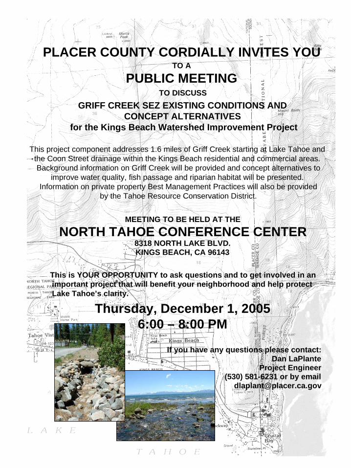
PLACER COUNTY CORDIALLY INVITES YOU TO A
PUBLIC MEETING TO DISCUSS
GRIFF CREEK SEZ EXISTING CONDITIONS AND CONCEPT ALTERNATIVES
for the Kings Beach Watershed Improvement Project
This project component addresses 1.6 miles of Griff Creek starting at Lake Tahoe and . the Coon Street drainage within the Kings Beach residential and commercial areas.
Background information on Griff Creek will be provided and concept alternatives to improve water quality, fish passage and riparian habitat will be presented.
Information on private property Best Management Practices will also be provided by the Tahoe Resource Conservation District.
MEETING TO BE HELD AT THE
NORTH TAHOE CONFERENCE CENTER 8318 NORTH LAKE BLVD. KINGS BEACH, CA 96143
This is YOUR OPPORTUNITY to ask questions and to get involved in an important project that will benefit your neighborhood and help protect Lake Tahoe’s clarity.
Thursday, December 1, 2005 6:00 – 8:00 PM
If you have any questions please contact: Dan LaPlante
Project Engineer (530) 581-6231 or by email
PLACER COUNTY CORDIALLY INVITES YOU TO ATTEND:
THE KINGS BEACH WATERSHED IMPROVEMENT PROJECT
GRIFF CREEK EXISTING CONDITIONS
AND WATER QUALITY ALTERNATIVES
PUBLIC MEETING NORTH TAHOE CONFERENCE CENTER
8318 NORTH LAKE BOULEVARD KINGS BEACH, CA 96143
THURSDAY, DECEMBER 1, 2005
6:00 PM – 8:00 PM
This is YOUR OPPORTUNITY to become involved, offer suggestions and ask questions.
Project Description:
The Kings Beach Watershed Improvement Project was initiated by Placer County to improve water quality and storm water drainage within the Kings Beach residential and
commercial areas. In order to address the entire watershed leading to and including these areas, the project also examines the existing conditions and potential water quality
improvements along portions of Griff Creek and the Coon Street drainage. The Griff Creek portion of the project includes 1.6 miles of stream beginning at Lake Tahoe. The project proposes concept alternatives that will improve water quality, fish passage and
habitat and protect Lake Tahoe’s clarity.
Meeting Purpose:
Existing conditions and concept alternatives for Griff Creek and the Coon Street drainage will be presented to solicit input from the community prior to selecting the
preferred alternative and initiating the design process. If you have questions or would like to submit written comments outside the public forum please contact:
Dan LaPlante, P.E. Associate Civil Engineer
Placer County Department of Public Works, Tahoe Design Division 10825 Pioneer Trail, Suite 105
Truckee, CA 96161 (530) 581-6231 [email protected]
Kings Beach Watershed Improvement Project Griff Creek Existing Conditions and Water Quality Alternatives
Public Meeting
Thursday, December 1, 2005
North Tahoe Conference Center 8318 North Lake Boulevard
Kings Beach, CA 96143 Dan LaPlante, of Placer County Department of Public Works (DPW), opened the meeting and introduced the attendees from Entrix, Inc., TRPA, CTC and TRCD. He then gave a general overview of how Griff Creek fits into the overall Kings Beach Project. It is related to the Kings Beach sidewalk project that has been in the works for several years. In conjunction with that work, the agencies have requested Placer County DPW to do a watershed study that looks at the whole watershed up to Martis Peak and Mt. Waldie. And, by looking at that whole planning area, Placer County can incorporate water quality improvements within the neighborhood. A spin-off of that whole water quality project is the Griff Creek Stream Environment Zone (SEZ) Project.
Scott Cecchi spoke about the Tahoe Resource Conservation District (TRCD) and their role in the community.
Attendees were encouraged to sign-in. This is part of the public and agency consultation process that is included in the environmental document. A comment sheet was also handed out for attendees to express any comments, concerns, observations, or suggestions associated with the Entrix, Inc. presentation. These comments will be folded into the overall planning and design efforts.
This project is the Griff Creek SEZ Existing Conditions Project. The method for measuring existing conditions is by going out to the Project Area and surveying for the hydraulic model to determine what kind of problems can be observed in the floodplain and the channel, and from there to come up potential concept level solutions to remedy the problems. The next phase is to develop and evaluate alternatives, and select a Preferred Alternative.
Entrix, Inc. presented their findings in regards to the existing conditions of the Griff Creek watershed. Copies of the presentation can be obtained by request.
In 1984, a Placer County Erosion Control Project channelized the reach behind the County Library.
Brendan Belby, of Entrix, Inc., asked the attendees who live on the creek to contact him if they knew of certain flood areas that weren’t mapped, or how often the areas around their house flood.
A question from the audience was how often a floodplain should flood. However, there is no definitive answer as every channel floods when it wants to flood. There is no universal equation to determine the exact flood potential.
Another question from the audience was if all the creeks around Tahoe were being analyzed. Brendan stated that Entrix, Inc. is working on the Kings Beach area, Griff Creek, Homewood, Angora Creek, Christmas Valley, and several projects on the Truckee River.
Before 1984, National Avenue has a basin that often has stagnant water during the summer. Downstream of Highway 28 is the worst area. KB Foster did the restoration across from the hardware store. The Forest Service also did a study in the 1990s of that basin, and although it
works really well in the beginning, but over time it is not as efficient. One of the alternatives proposed is to incorporate a management plan to go in periodically and remove material.
What affect is this Project going to have on the street and sidewalk Project? Any recommended changes for the area will have to be incorporated into the design. Some of the watershed boundaries, especially those that cross Highway 28, should be the responsibility of Caltrans. The watershed lines are delineated by the TRPA.
Opportunities will be sought to combine upland runoff with SEZ restoration. Originally the runoff was directed to Griff Creek. One of the things to look at is the overall water quality and separating what is considered clean water, in the urban boundary of Griff Creek, and the dirtier water which is the sediment laden water that runs off the creek. Having the dirtier water go into Griff Creek is a direct shot into Lake Tahoe and is not a good solution. Right now, the erosion control part of the project is just starting to develop alternatives. There will be further Public Meetings to discuss these alternatives.
Right now, conceptual alternatives are being developed, those alternatives will be evaluated, and a Preferred Alternative will be recommended. After that stage, there will be another Public Meeting to bring everyone back together and let them know the ideas that have been formulated and how they were formulated, and then get further input from the community.
The water quality alternatives will be out by January 2006 and will include how the urban area interfaces with Coon Street. In terms of the Coon Street SEZ, there is much less opportunity for SEZ connection than Griff Creek because the Coon Street drainage is very hard to follow; some places flows through open lots, some parts of it flow though private parcels, and some part slow across the road; it is very fragmented. There are also many privately owned parcels associated with Coon Street.
The erosion component of the Project will be looking at how much sediment is loaded into the culverts, as well as under-sized culverts, etc. One of the major issues that need to be addressed tonight is the fact that easements will need to be acquired from residents to do much of the work needed for restoration. Nothing can be done on private property without easements.
Several groundwater wells were put into the urban area to monitor the groundwater.
Outreach for this meeting was done through public notices in the Tahoe World and Sierra Sun, mailers to the Griff Creek homeowners, and notices placed on the doors of Griff Creek residents. Comments submitted by meeting attendees will be included in the next document. Comment cards should be sent to Dan LaPlante.
Almost all the parcels along Griff Creek that are included in the Project Area are privately owned. The Library and the Boys and Girls Club is publicly owned. The abandoned floodplain is where there is real opportunity to make changes, but it is all privately owned.
There is a Technical Advisory Committee (TAC) comprised of staff from Entrix, Placer County, TRPA, Conservancy, US Forest Service, and Lahontan. They would review the alternatives and sign-off on a Preferred Alternative which would then be brought back to the public. An audience member suggested that there be a citizen representative on the group as well.
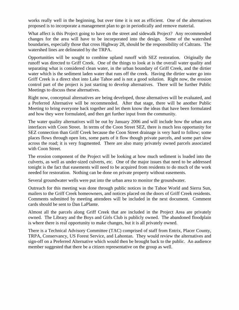
Kings Beach Watershed Improvement Project Stream Environment Zone Existing Conditions and Alternatives
Placer County Department of Public Works ENTRIX, Inc.
Decline in Lake Tahoe’s Water Clarity
• Loss of about 27 feet in water clarity since late 1960s • Increased atmospheric and watershed inputs of nutrients • Increased nutrients supports increased algal production (blue to
green) • Fine grained minerals further reduce clarity and remain suspended
in the lake
1
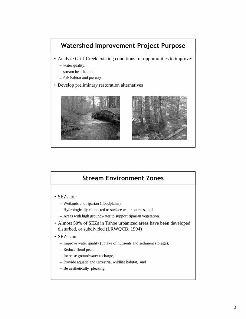
Watershed Improvement Project Purpose
• Analyze Griff Creek existing conditions for opportunities to improve: – water quality, – stream health, and – fish habitat and passage.
• Develop preliminary restoration alternatives
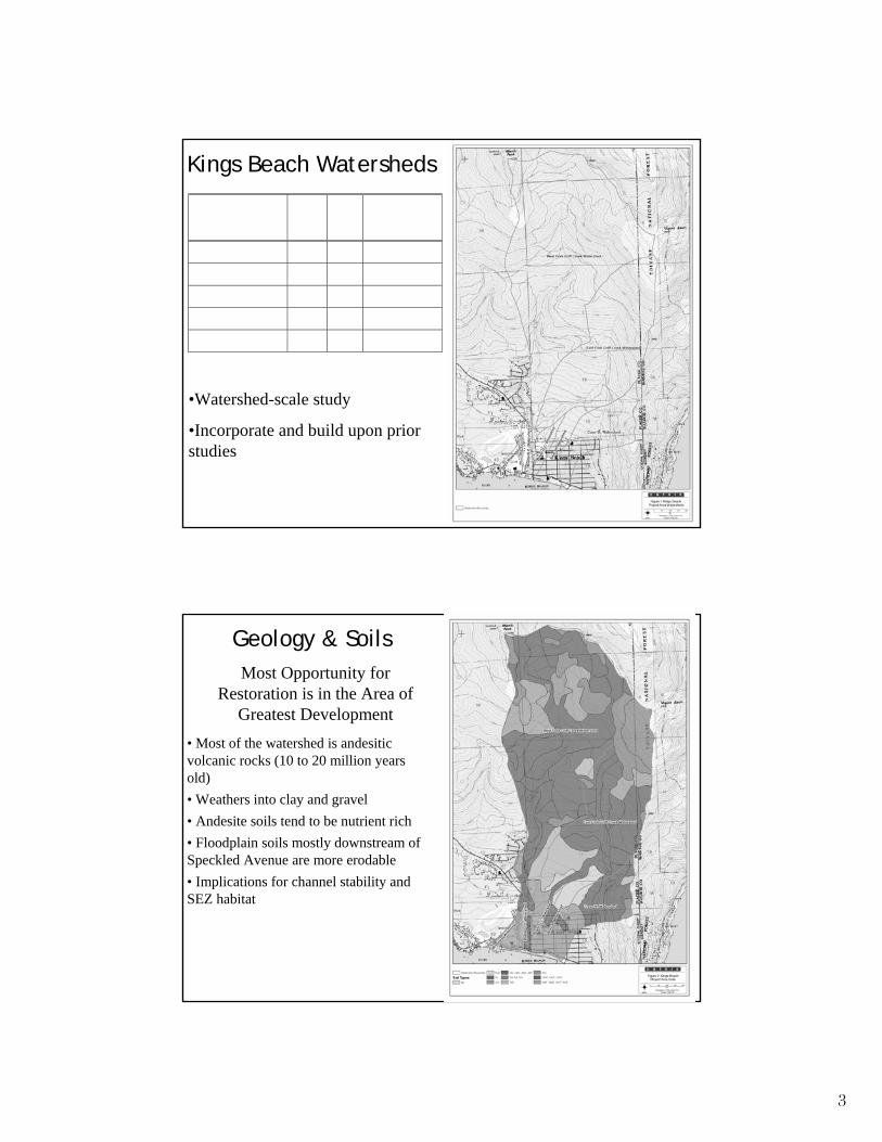
Stream Environment Zones
• SEZs are: – Wetlands and riparian (floodplains), – Hydrologically connected to surface water sources, and – Areas with high groundwater to support riparian vegetation.
• Almost 50% of SEZs in Tahoe urbanized areas have been developed, disturbed, or subdivided (LRWQCB, 1994)
• SEZs can: – Improve water quality (uptake of nutrients and sediment storage), – Reduce flood peak, – Increase groundwater recharge, – Provide aquatic and terrestrial wildlife habitat, and – Be aesthetically pleasing.
2
Sub-WatershedSquareMiles Acres
% of Total GriffCreek
Watershed Area
Lower Griff Creek 0.10 63 2.2
Middle Griff Creek 0.09 55 1.9
East Fork Griff Creek 1.41 900 31.6
West Fork Griff Creek 2.86 1,833 64.3
Total Griff Creek 4.45 2,851 100
Kings Beach Watersheds
•Watershed-scale study
•Incorporate and build upon prior studies
Geology & Soils Most Opportunity for
Restoration is in the Area of Greatest Development
• Most of the watershed is andesitic volcanic rocks (10 to 20 million years old) • Weathers into clay and gravel • Andesite soils tend to be nutrient rich • Floodplain soils mostly downstream ofSpeckled Avenue are more erodable • Implications for channel stability and SEZ habitat
3
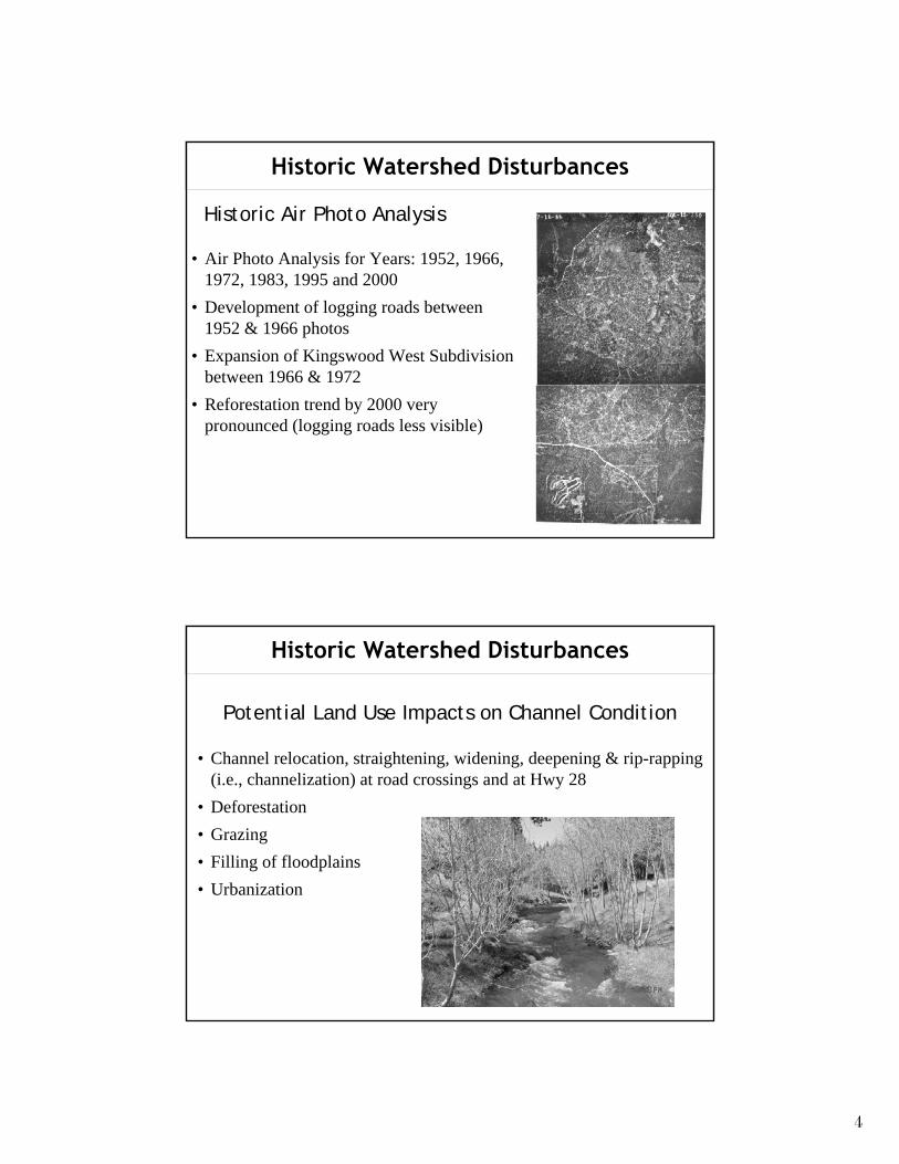
Historic Watershed Disturbances
• Air Photo Analysis for Years: 1952, 1966, 1972, 1983, 1995 and 2000
• Development of logging roads between 1952 & 1966 photos
• Expansion of Kingswood West Subdivision between 1966 & 1972
• Reforestation trend by 2000 very pronounced (logging roads less visible)
Historic Air Photo Analysis
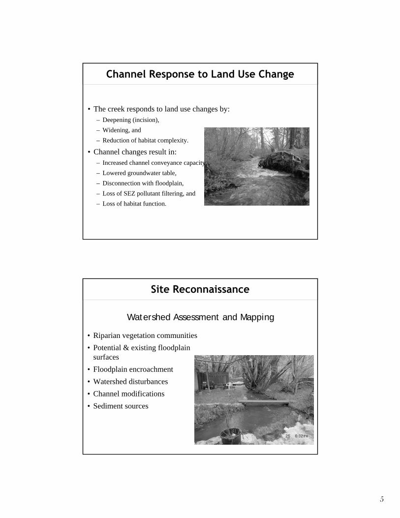
Historic Watershed Disturbances
• Channel relocation, straightening, widening, deepening & rip-rapping (i.e., channelization) at road crossings and at Hwy 28
• Deforestation • Grazing • Filling of floodplains • Urbanization
Potential Land Use Impacts on Channel Condition
4
ity,
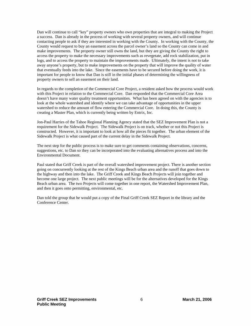
Channel Response to Land Use Change
• The creek responds to land use changes by: – Deepening (incision), – Widening, and – Reduction of habitat complexity.
• Channel changes result in: – Increased channel conveyance capac– Lowered groundwater table, – Disconnection with floodplain, – Loss of SEZ pollutant filtering, and – Loss of habitat function.
Site Reconnaissance
• Riparian vegetation communities • Potential & existing floodplain
surfaces • Floodplain encroachment • Watershed disturbances • Channel modifications • Sediment sources
Watershed Assessment and Mapping
5
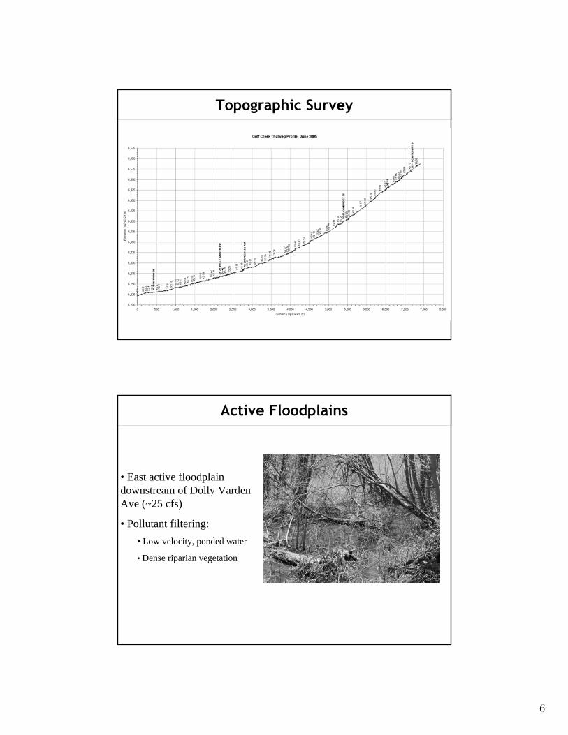
Topographic Survey
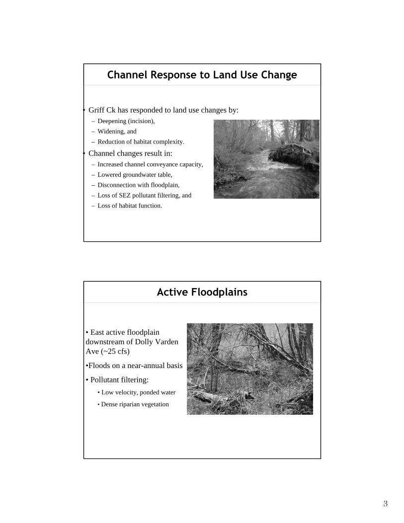
Active Floodplains
• East active floodplain downstream of Dolly Varden Ave (~25 cfs)
• Pollutant filtering: • Low velocity, ponded water
• Dense riparian vegetation
6
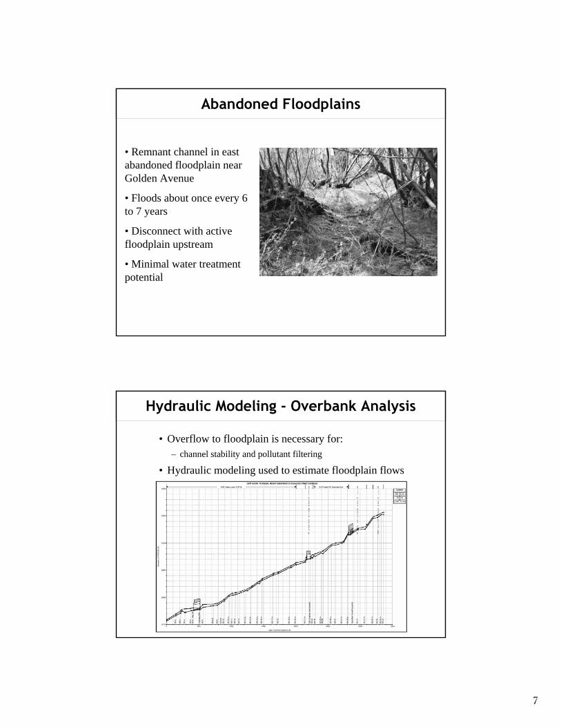
Abandoned Floodplains
• Remnant channel in east abandoned floodplain near Golden Avenue
• Floods about once every 6 to 7 years
• Disconnect with active floodplain upstream
• Minimal water treatment potential
Hydraulic Modeling - Overbank Analysis
• Overflow to floodplain is necessary for: – channel stability and pollutant filtering
• Hydraulic modeling used to estimate floodplain flows
7
Hydraulic Modeling - Overbank Conclusions • Channelized reach downstream of public library
– Infrequent overbank flow (50 - 100 yr event) – No active floodplain downstream Hwy 28
• Public library to Steelhead Avenue – Most severe channel degradation – Overbanking about once every 6 to 8 years – Abandoned floodplain east of channel
• Steelhead Avenue to Dolly Varden Avenue – Active floodplain east of channel – Overbanking about once every 4 to 5 years
• Dolly Varden Avenue to Speckled Avenue – Overbanking about once every 4 to 6 years – Wolf Street fill removal/active floodplain (2 to 3 yr overbank event)
• Upstream of Speckled Avenue – Incised meadow channels US road (4 to 5 yr overbank event) – Minimal urban encroachment upstream (2 to 4 yr overbank event)
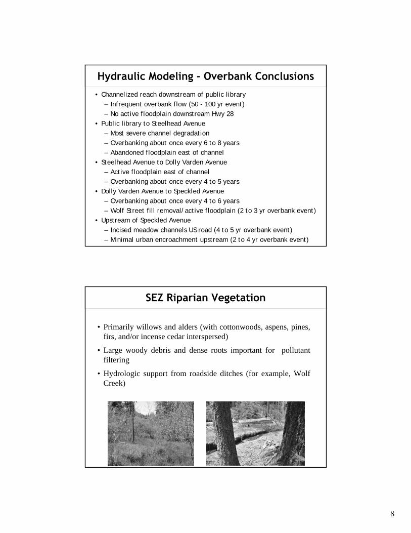
SEZ Riparian Vegetation
• Primarily willows and alders (with cottonwoods, aspens, pines, firs, and/or incense cedar interspersed)
• Large woody debris and dense roots important for pollutant filtering
• Hydrologic support from roadside ditches (for example, Wolf Creek)
8
State Route 28 Culverts
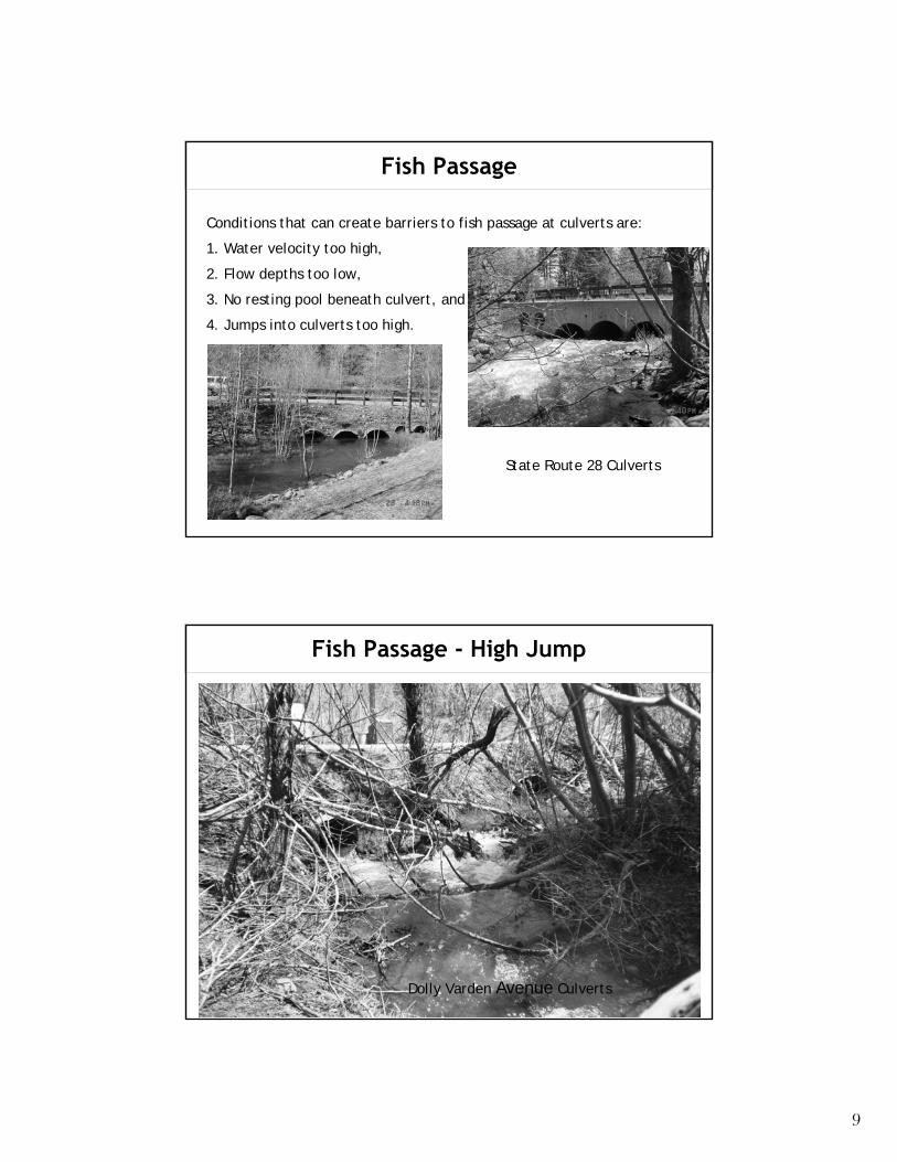
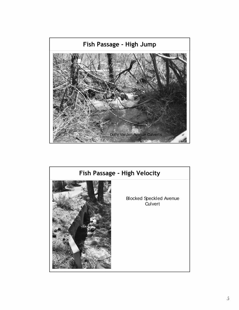
Dolly Varden Avenue Culverts
Fish Passage
Conditions that can create barriers to fish passage at culverts are:
1. Water velocity too high,
2. Flow depths too low,
3. No resting pool beneath culvert, and
4. Jumps into culverts too high.
Fish Passage - High Jump
9
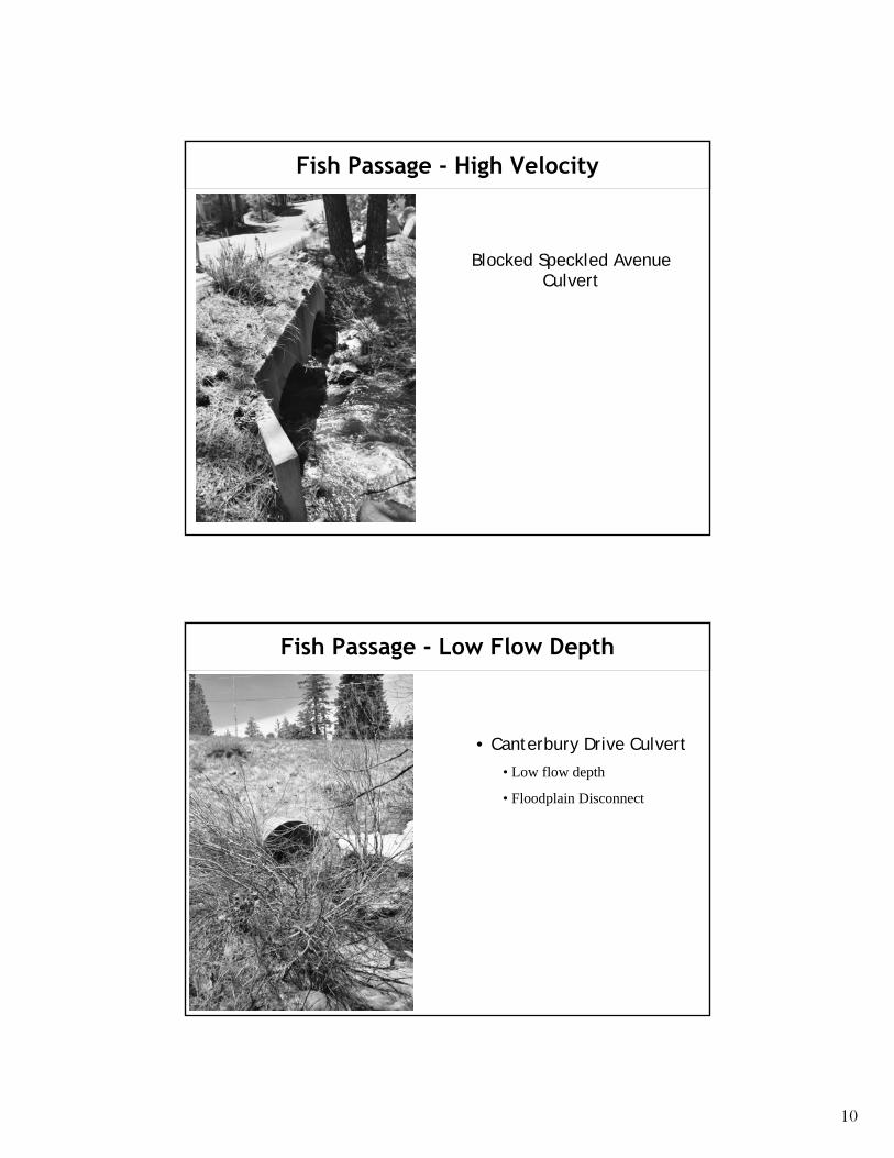
Fish Passage - High Velocity
Blocked Speckled Avenue Culvert
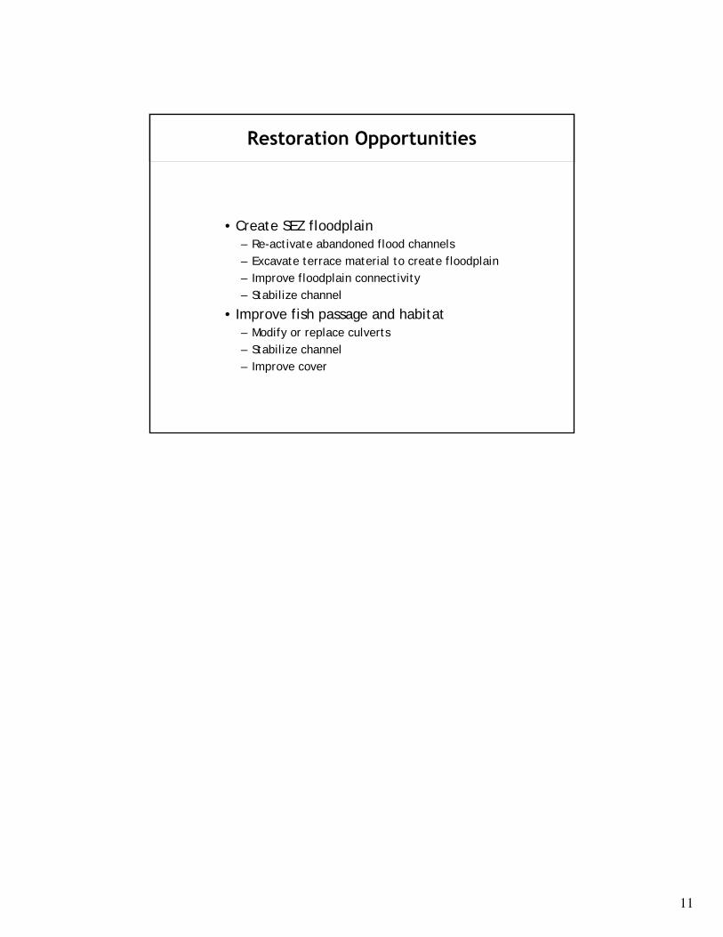
Fish Passage - Low Flow Depth
• Canterbury Drive Culvert
• Low flow depth
• Floodplain Disconnect
10
Restoration Opportunities
• Create SEZ floodplain – Re-activate abandoned flood channels – Excavate terrace material to create floodplain – Improve floodplain connectivity – Stabilize channel
• Improve fish passage and habitat – Modify or replace culverts – Stabilize channel – Improve cover
11
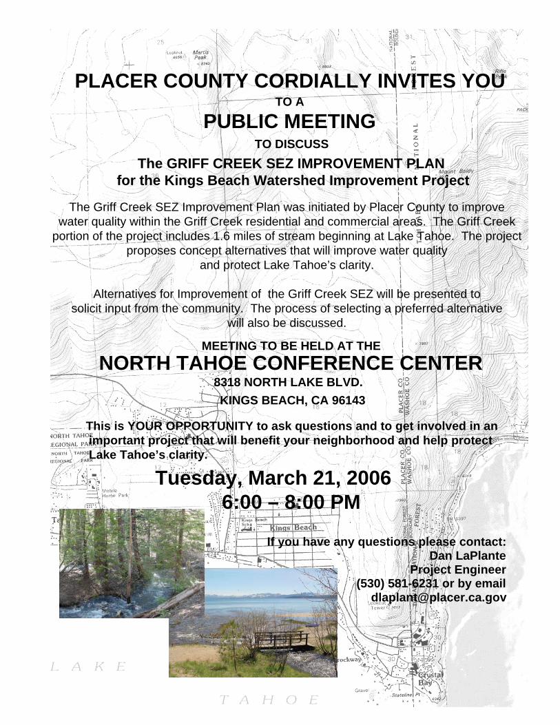
PLACER COUNTY CORDIALLY INVITES YOU TO A
PUBLIC MEETING TO DISCUSS
The GRIFF CREEK SEZ IMPROVEMENT PLAN for the Kings Beach Watershed Improvement Project
The Griff Creek SEZ Improvement Plan was initiated by Placer County to improve water quality within the Griff Creek residential and commercial areas. The Griff Creek
portion of the project includes 1.6 miles of stream beginning at Lake Tahoe. The project proposes concept alternatives that will improve water quality
and protect Lake Tahoe’s clarity.
Alternatives for Improvement of the Griff Creek SEZ will be presented to solicit input from the community. The process of selecting a preferred alternative
will also be discussed.
MEETING TO BE HELD AT THE NORTH TAHOE CONFERENCE CENTER
8318 NORTH LAKE BLVD. KINGS BEACH, CA 96143
This is YOUR OPPORTUNITY to ask questions and to get involved in an important project that will benefit your neighborhood and help protect Lake Tahoe’s clarity.
Tuesday, March 21, 2006 6:00 – 8:00 PM
If you have any questions please contact: Dan LaPlante
Project Engineer (530) 581-6231 or by email
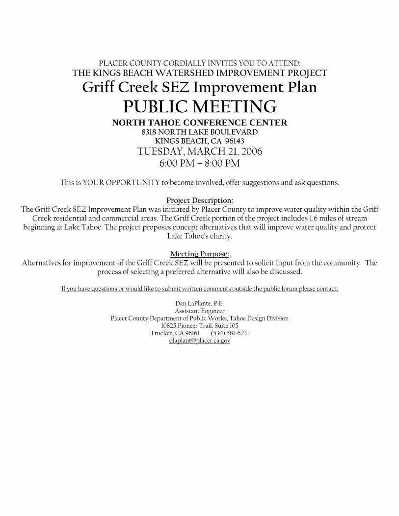
PLACER COUNTY CORDIALLY INVITES YOU TO ATTEND: THE KINGS BEACH WATERSHED IMPROVEMENT PROJECT
Griff Creek SEZ Improvement Plan PUBLIC MEETING
NORTH TAHOE CONFERENCE CENTER 8318 NORTH LAKE BOULEVARD
KINGS BEACH, CA 96143 TUESDAY, MARCH 21, 2006
6:00 PM – 8:00 PM
This is YOUR OPPORTUNITY to become involved, offer suggestions and ask questions.
Project Description: The Griff Creek SEZ Improvement Plan was initiated by Placer County to improve water quality within the Griff
Creek residential and commercial areas. The Griff Creek portion of the project includes 1.6 miles of stream beginning at Lake Tahoe. The project proposes concept alternatives that will improve water quality and protect
Lake Tahoe’s clarity.
Meeting Purpose: Alternatives for improvement of the Griff Creek SEZ will be presented to solicit input from the community. The
process of selecting a preferred alternative will also be discussed.
If you have questions or would like to submit written comments outside the public forum please contact:
Dan LaPlante, P.E. Assistant Engineer
Placer County Department of Public Works, Tahoe Design Division 10825 Pioneer Trail, Suite 105
Truckee, CA 96161 (530) 581-6231 [email protected]
Kings Beach Watershed Improvement Project Griff Creek SEZ Improvements
Public Meeting Tuesday, March 21, 2006
North Tahoe Conference Center 8318 North Lake Boulevard
Kings Beach, CA 96143
Introductions/Purpose of Meeting
Dan LaPlante of Placer County DPW-Design Division opened the meeting and introduced the team. He explained to the group that Griff Creek is the restoration portion of the overall Kings Beach Watershed Improvement Project. Currently, the team is studying Griff Creek and urban areas for water quality improvements.
Brendan Belby of Entrix, Inc. went through the presentation (available per request). A resident asked if these types of studies were being done for all the in-bound creeks to Lake Tahoe. Brendan responded that Entrix, Inc. is working on several creeks within the Kings Beach area, as well as several creeks in Homewood, and several reaches of the Upper Truckee River.
A resident mentioned the area around National Avenue, and how there is often stagnant water during the summertime and when the Lake level comes up the stagnant water washes out to the Lake.
Brendan stated that about 50 percent of Lake Tahoe’s SEZs no longer exist because they are in urban areas and have been developed. Water quality is an important attribute of an SEZ is that when water runs through an SEZ it traps and stores sediment and nutrients before they reach Lake Tahoe. SEZs also reduce deep floods when water overbanks the channel. Also, SEZs are important for wildlife habitat.
The Existing Conditions Report studied and reported what the existing processes are on Griff Creek. From that, a conclusion was drawn that the greatest opportunity to reduce the amount of nutrients and sediment that comes from Griff Creek and goes into Lake Tahoe is to prevent the channel from degrading further, and to create a better floodplain connection. However, the greatest opportunity for flooding on Griff Creek is the area that is most developed.
The issue is to determine how to get a functional SEZ and accommodate the development that is already existing.
Another goal of the Project is to increase fish passage. Some of the fish passage deterrents of the road crossing culverts include undersized culverts, which means the water velocities are too high and the fish can’t swim up through them, culverts that are too high, so the fish cannot get up to them, and low water velocity culverts, so fish have no habitat to rest before they go upstream. Some of the culverts are too big; meaning the flow that comes through is too low.
Overall, 20 enhancement sites were identified where there is potentially an existing constraint or an opportunity that can be taken advantage of (such as public parcels that can be utilized for enhancements). Each of the 20 enhancement sites contain three proposed alternatives that range from a minimal approach to a more aggressive approach.
All the alternatives were evaluated by criteria such as cost of construction and operations and maintenance, water quality benefits, and fish passage benefits. After being evaluated, the alternatives were then ranked. From the rankings, the alternative that comes out the best as far as attaining the Project’s goals, feasibility, owner participation, and compatibility with all reaches of the improvement area is what would be recommended as the Preferred Alternative.
Griff Creek SEZ Improvements 1 March 21, 2006 Public Meeting

Brendan explained that another element of developing the recommended alternatives is connectivity to the sites to ensure continuous lines of improvement through all of the sites.
A resident asked if studies were done to see what parcels are currently not flooded that might become flooded as an impact of this Project. Brendan replied that flood impacts were considered which is why most of the improvements are on the side of the channel opposite the houses. The FEMA map will be drawn by Entrix, Inc. and will indicate what is out there today, and document all flow considerations, including the 100-year flow.
Another resident asked if the excavation would be done by hand crews and Brendan responded that due to the large amount of fill removal, most of the excavation would be done with machinery. He also stated that access would be looked at due to the very limited amount of public access. And, traffic issues would also be analyzed. Those elements were also looked at when ranking the alternatives.
Discussion of SEZ Improvements
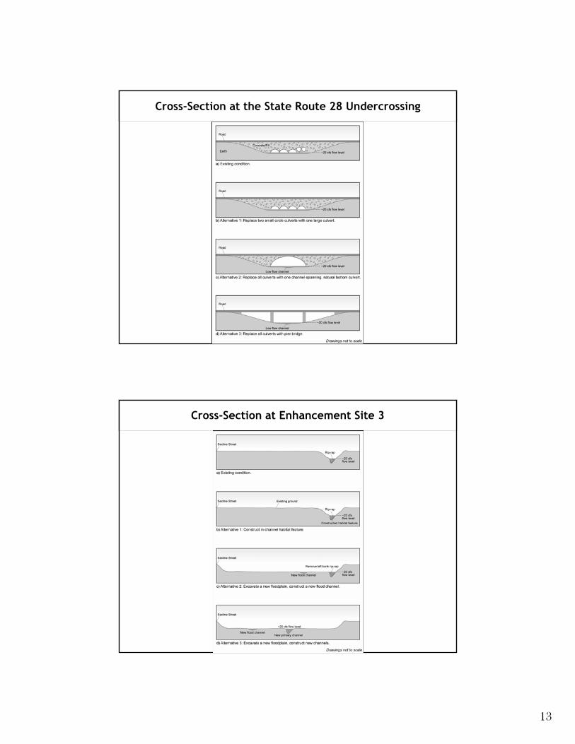
Enhancement Sites 1-3: Site 1, at the Lake, proposes to excavate a floodplain. The channel would stay in the same spot, but the riprap would be removed on the left bank to encourage fish passage and vegetation growth, and lower the surface to enable more water to enter the floodplain.
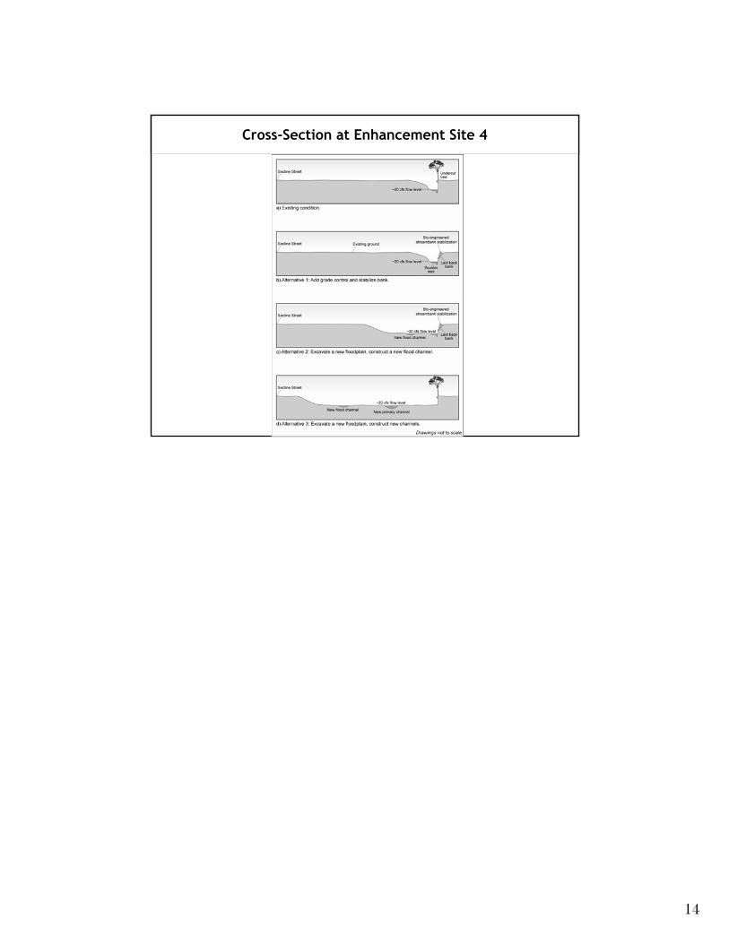
Site 2 recommends the removal of the existing culverts, and the construction of a channel-spanning culvert.
Dan stated that the proposed arch conspan culvert would look much like the one built on Snow Creek.
A resident asked Dan if the money for this Project was coming out of the money allotted for the street and sidewalk project. Dan replied that it was as it is all the same project.
A condition for Site 3 would require relocation of the library. Dan stated that the library is looking for a new location. Their relocation would be dependent on finding another building to move into.
Another resident asked if people would need to have more flood insurance due to the proposed increase in flooding. Brendan explained that the creation of floodplain (removal of material) is what will absorb the overbanked water.
Paul Wisheropp of Entrix, Inc. described the steps needed for a 100-year flood delineation. Entrix, Inc. will do a letter of map revision for FEMA. There is currently a flood delineation for Griff Creek. What Entix, Inc. will do is develop a set of maps, the first of which shows the conditions for flooding that currently exist. Brendan has done that for low flows, but will now do it for a 100-year event and get flood limits, velocities, depths, etc. At that time, the flood risks will also be addressed. Once the Preferred Alternative is selective, based on input from the public and the Technical Advisory Group, another set of maps will be developed based on the modeling done for the Preferred Alternative. This would be the second 100-year flood map illustrating the post-Project condition. These maps will be part of the package, including an application that is sent to FEMA. FEMA’s engineers will analyze the data and approve or deny the request.
Jon-Paul stated that when the fill was brought in it created a levy that is not going to be removed by the Project, it will be wider. The flooding impact should not increase at all. One resident commented that several years ago, science was to riprap the channel. Paul verified that fact, but stated that studies now indicate that this method makes downstream flooding worse because all the water runs through the channels never storing it in the floodplain. Therefore, the science has changed. Ultimately, the water is not being pushed in another direction; a floodplain is opening up for the disbursement of water.
Another resident asked how the fish would travel through a flat floodplain. Paul responded that the fish would travel through the channel, which will remain. The same resident stated that there have been no sightings of fish since the channel was put in. Paul responded that fish passage is part of the Project and
Griff Creek SEZ Improvements 2 March 21, 2006 Public Meeting
Entrix, Inc. fish biologists are identifying and suggesting improvements for areas that impede the potential for fish passage.
Jacquie Grandfield of the California Tahoe Conservancy explained that it is a natural process for there to be a barrier during certain times of the year. When the water is highest, fish usually spawn and can usually make it. If they don’t get through, that too is a part of the natural cycle.
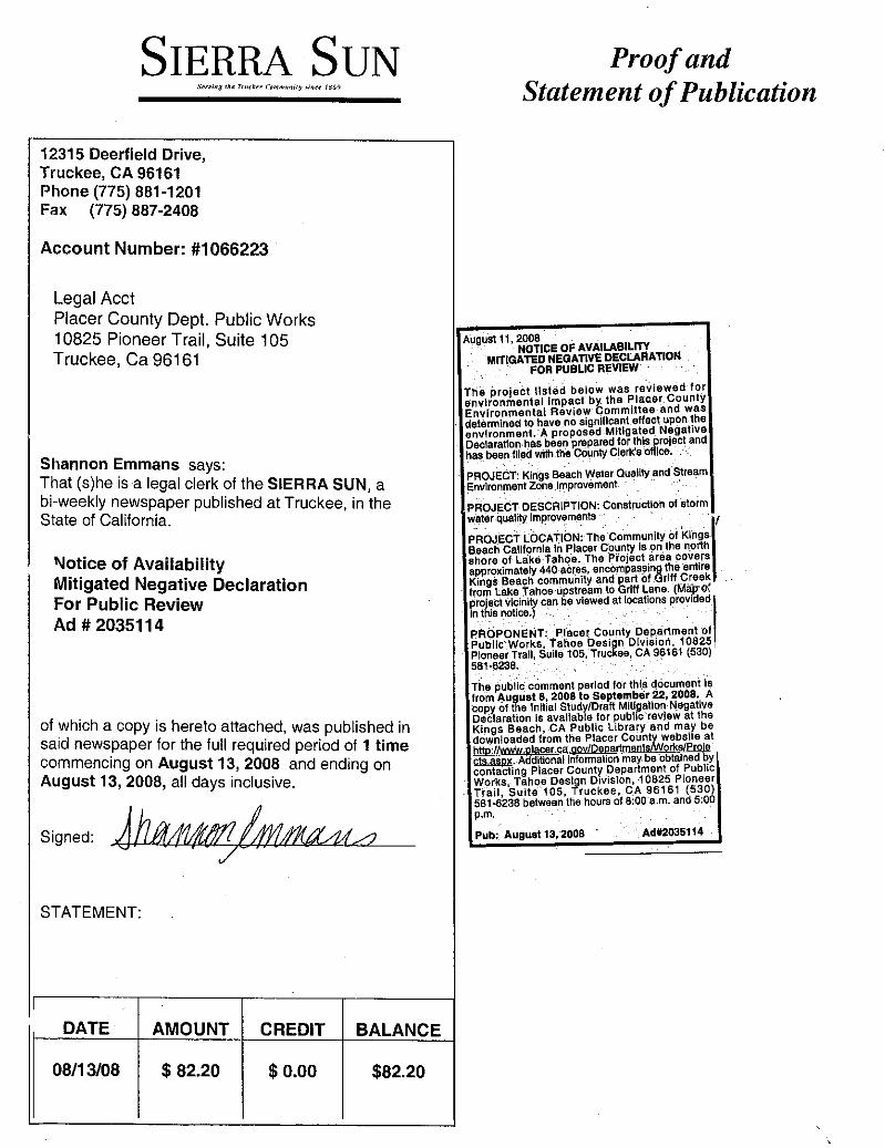
Enhancement Sites 4-6: The recommended alternative at Site 4 is to put in grade controls such as large wood jams, or a rock weir that would slow down the water. The existing channel will not be moved. There would be a floodplain excavation on the East Side of the channel. The width of the excavation would depend on what the landowners are willing to do.
Site 5 contains the abandoned floodplain, which differentiates it from Site 4. Site 5 is largely undeveloped land; used to be an active floodplain, but the channel is deep and wide and rarely overbanks. The intent is to lower the surface to let more water get into the area, thereby providing more flood storage and allowing sediment to drop out. Site 5 is the key to be able to do the Project and reconnect the floodplain. Dan is currently in discussion with the landowner that is interested in working with the County.
A resident asked what happens to the interface between 5 and 6 as it looks like excavation halts abruptly. Brendan responded that topography is higher because of the fill material.
Another resident asked if the Boys and Girls Club would be removed. The response was that there was no proposal to remove the Boys and Girls Club.
Site 6 will keep the channel in its existing location, and grade controls will be added. The exact location of the grade controls are not determined, however, they will be needed within the reach. The approach will be consistent with the local conditions and will look natural.
The existing culverts are not functioning properly for conveyance or fish passage; proposal is to put in a bottom-less arch culvert. Filling the existing flood channel is another suggestion. This channel is a bare minor depression and the water floods out of the channel during high flows. Right now there is a flood channel that makes a connection with the culvert; this will be reconfigured. Rather than having all the flow compressed and routed into a culvert, the proposal is to build a short section of the flood channel that will be continued upstream. Currently, the water floods under the road.
A resident asked how long it would take to construct this alternative. Paul stated that View Circle, in South Lake Tahoe, was started in early August and completed in early September.
Enhancement Sites 7-10: Site 7 is a good opportunity for flooding on Griff Creek because it is Conservancy land, and by slightly lowering the surface, water can get out of the main channel into the floodplain.
Due to the size of the Conservancy lot, a resident asked if the opportunity of flooding in that area would be aggressively pursued. Brendan agreed that if this alternative were picked, he would do additional surveying in the area to enhance the topography data to make sure the land was being utilized to the best of its potential.
Site 8 would entail making a diversion instead of taking out the existing vegetation. Another resident asked if it were possible to utilize the higher area to divert water to the right without removing all the existing vegetation. Basically the area has high grasses, weeds, etc. that are good for soaking up water. Brendan said that the vegetation is possibly supported by groundwater. Brendan will review the topography and elevation to look at the feasibility of getting the water to overflow rather than diverting it.
Another resident suggested that the soil be tested as they were under the impression that a dump existed in that area.
Griff Creek SEZ Improvements 3 March 21, 2006 Public Meeting
A bottom-less arch culvert is proposed at Site 9. Right now there are two culverts that convey the water from the main channel.
The main channel in Site 10 looks good, the banks are high and it has healthy, mature trees and vegetation. The proposal is to reconfigure the flood channel to get it to go under the road thereby improving the floodplain connectivity between the upstream side of the road and the downstream side of the road. Also, SEZ would be greatly approved by excavating a small portion of the land in this site.
A resident mentioned that the culvert was flowing fairly well after they cleaned it out. However, the Gas Company started a project out there and hit groundwater, and then abandoned the project. After that event, the flooding problems began. Brendan responded that one of the benefits of an arch culvert is the low potential for jams due to debris.
Enhancement Sites 11-14: There is no excavation proposed, and the channel is in functioning condition. The main channel would be kept where it is. Grade control is being proposed in the form of wood jams or rock structures. Sierra Power Company owns the whole parcel.
The existing man-made footbridge impedes fish passage. Proposal is to remove it completely. There is also an old road that was perhaps used as access to the dumpsite and there are old abutments, and an old culvert that is lined up and down streamwise. A resident mentioned that there is a drainage on Griff Lane that runs into the creek. Another resident stated that he is at the bottom right corner of the site and he gets all the drainage onto his property and it drains across his yard and into his garage. He’s getting flooding from groundwater. Jon-Paul asked if there was parking on Griff Lane to the east. A resident replied that it is used, but not for overnight parking. Another resident suggested the footbridge is used for motorcycle and snowmobile crossing.
There is a nice floodplain upstream and downstream that is cut off by fill. The proposal is to remove the fill to reduce the elevation.
Enhancement Sites 15-17: Site 15 has relatively minor improvement recommendations. Potential reconfiguration of the channel would enable more of the water to enter the grassy area.
Site 16, at Cambridge Drive, currently has two large twin corrugated metal pipe culverts and the entrance into the culverts is steep causing higher velocity and impaired fish passage. The recommendation is to put in a bottom-less arch culvert.
Site 17 has a steep change in bed elevation impeding fish passage. Recommendation is to put rock in the channel.
No public comments.
Enhancement Sites 18-20: Site 18 contains the road for the NTPUD to access their tank across Griff Creek. Stakeholder agencies have been discussing the idea of putting in some type of structure to use for truck crossing.
A resident asked if the Project Team had looked at the roads above this area, the old fire roads. Conservancy and EDAW are looking at that area.
The NTPUD water tower extends out into the floodplain. The floodplain is small and the channel is deep set into a 10 or 20 foot wide strip until it hits the valley wall. Several grade controls are proposed for this area.
Griff Creek SEZ Improvements 4 March 21, 2006 Public Meeting
The site at Canterbury Drive contains about twenty-five feet of fill in the channel bed at the top of the road. There is a six-foot corrugated metal pipe that goes through as well. The recommendation alternative is to put in a channel-spanning culvert, but this could be extremely expensive because of the amount of fill that needs to be removed. Once the costs are evaluated, this alternative may not be feasible. A resident said that the uphill side of Canterbury was recently revegetated.
Brendan then reviewed the cross-sections of the sites. These are available, upon request, as part of the presentation.
Group Discussion
Question from the group was if this Project would affect the completion of the Commercial Core Project, or impede it in any way. Dan responded that Caltrans is paying for the improvements in the Commercial Core, which will be implemented first. The water quality improvements are part of this. Placer County has also requested money from the California Tahoe Conservancy and the USFS to implement the improvements. The money for the Highway Project is either state, local, or federal monies. The study area of this Project is throughout the whole urban area, including Coon Street and Chipmunk. The study is to ensure that the improvements made in the urban area will interact positively with what is existing or proposed in the Commercial Core. The studies being done should not cause a lapse in the Commercial Core completion scheduled for 2008.
A resident mentioned the stream restoration work that had been done by KB Foster.
Brendan stated that the team is looking at another parcel that is owned by Placer County to remove fill in the lower Griff Creek area. Also, the drainage basin functions well in the beginning; however, over time it reaches its maximum storage potential. One of the alternatives proposed is a management plan to periodically go in and remove material from the basin.
A resident asked what affect this Project will have on the streets and sidewalks, particularly at Highway 28. Brendan responded that there would have to be coordination between the two. Placer County is working with another consulting firm to address sidewalks and streets. This Project is not far enough along in the process to make any determinations in regards to affects to that project.
Paul stated that the Griff Creek SEZ Project is looking at the hydrology of Griff Creek; the Kings Beach Project is looking at the issues of water quality of runoff from the urban areas and looking at ways to separate the clean water and the sediment laden water, and directing the clean water into Griff Creek.
Another resident asked if the last storms quantified a 100-year storm event. Brendan replied that from the data reported, it did not. However, Paul stated that if an area flooded that was perhaps missed from the surveying, perhaps landowners could put a stake in the area that flooded and Entrix, Inc. would go back in the summer and resurvey the information.
In terms of the Coon Street SEZ, there is less opportunity for connectivity due to its fragmented nature.
A resident asked how much private land would need to be acquired or need easements purchased. Brendan stated that there are parcels owned by Conservancy, PUD, or Placer County; however, many of the restoration opportunities are on privately owned land.
Next Steps
The next steps for the group is to come up with a Preferred Alternative. There is also a Technical Advisory Group made up of agency personnel (USFS, TRPA, Conservancy, Caltrans, etc.). The Technical Advisory Group reviews and provides feedback on all the evaluations and recommendations. Currently, the document is in their hands for review and comments.
Griff Creek SEZ Improvements 5 March 21, 2006 Public Meeting
Dan will continue to call “key” property owners who own properties that are integral to making the Project a success. Dan is already in the process of working with several property owners, and will continue contacting people to ask if they are interested in working with the County. In working with the County, the County would request to buy an easement across the parcel owner’s land so the County can come in and make improvements. The property owner still owns the land, but they are giving the County the right to access the property to make the necessary improvements such as revegetate, add rock stabilization, put in logs, and to access the property to maintain the improvements made. Ultimately, the intent is not to take away anyone’s property, but to make improvements on the property that will improve the quality of water that eventually feeds into the lake. Since the easements have to be secured before doing the work, it is important for people to know that Dan is still in the initial phases of determining the willingness of property owners to sell an easement on their land.
In regards to the completion of the Commercial Core Project, a resident asked how the process would work with this Project in relation to the Commercial Core. Dan responded that the Commercial Core Area doesn’t have many water quality treatment opportunities. What has been agreed on with the agencies is to look at the whole watershed and identify where we can take advantage of opportunities in the upper watershed to reduce the amount of flow entering the Commercial Core. In doing this, the County is creating a Master Plan, which is currently being written by Entrix, Inc.
Jon-Paul Harries of the Tahoe Regional Planning Agency stated that the SEZ Improvement Plan is not a requirement for the Sidewalk Project. The Sidewalk Project is on track, whether or not this Project is constructed. However, it is important to look at how all the pieces fit together. The urban element of the Sidewalk Project is what caused part of the current delay in the Sidewalk Project.
The next step for the public process is to make sure to get comments containing observations, concerns, suggestions, etc. to Dan so they can be incorporated into the evaluating alternatives process and into the Environmental Document.
Paul stated that Griff Creek is part of the overall watershed improvement project. There is another section going on concurrently looking at the rest of the Kings Beach urban area and the runoff that goes down to the highway and then into the lake. The Griff Creek and Kings Beach Projects will join together and become one large project. The next public meetings will be for the alternatives developed for the Kings Beach urban area. The two Projects will come together in one report, the Watershed Improvement Plan, and then it goes onto permitting, environmental, etc.
Dan told the group that he would put a copy of the Final Griff Creek SEZ Report in the library and the Conference Center.
Griff Creek SEZ Improvements 6 March 21, 2006 Public Meeting

Kings Beach Watershed Improvement Project Griff Creek SEZ Improvement Plan
Placer County Department of Public Works ENTRIX, Inc.
Introduction
• Included As Part of Kings Beach Watershed Improvement Project
– Principal Objectives: Improve Water Clarity and SEZ Ecology
• Griff Creek SEZ Restoration Reports – SEZ Existing Conditions and Alternatives
Report (Final Report, February 2006), – SEZ Improvement Plan (TAC Draft
Report, February 2006)
Griff Creek Stream Environment Zone Improvement Plan
1

Stream Environment Zones
• SEZs are: – Wetlands and riparian (floodplains), – Hydrologically connected to surface water sources, and – Areas with high groundwater to support riparian vegetation.
• Almost 50% of SEZs in Tahoe urbanized areas have been developed, disturbed, or subdivided (LRWQCB, 1994)
• SEZs can: – Improve water quality (uptake of nutrients and sediment storage), – Reduce flood peak, – Increase groundwater recharge, – Provide aquatic and terrestrial wildlife habitat, and – Be aesthetically pleasing.
SEZ Existing Conditions and Alternatives Report
• Objectives: – Described the condition and function of Griff Creek’s
channels and floodplains
• Conclusions: – Greatest opportunity to decrease pollutant delivery to Lake
Tahoe and enhance SEZ ecology is to prevent further channel degradation and improve floodplain connectivity
– Greatest opportunity for restoration is in the area of greatest development (lower Griff Creek)
2
Channel Response to Land Use Change
• Griff Ck has responded to land use changes by: – Deepening (incision), – Widening, and – Reduction of habitat complexity.
• Channel changes result in: – Increased channel conveyance capacity, – Lowered groundwater table, – Disconnection with floodplain, – Loss of SEZ pollutant filtering, and – Loss of habitat function.
Active Floodplains
• East active floodplain downstream of Dolly Varden Ave (~25 cfs)
•Floods on a near-annual basis
• Pollutant filtering: • Low velocity, ponded water
• Dense riparian vegetation
3

d
Abandoned Floodplains
• Remnant channel in east abandoned floodplain near Golden Avenue
• Floods about once every 6 to 7 years
• Disconnect with active floodplain upstream
• Minimal water treatment potential
Fish Passage
Conditions that can create barriers to fish passage at culverts are:
1. Water velocity too high,
2. Flow depths too low,
3. No resting pool beneath culvert, an
4. Jumps into culverts too high.
State Route 28 Culverts
4
Dolly Varden Avenue Culverts
Fish Passage - High Jump
Fish Passage - High Velocity
Blocked Speckled Avenue Culvert
5

Fish Passage - Low Flow Depth
• Canterbury Drive Culvert
• Low flow depth
• Floodplain Disconnect
SEZ Improvement Plan Report
• Identified 20 Enhancement Sites in which water quality, geomorphic channel stability, floodplain connectivity, riparian habitats, and fish passage could be improved by:
– Addressing an existing problem, or – Taking advantage of an enhancement opportunity
• Enhancement Sites – From 1 to 3 Alternatives developed at each site – Each Alternative is a feasible option that could potentially be
implemented
6
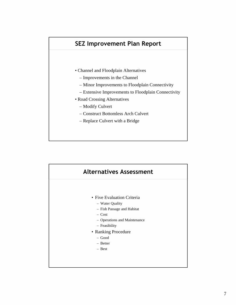
SEZ Improvement Plan Report
• Channel and Floodplain Alternatives – Improvements in the Channel – Minor Improvements to Floodplain Connectivity – Extensive Improvements to Floodplain Connectivity
• Road Crossing Alternatives – Modify Culvert – Construct Bottomless Arch Culvert – Replace Culvert with a Bridge
Alternatives Assessment
• Five Evaluation Criteria – Water Quality – Fish Passage and Habitat – Cost – Operations and Maintenance – Feasibility
• Ranking Procedure – Good – Better – Best
7
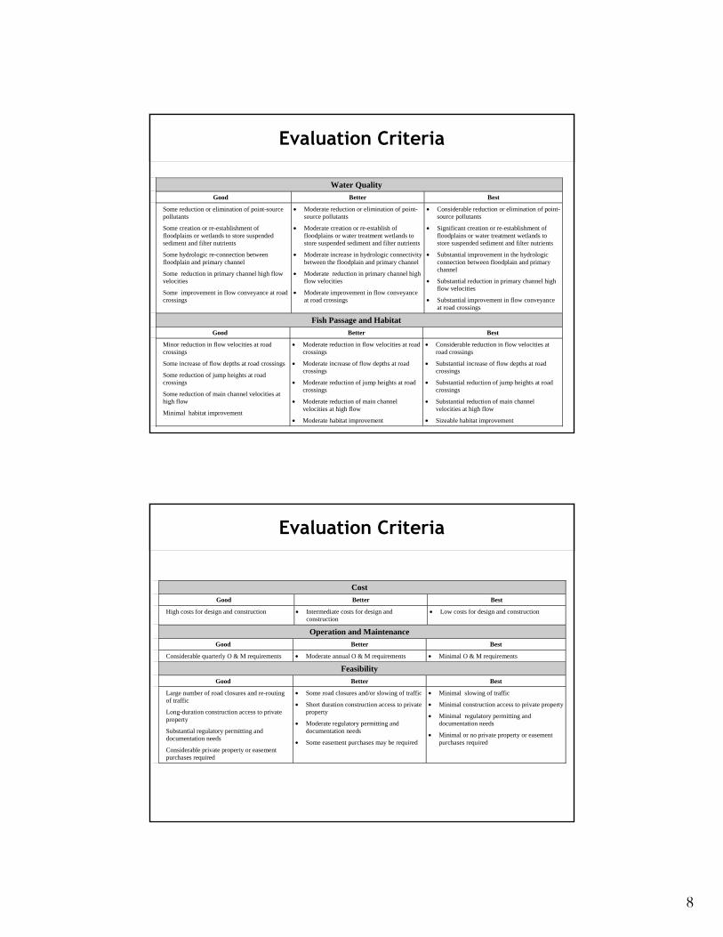
Evaluation Criteria
Water Quality Good Better Best
Some reduction or elimination of point-source pollutants
Some creation or re-establishment of floodplains or wetlands to store suspended sediment and filter nutrients
Some hydrologic re-connection between floodplain and primary channel
Some reduction in primary channel high flow velocities
Some improvement in flow conveyance at road crossings
• Moderate reduction or elimination of point-source pollutants
• Moderate creation or re-establish of floodplains or water treatment wetlands to store suspended sediment and filter nutrients
• Moderate increase in hydrologic connectivity between the floodplain and primary channel
• Moderate reduction in primary channel high flow velocities
• Moderate improvement in flow conveyance at road crossings
• Considerable reduction or elimination of point-source pollutants
• Significant creation or re-establishment of floodplains or water treatment wetlands to store suspended sediment and filter nutrients
• Substantial improvement in the hydrologic connection between floodplain and primary channel
• Substantial reduction in primary channel high flow velocities
• Substantial improvement in flow conveyance at road crossings
Fish Passage and Habitat Good Better Best
Minor reduction in flow velocities at road crossings
Some increase of flow depths at road crossings
Some reduction of jump heights at road crossings
Some reduction of main channel velocities at high flow
Minimal habitat improvement
• Moderate reduction in flow velocities at road crossings
• Moderate increase of flow depths at road crossings
• Moderate reduction of jump heights at road crossings
• Moderate reduction of main channel velocities at high flow
• Moderate habitat improvement
• Considerable reduction in flow velocities at road crossings
• Substantial increase of flow depths at road crossings
• Substantial reduction of jump heights at road crossings
• Substantial reduction of main channel velocities at high flow
• Sizeable habitat improvement
Evaluation Criteria
Cost Good Better Best
High costs for design and construction • Intermediate costs for design and construction
• Low costs for design and construction
Operation and Maintenance Good Better Best
Considerable quarterly O & M requirements • Moderate annual O & M requirements • Minimal O & M requirements
Feasibility Good Better Best
Large number of road closures and re-routing of traffic
Long-duration construction access to private property
Substantial regulatory permitting and documentation needs
Considerable private property or easement purchases required
• Some road closures and/or slowing of traffic
• Short duration construction access to private property
• Moderate regulatory permitting and documentation needs
• Some easement purchases may be required
• Minimal slowing of traffic
• Minimal construction access to private property
• Minimal regulatory permitting and documentation needs
• Minimal or no private property or easement purchases required
8
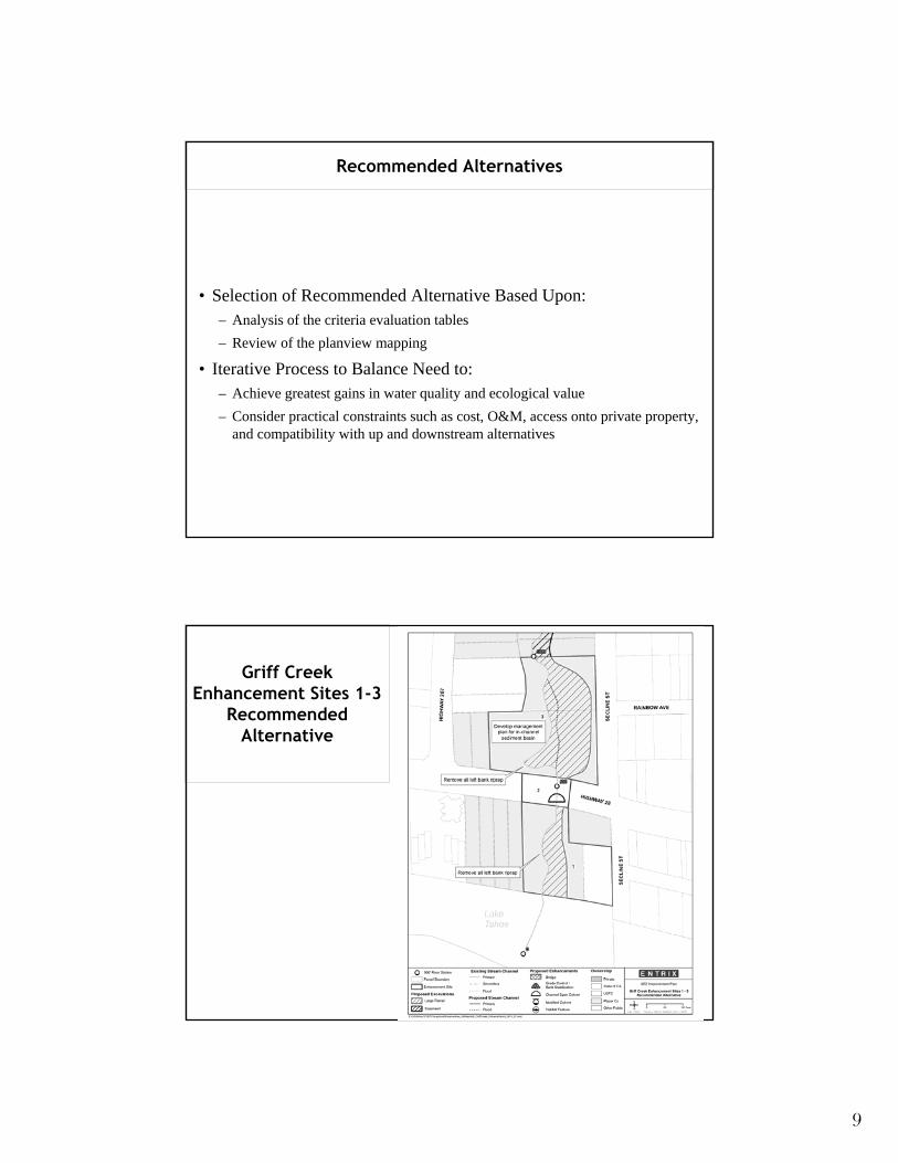
Recommended Alternatives
• Selection of Recommended Alternative Based Upon: – Analysis of the criteria evaluation tables – Review of the planview mapping
• Iterative Process to Balance Need to: – Achieve greatest gains in water quality and ecological value – Consider practical constraints such as cost, O&M, access onto private property,
and compatibility with up and downstream alternatives
Griff Creek Enhancement Sites 1-3
Recommended Alternative
9
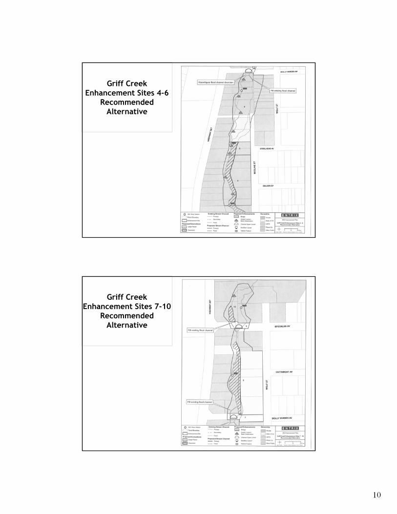
Griff Creek Enhancement Sites 4-6
Recommended Alternative
Griff Creek Enhancement Sites 7-10
Recommended Alternative
10
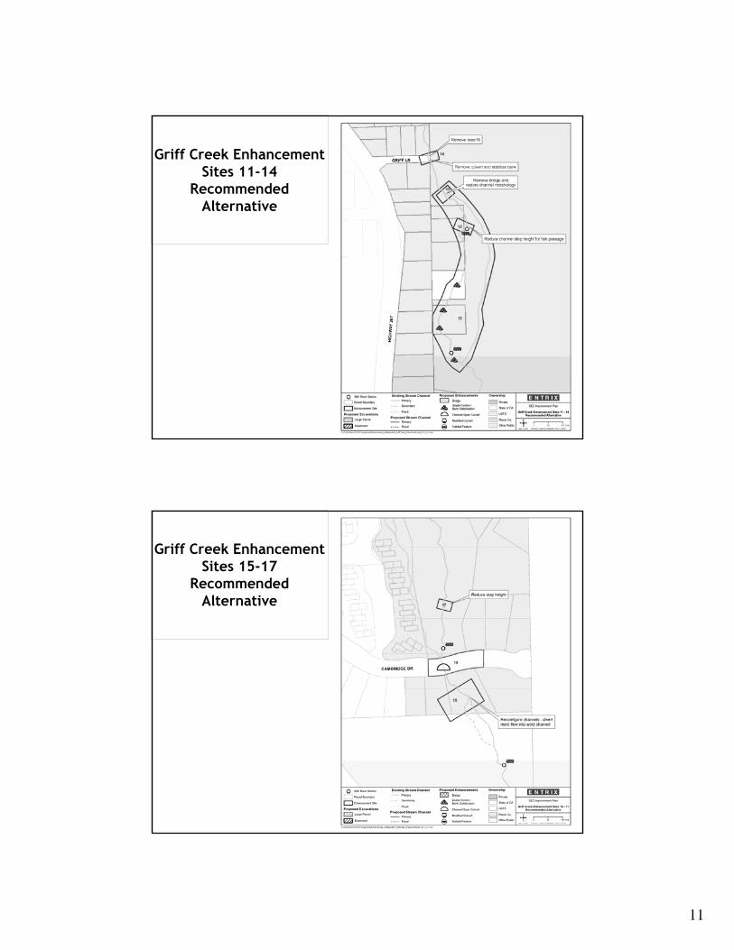
Griff Creek Enhancement Sites 11-14
Recommended Alternative
Griff Creek Enhancement Sites 15-17
Recommended Alternative
11
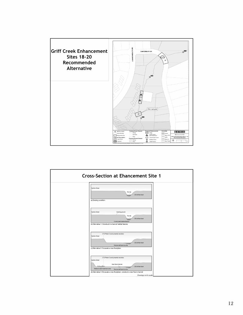
Griff Creek Enhancement Sites 18-20
Recommended Alternative
Cross-Section at Ehancement Site 1
12
Cross-Section at the State Route 28 Undercrossing
Cross-Section at Enhancement Site 3
13
Cross-Section at Enhancement Site 4
14
PLACER COUNTY CORDIALLY INVITES YOU TO A PUBLIC MEETING
TO DISCUSS THE KINGS BEACH WATER QUALITY AND STREAM ENVIRONMENTAL ZONE (SEZ)
Project Location: This project is located in Kings Beach, California, generally including the residential area between Lake Tahoe and Speckle Avenue.
Meeting Focus: Local and state agencies and their representatives will be available to answer technical questions related to the environmental document currently open for public comment.
Project Purpose: The proposed project is to address water quality needs within the Kings Beach residential area as well as SEZ improvements along Griff Creek.
PUBLIC MEETING TO BE HELD AT THE NORTH TAHOE CONFERENCE CENTER
8318 NORTH LAKE BOULEVARD KINGS BEACH, CA 96143
This is YOUR OPPORTUNITY to ask questions and to get involved in an important project that will greatly benefit your neighborhood and protect Lake Tahoe’s clarity.
DATE: SEPTEMBER 17, 2008 6:00 P.M. – 8:00 P.M.
If you have any questions please contact: Jon Mitchell
Project Engineer (530) 581-6218 or by email
General Note: This is a separate project from the Kings Beach Commercial Core Improvement Project (CCIP). Although it does address water quality improvements through the CCIP, it does not involve the sidewalk and parking issues. Only the Water Quality and SEZ Improvement Project will be discussed at this meeting.
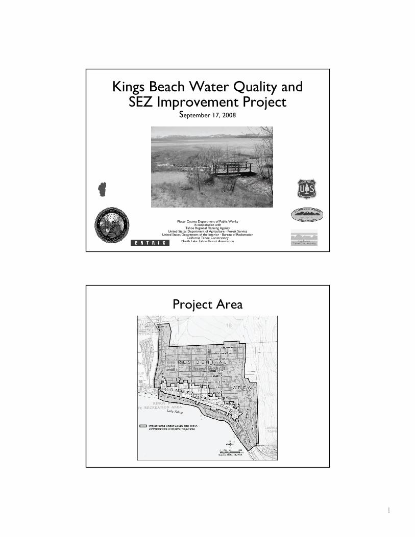
Project Area
Kings Beach Water Quality and Kings Beach Water Quality and SEZ Improvement Project SEZ Improvement Project
SSepeptteembmber 17, 20er 17, 2008 08
Placer County Department of Public Works in cooperation with
Tahoe Regional Planning AgencyUnited States Department of Agriculture - Forest Service
nited States Department of the Interior - Bureau of ReclamationCalCaliifornforniiaa Ta Tahoe Conservhoe Conservaannccyy
North LaNorth Lake Take Tahhoe Resort Aoe Resort Assocssociiatiation on
U
Project Area
111
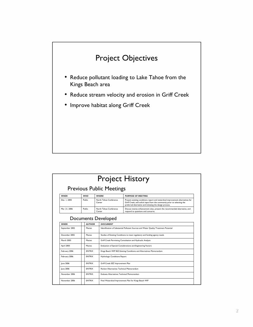
Project Objectives
• Reduce pollutant loading to Lake Tahoe from the Kings Beach area
• Reduce stream velocity and erosion in Griff Creek
• Improve habitat along Griff Creek
Previous Public Meetings
Project History
Documents Developed
Project Objectives
• Reduce pollutant loading to Lake Tahoe from the Kings Beach area
• Reduce stream velocity and erosion in Griff Creek
• Improve habitat along Griff Creek
Previous Public Meetings
Discuss twenty enhancement sites, present the recommended alternative, and respond to questions and concerns.
North Tahoe Conference Center
PublicMar. 21, 2006
Present existing conditions report and watershed improvement alternatives for Griff Creek, and solicit input from the community prior to selecting the preferred alternative and initiating the design process.
North Tahoe Conference Center
PublicDec. 1, 2005
PURPOSE OF MEETINGWHEREWHOWHEN
Project History
Documents Developed
Review Alternatives Technical MemorandumENTRIXJune 2006
Evaluate Alternatives Technical MemorandumENTRIXNovember 2006
Studies of Existing Conditions to meet regulatory and funding agency needsMactecDecember 2002
Griff Creek Permitting Consultation and Hydraulic AnalysisMactecMarch 2003
Evaluation of Special Considerations and Engineering FactorsMactecApril 2003
Kings Beach WIP SEZ Existing Conditions and Alternatives MemorandumENTRIXFebruary 2006
Hydrologic Conditions ReportENTRIXFebruary 2006
Griff Creek SEZ Improvement PlanENTRIXJune 2006
Final Watershed Improvement Plan for Kings Beach WIPENTRIXNovember 2006
Identification of Substantial Pollutant Sources and Water Quality Treatment PotentialMactecSeptember 2002
DOCUMENTAUTHORWHEN
222
Proposed Improvements
• Construct secondary channels to enhance floodplains
• Install grade controls, energy dissipaters and bank protection at key points
• Remove foot bridge at bottom of Griff Creek
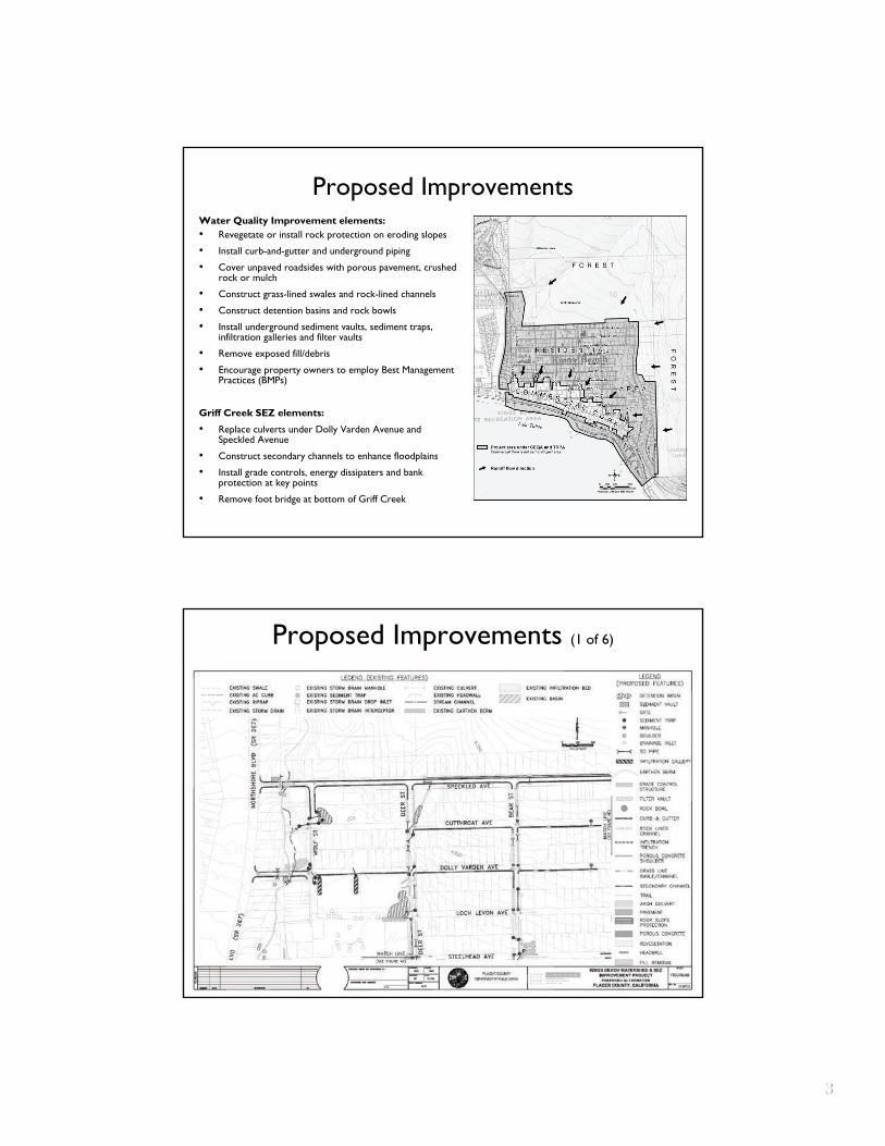
Proposed Improvements (1 of 6)
Proposed Improvements Water Quality Improvement elements: • Revegetate or install rock protection on eroding slopes
• Install curb-and-gutter and underground piping
• Cover unpaved roadsides with porous pavement, crushed rock or mulch
• Construct grass-lined swales and rock-lined channels
• Construct detention basins and rock bowls
• Install underground sediment vaults, sediment traps, infiltration galleries and filter vaults
• Remove exposed fill/debris
• Encourage property owners to employ Best Management Practices (BMPs)
Griff Creek SEZ elements:
• Replace culverts under Dolly Varden Avenue and Speckled Avenue
• Construct secondary channels to enhance floodplains
• Install grade controls, energy dissipaters and bank protection at key points
• Remove foot bridge at bottom of Griff Creek
Proposed Improvements (1 of 6)
333
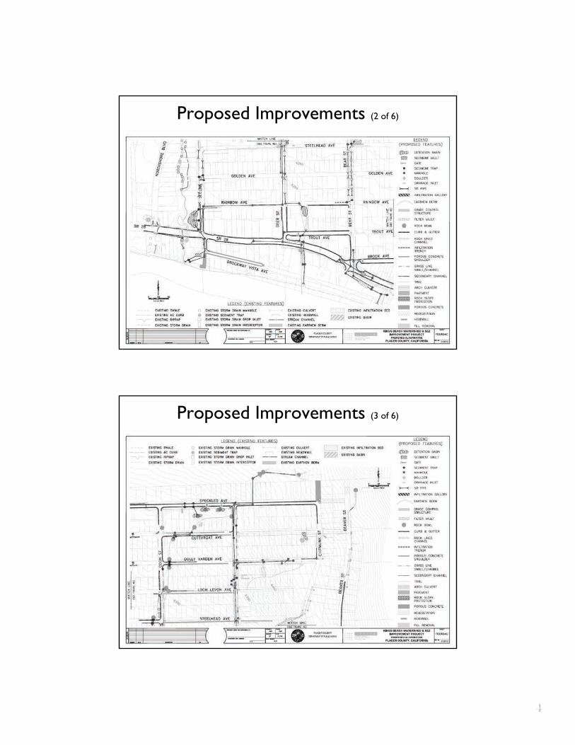
Proposed Improvements (2 of 6)
Proposed Improvements (3 of 6)
Proposed Improvements (2 of 6)
Proposed Improvements (3 of 6)
444

Proposed Improvements (4 of 6)
Proposed Improvements (5 of 6)
Proposed Improvements (4 of 6)
Proposed Improvements (5 of 6)
555
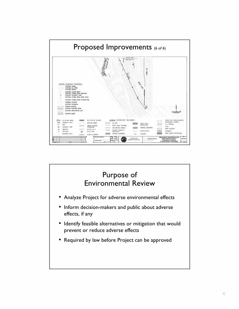
Proposed Improvements (6 of 6)
Purpose of Environmental Review
• Analyze Project for adverse environmental effects
• Inform decision-makers and public about adverse effects, if any
• Identify feasible alternatives or mitigation that would prevent or reduce adverse effects
• Required by law before Project can be approved
666
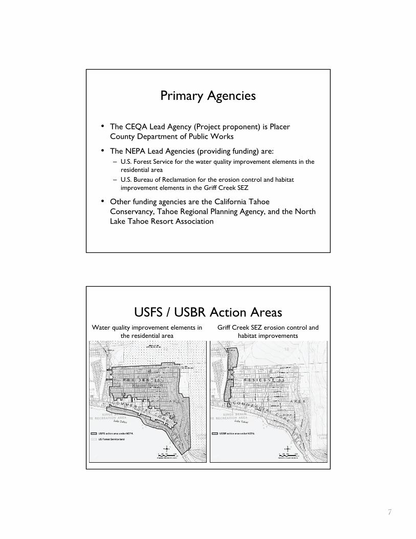
Primary Agencies
• The CEQA Lead Agency (Project proponent) is Placer County Department of Public Works
• The NEPA Lead Agencies (providing funding) are: – U.S. Forest Service for the water quality improvement elements in the
residential area– U.S. Bureau of Reclamation for the erosion control and habitat
improvement elements in the Griff Creek SEZ
• Other funding agencies are the California Tahoe Conservancy, Tahoe Regional Planning Agency, and the North Lake Tahoe Resort Association
USFS / USBR Action AreasWater quality improvement elements in
the residential area
Primary Agencies
• The CEQA Lead Agency (Project proponent) is Placer County Department of Public Works
• The NEPA Lead Agencies (providing funding) are: – U.S. Forest Service for the water quality improvement elements in the
residential area – U.S. Bureau of Reclamation for the erosion control and habitat
improvement elements in the Griff Creek SEZ
• Other funding agencies are the California Tahoe Conservancy, Tahoe Regional Planning Agency, and the North Lake Tahoe Resort Association
USFS / USBR Action Areas Water quality improvement elements in
the residential area Griff Creek SEZ erosion control and
habitat improvements
777
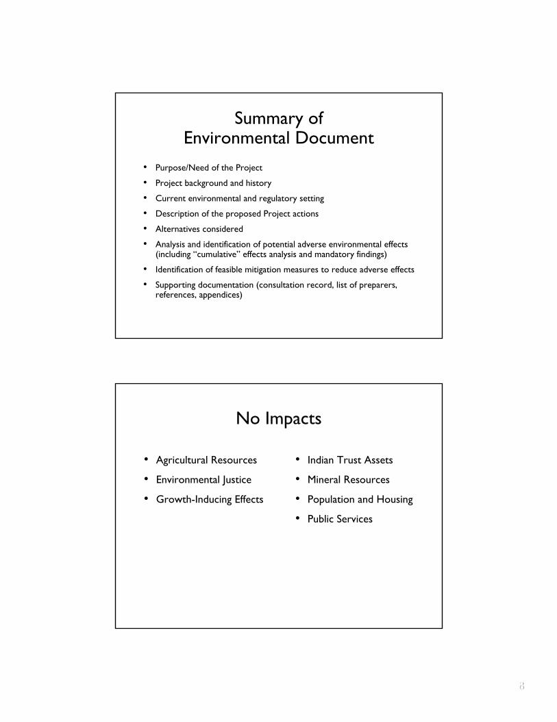
Summary of Environmental Document
• Purpose/Need of the Project
• Project background and history
• Current environmental and regulatory setting
• Description of the proposed Project actions
• Alternatives considered
• Analysis and identification of potential adverse environmental effects (including “cumulative” effects analysis and mandatory findings)
• Identification of feasible mitigation measures to reduce adverse effects
• Supporting documentation (consultation record, list of preparers, references, appendices)
No Impacts
• Agricultural Resources
• Environmental Justice
• Growth-Inducing Effects
• Indian Trust Assets
• Mineral Resources
• Population and Housing
• Public Services
Summary of Environmental Document
• Purpose/Need of the Project
• Project background and history
• Current environmental and regulatory setting
• Description of the proposed Project actions
• Alternatives considered
• Analysis and identification of potential adverse environmental effects (including “cumulative” effects analysis and mandatory findings)
• Identification of feasible mitigation measures to reduce adverse effects
• Supporting documentation (consultation record, list of preparers, references, appendices)
No Impacts
• Agricultural Resources • Indian Trust Assets
• Environmental Justice • Mineral Resources
• Growth-Inducing Effects • Population and Housing
• Public Services
888

Less-Than-Significant Impacts
• Aesthetics – ground-level structures
• Land Use – convert portions of existing parcels from vacant to public service to accommodate detention basins and channels
Less-Than-Significant Impacts with Mitigation Incorporated
• Air Quality – construction equipment emissions
• Biological Resources – potential disturbance of habitat/individuals during construction
• Cultural Resources – potential disturbance of archaeological site during construction
• Geology and Soils – construction in unstable soils, soil exposure during construction
• Hazards and Hazardous Materials – potential fuel/fluid spills from construction equipment, excavation in previously contaminated soils, potential wildfire risk during construction
999
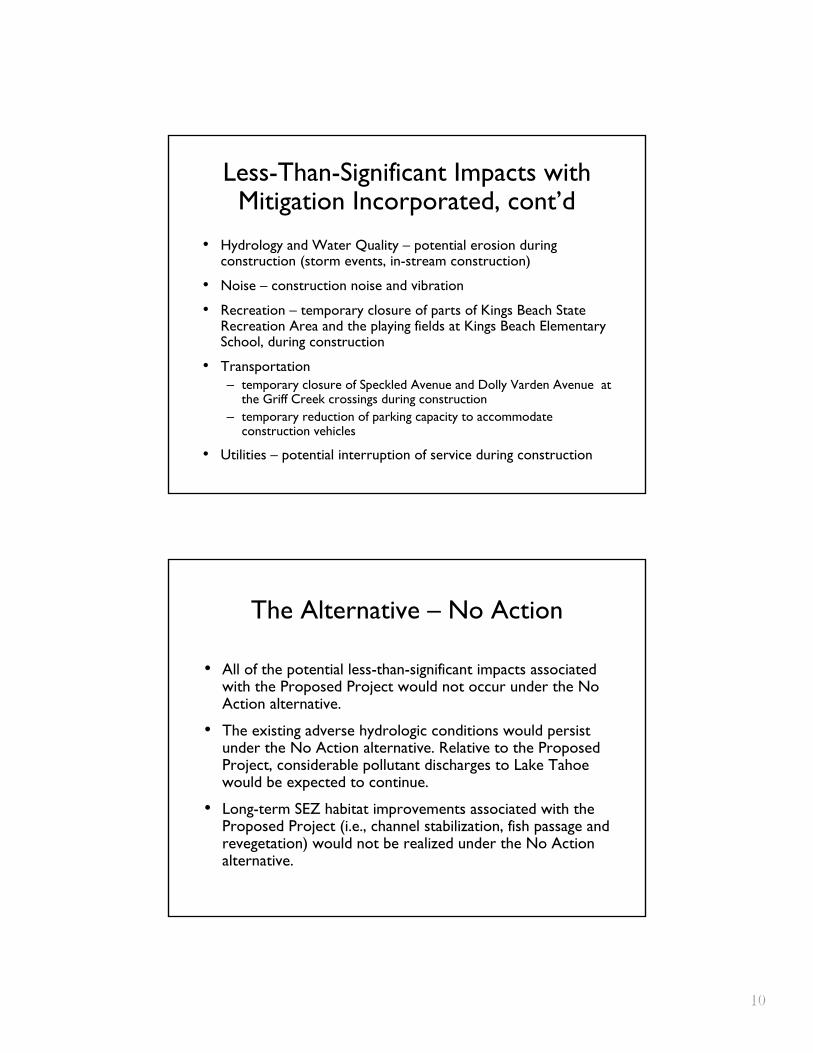
Less-Than-Significant Impacts with Mitigation Incorporated, cont’d
• Hydrology and Water Quality – potential erosion during construction (storm events, in -stream construction)
• Noise – construction noise and vibration
• Recreation – temporary closure of parts of Kings Beach State Recreation Area and the playing fields at Kings Beach ElementarySchool, during construction
• Transportation– temporary closure of Speckled Avenue and Dolly Varden Avenue at
the Griff Creek crossings during construction – temporary reduction of parking capacity to accommodate
construction vehicles
• Utilities – potential interruption of service during construction
The Alternative – No Action
• All of the potential less-than-significant impacts associated with the Proposed Project would not occur under the No Action alternative.
• The existing adverse hydrologic conditions would persist under the No Action alternative. Relative to the Proposed Project, considerable pollutant discharges to Lake Tahoe would be expected to continue.
• Long-term SEZ habitat improvements associated with the Proposed Project (i.e., channel stabilization, fish passage and revegetation) would not be realized under the No Action alternative.
Less-Than-Significant Impacts with Mitigation Incorporated, cont’d
• Hydrology and Water Quality – potential erosion during construction (storm events, in-stream construction)
• Noise – construction noise and vibration
• Recreation – temporary closure of parts of Kings Beach State Recreation Area and the playing fields at Kings Beach Elementary School, during construction
• Transportation – temporary closure of Speckled Avenue and Dolly Varden Avenue at
the Griff Creek crossings during construction – temporary reduction of parking capacity to accommodate
construction vehicles
• Utilities – potential interruption of service during construction
The Alternative – No Action
• All of the potential less-than-significant impacts associated with the Proposed Project would not occur under the No Action alternative.
• The existing adverse hydrologic conditions would persist under the No Action alternative. Relative to the Proposed Project, considerable pollutant discharges to Lake Tahoe would be expected to continue.
• Long-term SEZ habitat improvements associated with the Proposed Project (i.e., channel stabilization, fish passage and revegetation) would not be realized under the No Action alternative.
101010
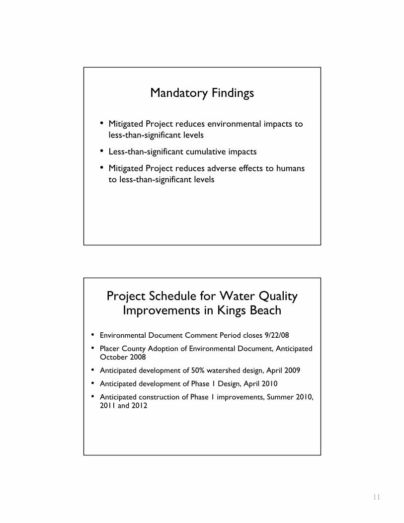
Mandatory Findings
• Mitigated Project reduces environmental impacts to less-than-significant levels
• Less-than-significant cumulative impacts
• Mitigated Project reduces adverse effects to humans to less-than-significant levels
Project Schedule for Water Quality Improvements in Kings Beach
• Environmental Document Comment Period closes 9/22/08
• Placer County Adoption of Environmental Document, Anticipated October 2008
• Anticipated development of 50% watershed design, April 2009
• Anticipated development of Phase 1 Design, April 2010
• Anticipated construction of Phase 1 improvements, Summer 2010, 2011 and 2012
111111
Q & AQ & A
121212