Embed Size (px)
Citation preview
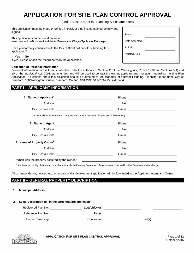
APPLICATION FOR SITE PLAN CONTROL APPROVAL Page 1 of 12
October 2016
APPLICATION FOR SITE PLAN CONTROL APPROVAL (under Section 41 of the Planning Act as amended)
This application must be typed or printed in black or blue ink, completed entirely and signed.
This application can be found online at: www.brantford.ca/Business/LandUseAndDevelopment/Pages/ApplicationFees.aspx Have you formally consulted with the City of Brantford prior to submitting this application?
Yes No
If yes, please attach the record/notes to the application.
Collection of Personal Information: Personal information on this form is collected under the authority of Section 41 of the Planning Act, R.S.O. 1990 and Sections 8(1) and 10 of the Municipal Act, 2001, as amended and will be used to contact the owner, applicant and / or agent regarding the Site Plan Application. Questions about this collection should be directed to the Manager of Current Planning, Planning Department, City of Brantford, 100 Wellington Square, Brantford, Ontario, N3T 2M2, 519-759-4150 ext. 5434.
PART I – APPLICANT INFORMATION
1. Name of Applicant1 Phone
Address
Fax
City, Postal Code
1 If the applicant is a numbered company, also provide the name of a principal of the company.
2. Name of Agent
Phone
Address
Fax
City, Postal Code E-mail
3. Name of Property Owner2
Phone
Address
Fax
City, Postal Code
When was the property acquired by the owner?
2 It is the responsibility of the owner or applicant to notify the Planning Department of any changes in ownership within 30 days of such a change.
All correspondence, notices, etc. in respect of this development application will be forwarded to the Applicant, Agent and Owner.
PART II – GENERAL PROPERTY DESCRIPTION
1. Municipal Address:
2. Legal Description (fill in the parts that are applicable):
Registered Plan No. Lot(s)/Block(s)
Reference Plan No. Part(s)
Former Township Concession Lot(s)
File No.:
Date Accepted:
Roll No.:
Related Files:
APPLICATION FOR SITE PLAN CONTROL APPROVAL Page 2 of 12
October 2016
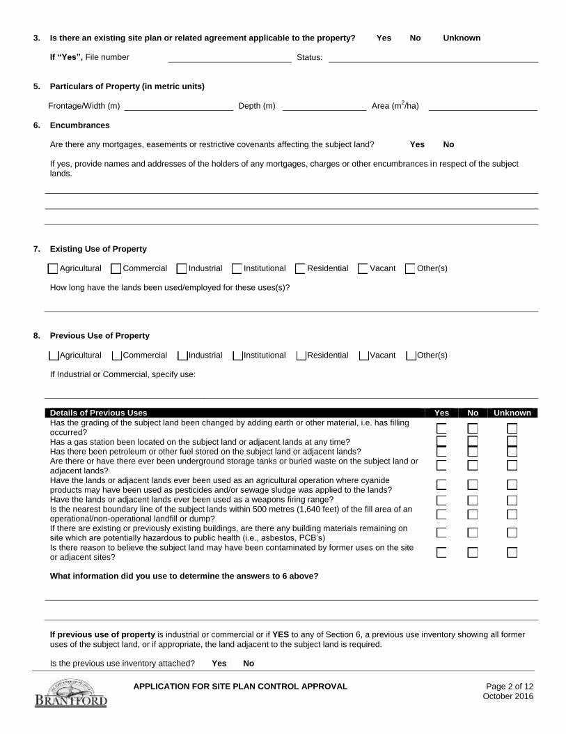
3. Is there an existing site plan or related agreement applicable to the property? Yes No Unknown
If “Yes”, File number Status:
5. Particulars of Property (in metric units)
Frontage/Width (m) Depth (m) Area (m
2/ha)
6. Encumbrances
Are there any mortgages, easements or restrictive covenants affecting the subject land? Yes No
If yes, provide names and addresses of the holders of any mortgages, charges or other encumbrances in respect of the subject lands.
7. Existing Use of Property
Agricultural Commercial Industrial Institutional Residential Vacant Other(s) How long have the lands been used/employed for these uses(s)?
8. Previous Use of Property
Agricultural Commercial Industrial Institutional Residential Vacant Other(s) If Industrial or Commercial, specify use:
Details of Previous Uses Yes No Unknown
Has the grading of the subject land been changed by adding earth or other material, i.e. has filling occurred?
Has a gas station been located on the subject land or adjacent lands at any time?
Has there been petroleum or other fuel stored on the subject land or adjacent lands? Are there or have there ever been underground storage tanks or buried waste on the subject land or adjacent lands?
Have the lands or adjacent lands ever been used as an agricultural operation where cyanide products may have been used as pesticides and/or sewage sludge was applied to the lands?
Have the lands or adjacent lands ever been used as a weapons firing range?
Is the nearest boundary line of the subject lands within 500 metres (1,640 feet) of the fill area of an operational/non-operational landfill or dump?
If there are existing or previously existing buildings, are there any building materials remaining on site which are potentially hazardous to public health (i.e., asbestos, PCB’s)
Is there reason to believe the subject land may have been contaminated by former uses on the site or adjacent sites?
What information did you use to determine the answers to 6 above?
If previous use of property is industrial or commercial or if YES to any of Section 6, a previous use inventory showing all former
uses of the subject land, or if appropriate, the land adjacent to the subject land is required. Is the previous use inventory attached? Yes No
APPLICATION FOR SITE PLAN CONTROL APPROVAL Page 3 of 12
October 2016
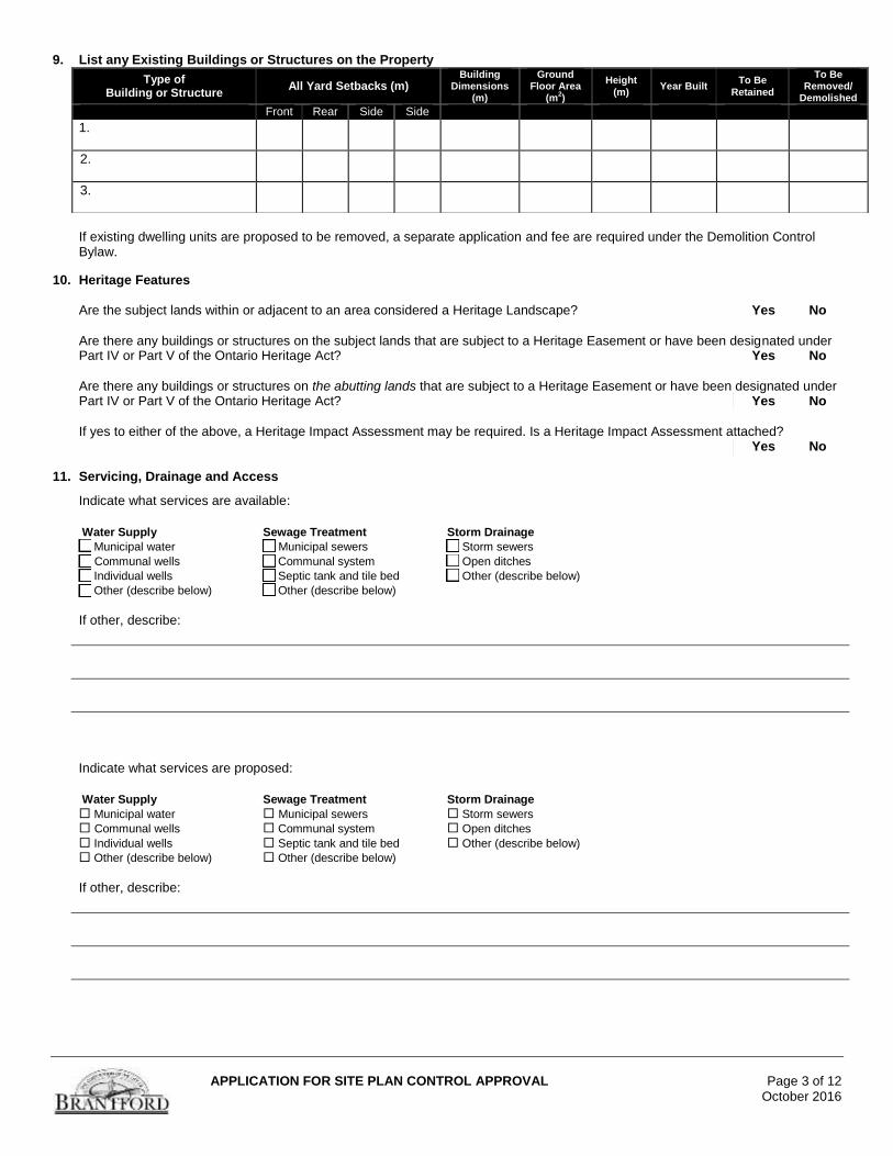
9. List any Existing Buildings or Structures on the Property
If existing dwelling units are proposed to be removed, a separate application and fee are required under the Demolition Control Bylaw.
10. Heritage Features
Are the subject lands within or adjacent to an area considered a Heritage Landscape? Yes No
Are there any buildings or structures on the subject lands that are subject to a Heritage Easement or have been designated under Part IV or Part V of the Ontario Heritage Act? Yes No
Are there any buildings or structures on the abutting lands that are subject to a Heritage Easement or have been designated under Part IV or Part V of the Ontario Heritage Act? Yes No
If yes to either of the above, a Heritage Impact Assessment may be required. Is a Heritage Impact Assessment attached? Yes No
11. Servicing, Drainage and Access
Indicate what services are available:
Water Supply Sewage Treatment Storm Drainage
Municipal water Municipal sewers Storm sewers
Communal wells Communal system Open ditches
Individual wells Septic tank and tile bed Other (describe below)
Other (describe below) Other (describe below)
If other, describe:
Indicate what services are proposed:
Water Supply Sewage Treatment Storm Drainage
Municipal water Municipal sewers Storm sewers
Communal wells Communal system Open ditches
Individual wells Septic tank and tile bed Other (describe below)
Other (describe below) Other (describe below)
If other, describe:
Type of Building or Structure
All Yard Setbacks (m) Building
Dimensions (m)
Ground Floor Area
(m2)
Height (m)
Year Built To Be
Retained
To Be Removed/
Demolished
Front Rear Side Side
1.
2.
3.
APPLICATION FOR SITE PLAN CONTROL APPROVAL Page 4 of 12
October 2016
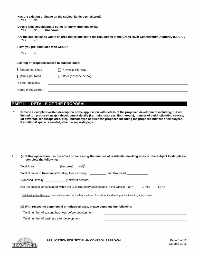
Has the existing drainage on the subject lands been altered? Yes No
Does a legal and adequate outlet for storm drainage exist? Yes No Unknown
Are the subject lands within an area that is subject to the regulations of the Grand River Conservation Authority (GRCA)?
Yes No
Have you pre-consulted with GRCA?
Yes No
Existing or proposed access to subject lands:
Unopened Road Provincial Highway
Municipal Road Other (describe below)
If other, describe:
Name of road/street:
PART III – DETAILS OF THE PROPOSAL 1. Provide a complete written description of the application with details of the proposed development including, but not
limited to: proposed use(s), development details (i.e. height/storeys, floor area(s), number of parking/loading spaces, lot coverage, landscape area, etc). Indicate type of business proposed including the proposed number of employees. If additional space is needed, attach a separate page.
2. (a) If this application has the effect of increasing the number of residential dwelling units on the subject lands, please
complete the following:
Total Area (hectares) (Net)1
Total Number of Residential Dwelling Units existing and Proposed
Proposed Density (units/net hectare)
Are the subject lands located within the Built Boundary as indicated in the Official Plan? Yes No
1 Net Residential Hectare means that portion of the lands utilized for residential dwelling units, including the lot area.
(b) With respect to commercial or industrial uses, please complete the following:
Total number of existing business before development
Total number of business after development
APPLICATION FOR SITE PLAN CONTROL APPROVAL Page 5 of 12
October 2016
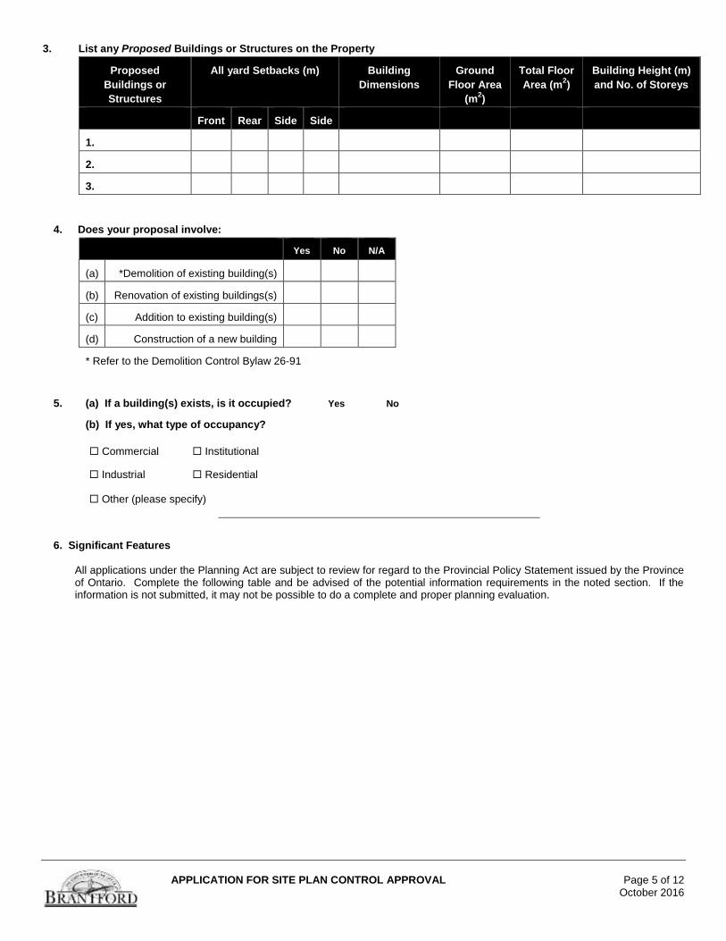
3. List any Proposed Buildings or Structures on the Property
Proposed
Buildings or
Structures
All yard Setbacks (m) Building
Dimensions
Ground
Floor Area
(m2)
Total Floor
Area (m2)
Building Height (m)
and No. of Storeys
Front Rear Side Side
1.
2.
3.
4. Does your proposal involve:
Yes No N/A
(a) *Demolition of existing building(s)
(b) Renovation of existing buildings(s)
(c) Addition to existing building(s)
(d) Construction of a new building
* Refer to the Demolition Control Bylaw 26-91
5. (a) If a building(s) exists, is it occupied? Yes No
(b) If yes, what type of occupancy?
Commercial Institutional
Industrial Residential Other (please specify)
6. Significant Features
All applications under the Planning Act are subject to review for regard to the Provincial Policy Statement issued by the Province of Ontario. Complete the following table and be advised of the potential information requirements in the noted section. If the information is not submitted, it may not be possible to do a complete and proper planning evaluation.
APPLICATION FOR SITE PLAN CONTROL APPROVAL Page 6 of 12
October 2016
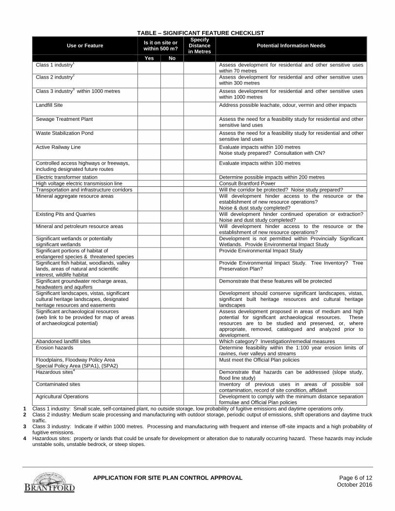
TABLE – SIGNIFICANT FEATURE CHECKLIST
Use or Feature Is it on site or within 500 m?
Specify Distance in Metres
Potential Information Needs
Yes No Class 1 industry
1
Assess development for residential and other sensitive uses within 70 metres
Class 2 industry2
Assess development for residential and other sensitive uses within 300 metres
Class 3 industry3 within 1000 metres
Assess development for residential and other sensitive uses within 1000 metres
Landfill Site
Address possible leachate, odour, vermin and other impacts
Sewage Treatment Plant
Assess the need for a feasibility study for residential and other sensitive land uses
Waste Stabilization Pond
Assess the need for a feasibility study for residential and other sensitive land uses
Active Railway Line Evaluate impacts within 100 metres Noise study prepared? Consultation with CN?
Controlled access highways or freeways, including designated future routes
Evaluate impacts within 100 metres
Electric transformer station Determine possible impacts within 200 metres
High voltage electric transmission line Consult Brantford Power
Transportation and infrastructure corridors Will the corridor be protected? Noise study prepared?
Mineral aggregate resource areas Will development hinder access to the resource or the establishment of new resource operations? Noise & dust study completed?
Existing Pits and Quarries Will development hinder continued operation or extraction? Noise and dust study completed?
Mineral and petroleum resource areas Will development hinder access to the resource or the establishment of new resource operations?
Significant wetlands or potentially significant wetlands
Development is not permitted within Provincially Significant Wetlands. Provide Environmental Impact Study
Significant portions of habitat of endangered species & threatened species
Provide Environmental Impact Study
Significant fish habitat, woodlands, valley lands, areas of natural and scientific interest, wildlife habitat
Provide Environmental Impact Study. Tree Inventory? Tree Preservation Plan?
Significant groundwater recharge areas, headwaters and aquifers
Demonstrate that these features will be protected
Significant landscapes, vistas, significant cultural heritage landscapes, designated heritage resources and easements
Development should conserve significant landscapes, vistas, significant built heritage resources and cultural heritage landscapes
Significant archaeological resources (web link to be provided for map of areas of archaeological potential)
Assess development proposed in areas of medium and high potential for significant archaeological resources. These resources are to be studied and preserved, or, where appropriate, removed, catalogued and analyzed prior to development.
Abandoned landfill sites Which category? Investigation/remedial measures
Erosion hazards Determine feasibility within the 1:100 year erosion limits of ravines, river valleys and streams
Floodplains, Floodway Policy Area Special Policy Area (SPA1), (SPA2)
Must meet the Official Plan policies
Hazardous sites4 Demonstrate that hazards can be addressed (slope study,
flood line study)
Contaminated sites Inventory of previous uses in areas of possible soil contamination, record of site condition, affidavit
Agricultural Operations Development to comply with the minimum distance separation formulae and Official Plan policies
1 Class 1 industry: Small scale, self-contained plant, no outside storage, low probability of fugitive emissions and daytime operations only. 2 Class 2 industry: Medium scale processing and manufacturing with outdoor storage, periodic output of emissions, shift operations and daytime truck
traffic. 3 Class 3 industry: Indicate if within 1000 metres. Processing and manufacturing with frequent and intense off-site impacts and a high probability of
fugitive emissions. 4 Hazardous sites: property or lands that could be unsafe for development or alteration due to naturally occurring hazard. These hazards may include
unstable soils, unstable bedrock, or steep slopes.
APPLICATION FOR SITE PLAN CONTROL APPROVAL Page 7 of 12
October 2016
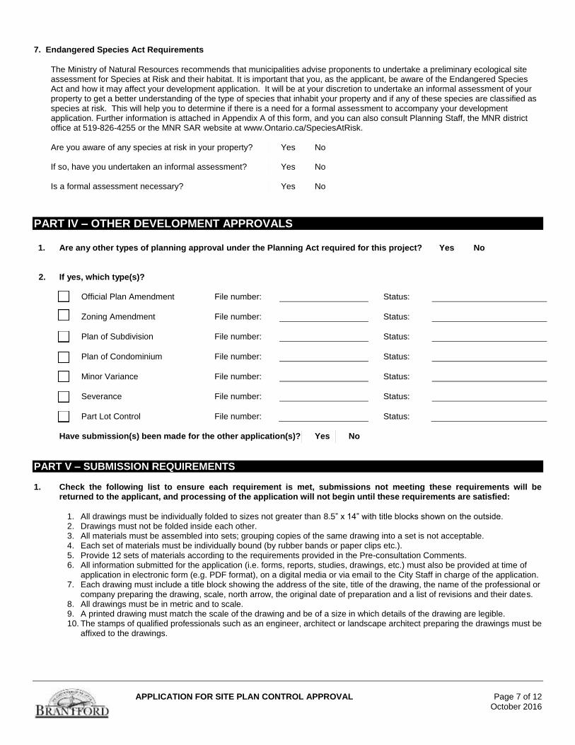
7. Endangered Species Act Requirements
The Ministry of Natural Resources recommends that municipalities advise proponents to undertake a preliminary ecological site assessment for Species at Risk and their habitat. It is important that you, as the applicant, be aware of the Endangered Species Act and how it may affect your development application. It will be at your discretion to undertake an informal assessment of your property to get a better understanding of the type of species that inhabit your property and if any of these species are classified as species at risk. This will help you to determine if there is a need for a formal assessment to accompany your development application. Further information is attached in Appendix A of this form, and you can also consult Planning Staff, the MNR district office at 519-826-4255 or the MNR SAR website at www.Ontario.ca/SpeciesAtRisk.
Are you aware of any species at risk in your property? Yes No If so, have you undertaken an informal assessment? Yes No Is a formal assessment necessary? Yes No
PART IV – OTHER DEVELOPMENT APPROVALS 1. Are any other types of planning approval under the Planning Act required for this project? Yes No
2. If yes, which type(s)?
Official Plan Amendment File number: Status:
Zoning Amendment File number: Status:
Plan of Subdivision File number: Status:
Plan of Condominium File number: Status:
Minor Variance File number: Status:
Severance File number: Status:
Part Lot Control File number: Status:
Have submission(s) been made for the other application(s)? Yes No
PART V – SUBMISSION REQUIREMENTS 1. Check the following list to ensure each requirement is met, submissions not meeting these requirements will be
returned to the applicant, and processing of the application will not begin until these requirements are satisfied:
1. All drawings must be individually folded to sizes not greater than 8.5” x 14” with title blocks shown on the outside. 2. Drawings must not be folded inside each other. 3. All materials must be assembled into sets; grouping copies of the same drawing into a set is not acceptable. 4. Each set of materials must be individually bound (by rubber bands or paper clips etc.). 5. Provide 12 sets of materials according to the requirements provided in the Pre-consultation Comments. 6. All information submitted for the application (i.e. forms, reports, studies, drawings, etc.) must also be provided at time of
application in electronic form (e.g. PDF format), on a digital media or via email to the City Staff in charge of the application. 7. Each drawing must include a title block showing the address of the site, title of the drawing, the name of the professional or
company preparing the drawing, scale, north arrow, the original date of preparation and a list of revisions and their dates. 8. All drawings must be in metric and to scale. 9. A printed drawing must match the scale of the drawing and be of a size in which details of the drawing are legible. 10. The stamps of qualified professionals such as an engineer, architect or landscape architect preparing the drawings must be
affixed to the drawings.
APPLICATION FOR SITE PLAN CONTROL APPROVAL Page 8 of 12
October 2016
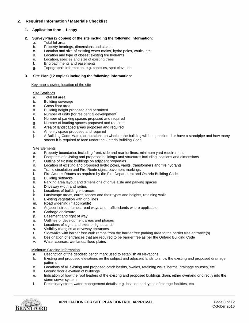
2. Required Information / Materials Checklist
1. Application form – 1 copy
2. Survey Plan (2 copies) of the site including the following information:
a. Total lot area b. Property bearings, dimensions and stakes c. Location and size of existing water mains, hydro poles, vaults, etc. d. Location and type of closest existing fire hydrants e. Location, species and size of existing trees f. Encroachments and easements
g. Topographic information, e.g. contours, spot elevation. 3. Site Plan (12 copies) including the following information:
Key map showing location of the site
Site Statistics a. Total lot area
b. Building coverage
c. Gross floor area d. Building height proposed and permitted e. Number of units (for residential development)
f. Number of parking spaces proposed and required
g. Number of loading spaces proposed and required
h. Area of landscaped areas proposed and required
i. Amenity space proposed and required j. A Building Code Matrix, or notations on whether the building will be sprinklered or have a standpipe and how many
streets it is required to face under the Ontario Building Code Site Elements
a. Property boundaries including front, side and rear lot lines, minimum yard requirements b. Footprints of existing and proposed buildings and structures including locations and dimensions c. Outline of existing buildings on adjacent properties d. Location of existing and proposed hydro poles, vaults, transformers and fire hydrants
e. Traffic circulation and Fire Route signs, pavement markings f. Fire Access Routes as required by the Fire Department and Ontario Building Code g. Building setbacks h. Parking area layout and dimensions of drive aisle and parking spaces
i. Driveway width and radius j. Locations of building entrances
k. Landscape areas, curbs, fences and their types and heights, retaining walls l. Existing vegetation with drip lines m. Road widening (if applicable)
n. Adjacent street names, road ways and traffic islands where applicable
o. Garbage enclosure p. Easement and right of way q. Outlines of development areas and phases
r. Locations of signs and exterior light stands s. Visibility triangles at driveway entrances t. Sidewalks with barrier free curb ramps from the barrier free parking area to the barrier free entrance(s)
u. Designation of entrances that are required to be barrier free as per the Ontario Building Code v. Water courses, wet lands, flood plains
Minimum Grading Information a. Description of the geodetic bench mark used to establish all elevations
b. Existing and proposed elevations on the subject and adjacent lands to show the existing and proposed drainage patterns
c. Locations of all existing and proposed catch basins, swales, retaining walls, berms, drainage courses, etc. d. Ground floor elevation of buildings
e. Indication of how the roof leaders of the existing and proposed buildings drain, either overland or directly into the storm sewer system
f. Preliminary storm water management details, e.g. location and types of storage facilities, etc.
APPLICATION FOR SITE PLAN CONTROL APPROVAL Page 9 of 12 October 2016
Mandatory Notes to be put on the Site Plan (where applicable) a. All works involved in the construction, relocation and repair of municipal services for the proposed development shall
be to the satisfaction of the General Manager of Public Works. b. Street Excavation Permits are required for any work in City right of way by any contractor. c. Private owner/developer is responsible for all servicing, utilities and costs. d. Remove curb and pour new curb for any new driveways or driveways to be abandoned. e. Storm water drainage
must not have a negative impact on adjacent properties. f. Driveway slopes must be 8% maximum, and sidewalk cross fall 2% to 4% maximum. g. A 5.0 m driveway visibility triangle on either side of the driveways projected from where the property lines meets
the driveway is required where no plant material/structure greater than 0.6m is to be planted within this area. h. No person shall cause or permit alteration of a site in the municipality, without having first obtained a Site
Alteration Permit in accordance with By-law Number 28-2011. i. Rooftop equipment shall be screened from street view. j. No person shall construct or demolish a building or cause a building to be constructed or demolished (including
site servicing) unless a building permit has been issued therefore by the Chief Building Official.
4. Building Elevations (3 copies) showing the following information: a. 4 sides of the building and structure b. Notation of building materials and colours c. Hatch patterns to represent different building materials, e.g. brick, siding, shingle, etc.
5. Studies determined to be necessary in pre-consultation
3. Application Fees
The fees are determined in the pre-consultation comments to the applicant. The current Development Application Fee Schedule can be found on the City’s webpage. If not certain, please consult Planning Staff. Applications meeting the following criteria are subject to the Minor Site Plan Application fee; otherwise the Major Site Plan Application fee will apply. 1. To facilitate a development directly related to the functions or activities of a registered non-profit agency. 2. To facilitate developments containing a minimum of 25% affordable housing units subject to satisfying the requirements of the
City to ensure the affordable units are affordable upon development. 3. No supporting reports are required for review (eg. traffic impact, environmental impact, noise, storm water management
reports etc.). 4. No change in use is proposed and no alteration to grades required. 5. The change in land use involves the creation of 3 or less dwelling units. 6. Consultation with external departments/agencies is limited to less than three. 7. Minor additions to existing buildings equivalent to 20% of the existing structure, to a maximum of 500 m² (5382 ft²).
APPLICATION FOR SITE PLAN CONTROL APPROVAL Page 10 of 12 October 2016
PART VI – ACKNOWLEDGEMENT I/we hereby submit an application for Site Plan Control Approval pursuant to Section 41 of the Planning Act R.S.0. 1990 (as amended), and enclose the required fee of $ _____________. 1. PERMISSION TO ENTER SUBJECT LANDS Permission is hereby granted to City of Brantford Staff and their consultants to enter the premises subject to this development
application for the purposes of making inspections associated with this application, during normal and reasonable working hours.
Date Signature of Owner
2. FREEDOM OF INFORMATION
Application information is collected under the authority of the Planning Act, R.S.O. 1990, c.P.13. In accordance with that Act, it is the policy of the City of Brantford to provide public access to all Planning Act applications and supporting documentation submitted to the City. I, , the Owner, hereby agree and acknowledge (Print name of Owner) That the information contained in this application and any documentation, including reports, studies and drawings, provided in support of the application, by myself, my agents, consultants and solicitors, constitutes public information and will become part of the public record. As such, and in accordance with the provisions of the Municipal Freedom of information and Protection of Privacy Act, R.S.O. 1990, c.M.56, I hereby consent to the City of Brantford making this application and its supporting documentation available to the general public, including copying and disclosing the application and its supporting documentation to any third party upon their request.
Date Signature of Owner
3. ACKNOWLEDGEMENT CLAUSES
a. I hereby apply for site plan approval. I understand that site plan approval is required before a building permit can be issued.
b. I acknowledge that the City of Brantford is not responsible for identification and remediation of contamination on the property, which is the subject of this Application – by reason of its approval to this Application.
Applicant Signature Date
Applicant Signature Date
APPLICATION FOR SITE PLAN CONTROL APPROVAL Page 11 of 12
October 2016
4. AUTHORIZATION
If the applicant is not the owner of the land that is the subject of this application, the authorization set out below must be
completed.
Authorization of Owner for Agent
to Make the Application
I, am the owner of the land that is the subject of this application
and I authorize to act as my agent in this matter and to make this application
on my behalf and to provide any of my personal information that will be included in this application or collected during the
processing of this application.
Date Signature of Owner
5. AFFIDAVIT OR SWORN DECLARATION
I, of the
in the make oath and say (or solemnly declare) that the information contained in
this application is true and that the information contained in the documents that accompany this application is true. Sworn (or declared) before me at the
in the
this day of , .
Signature of Owner Applicant Agent
Signature of a Commissioner, etc.
APPLICATION FOR SITE PLAN CONTROL APPROVAL Page 12 of 12
October 2016
APPENDIX “A”
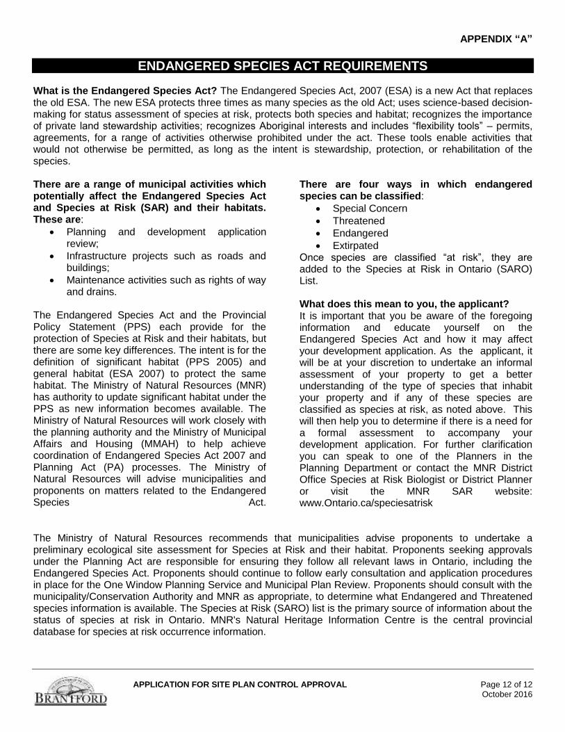
ENDANGERED SPECIES ACT REQUIREMENTS What is the Endangered Species Act? The Endangered Species Act, 2007 (ESA) is a new Act that replaces the old ESA. The new ESA protects three times as many species as the old Act; uses science-based decision-making for status assessment of species at risk, protects both species and habitat; recognizes the importance of private land stewardship activities; recognizes Aboriginal interests and includes “flexibility tools” – permits, agreements, for a range of activities otherwise prohibited under the act. These tools enable activities that would not otherwise be permitted, as long as the intent is stewardship, protection, or rehabilitation of the species. There are a range of municipal activities which potentially affect the Endangered Species Act and Species at Risk (SAR) and their habitats. These are:
Planning and development application review;
Infrastructure projects such as roads and buildings;
Maintenance activities such as rights of way and drains.
The Endangered Species Act and the Provincial Policy Statement (PPS) each provide for the protection of Species at Risk and their habitats, but there are some key differences. The intent is for the definition of significant habitat (PPS 2005) and general habitat (ESA 2007) to protect the same habitat. The Ministry of Natural Resources (MNR) has authority to update significant habitat under the PPS as new information becomes available. The Ministry of Natural Resources will work closely with the planning authority and the Ministry of Municipal Affairs and Housing (MMAH) to help achieve coordination of Endangered Species Act 2007 and Planning Act (PA) processes. The Ministry of Natural Resources will advise municipalities and proponents on matters related to the Endangered Species Act.
There are four ways in which endangered species can be classified:
Special Concern
Threatened
Endangered
Extirpated Once species are classified “at risk”, they are added to the Species at Risk in Ontario (SARO) List. What does this mean to you, the applicant? It is important that you be aware of the foregoing information and educate yourself on the Endangered Species Act and how it may affect your development application. As the applicant, it will be at your discretion to undertake an informal assessment of your property to get a better understanding of the type of species that inhabit your property and if any of these species are classified as species at risk, as noted above. This will then help you to determine if there is a need for a formal assessment to accompany your development application. For further clarification you can speak to one of the Planners in the Planning Department or contact the MNR District Office Species at Risk Biologist or District Planner or visit the MNR SAR website: www.Ontario.ca/speciesatrisk
The Ministry of Natural Resources recommends that municipalities advise proponents to undertake a preliminary ecological site assessment for Species at Risk and their habitat. Proponents seeking approvals under the Planning Act are responsible for ensuring they follow all relevant laws in Ontario, including the Endangered Species Act. Proponents should continue to follow early consultation and application procedures in place for the One Window Planning Service and Municipal Plan Review. Proponents should consult with the municipality/Conservation Authority and MNR as appropriate, to determine what Endangered and Threatened species information is available. The Species at Risk (SARO) list is the primary source of information about the status of species at risk in Ontario. MNR's Natural Heritage Information Centre is the central provincial database for species at risk occurrence information.