Embed Size (px)
Citation preview
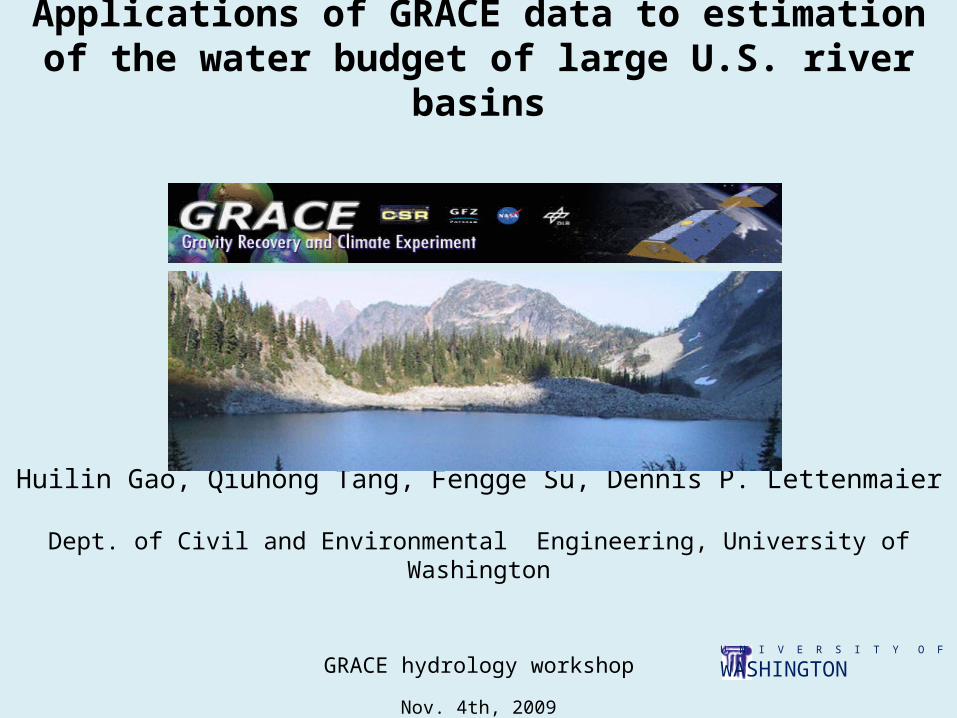
Applications of GRACE data to estimation of the water budget of large U.S. river basins
Huilin Gao, Qiuhong Tang, Fengge Su, Dennis P. Lettenmaier
Dept. of Civil and Environmental Engineering, University of Washington
GRACE hydrology workshop
Nov. 4th, 2009U N I V E R S I T Y O F
WASHINGTON

Outline
1. Background and motivation2. Research strategy3. Evaluation of remotely sensed precipitation, evapotranspiration (ET), and terrestrial water storage (TWS)4. Testing the ability to close the water budget solely from remote sensing 5. Further evaluation of GRACE terrestrial water storage change (TWSC) over the west coast6. Conclusions
1U N I V E R S I T Y O F
WASHINGTON

Background
1. Importance for understanding water budget at continental scale2. Limitations of observations and modeling3. The opportunities brought by remotely sensed water budget terms, especially GRACE TWS (Rodell et al., 2004; Tang et al., 2009)4. Challenges to remote sensing products (Sheffield et al., 2009)
2U N I V E R S I T Y O F
WASHINGTON
∆S = P –R– ET

Background
1. Importance for understanding water budget at continental scale2. Limitations of observations and modeling3. The opportunities brought by remotely sensed water budget terms, especially GRACE TWS (Rodell et al., 2004; Tang et al., 2009)4. Challenges to remote sensing products (Sheffield et al., 2009)
Motivation Over major river basins across the CONUS, how well can estimates of terrestrial water budget terms derived entirely from remote sensing be used to close the terrestrial water budget?
Which remotely sensed terms have the largest/least uncertainty, and is it possible to close the water balance by selecting a suite of satellite products with superior performance?
2U N I V E R S I T Y O F
WASHINGTON
∆S = P –R– ET

Research Strategy
R (observed) = P – ∆S – ET (remote sensing)
Research Domain – Continental U.S.
Precipitation ET ΔS Runoff
Remote sensing TMPACMORPHPERSIANN
MODIS based by UM, PU,
UW
GRACE by CSR; GFZ; JPL
Inferred
Observed/Modeled
Gridded gauge data
*VIC output *VIC output Observed runoff
*VIC output: Variable Infiltration Capacity model forced by gridded gauge precipitation
High quality precipitation from gridded gauge measurements - help evaluate P
LSM outputs using quality forcings - help evaluate ΔS and ET
3
?

Arkansas-Red (AR) East Coast (EA) Lower Mississippi (LM) Rio Grande (RG)California (CA) Great Lakes (GL) Upper Mississippi (UM)Colorado (CO) Great Basin (GB) Missouri (MO)Columbia (CB) Gulf (GU) Ohio (OH)
Hydrological Regions and River Basins in the U.S.
4U N I V E R S I T Y O F
WASHINGTON

Seasonal Precipitation
6
• Orographic effects are poorly represented by the remote sensing products
• Remotely sensed precipitation is biased high over the central CONUS
•TMPA precipitation performs the best among the three
U N I V E R S I T Y O F
WASHINGTON

Seasonal Evapotranspiration
• It is difficult to validate remotely sensed ET at the continental scale
• Over most regions, UM ET tends to provide the smallest values, and UW ET is closest to VIC estimate
8U N I V E R S I T Y O F
WASHINGTON
•Remotely sensed ET accounts for irrigation contribution

Dynamic Range of TWS(2003~2006)
9U N I V E R S I T Y O F
WASHINGTON(acknowledgement to Dr D.P. Chambers for smoothing method)

Seasonal TWS
• GRACE products from different data centers are similar in their differences with VIC
10U N I V E R S I T Y O F
WASHINGTON
• Dynamic range of VIC TWS is larger than GRACE over the western hydrologic regions
• Dynamic range of VIC TWS is smaller than GRACE estimates in much of the Mississippi basin

U N I V E R S I T Y O F
WASHINGTON
R (observed) = P – ∆S – ET (remote sensing)
Inferred Runoff v.s. Observed Runoff (I)3×3×3=27 ensemble members
11
?

U N I V E R S I T Y O F
WASHINGTON
R (observed) = P – ∆S – ET (remote sensing)
Inferred Runoff v.s. Observed Runoff (II)3×3=9 ensemble members
12
?

mean of the three GRACE datasets maximum and minimum of the three
Amplitude of Seasonal TWS
Are the biases from VIC or GRACE?
U N I V E R S I T Y O F
WASHINGTON 13

KL03 KL04
Tonzi Ranch Vaira Ranch
Blodgett
Satellite/Observation based TWSC
∆S = P –R– ET
PRISM gaugeSatellitevalidatedreliable
14
PRISM: Parameter-elevation Regressions on Independent Slopes Model
15U N I V E R S I T Y O F
WASHINGTON
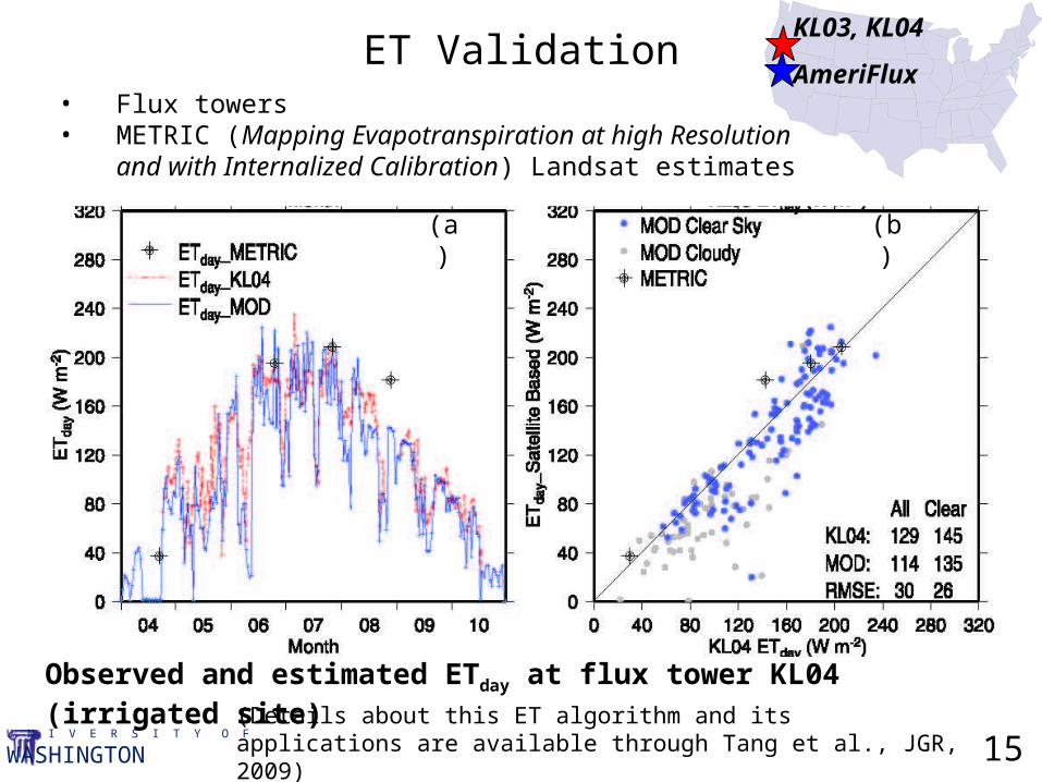
Observed and estimated ETday at flux tower KL04 (irrigated site)
• Flux towers• METRIC (Mapping Evapotranspiration at high Resolution and
with Internalized Calibration) Landsat estimates
ET ValidationKL03, KL04
AmeriFlux
(Details about this ET algorithm and its applications are available through Tang et al., JGR, 2009)
(a) (b)

16U N I V E R S I T Y O F
WASHINGTON
TWSC intercomparisonsT
WS
C (
mm
)

Conclusions• Water budget closure at the scale of large continental river basins is not currently possible on the basis of satellite data alone, even with a combination of the best products;
• Among the remotely sensed budget terms, precipitation has the largest error;
• ET estimation errors are the second most important, and notwithstanding their coarse spatial resolution, GRACE TWSC errors are of smaller magnitude than the other two sources;
• GRACE water storage change appears to be underestimated along the west coast.
17

Thanks!!!Questions?