Embed Size (px)
Citation preview
122/05/2015 Presented to CADCORP BLUEGROWTH Conference, London
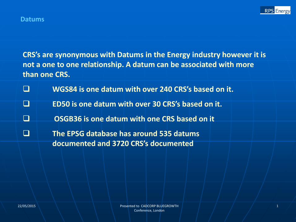
Datums
CRS’s are synonymous with Datums in the Energy industry however it is not a one to one relationship. A datum can be associated with more than one CRS.
WGS84 is one datum with over 240 CRS’s based on it.
ED50 is one datum with over 30 CRS’s based on it.
OSGB36 is one datum with one CRS based on it
The EPSG database has around 535 datumsdocumented and 3720 CRS’s documented
222/05/2015 Presented to CADCORP BLUEGROWTH Conference, London
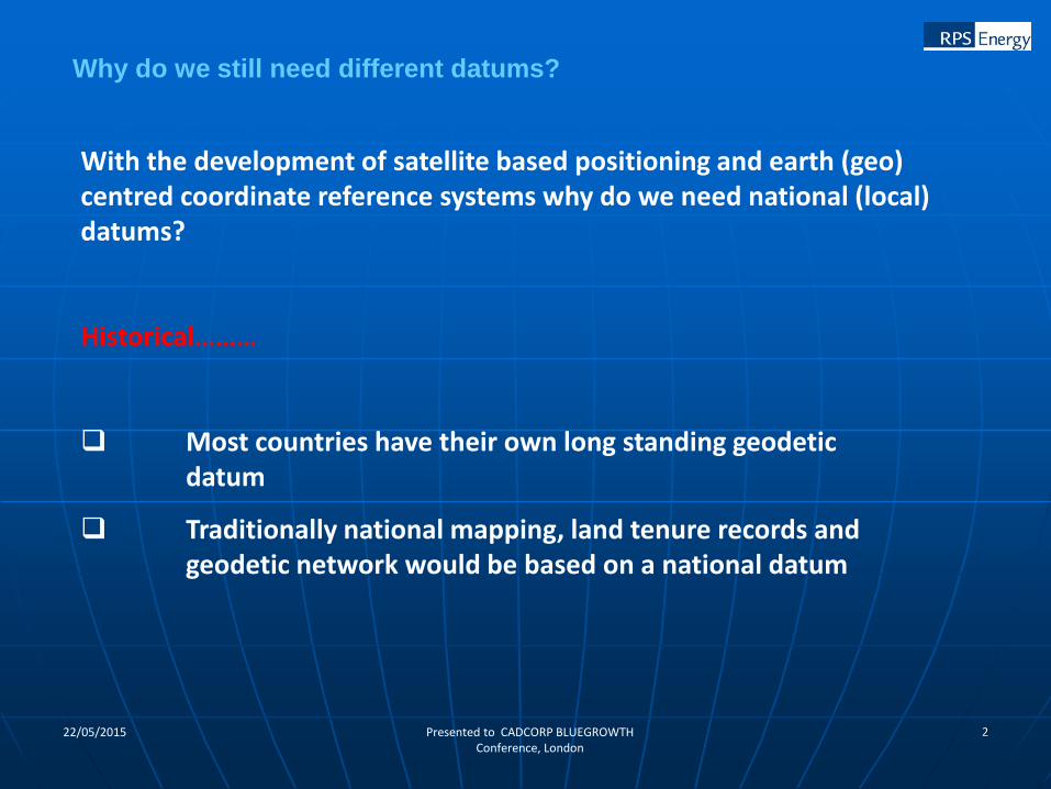
Why do we still need different datums?
With the development of satellite based positioning and earth (geo) centred coordinate reference systems why do we need national (local) datums?
Historical………
Most countries have their own long standing geodetic datum
Traditionally national mapping, land tenure records and geodetic network would be based on a national datum
322/05/2015 Presented to CADCORP BLUEGROWTH Conference, London
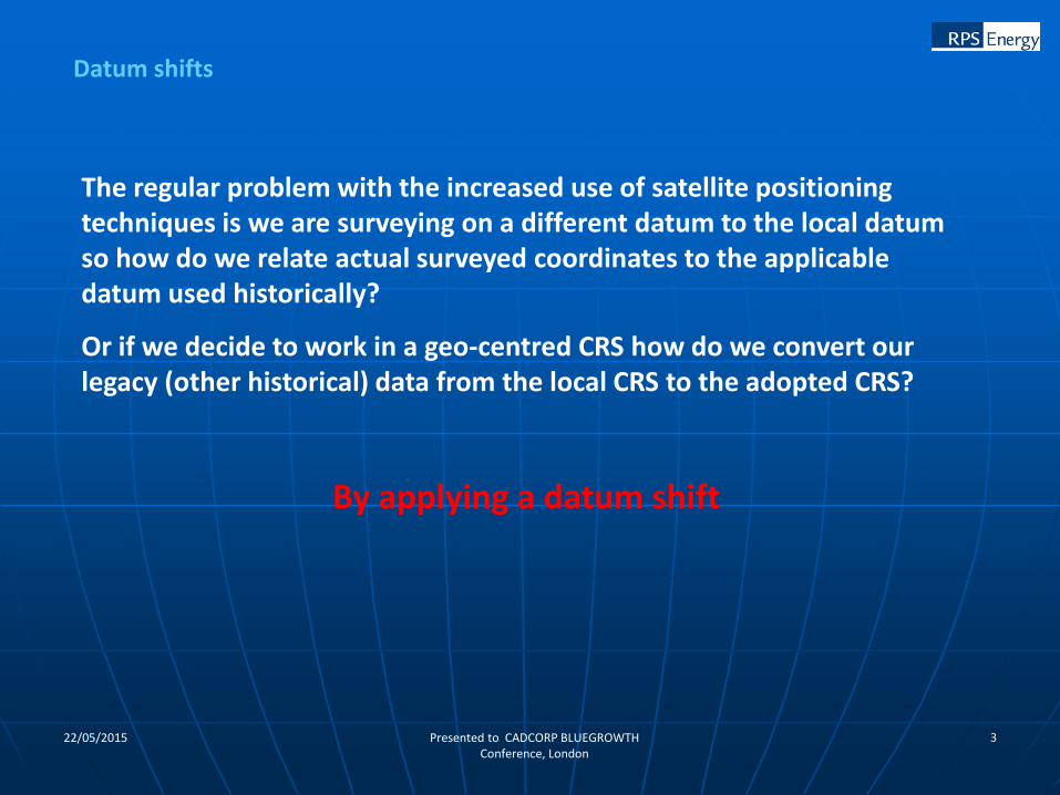
Datum shifts
The regular problem with the increased use of satellite positioning techniques is we are surveying on a different datum to the local datum so how do we relate actual surveyed coordinates to the applicable datum used historically?
Or if we decide to work in a geo-centred CRS how do we convert our legacy (other historical) data from the local CRS to the adopted CRS?
By applying a datum shift
422/05/2015 Presented to CADCORP BLUEGROWTH Conference, London
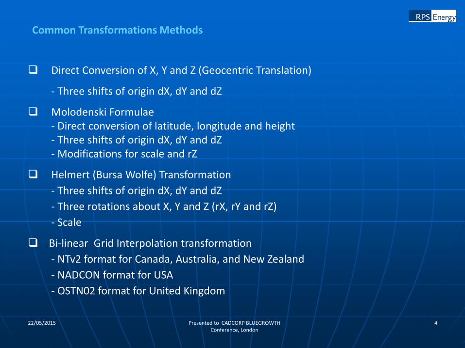
Direct Conversion of X, Y and Z (Geocentric Translation)
- Three shifts of origin dX, dY and dZ
Molodenski Formulae- Direct conversion of latitude, longitude and height- Three shifts of origin dX, dY and dZ- Modifications for scale and rZ
Helmert (Bursa Wolfe) Transformation
- Three shifts of origin dX, dY and dZ
- Three rotations about X, Y and Z (rX, rY and rZ)
- Scale
Bi-linear Grid Interpolation transformation
- NTv2 format for Canada, Australia, and New Zealand
- NADCON format for USA
- OSTN02 format for United Kingdom
Common Transformations Methods
522/05/2015 Presented to CADCORP BLUEGROWTH Conference, London
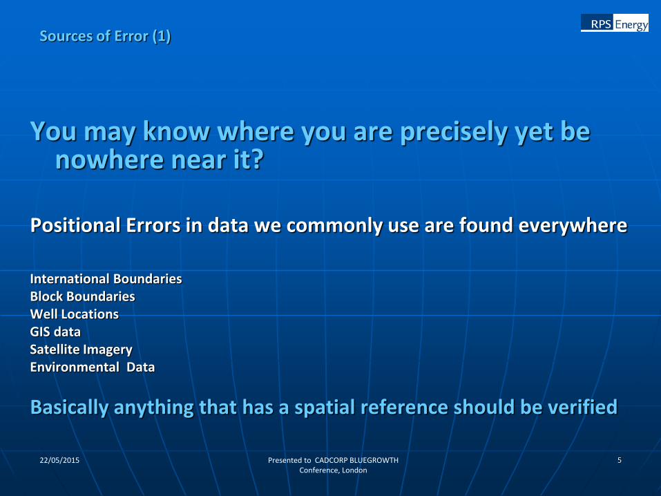
You may know where you are precisely yet be nowhere near it?
Positional Errors in data we commonly use are found everywhere
International BoundariesBlock BoundariesWell LocationsGIS dataSatellite ImageryEnvironmental Data
Basically anything that has a spatial reference should be verified
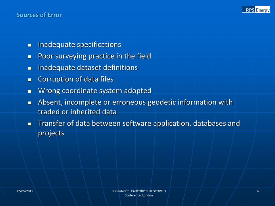
Sources of Error (1)
622/05/2015 Presented to CADCORP BLUEGROWTH Conference, London
Inadequate specifications
Poor surveying practice in the field
Inadequate dataset definitions
Corruption of data files
Wrong coordinate system adopted
Absent, incomplete or erroneous geodetic information with traded or inherited data
Transfer of data between software application, databases and projects
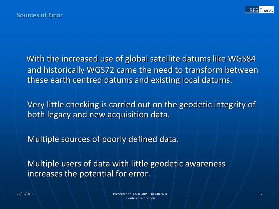
Sources of Error
722/05/2015 Presented to CADCORP BLUEGROWTH Conference, London
With the increased use of global satellite datums like WGS84 and historically WGS72 came the need to transform between these earth centred datums and existing local datums.
Very little checking is carried out on the geodetic integrity of both legacy and new acquisition data.
Multiple sources of poorly defined data.
Multiple users of data with little geodetic awareness increases the potential for error.
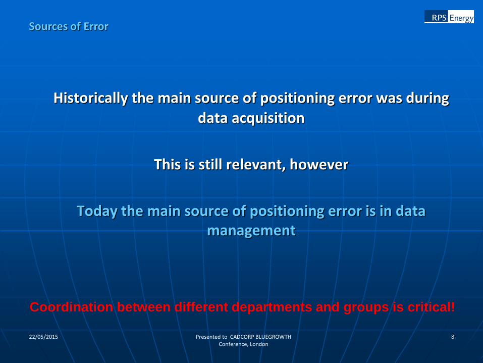
Sources of Error
822/05/2015 Presented to CADCORP BLUEGROWTH Conference, London
Historically the main source of positioning error was during data acquisition
This is still relevant, however
Today the main source of positioning error is in data management
Sources of Error
Coordination between different departments and groups is critical!
922/05/2015 Presented to CADCORP BLUEGROWTH Conference, London
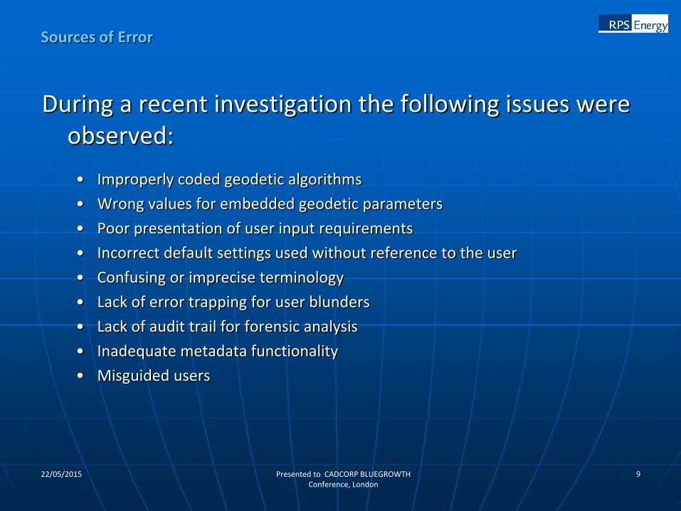
During a recent investigation the following issues were observed:
• Improperly coded geodetic algorithms
• Wrong values for embedded geodetic parameters
• Poor presentation of user input requirements
• Incorrect default settings used without reference to the user
• Confusing or imprecise terminology
• Lack of error trapping for user blunders
• Lack of audit trail for forensic analysis
• Inadequate metadata functionality
• Misguided users
Sources of Error
1022/05/2015 Presented to CADCORP BLUEGROWTH Conference, London
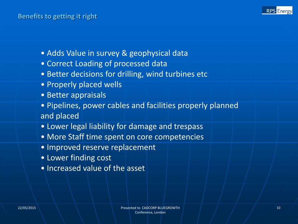
• Adds Value in survey & geophysical data• Correct Loading of processed data• Better decisions for drilling, wind turbines etc• Properly placed wells• Better appraisals• Pipelines, power cables and facilities properly planned and placed• Lower legal liability for damage and trespass• More Staff time spent on core competencies• Improved reserve replacement• Lower finding cost• Increased value of the asset
Benefits to getting it right
1122/05/2015 Presented to CADCORP BLUEGROWTH Conference, London
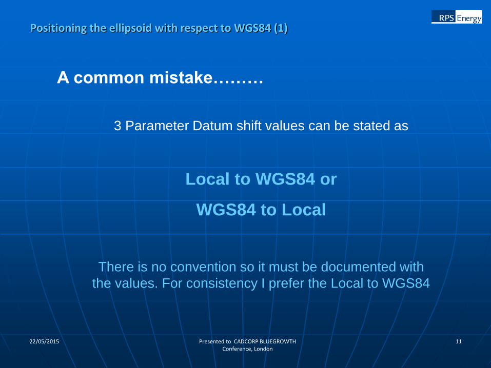
A common mistake………
3 Parameter Datum shift values can be stated as
Local to WGS84 or
WGS84 to Local
There is no convention so it must be documented with
the values. For consistency I prefer the Local to WGS84
Positioning the ellipsoid with respect to WGS84 (1)
1222/05/2015 Presented to CADCORP BLUEGROWTH Conference, London
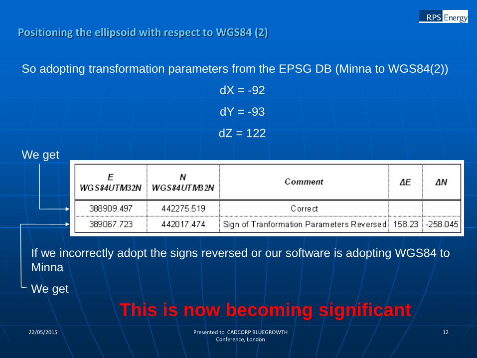
So adopting transformation parameters from the EPSG DB (Minna to WGS84(2))
dX = -92
dY = -93
dZ = 122
We get
If we incorrectly adopt the signs reversed or our software is adopting WGS84 to
Minna
We get
This is now becoming significant
Positioning the ellipsoid with respect to WGS84 (2)
1322/05/2015 Presented to CADCORP BLUEGROWTH Conference, London
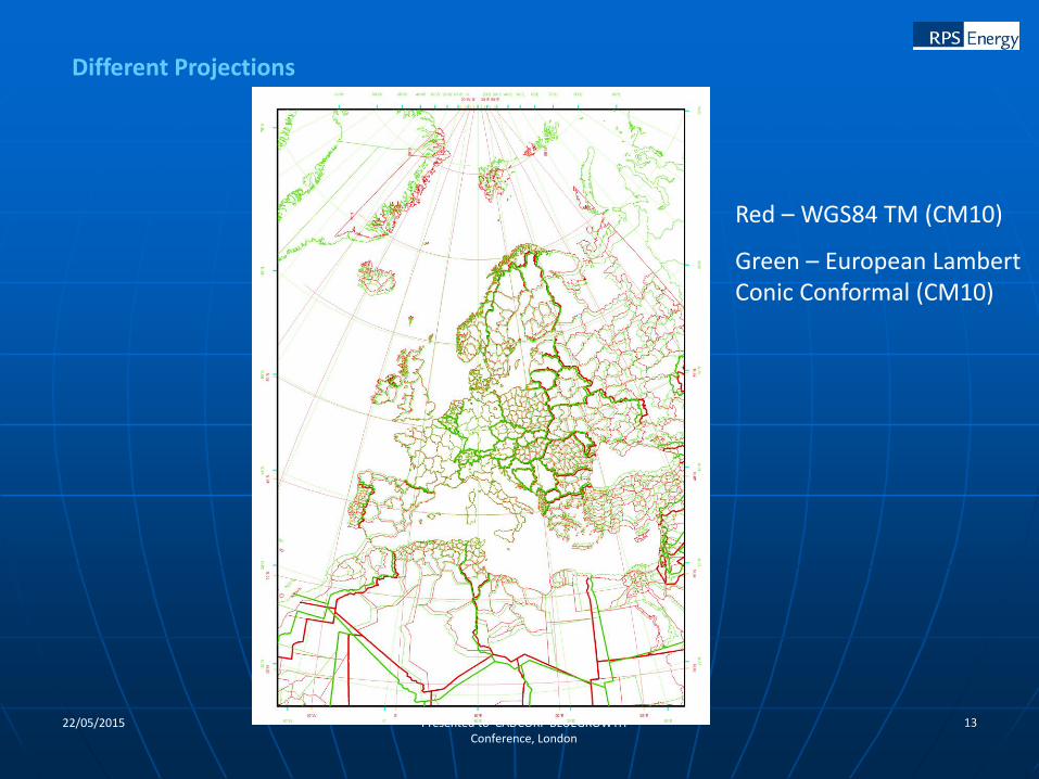
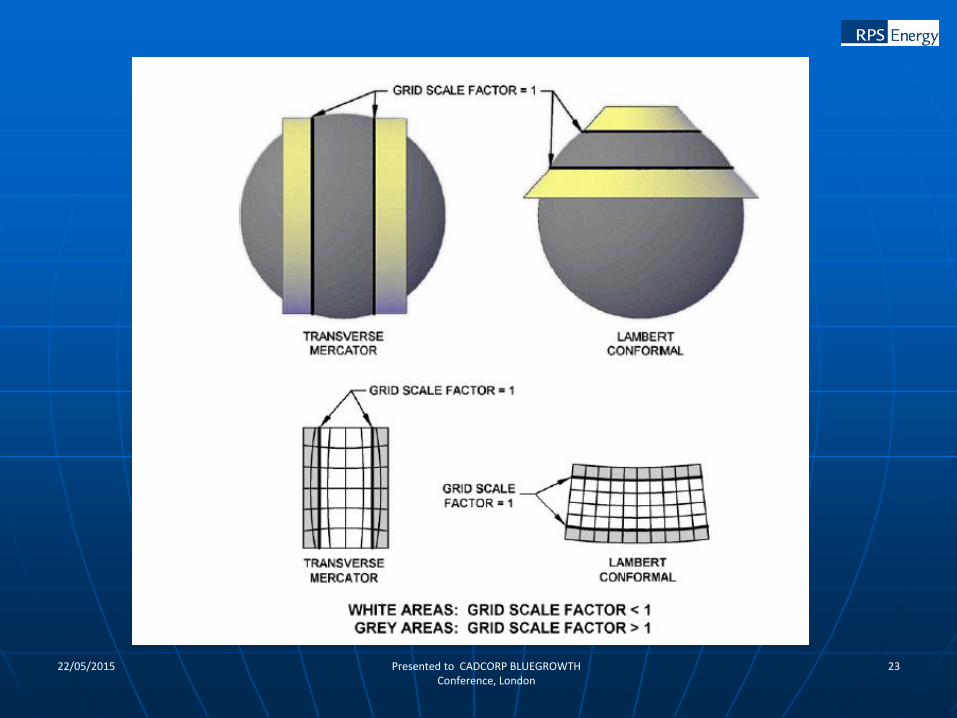
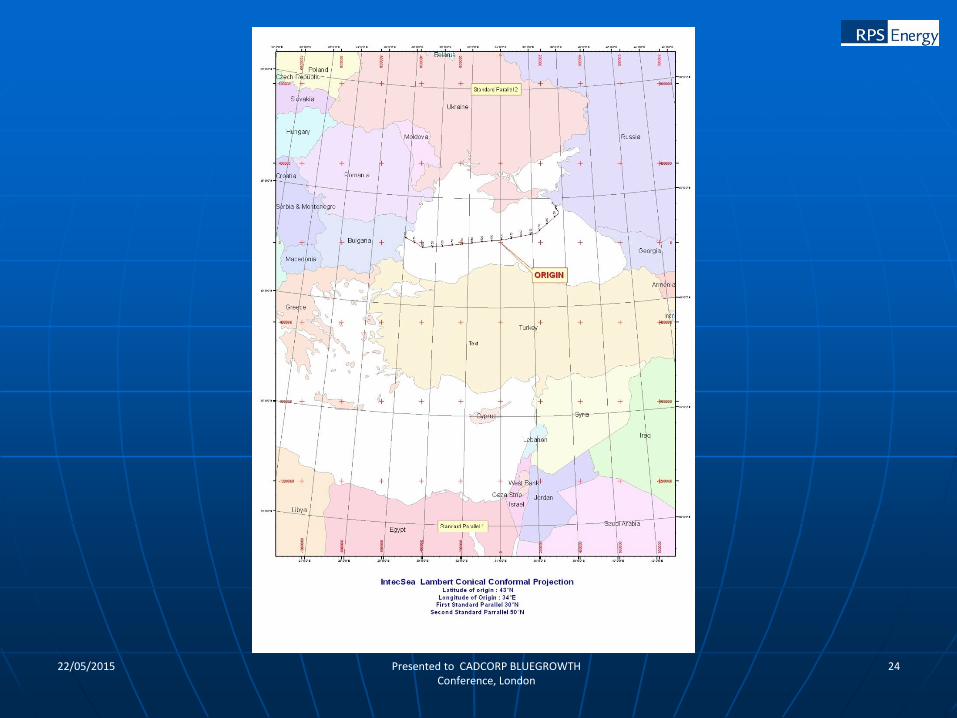
Red – WGS84 TM (CM10)
Green – European Lambert Conic Conformal (CM10)
Different Projections
1422/05/2015 Presented to CADCORP BLUEGROWTH Conference, London
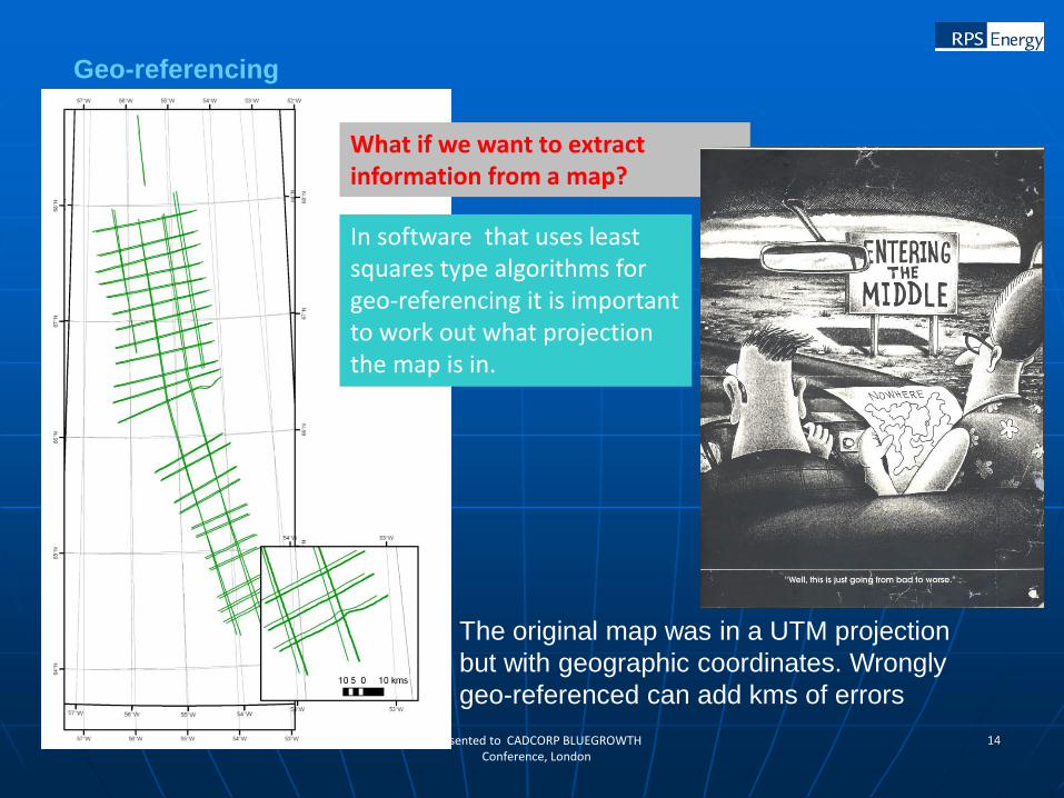
Geo-referencing
In software that uses least squares type algorithms for geo-referencing it is important to work out what projection the map is in.
What if we want to extract information from a map?
The original map was in a UTM projection
but with geographic coordinates. Wrongly
geo-referenced can add kms of errors
1522/05/2015 Presented to CADCORP BLUEGROWTH Conference, London
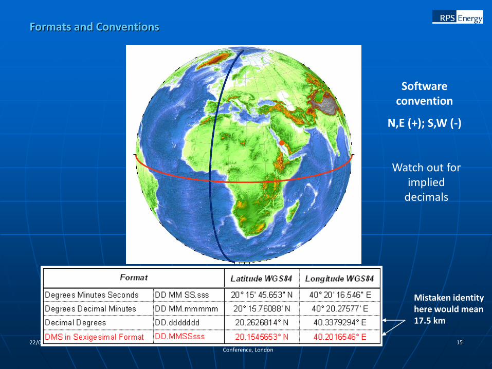
Formats and Conventions
Software convention
N,E (+); S,W (-)
Mistaken identity here would mean 17.5 km
Watch out for implied
decimals
1622/05/2015 Presented to CADCORP BLUEGROWTH Conference, London
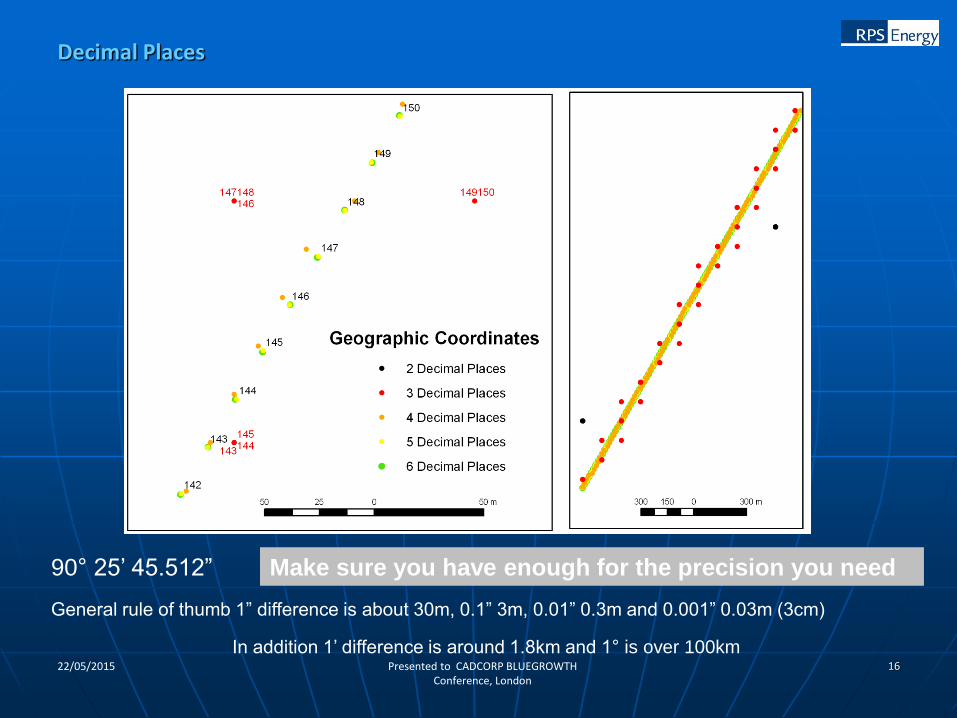
Decimal Places
90° 25’ 45.512”
General rule of thumb 1” difference is about 30m, 0.1” 3m, 0.01” 0.3m and 0.001” 0.03m (3cm)
In addition 1’ difference is around 1.8km and 1° is over 100km
Make sure you have enough for the precision you need
1722/05/2015 Presented to CADCORP BLUEGROWTH Conference, London
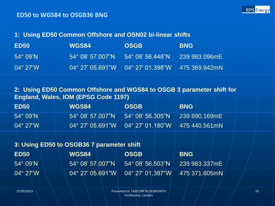
The official method for conversion between offshore and onshore data sets between OSGB36 and ETRF89 (WGS84) is via the official Quest software freely available from the Ordnance Survey. This software uses the bi-linear OSTN02 grid. (www.gps.gov.uk)
Be aware that this software is limited up to about 5 kilometres from the shoreline.
The process is ED50 to WGS84 (ETRF89) using the ED50 Common Offshore 5 parameter shift (EPSG Code 1311). Then WGS84 (ETRF89) to OSGB using the Quest software.
The EPSG data base lists a series of 3 parameter shifts for various parts of the UK but be warned that these can lead to errors in excess of 50m compared with the official co-ordinate transformation
The UKOOA derived 7 parameter shift (EPSG Code 1314) between WGS84 and OSGB36 gives results generally better than 4m.
ED50/OSGB36/WGS84/ETRF89 Conversions
1822/05/2015 Presented to CADCORP BLUEGROWTH Conference, London
1: Using ED50 Common Offshore and OSN02 bi-linear shifts
ED50 WGS84 OSGB BNG
54° 09’N 54° 08’ 57.007”N 54° 08’ 56.448”N 239 983.096mE
04° 27’W 04° 27’ 05.691”W 04° 27’ 01.398”W 475 369.942mN
2: Using ED50 Common Offshore and WGS84 to OSGB 3 parameter shift for
England, Wales, IOM (EPSG Code 1197)
ED50 WGS84 OSGB BNG
54° 09’N 54° 08’ 57.007”N 54° 08’ 56.305”N 239 890.169mE
04° 27’W 04° 27’ 05.691”W 04° 27’ 01.180”W 475 440.561mN
3: Using ED50 to OSGB36 7 parameter shift
ED50 WGS84 OSGB BNG
54° 09’N 54° 08’ 57.007”N 54° 08’ 56.503”N 239 983.337mE
04° 27’W 04° 27’ 05.691”W 04° 27’ 01.387”W 475 371.605mN
ED50 to WGS84 to OSGB36 BNG
1922/05/2015 Presented to CADCORP BLUEGROWTH Conference, London
OK to use for overall planning – ie access, villages, roads, etc
Dangers –
• Maps based on a Sphere of radius 6378137 metres
• Expects user data to be imported in the cylindrical equidistant projection
• Source Imagery is distorted to match Digital Vector data
• Adjoining images can be distorted and skewed.
• Latitude and Longitude from these products are only good to the nearest 300m metres at best.
USE WITH CAUTION
CHECK WITH HANDHELD GPS ON THE GROUND
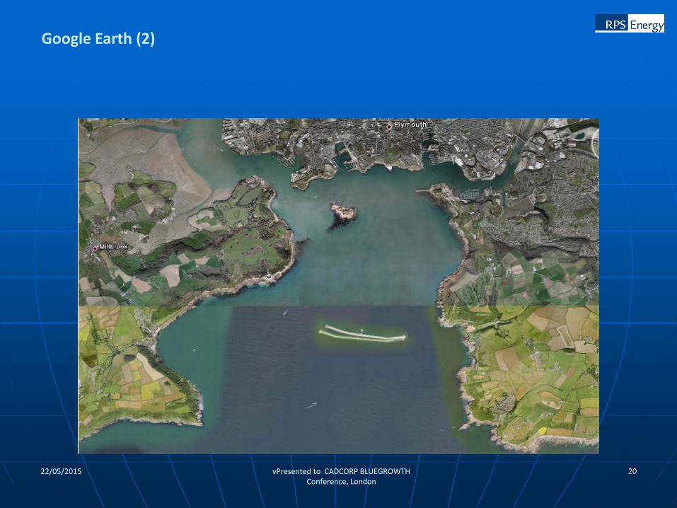
Google Earth and other Internet maps
2022/05/2015 vPresented to CADCORP BLUEGROWTH Conference, London
Google Earth (2)
2122/05/2015 Presented to CADCORP BLUEGROWTH Conference, London
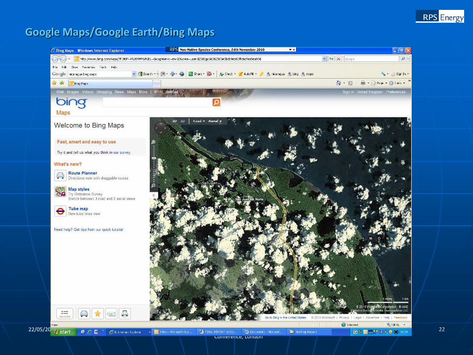
Nicaragua Accidentally Invades Costa Rica, Blames Google Maps
from the oops dept October 2010
You would think that military professionals would rely on something other than Google Maps in determining where countries have their borders. However, down in Central America, there's apparently been something of an international incident, after a Nicaraguan military commander, using Google Maps as his guide, brought his troops into Costa Rica. He insists that he was just following what Google Maps said, and that he never intended to go into the neighboring country. Yet... the report also notes that there was a Costa Rican flag there, which the Nicaraguans took down and replaced with their own flag. You would think, at that point, that everyone involved might double check to make sure they were on the right side of the border. After raising their own flag, the Nicaraguans apparently set up camp, cleaned up a nearby river (nice of them) and then dumped sediment into Costa Rican territory (not so nice of them). If this truly is an honest mistake, then hopefully nothing more is made of it, but it sounds like Costa Rican citizens are quite upset about the whole thing, leading Costa Rican President Laura Chinchilla to go on TV to ask citizens to "be calm... amid the outrage that these events provoke within us."
Google Maps
2222/05/2015 Presented to CADCORP BLUEGROWTH Conference, London
Google Maps/Google Earth/Bing Maps
22/05/2015 Presented to CADCORP BLUEGROWTH Conference, London
23
22/05/2015 Presented to CADCORP BLUEGROWTH Conference, London
24