Embed Size (px)
Citation preview
CultureGramsTM
States Edition 2016 Arizona
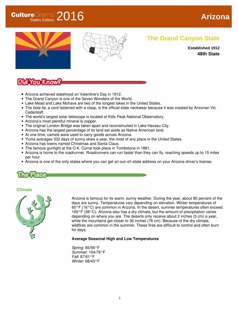
The Grand Canyon StateEstablished 1912
48th State
Arizona achieved statehood on Valentine’s Day in 1912.
The Grand Canyon is one of the Seven Wonders of the World.
Lake Mead and Lake Mohave are two of the longest lakes in the United States.
The bola tie, a cord fastened with a clasp, is the official state neckwear because it was created by Arizonan Vic
Cedarstaff.
The world’s largest solar telescope is located at Kitts Peak National Observatory.
Arizona’s most plentiful mineral is copper.
The original London Bridge was taken apart and reconstructed in Lake Havasu City.
Arizona has the largest percentage of its land set aside as Native American land.
At one time, camels were used to carry goods across Arizona.
Yuma averages 332 days of sunny skies a year, the most of any place in the United States.
Arizona has towns named Christmas and Santa Claus.
The famous gunfight at the O.K. Corral took place in Tombstone in 1881.
Arizona is home to the roadrunner. Roadrunners can run faster than they can fly, reaching speeds up to 15 miles
per hour.
Arizona is one of the only states where you can get an out–of–state address on your Arizona driver’s license.
Climate
Arizona is famous for its warm, sunny weather. During the year, about 80 percent of the
days are sunny. Temperatures vary depending on elevation. Winter temperatures of
60°F (16°C) are common in Arizona. In the desert, summer temperatures often exceed
100°F (38°C). Arizona also has a dry climate, but the amount of precipitation varies
depending on where you are. The deserts only receive about 2 inches (5 cm) a year,
while the mountains get closer to 30 inches (76 cm). Because of the dry climate,
wildfires are common in the summer. These fires are difficult to control and often burn
for days.
Average Seasonal High and Low Temperatures
Spring: 85/56°F
Summer: 104/78°F
Fall: 87/61°F
Winter: 68/43°F
1
CultureGramsTM
Arizona
Geography
Arizona is made up of three geographic regions—the Colorado Plateau, the Central
Mountain, and the Basin and Range. The Colorado Plateau, an area of flat highlands,
covers most of northern Arizona. Rivers such as the Colorado and the Little Colorado
have cut deep canyons into this region. The state gets its nickname from the most
famous of these canyons—the Grand Canyon. Steep mountain ranges and large
ponderosa pine forests characterize the Central Mountain region, also called the
Transition Zone. The Basin and Range region covers most of southern Arizona and is
made up of both mountains and desert basins. It includes the Sonoran and Yuma
deserts. This region is also where most of Arizona’s largest cities are located. Arizona
is also home to the Petrified Forest—a national park famous for its fossils. The fossils
come from trees that have been fossilized over millions of years, turning into hard
mineral rocks.
Resources and Economy
Manufacturing is one of the most important industries in the state. Leading
manufactured goods include electronic, communications, and aeronautical products.
Also, Arizona produces most of the nation’s copper. Irrigation has made it possible for
farmers to produce crops in spite of the dry climate. The state’s farmers grow cotton,
grains, fruits, and vegetables. A growing number of Arizonans work for the government
and in service industries such as hotels and restaurants. The state is a popular place
for people to retire because of the warm weather. Arizona’s climate and beautiful
scenery also attract many visitors to the state. While many Arizonans have benefited
from the state’s growing economy, the Native Americans who live on reservations (land
set aside by the federal government for Native Americans) are among the poorest
people in the nation.
Time Line
Native American tribes live in the area thousands of years before the
arrival of European explorers and settlers
AD 300
AD 300–500 Hohokam culture develops in central and southwestern Arizona
1500
1539 Marcos de Niza, a Franciscan friar, and Esteban de Dorantes, a black
Moorish slave, are the first Europeans to explore Arizona
1540 Francisco Vásquez de Coronado leads an expedition into Arizona and
claims it for Spain; part of his group reaches the Grand Canyon
1600
2
CultureGramsTM
Arizona
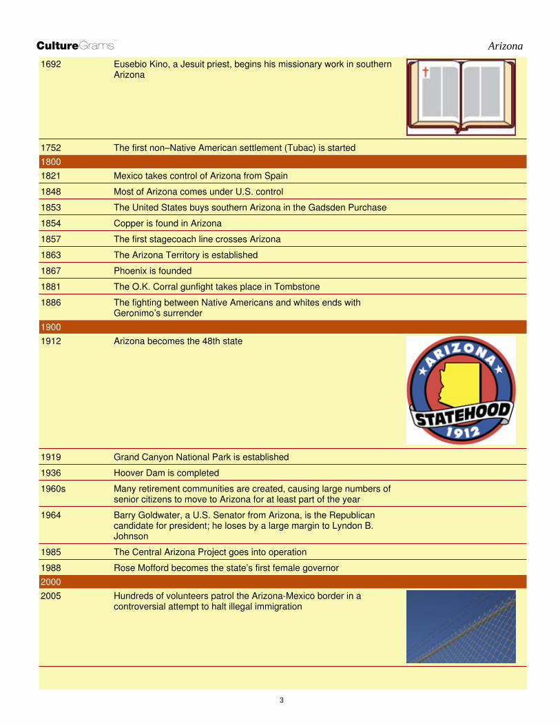
1692 Eusebio Kino, a Jesuit priest, begins his missionary work in southern
Arizona
1752 The first non–Native American settlement (Tubac) is started
1800
1821 Mexico takes control of Arizona from Spain
1848 Most of Arizona comes under U.S. control
1853 The United States buys southern Arizona in the Gadsden Purchase
1854 Copper is found in Arizona
1857 The first stagecoach line crosses Arizona
1863 The Arizona Territory is established
1867 Phoenix is founded
1881 The O.K. Corral gunfight takes place in Tombstone
1886 The fighting between Native Americans and whites ends with
Geronimo’s surrender
1900
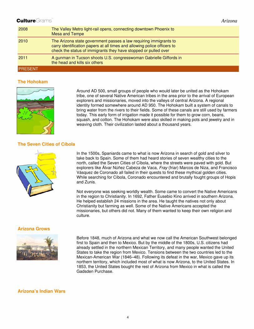
1912 Arizona becomes the 48th state
1919 Grand Canyon National Park is established
1936 Hoover Dam is completed
1960s Many retirement communities are created, causing large numbers of
senior citizens to move to Arizona for at least part of the year
1964 Barry Goldwater, a U.S. Senator from Arizona, is the Republican
candidate for president; he loses by a large margin to Lyndon B.
Johnson
1985 The Central Arizona Project goes into operation
1988 Rose Mofford becomes the state’s first female governor
2000
2005 Hundreds of volunteers patrol the Arizona-Mexico border in a
controversial attempt to halt illegal immigration
3
CultureGramsTM
Arizona
2008 The Valley Metro light-rail opens, connecting downtown Phoenix to
Mesa and Tempe
2010 The Arizona state government passes a law requiring immigrants to
carry identification papers at all times and allowing police officers to
check the status of immigrants they have stopped or pulled over
2011 A gunman in Tucson shoots U.S. congresswoman Gabrielle Giffords in
the head and kills six others
PRESENT
The Hohokam
Around AD 500, small groups of people who would later be united as the Hohokam
tribe, one of several Native American tribes in the area prior to the arrival of European
explorers and missionaries, moved into the valleys of central Arizona. A regional
identity formed somewhere around AD 950. The Hohokam built a system of canals to
bring water from the rivers to their fields. Some of these canals are still used by farmers
today. This early form of irrigation made it possible for them to grow corn, beans,
squash, and cotton. The Hohokam were also skilled in making pots and jewelry and in
weaving cloth. Their civilization lasted about a thousand years.
The Seven Cities of Cíbola
In the 1500s, Spaniards came to what is now Arizona in search of gold and silver to
take back to Spain. Some of them had heard stories of seven wealthy cities to the
north, called the Seven Cities of Cíbola, where the streets were paved with gold. But
explorers like Álvar Núñez Cabeza de Vaca, Fray (friar) Marcos de Niza, and Francisco
Vásquez de Coronado all failed in their quests to find these mythical golden cities.
While searching for Cíbola, Coronado encountered and brutally fought groups of Hopis
and Zunis.
Not everyone was seeking worldly wealth. Some came to convert the Native Americans
in the region to Christianity. In 1692, Father Eusebio Kino arrived in southern Arizona.
He helped establish 24 missions in the area. He taught the natives not only about
Christianity but farming as well. Some of the Native Americans accepted the
missionaries, but others did not. Many of them wanted to keep their own religion and
culture.
Arizona Grows
Before 1848, much of Arizona and what we now call the American Southwest belonged
first to Spain and then to Mexico. But by the middle of the 1800s, U.S. citizens had
already settled in the northern Mexican Territory, and many people wanted the United
States to take the region from Mexico. Tensions between the two countries led to the
Mexican-American War (1846–48). Following its defeat in the war, Mexico gave up its
northern territory, which included most of what is now Arizona, to the United States. In
1853, the United States bought the rest of Arizona from Mexico in what is called the
Gadsden Purchase.
Arizona’s Indian Wars
4
CultureGramsTM
Arizona
As more white settlers moved into Arizona in the 1860s, intrusions on Native American
lands increased. Some of the Native Americans survived by raiding towns and ranches
to get food and supplies. As a result, there were many battles between the native tribes
and federal troops. Cochise, a famous Apache chief, and Geronimo, an Apache military
leader, led the Native Americans against the U.S. Army. Although outnumbered by U.S.
soldiers, the Apache survived for years by hiding in the deserts and mountains.
However, Cochise’s Apache were finally defeated in 1872. Geronimo's forces
successfully escaped U.S. and Mexican armies countless times before surrendering at
Skeleton Canyon in 1886. By that time, most Native Americans in the state had been
moved to reservations.
Bringing Water to the Desert
One of the great challenges Arizona continues to face is supplying enough water to
support its farming, industry, and growing population. A network of canals and dams
was built in the early part of the 20th century to harness the state’s rivers to make water
available to Arizona’s farmland and cities. Later on, the state also looked for help from
the federal government for the Central Arizona Project, which brought water from the
Colorado River to cities like Phoenix and Tucson beginning in the mid-1980s. Increased
development of the land and increased technology such as air-conditioning made it
possible for more people to live in desert areas. In fact, because of the addition of
canals and irrigation systems in Phoenix, the city now has moderate humidity, which is
uncommon in a desert climate. Many retirement communities were created for senior
citizens who became part-time or full-time Arizona residents. Water in Arizona is not
sustainable unless new technologies are developed and conservation efforts are put
into place.
Population
Arizona is one of the fastest-growing states in the country. Many, particularly retirees (older people who have finished
working), are attracted to the state because of the warm climate. Hispanics are the state’s largest ethnic minority, but
Arizona also has one of the largest Native American populations in the country. Twenty-one tribes are represented on
more than 20 reservations, including the Navajo, Gila, Apache, and Hopi tribes. The majority of Arizonans live in cities.
The two main cities are Phoenix and Tucson.
5

CultureGramsTM
Arizona
Government
Capital: Phoenix
State Abbreviation: AZ
Governor: Doug Ducey (Republican)
U.S. Senators: 2
Jeff Flake (Republican)
John McCain (Republican)
U.S. Representatives: 9
Republicans: 5
Democrats: 4
State Senators: 30
State Representatives: 60
Counties: 15
Arizona’s constitution was adopted in 1911.
Arizona legislators (lawmakers) serve two-year terms.
Arizona casts 10 electoral votes in presidential elections.
Famous People
Cesar Chavez
Erma Bombeck — Newspaper columnist
Kit Carson — Trapper and frontiersman
Cesar Chavez — Labor leader
Wyatt Earp — Frontier marshal
Barry Goldwater — Politician
Zane Grey — Western novelist
Helen Hull Jacobs — Tennis player
Percival Lowell — Astronomer
Stevie Nicks — Singer
6

CultureGramsTM
Arizona
Wyatt Earp
Sandra Day O’Connor
Linda Ronstadt
Geronimo — Apache chief
Cochise — Apache chief
Sandra Day O’Connor — Supreme Court justice
John Wesley Powell — Explorer
William Rehnquist — Supreme Court justice
Linda Ronstadt — Singer
Emma Stone — Actress
Frank Lloyd Wright — Architect
Native America
After the Hohokam civilization mysteriously disappeared, the Navajo and Apache
people came to Arizona in the 1400s. The Navajo farmed and lived in the north, while
the Apache hunted in the south. When Arizona became an official United States
territory, white settlers took any land they wanted. The Native Americans responded by
raiding the settlements. Eventually the U.S. Army stepped in. Colonel Kit Carson
rounded up thousands of Navajo, forcing them to march 300 miles (500 km) to Bosque
Redondo in New Mexico. The journey took around 20 days, and hundreds of Navajo
died along the way from cold and starvation. The trek was called the Long Walk. After
five years of enduring nightmarish conditions in Bosque Redondo, the surviving Navajo
were allowed to return to a reservation in Arizona.
In the late 1800s, Native American children in Arizona were sent to Indian Schools,
such as the Phoenix Indian School. These schools forced children to adopt white,
Anglo-American culture. Students were forced to cut their hair, speak only English, and
take English names. The Phoenix Indian School closed in 1990.
During World War II, the military recruited several hundred Navajo Marines to develop a
code based on the Navajo language. Since it was a highly difficult language native to
America, military leaders believed it would be almost impossible to crack the code.
Navajo soldiers created and memorized the code until they were able to transmit and
decode a message in a matter of seconds. Known as “code talkers,” these soldiers
were directly responsible for the American victory at the Battle of Iwo Jima, during
which six code talkers worked nonstop, sending more than eight hundred messages
without a single error. The code was never broken. The code talkers received a
Congressional Gold Medal in 2000, and a film was later made based on their story.
Today, Arizona is home to the largest reservation in the country, including the Navajo
Nation. In fact, reservations cover more than a quarter of the land in Arizona. The
7
CultureGramsTM
Arizona
Navajo reservation covers northeastern Arizona, stretching into Utah and New Mexico,
an area larger than West Virginia. There are several hundred thousand Navajo
members. Founded close to one thousand years ago, the oldest continuously inhabited
settlement in the United States is Oraibi, a village located on top of a mesa on the Hopi
reservation.
Twenty tribes have come together to form the Inter Tribal Council of Arizona. The
council is made up of the highest ranking members of each tribe. United, they work with
the federal and state governments to address family, health, environmental, and other
issues that affect all Arizona tribes.
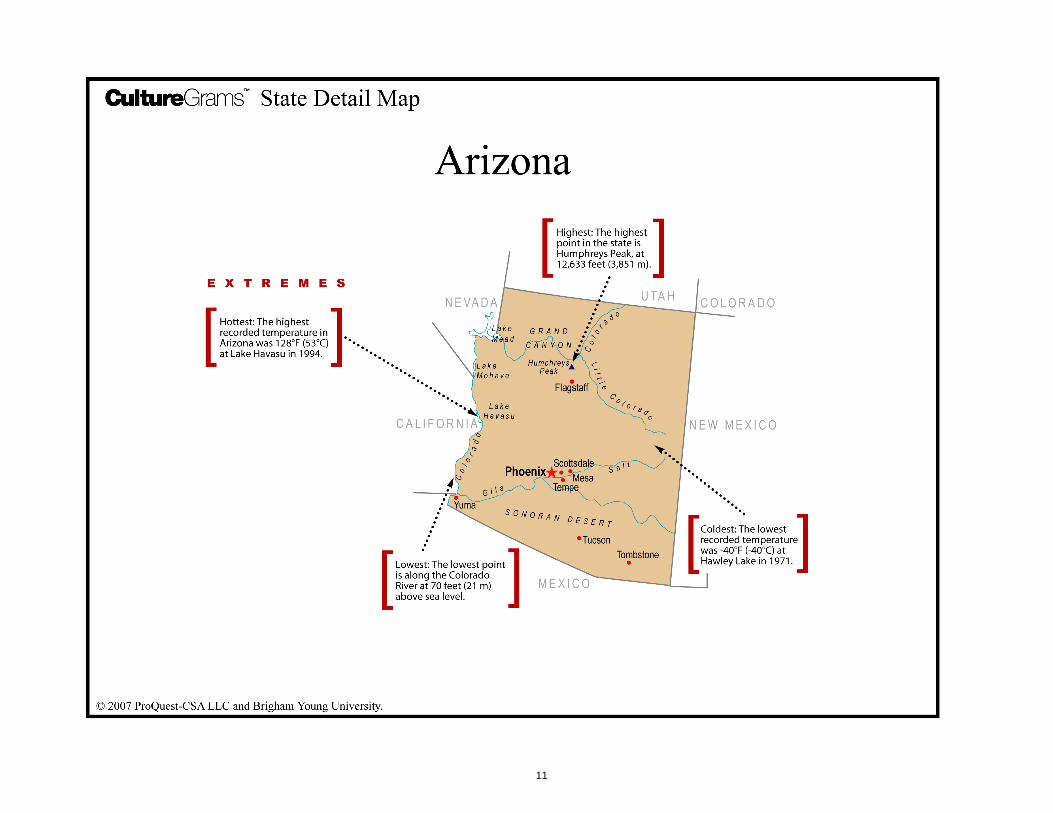
The Grand Canyon
The Grand Canyon is 277 miles (445 km) long and nearly 1 mile (1.6 km) deep at its
deepest point. It was largely unknown until after the Civil War. In 1869, a one-armed
Civil War veteran named John Wesley Powell led the first expedition through the
canyon on the Colorado River. He and his men made the trip in just four small wooden
boats. They made maps of the area and provided descriptions of the landscape. The
Grand Canyon became a national park in 1919, just three years after the National Park
Service was created. Now there are close to five million visitors to the canyon each
year.
Tombstone
During the mining boom of the late 1800s, Wyatt Earp and his brothers settled in
Tombstone. Tombstone was a famous Wild West town. At the time, a small area in the
town was home to more than 70 saloons. Many miners would come to the town to
spend the money they just earned from their work. Wyatt’s older brother Virgil was a
U.S. marshal and worked to keep the peace in the often rowdy city of Tombstone. Doc
Holliday, a well-known gambler and friend of the Earps, soon joined them. In 1880, the
Earps and Holliday got caught up in a feud with local cowboy gangs the McLaurys and
the Clantons.
Things came to a head between the lawmen and the cowboys on the afternoon of 26
October 1881 at the O.K. Corral. The gunfight lasted only 30 seconds, but by the end
more than 20 shots had been fired and three cowboys were dead. To this day no one
knows who fired the first shot. Wyatt Earp and Doc Holliday were charged with murder,
but the judge dismissed the case for lack of evidence. A few weeks later, gunmen shot
and killed Morgan Earp and wounded Virgil. Wyatt and Doc got revenge by hunting
down and killing the men they believed responsible. The two friends then left Arizona
for good. Today, hundreds of thousands of tourists visit the site of one of the most
famous gunfights in U.S. history.
State Symbols
8
CultureGramsTM
Arizona
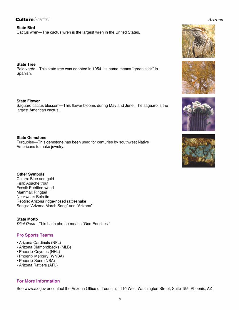
State Bird
Cactus wren—The cactus wren is the largest wren in the United States.
State Tree
Palo verde—This state tree was adopted in 1954. Its name means “green stick” in
Spanish.
State Flower
Saguaro cactus blossom—This flower blooms during May and June. The saguaro is the
largest American cactus.
State Gemstone
Turquoise—This gemstone has been used for centuries by southwest Native
Americans to make jewelry.
Other Symbols
Colors: Blue and gold
Fish: Apache trout
Fossil: Petrified wood
Mammal: Ringtail
Neckwear: Bola tie
Reptile: Arizona ridge-nosed rattlesnake
Songs: “Arizona March Song” and “Arizona”
State Motto
Ditat Deus—This Latin phrase means “God Enriches.”
Pro Sports Teams
• Arizona Cardinals (NFL)
• Arizona Diamondbacks (MLB)
• Phoenix Coyotes (NHL)
• Phoenix Mercury (WNBA)
• Phoenix Suns (NBA)
• Arizona Rattlers (AFL)
For More Information
See www.az.gov or contact the Arizona Office of Tourism, 1110 West Washington Street, Suite 155, Phoenix, AZ
9

CultureGramsTM
Arizona
85007; phone (866) 275-5816; web site www.visitarizona.com.
© 2016 ProQuest LLC and Brigham Young University. It is against the law to
copy, reprint, store, or transmit any part of this publication in any form by any
means without strict written permission from ProQuest.
CultureGramsTM
ProQuest
789 East Eisenhower Parkway
Ann Arbor, Michigan 48106 USA
Toll Free: 1.800.521.3042
Fax: 1.800.864.0019
www.culturegrams.com
10