Embed Size (px)
Citation preview

Institute for Wetland Science and Public Policy The Association of State Wetland Managers, Inc.
Final Report 1: Wetland Assessment for Regulatory Purposes
ASSESSING FUNCTIONS AND VALUES By Jon Kusler, Esq., Ph.D.

September 1, 2004
FINAL REPORT 1: WETLAND ASSESSMENT FOR REGULATORY
PURPOSES
ASSESSING FUNCTIONS AND
VALUES
By: Jon Kusler, Esq., Ph.D.
Available from the: Association of State Wetland Managers
1434 Helderberg Trail Berne, NY 12023
518-872-1804; Fax: 518-872-2171; [email protected]
Limited hard copies: $20.00 Limited copies on CD: $5.00
Please visit our website to access this and other reports at http://www.aswm.org
Direct site: http://www.aswm.org/propub/functionsvalues.pdf
Final Report 2: Wetland Assessment in the Courts: http://www.aswm.org/propub/courts.pdf
Final Report 3: Integrating Wetland Assessment into Regulatory Permitting: http://www.aswm.org/propub/integrating.pdf

DISCLAIMER The views expressed in this report are those of the author and do not necessarily represent those of the sponsoring agencies and organizations or reviewers.
ACKNOWLEDGMENTS Principal financial support for this final report has been provided by the U.S. Environmental Protection Agency, Wetlands Division. Additional funding was provided by the U.S. Environmental Protection Agency, Region 2, the USDA Natural Resources Conservation Service, and the Federal Emergency Management Agency. This support is gratefully acknowledged. The report draws upon a number of sources of information. These include: • A review of the literature (reports, articles, books, web pages) dealing with assessment
of wetland functions and values (See Bibliography). • Interviews and field visits with those who have developed and used various assessment
methods and techniques. • A national symposium concerning wetland assessment conducted by the Association of
State Wetland Managers in 1997 and three national workshops conducted in l996 and l998 concerning the HGM approach, landscape level wetland assessment, and the use of reference in wetland assessment.
• Many individual workshops and symposia conducted by ASWM over the last decade concerning various aspects of assessment such as wetland hydrology, restoration, classification, and delineation.
• Helpful insights of many wetland regulators and wetland scientists who reviewed earlier drafts of this report. Over one hundred individuals reviewed the draft working paper. We particularly thank Mark Brinson, Paul Adamus, Anna Hicks, Joe Larson, Terry Huffman, Robin Lewis, Paul Schmidt, Dale Simon, Tom Kelsch, and Andy McMillan for their comments and help.
We thank you all for your help.
Sincerely,
Jon Kusler

PREFACE In 1996 the Association of State Wetland Managers began a four-year project to help local, state, and federal resource agency personnel, legislators, planners, lawyers, and others understand and improve wetland information gathering for regulatory purposes. The goal was to identify measures to improve the full range of information gathering needs for regulatory purposes—mapping, planning, alternatives analysis, impact assessment, evaluation of impact reduction measures, compensation, and monitoring. Information needs and approaches for meeting the needs were examined from a variety of perspectives including legal requirements, scientific issues and problems, and agency budgets and staffing capabilities. Four draft reports were produced by this project. The drafts received quite extensive review. They were updated in late 2003 and early 2004. The following report is one of three final reports produced by this project. It was originally prepared as a working paper for the project. Some materials contained in this report were used in the two later reports. Nevertheless, there is much additional material. We have, therefore, reproduced the entire report. In addition to this report, two final project reports include Final Report 2, Wetland Assessment in the Courts, which addresses legal (Constitutional, statutory, administrative regulation, or ordinance) needs and requirements. The third final report, Integrating Wetland Assessment into Regulations makes recommendations for integrating wetland assessment into regulations and proposes a five-step wetland regulatory assessment process. All are being posted to the ASWM web site as PDF files: www.aswm.org The report which follows focuses upon assessment of wetland “functions” and “values” for regulatory purposes. What are regulatory assessment needs for assessing “functions and values? What assessment methods and techniques are available? Which methods, if any, are being used by regulators? What are the restraints upon assessment and various assessment techniques? What approaches are being taken by scientists and regulatory agencies to deal with restraints? What are productive future directions? We hope that the report and the other reports in the series will be useful and will stimulate your thinking in addressing this important but complex and difficult subject.
i

EXECUTIVE SUMMARY; RECOMMENDATIONS
There is great interest in improved techniques for assessing wetlands “functions” and “values” by regulatory agencies, resource management agencies, not-for-profit environmental organizations, wetland landowners, and others. These groups and individuals seek improved wetland assessment techniques to meet a variety of wetland analysis and decision-making needs including, but not limited to, regulatory purposes. For regulatory purposes, agencies need to evaluate the impact of proposed projects in wetland areas upon “functions” and “values” (See 1989 M.O.U. Between the Army Corps of Engineers and EPA) and the adequacy of proposed impact reduction and compensation (wetland restoration, creation, enhancement) measures. In response to this interest, scientists and regulators have attempted to develop, during the last two decades, a “silver bullet” rapid assessment approach for wetland functions and values which would permit inexpensive and accurate assessment of project impacts and the adequacy of impact reduction and compensation measures. These include more than 100 efforts including WET, state versions of WET, HGM, Bio Assessment, and other approaches. Forty of these methods were profiled in a report by Candy Bartoldus in 1999 (Bartoldus, 1999). Dozen of additional methods HGI, IBI, GIS and other methods have been developed since then. In addition, many hydrologic, stream stability, and other natural resource assessment methods have been used, to a greater of lesser extent, by wetland regulators. All told, there may be more than 90 methods in use or proposed. Despite these efforts, no silver bullet approach has emerged. Methods developed specifically for wetlands and those developed for other purposes but applied to wetlands vary considerably in terms of their goals, the issues addressed, the types of information provided, the levels of detail and accuracy of the information, costs, necessary expertise, and other characteristics. Regulators have attempted to use some of these methods. For example, Washington, Oregon and Alaska have developed HGM-related models. Ohio and Minnesota are using IBI models. Wisconsin, Minnesota and many other states have developed WET-related models. However, none of the “rapid” assessment approaches for assessing functions and values have been widely used by regulators for a variety of reasons including high cost, conceptual problems with the approaches, too many simplifying assumptions, narrow scope, and inaccuracies. Approaches have too often provided little of the information needed for regulation although they have been ostensibly developed for regulatory purposes. If scientists are to be faulted in their efforts, it is not for lack of trying. The technical and budgetary problems encountered with wetland assessment are considerable. Wetlands are extremely complicated and dynamic systems and this makes assessment difficult. There are millions of individual wetlands (an estimated 25 million in the Prairie Pothole Region alone) and detailed assessment for even a small number is expensive. Many important wetland features such a long term hydrology cannot be readily assessed from air photos,
ii

satellite imagery, or even a single field visit. Time series information is needed for accurate assessment. The Hydrogeomorphic Wetland Assessment Method (HGM) epitomizes a dilemma faced by scientists and regulators. In 1996 federal agencies announced in the Federal Register their intent to develop the HGM methodology and use it on 80% of the Section 404 permits by 1998. The HGM approach includes many innovative features and holds promise, if implemented, for more accurate evaluation of wetland natural processes and for improved determination of project impacts and wetland mitigation needs. But, it employs highly technical language and is complicated, time consuming, and expensive (at least for early phases). It contains simplifying but not totally accurate assumptions such as a close relationship between wetland condition and the goods and services (functions/values) produced by wetlands. The method also does not necessarily (in its present form) develop species-specific information needed to apply Endangered Species Act and species-specific regulatory criteria such as biocriteria in state water quality standards. HGM does not assess “values” including opportunity and social significance for functions. It does not address aesthetic, archaeological, historic, or other cultural features of wetlands. It does not consider who benefits and who suffers costs when decisions are made to destroy or degrade wetlands. In short, HGM holds much promise in developing certain types of valuable ecological and other “process” information but is costly and develops only a portion of the functions/values information needed by regulators in applying the federal Section 404 “public interest” review process and similar processes at state and local levels. The issue for federal, state, or local regulators with HGM and other approaches is not whether an assessment approach for evaluating functions and values is somewhat useful. The issue is whether the approach develops enough essential information and can be practically utilized, given the many other information needs and the limited budgets, time frames, and staffing of regulatory agencies. Looking to the future, scientists and others designing wetland assessment techniques should (See Chapter 7 for more in depth discussion of selected recommendations): 1. Better Define and Reflect the Special Needs of Regulators.
Scientists and regulators designing and implementing wetland assessment techniques for functions and values should:
• Recognize that the functions and functions/values assessment needs of regulators (federal, state, and local) are somewhat different from those of wildlife agencies, public land managers, watershed planners, transportation and infrastructure agencies, and other land/water decision makers. Regulators need to comply with the goals, criteria, and procedures contained in regulatory statutes. They need information which will help them comply with the Constitutional protections for private property. They need sufficient information to evaluate the impact of proposed projects impacts on wetland functions and values specified in statutes and regulations and the adequacy of proposed impact reduction and compensation measures to apply a “no net loss” goal.
iii

Regulators require more detailed and accurate information and, in some instances, different types of information (e.g., health and safety impacts), where denial or conditioning of a permit may deny all economic use of private lands or where a proposed permit may be precedent setting or may significantly impact society. They require time-series information to monitor conditions attached to permits such as replanting and restoration and to enforce permits. Regulators do not (in general) need to compare wetlands with one another although such comparisons are useful in wetland acquisition, restoration, and other management programs.
• Design assessment methods and approaches consistent with the capabilities and needs of the people who must apply such methods and approaches. Function/values assessment methods and guidebooks and training materials must be designed so they are understandable and useable not only by technical regulatory agencies but by landowners and their consultants as well as regulatory and other resource agencies if landowners/consultants are to continue to carry out much of the actual assessment (now the case).
• Develop assessment techniques which address not only basic wetland functions (processes) but also “opportunity” and “social significance” to help determine the “public interest” in issuing or denying permits by relating wetland processes to the needs of mankind. Regulators need to know, at least qualitatively, “who” is affected, how they are affected, how much they are affected, and how society feels about these impacts to determine the “public interest”. It is not enough to evaluate wetland “processes” or other natural resource characteristics alone in determining the “public interest”.
• Develop assessment techniques which better address the typical regulatory situations (e.g., a small fill for urban or urbanizing, freshwater, partially altered wetland with changing hydrology) rather than simply mid to large projects in rural or semi-rural environments. They also need to design assessment approaches to better help regulators better determine the impact of activities on portions of wetlands (the typical situation) including the adequacy of impact reduction and compensation measures. Little guidance is now available for regulators concerning impact of activities on portions of wetlands and techniques for reducing these impacts.
• Develop assessment techniques which can be simultaneously and collaboratively used at federal, state, and local levels to make better use of staff and information at all levels to cut down on duplication and to facilitate multilevel decision-making which simultaneously reflects national, state, and local interests.
• Test assessment techniques, methods, and processes in the field with regulatory users (agencies, consultants, landowners) for relevance, accuracy, cost, and overall practicality before broad deployment. Scientists and regulators also need to monitor the performance of assessment methods, techniques, and processes and modify them in light of such knowledge.
2. Make Better Use of Available Information, Assessment Techniques, and Expertise.
iv

Scientists and regulators designing wetland assessment techniques should:
• Make better use of available information. Wetland regulators need to better tap and utilize natural resource information presently available and under development throughout the nation such as wetland maps (NWI and other maps), topographic maps, geologic maps, flood maps, floodway maps, water resources inventory data, existing use maps, natural area inventories, rare and endangered species inventories, air photos, satellite imagery, orthophotos and other sources of information. To do this, wetland regulators need to help develop and implement state, regional, or local information networks which allow rapid access to such information in permitting contexts such as posting the information to the Internet in readily retrievable form. They should use joint permitting procedures and collaborative, multidisciplinary “team” approaches to tap expertise and information in agencies. See Integrating Wetland Assessment into Regulatory Permitting, a companion report.
• Develop guidance for use of various assessment methods in specific contexts. Regulators and scientists should develop guidance for use of available assessment techniques to analyze specific wetland functions/values or functions and values at specific sites (e.g., HEC models for flood conveyance.) These include techniques for landscape profiling, general ecological characterization (e.g., HGM), species characterization (e.g., WETHINGS), hydrologic investigation (e.g. HEC, other), and stream characterization and restoration (e.g., Rosgen, other). To make better, selective use of existing assessment methods and techniques, regulators need to apply improved, “early-on”, qualitative evaluation procedures which can help determine if more detailed examinations are needed and, if so, what sorts of more detailed assessment methods are most appropriate.
• Make use of available expertise. Regulatory agencies need to make better use of the “pool” of wetland experts in government agencies, academic institutions, consulting firms, and environmental not for profits. This pool has increased greatly in the last decade. To tap this expertise, regulatory agencies need to make better use of “notice” procedures and hearings to tap other resource agencies, regulatory agencies, not for profits, and other groups and individuals. They need to undertake “collaborative” permitting and planning with other regulatory agencies (state, federal, local). They need to coordinate wetland and function assessment efforts with other resource assessment efforts such as information gathering for local comprehensive planning.
3. Acknowledge Limitations on Assessment; Reflect these Limitations in “Alternatives Analysis” Requirements, Calculation of Compensation Ratios, Use of Conservancy Zoning, and Adoption of Other Measures. Scientists and regulators designing assessment techniques should more clearly acknowledge the limitations upon assessment techniques rather than imply that accurate assessment can be accomplished in many circumstances where it is not possible. This is particularly true for “quasi-quantitative” models which give the appearance of accuracy but often fail to consider a broad range of critical factors, greatly reducing their accuracy. Due to the dynamic nature of wetlands due to fluctuating water levels and changing landscape contexts, accurate long term determination of functions/values is very difficult
v

for many wetlands. Budgetary restraints are also a severe limitation upon detailed, accurate assessment. More specifically, scientists and regulators should:
• Acknowledge the overall gaps in scientific knowledge and other restraints upon assessment of functions and values.
• Honestly represent the capabilities and limitations of functions/values assessment techniques and methods including assumptions and simplifications in assessing project impacts and the adequacy of mitigation measures.
• Avoid the use of quasi quantitative models which have the appearance of accuracy but are often very inaccurate.
• Continue to apply alternative analysis requirements and other avoidance strategies in regulatory permitting particularly for sensitive wetland systems where project impacts or the adequacy of mitigation and compensation measures are unclear.
• Use other “forgiving” approaches in regulation such as multiobjective conservancy zoning which can be based upon natural hazards, soils, topographic, and other types of information and does not detailed and accurate assessment of functions/values at every site because assessment of all functions/values of wetlands is often beyond the technical and financial capabilities of local regulatory agencies.
4. Better Utilize A Combination of Initial, Broad Qualitative Assessment with More Detailed Analysis for Specific Functions, Functions/Values and Problems (As Needed). Experience indicates that “a one size fits all” approach to assessment involving the same analysis of the same functions/values and same level of detail and accuracy for all permits does not adequately reflect the wide variations encountered in wetland ecosystems nor the differences in the amounts and scale of functions and values information needed in specific contexts. There is not enough money or time or need for detailed assessment of all in all contexts. More specifically, scientists and regulators in developing future assessment methods should:
• Develop and utilize procedures which identify, early-on in a regulatory permitting situation, the types and amount of information and the needed accuracy. These include improved red flag, yellow flag, screening, and other mechanisms to identify, early on, significant functions/values, issues, and problems and the possible magnitude of project impact. Decisions should be based upon known or more easily obtained information wherever possible.
• Group (scientifically classify) wetlands to help with preliminary and more detailed analysis. For example, the HGM overall classification of wetland types is useful (See Appendix D of Final Report 3: Integrating Wetland Assessment Into Regulatory Permitting to help characterize ecological functions and values but it may be possible to use other classifications such as the National Wetland Classification system and National Wetland Inventory as well.
• Develop guidance for use of assessment methods in specific contexts. See discussion above.
• Move (over time) toward improved wetland assessment methods for specific functions and values which provide real, numerical evaluation of wetlands (e.g. use of HEC
vi

models for assessing flood conveyance) where possible and not simply ordinal numbers which are often misleading and misused.
5. Combine Case-by-Case Analysis With Upfront Information Gathering and Landscape Profiling Techniques for Wetlands and Broader Areas. More specifically, scientists and regulators should, over time:
• Prepare and make more broadly available various types of “up front” information which identifies specific functions and values at specific sites or can help regulators identify functions and values on a case by case basis. This may include many types of information in map, digital, and written form such as wetland maps, flood hazard maps, erosion hazard maps, inventories of endangered species, ecosystem studies, identification and description of fish and shellfish habitat, historic and archaeological site inventories, source water supply inventories, existing land use data, hydrologic regime information, water quality information, and wetland restoration site information. This up front information cannot only facilitate case-by-case assessments but provide greater up front certainty to landowners. This information can also be used not only for regulation but water and land use planning and management, wetland restoration, public land management and other purposes.
• Develop improved wetland/landscape wetland characterization techniques which can be used both up front and on a case by case basis to suggest functions/values including the “opportunity” and “social significance”. These techniques should include improved function/values assessment techniques and methods which are applicable to not only wetlands but adjacent deep water habitats and uplands.
• Over time, establish regional systems of reference wetland sites (as recommended by HGM, IBI, other methods) to develop factually-based profiles of wetlands, provide models and other information for restoration and creation, facilitate monitoring, and serve other objectives.
• Develop “bio-criteria” for various plant and animal species in wetlands. Bio-criteria can help agencies establish specific wetland goals, establish water quality standards for wetlands, assist agencies evaluate project impact and the adequacy of impact reduction measures, help design and evaluate the success of wetland restoration, creation, and enhancement projects.
There are limits to the amount of detail and accuracy which can be provided by upfront assessments. Limitations upon funding and the dynamic nature of wetlands will require that some measure of continued, detailed case-by-case assessment for delineation, functional assessment, mitigation, and compensation will also be needed. Techniques for efficiently combining broad scale, up front surveys and some measure of detailed case-by-case assessment are needed. 6. Fill the Gaps in Scientific Knowledge. Collaborative agency, academic institution, not for profit, and other scientific research is needed to fill gaps in scientific knowledge. Some priority wetland scientific research issues relevant to assessment of functions and values include:
vii

• Determine the hydrologic and ecological requirements of various “priority” wetland plant and animal species (e.g., rare and endangered species, species of commercial or recreational importance). This has, to some extent, been done. But, more work is needed.
• Help regulators predict changes in wetland hydrology from watershed urbanization, deforestation of rural areas, channelization and other activities. Regulators also need to be able to predict the impacts of such changes.
• Identify indicators for specific functions/values in particular contexts such as the use of vegetation, flood frequency, and various animal species and determine their accuracy.
• Determine to what extent wetland “condition” is an accurate indicator of wetland function/values and, if so, how it is best evaluated.
• Compare the accuracy of various wetland function and value assessment approaches. • Determine the extent to which offsite and out of kind mitigation maintains or
compromises the functions/values and overall ecological integrity of wetland systems. • Conduct long-term, multidisciplinary research concerning the impacts of various types
activities on wetlands and the adequacy of various impact reduction and compensation measures.
7. Improve Information Dissemination and Training. To improve assessment information dissemination and training, scientists and regulators should:
• Translate highly complicated assessment concepts and approaches into understandable language and guidance with case study, “how to” examples. Guidance documents and materials should be posted to the Internet where they are can be available to all free of charge. Improved assessment of wetland functions and values can occur only if those responsible for such assessment receive training and education in assessment methods and techniques.
• Broadly distribute, through the Internet, available wetland-related resource information such as wetland, flood, erosion, endangered species, and other maps relevant to assessment of wetland functions and values.
• Provide training and education in assessment of functions and values simultaneously to federal agencies, states, local governments, and consultants to encourage cross-communication and partnerships which can be continued in the years to come.
viii

TABLE OF CONTENTS CHAPTER 1: ASSESSMENT APPROACHES.................................................................1
Controversy In Assessment .............................................................................................1 A “Functions” or “Functions/Values” Focus In Rapid Assessment Methods .................4 Assessment Approaches...................................................................................................5
Rapid or Overview Wetland Assessment Approaches ................................................5 More Detailed, Function/Value, Issue or Problem Oriented Approaches ...................8
Actual Use of Methods ..................................................................................................12 What Sort of Assessments Are Being Done? ................................................................15 Summary ........................................................................................................................18
CHAPTER 2: WHY IS ASSESSMENT SO DIFFICULT? ...............................................19 Introduction....................................................................................................................19 Scientific Impediments ..................................................................................................19 Institutional Problems ....................................................................................................32 Summary ........................................................................................................................35
CHAPTER 3: STRATEGIES FOR DEALING WITH PROBLEMS/LIMITATIONS..........36 Introduction....................................................................................................................36 Scientific Strategies .......................................................................................................36 Institutional Strategies ...................................................................................................39 Summary ........................................................................................................................45
CHAPTER 4: CONFUSION IN ASSESSMENT..............................................................46 Why the Confusion? ......................................................................................................46 Reducing Confusion and Promoting Dialogue ..............................................................48 Summary ........................................................................................................................52
CHAPTER 5: PRIORITY NEEDS IN ASSESSMENT.....................................................53 Comply With Regulatory Goals and Criteria ................................................................53 Meet Constitutional Challenges.....................................................................................53 Assess Impacts Upon Functions/Values ........................................................................55 Assess the Adequacy of Impact Reduction and Compensation Measures ....................57 Provide Information on Critical Species........................................................................59 Assess “Condition” ........................................................................................................60 Assess “Opportunity” and “Social Significance” ..........................................................62 Assess Wetland Relationships to Adjacent Waters and Lands....................................634Assist Monitoring and Enforcement ..............................................................................63 Summary ......................................................................................................................645
CHAPTER 6: LESSONS LEARNED ..............................................................................65 Are Rapid Assessment Techniques Misleading?...........................................................65 Do Resource-Based Rapid Assessment Techniques Provide All of the Information Needed to Meet Multiobjective Regulatory Goals? ......................................................65 Is Assessment of Functions/Values Necessary in All Circumstances? .........................66 Are “Omissions” In Assessment Factors As Important as Inclusions? .........................66 Is Quantitative Evaluation Necessary or Possible? .......................................................67 Are Functions Additive?................................................................................................69 Should Wetlands Be Compared With One Another? ....................................................69
ix
Should Restoration Potential and Compensation Ratios Be Based Upon Relative Ecological “Condition” Alone? .....................................................................................70 Should It Be Assumed That Natural Wetlands Are Operating at the “Highest Level” in Evaluating and Comparing Wetlands? ..........................................................................71 Should Partially “Subjective” As Well As “Objective” Data Be Used in Assessment?...................................................................................................................71 Should Objective Fact-Finding Be Separated From More Subjective Determination of Values?...........................................................................................................................72 Are There Shortcuts in Determining The Specific Functions/Values Needing Analysis for a Particular Regulatory Permit? ...............................................................................73 How Are Public “Values” To Be Considered in Assessment? ......................................73 Summary ........................................................................................................................78
CHAPTER 7: COMPROMISES, SIMPLIFICATIONS, AND TRADEOFFS ..................790Introduction..................................................................................................................790Entire Wetlands or Portions of Wetlands ......................................................................83 Existing Versus Future Conditions ..............................................................................845Consideration of Restoration Potential ........................................................................856Assessing Only the Wetland Area ...............................................................................867Data Gathering by The Regulatory Agency Only .........................................................88 A Single Individual Carrying Out Wetland Assessment or Several ..............................89Differentiation Between Types of Wetlands..................................................................88 “Once and For All” or Periodic Updating ...................................................................901Summary ......................................................................................................................923
CHAPTER 8: LOOKING TO THE FUTURE .................................................................934Recognize the Limits of Assessment ...........................................................................934Shift Strategy ...............................................................................................................945Design for People.........................................................................................................956Assess Both Natural Processes and Values .................................................................967Combine Case by Case Area Wide Information Gathering Approaches.....................978Assess Condition............................................................................................................99Use “Reference”.............................................................................................................99APPENDIX A: DEFINITION OF “FUNCTIONS” ....................................................990APPENDIX B: OVERVIEW OF SELECTED ASSESSMENT APPROACHES AND METHODS ................................................................................................................1034APPENDIX C: SELECTED READINGS.................................................................1134
x
LIST OF TABLES Box 1 Definitions and Acronyms Used In This Report......................................................2 Box 2 Examples of Wetland Animal Species of Particular Importance...........................21Box 3 Examples of Wetland Functions/Values ................................................................23Box 4 Significance of Fluctuating Water Levels..............................................................26Box 5 Observing Versus “Deducing” Wetland Hydrology, Wildlife, and Other Features....................................................................................................................37Box 6 Some Important Existing Information Sources......................................................41Box 7 Goals for “Red Flagging”, “Yellow Flagging”, and “Filtering” Mechanisms.......44Box 8 Some “Ideals” For Regulatory Assessment Methods ............................................50Box 9 What Is Special About Regulations?......................................................................54Box 10 Present Ability and Future Ability to Produce Goods and Services ....................56Box 11 Wetland/Related Resource Characteristics Important to “Capacity” to Produce Goods and Services (Functions/Values) ............................................................................57Box 12 Factors Relevant to the Establishment of Mitigation (Compensation) Ratios.....58Box 13 Evaluating “Condition”........................................................................................61Box 14 Wetland “Values”.................................................................................................73Box 15 Approaches for Assessing Social Significance and “Value” ...............................74Box 16 Is Examinatin of Natural Processes Alone Sufficient In Establishing Compensation Ratios .........................................................................................................76Box 17 Examples of Tradeoffs .......................................................................................801Box 18 Examples of Simplifying Assumptions..............................................................812Box 19 Importance of the Position of an Activity Within a Wetland on Functions/Values .............................................................................................................834Box 20 Importance of Offsite Parameters to Wetland Functions/Values.......................878Box 21 Red Flags or Yellow Flags for Assessing Functions/Values .............................890Box 22 Protecting Functions/Values Where Limited Information Exists ConcerningSpecific Functions and Values.........................................................................................912
xi
CHAPTER 1: ASSESSMENT APPROACHES
Controversy In Assessment No topic in wetland management has during the last two decades spawned more controversy, reports or papers than assessment of wetland functions and values. See Appendix D for a partial listing of publications. To the landowner, legislator, or member of the public, assessment of wetland functions and values may appear a straight-forward task. The reasoning goes: “We are told that wetlands are, in general, useful to society because they have the ability to provide certain goods or services (i.e., “functions/values”) such as water pollution control, flood storage, and waterfowl production. O.k. the lets identify wetlands. Let’s also inventory wetlands to determine functions and values once and for all. Having accomplished this, we can classify wetlands and help regulatory agencies decide what wetlands to save and destroy while providing certainty to landowners.” Such an approach is called for in House Bill 961 which was adopted by the U.S House of Representatives in 1995. If assessment of functions and functions/values were only this simple! Unfortunately, assessment of functions and values involves a variety of conceptual questions (i.e., definition of “function” and “value”), assumptions, and data gathering and analysis challenges which are not easily resolved and there is no general agreement among scientists on how to resolve them. In addition detailed, accurate site-specific assessment of functions/values is complicated and requires the gathering of a great deal of time series information (e.g., hydrology, species) which is rarely available and cannot be easily generated. There are significant gaps in scientific knowledge pertaining to the assessment of specific functions such as habitat requirements for particular plant and animal species. A publication by Candy Bartoldus in 1999 described 40 rapid assessment methods for assessing wetland functions and values at that time. There are now probably 90 or more approaches. In developing these methods, scientists have made many simplifying assumptions and utilized a great many “short cuts” in analyses. They have done so because the funds and time available for wetland assessment are limited. Unfortunately, the resulting methods have often not met the needs of regulators and the short cuts and simplifications have greatly reduced the accuracy of the assessment methods. The combination of narrow perspectives, time consuming procedures, failure of models to fit the situations encountered by regulators, high costs in use, and relatively low levels of accuracy have been unacceptable to regulators and there has been limited use of these techniques. See discussion below. It hasn’t taken long for regulatory agencies to lose confidence in an assessment method when the results applied to a particular permit don’t make any sense or can be generated more quickly with field observations and a “little common sense”. Regulatory agencies have often found that a quick, holistic look at a wetland and a qualitative evaluation with other resource agencies provides a more accurate, focused, and common sense evaluation
1

of functions and values than the use of a narrow but more quasi-quantitative, rapid assessment approach. See, the New England District Corps of Engineers, The Highway Methodology Workbook Supplement for an example of such a qualitative approach. While writing this report, the author interviewed hundreds of regulators at state, tribal, federal, and local levels. Regulators commonly used the words “unrealistic”, “unusable”, and “impractical” in describing the many of the proposals for rapid assessment although most were also keenly interested in the development of improved assessment methods. The author also interviewed many wetland consultants working for private and public landowners. Four prominent consultants indicated that they or their firms had been collectively responsible for more than 6,000 wetland permits. They reported that they had never used one of the available formal rapid wetland assessment techniques nor had they been asked to do so by a regulatory agency. This should, at a minimum, suggest that rapid assessment techniques are not meeting the needs of the intended audiences.
Box 1 Definitions and Acronyms Used In This Report
Definitions: In this report, terms are used in the following ways: • Assessment. The term wetland “assessment” is broadly used in this report to include
wetland-related data gathering, data analysis, and the presentation of resulting information to regulatory decision-makers. It includes but is not limited to mapping, delineation, determination of ownership, natural hazards analysis, project impact analysis, analysis of functions and values, alternatives analysis, determination of mitigation needs and the design of mitigation measures, the determination of “compensation needs” including compensation ratios, and monitoring, and enforcement of regulations.
• Capacity. The ability of a wetland and related water and floodplain/riparian resources to produce various goods and services of use to society. Capacity is primarily dependent upon natural hydrologic, biological, and chemical processes but also depends on other characteristics such as soils, topography, and size.
• Data. “Raw information” such as air photos, vegetation information, soils information, topography, etc. not yet analyzed for a specific purpose.
• Function. The term function is primarily used in this report as a noun to refer to natural processes contributing to the “capacity” of a wetland and related ecosystems to provide certain goods and services.
• Functions/values. As used in this report, the term “functions/values” or “functional values” is used generally to refer to the goods and services provided by wetlands and their value to society. Functions/values are also referred to elsewhere in the wetland literature as “functions”, “values”, “functional values”, or “valuable functions”.
• Information. Data analyzed for a specific purpose; the results of such analysis. • Natural. In an unaltered or relatively unaltered condition.
2

• Opportunity. The present or reasonably foreseen ability of a wetland with certain “capacities” to actually deliver goods or services to society. Opportunity depends upon overall context. For example, a wetland may have the natural capacity to intercept pollution but may not do so because there are no pollution sources. The presence of existing or reasonably anticipated up-slope pollution sources provides the “opportunity” for actually doing so.
• Red flag. In this guide, an issue or problem sufficient to warrant denial of a regulatory permit. Also see, yellow flag.
• Social significance. The existing and reasonably foreseen benefits and costs to people and their attitudes toward these benefits and costs. Social significance in a wetland function/value context depends upon not only capacity and opportunity but who benefits and suffers adverse impacts, how many benefit and suffer adverse impacts, how they benefit or suffer costs, how much they benefit and suffer costs, and how strongly segments of society feel about the benefits and costs.
• Value. In this report, “value” is primarily used to describe the attitudes of society toward various wetland goods and services. In other contexts, it is often used synonymously (or in approximately the same way) as functions (used in the broadest sense) or functions/values.
• Yellow flag. In this report, an issue or problem requiring more detailed investigation or study. A yellow flag issue may become a red flag after additional data gathering (e.g., confirmation of an endangered species)
________________________________________________________________________
Acronyms. This report uses the following acronyms. EPA. The U.S. Environmental Protection Agency. GIS. Geoinformation System. A geo-referenced information storage and analytical system, usually computerized. HGM. Hydrogeomorphic Assessment Method. This method is being developed by the U.S. Army Corps of Engineers in cooperation with other agencies. IBI. Index of Biological Integrity. This is a biological reference standard of biological health and condition developed pursuant to various biological indicator assessment approaches (collectively referred to in this report as IBI assessment approaches). NRCS. The Natural Resources Conservation Service, United States Department of Agriculture. HEP. Habitat Evaluation Procedure. This is a wildlife assessment procedure developed by the U.S. Fish and Wildlife Service. HEC. Hydrologic Engineering Center. A series of hydrologic and hydraulic assessment techniques developed by the Hydrologic Engineering Center, U.S. Army Corps of Engineers. WET. Wetland Evaluation Technique. This is a rapid assessment approach which was developed by the Federal Highway Administration in cooperation with the U.S. Army Corps of Engineers and other agencies.
3

A “Functions” or “Functions/Values” Focus In Rapid Assessment Methods
Rapid wetland assessment techniques have focused upon “functions/values” or, more recently upon “functions” alone (e.g., HGM). Unfortunately, as discussed in Appendix Note A, there is no agreement between assessment approaches concerning what should be assessed or even basic terms such as “functions”. HGM and some other assessment models focus on “functions” which are defined to include chemical, physical, and biological “processes”. Other models focus on the end-product of such processes such as flood storage, food chain support, fish production, and rare and endangered species habitat. These end products are also, typically called “functions”, “values”, “functional values” or by some other similar terms.
The definitions adopted for “function” and “value” in a regulatory program requiring “no net loss of function” is not a semantic exercise. The definitions determine no net loss of “what”. Definitions determine what is and is not assessed and ultimately what is and is not protected including calculation of compensation ratios.
Various definitions for “functions” are considered in Appendix A. For the purpose of consistency, this report will use the term “function” to refer primarily to natural processes and the combined term “functions/values” to generally refer to the goods and services which are produced by such natural processes combined with other factors such as topography and landscape context.
The focus in rapid assessment models upon functions/values has, perhaps, been understandable for reasons discussed below, but it has also obscured the importance of assessing other features of wetlands in determining land and water planning and management needs such as land ownership, natural hazards, general hydrology, and restoration potential. Functions/values information is only one type of information needed to meet statutory, administrative regulation and ordinance goals, and criteria. It is only one type of information needed to meet Constitutional challenges (i.e., provide data sufficient to defend regulations against takings challenges). Wetland function/value information is important. But regulators cannot spend limited funds and staff resources in meeting a single type of information need when they much satisfy the full range of critical information needs, not just one type.
A focus on wetland functions/values in rapid assessment approaches has been understandable and partially justified by several factors:
(1) Wetland publicity campaigns over the last 20 years by environmental organizations and resource agencies have largely focused upon wetland functions/values (e.g., wildlife, pollution control, waterfowl). These campaigns have encouraged the public, legislators, and landowners to think of wetlands in terms of certain natural ecological or environmental functions/values such as waterfowl, fisheries, wildlife, recreation, water pollution control, flood storage, etc. Scientists designing wetland assessment efforts have, therefore, also approached wetlands in terms of functions/values.
4

(2) The first “wetland assessment” models developed more than 20 years ago were initially designed to help guide wildlife and waterfowl management and wildlife and waterfowl land acquisition efforts. These efforts focused on wetland habitat functions and values and the relative “value” of one wetland versus another to help guide land management efforts (e.g., management of waterfowl production) and the expenditure of scarce land acquisition monies. Features of these early efforts such as relative ranking have been carried forward to many more recent regulatory assessment methods, due, in part, to historical precedent. (3) Efforts to develop wetland assessment models and guidebooks have been developed primarily by agency, academic, and consultant biologists and botanists with expertise and interest in habitat “functions” or functions/values, not in other aspects of wetlands assessment such as assessment of natural hazards. (4) Since 1989 with the advent of the “no net loss” of “functions” and “values” goal, emphasis in wetland regulatory programs at the federal level has shifted from either/or decision-making (either you are in a wetland and don’t get a permit or you are out of a wetland and get a permit) to the conditional granting of permits subject to mitigation and restoration of functions and values and/or acreage. Qualitative and quantitative assessment of functions/values for the original wetland (which will be impacted) and the replacement or restored wetland are needed for such evaluations.
Assessment Approaches Over the last several decades, wetland scientists at federal, state, and local levels have developed a range of approaches to assess wetland functions and values. These may be broadly categorized as:
• “Rapid” wetland function/value assessment approaches. • Issue-specific assessment approaches focusing on a specific issue or aspect,
function/value, or problem. Rapid or Overview Wetland Assessment Approaches As noted above, more than 40 wetland rapid assessment techniques (Bartoldus, 1999) have been developed by scientists in the last two decades for use in regulatory and nonregulatory contexts. Most of the assessment methods attempt to rapidly evaluate a broad range of functions and values. Many attempt to compare the functions and values of some wetlands with those of other wetlands. This is useful in helping an acquisition agency decide what wetlands to acquire. It is also helpful to a transportation agency attempting to decide which proposed road “corridor” would have least impact. But, comparison of the functions and values of one wetland with another is of limited value in many regulatory contexts where the issue is whether an activity should be located on an upland rather than a specific wetland rather than in one wetland rather than another.
5
These approaches include the following. See also Appendix C for a more detailed description of some of these techniques. • Generalized assessment of functions/values using lists of questions and matrices. A relatively large number of rapid assessment methods have been developed to provide generalized assessment of wetland functions/values using various lists of questions and matrices analyses. See Larson, J.S. (ed.) 1976. Models for Assessment of Freshwater Wetlands, Publication No. 32, Water Resources Research Center, University of Massachusetts, Amherst, MA. WET and WET2 were the first broad scale wetland assessment approaches developed to evaluate the broad range of functions/values for specific wetlands in a regulatory context. See Adamus, P.R. et al. 1987. Wetland Evaluation Technique (WET), Technical Report Y-87, Volume II. U.S. Army Corps of Engineers, Waterways Experiment Station, Vicksburg, MS. It was designed to evaluate 11 functions/values and the impact of proposed activities upon a number of targeted animal species. Wetlands are qualitatively evaluated through the use of a series of questions which must be answered by the assessor. Capacity, opportunity, and social significance are considered. A somewhat similar approach with numerical scores and weights was developed by Hollands Magee. See Hollands, G.G., and D.W. Magee. 1985. “A Method for Assessing the Functions of Wetlands,” pp. 108-118 in J. Kusler and P. Riexinger (eds.), Proceedings of the National Wetland Assessment Symposium (1985), Association of State Wetland Managers, Berne, NY. Many state and academic matrices analysis models were subsequently developed in Connecticut, New Hampshire, Maryland, Wisconsin, Oregon, Minnesota, and Ontario based upon the Larson, WET, and Hollands Magee approaches. See, e.g., U.S. Army Corps of Engineers. 1988. The Minnesota Wetland Evaluation Methodology for the North Central United States. Minnesota Wetland Evaluation Methodology Task Force and U.S. Army Corps of Engineers, St. Paul District; N Y; Ammann, A.P. and A.L. Stone. 1991. Method for the Comparative Evaluation of Nontidal Wetlands in New Hampshire, NHDES-WRD-1991-3, New Hampshire Department of Environmental Services, Concord, NH; Euler, D.L. et al. 1983. An Evaluation System for Wetlands of Ontario South of the Precambrian Shield. Ontario Ministry of Natural Resources and Canadian Wildlife Service, Ontario, Canada. With some of these matrices approaches (e.g., WET), wetlands are rated as high, medium, and low with regard to specific functions and values. With others (e.g., Hollands, Magee) “nominal” (non interval) numeric scores are assigned to specific functions and values. Some approaches then weigh function scores to provide overall scores by function or wetland. WET and similar matrices analysis approaches were used quite extensively in the late 1980’s and early 1990's by consultants and by some state, federal, and local regulatory agencies for not only regulatory permitting but assessment of wetlands for planning purposes (Advanced I.D.’s, Special Area Management). Use has diminished over time,
6

however, because these procedures are time consuming and complicated and have proven inadequate for evaluating the adequacy of impact reduction and compensation measures including compensation ratios. In addition, the accuracy of evaluations is limited by the simplifications and assumptions contained in the techniques, and the failure of some techniques to consider many relevant factors. Nevertheless, some elements of these approaches such as lists of functions, list of “red flag” issues, indicators, and annotated bibliographies continue to be used. • Broad qualitative analysis of functions/values. The U.S. Army Corps of Engineers. 1995. The Highway Methodology Workbook Supplement, Wetland Functions and Values, A Descriptive Approach, NEDEP-360-1-30a. The New England Division’s descriptive approach is quite different from other approaches and retreats from the attempt to assign numerical scores (ordinal) to functions and values. It is more qualitative and it is the only approach that has been developed primarily by regulators and users. It was developed in a region of the country where there has been extensive experimentation with WET, Hollands/Magee, and other approaches. It is based upon much of what has proven to be “workable” on individual permits. This approach uses a multidisciplinary regulatory team (applicant’s consultant, Corps of Engineers staff, and State and Federal agency staff) to evaluate the impact of project proposals upon 13 wetland functions and values including ground water recharge/discharge, flood flow alteration, fish and shellfish habitat, sediment/toxicant/pathogen retention, nutrient removal/retention/transformation, production export, sediment/shoreline stabilization, wildlife habitat, recreation, education/scientific value, uniqueness/heritage, visual quality/aesthetics, and threatened or endangered species habitat. The document setting forth the assessment method recommends that the project consultant first seek guidance from the Corps of Engineers, then evaluate the wetlands. The team will either be a party to this assessment effort or review work products and offer comments. The evaluation is to be a qualitative description of the physical characteristics of the wetlands including a determination of the “principal” functions and values exhibited. The method rejects “numerical methods” unless the data is available to support the analysis. It prohibits arbitrary weighing of wetland functions and the ranking of dissimilar functions. The guide provides a simple evaluation form and calls for attachments such as a sketch of a wetland in relation to the impact area and surrounding landscape and an inventory of vegetation and potential wildlife species. It calls for a graphical approach to wetland evaluation. The document sets forth a draft evaluation form and provides an example of “considerations” that were taken into account for a New Hampshire highway project. This approach ties into regulatory processes and can be used in conjunction with comment and notice and hearings. It is flexible and depends upon discussion and negotiation. It uses a hierarchical, sorting approach to first determine relevant functions
7

and then to focus on those factors in greater depth. It asks for graphic, qualitative analysis from a project proponent which can be understood by all members of a team. It relies on professional judgment and does not attempt to rigorously separate policy from fact. It considers a broad range of functions such as recreation, heritage, education, and archaeological values. More Detailed, Function/Value, Issue or Problem Oriented Approaches Regulatory agencies have also applied a variety of more detailed approaches to address specific functions/values, issues, or problems. Examples include: • More Detailed Field Observations/Surveys. The most common approach for gathering more detailed information concerning a particular wetland function/values, feature, problem, or issue is to carry out (or to require a landowner/consultant to carry out) a more detailed field survey of the site to directly observe waterfowl, fish, mammals, reptiles, etc. or other features. Field observations are highly persuasive in court and provide “hard” information for denial or conditioning of permits. More detailed field observations and surveys may be used to determine:
• presence of rare or endangered species or representative ecosystems, • presence of archaeological or historical sites, • use of wetlands by waterfowl for breeding, nesting, and feeding, • use of wetlands by fish, fish and shellfish propagation in wetlands, • use of wetlands by mammals, reptiles, amphibians, and other species, • recreational use of wetlands by birders, canoeists, and fisherman, • presence of natural crops such as wild rice, cranberries and timber, and • evidence of flooding or erosion (natural hazards),
Some field surveys may involve the use of “named” techniques or approaches. More often, field surveys primarily involve visual observations with note-taking and photographs rather than “named” assessment methods. Although useful, field observations can also be time consuming and expensive. In addition, single field observations may be misleading since water levels, vegetation, and animal use fluctuate over time. • Hydrologic and hydraulic models (e.g., HEC, TR 20 others). Regulatory agencies (or landowners/consultants) have used, in some instances, a variety of hydrologic and hydraulic models to investigate flood conveyance, flood storage, erosion control, wave attenuation, and other hydrologic functions/values. They have also used models to determine flood and erosion natural hazards at a site and determine the impact of a proposed activity upon flood, wave, and erosion hazards.
8

For example, the “Rational Formula” and various variations and computerized models can be used to compute the quantity of runoff from a defined watershed area based upon rainfall, slope, area, and other factors. See, for example, NRCS (SCS) TR-20 computer program for Project Formulation Hydrology and TR-55 Urban Hydrology for Small Watersheds. Also see Appendix B. • Stream hydrologic/geomorphic assessment approaches (e.g., Rosgen). Regulatory agencies can use several models to evaluate the morphology and condition of streams to help determine functions/values and restoration and management needs. The models evaluate the condition of streams versus natural streams in terms of stream slope and form. These approaches are increasingly used to determine possible erosion, flooding and other problems, the impact of activities upon these problems, and the adequacy of compensation measure. See Dave Rosgen, Applied River Morphology, Wildland Hydrology, Pagosa Springs, Colorado (1997); L.B. Leopold, A View of the River, Harvard University Press, Cambridge, Mass. (1994). • Animal species and biological community evaluation models (e.g., HEP, WETHINGS, IBI, Instream Flow Models). Regulators can use a combination of field observations (see above) and various inferential (deductive) models to determine the capacity of particular wetland environments to serve as habitat for particular fish, amphibian, mammal, or species or assemblages of species (e.g., IBI). These models can be used not only to determine functions but to establish water quality standards for wetlands, to enforce such standards, and to assist monitoring efforts. These models do not evaluate opportunity or social significance. For examples of these models see HEP (Habitat Evaluation Procedures), U.S. Fish and Wildlife Service. 1980. Habitat Evaluation Procedures (HEP) Manual (102ESM), U.S. Fish and Wildlife Service, Washington, D.C.; Cable, T.T., V. Brack, Jr., and V.R. Holmes. 1989. “Simplified Method for Wetland Assessment”, Environmental Management 13, 207-213; Whitlock, A.L, N. Jarman, J.A. Medina, and J. Larson. 1995. WETHINGS. The Environmental Institute, University of Massachusetts; Adamus, P.R. and K. Brandt, Impacts on Quality of Inland Wetlands of the United States: A Survey of Indicators, Techniques, and Applications of Community-Level Biomonitoring Data. EPA/600/3-90. Office of Research and Development, U.S. Environmental Protection Agency, Washington, D.C. (l990); Davis, W.S., and T.P. Simon (eds.). Biological Assessment and Criteria. Tools for Water Resource Planning and Decision Making. Lewis Publishers, Boca Raton, FL. (1995). Habitat models have been principally used for mid-sized or large projects such as proposed dams, dikes and levees. They have generally been quite expensive and time consuming. Also see Appendix B.
9

• Approaches to evaluate restoration potential and identify restoration sites. A number of models have been developed to help identify potential wetland restoration sites and to evaluate the restoration potential and needs of wetlands and related floodplains and aquatic ecosystems. See for example, C. Bartoldus, E.W. Garbish, M. Kraus, Wetland Replacement Evaluation Procedure, Environmental Concern, St. Michaels, Maryland (1994) which recommends a procedure for calculating differences between the wetland to be impacted and replacement wetland in terms of six functions and 82 determinants. These functions include shoreline bank erosion control, sediment stabilization, water quality, wildlife, fish, and uniqueness/heritage. For other guidance concerning evaluation of restoration potential see, Bureau of Land Management, Riparian Area Management, Process for Assessing Proper Functioning Condition, U.S. Department of Interior, Bureau of Land Management, Service Center, Denver, Colorado (1993, 1995); Dave Rosgen, Applied River Morphology, Wildland Hydrology, Pagosa Springs, Colorado (1997); C. R. Brown, F.O. Stayner, C.L. Page, C.A. Aulback-Smith, Toward No Net Loss, A Methodology for Identifying Potential Wetland Mitigation Sites Using a Geographic Information System, South Carolina Water Resources Commission Report No. 178, USEPA Report No. EPA904-R-94-001 (1993); and the HGM approach described below. • Assessment of ecological processes (“functions”) and relative condition through HGM. See Appendix C for more detailed discussion. The HGM wetland assessment method was proposed by the Corps of Engineers and other federal agencies for use on Section 404 regulatory permits (see work plan published in the Federal Register, August 16, 1996). So far, two documents in addition to this action plan have been published by the Corps of Engineers describing this approach in greater detail. The first is a “procedural” HGM document: Smith, D., A. Ammann, C. Bartoldus, and M. Brinson. 1995. An Approach for Assessing Wetland Functions Using Hydrogeomorphic Classification, Reference Wetlands, and Functional Indices, U.S. Army Corps of Engineers, Waterways Experiment Station, Wetlands Research Program Technical Report WRP-DE-9. More documents are in publication or preparation. At least nine states are attempting to implement HGM or HGM-related approaches. HGM was designed to help regulators assess overall wetland ecological condition and to establish compensation ratios. This approach has a number of significant new and interesting features in comparison with earlier rapid wetland assessment approaches. See Appendix C. However, it has received limited use in a regulatory context to date and questions remain concerning its application. Several features are particularly attractive for improving assessment of not only wetland functions/values but those of related aquatic and floodplain/riparian ecosystems--the classification system and the establishment of “reference” sites hold potential. Regional subclass guidebooks should also be very useful in helping regulatory agencies evaluate capacity and the impact of activities upon capacity. But, other features pose problems. Indices of Biological Integrity. Many efforts are also underway across the nation to develop models for measuring the biological integrity and relative condition of wetlands.
10

These efforts involve information gathering for particular plant and animal species for a broad range of similar sites with various levels of anthropogenic impacts (different conditions). Information gathering typically pertains to not only plants and animals but to hydrogeomorphic setting, hydrology. “Reference” sites are identified with no or little disturbance; a suite of similar sites representing various levels of disturbance are also identified. Plants, insects, amphibians, birds and other forms of life are compared at the various sites. Indicator species are identified which can be used to compare the relative condition or sites. Quantitative indices are also typically developed which allow the comparison of sites. These biological surveys and indices have a number of important uses. First, the biological information gathered at site of a proposed activity can be used to determine whether there are endangered species at the site and the impact of a proposed activity at the site upon fish and wildlife. Biological information is also proving useful as a surrogate for the types and magnitudes of other wetland functions (e.g., food chain support, pollution control.) Indices can also be used to establish water quality standards for a wetland. For example, such standards can specify that water quality and other features (e.g. depth, vegetation) cannot be degraded to the point that there will be a loss of specific indicator species in a wetland, lake, or stretch of stream. Alternatively, standards can specify that water quality and other features must be restored to the point that the water body will again support specific indicator species. Emergence of indicator species will indicate success.
Biological indices, reference sites used to prepare such indices, and the background information gathered to prepare the indices hold broad promise for improving wetland assessment procedures for habitat functions and values. However, development of such indices is proving difficult, time consuming, and expensive. It is also very difficult to develop accurate indices because there are often many ecological zones within a single wetland and these zones shift by season and over a period of years as rainfall varies. Finally, the correspondence between biological integrity and many other wetland functions/values such as flood storage, flood conveyance, erosion control, and natural crop production is yet to be demonstrated. • Area wide assessment of functions/values through the Synoptic Approach, various GIS approaches, and other approaches. The U.S. Environmental Protection Agency has proposed a “synoptic” approach to wetland assessment. This approach looks at wetland position in the landscape and overall landscape features to help evaluate wetland functions/values. See Abbruzzese, B., S.G. Leibowitz and R. Sumner. 1990. Application of the Synoptic Approach to Wetland Designation: A Case Study Approach, EPA/600/3-90/072, U.S. EPA Environmental Research Lab, Corvallis, OR. It does not attempt to evaluate the functions/values of individual wetlands. The Synoptic Approach is broad brush but has strengths in evaluating wetlands in broader hydrologic, ecological, and policy contexts. A variety of other area wide approaches utilizing GIS systems to provide landscape level analyses have been developed in Michigan, Missouri, North Carolina, Maryland, and
11

elsewhere. These, like the Synoptic Approach, consider soils, topography, location, and other factors. GIS models have been used in regulatory permitting in North Carolina and Maryland, but not as a complete substitute for case-by-case, on the ground analysis.
Actual Use of Methods
As noted above, most of the focus in the wetland scientific community in developing wetland assessment methods and models over the last decade has been upon rapid assessment methods for wetland functions and values. Despite widespread interest in improved techniques and methods to rapidly assess functions/values by planners, academics, regulators and others, rapid approaches developed to date have been rarely used by regulatory agencies on specific permits for the following reasons although some techniques such as WET and “state” WETs and more recently HGM has been used in some situations. Regulatory agencies are likely to avoid use of future rapid assessment approaches for the many of the same reasons. • Analysis of wetland functions and values becomes unnecessary where there are other clear grounds for denial of a permit. This is particularly true where a regulatory agency uses a formal or informal hierarchical sequential evaluation process that “screens” permit applications through a variety of tests and rejects outright some permits before functional analysis is needed. A permit may be rejected outright for a variety of reasons before analysis of wetland functions and values becomes necessary such as presence of alternative sites for proposed activities, lack of water dependency, natural hazards (blockage of floodway), incompatibility of proposed uses with other regulations (e.g., an industry in a residential zone), failure of landowner to establish land ownership (wetland on public lake bed rather than private shoreland), or incompatibility with a single, prominent function/value such as habitat for an endangered species.
• The impact of a project may be so small (e.g., 1,000 square feet of fill for a driveway) that a systematic assessment of wetland functions/values is not considered financially or technically justified by the regulatory agency. • A wetland conservancy zone approach is used which prohibits outright and up-front, most activities in wetlands based upon overall wetland functions and values, natural hazards, and other factors. This obviates the need for case-by-case evaluation of functions and values in individual wetlands. With such an approach, case-by-case evaluation may be needed only for a small number of “special exceptions” and “variances”.
• Rapid assessment techniques are too often complicated and complex for use by regulators, consultants, and others. Regulators and other users will not use techniques which they cannot understand or which exceed their expertise. • “Rapid” wetland assessment methods are too time-consuming and expensive, despite being called “rapid”. The term “rapid” has been used very loosely to mean hours to days of analysis. Regulatory agencies lack the time, money, expertise, and data to
12

carry out systematic analyses of functions/values pursuant to these methods and techniques in light of all of the rest of the critical information-generation needs such as determination of regulatory jurisdiction, natural hazards analysis, etc. And, agencies have not considered it reasonable to shift this burden to landowners for small scale projects (perhaps 90% of all permit applications). Regulatory agencies typically spend much of their financial and staffing resources in determining whether a proposed activity is located in a wetland subject to the regulatory jurisdiction of the agency (not all wetlands are regulated under most programs) the precise boundaries of that wetland at the proposed permit application site, whether the proposed activity is consistent with other regulations, whether the site is in public or private ownership, and in other fact-finding.
• Rapid assessment methods have not provided the right sorts of wetland information (e.g., endangered species, impacts on hydrology, permanency of impacts) with enough detail and accuracy needed by regulators. This is the most serious complaint with many assessment techniques which are too time consuming and expensive to be acceptable financially but are also too general to be of much use in determining the adequacy of impact reduction or compensation measures to apply a no net loss goal. • Rapid assessment methods have focused exclusively upon wetlands although many projects impact both wetlands and adjacent waters, riparian areas, floodplains, and uplands and many regulatory programs (e.g., the Section 404 program, local zoning) regulate not only wetlands but adjacent waters and uplands. This has limited the use of the techniques because a regulatory agency needs to evaluate all of the project impacts, not just a small portion. • Rapid assessment techniques have not contained methods for assessing the functions/values of only portions of wetlands and the impact and impact compensation measures on these portions. This is important because fill projects typically impact only a portion of a wetland. • Rapid assessment approaches have utilized a broad range of simplifying assumptions and rely upon a series of poorly tested indicators or surrogates to predict wetland functions thereby producing inaccurate results. See Chapter 6 below. • Rapid assessment methods have been generally developed for use by a single regulator and a single regulatory agency while wetland assessment quite often also involves the landowner/consultant and other agencies. See Chapter 5 of Wetland Assessment: The Broader Context. Consequently, assessment methods are not designed to tap multiple sources of expertise and information. They also do not contain consensus-building mechanisms. • Wetland comparative ranking procedures originally developed for acquisition and highway corridor analysis programs are only partially applicable in typical regulatory contexts. For example, the practice to “rank” wetlands by function/value in comparison with other assessment procedures is important for determining the highest priority acquisition sites or the lowest impact transportation corridor but misses the real
13

issue in regulatory permitting. As suggested above, the issue in regulation is not whether a proposed activity should be placed in one wetland rather than another wetland but whether a proposed activity should be located on a wetland versus an upland site. Knowing that one wetland has a higher ranking than another wetland in meeting certain societal goals (e.g., habitat) may help to “red flag” functions or values and help determine the magnitude of the public interest in a public interest review but does little to indicate the value of the wetland versus an upland or aquatic system. • Assessment methods often mix apples and oranges when they attempt to “add” various function/values (approaches which assign numerical weights) and allow subjective combination of factors. This has meant that the assessment methods which allow adding have been, to a considerable extent, “black box” exercises and susceptible to large enormous amount of manipulation. Regulators quickly lose confidence in an assessment approach when they see results being manipulated by consultants and they cannot reproduce results.
• Assessment methods have not reflected the dynamic nature of wetlands and have little predictive capability in urban contexts where hydrology and hydraulics (and resulting wetland functions and values) are rapidly changing and no formal consideration is given to these changes.
• Efforts to develop assessment methods have not defined key terms such as “value”, “function”, and “process” consistent with critical regulatory decision-making needs. Regulators need to assess scientific processes (i.e., functions) but they also need to relate the impact of changes in wetlands to the needs of mankind to comply with broad “public interest” permitting criteria and to satisfy political and legal needs. They need to carry out information gathering which not only documents wetland natural resource characteristics, but the impacts of changes upon flooding of adjacent or downstream properties, and possible water pollution for wells and nearby streams due to inadequate septic tank systems, possible water pollution of water supply streams or lakes, etc.
• Limited guidance materials and training have been provided to regulators for most wetland assessment methods, discouraging their use. This is not to suggest that rapid assessment efforts developed to date do not have some strengths or that they have not received some use in regulatory contexts (and greater use in nonregulatory contexts). The lists of questions or indicators pertaining to particular functions and attributes contained in the assessment techniques have also proven useful to regulators for several purposes although the techniques as a whole have not been used:
• To “red flag”, “yellow flag”, highlight, and screen possible problems and functions of particular importance,
• To identify groups and individuals who should be provided with public notice on permit application, and
• To help “scope” and design more detailed data gathering efforts by the regulatory agency, the project applicant, or other groups and individuals.
14

What Sort of Assessments Are Being Done? If regulatory agencies are not using the rapid assessment techniques developed to date, what are they doing?
• Regulatory agencies rarely undertake systematic assessment of all wetland functions and values for any project. This is due to the complexities encountered in analyzing functions/values, limitations upon staff and financial resources, limited time frames, and the need to spend limited funds on other critical assessments that need to be carried out such as delineation of boundaries. The degree of functions/values analysis actually undertaken depends, in large measure, upon the size and type of project and whether “red flags” or “yellow flags” are identified early-on in the regulatory process. See discussion below.
• Regulatory agencies use a variety of informal sorts of “red flagging”, “yellow flagging”, “screening”, and “scoping” processes including informal checklists to determine whether significant functions/values may be present at a site and whether impacts may be significant. These procedures often involve soliciting comments (for mid-size to larger projects) not only from the regulatory agency staff but other resource agencies, the landowners, not-for-profits, academics, and many others. These procedures typically involve not only some measure of “office” analysis and often a field visit by the regulatory agency, but the use of notice procedures, public hearings, and various team evaluation procedures.
• If a regulatory agency determines that specific significant functions/values may be present at a site, there may then be a more detailed investigation of those functions/values by the regulatory agency, the project applicant, other regulatory agencies, or other resource agencies. More detailed input from academics, not-for-profits, and the public may be solicited through public notice and hearing processes. One or more hearings may be held. • Regulators attempt to use “common sense” to take into account hard to address considerations not typically considered in rapid assessment methods such as changing watershed hydrology, the possibility that a wetland may disappear, and natural restoration potential. The ultimate regulatory agency decision on a permit including conditions attached to a permit is usually based upon a combination of factual information and “values” information. The determination of “public interest” requires that not only impacts be known but the acceptability of the impacts to the public be taken into account. The analyses of wetland functions/values differs considerably not only upon the type of wetland and location but upon the type and size of project: 1. Small fills and other alterations for residential, noncommercial purposes. For small fills and other alterations for residential or other noncommercial purposes proposed by individual lot owners, a regulatory agency typically conducts only a “red flag/yellow
15
flag” review of wetland functions/values to detect significant functions/values or glaring problems which might be caused by the activity. The review is limited for several reasons:
• Many of these activities are totally or partially exempt from individual permit review pursuant to Nationwide Permits or state or local exemptions based on the types of regulated activities, size of regulated activities, or type or size of wetland.
• Regulators lack the time and finances to carry out a detailed review, • The impact of the individual proposed fill upon functions and values (whatever
they may be) is often quite small (although cumulative impacts may be significant).
• It is not possible to shift the data-gathering and analysis burden to individual lot owners who lack the financial resources and expertise necessary to carry out detailed functional assessment.
• There are financial and other practical limits to what an individual lot owner can do to mitigate impacts if such impacts are known. In other words, there are limited practical options available for onsite restoration/creation or enhancement.
• There are often few practical location or design “alternatives” for individual lot owners, making functions/values information somewhat irrelevant.
• There is a concern that denial of a permit, particularly if a small lot with a large amount of wetland is involved, will result in a successful “taking” challenge in court.
Public hearings are usually not held on these projects unless one or more red flags or yellow flags are identified. Permits for such small projects are often granted unless serious red flags emerge from the analysis. Permits may be subject to “generic” impact reduction measures and, in some instances, compensation measures.
Typically, small proposals for fill or drainage for lake fringe, estuarine or coastal fringe, or river fringe wetlands receive more detailed review due to the high incidence of fishery, waterfowl, and water recreation functions/values of these wetlands and because the beds of many of these wetlands are in public ownership and the wetlands are subject to navigable servitude and trust values. Proposals for alteration of small depressional, slope, and “flats” wetlands typically receive less review.
2. Mid-sized fills, dredging, and drainage. For larger fills, dredging and drainage projects (particularly projects proposed by developers and other commercial ventures and those proposed by public agencies or public utilities), there is often both a “red flag/yellow flag” analysis of functions/values and a more detailed analysis by the regulatory agency, by other resource and regulatory agencies, or required by the project proponent. This is particularly true if lake fringe, estuarine or coastal fringe, or river fringe wetlands are involved or major hydrologic modifications are involved. Depending upon the nature of the project and the state, an environmental impact analysis and statement may be required for such projects.
16
The regulatory agency will often undertake more detailed office analysis of wetland functions/values based upon topographic maps, soils maps, endangered species maps and listings, NWI maps, and other sources of information. This will be supplemented with a site visit (or perhaps more than one). Typically, the regulatory agency will not conduct a full-scale rapid assessment analysis for the entire wetland for a variety of reasons discussed above but may use some of the “questions” and indicators set forth in these methods. If this is a fairly large project and the project proponent has hired a wetland consultant, the consultant may be required to prepare an analysis of wetland functions/values and additional problems or issues. This will be submitted to the regulatory agency. 3. Large projects (reservoirs, major dikes and levees, major highways, airports, malls, major subdivisions). Typically, regulatory agencies require that project proponents and their consultants carry out quite extensive studies of wetland functions/values for very large projects affecting whole wetlands or many wetlands. Often these projects require many different sorts of regulatory permits and regulatory agencies may jointly form an official or unofficial interagency and multigovernment review team for the project. An environmental impact statement is quite often required. Typically, a “red flag/yellow flag” procedure will be used by the regulatory agency or review team to help determine more detailed data gathering needs. One or more public notices and hearings are common. The project proponent is often required to carry out more detailed supplementary data gathering and analysis for functions/values identified by red flag procedures, notice or hearing, or intergovernmental review as particularly important. The higher level of scrutiny for mid and large size projects and low levels of scrutiny for other projects may seem unfair but makes sense from several perspectives.
First, the impact of a large scale project such as a subdivision, major road, or industrial park upon wetland and associated ecosystems is likely to be much greater than that of a small or mid-size project not only because of fills or alterations within the wetland or wetlands, but alterations to the surrounding upland ecosystems, and changes in the watershed hydrology and water quality. Size of impact, of course, is not the only consideration. Large scale projects often involve major fills and/or drainage or flooding which irreversibly damage or destroy wetlands. Second, the ability of various landowners to carry out certain types of assessments and to absorb the costs of assessment and compensation measures varies greatly. Developers and public infrastructure agencies (roads, sewers, water resources projects) typically employ surveyors, engineers, landscape architects and other consultants to design and construct a subdivision, mall, industrial park, road, airport, or other large scale development. Detailed topographic, soils, and other information are typically gathered for the site for a broad range of purposes. Determination of wetland boundaries and functions and values and mitigation and compensation for impacts may be carried out as
17

part of these broader activities. Costs may, to some extent, be passed on to buyers or the general public. In contrast, the owners of residential lots, farmers, and small scale commercial operations do not typically carry out detailed resource assessments before they construct a house, a small road, or activity use of the land for forestry, agriculture, or other purposes. They have limited funds and expertise. Somewhat different assessment issues are also raised by proposals for offsite as well as onsite mitigation which are now common for mid-sized and large projects. As long as compensation (restoration, creation, enhancement) are onsite and at least roughly “in kind” there is a greater likelihood that impacts to the ecosystem will be minimized and that the same segments of society will continue to be benefited by wetland functions and values. With offsite restoration or creation, more serious issues are raised with regard to “no net loss” of ecosystem function.
Summary There is great interest in improving assessment of wetland functions and values by scientists, regulators, landowners, legislators, and others due in part, to the need to determine the adequacy of impact reduction and compensation measures to comply with “no net loss of function” or comparable regulatory standard. A variety of assessment approaches have been developed and/or used by federal, state, and local regulators to help meet these assessment needs. Broad resource assessment techniques, informal rapid wetland assessment techniques, and more detailed assessment techniques have been used to a greater or lesser extent. However, the formal “rapid” assessment techniques developed by scientists over the last two decades have been rarely applied by regulators or landowners/consultants for a variety of reasons. Regulators have, instead, used a variety of informal assessment approaches which involve “red flagging”, “yellow flagging” and other screening procedures during initial phases of assessment with more detailed investigation of particular functions and values with more specific assessment approaches as needed. Much of the information gathering burden is typically shifted to permit applicants, particularly for mid sized and large projects. Looking to the future, the use of more rigorous red flagging, yellow flagging and other screening procedures followed by the selective application of more specific methods and approaches to particular issues, problems, or values identified in the early phase hold promise. See Final Report 3. Integrating Wetland Assessment Into Regulatory Permitting.
18

CHAPTER 2: WHY IS ASSESSMENT SO DIFFICULT?
Why has assessment of wetland functions/values in regulatory contexts proven so difficult? Chapter 2 discusses in greater depth some of the reasons why scientists and regulators have struggled and will continue to struggle to develop and apply methods and techniques.
Introduction The reasons why assessment of wetland functions and functions/values has proven so difficult (and will prove to be in the future) may be grouped in two broad categories: (1) Scientific problems and restraints (e.g., the complex and dynamic nature of wetlands,
gaps in scientific knowledge, the high cost of information gathering), and (2) Institutional problems and restraints (e.g., inadequate funding, limited staffing, short
regulatory permitting time frames, etc.) We will examine scientific impediments first.
Scientific Impediments
Scientists have had great difficulty in developing accurate wetland assessment methods to document functions and values for individual wetlands due, in part, to the varied and complex physical characteristics of wetlands and their dynamic nature. Some scientific characteristics of wetlands posing severe challenges to rapid and accurate assessment include: (A) Large amounts of data are needed to describe all of the characteristics, functions, and combinations of functions taking place within a single wetland much less all wetlands within a local government or state. Choices must be made in the wetland characteristics which are to be assessed including various “functions” and the types, scales, and levels of the data gathering. It is not exaggerated to suggest that an almost unlimited amount of data may be gathered to describe even a single small wetland if “all” characteristics are to be described in an assessment effort. Wetlands are extremely diverse and complex systems hydrologically, geologically, botanically, and biologically. Wetland hydrology, soils, vegetation, and biota combine to produce thousands of “mini” ecological niches and subniches for specific plants, insects, birds, fish, and other animals in even a single wetland. Assessment of all characteristics of even a small wetland including those niches and subniches is almost impossible and even a focused effort can consume huge amounts of money and time.
19

For example, it is not unusual for a masters degree or doctoral degree graduate student to study the propagation, growth, feeding or nutrient uptake, distribution or other characteristics of a single type of plant, insect, or animal for several years with the investment of thousands of man or woman hours. Assessment of the ground water regime of a single wetland including recharge and discharge interrelationships through nests of piezometer test wells typically costs hundreds of thousands of dollars and takes years because of the costs of instrumentation and monitoring and because quite lengthy time-series information is needed. It is for this reason that scientists and regulators cannot simply accurately inventory “wetland characteristics” of all wetlands in a region including all natural processes and worry about the purposes of such an inventory later on--the dream of some data-gathers, planners, and legislators. It is also the reason why efforts to assess wetlands without specific goals which focus on a particular type of data gathering such as identification of vegetation based upon relatively inexpensive air photos are of limited value. To be useful, data gathering efforts must not simply gather data but must focus on “information” needed to serve a particular purpose or answer a specific question or series of questions. Experience has indicated that a sorting and focusing process is needed to identify high priority versus low priority information for particular purposes and (in many instances) a hierarchical approach is needed for gathering data for a wetland, group of wetlands or region with increasing degrees of specificity as various functions/values, problems, or issues emerge from this analysis. (B) Assessment of wetlands is difficult due to a large number of wetland plants and animals found in individual wetlands or wetlands throughout a region and relatively narrow habitat requirements for many; inches in surface water elevation often make a big difference to specific species. Efforts to characterize wetland habitat and other values based upon remote sensing or limited field surveys are complicated by the varying habitat requirements of the enormous number of wetland plants and animals found in the United States. Over 6,000 plants species have been characterized as wetland plants in the U.S. Thousands of amphibians, mammals, and reptiles live in wetlands. See Box 3 for a short list of a few significant animal species (and this is a limited list). Hundreds of thousands of insect species also live in wetlands. Water levels in a wetland often vary from ground water saturation to or near the surface at the landward edge to water depths of several feet or more. These differences create a broad range of hydrologic and ecological niches, resembling terrestrial niches on the landward edge, “wetland” niches in the middle, and deeper water habitat niches in the deeper portions. Different portions of a single wetland typically serve as habitat for quite different plants, insects, amphibians, and birds. Many wetland-dependent plant and animal species such as certain water birds, salamanders, reptiles, and plants have relatively narrow acceptable or desirable
20
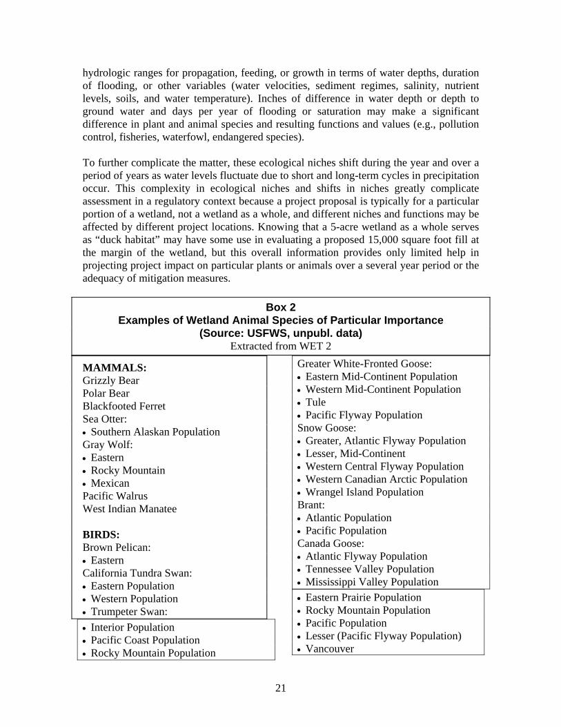
hydrologic ranges for propagation, feeding, or growth in terms of water depths, duration of flooding, or other variables (water velocities, sediment regimes, salinity, nutrient levels, soils, and water temperature). Inches of difference in water depth or depth to ground water and days per year of flooding or saturation may make a significant difference in plant and animal species and resulting functions and values (e.g., pollution control, fisheries, waterfowl, endangered species). To further complicate the matter, these ecological niches shift during the year and over a period of years as water levels fluctuate due to short and long-term cycles in precipitation occur. This complexity in ecological niches and shifts in niches greatly complicate assessment in a regulatory context because a project proposal is typically for a particular portion of a wetland, not a wetland as a whole, and different niches and functions may be affected by different project locations. Knowing that a 5-acre wetland as a whole serves as “duck habitat” may have some use in evaluating a proposed 15,000 square foot fill at the margin of the wetland, but this overall information provides only limited help in projecting project impact on particular plants or animals over a several year period or the adequacy of mitigation measures.
Box 2 Examples of Wetland Animal Species of Particular Importance
(Source: USFWS, unpubl. data) Extracted from WET 2
MAMMALS: Grizzly Bear Polar Bear Blackfooted Ferret Sea Otter: • Southern Alaskan Population Gray Wolf: • Eastern • Rocky Mountain • Mexican Pacific Walrus West Indian Manatee BIRDS: Brown Pelican: • Eastern California Tundra Swan: • Eastern Population • Western Population • Trumpeter Swan: • Interior Population • Pacific Coast Population • Rocky Mountain Population
Greater White-Fronted Goose: • Eastern Mid-Continent Population • Western Mid-Continent Population • Tule • Pacific Flyway Population Snow Goose: • Greater, Atlantic Flyway Population • Lesser, Mid-Continent • Western Central Flyway Population • Western Canadian Arctic Population • Wrangel Island Population Brant: • Atlantic Population • Pacific Population Canada Goose: • Atlantic Flyway Population • Tennessee Valley Population • Mississippi Valley Population • Eastern Prairie Population • Rocky Mountain Population • Pacific Population • Lesser (Pacific Flyway Population) • Vancouver
21

• Dusky • Cackling • Aleutian Northern Pintail Wood Duck Black Duck Mallard Canvasback: • Eastern Population • Western Population Ring-Necked Duck Redhead California Condor Osprey Bald Eagle: • Southeastern Population • Chesapeake Bay Population • Northern Population • Southwestern Population • Pacific State Population • Alaskan Population Golden Eagle: • Western Population Peregrine Falcon: • Eastern Population • Rocky Mountain Population • Southwestern Population • Pacific Coast Population • Alaskan Population (Arctic, American
and Peal’s) Attwater’s Greater Prairie Chicken Masked Bobwhite Clapper Rail: • Yuma • Light-Footed Sandhill Crane: Eastern Population-Greater • Mid-Continent Population-Lesser • Canadian-Greater • Rocky Mountain Population-Greater • Lower Colorado Population-Greater
• Central Valley Population-Greater • Pacific Flyway Population-Greater Whooping Crane American Woodcock Piping Plover Least Tern: • Interior • Eastern • California Roseate Tern White-Winged Dove Spotted Owl (Northern) Red-Cockaded Woodpecker Kirtland’s Warbler REPTILES AND AMPHIBIANS: American Alligator FISH: Sockeye Salmon (Alaskan) Coho Salmon: • Non-Alaskan U.S. Stock • Alaskan Stock Chinook Salmon Cutthroat Trout (Western United States) Steelhead Trout ATLANTIC SALMON: Lake Trout (Great Lakes) Striped Bass Cui-ui
22
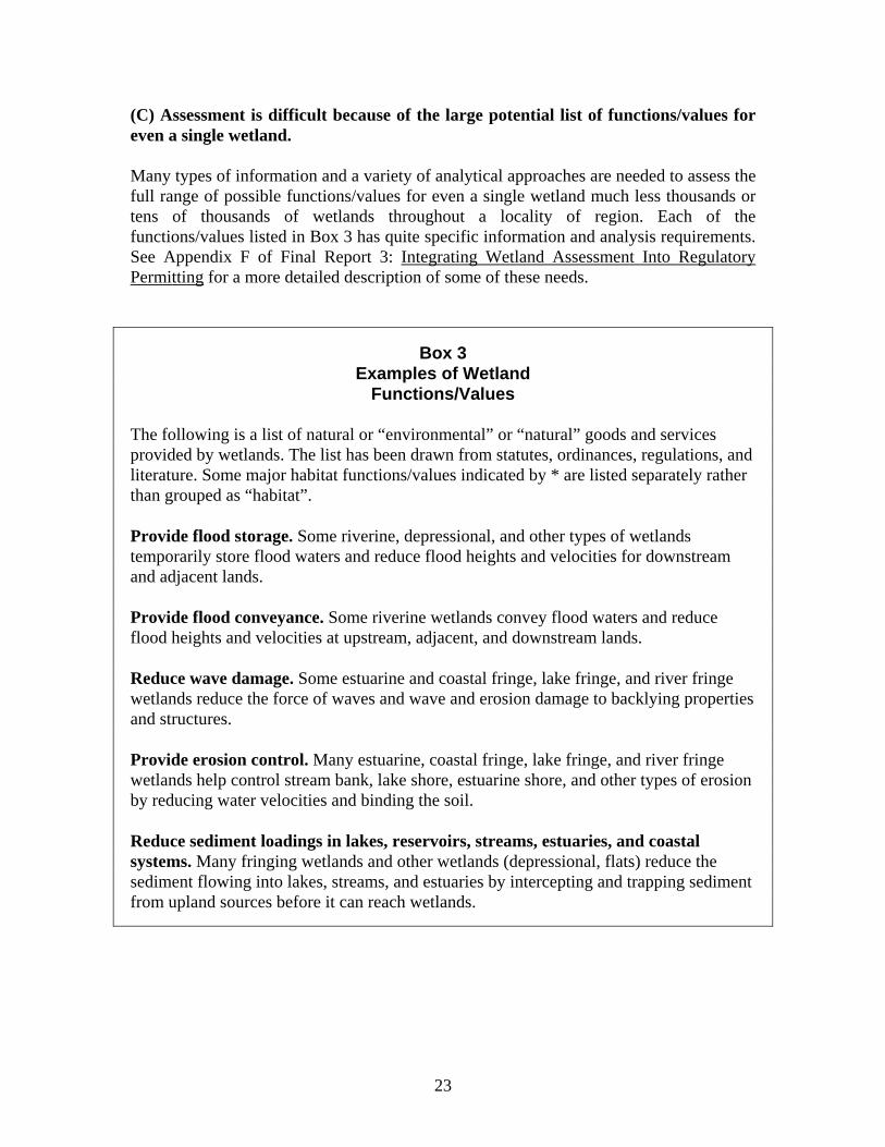
(C) Assessment is difficult because of the large potential list of functions/values for even a single wetland. Many types of information and a variety of analytical approaches are needed to assess the full range of possible functions/values for even a single wetland much less thousands or tens of thousands of wetlands throughout a locality of region. Each of the functions/values listed in Box 3 has quite specific information and analysis requirements. See Appendix F of Final Report 3: Integrating Wetland Assessment Into Regulatory Permitting for a more detailed description of some of these needs.
Box 3 Examples of Wetland
Functions/Values The following is a list of natural or “environmental” or “natural” goods and services provided by wetlands. The list has been drawn from statutes, ordinances, regulations, and literature. Some major habitat functions/values indicated by * are listed separately rather than grouped as “habitat”. Provide flood storage. Some riverine, depressional, and other types of wetlands temporarily store flood waters and reduce flood heights and velocities for downstream and adjacent lands. Provide flood conveyance. Some riverine wetlands convey flood waters and reduce flood heights and velocities at upstream, adjacent, and downstream lands. Reduce wave damage. Some estuarine and coastal fringe, lake fringe, and river fringe wetlands reduce the force of waves and wave and erosion damage to backlying properties and structures. Provide erosion control. Many estuarine, coastal fringe, lake fringe, and river fringe wetlands help control stream bank, lake shore, estuarine shore, and other types of erosion by reducing water velocities and binding the soil. Reduce sediment loadings in lakes, reservoirs, streams, estuaries, and coastal systems. Many fringing wetlands and other wetlands (depressional, flats) reduce the sediment flowing into lakes, streams, and estuaries by intercepting and trapping sediment from upland sources before it can reach wetlands.
23

Prevent and treat pollution:
Prevent pollution from entering a water body. Virtually all types of wetlands may (under the right circumstances) intercept nutrients, debris, chemicals, etc. from upland sources before they reach rivers, streams, lakes, estuaries, and oceans.
Treat (remove) pollution in a water body. Wetlands located in lakes, streams, estuaries, depressions, and at other locations where they are periodically flooded by surface waters from these water bodies may remove some pollutants (e.g., denitrification) from these waters.
Produce natural crops and timber. Many types of wetlands produce cranberry, blueberry, saltmarsh hay, aquaculture species, wild rice, forestry, other natural crops, and time.
Provide groundwater recharge. Some riverine and depressional wetlands provide groundwater recharge although most wetlands are discharge areas most of the year.
Provide groundwater discharge. Some wetlands help maintain the base flow of streams and help to reduce ground water levels (which would otherwise flood basements and cause other flooding) by providing groundwater discharge.
Provide habitat for fish, produce fish.* Wetlands (primarily those adjacent to lakes, streams, estuaries, oceans) provide food chain support, spawning areas, rearing areas, and shelter for fish.
Provide habitat for shellfish, produce shellfish.* Wetlands (primarily those adjacent to oceans) provide food chain support, spawning areas, rearing areas, and shelter for shellfish.
Provide habitat for mammals, reptiles, amphibians, birds.* Virtually all types of wetlands may provide food chain support, feeding, nesting, and substrate for mammals, reptiles, amphibians, and birds.
Provide habitat for endangered and threatened species.* Virtually all types of wetlands may provide food chain support, feeding, nesting, substrate for endangered and threatened animals and plants.
Provide habitat for waterfowl; produce waterfowl.* Many depression, river fringe, lake fringe, coastal, and estuarine fringe wetlands provide food supply, nesting, water etc. for waterfowl.
Provide scenic beauty. Many wetlands have aesthetic value. Scenic beauty when viewed from a car, a path, a structure, or a boat. Aesthetic values may enhance real estate values and provide recreation and ecotourism opportunities.
Provide recreational opportunities. Many wetlands provide canoeing, boating, birding, hiking, wildlife viewing, and other water and land-based recreational opportunities.
24
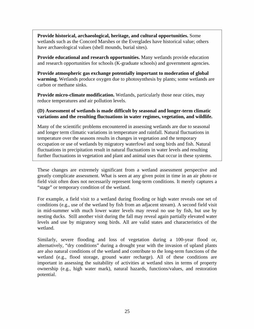
Provide historical, archaeological, heritage, and cultural opportunities. Some wetlands such as the Concord Marshes or the Everglades have historical value; others have archaeological values (shell mounds, burial sites).
Provide educational and research opportunities. Many wetlands provide education and research opportunities for schools (K-graduate schools) and government agencies.
Provide atmospheric gas exchange potentially important to moderation of global warming. Wetlands produce oxygen due to photosynthesis by plants; some wetlands are carbon or methane sinks.
Provide micro-climate modification. Wetlands, particularly those near cities, may reduce temperatures and air pollution levels.
(D) Assessment of wetlands is made difficult by seasonal and longer-term climatic variations and the resulting fluctuations in water regimes, vegetation, and wildlife.
Many of the scientific problems encountered in assessing wetlands are due to seasonal and longer term climatic variations in temperature and rainfall. Natural fluctuations in temperature over the seasons results in changes in vegetation and the temporary occupation or use of wetlands by migratory waterfowl and song birds and fish. Natural fluctuations in precipitation result in natural fluctuations in water levels and resulting further fluctuations in vegetation and plant and animal uses that occur in these systems.
These changes are extremely significant from a wetland assessment perspective and greatly complicate assessment. What is seen at any given point in time in an air photo or field visit often does not necessarily represent long-term conditions. It merely captures a “stage” or temporary condition of the wetland. For example, a field visit to a wetland during flooding or high water reveals one set of conditions (e.g., use of the wetland by fish from an adjacent stream). A second field visit in mid-summer with much lower water levels may reveal no use by fish, but use by nesting ducks. Still another visit during the fall may reveal again partially elevated water levels and use by migratory song birds. All are valid states and characteristics of the wetland. Similarly, severe flooding and loss of vegetation during a 100-year flood or, alternatively, “dry conditions” during a drought year with the invasion of upland plants are also natural conditions of the wetland and contribute to the long-term functions of the wetland (e.g., flood storage, ground water recharge). All of these conditions are important in assessing the suitability of activities at wetland sites in terms of property ownership (e.g., high water mark), natural hazards, functions/values, and restoration potential.
25
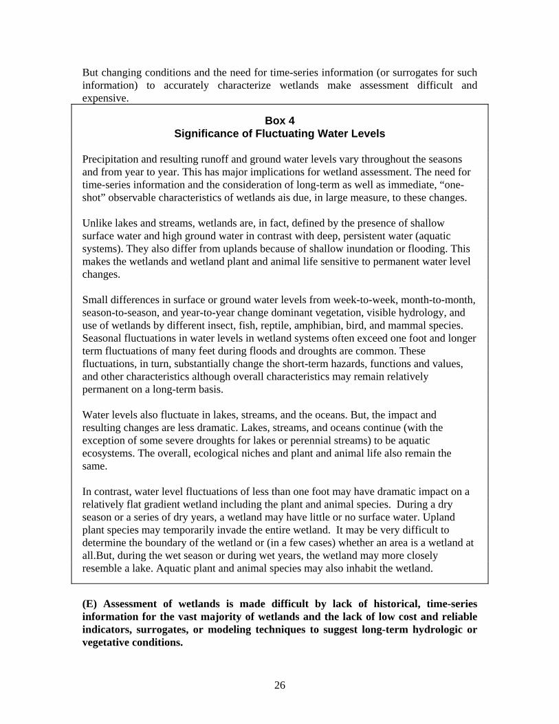
But changing conditions and the need for time-series information (or surrogates for such information) to accurately characterize wetlands make assessment difficult and expensive.
Box 4 Significance of Fluctuating Water Levels
Precipitation and resulting runoff and ground water levels vary throughout the seasons and from year to year. This has major implications for wetland assessment. The need for time-series information and the consideration of long-term as well as immediate, “one-shot” observable characteristics of wetlands ais due, in large measure, to these changes. Unlike lakes and streams, wetlands are, in fact, defined by the presence of shallow surface water and high ground water in contrast with deep, persistent water (aquatic systems). They also differ from uplands because of shallow inundation or flooding. This makes the wetlands and wetland plant and animal life sensitive to permanent water level changes. Small differences in surface or ground water levels from week-to-week, month-to-month, season-to-season, and year-to-year change dominant vegetation, visible hydrology, and use of wetlands by different insect, fish, reptile, amphibian, bird, and mammal species. Seasonal fluctuations in water levels in wetland systems often exceed one foot and longer term fluctuations of many feet during floods and droughts are common. These fluctuations, in turn, substantially change the short-term hazards, functions and values, and other characteristics although overall characteristics may remain relatively permanent on a long-term basis. Water levels also fluctuate in lakes, streams, and the oceans. But, the impact and resulting changes are less dramatic. Lakes, streams, and oceans continue (with the exception of some severe droughts for lakes or perennial streams) to be aquatic ecosystems. The overall, ecological niches and plant and animal life also remain the same. In contrast, water level fluctuations of less than one foot may have dramatic impact on a relatively flat gradient wetland including the plant and animal species. During a dry season or a series of dry years, a wetland may have little or no surface water. Upland plant species may temporarily invade the entire wetland. It may be very difficult to determine the boundary of the wetland or (in a few cases) whether an area is a wetland at all.But, during the wet season or during wet years, the wetland may more closely resemble a lake. Aquatic plant and animal species may also inhabit the wetland.
(E) Assessment of wetlands is made difficult by lack of historical, time-series information for the vast majority of wetlands and the lack of low cost and reliable indicators, surrogates, or modeling techniques to suggest long-term hydrologic or vegetative conditions.
26

There is little or no time series information pertaining to water levels, water depths, or particular plant or animal species for most isolated and headwater wetlands. Water level information is more available for lake, river, and estuarine/coastal fringe wetlands where there has been gauging of adjacent water levels. Regulators rarely have the time or money to gather time-series information concerning water level fluctuations, vegetation changes, and use of wetlands by various wildlife over a single season much less many years (relevant to flood analysis, restoration potential). Regulators have, in some instances, been able to use historic records such as stream gauge records, lake level records, tide records, duck counts, etc. to provide a portion of the desired information. But historic water level records and other historic records are available for only a tiny portion of the wetlands. They are more common for lake fringe, river fringe, and coastal/estuarine fringe wetlands but extremely rare for most depressional, slope, or “flats” wetlands. Regulators have attempted to deal with this lack of time series information in several ways: First, they have, for the purposes of simplicity, ignored fluctuations other than those readily observable such as tidal fluctuations in coastal wetlands. But, ignoring short and long-term fluctuations often results in major inaccuracies in boundary delineation and assessment of functions/values. Also, the number one reason for wetland restoration project failures is the failure to anticipate long-term as well as short-term hydrology. Second, they have used various “indicators” or “surrogates” for longer term conditions. For example, they use various indicators of fluctuations in water levels for boundary delineation such as flood marks on trees, flood debris, and soils information. Unfortunately, such indicators are often hard to find and interpret and provide only a generalized indication of fluctuating conditions, not a quantified estimate such as 14 days of flooding to a certain elevation. Third, they have used various hydrologic, quantitative models such as flood models that predict water level fluctuations based upon rainfall estimates and runoff/retention calculations. These are expensive and typically require a great deal of data but are increasingly available from flood, stormwater management, pollution control, and other broader watershed management efforts. Fourth, they have attempted to characterize wetlands utilizing general assessment models which attempt to imply overall, long-term conditions from the class and subclass of wetlands and other indicators. Regulators have used still another technique to deal with difficulties in assessing long-term conditions--the adoption of wetland management and restoration requirements which reflect margins of uncertainty such as the use of “freeboard” in flood protection
27

elevations for structures. A one or two foot freeboard will help avoid future flood damage even if future fluctuations are not accurately known. Similarly, many states and local governments now require wetland buffers of 25-100 feet. Buffers provide a hedge against fluctuating water levels in the location of septic tank/soil absorption fields and structures that may be flooded. Such buffers also provide protection from the wetland from upland pollution and “ecotone” for many plant and animal species which utilize wetlands only a portion of the time. (F) Assessment of wetlands is difficult due to anthropomorphic changes in water levels which have already occurred in many wetlands and are likely to occur in many others in the typical permitting situation--an urban or urbanizing area. Significant changes in hydrology often accompany the activities of man. Assessment of wetlands is difficult not only because of natural fluctuations in water levels but because of changes in wetland hydrology due to the activities of man. Temporary and permanent changes in wetland hydrologic and sediment regimes are caused by direct alteration of wetlands and indirectly by watershed changes which affect runoff and water quality. Direct hydrologic changes in wetlands are caused by drainage, fills, dikes, levees, channelization, impoundments, and other activities in wetlands. Indirect changes are caused by water diversion, impoundment of lakes and streams, impervious surfaces, grading, filling, construction of houses and a broad range of other activities. Consideration of anthropomorphic changes is particularly important in the typical regulatory context---urban areas, urbanizing areas, and areas undergoing intense development adjacent to lakes, rivers, and coasts. Knowing what changes have already occurred in a wetland or are likely to occur is important in the determination of hazards, functions/values, project impacts, and restoration potential. For example, it makes no sense to require replanting of historic wetland vegetation as part of a restoration project if a wetland has become drier or wetter due to hydrologic changes which has already occurred. It is possible to determine some of the hydrologic changes that have already occurred in a wetland at the time of permitting by examining the wetland (e.g., visible evidence of drains, ditches, fills, etc.). But, it is much more difficult to anticipate future anthropomorphic changes because they depend upon federal, state, and local water and land use decision-making which cannot be easily predicted. Nevertheless, it is possible in some instances to make some “common sense” assumptions based upon the position of a development in relationship to likely development. For example, it is a fair assumption that the hydrology will be substantially
28

changed for a small, isolated wetland in the midst of a large residential subdivision where building will take place on most lots. It is also possible to make use, in some instances, of various water modeling efforts and land planning efforts under way such as:
• Floodplain and stormwater hydrologic modeling efforts which anticipate “build out” conditions based upon land use plans and regulations and other techniques.
• Other watershed modeling and planning efforts which set forth specific criteria for diversions, pumping, and reservoir releases and levels.
• Land use planning and regulatory efforts which establish the types and densities of uses including impervious surface limits.
B) Assessment of wetlands is difficult because there are often no simple relationships between wetland vegetation, soils and other readily observable characteristics and wetland functions (natural processes). There are also no simple relationships between functions and the functions/values. It was widely asserted a decade ago that reliable surrogates could be found for certain wetland processes and that processes could be easily linked to wetland functions and values. But, few really good surrogates had been found and there are often no simply links between individual processes and functions/values which depend upon large numbers of interrelating processes. Efforts to develop numerical HGM models have proven difficult and few have been empirically validated at this point in time. This is one of the reasons why HGM models have not progressed beyond the “interim” stage. Because of lack of detailed data on most wetlands and the extreme complexity and dynamic nature of wetland systems, scientists have attempted, over the last 30 years, to find various “indicators” or surrogates to suggest broader wetland characteristics or functions. This has been, at times, referred to as the search for the ecological “canary”. The “canary” refers to the success of coal miners in the 19th century in using canaries as a cheap and easy way to detect lethal or dangerous levels of coal gas in coalmines. The search for wetland “canaries” is not new. And, a variety of “canaries” have been postulated. For example, in the 1970’s wetland scientists postulated that wildlife habitat values could be used as a surrogate or indicator of all wetland functions and values. But, wildlife habitat values have proven of only limited value in indicating flood storage, flood conveyance, erosion control, and pollution control potential. And, habitat value for one type of wildlife (e.g., ducks, fish) has quite often not proven a good indicator for other wildlife. Similarly, wetland vegetation has been broadly used as a surrogate for wetland functions and values in determining the “success” of wetland restoration or creation projects. But, experience with restoration and creation suggests that restoration or creation of certain types of wetland vegetation for a short period of time (usually a year or two) may be a
29

relatively poor indicator of long-term vegetation and also a relatively poor indicator of many long-term wetland functions (e.g., flood storage, flood conveyance) including habitat functions. Attempts to use habitat as an indicator of other wetland characteristics relevant to regulatory permitting have also proven tenuous. For example, an urban wetland with no or little habitat value due to pollution, high rates of sedimentation, no vegetation, and little wildlife may, nevertheless, be subject to deep and high velocity flood hazards and may play important flood conveyance roles. Such a wetland is not a good development site, despite the limited habitat value. Any characterization of the wetland for development based solely on habitat value would be misleading. Finally, many wetlands with limited present functions may have high restoration potential--e.g., a coastal wetland behind a dike; a partially drained and farmed wetland. Assessment based upon use of “existing conditions” understates the long use potential for a wetland to society. This is not to suggest that all indicators or surrogates are not useful or that the search for indicators is invalid. An aggressive effort is now being made to search for indicators to help implement the HGM method. The discovery of good surrogates or indicators are key to low cost implementation of this approach. But, experiences to date with efforts to find simple, easily applied indicators are not very encouraging and future efforts should be subject to careful field-testing. (H) Area wide assessment of wetlands is made difficult due to the huge number of wetlands found in some areas of the country. There are many tens millions of wetlands in the U.S. It has been estimated that the Prairie Pothole region alone may contain more than twenty five million wetland basins. To appreciate the magnitude of the task of assessing all wetland characteristics or even selected wetland characteristics in detail at a local government, regional, state, or national scale, consider the challenge facing even a single state such as Illinois. An inventory of wetlands in this state revealed almost 1,000,000 wetlands despite wetland losses. And, Illinois has a modest number of wetlands in comparison to Wisconsin, Minnesota, and Michigan. Given the complexity and dynamic nature of wetlands, how could detailed assessment of all characteristics relevant to functions and values and suitability for particular uses take place for all of these wetlands by a federal, state, or local agency with limited staff and budgets? How can a regulatory agency determine all of the functions and values if it receives 3,000 regulatory permit applications a year? How could it keep this information up to date as changes occur? The answer is: it cannot. Some low cost techniques for mapping and assessment such as use of satellite imagery or air photos have proven useful in gathering certain types of wetland information needed for regulatory and planning purposes such as wetland vegetation. But, few real short cuts have been found in assessing the detailed wetland characteristics relevant to certain
30

functions as values such as presence of many endangered species and biodiversity (they don’t appear on satellites or photos), ground and surface water interrelationships (some clues are possible for remote sensing) or wetland soils (air photos, topography, and vegetation provide clues but there is no substitute for detailed field investigations). (I) Assessment of wetlands is difficult because there are many gaps in scientific knowledge. Despite increases in wetland scientific knowledge over the last decade, there are many continued gaps in scientific knowledge. For example, little is known concerning the ecological “niches” of the tens of thousands of amphibians, birds, insects, mammals, and various forms of plant life that inhabit wetlands on a part-time or full-time basis. There have been limited monitoring and follow-up studies for hundreds of thousands of wetland projects permitted by federal, state, and local wetland regulatory programs over the last 20 years for several reasons. First, regulatory agencies typically lack the funds to carry out even superficial post permit monitoring much less detailed scientific studies concerning project impacts and the adequacy of various mitigation measures. Second, project applicants rarely wish to spend funds to monitor the project impacts nor do they necessarily want other groups (e.g., academics, students) to monitor those impacts. Third, academics and students often prefer to study relatively “pristine” wetland systems for scientific research and graduate degrees rather than impacted systems. There are limited scientific journals and other publications interested in specific impact studies. Finally, most research is relatively short-term (e.g., one or two years) and involves a single discipline (e.g., botany, biology). Measurement of long-term impact requires longer term analysis and multidisciplinary approaches. The result is that relatively little “cause and effect” information has been gathered concerning interrelationships between species and the impacts and effectiveness of “mitigation” measures. There are also continued, serious gaps in restoration, creation, and enhancement knowledge including the ability to replicate habitat for specific species. The most that can be hoped for in most restoration or creation projects is that creating similar overall hydrologic and ecological conditions with similar vegetation will result in similar animal use. However, there is no guarantee that the same species will inhabit the replacement system and there is strong evidence this often will not happen. This means that destruction of wetlands based upon assertions of total “restoration” or “creation” must be approached with care, particularly when specific plant or animal species or suites of species are at stake. And, wetland assessment for the purpose of making the initial decision whether a wetland should be destroyed or altered should be as species-specific as possible (e.g., HEP, WETHINGS). On the other hand, once a decision is made that a wetland can be destroyed or altered, an overall ecological
31
assessment approach like HGM which helps create similar, overall hydrologic and ecological conditions can be most useful.
Institutional Problems Wetland assessment is difficult not only because of scientific issues and restraints, but because of institutional problems: (A) Detailed and accurate assessment is difficult due to limited funding for regulatory programs. Inadequate budget is an increasing limitation upon gathering data, hiring staff, and carrying out assessments as federal, state, and local government staffs are cut and the costs of assessments increase. In addition, as wetland management techniques become more sophisticated, more staff time is required per permit. Field studies are costly. For example, a detailed ground water study on a two-acre wetland involving a nest of piezometers (test wells) and piezometers over a several year period could cost many hundreds of thousands of dollars. (B) Assessment is difficult due to limited staff expertise. Few agencies have the combination of biology, botany, soils, geology, hydrology, and other experts needed to carry out all aspects of wetland functional assessment including hydrologic, hydraulic, fisheries, waterfowl, pollution control, and other functions/values. Without such expertise, agencies encounter problems in interpreting and using even available data, much less gathering new data. (C) Assessment is difficult due to time limitations upon regulatory permitting. Tight time limitations for processing permits are contained in most statutes and agency regulations. These severely limit assessment efforts for regulatory purposes in some circumstances. (D) Development of assessment methods is made difficult by inadequate understanding of regulatory needs by many scientists. Hundreds of papers and reports have been published over the last several decades addressing wetland assessment methods and techniques. Unfortunately, not even a single report or paper has addressed regulatory assessment needs (At least I couldn't find one). Consequently scientists developing assessment methods for regulatory purposes have often done so with limited knowledge of regulatory programs. Scientists and others designing wetland assessment methods have generally assumed that regulatory needs are the same as those for other purposes. But, regulatory functions/values assessment needs are somewhat different than the needs of wetland
32
acquisition, public land management, environmental impact analysis, land use planning, restoration, and other purposes. Regulatory needs have also evolved over time. In 1989 the National Wetland Policy Forum recommended a “no net loss” interim goal for wetland functions and acreage which was endorsed by President George Bush. This no net loss goal was incorporated into Section 404 permitting criteria by a Memorandum of Agreement between the Corps of Engineers and EPA. Many states and local governments also adopted the no net loss goal (stated in various ways). This has required more detailed assessment of wetland functions that was required by earlier regulations. At the same time, the Corps and other federal agencies began to more vigorously enforce the Section 404 permitting requirements (the legal power had always been there) as they apply to headwater and isolated wetlands. States and local governments also began to more vigorously enforce wetland regulations for isolated and headwater wetlands. Over time, permit applications for large alterations to adjacent wetlands became less common. But permit applications for partially isolated and headwater wetlands have increased, requiring improved information gathering approaches for these wetlands. While this was happening, the federal and state courts began to more stringently review wetland regulations in terms of the “taking” issue. In the last decade, the U.S. Supreme Court and the Federal Court of Claims have issued a series of decisions making it easier for landowners to challenge the application of specific regulations to specific properties as an unconstitutional taking, particularly where regulations prevent all economic use of land. See Final Report 2: Wetland Assessment in the Courts. This combination of factors led to a shift in regulatory permitting at federal and state levels from outright denial of wetland permits (in some instances) to “conditional” approval subject to impact reduction and “compensation”. This shift has been particularly pronounced for isolated and headwater wetlands. This shift from a “yes” or “no” determination to a “yes with mitigation and compensation” has also shifted federal assessment needs to focus upon the adequacy of impact reduction and compensation measures in achieving a “no net loss” goal. (E) Development of adequate assessment methods is made difficult by lack of agreement concerning basic terms such as wetland “functions”, “values”, and “condition”. Satisfactory definition of “functions” and “values” for developing wetland assessment methods and approaches has proven difficult. Part of the problem has been the multiple meanings of the terms “function” and “value”. Both terms can be used as both nouns and verbs (See Webster, 3rd International Edition). For example, a wetland can be said to be characterized by certain onsite “functions” (noun) such as atmospheric gas exchange. A wetland also “functions” (verb) to retard and store flood waters. Similarly, a wetland may be characterized as possessing a certain “value”(noun) such as an annual economic value
33

of $1,000/acre for forestry production. But, members of society may also “value” (verb) a wetland for birding, pollution control, or other purposes. To further complicate and confuse matters, a “function” (noun) such as the storage of flood waters can be (and often has been) characterized as a “value” because it is valuable to society. Conversely, such a wetland “value”, such as flood water retention may perform certain offsite flood loss reduction “functions” for downstream landowners and society. It is not surprising that legislators, the public, agency staff, scientists, and others have often used the terms function and value somewhat interchangeably in statutes, regulations, ordinances, articles, books, and newspapers. It is also understandable that scientists have sought more precise meanings for the terms “function” and “value”. However, more recent attempts to more precisely define terms such as narrowing the definition of function to processes alone are partially inconsistent with existing statutes and regulations and analytical needs. In other words, scientists have correctly identified the problem of imprecise terms but it is not clear that existing proposals solve the problems. See Appendix A for discussion of the definition of “function”. (F) Wetland assessment has become increasingly technical with the result that landowners, consultants, legislators, and the public do not understand the techniques and are not able to use them; this problem is particularly serious if landowners, consultants, and others are to continue to carry out much of the needed information-gathering and if legislators are to continue to support and fund wetland programs. Over time, wetland data gathering and analysis techniques have become increasingly difficult to understand with use of terms and concepts such as “digital imagery”, global positioning systems”, and “geoinformation systems”. Wetland assessment methods like the Hydrogeomorphic Wetland Assessment Method, under development by the Corps of Engineers, requires the use of a complicated set of procedures and many technical terms such as “reference domain”, “reference sites”, “rule-based decision-making”, “functional models”, and “calibration”. Technical methods and terms can be useful in helping scientists communicate with one another more precisely. But, the increasingly technical nature of wetland assessment has serious limitations from a regulatory perspective. Many wetland “regulators”, particularly those at the local level, have limited scientific expertise. They are unable to understand much less use highly complex data gathering and analysis techniques. Highly technical approaches also pose problems for federal and state regulators who typically have generalized expertise--botany, biology, and general environmental studies.
34

Equally important, landowners and their consultants who carry out much of the actual data-gathering in most regulatory programs often cannot understand and make use of highly technical approaches. If large amounts of money were available at federal, state, or local levels to hire new staff or train existing staff this would not be such a problem. But, federal and state budgets are being cut, not increased, and this trend will likely continue. As wetland assessment becomes increasingly technical, the gap also widens between scientists and legislators. Over the last decade, legislators (Congress, state legislators, and local councils) have become uneasy about the “objectivity” of wetland science. The widening gap between science and legislators is illustrated by the House of Representatives adoption of a Clean Water Act bill in 1995 (HR 961) which establishes wetland definition and delineation criteria in contradiction with recommendations of the National Research Council. These definition and delineation criteria were adopted after a raucous debate on the House floor in which capabilities of wetland science in general was severely questioned. Increasingly, legislators are reluctant to support programs they do not understand. Unfortunately, the cynical attitude of legislators toward science makes many scientists more reluctant to attempt to communicate with legislators. This, in turn, broadens the gap.
Summary
Assessment of wetland functions and values in sufficient detail and at adequate levels of accuracy for regulatory permitting is difficult because of both scientific and institutional restraints and problems. Principal scientific reasons include the complexity and dynamic nature of wetlands, the lack of up-front information on many important aspects of wetlands (e.g., hydrology, animal species). Principal institutional problems and restraints including inadequate funding, inadequate staff expertise, short time frames for regulatory permitting, and lack of understanding of regulatory needs by scientists developing assessment methods. Problems encountered in evaluating the functions and values of a particular wetland sites are multiplied tens of thousands of times when efforts are made to evaluate wetland functions and values “up-front” for an entire local government or region with tens of thousands of wetlands. Looking to the future, improved efforts to assess functions/values must, first, recognize these restraints and problems. A number of strategies must then be simultaneously combined to help deal with restraints and problems and produce practical and useful evaluations. See the Executive Summary and Chapters 3 and 7 for suggestions.
35

CHAPTER 3: STRATEGIES FOR DEALING WITH PROBLEMS/LIMITATIONS
Chapter 3 summarizes some of the strategies that scientists and regulators have used to address the sorts of problems and limitations outlined in Chapter 2. Many of these strategies hold promise for future applications.
Introduction
Strategies used to address problems and limitations include:
• Scientific strategies used to cope with the complexity and the dynamic nature of wetlands, and
• Institutional, administrative strategies to deal with inadequate data, staffing, and financing and short regulatory time frames.
Scientific Strategies
Scientists and regulators have responded to problems in assessing wetlands due to the complexity and the dynamic nature of wetlands in several ways. These strategies include: (A) Use of soil or vegetation “indicators” to imply hydrology or other unknown wetland characteristics. Because long term hydrology and vegetation and the ability of a wetland to produce goods and services (e.g., production of species fish, shellfish, waterfowl, birds, etc.) cannot be directly observed, scientists have turned to a variety of soil and vegetative “indicators” and techniques to deduce or imply the ability of specific wetlands or types of wetlands (classes or subclasses) to produce such goods and services based upon a variety of indicators and techniques. See Box 6. Deductions are based upon certain physical characteristics that are observable such as depth, vegetation type, vegetation density, flooding, and so forth. All methods make a variety of simplifying assumptions. See discussion in Chapter 6. Unfortunately, indicators are often not very accurate due to the complexity and dynamic nature of wetlands and the simplifying assumptions inherent in the use of indicators. The also often provide only limited information. For example, water marks on trees indicate flood levels but provide little information concerning the frequency of flooding.
36

Box 5 Observing Versus “Deducing”
Wetland Hydrology, Wildlife, and Other Features It is difficult to assess the capacity of wetlands to produce certain goods and services because it is often not possible to use a single field visit, air photo, or other “one shot” observation to accurately describe long-term hydrology, vegetation, and wildlife since water levels vary seasonally throughout the year and from year to year. Four principal approaches have been used by scientists and regulators to address this problem. The first is to actually conduct time-series studies involving multiple observations such as multi-year stream gauging for a river, monitoring of piezometers for ground water elevation, the use of time-series air photos, and multiple field visits to observe plants/wildlife. Long-term studies have the advantage of providing “real” information but they are time-consuming and costly. And, they cannot be carried out in the typical short time frame of regulatory permitting. Such long-term studies are rare in a regulatory context and only typically occur when an endangered species is threatened, a well field, or there is some other major threat. Second, use a variety of techniques to “capture” whatever time series information is available. These include interviews and workshops with local birders, hunters, landowners, and others who may have made long-term observations at particular sites. Third, extrapolate from known to unknown areas. For example, wetland regulators may use stream flow and ecological information from one study stream in a region to suggest stream flow characteristics and ecological characteristics for another stream. Fourth, use various indicators, surrogates, and “models” to calculate, deduce, or infer long-term hydrology and plant/animal species from “one shot” field observations, air photos, or other limited information. For example, soils information may be used to infer long-term hydrology because soils reflect long-term saturation. Hydrologic models may be used to predict runoff and flood heights based upon estimated rainfall amounts. Various combinations of vegetation, land form, soils, and other characteristics may “deduce” or characterize the capability of particular areas to produce certain plants and wildlife (e.g., WET, WETHINGS, HEP, HGM). Surrogates (e.g., one species of plant or animal) may be used to suggest the capability of an area to produce a broader suit of plants and animals. The fourth approach is broadly used in wetland assessment methods. But, because of the broad range of simplifying assumptions, this approach is typically subject to substantial margins of error.
37

(B) Use plant and animal surrogates. A second approach closely related to the use of indicators has been the use of plant and animal specie surrogates. For example, efforts were made in the 1980’s to use waterfowl production capability as a surrogate for broader wetland functions. HEP uses wildlife indicator species as surrogates for broader wildlife functions. But, field experience suggests such surrogates must be used with care because one species is often not a good indicator for another species. Similarly habitat capability is not a good surrogate for hydrologic functions. (C) Use simplifying assumptions. As will be discussed in Chapter 6, scientists developing assessment methods have invariably made a wide range of simplifying assumptions with regard to the type of the wetland, the hydrologic conditions, and other factors. Simplifying assumptions are essential in assessing and modeling complex natural systems because it is too costly and time consuming to attempt to address all relevant factors. But, often information which contains many simplifying assumptions will not match the actual conditions encountered in the field on a specific permit. While a numerical calculation may be undertaken using such a model, the resulting figures often have little validity. If simplifying assumptions are used as part of an assessment method, they should be clearly stated. More field tests are also needed to determine the accuracy of the assumptions and simplifications and to “calibrate” models. (D) Separate fact-finding from “values” analysis. The HGM approach and some other approaches separate assessment of physical processes from assessment of wetland values. This reduces the mixing of “apples and oranges” and simplifies assessment of processes but creates a variety of problems as well. (E) Classify or otherwise group wetlands. The HGM approaches classifies wetlands into six or seven major categories or classes (different HGM publications list a different number) and a much larger number of subclasses (numbers to be determined) in an effort to help regulators and other decision-makers draw some overall conclusions concerning wetland functions based upon readily identifiable characteristics. Efforts are also being made to apply the National Wetland Classification System and the National Wetland Inventory to help characterize and determine the characteristics of wetland systems. Classification can suggest predominant wetland functions and values, red flagging, and other approaches, particularly if used on a presumptive basis. However, grouping wetlands to imply characteristics is also subject to limitations. Little useful information may be provided if a grouping is too broad (e.g., the Palustrine Class in the National Wetland Classification System). Conversely, too many classes and subclasses may create a scientific and administrative nightmare with too much time and effort spent upon trying to determine class or subclass and too little examining basic characteristics and processes.
38
(F) Use sampling techniques and/or reference sites. A number of assessment approaches such as HGM, HEP, and the IBI models use “sampling” and/or reference sites to develop overall regional profiles on particular types of wetlands with regard to specific characteristics such as vegetation type, density, slope, and other features. HGM and IBI use sampling and reference sites to evaluate wetland condition. Sampling and reference sites can be used to not only develop regional profiles but can lend objectivity to efforts to “profile” wetland characteristics and help document both natural variability and the range of conditions due to human activities. But, there are also problems with sampling because results depend upon the number and types of reference sites selected. (H) Ignore certain factors, processes, or types of information. All wetland assessment methods attempt to simplify analysis by limiting the number of factors, processes, or types of information considered in the assessment and this may be considered a special case of simplification. See Chapter 6. Often important factors such as changes in hydrology are ignored because they are difficult or complex to easily evaluate. But, it may also result in inaccurate or misleading assessment and the failure of restoration projects that depend upon accurate assessment of future hydrology. Unfortunately, there is also the danger that evaluation of a single function or set of issues without considering others may be represented as complete “wetland evaluation” without carefully describing what has not been evaluated.
Institutional Strategies Regulators have also developed and applied a variety of institutional strategies to address problems and limitations in assessment due to the complexity and dynamic nature of wetlands and inadequate funding, budgets, time frames, and other restraints. These overlapping strategies include: (A) Use case-by-case data gathering and analysis approaches focusing upon specific sites rather than wetlands throughout a region in regulatory decision-making. Regulatory agencies have rarely attempted to evaluate functions/values of all wetlands in a locality due to limitations upon staffing, funding, and time restraints. They have, instead, concentrated information gathering upon specific sites where changes are proposed in wetlands. This is a cost-effective strategy but provides little hydrologic and ecological context for the evaluation of individual permits. (B) Use “red flagging”, “yellow flagging”, “focusing”, “screening”, “scoping”, and other “filtering” mechanisms. Wetland regulatory agencies have broadly used various informal “red flagging”, “yellow flagging”, “filtering”, and “scoping” procedures to identify wetlands, functions/values, and special issues and problems which should receive more detailed examination in permitting. With such an approach, data-gathering has been progressively focused on functions/values or issues or problems likely for a particular activity and wetland (e.g.,
39

potential blockage of flood flows). See discussion below and Final Report 3: Integrating Assessment into Regulatory Permitting. (C) Decide at any early stage of permit processing what level of detail and accuracy is necessary for assessment, taking into account a broad range of factors. Wetland regulators have used a variety of informal approaches to help determine, early on, the level of detail and accuracy needed for assessment in a particular circumstance. Required levels of detail and accuracy depend upon: (1) Step or stage in regulation. More general data with lower levels of detail and higher
levels of inaccuracy are often sufficient to permit initial adoption of programs, carry out initial mapping, etc. More detailed data is needed at later stages.
(2) Whether information used by an assessment is used on a preliminary or presumptive basis versus a more final basis. Less detailed and accurate information can be used on a presumptive basis; more detailed and accurate information is needed for final determination.
(3) The principal functions/values at a site identified through red flag/yellow flag procedures. There are some circumstances where low levels of detail and high levels of error in determining a floodplain function such as ground water discharge rate may be acceptable because the function has limited significance. In others, such as investigation of habitat for a suspected endangered species, high levels of detailed and even moderate levels of error may be unacceptable.
(4) The types and magnitudes of threats posed by the activity to resources and society. For example, a proposal for a toxic waste dump or nuclear power plant in a floodplain would need much greater detail and scrutiny than a proposal for a residential lot.
(5) Parcel characteristics and impact on the landowner. More detail and accuracy is needed for floodplain and subzone boundary delineation, assessment of natural hazards, and assessment of functions and values where extremely valuable land is involved and there may be a potential “taking” due to economic impact on a landowner. Less detail and accuracy may suffice for a rural environment where land values and taxes are low and existing forestry, agricultural, or other activities provide a reasonable economic rate of return on the land.
(D) Use hierarchical decision-making processes. Regulators often use decision-making processes which base decisions, to the extent possible, upon known and relatively certain information and avoid the necessity of making difficult and problematic assessments. For example, permits for activities in wetlands may be rejected on the availability of alternative sites, natural hazards, inadequate onsite waste disposal, or other grounds before an expensive, time-consuming, and error-prone effort is made to analyze specific wetland function and values. (E) Use qualitative assessment procedures and professional judgment. Regulators have typically undertaken broad qualitative assessment of wetlands based upon professional judgment to “red flag/yellow flag” functions and values, issues and other
40
problems. Qualitative assessment approaches such as the New England District Corps of Engineers Highway Supplemental Methodology allow a broader evaluation of a permit application and a wetland than more formalized but less inclusive rapid assessment approaches. However, they are also more subjective. (F) Require landowners to develop much of the required information for mid-size and larger projects. Wetland regulatory agencies typically rely upon landowners or their consultants to develop much of the required information for regulatory permitting. This means that landowners and their consultants must be involved in the assessment process and guidance for wetland assessment must be written for the landowner and his or her consultant. Guidance must be written in simple, understandable terms and be provided at reasonable costs to landowners and developers. Training and education and technical assistance are needed. Involvement of landowners in information gathering is a practical necessity in most programs but it can also lead to biases information. (G) Use a variety of mechanisms to tap existing information sources. To reduce costs, wetland regulators have found it important to tap available information sources. Examples include: (1) Regulators have found it desirable to make broad use of existing floodplain, soils,
topographic, land use, and other maps for certain types of analysis. See Box 7. (2) Regulators have often used relatively low cost air photos and remote sensing sources
rather than field surveys. For example, air photos and to a lesser extent satellite data have been heavily used in wetland efforts to map wetlands for regulatory purposes (states, locals), to monitor development, and to carry out certain types of analyses.
(3) Regulators have tapped sources of information in other resource management
agencies at federal, state, and local levels by providing “notices” to other agencies for permit applications, undertaking joint permit processing, undertaking collaborative planning, holding hearings and workshops, and using other techniques. See discussion below.
Box 6 Some Important Existing Information Sources
41

Wetland regulators have found many types of information useful in evaluating wetland functions and values. These include (note the list is not exhaustive): 1. Wetland maps available for most of the nation (NWI, state, local). 2. Other resource maps such as flood maps, soil maps, topographic maps, and
geological maps. 3. Orthophotos, infrared photos, satellite images, and other low level digital
imagery. 4. Landscape level inventories of features of special interest such as natural area
inventories (state Heritage Programs), archaeological and historical site inventories, and inventories of rare and endangered species.
5. Hydrologic studies prepared for stormwater management, water quality
protection (point and nonpoint), source water planning, floodplain management, navigation, and other purposes.
6. Inventories of potential wetland restoration sites prepared as part of various
river restoration, mitigation bank, and other studies (e.g., Everglades, Kissimmee).
7. Multiobjective GIS (geoinformation system) and LIS (land information system)
databases (e.g., land parcel information, existing uses). 8. Resource plans available at all levels of government--public land management,
infrastructure planning, water resources planning, etc.
(H) Use a variety of mechanisms to tap available expertise including the use of notices, joint permit processing, public hearings, and other approaches. Regulators have used a variety of techniques to tap available staff resources and expertise as well as information sources throughout other regulatory agencies, resource agencies, not-for-profits, and academic institutions. These techniques may include, depending upon the circumstances: (1) Use “notice” procedures and referrals. (2) Use joint permit processing and interagency teams. (3) Use public hearings. Hearings are often extremely important information gathering
devices. They can be used to gather factual information from a broad range of sources not typically involved in permit processing such as academics, non-profits, and other
42

landowners. Public hearings can also help disseminate information and build consensus. Finally, they can determine public attitudes. To make maximum use of public hearings, floodplain management agencies must insure that those who may have an interest in an alteration (a) receive adequate notice, and (b) be provided with adequate information concerning the proposed project, activity, or area.
(4) Use expert commissions or work groups. Often the greatest expertise in a state or
region concerning functions and values for specific wetlands is located in government agencies, academic institutions, not-for-profit organizations, and consulting firms. Wetland management agencies have used a variety of techniques for capturing and applying this expertise and data such as:
• Appointing and using conservation commissions. • Forming A-Teams (HGM). • Forming advisory committees (e.g., Washington state advisory committee on
wetland assessment). • Forming special councils. For example, the National Wetland Technical
Council. • Forming other types of standing committees and advisory groups.
(5) Use workshops. Workshops can be used to:
• Generate information. • Check and validate information. • Analyze information. • Disseminate information.
(I) Combine up-front data gathering and site-specific surveys. Wetland regulators have found it practical to combine some measure of “up-front” data gathering (e.g., flood maps) and site specific surveys (e.g., investigation through a HEC model of the impact of a proposed fill upon flood heights). When wetland regulations were first adopted at federal, state, and local levels in the early 1970’s, it was broadly hoped by regulators that wetland boundary maps and other types of assessments could be developed with sufficient accuracy and detail on a community-wide, state, or regional basis to replace on-site delineation of boundaries or assessment of functions and values at the time permit applications were submitted. A great deal of money was spent preparing very detailed wetland maps in some localities. But, field experience has indicated that maps and assessments, even those with considerable detail have not usually proven sufficient to make a “final” determination of wetland boundaries, functions/values, and other features for a number of reasons:
• Many mapping efforts were carried out to meet narrow agency missions. • There are physical limitations in representing floodplain and more specific
subzone (e.g., wetlands) with enough precision on maps (e.g., the width of a
43

pencil line may be 10-25 feet) to determine precise boundaries or other characteristics on the ground without supplementary field investigation.
• There are practical (economic, staffing) limits to the scale and accuracy of mapping and other information gathering on a locality or region even if large amounts of money are spent.
• The number of wetlands increase exponentially with map scale and the task of accurate delineating of all boundaries, functions and values, and other features also increases.
• Wetlands are extremely dynamic and it is difficult, in advance, to determine natural fluctuations in water levels and other features over time.
• There are many changes in wetlands and wetland water regimes due to the activities of man and it is difficult to anticipate these changes.
Faced with cost/benefit tradeoffs, management agencies have often opted for rather generalized up-front mapping and evaluation and concentrated most of their funds on site-by-site analysis as permit applications are submitted. (J) Apply “conservancy zoning” approaches. Local regulatory agencies have applied various conservancy zoning approaches to wetlands in general or selected wetlands based upon generalized information concerning wetland functions and values (rather than site-specific information), natural hazards information, public/private ownership considerations, onsite waste disposal considerations, availability and costs of roads, sewers, and water supply, compatibility of adjacent uses, and other factors. With a conservancy zone approach most of all development is prevented in wetlands unless a variance or special exception are issued. Wetland-by-wetland evaluation of functions/values does not take place for individual wetlands except for special exceptions or variances. Conservancy zone approaches can be implemented without up front, site specific information on each wetland. However, some landowners strongly oppose such approaches. (K) Apply generic impact reduction and compensation measures. Regulatory agencies often apply generic impact reduction measures and require onsite/in-kind compensation using set rations even if wetland functions and values at a site are not fully known. A regulatory agency may modify these requirements if a landowner is willing to undertake a more detailed assessment of the wetland resource. This is a practical and widely applied technique for dealing with limited information but it also often provides limited protection for wetlands.
Box 7
Goals for “Red Flagging”, “Yellow Flagging”, and “Filtering” Mechanisms
44

“Red-flagging”, “yellow flagging”, and other filtering procedures can be used to: • Identify, early-on, clear grounds for denial of the permit. Various red flag and
yellow flag procedures are used to determine whether a permit should be denied early on due to a single important problem or failure to comply with specific criteria.
• Help determine wetland functions/values that will need to be examined in greater depth at specific permit application sites (essential from cost and time frame perspectives).
• Identify potential problems and issues (e.g., increase in flood heights or erosion on other lands) that will need to be addressed by the regulatory agency, other agencies, or the permit applicant through more detailed studies or analysis.
• Determine special factors that will need to be considered in analysis such as changed or changing watershed conditions.
• Determine groups and individuals (e.g., adjacent landowners, downstream landowners, environmental not-for-profits, academics, others) who may have an interest in the permit application, who may be able to supply data, or who may wish to appear at a public hearing. These groups may then be notified with regard to the pending application.
• Determine whether other agencies have jurisdiction over the permit application and if so, their needs and desires with regard to the application and how they wish to proceed.
Summary
Scientists and regulators have developed a variety of useful scientific and institutional strategies to deal with the scientific complexity and dynamic nature of wetlands and the limited budgets and time frames of regulatory agencies. However, many of these strategies are in themselves subject to limitations and problems. And, strategies have not been systematically applied nor have they been optimally combined. Looking to the future, combinations of wetland assessment strategies are needed. Refinements are also needed in individual strategies for particular functions/values or issues.
45

CHAPTER 4: CONFUSION IN ASSESSMENT Chapter 4 considers in greater depth why there confusion among scientists and regulators regarding assessment of functions and values and what might be done about it.
Why the Confusion?
Controversy and confusion are due, in part, to reasons already suggested in Chapters 2 and 3 including the scientific complexity and dynamic nature of wetlands which make the development of simple, broadly applicable assessment approaches extremely difficult. Gaps in scientific knowledge are another problem. The large number of assessment approaches which have been proposed to date with limited guidance and training available concerning these approaches is a third.
But, there are other reasons as well:
• Assessment approaches are becoming so complex that potential users cannot understand and evaluate them much less select from among techniques. For example, few technical participants in a two-day workshop concerning the HGM approach that the Association of State Wetland Managers conducted in April 1996 and a much larger 3 1/2 day symposium conducted by the Association conducted in March 1997 concerning HGM and other approaches felt they sufficiently “understood” most assessment approaches to evaluate them much less use them in the field.
• There have been inadequate efforts to identify and agree upon regulatory “needs” and the objectives for assessment methods. Without a clear picture of regulatory needs and assessment goals, arguments for and against particular approaches take place in the abstract rather than in the context of defined needs and goals. As discussed in this report series, regulatory assessment needs are somewhat different from nonregulatory needs.
• Information concerning wetland functions/values is only of many types of information needed by regulators. There has been little effort to relate various wetland assessment approaches to such broader information gathering needs despite the fact that regulators must simultaneously gathering not only functions/values information but broader information with limited budgets and personnel. This has created confusion concerning what should be undertaken with “assessment”.
• Regulators have often not been involved, early on, in the design and testing of assessment methods and, there has often been limited communication between the regulators and the scientists developing wetland assessment techniques and models. Scientists designing assessment techniques have typically approached regulators after a technique has been developed with the question, “How can we fine tune this approach?” rather than, “What information do you need, given all of the other available approaches and your limitations upon funding, staffing, and other restraints?”
46

This has, in some instances, been equivalent to presenting a built car to an individual needing transportation and asking him or her to help “fine tune the car” when the individual may need a boat.
• The policy implications of wetland assessment definitions such as “functions” and approaches have not been acknowledged. Scientists have quite often asserted that development of assessment methods is a “scientific issue.” But, assessment methods have large policy dimensions because regulatory assessment methods (and the information developed by such methods) determine which wetlands will be protected and which will be destroyed and the adequacy of impact reduction and compensation measures. Important policy issues are involved in the definition of basic terms such as “function” (See Appendix A), “values”, “processes” and the factors considered and omitted in the assessment. Some scientists recognize this and, therefore, take particularly strong positions depending upon their assessment and protection preferences. But, others do not. Unfortunately there policy considerations are not discussed “up front” in documents, conferences, and workshops. Instead, arguments are often couched in scientific terms with the assumption that there are no policy issues. Also, as wetland assessment and wetland assessment techniques have become more complicated, policy-makers have had greater difficulty in understanding them and selecting from among wetland assessment techniques and approaches. Policy-makers must even more rely upon the recommendations of scientists. And, this means that the scientists developing and recommending assessment approaches have even greater, implicit policy-setting roles.
• A change in the definition of “function” changes the wetland protection/destruction equation. The definition of “function” used in an assessment method determines, to a considerable extent, what information will and will not be gathered in the assessment effort, and, ultimately what wetlands will be protected in a regulatory program implementing a “no net loss of function” goal. For example, if the term “function” is used only to refer to natural processes in wetland assessment (e.g., HGM), then wetland permits evaluated with a “no net loss of function” criteria will be denied only where there is a substantial, uncompensated change in natural processes. But, if “functions” are more broadly defined to include not only ecological processes but recreational uses, archaeological values, historical values, aesthetics, wetland interpretation values, education values, and other factors important to the public, then a broader range of wetland characteristics will be protected. This important distinction is not broadly recognized and has received little formal debate in scientific meetings or publications.
• Given the limited amount of funds and time available for regulatory assessment, formal adoption of any single wetland assessment approach for regulatory agencies may, practically, preclude or limit the use of other approaches and this too has important policy implications. Theoretically, a regulatory agency might simultaneously apply variety of assessment approaches to analyze a specific proposed permit. But, regulatory agencies often cannot, practically, use even a single,
47
detailed functions/values assessment approach much less combinations of approaches on routine permits due to limitations on regulatory budgets, staffing, and time frames. So, if a regulatory agency adopts a specific approach it will probably become the only approach used on most permits. And, if the single approach (whatever it is) fails to meet the typical permitting needs, assessment will often be inadequate.
• Advocates of particular assessment methods designed to serve specific, narrow goals fail to recognize that regulators must meet the full range of critical needs with limited regulatory dollars, staff, and time frames and not simply carry out a single type of assessment. Regulatory assessment methods and techniques are often advocated without any sense of the “large picture” of assessment needs.
• Those designing assessment approaches typically fail to describe the assumptions, simplifications, compromises, and tradeoffs implicit in various assessment approaches. See Chapter 6. These collectively determine, to a considerable extent, what is addressed and what is not addressed in a particular method. They also determine the accuracy of the assessment method. Because they are not stated upfront, it is very difficult for potential users to compare approaches and to understand what techniques do and do not do in varying situations.
• There has been limited, rigorous field-testing of methods and models to determine whether they do, indeed, identify or predict various “functions” and “values” and the adequacy of the information in applying regulatory permitting criteria. Without field-testing, it is easy to argue the theoretical merits of one approach over another.
Reducing Confusion and Promoting Dialogue What, then, could be done to reduce confusion and promote dialogue? (1) Perhaps the single most important step would be for scientists, regulators, and others to better define and recognize regulatory information needs and assessment goals and the restraints upon information gathering and analysis inherent in regulatory processes including the special issues encountered with regulations. This has not been done. This wouldn't solve all of the problems but it would help put scientists, regulators, and others on the “same page” and provide the basis for meeting issues and needs. See Box 9 for some “ideals” for assessment methods and techniques. (2) A second step would be to recognize that wetlands are highly varied, complex and diverse; a number of techniques and methods are to address the full range of needs not simply one technique or method. For example, analyzing the impact of proposed fills upon flood conveyance and storage in riverine wetlands requires hydraulic and hydrologic models; analyzing the impact of fills or drainage on endangered plants in a bog required detailed onsite information combined with scientific knowledge concerning the requirements of those species. Wetland regulators and other managers need a suite of techniques to address particular functions/values and issues in specific
48
contexts. They also need an overall analytical framework to help them decide what is needed in a particular circumstance. (3) A third step would be to recognize, up front, the policy implications in assessment approaches including the policy implications in defining critical terms such as “function”. Public debate is then needed concerning these policy implications. (4) Any effort to require the exclusive use of any single assessment method for regulatory purposes should be approached with great care and should take place only after broad and open debate and scientific peer review. There is no “silver bullet” approach. Any approach proposed for broadscale use should also be tested in the field for not only accuracy, but cost and practicality with potential users before adoption. (5) The authors of assessment approaches should acknowledge the simplifications and assumptions contained in their methods in guidance materials and training. With such acknowledgments, regulators and other users will be able to better understand and use assessment techniques and tailor them for use in particular circumstances. (6) Federal agencies should, in cooperation with states, local governments, academic institutions, and other organizations, form an interagency “wetland assessment” task group or working group designed to help governmental units at all levels of government develop and apply wetland assessment methods in regulatory contexts. This working group (or another) should propose a set of “ideals” or goals for regulatory assessment methods. A set of ideals or goals could not only help direct future efforts but provide the basis for evaluation or comparison of methods, even if such ideals could not be fully met. Without some sort of “ideal” or “standard”, assessment methods become free-floating entities and it is extremely difficult to compare them. Box 9 attempts to capture some ideals (however unrealistic some may be). This working group (or another) should also set forth alternative definitions for the terms “function” and “value” for regulatory purposes and other key terms. These terms should be openly debated in light of the scientific and policy implications. (7) This working group should prepare and make broadly available a detailed description of available assessment methods describing their goals, how they work, how much they cost, how much expertise is required, what assumptions are made, whether they have been applied (and if so what has been the experience), and other characteristics. Such an inventory should not be confined to rapid wetland assessment methods but should include the broad range of other useful methods. Such an inventory could build upon an excellent report, A Comprehensive Review of Wetland Assessment Procedures by Candy Bartoldus of Environmental Concern but should be more comprehensive in its scope. Other recommendations are set forth in Chapter 8 and the Executive Summary. Box 9 suggests some ideals or goals for assessment methods.
49

Box 8
Some “Ideals” For Regulatory Assessment Methods For a regulator’s perspective, a regulatory functional/values assessment method or combination of methods should be designed, first and foremost, to meet the priority ecological, legal, political, and other regulatory decision-making needs. A list of ideals or goals for a regulatory assessment method or combination of methods includes the following (Note, I am suggesting this wish list for discussion purposes. No technique can conform to all of the ideals. Which ideals would you include or omit?). • An assessment method or methods should be designed to “work” in typical regulatory
permitting situations such as a small fill for a small, partially altered wetland (often a depression or slope wetland) in an urban or urbanizing area. A method or methods should also, of course, work for mid and large scale projects in all contexts.
• An assessment method or methods should be usable by a single regulator and also by multiple regulators at a single level of government or several levels of government simultaneously. It should “tap” the capabilities and information available at each level and help build consensus among regulatory agencies and resource agencies.
• An assessment method or methods should generate the sorts of information needed to apply statutory and administrative regulation/ordinance criteria (e.g., impact of proposed activities on fisheries, flooding, etc.) and should help meet Constitutional needs including dealing with the “taking” issue and other legal issues on both a generic and site-specific basis. See Wetland Assessment in the Courts.
• An assessment method or methods should “tie into” and work with other sorts of assessments needed for processing regulatory permits (wetland boundary information, alternatives analysis, environmental impact analysis).
• An assessment method or methods should be understandable to landowners, consultants, local regulators, and others who will carry out much of the necessary data gathering and analysis.
• An assessment method or methods and the results of such methods should be predictable and reproducible.
• An assessment method or methods should take into account the full range of critical
factors relevant to assessment of functions/values or, if it does not fully do so, at least recognize the relevance of such factors and permit users of the method to consider special factors (e.g. changing watershed hydrology) where they are relevant.
• An assessment method or methods should, to the extent possible, reflect actual, on the ground scientific conditions. To do so, they should take into account the complexity
50

and dynamic nature of wetlands. In the best of all possible worlds (remember, I can dream), they should, more specifically:
--Assess both general ecosystem functions (e.g., HGM) and species-specific functions such as support of specific birds and fish (e.g., WETHINGS). As a practical matter a detailed analysis of both ecosystem function and specific species will not be possible on most permits but both are desirable.
--Reflect critical offsite as well as onsite characteristics related to various functions/values such as buffer areas and proximity to other wetlands and waters. See Chapter 7.
--Develop “real” interval numbers for functions such as acre feet of flood storage for a 100-year flood, number of mallards produced, number of fish produced, etc. (I know this is pipe dreaming). This is an ideal extremely difficult to achieve except for certain limited types of analyses (e.g., backwater computations).
--Reflect natural and anthropogenic fluctuations in wetland hydrology such as short and long term precipitation cycles.
--Take into account future changes in hydrology due to urbanization, water control structures, etc. This is difficult, but some common sense projections are often possible.
• An assessment method or methods (perhaps several need to be combined) to serve a
“public interest” review process should at least qualitatively provide information concerning the “capacity” or “efficiency”, “opportunity” and “social significance” of wetlands. An assessment method or methods should, therefore, determine not only whether an impact will occur but should suggest who will be affected and how much. Accurate evaluation of capacity, opportunity, and social significance is, of course, very difficult. But, generalized, qualitative evaluation of opportunity and social significance is better than none at all and can help shape information gathering. See Integrating Wetland Assessment Into Regulatory Permitting.
• An assessment method or methods should permit determination of project impact on the portion of the wetland typically affected by a fill, vegetation cutting, or other activity.
• An assessment method or methods should permit the determination of “natural” restoration potential of a wetland. This is, of course, difficult but a general, qualitative evaluation may be possible.
51
• A “rapid” assessment method should be designed to so that it will mesh with and set the scene for (including indicating the need for) more detailed assessments where more detailed assessments are necessary. Experience suggests that to do this and be practical and workable, an assessment method should involve several levels of analysis, beginning with overview analysis and “red flagging”, “yellow flagging”, “filtering” mechanisms, and “scoping” mechanisms to determine if a proposed project involves significant issues with regard to wetland functions, wetland values, public/private property, natural hazards, project impacts, conflicts with other regulations, or other issues and problems. Additional levels of more specific analysis impacts will be based upon what (if anything) is discovered in this preliminary analysis.
• An assessment method or methods should be inexpensive and easy to use (I can always hope).
• In the best of all possible worlds (I’m dreaming again), any case by case assessment method or methods should also facilitate or mesh with accurate “up-front” assessment of all wetlands within a locality, region, states or the nation. In the alternative, the assessment method should permit broad scale, “up-front” characterization of wetlands with some measure of case-by-case supplement to provide more detailed and accurate information on a site-specific basis.
Summary Confusion in assessment of functions and values for regulatory purposes is due to many factors including lack of agreement concerning regulatory assessment needs and assessment goals, the lack of mutually agreed upon definitions for key terms such as functions and values, the use of many simplifying assumptions in assessment methods and techniques, and the failure to recognize, up front, that assessment has important policy implications and such implications should be openly discussed. To reduce confusion and improve dialogue, agencies and other groups dealing with assessment should collectively take a fresh joint look at regulatory assessment needs for functions and values. They should also look at the “larger” picture of regulatory information needs which must be met with limited regulatory budgets, time frames, and staff. Coordinating mechanisms are needed between broader information gathering and efforts to assess wetland functions and values. Peer review, open dialogue and debate, field-testing for cost, accuracy, and evaluating the practicality of alternative assessment techniques are needed.
52

CHAPTER 5: PRIORITY NEEDS IN ASSESSMENT Chapter 5 addresses priority information gathering and analysis needs for wetland assessment for regulatory purposes. Priorities are suggested based upon legal (statutory, Constitutional), scientific, and institutional considerations and upon interviews with regulators at all levels of government. See also see Chapters 6 and 7. Wetland assessment methods used for regulatory purposes should (ideally) provide the regulatory agency with the information and analytical capabilities needed to: • Comply with regulatory goals and criteria, • Meet Constitutional challenges, • Evaluate impacts upon functions and values, • Assess the adequacy of impact reduction and compensation measures, • Provide information on critical species, • Assess “condition”, • Assess “opportunity” and “significance”, • Assess adjacent lands and waters, and • Monitor projects after permitting. More than one technique may be needed to meet these needs. These needs will now be individually discussed.
Comply With Regulatory Goals and Criteria Wetland regulators must gather the sorts of wetland functions and values information needed to comply with the regulatory goals, criteria, and procedures set forth in wetland statutes and regulations. See Box 9 and Wetland Assessment in the Courts. They also need to gather the information needed to carry out “jurisdictional determinations” (mapping, delineation, determination of land ownership, determination whether an activity is “regulated”).
Meet Constitutional Challenges Regulators also need to gather the information necessary to defend regulations against possible Constitutional challenges including “taking” challenges if necessary. Certain types of information such as threats to health and safety and possible nuisance impacts of activities are given particular weight by courts, and gathering such information may be particularly important where denial of a permit may deny all economic use of land. See Final Report 2: Wetland Assessment in the Courts.
53

Box 9 What Is Special About Regulations?
1. Private lands and landowner rights are involved (this has legal, political, and
“who does what” implications).
2. Private landowners and consultants do much of the actual assessment on mid to large size projects.
3. Changes are typically proposed for wetlands (e.g., fills, drainage). These changes need to be evaluated in terms of “before” and “after” conditions to determine impacts on processes and people.
4. Wetland regulations are subject to jurisdictional (legal) requirements (statutory, administrative regulation, ordinance) such as:
• Regulated wetland or not? • Regulated activity? • Boundaries? • Public/private ownership?
5. Regulatory agencies must apply broad-based statutory goals and permitting criteria. State and local regulators need to be able to determine the “suitability” (local zoning, federal/state alternatives analysis) or “appropriateness” of placing a proposed activity in a wetland versus an upland or aquatic area. The Section 404 “public interest” review provides similar broad goals. Suitability depends upon:
• Flooding, other hazards. • Infrastructure costs. • Functions and values. • Compatibility with adjacent uses. • Other.
6. Regulatory agencies must comply with procedural requirements of regulatory statutes, administrative regulations, and ordinances: time frames, notices, hearings, appeal procedures, etc.
7. Regulatory agencies must be able to defend regulations against Constitutional challenges (discrimination, unreasonableness, “taking”).
8. The typical regulatory permitting situation is often not the typical “wetland situation”. It involves:
• Urban or urbanizing area, • Altered wetland and altered hydrology, • Changing hydrology, • Small fill or drainage proposed, and • Only a portion of a wetland affected.
54

9. Some (but not all) regulatory agencies (state, local) need up-front mapping and characterization on a geographical basis.
10. Regulatory agencies need monitoring information concerning permitted activities to determine compliance and for enforcement actions.
Assess Impacts Upon Functions/Values In general, regulatory statutes, administrative regulations, and ordinances require that regulatory agencies evaluate the impact of proposed activities upon certain wetland functions/values such as fisheries, water quality, flood loss reduction potential, and endangered species. The regulatory agency may also need to apply a “no net loss of function” standard. This means that regulators must assess changes in wetland functions/values including the magnitude of these changes. It may be possible in the future to assess wetland processes (functions) to determine impacts upon functions/values (e.g. HGM models). However, the relationships between processes characterized through the use of various “indicators” and functions/values are yet to be demonstrated in many instances. Regulators do not need to know all of the functions/values of a wetland. They need to know what changes in specific functions will be caused by a proposed activity. This is an important distinction because many rapid wetland assessment approaches focus exclusively upon the wetland rather than the type and size of a proposed activity and assume that all functions/values need to be assessed rather than the specific ones which may be impacted or changed by a particular activity. To assess changes, regulators typically need to both:
• Assess the functions/values in a natural or semi-natural (pre-permitting) condition, and
• Assess those functions/values in an altered, future condition (with the proposed
project or activity).
A variety of wetland characteristics determine existing and future functions/values. These include, but are not limited to, natural processes. Some of these characteristics are outlined in Boxes 11 and 12 and discussed in greater depth in the chapters that follow.
55

Box 10 Present Ability and Future Ability to Produce Goods and Services
(1) Present and reasonably anticipated functions/values without the proposed activity and in an unaltered condition. Some factors relevant to assessment of the present ability of a wetland to produce goods and services include:
• Existing physical processes and characteristics (observed at the time evaluation is carried out) without a proposed project or activity.
• Existing use and condition of the wetland. • Natural fluctuations in hydrology and other natural processes. • Future changes which may occur in the wetland due to changes in watershed
hydrology and other impacts of man (other than the proposed project) including any natural restoration which will likely occur if a wetland in an altered condition is left alone). (2) Future functions/values with the proposed activity. Some factors relevant to assessment of the future ability of a wetland to produce goods and services with the proposed activity include:
• Projected future wetland physical processes and characteristics with the proposed project or activity.
• Projected, future use and condition of the wetland. • Natural fluctuations in hydrology and other natural processes. • Future changes which may occur due to changes in watershed hydrology and
other impacts of man (other than the proposed project) including any natural restoration which will likely occur (if a wetland is already altered).
• Any restoration, creation, or enhancement which will take place as part of the project or activity.
Future conditions will depend not only on what happens on a project site but more broadly in the watershed. Future conditions depend not only upon physical alterations in the wetland but future management (e.g., periodic burns, control of exotic species). In assessing changes in wetland functions and values, regulators have often found it useful to focus, first, on the characteristics of a proposed activity rather than the wetland itself. The characteristics of the proposed activity determine the sorts of changes which may occur to specific functions/values and the geographical extent of those changes. They have found it useful to apply various “red flagging/yellow flagging” techniques to highlight possible functions/values of special importance or issues or problems. They may also use HGM classes and subclasses to focus on specific functions/values. They have found it useful to focus upon impacts and hydrology since hydrology determines most long-term characteristics.
56
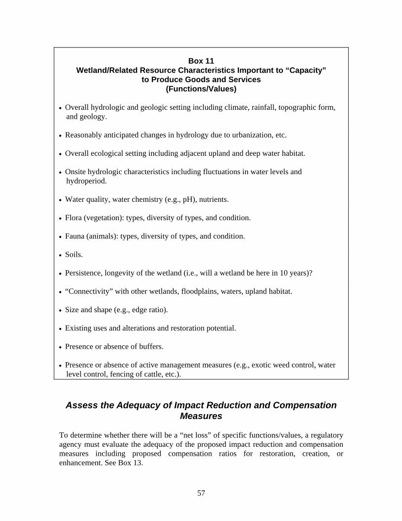
Box 11
Wetland/Related Resource Characteristics Important to “Capacity” to Produce Goods and Services
(Functions/Values) • Overall hydrologic and geologic setting including climate, rainfall, topographic form,
and geology. • Reasonably anticipated changes in hydrology due to urbanization, etc. • Overall ecological setting including adjacent upland and deep water habitat. • Onsite hydrologic characteristics including fluctuations in water levels and
hydroperiod. • Water quality, water chemistry (e.g., pH), nutrients. • Flora (vegetation): types, diversity of types, and condition. • Fauna (animals): types, diversity of types, and condition. • Soils. • Persistence, longevity of the wetland (i.e., will a wetland be here in 10 years)? • “Connectivity” with other wetlands, floodplains, waters, upland habitat. • Size and shape (e.g., edge ratio). • Existing uses and alterations and restoration potential. • Presence or absence of buffers. • Presence or absence of active management measures (e.g., exotic weed control, water
level control, fencing of cattle, etc.).
Assess the Adequacy of Impact Reduction and Compensation
Measures To determine whether there will be a “net loss” of specific functions/values, a regulatory agency must evaluate the adequacy of the proposed impact reduction and compensation measures including proposed compensation ratios for restoration, creation, or enhancement. See Box 13.
57

58
Box 12
Factors Relevant to the Establishment of Mitigation (Compensation) Ratios
Some major factors relevant to the establishment of mitigation (compensation) ratios include:
• The overall ecological condition (persistence, biodiversity, ecosystem integrity) of the original wetland versus the probable ecological condition of the replacement (restoration/creation) wetland/related resource. Larger ratios are justified where a replacement wetland will be less persistent, diverse, or have less ecosystem integrity than the original wetland.
• The opportunity that society has to make use of the original wetland versus the opportunity that society probably has to make use of the replacement (restoration/creation) wetland/related resource. Larger ratios are justified where a replacement wetland will be less available for public use; smaller ratios are justified where a replacement wetland will be more accessible to a larger number of people.
• The range and magnitude of functions/values of the original wetland/related
resource versus the probable range of functions/values of the replacement (restoration/creation) wetland. Larger ratios are justified where a replacement wetland will have a smaller number of functions/values with lesser magnitude than the original wetland.
• The wetland/resource type and probable project success or failure for this type.
Larger ratios are justified for the wetland types which have proved most difficult to restore or create with resulting greater possibilities of project failure. Difficulty is determined, in large measure, by the difficulty in determining and restoring or creating original or comparable hydrology. In general, difficulty increases in the following order: (a) estuarine (shallow and deep marsh), (b) coastal (shallow and deep marsh), (c) lake fringe and stream fringe (shallow and deep marsh), (d) depressional (shallow and deep marsh), and (e) flat and slope (shallow and deep marsh, shrub).
• Whether restoration or creation are involved. Larger ratios are needed for the difficult efforts to create functions/values and with the lowest probability of success such as restoration or creation of endangered or threatened species habitat. Smaller ratios are justified for less difficult efforts to restore or create functions such as flood conveyance or storage which also have a greater probability of success.
• The expertise of the agency/consultant proposing to carry out the project. Larger ratios are justified for less expert and less experienced project proponents.
• The length of time it will take for the restoration to become fully functioning. Larger ratios are justified where it will take many years for a project to be fully functioning.

59
• Threats (if any) to the restoration site. Larger ratios are justified where there are threats to compensation sites (changes in hydrology, sedimentation, water pollution, etc.); smaller ratios where there are none.
• Whether the site will be susceptible to “mid-course” corrections. Larger ratios are justified where the site has little “mid-course” correction capability; smaller ratios are justified where there is more correction capability.
• Whether there will be monitoring to provide the basis for “mid-course” corrections over time. Larger ratios are justified where there will be little or no monitoring; smaller ratios where there will be monitoring and mid-course corrections.
• Whether active management will take place over time. Larger ratios are justified where there will be no active management; smaller ratios are justified where active management (e.g., fencing, exotic weed control, controlled burns) will be undertaken.
• The relative costs and equities between onsite restoration/creation versus offsite restoration/creation. Larger ratios may be justified where the costs of offsite restoration/creation are less than the costs of onsite restoration/creation. Project proponents allowed to use offsite restoration/creation should not gain huge financial advantages over those required to carry out onsite restoration/creation.
Provide Information on Critical Species
The Section 404 program and virtually all state wetland regulations require that regulatory agencies protect “endangered species”. Regulatory information gathering techniques must help must determine whether such species are present at a site. Some state biological water quality criteria for wetlands also incorporate specific assemblages of species. Many statutes and regulations also require that regulators consider the impact of proposed activities on fisheries, waterfowl, shellfish, etc. which requires species specific information. A number of assessment methods focus upon evaluation of particular species or communities (e.g., WETHINGS, HEP, HAT, IBI). See Appendix B. Others, such as HGM, consider general ecological capacity. Should a regulatory agency use species or community models or a general ecological method or both? This is an important question and the answer depends, in part, upon how and when a specific approach is to be used. Species-specific information is important in deciding whether destruction or alteration of a wetland should be allowed. The ability of a wetland to provide (or replace if a restoration project or use of a mitigation bank is proposed) habitat for a specific species of bird (e.g., an Everglades Kite) depends upon specific factors such as specific vegetation types, depth of water during the nesting season and specific food (such as snails for the Kite). This requires more detailed information and much finer analysis and predictive capability than determination of overall ecosystem capability.

60
Therefore, general ecosystem analysis is not a substitute for more specific species-levels analysis and vice versa. Conversely, species-specific analysis is not a substitute for general ecosystem analysis. Both are needed. Once a decision is made to issue a permit, an evaluation of overall ecosystem capability is often the best that can be done to help guide onsite or offsite restoration. It is at this point in the decision-making that general ecosystem evaluation methods such as HGM can be most useful. The status of restoration/creation scientific knowledge is generally insufficient to predict or serve as the basis for species-specific restoration capability. General ecosystem capability is often the best one can do. Gathering the information needed to determine use of a wetland by a specific species is not easy. But, this does not mean that it should not be done at all. Regulatory agencies typically look for direct or indirect evidence of specific species (e.g., a bald eagle’s nest) when they conduct a field visit to a wetland. They also use various red flag procedures including “notice” and “hearing” procedures to solicit observations from adjacent landowners, environmental not for profits, birders, fishermen, or others with time-series information. If it appears that an endangered species may occupy a site or some other important function is at stake, the regulatory agency may undertake onsite investigation or request further studies from the landowner using a more detailed assessment technique such as HEP or WETHINGS.
Assess “Condition”
To assess both present functions/values and future functions and values, regulators have found it increasingly useful to assess wetland “condition” relative to unaltered wetlands. Assessment methods addressing condition include HGM, the Rosgen stream assessment approach, and the various IBI approaches. Assessment of condition can help regulators:
• Assess the magnitude of existing functions/values. A wetland in a natural or semi-natural condition often has a greater ability to produce particular goods and services such as fish, waterfowl, birds, flood storage, flood conveyance than that of an altered wetland. This is not always true, however, for specific functions because the ability of altered wetlands to produce a particular good or service (e.g., flood storage, flood conveyance, fish) may be greater in some instances than that of a comparable natural wetland.
• Assess the longevity or persistence of a wetland and its functions/values. The condition of a wetland often suggests the longevity or persistence of a wetland. Altered wetlands in a degraded condition are quite often subject to high rates of sedimentation, lowered water tables due to incising streams, or lack of natural flood regimes. And, longevity or persistence of a wetland is relevant to its functions and value. The long term functions and value of a wetland to society which is quickly disappearing will be less than one which exists perpetually.
• Assess the restoration potential of a wetland. Assessment of condition can help a
regulator determine the restoration potential of a wetland and whether a wetland is

61
undergoing natural restoration. Restoration potential is important in deciding whether impact reduction and compensation measures proposed by a project applicant are adequate. Restoration may occur naturally or due to the activities of the project applicant. For example, many wetlands drained for agricultural purposes are now reverting to natural wetlands due to sedimentation and vegetation in the drainage ditches, collapse of drainage tiles, and beaver activity. The magnitude of the reasonably projected functions/values of these wetlands is higher than for an altered wetland where no natural restoration is occurring.
• Establish water quality standards for waters and wetlands. Evaluation of wetland and water condition in terms of particular animal species and suites of species (biological indices) can help establish water quality standards for particular wetlands and waters. Biological monitoring can also help monitor and enforce these standards over time.
• Implement mitigation banking. Assessment of condition can help regulators establish mitigation ratios although a broad range of additional factors are also relevant to such ratios. Assessment of condition for wetlands throughout a locality, region, or state with a high restoration potential for various restoration programs (e.g., Wetland Reserve, Partners of Wildlife) and for mitigation banking purposes.
Box 13 Evaluating “Condition”
The capacity of a wetland/related resource area to produce goods and services depends, in part, upon the “condition” of the wetland and how it will be managed and used over time. A wetland in a “natural” or unaltered condition is particularly likely to be of special value as endangered or rare species habitat. It may also have the greatest ability (in some circumstances) to provide other goods and services. To evaluate condition a regulatory agency should consider: • What is the existing use (if any) of the wetland/related resource area? Is it in a
natural condition? Is it used for agriculture? Forestry? Stormwater? Other purposes? A wetland used for agriculture or forestry often has less functional/value as habitat for rare and endangered species.
• Has the wetland/related resource area been altered? If so, how? Has it been partly
drained? Filled? Is it subject to high rates of sedimentation or other threats which may destroy the wetland in a short period of time? Is it subject to pollution? Is the wetland now undergoing natural restoration (e.g., water levels increasing in a partly drained wetland)? Will this restoration likely continue? Most functions/values are diminished by alterations. However, certain functions may be enhanced. For example, partial drainage and clearing of vegetation may increase flood conveyance.
62
• Is the hydrology of the wetland/related resource area changing due to urbanization in the watershed or other factors? If so, what does this mean to wetland functions/values such as habitat values, flood storage, and flood conveyance? Urbanization will usually increase both peak flood flows and total runoff. It will also increase pollution and sediment loadings.
• What is happening to adjacent areas? Wetlands/related resources protected by
buffers or adjacent to public open space lands have greater habitat value. They are also less likely to be subject to pollution and sedimentation problems.
• Will the wetland/related resource area be actively managed pursuant to the
proposed activity? A wetland with exotic weed control, water level control or fencing of cattle often has enhanced habitat functions/values.
Assess “Opportunity” and “Social Significance”
Regulatory decision-makers have often found that three aspects of wetlands are important in carrying out a broad “public interest” review or applying similar broad criteria at state or local levels. These factors include “efficiency (capacity)”, “opportunity”, and “social significance”. The first relates primarily to wetland processes; the second and third primarily to the importance of wetlands to human beings. The WET assessment method developed by the Corps of Engineers and most other rapid assessment methods attempt to evaluate all three sets of considerations through a set of questions. However, complexity in analysis and the mixing of subjective and objective considerations in WET and similar approaches was one of the motivating factors in the development of an alternative approach—HGM. HGM focuses upon natural processes alone. In this way, HGM is limited by its failure to evaluate opportunity and social significance. The impact of a proposed activity upon people (opportunity, social significance) is of great importance in determining the “public interest” for Section 404 permitting and other permitting at state and local levels. It is of interest in defending regulations against constitutional challenge and keeping an agency out of liability trouble. For example, a regulatory agency needs to know if a proposed fill will impede flood flows, thereby increasing flood heights (change in the resource) on other lands and people. Allowing such an increase may not only violate the rights of adjacent landowners but may subject the regulatory agency to a successful liability lawsuit. See Wetlands in the Courts. Evaluating opportunity and social significance is difficult. But, qualitative, “common sense” evaluation is better than no evaluation.

63
Assess Wetland Relationships to Adjacent Waters and Lands
It is easier and simpler for regulators to focus only upon wetland sites. But selective analysis of broader context and issues is often needed for several reasons: First, proposed projects submitted to a regulatory agency such as bridges, culverts, roads, marinas, dredging operations, and fills often impact not only wetlands but adjacent “waters” (lakes, rivers, streams, estuaries), floodplains, and sometimes related uplands. Quite often wetland regulatory agencies have simultaneous regulatory jurisdiction over wetlands and these broader areas and they must evaluate such broader impacts. For example, the federal Section 404 program applies to both wetlands and broader waters. Many state wetland programs also apply to waters. Many also regulate wetland buffers of 50 to several hundred feet. Local regulatory programs (zoning) typically apply to not only to wetlands but floodplains and upland areas. Second, regulators at all levels of government must determine whether landowners have “practical alternatives” to proposed wetland activities. To rationally determine this, they must be able to evaluate the environmental impact of proposed activities on not only wetlands, but adjacent waters and uplands. For example, it makes no sense (and would violate statutes) for a regulatory agency to attempt to shift a proposed wetland activity to an endangered species upland site. Third, wetland functions and values including the restoration potential of a wetland often depend in part upon the functions and values of the related aquatic and upland ecosystem and upon the broader hydrologic context. For example, wetland “fisheries” functions and values often depend in large measure upon the fisheries potential of adjacent lakes, rivers, or streams. Finally, local planners and regulators need information concerning the relative “suitability” and “appropriateness” of land and water uses throughout a community as a whole for planning and zoning purposes. Similarly, Section 404 regulators need a variety of contextual information to determine the “public interest”. Assessing the broader context is, of course, not easy. But a common sense approach which takes a qualitative look at the interrelationships between wetlands and broader areas, functions/values, and other relevant factors is possible.
Assist Monitoring and Enforcement Finally, regulatory agencies must monitor permitted activities and other activities in wetlands over time. Agencies need to determine compliance with permit conditions such as restoration conditions designed to compensate for loss of particular functions/values. They need to detect unpermitted activities in violation of regulations. They need to document violations for enforcement actions and suggest function/values in restoration plans. They need to gather information to defend regulations against court challenges. See Wetland Assessment in the Courts.

64
Summary Information gathering and analysis for regulatory purposes should be designed to meet a variety of priority needs. These priorities differ somewhat depending upon the context. But, in general, priorities will include the generation of information needed to apply regulatory criteria, to defend regulations against constitutional challenges, to indicate changes in wetland functions/values, to evaluate the condition of wetlands, to evaluate opportunity and social significance, to evaluate related lands and waters, to evaluate the adequacy of various impact reduction and compensation measures, and to monitor and enforce regulations. Looking to the future, regulatory agencies can best address these needs by using an initial assessment “process” involving “red flagging”, “yellow flagging” and other “screening procedures combined with more detailed analysis of particular functions/values, issues and problems identified by the initial assessment. See Final Report 3: Integrating Wetland Assessment Into Regulatory Permitting for a description of such a suggested approach.
65
CHAPTER 6: LESSONS LEARNED Regulators at state, local, and federal levels have gained considerable experience in assessing functions and values over the last 30 years. The following discussion summarizes some of this experience as it pertains to key issues (stated as questions).
Are Rapid Assessment Techniques Misleading? Rapid assessment techniques with numeric products but many assumptions and simplifications may give the impression to landowners and the public that accurate assessment of functions and values (e.g., accurate assessment of hydrologic characteristics, accurate assessment of habitat) is, in fact, practical and doable. This is often not true and such techniques are misleading. As discussed in Chapter 2, there are scientific gaps in the understanding of relatively even straight-forward functions such as pollution control. There are even more gaps in understanding subtle functions such as atmospheric gas exchange and food chain support for low profile species such as insects and amphibians. There have also been few scientific “cause and effect” studies concerning the effectiveness of various impact reduction measures. To avoid the impression that techniques can do more than they are capable of doing, scientists should make clear the margins of error and simplifying assumptions in preparing guidance materials for use of assessment techniques. Techniques should be applied with common sense. Numeric products based upon highly simplified (and often inaccurate) calculations should be avoided. See discussion below. Do Resource-Based Rapid Assessment Techniques Provide All
of the Information Needed to Meet Multiobjective Regulatory Goals?
Wetland regulations often establish multiple regulatory goals and criteria. The overall issue in wetland regulatory permitting is often the appropriateness or “suitability” of a proposed activity at a wetland site. In the Section 404 program, the issue is deciding whether permit issuance will be in the “public interest”. Use of a functional assessment method which focus only upon natural processes or natural functions and values without considering and giving weight to other factors such as natural hazards, land ownership, and compatibility with adjacent uses will fail to fully evaluate the suitability of a wetland site for particular activities. It will provide some but not all of the needed information. Any effort to classify and rate wetlands for development purposes based only upon functions and values information will, therefore, also be misleading because it will ignore a broad range of relevant factors.

66
Is Assessment of Functions/Values Necessary in All Circumstances?
Assessment of the functions/values of all wetlands or even individual wetlands is not needed in some contexts where all development is prohibited. For example, courts have broadly sustained open space (conservancy) zoning for wetlands, agricultural lands, and other open areas based upon the overall suitability of lands for various uses taking into account natural hazards, infrastructure costs, existing uses, compatibility of uses, overall functions and values and other factors. Detailed assessment of functions and values is also not necessary in a case-by-case wetland permitting program where a permit application for a proposed activity is denied because the activity will be subject to severe natural hazards or a permit application fails to comply with water dependency, alternatives analysis, land ownership, or other criteria. Water dependency and alternatives analysis requirements are, like conservancy zoning, based upon the overall functions/values of wetlands, natural hazards, high incidence of public ownership and trust interest and other factors, not simply site-specific simply functions and values. On the other hand, determination of the functions and values of individual wetlands is practically needed where activities are allowed on a case-by-case basis and where the regulatory agency must determine adequacy of specific impact reduction or compensation measures
Are “Omissions” In Assessment Factors As Important as Inclusions?
What is not considered in analysis is often as important as what is considered. Consider, for example, a riverine wetland assessment undertaken for the purpose of evaluating a proposed dam. If the assessment only considers the impact of the dam on warm water fisheries in upstream wetlands, the regulatory agency may conclude that the dam will have little impact (other than the reservoir area) because warm water fish will thrive in the resulting reservoir and perhaps upstream areas. But, if the assessment takes into account cold water fish species as well, an entirely different set of conclusions will emerge. So the factors omitted from consideration as well as those included are very important in the outcome of an assessment. Similarly, consideration of project impact on general ecological capacity using general models of capacity may reveal limited impact. But if ecological processes are examined from the perspective of specific species (e.g., Everglades Kite, Bald Eagle) a project may be unacceptable. Conversely, consideration of impact on only a single species may suggest no impact but consideration of impact on overall ecological capacity may reveal substantial impacts.

67
Problems with “omissions” are not limited to the overall factors considered (questions asked) but attempts to carry out numerical calculations and engineering studies. Consider, for example, the task faced by a regulator in evaluating a wetland creation project proposed by a landowner as compensation for a proposed wetland loss. Assume that the landowner/consultant has computed the amount of water which will accumulate in the excavated area by computing existing runoff using existing watershed conditions (the typical simplifying assumption) and various hydrologic models. The numerical calculation might be carried out to several decimal points using rainfall estimates and runoff calculations. But, if this is a typical urban watershed, the watershed hydrology is changing due to tree-cutting, land excavation, and construction of ditches and impervious surfaces. Peak runoff will likely be increased 3-20 times and total runoff to the proposed wetland may also be greatly increased due to the increased impervious surface. Under such conditions, the proposed wetland will often become a shallow pond or lake rather than a wetland. If changes in hydrology are not considered, the landowner and the regulator will not be able to achieve a “no net loss of function” objective. The proposed restoration or creation project will often fail, wasting a great deal of money for the planting of wetland plant species which will quickly die in the lake or pond environment. Yet, changes in hydrology are rarely considered in numeric analyses. Sophisticated number-crunching in calculating wetland functions as proposed by some approaches and methods makes little sense if critical parameters such as changes in hydrology are not considered. The appearance of accuracy and precision is not warranted.
Is Quantitative Evaluation Necessary or Possible? In an ideal world, wetland assessment would involve quantitative evaluation of wetland functions (using real “interval” or “ratio” numbers), the impacts of specific project proposals on such functions, and then the significance of these changes to particular segments of society. In other words, an assessment of flood storage would indicate how much flood storage a wetland provides for a 100-year flood, what individual and cumulative impact of a proposed fill might have on this storage, how much this would affect downstream flood heights and velocities, and what this would mean in terms of flood damages to both existing and potential development. In an ideal world, this information might be translated into a cost/benefit economic analysis. Of course, this is not an ideal world. For a variety of scientific, budgetary, and other reasons it is difficult to provide even a qualitative evaluation of functions and values for a specific wetland much less highly quantitative information. It is even more difficult to provide an accurate analysis of opportunity and social significance. Because of problems in “true” numerical quantification of functions, impact of activities on functions, and impacts of these changes on various segments of society, a variety of subjective techniques have been used to rate wetlands using “ordinal” or “nominal” scale numbers. With ordinal scales, there is no fixed interval between numbers. For example, a wetland rated a 2 for flood storage on an ordinal scale of 1 to 10 might have twice as

68
much, ten times as much, or only slightly more flood storage capability than a wetland rated a 1. In contrast a wetland rated a 2 on an “interval” scale would have twice as much flood storage as a wetland rated a 1. Some regulators, landowners, and consultants have supported the use of ordinal, numeric rating schemes to provide estimates of relative importance or simple, “bottom line” numbers even when they have known that such a number is more or less arbitrary because it provides some estimation of weight or probability of importance. They argue that some method must be used to determine “how important” a particular function may be and this is the best that can be done. They also argue that some numerical rating is better than none in determining compensation needs and mitigation needs. But, there are also problems with subjective, ordinal rating schemes: 1. They may mislead landowners, developers, members of the public, legislators,
regulators, and others who do not understand ordinal versus interval numbers. Ordinal number values often quickly develop a life of their own (i.e., the public believes that “figures don’t lie” particularly if they are developed by scientists).
2. Ordinal ratings can, because of their subjectivity, be easily manipulated by the
individual carrying out the rating. 3. It is statistically invalid to multiple, add, and divide ordinal numbers. And, yet, this is
often done. 4. Ordinal numbers provide little actual guidance for the design of mitigation measures
and compensatory mitigation. Consider a proposed fill for an acre of inland marsh. If “no net loss” of function is to occur, a regulator must know what impact this fill will have in terms of loss of flood storage. It is not very useful to know simply that “some” loss of flood storage will occur for the design of specific mitigation or compensation measures or that a wetland ranks 2 on an ordinal scale. What does an ordinal rating of 2 mean--1 acre feet, 2 acre foot, 3 acre feet of flood storage, etc.?
On the other hand, ordinal numbers can provide regulators with a “feel” for relative importance of wetlands. And, this is important in some contexts. Problems with providing quantitative numbers have led some regulators to “ban” the use of non-ratio number rating schemes and to recommend, instead, careful qualitative evaluation. See, for example, the Highway Methodology Workbook Supplement of the U.S. Army Corps of Engineers, New England Division. If non-ratio numbers are to be used in evaluating functions/values, their limitations of such numbers should be carefully described in the guidance materials. Simplifying assumptions and possible margins of error should also be specified. Invalid statistical evaluations should not be carried out.

69
Are Functions Additive? Efforts to “add” assessment functions and values using either ordinal or interval scales create further problems because some functions and values are wholly or partially contradictory with one another. For example, dense wetland vegetation helps slow flood watershed, increasing water retention and flood storage. But, dense vegetation may also trap sediment resulting in rapid filling of a wetland (sometimes many feet of sediment in a single flood event) and the destruction of flood storage, pollution control, and other functions. Contradictions between sediment trapping and flood storage, pollution control, and other valuable wetland functions are dramatic and obvious. But, there are many more subtle contradictions such as differences between functions which favor maintenance of open water (fisheries, waterfowl) versus functions such as pollution control which favor dense vegetation. For this reason, any effort to add functions or functions/values should be approached with care.
Should Wetlands Be Compared With One Another?
Some rapid assessment methods such as the New Hampshire Method compare wetlands functions/values with other wetlands, reflecting in part on the origin of many assessment techniques in public acquisition of wetlands, wildlife management, and highway and other infrastructure planning and assessment. Wetland and wildlife managers in these contexts sometime need to know the relative functions and values of one wetland versus another for acquisition or other management purposes. Comparison of wetlands within one another also has some uses in regulatory assessment. Knowing that one wetland is more important than others for one or several functions may help red flag certain wetlands and certain functions for more detailed analysis. A comparison between wetlands is useful for comparison alternative locations and alternative project designs for large scale projects such as large subdivisions, reservoirs, and roads which may affect many wetlands. HGM compares wetlands within a HGM subclass in a different way--by relative “condition”. Natural wetlands in an unaltered condition are given the highest rating. This is useful for helping to determine compensation ratios for regulatory permitting and for various types of management planning. But, the real issue for regulatory alternatives analysis and determining the suitability of particular sites for particular activities is not the comparison of one wetland to another but the comparison of wetlands to alternative upland or deep water sites for location of a particular activity. Comparison to other wetlands is relatively irrelevant and may, in many instances, be misleading for several reasons:
• Functional rating schemes typically consider only wetland functions/values and do not consider natural hazards or other limitations on development so they do

70
not provide an estimate of relatively “suitability” for development. For example, if a wetland is rated as having very “low” for natural functions or values, a landowner may conclude that such a wetland is, therefore, appropriate for development. But, many highly degraded wetlands (e.g., a riverine floodway wetland in an urban industrial park) are subject to high velocity flood flows and severe erosion, making them undesirable if not a dangerous development sites.
• It is very difficult to compare functions/values with one, dissimilar functions and values because some functions are incompatible and non-additive. See discussion above.
• Wetland rating schemes using nominal numbers often provide little real information about a wetland in terms of mitigation and compensation needs where the issue is not only the types of impacts but their magnitude.
• Rating schemes are typically based upon a wide range of simplifications which greatly decrease their accuracy.
• Limited data is typically available to evaluate the factors which are rated and this further reduces the usefulness of the rating.
Should Restoration Potential and Compensation Ratios Be
Based Upon Relative Ecological “Condition” Alone? The HGM model has been developed, in part, to help determine restoration potential and calculate compensation ratios by comparing the functional capacity of one wetland with the functional capacity of another wetland. Both natural variability and anthropomorphic influences are considered together (see Smith et al., 1995) in evaluating and rating “condition.” Experience with restoration over the last two decades suggests that the “condition” of a wetland is important in determining the ability of a wetland to provide goods and services. It is also important in evaluating restoration potential and setting compensation ratios. However, a wide variety of factors are relevant to the assessment of this condition (not just ecological considerations). Experience also suggests that ecological condition is only one of many factors relevant to the “success” of wetland restoration, creation, and enhancement projects and, therefore, only one of many factors relevant to compensation ratios. Success rates for restoration of a particular type of wetland, the overall hydrologic condition, expertise and experience of the restorer, and other factors are relevant. See Box 14. Experience also suggests that distinctions should be drawn between natural variability and anthropogenic influences in evaluating condition for determining restoration potential. It is impossible to “upgrade” a wetland if it is operating (from a process perspective) at its maximum range from a natural variability perspective. But, it may be possible to upgrade the wetland if it is operating at a relatively low condition based upon the impacts of man. So, natural variability and anthropogneic influences need to be distinguished in determining relative ecological condition.

71
Should It Be Assumed That Natural Wetlands Are Operating at the “Highest Level” in Evaluating and Comparing Wetlands?
The HGM approach assumes that, overall, a natural wetland provides the high level of function. Wetlands at or near natural condition would, therefore, rate 1.0 on a scale of .0 to 1.0. It may be argued that, overall, natural wetlands do provide the highest level of ecological functioning over a broad suite of functions. But, this is not necessarily true for individual functions, particularly certain hydrologic functions. Consider, for example, a specific riverine wetland in a natural condition. It may be operating at an overall “optimum” level for biodiversity and for certain habitat. But it may have much lower flood storage or flood conveyance value in a particular circumstance than a partially channelized or wetland since topographic contours (depth, outlet, etc.) are the primary determinants of flood storage and flood conveyance capacity. If a natural wetland is used to guide compensation ratios or compensation design, the result may be decreased storage and conveyance along a stretch of stream than the original (pre-permit wetland). And, allowing decreased storage and conveyance would not only result in “net loss” of function for those functions but could, under certain circumstances, result in a successful liability suit against the regulatory agency for allowing increases in flood heights or erosion damage which damages other landowners. See Chapter 4 of Wetland Assessment in the Courts. Using natural wetlands to establish benchmarks for comparing wetland condition and establishing compensation ratios makes overall sense, but the use of natural wetlands as a standard for guiding wetland alteration, mitigation, and compensation decisions must be tempered with common sense. Guidance needs to be provided with regard to application of reference standards where altered wetlands possess “functions” which exceed those of natural wetlands.
Should Partially “Subjective” As Well As “Objective” Data Be Used in Assessment?
Scientists often prefer to assess wetlands using “objective” data and objective data-gathering techniques in assessment such as systematic field surveys conducted with standardized protocols, systematic use of air photos, and standardized hydrologic models (e.g., HEC 2). But, objective data gathering consistent with scientific protocols is also expensive and time consuming. And, it is often practically impossible to acquire objective time-series information pertaining to water levels, wildlife, fish, or other features which vary over time and these variations cannot be observed within a typical statutory project evaluation time frame. For this reason, regulatory agencies have often turned to somewhat more subjective and less systematic sources for time-series data or information such as:
• Bird surveys over a period of years by local birders,

72
• Flooding records over a period of years kept by public works officials, • Fishing observations over a period of years by fishermen, and • Hunting experience over a period of years by local duck hunters.
While less objective, these information sources are often the only long-term information available for a wetland other than what can be implied from vegetation and soils. If used with care, such information can be useful and acceptable in court. To tap such information sources (e.g., fisherman, birders, duck hunters), regulators must distribute notices of proposed activities to interest groups and supply them with enough information concerning the wetland and the proposed activity to solicit informed responses. Groups, agencies, and individuals may come forward with such information if:
• they receive notice of the proposed activity and impacted wetland, • they are informed as to the nature of the proposed activity and its possible impact,
and • they are provided with a “forum” to submit information and express their views.
Should Objective Fact-Finding Be Separated From More
Subjective Determination of Values? It is useful for certain data-gathering and analytical purposes to separate or partially separate objective fact-finding including determination of wetland physical characteristics from the opportunity such physical characteristics may have to provide goods and services and the importance of the goods and services to society (social context). See Appendix A. Physical features of wetlands, processes, and impacts can be categorized, studied, described, and modeled by scientists, engineers, and other experts with a fair amount of objectivity. Separation of objective from more subjective factors in analysis of wetlands facilitates a “meeting of the minds” between resource agencies, the regulatory agency, and a landowner or his or her consultant. Agreeing on physical “facts” can be an important step in reaching later agreement on more policy-related issues policy. But “values” are also of great importance. An urban wetland protecting the water supply of eight million people (e.g., the New York water supply) has much greater economic and social value from a “public interest” perspective than one with similar physical features and processes but far from any water supply or other direct use. Values are relevant to balancing public and private interests in a typical public interest review process. So, wetland assessment should consider both natural processes and “values” although only highly qualitative evaluation of values may be possible on the typical permit. This does not mean, however, that analysis of natural processes and “values” should be mixed in all phases of permit evaluation. Regulators have learned that qualitative, simultaneous evaluation of natural processes and values may often best take place during early the early “survey” phrases of permit evaluation to help determine whether more detailed information gathering should occur. This can be followed more detailed analysis of natural process if the if preliminary analysis indicates that significant impacts may occur upon wetland resources. More detailed evaluation of value (opportunity, social significance) may then follow this objective evaluation. See Final Report 3: Integrating Wetland Assessment Into Regulatory Permitting.

73
Are There Shortcuts in Determining The Specific
Functions/Values Needing Analysis for a Particular Regulatory Permit?
It is not possible from budgetary and staffing perspectives to evaluate, in detail, all natural processes for all wetlands throughout a region or for a particular wetland for regulatory permit analysis. See Chapter 2. Typically, a regulatory agency (with the help of the landowner and other resource agencies) can carry out only detailed assessment of only a limited number of wetland “functions” and values.
How, then, are decisions to be made with regard to what functions are to be examined for a group of wetlands or for a specific wetland for the evaluation of an individual permit? Regulatory agencies may consider several factors in determining (and narrowing) which functions and values need analysis on a specific permit. These include (1) the type, size, location, and design of the proposed project, (2) the wetland class and subclass (e.g., using HGM class), (3) available map and other information pertaining to the wetlands. Agencies may also use a variety of other “red flagging”, “yellow flagging” and “screening” procedures. See Integrating Wetland Assessment Into Regulatory Permitting.
How Are Public “Values” To Be Considered in Assessment?
In carrying out a Section 404 “public interest” review of a proposed permit or similar evaluation processes at state and local levels, regulators need to know not only physical impacts of a proposed activity but the significance of these impacts to society.
Box 14 Wetland “Values”
The term “value” is used in two different ways in wetland contexts. The term “value” is, in its simplest form, used to describe how society “feels” (i.e., attitudes and relative weights) about combinations of wetland functions and processes and other characteristics:
• Economic values, • Health and safety values, • Historical, heritage values, • Education, research, scientific values, and • Aesthetic values.
The term “value” has often used to describe the ability of wetlands to provide certain goods and services of value to society based upon natural processes, opportunity, and social significance. For example, a wetland may be said to have a flood storage value, a flood conveyance value, etc.
Determination of “values” attached to society to various wetland physical processes and the potential for a wetland to provide certain goods and services is, admittedly, difficult

74
ociety (e.g., fishermen) may attach quite different values to different wetland species.
e in wetland assessment (e.g., the HGM approach) and determining compensation ratios.
policy questions, given the broad range of uncertainties inherent in evaluation processes.
social context can help determine whether roposed impacts are in the “public interest”.
because there are many intangibles involved. Different segments of society place different weights on various functions/values. For example, fisherman often prefer production of fish in a wetland (requiring open water) over production of song birds (requiring shrubs, trees). Even within a given segment of s
Because of both conceptual and substantive (how it is to be done?) problems in assessing wetland “values”, proposals have been made to focus only on wetland functions alon
This fails to recognize that it is almost impossible to decide which “functions” of a particular type of wetland or wetlands in a region, state, or site are to be assessed to achieve certain policy goals with introducing early-on in an evaluation process some consideration of value. It also fails to recognize that regulatory permitting is, to a lesser or greater extent, a public participatory process involving many agencies and units of government as well as adjacent landowners and the public. Review and consensus-building are needed concerning factual issues as well as
Box 15 suggests a variety of methods for qualitatively determining public attitudes and “value” in a particular context. None are perfect but they are often the best that can be done. And, they are better than no consideration of value. A broad, qualitative evaluation of value taking into account opportunity and p
Box 15
Approaches for Assessing Social Significance and “Value”
Regulatory agencies can use a variety of approaches to help assess public attitudes and values with regard to the ability of wetlands to produce goods and services (functions/values).
1. Regulatory agencies can circulate for comment to adjacent landowners, other agencies, and interest groups proposed permit applications. They can also hold public hearings on applications. This is the most common, although imperfect, way for regulators to determine gain some direct measure of public preferences and values on a site-specific basis.

75
2. Regulatory agencies can use their own observations and perceptions and “common sense” to recognize values held by society as a whole or in a community. A regulatory agency does not need an independent “poll” to determine that the public does not want wetland landowners to pollute wells on adjacent properties. Regulatory agencies can use their common sense and general knowledge (newspapers, T.V., interaction with interest groups, interaction with the public) to recognize “values” broadly held by the public such as importance of protecting a local park. Not all values need to be scientifically documented. 3. Regulatory agencies can sometimes refer to statutes, ordinances, and formally adopted plans to determine what legislative bodies or the public believes to be important. For example, some statutes provide protection for endangered species; others protect historic and archaeological sites. 4. Regulatory agencies can, in some instances, gain feedback from a broad range of groups and organizations concerning values through the use of various planning processes. For example, the Land County Regional Planning Agency undertook a detailed wetland assessment process in preparing a detailed wetland plan for West Eugene, Oregon. This assessment and planning process used a broad range of techniques to gain feedback from various groups and individuals concerning what wetlands should be protected including one-on-one consultations, questionnaires, and public workshops. The plan was ultimately submitted to the electorate for approval and is now used as the basis for regulatory permitting. 5. Regulatory agencies can (under some circumstances) undertake various sorts of “economic analyses” for wetland functions and values. Determination of economic value can help gauge overall value to society. However, economic valuation is typically time-consuming and expensive and subject to many uncertainties, particularly with regard to nonmarket values. 6. Regulatory agencies can, with the help of their attorneys determine “values” which have been afforded legal status as “rights” and “duties” by the courts. For example, wetland functions such as flood conveyance have legal status in terms of landowner rights and duties. As discussed in Wetland Assessment in the Courts, private landowners owning lands adjacent to and downstream to wetland parcels or on the same water body have a variety of legal rights such as reciprocal “riparian rights” and “appropriation rights” to surface waters which need to be reflected in regulatory decision-making. Pursuant to such doctrines, landowners may have a legal “right” to continued passage of flood flows on streams. And, if a wetland landowner who blocks such flows through a fill may be successfully sued on “nuisance”, “trespass”, “negligence”, or other grounds. Courts give great weight to protection of public safety and prevention of nuisances and data gathering which documents functions relevant to the protection of safety and prevention of nuisances will help sustain regulations against takings and other challenges.

76
7. Regulatory agencies can, in some instances, subject the question of “value” directly to local elected officials for determination. For example, a local wetland regulatory agency may submit a proposed “special exception”, “variance”, or wetland permit or proposed conservancy zone amendment to a town, city, or county council for a vote to determine how the legislative body feels about protecting certain “functions” associated with a specific wetland or area. This is much harder to do at the state or national level and, if conducted at the local level, may only reflect a local point of view. 8. Regulatory agencies can, in some instances, subject the question of value to direct vote by the public. At the local level, bond issues for protecting wetlands, plans, and other measures may be placed on voting ballets for direct vote. This isn’t a quick process, but it can provide direct public feedback. 9. Regulatory agencies can subject the question of value to executive commissions or committees. Quite often local regulators submit proposed permit applications to appointed soil and water conservation boards, conservation commissions, or planning agencies for comment. Such commissions or boards may, to some extent, represent the public.
Box 16
Is Examination of Natural Processes Alone Sufficient In Establishing Compensation Ratios?
Proposals have been made (e.g., the HGM method) to evaluate project impacts and to determine mitigation and compensation needs based upon wetland functions or processes without formally considering opportunity or social significance. Such an approach simplifies project evaluation. But, does it provide adequate information for a “public interest” review and for establishing the adequacy of compensation needs and ratios? The HGM method has been developed in part to help establish wetland compensation ratios for residual impacts including the computation of credits and debits for mitigation banks. It does so by characterizing wetland subclass, by preparing profiles of wetland characteristics for that subclass through the use of reference sites, and then by comparing the condition of a specific wetland with other wetlands in that subclass. HGM assumes the “highest functioning” wetland is a wetland in a natural condition and compares other wetlands within a reference domain with wetlands in a natural or semi-natural condition. The rating a wetland receives (on a .0 to 1.0 scale) is then multiplied by acreage to suggest compensation ratios. HGM stops there. HGM does not assess “opportunity” or “social significance.”
77
HGM does hold promise for improved evaluation of basic wetland “processes” and wetland condition relative to other wetlands. But, its failure to consider “opportunity” or “social significance” limits its usefulness to establish compensation ratios consistent with the “no net loss goal” and the “public interest” review process if it is not supplemented by other approaches. Consider, for example, the consideration of functions (processes) alone through the use of HGM in a typical urban setting for a small urban wetland. Assume that a landowner is proposing to fill or drain a 2-acre urban wetland and wants to buy credits from a mitigation bank or to create or restore a wetland offsite in a rural setting. “Natural” or nearly natural wetlands operating at the highest level of functions within the reference domain for this subclass of wetland may be assigned a score of 1.0 (or close to a 1.0). Other wetlands with various degrees of alteration and levels of natural function will be assigned lower scores (e.g., 0.1-0.9). The 2-acre urban wetland will then be assessed using this rating scheme. How will the urban wetland fare? The typical urban wetland has been partially drained/filled and is subject to hydrologic changes. It will therefore, typically, receive a low score of .2 to .8 for most functions if the reference domain contains relatively unaltered wetlands. Let’s assume an overall score of .5. What does this mean for compensation ratios if only ecological capacity is considered? It means that the landowner developer can propose to destroy 2 acres in the urban setting and replace it with 1-acre in an rural setting (2 acres x .5=1 and 1 acre x 1.0=1) because, pursuant to HGM, the condition scores are multiplied by acreage. While replacement of a two acre urban wetland with a one acre rural wetland might make ecological sense from the perspective of certain animal or plant species (some urban ecologists would strongly dispute this), would such a result be consistent with the “public interest”? Would it actually replace wetland goods or services for nearby urban dwellers or would it simply replicate certain wetland characteristics and processes at another site? This is a critical question. The “opportunity” for a wetland to provide goods and services to people is often much greater in an urban setting. But, this is not considered by the HGM analysis. For example, an urban wetland with the same ecological capacity to reduce pollution or provide flood storage as a rural wetland often has significantly greater opportunity to reduce pollution or provide flood storage than a comparable rural wetland. Urban runoff is typically polluted and flooding is a particular problem in urban areas.

78
The “social context” and societal use of an urban wetland is also often significantly greater than the rural wetland. But, this too is not considered. Tens of thousands of people living near an urban wetland or an urban lake or stream protected by such a wetland may directly benefit from the pollution prevention, flood storage or conveyance, educational, interpretation, or other functions/values of the wetland in an urban setting. Very few may enjoy those same benefits from a comparable wetland in the rural setting. There are social justice issues involved as well. Most minorities live in urban areas. Destruction of wetlands in urban areas with their restoration or creation in rural settings will significantly shift the incidence of benefits of wetlands from rural to urban areas. Failure to consider the impacts of such a shift would in some circumstances, apparently, violate the Executive Order 12898 which requires that “(e)ach Federal agency shall analyze the environmental effects, including human health, economic and social effects, of Federal actions, including effects on minority communities and low-income communities, when such analysis is required by the National Environmental Policy Act of 1969….” HGM or similar approaches which focus on ecological capacity are useful in providing some of the information needed to compute compensation ratios. But, supplementary information gathering and analysis techniques are needed to help regulators determine the “public interest” including information concerning opportunity and social significance as well. Should such supplementary information gathering and analysis of opportunity and social significance be part of a formal assessment process and be left to the informal devices of individual regulators using existing regulatory processes? Experience with numerical rapid assessment approaches over the last decade suggests that “numbers” often develop a life of their own. If HGM provides the only formal assessment, regulators will likely be pressured to give disproportionate weight to capacity alone. At the minimum, a qualitative, descriptive evaluation of opportunity and social significance should also be undertaken. Then, regulators would at least have several types of relevant assessment information in determining the “public interest”.
Summary
Much has been learned in the last several decades pertaining to the “workability” and “practicality” of various approaches for assessment of wetland functions and values. This experience suggests that rapid assessment approaches for wetlands are subject to many limitations and should be approached with care. These lessons learned should be applied in future efforts as well.

79
CHAPTER 7: COMPROMISES, SIMPLIFICATIONS, AND TRADEOFFS
Chapter 7 examines in greater depth some common compromises, simplifications, and tradeoffs in assessment.
Introduction To make assessment approaches practical and “workable”, scientists developing wetland assessment methods have incorporated in the methods various simplifying assumptions, compromises, and tradeoffs. However, experience suggests that these invariably come at a price. The accuracy of the assessment steadily diminishes as the number of simplifying assumptions and compromises increase and the “realities” of the wetland and permit context are lost. There is a point at which simplifications, compromises in accuracy, and tradeoffs render an assessment method useless. And, consistent with the old expression--“the proof of the pudding is in the eating”--an assessment method which often produces results which are not consistent with reality and common sense will not be used. “Virtual reality” is not, as yet, a wholly satisfactory substitute for reality. Unfortunately, most wetland assessment methods developed to date do not make clear the assumptions, simplifications, compromises, and tradeoffs. And, there has been limited field testing of approaches to determine their “on the ground” validity in typical regulatory permit settings. For example, if an assessment technique suggests that ducks will actually use certain types of wetlands, field checking should usually find ducks in a fair share of the wetlands. Failure of the authors of assessment techniques to state assumptions, simplifications, compromises, and tradeoffs gives the impression that assessment results are more accurate than they actually are. Failure also hinders “common sense” tailoring and application of assessment methods to specific contexts. For example, it has been necessary, for the purposes of simplification, to assume in most wetland assessment methods that the existing hydrologic regimes will continue into the future. But, this makes no sense if restoration is proposed for a small, isolated wetland in the middle of a 1000-acre parcel which has been subdivided and is awaiting development. The hydrologic regime will be dramatically changed. Sediment and pollution loads will greatly increase. The upland connection between the wetland and the broader ecosystem will be reduced or destroyed. Any attempt to replant the original wetland vegetation as part of a restoration effort will almost certainly fail because the emerging hydrologic conditions will not support original vegetation. “Common sense” corrections in the overall assumption of continued, unchanged hydrology should be made in analyzing the proposed restoration. Such corrections are difficult or impossible if the assessment method does not state that it is “assuming static conditions” and if the method does not provide some flexibility and guidance for common sense corrections for changing hydrology.

80
The discussion which follows examines in greater depth specific simplifications, compromises, and tradeoffs.
Box 17
Examples of Tradeoffs The following sorts of tradeoffs are common in approaches for assessing wetland functions and values. Note, the list is not exhaustive but only provides examples. Less accurate versus more accurate assessment. Less accurate approaches are (in general) also less expensive and more doable. Less detail versus more detail (scale) in assessment. Less detailed or precise approaches are (in general) also less expensive and more doable. More limited geographical scope versus broader geographical scope. Case-by-case approaches focusing on specific wetland sites at the time of permitting are less expensive and more doable than area wide assessment approaches applying to wetlands in a region or state but do not provide “up front” characterization of wetlands. Less versus more simplifying assumptions. Approaches with many simplifying assumptions are less expensive, but they are also less accurate. Less versus more use of indicators and surrogates. Approaches with more use of indicators and surrogates rather than direct field measures are less expensive but are also less accurate. Use of remote sensing versus field observations. Use of remote sensing (air photos, digital imagery) is less expensive than field observation, but it also does not provide many types of data (e.g., animal species, surface water, etc.) needed for detailed and accurate assessment. These types of data are typically only available through field surveys. Wetland to wetland versus wetland to upland/deepwater comparisons. Wetland to wetland comparisons are often easier to carry out and less expensive than wetland to upland/deepwater because they only require assessment of wetlands but they also provide less useful information for alternatives analysis or determining “suitability” in comparison with other sites. Overall ecological capability versus species-specific capability. Determination of overall ecological capability (e.g., HGM) may be less expensive than attempting to assess specific species (e.g., WETHINGS) but it may also fail to provide information needed to implement rare and endangered species laws and determine the capability of a wetland to support particular fish, etc.

81
Use of subjective or semi-subjective information versus objective information. A mixture of subjective and semi-subjective data gathering (e.g., reports of bird sitings by birders) is less expensive and more doable within short time frames than sole use of objective data gathering (field surveys by regulatory agencies) but it is also be less reliable. Existing data only versus existing and new. Use of existing data sources (e.g., air photos) is less expensive than generation of new data (photos, field surveys) but there are also often various gaps in existing data and existing data may be outdated. Landowners playing greater or lesser roles in assessment. Placing greater data gathering burdens on landowners is less expensive for regulatory agencies than independent collection of data but data gathering by landowners and their consultants also results in less objective information.
Box 18
Examples of Simplifying Assumptions Rapid assessment methods typically make a variety of simplifying assumptions to reduce complexity and make assessment a “doable” task. Unfortunately, these simplifications do not reflect the typical situation encountered by a regulatory agency, undermining the accuracy of the methods. Simplifying Assumption: Wetlands/related resources subject to regulation are in a natural condition. Reality: Most wetlands/related resources encountered in regulatory permitting (urban areas, along waterways) have been substantially modified. The types of alterations and their reversibility affect not only functions and values but restoration potential. Simplifying Assumption: Existing hydrology (as observed or deduced) will stay the same into the future. Reality: Wetland/related resource hydrology in typical regulatory permitting conditions (urban areas, along waterways) is often changing at the time of a permit application and will be subject to other major modifications in the future, particularly for isolated and headwater freshwater wetlands. Simplifying Assumption: Existing wetland/related resources alterations (if they have occurred) will continue into the future. Reality: As noted above, most wetlands/related resources encountered in regulatory permitting are now modified, affecting functions and values. But, many partially drained wetlands are also reverting to a natural or semi-natural condition. This means that assuming continuation of existing modifications is often not accurate.

82
Simplifying Assumption: All wetlands/related resources or portions of wetlands impacted by a regulatory permit which now exist will continue to exist in the future. Reality: Many artificial isolated, depressional wetlands in typical permitting contexts (urban areas) or portions of wetlands are subject to high rates of sedimentation due to land clearance and soil exposure and will either disappear in the near future or be greatly changed in terms of hydrology. Water diversions, dams, ground water pumping, water pollution, and a broad range of other activities may also destroy wetlands. Simplifying Assumption: Wetland/related resource functions and values are based upon wetland onsite characteristics. Reality: Many wetland/related resource functions/values depend as much upon offsite characteristics such as hydrologic connections and ecosystem context as onsite characteristics. Therefore, any assessment effort focusing on onsite conditions alone is often inaccurate. Simplifying Assumption: Wetland/related resource functions/values are uniform throughout a wetland. Reality: The function of various areas within a wetland often vary considerably. For example, the area immediately adjacent to a river in a large riverine wetland may be particularly important for conveying flood flows, but not outer areas; the outlet of depressional wetland may be particularly important to the ability of the wetland to store flood flows; the interface area between a wetland and lake may be particularly important for fish spawning. Simplifying Assumption: A specific wetland/related resource feature or small number of features can be used as a surrogate to measure or indicate for other functions and values. Reality: Some surrogates are useful, but many are not such as use of revegetation in a wetland restoration/creation project as an indicator of the full range of functions and values. Use of surrogates should be approached with care. Simplifying Assumption: A natural wetland/related resource area has the highest functions. Reality: This may be overall true but some altered wetlands have flood storage, flood conveyance, pollution buffering, pollution treatment, and other functions equal to natural wetlands. In addition, there is often more “opportunity” for altered wetlands (e.g., urban contexts) to provide specific benefits. Simplifying Assumption: Altered wetlands/related resource areas in urban areas have the lowest functions. Reality: Many urban wetlands have significant pollution control, flood conveyance, flood storage and other functions although habitat functions may be impaired. Even where urban wetland functions are impaired, they are also where the greatest number of potential users are located.
83
Entire Wetlands or Portions of Wetlands For simplicity and to reduce costs, rapid assessment techniques to date have often focused upon assessment of the functions/values for whole wetlands. This works all right for small wetlands impacted by large fills or drainage projects which affect entire wetlands. But, knowing the function of a whole, large wetland is not sufficient in itself to determine the impact of a specific project (e.g., 10,000 feet of fill in a 10 acre wetland) on a particular portion of a wetland. As suggested by Box 20, all areas within a wetland are not the same and assessment of functions or values for an entire wetland provides only a portion of the information needed to determine and compensate for impacts. For example, a 1/10 area impact on a whole wetland often does not mean a 1/10 impact on functions and values and compensation ratios need to be varied, depending upon those differences. What does a regulator do? The HGM method allows regulators to identify and evaluate different subclasses within a specific, larger wetlands. This can be helpful. As a practical matter, a regulator may need to assume in the absence of information pertaining to the functions of particular areas that all areas within a wetland play uniform roles in achieving a particular function and that any activity such as a fill will have equal broad impact. But, a regulator also needs flexibility in modifying this assumption based specific location of the fill and other circumstances. In developing assessment methods and techniques, scientists need to provide regulators with more guidance in evaluating site-specific functions/values of portions of wetland, impacts on those portions, the adequacy of mitigation measures, and the adequacy of compensation measures.
Box 19
Importance of the Position of an Activity Within a Wetland on Functions/Values
The importance of location of a proposed activity within a wetland is important to the impact of the activity because different portions of a wetland often serve somewhat different “functions” or play larger roles in serving particular functions than other areas. Examples include the following. Many more could be provided. Flood storage. Deepening an outlet of a wetland may greatly decrease the flood storage capability of the entire wetland and have much greater impact than fills or excavations in or along other edges of a wetland.
84
Flood conveyance. Fills or other obstructions placed in a riverine wetland near the channel of the river or stream often cause much greater increases in upstream and adjacent flood heights than a comparable fill in a riverine wetland some distance back from the channel. Fisheries. Fills placed in the deeper areas of a depressional wetland may interfere with fish more than fills in shallow water. Wave retardation; erosion control. Channelization or other alterations for portions of a wetland subject to high velocity waves or flows (e.g., portions of a coastal or lake fringe wetland adjacent to open water; streambed and stream bank riverine wetlands) will often have more impact on wave retardation and erosion control functions than activities in other portions. Navigation. Fills in the open water portion of a river, lake, or ocean will have greater impact on navigation (boating, canoeing, fishing) and water recreation than fills in a shallow portion of a wetland. Bird watching. Fills or alterations of wetland habitat needed by the particular types of birds such as shallow water areas for shorebirds will often have greater impact on bird-watching than fills or alterations in other areas.
Existing Versus Future Conditions Should regulators assume “existing” hydrologic, vegetative, or other conditions for the purposes of simplicity in assessing wetlands or project impacts on wetlands or should the regulatory agency make some attempt be made to anticipate future conditions as well? This was already partially addressed above. It is far simpler to assess functions and other characteristics based only upon existing conditions alone. Attempts to project future conditions become more complex, expensive, and difficult to defend (in some instances). Wetland assessment methods have, therefore, generally assumed “status quo” with regard to other aspects of watershed hydrology, water quality, and restoration status. Unfortunately, this also results in wetland impact reduction and restoration projects that simply do not work. Changes which may be reasonably anticipated in some instances include: 1. Anthropomorphic changes in wetland hydrology due to watershed development.
Various models developed to predict future stormwater runoff can also be used to estimate changes in runoff to wetlands.
2. Destruction of a wetland over time by sedimentation, dewatering, and other
processes. Both natural and man made processes such as sedimentation, pollution, or other processes may destroy or seriously impair a wetland or reduce its capacity of a
85
wetland to provide goods and services over time. This is hard to estimate except in extreme cases (e.g. much new development and very high rates of sedimentation).
3. Natural restoration of an altered wetland which improves its capacity to provide goods
and services. See discussion below. This can, to some extent, be anticipated. 4. Changes in land use development patterns and use, such as building in floodplain areas
may increase the “opportunity” for a wetland to provide goods or services. For example, floods may inundate a natural floodplain with no damage to society as long as no houses or other economic activities are located in a floodplain downstream from a wetland. But, once houses are constructed in the floodplain, the flood storage “function” of the wetland becomes highly relevant to the flood damage reduction. This also can be anticipated by examining community land use plans and floodplain regulations.
Regulators cannot be reasonably expected to anticipate future conditions for all routine permits. This is just too difficult. But, obvious and likely changes should be considered. And consideration of future hydrology is essential if restoration projects are to succeed. Regulators should not be limited in their ability to anticipate future changes if there is clear physical evidence of such change or plans or models which allow reasonable anticipation of such changes. For example, an operation plan for a dam may allow prediction of future downstream wetland water levels. Future wetland assessment methods should also be designed to better reflect information concerning changes in hydrologic regimes and landscape context available from other sources. For example:
• Watershed modeling efforts for water supply, floodplain management, stormwater management, or water quality management can help predict changes in hydrology.
• Ecosystem management plans can help establish overall ecosystem context and predict future ecosystem conditions such as climate changes.
• Land use plans can help predict future land use types and development densities relevant to capacity and opportunity.
Consideration of Restoration Potential
For purposes of simplicity, assessment approaches typically assume continuation of existing, altered conditions for assessment of the functions and values of already altered wetlands. But many altered wetlands (typical wetlands in a regulatory permitting context) are reverting to former functions/values due to regrowth of vegetation, the filling of ditches, the collapse of underground drainage tiles, the action of beavers, or other natural or anthropomorphic processes such as flood events which restore natural meanders in streams. Should a wetland that is reverting to former functions be evaluated the same way as a wetland with no natural restoration potential or natural restoration underway?
86
Regulators should be able to take a common sense approach to natural restoration and take natural restoration into account where such restoration is occurring will likely continue.
Assessing Only the Wetland Area
For the purposes of simplicity, wetland assessment approaches often focus only upon the area within wetland boundaries. But, as suggested by Box 20, many wetland hydrologic functions and values depend to a large extent upon broader hydrologic and ecological context. For example, the use of wetlands by deer, bear, moose, song birds, and many other animal species which live in uplands depends upon the availability of adjacent upland habitat. Wetlands are not simply influenced by the broader hydrologic regime; they are part of this regime. So, efforts to separate assessment of wetland functions/values from consideration of broader hydrologic and ecosystems context are often bound to have large margins of error. And, it makes little sense to spend large sums of money on evaluating onsite features in great depth and with complicated numerical calculations when the most that can be expected from such an analyses are evaluation results with large margins of error. On the other hand, the ability of regulators to consider broader context is limited by lack of data, time and money, and uncertainties such as future land uses in adjacent areas. Some regulators also believe that since their regulatory “jurisdiction” is limited to wetlands, and they cannot legally consider offsite parameters in evaluating functions and values. A common sense approach is justified here as well. At the present time, regulators rarely undertake a systematic analysis of all relevant offsite conditions, but they do not blind themselves either. Regulators use the public review/information process including notices and public hearings to identify important offsite parameters (e.g., possible flooding to adjacent property). They make referrals to other resource agencies. To some extent, regulators also reflect easily recognized and common sense offsite considerations in their field visits. For example, regulators typically consider whether wetlands are adjacent to or connected to other waters such as lakes, rivers, and streams in evaluating permits. They typically consider whether a wetland is adjacent to a park, refuge, or interpretative site. Regulators typically consider the “rarity” of a wetland type. They are much more likely to deny a permit or require detailed studies if a wetland is a bog or another rare wetland type. If wetland assessment methods are, over time, to provide more accurate assessment of functions/values, they must consider and be part of broader hydrologic assessment and ecological assessment and planning efforts. There is no alternative.

87
Box 20
Importance of Offsite Parameters to
Wetland Functions/Values Wetland functions/values often depend as much (or more) upon offsite context as onsite characteristics. Examples include: Flood storage. The flood storage function of a wetland is, to a considerable extent, dependent upon the flood characteristics of the river or stream as a whole (not just the wetland) and the size and shape of the entire wetland depression including any berm, lip, or rim around the wetland. Protection of the wetland area alone will not protect the flood damage reduction value of a wetland. Flood conveyance. The flood conveyance function of a riverine wetland depends upon the flood characteristics of the river or stream and the topographic contours of not only the riverine wetland but the area on both sides of the river or stream capable of conveying flood flows including, but not limited to, the wetland. Fisheries. The fisheries function of a wetland depends, in most circumstances, not only upon the characteristics of the wetland but whether the wetland is adjacent to and connected with a larger water body (river, stream, lake, ocean, estuary) where fish may live, feed, and breed. Waterfowl. The waterfowl breeding and feeding function of many wetlands depends, in many instances, not only on the onsite characteristics of the wetland (if it has limited open water) but whether it is adjacent to a lake, river, or stream with open water. Song Bird Habitat. The bird habitat function of a wetland often depends not only upon the onsite characteristics of the wetland but the adjacent buffer and upland areas since many bird species nest in upland areas and use wetlands for feeding. Mammal, Reptile, and Amphibian Habitat. The use of wetlands by raccoons, bears, deer, moose, mouton lions, frogs, snakes, turtles and other animals often depends, in large measure, upon adjacent upland habitat and the adequacy of the connections (corridors) between the wetland and upland habitats. Many reptiles and amphibians spend only a portion of their life cycles in wetlands. Recreational Uses. The recreational use of wetlands by boaters and canoers depends, in large measure, upon the proximity of the wetland to open water and the ability of the canoers or boaters to enter and exit the wetland. Pollution Prevention. The pollution prevention function of a wetland depends, in large measure, upon the overall surface water runoff regime of adjacent areas and the quality of water and runoff.

88
Data Gathering by the Regulatory Agency Only
To insure “objectivity”, some wetland assessment efforts rely exclusively upon data gathered directly by an “evaluator” through field visits or from “objective” data sources such as air photos. There is no attempt to solicit information or incorporate information from local, more subjective data sources such as fishermen, bird watchers, hunters, etc. But, this means that no or little time-series information will typically be available for analysis such as fluctuating water levels and the presence of specific plant and animal species over time. Limited objective information can be gathered from a single air photo or site visit. And, this means further that inaccurate assessment of overall wetland functions and values will often result, particularly for wetlands with widely fluctuating water levels and plant and animal species visible only part of the time. Assessment methods can use a common sense approach here as well to screen or “red flag” wetlands and activities where time-series information may be particularly needed (e.g., possible endangered species, possible flooding of adjacent properties). Use of various onsite indicators (e.g., water marks on trees) can be combined with other relatively subjective information gathering techniques such as the use of notice and hearings to solicit information from a broad range of groups. A regulatory agency should use every technique and information source available to gather possibly relevant information at an early stage of evaluation. The reliability of information can be sorted out later. A Single Individual Carrying Out Wetland Assessment or Several
It is easier to design and implement an assessment method which assumes that there is only one wetland regulator in an agency or one agency with approval over a specific permit. But, this is not what is now occurring or is likely to occur in the future for mid-size and larger projects. If the goal is to improve overall decision-making from both resource protection and landowner perspectives, assessment methods must be designed for simultaneous use multiple individuals within an agency and, in some instances, other agencies. This means that the method must be simple and that the information generated is easily understood. It must be “participatory” and allow input from several sources. “Black boxes” will not work. The method should also have internal consensus-building elements. To build consensus:
• All agencies with regulatory approval power for a specific permit need to be involved early-on.
• Mechanisms must be provided to help agencies develop consensus concerning appropriate assessment methods (e.g., the use of A-teams, joint permit processing procedures) and later the appropriateness of mitigation and compensation measures.
Differentiation Between Types of Wetlands

89
For simplicity purposes, most wetland assessment methods do not differentiate between different types of wetlands and between different regulatory permitting contexts. But, the functions and values of individual types of wetlands differ between types and contexts. And, the techniques needed to analyze these functions and values differ. Use of a single assessment method and uniform level of assessment for all wetland types and contexts has, overall, proven unrealistic and impractical and costly to landowners/consultants. The HGM method differentiates between various classes and subclasses of wetlands. This is a good start for refining analyses. However, a broader, preliminary assessment “process” is also needed which considers not only wetland class and subclass but other factors relevant to the specific wetland context. See Integrating Wetland Assessment to Regulatory Permitting. With such an approach, the regulatory agency varies the ultimate level of data gathering and analysis based upon a preliminary analysis of possible functions, values, problems, impacts, and issues. The agency uses “red flags/yellow flags”, “filters”, and other mechanisms to identify functions and values early on and then to progressively focus information gathering and analysis by the regulatory agency, the project applicant, or others.
Box 21
Red Flags or Yellow Flags for
Assessing Functions/Values Agencies have developed a variety of “red flags”, “yellow flags”, or “filters” with regard to possible important functions/values. Red flags or yellow flags are used to determine whether certain individual permit applications deserve a closer look including follow up studies and/or a hearing or whether a permit will be routinely granted. Red and yellow flags can also be used to decide how rigorously “water dependency” and “alternatives analysis” tests are to be applied and carefully proposed mitigation and/or compensation measures are to be examined. Examples of red and yellow flags with regard to potential impacts on functions and values include:
• Type of project. In general, projects which involve a great deal of grading and filling and impervious surfaces should be closely examined even if much of the activity occurs on upland areas because of the impact of the projects on hydrology and water quality and resulting impacts upon wetland functions/values.
• Size of project. In general, larger projects should be carefully examined because of their potential impact on hydrology and water quality and resulting impacts upon wetland functions/values.
• Size of wetland alteration, number of wetlands affected. In general, projects which affect large areas of wetland and/or many wetlands should receive careful scrutiny because of their potential impacts upon functions/values.

90
• Type of wetland alteration (drainage, fills, discharge of effluent, stormwater). In general, wetland activities which substantially impact wetland hydrology and/or the connection of a wetland to other waters should be carefully examined because of the long-term impact on wetland functions/values of changes in hydrology.
• Lake, coastal, estuarine, or river fringe wetland. In general, proposals to alter lake fringe, coastal or estuarine fringe, or river fringe wetlands should receive careful scrutiny because of the high incidence of fish, waterfowl, water recreation, and other values as well as the high incidence of public ownership and natural hazards.
• Condition of the wetland. In general, proposals to alter wetlands in “pristine” conditions should receive particularly careful scrutiny because of the high incidence of functions and values such as biodiversity, research, and educational value.
• How rare is the wetland or wetland type in the locality, region, etc.? In general, proposals to alter wetlands types which are rare in a locality or region or proposals to alter wetlands in a locality or region where all wetlands are rare should receive careful scrutiny.
• Wetlands forming part of a significant aquatic system or aquatic/terrestrial system pathway for nutrients, pollutants, fish, mammals, and other animals. In general, proposals to alter wetlands with a part of a significant hydrologic or ecosystem pathway should receive careful scrutiny.
• Location of the wetland in relationship to parks, sanctuaries, refuges, water supply reservoirs, and well fields. In general, proposals to alter wetlands which are in or adjacent to federal, state, local parks, sanctuaries, refuges, or other protected areas should be subject to careful scrutiny.
• Significant, identified functions/values. In general, proposals to alter wetlands which have significant, identified functions/values on federal, state, local, not for profit or other maps, lists, or other designations should be subject to more careful scrutiny.
• Evidence or signs of significant functions/values. In general, proposals to alter wetlands where there is some evidence or signs or significant functions/values should receive more careful scrutiny. Such evidence or signs may include field evidence or various indicators of significant functions/values.
Any one of these red or yellow flags may demand more analysis. A combination of many yellow flags almost inevitably demands more analysis.
“Once and For All” or Periodic Updating
Legislative proposals have been made to broadly assess wetland functions/values “up-front” and “once and for all” for a locality, region, state, or the nation to implement a regulatory classification or categorization scheme. But, is a “once and for all, upfront” approach practical? Would it be scientifically sound (assuming adequate funding and expertise for implementation)? As discussed in Chapter 4, it is impractical to assess in detail all of the functions and values of all of the wetlands in a locality or region on a once and for all basis unless one is willing to live with many simplifying assumptions and large margins of error. The costs would be prodigious. In addition, a once and for all approach cannot reflect the many natural and anthropomorphic changes that occur in wetlands.

91
Problems posed by a “once and for all” approach do not end with the complex and dynamic nature of wetlands. What assumptions should be made about the future in terms of continued wetland loss? Population increases? Climate change? Other factors? Assumptions about future supply and demand will dramatically affect value. For example, since some functions (e.g., protection of endangered species habitat) depend upon rarity, should it be assumed that most wetlands will ultimately become rare? This means that all would be rated as valuable. On the other hand, is not reasonable to assume that the status quo will continue and all existing wetlands will continue. What assumptions should be made? Even if status quo in a number of wetlands is maintained, there will likely be continued major population increases and development throughout watersheds. If so, there will be more wetland “users” for fishing, recreation, bird watching, etc. This affects “opportunity” and societal “value”. What assumptions are to be made with regard to population increases? Because of these problems, wetland assessment methods to assess wetland functions “up-front” should operate on a presumptive basis. They should be combined with some measure of supplementary case-by-case data gathering to validate, refine, and update “up-front” characterizations.
Box 22
Protecting Functions/Values Where Limited Information Exists Concerning
Specific Functions and Values Options for protecting functions/values where there is limited information concerning specific functions and values include: • Shift the burden to landowners to carry out more detailed information gathering
concerning the broad range of potential functions/values (often unrealistic) or selected functions/values identified by “red flagging” processes (often more realistic).
• Require that permit applications apply generic mitigation (impact reduction) requirements generally applicable to the protection of functions and values even if specific functions and values are not known. More specifically, reduce the size of any impacts to the extent practical; protect hydrology (connectivity, topography) since all functions and values depend upon hydrology if alterations are to occur.
92
• Require onsite, inkind restoration or creation to the extent practical because onsite has a greater probability of protecting and restoring hydrologic and other functions, whatever they may be. Require, in addition, onsite restoration of hydrology as much as possible since this will help not only restore functions but help address potential offsite increase in natural hazards.
• Enforce water dependency and alternatives analysis requirements; enforce natural hazards requirements; require permit applicants to secure all other regulatory permits prior to issuance of a wetland permit (may result in significant reduction in the number of permits issued).
• Limit all or selected types of wetlands to open space uses and prohibit damaging activities through conservancy zoning, protective orders, acquisition, and very tight, up-front policies. Variances requiring more detailed case-by-case analysis may be issued on a case-by-case basis.
Summary
Assessment methods typically incorporate a variety of assumptions, compromises, and tradeoffs. These reduce accuracy of assessment approaches although they are, to some extent, also a practical necessity in assessment. Looking to the future, scientists should clearly state simplifications, compromises, and tradeoffs in assessment methods. Scientists should also design assessment approaches with sufficient flexibility to allow regulators “common sense”, adjustments to take into account varying circumstances and site specifics which are often not considered with standardized models. Various red flagging, yellow flagging and screening procedures can be used to facilitate preliminary evaluation with later application of more detailed evaluation methods involving fewer assumptions, compromises, and tradeoffs if the preliminary analysis suggests that more detailed evaluation is necessary.

93
CHAPTER 8: LOOKING TO THE FUTURE The Executive Summary of this report sets forth a broad range of recommendations for improving assessment of wetland functions and values in regulatory contexts. Chapter 8 discusses a number of critical recommendations in greater depth.
Recognize the Limits of Assessment
As discussed in earlier chapters, scientists have attempted, with little success, to develop rapid, accurate, and broadly acceptable techniques for assessing wetland functions and values for over the last twenty years. Many really bright and committed individuals have been involved in these efforts. Scientists have done their best, driven by a strong “can do” attitude. If they have failed, it has not been for lack of trying.
Wetland systems are simply too complex and dynamic for easy assessment and the use of a single assessment technique. It is not enough to evaluate wetlands alone because functions and values depend in large measure upon ecological and social context. Regulators always have limited funds, expertise, and time to carry out evaluations.
It is time to recognize that rapid and accurate assessment of wetland functions and values may simply not be possible in many regulatory permitting contexts. This has important implications for wetland protection and restoration. Policy makers need to accept that and regulatory agencies will continue to operate partially in the dark in issuing regulatory permits because there is no way to rapidly and accurate evaluate the functions and values of a wetland before and after alteration including impact reduction and compensation measures. They will not know whether they are achieving a “no net loss” of function or function and values goal. There can be no guarantee that proposals to destroy wetlands at one location and to compensate for this loss by restoring, creating, or enhancing them at another location will be successful because there are no accurate way of measuring before and after conditions.
This does not mean that substantial improvements cannot be made in assessment methods and procedures. But, because of inaccuracies in evaluation, a cautious approach to wetland destruction is justified if it is to be based upon rapid assessments. Alternatives analysis before wetland alteration will continue to make sense into the foreseeable future. So will efforts to require relatively large compensation ratios for restoration, creation, or enhancement which provide a margin of error in compensating for losses. Multiobjective efforts to protect and restore wetlands which are based upon a broad range of considerations and not simply functions and values also make sense. For example, local conservancy zoning is often based upon not only functions and values but natural hazards, costs of infrastructure, and other factors.
Policy-makers need to recognize that efforts to classify wetlands “once and for all” will fail unless users are willing to live with very large margins of error due to inaccuracies and gaps in data and assessment methods and the changing and dynamic nature of wetlands due to fluctuations in precipitation and anthropomorphic influences. It may never be possible to inventory statewide or nationally on “once and for all” basis all of the critical characteristics of wetlands needed for regulatory permitting. It will cost too

94
much and there are simply too many wetlands with too many diverse and dynamic characteristics with too much variation in functions and values and other characteristics.
Shift Strategy
The recognition of limits to assessment will be important. But, a shift in strategy in designing assessment methods is also needed. Development of a wetland assessment method should not be approached as the search for the “Holy Grail” A single, accurate and rapid assessment technique for all wetlands and all functions and values is probably impossible. Instead, the search should shift to refinement of specific assessment methods for particular functions and values combined with broader analytical procedures to help decide which assessment methods are most appropriate in a particular circumstances. See Integrating Wetland Assessment Into Regulatory Permitting.
Regulatory experience in the last two decades suggests that a two-step procedure will often be most useful for evaluating permit applications. The first step involves “screening”, “sorting”, “red flagging”, and yellow flagging to identify possible or likely functions and values in a particular context and whether a project may significantly impact functions and values. The second step involves the use of more detailed assessment methods to address specific functions and values if there may be significant impacts. Such hierarchical, sequenced approaches to identification of significant functions/values, issues and other problems with more selective application of detailed assessment methods are needed to base decisions upon the best available information and reduce the costs and time for data-gathering. With such a strategy, rapid assessment methods should be designed to form the basis for and lead into more detailed assessment (where this is necessary). See Integrating Wetland Assessment Into Regulatory Permitting. Efforts should be made to refine existing assessment methods for specific functions, values, and problems and specific permitting circumstances. For example, regulatory agencies may need to refine both species-specific models (e.g., WETHINGS, IBI) and models addressing broader ecological capacity (e.g., HGM). Efforts should be made to develop improved wetland assessment methods for specific functions and values which provide real, numerical evaluation (ratio numbers) of wetlands (e.g. HEC backwater computations) and not simply ordinal numbers which are often misleading and misused. However, quantified analysis is not practical for many functions/values and qualitative approaches may be all that is practical or possible.
A shift in strategy should also place more emphasis upon meeting the special needs of regulators including legal requirements due to statutory and ordinance requirements and Constitutional guarantees. Legal requirements should not be considered a straight jacket to assessment but they should also not be ignored.
Assessment of functions and values should also be tied into broader critical regulatory information gathering such as wetland mapping and boundary delineation, assessment of natural hazards, and assessment of restoration potential because regulators must meet all critical information needs with available budgets, staff, and time frames. Assessment methods for regulatory purposes must be understandable and usable by private landowners/consultants if they are to continue to carry out much of the necessary information-gathering (as they now do).
95
A shift in strategy should recognize that both physical processes (“functions in a narrow scientific sense) and their importance to society (“opportunity”, “social significance”) are important and need to be assessed. Increased objectivity and quantification in assessment methods are desirable for measuring changes in physical processes. But qualitative assessment of impacts to society of such changes are also needed: Who is benefited or hurt from the proposed wetland changes? How many? How are they benefited or hurt?
Design for People
It is likely that the present trend to develop more complex and complicated assessment methods for particular functions and values will likely continue including the increased use of computer models for hydrologic and spatial analysis. These new methods and models do hold promise for more accurate assessment and may be practical for larger projects and broader planning efforts.
But, the increased costs which typically accompany the increased complexity and sophistication of these methods will be a serious challenge to landowners, local governments, and state and federal regulatory agencies. In addition, these users often lack the expertise and training to apply complex approaches.
To deal with costs and complexity, better use needs to be made through various collaborative approaches of existing wetland information, staff, and expertise in the private sector and at all levels of government. In the future, guidance materials and training programs must also be better designed consistent with the capabilities and needs of the people who must apply such methods and approaches--landowners, consultants, and other resource agencies, as well as federal, state, and local regulators.
This does not mean that assessment approaches should be designed for the lowest common denominator user in terms of expertise, funding levels, and time frames. But methods intended for use on routine permits cannot exceed the capabilities of those who must evaluate such permits. Guidance materials should avoid highly technical language and should be made as understandable as possible.
Assessment approaches need to be designed for simultaneous use at federal, state, and local levels to make better use of staff and information at all levels, to cut down on duplication, and to facilitate multilevel decision-making which simultaneously reflects national, state, and local interests. “Cooperative” wetland assessment processes and methods should be developed for simultaneous use and involvement of all levels of government and by the others who contribute information to regulatory processes. See Final Report 3. Integrating Wetland Assessment Into Regulatory Permitting for an overall, five step process.
The experience of the Corps with two approaches developed in l995 is illustrative of the need for simplicity and understandable guidance. One approach, the Supplemental Methodology is simple and collaborative. Guidance has been written for layman user. This method has received broad scale use since 1995. The second--HGM-- is technical. It

96
has many useful and interesting features. But, it is also very complicated and technical. Guidance is written for the wetland expert. Despite the millions of dollars in funding support to develop HGM models and broad initial endorsement by the federal agencies, this model has received limited use in regulatory contexts. HGM is elegant but it may be too complicated, complex, and time-consuming for most routine regulatory permits. Assessment techniques, methods, and processes need to be better tested in the field with users for relevance, accuracy, cost, and overall practicality before broad deployment. In general, wetland assessment approaches have not been tested in the field with regulators and landowners/consultants for accuracy, cost and overall practicality.
Assess Both Natural Processes and Values
Early wetland assessment methods such as WET and WET 2 attempted to evaluate both wetland natural processes (“capacity”) and the relevance of processes to people (“opportunity”, “social significance”). More recently, models such as HGM and IBM have not attempted to evaluate the relevance of “processes” to people.
Several rationales have been offered for this. “Values” are more subjective and less subject to quantification than natural processes. Natural processes can be “objectively” studied and described. A focus on natural processes helps regulators understand natural systems, the impacts of proposed projects, and the adequacy of impact reduction and compensation measures.
Guidance materials for the HGM method have attempted to focus on natural processes by redefining “function” to refer only natural processes. With such a redefinition, “no net loss” of “function”, then, means no net loss of wetland processes and not loss of wetland process and the benefits of these processes to people. Such a redefinition results, however, in a variety of problems in the context of a Section 404 or Section “public interest review” permitting. It represents a significant shift in regulatory policy. See Appendix A for more detailed discussion.
Partial separation of objective and subjective factors is often desirable in project review. But, natural processes are not the only objective factors needing assessment. “Opportunity” and “social significance” due not readily lend themselves to quantified evaluation. But, this does not make them less important. Both natural processes and values should be assessed. Regulatory experience over the last several decades suggests that in combined consideration of objective and subjective factors is useful in initial, preliminary permit review to determine if a proposed project may have a significant impact. However, separate analysis of objective and subjective factors are often desirable for more detailed project review of specific functions/values or other issues and problems.
97
Combine Case-by-Case Area Wide Information Gathering Approaches
Case-by-case assessment approaches for individual regulatory permits often have significant limitations because they do not take into account broader hydrologic and ecosystem contexts. They provide little up front certainty to landowners in the use of their lands. They are difficult for regulatory agencies to apply within short regulatory permitting time frames. Looking to the future, resource management agencies and regulatory agencies should supplement case-by-case analyses with a variety of area wide information gathering approaches. For a start, they should collect and make available to regulatory staff, landowners, and others many types of information indicating specific functions or values at particular sites such as floodplain maps, floodway maps, maps of rare and endangered species, erosion area maps, maps of wetlands with recreation potential, orthophotos, soils maps and other specialized maps and information. Regulators may also be able to use wetland/landscape profiling techniques which suggest the capacity of particular types of wetlands to provide goods and services. Landscape profiling approaches of the sort suggested by Barbara Bedford at Cornell and others can be used to not only suggest functions and values but carry out more detailed analyses in particular circumstances. Case by case assessment efforts can be improved by linking them with wetland assessment and broader land and watershed planning efforts. GIS and LIS systems can also provide help analyze the concerning relationships between wetlands and other wetlands, wetlands and other waters, and wetlands and upland features such as rarity of wetland types, proximity of wetlands to other wetlands or a similar type, to other water bodies, and to upland sites, and possible development in watershed. They also hold great potential for analyzing hydrologic regimes (assuming adequate funds are available) and in providing certain types of information needed to determine the suitability of activities at wetland sites. However, GIS and LIS systems and other computer modeling efforts often have limitations for detailed site-specific wetland assessment because they often lack site-specific data. Case-by-case assessment of wetlands can also be improved by simultaneous assessment of adjacent deep water habitats and uplands. Such broader assessments are needed to accurately evaluate many functions and values which depend, in large measure, upon landscape context. Such broader determinations are also needed for “alternatives” analysis and for planning wetlands in the broader landscape (determining “suitability” and “appropriateness”) and for broad “public interest” review. Although useful, upfront inventories, landscape characterizations, and GIS/LIS systems need to be combined some measure of continued case-by-case assessment for delineation, functional assessment, mitigation, and compensation. Generalized, up front assessment approaches can be used for red flagging and establishing overall hydrologic system and ecosystem context. More detailed case-by-case assessment is needed to address specific functions/values, issues and problems.
Assess Condition

98
To assess both present and potential functions/values, regulators have found it increasingly useful to assess relative wetland “condition”. See discussion in Chapter 6 and Box 14 above. Assessment methods addressing condition include HGM, the Rosgen stream assessment approach, various IBI approaches, and BLM’s “proper functioning condition” procedure. Assessment of condition generally involves the comparison of similar types of wetlands in terms of different levels of disturbance. An undisturbed wetland of a particular type serves as the baseline “reference”. Plants, animals (fish, amphibians, insects) vary depending upon the level of disturbance. Determination of relative condition can help regulators assess the magnitude of existing functions and values, the longevity or persistence of a wetland and its functions/values over time, the restoration potential of a wetland. It can help regulators establish water quality standards for wetlands and utilize mitigation banks. A number of factors like those outlined in Box 14 are relevant to “condition”. Despite the increasing interest and value of assessing condition, a study by the Washington State Department of Ecology suggests that there may be a poor correlation between wetland condition and certain functions/values in some instances. This needs further field investigation. It is also difficult to determine whether particular characteristics are natural or due to the activities of man.
Use “Reference”
The HGM and IBI models use “reference” sites to develop factually-based profiles of wetlands and compare the condition of wetlands. Reference sites are also formally or informally used in other wetland assessment efforts to guide restoration efforts (types of plants, hydrology, soils) and to provide seed stocks for restoration. They are also being used to help determine success by comparing reference sites with restored, created, or enhanced wetlands. Wetland reference sites can also serve a broad range of important research, education, and interpretation objectives such as student research. They can be used to calibrate and test wetland methods. HGM and IBI methods involve the establishment of temporary reference sites. However, the establishment of more permanent reference sites permits the tracking of changes in such sites. Permanent sites can also be used and reused over time. Robert Brooks at Penn State University has created a state system of reference sites which has facilitated development, testing, and comparison of HGM, IBI and other assessment methods in that state. Looking to the future, regulatory agencies should work with academic institutions, resource management agencies at all levels of government, and not for profits (e.g. Nature Conservancy, Trust for Public Lands) to establish regional or statewide systems of reference sites.

99
APPENDIX A: DEFINITION OF “FUNCTIONS” Many regulatory programs, such as the Section 404 program, now require that regulatory permits not result in net loss of wetland “function” and “value”. This requires that regulators determine the impact of proposed activities upon flood storage, flood conveyance, fisheries, pollution control and other “goods and services” provided by wetlands to society. These features are generically referred to as “functions” or “values” without detailed definition. The actual definition of “function” used in the programs is, therefore, is of considerable importance. Is it to be confined to natural process or to a broader range of factors? What, exactly, is there to be “no net loss” of? The scope of the definition of “function” indirectly determines, in some cases, what wetlands are to protected and destroyed and the adequacy of impact reduction and “compensation” measures necessary for specific permits. The Conservation Foundation Report, Protecting America’s Wetlands: An Action Agenda first coined the “no net loss of function” goal in 1989. In this report, the Conservation Foundation used “function” to refer not only to natural resource capability but cultural and aesthetic values. This report led directly to the EPA and Corps of Engineers Memorandum of Understanding which incorporated the no net loss of “function” and “value” standard into Corps regulatory permitting. Until 1995, the terms “functions” and “values” were often used somewhat interchangeably in statutes, regulations, and reports at federal, state, and local levels to refer to “goods and services” provided by wetlands to society such as habitat for waterfowl, production of fish, habitat for rare and endangered species, control of pollution, storage of flood waters, and cultural and heritage functions (e.g., shell mounds, recreation, historic sites). In 1995, the Army Corps of Engineers Waterways Experiment Station attempted to more specifically define “function” in a Hydrogeomorphic Method Procedural Guide. The HGM procedural guide (see Smith et al., 1995) defined functions “as the “normal or characteristic activities that take place in wetland ecosystems or simply the things that wetlands do”. The HGM procedural guide then, in its procedures, more specifically focuses (see table 2 in Smith et al., 1995) upon the analysis of wetland natural resource processes relevant to the ecological suitability of wetlands. The goal was apparently, in part, to separate objective investigation of project impacts upon wetland processes from more subjective analysis of the “value” of such changes. A second goal was to permit the determination of relative wetland “condition” to help determine restoration needs and mitigation ratios. The more specific definition of function in the Procedural Guide combined with a focus upon ecological functions represented a narrowing of factors considered “functions” and in wetland assessment. Previously, the WET (Wetland Evaluation Technique) used by the Corps considered both functions and “values”. WET considered “efficiency” or “capacity”, “opportunity” and “social significance”. HMG only considers capacity or efficiency. Use of the Term “Function” To Apply Only to Ecological Processes
100
However desirable it may be to improve evaluation of ecological processes (see reasons suggested below) by separating objective information gathering from more subjective determination of “value”, a redefinition of “functions” as proposed in HGM causes a variety of problems. First, the HGM definition of “function” combined with the HGM procedures on permits increases the amount and quality of ecological information generated by “assessment” but it may decrease the amount gathered pertaining to archaeological, aesthetic, historical and other wetland characteristics also important to society unless similar procedures and guidance are developed for these characteristics. And, redefinition of function to include only natural processes subtly changes the sorts of information gathered and available to a regulator in carrying out a “public interest” review. It should also be noted that state and local regulatory statutes and administrative similarly require determination of project impact on flooding, pollution, erosion and other wetland goods and services affecting people, not impacts on biological or hydrologic processes alone (see, e.g., the Section 404 “public interest” criteria). The ultimate issue is not project impact on processes, but on services and their importance to the public. Second, a narrow definition of function in assessment leads to inconsistent use of “function” in HGM assessment in contrast with the use of “function” in the broader literature, statutes, regulations, and other guidance materials. This is confusing to the public, landowners, regulators and others. Use of a term in a specialized manner inconsistent with general usage should be avoided unless necessary. Third, while overall distinctions between functions and values may be useful, they also leave a void in terminology for the combinations of natural processes and other characteristics which make a wetland valuable to society. There is no satisfactory alternative term to “function” (verb) to describe the ability of wetlands to produce “goods or services”. What other verb is to be used? Also, what are these combinations of processes and other characteristics to be called if not functions (noun)—“functional values”, “valuable functions”, etc.? None of the other terms fits well. Forth, for budgetary and other reasons, it is often impossible for regulators to determine all of the processes for a particular class or subclass of wetland or for even a specific wetland without some way of deciding, early on in an analysis, which processes may be of greatest importance to the “public” in a particular context. This requires some consideration of preference or “value” early on. For example, what processes should a regulator examine to determine the recreational potential of a wetland without some preliminary consideration of public preferences as well as scientific characteristics? There are simply too many different types of recreation and too many types of natural processes relevant to the potential types of recreation at a site without narrowing the field of analysis taking into account a least some society as well as scientific factors. Potential types of recreation at a wetland site may include canoeing, kayaking, recreational boating, bird watching from shore, swimming (some wetlands), waterfowl hunting, and wildlife viewing from shore or boat. Each has somewhat different requirements in terms of water depth, water acreage, water quality, scenic qualities, vegetation, access, and other features. A preliminary consideration of existing and potential, priority uses of a

101
wetland for various types and numbers of users can narrow the types of recreation and natural processes needing consideration. This requires, however, some value judgments early-on. Future Use of the Term “Function” How, then, should the term “function” be used in various contexts? The HGM use of the “function” to refer to natural processes is appropriate in scientific contexts as long as users make clear that this is a scientific definition and that other definitions are also in use. If the term is to be used in a limited sense to apply only to natural process, scientists should also make clear that they are not attempting to subtly redefine the scope of Section 404 and similar project review in evaluating such “functions” and that there are other factors need evaluation as well. Narrowing the concept of “net loss of function” to apply only to changes in natural processes has significant policy implications which deserve open public debate and review and perhaps public rule-making. It should not be decided based upon sound public policy considering a broad range of factors and not limited scientific considerations alone. Further, if the term “function” is to be narrowly used in scientific contexts to refer to natural processes, scientists should further make clear that processes encompass only a portion of “what wetlands do” (e.g., HGM). What wetlands do, in even a narrow natural resource sense, depends upon size, shape, location, surrounding land uses, and other factors not simply chemical or physical processes. On the other hand, if scientists wish to select a single term to describe natural processes, why not simply call them “natural processes”? The continued use of term wetland “function” as a verb in nonscientific contexts to refer the ability of wetlands to produce certain goods and services is probably acceptable as well because there is no satisfactory alternative term. In other words, wetlands “function” to produce waterfowl, timber, natural crops, fish, shellfish, etc. Wetlands also “function” to produce cultural values such as aesthetic, heritage, and historical values. The continued use of “function” as a noun is also justified in nonscientific contexts to describe the goods and services produced by wetlands—flood conveyance, flood storage, pollution control, shellfish production, production of natural crops, etc. Separating or Combining Fact-Finding and “Values” Analysis Clearly, distinguishing functions and values can help separate “objective” fact finding from more subjective determination of “value”. Physical features of wetlands, processes, and impacts can be categorized, studied, described, measured and modeled by scientists, engineers, and other experts with a fair amount of objectivity. Separation of objective from more subjective factors in analysis wetlands can facilitate a “meeting of the minds” between resource agencies, the regulatory agency, and a landowner or his or her consultant. Agreeing on “facts” can be an important step in reaching later agreement on policy.
102
Objective fact-finding should, therefore, be an important part of detailed wetland assessment. However it should not be confined to natural processes (the principal focus of HGM). A broad range of wetland characteristics and the relationship between these characteristics and society can be, to a greater or lesser degree, be objectively described and measured or modeled. Objective fact-finding can apply to wetland size, existing uses, adjacent land uses, threats to hydrologic modifications, historic sites, archaeological sites, and a host of other factors relevant to the impact of an activity upon a wetland and the adequacy of impact reduction and compensation measures. Objective fact-finding can include use of models to measure the possible impacts of changes in wetlands upon people such as increases in flood heights and possible levee breaches resulting from protection or destruction of a wetland. A critical issue from a regulator’s perspective is often not only what is happening hydrologically and hydraulically (impact on natural processes) within and without a wetland but how this might or will affect particular segments of society (e.g., flooding of specific downstream property owners).
Should objective fact-finding always precede investigation of “value”? As suggested above, in many instances, a preliminary investigation to determine whether there “might be” significant project impact can best simultaneously consider both physical processes and the significance of those processes to society (e.g., might a proposed permit not only cause pollution of a reservoir but affect thousands versus a small number of people?). This can help determine what should be investigated in depth in a particular instance. If there is the possibility of significant impact, more detailed physical fact-finding for particular can then be undertaken. . See Integrating Wetland Assessment Into Regulatory Permitting. In other words, a preliminary combined, overview of functions and values at a proposed project site can best set the scene for more detailed, objective fact-finding on a particular natural process, culture characteristics or other issue. This, in turn, can be followed by more detailed analysis of the importance of these characteristics to society through public hearings and other techniques.
103
APPENDIX B: OVERVIEW OF SELECTED ASSESSMENT APPROACHES AND METHODS
The following summary of assessment approaches developed for wetlands or developed for other purposes but used for wetlands draws upon a wide range of sources. In many instances the author talked to both the approach’s author and individuals who have attempted to use the techniques. For a more extensive description of rapid assessment techniques see Paul Adamus, World Wildlife Fund, Statewide Wetland Strategies, Washington, D.C., 1992; Candy C. Bartoldus, A Comprehensive Review of Wetland Assessment Procedures, Environmental Concern, 1999.
WETLAND SPECIES AND BIOLOGICAL COMMUNITY ASSESSMENT APPROACHES
HEP
See HEP (Habitat Evaluation Procedures), U.S. Fish and Wildlife Service. 1980. Habitat Evaluation Procedures (HEP) Manual (102ESM), U.S. Fish and Wildlife Service, Washington, D.C. HEP procedures, which have been in use since the mid 1970s, can be used to evaluate the habitat value of selected wildlife, fish and invertebrates for wetlands and other landscapes. Both a short version and longer version of HEP have been developed. A team of biologists uses U.S. Fish and Wildlife Service publications which contain “habitat suitability” models which provide a list of habitat features that should be measured for indicator species. The team visits a wetland and measures or estimates habitat structural features that are believed to indicate the density of at least five animal species at a site. The team arrives at a habitat suitability score for each species. These scores (1=most suitable, 0=least suitable) are then pooled to give an overall score which is multiplied by acreage. This is the most widely used of the wetland habitat rapid assessment methods with strong documentation in the literature but is limited by the relatively small number of supporting models for wetland species. At least three trained evaluators with hours to weeks of time per wetland are needed. The accuracy of the habitat characterization depends upon selected indicator species. Accuracy also depends upon conditions encountered at a site at the time of evaluation which may vary greatly from year to year with seasonal and longer term fluctuations in rainfall and vegetation. This is the only rapid wetland assessment method with relatively long-term efforts to validate models with actual field observation of species. Results have been somewhat mixed. This is a relatively “rapid” method but only estimates habitat value among the many potential wetland values and requires considerable time and expertise. It is therefore not suitable for the routine permits. The HGM approach uses many HEP features.
HAT (HABITAT ASSESSMENT TECHNIQUE)

104
See Cable, T.T., V. Brack, Jr., and V.R. Holmes. 1989. “Simplified Method for Wetland Assessment”. Environmental Management 13, 207-213. This technique evaluates wetlands as bird habitat. An ornithologist or other birder comprehensively inventories birds during the breeding season in a wetland. The diversity and uniqueness of the species present are calculated along with acreage. Rather than rely on indicators, birds are surveyed directly. At least three visits to wetlands are required to inventory rarer species. The problem with an approach which bases evaluation upon bird presence is that bird populations fluctuate from year to year based on changes in vegetation and water levels and a broad range of other reasons.
WETHINGS See Whitlock, A.L, N. Jarman, J.A. Medina, and J. Larson. 1995. WETHINGS. The Environmental Institute, University of Massachusetts. This method, like HEP, HES, and the instream flow models, focuses on the evaluation of habitat for wetland-dependent amphibians, reptiles, and mammals. The method is based on an extensive literature review of measurable habitat characteristics conducted for 22 amphibian, 15 reptile, and 22 mammal species, many of which are listed as rare, threatened, or endangered in at least one of the six new England states. The models may be used individually or combined into a software package that provides a composite habitat predicting model for all species. The method use field data collection and analysis of data to evaluate and predict potential habitat. Strengths of this approach include: it focuses with specificity upon specific species and recognizes the importance of specific species information in regulatory permitting; it includes excellent references; and it can be used relatively quickly by a relatively untrained user. Weaknesses include: it is limited in its use to a small number of species; it has not had extensive field validation or testing; and it is relatively time-consuming, given the amount of information generated.
LANDSCAPE LEVEL WETLAND APPROACHES
SYNOPTIC APPROACH FOR WETLANDS See Abbruzzese, B., S.G. Leibowitz, and R. Sumner. 1990. Application of the Synoptic Approach to Wetland Designation: A Case Study Approach, EPA/600/3-90/072, U.S. EPA Environmental Research Lab, Corvallis, OR. This approach addresses water quality, life support, and hydrologic functions of wetlands through the preparation of maps ranking watersheds or other landscape units. Individual wetlands are not ranked. Maps are developed from existing spatial data and without site

105
visits. These maps indicate wetland capacity, cumulative loss and landscape input. The method is intended to provide a landscape perspective on wetlands and is not a substitute for site-specific data gathering. In pilot tests the data compiled have consisted of information concerning hydric soil acreage, wetland acreage, watershed acreage, annual precipitation, land cover, slope, main channel length, length of polluted streams, number of threatened and endangered species, and agricultural and population growth rates. The method has apparently been experimentally used in a few management contexts.
MULTIOBJECTIVE WETLAND APPROACHES
LARSON/GOLET METHOD
See Larson, J.S. (ed.). 1976. Models for Assessment of Freshwater Wetlands, Publication No. 32, Water Resources Research Center, University of Massachusetts, Amherst, MA. This was the first of the wetland rapid assessment methods. It combines several submodels to address wildlife value, groundwater potential, and visual-cultural value. It is a numerical (ordinal) scoring technique based upon ranking a series of wetlands with each other. Scores are assigned to each of the values. The method has formed the basis for later assessment techniques. A submodel developed by Frank Golet has been quite extensively used in the Rhode Island regulatory program. Some of its strengths include:
• It is quite simple and easy to understand. • It provides a comparative score for wetlands which can be useful in acquisition,
highway corridor planning, and some other purposes. • This was the “first” of the rapid assessment techniques and in many ways
pioneered later efforts. • It focuses on several values considered particularly important in a urbanizing state
such as Massachusetts. Some of its weaknesses include:
• Scoring and weighting are subjective and subject to biases and manipulation. • It does not compare wetlands with upland habitat or deepwater habitat, limiting its
use for alternatives analysis and local land planning purposes. • It addresses a limited number of functions/values. • Much has been learned in the last 20 years since this approach was first proposed.
WET 2.0 (WETLAND EVALUATION TECHNIQUE)

106
See Adamus, P.R. et al. 1987. Wetland Evaluation Technique (WET), Technical Report Y-87, Volume II. U.S. Army Corps of Engineers, Waterways Experiment Station, Vicksburg, MS. This method addresses eleven functions plus habitat suitability for selected birds and fish. Functions include groundwater discharge, groundwater recharge, floodflow alteration, sediment stabilization, nutrient removal, sediment/toxicant removal, transformation, production export, aquatic diversity/abundance, and wildlife diversity/abundance. The user also collects data to determine whether a wetland is likely to have special social significance because of its loss rate, landscape position, present designation or other factors. Topographic maps and aerial photos are then used with a field visit to estimate the capacity of a wetland and its opportunities to perform a function. A user’s yes/no responses to 80 indicators of function and value are analyzed. The result categorizes a wetland as “high”, “moderate”, or “low” for social significance, effectiveness, and opportunity for each of the 11 functions. No overall rating is produced for the wetland. This method was based upon an extensive review of the literature on wetlands. This literature review and discussion of indicators contained in the method documents have proven very useful to planners and regulators. The list of functions and the list of indicators have also proven useful in regulatory efforts. But, regulatory agencies have rarely conducted a full scale WET analysis because the assessment method is ostensibly “rapid” but takes hours to days and requires quite a skilled user. The “high”, “middle”, and “low” rating has not proven very useful in evaluating the adequacy of proposed impact reduction or compensation measures. Acreage is not taken into account. The method does not compare wetlands with uplands. WET and variations on WET have been used in a number of U.S. EPA Advance Identification Projects and Corps of Engineers Special Area Management Plans. WET has also served as the basis for a variety of state rapid assessment approaches. See discussion below. The assessment documents provide a good discussion of the factors contributing to functions and values, an excellent annotated bibliography, an excellent discussion of indicators, and a good list of “red flags”. Some of its weaknesses include: it is quite complex and it requires use by a trained individual; it can be quite time consuming to use; it requires the same sort of analysis for all wetlands without targeting particular functions; and the “high”, “middle”, and “low” ratings do not permit comparisons between wetlands and uplands or deep water habitat or between wetlands and other wetlands.
MINNESOTA WETLAND EVALUATION METHODOLOGY (WEM)

107
See U.S. Army Corps of Engineers. 1988. The Minnesota Wetland Evaluation Methodology for the North Central United States. Minnesota Wetland Evaluation Methodology Task Force and U.S. Army Corps of Engineers, St. Paul District. This method is similar to WET and the Hollands/Magee methods from which it was partly derived. Eleven functions/values are addressed including peak flow reduction, sediment trapping, nutrient trapping, wildlife diversity and productivity, warm water fish, northern pike spawning habitat, shoreline anchoring, visual variety, visual importance, visual integrity, and special features. WEM provides the user with an option to assign scores to “high”, “moderate”, and “low” ratings for individual functions and then assign weights to individual functions. Scores can then be multiplied by function weights to provide an overall score. Strengths include: it has most the strengths of WET and it provides an overall score (which may be challenged, however). Weaknesses include: it has most of the weaknesses of WET: it depends, to a considerable extent, upon the expertise (and in some instances) the biases of users for assigning numeric scores and weights and is, therefore, subject to manipulation; and. it can be quite time-consuming.
HOLLANDS-MAGEE (NORMANDEAU) METHOD See Hollands, G.G., and D.W. Magee. 1985. “A Method for Assessing the Functions of Wetlands,” pp. 108-118 in J. Kusler and P. Riexinger (eds.), Proceedings of the National Wetland Assessment Symposium (1985), Association of State Wetland Managers, Berne, NY. The user of this method visits a wetland and answers a series of multiple choice questions pertaining to various structural indicators or elements related to 10 wetland functions. These 10 functions/values include: biological function, hydrologic support, groundwater function, storm and floodwater storage, shoreline protection, water quality maintenance, cultural and economic function, recreational function, aesthetics function, and educational function. The user assigns each element or indicator a numerical score (e.g., 3=best condition, 0=worst condition) and a weight. The user then multiples each score by the weight to provide a weighted score for each function. The 10 functions are also assigned weights or are ranked in comparison with other wetlands. From this, each wetland is assigned an overall score. The method does not place wetlands in a high, moderate, or low category but allows wetlands to be assigned to a numeric group in comparison with other wetlands the user has assessed. Some of the strengths of this method include: it is quite simple and easy to understand; it stresses hydrologic and geomorphic indicators which determine overall functions and values over time despite fluctuations in water levels and vegetation; it allows flexible weighting based upon “common sense” judgments.

108
Some weaknesses include: accuracy depends, to a considerable extent, upon the expertise (and in some instances) the biases or users for assigning numeric scores and weights and is, therefore, subject to manipulation; it can be quite time-consuming; it requires geologist/hydrologists and botanist/ecologist expertise which often is not available; it multiplies ordinal numbers (considered invalid by many statisticians); and, it is a proprietary method.
CONNECTICUT/NEW HAMPSHIRE METHODS See Ammann, A.P. and A.L. Stone. 1991. Method for the Comparative Evaluation of Nontidal Wetlands in New Hampshire, NHDES-WRD-1991-3, New Hampshire Department of Environmental Services, Concord, NH. This method was first developed for use in Connecticut and then refined for use in New Hampshire. It is a numerical (ordinal) scoring approach similar to the Hollands-Magee method. Fourteen functions or values are addressed including wildlife habitat, ecological integrity, finfish habitat, educational potential, visual/aesthetic quality, flood control potential, water-based recreation, ground water potential, sediment trapping, nutrient attenuation, shoreline anchoring, historical site potential, urban quality of life, and noteworthiness. With this method, wetlands are compared with other wetlands and scored based upon a series of indicators. Functional scores may be (optionally) multiplied by acreage to give a total wetland score as with HEP. For flood control, a deterministic model is used but other functions are evaluated based on indicators. This method has not been broadly used in Connecticut or New Hampshire although there has been some use by consultants, agencies, and by a fair number of local governments. Some of the strengths of the method include: the list of functions/values coincide with state, federal, and local government regulatory goals and criteria (e.g., flood, recreation, aesthetics); the generation of point totals (function times acreage) is useful in establishing compensation ratios; it is quite easy to understand and was designed for use by a local government official; it’s list of functions/values coincide with the expertise and interests of various groups (fishermen, water recreation enthusiasts), facilitating input from these groups; it focuses, to some extent, on hydrologic setting and context. Some of the weaknesses include: it uses ordinal data for integrative mathematical calculations; it compares wetlands with wetlands rather than wetlands with the rest of the landscape, reducing its usefulness for alternatives analysis or planning; and it is quite time-consuming to apply.
ONTARIO METHOD
See Euler, D.L. et al. 1983. An Evaluation System for Wetlands of Ontario South of the Precambrian Shield. Ontario Ministry of Natural Resources and Canadian Wildlife Service, Ontario, Canada.
109
This approach is similar to the Hollands/Magee approach but the numbers and types of functions/values examined are somewhat larger. Fifteen functions/values are addressed including flow stabilization, water quality improvement, erosion control, biological productivity, biological diversity, marketable resources, recreation, aesthetics, education, rarity/scarcity, special habitat features, ecological age, size, ownership, and proximity to urban areas. Some strengths include: it has been under development since 1980 and quite extensively used to characterize wetlands in southern Ontario; it is understandable and intended for use by local planners and other relatively untrained personnel; it has virtually all of the strengths of the Hollands/Magee method; it examines additional functions/values such as rarity/scarcity, special habitat features, ecologic, age, size, ownership, and proximity to urban areas; it considers in significant depth the definition of the assessment area; and it focuses more specifically on “opportunity” and “social significance” than other approaches. Some weaknesses include: it has most of the weaknesses of the Hollands/Magee method. See above. It is also quite time-consuming to apply.
HYDROGEOMORPHIC ASSESSMENT APPROACH (SEE DISCUSSION IN APPENDIX C BELOW)
QUALITATIVE WETLAND ASSESSMENT
(Note, all of the above methods are qualitative but the following method stresses qualitative analysis). NEW ENGLAND CORPS OF ENGINEERS, THE HIGHWAY METHODOLOGY
WORKBOOK SUPPLEMENT
See U.S. Army Corps of Engineers. 1995. The Highway Methodology Workbook Supplement, Wetland Functions and Values, A Descriptive Approach, NEDEP-360-1-30a, New England Division.
This descriptive approach is quite different from earlier approaches and retreats from the attempt to assign numerical scores (ordinal) to functions and values. It is more qualitative and it is the only approach which has been developed primarily by regulators. It was developed in a region of the country where there has been extensive experimentation with WET, Hollands/Magee, and other approaches. It is based upon much of what has proven to be “workable” on individual permits.
This approach uses a multidisciplinary regulatory team (applicant’s consultant, Corps of Engineers staff, and State and Federal agency staff) to evaluate the impact of project proposals upon 13 wetland functions and values including ground water recharge/discharge, floodflow alteration, fish and shellfish habitat, sediment/toxicant/pathogen retention, nutrient removal/retention/transformation, production export, sediment/shoreline stabilization, wildlife habitat, recreation,

110
education/scientific value, uniqueness/heritage, visual quality/aesthetics and threatened or endangered species habitat.
The document setting forth the assessment method recommends that the project consultant first seek guidance from the Corps of Engineers, then evaluate the wetlands. The team will either be a party to this effort directly or review work products and offer comments.
The evaluation is to be a qualitative description of the physical characteristics of the wetlands including a determination of the “principal” functions and values exhibited. The method rejects “numerical methods” unless the data is available to support the analysis. It prohibits arbitrary weighing of wetland functions and the ranking of dissimilar functions. The guide provides a simple evaluation form and calls for attachments such as a sketch of a wetland in relation to the impact area and surrounding landscape and an inventory of vegetation and potential wildlife species. It calls for a graphical approach to wetland evaluation.
The document sets forth a draft evaluation form and provides an example of “considerations” that were taken into account for a New Hampshire highway project.
Some of the strengths of this approach include the following:
• It ties into regulatory processes and can be used in conjunction with comment and notice and hearings.
• It is designed for a federal/state/local team. • It is flexible and depends upon discussion and negotiation. • It uses a hierarchical, sorting approach to first determine relevant functions and
then to focus on those factors in greater depth. • It rejects ordinal ratings. • It asks for graphic, qualitative analysis from a project proponent which can be
understood by all members of a team. • It relies on professional judgment. • It does not attempt to rigorously separate policy from fact. • It requires consideration of off-site as well as on-site factors. • It considers a broad range of functions such as recreation, heritage, education,
and archaeological values. Some of its weaknesses include:
• It cannot be used for up-front, area wide assessment; this approach is specifically designed for case-by-case permitting.
• It is primarily a “red flag” process which leads into more detailed analysis of specific functions and issues where these are identified in the early stages of red-flagging.
• It does not consider the same features in all instances. • It relies on professional judgment (both a strength and a weakness). • “Red flags” are not clearly identified. • It mixes factual, objective factors with more subjective factors.
HYDROLOGY, FLOODING, STREAM MORPHOLOGY

111
HYDROLOGIC AND HYDRAULIC MODELS
Regulatory agencies or landowners/consultants have available a variety of hydrologic and hydraulic models to investigate overall wetland hydrology, flood conveyance, flood storage, erosion control, wave attenuation and other hydrologic functions/values. They can also use the models to determine flood and erosion natural hazards at a site and determine the impact of a proposed activity upon hazards. For example, the “Rational Formula” and various variations and computerized models can be used to compute the quantity of runoff from a defined watershed area based upon rainfall, slope, area, and other factors. See, for example, NRCS (SCS) TR-20 computer program for Project Formulation Hydrology and TR-55 Urban Hydrology for Small Watersheds. The Computer Program HEC-2, “Water Surface Profiles”, is widely used by engineers in hydrologic studies to determine floodplains and floodways and the effects of fills, culverts, bridges, and other obstruction upon water surface elevations. See, e.g., U.S. Army Corps of Engineers, Hydrologic Engineering Center, Floodway Determination Using Computer Program HEC-2 (1988); U.S. Army Corps of Engineers, Hydrologic Engineering Center, Training Document No. 26, Computing Water Surface Profiles With HEC-2 on a Personal Computer (1992). See also, Chow, V.T., Open Channel Hydraulics, McGraw-Hill Book Company, New York, 1959; Chow, V.T., Handbook of Applied Hydrology, McGraw-Hill, New York, New York. These models have been broadly used in other contexts for floodplain management, stormwater management, watershed planning, stormwater, and other water-related programs to predict runoff, floodplain and floodway boundaries and elevations, flow velocities, and other hydrologic and hydraulic features. They have been used to evaluate not only the seriousness of flood hazards at a site (e.g., the 100 year flood elevation) but the impacts of fills and other activities upon such hazards (e.g., backwater computations using HEC). They can also be used to project future hydrologic conditions by assuming various degrees of urbanization, impermeable surface, and density of development.
Hydrologic and hydraulic models typically use information gathered from stream gauging, rainfall estimates, and other sources of information combined with topographical, soils, vegetative cover, and land use information. These models provide quantified, “real number” outputs for analysis of project impacts and evaluation of the adequacy of impact reduction and compensation. These models do not evaluate social significance. But, they can be used to determine the impact of various activities including land use changes on specific downstream flood heights, etc. at specific locations (e.g., groups of residential structures). Hydrologic and hydraulic models are increasingly combined with GIS models to help predict future changes in hydrology.
Basic hydrologic information generated by these models including mean depth of water, water velocities, and frequency and depth of flooding can be very useful in evaluating all wetland functions/values since all functions/values depend, in part, upon water regime. They can be more specifically used to determine flood conveyance and flood storage potential for a wetland and wave retardation and erosion control potential. They can be used to determine flood and erosion threats at a site and the impact of proposed wetland

112
activities upon those threats. They can be used to evaluate the adequacy of project impact reduction and compensation measures.
Data gathering to apply these models is relatively expensive since detailed topographic information is needed. However, use of Global Positioning Systems and other techniques is reducing the cost of detailed topographic information. In addition, hydrologic information gathered for floodplain management, stormwater management, and other purposes can often be used for assessment of activities in wetlands including wetland functions/values as well.
APPLIED RIVER MORPHOLOGY
A number of models are available to evaluate the condition of streams to help determine functions/values and restoration and management needs. The models evaluate stream condition and departures from normal stream conditions. These approaches are increasingly used to determine possible erosion, flooding and other problems, the impact of activities upon these problems, and the design and adequacy of compensation measure.
See Dave Rosgen, Applied River Morphology, Wildland Hydrology, Pagosa Springs, Colorado (1997); L.B. Leopold, A View of the River, Harvard University Press, Cambridge, Mass. (1994).
113
APPENDIX C: SELECTED READINGS (Note, some but not all are cited in the text.) Adamus, P.R. 1987. Wetland Evaluation Technique for Bottomland Hardwood Functions. (Draft). Office of Wetlands Protection, U.S. Environmental Protection Agency, Washington, D.C. Adamus, P.R., E.J. Clairain, R.D. Smith, and R.E. Young. 1987. Wetland Evaluation Technique (WET); Vol. II: Methodology. Operation Draft Technical Report Y-87. U.S. Army Corps of Engineers Waterways Experiment Station. Vicksburg, Mississippi. Agency of Environmental Conservation. 1982. Vermont Wetlands: Identifying Values and Determining Boundaries. Montpelier, Vermont. Amacher, G.S., R.J. Brazee, J.W. Bulkley, and R.A. Moll. 1989. Application of Wetland Valuation Techniques: Examples from Great Lakes Coastal Wetlands. School of Natural Resources, The University of Michigan. Ann Arbor, Michigan. Amacher, G.S., R.J. Brazee, J.W. Bulkley, and R.W. Moll. 1988. An Interdisciplinary Approach to Valuation of Michigan Coastal Wetlands. The University of Michigan, School of Natural Resources. Ammann, A.P., and A.L. Stone. 1991. Method for the Comparative Evaluation of Nontidal Wetlands in New Hampshire. New Hampshire Department of Environmental Service. Concord, New Hampshire. NHDES-WRD-1991-3. Association of State Wetland Managers, Inc. 1994. Effective Mitigation: Mitigation Banks and Joint Projects in the Context of Wetland Management Plans. Proceedings of national symposium held in Palm Beach Gardens, Florida, June 24-27, 1992. Berne, New York. Association of State Wetland Managers, Inc. 1993. State Perspectives on Wetland Classification (Categorization) for Regulatory Purposes. Berne, New York. Association of State Wetland Mangers, Inc. 1993. Wetlands of the Great Lakes. Proceedings of a international symposium held May 16-18, 1990 in Niagara Falls, New York. Berne, New York. Association of State Wetland Managers, Inc. 1991. Ecotourism and Resource Conservation. Vol. 1 and Vol. II. Berne, New York. Association of State Wetland Managers, Inc. 1990. Wetlands and River Corridor Management. Proceedings of a international symposium held on July 5-9, 1989 in Charleston, South Carolina. Berne, New York. Association of State Wetland Managers, Inc. 1988. Wetland Hydrology. Proceedings of a national wetland symposium held on September 16-18, 1987 in Chicago, Illinois. Berne, New York.
114
Association of State Wetland Managers, Inc. 1986. Mitigation of Impacts and Losses. Proceedings of a national wetland symposium held on October 8-10, 1986 in New Orleans, Louisiana. Berne, New York. Association of State Wetland Managers, Inc. 1987. National Wetlands Assessment Symposium. Proceedings of a national symposium held on June 17-29, 1985 in Portland, Maine. Berne, New York. Atkinson, R.B., J.E. Perry, E. Smith, and J. Cairns, Jr. 1993. Use of Created Wetland Delineation and Weighted Averages as a Component of Assessment. In Wetlands, Vol. 13, No. 3, September. The Society of Wetland Scientists. Bartoldus, C.C., E.W. Garbisch, and M.L. Kraus. 1994. Evaluation for Planned Wetlands (EPW). Environmental Concern, Inc. St. Michaels, Maryland. Bartoldus, C.C., E.W. Garbisch, and M.L. Kraus. Operational Draft. Wetland Replacement Evaluation Procedure (WREP). Environmental Concern, Inc. St. Michaels, Maryland. Berger, J.J. (ed.) 1990. Environmental Restoration: Science and Strategies for Restoring the Earth. Proceedings of a conference held at the University of California at Berkeley in January 1988. Island Press, Washington, D.C. Bond, W.K., K.W. Cox, T. Heberlein, E.W. Manning, D.R. Witty, and D.A. Young. 1992. Wetland Evaluation Guide. North American Wetlands Conservation Council (Canada). Ottawa, Ontario, Canada. Boon, J.D., III and M.P. Lynch. 1972. Tidal Datum Planes and Tidal Boundaries and Their Use As Legal Boundaries: A Study With Recommendations for Virginia. Virginia Institute of Marine Science. Gloucester Point, Virginia. Special Report No. 22. Bovee, K.D. and R. Milhous. 1978. Hydraulic Simulation in Instream Flow Studies: Theory and Techniques. Cooperative Instream Flow Service Group. Fort Collins, Colorado. Paper No. 5. FWS/OBS-78/33. Brinson, M. 1996. Assessing Wetland Functions Using HGM. In National Wetlands Newsletter. January-February Issue. pp. Brinson, M. 1995. The HGM Approach Explained. In National Wetlands Newsletter. November-December Issue. Environmental Law Institute, Washington, D.C. Cairns, J., Jr. 1991. The Use of Community- and Ecosystem-Level End Points in Environmental Hazard Assessment: A Scientific and Regulatory Evaluation. In Environmental Auditor. Vol. 2, No. 4. Springer-Veriag New York, Inc. Clark, J.R. and J. Benforado. 1981. Workshop Report on Bottomland Hardwood Wetlands. National Wetlands Technical Council. Washington, D.C.

115
The Conservation Foundation. 1988. Protecting America’s Wetlands: An Action Agenda. Washington, D.C. Cowardin, L., V. Carter, F.C. Golet, and E.T. LaRoe. 1979. Classification of Wetlands and Deepwater Habitats of the United States. U.S. Department of Interior, Fish and Wildlife Service, Washington, D.C. FWS/OBS-79/31. The Environmental Institute. Alaska: Regional Wetland Functions. Proceedings of a workshop held at Anchorage, Alaska, May 28-29, 1986. University of Massachusetts. Pub. No. 90-1. The Environmental Institute. 1986. Great Basin/Desert and Montana Regional Wetland Functions. Proceedings of a workshop held at Logan, Utah on February 27-28. University of Massachusetts. Pub. No. 90-4. Erwin, K.L. 1996. A Bibliography of Wetland Creation and Restoration Literature. Association of State Wetland Managers, Inc. Berne, New York. Federal Interagency Floodplain Management Task Force. 1995. Protecting Floodplain Resources: A Guidebook for Communities. Washington, D.C. Federal Interagency Floodplain Management Task Force. 1994. A Unified National Program for Floodplain Management. Washington, D.C. Golet, F. C. 1972. Classification and Evaluation of Freshwater Wetlands as Wildlife Habitat in the Glaciated Northeast. Ph.D. dissertation. University of Massachusetts. Amherst, Michigan. Gopal, B. (ed.) Handbook of Wetland Management. World Wide Fund for Nature-India. New Delhi, India. Gopal, B., A. Hillbricht-Ilkowska, and R.G. Wetzel (eds.). 1993. Wetlands and Ecotones: Studies on Land-Water Interactions. National Institute of Ecology and International Scientific Publications, New Delhi, India. Gosselink, J.G., E.P. Odum, and R.M. Pope. 1974. The Value of the Tidal Marsh. Center for Wetland Resources, Louisiana State University. Baton Rouge, Louisiana. Pub. No. LSU-SG-74-03. Greeson, P.E., J.R. Clark, and J.E. Clark (eds.). 1979. Wetland Functions and Values: The State of Our Understanding. American Water Resources Association. Minneapolis, Minnesota. Hey, D. 1991. Evaluation Criteria for Successful Restoration of Aquatic Ecosystems. Chicago, Illinois. Hughes, J.M.R. and L. Heathwaite. 1995. Hydrology and Hydrochemistry of British Wetlands. Wiley Press. New York, New York.

116
Imhof, J.G., J. Fitzgibbon, and W.K. Annable. 1995. A Hierarchical Evaluation System for Characterizing Watershed for Fish Habitat. Can. J. Fish. Aquat. Sci. Kadlec, R.H. and R.L. Knight. 1995. Treatment Wetlands: Theory and Implementation. Lewis Publishers. Boca Raton, Florida. Kent, D.M. (ed.). Applied Wetlands Science and Technology. Lewis Publishers. Boca Raton, Florida. Kentula, M.E., R.P. Brooks, S.E. Gwin, C.C. Holland, A.D. Sherman, and J.C. Sifneos. 1992. An Approach to Improving Decision Making in Wetland Restoration and Creation. Island Press. Washington, D.C. Kusler, J.A. 1983. Our National Wetland Heritage: A Protection Guidebook. The Environmental Law Institute, Washington, D.C. Kusler, J.A. and L. Krantz (eds.). 1994. Improving Wetland Public Outreach, Training and Education, and Interpretation. Proceedings of a national symposium held in Madison, Wisconsin, June 15-19, 1993. Kusler, J.A. and M.E. Kentula (eds.). 1990. Wetland Creation and Restoration: The Status of the Science. Island Press, Washington, D.C. Kusler, J.A. and T. Opheim. 1996. Our National Wetland Heritage: A Protection Guide, Second Edition. Environmental Law Institute. Washington, D.C. Kusler, J.A., D. Willard, and C. Hull (eds.). 1996. Wetlands and Watershed Management: Science Applications and Public Policy. Collection of papers from a national symposium and several workshops. Berne, New York. Larson, J.S. (ed.). 1976. Models for Assessment of Freshwater Wetlands. Water Resources Research Center. University of Massachusetts at Amherst, Amherst, Massachusetts. Pub. No. 32. Larson, J.S. (ed.). 1973. A Guide to Important Characteristics and Values of Fresh Water Wetlands in the Northeast. Water Resources Research Center. University of Massachusetts at Amherst. Amherst, Massachusetts. Pub. No. 31. Larson, J.S. (ed.) Reprint 1981. A Guide to Important Characteristics and Values of Fresh Water Wetlands in the Northeast: Models for Assessment of Freshwater Wetlands. Water Resources Research Center. University of Massachusetts at Amherst. Amherst, Massachusetts. Pub. No. 31. Larson, J.S. and C. Neill (eds.). 1986. Mitigating Freshwater Wetland Alterations in the Glaciated Northeastern United States: An Assessment of the Science Base. Proceedings of a workshop held September 29-30 at the University of Massachusetts. Amherst, Massachusetts. Pub. No. 87-1. Lavigne, Peter M. 1995. The Watershed Innovators Workshop. Proceedings of River Network, June 4-5, Cummington, Massachusetts.

117
Leibowitz, S.G., B. Abbruzzese, P.R. Adamus, L.E. Hughes, and J.T. Irish. 1992. A Synoptic Approach to Cumulative Impact Assessment: A Proposed Methodology. U.S. Environmental Protection Agency, Corvallis, Oregon. EPA/600/R-92/167. Lodge, T.E. 1994. The Everglades Handbook: Understanding the Ecosystem. St. Lucie Press. Delray Beach, Florida. Lonard, R I., E.J. Clairain, Jr., R.T. Huffman, J.W. Hardy, L.D. Brown, P.E. Ballard, and J.W. Watts. 1981. Analysis of Methodologies Used for the Assessment of Wetlands Values. U.S. Water Resources Council. Washington, D.C. Louisiana State University Agricultural Center. 1995. Wetlands Functions & Values in Louisiana. Louisiana Cooperative Extension Service. Pub. 2519. Lyon, J.G. and J. McCarthy. 1995. Wetland and Environmental Applications of GIS. Lewis Publishers. Boca Raton, Florida. Marsh, L.L., D.R. Porter, and D.A. Salvesen. 1996. Mitigation Banking: Theory and Practice. Island Press. Washington, D.C. Maurizi, S. and F. Poillon. 1992. Restoration of Aquatic Ecosystems: Science, Technology, and Public Policy. National Academy Press. Washington, D.C. Minnesota Board of Water & Soil Resources. 1995. Minnesota Routine Assessment Method for Evaluating Wetland Functions. (Draft.) St. Paul, Minnesota. Mitsch, W.J. (ed.). 1994. Global Wetlands Old World and New. Elsevier Science. New York, New York. Mitsch, W. J. and J.G. Gosselink. 1993. Wetlands: Second Edition. Von Nostrand Reinhold, New York, New York. Moshiri, G.A. (ed.). 1994. Constructed Wetlands for Water Quality Improvement. Lewis Publishers. Boca Raton, Florida. Musgrave, R.S. and M.A. Stein. 1993. State Wildlife Laws Handbook. Government Institutes. Rockville, Maryland. NCASI. 1991. Forested Wetlands Classification and Mapping: A Literature Review. Technical Bulletin No. 606. New York, New York. National Research Council. 1992. Restoration of Aquatic Ecosystems. National Academy Press. Washington, D.C. National Wetlands Technical Council. 1985. Northern Prairie Regional Wetland Functions. Proceedings of a workshop held at Jamestown, North Dakota; November 11-12.

118
Nelson, R.W., G.B. Shea, and W.J. Logan. 1982. Ecological Assessment and Reduction of Impacts from Inland Dredge and Fill Operations. U.S. Fish and Wildlife Service. Kearneysville, West Virginia. FWS/OBS-82/19. Nelson, R.W., G.B. Shea, W.J. Logan, and E.C. Weller. 1982. The Nature and Mitigation of Wetland Ecological Impacts from Construction and Development. (Draft). Oceans and Environmental Program, Office of Technology Assessment, Washington, D.C. New York State Department of Environmental Conservation. 1980. Freshwater Wetlands Maps and Classification Regulations. 6NYCRR, Part 664. Albany, NY. Ogawa, H. and J.W. Male. 1983. The Flood Mitigation Potential of Inland Wetlands. Water Resources Research Center, University of Massachusetts. Amherst, Massachusetts. Pub. No 138. Ontario Ministry of Natural Resources. 1984. An Evaluation System for Wetlands of Ontario South of the Precambrian Shield, Second Edition. Wildlife Branch Outdoor Recreation Group, and Canadian Wildlife Service, Ontario Region. Pacific Estuarine Research Laboratory. 1990. A Manual for Assessing Restored and Natural Coastal Wetlands: With Examples from Southern California. California Sea Grant Report No. T-CSGCP-021. La Jolla, California. Porter, D.R. and D.A. Salvesen. (eds.). 1995. Collaborative Planning for Wetlands and Wildlife: Issues and Examples. Island Press. Washington, D.C. Roth, E.M., R.D. Olsen, P.L. Snow, and R.R. Sumner. 1993. Oregon Freshwater Wetland Assessment Methodology. (ed.) by S.G. McCannell. Oregon Division of State Lands. Salem, Oregon. Ruta Stuber, P.J. 1986. User’s Handbook for the Wetland Values Data Base: 1986 Update. National Wetlands Inventory, Fish and Wildlife Service, U.S. Department of the Interior, Washington, D.C. Sample. V.A. (ed.). 1994. Remote Sensing and GIS in Ecosystem Management. Island Press. Washington, D.C. Shabman, L.A. and M.A. Bertelsen. 1978. The Development Value of Natural Coastal Wetlands: A Framework for Analysis of Residential Values. Sea Grant, Department of Agricultural Economics, Virginia Polytechnic Institute and State University. Blacksburg, Virginia. Research Report A.E. 35. Shiyam, C.A. and R.C. Smardon. 1990. Methodology and Literature Review as Part of Wetland Evaluation Technique (WET). IEPP Report #90-4. Silverberg, S.M. and M.S. Dennison. 1993. Wetlands and Coastal Zone Regulation and Compliance. Wiley Press. New York, New York.
119
Smardon, R.C., J. Smith, J.E. Palmer, and S. Winters. 1986. Assessing Human-Use Values of Wetlands With the City/Borough of Juneau, Alaska. Human Ecology Conference, October 18-19. Bar Harbor, Maine. Smith, R.A., R.B. Alexander, and K.J. Lanfear. 1992. Stream Water Quality in the Conterminous United States-Status and Trends of Selected Indicators During the 1980’s. U.S. Geological Survey Water-Supply Paper 2400. Reston, Virginia. State of Maine. 1990. Natural Resources Protection Act Wetland Protection Rules, Chapter 310. Department of Environmental Protection. State of Wisconsin. 1995. Basic Guide to Wisconsin’s Wetlands and Their Boundaries. Department of Administration, Wisconsin Coastal Management Program, Madison, Wisconsin. Steinberg, R.E. 1991. Wetlands and Real Estate Development Handbook, 2nd Edition. Government Institutes. Rockville, Maryland. Strand, M. 1996. Wetlands Deskbook. Environmental Law Institute, Washington, D.C. Strickland, R. (ed.). 1986. Wetland Functions, Rehabilitation, and Creation in the Pacific Northwest: The State of Our Understanding. Proceedings of a conference held April 30-May 2. Fort Worden State Park, Port Townsend, Washington. Pub. No. 86-14. U.S. Army Corps of Engineers. 1995. Section 404 of the Clean Water Act and Wetlands. Special Statistical Report. Washington, D.C. U.S. Army Corps of Engineers. 1990. Department of the Army Regulatory Program: An Overview. CECW-OR. Washington, D.C. U.S. Department of the Interior. 1991. A Casebook in Managing Rivers for Multiple Uses. National Park Service, Washington, D.C. U.S. Department of the Interior. 1975. Information/Data Handling Requirements for Selected State Resource Management Programs. Office of Land Use and Water Planning and U.S. Geological Survey, Resource and Land Investigation Program. Technical Supporting Report C. Washington, D.C. U.S. Environmental Protection Agency. 1995. Wetland Fact Sheets. Office of Wetlands, Oceans, and Watersheds. Washington, D.C. No. EPA 843-F-95-001. U.S. Environmental Protection Agency, Region 2. 1993. Building Near Wetlands. Pub. No. EPA-902-F-93-001. New York, New York. U.S. Environmental Protection Agency, Region IV. 1993. High Risk Geographic Areas Targeted for Wetlands Advance Identification. Wetlands Planning Unit. Atlanta, Georgia. U.S. Environmental Protection Agency. 1993. Natural Wetlands and Urban Stormwater: Potential Impacts and Management. Office of Wetlands, Oceans and Watersheds, Wetlands Division. Washington, D.C. 843-R-001.
120
U.S. Environmental Protection Agency. 1990. Water Quality Standards for Wetlands. Office of Water Regulations and Standards. EPA/440/S-90-011. Washington, D.C. U.S. Fish and Wildlife Service. 1989. National Wetlands Priority Conservation Plan. U.S. Department of the Interior. Washington, D.C. U.S. Fish and Wildlife Service. 1987. National Wetlands Priority Conservation Plan. (Draft) Department of the Interior. Washington, D.C. U.S. Fish and Wildlife Service. Classification, Inventory, and Analysis of Fish and Wildlife Habitat. Proceeding of a national symposium, Phoenix, Arizona. January 24-27, 1977. Office of Biological Service. Washington, D.C. FSW/OBS-78/76. Washington Department of Ecology. 1996. An Approach to Developing Methods to Assess the Performance of Washington’s Wetlands. (Draft.) Olympia, Washington. Pub. No. 96-110. Washington Department of Ecology. 1991. Washington State Wetlands Rating System for Western Washington. Olympia, Washington. Wetlands: Characteristics and Boundaries. 1995. National Academy Press. Washington, D.C. Whitaker, D., B. Shelby, W. Jackson, and R. Beschta. 1993. Instream Flows for Recreation: A Handbook on Concepts and Research Methods. National Park Service. Anchorage, Alaska. Winter, T.C. A Physiographic and Climatic Framework for Hydrologic Studies of Wetlands. pp. 127-148. Wisconsin Department of Natural Resources. 1995. Evaluation of Wisconsin’s Wetland Water Quality Standards. Bureau of Water Regulation and Zoning. Madison, Wisconsin World Bank. 1993. Water Resources Management. Washington, D.C. World Wildlife Fund. 1992. Statewide Wetland Strategies: A Guide to Protecting and Managing the Resource. Island Press. Washington, D.C.