Embed Size (px)
Citation preview

Atlantic regionsAtlantic regionsAtlantic regionsAtlantic regions
1.Region
2.Index
3.Basic Climate
4.More Climate
5. More Climate6.St John’s, Newfoudland
7.More St John’s
8.Fredericton, N-B
9.More Fredericton
10.Halifax, N-S
11.More Halifax12.Charlottetown, PEI
13.More Charlottetown14.Regional Impacts15.Soils16.Natural Vegetation
17.Forests18.Population19.Reasons20.Weather21.History22.Map23.Bibliography24.Pyramid
25.Bibliography 226.Landforms

Atlantic Region Atlantic Region
Tony Won, Marlaina Stocco, Terushige Saito, Abencio Balboa
Tony Won, Marlaina Stocco, Terushige Saito, Abencio Balboa

Index of ClimateIndex of Climate Basic Climate of Atlantic Region Climate of Saint John’s, New
Foundland Climate of Fredericton, New
Brunswick Climate of Halifax, Nova Scotia Climate of Charlottetown, PEI Potential Regional Impacts
Basic Climate of Atlantic Region Climate of Saint John’s, New
Foundland Climate of Fredericton, New
Brunswick Climate of Halifax, Nova Scotia Climate of Charlottetown, PEI Potential Regional Impacts

Basic Climate of Atlantic Region
Basic Climate of Atlantic Region
The Atlantic provinces are subject to the combined influences of continental air masses and winds blowing in from the ocean. This causes a variable climate, with sudden temperature changes and frequent freeze-thaw cycles, even in the depths of winter.
Climate change in the Atlantic region has not followed the national warming trend of the past century and, in fact, a slight cooling trend has been experienced over the past 50 years.
In winter, snowfalls are often heavy, but the snow cover melts completely several times over the course of the winter
In summer, it is warm, but not fiercely hot. Coastal cities are also subject to the influence of the humid Atlantic air for the greater part of the year. The closer you come to the ocean, the greater the sea's moderating effect on temperatures: it tends to make summers a little cooler and winters a little milder.

More about Climate of Atlantic Region
More about Climate of Atlantic Region
Atlantic Canada is particularly vulnerable, however, to rising sea levels. The significant impacts could include greater risk of floods, coastal erosion, coastal sedimentation, and reductions in sea and river ice.
The cold Labrador ocean current and warm Gulf Stream current effect the climate of Atlantic Region.

Climate of Saint John’s, New Foundland
Climate of Saint John’s, New Foundland
The climate of St. John is changing rapidly. The 20th Century has been the warmest globally in the past 600 years with the 1980s and 1990s the warmest decades on record
The frogs are formed by the intersect of Labrador ocean current and Gulf Stream current
St. John gets the hardest hit by the stormAverage Temperature : 4.7 CTotal Precipitation : 1191 mmClick here to see the weather or St. John’s.
This is a picture of a mall in Saint John’s. It is flooding during theTropical Storm Gabrielle (2001)

Saint John’s, Climate GraphSaint John’s, Climate Graph
Saint John, Newfoundland
MarApr
May JuneJuly
Aug
Sept
OctNov Dec
Jan
Feb
Jan FebMar
Apr
May
June
July Aug
Sept
Oct
Nov
Dec
0
50
100
150
200
250
300
350
400
Jan Feb Mar Apr May June July Aug Sept Oct Nov Dec
Months
Precipitation (mm)
-50
-40
-30
-20
-10
0
10
20
30
Temperature (C)

Climate of Fredericton, New Brunswick
Climate of Fredericton, New Brunswick
Fredericton enjoys a mild climate compared to most of Canada, Flooding occurs during the spring of most years on area rivers
and affects the city's low lying neighborhoods.Average Temperature : 5.3 CTotal Precipitation : 885.2 mmClick here to see the weather of Fredericton.
Fredericton enjoys a mild climate compared to most of Canada, Flooding occurs during the spring of most years on area rivers
and affects the city's low lying neighborhoods.Average Temperature : 5.3 CTotal Precipitation : 885.2 mmClick here to see the weather of Fredericton.

Fredericton’s Climate GraphFredericton’s Climate Graph
Frederiction
MarApr
MayJune July Aug Sept Oct Nov Dec
Jan
Feb
JanFeb
Mar
Apr
May
JuneJuly Aug
Sept
Oct
Nov
Dec
0
50
100
150
200
250
300
350
400
Jan Feb Mar Apr May June July Aug Sept Oct Nov Dec
Months
Precipitation (mm)
-50
-40
-30
-20
-10
0
10
20
30
Temperature(C)

Climate of Halifax, Nova Scotia
Climate of Halifax, Nova Scotia
Halifax's climate is less severe than might be expected because of the proximity of the Atlantic Ocean. Winter temperatures are higher and summer temperatures are lower than those encountered in towns farther inland
Halifax has an eastern-maritime climate, with a short, warm summer and a cold winter. Disturbed, changeable weather is common throughout the year.
Sunshine is somewhat less common in Halifax than in most Canadian cities owing to Nova Scotia's notorious fogs. Halifax
has over 100 days of mist or fog each year. Average Temperature : 7.2 CTotal precipitation : 1356.1 mm
Click here to see the weather of Halifax

Climate Graph ofHalifax, Nova Scotia
Climate Graph ofHalifax, Nova Scotia
Halifax
MarApr May
June JulyAug
Sept
Oct
Nov Dec
Jan
Feb
Jan Feb
Mar
Apr
May
June
July Aug
Sept
Oct
Nov
Dec
0
50
100
150
200
250
300
350
400
Jan Feb Mar Apr May June July Aug Sept Oct Nov Dec
Months
Precipitation (mm)
-50
-40
-30
-20
-10
0
10
20
30
Temperature (C)

Climate of Charlottetown, Prince Edward Island
Climate of Charlottetown, Prince Edward Island
There are a lot of precipitation and floods in Charlottetown
Average Temperature : 5.3C
Total Precipitation : 1173.4
Click here to see the weather of Charlottetown
There are a lot of precipitation and floods in Charlottetown
Average Temperature : 5.3C
Total Precipitation : 1173.4
Click here to see the weather of Charlottetown
This is a picture offlooding in Charlottetown

Climate Graph of Charlottetown, PEIClimate Graph of Charlottetown, PEI
Charlottetown
March AprilMay June July AugustSeptember
OctoberNovemberDecember
Febrary
January
JanuaryFebrary
March
April
May
JuneJuly August
September
October
November
December
0
50
100
150
200
250
300
350
400
JanuaryFebrary March April May June JulyAugust
SeptemberOctober
NovemberDecember
Months
Precipitation (mm)
-50
-40
-30
-20
-10
0
10
20
30January Febrary March April May June July August SeptemberOctober NovemberDecember
Temperature in (C)

Potential Regional Impacts inAtlantic Region
Potential Regional Impacts inAtlantic Region
With the sea level rise anticipated in this region in the future, storm surges may flood areas never flooded before.
Changes in ice-free days could allow easier transportation by sea and reduce the risk of iceberg impact on offshore structures.
Many coastal communities in Atlantic Canada may face increased flooding as a result of storm surges overflowing dykes and sea walls.
Icebergs that drift south in the Labrador Current may melt sooner as the southern melt limit moves farther north.
Tree blow down may increase in forests, as storms may become more frequent and intense.

Atlantic Provinces: Soils
by: Marlayna, Tony, Terushige, & Abencio. QuickTime™ and aTIFF (Uncompressed) decompressorare needed to see this picture.
QuickTime™ and aTIFF (Uncompressed) decompressorare needed to see this picture.QuickTime™ and aTIFF (Uncompressed) decompressorare needed to see this picture.
Soil madeMostly of Rock. Podzolic Luvisol
Rock
Hrizon B Is darker
and Richer than
Horizon A due to
Leaching.
Hrizon B Is darker
and Richer than
Horizon A due to
Leaching.Most of the southern Maritimes (New Brunswick, Nova Scotia and Prince-Edward-Island) are made up of Podzolic soil with a little bit of luvisole as well. In the north (New Found Land and Labrador) the soil is mainly made up of Podzolic with a little more Rock mainly on the shorelines. Podzolic soils are found under coniferous forests and have all their nutrients and organic matter (mainly aluminum and iron), which normally would have been found in the topsoil (horizon A), in the subsoil (horizon B) due to leaching which is very common because of the rainy weather in the maritime provinces. The luvisolic soil, found scarcely throughout the southern Atlantic Provinces, develops under the forest-grassland vegetation found in areas with a cool and damp climate. It is mainly made up of clay and is therefore quite a bit more solid, but not as firm as the rock we find throughout Newfoundland.
Soil madeUp mostly Of Clay- Denser due To smallerParticles.

Atlantic Provinces: Natural Vegetation
By: Marlayna, tony, terushige & Abencio.
QuickTime™ and aTIFF (Uncompressed) decompressor
are needed to see this picture.
The natural vegetation and distribution of the forests is quite different between the lower Atlantic Provinces (New Brunswick, Nova Scotia and Prince-Edward-Island) and the higher provinces (Newfoundland and Labrador). The specific natural vegetation in the Maritimes is caused by the difference in placement, soil types and of course the unique climate of the area. First off, in Newfoundland and Labrador, most of the vegetation is Light Boreal- Forest and Barren. This means that there are very scarcely placed forests of white spruce, clack spruce and tamarack in the area. However, in some areas of the North-East and South-West of Newfoundland and in the North of Labrador there are areas which are Boreal (predominantly forest) with white spruce, black spruce, balsam fir, jack pine, white birch, trembling aspen, etc. The forests in this province have a variety of different tree types because of the soil and the amount of rain and precipitation the area has. It is not good for growing smaller vegetation due to the immense amount of leaching, but is very good when growing large trees with deep roots because of the vast amount of water available to help them grow. Despite the cool, moist climate, there are many barren spaces in the north simply because of the soil being mostly rock not permitting any forests or vegetation of any sort to be grown. In the three southern provinces, the weather permits the budding and growth of larger trees with deep roots due to the fact that the soils’ nutrients are found in the B horizon instead of the A. This is the reason, as well as the very moist climate, that you will find many Acadian forests in these provinces. The trees you’d expect to find here are Red spruce, balsam fir, maple and yellow birch.

Forests ofThe
Atlantic Provinces
by: Marlayna
Forests ofThe
Atlantic Provinces
by: Marlayna
QuickTime™ and aTIFF (Uncompressed) decompressor
are needed to see this picture.
QuickTime™ and aTIFF (Uncompressed) decompressor
are needed to see this picture.
Acadian forests found in Nova Scotia, New Brunskwick and PEI. This type of forest has many different types of trees, spaced closely together. They are large, strong trees, with thick trunks that live a long time. These are found in areas with rich soil and a lot of precipitation.
Borial forests are found In Newfoundland mostly. These trees form big forests with different types of trees in numerous areas because of the various soils.The trees in these forests are very tall. There is some barren land due to the rock and clay soil in and around the forests in the area.
The population of Atlantic Region and each provincesThe population of Atlantic Region and each provinces
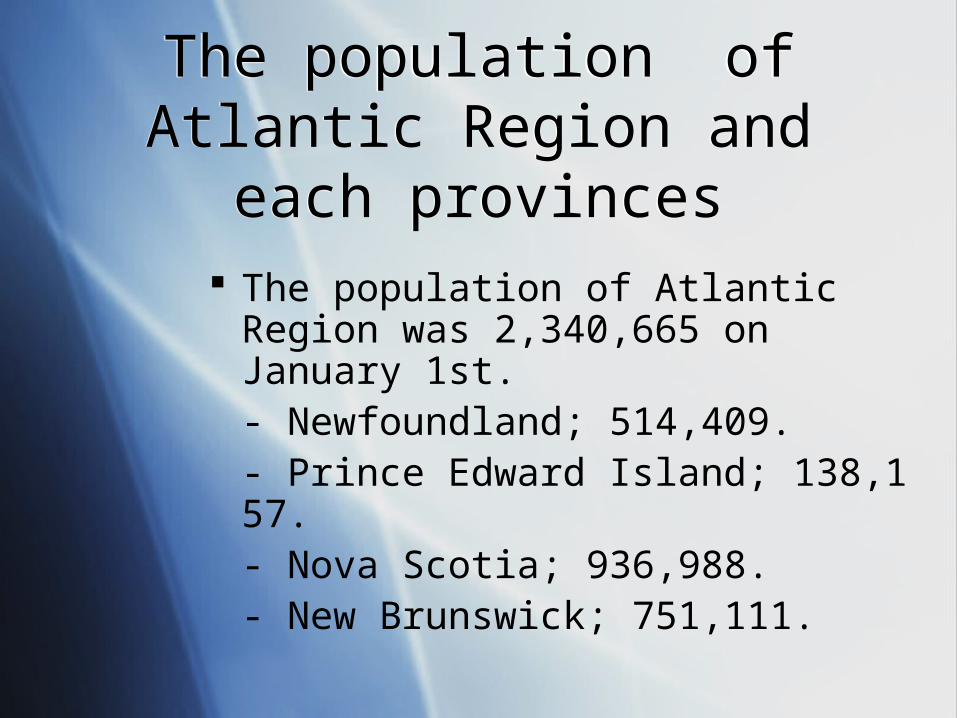
The population of Atlantic Region was 2,340,665 on January 1st. - Newfoundland; 514,409.- Prince Edward Island; 138,157.- Nova Scotia; 936,988.- New Brunswick; 751,111.

Why people living in Atlantic Region?
Why people living in Atlantic Region?
Atlantic region is good for fishing, hinting, and there are many forest. People cut trees to make paper, furniture, pulp, cardboard, and etc. Also this region is close to ocean, and has oil and gas. There are two main off shore drilling rigs for oil and gas in this region. One is around Nova Scotia and one is around Newfoundland. Also they have drills in the ocean and it very expensive to drill from ocean but it will bring a lot of money. So Atlantic region is good place to live.
Atlantic region is good for fishing, hinting, and there are many forest. People cut trees to make paper, furniture, pulp, cardboard, and etc. Also this region is close to ocean, and has oil and gas. There are two main off shore drilling rigs for oil and gas in this region. One is around Nova Scotia and one is around Newfoundland. Also they have drills in the ocean and it very expensive to drill from ocean but it will bring a lot of money. So Atlantic region is good place to live.
WeatherWeather
The ocean helps the temperature to make milder or cooler. Sometimes ocean bring the storms or bad weather. Each provinces has own pattern of weather. Newfoundland is one of the foggiest places in the region, Nova Scotia is the warmest because of the ocean's effect on the weather, and in New Brunswick is ocean doesn’t effect the weather because it’s farthest province in the Atlantic region. P.E.I. is the only province that is completely surrounded by water. P.E.I.'s weather can change suddenly due to its' location in the region.
The ocean helps the temperature to make milder or cooler. Sometimes ocean bring the storms or bad weather. Each provinces has own pattern of weather. Newfoundland is one of the foggiest places in the region, Nova Scotia is the warmest because of the ocean's effect on the weather, and in New Brunswick is ocean doesn’t effect the weather because it’s farthest province in the Atlantic region. P.E.I. is the only province that is completely surrounded by water. P.E.I.'s weather can change suddenly due to its' location in the region.

History of Atlantic RegionHistory of Atlantic Region
There are high population of British and French people in the Atlantic Region, because they came to Canada long time ago and people started to living in this Atlantic region.
There are high population of British and French people in the Atlantic Region, because they came to Canada long time ago and people started to living in this Atlantic region.

Population density mapPopulation density map
There are high populationdensity in around the south of Atlantic region, especially in the Nova Scotia, P.E.I. and Newfoundland. In Newfoundland, There are not
many people on the south and north-west coast. However in the far east there is a part of the island with a very high density. In the southern proinces, there are a lot of people. However, the area with the most people is Nova Scotia where it is almost all blue (high
density).
QuickTime˛ Ç∆ǻǵ êLí£ÉvÉçÉOÉâÉÄǙDZÇÃÉsÉNÉ`ÉÉÇ å©ÇÈÇΩÇflÇ…ÇÕïKóvÇ≈Ç∑ÅB

BibliographyBibliography
VIA Rail Canada Inc, “Weather and climate for the Atlantic region” [Internet]
1995. Available :
www.viarail.ca [2006. May 26]
Author Unknown, “Regional Aspects of Climate Change” [Internet]
2002, February 12. Avaliable :
http://adaptation.nrcan.gc.ca [2006. May 26]
VIA Rail Canada Inc, “Weather and climate for the Atlantic region” [Internet]
1995. Available :
www.viarail.ca [2006. May 26]
Author Unknown, “Regional Aspects of Climate Change” [Internet]
2002, February 12. Avaliable :
http://adaptation.nrcan.gc.ca [2006. May 26]

Population Pyramid Population Pyramid
This represent of the population pyramid of Atlantic region. There is baby boom between age of 30 to 60 and baby bust less than age of 30. The babyboom echo is not yet visible in the maratimes.
This represent of the population pyramid of Atlantic region. There is baby boom between age of 30 to 60 and baby bust less than age of 30. The babyboom echo is not yet visible in the maratimes.
Baby boom
Baby bust

Bibliography Bibliography
http://www.statcan.ca/Daily/English/060328/d060328e.htm
http://www.phac-aspc.gc.ca/canada/regions/atlantic/Publications/Shifting_sands/1_e.html
http://webacc.fsd38.ab.ca/schools/Gibson/milz/geography/atlantic_maritime_sw/atlantic_maritime1.htm
http://www.statcan.ca/Daily/English/060328/d060328e.htm
http://www.phac-aspc.gc.ca/canada/regions/atlantic/Publications/Shifting_sands/1_e.html
http://webacc.fsd38.ab.ca/schools/Gibson/milz/geography/atlantic_maritime_sw/atlantic_maritime1.htm