Embed Size (px)
Citation preview

August-September
NSF NOAA NRL NCAR UW UM
27th Conference on Hurricanes and Tropical Meteorology, Monterey, CA, 27 April 2006

Shuyi ChenR. Houze
Wen-Chau Lee Jim Moore

Katrina Ophelia Rita
Hurricanes investigated in RAINEX

Motivation for RAINEX
Understanding Rapid Intensity Changes


Cat 2
Cat 3
Cat 5
Cat 4
Day 1 2 43 5
Famous Rapidly Intensifing StormHurricane Opal (1995)
Pressure drop
How do interactions of eyewalls & rainbands in the mature storm…
…lead to intensity changes like these?
rain
ban
d
Intensity change problem:

RAINEX Flight CoordinationRAINEX Flight Coordination
ELDORA radar
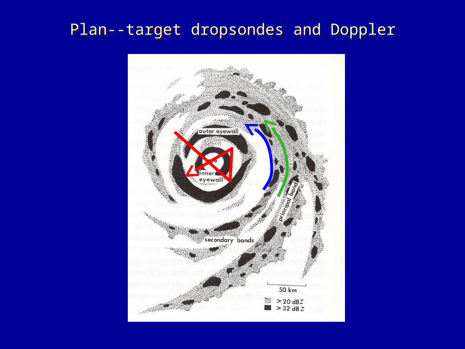
Plan--target dropsondes and DopplerPlan--target dropsondes and DopplerPlan--target dropsondes and DopplerPlan--target dropsondes and Doppler

Plan--target dropsondes and DopplerPlan--target dropsondes and DopplerPlan--target dropsondes and DopplerPlan--target dropsondes and Doppler

KatrinaKatrina

Katrina-28 AugustKatrina-28 August
NRL
convectiveupwind
stratiformdownwind
Atlas et al. ‘63

Katrina-28 AugustKatrina-28 August
ELDORA data
Ref
VelBarnes et al. ‘83
NRL

Katrina-28 AugustKatrina-28 August
Confirms “Barnes” structure

RitaRita

RAINEX Flights in Hurricane RitaRAINEX Flights in Hurricane Rita

Rita-21 September Intensifying to Cat. 5Rita-21 September Intensifying to Cat. 5

0ºC
Rita-21 September Intensifying to Cat. 5Rita-21 September Intensifying to Cat. 5

DropsondesDropsondes
Eye Eyewall
Rita-21 September Intensifying to Cat. 5Rita-21 September Intensifying to Cat. 5

Rita-22 September-Concentric EyewallsRita-22 September-Concentric Eyewalls

ELDORA composite Kossin et al. 2000
vorticity
Rita-22 September-Concentric EyewallsRita-22 September-Concentric Eyewalls

Dropsonde in the “moat” region
1802 UTC 22 September ‘05
Rita-22 September-Concentric EyewallsRita-22 September-Concentric Eyewalls

Rita-23 September-ShearedRita-23 September-Sheared
ShearShear
Rogers et al. ‘03

OpheliaOphelia

A
B
Ophelia-9 September-Dry Midlevel InflowOphelia-9 September-Dry Midlevel Inflow
B A
Dry air
Ref
Vel

Data AvailabilityData Availability

CONCLUSIONS
RAINEX Notables:
• 3 hurricanes—Katrina, Ophelia, & Rita• Innovative satellite-based flight control• First use of ELDORA in a hurricane• Data available via NCAR Field Catalog
Katrina and Rita details:
• K & R’s spiral rainbands had Atlas & Barnes structures• R sampled in 3 stages: rapid int., 2nd eyewall, shear• Echo cores in eyewalls were linear & oblique• Moat region had eye-like sounding• Dry air entered in subsiding mesoscale midlevel inflows
Katrina Ophelia Rita

ThanksThanks