Embed Size (px)
Citation preview
Description The Avalon Marshes has many layers of ancient history below its surface. This activity will help your pupils understand some of the wetlands’ past. You can adapt this activity to different levels by choosing which cards to include in the activity.
Equipment Picture cards. You could use string and pegs/paper clips to display the finished timeline.
Time 45 minutes (plus extra for extension activities)
Curriculum
KS2 History— Develop a chronologically secure knowledge and understanding of British and local history (links to Stone-Age, Iron-Age, Romans, Anglo-Saxons, and British history beyond 1066).
KS3 History—Extend chronologically secure knowledge and understanding of British and local history (links to Medieval Britain, industry, World Wars.
Aims Explore key periods and important events in the history of the Avalon Marshes.
Create a timeline showing a chronological history of the wetlands
Learning outcomes
Following this activity pupils should be able to:
Describe important points in the past of the Avalon Marshes
Give examples of changes that have been seen in the Wetlands over time
Linked resources
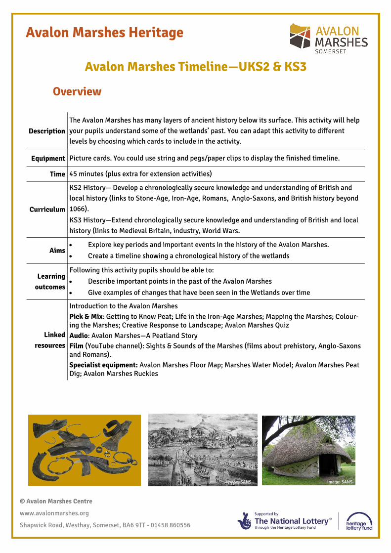
Introduction to the Avalon Marshes Pick & Mix: Getting to Know Peat; Life in the Iron-Age Marshes; Mapping the Marshes; Colour-ing the Marshes; Creative Response to Landscape; Avalon Marshes Quiz Audio: Avalon Marshes—A Peatland Story Film (YouTube channel): Sights & Sounds of the Marshes (films about prehistory, Anglo-Saxons and Romans). Specialist equipment: Avalon Marshes Floor Map; Marshes Water Model; Avalon Marshes Peat Dig; Avalon Marshes Ruckles
Image: SANS
© Avalon Marshes Centre
www.avalonmarshes.org
Shapwick Road, Westhay, Somerset, BA6 9TT - 01458 860556
Avalon Marshes Heritage
Avalon Marshes Timeline—UKS2 & KS3
Overview
Image: SANS
Prepare the activity by printing out the cards. They are designed to be printed double sided! Or for the black
and white sheets to be stuck onto the back of the coloured sheets. Choose which cards you want to use,
based on the level of your pupils and the focus of your lesson.
Introduce the Avalon Marshes to your pupils. Explain that the Wetlands have gone through many changes
over thousands of years—once it was under the sea! Over many centuries people have managed the
wetlands, changing water levels and impacting on the landscape. Lots of things from the past have been
preserved by the water-logged peat in the Marshes, and archaeologists have discovered a lot about how
people lived in the past, by studying the artefacts.
Put your class in pairs and give each pair a card. Choose one side/corner of the room to be 5000BC, and the
opposite side/corner to be present day. Challenge the class to get into chronological order without your
help. Go through the timeline to check the order, and discuss the changes that have happened over time.
Whilst doing this, write on the white board the different periods of history, and for each one ask pupils to
pick out the highlighted words on their card, and write them on the board.
Once you have discussed all of the cards, peg them on string across a wall, so the timeline can be seen by all
pupils.
If your school is local to the Marshes, ask pupils to think of historical events that are missing from the
timeline (when the school was built, a local anecdote about a village etc) and add these to blank cards that
can be added to the timeline.
To end:
Ask pupils to give and example of a significant point in the Marshes’ history
Ask pupils to describe how the Marshes have changed over time
Extension:
Included in this document is a page to print so that pupils can write/draw their own Avalon Marshes
timeline.
Do role-play activities linked to a chosen period of history in the Marshes.
Print maps from the ‘Mapping the Marshes’ activity, and ask pupils to label the map with key historical
information.
Use the Avalon Marshes Floor Map (for hire from the Avalon Marshes Centre) and place the cards on
the map to show where different events have happened.
© Avalon Marshes Centre
www.avalonmarshes.org
Shapwick Road, Westhay, Somerset, BA6 9TT - 01458 860556
Avalon Marshes Heritage
Teachers’ notes—
+
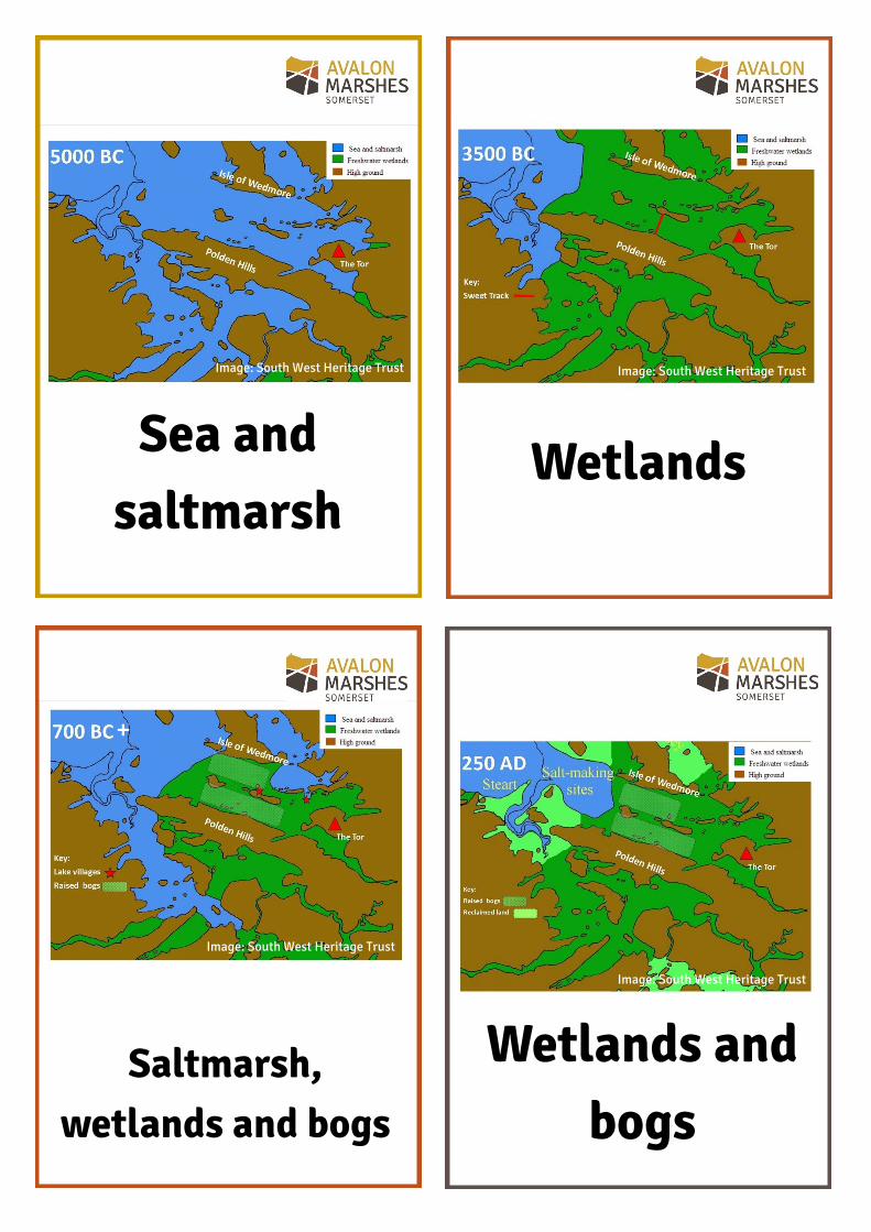
Sea and saltmarsh
Wetlands
Saltmarsh, wetlands and bogs
Wetlands and bogs
Image: South West Heritage Trust Image: South West Heritage Trust
Image: South West Heritage Trust
Image: South West Heritage Trust
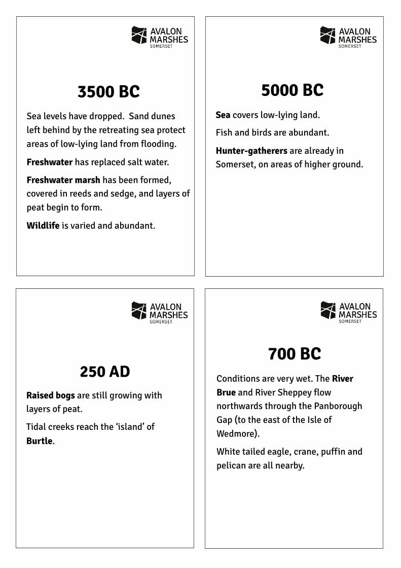
5000 BC Sea covers low-lying land.
Fish and birds are abundant.
Hunter-gatherers are already in Somerset, on areas of higher ground.
3500 BC Sea levels have dropped. Sand dunes left behind by the retreating sea protect areas of low-lying land from flooding.
Freshwater has replaced salt water.
Freshwater marsh has been formed, covered in reeds and sedge, and layers of peat begin to form.
Wildlife is varied and abundant.
250 AD Raised bogs are still growing with layers of peat.
Tidal creeks reach the ‘island’ of Burtle.
700 BC Conditions are very wet. The River Brue and River Sheppey flow northwards through the Panborough Gap (to the east of the Isle of Wedmore).
White tailed eagle, crane, puffin and pelican are all nearby.
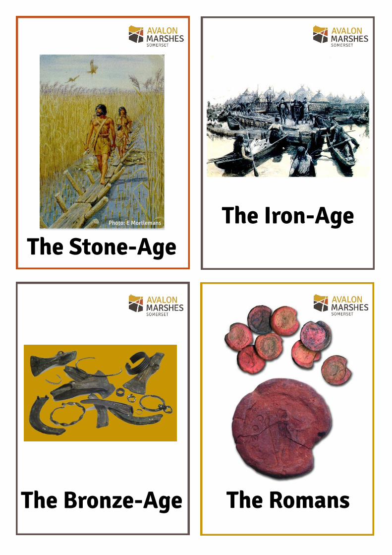
The Iron-Age
The Bronze-Age The Romans
The Stone-Age Photo: E Mortlemans
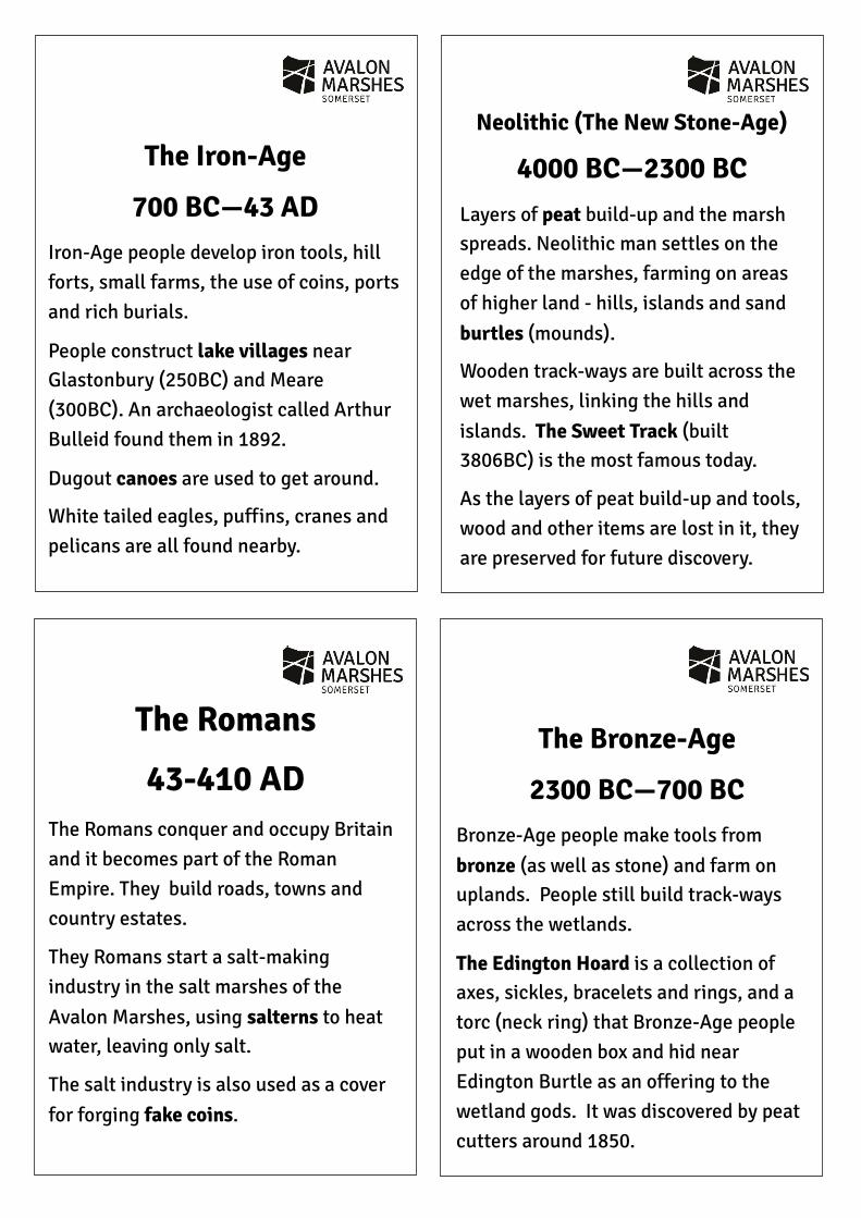
Neolithic (The New Stone-Age)
4000 BC—2300 BC Layers of peat build-up and the marsh spreads. Neolithic man settles on the edge of the marshes, farming on areas of higher land - hills, islands and sand burtles (mounds).
Wooden track-ways are built across the wet marshes, linking the hills and islands. The Sweet Track (built 3806BC) is the most famous today.
As the layers of peat build-up and tools, wood and other items are lost in it, they are preserved for future discovery.
The Iron-Age
700 BC—43 AD Iron-Age people develop iron tools, hill forts, small farms, the use of coins, ports and rich burials.
People construct lake villages near Glastonbury (250BC) and Meare (300BC). An archaeologist called Arthur Bulleid found them in 1892.
Dugout canoes are used to get around.
White tailed eagles, puffins, cranes and pelicans are all found nearby.
The Bronze-Age
2300 BC—700 BC Bronze-Age people make tools from bronze (as well as stone) and farm on uplands. People still build track-ways across the wetlands.
The Edington Hoard is a collection of axes, sickles, bracelets and rings, and a torc (neck ring) that Bronze-Age people put in a wooden box and hid near Edington Burtle as an offering to the wetland gods. It was discovered by peat cutters around 1850.
The Romans
43-410 AD The Romans conquer and occupy Britain and it becomes part of the Roman Empire. They build roads, towns and country estates.
They Romans start a salt-making industry in the salt marshes of the Avalon Marshes, using salterns to heat water, leaving only salt.
The salt industry is also used as a cover for forging fake coins.
The Anglo-Saxons
The Vikings The Normans
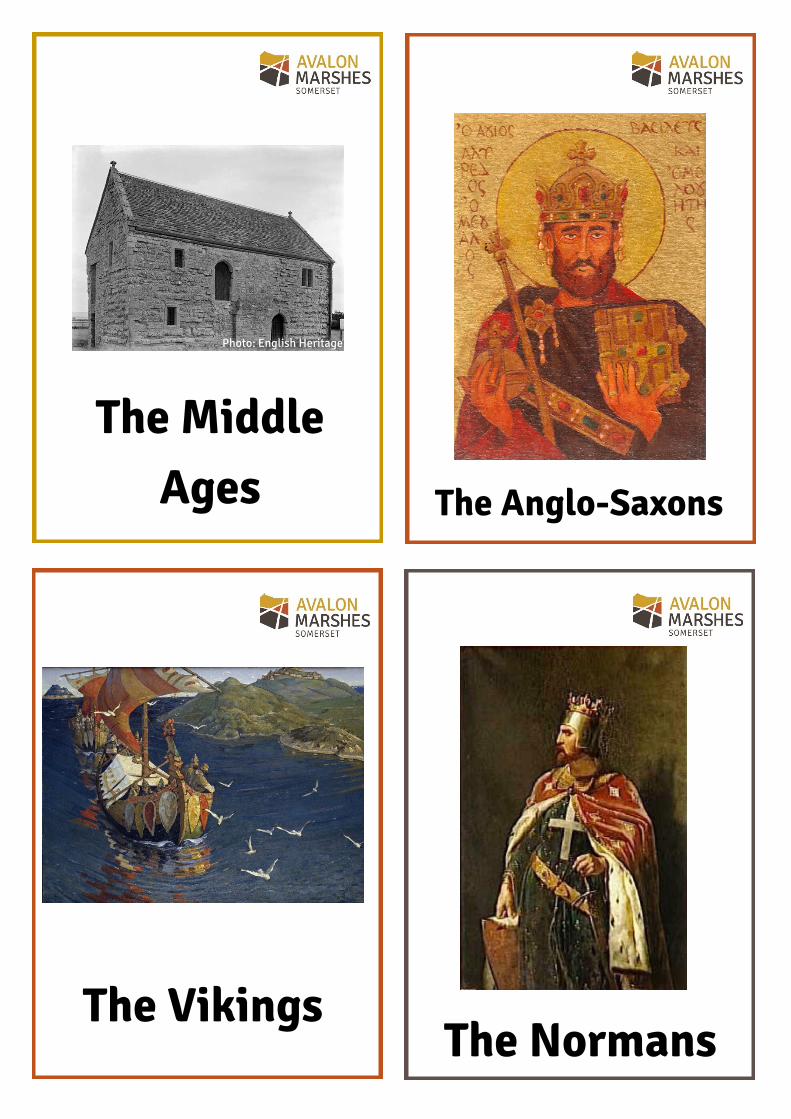
The Middle Ages
Photo: English Heritage
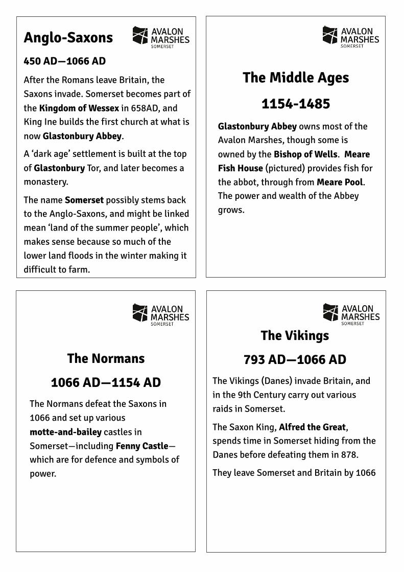
Anglo-Saxons 450 AD—1066 AD
After the Romans leave Britain, the Saxons invade. Somerset becomes part of the Kingdom of Wessex in 658AD, and King Ine builds the first church at what is now Glastonbury Abbey.
A ‘dark age’ settlement is built at the top of Glastonbury Tor, and later becomes a monastery.
The name Somerset possibly stems back to the Anglo-Saxons, and might be linked mean ‘land of the summer people’, which makes sense because so much of the lower land floods in the winter making it difficult to farm.
The Normans
1066 AD—1154 AD The Normans defeat the Saxons in 1066 and set up various motte-and-bailey castles in Somerset—including Fenny Castle—which are for defence and symbols of power.
The Vikings
793 AD—1066 AD The Vikings (Danes) invade Britain, and in the 9th Century carry out various raids in Somerset.
The Saxon King, Alfred the Great, spends time in Somerset hiding from the Danes before defeating them in 878.
They leave Somerset and Britain by 1066
The Middle Ages
1154-1485 Glastonbury Abbey owns most of the Avalon Marshes, though some is owned by the Bishop of Wells. Meare Fish House (pictured) provides fish for the abbot, through from Meare Pool. The power and wealth of the Abbey grows.
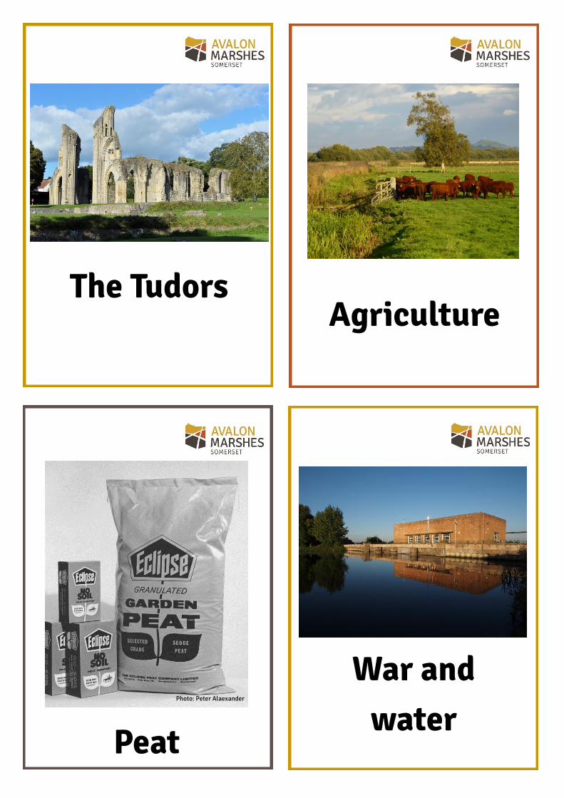
The Tudors Agriculture
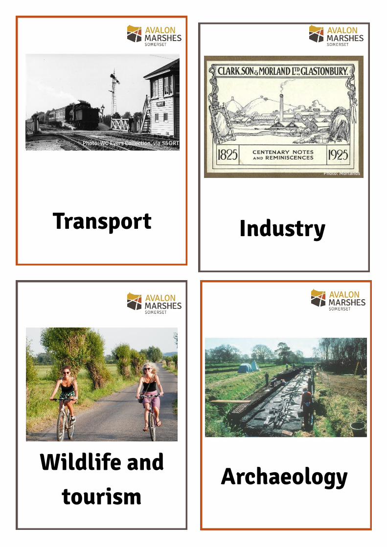
Peat
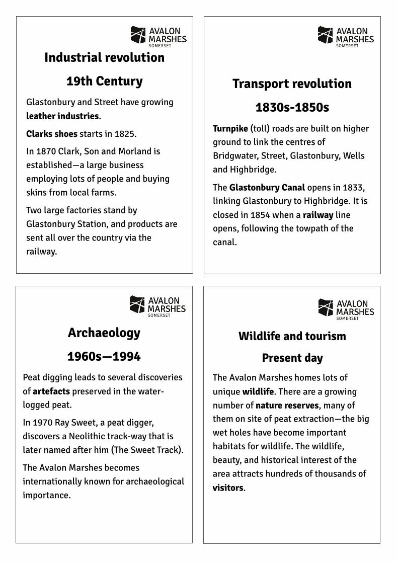
War and water
Photo: Peter Alaexander
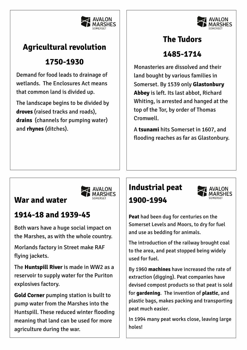
Agricultural revolution
1750-1930 Demand for food leads to drainage of wetlands. The Enclosures Act means that common land is divided up.
The landscape begins to be divided by droves (raised tracks and roads), drains (channels for pumping water)and rhynes (ditches).
The Tudors
1485-1714 Monasteries are dissolved and their land bought by various families in Somerset. By 1539 only Glastonbury Abbey is left. Its last abbot, Richard Whiting, is arrested and hanged at the top of the Tor, by order of Thomas Cromwell.
A tsunami hits Somerset in 1607, and flooding reaches as far as Glastonbury.
War and water
1914-18 and 1939-45 Both wars have a huge social impact on the Marshes, as with the whole country.
Morlands factory in Street make RAF flying jackets.
The Huntspill River is made in WW2 as a reservoir to supply water for the Puriton explosives factory.
Gold Corner pumping station is built to pump water from the Marshes into the Huntspill. These reduced winter flooding meaning that land can be used for more agriculture during the war.
Industrial peat 1900-1994
Peat had been dug for centuries on the Somerset Levels and Moors, to dry for fuel and use as bedding for animals.
The introduction of the railway brought coal to the area, and peat stopped being widely used for fuel.
By 1960 machines have increased the rate of extraction (digging). Peat companies have devised compost products so that peat is sold for gardening. The invention of plastic, and plastic bags, makes packing and transporting peat much easier.
In 1994 many peat works close, leaving large holes!
Transport Industry
Wildlife and tourism
Archaeology
Photo: WC Eyers Collection, via S&DRT
Photo: Morlands
Wildlife and tourism
Present day
The Avalon Marshes homes lots of unique wildlife. There are a growing number of nature reserves, many of them on site of peat extraction—the big wet holes have become important habitats for wildlife. The wildlife, beauty, and historical interest of the area attracts hundreds of thousands of visitors.
Industrial revolution
19th Century Glastonbury and Street have growing leather industries.
Clarks shoes starts in 1825.
In 1870 Clark, Son and Morland is established—a large business employing lots of people and buying skins from local farms.
Two large factories stand by Glastonbury Station, and products are sent all over the country via the railway.
Transport revolution
1830s-1850s Turnpike (toll) roads are built on higher ground to link the centres of Bridgwater, Street, Glastonbury, Wells and Highbridge.
The Glastonbury Canal opens in 1833, linking Glastonbury to Highbridge. It is closed in 1854 when a railway line opens, following the towpath of the canal.
Archaeology
1960s—1994 Peat digging leads to several discoveries of artefacts preserved in the water-logged peat.
In 1970 Ray Sweet, a peat digger, discovers a Neolithic track-way that is later named after him (The Sweet Track).
The Avalon Marshes becomes internationally known for archaeological importance.


5000BC
Avalon M
arshes Timeline
Present