Embed Size (px)
Citation preview

Transit Connectivity Evaluation
in Southeast Seattle
Tianle Cheng, Julie Coronado, & Neela Vahora
URBDP 422 - Group ProjectMarch 13, 2014

Background
• Transit-Dependent Communities o Low-income o Minorities o Auto-oriented development
McKenzie 2013, Tomer 2011
• Metro aims to “promote fair and equal access to Metro’s services and activities for all people in our service area, including minority populations and people who have limited English proficiency, disabilities, or low incomes.”
King County Metro Transit Report 2013

Why Southeast Seattle?
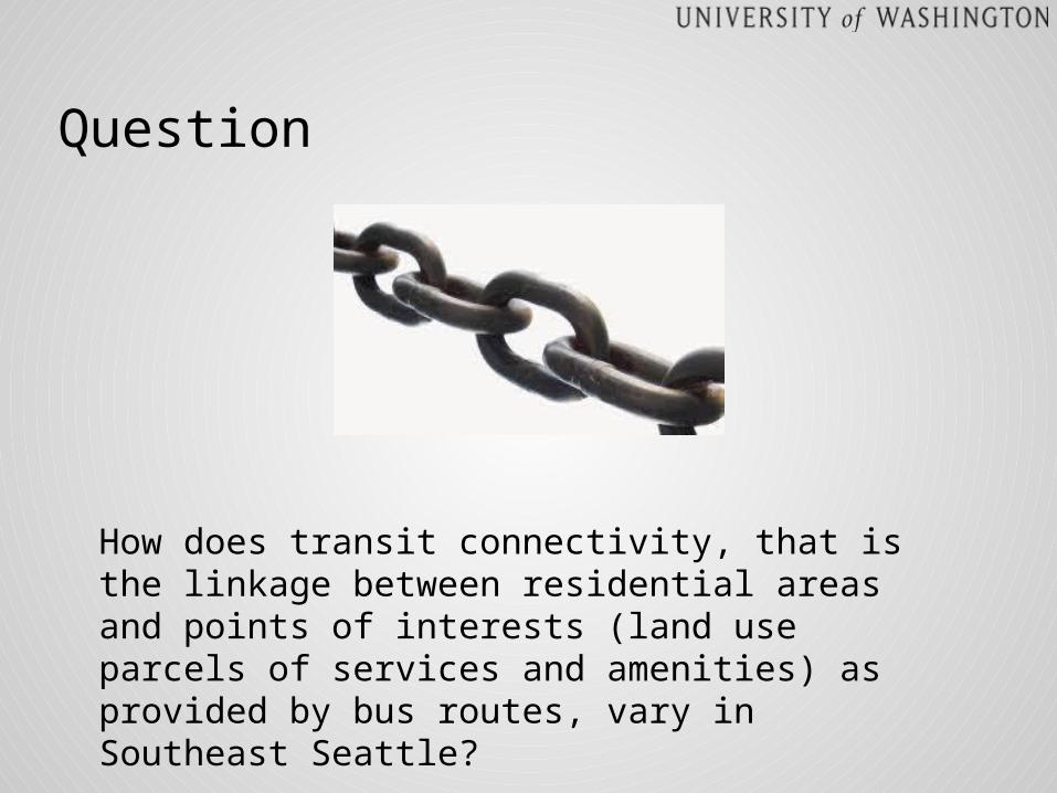
Question
How does transit connectivity, that is the linkage between residential areas and points of interests (land use parcels of services and amenities) as provided by bus routes, vary in Southeast Seattle?

Access
Connectivity
Increased Ridership
Safety & Comfort
Frequency & Reliability
Origin: neighborhood (Block Group)
Transit Network
Spatial
Temporal
Destinations:Points of Interest
Supporting Infrastructure
Bus Stop Facilities
Fare Cost
Outreach & Public Knowledge
Spatial Extent
Routes
Stops
Areas of transit dependency
Scale
Median HH Income
Auto-oriented development
Pop. Density
Land Use:● Gov. Services● Retail/Services● School/ daycare● Park/playground● Public Facilities● Recreation/entertainment

Data Dictionary
File Type
Function
Seattle Block Groups .shp defining city boundary
Seattle Neighborhoods
.shp defining study boundary (Southeast Seattle)
K.C. Metro Bus Stops Spring 2012
.shp creating buffer areas around selected bus stops
K.C. Metro Bus Routes Spring 2012
.shp used for performing intersection with selected block groups
Seattle Land Use Parcels
.shp used for making selection to get parcels for points of interest

Procedure
Select by Attribute
Select by Location

Procedure
Select by LocationBuffer
Select by Location
Frequency Table
Procedure
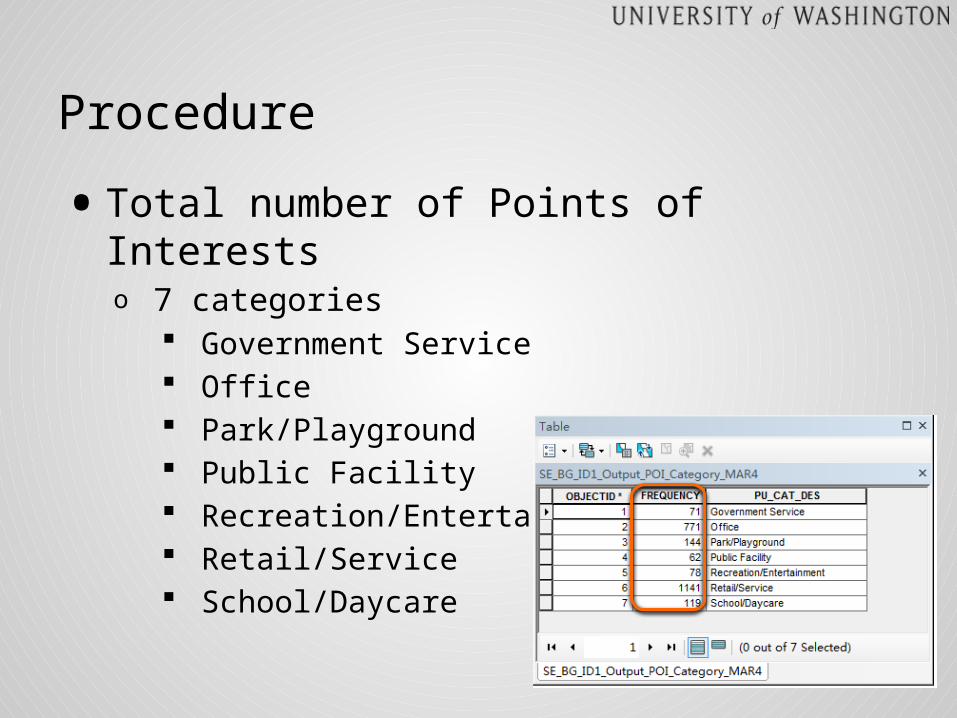
• Total number of Points of Interestso 7 categories
Government Service Office Park/Playground Public Facility Recreation/Entertainment Retail/Service School/Daycare

Procedure
• (Shannon) Diversity Indexo It accounts for both abundance and evennesso Equation
Number of Category
Distribution
Diversity Index Value
1 Evenly 0
2 Evenly 0.693
4 Evenly 1.386
H = 1.258
Findings & Analysis

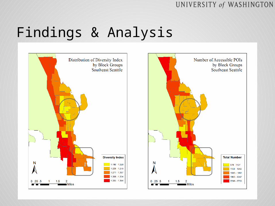
Findings & Analysis
● I-90 Junction● Rainier Beach area● Martin Luther King Jr. Way S. corridor
Diversity Index Number of Accessible POIs
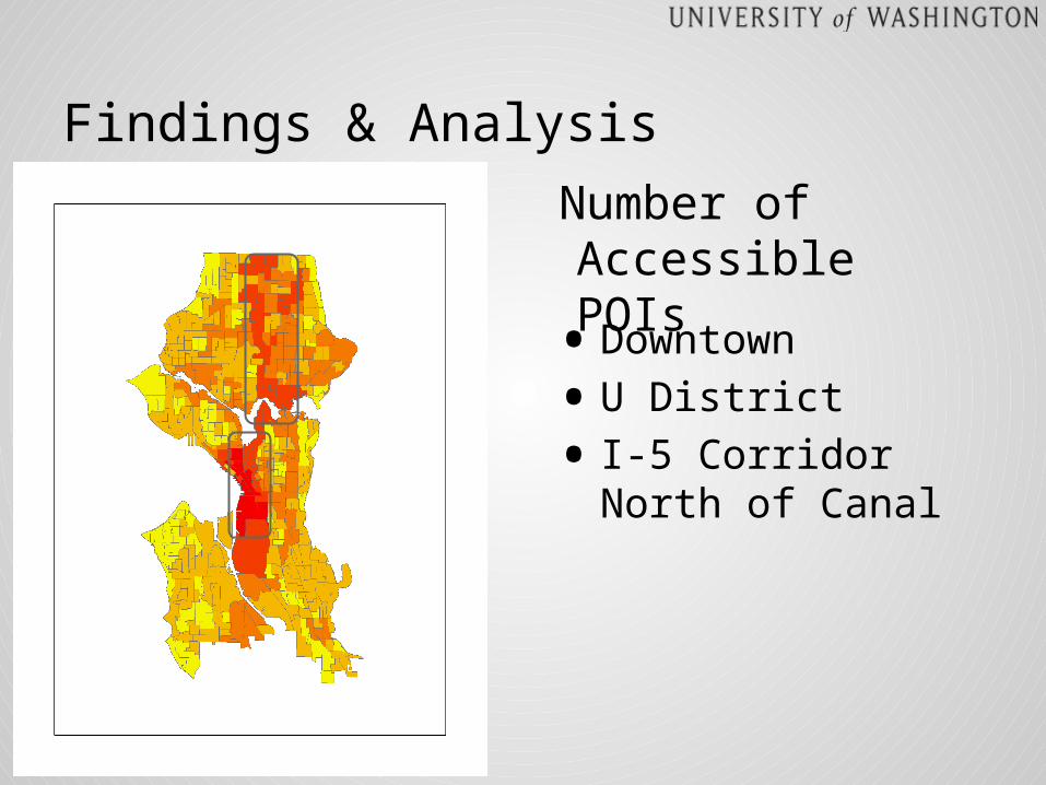
Findings & Analysis
Number of Accessible POIs
• Downtown
• U District
• I-5 Corridor North of Canal

Limitations
• Frequency of service
• Transfer
• POIs within block groups are also included
• POI data mainly for Seattle
• Euclidian vs. Network Distance
• Other modes of transit excluded (Light Rail, Sound Transit buses)

Implications & Next Steps
• Diversity index of census block groups reveals connectivity to services and amenities
• King County Metro can use the diversity index to improve services
• Apply similar methods to entire city
Thank you!
Questions?