Embed Size (px)
Citation preview

© 2011-2012 Towson University All Rights Reserved
Balloon Mapping:
Creating High Resolution Aerial Photographs at a Low Cost
Jay Morgan and Phil Reese

2
BALLOON MAPPING
Taking aerial photographs from a tethered balloon is not a new idea
1858 - first aerial photograph from a balloon was taken taken of Paris
by a French photographer, Felix Tournachon
Tournachon was also known by the pseudonym “Nadar”
3
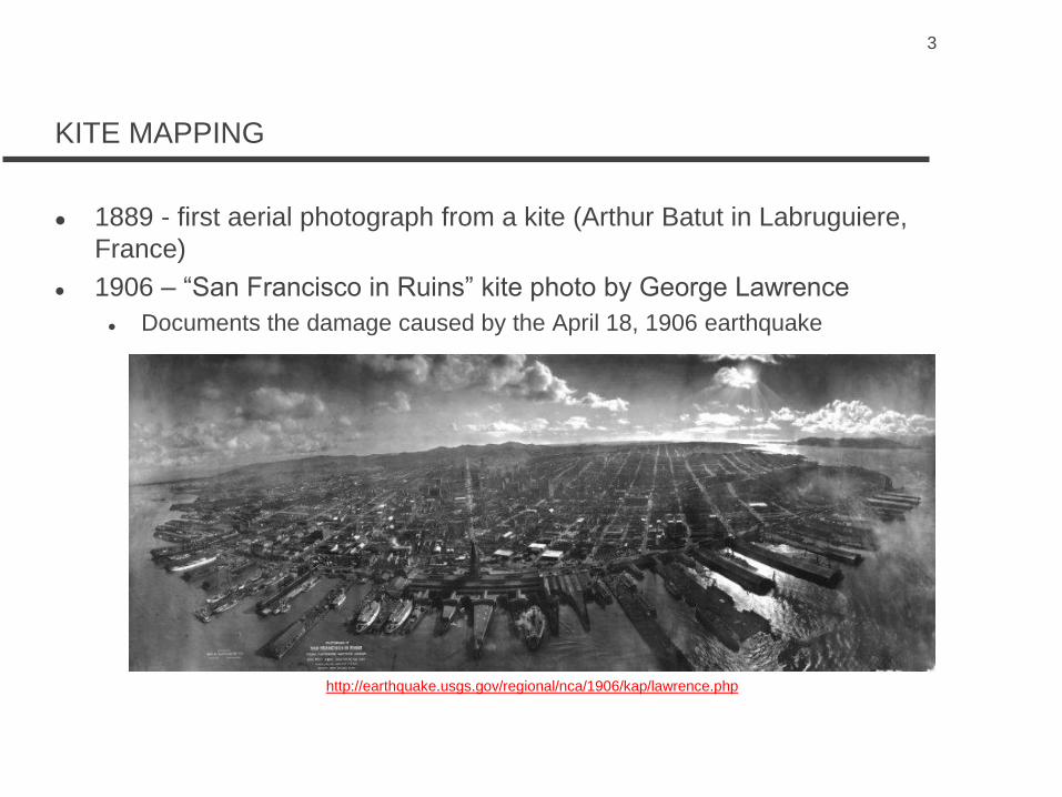
KITE MAPPING
1889 - first aerial photograph from a kite (Arthur Batut in Labruguiere,
France)
1906 – “San Francisco in Ruins” kite photo by George Lawrence
Documents the damage caused by the April 18, 1906 earthquake
http://earthquake.usgs.gov/regional/nca/1906/kap/lawrence.php

4
INSPIRATION FOR OUR PROJECT
Support for efforts to “democratize” mapping
Grassroots Mapping (part of the Public Laboratory for Open Technology
and Science)
http://www.grassrootsmapping.org/
http://publictechnology.org/
Maryland Chapter of the American Planning Association
Submitted proposal to fund a project to investigate the potential use of
balloon aerial photography
Grant monies ($1,000) had to be used for the purchase of equipment
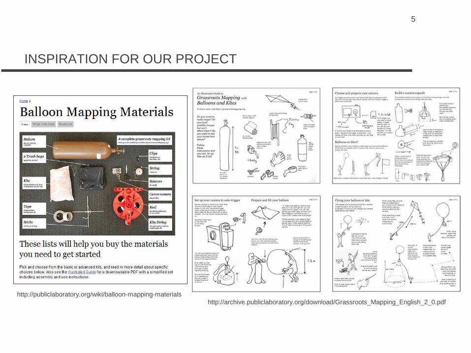
5
INSPIRATION FOR OUR PROJECT
http://publiclaboratory.org/wiki/balloon-mapping-materials
http://archive.publiclaboratory.org/download/Grassroots_Mapping_English_2_0.pdf

6
INSPIRATION FOR OUR PROJECT
http://publiclaboratory.org/place/western-carolina-university

7
EQUIPMENT PURCHASED OR RENTED
Purchased
Brooxes Simplex manually-aimed camera frame and Picavet suspension
system
Canon PowerShot SD940IS (Elph) 12.1 megapixel digital camera with 4X
wide angle optical image stabilized zoom and 2.7-inch LCD
4 MB SD card for the Canon camera
TrackStick Mini GPS tracking system and data logging device
5.5 foot weather balloon and inflation hose
500 feet of 200 pound Dacron line and winder
“The Canon Camera Hackers Manual” book
Vinyl survey targets (4)
Rented
Helium cylinder with 80 cubic feet of helium from Earlbeck Gases &
Technologies

8
CANON CAMERA AND ACCESSORIES

9
TRACK STICK MINI GPS RECEIVER AND DATA RECORDER

10
BROOXES SIMPLEX RIG AND PICAVET SUSPENSION

11
WINDER, INFLATION HOSE, AND BALLOON
12
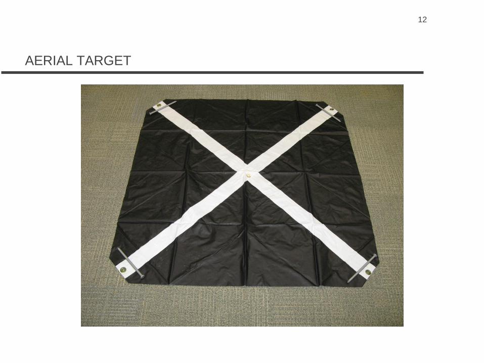
AERIAL TARGET

13
PICAVET SUSPENSION SYSTEM
The Picavet suspension system, named after French inventor Pierre
Picavet, provides a level platform for balloon and kite aerial
photography

14
FIRST MISSION – AUGUST 26, 2011
The first mission was attempted the day before the arrival of Hurricane
Irene (less than 10 percent cloud cover and winds were less than 5
miles per hour)
We had no idea if our “platform” would work
Given the rotation of the camera frame due to the wind we were
concerned that our photographs would be blurred
A total of 167 aerial photographs were captured of the College of
Liberal Arts Building
Assembly of the platform and balloon inflation took approximatey one hour
to complete
The first mission took approximately one hour to complete
We walked around the building stopping every 50 feet or so and staying at a
location for several minutes to take photographs
Our Canon hack script took a picture every 15 seconds (and focused the camera
prior to taking a picture)
15
FIRST MISSION – AUGUST 26, 2011

16
FIRST MISSION - PICTURES

17
FIRST MISSION – QUALITY OF AERIAL PHOTOGRAPHS

18
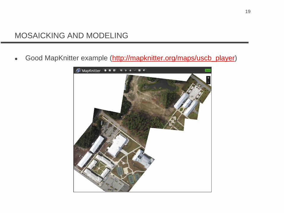
MOSAICKING AND MODELING
Grassroots Mapping recommends MapKnitter (http://mapknitter.org/)
19
MOSAICKING AND MODELING
Good MapKnitter example (http://mapknitter.org/maps/uscb_player)

20
MOSAICKING AND MODELING
Not so good MapKnitter example (http://mapknitter.org/maps/2011-5-3-
louisiana-bonnet-carre)

21
MOSAICKING AND MODELING
Photoshop
(http://www.wcu.edu/WebFiles/How_to_make_a_georeferenced_map_
from_many_aerial_photographs.doc)
22
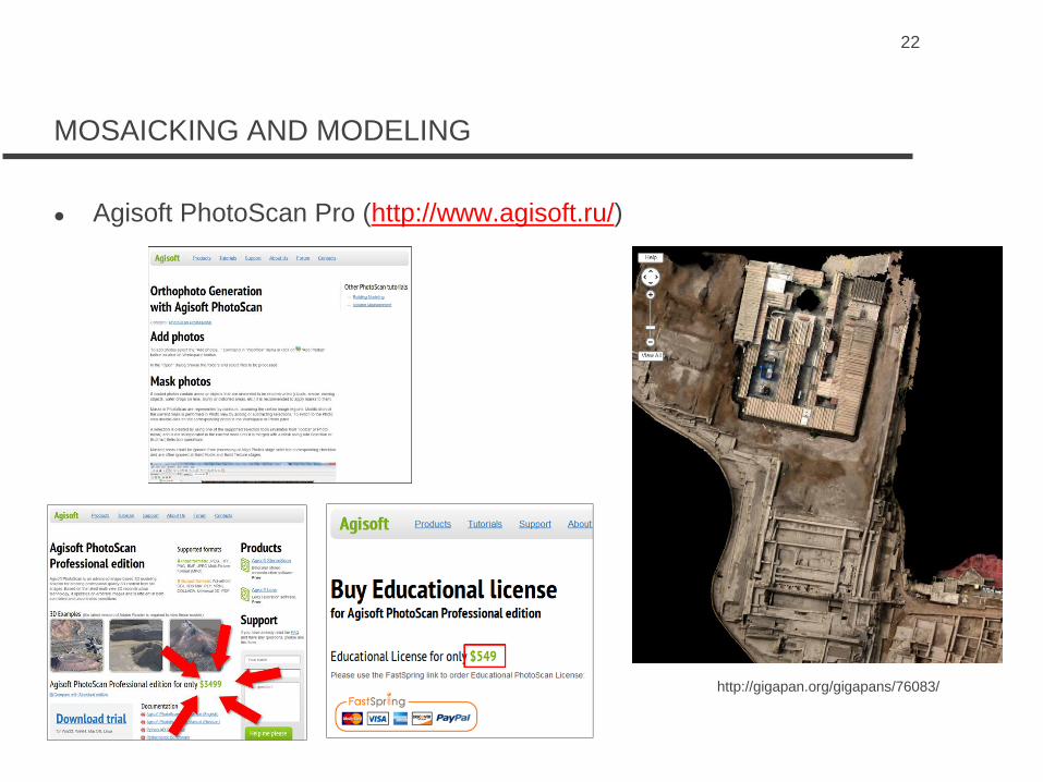
MOSAICKING AND MODELING
Agisoft PhotoScan Pro (http://www.agisoft.ru/)
http://gigapan.org/gigapans/76083/
24
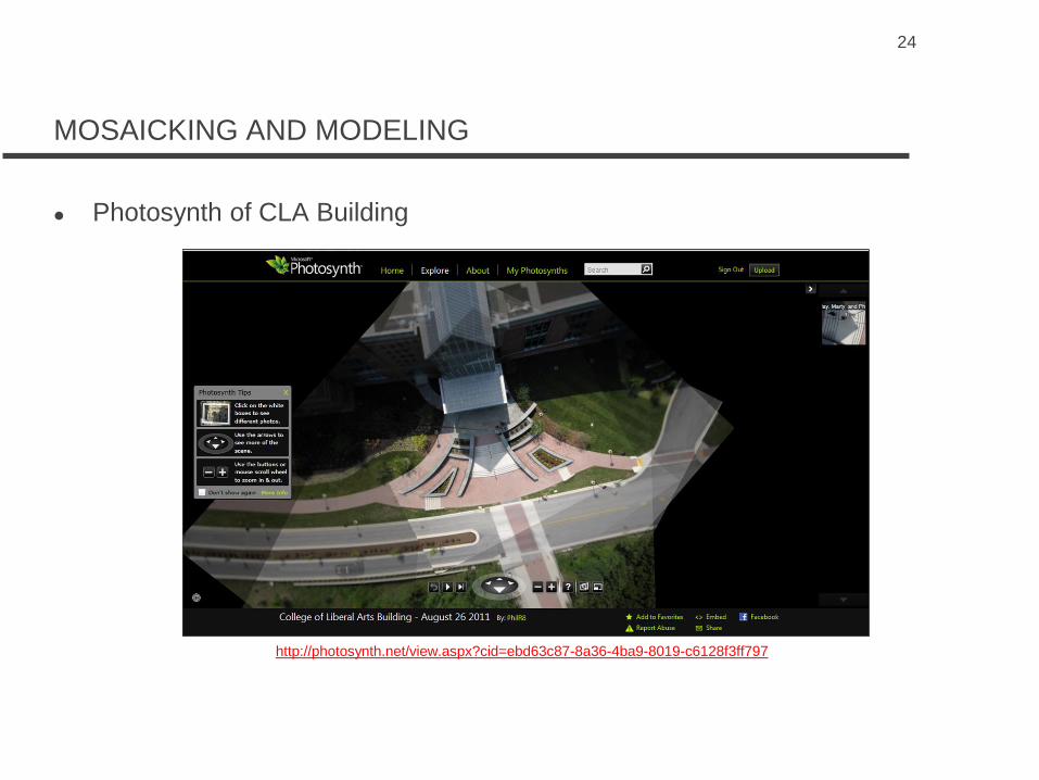
MOSAICKING AND MODELING
Photosynth of CLA Building
http://photosynth.net/view.aspx?cid=ebd63c87-8a36-4ba9-8019-c6128f3ff797

25
MOSAICKING AND MODELING
Photosynth overhead view

26
MOSAICKING AND MODELING
Photosynth point cloud

MOSAICKING AND MODELING
Microsoft Image Composite Editor (ICE)
27

MOSAICKING AND MODELING
Agisoft PhotoScan Pro: Masking photos, adding control points
28

MOSAICKING AND MODELING
Control Points – X, Y, Z with eTrex H
29

MOSAICKING AND MODELING
3D Model with control points, no texture
30

MOSAICKING AND MODELING
Textured 3D model
31

MOSAICKING AND MODELING
Exported 3D model (PDF)
32

PHOTOSCAN PRO – FINAL ORTHOPHOTOGRAPH
33

34
FUTURE PROJECTS
Create a map of the Towson campus
http://www.wcu.edu/27805.asp

35
FUTURE PROJECTS
Map the Chesapeake Bay shoreline (http://psds.wcu.edu/)
http://psds.shutterfly.com/

36
FUTURE PROJECTS
Map archaeological sites
(http://www.personal.psu.edu/nmc15/blogs/anthspace/2011/04/super-
simple-kap-and-photoscan-example.html)

37
FUTURE PROJECTS
Other ideas
Post-disaster mapping
Wetlands mapping
Impervious surfaces mapping

38
FUTURE IMPROVEMENTS??
Purchase a Gyro-stabilized camera platform
Purchase another Canon camera and have it converted for capture of
infrared photographs (http://www.lightpixel.com/)
Digital cameras can be converted to infrared (IR), ultraviolet (UV), and full
spectrum (UVIR and visible)
The addition of infrared will enable creating vegetation indexes (identifying
vegetative stress), mapping heat loss from roofs, and other multispectral
digital image processing applications
Purchase software to create an orthorectifed photomosaic (Agisoft
Photoscan Professional (32 bit)
Determine feasibility of purchasing a UAV or helicopter for taking aerial
photographs and aerial videos
http://www.sensefly.com/

39
CONTACT INFORMATION
Jay Morgan and Phil Reese
Geospatial Research and Education Laboratory
Towson University
8000 York Road
Baltimore, Maryland 21252-0001
410-704-2964
410-704-4702 (fax)
http://pages.towson.edu/morgan