Embed Size (px)
Citation preview
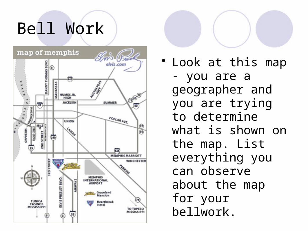
Bell Work
• Look at this map - you are a geographer and you are trying to determine what is shown on the map. List everything you can observe about the map for your bellwork.
Agenda
• Bellwork - the mystery map• Review GIS/GPS• Notes: Elements of a map• HW: Map Elements Worksheet• Reminder: Quiz MONDAY
Elements of a Map
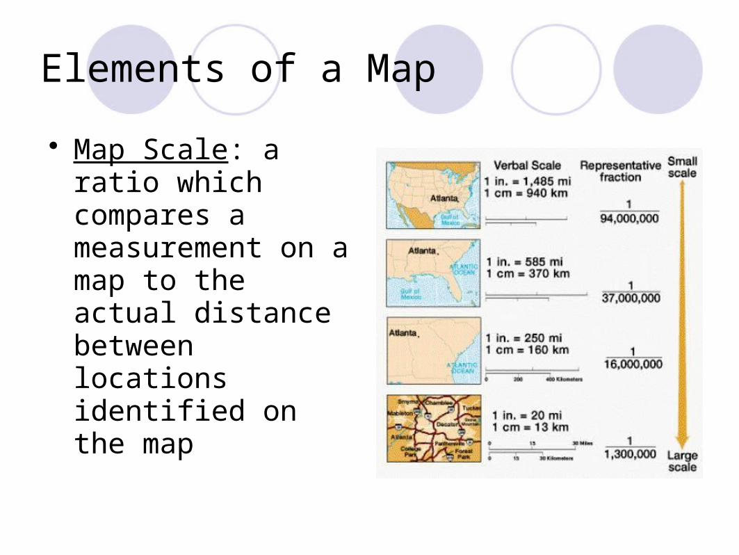
• Map Scale: a ratio which compares a measurement on a map to the actual distance between locations identified on the map
Elements of a Map
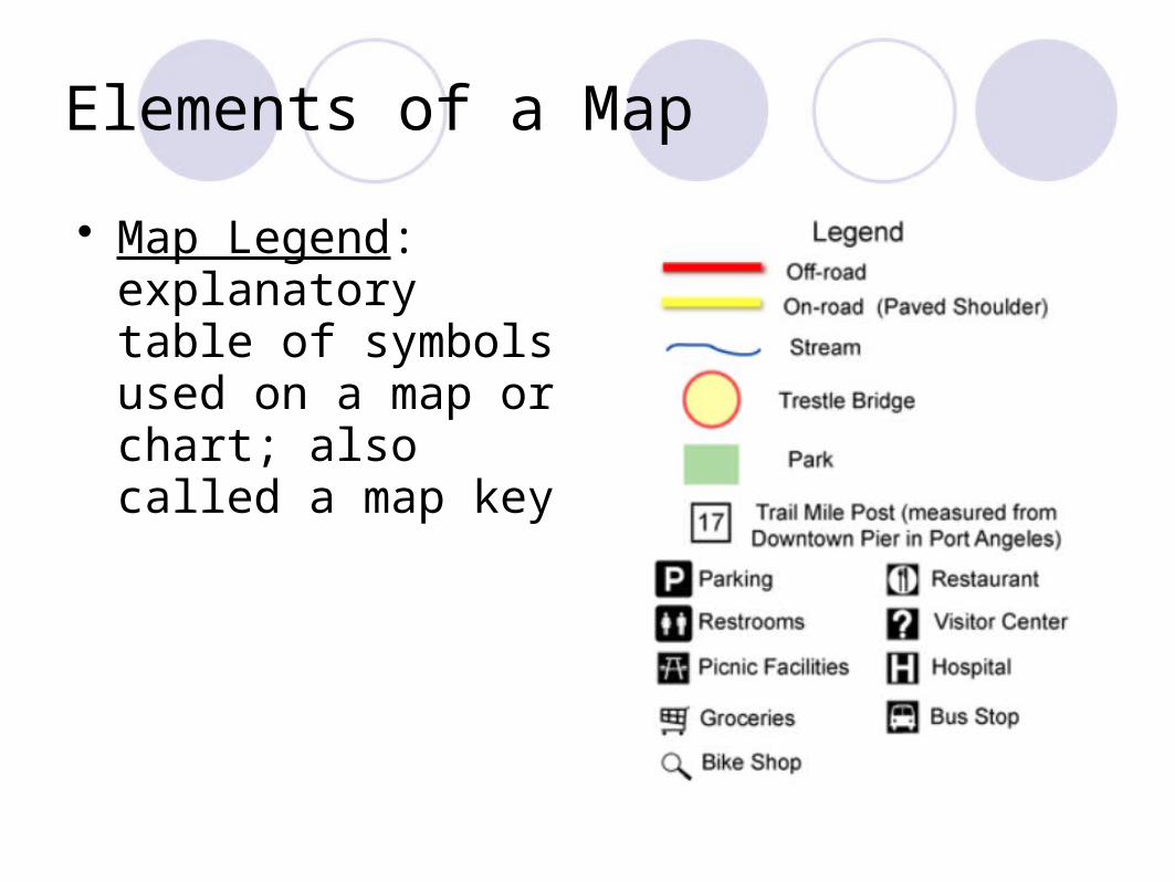
• Map Legend: explanatory table of symbols used on a map or chart; also called a map key
Elements of a Map
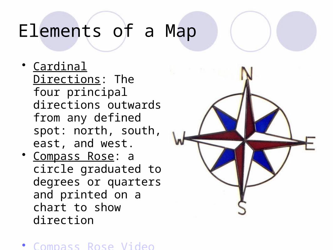
• Cardinal Directions: The four principal directions outwards from any defined spot: north, south, east, and west.
• Compass Rose: a circle graduated to degrees or quarters and printed on a chart to show direction
• Compass Rose Video
Elements of a Map
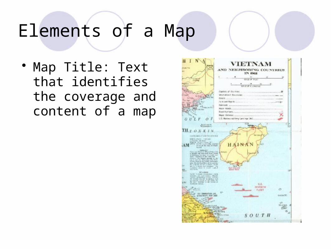
• Map Title: Text that identifies the coverage and content of a map
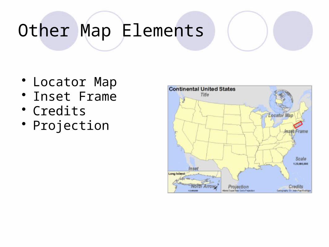
Other Map Elements
• Locator Map• Inset Frame• Credits• Projection
Homework
You are to draw a map of where your classes are at Central High School. Include the following elements: - Map Title - Map Scale - Compass Rose (CORRECT directions) - Map Legend
Bellwork
Map Element
Purpose (In Own Words)
Agenda
• Bellwork – review Map Elements• HW: Check, Review Map Elements• Notes: Latitude and Longitude• HW: Battleship• Quiz Friday for Honors, Monday for Standard
Latitude
• Imaginary lines drawing circles around the Earth, parallel to the Equator
• Called Parallels• Measure North and South of the Equator• Equator = 0 degrees• North Pole = 90N• South Pole = 90S
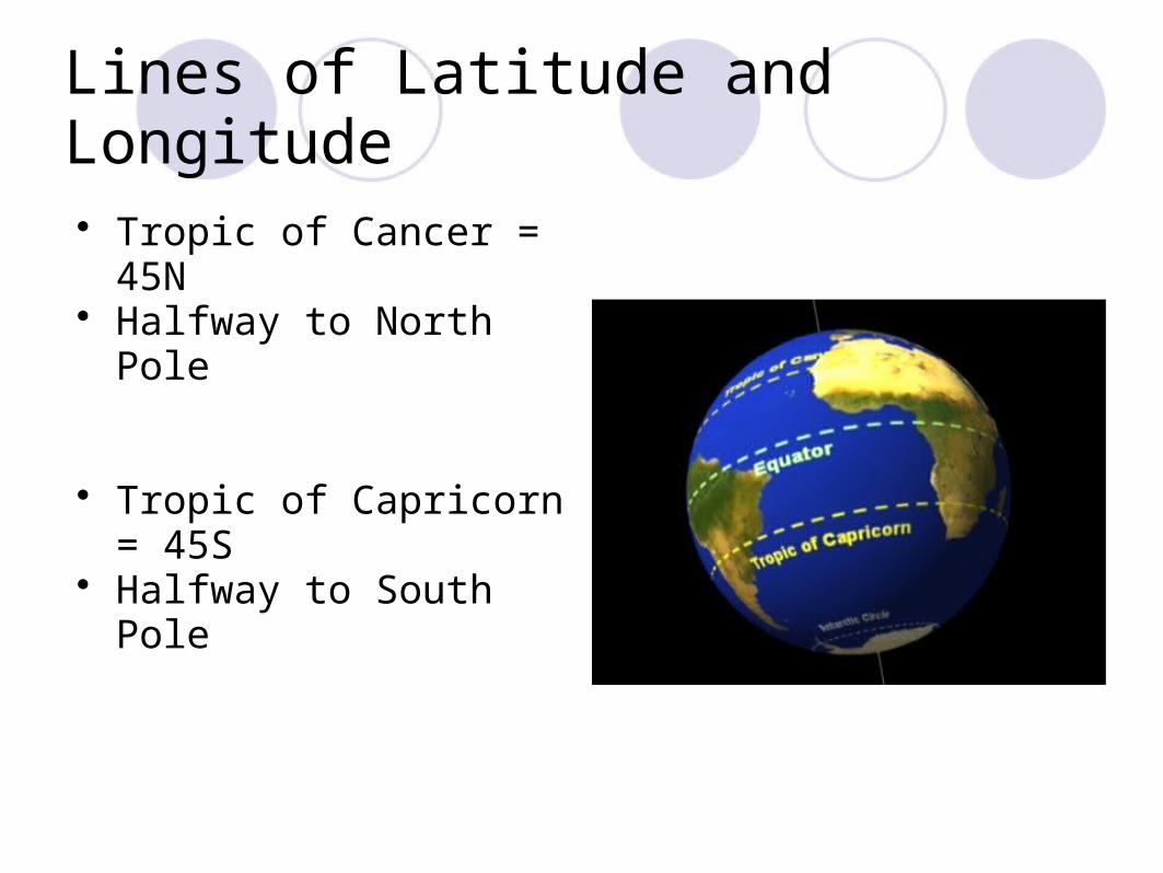
Lines of Latitude and Longitude
• Tropic of Cancer = 45N• Halfway to North Pole
• Tropic of Capricorn = 45S• Halfway to South Pole
Longitude
• Imaginary lines called Meridians• Run longways down from the poles• Measure West and East of Prime Meridian• Prime Meridian (0 degrees) in Greenwich,
England• 180 degrees = opposite side, called International
Date Line
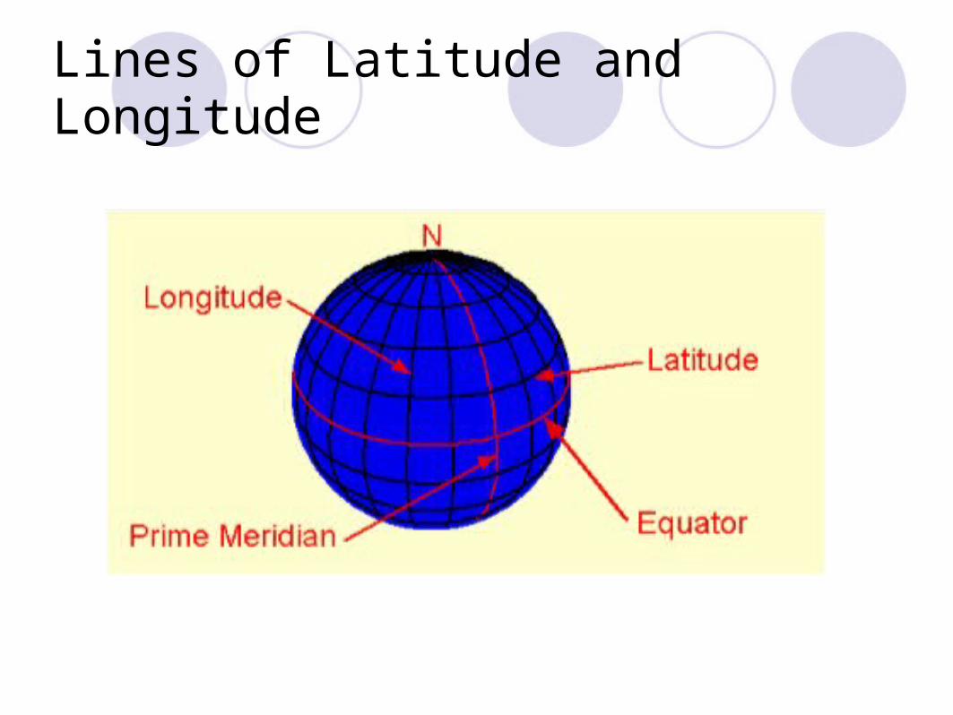
Lines of Latitude and Longitude
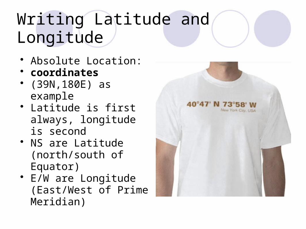
Writing Latitude and Longitude
• Absolute Location:• coordinates • (39N,180E) as example• Latitude is first always,
longitude is second• NS are Latitude
(north/south of Equator)• E/W are Longitude
(East/West of Prime Meridian)
Other Information
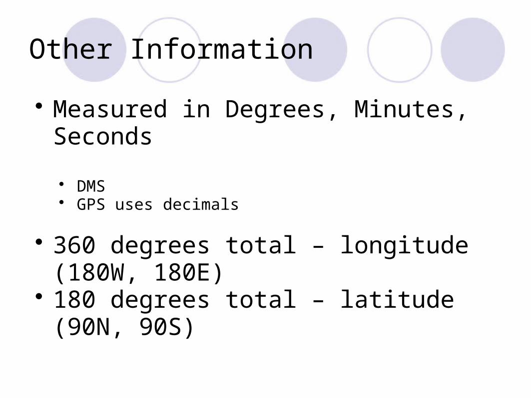
• Measured in Degrees, Minutes, Seconds
• DMS• GPS uses decimals
• 360 degrees total – longitude (180W, 180E)
• 180 degrees total – latitude (90N, 90S)
Practicing Longitude and Latitude
• Find Hannah Game• Going on a Trip• Quiz yourself
Bellwork
• Get out Battleship Game Piece• Do you have 10 coordinates marked and labeled?
• You cannot play the game if you don’t have those coordinates marked.
Agenda
• Bellwork – Prep Game Piece• Notes: Time Zones• Review Latitude and Longitude• Battleship• HW: Study for Quiz 1.1!!
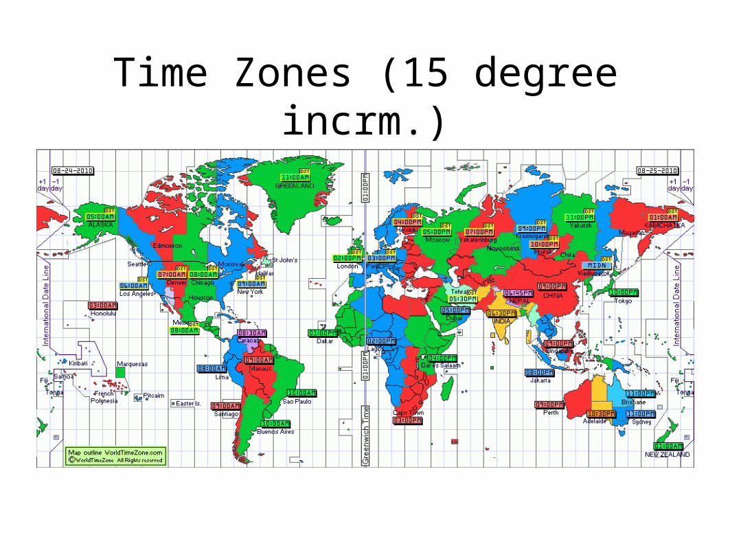
Time Zones (15 degree incrm.)
Time Zones
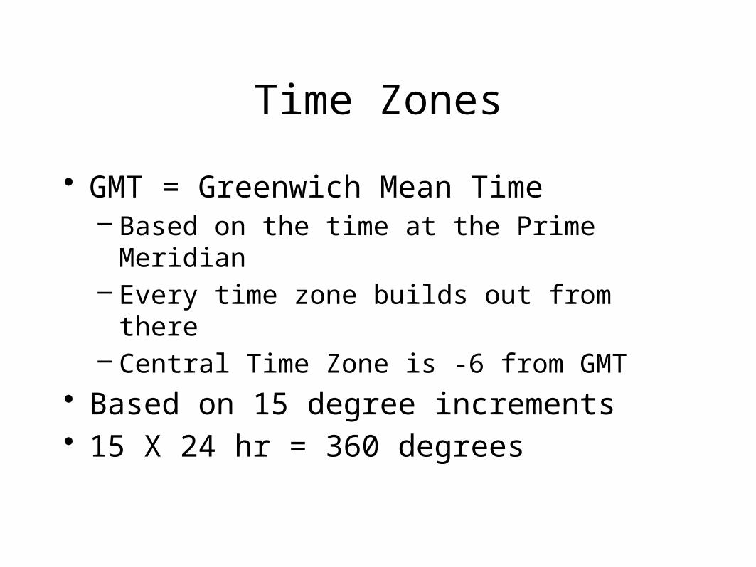
• GMT = Greenwich Mean Time– Based on the time at the Prime Meridian– Every time zone builds out from there– Central Time Zone is -6 from GMT
• Based on 15 degree increments• 15 X 24 hr = 360 degrees