Embed Size (px)
Citation preview
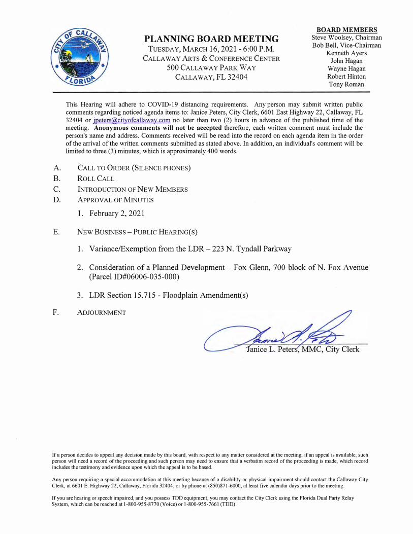
PLANNING BOARD MEETING
TUESDAY, MARCH 16, 2021 - 6:00 P.M.
CALLAWAY ARTS & CONFERENCE CENTER
500 CALLAWAY PARK WAY
CALLAWAY, FL 32404
BOARD MEMBERS Steve Woolsey, Chairman Bob Bell, Vice-Chairman
Kenneth Ayers John Hagan
Wayne Hagan Robert Hinton Tony Roman
This Hearing will adhere to COVID-19 distancing requirements. Any person may submit written public comments regarding noticed agenda items to: Janice Peters, City Clerk, 6601 East Highway 22, Callaway, FL 32404 or [email protected] no later than two (2) hours in advance of the published time of the meeting. Anonymous comments will not be accepted therefore, each written comment must include the person's name and address. Comments received will be read into the record on each agenda item in the order of the arrival of the written comments submitted as stated above. In addition, an individual's comment will be limited to three (3) minutes, which is approximately 400 words.
A. CALL TO ORDER (SILENCE PHONES)
B. ROLL CALL
C. INTRODUCTION OF NEW MEMBERS
D. APPROVAL OF MINUTES
I. February 2, 2021
E. NEW BUSINESS - PUBLIC HEARING(S)
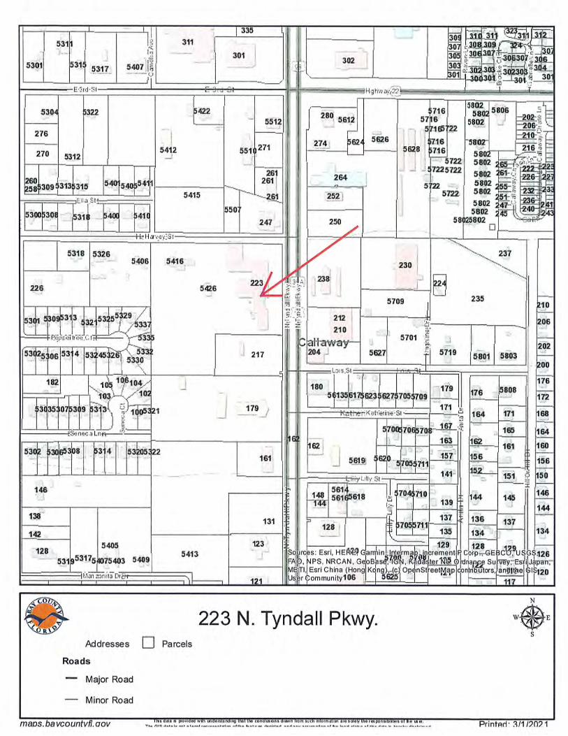
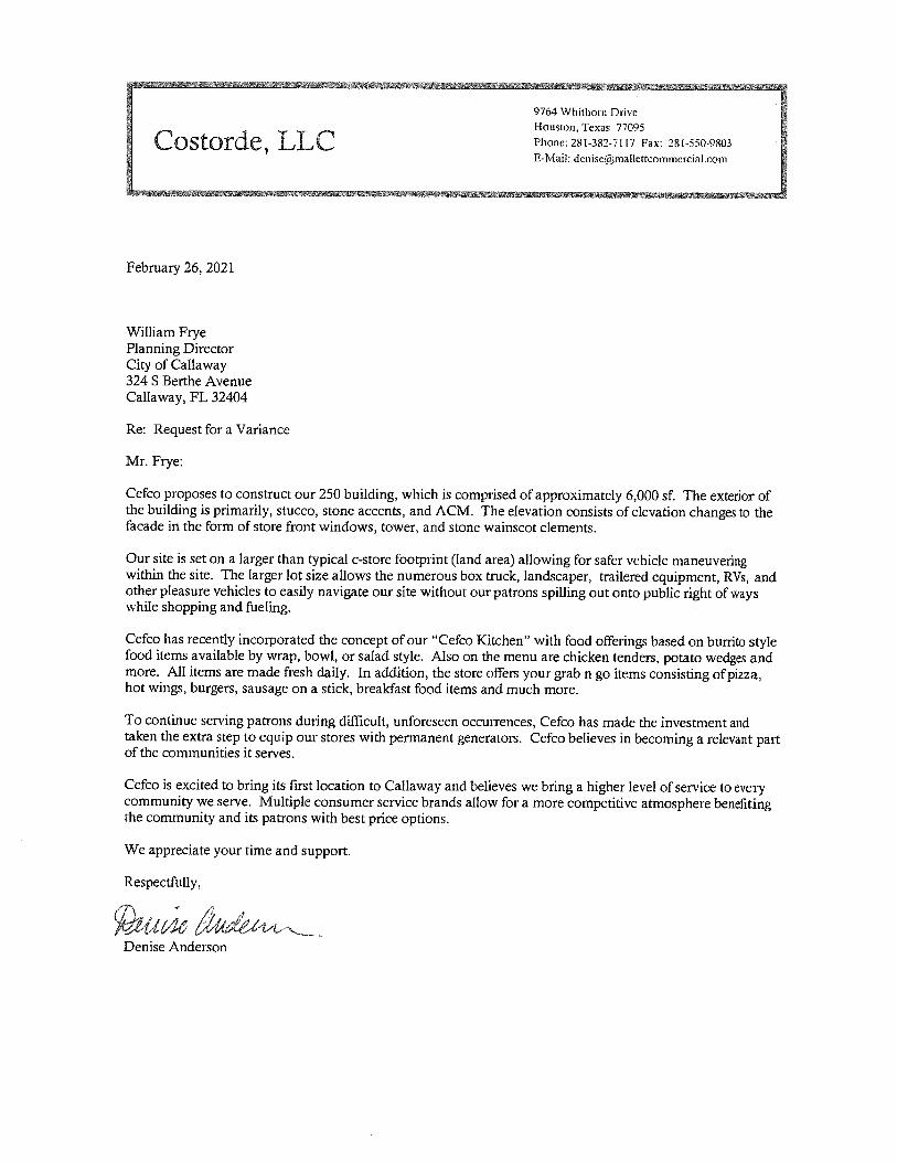
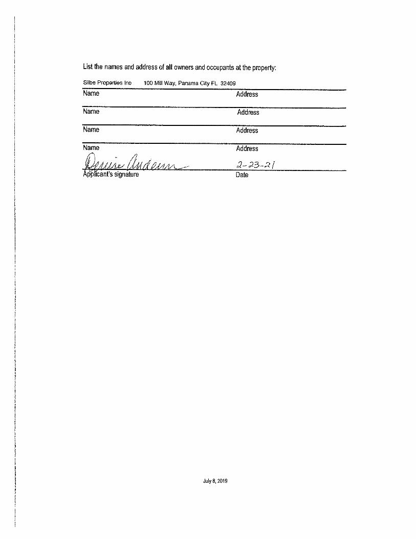
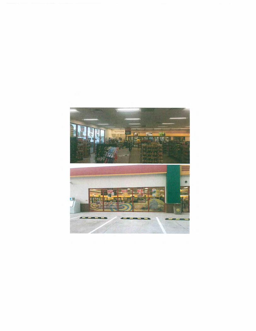
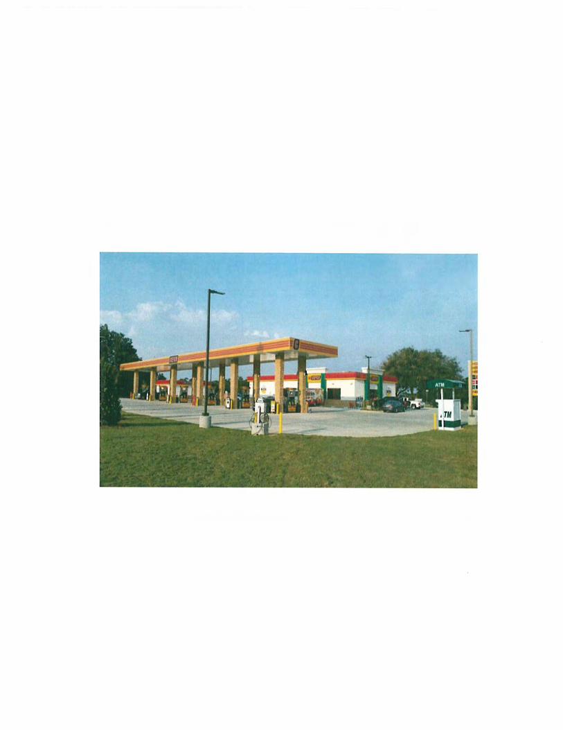
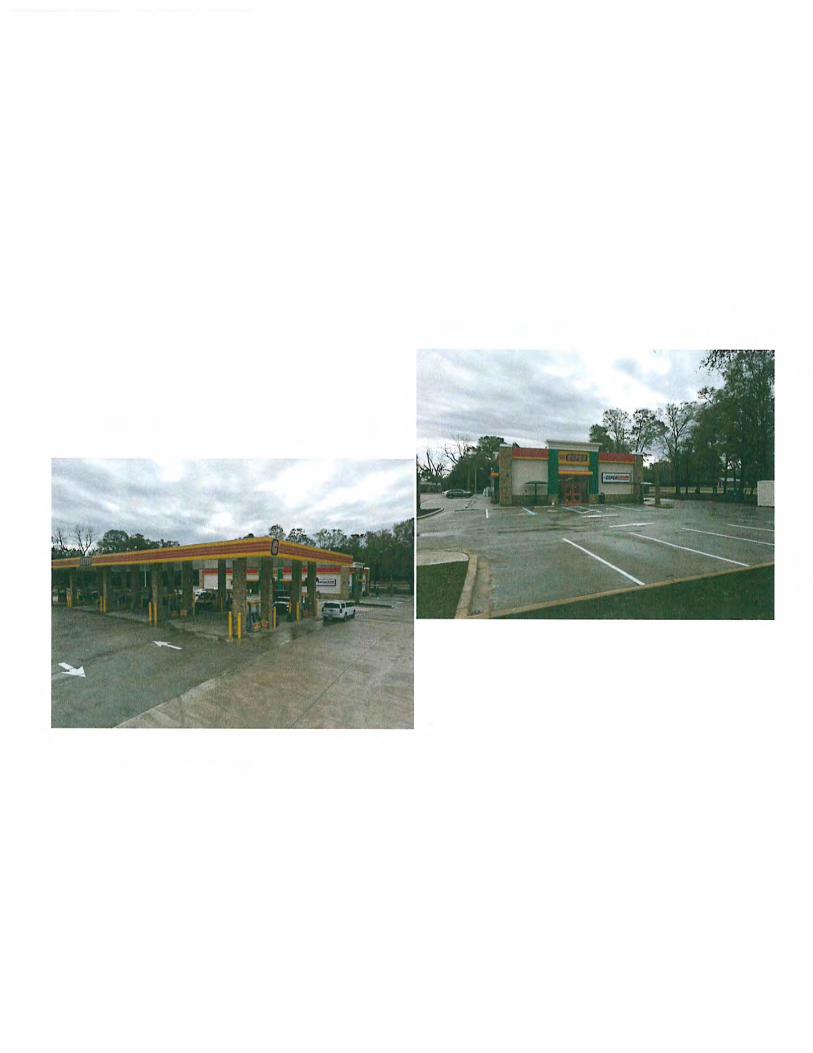
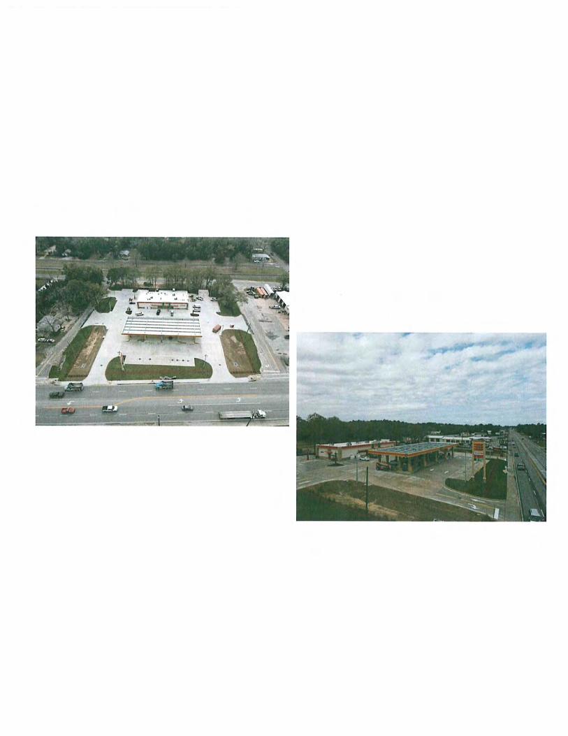
1. Variance/Exemption from the LDR - 223 N. Tyndall Parkway
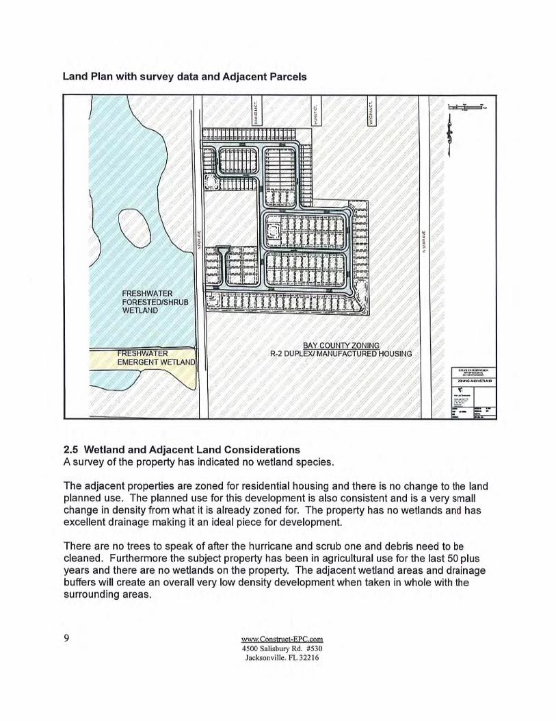
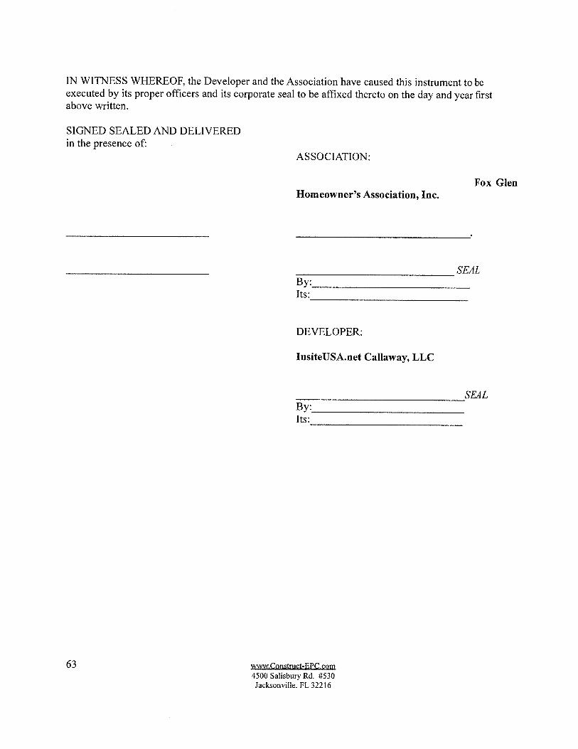
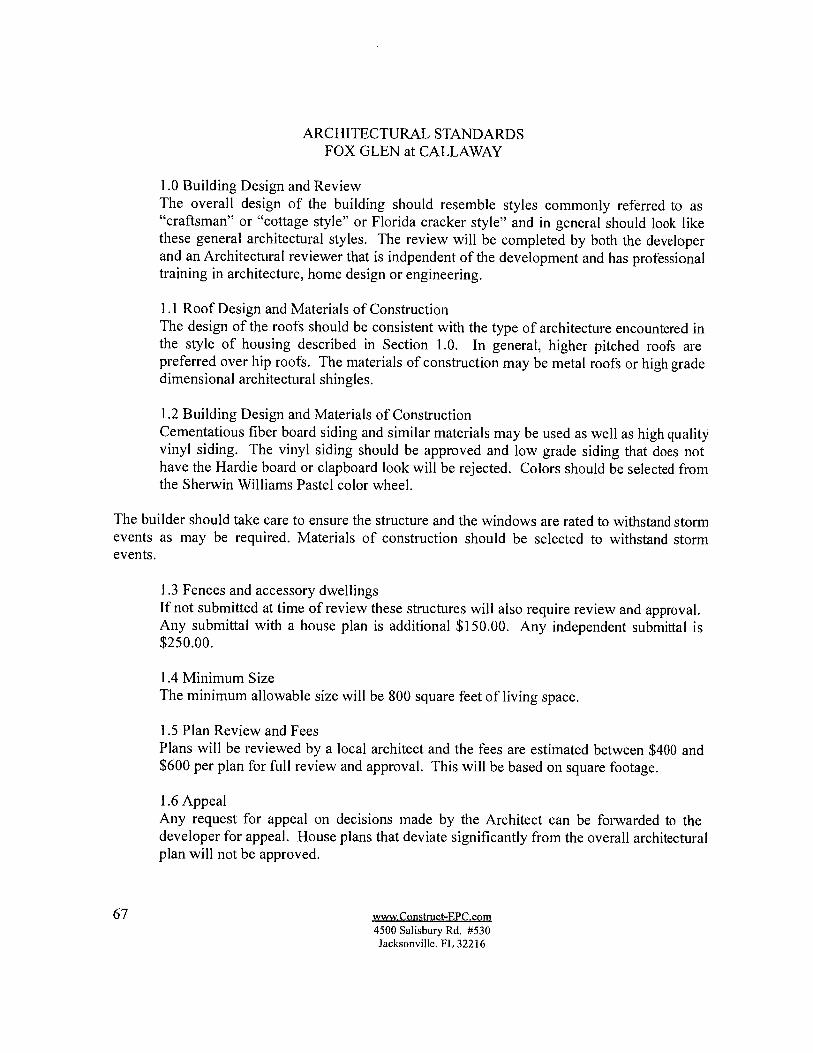
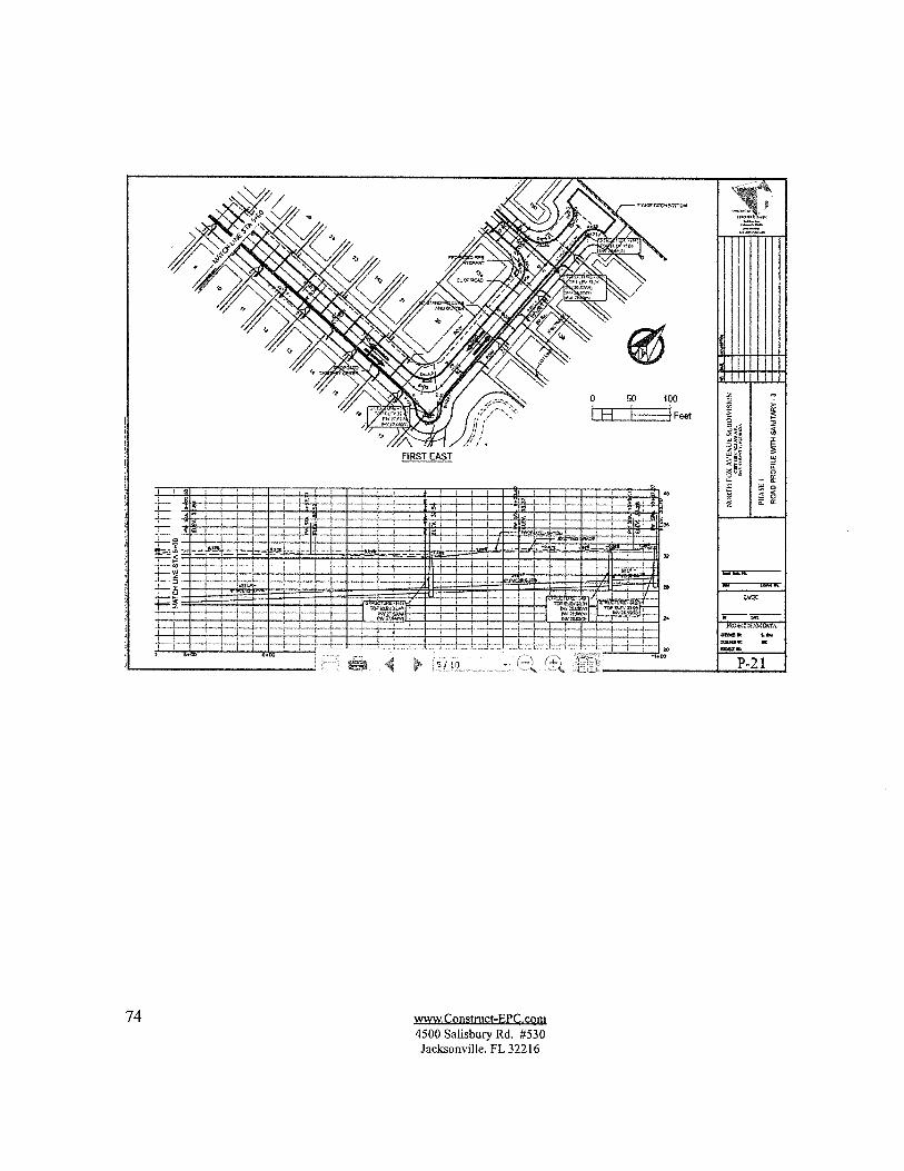
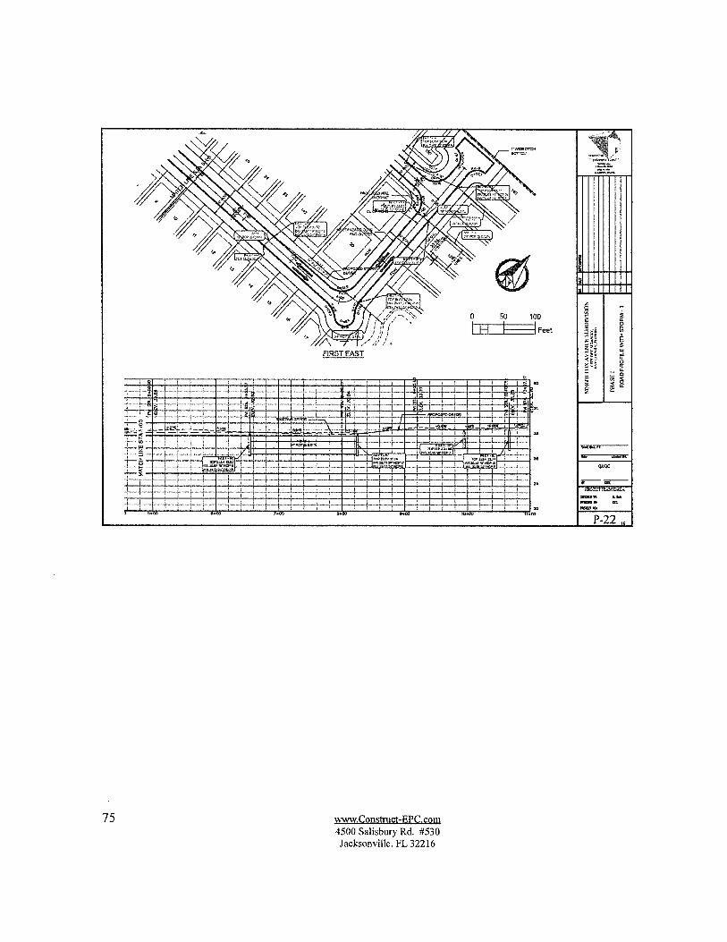
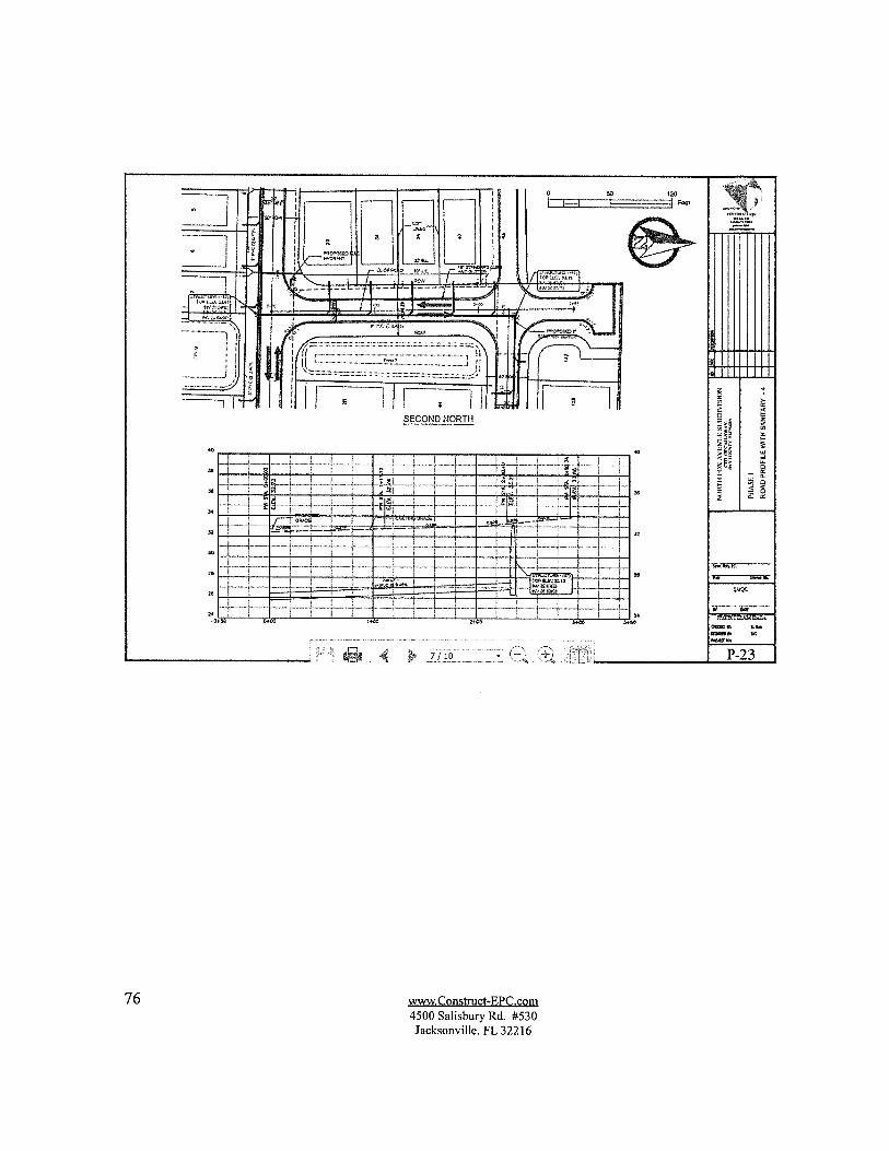
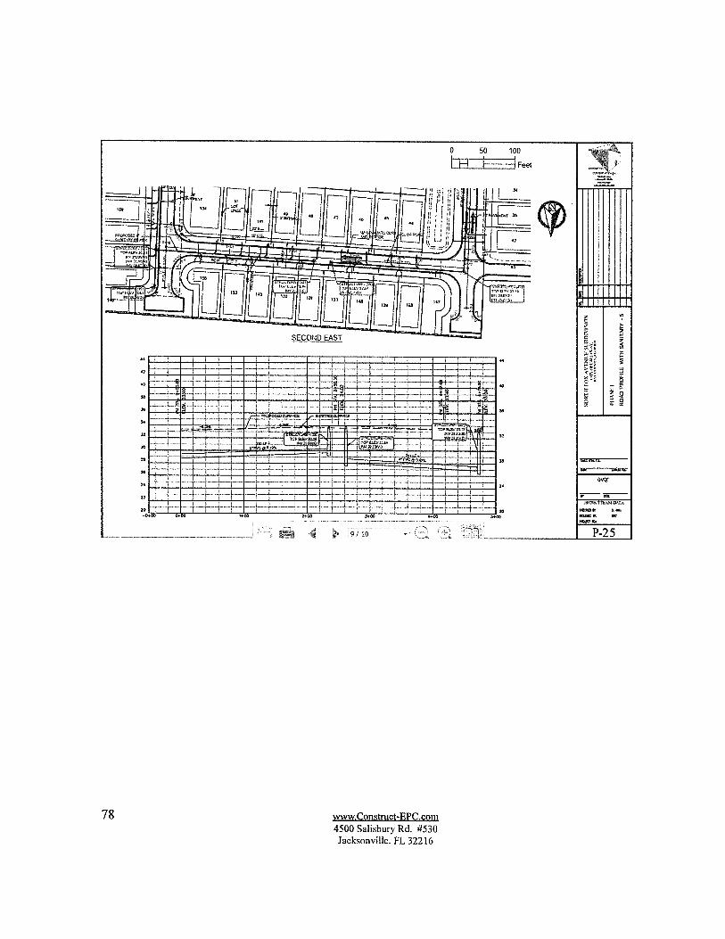
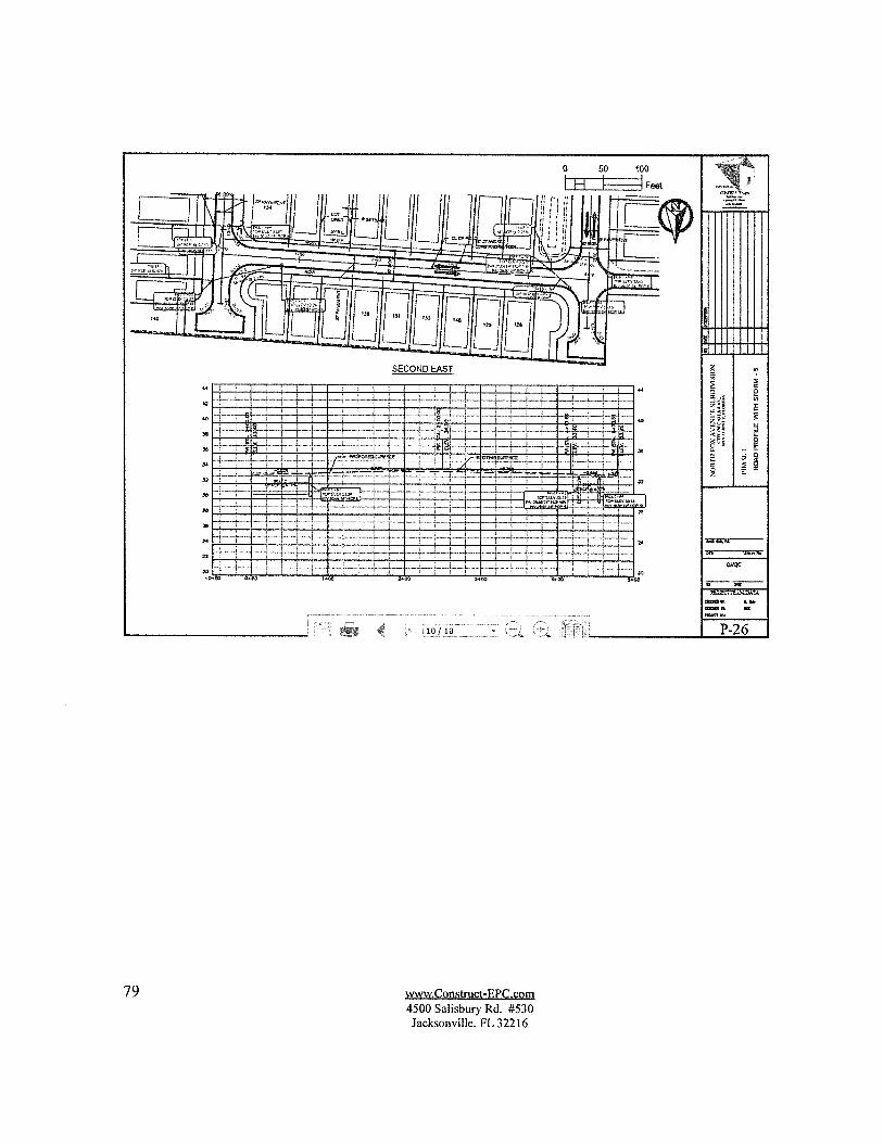
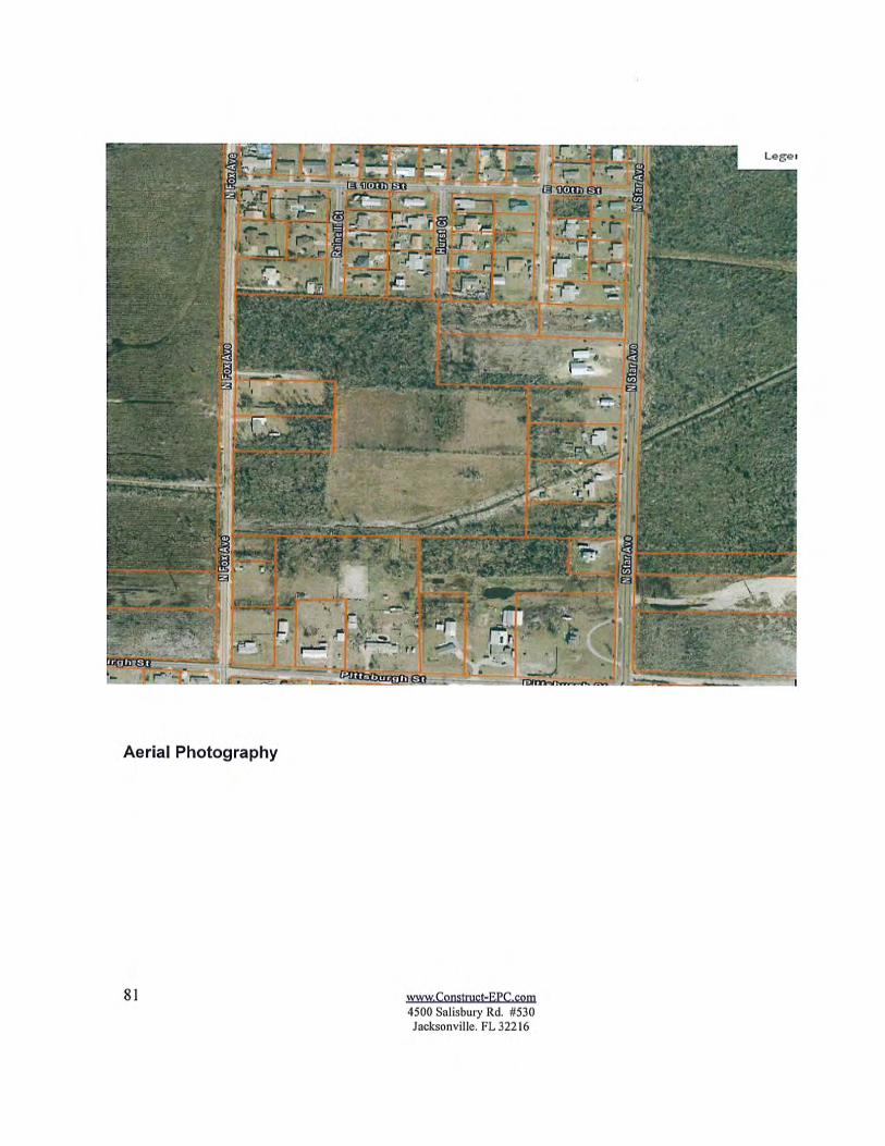
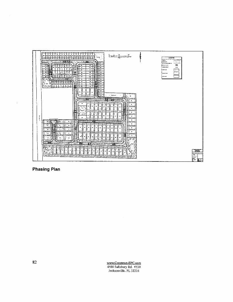
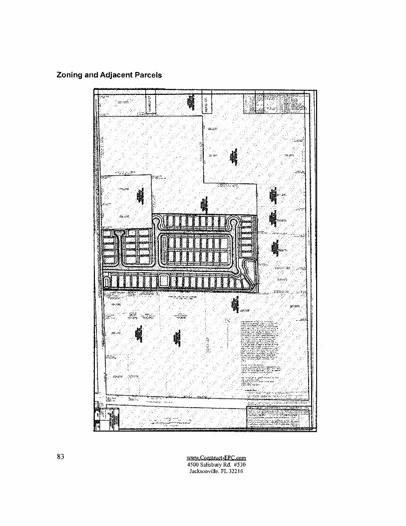
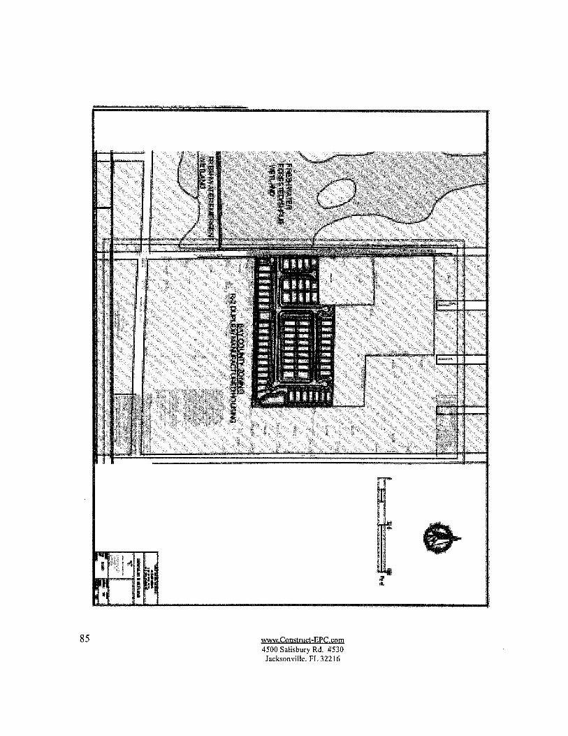
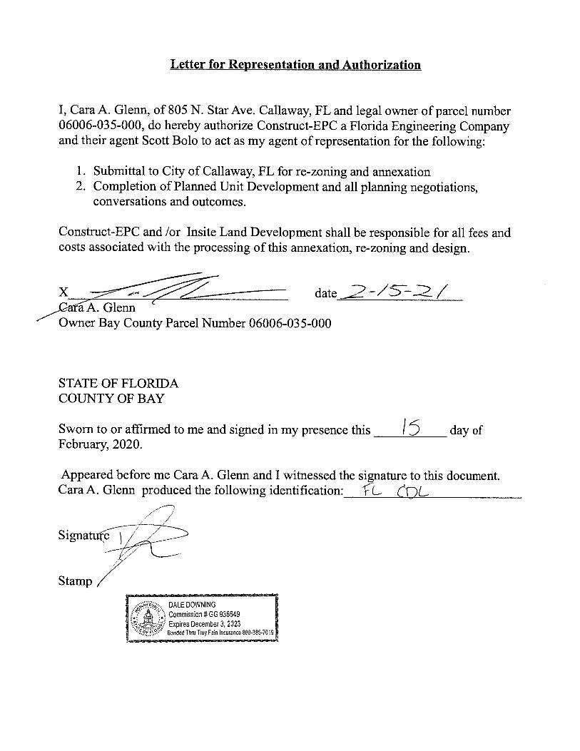
2. Consideration of a Planned Development - Fox Glenn, 700 block ofN. Fox Avenue(Parcel ID#06006-035-000)
3. LDR Section 15.715 - Floodplain Amendment(s)
F. ADJOURNMENT
If a person decides to appeal any decision made by this board, with respect to any matter considered at the meeting, if an appeal is available, such person will need a record of the proceeding and such person may need to ensure that a verbatim record of the proceeding is made, which record includes the testimony and evidence upon which the appeal is to be based.
Any person requiring a special accommodation at this meeting because of a disability or physical impairment should contact the Callaway City
Clerk, at 6601 E. Highway 22, Callaway, Florida 32404; or by phone at (850)871-6000, at least five calendar days prior to the meeting.
If you are hearing or speech impaired, and you possess TDD equipment, you may contact the City Clerk using the Florida Dual Party Relay System, which can be reached at 1-800-955-8770 (Voice) or 1-800-955-7661 (TDD).

PLANNING BOARD MEETING MINUTES – February 2, 2021 Page 1
CITY OF CALLAWAY PLANNING BOARD MEETING MINUTES
FEBRUARY 2, 2021 – 6:00 P.M.
The Callaway Planning Board met in regular session with Steve Woolsey, Chairman, Bob Bell, Vice-Chair and Board Members John Hagan, Robert Hinton, and Tony Roman present. Also present were Bill Frye, Director of Public Works/Planning (via teleconference) and Janice L. Peters, City Clerk. Kenneth Ayers and Wayne Hagan were not in attendance
The meeting was called to order by Chairman Woolsey, followed by a moment of silence and the Pledge of Allegiance.
City Clerk Peters introduced the three new board members, Kenneth Ayers, who was not in attendance, Robert Hinton and John Hagan.
APPROVAL OF MINUTES
November 17, 2020
Board Member John Hagan asked if the Bond for the Cove at Bridge Harbor had been corrected. Director Frye advised it has been.
Motion: Motion was made by Board Member Roman and seconded by Board Member Hinton for approval of the minutes. Motion carried unanimously.
NEW BUSINESS
Voluntary Annexation Application – 760 N. Fox Avenue
Director Frye reviewed, advising it is approximately 9.83 acres and is contiguous to the City. The Planning Dept. has analyzed the proposed petition and finds that all the information given is true and accurate to the best of its knowledge. Staff recommends approval.
Board Member Bell asked about the fact that Cara Glenn owns the property but Insite Land Development is asking for the annexation. Scott Sivan, with Insite, clarified that Insite has an agreement to purchase the property from Ms. Glenn. The closing has been held up so the Warranty Deed has not been executed. Director Frye indicated a Letter of Authorization will be acquired from Ms. Glenn authorizing Insite to apply on her behalf.
Motion: Motion made by Board Member Bell, and seconded by Board Member John Hagan, to approve the Annexation contingent upon submission of the proper Warranty Deed and Authorization Letter, recommending same to Commission. Motion carried unanimously.
AGENDA ITEM #D-1

PLANNING BOARD MEETING MINUTES – February 2, 2021 Page 2
Rezoning Application – 760 N. Fox Avenue
Director Frye reviewed, advising the rezoning is in conjunction with the annexation and would be in compliance with the LDR. They are requesting a rezoning designation from Bay County Residential R-2 to a Planned Urban Development (PUD), which will need to be approved at another time.
Board Member John Hagan asked about possible future water/sewer problems. Director Frye advised there is plenty of capacity for water. The sewer will need to be pumped to Hwy. 22, which will mostly be done and paid for by the developer. Mr. Sivan reviewed the intended plan for the property, which will be similar to Callaway Corners.
Director Frye clarified that this process in no way authorizes any permitting on the property.
Motion: Motion made by Board Member John Hagan, and seconded by Board Member Roman, to approve the Rezoning contingent upon the proper Warranty Deed and Authorization Letter, recommending same to Commission. Motion carried unanimously.
Rezoning Application – 518 N. Tyndall Parkway
Vice-Chair Bell advised he knows Mr. Marsh personally but has no business dealings with the firm.
Director Frye advised that this is the Abalone Apartments. A demo grant has been applied for through the CRA. They are want a change to the zoning from Residential Multi-family to Commercial. He recommended approval.
Motion: Motion made by Board Member John Hagan, and seconded by Vice-Chair Bell, to approve the Rezoning, recommending same to Commission. Motion carried unanimously.
ADJOURNMENT
There being no further business, the meeting adjourned at 6:27 p.m.
______________________________ Janice L. Peters, City Clerk
_____________________________ Board Chairman

AGENDA ITEM #E-1


AGENDA ITEM #E-2


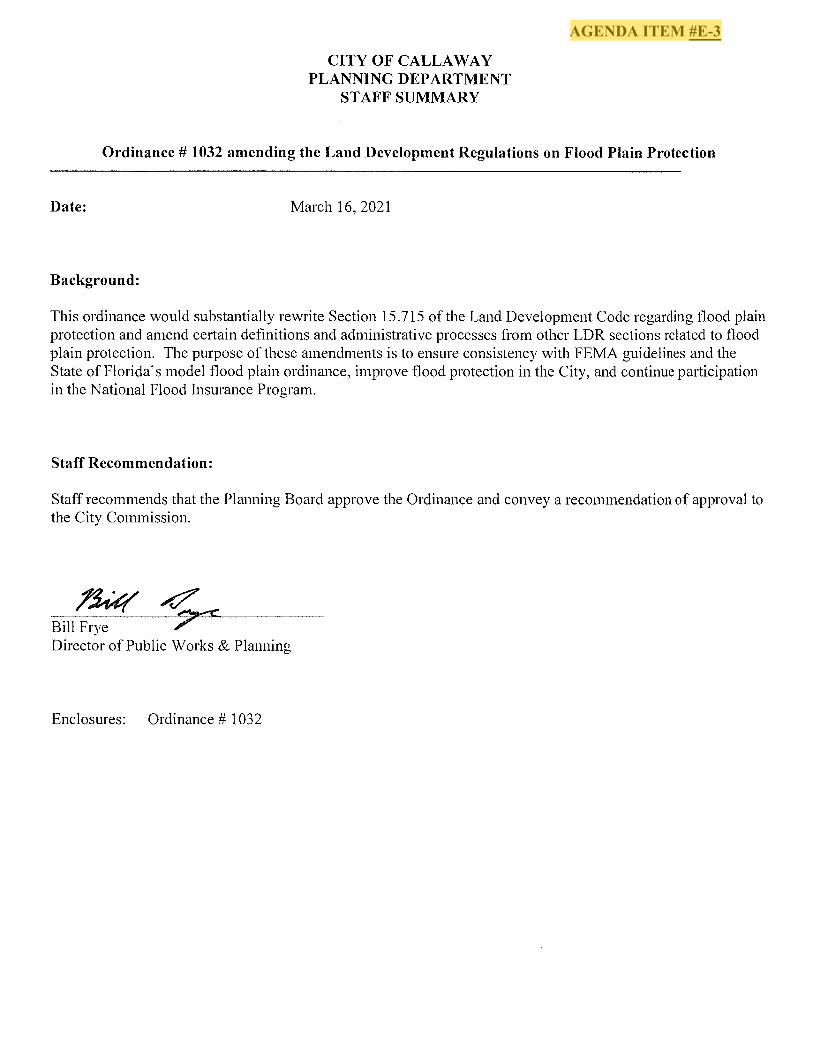
AGENDA ITEM #E-3
Page 1 of 31
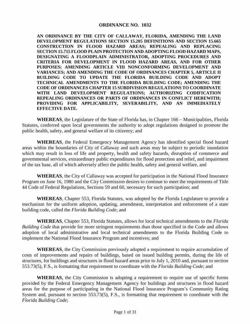
ORDINANCE NO. 1032
AN ORDINANCE BY THE CITY OF CALLAWAY, FLORIDA, AMENDING THE LAND DEVELOPMENT REGULATIONS SECTION 15.205 DEFINITIONS AND SECTION 15.665 CONSTRUCTION IN FLOOD HAZARD AREAS; REPEALING AND REPLACING SECTION 15.715 FLOOD PLAIN PROTECTION AND ADOPTING FLOOD HAZARD MAPS, DESIGNATING A FLOODPLAIN ADMINISTRATOR, ADOPTING PROCEDURES AND CRITERIA FOR DEVELOPMENT IN FLOOD HAZARD AREAS, AND FOR OTHER PURPOSES; AMENDING ARTICLE VIII NONCONFORMING DEVELOPMENT AND VARIANCES; AND AMENDING THE CODE OF ORDINANCES CHAPTER 5, ARTICLE II BUILDING CODE TO UPDATE THE FLORIDA BUILDING CODE AND ADOPT TECHNICAL AMENDMENTS TO THE FLORIDA BUILDING CODE; AMENDING THE CODE OF ORDINANCES CHAPTER 15 SUBDIVISION REGULATIONS TO COORDINATE WITH LAND DEVELOPMENT REGULATIONS; AUTHORIZING CODIFICATION REPEALING ORDINANCES OR PARTS OF ORDINANCES IN CONFLICT HEREWITH; PROVIDING FOR APPLICABILITY, SEVERABILITY, AND AN IMMEDIATELY EFFECTIVE DATE.
WHEREAS, the Legislature of the State of Florida has, in Chapter 166 – Municipalities, Florida Statutes, conferred upon local governments the authority to adopt regulations designed to promote the public health, safety, and general welfare of its citizenry; and WHEREAS, the Federal Emergency Management Agency has identified special flood hazard areas within the boundaries of City of Callaway and such areas may be subject to periodic inundation which may result in loss of life and property, health and safety hazards, disruption of commerce and governmental services, extraordinary public expenditures for flood protection and relief, and impairment of the tax base, all of which adversely affect the public health, safety and general welfare, and WHEREAS, the City of Callaway was accepted for participation in the National Flood Insurance Program on June 16, 1980 and the City Commission desires to continue to meet the requirements of Title 44 Code of Federal Regulations, Sections 59 and 60, necessary for such participation; and WHEREAS, Chapter 553, Florida Statutes, was adopted by the Florida Legislature to provide a mechanism for the uniform adoption, updating, amendment, interpretation and enforcement of a state building code, called the Florida Building Code; and
WHEREAS, Chapter 553, Florida Statutes, allows for local technical amendments to the Florida Building Code that provide for more stringent requirements than those specified in the Code and allows adoption of local administrative and local technical amendments to the Florida Building Code to implement the National Flood Insurance Program and incentives; and
WHEREAS, the City Commission previously adopted a requirement to require accumulation of costs of improvements and repairs of buildings, based on issued building permits, during the life of structures, for buildings and structures in flood hazard areas prior to July 1, 2010 and, pursuant to section 553.73(5), F.S., is formatting that requirement to coordinate with the Florida Building Code; and
WHEREAS, the City Commission is adopting a requirement to require use of specific forms provided by the Federal Emergency Management Agency for buildings and structures in flood hazard areas for the purpose of participating in the National Flood Insurance Program’s Community Rating System and, pursuant to section 553.73(5), F.S., is formatting that requirement to coordinate with the Florida Building Code;
Page 2 of 31
WHEREAS, the City Commission has determined that it is in the public interest to adopt the proposed local technical amendments to the Florida Building Code and the proposed amendments are not more stringent than necessary to address the need identified, do not discriminate against materials, products or construction techniques of demonstrated capabilities, are in compliance with section 553.73(4), Florida Statutes; and WHEREAS, the City Commission has determined that it is in the public interest to adopt the proposed floodplain management regulations that are coordinated with the Florida Building Code.
NOW, THEREFORE, BE IT ENACTED BY THE CITY COMMISSION OF THE CITY OF CALLAWAY, FLORIDA: SECTION 1. RECITALS. The foregoing whereas clauses are incorporated herein by reference and made a part hereof.
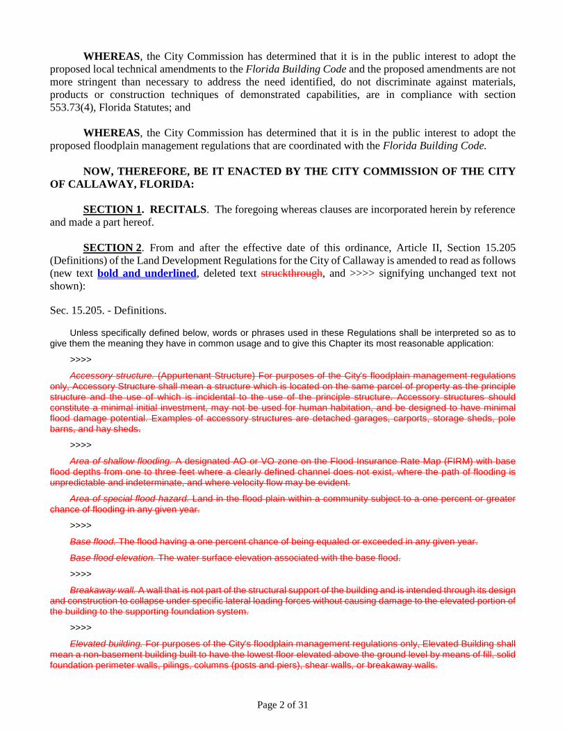
SECTION 2. From and after the effective date of this ordinance, Article II, Section 15.205 (Definitions) of the Land Development Regulations for the City of Callaway is amended to read as follows (new text bold and underlined, deleted text struckthrough, and >>>> signifying unchanged text not shown): Sec. 15.205. - Definitions.
Unless specifically defined below, words or phrases used in these Regulations shall be interpreted so as to
give them the meaning they have in common usage and to give this Chapter its most reasonable application:
>>>>
Accessory structure. (Appurtenant Structure) For purposes of the City's floodplain management regulations only, Accessory Structure shall mean a structure which is located on the same parcel of property as the principle structure and the use of which is incidental to the use of the principle structure. Accessory structures should constitute a minimal initial investment, may not be used for human habitation, and be designed to have minimal flood damage potential. Examples of accessory structures are detached garages, carports, storage sheds, pole barns, and hay sheds.
>>>>
Area of shallow flooding. A designated AO or VO zone on the Flood Insurance Rate Map (FIRM) with base flood depths from one to three feet where a clearly defined channel does not exist, where the path of flooding is unpredictable and indeterminate, and where velocity flow may be evident.
Area of special flood hazard. Land in the flood plain within a community subject to a one percent or greater chance of flooding in any given year.
>>>>
Base flood. The flood having a one percent chance of being equaled or exceeded in any given year.
Base flood elevation. The water surface elevation associated with the base flood.
>>>>
Breakaway wall. A wall that is not part of the structural support of the building and is intended through its design and construction to collapse under specific lateral loading forces without causing damage to the elevated portion of the building to the supporting foundation system.
>>>>
Elevated building. For purposes of the City's floodplain management regulations only, Elevated Building shall mean a non-basement building built to have the lowest floor elevated above the ground level by means of fill, solid foundation perimeter walls, pilings, columns (posts and piers), shear walls, or breakaway walls.
Page 3 of 31
>>>>
Encroachment. For purposes of the City's floodplain management regulations only, Encroachment shall mean the advancement or infringement of uses, plant growth, fill, excavation, buildings, permanent structures or development into a flood plain, which many impede or alter the flow capacity of the flood plain.
>>>>
Existing construction. For purposes of the City's floodplain management regulations only, Existing Construction shall mean any structure for which the "start of construction" commenced before November 24, 1987, or structures for which the "start of construction" commenced after November 24, 1987, which were built in compliance with the then existing Callaway flood damage prevention plan.
Existing manufactured home park or subdivision. For purposes of the City's floodplain management regulations only, Existing Manufactured Home Park or Subdivision shall mean a manufactured home park or subdivision for which the construction of facilities for services the lots on which the manufactured homes are to be affixed (including at a minimum the installation of utilities, the construction of streets, and either final site grading or the pouring of concrete pads) is completed before the effective date of the floodplain management regulations adopted by the City of Callaway on November 21, 1987.
Expansion to an existing manufactured home park or subdivision. For purposes of the City's floodplain management regulations only, expansion to an existing manufactured home park or subdivision shall mean the preparation of additional sites by the construction of facilities for servicing the lots on which the manufactured homes are to be affixed (including the installation of utilities, the construction of streets, and either final site grading or the pouring of concrete pads).
>>>>
Fair market value. As used in the definition of "substantial improvement," means the value of the property or structure as determined by the property appraiser, either: (1) before the improvement was started, or (2) if the structure has been damaged and is being restored, before the damage occurred.
>>>>
Flood boundary and floodway map (FBFM). The official map on which the Federal Emergency Management Agency has delineated the areas of special flood hazard and regulatory floodways.
Flood hazard boundary map (FHBM). An official map of the City issued by the Federal Emergency Management Agency where the boundaries of the areas of the special flood hazard have been defined as Zone A.
Flood insurance rate map (FIRM). An official map of the City on which the Federal Emergency Management Agency has delineated both the special areas and the risk premium zones applicable to the City.
Flood insurance study. The official report provided by the Federal Emergency Management Agency. The report contains flood profiles, as well as the Flood Boundary Floodway Map and the water surface elevation of the base flood.
>>>>
Floodplain administrator. The individual appointed to administer and enforce the City's floodplain management regulations.
Floodplain management regulations. means Section 15.715 of these Land Development Regulations and other zoning ordinances, subdivision regulations, building codes, health regulations, special purpose ordinances and other applications of police power which control development in flood-prone areas.
Flood-proofing. Any combination of structural and non-structural additions, changes or adjustments to structures which reduce or eliminate flood damage to real estate or improved real property, water and sanitary facilities, structures and their contents.
Flood protection elevation. The elevation of the base flood plus one (1) foot.
>>>>
Floor. For purposes of the City's floodplain management regulations only, Floor shall mean the top surface of an enclosed area in a building (including basement), i.e., top of slab in concrete slab construction or top of wood flooring in wood frame construction. The term does not include the floor of a garage used solely for parking vehicles.
>>>>
Page 4 of 31
Foundation survey. A perimeter survey which locates the slab, or foundation pilasters, on the lot, plot, or parcel, showing tie-in distances to the front, side and rear property lines. If other control lines have been established by the City or other governmental agencies, i.e., Florida Department of Environmental Regulation, etc., as applicable to the property, those lines and slab tie-in distances must also be shown.
If the slab is monolithic, the "foundation" survey must also show total square footage covered by the foundation, including all porches, breezeways, patios, garages, or carports, but shall not include pads for accessory structures such as air conditioners, pool pumps, etc. If the "foundation" survey pertains to a lot, plot, or parcel of land lying wholly, or in part, within the established flood hazard area 100-year flood plain, the survey must also show the elevation of the slab in relation to datum on the Flood Insurance Rate Map mean sea level, or in the case of pilasters, the lowest habitable floor level of the planned structure. Lowest floor is defined in Sec. 15.715.
>>>>
Free of obstruction. For purposes of the City's floodplain management regulations only, Free of Obstruction shall mean any type of lower area enclosure of other construction element that will obstruct the flow of velocity water and wave action beneath the lowest horizontal structural member of the lowest floor of an elevated building during a base flood event.
>>>>
Functionally dependent facility. A facility which cannot be used for its intended purpose unless it is located or carried out in a close proximity to water, such as a docking or port facility necessary for the loading and unloading of cargo or passengers, shipbuilding, ship repair, or seafood processing facilities. The term does not include long-term storage, manufacture, sales, or service facilities.
>>>>
Hardship. For purposes of the City's floodplain management regulations only, Hardship shall mean the exceptional hardship that would result from a failure to grant the requested variance. The City of Callaway requires that the variance is exceptional, unusual, and peculiar to the property involved. Mere economic or financial hardship alone is not exceptional, Inconvenience, aesthetic considerations, physical handicaps, personal preferences, or the disapproval of one's neighbors likewise cannot, as a rule, qualify as an exceptions hardship. All of these problems can be resolved through other means without granting a variance, even is the alternative is more expensive, or requirements the property owner to build elsewhere or put the parcel to a different use than originally intended.
>>>>
Highest adjacent grade. The highest natural elevation of the ground surface, prior to construction, next to the proposed walls of a structure or building.
>>>>
Historic structure. Any structure that is: (1) Listed individually in the National Register of Historic Places (a listing maintained by the Department of Interior) or determined by the Florida Department of State as meeting the requirements for individual listing on either registry; (2) Certified or preliminarily determined by the Department of the Interior as contributing to the historical significance of a registered historic district or a district preliminarily determined by the Department's Secretary to qualify as a registered historic district; or (3) Individually listed on the state inventory of historic places.
>>>>
Increased cost of compliance (ICC). The cost to repair a substantially damaged building that exceeds the minimal repair cost and that is required to bring a substantially damaged building into compliance with the local flood damage prevention ordinance. ICC insurance coverage is provided in a standard (NFIP) flood insurance policy.
>>>>
Lowest adjacent grade. The lowest elevation, after the completion of construction, of the ground, sidewalk, patio, deck support, or basement entryway immediately next to the structure.
Lowest floor. The top surface of the lowest area within the inside perimeter of the exterior walls of a building. For slab-on-grade type of buildings or buildings with basements, the top surface of the slab or basement floor would constitute the lowest floor. For footing, foundation walls or pile type buildings with crawl spaces under the building without basements, the top surface of the finished flooring above the horizontal joist, beam or other supporting member would constitute the lowest floor. An unfinished or flood-resistant enclosure usable solely for parking of

Page 5 of 31
vehicles, building access, or storage in an area other than a basement area, is not considered a building's lowest floor, provided that such enclosure is not built so as to render the structure in violation of the applicable non-elevation design requirements of this chapter.
>>>>
Market value. A building value, excluding the land and other improvements on the parcel (as agreed to between a willing buyer and seller), as established by what the local real estate market will bear. Market value can be established by independent certified appraisal, replacement cost depreciated by age of building (actual cash value) or adjusted assessed values.
>>>>
Mean sea level. The average height of sea for all stages of the tide. It is used as a reference for establishing various elevations within the flood plain. For purposes of this ordinance, the term is synonymous with national Geodetic Vertical Datum (NGVD).
M.S.L. The abbreviation for mean sea level. The average height of the sea for all stages of the tide. For purposes of this Code, the term is synonymous with national Geodetic Vertical Datum (NCVD).
>>>>
New construction. Structures for which the "start of construction" commenced on or after [October 26, 2010]. For purposes of the City's floodplain management regulations only, New Construction shall mean any structure for which the "start of construction" commenced after November 24, 1987, but does not include any structure for which the "start of construction" was after November 24, 1987, and before September 18, 2002, which were built in compliance with the then existing Callaway flood damage preventing plan. The term also includes any subsequent improvements to such structure.
New manufactured home park or subdivision. For purposes of the City's floodplain management regulations only, New Manufactured Home Park or Subdivision shall mean a manufactured home park or subdivision for which the construction of facilities for servicing the lots on which the manufactured homes are to be affixed (including at a minimum, the installation of utilities, the construction of streets, and either final site grading or the pouring of concrete pads) is completed on or after November 24, 1987.
>>>>
Obstruction. For purposes of the City's floodplain management regulations only, Obstruction shall mean, but is not limited to, any dam, wall, wharf, embankment, levee, dike, pile, abutment, protection, excavation, channelization, bridge, conduit, culvert, building, wire, fence, rock, gravel, refuse, fill, structure, vegetation or other material in, along, across or projecting into any watercourse which may alter, impede, retard or change the direction and/or velocity of the flow of water, or due to its location, its propensity to share or collect debris carried by the flow of water, or its likelihood of being carried downstream.
>>>>
Public safety and nuisance. Anything which is injurious to the safety or health of the entire community or neighborhood, or any considerable number of persons, or unlawfully obstructs the free passage or use, in the customary manner, of any navigable lake, or river, bay, stream, canal, or basin.
>>>>
"Reasonably safe from flooding". means base flood waters will not inundate the land or damage structures to be removed from the SFHA and that any subsurface waters related to the base flood will not damage existing or proposed buildings.
>>>>
Recreational vehicle. A vehicular-type portable structure without permanent foundation, which can be towed, hauled or driven and primarily designed as temporary living accommodation for recreation, camping, and travel use and including, but not limited to, travel trailers, truck campers, camping trailers, and self-propelled motor homes. For purposes of the City's floodplain management regulations only, Recreational Vehicle shall mean a vehicle which is (1) built on a single chassis; (2) 400 square feet or less when measured at the largest horizontal projection; (3) designed to be self-propelled or permanently towable by a light duty truck; and (4) designed primarily not for use as a permanent dwelling but as temporary living quarters for recreational, camping, travel or seasonal use.
>>>>

Page 6 of 31
Regulatory floodway. The channel of a river or other watercourse and the adjacent land areas that must be unobstructed in order to discharge the base flood without cumulatively increasing the water surface elevation of that flood more than one (1) foot at any point.
>>>>
Repetitive loss. Flood-related damages sustained by a structure on two separate occasions during a ten-year period ending on the date of the event for which the second claim is made, in which the cost of repairing the flood damage, on the average equaled or exceeded 25 percent of the market value of the building at the time of each such flood event.
>>>>
Substantial improvements. Any combination of repairs, reconstruction, alterations, additions, or other improvements to a building or structure, taking place during the life of the structure or a building, in which the cumulative cost equals or exceeds fifty (50) percent of the fair market value of the structure before the improvement or repair is started. The market value of the building should be (1) the appraised value of the building prior to the start of the initial repair or improvement, or (2) in the case of damage, the value of the building prior to the damage occurring. For the purposes of this definition, "Substantial improvement" is considered to occur when the first alteration of any wall, ceiling, floor or other structural part of the building commences, whether or not that alteration affects the external dimensions of the structure. The term includes structures which have incurred substantial damage, regardless of the actual repair work performed. The term does not, however, include either: (1) any project for improvement of a structure to correct comply with existing state or local health, sanitary or safety code violations identified by the building official and which are the minimum specifications which are solely necessary to assure safe living conditions, or (2) any alteration of a structure listed on the National Register of Historic Places or State Inventory of Historic Places provided the alteration will not preclude the structure’s continued designation as a historic structure.
Substantially improved existing manufactured home parks or subdivisions. Where the repair, reconstruction, rehabilitation or improvement of the streets, utilities and pads equals or exceeds 50 percent of the value of the streets, utilities and pads before the repair, reconstructions or improvement commenced.
>>>>
Violation. For purposes of the City's floodplain management regulations only, Violation means the failure of a structure or other development to be fully compliant with Section 15.715. A structure or other development without the elevation certificate, other certifications, or other evidence of compliance required in the chapter is presumed to be in violation until such time as that documentation is provided.
>>>>
Water surface elevation. The height, in relation to the National Geodetic Vertical Datum (NGVD) of 1929, (or other datum, where specified) of floods of various magnitudes and frequencies in the floodplains of coastal or riverine areas.
>>>>
SECTION 3. From and after the effective date of this ordinance, Article VI, Section 15.665 (Construction in flood hazard areas) of the Land Development Regulations for the City of Callaway is amended to read as follows (new text bold and underlined, deleted text struckthrough, and >>>> signifying unchanged text not shown):
Sec. 15.665. - Construction in flood hazard areas. (a) When building within areas of special flood hazard areas, a building permit issued by the building official or his designee in conformity with the provisions of the Florida Building Code and the Design and Construction Standards Section 15.715, Flood Damage Flood Plain Protection, shall be secured prior to the erection, repairs, reconstruction or alteration of, or improvements to, any structure of portion thereof resulting in substantial improvement thereto, or other development, including but not limited to, the placement of a mobile home, dredging, filling, grading, paving or clearing of land lying within areas identified as areas of special flood hazard areas or floodways, on the flood insurance rate hazard boundary map.

Page 7 of 31
SECTION 4. From and after the effective date of this ordinance, Article VII, Section 15.715, et seq. (Flood Plain Protection) of the Land Development Regulations for the City of Callaway is repealed in its entirety and replaced with the following text to read as follows (new text bold and underlined, deleted text struckthrough, and >>>> signifying unchanged text not shown): Sec. 15.715. - Flood Damage Protection. Sec. 15.715.1 – General. (a) Title. These regulations shall be known as the Flood Damage Protection Regulations of City of Callaway, hereinafter referred to as “this section.” (b) Scope. The provisions of this section shall apply to all development that is wholly within or partially within any flood hazard area, including but not limited to the subdivision of land; filling, grading, and other site improvements and utility installations; construction, alteration, remodeling, enlargement, improvement, replacement, repair, relocation or demolition of buildings, structures, and facilities that are exempt from the Florida Building Code; placement, installation, or replacement of manufactured homes and manufactured buildings; installation or replacement of tanks; placement of recreational vehicles; installation of swimming pools; and any other development. (c) Intent. The purposes of this section and the flood load and flood resistant construction requirements of the Florida Building Code are to establish minimum requirements to safeguard the public health, safety, and general welfare and to minimize public and private losses due to flooding through regulation of development in flood hazard areas to:
(1) Minimize unnecessary disruption of commerce, access and public service during times of flooding; (2) Require the use of appropriate construction practices in order to prevent or minimize future flood
damage; (3) Manage filling, grading, dredging, mining, paving, excavation, drilling operations, storage of
equipment or materials, and other development which may increase flood damage or erosion potential;
(4) Manage the alteration of flood hazard areas, watercourses, and shorelines to minimize the impact of development on the natural and beneficial functions of the floodplain;
(5) Minimize damage to public and private facilities and utilities; (6) Help maintain a stable tax base by providing for the sound use and development of flood hazard
areas; (7) Minimize the need for future expenditure of public funds for flood control projects and response to
and recovery from flood events; and (8) Meet the requirements of the National Flood Insurance Program for community participation as set
forth in Title 44 Code of Federal Regulations, Section 59.22. (d) Coordination with the Florida Building Code. This section is intended to be administered and enforced in conjunction with the Florida Building Code. Where cited, ASCE 24 refers to the edition of the standard that is referenced by the Florida Building Code. (e) Warning. The degree of flood protection required by this section and the Florida Building Code, as amended by this community, is considered the minimum reasonable for regulatory purposes and is based on scientific and engineering considerations. Larger floods can and will occur. Flood heights may be increased by man-made or natural causes. This section does not imply that land outside of mapped special flood hazard areas, or that uses permitted within such flood hazard areas, will be free from flooding or flood damage. The flood hazard areas and base flood elevations contained in the Flood Insurance Study and shown on Flood Insurance Rate Maps and the requirements of Title 44 Code of Federal Regulations, Sections 59 and 60 may be revised by the Federal Emergency Management Agency, requiring this community to revise these regulations to remain eligible for participation in the National Flood Insurance Program. No guaranty of vested use, existing use, or future use is implied or expressed by compliance with this section.
Page 8 of 31
(f) Disclaimer of Liability. This section shall not create liability on the part of City Commission of City of Callaway or by any officer or employee thereof for any flood damage that results from reliance on this section or any administrative decision lawfully made thereunder. Sec. 15.715.2 – Applicability. (a) General. Where there is a conflict between a general requirement and a specific requirement, the specific requirement shall be applicable. (b) Areas to which this section applies. This section shall apply to all flood hazard areas within the City of Callaway, as established in Section 15.715.2(c) of this section.
(c) Basis for establishing flood hazard areas. The Flood Insurance Study for Bay County, Florida and Incorporated Areas dated June 2, 2009, and all subsequent amendments and revisions, and the accompanying Flood Insurance Rate Maps (FIRM), and all subsequent amendments and revisions to such maps, are adopted by reference as a part of this section and shall serve as the minimum basis for establishing flood hazard areas. Studies and maps that establish flood hazard areas are on file at the Department of Public Works/Planning. (d) Submission of additional data to establish flood hazard areas. To establish flood hazard areas and base flood elevations, pursuant to Section 15.715.5 of this section the Floodplain Administrator may require submission of additional data. Where field surveyed topography prepared by a Florida licensed professional surveyor or digital topography accepted by the community indicates that ground elevations:
(1) Are below the closest applicable base flood elevation, even in areas not delineated as a special flood hazard area on a FIRM, the area shall be considered as flood hazard area and subject to the requirements of this section and, as applicable, the requirements of the Florida Building Code.
(2) Are above the closest applicable base flood elevation, the area shall be regulated as special flood hazard area unless the applicant obtains a Letter of Map Change that removes the area from the special flood hazard area.
(e) Other laws. The provisions of this section shall not be deemed to nullify any provisions of local, state or federal law. (f) Abrogation and greater restrictions. This section supersedes any ordinance in effect for management of development in flood hazard areas. However, it is not intended to repeal or abrogate any existing ordinances including but not limited to land development regulations, zoning ordinances, stormwater management regulations, or the Florida Building Code. In the event of a conflict between this section and any other ordinance, the more restrictive shall govern. This section shall not impair any deed restriction, covenant or easement, but any land that is subject to such interests shall also be governed by this section. (g) Interpretation. In the interpretation and application of this section, all provisions shall be:
(1) Considered as minimum requirements; (2) Liberally construed in favor of the governing body; and (3) Deemed neither to limit nor repeal any other powers granted under state statutes.
Sec. 15.715.3 – Duties and Powers of the Floodplain Administrator. (a) Designation. The Director of Planning is designated as the Floodplain Administrator. The Floodplain Administrator may delegate performance of certain duties to other employees. (b) General. The Floodplain Administrator is authorized and directed to administer and enforce the provisions of this section. The Floodplain Administrator shall have the authority to render interpretations of this section consistent with the intent and purpose of this section and may establish policies and procedures in order to clarify the application of its provisions. Such interpretations, policies, and procedures shall not have the effect of waiving requirements specifically provided in this section without the granting of a variance pursuant to Section 15.715.7 of this section.

Page 9 of 31
(c) Applications and permits. The Floodplain Administrator, in coordination with other pertinent offices of the community, shall:
(1) Review applications and plans to determine whether proposed new development will be located in flood hazard areas;
(2) Review applications for modification of any existing development in flood hazard areas for compliance with the requirements of this section;
(3) Interpret flood hazard area boundaries where such interpretation is necessary to determine the exact location of boundaries; a person contesting the determination shall have the opportunity to appeal the interpretation;
(4) Provide available flood elevation and flood hazard information; (5) Determine whether additional flood hazard data shall be obtained from other sources or shall be
developed by an applicant; (6) Review applications to determine whether proposed development will be reasonably safe from
flooding; (7) Issue development permits for development other than buildings and structures that are subject to
the Florida Building Code, including buildings, structures and facilities exempt from the Florida Building Code, when compliance with this section is demonstrated, or disapprove the same in the event of noncompliance; and
(8) Coordinate with and provide comments to the Building Official to assure that applications, plan reviews, and inspections for buildings and structures in flood hazard areas comply with the applicable provisions of this section.
(d) Substantial improvement and substantial damage determinations. For applications for building permits to improve buildings and structures, including alterations, movement, enlargement, replacement, repair, change of occupancy, additions, rehabilitations, renovations, substantial improvements, repairs of substantial damage, and any other improvement of or work on such buildings and structures, the Floodplain Administrator, in coordination with the Building Official, shall:
(1) Estimate the market value, or require the applicant to obtain an appraisal of the market value prepared by a qualified independent appraiser, of the building or structure before the start of construction of the proposed work; in the case of repair, the market value of the building or structure shall be the market value before the damage occurred and before any repairs are made;
(2) Compare the cost to perform the improvement, the cost to repair a damaged building to its pre-damaged condition, or the combined costs of improvements and repairs, if applicable, to the market value of the building or structure;
(3) Determine and document whether the proposed work constitutes substantial improvement or repair of substantial damage; the determination requires evaluation of previous permits issued for improvements and repairs as specified in the definition of “substantial improvement”; and
(4) Notify the applicant if it is determined that the work constitutes substantial improvement or repair of substantial damage and that compliance with the flood resistant construction requirements of the Florida Building Code and this section is required.
(e) Modifications of the strict application of the requirements of the Florida Building Code. The Floodplain Administrator shall review requests submitted to the Building Official that seek approval to modify the strict application of the flood load and flood resistant construction requirements of the Florida Building Code to determine whether such requests require the granting of a variance pursuant to Section 15.715.7 of this section. (f) Notices and orders. The Floodplain Administrator shall coordinate with appropriate local agencies for the issuance of all necessary notices or orders to ensure compliance with this section. (e) Inspections. The Floodplain Administrator shall make the required inspections as specified in Section 15.715.6 of this section for development that is not subject to the Florida Building Code, including buildings,
Page 10 of 31
structures and facilities exempt from the Florida Building Code. The Floodplain Administrator shall inspect flood hazard areas to determine if development is undertaken without issuance of a permit. (f) Other duties of the Floodplain Administrator. The Floodplain Administrator shall have other duties, including but not limited to:
(1) Establish, in coordination with the Building Official, procedures for administering and documenting determinations of substantial improvement and substantial damage made pursuant to Section 15.715.3(d) of this section;
(2) Require that applicants proposing alteration of a watercourse notify adjacent communities and the Florida Division of Emergency Management, State Floodplain Management Office, and submit copies of such notifications to the Federal Emergency Management Agency (FEMA);
(3) Require applicants who submit hydrologic and hydraulic engineering analyses to support permit applications to submit to FEMA the data and information necessary to maintain the Flood Insurance Rate Maps if the analyses propose to change base flood elevations, flood hazard area boundaries, or floodway designations; such submissions shall be made within 6 months of such data becoming available;
(4) Review required design certifications and documentation of elevations specified by this section and the Florida Building Code to determine that such certifications and documentations are complete;
(5) Notify the Federal Emergency Management Agency when the corporate boundaries of the City of Callaway are modified; and
(6) Advise applicants for new buildings and structures, including substantial improvements, that are located in any unit of the Coastal Barrier Resources System established by the Coastal Barrier Resources Act (Pub. L. 97-348) and the Coastal Barrier Improvement Act of 1990 (Pub. L. 101-591) that federal flood insurance is not available on such construction; areas subject to this limitation are identified on Flood Insurance Rate Maps as “Coastal Barrier Resource System Areas” and “Otherwise Protected Areas.”
(g) Floodplain management records. Regardless of any limitation on the period required for retention of public records, the Floodplain Administrator shall maintain and permanently keep and make available for public inspection all records that are necessary for the administration of this section and the flood resistant construction requirements of the Florida Building Code, including Flood Insurance Rate Maps; Letters of Map Change; records of issuance of permits and denial of permits; determinations of whether proposed work constitutes substantial improvement or repair of substantial damage; required design certifications and documentation of elevations specified by the Florida Building Code and this section; notifications to adjacent communities, FEMA, and the state related to alterations of watercourses; assurances that the flood carrying capacity of altered watercourses will be maintained; documentation related to appeals and variances, including justification for issuance or denial; and records of enforcement actions taken pursuant to this section and the flood resistant construction requirements of the Florida Building Code. These records shall be available for public inspection at the Department of Public Works/Planning. Sec. 15.715.4 – Permits. (a) Permits required. Any owner or owner’s authorized agent (hereinafter “applicant”) who intends to undertake any development activity within the scope of this section, including buildings, structures and facilities exempt from the Florida Building Code, which is wholly within or partially within any flood hazard area shall first make application to the Floodplain Administrator, and the Building Official if applicable, and shall obtain the required permit(s) and approval(s). No such permit or approval shall be issued until compliance with the requirements of this section and all other applicable codes and regulations has been satisfied. (b) Development permits. Development permits shall be issued pursuant to this section for any development activities not subject to the requirements of the Florida Building Code, including buildings, structures and facilities exempt from the Florida Building Code. Depending on the nature and extent of proposed development that includes a building or structure, the Floodplain Administrator may determine that a development permit is required in addition to a building permit.
Page 11 of 31
(c) Buildings, structures and facilities exempt from the Florida Building Code. Pursuant to the requirements of federal regulation for participation in the National Flood Insurance Program (44 C.F.R. Sections 59 and 60), development permits shall be required for the following buildings, structures and facilities that are exempt from the Florida Building Code and any further exemptions provided by law, which are subject to the requirements of this section:
(1) Railroads and ancillary facilities associated with the railroad. (2) Nonresidential farm buildings on farms, as provided in section 604.50, F.S. (3) Temporary buildings or sheds used exclusively for construction purposes. (4) Mobile or modular structures used as temporary offices. (5) Those structures or facilities of electric utilities, as defined in section 366.02, F.S., which are directly
involved in the generation, transmission, or distribution of electricity. (6) Chickees constructed by the Miccosukee Tribe of Indians of Florida or the Seminole Tribe of Florida.
As used in this paragraph, the term “chickee” means an open-sided wooden hut that has a thatched roof of palm or palmetto or other traditional materials, and that does not incorporate any electrical, plumbing, or other non-wood features.
(7) Family mausoleums not exceeding 250 square feet in area which are prefabricated and assembled on site or preassembled and delivered on site and have walls, roofs, and a floor constructed of granite, marble, or reinforced concrete.
(8) Temporary housing provided by the Department of Corrections to any prisoner in the state correctional system.
(9) Structures identified in section 553.73(10)(k), F.S., are not exempt from the Florida Building Code if such structures are located in flood hazard areas established on Flood Insurance Rate Maps
(d) Application for a permit. To obtain a development permit the applicant shall first file an application in writing on a form furnished by the community. The information provided shall:
(1) Identify and describe the development to be covered by the permit. (2) Describe the land on which the proposed development is to be conducted by legal description,
street address or similar description that will readily identify and definitively locate the site. (3) Indicate the use and occupancy for which the proposed development is intended. (4) Be accompanied by a site plan or construction documents as specified in Section 15.715.5 of this
section. (5) State the valuation of the proposed work. (6) Be signed by the applicant or the applicant's authorized agent. (7) Give such other data and information as required by the Floodplain Administrator.
(e) Validity of permit. The issuance of a development permit pursuant to this section shall not be construed to be a permit for, or approval of, any violation of this section, the Florida Building Codes, or any other ordinance of this community. The issuance of permits based on submitted applications, construction documents, and information shall not prevent the Floodplain Administrator from requiring the correction of errors and omissions. (f) Expiration. A development permit shall become invalid unless the work authorized by such permit is commenced within 180 days after its issuance, or if the work authorized is suspended or abandoned for a period of 180 days after the work commences. Extensions for periods of not more than 180 days each shall be requested in writing and justifiable cause shall be demonstrated. (g) Suspension or revocation. The Floodplain Administrator is authorized to suspend or revoke a development permit if the permit was issued in error, on the basis of incorrect, inaccurate or incomplete information, or in violation of this section or any other ordinance, regulation or requirement of this community.
Page 12 of 31
(h) Other permits required. Floodplain development permits and building permits shall include a condition that all other applicable state or federal permits be obtained before commencement of the permitted development, including but not limited to the following:
(1) The Northwest Florida Water Management District; section 373.036, F.S. (2) Florida Department of Health for onsite sewage treatment and disposal systems; section 381.0065,
F.S. and Chapter 64E-6, F.A.C. (3) Florida Department of Environmental Protection for activities subject to the Joint Coastal Permit;
section 161.055, F.S. (4) Florida Department of Environmental Protection for activities that affect wetlands and alter surface
water flows, in conjunction with the U.S. Army Corps of Engineers; Section 404 of the Clean Water Act.
(5) Federal permits and approvals. Sec. 15.715.5 – Site Plans and Construction Documents. (a) Information for development in flood hazard areas. The site plan or construction documents for any development subject to the requirements of this section shall be drawn to scale and shall include, as applicable to the proposed development:
(1) Delineation of flood hazard areas, floodway boundaries and flood zone(s), base flood elevation(s), and ground elevations if necessary for review of the proposed development.
(2) Where base flood elevations or floodway data are not included on the FIRM or in the Flood Insurance Study, they shall be established in accordance with Section 15.715.5(b)(2) or (3) of this section.
(3) Where the parcel on which the proposed development will take place will have more than 50 lots or is larger than 5 acres and the base flood elevations are not included on the FIRM or in the Flood Insurance Study, such elevations shall be established in accordance with Section 15.715.5(b)(1) of this section.
(4) Location of the proposed activity and proposed structures, and locations of existing buildings and structures; in coastal high hazard areas, new buildings shall be located landward of the reach of mean high tide.
(5) Location, extent, amount, and proposed final grades of any filling, grading, or excavation. (6) Where the placement of fill is proposed, the amount, type, and source of fill material; compaction
specifications; a description of the intended purpose of the fill areas; and evidence that the proposed fill areas are the minimum necessary to achieve the intended purpose.
(7) Extent of any proposed alteration of sand dunes or mangrove stands, provided such alteration is approved by the Florida Department of Environmental Protection.
(8) Existing and proposed alignment of any proposed alteration of a watercourse. The Floodplain Administrator is authorized to waive the submission of site plans, construction documents, and other data that are required by this section but that are not required to be prepared by a registered design professional if it is found that the nature of the proposed development is such that the review of such submissions is not necessary to ascertain compliance with this section. (b) Information in flood hazard areas without base flood elevations (approximate Zone A). Where flood hazard areas are delineated on the FIRM and base flood elevation data have not been provided, the Floodplain Administrator shall:
(1) Require the applicant to include base flood elevation data prepared in accordance with currently accepted engineering practices.
(2) Obtain, review, and provide to applicants base flood elevation and floodway data available from a federal or state agency or other source or require the applicant to obtain and use base flood elevation and floodway data available from a federal or state agency or other source.
Page 13 of 31
(3) Where base flood elevation and floodway data are not available from another source, where the available data are deemed by the Floodplain Administrator to not reasonably reflect flooding conditions, or where the available data are known to be scientifically or technically incorrect or otherwise inadequate:
(a) Require the applicant to include base flood elevation data prepared in accordance with currently accepted engineering practices; or
(b) Specify that the base flood elevation is two (2) feet above the highest adjacent grade at the location of the development, provided there is no evidence indicating flood depths have been or may be greater than two (2) feet.
(4) Where the base flood elevation data are to be used to support a Letter of Map Change from FEMA, advise the applicant that the analyses shall be prepared by a Florida licensed engineer in a format required by FEMA, and that it shall be the responsibility of the applicant to satisfy the submittal requirements and pay the processing fees.
(c) Additional analyses and certifications. As applicable to the location and nature of the proposed development activity, and in addition to the requirements of this section, the applicant shall have the following analyses signed and sealed by a Florida licensed engineer for submission with the site plan and construction documents:
(1) For development activities proposed to be located in a regulatory floodway, a floodway encroachment analysis that demonstrates that the encroachment of the proposed development will not cause any increase in base flood elevations; where the applicant proposes to undertake development activities that do increase base flood elevations, the applicant shall submit such analysis to FEMA as specified in Section 15.715.5(d) of this section and shall submit the Conditional Letter of Map Revision, if issued by FEMA, with the site plan and construction documents.
(2) For development activities proposed to be located in a riverine flood hazard area for which base flood elevations are included in the Flood Insurance Study or on the FIRM and floodways have not been designated, hydrologic and hydraulic analyses that demonstrate that the cumulative effect of the proposed development, when combined with all other existing and anticipated flood hazard area encroachments, will not increase the base flood elevation more than one (1) foot at any point within the community. This requirement does not apply in isolated flood hazard areas not connected to a riverine flood hazard area or in flood hazard areas identified as Zone AO or Zone AH.
(3) For alteration of a watercourse, an engineering analysis prepared in accordance with standard engineering practices which demonstrates that the flood-carrying capacity of the altered or relocated portion of the watercourse will not be decreased, and certification that the altered watercourse shall be maintained in a manner which preserves the channel's flood-carrying capacity; the applicant shall submit the analysis to FEMA as specified in Section 15.715.5(d) of this section.
(4) For activities that propose to alter sand dunes or mangrove stands in coastal high hazard areas (Zone V), an engineering analysis that demonstrates that the proposed alteration will not increase the potential for flood damage.
(d) Submission of additional data. When additional hydrologic, hydraulic or other engineering data, studies, and additional analyses are submitted to support an application, the applicant has the right to seek a Letter of Map Change from FEMA to change the base flood elevations, change floodway boundaries, or change boundaries of flood hazard areas shown on FIRMs, and to submit such data to FEMA for such purposes. The analyses shall be prepared by a Florida licensed engineer in a format required by FEMA. Submittal requirements and processing fees shall be the responsibility of the applicant. Sec. 15.715.6 – Inspections. (a) General. Development for which a development permit is required shall be subject to inspection. (b) Development other than buildings and structures. The Floodplain Administrator shall inspect all development to determine compliance with the requirements of this section and the conditions of issued development permits.
Page 14 of 31
(c) Buildings, structures and facilities exempt from the Florida Building Code. The Floodplain Administrator shall inspect buildings, structures and facilities exempt from the Florida Building Code to determine compliance with the requirements of this section and the conditions of issued development permits. (d) Buildings, structures and facilities exempt from the Florida Building Code, lowest floor inspection. Upon placement of the lowest floor, including basement, and prior to further vertical construction, the owner of a building, structure or facility exempt from the Florida Building Code, or the owner’s authorized agent, shall submit to the Floodplain Administrator:
(1) If a design flood elevation was used to determine the required elevation of the lowest floor, the certification of elevation of the lowest floor prepared and sealed by a Florida licensed professional surveyor; or
(2) If the elevation used to determine the required elevation of the lowest floor was determined in accordance with Section 15.715.5(b)(3)(b) of this section, the documentation of height of the lowest floor above highest adjacent grade, prepared by the owner or the owner’s authorized agent.
(e) Buildings, structures and facilities exempt from the Florida Building Code, final inspection. As part of the final inspection, the owner or owner’s authorized agent shall submit to the Floodplain Administrator a final certification of elevation of the lowest floor or final documentation of the height of the lowest floor above the highest adjacent grade; such certifications and documentations shall be prepared as specified in Section 15.715.6(d) of this section. (f) Manufactured homes. The Floodplain Administrator shall inspect manufactured homes that are installed or replaced in flood hazard areas to determine compliance with the requirements of this section and the conditions of the issued permit. Upon placement of a manufactured home, certification of the elevation of the lowest floor shall be submitted to the Floodplain Administrator. Sec. 15.715.7 – Variances and Appeals. (a) General. The Development Review Board shall hear and decide on requests for appeals and requests for variances from the strict application of this section. Pursuant to section 553.73(5), F.S., the Development Review Board shall hear and decide on requests for appeals and requests for variances from the strict application of the flood resistant construction requirements of the Florida Building Code. The public notice and participation requirements for variances outlined in the Land Development Code shall apply. (b) Appeals. The Development Review Board shall hear and decide appeals when it is alleged there is an error in any requirement, decision, or determination made by the Floodplain Administrator in the administration and enforcement of this section. Any person aggrieved by the decision may appeal such decision to the Circuit Court, as provided by Florida Statutes. (c) Limitations on authority to grant variances. The Development Review Board shall base its decisions on variances on technical justifications submitted by applicants, the considerations for issuance in Section 15.715.7(h) of this section, the conditions of issuance set forth in Section 15.715.7(i) of this section, and the comments and recommendations of the Floodplain Administrator and the Building Official. The Development Review Board has the right to attach such conditions as it deems necessary to further the purposes and objectives of this section. (d) Restrictions in floodways. A variance shall not be issued for any proposed development in a floodway if any increase in base flood elevations would result, as evidenced by the applicable analyses and certifications required in Section 15.715.5(c) of this section. (e) Flowage easements. No variance that would increase flood damage on other property shall be granted unless flowage easements have been obtained from the owners of all affected properties. (f) Historic buildings. A variance is authorized to be issued for the repair, improvement, or rehabilitation of a historic building that is determined eligible for the exception to the flood resistant construction requirements of the Florida Building Code, Existing Building, Chapter 12 Historic Buildings, upon a determination that the proposed repair, improvement, or rehabilitation will not preclude the building’s
Page 15 of 31
continued designation as a historic building and the variance is the minimum necessary to preserve the historic character and design of the building. If the proposed work precludes the building’s continued designation as a historic building, a variance shall not be granted and the building and any repair, improvement, and rehabilitation shall be subject to the requirements of the Florida Building Code. (g) Functionally dependent uses. A variance is authorized to be issued for the construction or substantial improvement necessary for the conduct of a functionally dependent use, as defined in this section, provided the variance meets the requirements of Section 15.715.7(d), is the minimum necessary considering the flood hazard, and all due consideration has been given to use of methods and materials that minimize flood damage during occurrence of the base flood. (h) Considerations for issuance of variances. In reviewing requests for variances, the Development Review Board shall consider all technical evaluations, all relevant factors, all other applicable provisions of the Florida Building Code, this section, and the following:
(1) The danger that materials and debris may be swept onto other lands resulting in further injury or damage;
(2) The danger to life and property due to flooding or erosion damage; (3) The susceptibility of the proposed development, including contents, to flood damage and the effect
of such damage on current and future owners; (4) The importance of the services provided by the proposed development to the community; (5) The availability of alternate locations for the proposed development that are subject to lower risk
of flooding or erosion; (6) The compatibility of the proposed development with existing and anticipated development; (7) The relationship of the proposed development to the comprehensive plan and floodplain
management program for the area; (8) The safety of access to the property in times of flooding for ordinary and emergency vehicles; (9) The expected heights, velocity, duration, rate of rise and debris and sediment transport of the
floodwaters and the effects of wave action, if applicable, expected at the site; and (10) The costs of providing governmental services during and after flood conditions including
maintenance and repair of public utilities and facilities such as sewer, gas, electrical and water systems, streets and bridges.
(i) Conditions for issuance of variances. Variances shall be issued only upon:
(1) Submission by the applicant, of a showing of good and sufficient cause that the unique characteristics of the size, configuration, or topography of the site limit compliance with any provision of this section or the required elevation standards;
(2) Determination by the Development Review Board that: (a) Failure to grant the variance would result in exceptional hardship due to the physical
characteristics of the land that render the lot undevelopable; increased costs to satisfy the requirements or inconvenience do not constitute hardship;
(b) The granting of a variance will not result in increased flood heights, additional threats to public safety, extraordinary public expense, nor create nuisances, cause fraud on or victimization of the public or conflict with existing local laws and ordinances; and
(c) The variance is the minimum necessary, considering the flood hazard, to afford relief; (3) Receipt of a signed statement by the applicant that the variance, if granted, shall be recorded in the
Office of the Clerk of the Court in such a manner that it appears in the chain of title of the affected parcel of land; and
(4) If the request is for a variance to allow construction of the lowest floor of a new building, or substantial improvement of a building, below the required elevation, a copy in the record of a written notice from the Floodplain Administrator to the applicant for the variance, specifying the difference between the base flood elevation and the proposed elevation of the lowest floor, stating that the
Page 16 of 31
cost of federal flood insurance will be commensurate with the increased risk resulting from the reduced floor elevation (up to amounts as high as $25 for $100 of insurance coverage), and stating that construction below the base flood elevation increases risks to life and property.
Sec. 15.715.8 – Violations. (a) Violations. Any development that is not within the scope of the Florida Building Code but that is regulated by this section that is performed without an issued permit, that is in conflict with an issued permit, or that does not fully comply with this section, shall be deemed a violation of this section. A building or structure without the documentation of elevation of the lowest floor, other required design certifications, or other evidence of compliance required by this section or the Florida Building Code is presumed to be a violation until such time as that documentation is provided. (b) Authority. For development that is not within the scope of the Florida Building Code but that is regulated by this section and that is determined to be a violation, the Floodplain Administrator is authorized to serve notices of violation or stop work orders to owners of the property involved, to the owner’s agent, or to the person or persons performing the work. (c) Penalties for violation. Any person who violates this Section or fails to comply with any of its requirements shall, upon adjudication thereof, be fined not more than $500.00, and in addition, shall pay all costs and expenses involved in the case. Each day such violation continues shall be considered a separate offense. Nothing herein contained shall prevent the City of Callaway from taking such other lawful actions as is necessary to prevent or remedy any violation. Sec. 15.715.9 – Definitions. Unless otherwise expressly stated, the following words and terms shall, for the purposes of this section, have the meanings shown in this section or in Section 15.205. Where terms are not defined in this section and are defined in the Florida Building Code, such terms shall have the meanings ascribed to them in that code. Where terms are not defined in this section or the Florida Building Code, such terms shall have ordinarily accepted meanings such as the context implies.
Accessory structure/accessory structure (appurtenant structure) means a structure which is located on the same parcel of property as the principle structure and the use of which is incidental to the use of the principle structure. Accessory structures must be used only for parking and storage, should constitute a minimal initial investment, may not be used for human habitation, and must be designed to have minimal flood damage potential. Examples of accessory structures are detached garages, carports, storage sheds, pole barns, and hay sheds.
Alteration of a watercourse means a dam, impoundment, channel relocation, change in channel
alignment, channelization, or change in cross-sectional area of the channel or the channel capacity, or any other form of modification which may alter, impede, retard or change the direction and/or velocity of the riverine flow of water during conditions of the base flood.
ASCE 24 means the standard titled Flood Resistant Design and Construction that is referenced by the
Florida Building Code. ASCE 24 is developed and published by the American Society of Civil Engineers, Reston, VA.
Base flood means the flood having a 1-percent chance of being equaled or exceeded in any given year.
[Also defined in FBC, B, Section 202.] The base flood is commonly referred to as the "100-year flood" or the “1-percent-annual chance flood.”
Base flood elevation means the elevation of the base flood, including wave height, relative to the
National Geodetic Vertical Datum (NGVD), North American Vertical Datum (NAVD) or other datum specified on the Flood Insurance Rate Map (FIRM). [Also defined in FBC, B, Section 202.]
Basement means the portion of a building having its floor subgrade (below ground level) on all sides.
[Also defined in FBC, B, Section 202; see “Basement (for flood loads)”.]

Page 17 of 31
Coastal high hazard area means a special flood hazard area extending from offshore to the inland limit of a primary frontal dune along an open coast and any other area subject to high velocity wave action from storms or seismic sources. Coastal high hazard areas are also referred to as “high hazard areas subject to high velocity wave action” or “V Zones” and are designated on Flood Insurance Rate Maps (FIRM) as Zone V1-V30, VE, or V.
Critical facility means a facility for which even a slight chance of flooding might impair the facility’s
ability to serve its intended function. Critical facilities include, but are not limited to, schools, nursing homes, hospitals, police, fire and emergency response installations, and facilities that produce, use or store hazardous materials or hazardous waste. The term includes buildings and structures assigned to Flood Design Class 3 and Flood Design Class 4 in accordance with ASCE 24.
Design flood means the flood associated with the greater of the following two areas: [Also defined in
FBC, B, Section 202.] (1) Area with a floodplain subject to a 1-percent or greater chance of flooding in any year; or (2) Area designated as a flood hazard area on the community’s flood hazard map, or otherwise legally
designated.
Design flood elevation means the elevation of the “design flood,” including wave height, relative to the datum specified on the community’s legally designated flood hazard map. In areas designated as Zone AO, the design flood elevation shall be the elevation of the highest existing grade of the building’s perimeter plus the depth number (in feet) specified on the flood hazard map. In areas designated as Zone AO where the depth number is not specified on the map, the depth number shall be taken as being equal to 2 feet. [Also defined in FBC, B, Section 202.]
Development means any man-made change to improved or unimproved real estate, including but not
limited to, buildings or other structures, tanks, temporary structures, temporary or permanent storage of equipment or materials, mining, dredging, filling, grading, paving, excavations, drilling operations or any other land disturbing activities.
Elevation Certificate means the FEMA Elevation Certificate form issued by FEMA for the collection of
information and elevations for specific buildings in flood hazard areas. The FEMA Elevation Certificate, FEMA Form 086-0-33 (or successor form), is revised and reissued periodically. Applicants and permittees shall use the edition current as of the date of submission.
Encroachment means the placement of fill, excavation, buildings, permanent structures or other
development into a flood hazard area which may impede or alter the flow capacity of riverine flood hazard areas.
Existing building and existing structure means any buildings and structures for which the “start of
construction” commenced before July 16, 1980. [Also defined in FBC, B, Section 202.] Federal Emergency Management Agency (FEMA) means the federal agency that, in addition to carrying
out other functions, administers the National Flood Insurance Program. Flood damage-resistant materials means any construction material capable of withstanding direct and
prolonged contact with floodwaters without sustaining any damage that requires more than cosmetic repair. [Also defined in FBC, B, Section 202.]
Flood hazard area means the greater of the following two areas: [Also defined in FBC, B, Section 202.]
(1) The area within a floodplain subject to a 1-percent or greater chance of flooding in any year. (2) The area designated as a flood hazard area on the community’s flood hazard map, or otherwise
legally designated.
Flood Insurance Rate Map (FIRM) means the official map of the community on which the Federal Emergency Management Agency has delineated both special flood hazard areas and the risk premium zones applicable to the community. [Also defined in FBC, B, Section 202.]

Page 18 of 31
Flood Insurance Study (FIS) means the official report provided by the Federal Emergency Management
Agency that contains the Flood Insurance Rate Map, the Flood Boundary and Floodway Map (if applicable), the water surface elevations of the base flood, and supporting technical data. [Also defined in FBC, B, Section 202.]
Floodproofing Certificate means the FEMA Non-Residential Floodproofing Certificate for
Nonresidential Construction form issued by FEMA for the collection of information and elevations for specific buildings in flood hazard areas. The FEMA Non-Residential Floodproofing Certificate, FEMA Form 086-0-34 (or successor form), is revised and reissued periodically. Applicants and permittees shall use the edition current as of the date of submission.
Floodplain Administrator means the office or position designated and charged with the administration
and enforcement of this section (may be referred to as the Floodplain Manager). Floodway means the channel of a river or other riverine watercourse and the adjacent land areas that
must be reserved in order to discharge the base flood without cumulatively increasing the water surface elevation more than one (1) foot. [Also defined in FBC, B, Section 202.]
Floodway encroachment analysis means an engineering analysis of the impact that a proposed
encroachment into a floodway is expected to have on the floodway boundaries and base flood elevations; the evaluation shall be prepared by a qualified Florida licensed engineer using standard engineering methods and models.
Florida Building Code means the family of codes adopted by the Florida Building Commission,
including: Florida Building Code, Building; Florida Building Code, Residential; Florida Building Code, Existing Building; Florida Building Code, Mechanical; Florida Building Code, Plumbing; Florida Building Code, Fuel Gas.
Functionally dependent use means a use which cannot perform its intended purpose unless it is
located or carried out in close proximity to water, including only docking facilities, port facilities that are necessary for the loading and unloading of cargo or passengers, and ship building and ship repair facilities; the term does not include long-term storage or related manufacturing facilities.
Highest adjacent grade means the highest natural elevation of the ground surface prior to construction
next to the proposed walls or foundation of a structure. Historic structure means any structure that is determined eligible for the exception to the flood hazard
area requirements of the Florida Building Code, Existing Building, Chapter 12 Historic Buildings. Letter of Map Change (LOMC) means an official determination issued by FEMA that amends or revises
an effective Flood Insurance Rate Map or Flood Insurance Study. Letters of Map Change include:
Letter of Map Amendment (LOMA): An amendment based on technical data showing that a property was incorrectly included in a designated special flood hazard area. A LOMA amends the current effective Flood Insurance Rate Map and establishes that a specific property, portion of a property, or structure is not located in a special flood hazard area. Letter of Map Revision (LOMR): A revision based on technical data that may show changes to flood zones, flood elevations, special flood hazard area boundaries and floodway delineations, and other planimetric features. Letter of Map Revision Based on Fill (LOMR-F): A determination that a structure or parcel of land has been elevated by fill above the base flood elevation and is, therefore, no longer located within the special flood hazard area. In order to qualify for this determination, the fill must have been permitted and placed in accordance with the community’s floodplain management regulations. Conditional Letter of Map Revision (CLOMR): A formal review and comment as to whether a proposed flood protection project or other project complies with the minimum NFIP requirements
Page 19 of 31
for such projects with respect to delineation of special flood hazard areas. A CLOMR does not revise the effective Flood Insurance Rate Map or Flood Insurance Study; upon submission and approval of certified as-built documentation, a Letter of Map Revision may be issued by FEMA to revise the effective FIRM.
Light-duty truck, as defined in 40 C.F.R. 86.082-2, means any motor vehicle rated at 8,500 pounds Gross Vehicular Weight Rating or less which has a vehicular curb weight of 6,000 pounds or less and which has a basic vehicle frontal area of 45 square feet or less, which is:
(1) Designed primarily for purposes of transportation of property or is a derivation of such a vehicle, or
(2) Designed primarily for transportation of persons and has a capacity of more than 12 persons; or (3) Available with special features enabling off-street or off-highway operation and use.
Lowest floor means the lowest floor of the lowest enclosed area of a building or structure, including
basement, but excluding any unfinished or flood-resistant enclosure, other than a basement, usable solely for vehicle parking, building access or limited storage provided that such enclosure is not built so as to render the structure in violation of the non-elevation requirements of the Florida Building Code or ASCE 24. [Also defined in FBC, B, Section 202.]
Manufactured home means a structure, transportable in one or more sections, which is eight (8) feet
or more in width and greater than four hundred (400) square feet, and which is built on a permanent, integral chassis and is designed for use with or without a permanent foundation when attached to the required utilities. The term "manufactured home" does not include a "recreational vehicle" or “park trailer.” [Also defined in 15C-1.0101, F.A.C.]
Manufactured home park or subdivision means a parcel (or contiguous parcels) of land divided into
two or more manufactured home lots for rent or sale.
New construction, for the purposes of administration of this section and the flood resistant construction requirements of the Florida Building Code, means structures for which the “start of construction” commenced on or after July 16, 1980 and includes any subsequent improvements to such structures.
Park trailer means a transportable unit which has a body width not exceeding fourteen (14) feet and
which is built on a single chassis and is designed to provide seasonal or temporary living quarters when connected to utilities necessary for operation of installed fixtures and appliances. [Defined in section 320.01, F.S.]
Public safety and nuisance means anything which is injurious to the safety or health of the entire
community or neighborhood, or any considerable number of persons, or unlawfully obstructs the free passage or use, in the customary manner, of any navigable lake, or river, bay, stream, canal, or basin.
Recreational vehicle means a vehicle, including a park trailer, which is: [See section 320.01, F.S.) (1) Built on a single chassis; (2) Four hundred (400) square feet or less when measured at the largest horizontal projection; (3) Designed to be self-propelled or permanently towable by a light-duty truck; and (4) Designed primarily not for use as a permanent dwelling but as temporary living quarters for
recreational, camping, travel, or seasonal use.
Sand dunes means naturally occurring accumulations of sand in ridges or mounds landward of the beach.
Special flood hazard area means an area in the floodplain subject to a 1 percent or greater chance of
flooding in any given year. Special flood hazard areas are shown on FIRMs as Zone A, AO, A1-A30, AE, A99, AH, V1-V30, VE or V. [Also defined in FBC, B Section 202.]
Variance means a grant of relief from the requirements of this section, or the flood resistant
construction requirements of the Florida Building Code, which permits construction in a manner that would
Page 20 of 31
not otherwise be permitted by this section or the Florida Building Code. Sec. 15.715.10 – Buildings and Structures. (a) Design and construction of buildings, structures and facilities exempt from the Florida Building Code. Pursuant to Section 15.715.4(c) of this section, buildings, structures, and facilities that are exempt from the Florida Building Code, including substantial improvement or repair of substantial damage of such buildings, structures and facilities, shall be designed and constructed in accordance with the flood load and flood resistant construction requirements of ASCE 24. Structures exempt from the Florida Building Code that are not walled and roofed buildings shall comply with the requirements of Section 15.715.16 of this section. (b) Detached accessory structures. Accessory structures are permitted below the base flood elevation provided the accessory structures are used only for parking or storage and:
(1) If located in special flood hazard areas (Zone A/AE) other than coastal high hazard areas, are one-story and not larger than 600 sq. ft.
(2) If located in special flood hazard areas (Zone A/AE) other than coastal high hazard areas, have flood openings in accordance with Section R322.2 of the Florida Building Code, Residential.
(3) If located in coastal high hazard areas (Zone V/VE), are not located below elevated buildings and are not larger than 100 sq. ft.
(4) Are anchored to resist flotation, collapse or lateral movement resulting from flood loads. (5) Have flood damage-resistant materials used below the base flood elevation plus one (1) foot. (6) Have mechanical, plumbing and electrical systems, including plumbing fixtures, elevated to or
above the base flood elevation plus one (1) foot.
(c) Critical facilities. Construction of new critical facilities shall be, to the extent possible, located outside the limits of the special flood hazard area. Construction of new critical facilities shall be permitted in the special flood hazard area if no feasible alternative site is available. When permitted in special flood hazard areas, critical facilities shall have the lowest floor elevated or dry floodproofed, if permitted, to or above the elevation required in the Florida Building Code or three feet or more above the level of the base flood elevation, whichever is higher. Floodproofing and sealing measures must be taken to ensure that toxic substances will not be displaced by or released into floodwaters. Access routes elevated to or above the level of the base flood elevation shall be provided to all critical facilities to the extent possible. Sec. 15.715.11 – Subdivisions. (a) Minimum requirements. Subdivision proposals, including proposals for manufactured home parks and subdivisions, shall be reviewed to determine that:
(1) Such proposals are consistent with the need to minimize flood damage and will be reasonably safe from flooding;
(2) All public utilities and facilities such as sewer, gas, electric, communications, and water systems are located and constructed to minimize or eliminate flood damage;
(3) Building sites for residences, motels, resorts, or other dwelling or accommodation uses are not located in floodways;
(4) Where fill is proposed to achieve the required building elevation, fill must extend at least ten (10) feet beyond the footprint of the building;
(5) The finished elevation of proposed streets shall be no more than one (1) foot below the base flood elevation. The planning board may require, where necessary, detailed profiles and elevations of streets to determine compliance with this requirements. Drainage openings under streets shall be sufficient to discharge flood flows without unduly increasing flood heights.
(6) Levees, fills, structures and other features will not individually or collectively significantly increase flood flow heights or damage; and
(7) Adequate drainage is provided to reduce exposure to flood hazards; in Zones AH and AO, adequate drainage paths shall be provided to guide floodwaters around and away from proposed structures.
Page 21 of 31
(b) Subdivision plats. Where any portion of proposed subdivisions, including manufactured home parks and subdivisions, lies within a flood hazard area, the following shall be required:
(1) Delineation of flood hazard areas, floodway boundaries and flood zones, and design flood elevations, as appropriate, shall be shown on preliminary plats;
(2) Where the subdivision has more than 50 lots or is larger than 5 acres and base flood elevations are not included on the FIRM, the base flood elevations determined in accordance with Section 15.715.5(b)(1) of this section; and
(3) Compliance with the site improvement and utilities requirements of Section 15.715.12 of this section.
(c) Limitations on development.
(1) When the planning board, the city engineer, and the Floodplain Administrator determine that only a part of a proposed subdivision plat can be safely developed, development shall be limited to that part and shall proceed consistent with this determination.
(2) When a subdivider does not intend to develop the proposed subdivision himself and the planning board determines that additional use controls are required to ensure safe development, the board may require the subdivider to impose appropriate deed restrictions on the land. Any such deed restriction shall be inserted in every deed and noted on the face of the final recorded plat.
Sec. 15.715.12 – Site Improvements, Utilities and Limitations. (a) Minimum requirements. All proposed new development shall be reviewed to determine that:
(1) Such proposals are consistent with the need to minimize flood damage and will be reasonably safe from flooding;
(2) All public utilities and facilities such as sewer, gas, electric, communications, and water systems are located and constructed to minimize or eliminate flood damage; and
(3) Adequate drainage is provided to reduce exposure to flood hazards; in Zones AH and AO, adequate drainage paths shall be provided to guide floodwaters around and away from proposed structures.
(b) Sanitary sewage facilities. All new and replacement sanitary sewage facilities, private sewage treatment plants (including all pumping stations and collector systems), and on-site waste disposal systems shall be designed in accordance with the standards for onsite sewage treatment and disposal systems in Chapter 64E-6, F.A.C. and ASCE 24 Chapter 7 to minimize or eliminate infiltration of floodwaters into the facilities and discharge from the facilities into flood waters, and impairment of the facilities and systems. (c) Water supply facilities. All new and replacement water supply facilities shall be designed in accordance with the water well construction standards in Chapter 62-532.500, F.A.C. and ASCE 24 Chapter 7 to minimize or eliminate infiltration of floodwaters into the systems. (d) Limitations on sites in regulatory floodways. No development, including but not limited to site improvements, and land disturbing activity involving fill or regrading, shall be authorized in the regulatory floodway unless the floodway encroachment analysis required in Section 15.715.5(c)(1) of this section demonstrates that the proposed development or land disturbing activity will not result in any increase in the base flood elevation. (e) Limitations on placement of fill. Subject to the limitations of this section, fill shall be designed to be stable under conditions of flooding including rapid rise and rapid drawdown of floodwaters, prolonged inundation, and protection against flood-related erosion and scour. In addition to these requirements, if intended to support buildings and structures (Zone A only), fill shall comply with the requirements of the Florida Building Code. (f) Limitations on sites in coastal high hazard areas (Zone V). In coastal high hazard areas, alteration of sand dunes and mangrove stands shall be permitted only if such alteration is approved by the Florida Department of Environmental Protection and only if the engineering analysis required by Section 15.715.5(c)(4) of this section demonstrates that the proposed alteration will not increase the potential for
Page 22 of 31
flood damage. Construction or restoration of dunes under or around elevated buildings and structures shall comply with Section 15.715.16(h)(3) of this section. Sec. 15.715.13 – Manufactured Homes. (a) General. All manufactured homes installed in flood hazard areas shall be installed by an installer that is licensed pursuant to section 320.8249, F.S., and shall comply with the requirements of Chapter 15C-1, F.A.C. and the requirements of this section. (b) Foundations. All new manufactured homes and replacement manufactured homes installed in flood hazard areas shall be installed on permanent, reinforced foundations that:
(1) In flood hazard areas (Zone A) other than coastal high hazard areas, are designed in accordance with the foundation requirements of the Florida Building Code, Residential Section R322.2 and this section. Foundations for manufactured homes subject to Section 15.715.13(f) of this section are permitted to be reinforced piers or other foundation elements of at least equivalent strength.
(2) In coastal high hazard areas (Zone V), are designed in accordance with the foundation requirements of the Florida Building Code, Residential Section R322.3 and this section.
(c) Anchoring. All new manufactured homes and replacement manufactured homes shall be installed using methods and practices which minimize flood damage and shall be securely anchored to an adequately anchored foundation system to resist flotation, collapse or lateral movement. Methods of anchoring include, but are not limited to, use of over-the-top or frame ties to ground anchors. This anchoring requirement is in addition to applicable state and local anchoring requirements for wind resistance. (d) Elevation. All manufactured homes that are placed, replaced, or substantially improved in flood hazard areas shall be elevated such that the bottom of the frame is at or above the elevation required, as applicable to the flood hazard area, in the Florida Building Code, Residential Section R322.2 (Zone A) or R322.3 (Zone V). (e) Enclosures. Enclosed areas below elevated manufactured homes shall comply with the requirements of the Florida Building Code, Residential Section R322.2 or R322.3 for such enclosed areas, as applicable to the flood hazard area. (f) Utility equipment. Utility equipment that serves manufactured homes, including electric, heating, ventilation, plumbing, and air conditioning equipment and other service facilities, shall comply with the requirements of the Florida Building Code, Residential Section R322, as applicable to the flood hazard area. Sec. 15.715.14 – Recreational Vehicles and Park Trailers. (a) Temporary placement. Recreational vehicles and park trailers placed temporarily in flood hazard areas shall:
(1) Be on the site for fewer than 180 consecutive days; or (2) Be fully licensed and ready for highway use, which means the recreational vehicle or park model is
on wheels or jacking system, is attached to the site only by quick-disconnect type utilities and security devices, and has no permanent attachments such as additions, rooms, stairs, decks and porches.
(b) Permanent placement. Recreational vehicles and park trailers that do not meet the limitations in Section 15.715.14(a) of this section for temporary placement shall meet the requirements of Section 15.715.13 of this section for manufactured homes. Sec. 15.715.15 – Tanks. (a) Underground tanks. Underground tanks in flood hazard areas shall be anchored to prevent flotation, collapse or lateral movement resulting from hydrodynamic and hydrostatic loads during conditions of the design flood, including the effects of buoyancy assuming the tank is empty. (b) Above-ground tanks, not elevated. Above-ground tanks that do not meet the elevation requirements of
Page 23 of 31
Section 15.715.15(c) of this section shall: (1) Be permitted in flood hazard areas (Zone A) other than coastal high hazard areas, provided the
tanks are anchored or otherwise designed and constructed to prevent flotation, collapse or lateral movement resulting from hydrodynamic and hydrostatic loads during conditions of the design flood, including the effects of buoyancy assuming the tank is empty and the effects of flood-borne debris.
(2) Not be permitted in coastal high hazard areas (Zone V). (c) Above-ground tanks, elevated. Above-ground tanks in flood hazard areas shall be elevated to or above the design flood elevation and attached to a supporting structure that is designed to prevent flotation, collapse or lateral movement during conditions of the design flood. Tank-supporting structures shall meet the foundation requirements of the applicable flood hazard area. (d) Tank inlets and vents. Tank inlets, fill openings, outlets and vents shall be:
(1) At or above the design flood elevation or fitted with covers designed to prevent the inflow of floodwater or outflow of the contents of the tanks during conditions of the design flood; and
(2) Anchored to prevent lateral movement resulting from hydrodynamic and hydrostatic loads, including the effects of buoyancy, during conditions of the design flood.
Sec. 15.715.16 – Other Development. (a) General requirements for other development. All development, including man-made changes to improved or unimproved real estate for which specific provisions are not specified in this section or the Florida Building Code, shall:
(1) Be located and constructed to minimize flood damage; (2) Meet the limitations of Section 15.715.12(d) of this section if located in a regulated floodway; (3) Be anchored to prevent flotation, collapse or lateral movement resulting from hydrostatic loads,
including the effects of buoyancy, during conditions of the design flood; (4) Be constructed of flood damage-resistant materials; and (5) Have mechanical, plumbing, and electrical systems above the design flood elevation or meet the
requirements of ASCE 24, except that minimum electric service required to address life safety and electric code requirements is permitted below the design flood elevation provided it conforms to the provisions of the electrical part of building code for wet locations.
(b) Fences in regulated floodways. Fences in regulated floodways that have the potential to block the passage of floodwaters, such as stockade fences and wire mesh fences, shall meet the limitations of Section 15.715.12(d) of this section. (c) Retaining walls, sidewalks and driveways in regulated floodways. Retaining walls and sidewalks and driveways that involve the placement of fill in regulated floodways shall meet the limitations of Section 15.715.12(d) of this section. (d) Roads and watercourse crossings in regulated floodways. Roads and watercourse crossings, including roads, bridges, culverts, low-water crossings and similar means for vehicles or pedestrians to travel from one side of a watercourse to the other side, that encroach into regulated floodways shall meet the limitations of Section 15.715.12(d) of this section. Alteration of a watercourse that is part of a road or watercourse crossing shall meet the requirements of Section 15.715.5(c)(3) of this section. (e) Concrete slabs used as parking pads, enclosure floors, landings, decks, walkways, patios and similar nonstructural uses in coastal high hazard areas (Zone V). In coastal high hazard areas, concrete slabs used as parking pads, enclosure floors, landings, decks, walkways, patios and similar nonstructural uses are permitted beneath or adjacent to buildings and structures provided the concrete slabs are designed and constructed to be:
(1) Structurally independent of the foundation system of the building or structure;

Page 24 of 31
(2) Frangible and not reinforced, so as to minimize debris during flooding that is capable of causing significant damage to any structure; and
(3) Have a maximum slab thickness of not more than four (4) inches. (f) Decks and patios in coastal high hazard areas (Zone V). In addition to the requirements of the Florida Building Code, in coastal high hazard areas decks and patios shall be located, designed, and constructed in compliance with the following:
(1) A deck that is structurally attached to a building or structure shall have the bottom of the lowest horizontal structural member at or above the design flood elevation and any supporting members that extend below the design flood elevation shall comply with the foundation requirements that apply to the building or structure, which shall be designed to accommodate any increased loads resulting from the attached deck.
(2) A deck or patio that is located below the design flood elevation shall be structurally independent from buildings or structures and their foundation systems, and shall be designed and constructed either to remain intact and in place during design flood conditions or to break apart into small pieces to minimize debris during flooding that is capable of causing structural damage to the building or structure or to adjacent buildings and structures.
(3) A deck or patio that has a vertical thickness of more than twelve (12) inches or that is constructed with more than the minimum amount of fill necessary for site drainage shall not be approved unless an analysis prepared by a qualified registered design professional demonstrates no harmful diversion of floodwaters or wave runup and wave reflection that would increase damage to the building or structure or to adjacent buildings and structures.
(4) A deck or patio that has a vertical thickness of twelve (12) inches or less and that is at natural grade or on nonstructural fill material that is similar to and compatible with local soils and is the minimum amount necessary for site drainage may be approved without requiring analysis of the impact on diversion of floodwaters or wave runup and wave reflection.
(g) Other development in coastal high hazard areas (Zone V). In coastal high hazard areas, development activities other than buildings and structures shall be permitted only if also authorized by the appropriate federal, state or local authority; if located outside the footprint of, and not structurally attached to, buildings and structures; and if analyses prepared by qualified registered design professionals demonstrate no harmful diversion of floodwaters or wave runup and wave reflection that would increase damage to adjacent buildings and structures. Such other development activities include but are not limited to:
(1) Bulkheads, seawalls, retaining walls, revetments, and similar erosion control structures; (2) Solid fences and privacy walls, and fences prone to trapping debris, unless designed and con-
structed to fail under flood conditions less than the design flood or otherwise function to avoid obstruction of floodwaters; and
(3) On-site sewage treatment and disposal systems defined in 64E-6.002, F.A.C., as filled systems or mound systems.
(h) Nonstructural fill in coastal high hazard areas (Zone V). In coastal high hazard areas: (1) Minor grading and the placement of minor quantities of nonstructural fill shall be permitted for
landscaping and for drainage purposes under and around buildings. (2) Nonstructural fill with finished slopes that are steeper than one unit vertical to five units horizontal
shall be permitted only if an analysis prepared by a qualified registered design professional demonstrates no harmful diversion of floodwaters or wave runup and wave reflection that would increase damage to adjacent buildings and structures.
(3) Where authorized by the Florida Department of Environmental Protection or applicable local approval, sand dune construction and restoration of sand dunes under or around elevated buildings are permitted without additional engineering analysis or certification of the diversion of floodwater or wave runup and wave reflection if the scale and location of the dune work is consistent with local beach-dune morphology and the vertical clearance is maintained between the top of the sand dune and the lowest horizontal structural member of the building.
Page 25 of 31
SECTION 5. From and after the effective date of this ordinance, Article VIII, Sections 15.810.1 (Nonconforming development), 5.820.3 (Special provisions where variances are sought for requirements to flood damage prevention regulations), and 15.830.1 (Zoning standards) of the Land Development Regulations for the City of Callaway are amended to read as follows (new text bold and underlined, deleted text struckthrough, and >>>> signifying unchanged text not shown): Sec. 15.810.1. - Nonconforming development.
(a) Generally. Nonconforming developments are those land uses, buildings or structures which are in existence on the effective date of this Code and which by use, design or construction do not comply with the provisions of this Code. Nonconforming development may remain in a nonconforming state subject to the following restrictions:
(1) Public hazard. The development must not constitute a threat to the general health, safety and welfare of the public.
(2) Ordinary repair and maintenance. Normal and ordinary maintenance and repair necessary to continue a nonconforming development shall be deemed an authorized activity.
(3) Expansions or extensions. The gross floor area of nonconforming uses shall not be expanded, modified, enlarged or extended onto adjacent properties by more than ten (10) percent, or more than four thousand (4,000) square feet, whichever is less, unless approved by the City Commission. Repeated expansion of a development, constructed over any period of time commencing with the effective date of these regulations, shall be combined in determining whether this threshold has been reached.
(4) Abandonment or discontinuance. Where nonconforming development is abandoned or a nonconforming use is discontinued or abandoned for a period of six consecutive months, the existence of the nonconforming use or development shall terminate, and any further use or development of the premises shall comply with the provisions of this Code.
(5) Damage or destruction. Where nonconforming development is substantially damaged or destroyed, reconstruction of such development shall comply with the provisions of this Code. A structure shall be considered substantially damaged or destroyed if the cost of reconstruction or repair is 50 percent or more of the fair market value of the structure at the time of the damage or destruction. Except for the purposes of Section 15.715 and the flood resistant provision of the Florida Building Code, if If the nonconforming development is comprised of multiple structures, the cost of reconstruction shall be measured against the combined fair market value of all of the structures in determining the issue of substantial damage.
(6) Change of ownership. Change of ownership or other transfer of an interest in real property on which a nonconforming use is located shall not in and of itself terminate the nonconforming status of the premises.
(7) Change in use. Should nonconforming use be converted in whole or in part to conforming use, that portion of the nonconforming use so converted shall lose its nonconforming status.
(8) Removal from Property. Should a nonconforming development be removed from real property for any reason, it shall be replaced by development which complies with applicable law.
(9) Mobile Home Developments. Mobile Home Developments existing on the effective date of this ordinance may remain in a nonconforming state unless and until the Mobile Home Development becomes an Expanded Mobile Home Development or other provisions of this ordinance apply. Expanded Mobile Home Developments must comply with the provisions of Section 15.700.1, Land Development Regulations of Callaway, Regulations for Mobile Homes. Replacement of an existing Mobile Home onto a permitted space or Lot of Record in an existing Mobile Home Development does not constitute expansion or extension for purposes of Section 15.810.1(a)(3) above.
>>>>
Sec. 15.820.3. - Special provisions where variances are sought for requirements to flood damage protection prevention regulations.
Provisions for variances sought from the flood damage protection requirements of this Chapter and the flood resistant provisions of the Florida Building Code are in section 15.715, et seq.

Page 26 of 31
(a) Additional finding. In addition the findings required above, the Development Review Board shall find that the requested variance will not result in an increase in the base flood elevation, additional threat to public safety, additional public expense, that the creation of nuisances, fault or victimization of the public, or conflicts with other local ordinances.
(b) Considerations. Before granting a variance, the Development Review Board shall consider:
(1) The danger that materials may be swept from site onto other lands.
(2) The danger of life and property from flooding or erosion.
(3) The potential of the proposed facility and its contents to cause flood damage and the effect of that damage on the owner and the public.
(4) The importance of the services provided by the proposed facility of the community, and whether it is a functionally dependent facility.
(5) The availability of alternative locations, not subject to erosion, to the proposed use.
(6) The compatibility of the proposed use for the existing and anticipated neighboring development.
(7) The relationship of the proposed use to the Comprehensive plan and flood plan management program for the area.
(8) Safe vehicular assess to the property in times of flood.
(9) The expected heights, velocity, duration, rate of rise and sediment transport of the flood waters and effects of wave action, a fact that will come at the site.
(10) The cost of providing governmental services during and after floods including maintenance and repair of public utilities of the facilities.
(c) Special restriction for regulatory flood ways. Variances that would increase flood levels during the base flood shall not be issued within any regulatory flood way.
(d) Flowage easements. No variance that would increase flood damage on other property shall be granted unless flowage easements have been obtained from the owners of all affected properties. In no event shall a variance be granted that would increase the elevation of the Base Flood more than one (1) foot.
(e) Notification. All variances to the flood damage prevention regulations shall [allow public notice and participation as required for variances as outlined in the Land Development Regulations.]
>>>>
Sec. 15.830.1. – Zoning standards. The Board of Adjustment City Commission may grant variances, in accordance with the procedures outlined
in Article III of this Chapter, from the following Sections of Article VII of this Chapter:
(1) Flood Plain Protection.
a. The Flood Control Board shall be the Board of Adjustment and shall hear and decide appeals and requests for variances from requirements of the flood plain protection section of this Chapter and appeals when it is alleged there is an error in any requirement, decision or determination made by the flood damage control administrator in the enforcement or administration of this Chapter.
b. Any person aggrieved by the decision of the Flood Control Board, or any taxpayer, may appeal such decision to the appropriate court of appropriate jurisdiction by petition for writ of certiorari.
c. Variances may be issued for the reconstruction, rehabilitation or restoration of structures listed on the National Register of Historic Places or the State inventory of Historic Places, without regard to the procedures set forth in the remainder of this Section.
d. In passing upon applications for variances, the Flood Control Board shall consider all technical evaluations, all relevant facts, all standards specified in this Section, and: 1. The danger that materials may be swept into other lands to the injury of others; 2. The danger of life and property due to flooding or erosion damage; 3. The susceptibility of the proposed facility and its contents to flood damage and the effect of such
damage on the individual owners; 4. The importance of the services provided by the proposed facility to the community; 5. The necessity to the facility of a waterfront location, where applicable;
Page 27 of 31
6. The availability of alternative locations, not subject to flooding or erosion damage for the proposed use; 7. The compatibility of the proposed use with existing and anticipated development; 8. The relationship of the proposed use to the comprehensive plan and flood plain management program
for the area; 9. The safety of access to the property in times of flood for ordinary and emergency vehicles; 10. The expected heights, velocity, duration, rate of rise, and sediment transport of the flood waters and
the effects of wave action if applicable, expected at the site; and 11. The costs of providing governmental services during the after flood conditions including maintenance
and repair of public utilities and facilities such as sewer, gas, electrical and water systems, and streets and bridges.
e. Upon consideration of the factors listed above, and the purposes of flood plain protection, the Flood Control Board may attach such conditions to the granting of variances as it deems necessary to further the purposes of this Section.
f. Variances shall not be issued within a designed floodway if an increase in flood levels during the base flood discharge would result.
g. Conditions for the granting of variances: 1. Variances shall only be issued upon a determination that the variance is the minimum necessary,
considering the flood hazard, to afford relief. 2. Variances shall only be issued upon (a) a showing of good and sufficient cause, (b) a determination
that failure to grant the variance would result in an unusual and unnecessary hardship relative to the land, and (c) a determination that the granting of a variance will not result in increased flood heights, additional threats to public safety, extraordinary public expense, create nuisances, cause fraud on or victimization of the public, or conflict with existing local laws or ordinances.
3. Any applicant to whom a variance is granted shall be given written notice that when a structure is permitted to be built with the lowest flood elevation being lower than eighteen (18) inches above the base flood elevation, the cost of flood insurance will be commensurate with the increased risk resulting from the reduced lowest flood elevation.
4. The flood damage control administrator shall maintain the records of all appeal actions and report any variances to the Federal Insurance Administration on an annual basis.
(2) Historic properties. Notwithstanding the foregoing requirements related to nonconformity, special
variances may be granted for the reconstruction, rehabilitation, or restoration of structures listed on, or classified as contributing to a district listed on, the National Register of Historic Places, the local register of historic places, or the State Inventory of Historic Places. The special variance shall be the minimum necessary to protect the historic character and design of the structure. No specific variance shall be granted if the proposed construction, rehabilitation, or restoration will cause the structure to lose its historical designation.
SECTION 6. From and after the effective date of this ordinance, Chapter 5 (Buildings and
Building Regulations) of the Code of Ordinances for the City of Callaway, Sections 5-22 and 5-23 are amended and 5-25 and 5-26 are created to read as follows (new text bold and underlined, deleted text struckthrough, and >>>> signifying unchanged text not shown): Sec. 5-22. - Standard Florida Building Code adopted.
The Standard Florida Building Code, as amended from time to time by the Florida Building
Commission,1985 edition, a copy of which is on file in the office of the city clerk, is hereby adopted by reference as the building code of the city and incorporated into the Code of Ordinances as if fully set forth herein. Sec. 5-23. - Building permit requirements.
Building permits shall be issued as outlined in the Standard Florida Building Code with the following additional
requirements: (1) A Bay County septic tank permit shall be obtained and its number entered on the permit application, or
the applicant shall provide evidence of the establishment of a sewer system or of a hook-up to existing sewer facilities;

Page 28 of 31
(2) A legal description of the property shall be provided; and (3) If a contractor is used, the contractor's number will be furnished.
>>>>
Sec. 5-25. – Florida Building Code Amendments, Administrative
In the Florida Building Code, Building, modify Sec. 107.3.5 as follows:
107.3.5 Minimum plan review criteria for buildings. Commercial Buildings:
Building 8. Structural requirements shall include:
Flood requirements in accordance with Section 1612, including lowest floor elevations, FEMA Non-Residential Floodproofing Certificate (FEMA Form 086-0-34); enclosures, flood damage-resistant materials
In the Florida Building Code, Building, modify Sec. 110.3 as follows:
110.3 Required inspections. Building [partial shown]
1. Foundation inspection. 1.1. In flood hazard areas, upon placement of the lowest floor, including basement, and prior to
further vertical construction, the FEMA Elevation Certificate elevation certification shall be submitted to the authority having jurisdiction.
5. Final inspection. 5.1. In flood hazard areas, as part of the final inspection, final FEMA Elevation Certificate a
final certification of the lowest floor elevation shall be submitted to the authority having jurisdiction.
Sec. 5-26. – Florida Building Code Amendments, Technical.
In the Florida Building Code, Building, and the Florida Building Code, Existing Building, modify Sec. 202 as follows:
SUBSTANTIAL IMPROVEMENT. Any combination of repair, reconstruction, rehabilitation, alteration, addition or improvement of a building or structure taking place during the life of the building or structure, the cumulative cost of which equals or exceeds 50 percent of the market value of the structure before the improvement or repair is started. If the structure has sustained substantial damage, any repairs are considered substantial improvement regardless of the actual repair work performed. The term does not, however, include either:
(1) Any project for improvement of a building required to correct existing health, sanitary or safety code violations identified by the building official and that are the minimum necessary to assure safe living conditions.
(2) Any alteration of a historic structure provided that the alteration will not preclude the structure’s continued designation as a historic structure.
SECTION 7. From and after the effective date of this ordinance, Chapter 15 (Subdivision
Regulations) of the Code of Ordinances for the City of Callaway, Sections 15-38, 15-77, and 15-108 are amended to read as follows (new text bold and underlined, deleted text struckthrough, and >>>> signifying unchanged text not shown):
Sec. 15-38. - Specifications.
>>>>
(e) Flood hazard reports. If the proposed subdivision is in a special flood hazard area as defined by section 15.715 of the Land Development Regulations an area subject to flooding (see section 15-108), the planning board shall require the subdivider to submit three valley cross sections including the channel of the stream at

Page 29 of 31
points specified, topographic information for areas adjoining sides of the channel, cross sections for land to be occupied by the proposed development, highwater information and other pertinent information. The planning board shall transmit one copy of this information described to a designated engineer or other expert person or agency for technical assistance, where necessary, in evaluating the proposed project in relation to flood heights and velocities, the seriousness of flood damage to the use, the adequacy of the plans for protection and other technical matters. The planning board with expert assistance, shall:
(1) Estimate the discharge of the base regulatory flood;
(2) Determine the specific flooding threat at the site of the proposed subdivision and determine whether the subdivision is located in a floodway or flood fringe area by:
a. Calculation of water surface elevations and flood protection elevations based upon a hydraulic analysis of the capacity of the stream channel and overbank areas to convey the regulatory flood. Flood protection elevations shall be one foot above the water surface elevations of the base regulatory flood; and
b. Computation of the floodway required to convey this flood without increasing flood heights to an extent which would cause substantial upstream or downstream damage to existing or reasonably anticipated future development. Computations of increases in flood heights caused by any encroachment shall be based upon the reasonable assumption that there will be an equal degree of encroachment on the floodplain of any river or stream not to exceed one foot in any one reach or for the cumulative effect of several reaches.
>>>>
Sec. 15-77. - Land subject to flooding and containing poor drainage facilities.
No plat of a subdivision will be approved which is subject to periodic flooding, as defined by section 15.715 of the Land Development Regulations the U.S. Department of Housing and Urban Development, Federal Insurance Administration, Flood Hazard Boundary Map or the U.S. Department of Interior, Geological Survey, Map of Flood Prone Areas, whichever is the most definitive, which contains extremely poor drainage facilities or where conditions are such that adequate drainage of the streets and the entire subdivision is impossible. However, if the subdivider agrees to make improvements which will, in the opinion of the planning board, make the area completely safe for residential occupancy and provides adequate street drainage, the preliminary and final plats of the subdivision may be approved.
>>>>
Sec. 15-108. - Improvements in flood hazard areas zones. Requirements for subdivisions in flood hazard areas are in section 15.715 of the Land Development
Regulations. (a) Building site improvements. Building site improvements in flood hazard areas shall conform to the following
requirements:
(1) No subdivision or part thereof shall be approved if proposed subdivision levees, fills, structures or other features will individually or collectively significantly increase flood flows height or damages.
(2) Building sites for residences, motels, resorts or other dwelling or accommodation uses shall not be permitted in floodway areas. Sites for these uses may be permitted outside the floodway if the sites are elevated or filled to a height at least one foot above the elevation of the regulatory flood or if other provisions are made for elevation or adapting structures to achieve the same result. Required fill areas must extend ten feet beyond the limits of intended structures and, if the subdivision is not to be sewered, must include areas for onsite waste disposal.
(3) If the planning board and the city engineer determine that only part of a proposed plat can be safely developed, development shall be limited to that part and shall proceed consistent with this determination.
(4) When the subdivider does not intend to develop the plat himself and the planning board determines that additional use controls are required to insure safe development, the board may require the subdivider to impose appropriate deed restrictions on the land. Any such deed restrictions shall be inserted in every deed and noted on the face of the final recorded plat.
Page 30 of 31
(b) Drainage facilities. Storm drainage facilities shall be designed to store and convey the flow of surface waters from a 100-year storm without damage to persons or property. The system shall insure drainage at all points along the streets, with the depth of flood water in the streets not to exceed one foot, and shall provide positive drainage away from buildings and onsite waste disposal sites. Plans shall be subject to approval by the planning board. The planning board may require a primarily underground system to accommodate frequent floods and a secondary surface system to accommodate less frequent floods. Drainage plans shall be consistent with local and regional drainage plans.
(c) Roads. The finished elevation of proposed streets shall be no more than one foot below the base flood elevation. The planning board may require, where necessary, detailed profiles and elevations of streets to determine compliance with this requirement. Drainage openings shall be sufficient to discharge flood flows without unduly increasing flood heights.
(d) Sanitary sewer facilities. Sanitary sewer facilities in flood hazard zones shall conform with the following requirements:
(1) The planning board may prohibit installation of sewage disposal facilities requiring soil absorption systems where any such systems will not function due to high ground water, flooding or unsuitable soil characteristics. The planning board may require that the subdivider note on the face of the plat and in any deed or conveyance that soil absorption fields are prohibited in designated areas.
(2) The planning board may prescribe adequate methods for waste disposal. If a sanitary sewer system is located on or near the proposed subdivision, the planning board shall require the subdivider to provide sewage facilities to connect to this system where practical and shall prescribe the procedures to be followed by the subdivider in connecting to the system.
(e) Water facilities. All water systems including individual wells located in floodprone areas whether public or private, shall be floodproofed to a point at or above the flood protection elevation. If there is an existing public water supply system on or near the subdivision, the planning board may require the subdivider to connect to this system.
(f) Erosion and sediment control measures. The city commission shall require the subdivider to utilize grading techniques, subdivision design, landscaping, sedimentation basins, special vegetation cover and other measures to reduce erosion and sediment.
(g) Warning and declaimer of liability. The degree of flood protection required by this section is considered reasonable for regulatory purposes and is based on engineering and scientific methods of study. Larger floods may occur on rare occasions. Flood heights may be increased by manmade or natural causes, such as bridge openings restricted by debris. This section does not imply that areas outside the delineated flood hazard areas or land uses permitted within such areas will be free from flooding or flood damages. This section shall not create liability on the part of the city commission or any officer or employee of the city for any flood damages that result from reliance on this section or any administrative decision lawfully made thereunder.
SECTION 8. FISCAL IMPACT STATEMENT OF FLORIDA BUILDING CODE AMENDMENTS. In terms of design, plan application review, construction and inspection of buildings and structures, the cost impact as an overall average is negligible in regard to the local technical amendments of the Florida Building Code because all development has been subject to the requirements of the local floodplain management ordinance adopted for participation in the National Flood Insurance Program. In terms of lower potential for flood damage, there will be continued savings and benefits to consumers.
SECTION 9. APPLICABILITY. For the purposes of jurisdictional applicability, this ordinance shall apply in the City of Callaway, Florida. This ordinance shall apply to all applications for development, including building permit applications and subdivision proposals, submitted on or after the effective date of this ordinance.
SECTION 10. If any section, subsection, sentence, clause or phrase of this ordinance is, for any reason, declared by the courts to be unconstitutional or invalid, such decision shall not affect the validity of the ordinance as a whole, or any part thereof, other than the part so declared.
Page 31 of 31
SECTION 11. All ordinances or parts of ordinances in conflict herewith are repealed to the extent
of such conflict.
SECTION 12. The appropriate officers and agents of the City are authorized and directed to codify, include and publish the provisions of this Ordinance within the Callaway Land Development Regulations and Code of Ordinances, and unless a contrary ordinance is adopted within ninety (90) days following such publication, the codification of this Ordinance shall become the final and official record of the matters herein ordained. Section numbers may be assigned and changed whenever necessary or convenient.
SECTION 13. This Ordinance shall take effect immediately upon its passage.
PASSED, APPROVED AND ADOPTED at the regular meeting of the City Commission of the City of Callaway, Florida, this day of , 2021.
CITY OF CALLAWAY, FLORIDA By: Pamn Henderson, Mayor ATTEST: Janice L. Peters, MMC, City Clerk PASSED ON FIRST READING: NOTICE PUBLISHED ON: PASSED ON SECOND READING: APPROVED AS TO FORM AND LEGAL VOTE OF COMMISSION: SUFFICIENCY FOR THE CITY OF CALLAWAY Davis ____ ONLY: Griggs ____ Henderson ____ Pelletier ____ _________________________________ Mancinelli ____ Kevin Obos, City Attorney


![1010 woolsey[1]](https://img.pdfslide.net/doc/110x75/55a27ed71a28ab15408b465e/1010-woolsey1.jpg)