Embed Size (px)
Citation preview

8/7/2019 BP SDEIS App C-2 GPI Transportation Plan 11-30-2010 Cape Vincent
http://slidepdf.com/reader/full/bp-sdeis-app-c-2-gpi-transportation-plan-11-30-2010-cape-vincent 1/26
Traffic and Transportation Plan - GPIAppendix C -2
February 2011Project No. 0092352
8/7/2019 BP SDEIS App C-2 GPI Transportation Plan 11-30-2010 Cape Vincent
http://slidepdf.com/reader/full/bp-sdeis-app-c-2-gpi-transportation-plan-11-30-2010-cape-vincent 2/26
INTER STATE
81
( NOR TH ON-
R AMP)
I N T E R S T A
T E 8 1
( N O R T H
O F F - R A
M P )
YELLOW LINES INDICATE TRUCKS WHEEL PATH (TYP.)
GPI80 WOLF ROAD
SUITE 300
ALBANY, NY 12205
GREENMAN-PEDERSEN
CONSULTING ENGINEERS
GPI80 WOLF ROAD
SUITE 300
ALBANY, NY 12205
GREENMAN-PEDERSEN
CONSULTING ENGINEERS
8/7/2019 BP SDEIS App C-2 GPI Transportation Plan 11-30-2010 Cape Vincent
http://slidepdf.com/reader/full/bp-sdeis-app-c-2-gpi-transportation-plan-11-30-2010-cape-vincent 3/26
GPI80 WOLF ROAD
SUITE 300
ALBANY, NY 12205
GREENMAN-PEDERSEN
CONSULTING ENGINEERS
GPI80 WOLF ROAD
SUITE 300
ALBANY, NY 12205
GREENMAN-PEDERSEN
CONSULTING ENGINEERS
8/7/2019 BP SDEIS App C-2 GPI Transportation Plan 11-30-2010 Cape Vincent
http://slidepdf.com/reader/full/bp-sdeis-app-c-2-gpi-transportation-plan-11-30-2010-cape-vincent 4/26
INTERSTATE 81
( NORTH ON-RAM
P)
INTER ST
ATE 8
1
( NOR
TH OFF-
R AMP
)
INTER
STAT
E 81
( SOU
TH OF
F-R AM
P)
STEEP GRADE
UTILITY BOX
GPI80 WOLF ROAD
SUITE 300
ALBANY, NY 12205
GREENMAN-PEDERSEN
CONSULTING ENGINEERS
GPI80 WOLF ROAD
SUITE 300
ALBANY, NY 12205
GREENMAN-PEDERSEN
CONSULTING ENGINEERS
8/7/2019 BP SDEIS App C-2 GPI Transportation Plan 11-30-2010 Cape Vincent
http://slidepdf.com/reader/full/bp-sdeis-app-c-2-gpi-transportation-plan-11-30-2010-cape-vincent 5/26
PROPOSED CULVERT
I N
T E R S T A T E 8 1
( N O R T H O F F - R A M P )
INTERSTATE
81
( NORTH ON-RA
MP)
HYDRANT
PROPOSED CULVERT
GPI80 WOLF ROAD
SUITE 300
ALBANY, NY 12205
GREENMAN-PEDERSEN
CONSULTING ENGINEERS
I N T E R
S T A T E 8 1
( S O U T H
O N - R A M P )
I N T E R S T A T E 8 1
( N O R T H O N - R A M P )
I N T E R S T A T E 8 1
( S O U T H O F F - R A M P )
ROW MONUMENT
S T E E P G R A D E
S T E E P G R A D E
L O W E L E V
.
S L O P E
GPI80 WOLF ROAD
SUITE 300
ALBANY, NY 12205
GREENMAN-PEDERSEN
CONSULTING ENGINEERS
8/7/2019 BP SDEIS App C-2 GPI Transportation Plan 11-30-2010 Cape Vincent
http://slidepdf.com/reader/full/bp-sdeis-app-c-2-gpi-transportation-plan-11-30-2010-cape-vincent 6/26
LOW OVERHEAD WIRES
GPI80 WOLF ROAD
SUITE 300
ALBANY, NY 12205
GREENMAN-PEDERSEN
CONSULTING ENGINEERS
GUY
WIRES
DITCH
UTILITY
BOX
ROW MONUMENT
DITCH
D I T C H
GPI80 WOLF ROAD
SUITE 300
ALBANY, NY 12205
GREENMAN-PEDERSEN
CONSULTING ENGINEERS
8/7/2019 BP SDEIS App C-2 GPI Transportation Plan 11-30-2010 Cape Vincent
http://slidepdf.com/reader/full/bp-sdeis-app-c-2-gpi-transportation-plan-11-30-2010-cape-vincent 7/26
GPI80 WOLF ROAD
SUITE 300
ALBANY, NY 12205
GREENMAN-PEDERSEN
CONSULTING ENGINEERS
HYDRANT
GPI80 WOLF ROAD
SUITE 300
ALBANY, NY 12205
GREENMAN-PEDERSEN
CONSULTING ENGINEERS
8/7/2019 BP SDEIS App C-2 GPI Transportation Plan 11-30-2010 Cape Vincent
http://slidepdf.com/reader/full/bp-sdeis-app-c-2-gpi-transportation-plan-11-30-2010-cape-vincent 8/26
C E M E T E R Y R O A D
CEMETER Y
GPI80 WOLF ROAD
SUITE 300
ALBANY, NY 12205
GREENMAN-PEDERSEN
CONSULTING ENGINEERS
D I T C H
DITCH
X X
XX
D I T C H
GPI80 WOLF ROAD
SUITE 300
ALBANY, NY 12205
GREENMAN-PEDERSEN
CONSULTING ENGINEERS
8/7/2019 BP SDEIS App C-2 GPI Transportation Plan 11-30-2010 Cape Vincent
http://slidepdf.com/reader/full/bp-sdeis-app-c-2-gpi-transportation-plan-11-30-2010-cape-vincent 9/26
F A V R E T R O A D
HYDRANT
GPI80 WOLF ROAD
SUITE 300
ALBANY, NY 12205
GREENMAN-PEDERSEN
CONSULTING ENGINEERS
BURNT ROCK ROA
D
F A V R E T R O A D
BURNT ROCK ROAD
PROPOSEDCULVERT
POND
D I T C H
GPI80 WOLF ROAD
SUITE 300
ALBANY, NY 12205
GREENMAN-PEDERSEN
CONSULTING ENGINEERS
8/7/2019 BP SDEIS App C-2 GPI Transportation Plan 11-30-2010 Cape Vincent
http://slidepdf.com/reader/full/bp-sdeis-app-c-2-gpi-transportation-plan-11-30-2010-cape-vincent 10/26
BUR NT R OCK R OA
D
S W A M P R O
A D
DITCH
GPI80 WOLF ROAD
SUITE 300
ALBANY, NY 12205
GREENMAN-PEDERSEN
CONSULTING ENGINEERS
F A V R E T
R O A D
MASON ROAD
MASON R OAD
F A V R E T R O A
D
D I T C
H
UTILITY BOX
GPI80 WOLF ROAD
SUITE 300
ALBANY, NY 12205
GREENMAN-PEDERSEN
CONSULTING ENGINEERS
8/7/2019 BP SDEIS App C-2 GPI Transportation Plan 11-30-2010 Cape Vincent
http://slidepdf.com/reader/full/bp-sdeis-app-c-2-gpi-transportation-plan-11-30-2010-cape-vincent 11/26
H E L L S T R E E T
UTILITYBOX
GPI80 WOLF ROAD
SUITE 300
ALBANY, NY 12205
GREENMAN-PEDERSEN
CONSULTING ENGINEERS
GPI80 WOLF ROAD
SUITE 300
ALBANY, NY 12205
GREENMAN-PEDERSEN
CONSULTING ENGINEERS
8/7/2019 BP SDEIS App C-2 GPI Transportation Plan 11-30-2010 Cape Vincent
http://slidepdf.com/reader/full/bp-sdeis-app-c-2-gpi-transportation-plan-11-30-2010-cape-vincent 12/26
FAVR ET R OAD
D I T C H
GPI80 WOLF ROAD
SUITE 300
ALBANY, NY 12205
GREENMAN-PEDERSEN
CONSULTING ENGINEERS
MERCHANT ROAD
ELEVATED ( 6+ FEET)
D I T C H
WATER TOWER
GPI80 WOLF ROAD
SUITE 300
ALBANY, NY 12205
GREENMAN-PEDERSEN
CONSULTING ENGINEERS
8/7/2019 BP SDEIS App C-2 GPI Transportation Plan 11-30-2010 Cape Vincent
http://slidepdf.com/reader/full/bp-sdeis-app-c-2-gpi-transportation-plan-11-30-2010-cape-vincent 13/26
MER C
HANT
R OAD
GPI80 WOLF ROAD
SUITE 300
ALBANY, NY 12205
GREENMAN-PEDERSEN
CONSULTING ENGINEERS
ELEVATED
HYDRANT
GPI80 WOLF ROAD
SUITE 300
ALBANY, NY 12205
GREENMAN-PEDERSEN
CONSULTING ENGINEERS
8/7/2019 BP SDEIS App C-2 GPI Transportation Plan 11-30-2010 Cape Vincent
http://slidepdf.com/reader/full/bp-sdeis-app-c-2-gpi-transportation-plan-11-30-2010-cape-vincent 14/26
W I L S O N R O A D
SLOPE
MAIL BOX
GPI80 WOLF ROAD
SUITE 300
ALBANY, NY 12205
GREENMAN-PEDERSEN
CONSULTING ENGINEERS
HUFF ROAD
ELEVATED
HYDRANT
GPI80 WOLF ROAD
SUITE 300
ALBANY, NY 12205
GREENMAN-PEDERSEN
CONSULTING ENGINEERS
8/7/2019 BP SDEIS App C-2 GPI Transportation Plan 11-30-2010 Cape Vincent
http://slidepdf.com/reader/full/bp-sdeis-app-c-2-gpi-transportation-plan-11-30-2010-cape-vincent 15/26
BATES R OAD
D I T C H
GPI80 WOLF ROAD
SUITE 300
ALBANY, NY 12205
GREENMAN-PEDERSEN
CONSULTING ENGINEERS
DITCH
STONE WALL
GPI80 WOLF ROAD
SUITE 300
ALBANY, NY 12205
GREENMAN-PEDERSEN
CONSULTING ENGINEERS
8/7/2019 BP SDEIS App C-2 GPI Transportation Plan 11-30-2010 Cape Vincent
http://slidepdf.com/reader/full/bp-sdeis-app-c-2-gpi-transportation-plan-11-30-2010-cape-vincent 16/26
B
EDFORD
CORN
ERS RO
AD
GPI80 WOLF ROAD
SUITE 300
ALBANY, NY 12205
GREENMAN-PEDERSEN
CONSULTING ENGINEERS
BEDFORD CORNERS ROAD
BEDFOR D CO
R NER S R OAD
M O R R I S O N ' S
L O O P D R
LOW WIRES
MAIL BOXES
STONES
GPI80 WOLF ROAD
SUITE 300
ALBANY, NY 12205
GREENMAN-PEDERSEN
CONSULTING ENGINEERS
8/7/2019 BP SDEIS App C-2 GPI Transportation Plan 11-30-2010 Cape Vincent
http://slidepdf.com/reader/full/bp-sdeis-app-c-2-gpi-transportation-plan-11-30-2010-cape-vincent 17/26
FO X C REEK RO
AD
S L O P E
GPI80 WOLF ROAD
SUITE 300
ALBANY, NY 12205
GREENMAN-PEDERSEN
CONSULTING ENGINEERS
8/7/2019 BP SDEIS App C-2 GPI Transportation Plan 11-30-2010 Cape Vincent
http://slidepdf.com/reader/full/bp-sdeis-app-c-2-gpi-transportation-plan-11-30-2010-cape-vincent 18/26
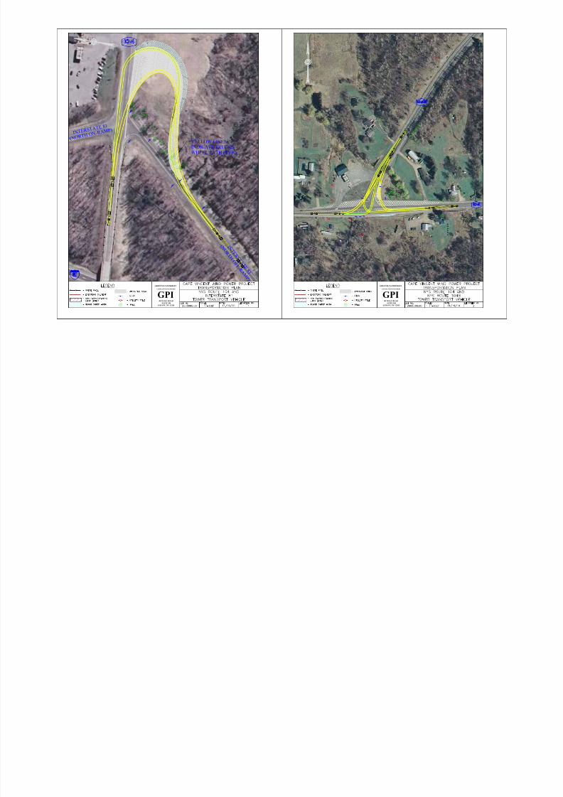
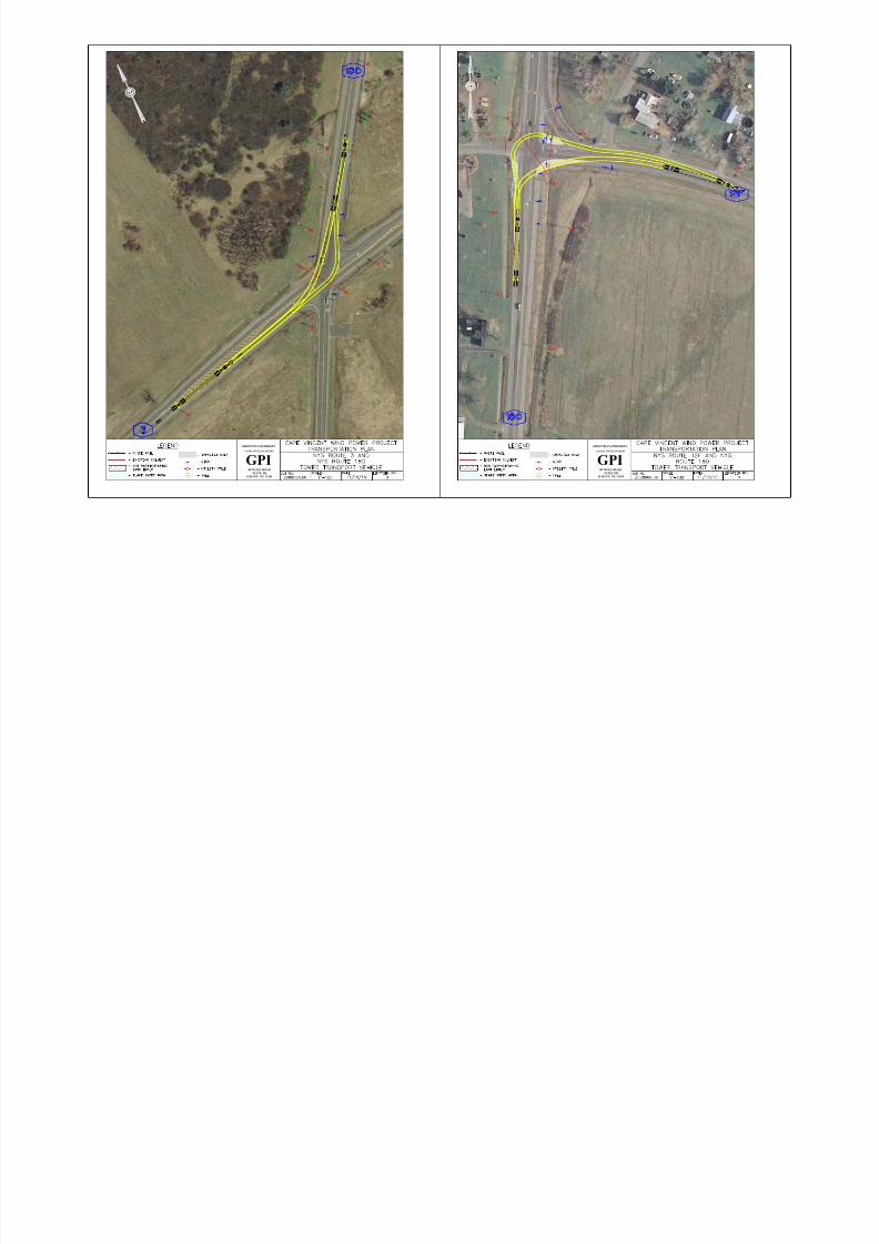
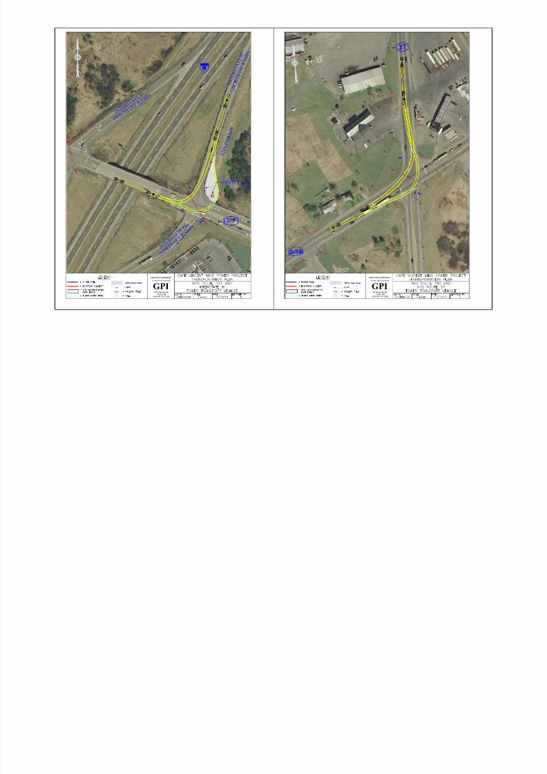
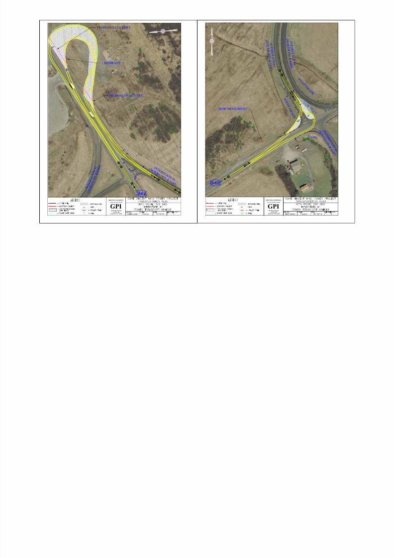
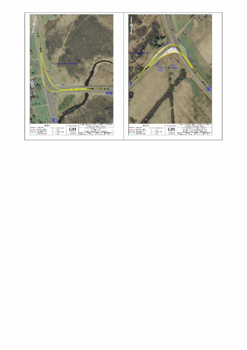
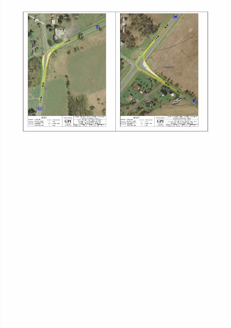
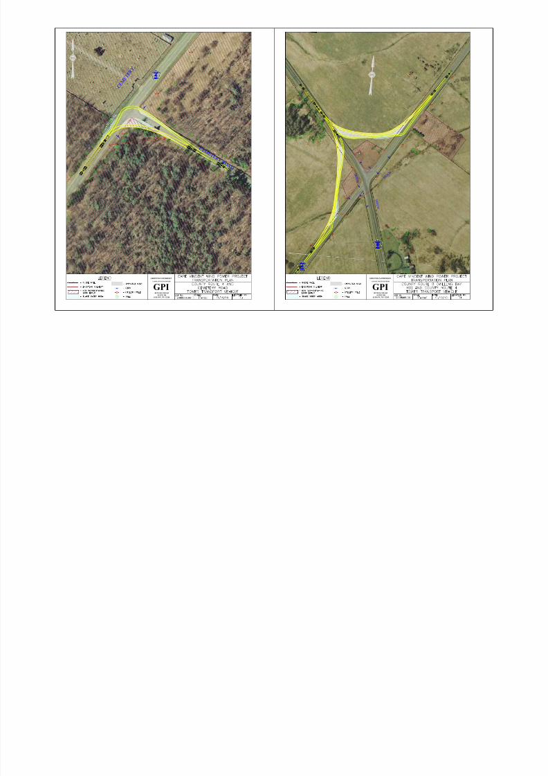
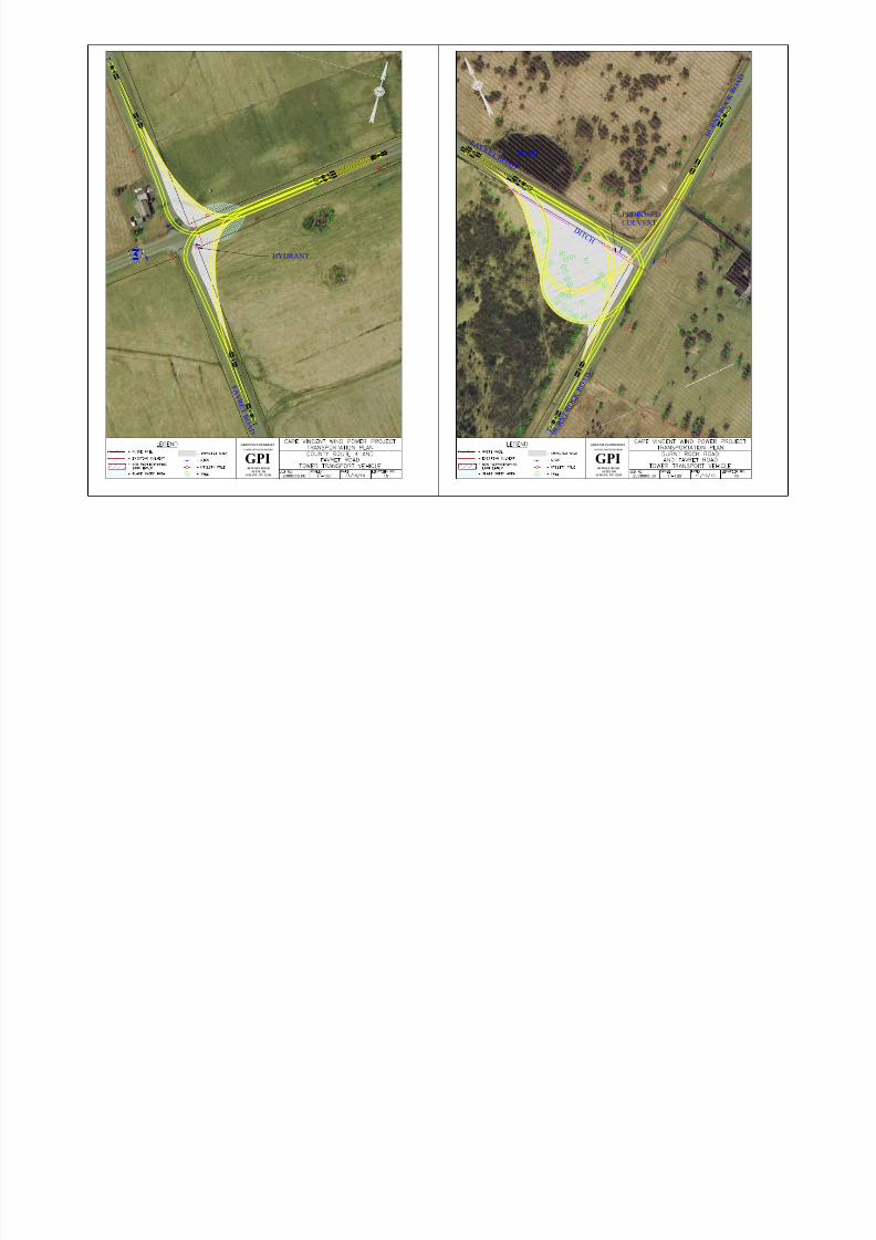
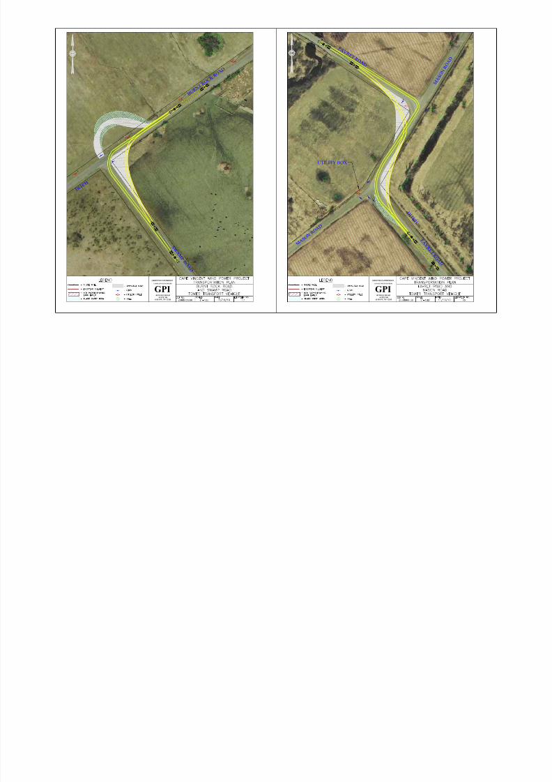
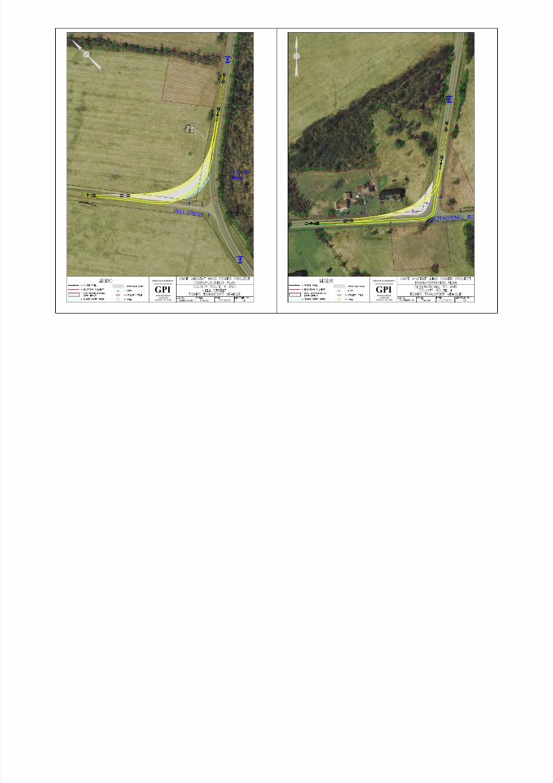
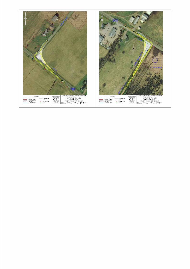
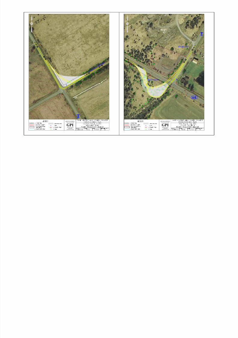
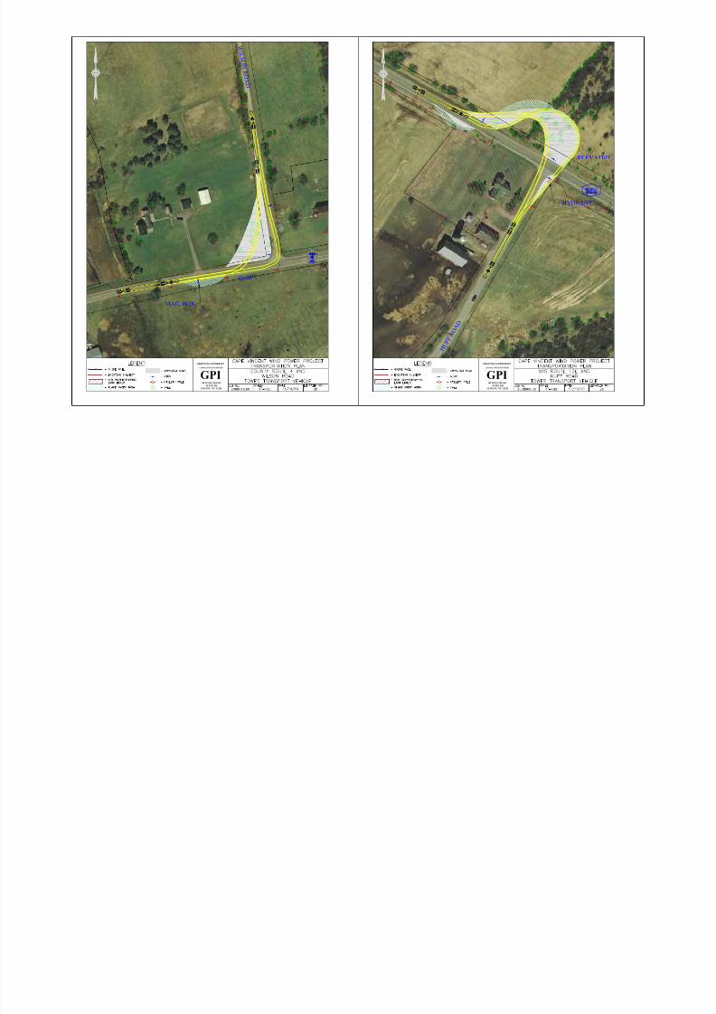
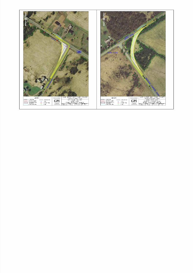
D. Evaluation of Culverts
There are several culverts located along the proposed regional haul routes andlocal delivery routes that could be impacted by the OS/OW vehicles. GPI
transportation engineers met with representatives from NYSDOT, Jefferson
County and the Town of Cape Vincent to discuss the haul routes and localdelivery routes along roadways under their jurisdiction. The routes chosen were
selected to avoid traveling across bridges/culverts that have posted or known
weight restriction. Jefferson County provided GPI with culvert and bridge
inspection reports for many of the county and town roads expected to be used
during construction in the Town of Cape Vincent. The reports indicated that 2culverts and 1 bridge have visual signs of deterioration and are noted as follows:
A culvert located on County Route 4 (approximately 160 ft west of County Route8) shows deterioration on the headwall and wingwall.
A culvert located on County Route 8 (approximately 1000 ft south of MacombSettlement Road) shows moderate spalling on the headwall and wingwall.
A bridge located on Hell Street (approximately 3700 ft north of County Route 4)shows galvanized coating deterioration below the spring lines.
The culvert located on County Route 4 (approximately 160 ft west of County
Route 8) is the only location along a regional haul route or local delivery route.This culvert should be investigated further prior to construction to determine if
adequate capacity exists or if replacement should be considered. If replacement isnot considered feasible, alternate routes which avoid the suspect culvert should beestablished for delivery of the OS/OW equipment. The other culvert and bridge
listed is provided for informational purposes only and is not expected to be used
for the transport of OS/OW components during construction.
E. Evaluation of Bridges
Improvements to bridges along the proposed regional haul routes and localdelivery routes are not expected to be required. NYSDOT provided input on
established OS/OW haul routes which avoid bridges along state highways that
have size or weight restrictions. Jefferson County and the Town of Cape Vincent
provided input on posted or restricted bridges along their roadways within the
8/7/2019 BP SDEIS App C-2 GPI Transportation Plan 11-30-2010 Cape Vincent
http://slidepdf.com/reader/full/bp-sdeis-app-c-2-gpi-transportation-plan-11-30-2010-cape-vincent 19/26
F. Potential Additional Evaluations
The improvements required to facilitate construction of the project will likelygenerate the need for additional studies and permits. Additional studies could
include:
Pavement Evaluation – a pavement evaluation could be used to determinethe condition of the existing roadways by establishing a baseline for
measuring impacts caused during construction.
Culvert Evaluation – a culvert evaluation could be performed to determine
the existing condition of culverts and ensure the safety of OS/OW loadstraveling over the culverts.
Bridge Evaluation – a bridge evaluation could be performed to determine
the existing condition of bridges and ensure the safety of OS/OW loads
traveling over the bridges.
G. Permits Required
The required improvements including intersection widening, extending culvertsand transporting OS/OW loads will require various permits. Permits from
NYSDOT, Jefferson County and the Town of Cape Vincent will be required to
complete the improvements and transport the components. Permits which will be
required are as follows:
Environmental Permits – site specific analyses of environmentalconditions will determine the need for permits at a particular location. Dueto the nature of the area, it’s anticipated the wetland permits will be
required at several locations.
Highway Work Permit – a highway work permit will be required for intersection improvements and proposed entrances to State, County andLocal roadways.
Special Hauling Permits – special hauling permits will be required for transporting the OS/OW components to the project area. Permits will be
required from NYSDOT and Jefferson County.
8/7/2019 BP SDEIS App C-2 GPI Transportation Plan 11-30-2010 Cape Vincent
http://slidepdf.com/reader/full/bp-sdeis-app-c-2-gpi-transportation-plan-11-30-2010-cape-vincent 20/26
8.0 PRE-CONSTRUCTION CONDITIONS
A. Pre-Construction Road Conditions
On November 17-18, 2008, two GPI transportation engineers performed a cursoryvisual inspection of the proposed haul routes and roadway network. Their
inspection included identifying any restrictions that would be encountered along
the haul routes, more specifically identifying any overhead utilities or
obstructions, identifying any intersections which may require modifications or improvements and observing the general pavement and drainage conditions of the
roadways along the haul routes.
All of the NYS Highways including NYS Routes 3, 12, 12E, 12F, 13, 37, 104,
104B, 180 and 342 were all constructed using asphalt pavement. The shoulder
widths along these highways vary from 4 - 10 feet while the pavement widthvaries from 20 - 24 feet. The asphalt pavement was in fair to good condition
according to the 2006 NYSDOT Highway Sufficiency Ratings. A fair rating
indicates that pavement distress is clearly visible whereas a good rating indicates
that distress symptoms are beginning to show. The visual inspection performed byGPI confirmed that some of the routes show pavement distress beginning, usually
in the form of surface cracking. The NYS highways mentioned in this analysis
have been maintained as most of the cracking observed had been sealed to preventfurther degradation.
The Jefferson County Highways expected to be used during construction are
County Routes (CR) 4, 8 and 9. CR 9 consists of two 10-foot wide travel lanesand 3-foot wide gravel shoulders. Field observations noted the asphalt pavement
was in fair to good condition. Some longitudinal alligator cracking was noted
which had been recently sealed. CR 8 consists of two 10-foot wide travel lanesand 4-foot wide gravel shoulders which appeared to be in good condition. CR 4
consists of a 20-foot pavement width for two-way travel with no shoulders and
was in poor condition with visible potholes and structural problems. It appearedthat a recent micro overlay of the asphalt pavement has been performed, however
the structural problems were still clearly evident. The county roads are expected
to be utilized as part of the haul routes for the OS/OW materials which could
result in structural damage to county roads which already show significant signsof deterioration.
8/7/2019 BP SDEIS App C-2 GPI Transportation Plan 11-30-2010 Cape Vincent
http://slidepdf.com/reader/full/bp-sdeis-app-c-2-gpi-transportation-plan-11-30-2010-cape-vincent 21/26
vehicles and an increase in volume caused by construction vehicles. The town
roads expected to be used during development were constructed with asphalt
pavement, although some sections of Hell Street, Wilson Road and MerchantRoad were constructed with crushed gravel. Many of the town roads are
approximately 18 feet wide with 5-foot wide shoulders for two-way traffic.
B. Pre-Construction Culvert Conditions
There are several culverts located along the proposed regional haul routes and
local delivery routes. GPI transportation engineers met with representatives fromNYSDOT to discuss possible regional haul routes to the project area. The routes
ultimately selected avoided culverts/bridges with weight restrictions.
A GPI transportation engineer met with representatives from Jefferson Countyand the Town of Cape Vincent to discuss the regional haul routes and local
delivery routes along roadways under their jurisdiction. The routes chosen were
selected to avoid traveling across bridges/culverts that have posted or known
weight restrictions. Jefferson County provided GPI with culvert and bridgeinspection reports for many of the county and town roads expected to be used
during construction in the Town of Cape Vincent. The reports indicated that 2
culverts and 1 bridge have visual signs of deterioration. Only the culvert locatedon County Route 4 (approximately 160 ft west of County Route 8) will be utilized
under the recommended haul or delivery routes. This culvert should be
investigated further prior to construction to determine if adequate capacity existsor if replacement should be considered.
C. Pre-Construction Bridge Conditions
The proposed regional haul routes include a number of bridges which the OS/OW
loads will travel over. Regional haul routes were selected to avoid traveling over
bridges which have capacity or clearance restrictions. No impacts are expected for
the bridges located along the regional haul routes.
Local delivery routes were selected to avoid traversing bridges which have
capacity or clearance restrictions. There is a bridge located along County Route 4approximately 1,700 feet east of Wilson Road which is posted for 18 tons. The
local delivery routes recommended in this study avoid the restricted bridge and
8/7/2019 BP SDEIS App C-2 GPI Transportation Plan 11-30-2010 Cape Vincent
http://slidepdf.com/reader/full/bp-sdeis-app-c-2-gpi-transportation-plan-11-30-2010-cape-vincent 22/26
9.0 SCHEDULING OF DELIVERIES
There are several considerations which must be taken into account when planning
the schedule of deliveries to the project area as local travel patterns are subject toseasonal influences. During the winter months, severe weather conditions can
limit road access, as well as functional road width. During the summer months,
the region experiences a significant increase in tourism-related traffic. In addition,
commuting traffic and school bus schedules should be considered to avoidpotential impacts to these time-sensitive motorists.
It is expected that construction activities related to the project will coincide withthe peak seasonal travel and some overlap with the school year is anticipated.
Early strategic planning will be required to minimize the disruptions to motorists.
To the maximum extent feasible, BP Wind Energy should construct roadway and
intersection improvements along major arterials during the non-recreationalseason and establish an equipment staging area that contains enough capacity to
minimize the amount of equipment deliveries into the area which would take
place during the recreational season.
The delivery of OS/OW components and materials will likely follow one of the
proposed regional haul routes to access the project area. The proposed haul routes
for OS/OW components and materials were selected to minimize disruptions tomotorists and residents. Local school officials and emergency response
representatives will be notified in advance of temporary closures or traffic
restrictions required to improve intersections to accommodate OS/OW loads or cross roadways with utility lines.
It is expected that equipment and materials will be delivered to the site during
normal construction hours. The heavy equipment and materials needed for siteaccess, site preparation and foundation construction are typical of road
construction and do not pose unique transportation considerations. The delivery of
OS/OW turbine components will create the greatest impact to motorists as these
large transport vehicles will be slow moving and will require additional time tonavigate turns. The deliveries of OS/OW components have the potential to inhibit
operations along the major two-lane highways (NYS Route 12) during peak hoursand deliveries of such OS/OW turbine components should be limited to off-peak
hours to minimize the disruption to motorists. According to NYSDOT Traffic
Count Hourly Reports for NYS Route 12, which is located along the regional haul
8/7/2019 BP SDEIS App C-2 GPI Transportation Plan 11-30-2010 Cape Vincent
http://slidepdf.com/reader/full/bp-sdeis-app-c-2-gpi-transportation-plan-11-30-2010-cape-vincent 23/26

8/7/2019 BP SDEIS App C-2 GPI Transportation Plan 11-30-2010 Cape Vincent
http://slidepdf.com/reader/full/bp-sdeis-app-c-2-gpi-transportation-plan-11-30-2010-cape-vincent 24/26
8/7/2019 BP SDEIS App C-2 GPI Transportation Plan 11-30-2010 Cape Vincent
http://slidepdf.com/reader/full/bp-sdeis-app-c-2-gpi-transportation-plan-11-30-2010-cape-vincent 25/26
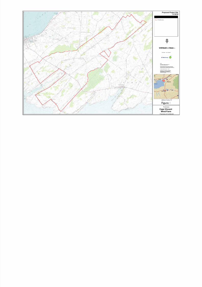
²
0 0.25 0.5 0.75 10.125Miles
LEGEND
Cape Vincent
Wind Farm
Jefferson County, NY
Preliminary
Proprietary & Confidential
NOTES:
Parcel Data from Jefferson County, New YorkUSGS 1:24K TopoQuad Background
BP Wind Energy NA does not guarantee the completeness or accuracy of information contained on the map (including thirdparty data). The data was compiled from the best sources available.
**Information Subject to Change 11/18/10 **
**PROPRIETARY & CONFIDENTIAL INFORMATION**This drawing is proprietary information owned byBP Wind Energy NA, Inc. and is intended to beheld CONFIDENTIAL. Any unauthorized reproductionor distribution is prohibited.
UTM NAD83 Zone 18 MetersF
Proposed Project Site11/18/10
Project Boundary
E
Figure 1
8/7/2019 BP SDEIS App C-2 GPI Transportation Plan 11-30-2010 Cape Vincent
http://slidepdf.com/reader/full/bp-sdeis-app-c-2-gpi-transportation-plan-11-30-2010-cape-vincent 26/26
!
!
!
!
!
!
!
!
!
!
!
!
!
!!
!
!
! !
!!
!
!
!
!
!
!
!
!
!!
!
!
!
!
!
!
! !
!
!
!
!
!
!
!
!
!
!
!
!
!
!
!
!
!
!
!
!
!
!
!
!
!
!
!
!
!
!
!
!
!
!
!
!
!
!
!!
!
!
!
!
!2
9
8
7
6
5
4
1
87
86
85
84
8382
81
80
78
77
76
75
74
73
72
71
70
69
68
67
66
65
63
62
61
60
59
58
57
56
55
54
53
52
51
50
49
48
47
46
45
44
43
42
4140
39
38
37
36
35
34
3332
31
30
29
28
27
26
25
24
23
22
2120
19
18
1716
15
14
13
12
11
10
²
0 0.25 0.5 0.75 10.125
Miles
LEGEND
Cape Vincent
Wind Farm
Jefferson County, NY
Preliminary
Proprietary & Confidential
NOTES:
Parcel Data from Jefferson County, New YorkUSGS 1:24K TopoQuad Background
BP Wind Energy NA does not guarantee the completeness or accuracy of information contained on the map (including thirdparty data). The data was compiled from the best sources available.
**Information Subject to Change 11/18/10 **
**PROPRIETARY & CONFIDENTIAL INFORMATION**This drawing is proprietary information owned byBP Wind Energy NA, Inc. and is intended to beheld CONFIDENTIAL. Any unauthorized reproductionor distribution is prohibited.
UTM NAD83 Zone 18 Meters
Proposed Project Site & Facilities11/18/10
! Array - 84 x GE 1.6 100
Underground Collection
Access Roads
Project Boundary
Laydown Yard
O&M Facility
Substation
Batch Plants
Overhead Transmission (TROW)
TCapeVincent
E
Figure 2