Embed Size (px)
Citation preview

Bridging the digital divide in WV GIS systems
Presenter: Tu H. Tran, MS Marshall University
Bridging the digital divide in Bridging the digital divide in WVGISWVGIS
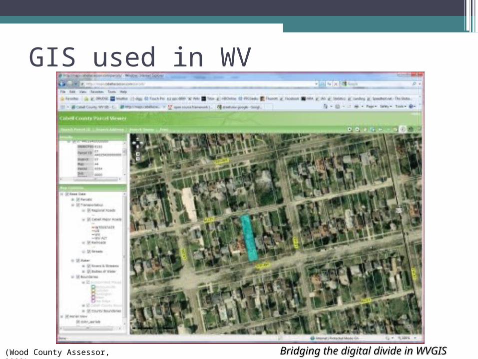
GIS used in WV
(Wood County Assessor, 2009)
Bridging the digital divide in Bridging the digital divide in WVGISWVGIS
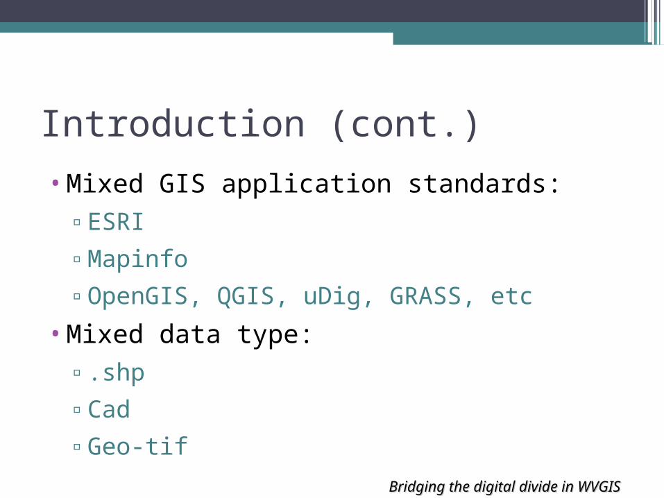
Introduction (cont.)
•Mixed GIS application standards:▫ESRI
▫Mapinfo
▫OpenGIS, QGIS, uDig, GRASS, etc
•Mixed data type:▫.shp
▫Cad
▫Geo-tif

Bridging the digital divide in Bridging the digital divide in WVGISWVGIS
Problems
•With the current technologies and applications, WV GIS agencies had some difficulties in:▫Sharing information▫Reusing information
across the system.

Bridging the digital divide in Bridging the digital divide in WVGISWVGIS
Project Purpose
•Develop an efficient and cost effective solution to help:▫Share data▫Save time and storage space▫Provide public access at convenient
locations▫Provide references to other research

Bridging the digital divide in Bridging the digital divide in WVGISWVGIS
Solution
•Using a combination of commercial and openGIS standard▫Set up a multi-tier GIS server system▫GIS Map Server for Web map application
servicesBeckley City’s Metro GIS system at Raleigh
county is an example of successfully applying this system
Bridging the digital divide in Bridging the digital divide in WVGISWVGIS
GIS System
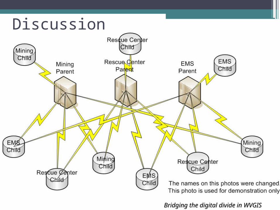
Discussion

Bridging the digital divide in Bridging the digital divide in WVGISWVGIS
Discussion (cont.)•Data center

Bridging the digital divide in Bridging the digital divide in WVGISWVGIS
Results•Public user can have access through the
Web site
(Cabell Assessor, 2009)

Bridging the digital divide in Bridging the digital divide in WVGISWVGIS
Results (cont.)
•Save millions of dollars by reusing data and resources.
•Example:▫$3 * 60000 parcels = $180,000▫$180,000 * 55 counties = $9,900,000
Bridging the digital divide in Bridging the digital divide in WVGISWVGIS
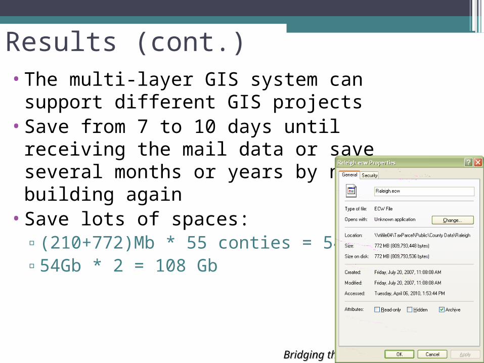
Results (cont.)•The multi-layer GIS system can support
different GIS projects•Save from 7 to 10 days until receiving the
mail data or save several months or years by not building again
•Save lots of spaces:▫(210+772)Mb * 55 conties = 54 Gb▫54Gb * 2 = 108 Gb

Bridging the digital divide in Bridging the digital divide in WVGISWVGIS
Scenario 1: Cadastral layer with Geomajas, PostGIS and Tomcat 6 •http://172.16.6.23:8080/majas-tutorial/
applications/db/html/db.html

Bridging the digital divide in Bridging the digital divide in WVGISWVGIS
Scenario 2: GIS and 3G network•Crime mapping:
http://www.crimemapping.com/•Huntington Crime Database
http://ist436.njrati.net/~ttran/simple-map/

Bridging the digital divide in Bridging the digital divide in WVGISWVGIS
Scenario 2 discussion
•OpenSource : Ubuntu server 9.10, PostgreSQL 8.3, PostGIS 1.4, ...
•Functionalities: Add, Edit, analysis• iPhone SDK•3G or 4G services•GPS accuracy

Bridging the digital divide in Bridging the digital divide in WVGISWVGIS

Bridging the digital divide in Bridging the digital divide in WVGISWVGIS
iPhone GPS accu.
•Cell tower: <500m•internet: <30m•GPS: <10m
(iGPSd, 2010)

Bridging the digital divide in Bridging the digital divide in WVGISWVGIS
And also save life

Bridging the digital divide in Bridging the digital divide in WVGISWVGIS

Bridging the digital divide in Bridging the digital divide in WVGISWVGIS
Conclusion
•Support and carry on other WV GIS projects.
•Provide a faster means to organize, to maintain, and to manage the GIS system
•Furnish the ability to access, edit, and share information with a click of a button.
Bridging the digital divide in Bridging the digital divide in WVGISWVGIS
Future project
•Huntington Crime analysis using PostGIS and dojo framework
•Real time speed synchronizing app (Android, iPhone, Window Mobile, google)
•GIS robotic controlling by Mobile Apps and VNC software

Bridging the digital divide in Bridging the digital divide in WVGISWVGIS
Question, Comment & Answer
•Thank you.
GIS Provides a Healthy GIS Provides a Healthy EnvironmentEnvironment