Embed Size (px)
Citation preview
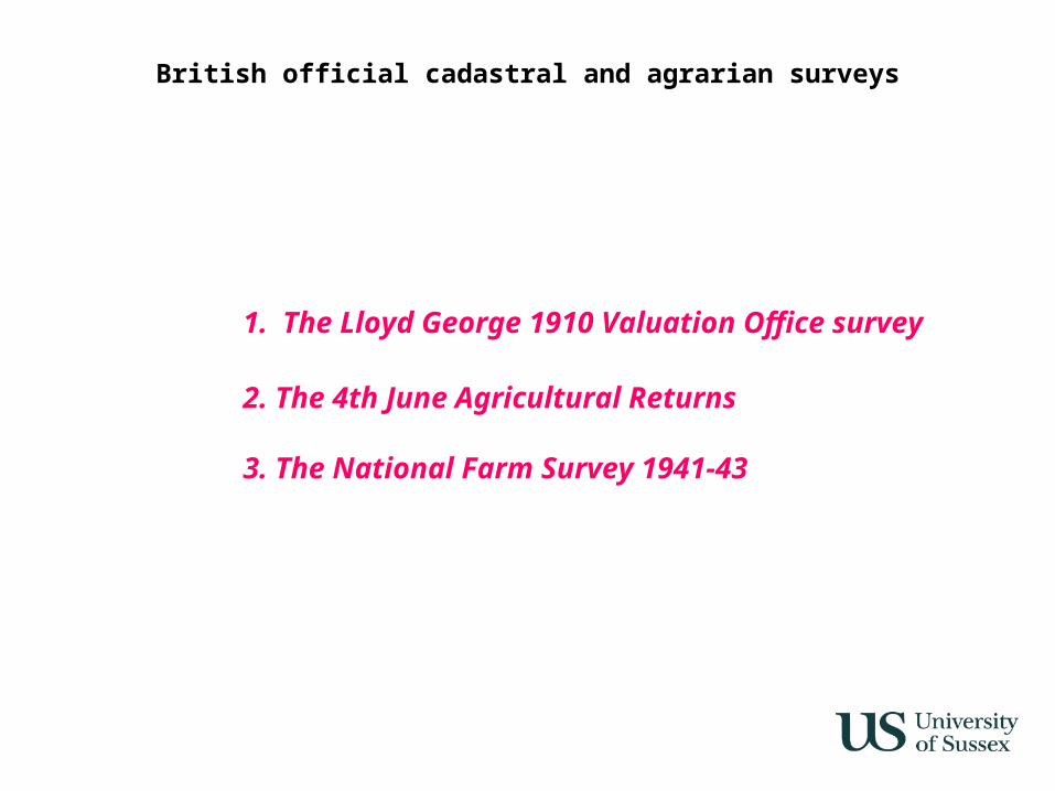
British official cadastral and agrarian surveys
1. The Lloyd George 1910 Valuation Office survey
2. The 4th June Agricultural Returns
3. The National Farm Survey 1941-43
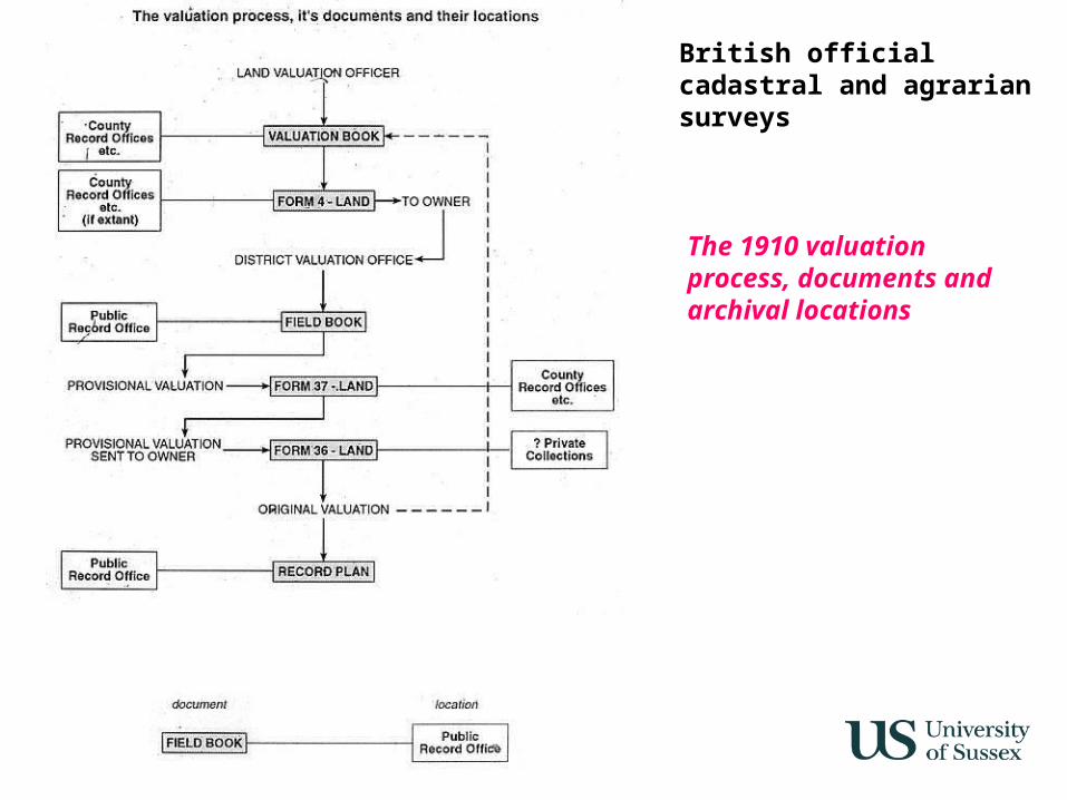
British official cadastral and agrarian surveys
The 1910 valuation process, documents and archival locations
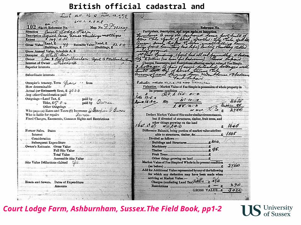
British official cadastral and agrarian surveys
Court Lodge Farm, Ashburnham, Sussex.The Field Book, pp1-2
British official cadastral and agrarian surveys
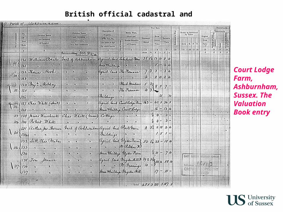
Court Lodge Farm, Ashburnham, Sussex. The Valuation Book entry
British official cadastral and agrarian surveys
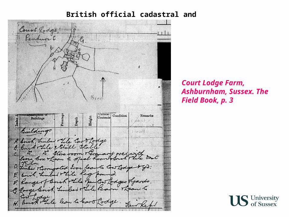
Court Lodge Farm, Ashburnham, Sussex. The Field Book, p. 3
British official cadastral and agrarian surveys
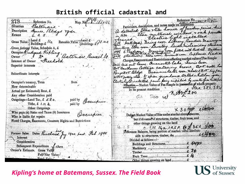
Kipling’s home at Batemans, Sussex. The Field Book
British official cadastral and agrarian surveys
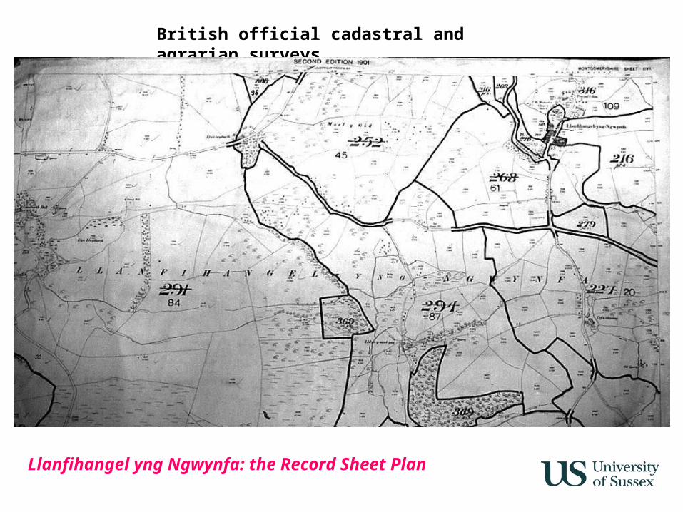
Llanfihangel yng Ngwynfa: the Record Sheet Plan
British official cadastral and agrarian surveys
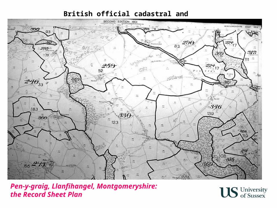
Pen-y-graig, Llanfihangel, Montgomeryshire: the Record Sheet Plan
British official cadastral and agrarian surveys
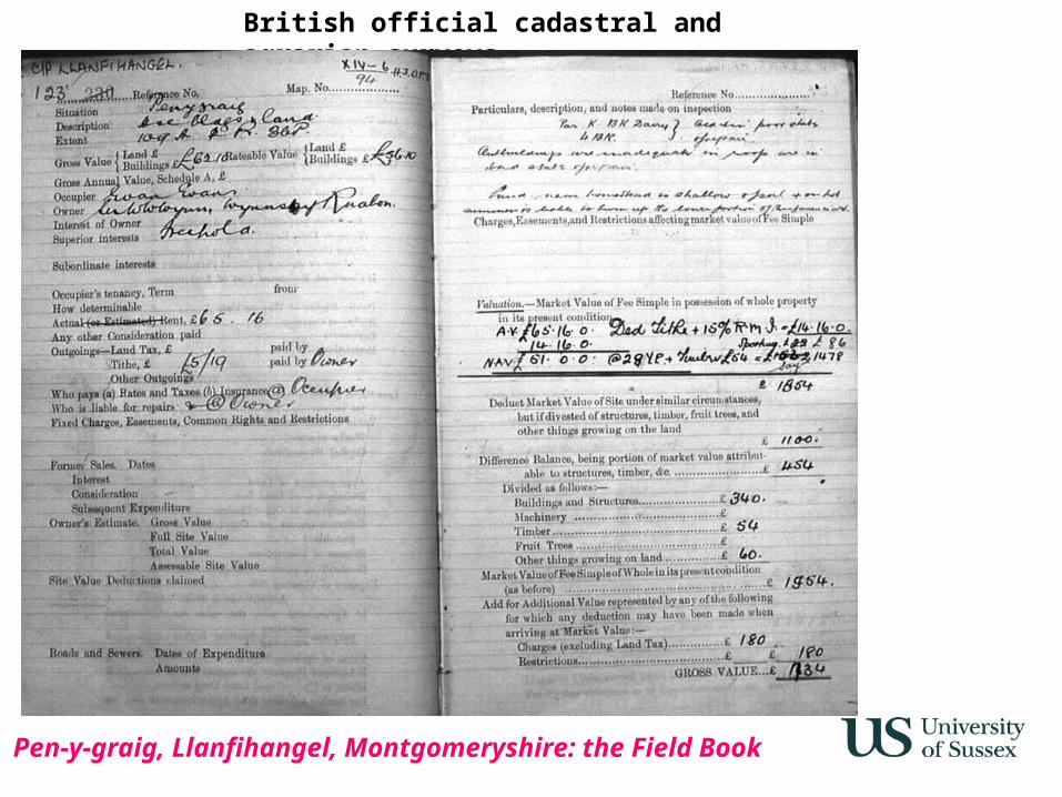
Pen-y-graig, Llanfihangel, Montgomeryshire: the Field Book
British official cadastral and agrarian surveys
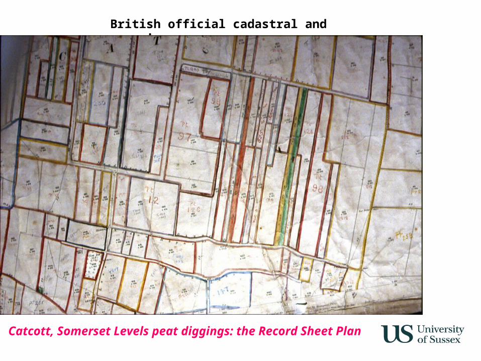
Catcott, Somerset Levels peat diggings: the Record Sheet Plan
British official cadastral and agrarian surveys
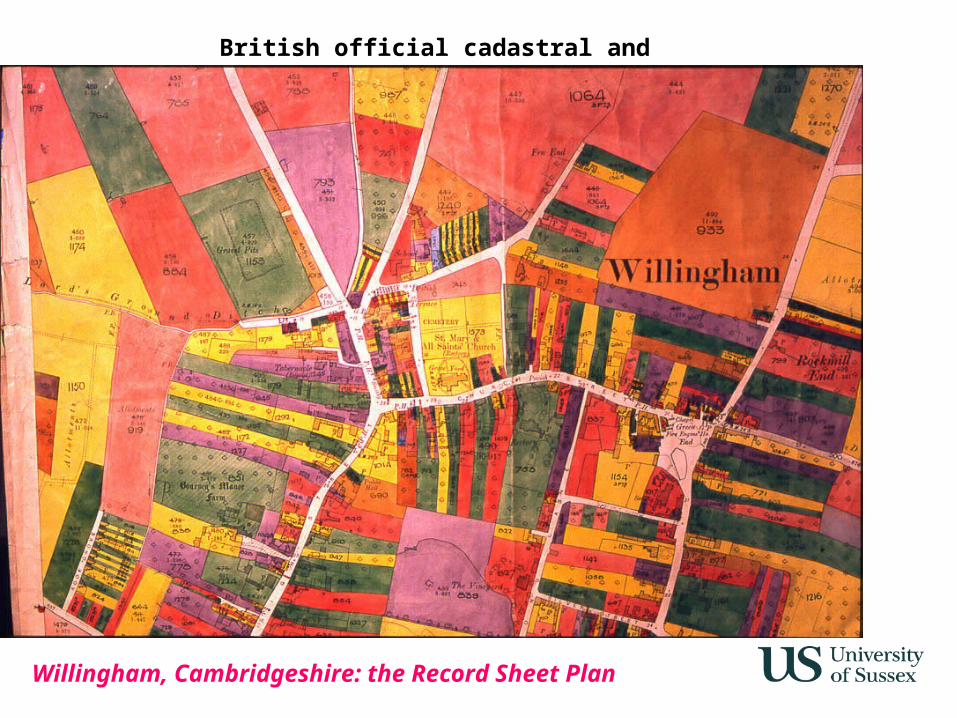
Willingham, Cambridgeshire: the Record Sheet Plan
British official cadastral and agrarian surveys
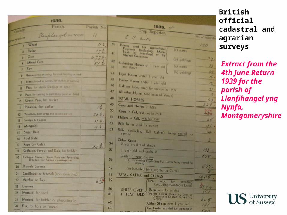
Extract from the 4th June Return 1939 for the parish of Llanfihangel yng Nynfa, Montgomeryshire
British official cadastral and agrarian surveys
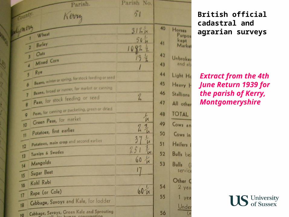
Extract from the 4th June Return 1939 for the parish of Kerry, Montgomeryshire
British official cadastral and agrarian surveys
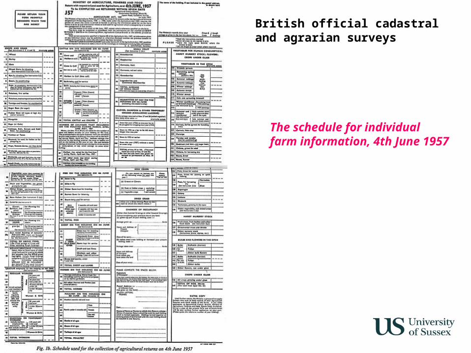
The schedule for individual farm information, 4th June 1957
British official cadastral and agrarian surveys
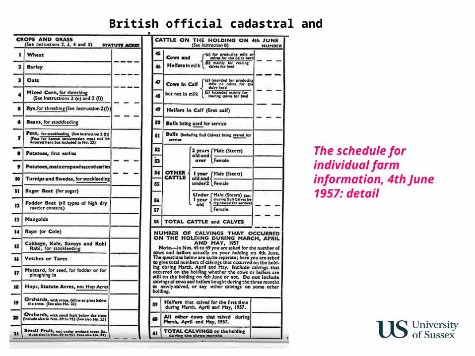
The schedule for individual farm information, 4th June 1957: detail
British official cadastral and agrarian surveys
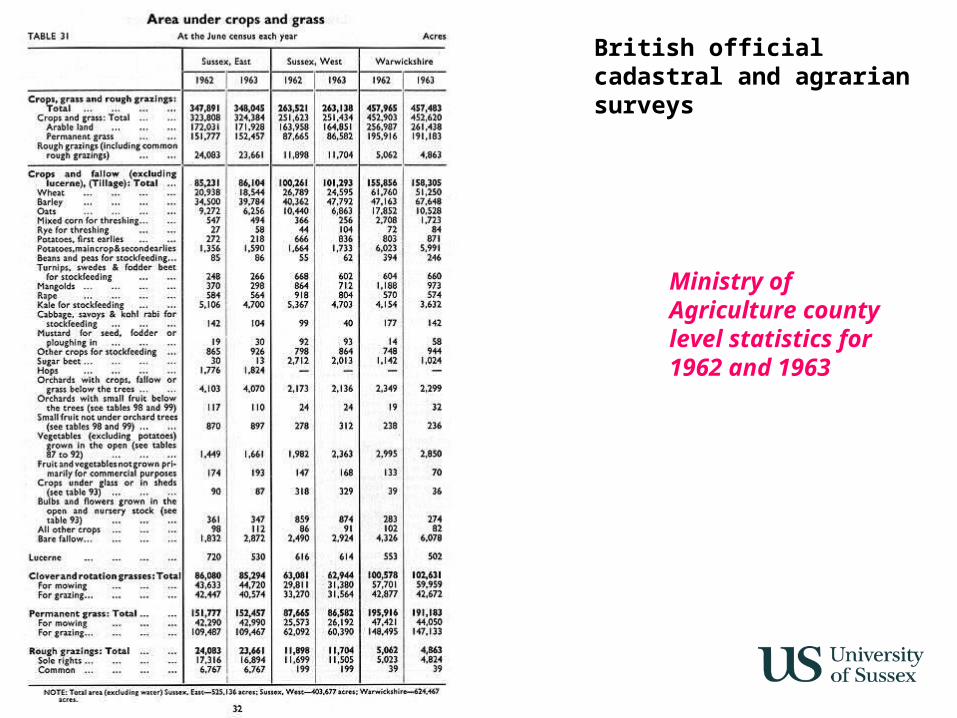
Ministry of Agriculture county level statistics for 1962 and 1963
British official cadastral and agrarian surveys
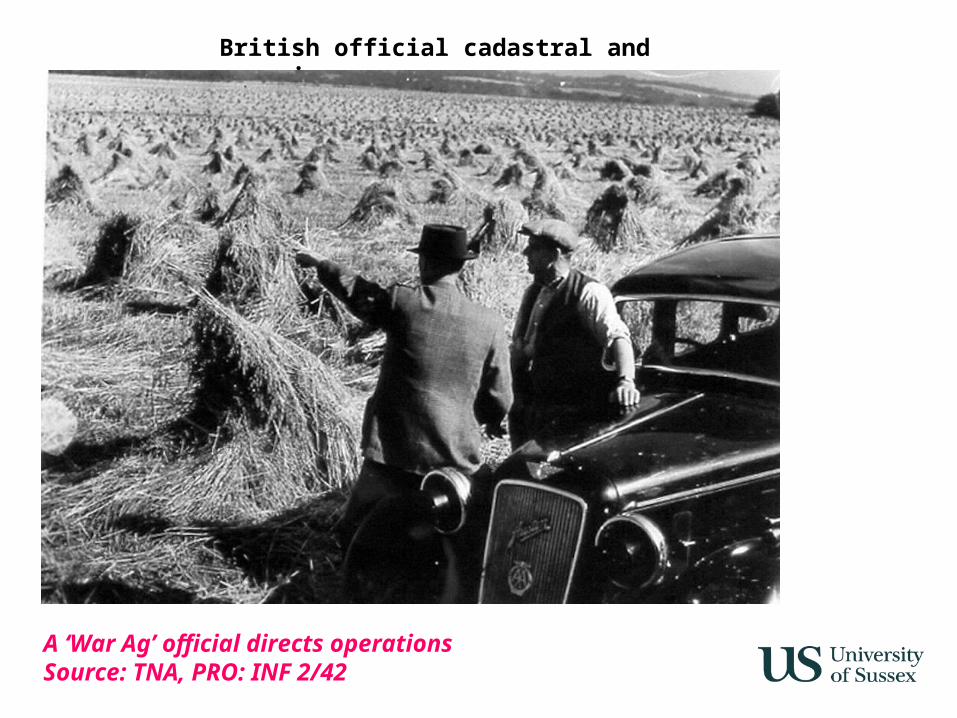
A ‘War Ag’ official directs operationsSource: TNA, PRO: INF 2/42
British official cadastral and agrarian surveys
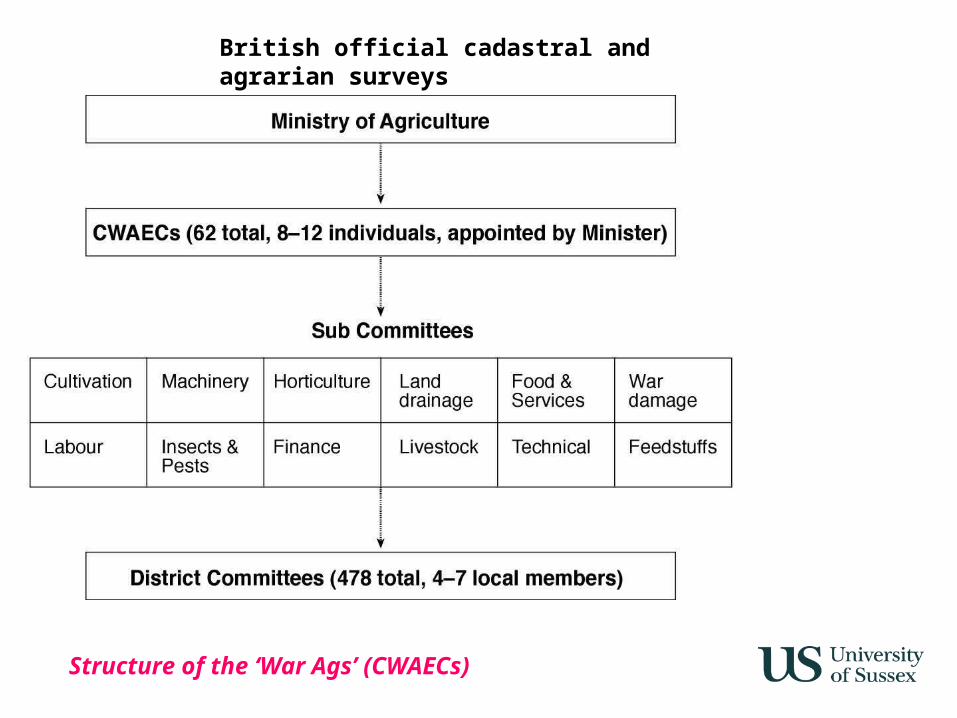
Structure of the ‘War Ags’ (CWAECs)
British official cadastral and agrarian surveys
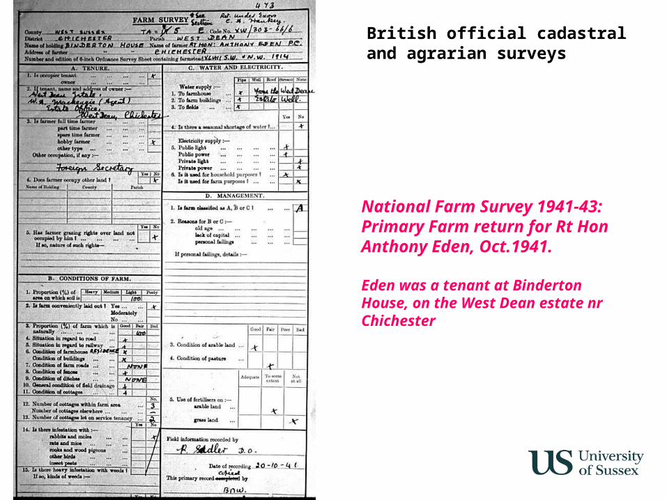
National Farm Survey 1941-43: Primary Farm return for Rt Hon Anthony Eden, Oct.1941.
Eden was a tenant at Binderton House, on the West Dean estate nr Chichester
British official cadastral and agrarian surveys
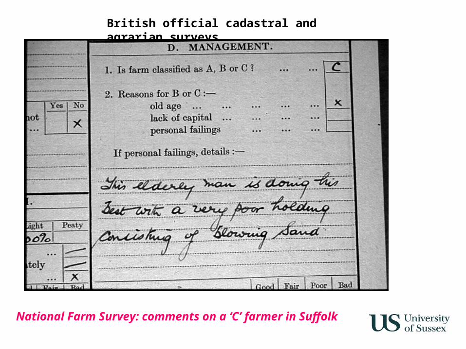
National Farm Survey: comments on a ‘C’ farmer in Suffolk
British official cadastral and agrarian surveys
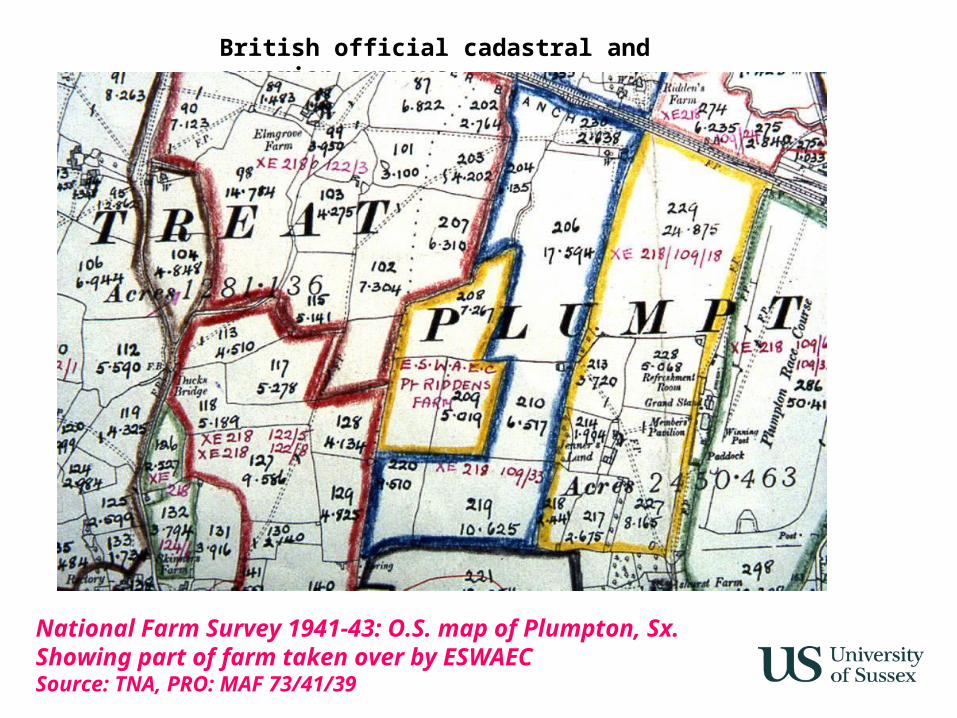
National Farm Survey 1941-43: O.S. map of Plumpton, Sx. Showing part of farm taken over by ESWAECSource: TNA, PRO: MAF 73/41/39
British official cadastral and agrarian surveys
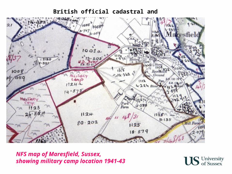
NFS map of Maresfield, Sussex, showing military camp location 1941-43
British official cadastral and agrarian surveys
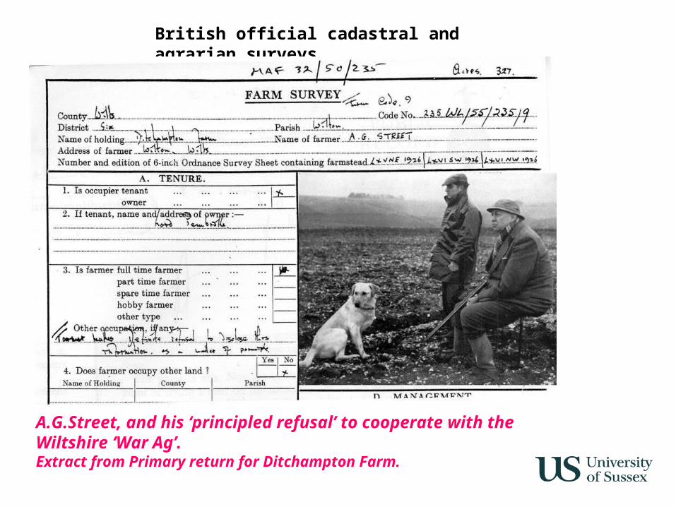
A.G.Street, and his ‘principled refusal’ to cooperate with the Wiltshire ‘War Ag’. Extract from Primary return for Ditchampton Farm.