Embed Size (px)
Citation preview

BUILDING STRONG®

BUILDING STRONG®
Dam Safety Production Center (DSPC)Southwestern Division, USACE
What is it? A means to deliver enduring and essential dam safety solutions to high priority projects.
Context: 91 dams (Southwestern Division) of which 39 are “actionable”, 40% of the entire risk in USACE.
Focus: Centralized source of Civil, Geotechnical, Structural, Geological, Hydraulics & Hydrology expertise:
Leads the engineering aspects of the region’s Dam Safety Modification mission
Supports a Risk Cadre dedicated to the Risk Management Center priorities
Supports other dam and levee safety program missions as requested
Clearwater Dam Cutoff wall

BUILDING STRONG®
Canton Dam Construction
Assistance to Issue Evaluation Studies (IES) and Periodic Assessments (PA) across the Region
Conducting Risk Assessments through a dedicated Risk Cadre across the country
Conducting Construction Liaison oversight through an MOA with RMC/MCX. Wright-Patman Modification Alternatives Joe Pool Hydro-fracturing Risk Assessment Levee Screenings
Major Activities Canton Dam Modification Pine Creek Dam Modification Addicks and Barker Dams Modification Dam Safety Modification Studies for
Lewisville Dam and Amistad Dam (in support of the International Boundary Water Commission)
Dam Safety Production Center (DSPC)Southwestern Division, USACE
BUILDING STRONG®
Prairie Creek and Engineers DitchRussellville, Arkansas
Little Rock District, USACE
Project Description: Small flood management project for the City of Russellville, Arkansas. The Sponsor is the City of Russellville.
Project Background Flooding occurs in downtown commercial,
residential, and public facilities in Russellville, AR. This causes traffic and safety hazards.
Capacity of culverts along Prairie Creek and Engineers Ditch are inadequate for current city growth, causing detention of flow.
Undersized pump and sump station become overwhelmed from rainfall and run-off.
Planning Objectives: • Reduce overall flood damages in the project area• Reduce risk to life and safety in the project area• Environmental Operating Principals are being considered throughout the study.
500 Year Flood Map

BUILDING STRONG®
Prairie Creek and Engineers DitchRussellville, Arkansas
Little Rock District, USACE
Project Summary: In July 2010, the City of Russellville, Arkansas
requested the U.S. Army Corps of Engineers Little Rock District conduct a flood damage reduction study under the authority of Section 205 of the Flood Control Act of 1948. The Corps of Engineers signed a cost sharing agreement with the City of Russellville on 20 April 2012 to complete this feasibility study.
Measures and alternative plans were developed and evaluated based on appropriate engineering, economic, environmental, cultural, and social factors. Measures considered included bridge removals, bridge replacement, channel redesign, and adding culverts and detention basins.
The tentatively selected plan includes replacing bridges, redesigning channels, and adding new culverts.
Benefits: Annual benefits of approximately $2 Million dollars (Damages
reduced) will be realized. 10% of structures will be removed from the 100 year flood
plain. The population living and working in the downtown Russellville
will be positively affected by reduced flooding.
Commerce St. looking North

BUILDING STRONG®
Watershed Map

BUILDING STRONG®
Concrete-lined channel within project area
Prairie Creek and Engineers Ditch
BUILDING STRONG®
Undersized box culvert at W. Main Street, looking south
Prairie Creek and Engineers Ditch

BUILDING STRONG®
Commerce Street bridge looking east
Prairie Creek and Engineers Ditch
BUILDING STRONG®
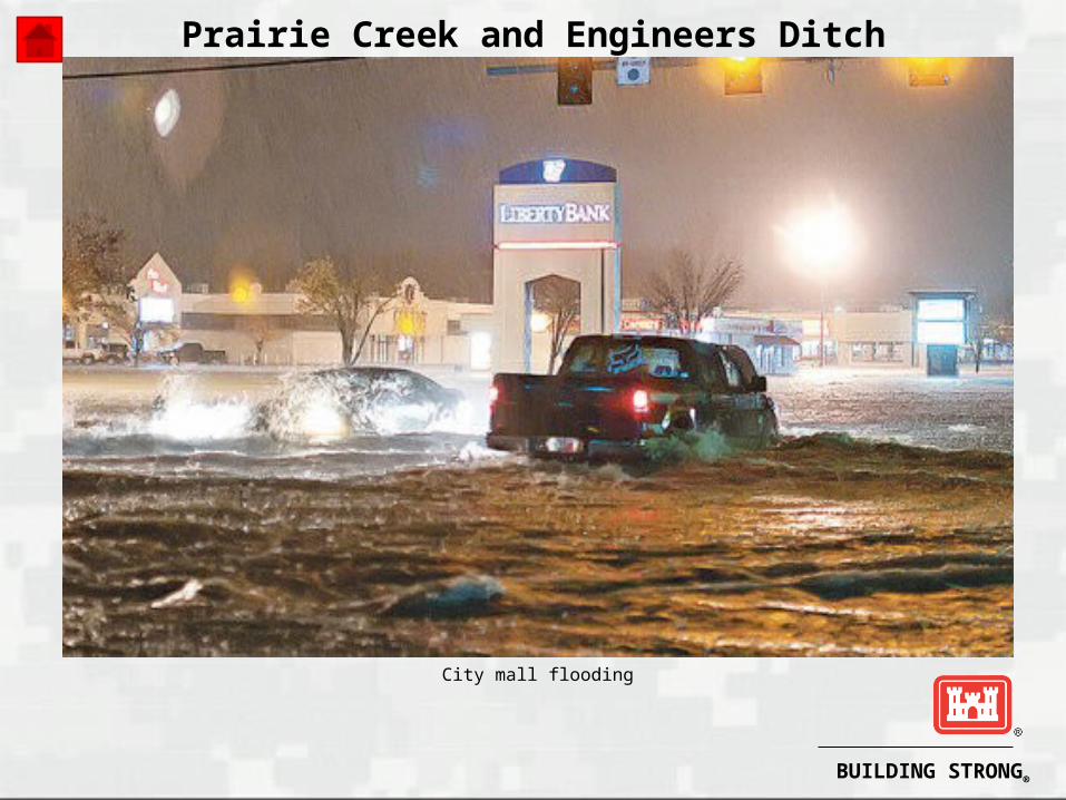
City mall flooding
Prairie Creek and Engineers Ditch

BUILDING STRONG®
McClellan-Kerr Arkansas River Navigation System Dredge Material Management Plan Update
The 445-mile long McClellan-Kerr Arkansas River Navigation System (MKARNS) consists of 18 locks and dams, provides 9-foot depth inland navigation from the Mississippi River to Catoosa, Oklahoma.
The MKARNS Dredge Material Management Plan (DMMP) was last prepared in a Letter Report dated July 1995 (known as the Long Term Management Strategy or LTMS for Disposal of Dredged Material). The recent White River National Wildlife Refuge Dredge Disposal areas issues (questionable capacity remaining at both disposal sites; and incompatibility issue described in the 2012 USFWS Compatibility report for the White River National Wildlife Refuge—conflict between USFWS mission and Corps’ Navigation mission on Wildlife Refuge lands) has led to the need to update the MKARNS DMMP.

BUILDING STRONG®
McClellan-Kerr Arkansas River Navigation System Dredge Material Management Plan Update
Facts:
1. The Project Delivery Team has been formed for the DMMP Update and Project Management Plan completed.
2. The scoping phase was initiated with a call for agency comments in October 2013. An agency scoping meeting was conducted in July 2014.
3. The District received funding in the amount of $100K in FY14 to continue work on this project.
Prepared by: John Balgavy, CESWL-OP, 25 July 2014

BUILDING STRONG®
Montgomery Point Lock & Dam Debris Issue
Montgomery Point Lock and Dam is located at mile 0.5 of the McClellan-Kerr Arkansas River Navigation System MKARNS. The facility was placed into service in 2004 and consists of a navigation lock, navigation pass with crest gates, and fixed embankment section.
Overview ofMontgomery Point area(December, 2012)

BUILDING STRONG®
Montgomery Point Lock & Dam Debris Issue
Facts:
1. At tailwater elevations of 115.0 or less, the crest gates are raised, and navigation traffic passes through the lock. At tailwater elevations greater than 115.0, the crest gates are lowered and navigation traffic transits over them in the navigation pass. Based on data between calendar years 2005 and 2013, the lock was used for an average of 2 distinct periods and 50 days per year (about 14% of the time). That includes three years (2009-2011) in which no lockages occurred.
2. The top of the lock wall is at elevation 138.0, and tailwater elevations above that level inundate all of the lock structure, except for the control tower. High tailwater is generally attributed to a high level on the Mississippi River in the area. Based on data between calendar years 2005 and 2013, the lock went underwater an average of 3.7 times for 101 days total for the year (about 28% of the time).
3. With each inundation comes a large amount of sediment in the lock chamber and downstream approach, generally attributed to backwater from the Mississippi River, and a large amount of debris and sediment from the White River.
BUILDING STRONG®
Montgomery Point Lock & Dam Debris Issue
Facts:
4. After each inundation event and when a return to lock operations is likely, the District mobilizes plant and personnel to remove debris and sediment to allow for safe lock operations and navigation traffic. In FY13, approximately 7000 man-hours and 100 plant days were necessary to clear the debris and sediment. In FY 12, approximately 2150 man-hours and 40 plant days were used, and in FY11, approximately 1800 man-hours and 36 plant days.
5. This significant commitment of plant and personnel to remove debris and sediment was not foreseen during planning for the project. With the need for this plant and personnel for critical repair needs on system infrastructure, a long-term solution to the debris and sediment issue at Montgomery Point is necessary.
6. Subject to availability of funding, a study in conjunction with the USACE Engineering Research and Development Center is planned to address alternative engineering and operational solutions to address the problem. The cost of the study is estimated at $400K.
Prepared by: John Balgavy, CESWL-OP, 25 July 2014
BUILDING STRONG®
Montgomery Point Lock & Dam Debris Issue
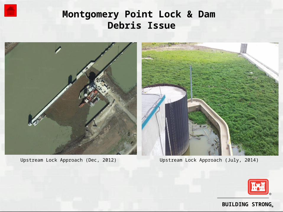
Upstream Lock Approach (Dec, 2012) Upstream Lock Approach (July, 2014)

BUILDING STRONG®
Montgomery Point Lock & Dam Navigation Difficulties at High Flows
Montgomery Point Lock and Dam is located at mile 0.5 of the McClellan-Kerr Arkansas River Navigation System (MKARNS). The facility was placed into service in 2004 and consists of a navigation lock, navigation pass with crest gates, and fixed embankment section.
Montgomery Point Lock Existing Flow Condition(Excerpted from Technical Report M55, USACE,St. Louis)

BUILDING STRONG®
Montgomery Point Lock & Dam Navigation Difficulties at High Flows
Facts:
1. At tailwater elevations of 115.0 or less, the crest gates are raised, and navigation traffic passes through the lock. At tailwater elevations greater than 115.0, the crest gates are lowered and navigation traffic transits over them in the navigation pass. Based on data between calendar years 2005 and 2013, the lock was used for an average of 2 distinct periods and 50 days per year (about 14% of the time). That includes three years (2009-2011) in which no lockages occurred.
2. The White River Entrance Channel (WREC) of the MKARNS is considered to extend from the mouth of the White River (Navigation Mile 0.0) to downstream approach to Norrell Lock (NM 10.3).
3. Mariners experience difficulties in navigating the WREC when a high water surface differential (i.e. the difference in elevation between the tailwater at Norrell and the headwater at Montgomery Point) exists. Generally, the concern is an outdraft condition for down bound vessels. At higher differentials (e.g. >5.0’) and with crest gates fully down, a hydraulic jump (i.e. a sudden vertical drop in the water surface) occurs over the crest gates that negatively affects up bound traffic.

BUILDING STRONG®
Montgomery Point Lock & Dam Navigation Difficulties at High Flows
Facts:
4. At differentials greater than 3.0-feet and in conjunction with the Arkansas River Emergency Response Team (USACE, USCG, and Industry reps), a set of restrictions has been implemented:
3.0 – 4.5-feet: 12-barge limit on down bound tows
4.5 – 5.0-feet: 9 barge limit on down bound tows
5.0 – 5.9-feet: 4 barge daylight limit and 2 barge night time limit on down bound tows
6.0-feet or greater: ARERT will meet and develop restrictions on a case-by-case basis
5. Based on data between calendar years 2005 and 2013, the differential is greater than 3’ about 22% of the time; 4.5’ about 14% of the time; 5’ About 11% of the time, and 6’ about 8% of the time. During that period, the highest differential was about 10.7’ (Sep 2012). To ensure continued safety of vessels transiting the area, a long-term solution to the outdraft issue at Montgomery Point Lock and Dam needs to be implemented.
BUILDING STRONG®
Montgomery Point Lock & Dam Navigation Difficulties at High Flows
Facts:
6. In 2011 and in conjunction with the Corps’ St. Louis District, modeling was conducted on multiple alternatives to address the outdraft condition. (See CEMVS Technical Report M55, Montgomery Point Lock and Dam HSR Model, White river Miles 4.0 – 0.0, Hydraulic Sediment Response Model Investigation.) The recommended alternative (#27) requires removal of four existing weirs and approximately 2019-feet of dike and revetment and construction of 10 bendway weirs at elevation 102.0. Total cost of the project is estimated at approximately $4M. Subject to availability of funding, the project to make these changes will proceed.
Prepared by: John Balgavy, CESWL-OP, 25 July 2014

BUILDING STRONG®
Interstate 30 Bridge Rehabilitation or Replacement
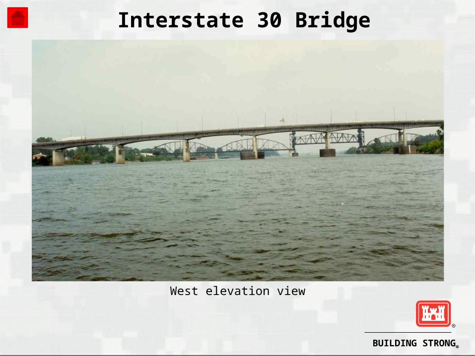
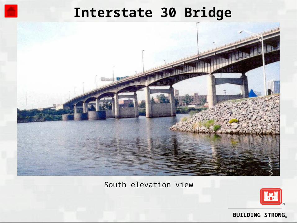
BACKGROUND: The Arkansas Highway and Transportation Department (AHTD) recently initiated the Interstate 30 (I-30) Planning and Environmental Linkages (PEL) Study which will evaluate potential transportation improvements along I-30 in central Arkansas. As part of this study, the I-30 bridge will be evaluated for rehabilitation or replacement. In 2003, Metroplan identified the need for transportation improvements for crossings of the Arkansas River. Some of the challenges identified include increasing traffic congestion and travel times, inadequate roadway capacity, roadway safety, and structural and functional deficiencies. The PEL will identify constraints such as impacts to the natural environment, impacts to adjacent neighborhoods and businesses, pier placement in the navigation channel, etc.
PROJECT LOCATION: The I-30 Bridge crosses the Arkansas River at Navigation Mile 118.5. The study area for the PEL includes I-30 from I-40 in North Little Rock to I-530 in Little Rock, including the Arkansas River Bridge.
PROJECT PURPOSE: The PEL process was established by the Federal Highway Administration to provide a more efficient process of identifying, evaluating and selecting preferred transportation improvements. The process allows early, planning-level decisions to be carried forward to accelerate future National Environmental Policy Act (NEPA) activities. The study will conclude in the summer of 2015 with recommended alternatives.
AUTHORIZATIONS: The PEL is funded by the AHTD’s Connecting Arkansas Program (CAP).
There are currently no other authorizations since the study was only recently initiated.

BUILDING STRONG®
BUILDING STRONG®
West elevation view
Interstate 30 Bridge
BUILDING STRONG®
South elevation view
Interstate 30 Bridge

BUILDING STRONG®
South elevation view
Interstate 30 Bridge
BUILDING STRONG®
Broadway Bridge Replacement between Little Rock and North Little Rock
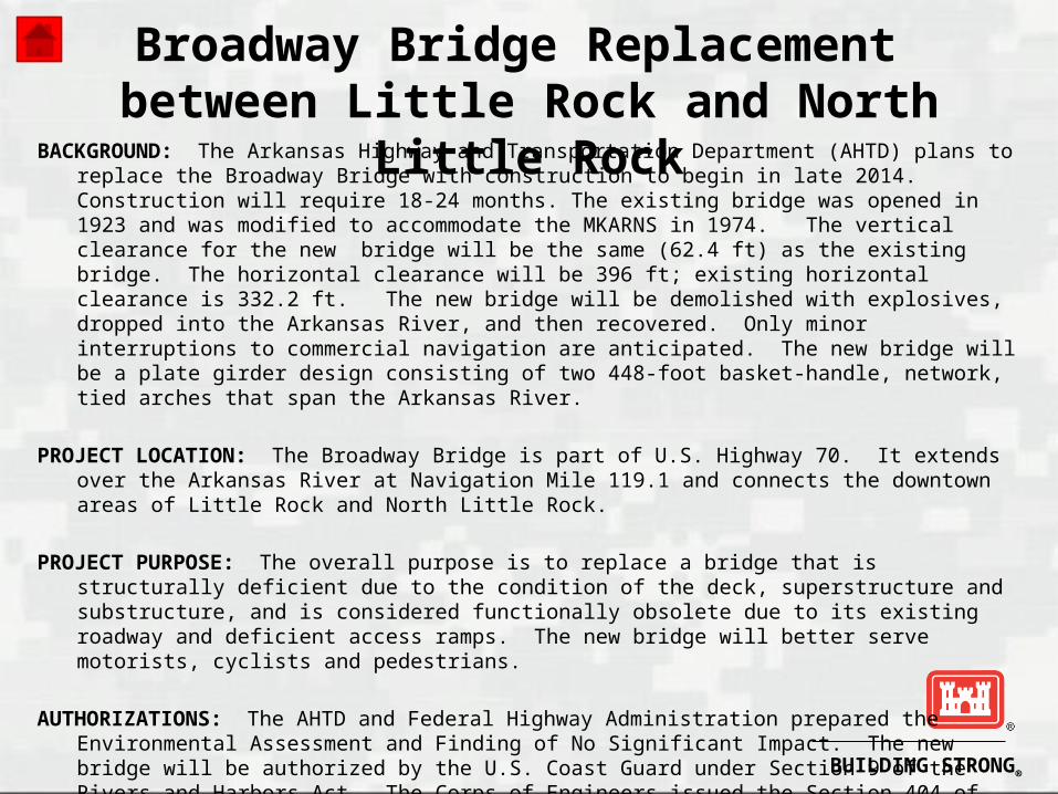
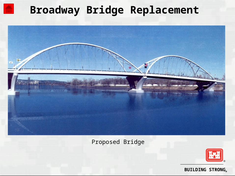
BACKGROUND: The Arkansas Highway and Transportation Department (AHTD) plans to replace the Broadway Bridge with construction to begin in late 2014. Construction will require 18-24 months. The existing bridge was opened in 1923 and was modified to accommodate the MKARNS in 1974. The vertical clearance for the new bridge will be the same (62.4 ft) as the existing bridge. The horizontal clearance will be 396 ft; existing horizontal clearance is 332.2 ft. The new bridge will be demolished with explosives, dropped into the Arkansas River, and then recovered. Only minor interruptions to commercial navigation are anticipated. The new bridge will be a plate girder design consisting of two 448-foot basket-handle, network, tied arches that span the Arkansas River.
PROJECT LOCATION: The Broadway Bridge is part of U.S. Highway 70. It extends over the Arkansas River at Navigation Mile 119.1 and connects the downtown areas of Little Rock and North Little Rock.
PROJECT PURPOSE: The overall purpose is to replace a bridge that is structurally deficient due to the condition of the deck, superstructure and substructure, and is considered functionally obsolete due to its existing roadway and deficient access ramps. The new bridge will better serve motorists, cyclists and pedestrians.
AUTHORIZATIONS: The AHTD and Federal Highway Administration prepared the Environmental Assessment and Finding of No Significant Impact. The new bridge will be authorized by the U.S. Coast Guard under Section 9 of the Rivers and Harbors Act. The Corps of Engineers issued the Section 404 of the Clean Water Act (CWA) authorization and the Arkansas Department of Environmental Quality issued the Section 401 of the CWA individual water qualitycertification. The Arkansas State Historic Preservation Officer cleared theproject for historical and cultural resources.

BUILDING STRONG®

BUILDING STRONG®
Broadway Bridge Replacement
Existing Bridge
BUILDING STRONG®
Broadway Bridge Replacement
Proposed Bridge

BUILDING STRONG®
Broadway Bridge Replacement
Proposed Bridge View South
BUILDING STRONG®
McClellan-Kerr Arkansas River Navigation System12-Foot Navigation Channel Project
Little Rock and Tulsa District, USACE
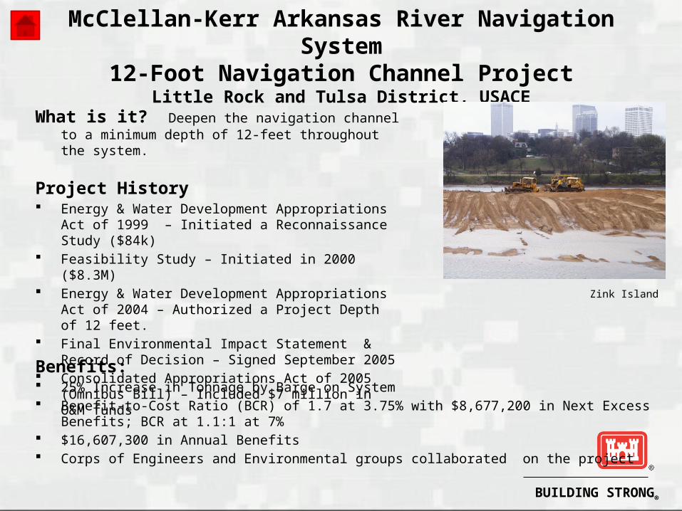
What is it? Deepen the navigation channel to a minimum depth of 12-feet throughout the system.
Project History Energy & Water Development Appropriations Act of 1999
– Initiated a Reconnaissance Study ($84k) Feasibility Study – Initiated in 2000 ($8.3M) Energy & Water Development Appropriations Act of 2004
– Authorized a Project Depth of 12 feet. Final Environmental Impact Statement & Record of
Decision – Signed September 2005 Consolidated Appropriations Act of 2005 (Omnibus Bill) –
Included $7 million in O&M funds
Benefits: 25% Increase in Tonnage by Barge on System Benefit-to-Cost Ratio (BCR) of 1.7 at 3.75% with $8,677,200 in Next Excess Benefits; BCR at 1.1:1
at 7% $16,607,300 in Annual Benefits Corps of Engineers and Environmental groups collaborated on the project
Zink Island

BUILDING STRONG®
McClellan-Kerr Arkansas River Navigation System12-Foot Navigation Channel Project
Little Rock and Tulsa District, USACE
Major Features and Sub-Features of Project Channel Dredging Dike Notching (Improves Fish Habitat) Rock Removal Revetment Re-Design Mitigation (Expand Fish Habitat in Back Channels &
Creates Fish & Wildlife Habitat along the Riparian Corridor)