Embed Size (px)
Citation preview
2 E
XIS
TIN
GC
ON
DIT
ION
S

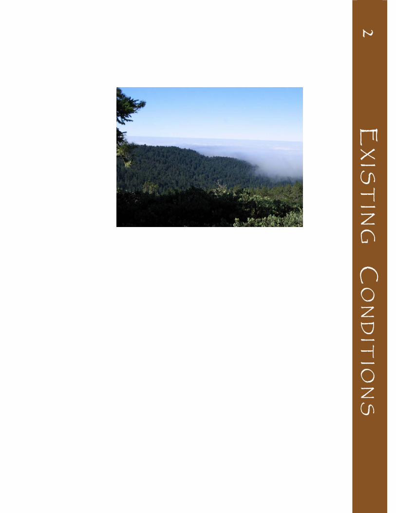
Photo on reverse: View from Butano ridge
Chapter 2: Exist ing Condit ions
Butano State Park Preliminary General Plan and Draft EIR March 2008
2‐1
C H A P T E R 2 : E X I S T I N G C O N D I T I O N S
Land use patterns in the Santa Cruz Mountains as well as on the San Mateo and Santa Cruz county coasts have not changed dramatically in the recent past. The general character of land use surrounding Butano SP is a mix of natural lands, coastal terrace and valley agriculture, hillside grazing, timber production, and small residential properties. The community of Pescadero is located approximately 3.5 miles north of the park at the intersection of Cloverdale Road and Pescadero Road.
Butano SP shares its southern border with Año Nuevo SP, with Año Nuevo State Natural Reserve (SNR) and Big Basin Redwoods SP in proximity. Pescadero State Beach (SB), Bean Hollow SB, and Pigeon Point Light Station State Historic Park (SHP) are to the northwest along the coast. Portola Redwoods SP, Pescadero Creek County Park, Michelson Ranch, and several other recreational and open space lands are located north of the park. Large undeveloped Peninsula Open Space Trust (POST) properties are located adjacent to the park’s west side.
Private ownership around the park generally consists of relatively large or very small parcels of land. Large parcels of private forested lands, some in timber production, are located between Butano SP and Big Basin Redwoods SP to the east, and also on the park’s northern border. There is a small community of residential properties over the park’s north ridge in a canyon along Butano Creek. The Boy Scouts of America own a large property adjacent to the northeast side of the park, and west of the park is Costanoa, a large private recreational development offering lodging, camping, food service, and trails connecting to Año Nuevo SP, regional trails, and local points of interest. See Figure 1, Regional Map, and Figure 2, Location Map, for the types of land use and land ownership surrounding the park and in the region.
2.1 REGIONAL LAND USE
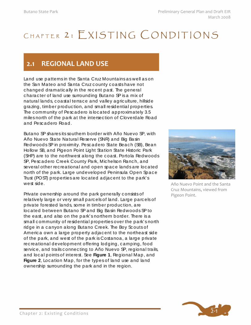
Año Nuevo Point and the Santa Cruz Mountains, viewed from Pigeon Point.
Chapter 2: Exist ing Condit ions
Preliminary General Plan and Draft EIR Butano State Park March 2008
2‐2
A variety of recreational activities are available within a ten-mile radius of Butano SP from a diversity of providers, both public and private. See Appendix B, Publicly-Owned Recreational Facilities in the Vicinity of Butano State Park, for a list of recreational facilities and activities offered by state and local agencies. Federal, state and local agency facilities are briefly summarized below. Figure 1 illustrates the proximity of other recreation lands in the region to State Park properties.
PUBLIC RECREATION FACILITIES
Federal Parks In 2005, Congress voted to add over 4,000 acres to the Golden Gate National Recreation Area (GGNRA) in northern San Mateo County, six miles south of Half Moon Bay. This property rises from Highway 1 along the coast to the nearly 2,000-foot peak of Montara Mountain on the east. The National Park Service is currently gathering public suggestions for the use of the property and plans to open this area to public access in the future.
The largest concentration of federal natural areas in the region other than in the GGNRA is to the northeast of the park along the southern shores of San Francisco Bay where there are several national wildlife refuges, and the California Coastal National Monument located along the California coastline.
State Parks Numerous state parks are located relatively close to Butano SP. Big Basin Redwoods, Portola Redwoods, and Henry Cowell Redwoods State Parks are well established and have camping and picnic facilities. Año Nuevo SNR, on the coast southwest of Butano SP, focuses on interpretation of the elephant seals and other marine mammals that use the beaches. Año Nuevo SP is a more recent unit of the State Park System, not yet developed for public use, sharing Butano SP’s southwestern edge. Northwest of Butano SP along the coast is Pigeon Point Light Station SHP and a series of state beach units that includes Bean Hollow SB, Pescadero SB, Pomponio SB, and San Gregorio SB. Castle Rock SP, on a ridge northeast of Big Basin Redwoods SP, is largely undeveloped except for primitive backpacking camps,
2.2 REGIONAL RECREATION FACILITIES
Chapter 2: Exist ing Condit ions
Butano State Park Preliminary General Plan and Draft EIR March 2008
2‐3
unusual rock formations popular with rock climbers, and trails that are part of a more extensive trail system linking the Santa Clara and San Lorenzo valleys with Castle Rock SP, Big Basin Redwoods SP, and the Pacific Coast.
Big Basin Redwoods SP, Portola Redwoods SP, and Henry Cowell Redwoods SP all contain redwood forest. Because of this they complement Butano SP, helping to fulfill the public’s desire to see, learn about, and appreciate redwood trees close up, as well as providing recreation, accommodations, and interpretation. Trails link Butano SP with Big Basin Redwoods SP, Año Nuevo SP and SNR, and Portola Redwoods SP and Castle Rock SP, as well as with other parks and preserves.
California State Parks has recently acquired two properties along the Santa Cruz County coast that are currently managed by Wilder Ranch SP. State Parks acquired approximately 407 acres from a total of some 6,831 acres of the Coast Dairies property, located between Waddell Beach and Wilder Ranch SP. This ranch property includes agricultural lands, redwood forest, beaches, and other natural and cultural resources. The entire Coast Dairies property was purchased from Coast Dairies and Land Company by The Trust for Public Land (TPL) using grants from the State Coastal Conservancy. In August 2006 over 400 acres of property on the coastal side of Highway 1 near the town of Davenport (approximately five miles of coastal bluff property) and seven acres on the inland side of Highway 1 was transferred to California State Parks. The balance of the inland portion of the property is to be transferred to the U.S. Bureau of Land Management (BLM) and a nonprofit group, Agri-Culture, in 2008.
Acquisition of this Coast Dairies property allows California State Parks to conserve and enhance the biological open space values of the property; provides State Parks with a substantial area of coastal frontage to use for public access, trails and staging areas, and scenic observation; creates new and diverse recreational and educational opportunities by making available to the public an additional 4.2 miles of coastline property; and allows the state to maintain and enhance sustainable agriculture by the continuation of the agricultural farming that has existed for decades.
In 2005 several local, state and federal agencies partnered with TPL to permanently protect a 154-acre coastal property called Sand Hill Bluff, located between the Coast Dairies property and Wilder Ranch SP. This property is also managed out of Wilder Ranch SP. California State Parks has acquired
Chapter 2: Exist ing Condit ions
Preliminary General Plan and Draft EIR Butano State Park March 2008
2‐4
over 70 acres closest to the shoreline to manage for public access, recreation, resource protection, and agricultural leasing.
County Parks San Mateo, Santa Cruz, and Santa Clara counties all contain parks near Butano SP. The three nearby San Mateo County parks, Pescadero Creek, Memorial Park, and Sam McDonald Park, are relatively large and offer camping, interpretive, and trail opportunities similar to some of the nearby state parks.
Santa Cruz County’s nearby parks are the smallest and most locally-oriented of the county parks around Butano SP, mainly emphasizing recreational facilities such as playgrounds and ball fields. The exception is Quail Hollow Ranch, which provides trails and interpretation.
The three nearby Santa Clara County parks provide a variety of recreation experiences. Sanborn Skyline Park has camping, hiking, and interpretation similar to the San Mateo County parks. Upper Stevens Creek Park offers hiking trails, biking trails, and a wilderness experience. Stevens Creek Park focuses on activities similar to a more urban day use park, including picnicking, trails for hikers, bikers, and equestrians, boating, fishing, and archery.
Midpeninsula Regional Open Space District The Midpeninsula Regional Open Space District (MROSD) was first created in 1972 to preserve open space along the spine of the coastal range running the length of the San Francisco Peninsula and along the boundary separating Santa Cruz and Santa Clara counties. The recent MROSD’s Coastside Protection Program expanded this boundary to provide open space and agricultural preservation and management services along the San Mateo County coast. The current MROSD boundary extends from the southern border of Pacifica to the San Mateo/Santa Cruz County line. The MROSD protects viewsheds, provides recreation opportunities in an ecologically-sensitive way, and educates the public about these lands. The MROSD has an active acquisition program to accomplish these goals.
The primary recreation facilities within MROSD properties are trails for hikers, bikers, and equestrians. Trail networks connect to other MROSD lands or nearby parks. Generally, trailheads and support facilities are located on land in other ownership; however, some of the MROSD properties encourage a variety
Chapter 2: Exist ing Condit ions
Butano State Park Preliminary General Plan and Draft EIR March 2008
2‐5
of public uses. Interpretation through self-guided experiences and docent-led tours are also priorities of the MROSD.
PRIVATE RECREATION FACILITIES The Santa Cruz Mountains are a primarily natural setting just over a prominent ridge from a large metropolitan area. This population supports a large number of retreats and conference centers in the region near Butano SP, mainly in the Boulder Creek-Felton area. San Mateo County is relatively undeveloped on the coastal side of the Santa Cruz Mountains but contains many parks, natural lands, and other open space properties owned by private landowners and nonprofit organizations.
Privately-owned overnight facilities supplement the camping provided by the state and county parks in the area. The Costanoa lodge and campground on Highway 1 provides a variety of overnight accommodations ranging from indoor lodging to outdoor individual campsites including some sites with full RV hookups. The Golden Gate Council of Hostelling International operates a hostel at Pigeon Point Light Station SHP, with both private and shared rooms. The Felton-Boulder Creek area has a number of campgrounds, two of which serve RVs. In addition, several motels, lodges, and bed and breakfasts are located in the surrounding Santa Cruz Mountains region. The Peninsula Open Space Trust has been working with California State Parks and other partners to develop trails and interpretation and education programs at its Cloverdale Coastal Ranches.
Butano SP is also close to services including restaurants and stores in the nearby communities of Pescadero and San Gregorio. Additionally, a variety of private recreational opportunities are available in the vicinity, including golf courses, horseback riding, fishing, vineyards, theaters, galleries, and museums. See Appendix C for further information about privately-owned recreational facilities in the region.
Chapter 2: Exist ing Condit ions
Preliminary General Plan and Draft EIR Butano State Park March 2008
2‐6
PARKWIDE LAND USE Historic use of this property has included logging, agriculture, lumber milling, and ranching. Today this land is utilized for resource preservation, open space, watershed conservation, wildlife sanctuary, and recreation and educational activities. The existing land use of the park complements the relatively undeveloped nature of the Santa Cruz Mountains and the coast located between Half Moon Bay and Santa Cruz. Rugged topography, sensitive resources, and government regulations have limited land developed for public use to a small percentage of the park’s acreage. Distance from transportation routes, topography, and the location of prime natural, cultural, and recreation resources have contributed to the current land use patterns within the park.
Following acquisition in 1957, facilities were built at Butano SP to support low-intensity recreation activities. Facilities and programs offer a variety of ways for visitors to enjoy and appreciate the natural and cultural resources of the park. The entrance area, on the western boundary of the park, provides picnic sites, a campground, staff housing, and administrative, interpretive, and maintenance facilities. Visitors can choose from several overnight camping experiences, including tent sites, walk-in sites, and a backcountry trail camp. Activities include picnicking, hiking on the numerous trails, and riding mountain bikes on the park’s extensive system of trails and fire roads.
The majority of the park is undeveloped backcountry, containing steep topography and sections of old growth and second growth redwood, Douglas-fir, and knobcone pine forests. Fire and maintenance roads, trails, bridges, interpretive signs, and overlooks are improvements in the backcountry. This area provides outstanding opportunities for solitude and unconfined recreation. Existing land uses within the backcountry include hiking, horseback riding, biking, nature study, tent camping, and orienteering.
2.2 EXISTING PARK LAND USE AND FACILITIES
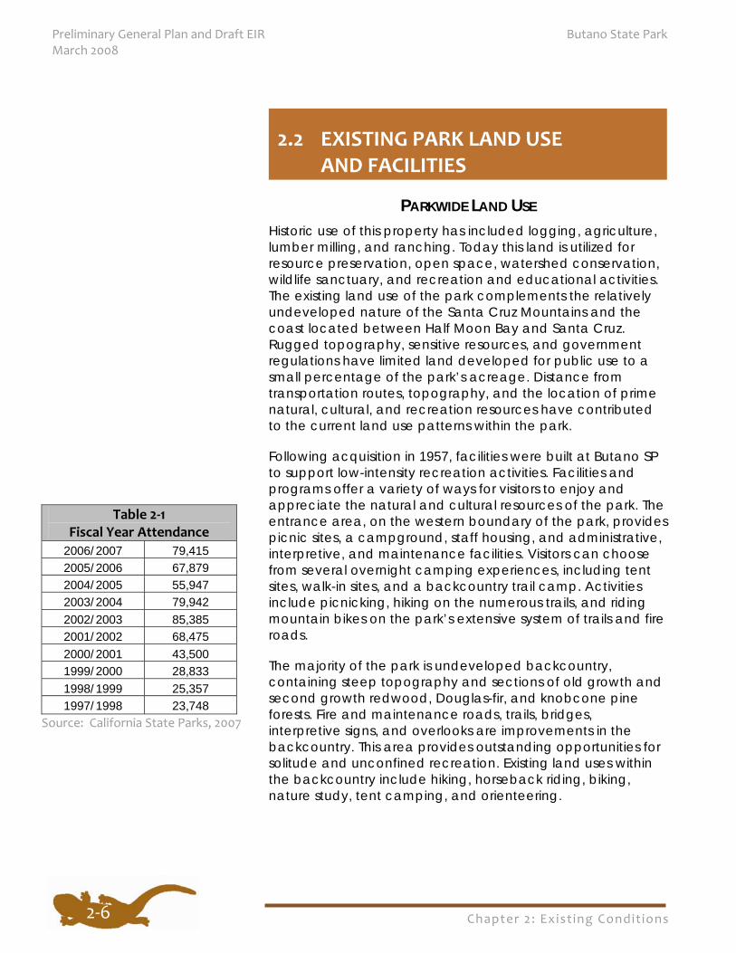
Table 2‐1 Fiscal Year Attendance
2006/2007 79,415 2005/2006 67,879 2004/2005 55,947 2003/2004 79,942 2002/2003 85,385 2001/2002 68,475 2000/2001 43,500 1999/2000 28,833 1998/1999 25,357 1997/1998 23,748
Source: California State Parks, 2007
Chapter 2: Exist ing Condit ions
Butano State Park Preliminary General Plan and Draft EIR March 2008
2‐7
PARK ATTENDANCE LEVELS The numbers of visitors paying for day use and camping have fluctuated over the years due to many factors, including changes in fees, but have generally reflected an upward trend. See Table 2-1.
DAY USE FACILITIES Visitors using day use facilities in the entrance area first stop at the park entrance kiosk to obtain information and pay user fees. The visitor center provides interpretive exhibits to help park visitors understand the natural and cultural history of Butano SP and to obtain additional park information. The visitor center building also provides staff and volunteer offices.
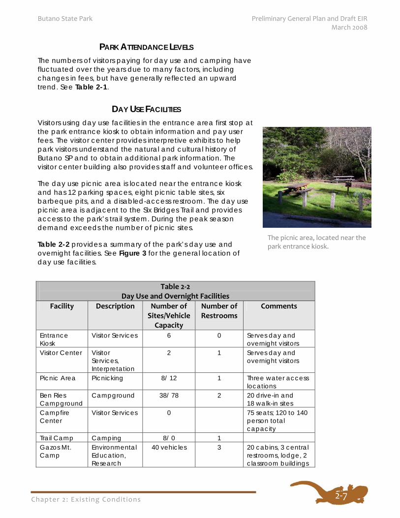
The day use picnic area is located near the entrance kiosk and has 12 parking spaces, eight picnic table sites, six barbeque pits, and a disabled-access restroom. The day use picnic area is adjacent to the Six Bridges Trail and provides access to the park’s trail system. During the peak season demand exceeds the number of picnic sites.
Table 2-2 provides a summary of the park’s day use and overnight facilities. See Figure 3 for the general location of day use facilities.
The picnic area, located near the park entrance kiosk.
Table 2‐2 Day Use and Overnight Facilities
Facility Description Number of Sites/Vehicle Capacity
Number of Restrooms
Comments
Entrance Kiosk
Visitor Services 6 0 Serves day and overnight visitors
Visitor Center Visitor Services, Interpretation
2 1 Serves day and overnight visitors
Picnic Area Picnicking 8/ 12 1 Three water access locations
Ben Ries Campground
Campground 38/ 78 2 20 drive-in and 18 walk-in sites
Campfire Center
Visitor Services 0 75 seats; 120 to 140 person total capacity
Trail Camp Camping 8/ 0 1 Gazos Mt. Camp
Environmental Education, Research
40 vehicles 3
20 cabins, 3 central restrooms, lodge, 2 classroom buildings
Chapter 2: Exist ing Condit ions
Preliminary General Plan and Draft EIR Butano State Park March 2008
2‐8
OVERNIGHT FACILITIES
Ben Ries Campground The Ben Ries Campground, situated in an old growth redwood forest on a hillside east of the entrance area, is open year-round and contains 20 drive-in and 18 walk-in campsites. Each campsite can accommodate up to eight visitors and three vehicles and contains a picnic table and barbeque pit. The walk-in campsites can accommodate one vehicle. The campground has two restroom facilities and several trash and recycle receptacles. Dogs are permitted in the campground and in developed areas, providing they are controlled with a leash at all times.
With the exception of campground host sites, there are no utility hook-ups in the park. RVs and trailers are limited to 24 feet long. Campground facilities are available by reservation only. The campground is very popular and is usually at capacity during the peak summer season and on many weekends.
Trail Camp Trail Camp, located on the east side of the park, is a walk-in campground with eight campsites, each with a picnic table, food locker, and a tent site. The camp has a restroom facility and a trash receptacle. Water is available only from Butano Creek, a quarter mile from camp.
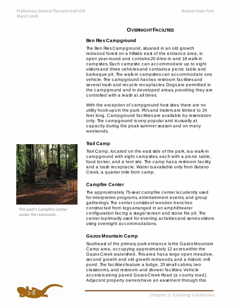
Campfire Center The approximately 75-seat campfire center is currently used for interpretive programs, entertainment events, and group gatherings. The center consists of wooden benches constructed from logs arranged in an amphitheater configuration facing a stage/screen and stone fire pit. The center is primarily used for evening activities and serves visitors using overnight accommodations.
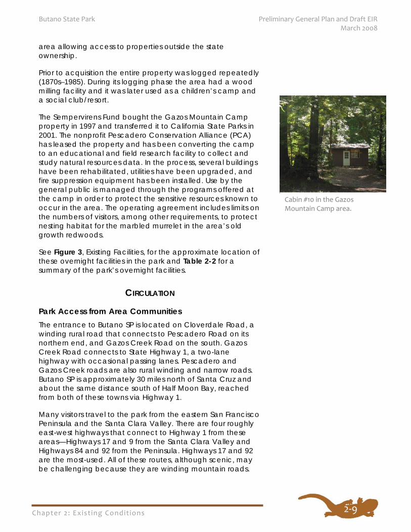
Gazos Mountain Camp Southeast of the primary park entrance is the Gazos Mountain Camp area, occupying approximately 12 acres within the Gazos Creek watershed. This area has a large open meadow, second growth and old growth redwoods, and a historic mill pond. The facilities feature a lodge, 20 small cabins, two classrooms, and restroom and shower facilities. Vehicle access is along paved Gazos Creek Road (a county road). Adjacent property owners have an easement through this
The park’s Campfire Center under the redwoods.
Chapter 2: Exist ing Condit ions
Butano State Park Preliminary General Plan and Draft EIR March 2008
2‐9
area allowing access to properties outside the state ownership.
Prior to acquisition the entire property was logged repeatedly (1870s–1985). During its logging phase the area had a wood milling facility and it was later used as a children’s camp and a social club/resort.
The Sempervirens Fund bought the Gazos Mountain Camp property in 1997 and transferred it to California State Parks in 2001. The nonprofit Pescadero Conservation Alliance (PCA) has leased the property and has been converting the camp to an educational and field research facility to collect and study natural resources data. In the process, several buildings have been rehabilitated, utilities have been upgraded, and fire suppression equipment has been installed. Use by the general public is managed through the programs offered at the camp in order to protect the sensitive resources known to occur in the area. The operating agreement includes limits on the numbers of visitors, among other requirements, to protect nesting habitat for the marbled murrelet in the area’s old growth redwoods.
See Figure 3, Existing Facilities, for the approximate location of these overnight facilities in the park and Table 2-2 for a summary of the park’s overnight facilities.
CIRCULATION
Park Access from Area Communities The entrance to Butano SP is located on Cloverdale Road, a winding rural road that connects to Pescadero Road on its northern end, and Gazos Creek Road on the south. Gazos Creek Road connects to State Highway 1, a two-lane highway with occasional passing lanes. Pescadero and Gazos Creek roads are also rural winding and narrow roads. Butano SP is approximately 30 miles north of Santa Cruz and about the same distance south of Half Moon Bay, reached from both of these towns via Highway 1.
Many visitors travel to the park from the eastern San Francisco Peninsula and the Santa Clara Valley. There are four roughly east-west highways that connect to Highway 1 from these areas—Highways 17 and 9 from the Santa Clara Valley and Highways 84 and 92 from the Peninsula. Highways 17 and 92 are the most-used. All of these routes, although scenic, may be challenging because they are winding mountain roads.
Cabin #10 in the Gazos Mountain Camp area.
Chapter 2: Exist ing Condit ions
Preliminary General Plan and Draft EIR Butano State Park March 2008
2‐10
According to the California Department of Transportation (Caltrans), over five million people in 2.2 million vehicles per year drive past the Santa Cruz/San Mateo County line on Highway 1, situated between Big Basin Redwood SP’s Waddell Beach and Año Nuevo SNR. Tourists visiting the elephant seals at Año Nuevo SNR and the beaches along the coast are a portion of these travelers. Visitor attendance at Butano SP has more than doubled since 1997, resulting in increased vehicle traffic on the park’s access and internal roads.
Public Transit to the Park San Mateo County’s SamTrans bus system serves the community of Pescadero, three miles north of the park, with one round trip in the morning and one round trip in the afternoon from Half Moon Bay north on Highway 1. SamTrans connects with the Bay Area Rapid Transit (BART) system on the west side of San Francisco Bay at Millbrae, and on the east side of the Bay to Pittsburg, Dublin, and Fremont. At the Millbrae transit hub, the CalTrain commuter system runs from San Francisco south to Gilroy. Bicycles are allowed on all three public transportation systems.
The Santa Cruz Metropolitan Transit District (SCMTD) provides bus service approximately 12 miles south of Butano SP on Highway 1 at Waddell Creek. Service is twice a day and on weekends, connecting to downtown Santa Cruz, with connections available to the Monterey-Salinas Transit system traveling south. Bicycle transport accommodations are currently available on SCMTD buses.
Circulation Within the Park The paved park entrance road extends approximately one mile east from the park’s boundary on Cloverdale Road. All park developed facilities and trailheads, except for those located in the Gazos Mountain Camp area, are reached via this single road (see Figure 3, Existing Facilities, and Figure 4, Existing Roads and Trails). Parking is available at the entrance kiosk for visitor center and backcountry trail access. There is a picnic area with paved parking approximately 200 yards east of the entrance kiosk.
The park’s campfire center and the Ben Ries Campground are another 200 to 300 yards east of the picnic area. Overnight campers park at designated campsites in the campground and generally use pedestrian paths and routes to access activities and facilities located in the campground
Chapter 2: Exist ing Condit ions
Butano State Park Preliminary General Plan and Draft EIR March 2008
2‐11
area. Campers can also drive from campsites to the campfire center and to day use facilities located in the entrance area.
The park road is gated and unpaved beyond the campground. The road continues for approximately 1.5 miles where it meets the east end of the Butano Creek Trail. The Butano and Olmo fire roads, managed and maintained by the California Department of Forestry and Fire Protection (Cal Fire), offer hikers, mountain bikers, and equestrians access to the higher eastern portions of the park. The Gazos Mountain Camp area, at the east end of the park, is reached via paved Gazos Creek Road, approximately 3.5 miles from the intersection with Highway 1.
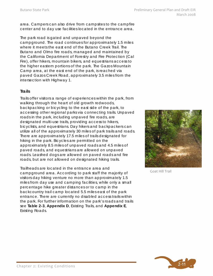
Trails Trails offer visitors a range of experiences within the park, from walking through the heart of old growth redwoods, backpacking or bicycling to the east side of the park, to accessing other regional parks via connecting trails. Unpaved roads in the park, including unpaved fire roads, are designated multi-use trails, providing access to hikers, bicyclists, and equestrians. Day hikers and backpackers can utilize all of the approximately 30 miles of park trails and roads. There are approximately 17.5 miles of trails designated for hiking in the park. Bicycles are permitted on the approximately 8.5 miles of unpaved roads and 4.5 miles of paved roads, and equestrians are allowed on unpaved roads. Leashed dogs are allowed on paved roads and fire roads, but are not allowed on designated hiking trails.
Trailheads are located in the entrance area and campground area. According to park staff the majority of visitors day hiking venture no more than approximately 1.5 miles from day use and camping facilities, while only a small percentage hike greater distances or to camp in the backcountry trail camp located 5.5 miles east of the park entrance. There are currently no disabled access trails within the park. For further information on the park’s roads and trails see Table 2-3, Appendix D, Existing Trails, and Appendix E, Existing Roads.
Goat Hill Trail
Chapter 2: Exist ing Condit ions
Preliminary General Plan and Draft EIR Butano State Park March 2008
2‐12
ADMINISTRATION AND MAINTENANCE FACILITIES Administrative offices are located in the visitor center building in the entrance area. The current visitor center was built in 2003/4. The main room of this building serves as an interpretive area, with offices for park administration and volunteers occupying the remaining building space.
There is a small park maintenance facility and staff residence area. This facility supplements a larger maintenance facility serving Butano SP located at the Rancho del Oso area in Big Basin Redwoods SP, approximately 12 miles south of Butano SP on Highway 1.
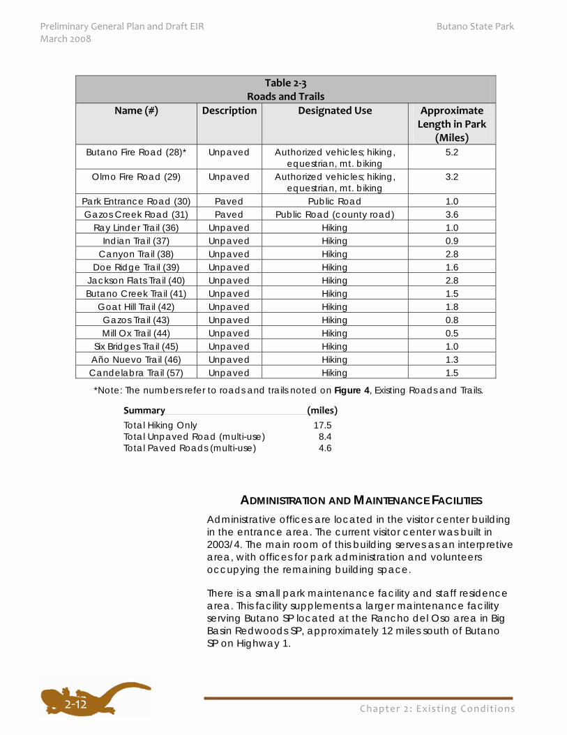
Table 2‐3 Roads and Trails
Name (#) Description Designated Use Approximate Length in Park
(Miles) Butano Fire Road (28)* Unpaved Authorized vehicles; hiking,
equestrian, mt. biking 5.2
Olmo Fire Road (29) Unpaved Authorized vehicles; hiking, equestrian, mt. biking
3.2
Park Entrance Road (30) Paved Public Road 1.0 Gazos Creek Road (31) Paved Public Road (county road) 3.6
Ray Linder Trail (36) Unpaved Hiking 1.0 Indian Trail (37) Unpaved Hiking 0.9
Canyon Trail (38) Unpaved Hiking 2.8 Doe Ridge Trail (39) Unpaved Hiking 1.6
Jackson Flats Trail (40) Unpaved Hiking 2.8 Butano Creek Trail (41) Unpaved Hiking 1.5
Goat Hill Trail (42) Unpaved Hiking 1.8 Gazos Trail (43) Unpaved Hiking 0.8 Mill Ox Trail (44) Unpaved Hiking 0.5
Six Bridges Trail (45) Unpaved Hiking 1.0 Año Nuevo Trail (46) Unpaved Hiking 1.3 Candelabra Trail (57) Unpaved Hiking 1.5
*Note: The numbers refer to roads and trails noted on Figure 4, Existing Roads and Trails.
Summary (miles) Total Hiking Only 17.5 Total Unpaved Road (multi-use) 8.4 Total Paved Roads (multi-use) 4.6
Chapter 2: Exist ing Condit ions
Butano State Park Preliminary General Plan and Draft EIR March 2008
2‐13
UTILITIES The park has separate septic systems serving the visitor center, the picnic area, the Ben Ries Campground, trail camp, and staff residence buildings. Little Butano Creek supplies water that is processed in a water treatment facility east of the campground. From there potable water flows by gravity to the entrance area facilities. Downstream of the visitor use area, within the park, is a small dam on Little Butano Creek. The dam allows the diversion of a limited amount of water from the creek between November 1 and the end of April each year by off-site agricultural lessees of the Peninsula Open Space Trust, which owns property west of the park.
The Gazos Mountain Camp facilities have obtained water from local springs and surface water diversions. This area of the park has a large septic system located adjacent to the lodge for sewage and wastewater.
Pacific Gas and Electric Company provides electric service to park facilities through buried lines. AT&T provides the entrance area and staff residences with telephone service through buried lines and provides one pay telephone at the entrance kiosk. An abandoned landing field in the eastern uplands of the park supports a radio repeater station.
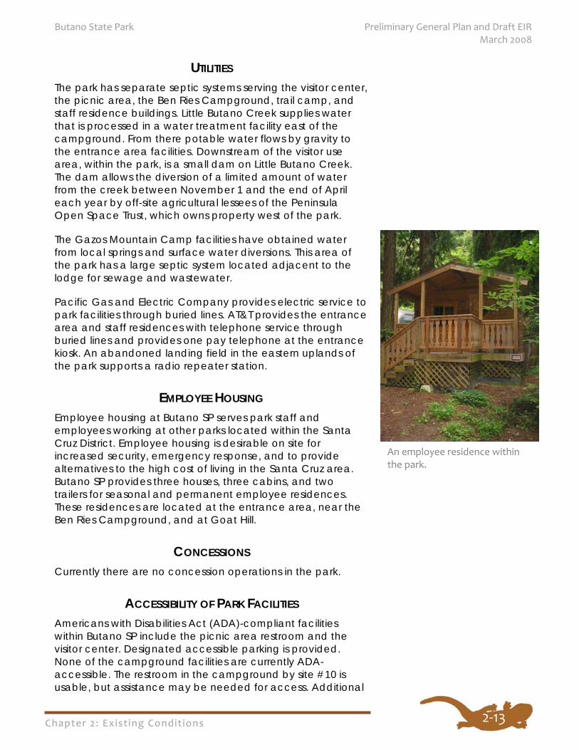
EMPLOYEE HOUSING Employee housing at Butano SP serves park staff and employees working at other parks located within the Santa Cruz District. Employee housing is desirable on site for increased security, emergency response, and to provide alternatives to the high cost of living in the Santa Cruz area. Butano SP provides three houses, three cabins, and two trailers for seasonal and permanent employee residences. These residences are located at the entrance area, near the Ben Ries Campground, and at Goat Hill.
CONCESSIONS Currently there are no concession operations in the park.
ACCESSIBILITY OF PARK FACILITIES Americans with Disabilities Act (ADA)-compliant facilities within Butano SP include the picnic area restroom and the visitor center. Designated accessible parking is provided. None of the campground facilities are currently ADA-accessible. The restroom in the campground by site #10 is usable, but assistance may be needed for access. Additional
An employee residence within the park.
Chapter 2: Exist ing Condit ions
Preliminary General Plan and Draft EIR Butano State Park March 2008
2‐14
information on the accessibility of Butano SP can be found in the June 2000 Santa Cruz District, Mountain Sector, Butano State Park Accessibility Survey, and the California State Parks Accessibility website.
As the General Plan is implemented, universal access for all park visitors will be considered for all program areas. This includes facilities and accessible routes to all facilities areas. Accessible interpretive techniques will be used in the development of interpretive displays and interpretive programs, both guided and self guided. Accessibility would not be limited to public use areas, but also employee areas and park housing areas. Currently there are no projects under construction specifically to improve accessibility in the park. As of July 2007, the Department’s ADA improvement program has scheduled a Butano SP project for the year 2014 to improve existing camping accessibility. The Department is continually improving existing facilities throughout the State Park System to comply with the Americans with Disabilities Act.
PHYSICAL RESOURCES The information in this section was compiled from existing documents and field research. For more detailed information on the park’s natural resources please refer to the References section of this document and the Department’s ongoing unit data file updates.
Topography The topography of the Santa Cruz Mountains is largely a result of uplift and deformation due to movement along the San Andreas fault system. Dominant landforms within the park are the steep-sloped canyons of Little Butano and Gazos creeks and their adjoining rounded ridgetops. Elevations range from approximately 106 feet at the junction of Gazos Creek Road and Cloverdale Road to a 1,734-foot summit along a ridgetop divide between Gazos Creek and the south fork of Butano Creek.
Climate Butano SP is located within the Mediterranean Climate Zone. The year round climate along the California coast is mild and not subject to severe seasonal change due primarily to the
2.4 SIGNIFICANT RESOURCE VALUES
State Parks will explore
methods to provide
universal access for all
park visitors in all program
areas.
Chapter 2: Exist ing Condit ions
Butano State Park Preliminary General Plan and Draft EIR March 2008
2‐15
moderating influence of the Pacific Ocean. Cool temperatures and medium to strong west and northwest winds dominate offshore waters and lower inland elevations during the summer. Occasionally, offshore circulation patterns permit hotter, continental temperature regimes to become established in the park, usually lasting only one to two days. Temperature ranges can be greater in the upper elevations of Butano SP and farther away from the marine influence.
A primary influence on the climate at Butano SP is the eastern North Pacific High, a semi-permanent high pressure area that intensifies and migrates northward during the summer months, keeping storm tracks well to the north. During this time of the year California receives little or no precipitation from Pacific storms. In winter, the North Pacific High decreases in intensity and retreats southward, allowing north Pacific storms (i.e. low pressure centers) to move into and across the state. The El Niño phenomenon of cyclical ocean warming increases the severity and frequency of winter storms, and increases the amount of precipitation.
Storms originating in the Gulf of Alaska are the major precipitation sources for the state. However, in winter, some precipitation arrives from the subtropics. Infrequent tropical storms (monsoonal moisture) may reach central California from northern Mexico during the summer and early fall.
Temperature
The average annual temperature for the Santa Cruz Mountains area ranges from 55° to 59° Fahrenheit (F). The overall temperature range is about 25° F to 102° F, with extremes occurring rarely. The warmest months are July, August, and September, with the coldest months being December, January, and February.
The proximity to the ocean moderates the temperatures in Butano SP. The annual mean temperature at Butano SP is approximately 56° F, ranging from 30° F to 95° F. The closest monitoring station is at San Gregorio, approximately 15 miles to the north. The annual mean average temperature is 55.1° F, based on data from 1971 to 2000. The mean reported average daily maximum and minimum temperatures are 65.2° and 44.8° F, respectively. Daily extremes on record are 99° F in October 1987 and 20° F in December 1998. The average temperatures for adjacent Big Basin Redwoods SP may be more indicative of temperatures in Butano SP. At Big Basin Redwoods SP, temperatures range from 30° to 40° F in the winter to 80° to 90° F in the summer.
Chapter 2: Exist ing Condit ions
Preliminary General Plan and Draft EIR Butano State Park March 2008
2‐16
Precipitation
The wet season along the California coast is from October through April. Annual average rainfall varies greatly within the Butano SP watersheds, increasing with increasing elevation due to orographic effects. The rainfall totals vary from 28 inches at the park entrance to approximately 40 inches at the eastern boundary on the Butano-Gazos Ridge. The Goat Hill rain gauge data indicated an annual average of approximately 33 inches. Summer precipitation (June to August) is usually limited to trace amounts or drizzle associated with occasional summer fog (CDPR c.1980). Precipitation amounts for the park are based on limited data from 1970-1976. More recent rainfall data is not available.
Based on data from the San Gregorio monitoring station, the mean average annual rainfall (1971-2000) is 29.52 inches, which correlates to the Butano SP rain gauge data at the park entrance. The highest recorded monthly rainfall was 17.15 inches in February 1998 (an El Niño year). The highest recorded daily rainfall, based on records from 1954-2001, was 6.37 inches on October 13, 1962. Snow is a rare occurrence on the California coast, but trace amounts have been recorded in 1972, 1974, and 1976, and 4.0 inches of snow was recorded in January 1962.
Summer fog is not common in Butano SP due to the blocking effect of the low coastal hills. There are many more sunny days in Butano SP than on the coast. Fog does make its way inland through the drainages of Pescadero and Butano Creeks to the north.
Wind
The prevailing wind direction year round in fair weather is from the north and west, tending north in winter and west in spring and summer. Strong west winds are common in the spring, but the summer winds are typically light and seldom gusty. Occasionally in late summer hot, dry east winds from the Sierra and the Central Valley, generated by an offshore low pressure area, affect the park and raise the fire danger. Winter winds are variable, predominantly from a southwesterly direction during storms, but typically shift to a northwesterly direction after the passage of the cold front.
Potential Effects of Global Climate Change on the Park
Climate change refers to change in the Earth’s weather patterns including the rise in the Earth’s temperature due to an increase in heat-trapping or greenhouse gases in the atmosphere. Greenhouse gases include carbon dioxide,
Chapter 2: Exist ing Condit ions
Butano State Park Preliminary General Plan and Draft EIR March 2008
2‐17
methane, nitrous oxide, and sulfur hexafluoride among others. Human activities are adding large amounts of greenhouse gases to the atmosphere. Combustion of fossil fuels for heat, electricity, and transportation is the main source of these gases.
Heat-trapping emissions in the world’s atmosphere have greatly increased since industrialization, contributing to a rise in average temperatures world-wide and other climate changes. How great this climate change is in the future will depend on the actions taken to limit future releases of heat-trapping emissions and new technologies developed to address the problem. At least some additional warming is inevitable in the next decade, even in the unlikely scenario that the most stringent measures to reduce heat-trapping gases are immediately put in place.
Some potential effects of climate change on Butano SP may include:
Habitat loss and shifts: Some climate change computer models predict decreased rainfall on the California coast, while others predict no change or greater rainfall. If coastal rainfall increases, most of the increase will be lost as runoff, and the dry summer/wet winter current climate pattern will persist. Warmer temperatures in summer will cause increased drying from evaporation. The combination of warmer temperatures and drier summer conditions may eliminate some plant communities and animal habitat, greatly fragment other habitat, and cause some habitats to shift. The moisture-dependent wetland, riparian, and redwood forest plant communities could be especially affected at Butano SP. Since the park is in the southern end of the coast redwood’s range, these trees are especially vulnerable to the effects of warming.
Fire danger: As the climate warms and possibly dries, wildfires may become more frequent in some areas of California. The San Mateo coast may see a small increase in fires. Both knobcone pine forest and chaparral plant communities located on the higher park ridges are very prone to fire. The plant species in these communities are adapted to fire and can usually regenerate, but increased fire could cause wildlife losses and contribute to poor air quality in the park.
Severe storms and flooding: Climate change may alter the frequency and intensity of winter storms. While this would not directly affect visitors during the usual
Warmer temperatures
and drier summer
conditions from global
climate change may
fragment, shift, and
even eliminate some
plant communities and
animal habitats that
are now found in the
Butano area.
Chapter 2: Exist ing Condit ions
Preliminary General Plan and Draft EIR Butano State Park March 2008
2‐18
summer season of park use, storms and resultant flooding and mudslides could damage park infrastructure and access roads.
Fishery habitat change: Over the next century, spawning streams may warm above temperatures suitable for cold water fish such as salmon and steelhead. Reduced summer stream flow due to evaporation will also cause a loss of fish habitat.
Possible visitor use increase: California central coast parks have historically been used in the summer by many Central Valley residents escaping the heat. As the Central Valley summer temperatures climb even higher, the number of visitors from these hotter areas could also climb.
Air Quality Butano SP is located within the San Francisco Bay Air Basin (SFBAB). The Bay Area Air Quality Management District is the local agency that regulates air quality in the SFBAB. In addition to regulating air quality standards, the Bay Area Air Quality Management District has established a Climate Protection Program to reduce pollutants that contribute to global climate change and affect air quality (see also Regulatory Influences).
Existing Air Quality
The main factors that determine air quality are the locations of pollutant sources (such as urban or industrial areas) and the influence of topographic and climatic/meteorological conditions. Wind direction, wind speed, and air temperature gradients interact with the physical features of the landscape to determine the movement and dispersal of air pollutants.
Butano SP is located within the southwestern portion of the SFBAB which includes Santa Clara, San Mateo, Contra Costa, San Francisco, Marin, Napa, southern Sonoma, and western Solano counties. Emission sources in the SFBAB are industrial facilities, several airports, and a dense freeway and surface street network. Though separated by the Coast Ranges (Santa Cruz Mountains) to the northeast, wind can move air pollution from the metropolitan San Francisco Bay area south through small gaps in the mountains; however, most pollutants from the urbanized Bay Area are transported to the Central Valley. The SFBAB is a non-attainment zone for ozone and PM10.
Chapter 2: Exist ing Condit ions
Butano State Park Preliminary General Plan and Draft EIR March 2008
2‐19
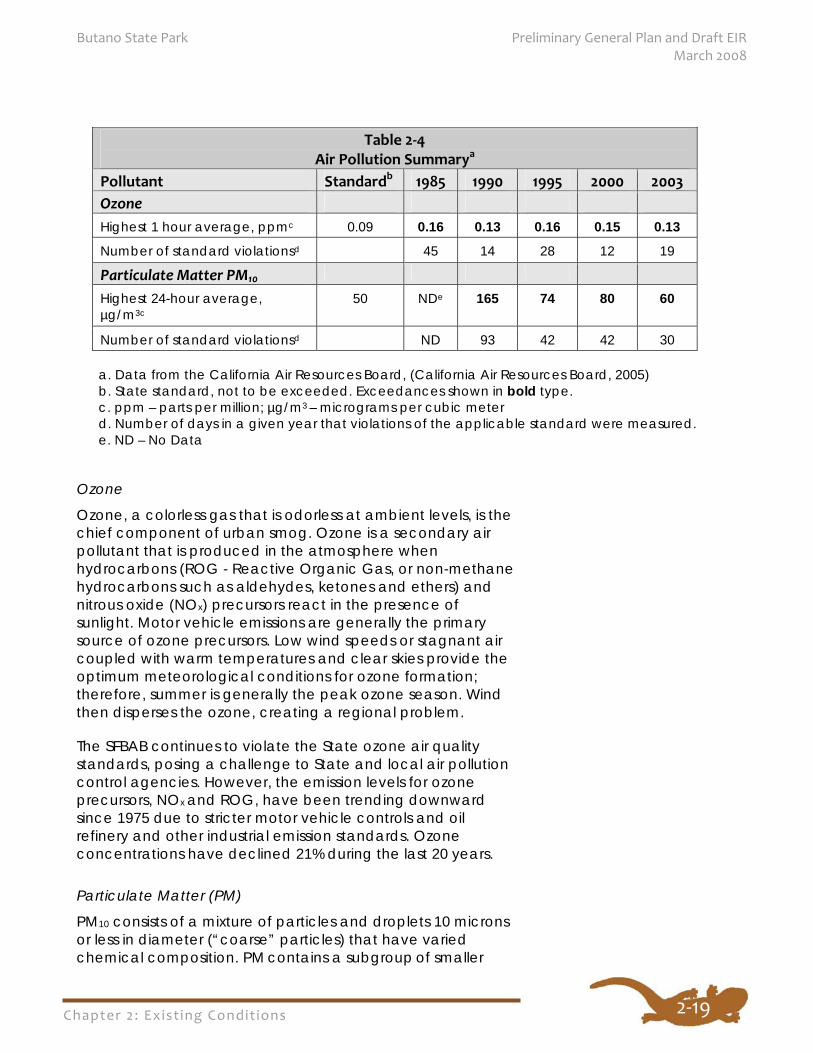
Ozone
Ozone, a colorless gas that is odorless at ambient levels, is the chief component of urban smog. Ozone is a secondary air pollutant that is produced in the atmosphere when hydrocarbons (ROG - Reactive Organic Gas, or non-methane hydrocarbons such as aldehydes, ketones and ethers) and nitrous oxide (NOx) precursors react in the presence of sunlight. Motor vehicle emissions are generally the primary source of ozone precursors. Low wind speeds or stagnant air coupled with warm temperatures and clear skies provide the optimum meteorological conditions for ozone formation; therefore, summer is generally the peak ozone season. Wind then disperses the ozone, creating a regional problem.
The SFBAB continues to violate the State ozone air quality standards, posing a challenge to State and local air pollution control agencies. However, the emission levels for ozone precursors, NOx and ROG, have been trending downward since 1975 due to stricter motor vehicle controls and oil refinery and other industrial emission standards. Ozone concentrations have declined 21% during the last 20 years.
Particulate Matter (PM)
PM10 consists of a mixture of particles and droplets 10 microns or less in diameter (“coarse” particles) that have varied chemical composition. PM contains a subgroup of smaller
Table 2‐4 Air Pollution Summarya
Pollutant Standardb 1985 1990 1995 2000 2003 Ozone Highest 1 hour average, ppmc 0.09 0.16 0.13 0.16 0.15 0.13
Number of standard violationsd 45 14 28 12 19
Particulate Matter PM10
Highest 24-hour average, µg/m3c
50 NDe 165 74 80 60
Number of standard violationsd ND 93 42 42 30
a. Data from the California Air Resources Board, (California Air Resources Board, 2005) b. State standard, not to be exceeded. Exceedances shown in bold type. c. ppm – parts per million; µg/m3 – micrograms per cubic meter d. Number of days in a given year that violations of the applicable standard were measured. e. ND – No Data
Chapter 2: Exist ing Condit ions
Preliminary General Plan and Draft EIR Butano State Park March 2008
2‐20
particles (“fine” particles) less than 2.5 microns designated as PM2.5. These smaller particles pose a greater health risk because their small size allows them to deposit deep in the lung and they contain substances that are particularly harmful to human health.
Sources of ambient PM include: combustion sources such as trucks and passenger vehicles, off-road equipment, industrial processes, residential wood burning, and forest/agricultural burning; fugitive dust from paved and unpaved roads, construction, mining, and agricultural activities; and ammonia sources such as livestock operations, fertilizer application, and motor vehicles. In general, combustion processes emit and form fine particles (PM2.5) whereas particles from dust sources tend to fall into the coarse (PM10 ) range.
Most of the State, including the SFBAB, is designated as non-attainment for PM10 standards. Due to the variety of sources and the size and chemical composition of the particles, the PM10 problem can vary widely from one area to another. PM10 concentration also varies with the seasons. Wildfires, agricultural practices, and dust storms are potential spring and summer season sources, while wood burning is a fall and winter season source. Dry weather and windy conditions cause higher coarse PM emissions, resulting in elevated PM10
concentrations.Direct emissions of PM10 increased in the SFBAB between 1975 and 2000 and are projected to continue increasing due to the growth in emissions from area-wide sources, primarily fugitive dust.
Geology Butano SP is located in the Coast Ranges, a northwest-trending chain of mountains that formed primarily due to movement along the San Andreas Fault and associated faults. Regionally, the igneous, metamorphic, and sedimentary basement rocks are part of the Jurassic to Cretaceous aged Salinian Block, a tectonic block bounded on the east by the San Andreas Fault. These rocks originated some 350 miles to the south and began moving north during the Miocene (26 to 7 million years ago) as the San Andreas Fault was activated. The Salinian Block (Pacific Plate) continues to move in a relative northerly direction along the northeast-trending San Andreas Fault Zone.
The Tertiary rocks of Butano SP increase in age from west to east. The western border of Butano SP is underlain by the Pliocene-Upper Miocene aged Purisima Formation. In the central portion of Butano SP east of the San Gregorio Fault, the Lower Pliocene Santa Cruz Mudstone underlies the
Chapter 2: Exist ing Condit ions
Butano State Park Preliminary General Plan and Draft EIR March 2008
2‐21
majority of Butano SP. A narrow band of Upper Miocene Santa Margarita Sandstone trends through the park, separating the Santa Cruz Mudstone from the easternmost outcrops of mid-lower Eocene Butano Sandstone. Younger Holocene-age stream channel deposits (alluvium) consisting of clay, silt, sand, gravel, and larger materials are found along Gazos Creek, Little Butano Creek, and tributary creeks.
The Purisima Formation consists of gray to greenish-gray to buff fine-grained sandstone, siltstone, and mudstone, with some porcelaneous shale and mudstone, chert and volcanic ash (Brabb, et al. 1998). The Purisima is easily eroded and susceptible to slope failures (ESA/Madrone 1982).
The Santa Cruz Mudstone is a brown and gray to light gray, buff, and light yellow siliceous mudstone with non-siliceous mudstone and siltstone and minor amounts of sandstone (Brabb, et al. 1998). Weathering reduces the strength of the Santa Cruz Mudstone and makes it very susceptible to slope instabilities (ESA/Madrone 1982).
Santa Margarita Sandstone is a light-gray to grayish-orange to white, friable, very fine to very coarse-grained arkosic sandstone. Fine-grained sandstone often contains glauconite. A quartz and feldspar pebble conglomerate crops out locally at the base of the section. This unit has a maximum thickness of 60 meters.
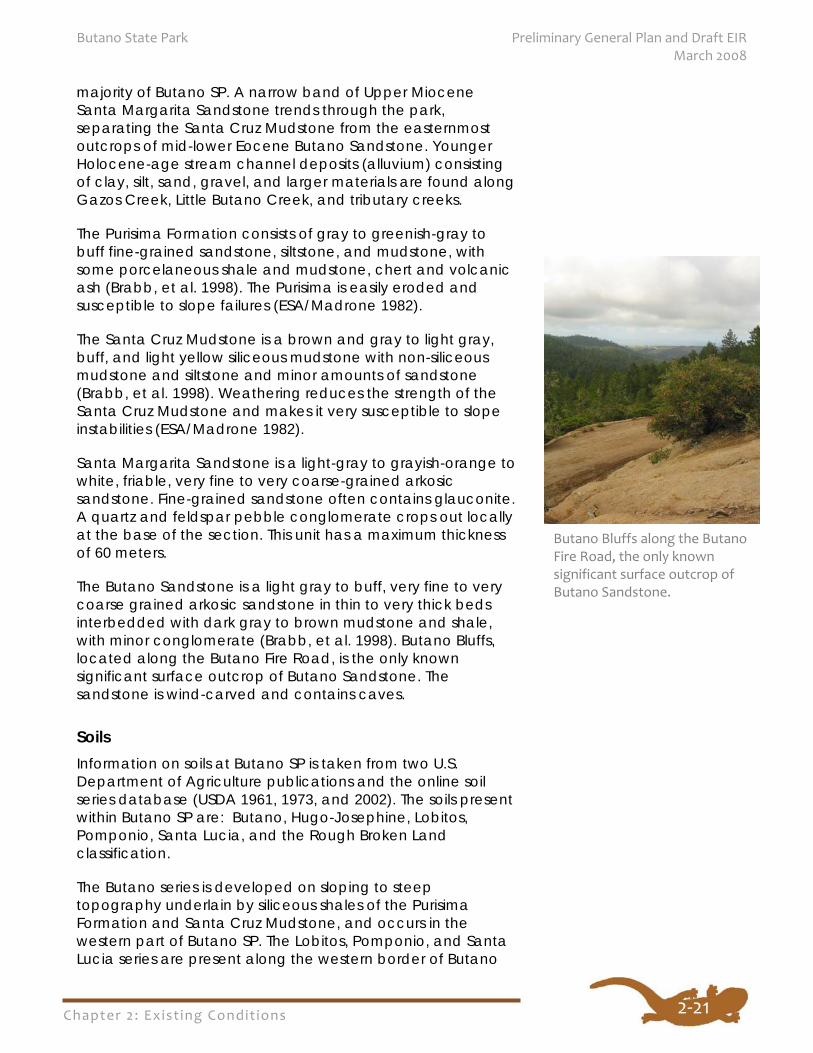
The Butano Sandstone is a light gray to buff, very fine to very coarse grained arkosic sandstone in thin to very thick beds interbedded with dark gray to brown mudstone and shale, with minor conglomerate (Brabb, et al. 1998). Butano Bluffs, located along the Butano Fire Road, is the only known significant surface outcrop of Butano Sandstone. The sandstone is wind-carved and contains caves.
Soils Information on soils at Butano SP is taken from two U.S. Department of Agriculture publications and the online soil series database (USDA 1961, 1973, and 2002). The soils present within Butano SP are: Butano, Hugo-Josephine, Lobitos, Pomponio, Santa Lucia, and the Rough Broken Land classification.
The Butano series is developed on sloping to steep topography underlain by siliceous shales of the Purisima Formation and Santa Cruz Mudstone, and occurs in the western part of Butano SP. The Lobitos, Pomponio, and Santa Lucia series are present along the western border of Butano
Butano Bluffs along the Butano Fire Road, the only known significant surface outcrop of Butano Sandstone.
Chapter 2: Exist ing Condit ions
Preliminary General Plan and Draft EIR Butano State Park March 2008
2‐22
SP, formed on sandstone and shale of the Purisima Formation. The Pomponio series, a loam to clay loam, has a dense claypan subsoil underlain by the parent shale. Rough Broken Land is a miscellaneous land type that is found on steep, rocky uplands, with slopes generally greater than 41%. Rock outcrops occupy about half of the surface area, and there is seldom more than a 10-inch thickness of soil. This land type is found in the western and through the central portion of Butano SP, mostly developed on the Santa Cruz Mudstone. The eastern quarter of Butano SP contains the Hugo-Josephine sandy loam developed on Santa Margarita and Butano sandstones.
The variability in erosion hazard is due to the slope; the hazard increases with increasing slope. The Butano, Hugo-Josephine, Pomponio, and Santa Lucia soils are all rated severe for septic systems (leach fields) and therefore are not suitable. Additional soil properties are summarized in Appendix F.
Geologic Hazards The following potential geologic hazards must be considered when planning new buildings, campsites, roads, or trails within Butano SP.
Seismic Hazards
Butano SP is located in the seismically active central California coast region. The closest major active (Holocene to Recent) fault, which trends across Butano SP’s western boundary, is the San Gregorio Fault, considered a segment of the San Andreas Fault (see Figure 5). The San Gregorio Fault, a right lateral strike slip fault, actually occupies a broad zone with several active traces extending from Butano SP west across adjacent Año Nuevo SP and State Natural Reserve and continuing offshore. These faults are delineated on the official Alquist Priolo Earthquake Fault Zone Map, Point Año Nuevo and Franklin Point quadrangles (California Geological Survey 1982). Therefore, the possibility of ground surface rupture within the western portion of Butano SP should be considered when planning future development.
The San Gregorio Fault is capable of generating an earthquake with a Maximum Moment Magnitude of 7.3 (Petersen, et al. 1996). The Seismic Shaking Hazard Map (California Geological Survey 2003) shows that Butano SP lies within a zone that has a 10% probability of experiencing moderate to strong shaking on the order of 0.4g to 0.8g peak ground acceleration within 50 years. In addition, the San Andreas Fault, located 15 miles to the east, is capable of
Chapter 2: Exist ing Condit ions
Butano State Park Preliminary General Plan and Draft EIR March 2008
2‐23
generating an earthquake of magnitude 7.0 (Santa Cruz Mountain segment). Any new structures must be built according to the specifications in the most current accepted edition of the Uniform Building Code or California Building Code. Secondary seismic hazards, such as liquefaction and landsliding, may occur during an earthquake. Strong seismic shaking may trigger movement on any existing landslides.
Liquefaction
Liquefaction could occur in loose, granular materials (alluvium) below the water table, such as along stream channels and in unconsolidated, disturbed materials. According to the liquefaction hazard maps from the Association of Bay Area Governments (ABAG), the liquefaction susceptibility at Butano SP is mainly very low to low. The Gazos Creek and Little Butano Creek drainages within the west portion of the park are ranked as moderate. The Arroyo de los Frijoles drainage is ranked as high, but only a small portion is present within the western area of the park (ABAG 2005).
Landslides
Most of the Gazos Creek drainage that forms the southern border of Butano SP is mapped as “mostly landslides” (USGS 1997). Specific landslide and sediment sources have been mapped along Gazos Creek as part of the Gazos Creek watershed study (Balance Hydrologics, Inc. 2003). The USGS map also shows that the lower reaches of Little Butano Creek are mapped as “mostly landslides.” The areas of Jackson Flats and Goat Hill are probable landslides (possibly ancient inactive landslides), based on criteria by Brabb and Pampeyan (CDPR c. 1980). These features include isolated ponds and depressions (hummocky topography), abundant natural springs, abrupt slope changes, smaller superimposed landslide deposits, steep, arcuate scarps, irregular soil and vegetation patterns, tilted trees, and flat benches within steep slopes.
The underlying geology contributes to landslide susceptibility since the underlying mudstones, shales, and sandstones are weak and fine-grained (ESA 2004). The Santa Cruz Mudstone, which underlies the majority of Butano SP, tends to form deep and large (approximately 100 acre) rotational landslides, with several of the largest in the middle reaches of Gazos Creek (Balance Hydrologics, Inc. 2003).
Chapter 2: Exist ing Condit ions
Preliminary General Plan and Draft EIR Butano State Park March 2008
2‐24
Hydrology and Water Resources
Watersheds
Butano SP contains three primary watersheds: Gazos Creek, Little Butano Creek, and Butano Creek. A small portion of the Arroyo de los Frijoles watershed is also within the park (see Figure 6, Watersheds and Streams). Gazos Creek defines the southern portion of Butano SP, forming part of the boundary with Año Nuevo SP. Approximately 22% of the Gazos Creek watershed is contained in the park. The Little Butano Creek watershed, with approximately 34% of the watershed within the park, encompasses the central area of Butano SP. Portions of the headwaters of the South Fork Butano Creek are in the northeast part of Butano SP and approximately 11% of the Butano Creek watershed occurs in the park. A very small amount (0.4%) of the Arroyo de los Frijoles watershed occurs in the western portion of the park. The Gazos Creek watershed is within the Big Basin Hydrologic Unit, as designated by the Central Coast Regional Water Quality Control Board (CCRWQCB). Butano Creek and its tributaries are within the San Mateo Coast Hydrologic Unit as defined by the San Francisco Regional Water Quality Control Board (SFRWQCB). Butano Creek is also a tributary to Pescadero Creek and is occasionally included in the Pescadero Creek watershed. These two creeks flow into the Pescadero Marsh before discharging to the Pacific Ocean (ESA 2004).
Gazos Creek The Gazos Creek Watershed Assessment and Enhancement Plan (Conrad and Chartrand 2003) identifies the creek as a priority watershed for restoration of habitat and recovery for coho salmon and steelhead trout. Gazos Creek originates partly within the southern portion of Butano SP, flows through privately owned land, and forms the northern boundary of Año Nuevo SP before it passes through private lands and then flows out to sea at Año Nuevo State Natural Reserve. The overall watershed area is approximately 16 square miles. In the upper watershed, the three tributaries (North, Middle, and South Forks) flow through steep narrow canyons. In the lower 2.5-3 miles, the topography is less steep with rolling hills surrounding the riparian zone. A lagoon is present at the mouth of Gazos Creek, west of Highway 1 (Coastal Watershed Council 2005).
Butano and Little Butano Creeks The combined Butano-Pescadero watershed is the largest coastal watershed between the Golden Gate and the San Lorenzo River (ESA 2004). Little Butano Creek, with a
Gazos Creek, Little Butano
Creek, and upper Butano
Creek have been identified
as important for recovery
of coho salmon and
steelhead.
Chapter 2: Exist ing Condit ions
Butano State Park Preliminary General Plan and Draft EIR March 2008
2‐25
watershed of approximately 3.2 square miles (CDPR c. 1980), is the southernmost tributary to Butano Creek, flowing west from Butano SP until it encounters a trace of the San Gregorio Fault. Little Butano Creek then turns northwest and follows the fault alignment until it intersects Butano Creek. The Pescadero-Butano Watershed Assessment, Final Report (ESA 2004) identifies the upper portion of Butano Creek as having moderate priority for anadromous fish habitat conservation and restoration, while Little Butano Creek has a high priority ranking. The higher ranking designation indicates higher quality habitat is present and should be protected. The Master Plan for the Coast Redwood, Santa Cruz Mountains Redwood Conservation Strategy, identifies the Butano Creek and Pescadero Creek watersheds as priority watersheds based upon the concentration of ancient redwood forest, watershed size, and proportion of the watershed that is protected (Save-the-Redwoods League 2003).
Other water bodies within Butano SP include several marshes or wetlands associated with old landslide deposits at Goat Hill, Jackson Flats, and the Ben Ries Campground. The 2.5 acre Goat Hill marsh primarily receives surface water runoff, but remains moist all year implying some spring or subsurface input. The five acre Jackson Flats marsh, a spring-fed impoundment, has a balanced inflow and outflow with little seasonal fluctuation. At the Ben Ries Campground, several small ponds described as sag ponds retain water in the wet season only (CDPR c. 1980). They are described as being developed on a landslide, but alternatively may have resulted from movement along the trace of the San Gregorio Fault that passes through the western portion of the park.
Groundwater Resources
Groundwater within Butano SP is limited to alluvial deposits along stream channels, with some storage in fractured bedrock units. Springs and seeps originating from the Purisima Formation and/or Santa Margarita Sandstone feed the marshy areas of Jackson Flats and Goat Hill, as well as providing inflow to Little Butano Creek and its tributaries. The Santa Cruz Mudstone stores water in extensive fracture systems, and likely provides summer baseflow to creeks in the Gazos Creek watershed (Balance Hydrologics, Inc. 2003). Two test wells were drilled; one at Little Butano Flats (alluvial deposits) and one at Goat Hill into an unknown source. The groundwater encountered was limited in volume and of poor quality (CDPR c. 1980).
There are marshes at
Goat Hill and Jackson
Flats. Both retain
moisture throughout
the year.
Chapter 2: Exist ing Condit ions
Preliminary General Plan and Draft EIR Butano State Park March 2008
2‐26
Water Quality
The Central Coast and San Francisco Bay Regional Water Quality Control Boards regulate water quality in the region and provide water quality standards and management criteria as required by the Clean Water Act. These standards and criteria are presented in the 1994 Water Quality Control Plan (Basin Plan) for the Central Coast Basin (CCRWQCB 1994) and the 1995 Water Quality Control Plan (Basin Plan) for the San Francisco Bay (SFRWQCB) region. The Basin Plans identify the beneficial uses and water quality objectives for the Central Coast and San Francisco Bay regions. Surface water beneficial uses that apply to creeks in Butano SP are listed in Appendix G. The SFRWQCB Basin Plan does not list specific beneficial uses for all creeks, such as Butano or Little Butano creeks. However, there are beneficial uses for Pescadero Creek which will apply to its tributaries, including the Butano Creek watershed. The Gazos Creek beneficial uses will apply to all Gazos Creek tributaries.
Surface water quality is good within the Gazos Creek watershed, with no impairments noted. Water quality parameters (temperature, dissolved oxygen, turbidity, pH, and conductivity) measured at monitoring sites within the Gazos Creek watershed are all within acceptable parameters. A macroinvertebrate survey showed that the creek condition is good (Coastal Watershed Council 2005). However, a geomorphic assessment conducted in 2003 indicates that there are some landslides and failed roads in the watershed that are potential sources of sediment that can degrade water quality and habitat for aquatic organisms (Balance Hydrologics, Inc. 2003).
Butano Creek is listed by the SFRWQCB as an impaired stream due to sediment/siltation from non-point sources. This is an impairment to steelhead habitat. Within Butano SP, Little Butano Creek shows relatively little impact from logging and is developed on rocks that have a low sediment yield. Because of these factors, Little Butano Creek provides limited but good quality spawning for anadromous fish (ESA 2004).
Groundwater quality is highly dependent on the composition of the water-bearing strata. Wells and springs located in proximity can have large variations in water quality and mineral content. The groundwater quality and yield can change dramatically after earthquake events, resulting in increases and decreases in available water. Two test wells drilled in the park yielded limited volumes of water with high levels of dissolved inorganic salts (CDPR c. 1980).
Chapter 2: Exist ing Condit ions
Butano State Park Preliminary General Plan and Draft EIR March 2008
2‐27
Flooding
According to the Federal Emergency Management Agency (FEMA) maps (2003) the 100-year floodplain for Butano Creek extends inland from the coast to the western boundary of Butano SP. It may actually extend into the park, since in many cases FEMA has not analyzed and mapped the floodplains on State Park property. Further studies may be necessary if future development is planned near Little Butano Creek. The 100-year floodplain for Gazos Creek does not extend into Butano SP.
Water Supply
Drinking water supply for the park comes from Little Butano Creek. Water flows in a piping system where it collects in a basin inside a pump house. There is a small wooden dam that impounds and diverts water via a wooden flume for use outside of park boundaries by lessees of the Peninsula Open Space Trust (POST) which owns agricultural land west of the park. In 2002, POST acquired 100% of the water rights for Little Butano Creek and 50% of the water rights for Gazos Creek (POST 2000; Powers 2006). The Gazos Mountain Camp facilities have used spring and surface water in the camp area for its water supply.
NATURAL RESOURCES
Plant Life
Vegetation Types
Butano SP contains vegetation types that are representative of the western slopes of the Santa Cruz Mountains. Based on the U.S. National Vegetation Classification system (Grossman et al. 1998), there are nine different vegetation alliances (equivalent to series and plant community) in the park. The most comprehensive listing of vegetation types for California is maintained by the California Natural Diversity Data Base (CNDDB) (CNDDB 2003), which is based on A Manual of California Vegetation (Sawyer and Keeler-Wolf 1995) and conforms to Grossman et al. (1998). The CNDDB is maintained by the California Department of Fish and Game (CDFG). This listing incorporates elements of the earlier CNDDB vegetation system described in Holland (1986).
Two of the nine vegetation types in Butano SP are considered by the CNDDB to be rare natural communities of high inventory priority and are identified by bold type. See Figure 8
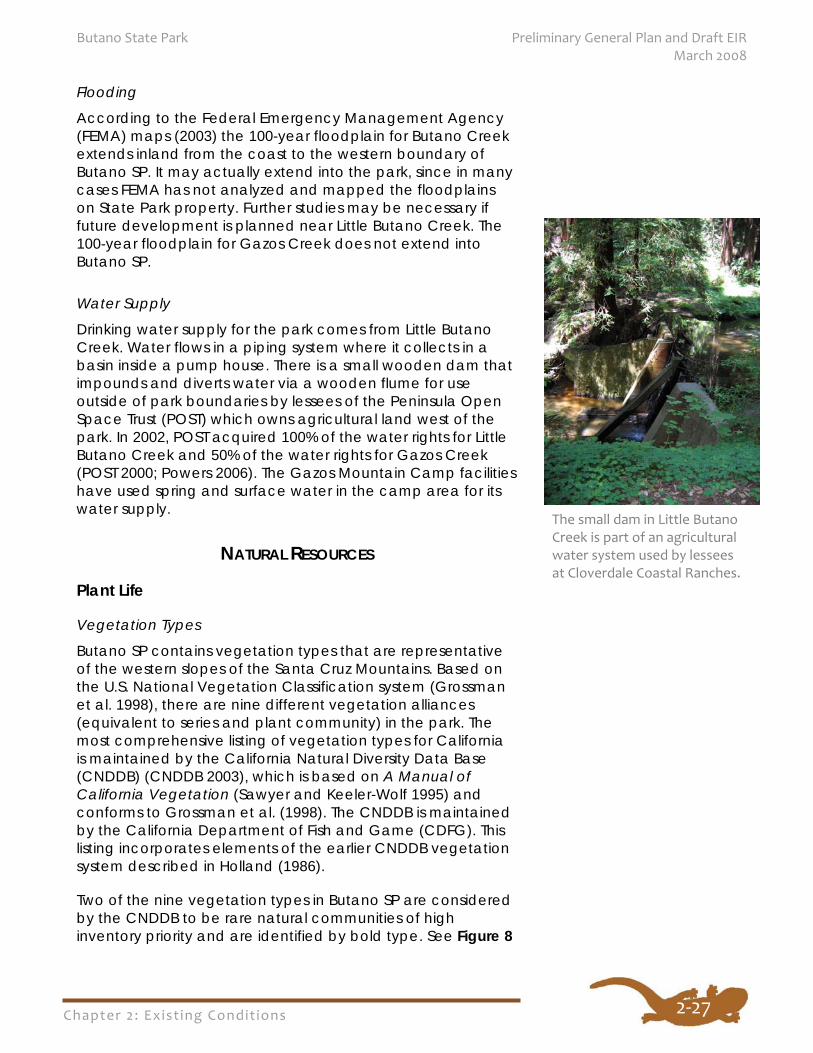
The small dam in Little Butano Creek is part of an agricultural water system used by lessees at Cloverdale Coastal Ranches.
Chapter 2: Exist ing Condit ions
Preliminary General Plan and Draft EIR Butano State Park March 2008
2‐28
for the location of these vegetation communities in the park. The vegetation types found in the park are:
Arroyo Willow Alliance California Annual Grassland Alliance; California
Oatgrass Alliance Canyon Live Oak Alliance; Interior Live Oak Alliance Coyote Brush Alliance Douglas-fir Alliance Knobcone Pine Alliance Redwood Alliance
The Arroyo Willow Alliance is found adjacent to perennial streams in the park, especially along the lower reaches of Little Butano Creek. It is dense, closed-canopy vegetation dominated by arroyo willow (Salix lasiolepis), with scattered wax myrtle (Myrica californica) in the canopy, but mostly lacking developed shrub and herbaceous layers.
Locations identified as California Annual Grassland Alliance; California Oatgrass Alliance are comprised of two vegetation types that are essentially equivalent in function and structure, but are quite different in species composition. They are so intermingled that distinct boundaries are difficult to determine, hence they have been mapped as a single type. However, most of the areas identified as grasslands consist of the primarily non-native California Annual Grassland series, which is dominated by slender wild oat (Avena barbata) and soft chess (Bromus hordeaceus).
Canyon Live Oak Alliance and Interior Live Oak Alliance vegetation types are of limited distribution in the park. Canyon live oak (Quercus chrysolepis) and California bay (Umbellularia californica) are dominant in the canopy of the former vegetation type, while interior live oak (Quercus wislizenii) is the dominant species in the canopy of the latter type. The understory for both vegetation series is usually sparse and open, but can include poison oak (Toxicodendron diversilobum), bush monkey flower (Mimulus aurantiacus), chamise (Adenostoma fasciculatum), mountain iris (Iris douglasiana), brittle-leaved manzanita (Arctostaphylos tomentosa), and various ferns.
Like the preceding oak vegetation types, the shrub-dominated Coyote Brush Alliance is found in the western portion of the park. This vegetation is dominated by coyote brush (Baccharis pilularis), and to a lesser extent poison oak
Chapter 2: Exist ing Condit ions
Butano State Park Preliminary General Plan and Draft EIR March 2008
2‐29
and California coffeeberry (Rhamnus californica). The herbaceous layer is sparse or lacking.
The Douglas-fir Alliance is the second most common vegetation type in the park. Redwood (Sequoia sempervirens) and tan oak are common constituents of the canopy, but in fewer numbers than the dominant Douglas-fir. Commonly encountered plants in the shrub and herbaceous layers include sword fern (Polystichum munitum), wild ginger (Asarum caudatum), redwood sorrel (Oxalis oregano), hedge nettle (Stachys bullata), and California blackberry (Rubus ursinus).
The Knobcone Pine Alliance occupies dry, ridgetop locations in the eastern portion of the park. Knobcone pine (Pinus attenuata) is the sole tree in a very open canopy. Common understory species include brittle-leaved manzanita, chamise, giant chinquapin (Chrysolepis chrysophylla var. minor), yerba santa, and bush monkey flower.
More than half of Butano SP is vegetated by the Redwood Alliance, most of which has been previously logged. Redwood is the dominant tree, with lesser numbers of Douglas-fir, tanoak (Lithocarpus densiflorus), and Pacific madrone (Arbutus menziesii) occupying the canopy. Common shrub and herbaceous species include California huckleberry (Vaccinium ovatum), thimbleberry (Rubus parviflorus), chain fern (Woodwardia fimbriata), western sword fern, creeping snowberry (Symphoricarpos mollis), redwood sorrel, hedge nettle, slinkpod (Scoliopus bigelovii), red clintonia (Clintonia andrewsiana), redwood violet (Viola sempervirens), trail plant (Adenocaulon bicolor), western wake-robin (Trillium ovatum), false Solomon’s seal (Smilacina racemosa), fairy bells (Disporum hookeri), striped coral root (Corallorhiza striata), spotted coral root (Corallorhiza maculata), and yerba de selva (Whipplea modesta).
Special Status Species
Special status plants are those listed on the CDFG’s Special Vascular Plants, Bryophytes, and Lichens List. Species officially listed or candidates for listing by the U.S. Fish and Wildlife Service (USFWS), CDFG, and the California Native Plant Society (CNPS) as rare, threatened, or endangered are included in this list. Species that are proposed for listing by the federal government and state candidates for listing are legally protected as if they were listed, and species listed by CNPS on their lists 1A and 1B meet the criteria for listing and are protected as such.
Nine different vegetation
alliances occur in Butano
State Park. Over half of
the park area is vegetated
by the Redwood Alliance.
Chapter 2: Exist ing Condit ions
Preliminary General Plan and Draft EIR Butano State Park March 2008
2‐30
The California Native Plant Society has established five list categories to describe the state’s rare, threatened, and endangered vascular plants. List 1A is comprised of plant species presumed to be extinct in California because they have not been seen or collected in the wild for many years. Plant species listed as 1B are considered rare, threatened, or endangered throughout their range, and with few exceptions are endemic to California. Species on this list are eligible for listing under provisions of the California Endangered Species Act. Species appearing on List 2 are considered rare, threatened, or endangered in California, but are more common elsewhere. CNPS List 3 consists of plant taxa that lack the necessary information to assign them to other lists or to reject them. Plants on List 4 comprise a watch list of plant taxa that are of limited distribution in California. Other species locally sensitive and important to the management of park units are also considered special by California State Parks.
There are no special status plant species known to occur within the boundaries of Butano SP according to the CNDDB. Of the 73 special status plant species for San Mateo County reported by CNPS (2001), suitable to marginally suitable habitat exists within the park for 24 of these species, which are identified in Appendix H. Nine of these species are CNPS List 1B plants, one is List 2, one is List 3, and thirteen are List 4. In addition to their CNPS status, three of the species are listed by the USFWS as Species of Local Concern. These are bent-flowered fiddleneck (Amsinckia lunaris), coast rock cress (Arabis blepharophylla), and stinkbells (Fritillaria agrestis).
Exotic Plants
Past activities such as agriculture, homesteading, and logging have contributed to the introduction of invasive exotic plants into the park. Species of concern are those that are invasive and/or difficult to eradicate, including pampas grass (Cortaderia jubata), and French broom (Genista monspessulana). Areas with grassland vegetation are also of concern because they support the most extensive stands of exotic species in the park and provide an annual dominated habitat type that can be readily exploited by weedy non-native species. This is especially true for the Cloverdale Road corridor, which is dominated by non-native annual grasses. The annual grasses typically do not have deep root systems and do not hold the soil in place as well as native grasses, as evidenced by erosion gullies occurring on the hillsides along Cloverdale Rd.
Chapter 2: Exist ing Condit ions
Butano State Park Preliminary General Plan and Draft EIR March 2008
2‐31
Animal Life In the Santa Cruz Mountains prior and ongoing land use practices, especially logging, have created a mosaic of pristine native habitats, habitats in various stages of succession, and other lands that provide little or no wildlife habitat value, such as areas converted for agriculture, road development, and home sites/businesses. The once pristine and fairly extensive redwood forest has undergone the most change of any habitat type from pre-Euroamerican conditions. The varied habitats represented in Butano SP, combined with the strategic connection at locations along its boundary to Año Nuevo SP, make this park very important for wildlife. The park contains valuable old growth and older second growth redwood habitat. The park’s connectivity to other California State Park units and the nearby extensive system of regional and county parks provides important movement corridors for wildlife between native habitat areas within the Santa Cruz Mountains Bioregion.
Butano SP encompasses a number of different wildlife habitats within its more than 4,600 acres. Although probably best known for the redwood-Douglas-fir forest blanketing the deep main canyon of the park, the coastal grassland, alder woodland, oak woodland, and chaparral present in the park also provide important wildlife habitat. The redwood-Douglas-fir habitat in the park is home to some highly-specialized species that are adapted to the old growth stages of these forests. High on the ridge tops above the canyon, the predominant habitat type is chaparral and knobcone pine. This warmer and drier environment is home to reptiles and birds more adapted to the sometimes harsh conditions on the ridges. In contrast, alder riparian woodland can be found along Little Butano Creek, which runs through the heart of the park. Butano SP also contains vernal wetlands/mountainside marshes on terraces at Jackson Flats and Goat Hill, which support populations of native amphibians. Near the park entrance, annual grassland and oak woodland contribute to the diversity of habitats in the park. Refer to Figure 9 for the distribution of wildlife habitats in Butano SP, which are classified using CDFG’s California Wildlife Habitat Relationships System.
Amphibians
Butano SP provides quality habitat for amphibians in the redwood and Douglas-fir forests as well as in aquatic habitats. Rough-skinned and California newts (Taricha granulosa and T. torosa) can be found in and near creeks and ponds, which they depend on during their larval stages. The redwood and
Butano SP is very
important for wildlife
because of its wide
variety of habitats and
connection to other
parklands.
Chapter 2: Exist ing Condit ions
Preliminary General Plan and Draft EIR Butano State Park March 2008
2‐32
Douglas-fir forest is home to salamanders such as the ensatina (Ensatina eschscholtzii) and California slender salamander (Batrachoseps attenuatus), which thrive under fallen and rotting logs in the moist forest duff. Pacific tree frogs (Hyla regilla), California red-legged frogs (Rana aurora draytonii), and California newts can be found in the riparian and aquatic habitats of the park.
Reptiles
A variety of species of lizards and snakes can be found in Butano SP. Western fence lizards (Sceloporus occidentalis) and western skinks (Eumeces skiltonianus) are common inhabitants of a number of the habitats, including coastal scrub and oak woodland. Freshwater emergent wetlands support aquatic garter snakes, including potential for the San Francisco garter snake (Thamnopsis sirtalis tetrataenia). The adjacent upland habitats are home to western rattlesnakes (Crotalus atrox) which can be seen warming themselves in exposed areas on sunny days.
Birds
The exuberant song of the winter wren can often be heard over the rest of the bird song chorus along Gazos Creek and other streams, which includes American robins (Turdus migratorius) and Wilson’s warblers (Wilsonia pusilla). The Douglas-fir and redwood forests of Butano SP are home to birds such as the Steller’s jay (Cyanocitta stelleri), brown creeper (Certhia americana) and winter wren (Troglodytes troglodytes), a tiny bird with a bursting, musical song that echoes through the forest. The old growth redwood forest is habitat for the marbled murrelet (Brachyramphus marmoratus). Along the streams of the park, migrants such as Wilson’s warblers, Swainson’s thrushes (Catharus ustulatus), and black-headed grosbeaks (Pheucticus melanocephalus) nest in the montane riparian habitat. In the more open coastal scrub and grasslands of the park, a number of species are present, including wrentits (Chamaea fasciata), white-crowned sparrows (Zonotrichia leucophrys), and Bewick’s wrens (Thryomanes bewickii). Annual grasslands provide good hunting grounds for numerous species of raptors, including red-tailed hawks (Buteo jamaicensis).
Mammals
Mammals are present in every habitat type in Butano SP. California gray squirrels (Sciurus griseus) are present in the forested habitats of the park, and are closely associated with oaks (Zeiner et al. 1990b). Larger species such as coyote
Chapter 2: Exist ing Condit ions
Butano State Park Preliminary General Plan and Draft EIR March 2008
2‐33
(Canis latrans), bobcat (Felis rufus), and black-tailed deer (Odocoileus hemionus) can also be seen throughout Butano SP in annual grasslands and other habitats.
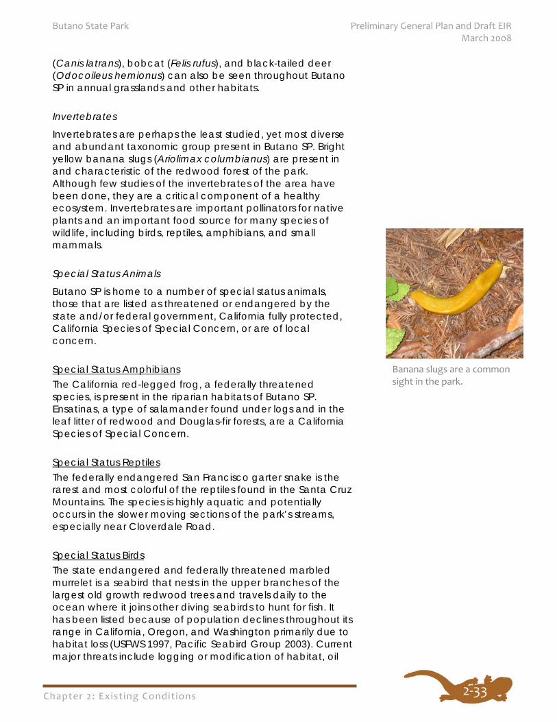
Invertebrates
Invertebrates are perhaps the least studied, yet most diverse and abundant taxonomic group present in Butano SP. Bright yellow banana slugs (Ariolimax columbianus) are present in and characteristic of the redwood forest of the park. Although few studies of the invertebrates of the area have been done, they are a critical component of a healthy ecosystem. Invertebrates are important pollinators for native plants and an important food source for many species of wildlife, including birds, reptiles, amphibians, and small mammals.
Special Status Animals
Butano SP is home to a number of special status animals, those that are listed as threatened or endangered by the state and/or federal government, California fully protected, California Species of Special Concern, or are of local concern.
Special Status Amphibians The California red-legged frog, a federally threatened species, is present in the riparian habitats of Butano SP. Ensatinas, a type of salamander found under logs and in the leaf litter of redwood and Douglas-fir forests, are a California Species of Special Concern.
Special Status Reptiles The federally endangered San Francisco garter snake is the rarest and most colorful of the reptiles found in the Santa Cruz Mountains. The species is highly aquatic and potentially occurs in the slower moving sections of the park’s streams, especially near Cloverdale Road.
Special Status Birds The state endangered and federally threatened marbled murrelet is a seabird that nests in the upper branches of the largest old growth redwood trees and travels daily to the ocean where it joins other diving seabirds to hunt for fish. It has been listed because of population declines throughout its range in California, Oregon, and Washington primarily due to habitat loss (USFWS 1997, Pacific Seabird Group 2003). Current major threats include logging or modification of habitat, oil
Banana slugs are a commonsight in the park.
Chapter 2: Exist ing Condit ions
Preliminary General Plan and Draft EIR Butano State Park March 2008
2‐34
spills, and predation of eggs by Steller’s jays and common ravens. Egg predation is particularly evident in the Santa Cruz Mountains population. Marbled murrelet surveys in the Santa Cruz Mountains have shown a drastic reduction in detections of murrelets in the past ten years. At Big Basin Redwoods SP the average number of occupied site behavior detections has gone from 55 in 1995 to less than five in 2005 for the annual survey period. The numbers from other parks also show a similar decline (Suddjian 2005).
Special Status Mammals Numerous bat species that are recognized as California Species of Special Concern and/or High Priority by the Western Bat Working Group are potentially present in Butano SP, including the pallid bat (Antrozous pallidus), Townsend’s big-eared bat (Corynorhinus townsendii), long-legged myotis (Myotis volans), fringed myotis (Myotis thysanodes), and western mastiff bat (Eumops perotis). The Santa Cruz Mountains region is home to a population of mountain lions, and Butano SP is an important component of a network of protected lands that lions range through. Large predators like these are critical components of healthy ecosystems.
Aquatic Life
The creeks of Butano SP support aquatic wildlife, including rare and endangered species. Aquatic amphibians and reptiles are present in addition to fish. Federally threatened steelhead trout (Oncorhynchus mykiss) and state endangered and federally threatened coho salmon (Oncorhynchus kisutch) are present in Gazos Creek (CDPR 2001). The steelhead spawning in the streams of the park are part of the Central California Coast ESU (Evolutionarily Significant Unit). Additionally, some of the creeks within the park could contain resident species such as prickly sculpin (Cottus asper) and coast range sculpin (Cottus aleuticus).
Please see Appendix I for a listing of sensitive wildlife species that occur, or for which potential habitat exists, within Butano SP and Figure 10 for the potential locations of sensitive species within the park.
Exotic Animals
Signs of wild (feral) pigs (Sus scrofa) have been observed in the park. Pigs can cause significant damage to natural resources by disturbing soil, uprooting native plants, and harming ground-nesting birds and other native wildlife.
Chapter 2: Exist ing Condit ions
Butano State Park Preliminary General Plan and Draft EIR March 2008
2‐35
CULTURAL RESOURCES The area encompassing Butano SP, Big Basin Redwoods SP, Año Nuevo SP, and Año Nuevo SNR contains a great variety of landscapes and habitats. The ecological productivity of this area has been shaped by past geologic, climatic and cultural events. Of principal interest to planning are the relationships of past human societies to the landscape and the archaeological evidence of their developments. Refer to Figure 11 for the general location of important cultural sites in the area.
In addition to the historic structures and associated archaeological features contained within the boundaries of the study area, approximately 12 prehistoric archaeological sites are currently recorded within Butano SP, a dozen more at Big Basin Redwoods SP, and 40 at Año Nuevo SP. Butano and Big Basin Redwoods State Parks have not been as thoroughly surveyed as Año Nuevo and it is likely that many more sites will continue to be discovered.
The archaeological record is one of the only places to can obtain data on the earliest history of the people, landscape, and ecology of the study area. Archaeological sites scattered along the upland ridges within Butano SP and Big Basin Redwoods SP have been impacted by historic logging activities, road grading, and trail construction. There is a rich record of both prehistoric and historic land use represented within the study area and these resources can greatly enhance the public experience in the parks through appropriate interpretation and site stewardship.
Año Nuevo SP and SNR provide good examples of what can be learned about the prehistoric groups who inhabited coastal California. Past archaeological investigations at Año Nuevo SNR have uncovered evidence of a long history of human interaction with the local ecology. The magnitude of the sites and the nature of their contents have provided clear evidence of the importance of the Natural Reserve lands to prehistoric Native California Indian societies. In addition to examining the archaeological record, it is important to understand what we know from the written record through ethnographical studies.
Ohlone Lifeways Ethnohistoric observations written at the time of first European contact in 1769 and during the subsequent colonization document that several different tribelets controlled territory along the peninsula coast and Santa Cruz Mountains.
Chapter 2: Exist ing Condit ions
Preliminary General Plan and Draft EIR Butano State Park March 2008
2‐36
Populations seasonally relocated from the coastal edge to locations in the nearby Santa Cruz Mountains (Palou, Vol. 3 in Bolton 1926:3:293-303; Crespi in Stanger and Brown 1969:88). Spanish Mission records show that coastal communities ultimately joined with a larger Bay Shore alliance network (King 1994:203-228; Milliken 1983; 1991). The study area was controlled by a single independent Native California Indian political entity recorded by the Spanish missionaries as the “Quiroste” (pronounced Keer-osh-tee) nation. The Quiroste were one of fifty politically independent tribelets that comprised the larger Ohlone group. The Ohlone’s cultural sphere existed within the San Francisco and Monterey Bay regions. Information about the Quiroste can be found in historic accounts and, more importantly, from the archaeological sites scattered throughout the landscape.
When the Spanish missionaries first arrived, the native people lived in groups that included extended families or clans that formed villages. Feuds between members of some villages were not uncommon, but relatives sought to avoid conflicts through payments made in shell beads. Within the villages, clan members belonged to different clubs or societies. Membership usually involved initiation where novices learned the customs of the organization, and used shell beads to pay dues. Different membership-driven organizations sponsored ceremonial events, each having their own distinctive costumes and regalia. Abalone (Haliotis) shell pendants were frequently used as badges of membership and rank. Together the various organizations formed the fabric of society and directed the storage and redistribution of surplus food resources, aided in the construction of village buildings, planned hunting strategies, and followed the seasonal cycles of nature that would determine where and when they should relocate the villages and clans.
Both men and women could be members of various societies and an elite group of women, called Mayen, directed the construction of large circular dance houses that were excavated several feet below the surrounding ground level. The Mayen selected the most virtuous individuals to represent various spiritual forces that were personified in dances and ceremonies. This practice was called Kuksui. Kuksu dancers wore woven feather bandoleers made from woodpecker quills placed edge to edge that draped over their foreheads and down their shoulders. Young children were initiated into the various societies and were taught proper manners and customs acceptable to their community by their elders. Once membership was invoked, they earned status and rank over the term of their lives.
Chapter 2: Exist ing Condit ions
Butano State Park Preliminary General Plan and Draft EIR March 2008
2‐37
Men typically governed the political structure of the village and did the hunting while women handled the gathering and processing of vegetal foods. Each village had a “head man” and the many villages throughout the Santa Cruz Mountains and coast each had its head man. Men wore little or no clothing, a trait common among hunting people who must avoid retaining the human scent so that they could better blend in with their natural surroundings. Women wore a braided tule reed skirt with a rear apron made from finely tanned deerskin.
During the historic period, the Spanish arrival resulted in dramatic environmental changes. These changes led to the subduing of the local coastal people. Those that were not relocated to missions suffered from poor nutrition and repeated exposure to introduced diseases that decimated their population. Nonetheless some survived and their descendants continue to live in the region (Milliken et al. 1993). Today the descendants of the mission people use the designation of Ohlone to encompass the families from as far south as Soledad and Monterey, all the way northward to Livermore and San Francisco. Some of the Ohlone have further subdivided into discrete family groups such as the Carmel Band of Rumsen, the Pajaro Valley Indian Association of Watsonville, the Mutsun of San Juan Bautista, the Amah Band of Gilroy, and the Muwekma Tribe of Santa Clara Valley. The descendants of the Ohlone continue to visit Butano, Año Nuevo, and Big Basin Redwoods State Parks, and participate in the archaeological research.
Prehistory Archaeological findings from Año Nuevo SP and other peninsula coastal sites reveal a succession of several cultural periods spanning the Early, Middle and Late Holocene ages. These sites have provided interesting insights into the local cultural prehistory and their adaptive responses to episodes of significant environmental change.
The study area overlays a larger fabric of dynamic cultural transformations that began sometime over 12,000 years ago when people first arrived along the west coast of North America. Legacies of dramatic (even cataclysmic) episodes of environmental changes have lead to the recognition of four major climatic shifts that have transpired during the time of human occupation. These changes define the Late Pleistocene, Early, Middle and Late Holocene epochs.
Approximately 10,000 years ago, during the Early Holocene period, the progressively rising sea began to encroach up the
Chapter 2: Exist ing Condit ions
Preliminary General Plan and Draft EIR Butano State Park March 2008
2‐38
level coastal terrace terrain that once extended considerably farther offshore until it reached its present height by Middle Holocene times, some 6,000 years ago (Bickel 1978; Brown 1994). With the stabilization of sea level, marine and terrestrial plants and animals developed distinctive behaviors and territorial distributions that allowed for predictable, patterned resources important to human societies. Cyclical patterns of seasonal food availability and repetitive use of these resources by the early people has resulted in the distribution of extensive archaeological deposits at locations where residential and/or task specific activities became established.
During the Middle Holocene (6700 to 3400 BC), stone mortars and pestles appear in the archaeological record. These artifacts indicate that acorns had increased in importance as a dietary staple since they were used for processing. This addition augmented an earlier reliance on hard seeds (tarweeds, clarkia seeds, and others) that were milled through the use of handstones and milling slabs. With the increasing reliance on acorns as a food staple, access to productive oak woodlands became a primary factor in the subsistence economy.
Coastal sites, such as those at Año Nuevo SP, contain a greater frequency and diversity of large side-notched chert projectile points and knives that are identical to Early period south coast forms (Hildebrandt and Mikkelsen 1991; Hylkema 1993:99-119; Hylkema 2002; Jones 1993; Jones and Hylkema 1988; Olsen and Payen 1969). Regionally, the Monterey chert outcrop at Año Nuevo SNR came to function as the principal source for chipped stone tool material, including projectile points, for coastal people. These robust point forms suggest that there was an emphasis on hunting large game, most likely tule elk.
Within the regional study area, a specific site in Quiroste Valley (Whitehouse Creek) (SMA-196) dates to this time. By the end of the Middle Holocene the overall artifact assemblage, along with a combined dietary focus on ocean mussels, marine mammals, and deer or elk, became the precursors to a consistent reliance on coastal resources that persisted through most of the Late Holocene. The ancestral Ohlone Indian people of the study area lived in a landscape of great ecological diversity. Their environment brought them in proximity to marine, sandy beach, rocky shore, tidal and freshwater marsh, grassland prairie, oak grassland savanna, riparian, chaparral, mixed hardwood, and evergreen forest habitats.
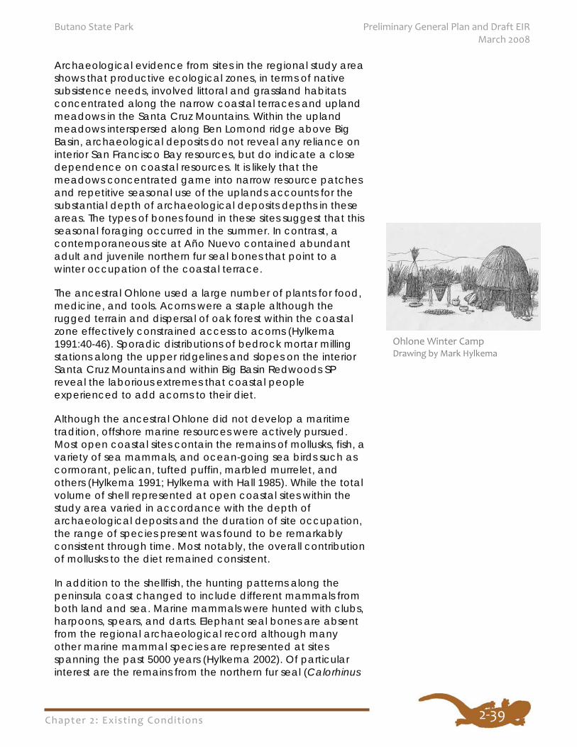
Chapter 2: Exist ing Condit ions
Butano State Park Preliminary General Plan and Draft EIR March 2008
2‐39
Archaeological evidence from sites in the regional study area shows that productive ecological zones, in terms of native subsistence needs, involved littoral and grassland habitats concentrated along the narrow coastal terraces and upland meadows in the Santa Cruz Mountains. Within the upland meadows interspersed along Ben Lomond ridge above Big Basin, archaeological deposits do not reveal any reliance on interior San Francisco Bay resources, but do indicate a close dependence on coastal resources. It is likely that the meadows concentrated game into narrow resource patches and repetitive seasonal use of the uplands accounts for the substantial depth of archaeological deposits depths in these areas. The types of bones found in these sites suggest that this seasonal foraging occurred in the summer. In contrast, a contemporaneous site at Año Nuevo contained abundant adult and juvenile northern fur seal bones that point to a winter occupation of the coastal terrace.
The ancestral Ohlone used a large number of plants for food, medicine, and tools. Acorns were a staple although the rugged terrain and dispersal of oak forest within the coastal zone effectively constrained access to acorns (Hylkema 1991:40-46). Sporadic distributions of bedrock mortar milling stations along the upper ridgelines and slopes on the interior Santa Cruz Mountains and within Big Basin Redwoods SP reveal the laborious extremes that coastal people experienced to add acorns to their diet.
Although the ancestral Ohlone did not develop a maritime tradition, offshore marine resources were actively pursued. Most open coastal sites contain the remains of mollusks, fish, a variety of sea mammals, and ocean-going sea birds such as cormorant, pelican, tufted puffin, marbled murrelet, and others (Hylkema 1991; Hylkema with Hall 1985). While the total volume of shell represented at open coastal sites within the study area varied in accordance with the depth of archaeological deposits and the duration of site occupation, the range of species present was found to be remarkably consistent through time. Most notably, the overall contribution of mollusks to the diet remained consistent.
In addition to the shellfish, the hunting patterns along the peninsula coast changed to include different mammals from both land and sea. Marine mammals were hunted with clubs, harpoons, spears, and darts. Elephant seal bones are absent from the regional archaeological record although many other marine mammal species are represented at sites spanning the past 5000 years (Hylkema 2002). Of particular interest are the remains from the northern fur seal (Calorhinus
Ohlone Winter Camp Drawing by Mark Hylkema
Chapter 2: Exist ing Condit ions
Preliminary General Plan and Draft EIR Butano State Park March 2008
2‐40
ursinus) and one of the most important discoveries of northern fur seal bones occurred at Año Nuevo (Hylkema 1991).
Sea otter remains at Late period coastal sites increased in frequency over Middle period Año Nuevo Phase sites. The range of bone elements indicated that they were most likely hunted more for their furs than their meat (Hylkema with Hall 1985). It is likely that they were harpooned among the kelp beds from tule reed boats. Although this watercraft was unsuitable for open sea, at least one historic account mentions that they were used offshore below the sheltered reach of Point Año Nuevo (Fages 1937:70).
The local coastal economy remained constant until AD 1100. Shortly after that date the coastal way of life began to change. Other Native California Indian groups from the interior areas of the state created a higher demand for various shells that were used as markers for wealth and status. The shells gave the coastal groups a valuable trade item. Evidence of this trade was discovered in an archaeological site at Big Basin Redwoods SP with the discovery of five projectile points that were made from obsidian that came from Napa. This stone tool source supplemented local Monterey chert, some of which was quarried from a partially submerged Monterey chert outcrop at Año Nuevo SNR.
Summary of Peninsula Coast Prehistory Archaeological data from sites throughout central California have shown a steady progression to a specialized, collector adaptive mode that emphasized reliance upon storable vegetal food resources, acorns in particular. This trait is often cited as the principal reason for demographic patterns associated with the cultural development of the region (Baumhoff 1963:155-236; Basgall 1987:21-52; Mayer 1976:30; and others). By the terminal phase of the Middle Holocene many archaeological sites began to exhibit greater social organization in tandem with increased use of mortars and pestles. Hildebrandt (in Elsasser 1986: 97) has demonstrated that an increased reliance on an acorn economy emerged as early as 2500 BC. Starting at that time, human burial patterns changed when various communities began burying deceased members of their groups within their villages. Social distinctions also appeared in the form of unique grave-associated artifacts distributed among a few individuals. This pattern continued throughout the subsequent Late Holocene.
With the advent of the Late Holocene, relatively small, mobile communities perpetuated an older generalized subsistence economy that emphasized a meat diet supplemented with
Chapter 2: Exist ing Condit ions
Butano State Park Preliminary General Plan and Draft EIR March 2008
2‐41
processed hard seeds, acorns, fish, and mollusks. Storage of food resources was not a critical aspect of the coastal lifeway, and a foraging economy was the optimal strategy (Hylkema 1991). However, after a period of prolonged drought between the years of AD 800 to 1100 (Jones and Kennett 1999), a transformation in the regional socio-political structure occurred and hierarchically ranked societies emerged. Logistically organized labor groups extended out from residential bases and returned with resources that were frequently stored for longer periods of time, forming what has come to be known as a collector economy. An increasing emphasis on wealth resulted in an increasing demand for abalone and Olive snail (Olivella) shells. These materials were used as markers of wealth and status by people throughout the interior of central California, and this put the coastal people in a unique position as providers (Hylkema 2002). By c. AD 1100 to the 1770s an elaborate social hierarchy had emerged, consistent with the ethnographic record.
Historical Overview
California Indians
California Indian villages were located in the vicinity of Whitehouse, Pescadero, and San Gregorio creeks throughout much of the prehistoric as well as historic periods. During the winter, California Indian groups living along the coast moved into the Santa Cruz Mountains to avoid exposure to winter storms. Because of the rugged nature of the mountains, along with the presence of grizzly bears, ridgetop routes were used in order to avoid the dense redwood forests. One of the principal routes was along the ridge that separates Big and Little Butano basins. An extensive midden site was found near the headwaters of Little Butano Creek, as well as along other ridges throughout the Santa Cruz Mountains.
According to some sources, it was the California Indians who gave the name Butano to the region, meaning a gathering place for friendly visits. Other sources indicate that the name was given by the Spanish, where it apparently means a drinking cup made out of a cow horn. The earliest recorded reference to the word Butano was in 1816, which refers to the canyon as el butano (Brown 1975). By the late nineteenth century, ‘The Butano’ was being used to refer to the forest encompassing a 10-square mile area around the basin of the various branches of Butano Creek. Other iterations of the name have been applied to geographic features, including Butano Pocket (Bolsa del Butano), Butano Creek, Butano Falls, Butano Hill, and Butano Ridge. Relatively recently, the name Big Butano has been applied to the main fork of the creek to
There are conflicting
theories of the origin of
the name “Butano.”
Some sources say it was
given to the area by the
California Indians and
means “a gathering
place for friendly visits.”
Chapter 2: Exist ing Condit ions
Preliminary General Plan and Draft EIR Butano State Park March 2008
2‐42
differentiate it from the drainage of Little Butano Creek to the south (encompassed by the current state park).
Spanish Period
The land encompassing what is now California remained largely un-exploited during its control by Spain. During the 1540s, Portuguese explorer Juan Rodriguez Cabrillo, acting on behalf of the Spanish Crown, led the first naval expedition to explore the coast of what is now California, and claim the land for Spain. While some scholars claim he made no note of Año Nuevo Point, others claim he called it “Cabo de Nieve” (Snowy Cape). Cabrillo and other early explorers did, however, note the extensive populations of seals and other marine mammals during their journeys. Years later, Sebastian Vizcaino was sent to explore the coast of California in 1602. Reaching Año Nuevo Point on New Years day of 1603, chaplain and diarist on the expedition, Father Antonio de la Ascension labeled the place on his map, “Punta de Año Nuevo” (Le Boeuf 1975:1; Holland 1963:149). Following Vizcaino’s expedition, there was virtually no Spanish exploration of Alta California for over a century and a half.
In 1769, Don Gaspar de Portola was placed in charge of an expedition to establish settlements in Alta California. After months of extremely difficult travel, the party reached Monterey Bay. From there they continued north, eventually sighting Año Nuevo Point, which they believed to be the northernmost point on the Monterey Bay. The expedition camped at Whitehouse Creek, trading beads with the Indians, whom they termed “Costaños,” though they identified themselves as the Quiroste. On Monday, October 23, the expedition encountered a large Indian village in what is now Año Nuevo SP. The Spanish called this camp Casa Grande because of the large lodge house there.
Later, an inland route from San Francisco Bay to southern California was blazed by a Spanish soldier, Pedro Fages, effectively isolating the coastal region for many years thereafter.
Missions To counter encroachment by foreign powers, the Spanish utilized three separate institutions in their attempts to settle and control California. These included missions, presidios (military forts), and pueblos (secular towns). A mission was generally established near a concentration of native peoples, and its main purpose was to convert them to Christianity and teach them farming, ranching, and other "civilized" practices.

Chapter 2: Exist ing Condit ions
Butano State Park Preliminary General Plan and Draft EIR March 2008
2‐43
Mission Dolores (founded in 1776) and Mission Santa Clara (1777) attracted some of the Quiroste, while Mission Santa Cruz contained 553 Native California Indians soon after its founding. Unfortunately, European diseases took their toll upon Native California Indians, decimating their numbers.
The coastal region of San Mateo County was used for livestock grazing from the Santa Cruz mission, which reportedly owned over 2,900 head of cattle. Native California Indians tended many of these mission herds in what were termed the ranchos, or outlying grazing areas. By 1825, 16 men and one woman were stationed in the Año Nuevo region to attend to these herds, which extended as far north as Pescadero. The cattle produced not only beef but hides and tallow, which were the main exports for the area.
Mexican Independence
Following the successful separation of Mexico from Spain in 1821, several major changes occurred in California. Foremost among these changes was the opening up of the area to outside trade. Both British and American companies became dominant in the profitable hide and tallow trade during this period. The mission system also declined in power and importance following independence. In 1834, the entire system was dismantled, and all land holdings were secularized and subdivided. The mission lands were granted to the government to be deeded to private citizens.
Mission Santa Cruz was included in the secularization, and mission lands were divided and parceled out to prominent Mexican citizens. In the San Mateo coast area, several rancho parcels were granted, including Rincon de la Ballena (between Bean Hollow and Gazos Creek), and Rancho Butano to the north. Soon thereafter, however, a grant of land was given to Simeon Castro, which included both of the above ranchos. The resulting legal dispute was not resolved until many years later. Castro’s Rancho Punta de Año Nuevo consisted of over 17,000 acres, including much of what is now Año Nuevo SP and SNR, as well as Butano SP (DPR 1974:4). By 1842, Castro took possession of the rancho, although he continued to live in Monterey. Largely through caretakers, he ran large herds of cattle on the land, as well as grew wheat, corn, melons, and potatoes (Stanger 1966:35).
Early Anglo Settlement
Following the Gold Rush, large numbers of Americans began arriving in California. In 1850, California became a state, and thousands of acres of rancho property began to be turned
The land grant map for Rancho Punta de Año Nuevo. (Courtesy of the Bancroft Library, University of California)
Chapter 2: Exist ing Condit ions
Preliminary General Plan and Draft EIR Butano State Park March 2008
2‐44
over to American citizens. Many of the large ranchos were purchased by wealthy European Americans. In 1851, Isaac Graham of Santa Cruz acquired the Rancho Punta de Año Nuevo from the Castro heirs, encompassing all of what would become Butano SP. Graham was a longtime California resident, and one of its most infamous personages. Although he did not live on the rancho, he leased much of the land out for cattle ranching. Because of financial troubles, Graham was unable to hold onto the property, and it was sold at public auction in 1862 to John H. Baird, for $20,000. Baird quickly sold the property to Loren Coburn for $30,000. Coburn purchased both the Rancho Butano and Rancho Punta de Año with his brother-in-law Jeremiah Clark. After buying out Clark, Coburn leased much of the land to a northern California family dairy enterprise by the name of Steele.
Dairies The Steeles had arrived in California from Ohio beginning in the mid-1850s, operating several dairies in Sonoma County. They soon began to make cheese, which was eagerly awaited in San Francisco. By 1857, George, Isaac, Edgar, and Rensselaer Steele leased land in Marin County. Demand for their cheese caused the Steeles to expand their herd and seek out new country. Beginning in 1862, the Steeles leased 17,763 acres of the Año Nuevo rancho from Coburn. The lease was for $6,000 per year for ten years plus all taxes on the rancho. A stipulation allowed for the Steeles to buy 7,000 acres of the ranch south of Gazos Creek when the lease expired, at $6 per acre. The Steeles exercised the option to buy the 7,000 acres, while Coburn retained the northern portion of the rancho (Steele 1948:10).
San Mateo County had become an important dairy producer for the growing city of San Francisco. Cheese and butter came from the coast side of the county, while milk was shipped from dairies on the bay side. By the 1880s, many saw bright prospects for the growth of coastal San Mateo County. In large part, this hope was driven by expectations for completion of the Ocean Shore Railroad. The agricultural products of the coast would be easily transported to San Francisco, and other smaller markets by way of this railroad, it was hoped (Alley 1883).
Lumbering Meanwhile, lumbering had also become a prominent economic activity in this region. As settlement south of San Francisco grew, the redwood trees prevalent in the Santa Cruz Mountains were exploited for their commercial use.
Chapter 2: Exist ing Condit ions
Butano State Park Preliminary General Plan and Draft EIR March 2008
2‐45
While the eastern slopes up to the summit were harvested beginning in the 1850s, the coastside areas were further from shipping points, markets, and transportation facilities, making logging operations difficult. By the 1870s, the accessible timber on the eastern slope had been largely harvested. Logging then focused on the coastside watersheds of the Purisima, Tunitas, San Gregorio, Pescadero, and Gazos creeks. Most local creeks dried up in the summer, requiring steam-powered mills for effective logging operations. Small shingle mills were often set up in small, remote canyons where oxen teams could not reach. Transporting the lumber to market proved extremely difficult and expensive. With no deep water port on the nearby coast, shipping the lumber from the few small wharfs (Waddell’s, Gordon’s Chute at Tunitas, Pigeon Point) was generally not cost effective. Prices of lumber also varied widely, based upon changing demand as the result of fires or other disasters. These price fluctuations frequently put small operations out of business (Hynding 1982). Nevertheless, several mills were established on the coast side of the mountains beginning in 1867, and some businesses thrived for a time.
The focus of most early lumbering in the area appears to have been along Gazos Creek. The Birch and Steen shingle mill was located approximately 0.5 miles west of the confluence of Bear Creek and Gazos Creek, and about five miles from the ocean. It was eventually sold to Horace Templeton who moved the mill upstream, began milling lumber, and organized the Pacific Lumber and Mill Company. Lumber was floated down a flume to the intersection of Cloverdale Road and Gazos Creek Road where it was hauled to Pigeon Point for shipping. Despite a promising beginning, the mill closed following the death of Templeton in 1873. The nationwide Panic of 1873 put several other mills in the Santa Cruz Mountains out of business. It would be several years before business would begin to pick up again. In 1882, James McKinley (brother of the future president) reactivated the Pacific Lumber mill, and soon was supplying the increasingly powerful and expanding Southern Pacific Railroad. The mill was renamed the “McKinley Mill” (Stanger 1967). Business continued to ebb and flow based upon the larger national, regional, and local economies.
Mills had also been built in the Half Moon Bay vicinity, including a steam-powered one established by the partnership of Rufus Hatch and George Borden in 1885. The Hatch and Borden partnership owned more than 1,000 acres in the Purisima canyon and operated several mills in the canyon for the next 60 years. A small town of mostly European-Americans emerged further downstream along the
Chapter 2: Exist ing Condit ions
Preliminary General Plan and Draft EIR Butano State Park March 2008
2‐46
Purisima. Several other small, short-lived communities emerged to the south of Half Moon Bay, including Tunitas and Lobitos. Difficult transportation and the rise of Half Moon Bay generally led to the abandonment of these hamlets. During this period, the lands that would make up Butano SP were owned by logging companies, and were extensively logged.
Pescadero By the early 1860s, the small town of Pescadero had emerged along this portion of the San Mateo Coast, and was soon served by several stage lines. Aside from Half Moon Bay, Pescadero was the only other town of any size during this period. By 1868 Pescadero had become the fourth largest town in the county (having just been annexed by San Mateo County that year). The town thrived as a result of it being a transportation hub for adjacent farms and lumber mills. Stages ran from Redwood City over the mountains via Searsville and La Honda to Pescadero. During periods of bad weather, mail and passenger stages were routed through Boulder Creek, passing through what is now Butano SP. The route followed those used by California Indians, along the ridgelines along Little Butano and Gazos. These routes were used until the 1880s.
By the turn-of-the-century, the long anticipated Ocean Shore Railroad that was to connect San Francisco with the San Mateo coastal area (en route to Santa Cruz) was finally being built. The anticipated contracts to supply the railroad with ties led to more lumbering activity in the mountains. By this time, the advent of the steam donkey engine and new circular saw in the 1880s led to more efficient logging operations and a greater depletion of old growth redwoods. Following the 1906 earthquake, which devastated San Francisco, demand for lumber rose again. Many fled the city for the bayside of the peninsula, which also led to increased demand for lumber. Several mills were built on Gazos Creek, as well as other locations (such as on Butano and Little Butano Creeks).
Homesteads Though most of the Santa Cruz Mountains were too rugged to be suitable for homesteading, the canyon of Little Butano Creek was one notable exception. There are several areas of flat open spaces that allowed for limited farming and ranching. The most pronounced of these consist of Little Butano Flats (at the entrance to the current park), Jackson Flats immediately below the north ridge, and Goat Hill on the south ridge. One of the first to arrive was William Jackson and his wife Isabella, who filed on three separate 160 acre parcels
Chapter 2: Exist ing Condit ions
Butano State Park Preliminary General Plan and Draft EIR March 2008
2‐47
of land in 1861. Jackson built a small house in the heart of his property, on the north side of the canyon. The area in which they settled became known as Jackson Flats. Jackson eventually acquired a total of 400 acres, and had four children, Mary, William, Fannie, and Thomas.
E.P. Mullen homesteaded on the south side of Little Butano canyon in the early 1860s. Mullen established a goat ranch on the property, giving the name to Goat Hill. Mullen’s daughter continued to live on the ranch with her husband, William M. Taylor. The Taylors remained until the late 1800s.
In 1873, Taylor built a shingle mill on the south bank of Little Butano Creek. Partnering with William Jackson, the two operated the mill for almost 10 years. By the 1880s, Sheldon “Pudy” Pharis had purchased property in the upper Little Butano basin. Known as the “shingle king,” Pharis built one of the first shingle mills in the Santa Cruz Mountains in 1863, and apparently operated as many as seven mills. Pharis purchased the Taylor mill, along with many others in the area. In 1885, however, Pharis committed suicide, and the mill ceased operation.
Peninsula Farms Several parcels of land north of Gazos Creek, including Little Butano Flats were developed into a farming cooperative known as Peninsula Farms beginning in 1923. The property was subdivided in into 41 parcels, many of which were further subdivided in later years. A manager of the cooperative built what is now the lower park residence (Residence #1), as well as the flume on Little Butano Creek.
New Ownership
In the 1920s, the Goat Hill property was purchased by Peter Olmo. Olmo operated a dog kennel, as well as a small turkey farm on the property. At roughly the same period, Joe Bacciocco purchased the Jackson property, along with the house built by the Peninsula Farms. Bacciocco, a wealthy San Franciscan meat wholesaler, did not live at the house, but instead used it as a weekend retreat. Bacciocco hosted parties that became infamous during the period of Prohibition. He hired local resident Hans Carlson to serve as caretaker for the property from 1936 to 1952. Land speculators initiated the purchase of much of the Bacciocco property, surveying forty homesites. Many of these homesites were in the location of what would become the present campground. The drastic decline of the stock market in 1929 sealed the fate of the land speculators, and no development
Chapter 2: Exist ing Condit ions
Preliminary General Plan and Draft EIR Butano State Park March 2008
2‐48
occurred in the Butano area. Bacciocco retained ownership of the land.
As described above, this region soon became a rich lumber resource. Several lumber companies acquired vast tracts of land in what is now Butano SP. A large area in the watershed of Pescadero Creek was known as “The Butano,” and was owned by the Western Shore Lumber Company and Mr. T.J. Hopkins. This area generally was centered on Butano Creek. The Butano Development Company owned several private holdings in this area “for subdivision as camp sites” (Lathrop et al. 1928). Land encompassing the watershed of the Little Butano Creek was owned by those individuals described above, as well as extensive holdings by the Pacific Lumber Company.
Early Preservation Efforts
Conservation groups had been lobbying to preserve California’s coastal redwoods beginning in the 1880s. This movement had its earliest and brightest victory in the creation of Big Basin Redwoods State Park in 1902. By 1921, the preservation group Sempervirens Club set their sights upon land along Butano Creek, which contained some of the best remaining stands of old growth redwoods in the state. In 1928, a statewide park survey called for the addition of 12,000 acres to Big Basin Redwoods State Park (encompassing Butano Creek). Though timber prices declined over the next few years (and thereby the value of the land), funds were not available for this purchase. As they had in the past, timber prices rose again, and logging activity was renewed in the early 1930s. In 1932, the Save-the-Redwoods League commissioned a study for the potential for a park in the Little Butano Creek area though no land purchases were made. By World War II, the Pacific Lumber Company had purchased a great deal of the property in the area surrounding the valley of Little Butano Creek. Meanwhile, in 1941, San Mateo County planned to purchase 160 acres in what was referred to as the Butano tract (along Butano Creek). The county planned to develop the area for recreation with the assistance of the Civilian Conservation Corps (CCC). This plan did not come to fruition, likely as a result of the war.
Post World War II
Landscape architect Frederick Law Olmsted, Jr., under contract with the state, surveyed the Little Butano area in 1946, recommending that a park not be considered for this region. Olmsted instead urged the acquisition of land in the Butano area. This area was favored by most conservationists,
Lobbying to preserve
the Santa Cruz
Mountains coastal
redwoods began in the
1880s. The Little
Butano Creek area was
first studied for its
park potential in 1932.
Chapter 2: Exist ing Condit ions
Butano State Park Preliminary General Plan and Draft EIR March 2008
2‐49
while Little Butano was not. Conservationists had, by this time, placed emphasis not only on saving the old growth redwoods, but also providing easy access to them by the large metropolitan areas of the San Francisco Bay area. Conservation efforts, however, were helped by the fact that Butano remained a rugged and relatively inaccessible area, making development difficult. The decline of lumber prices following the end of World War II also assisted in the conservation efforts (DPR 1974:8).
Efforts were again made to purchase the Butano beginning in the late 1940s. Many private groups (perhaps foremost among them the Loma Prieta Chapter of the Sierra Club) sought the establishment of a state park in the area. The State Park Commission was apparently convinced, and planned to acquire 4,500 acres encompassing Butano and Little Butano valleys. The commission set aside funds to purchase sections of the land on a matching basis. San Mateo County agreed to donate their tract of land in the area, known as the San Mateo County Memorial Park (Zimmermann 1948). In 1954, the state appraised 1,040 acres in the Butano area at $800,000. The owner (presumably the Pacific Lumber Company), however, would not sell for less than $1,600,000. The State Park Commission prepared to initiate condemnation proceedings. Lacking the support of local counties (San Mateo, San Francisco, and Santa Clara), the Commission began looking at alternate areas, including the Little Butano area (Sierra Club Bulletin 1955 January:19).
The Butano Forest Associates was formed to assist the state in acquiring and preserving 5,000 acres of the Butano and Little Butano watersheds. In 1951, the organization agreed to donate $5,000 in exchange for having a 40-acre redwood grove named for their organization. Apparently, the Division of Beaches and Parks agreed, and accepted the money. The first acquisition was made in 1956, consisting of 320 acres of government land. Soon thereafter it was designated “The Butano.” Olmo’s property, including their residence, was deeded to the state on March 31, 1958. In 1959, the state had acquired a total of 1,900 acres. Much of this land had already been logged extensively, and those trees remaining were primarily second growth. The park was not open to the public until many years later, when facilities were completed.
A request for $336,489 was made in the 1962/1963 budget for the first phase in the development of a 90-unit campsite in the new park. The first campground included 40 units with a graded dirt road, water system, and a single comfort station. In 1961, Benjamin Ries, Park Supervisor of the newly formed Butano SP, was killed in an accident at the park. Soon
Chapter 2: Exist ing Condit ions
Preliminary General Plan and Draft EIR Butano State Park March 2008
2‐50
thereafter, the campground was named in his honor. Plans were made for many more campgrounds, along with improved roads, trails, comfort stations, combination buildings, and electricity. The road through the park to the campground was completed in 1964 (with a bridge over the creek constructed that year). Overhead power lines were finally installed in 1967. By 1980, the park contained 2,186 acres.
Built Features Within the Park The following is a list of known historical-period resources within Butano SP. (See also Figure 11). These resources require further evaluation and recordation to determine the appropriate treatment and protective measures.
Historic Structures
Three existing buildings were acquired as a part of the creation of Butano SP. Each was originally a residence (Park Residence #1, and #2, and Park Office/Shop).
Park Residence #1 is described below under Historical-Period Archaeological Resources.
Park Residence #2 (Storage Shed) This building was constructed by the Olmo family in the early 1920s, adjacent to their main residence. The shed was originally used as a summer kitchen. The property was deeded to the state in 1958 and was remodeled in 1963.
Park Office/Shop Built in the early 1920s for the Peninsula Farms, this building was part of 3.86 acres of land purchased by Joseph Bacciocco in 1926. The building served as the residence for Bacciocco’s caretaker, Hans Carlson. Carlson was an early resident of the area, and lived in this building from 1936 to 1952. It was used as a park office and shop following state acquisition. Three rooms were apparently built onto the original structure in 1936. Bacciocco himself lived in the main residence (Residence #1).
Historical-Period Archaeological Resources
Several areas of historical-period occupation no longer contain standing structures. Because of the nature of their occupation, however, there are likely to be archaeological remains. Though by no means a complete list, the following sites are likely to contain buried resources.
Chapter 2: Exist ing Condit ions
Butano State Park Preliminary General Plan and Draft EIR March 2008
2‐51
Park Residence #1 This building was referred to as the lower residence, and was located approximately 250 feet from the main park road. It was apparently built in 1920 by the Peninsula Farm Corporation for use by managers of the operation. The property was acquired by Joseph Bacciocco in 1925 for $5,000. This was Bacciocco’s main residence, which he used as a retreat and for entertaining during Prohibition. The building, together with 404 acres, was purchased by the state in 1957 from Bacciocco for $120,000. The building was dismantled in 1979 due to extensive wood rot and termite damage. Archaeological remains may exist, however.
Jackson Flats Individual homesteaders arrived in Little Butano Canyon beginning in the 1860s, the first being William Jackson, who filed on 160 acres of land in 1861. Jackson built a small house in the heart of his property, on the north side of the canyon. The family lived on this property through the late nineteenth century, at which point some of the children moved further upstream.
Goat Hill In the early 1860s, E.P. Mullen homesteaded this area, establishing a goat ranch on the property. Mullen’s daughter continued to live on the ranch with her husband, William M. Taylor. They constructed several structures on the property. There are nine buildings depicted in the area of Goat Hill on the USGS topographical map of the Año Nuevo quadrangle in 1943. These were likely owned by Olmo by this time, and may represent the various structures built by Peninsula Farms and Olmo, as well as Mullen. This is also where Park Residence #2 is located. Archaeological remains from these buildings are likely.
Timber Harvest Resources
Taylor Shingle Mill In 1873, William Taylor built a shingle mill on the south bank of Little Butano Creek. Taylor partnered with William Jackson, and the two operated the mill for almost ten years. There are no standing buildings or structures remaining, but archaeological resources are likely to be present.
Gazos Sawmill A sawmill located in the clearing adjacent to the Gazos Mountain Camp was constructed sometime in the 1870s and
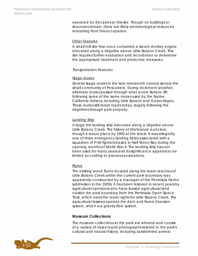
Chapter 2: Exist ing Condit ions
Preliminary General Plan and Draft EIR Butano State Park March 2008
2‐52
operated for decades at this site. Though no buildings or structures remain, there are likely archaeological resources remaining from this occupation.
Other features A small mill site that once contained a steam donkey engine is located along a ridgeline above Little Butano Creek. This site requires further evaluation and recordation to determine the appropriate treatment and protective measures.
Transportation Features
Stage routes Several stage routes in the late nineteenth century served the small community of Pescadero. During inclement weather, alternate routes passed through what is now Butano SP, following some of the same routes used by the Native California Indians, including Little Butano and Gazos ridges. These routes still retain roads today, largely following the ridgelines through park property.
Landing Strip A large dirt landing strip is located along a ridgeline above Little Butano Creek. The history of this feature is unclear, though it was in place by 1955 at the latest. It was allegedly one of three emergency landing fields associated with a squadron of P-40 fighters based in Half Moon Bay during the opening months of World War II. The landing strip has not been used for many years and its significance appears to be limited according to previous evaluations.
Flume The existing wood flume located along the lower reaches of Little Butano Creek within the current park boundary was apparently constructed by a manager of the Peninsula Farms subdivision in the 1920s. It has been restored in recent years by agricultural operators who have leased agricultural land outside the park boundary from the Peninsula Open Space Trust, which owns the water rights for Little Butano Creek. The agricultural lessees operate the dam and flume diversion system, which is a gravity-flow system.
Museum Collections The museum collections at the park are informal and consist of a variety of objects and photographs related to the park's cultural and natural history, including taxidermied animal
Chapter 2: Exist ing Condit ions
Butano State Park Preliminary General Plan and Draft EIR March 2008
2‐53
specimens and miscellaneous natural history objects. These objects are located in the visitor center. Natural and cultural history reference books are located in the park office.
AESTHETIC RESOURCES
Scenic Resources Scenic resources often provide a unique sense of place to an individual park, as well as to specific areas within a park unit. Scenery has been defined as the general appearance of a place and the features of its views or landscapes. It consists of biophysical elements (landforms, water, and vegetation) and cultural, or manmade, elements. Scenic quality is an important and valuable resource, especially on public lands. Many people value the quality of the scenery and have high expectations of scenic quality, especially when visiting California’s State Parks. Butano SP has been recognized for its natural beauty and outstanding scenic qualities.
The primary visual resources of Butano SP are the views inside the park, especially of majestic redwood trees, and the spectacular vistas of the surrounding rugged terrain of the Santa Cruz Mountains and the coast from the park’s higher elevations. These are the special scenic resources that provided part of the motivation to preserve this inspiring landscape.
The visual quality of this area is very important not only for visitors to the park, but also on a local, regional, and state level, as indicated in local and regional land use plans (such as the San Mateo County General Plan and Local Coastal Program), and the state scenic highway designation of Highway 1. Views from major roads to, near, and within the park are how many people experience this landscape. Consequently, the enhancement, preservation, and protection of scenic quality are important public issues in this region.
Overview of Scenic Character
Highway 1 and several local roads serve as gateways to the park. The scenic resources along Highway 1 in this vicinity are considered to be of high quality. While driving toward the park visitors can see a variety of terrain, land uses, and vegetation. Rich contrasts between wide marine terraces, high ridges, the ocean, and dry chaparral areas near lush forests add visual diversity to the scenery.
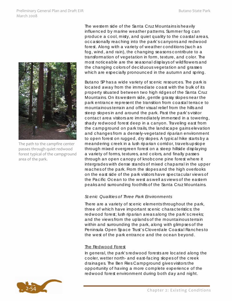
Chapter 2: Exist ing Condit ions
Preliminary General Plan and Draft EIR Butano State Park March 2008
2‐54
The western side of the Santa Cruz Mountains is heavily influenced by marine weather patterns. Summer fog can produce a cool, misty, and quiet quality to the coastal areas, occasionally reaching into the park’s canyons and redwood forest. Along with a variety of weather conditions (such as fog, wind, and rain), the changing seasons contribute to a transformation of vegetation in form, texture, and color. The most noticeable are the seasonal displays of wildflowers and the changing colors of deciduous vegetation and grasses which are especially pronounced in the autumn and spring.
Butano SP has a wide variety of scenic resources. The park is located away from the immediate coast with the bulk of its property situated between two high ridges of the Santa Cruz Mountains. On its western side, gentle grassy slopes near the park entrance represent the transition from coastal terrace to mountainous terrain and offer visual relief from the hills and steep slopes in and around the park. Past the park’s visitor contact area visitors are immediately immersed in a towering, shady redwood forest deep in a canyon. Traveling east from the campground on park trails, the landscape gains elevation and changes from a densely-vegetated riparian environment to open forest on rugged, dry slopes. A typical hike starts by a meandering creek in a lush riparian corridor, travels upslope through mixed evergreen forest on a steep hillside displaying a variety of forms, textures, and colors, and finally passes through an open canopy of knobcone pine forest where it intergrades with dense stands of mixed chaparral in the upper reaches of the park. From the slopes and the high overlooks on the east side of the park visitors have spectacular views of the Pacific Ocean to the west as well as views of the eastern peaks and surrounding foothills of the Santa Cruz Mountains.
Scenic Qualities of Three Park Environments
There are a variety of scenic elements throughout the park, three of which have important scenic characteristics: the redwood forest; lush riparian areas along the park’s creeks; and the views from the uplands of the mountainous terrain within and surrounding the park, along with glimpses of the Peninsula Open Space Trust’s Cloverdale Coastal Ranches to the west of the park entrance and the ocean beyond.
The Redwood Forest In general, the park’s redwood forests are located along the cooler, wetter north- and east-facing slopes of the creek drainages. The Ben Ries Campground gives visitors the opportunity of having a more complete experience of the redwood forest environment during both day and night.
The path to the campfire center passes through quiet redwood forest typical of the campgroundarea of the park.
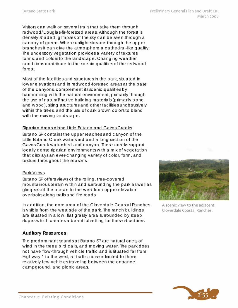
Chapter 2: Exist ing Condit ions
Butano State Park Preliminary General Plan and Draft EIR March 2008
2‐55
Visitors can walk on several trails that take them through redwood/Douglas-fir-forested areas. Although the forest is densely shaded, glimpses of the sky can be seen through a canopy of green. When sunlight streams through the upper branches it can give the atmosphere a cathedral-like quality. The understory vegetation provides a variety of textures, forms, and colors to the landscape. Changing weather conditions contribute to the scenic qualities of the redwood forest.
Most of the facilities and structures in the park, situated in lower elevations and in redwood-forested areas at the base of the canyons, complement its scenic qualities by harmonizing with the natural environment, primarily through the use of natural/native building materials (primarily stone and wood), siting structures and other facilities unobtrusively within the trees, and the use of dark brown colors to blend with the existing landscape.
Riparian Areas Along Little Butano and Gazos Creeks Butano SP contains the upper reaches and canyon of the Little Butano Creek watershed and a long section of the Gazos Creek watershed and canyon. These creeks support locally dense riparian environments with a mix of vegetation that displays an ever-changing variety of color, form, and texture throughout the seasons.
Park Views Butano SP offers views of the rolling, tree-covered mountainous terrain within and surrounding the park as well as glimpses of the ocean to the west from upper elevation overlooks along trails and fire roads.
In addition, the core area of the Cloverdale Coastal Ranches is visible from the west side of the park. The ranch buildings are situated in a low, flat grassy area surrounded by steep slopes which creates a beautiful setting for these structures.
Auditory Resources The predominant sounds at Butano SP are natural ones, of wind in the trees, bird calls, and moving water. The park does not have flow-through vehicle traffic and is situated far from Highway 1 to the west, so traffic noise is limited to those relatively few vehicles traveling between the entrance, campground, and picnic areas.
A scenic view to the adjacent Cloverdale Coastal Ranches.
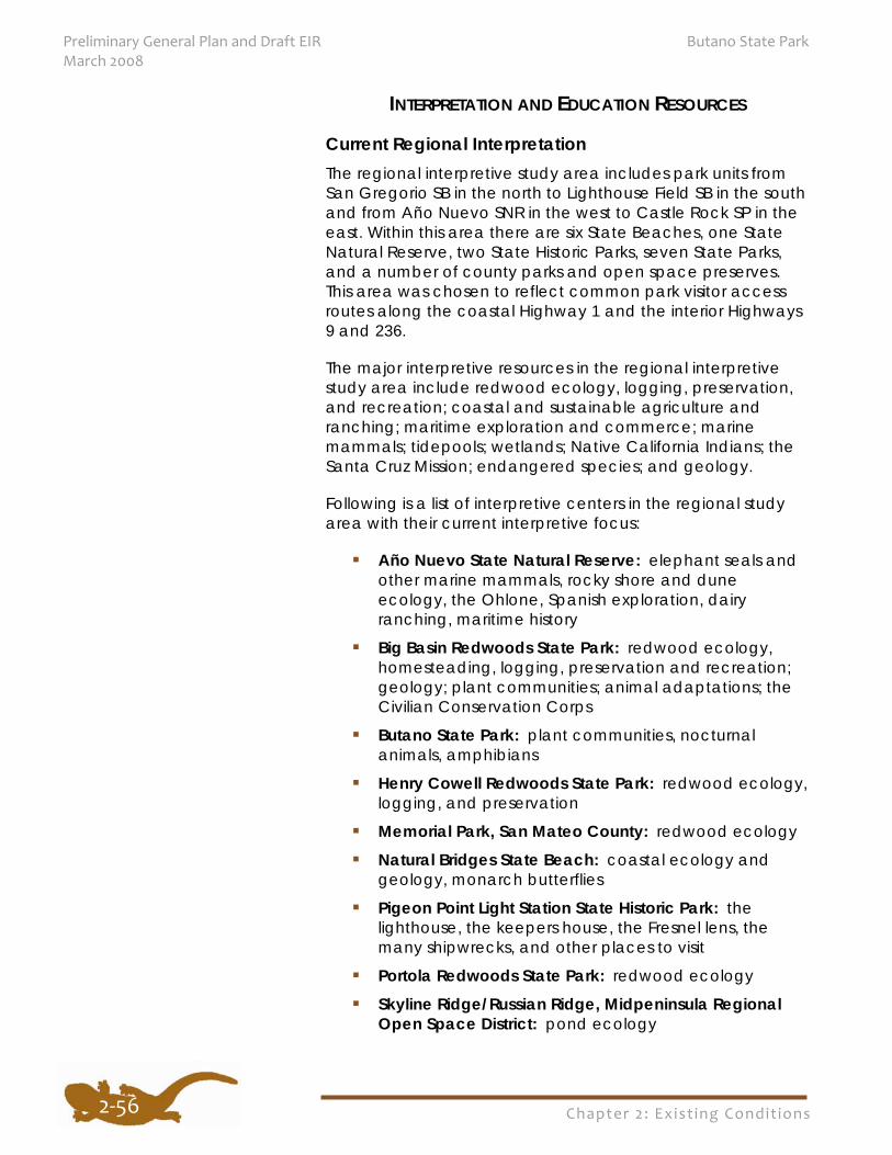
Chapter 2: Exist ing Condit ions
Preliminary General Plan and Draft EIR Butano State Park March 2008
2‐56
INTERPRETATION AND EDUCATION RESOURCES
Current Regional Interpretation The regional interpretive study area includes park units from San Gregorio SB in the north to Lighthouse Field SB in the south and from Año Nuevo SNR in the west to Castle Rock SP in the east. Within this area there are six State Beaches, one State Natural Reserve, two State Historic Parks, seven State Parks, and a number of county parks and open space preserves. This area was chosen to reflect common park visitor access routes along the coastal Highway 1 and the interior Highways 9 and 236.
The major interpretive resources in the regional interpretive study area include redwood ecology, logging, preservation, and recreation; coastal and sustainable agriculture and ranching; maritime exploration and commerce; marine mammals; tidepools; wetlands; Native California Indians; the Santa Cruz Mission; endangered species; and geology.
Following is a list of interpretive centers in the regional study area with their current interpretive focus:
Año Nuevo State Natural Reserve: elephant seals and other marine mammals, rocky shore and dune ecology, the Ohlone, Spanish exploration, dairy ranching, maritime history
Big Basin Redwoods State Park: redwood ecology, homesteading, logging, preservation and recreation; geology; plant communities; animal adaptations; the Civilian Conservation Corps
Butano State Park: plant communities, nocturnal animals, amphibians
Henry Cowell Redwoods State Park: redwood ecology, logging, and preservation
Memorial Park, San Mateo County: redwood ecology Natural Bridges State Beach: coastal ecology and
geology, monarch butterflies
Pigeon Point Light Station State Historic Park: the lighthouse, the keepers house, the Fresnel lens, the many shipwrecks, and other places to visit
Portola Redwoods State Park: redwood ecology Skyline Ridge/Russian Ridge, Midpeninsula Regional
Open Space District: pond ecology
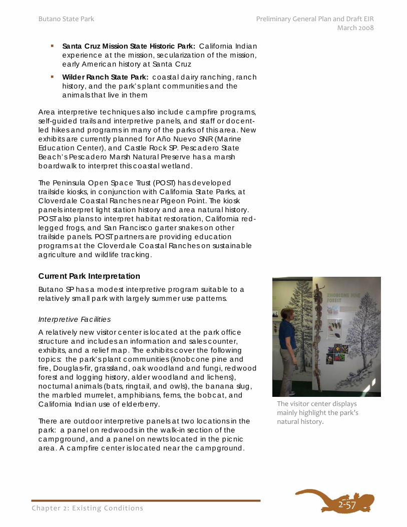
Chapter 2: Exist ing Condit ions
Butano State Park Preliminary General Plan and Draft EIR March 2008
2‐57
Santa Cruz Mission State Historic Park: California Indian experience at the mission, secularization of the mission, early American history at Santa Cruz
Wilder Ranch State Park: coastal dairy ranching, ranch history, and the park’s plant communities and the animals that live in them
Area interpretive techniques also include campfire programs, self-guided trails and interpretive panels, and staff or docent-led hikes and programs in many of the parks of this area. New exhibits are currently planned for Año Nuevo SNR (Marine Education Center), and Castle Rock SP. Pescadero State Beach’s Pescadero Marsh Natural Preserve has a marsh boardwalk to interpret this coastal wetland.
The Peninsula Open Space Trust (POST) has developed trailside kiosks, in conjunction with California State Parks, at Cloverdale Coastal Ranches near Pigeon Point. The kiosk panels interpret light station history and area natural history. POST also plans to interpret habitat restoration, California red-legged frogs, and San Francisco garter snakes on other trailside panels. POST partners are providing education programs at the Cloverdale Coastal Ranches on sustainable agriculture and wildlife tracking.
Current Park Interpretation Butano SP has a modest interpretive program suitable to a relatively small park with largely summer use patterns.
Interpretive Facilities
A relatively new visitor center is located at the park office structure and includes an information and sales counter, exhibits, and a relief map. The exhibits cover the following topics: the park’s plant communities (knobcone pine and fire, Douglas-fir, grassland, oak woodland and fungi, redwood forest and logging history, alder woodland and lichens), nocturnal animals (bats, ringtail, and owls), the banana slug, the marbled murrelet, amphibians, ferns, the bobcat, and California Indian use of elderberry.
There are outdoor interpretive panels at two locations in the park: a panel on redwoods in the walk-in section of the campground, and a panel on newts located in the picnic area. A campfire center is located near the campground.
The visitor center displays mainly highlight the park’s natural history.
Chapter 2: Exist ing Condit ions
Preliminary General Plan and Draft EIR Butano State Park March 2008
2‐58
Interpretive Programs
Interpretive programs include guided nature walks, Junior Ranger programs, roving interpretation about marbled murrelet conservation, and campfire programs. Girl Scout and Boy Scout troops and other organized groups often participate in the nature walks and Junior Ranger programs.
Educational Programs
The park provides school group programs on a by-request basis, provided a staff person or docent is available to lead the program. The estimated average number of programs is two per year. Most groups that request programs are in the grade 4-6 range. The program topic depends on the needs of the requesting educator. The most common topics are redwood ecology and riparian habitat issues.
RECREATION RESOURCES Since the original acquisition of the land that established Butano SP, the general pattern and intensity of visitor use has been moderate day use picnicking, hiking, and drive-in and walk-in camping near Little Butano Creek. Low intensity trail use and trail camping are the primary recreation activities in the backcountry area.
Visitor Support and Orientation Visitor support includes facilities such as visitor centers, campgrounds, picnic areas, restrooms, day use parking areas, and trailheads. These facilities serve the needs of park visitors and enhance their experience in the park. The park has a well-defined main entrance and arrival point from Cloverdale Road. Vehicular access to visitor facilities located in the forested Little Butano Creek watershed are connected to the main entrance. A secondary road, Gazos Creek Road, provides access to the Gazos Mountain Camp area in the adjacent Gazos Creek watershed to the south. The Gazos Mountain Camp is a developed area that includes a meadow, lodge, cabins, classrooms, restrooms with showers, parking, and picnic facilities. The nonprofit Pescadero Conservation Alliance is currently renovating the area for use as an environmental education and field research facility.
Trail Use Trail use in Butano SP is a main recreation activity and the primary way to explore the various areas of the park. The trail network includes hiking-only trails and trails managed and
A trail camp is available for overnight stays in the backcountry.
Chapter 2: Exist ing Condit ions
Butano State Park Preliminary General Plan and Draft EIR March 2008
2‐59
maintained as multi-use (designated for hiking, mountain biking, and equestrian use), as well as providing a variety of experiences in the park’s many natural environments (see Table 2-3). This trail network (approximately 26 miles) also provides connections to the Santa Cruz Mountains and coastal natural lands and open space areas that include other state parks and public open space properties.
Camping Camping is a recreation activity that has been offered since the establishment of the park. The Ben Ries Campground is a small drive-in and walk-in campground located within a redwood forest containing healthier and more developed understory vegetation than some of the larger campgrounds found at other nearby state parks. It is an important overnight facility in the regional network of campgrounds. Interpretive programs are provided at the nearby campfire center and the park’s visitor center.
There is a hike-in trail camp located on an inland ridgetop area which offers an alternative experience to the enclosed quiet redwood forest ambience of the Ben Ries Campground. This trail camp is part of a larger regional network of trail camps located in the Santa Cruz Mountains.
The nearest state park campgrounds in the region are north on Highway 1 at Half Moon Bay SB and south on Highway 1 at the Rancho del Oso campground in Big Basin Redwoods SP. Additional inland regional forested campgrounds are available at Big Basin Redwoods SP, Portola Redwoods SP, and Henry Cowell Redwoods SP. There are also coastal campgrounds at New Brighton SB, Seacliff SB, and Sunset SB near Santa Cruz. Costanoa, a private resort along Highway 1 adjacent to Año Nuevo SP, offers a variety of overnight accommodations including tent cabins, RV campsites, and equestrian campsites.
There is growing interest and demand for alternatives to traditional tent camping as the average age of the general population increases. Such alternative facilities include cabins, tent cabins, and yurts that allow park visitors to enjoy overnight stays without having to set up camps or invest in camping gear. These alternatives would also provide additional accommodations for visitors with special needs and accommodations for overnight park visits outside of the traditional summer peak season (especially during variable weather conditions).
Chapter 2: Exist ing Condit ions
Preliminary General Plan and Draft EIR Butano State Park March 2008
2‐60
As nearby Bay Area and park visitor demographics continue to evolve, recreation in Butano SP will need to respond to those demographic changes while still preserving the park’s vital and character-defining resources. This may include adding group facilities or converting some existing day use and overnight facilities to group use for visitors who prefer recreation with more social interaction. To accommodate demographic changes and recreation preferences, clusters of nearby state parks in a region may also be managed in such a way to identify those parks with greater opportunities or facilities for group or other specialized uses, while other parks are identified for more individual or family use. Butano SP may be a park unit that is more appropriate for the more traditional individual family use because of the limited additional development areas due to the park’s rugged terrain and site constraints.
Emerging Recreation such as Geocaching Geocaching is a new and developing sport where participants use global positioning system (GPS) receivers to locate caches hidden in various locations by other GPS users. The GPS coordinates of the caches are posted on the internet so that other GPS users can find the caches. Once found, a cache may provide the visitor with various rewards–from trinkets to pointing out an exceptional view seen from that particular location. Participants are urged by geocache advocates to practice the sport in an honorable and non-destructive manner. Laws, policies, and guidelines are in place in both National and State parks which provide park managers authority to manage activities such as geocaching. As this type of sport gains in popularity and concerns for geocache activity near sensitive resource areas increase, park managers may need additional resources and direction. California State Parks is currently developing statewide guidelines specific to geocaching activity. Approximately ten known geocache sites are currently located within the park, most in the backcountry adjacent to existing trails.
There are volunteer groups, nonprofit agencies, advocacy groups, and cooperative associations that assist with operations, maintenance, and interpretation at the park. Typical park support activities include trail patrols and maintenance, special events, interpretive programs, facility
2.5 PARK SUPPORT
Park managers will
need to adapt
recreation
opportunities in
response to changing
demands as the park’s
visitor demographics
evolve, while
preserving the park’s
essential character and
resources.
Chapter 2: Exist ing Condit ions
Butano State Park Preliminary General Plan and Draft EIR March 2008
2‐61
maintenance, habitat restoration, and land acquisition. Approximately ten volunteer docent naturalists support interpretive programs at Butano SP and approximately 35 Butano trail volunteers work out of a small park building dedicated to trail improvement in the park.
The Pescadero Conservation Alliance (PCA) is a nonprofit organization whose purpose is to restore the ecological health of the San Mateo coast. The PCA has been renovating the former Gazos Mountain Camp facilities for use as a field research station and outdoor environmental education facility with the goal to integrate environmental education activities with real-world projects in environmental research, restoration, land stewardship, and community cooperation.
The San Mateo Coast Natural History Association supports volunteers and staff who provide educational and interpretive activities to park visitors and provides items such as maps and books for the public in the visitor center.
The Santa Cruz Mountains Bioregional Council is a nonprofit public benefit corporation whose purpose is to conserve native plant and animal biodiversity in the Santa Cruz Mountains Bioregion. The Bioregional Council works to preserve and restore native plant and animal biodiversity and processes through information sharing, coordinating activities, fostering biological research, initiating land conservation and habitat enhancement projects, and supporting public education. Council members include individuals from state and federal resource management agencies, local governments, land trusts, open space districts, educational institutions, conservation groups, and private properties.
The Save-the-Redwoods League contributes to the permanent protection of redwood forest, funds environmental restoration, supports research to expand knowledge about the redwood forest, and educates the public about the redwoods and the redwood forest ecosystem.
The Sempervirens Fund works closely with California State Parks to preserve and protect the natural character of the Santa Cruz Mountains and encourages public enjoyment of this environment. The Fund purchases threatened redwood forest lands in the Santa Cruz Mountains region and fosters public participation in activities such as reforestation and trail projects.
The Trail Center provides and promotes non-motorized trail opportunities in San Mateo, Santa Clara, Santa Cruz,
Chapter 2: Exist ing Condit ions
Preliminary General Plan and Draft EIR Butano State Park March 2008
2‐62
Alameda, and San Francisco counties. Trail Center volunteers have provided support for a trail on a southern portion of the existing Olmo Fire Road, extending approximately 1.5 miles from the Goat Hill vicinity to connect to Gazos Creek Road and Año Nuevo SP.
The Wildlands Restoration Team, a volunteer-based organization dedicated to preserving the rich biodiversity of the Santa Cruz Mountains, has removed exotic vegetation from the park.
Planning for California State Parks must be extensive to consider issues that cross statewide, regional, and local boundaries. Federal, state, county, and community agencies are responsible for providing oversight and review of various planning-related policies and laws. Additionally, local planning information is essential is assisting California State Parks with relevant information regarding natural, cultural, recreational, and aesthetic resources, existing land uses, and education and interpretation programs pertinent to the park.
The following systemwide, regional, and regulatory planning influences were considered in developing the General Plan guidelines.
SYSTEMWIDE PLANNING Systemwide planning improves the ability of the Department to fulfill its mission by establishing policies, methods, and guidelines for managing state-owned park land. This enables the Department to apply a more consistent approach for implementation of various aspects of park planning, preservation, development, and operation throughout the park system. It is the intent of this General Plan to be consistent and current with the Department’s systemwide planning and policies. The following are elements of those systemwide planning policies, procedures and guidelines.
Public Resources Code In addition to the State Constitution and Statutes, California Law consists of 29 codes covering various subject areas (California Code of Regulations). The California Public Resources Code (PRC) addresses natural, cultural, aesthetic, and recreational resources of the state. PRC sections 5019.50
2.6 PLANNING INFLUENCES
Chapter 2: Exist ing Condit ions
Butano State Park Preliminary General Plan and Draft EIR March 2008
2‐63
to 5019.80, Classification of Units of the State Park System, provide guidelines for the designation of state park units and guiding principles for state park improvements. The PRC also classifies different types of state park improvements of park units.
California Environmental Quality Act The California Environmental Quality Act (CEQA) requires state and local agencies to regulate activities with consideration for environmental protection. If a proposed activity has the potential for a significant adverse environmental impact, an Environmental Impact Report (EIR) must be prepared and certified as to its adequacy before taking action on the proposed project. General plans require a Programmatic EIR, and park development projects require appropriate environmental review, which may include an EIR.
California Department of Parks and Recreation Administrative Manual The Department Administrative Manual provides the policies and procedures by which California State Parks function. Departmental manuals are intended to contain general matters of policy and procedure. When there is information and specifications too lengthy to include in a manual these more detailed materials will be prepared and issued in the form of handbooks, with each handbook devoted to a single topic (such as planning or trail maintenance).
California Department of Parks and Recreation Operations Manual The Department Operations Manual (DOM) provides the policies and procedures that are pertinent to the operation of the State Park System. It is intended as a working document for Department personnel.
Section 0300, Natural Resources
The DOM Section 0300, Natural Resources, is the basic natural resource policy document for the State Park System. The policies, definitions, processes, and procedures contained in this chapter guide the management of the natural resources under the jurisdiction of the Department of Parks and Recreation, including naturally occurring physical and biological resources and associated intangible values, such as natural sounds and scenic qualities. These policies, definitions, processes, and procedures amplify the legal codes in the PRC, the California Code of Regulations, and the
Chapter 2: Exist ing Condit ions
Preliminary General Plan and Draft EIR Butano State Park March 2008
2‐64
California State Park and Recreation Commission's Statement of Policies and Rules of Order as they pertain to the natural resources of the State Park System.
Section 0400, Cultural Resources
The DOM Section 0400, currently under revision, will be the basic cultural resource policy document for the State Park System. Until it is complete, Section 1832 of the Resource Management Directives (California Department of Parks and Recreation 1979b) and the Cultural Resources Management Handbook (California State Parks 2001a) provide the policies, definitions, processes, and procedures to guide the management of cultural resources under the jurisdiction of the Department, including prehistoric and historic archaeological sites, historic buildings, features and landscapes, and Native California Indian cultural resources. These policies, definitions, processes, and procedures highlight the legal codes in the PRC, the California Code of Regulations, State Historic Building Code, the Secretary of the Interior’s Standards, a Memorandum of Understanding between California State Parks and the Office of Historic Preservation, Executive Order W-26-92, and the California State Park and Recreation Commission’s Statement of Policies and Rules of Order as they pertain to the cultural resources of the State Park System.
California State Parks Accessibility Guidelines The Americans with Disabilities Act (ADA), the federal law that prohibits discrimination on the basis of disability, is applicable to all programs, services, and activities by the state, including the preparation of state park general plans. In compliance with the ADA, the Department published the California State Parks Accessibility Guidelines in 2005, which were first issued in 1994. The Guidelines detail procedures to make state parks universally accessible while maintaining the quality of park resources. The Department has also published All Visitors Welcome: Accessibility in State Park Interpretive Programs and Facilities (California State Parks 2003b), which provides guidance on developing accessible interpretive programs and facilities.
The Department’s Transition and Trail Plans for Accessibility in State Parks (California State Parks 2001b) outlines its commitment to achieve programmatic access throughout California State Parks. This vision is embodied in the Butano SP General Plan.
The Accessibility
Guidelines detail
procedures to make
the park accessible to
all visitors, while
maintaining the
quality of park
resources.
Chapter 2: Exist ing Condit ions
Butano State Park Preliminary General Plan and Draft EIR March 2008
2‐65
California Recreational Trails Plan The California Recreational Trails Plan (Phase One) (California State Parks 2002c) addresses the mission and overall role of the California State Parks Statewide Trails Office as well as provides guidelines for future actions of the Statewide Trails Office. The mission and vision of the Statewide Trails Office is to “. . . promote the establishment and maintenance of a system of trails and greenways that serves California’s diverse population while respecting and protecting the integrity of its equally diverse natural and cultural resources. The system should be accessible to all Californians for improving their physical and mental well-being by presenting opportunities for recreation, transportation, and education, each of which provides enhanced environmental and societal benefits.”
The California Recreational Trails Plan serves as a guideline for establishing and maintaining trails in California and integrates the Department’s trail programs with local government agencies and private organizations that operate and maintain the trails. The Trails Plan, the Trails Policy, and the Trails Maintenance Handbook serve as planning and maintenance guides for trails within the park system.
California State Park System Plan The California State Park System Plan describes both the challenges that face the State Park System as well as the goals, policies, objectives, and proposals for new programs and initiatives needed to guide the State Park System.
Systemwide Concessions Policies The Department partners with a variety of businesses, nonprofit organizations, and public agencies through concession contracts, cooperative agreements, and operating agreements to offer the public goods and services. How these opportunities are made available to the public is regulated by the California Public Resources Code, Section 5080 et seq.
REGIONAL PLANNING Consideration of regional planning influences is important for any park plan because it enables planners to anticipate and coordinate with regional planning efforts and issues that affect the park. For this General Plan, planning considerations include the region around Butano SP, Año Nuevo SNR, Año Nuevo SP, Big Basin Redwoods SP, Portola Redwoods SP, and Castle Rock SP, as well as the northern boundary of Henry
Chapter 2: Exist ing Condit ions
Preliminary General Plan and Draft EIR Butano State Park March 2008
2‐66
Cowell Redwoods SP. Butano SP is integrated within a regional landscape of open space recreation areas, habitat preservation areas, and recreational trail networks. Consideration is also given to major access routes traveled by most visitors as well as connections to other regional recreation destinations.
Butano SP is part of the region’s chain of parks and open space areas, and like these many other public and private open space ownerships, the park plays an important role in preserving natural and cultural resources and providing recreational opportunities and facilities. A number of non-governmental organizations, such as the Peninsula Open Space Trust, the Sempervirens Fund, and The Trust for Public Land, have also been acquiring property along the southern San Mateo and northern Santa Cruz coast with the intent of preserving it in perpetuity as open space.
Policies and recommendations of existing regional planning documents that are most pertinent to planning for Butano SP are summarized below.
Regional Plans and Programs
San Mateo County General Plan and Local Coastal Program
The 1986 San Mateo County General Plan calls for preservation of agricultural lands for agricultural use, protection of native habitats, animals and plants, and protection and enhancement of the natural visual quality of county lands. It proposes the continued provision of recreational lands for the “physical, mental, and spiritual quality of life of San Mateo County residents.” It also defines what the County would like California State Parks’ role to be:
“…to give priority to developing existing facilities.”
“…to provide park and recreation facilities of statewide significance.”
“…to be “the principal agency to acquire, develop and maintain Coastal beaches.”
The San Mateo County General Plan lists land use objectives for rural areas as: a) preserve natural resources; b) provide for the managed productive use and monitoring of resources; c) provide outdoor recreation; and d) protect public health and safety.
The 1998 San Mateo County Local Coastal Program (LCP) offers specific policies in support of the general policies of the
Chapter 2: Exist ing Condit ions
Butano State Park Preliminary General Plan and Draft EIR March 2008
2‐67
1986 San Mateo County General Plan. The LCP is focused on the Coastal Zone within the county. The LCP describes the Local Coastal Program as “…a comprehensive set of land use policies for the Coastal Zone in order to meet the requirements of the California Coastal Act of 1976. These policies encourage the development of recreation-oriented, visitor-serving facilities and the concentration of new development within rural service centers, while providing the maximum protection of access to beaches, the preservation of scenic values, and the protection of agricultural lands.” All development in the Coastal Zone requires either a Coastal Development Permit or an exemption from coastal permit requirements.
The following are summaries of the San Mateo County LCP policies that relate to California State Parks’ planning process:
The Coast Highway south of Half Moon Bay, Cloverdale Road, and Gazos Creek Road (from Highway 1 to Cloverdale Road) are designated as Scenic Roads which affords them high levels of scenic protection.
Priority is given to visitor-serving and commercial recreation facilities on designated Mid-Coast lands and throughout the South Coast over private residential, general industrial or commercial development but not over agriculture or coastal-dependent industry.
California State Parks is encouraged to give priority to the Mid-Coast (Gray Whale Cove, Montara, and Half Moon Bay State Beaches) for the development of public recreation facilities. Require new development of South Coast recreation facilities to be phased in accordance with a long-range development program that gives priority to development of Mid-Coast facilities.
Support a trails program that connects recreation facilities along the coast and which connects coastal and inland recreation facilities.
The Gazos Creek Coastal Access to Butano SP Trail (via Gazos Creek Access Road) is designated as a Local Coastal Program Trail.
California State Parks is encouraged to prohibit overnight RV parking in State Parks parking lots.
California State Parks is designated as the primary agency for the acquisition, development and maintenance of public recreation and visitor-serving
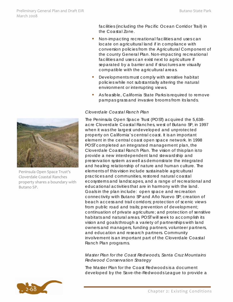
Chapter 2: Exist ing Condit ions
Preliminary General Plan and Draft EIR Butano State Park March 2008
2‐68
facilities (including the Pacific Ocean Corridor Trail) in the Coastal Zone.
Non-impacting recreational facilities and uses can locate on agricultural land if in compliance with conversion policies from the Agricultural Component of the county General Plan. Non-impacting recreational facilities and uses can exist next to agriculture if separated by a barrier and if structures are visually compatible with the agricultural areas.
Developments must comply with sensitive habitat policies while not substantially altering the natural environment or interrupting views.
As feasible, California State Parks is required to remove pampas grass and invasive brooms from its lands.
Cloverdale Coastal Ranch Plan
The Peninsula Open Space Trust (POST) acquired the 5,638-acre Cloverdale Coastal Ranches, west of Butano SP, in 1997 when it was the largest undeveloped and unprotected property on California’s central coast. It is an important element in the central coast open space network. In 1998 POST completed an integrated management plan, the Cloverdale Coastal Ranch Plan. The vision of this plan is to provide a new interdependent land stewardship and preservation system as well as demonstrate the integrated and healing relationship of nature and human culture. The elements of this vision include sustainable agricultural practices and communities, restored natural coastal ecosystems and landscapes, and a range of recreational and educational activities that are in harmony with the land. Goals in the plan include: open space and recreation connectivity with Butano SP and Año Nuevo SP; creation of beach access and trail corridors; protection of scenic views from public road and trails; prevention of development; continuation of private agriculture; and protection of sensitive habitats and natural areas. POST will seek to accomplish its vision and goals through a variety of partnerships with land owners and managers, funding partners, volunteer partners, and education and research partners. Community involvement is an important part of the Cloverdale Coastal Ranch Plan programs.
Master Plan for the Coast Redwoods, Santa Cruz Mountains Redwood Conservation Strategy
The Master Plan for the Coast Redwoods is a document developed by the Save-the-Redwoods League to provide a
Peninsula Open Space Trust's Cloverdale Coastal Ranches property shares a boundary with Butano SP.
Chapter 2: Exist ing Condit ions
Butano State Park Preliminary General Plan and Draft EIR March 2008
2‐69
science-based conservation strategy for the entire coast redwood ecosystem and guide the League’s conservation program. A regional plan focuses on the League’s conservation strategy specifically for the Santa Cruz Mountains coastal redwood forests. The objectives of this plan are to identify priorities for stewardship, restoration, and acquisition. The Master Plan gives the League a context to evaluate and prioritize conservation actions and to identify conservation partners and opportunities for collaboration. As identified in the League’s master plan, the greatest stresses to the redwood forest community are habitat loss and fragmentation, and the loss of old-forest components.
California Wildlife: Conservation Challenges (California Wildlife Action Plan)
This document, the state’s wildlife action plan, was developed and produced as a collaboration between CDFG and the Wildlife Health Center at the University of California, Davis. It is a comprehensive wildlife conservation strategy that addresses wildlife and habitat issues in all of California’s ecological regions. Regional chapters, such as the Central Coast, describe the problems and threats that may adversely affect wildlife and their habitats. The threats identified for the central coast region are growth and development; intensive agriculture; excessive livestock grazing; water management conflicts and degradation of aquatic ecosystems; recreational pressures; and invasive species.
Recommended region-specific conservation actions that are pertinent to California State Parks and Butano SP are found in the Central Coast Region chapter. Some of these conservation actions include working to protect large, relatively unfragmented habitat areas and wildlife corridors; protecting sensitive species and important wildlife habitats; working to restore fish passage in aquatic systems important for anadromous and wide-ranging fish populations; and providing resources and coordinating efforts to control existing occurrences of invasive species and prevent new introductions.
Midpeninsula Regional Open Space District Master Plan and Regional Open Space Study The Midpeninsula Regional Open Space District’s (MROSD) Master Plan (1992) and Regional Open Space Study (1998) guide their open space preservation efforts. The master plan sets forth guidelines for MROSD acquisitions and shows the relative desirability of potential open space land acquisitions for the purpose of “preserving a regional greenbelt along the
Chapter 2: Exist ing Condit ions
Preliminary General Plan and Draft EIR Butano State Park March 2008
2‐70
crest of the hills along the San Francisco peninsula.” The regional open space study shows the general extent of lands and public access improvements (both existing and under consideration) to complete the MROSD’s greenbelt mission. Both documents are submitted to the counties, cities, and other conservation-oriented local, state, and federal agencies and organizations for review and comment in order to encourage coordination with their planning and policies.
The MROSD can provide locally based, long-term stewardship of some lands and offer easement opportunities to willing sellers for agricultural lands. Over the next 15 years, the MROSD anticipates it could purchase or manage approximately 11,800 acres of land within the entire Coastside Protection area. The MROSD promotes watershed protection and is involved in regional recreation planning efforts such as the Skyline-to-the-Sea Trail, the Bay Trail, and the Bay Area Ridge Trail.
Coast Dairies Long-Term Resource Protection and Access Plan (February 2004)
The Coast Dairies property, over 6,800 acres of northern Santa Cruz County coastal dairy ranch land, is the centerpiece of a regional network of conservation open space, providing opportunities for regional trail development and other recreational linkages, such as beach access. California State Parks has acquired approximately five miles of coastal bluff property and seven acres of inland property. The remainder of the inland property is expected to be transferred to the BLM and a nonprofit group.
A collaborative effort by California State Parks, BLM, TPL, and the Santa Cruz community, the Coast Dairies Plan is a broad planning document and management plan. All transferred property will be managed in accordance with the Coast Dairies Plan. The plan’s vision is to preserve the distinctive character and resources of the area which is marked by the interface of the natural rugged coastline, sandy pocket beaches, coastal marine terraces, pastoral grasslands, densely forested upland and riparian corridors, and the developed uses of coastal agriculture, mining, Highway 1, and the town of Davenport. The Coast Dairies Plan provides broad direction and guidance on managing and protecting natural and physical resources, visitor use, and development on the property.
Chapter 2: Exist ing Condit ions
Butano State Park Preliminary General Plan and Draft EIR March 2008
2‐71
REGULATORY INFLUENCES There are a number of agencies involved in planning or regulatory authority in this region. A portion of Butano SP is within the coastal zone and is under the jurisdiction of the San Mateo County Local Coastal Program (see Figure 7, Coastal Zone). The coastal zone designation regulates development activities and use intensity that could have implications for park development and visitor use. The park also spans areas regulated by various air and water quality boards and regional planning agencies. These regulations are also considered in the park’s planning and management decisions.
California Coastal Commission, Central Coast District The California Coastal Commission was established by voter initiative in 1972 and made permanent by the Legislature in 1976 as the Coastal Zone Management Act (CZMA). The primary mission of the Commission, as the lead agency responsible for carrying out California’s federally-approved coastal management program, is to plan for and regulate land and water uses in the coastal zone consistent with the policies of the CZMA.
The most significant provisions of the CZMA give state coastal management agencies regulatory control (federal consistency review authority) over all federal activities and federally licensed, permitted or assisted activities, wherever they may occur (i.e., landward or seaward of the respective coastal zone boundaries fixed under state law) if the activity affects coastal resources. Examples of such federal activities include: outer continental shelf oil and gas leasing, exploration and development; military projects at coastal locations; U.S. Army Corps of Engineers fill permits; certain U.S. Fish and Wildlife Service permits; and highway improvement projects assisted with federal funds.
The California Coastal Commission jurisdiction in the coastal zone applies to all private and public entities. It covers development activities, including any division of land, a change in the intensity of use of state waters, and of public access to them. The Coastal Act includes specific policies (see Division 20 of the Public Resources Code) relating to such activities as public access and recreation, lower cost visitor accommodations, terrestrial and marine habitat protection, visual resources, landform alteration, agricultural lands, water quality, transportation, development design, and public works.
Chapter 2: Exist ing Condit ions
Preliminary General Plan and Draft EIR Butano State Park March 2008
2‐72
For all non-federal projects at Butano SP within the coastal zone, compliance with the Coastal Act is administered through a Local Coastal Program by the county (see San Mateo County General Plan, Local Coastal Program).
State Water Resources Control Board The watersheds within Butano SP fall under the jurisdiction of the San Francisco Bay Regional Water Quality Control Board (Butano Creek, Little Butano Creek) and the Central Coast Regional Water Quality Control Board (Gazos Creek, Arroyo de los Frijoles Creek). The Regional Water Quality Control Board (RWQCB) has regulatory authority in regard to water quality at the park. The mission of the RWQCB is to develop and enforce water quality objectives and implementation plans which will best protect the beneficial uses of the state's waters, recognizing local differences in climate, topography, geology, and hydrology.
The Regional Water Quality Control Boards fall within the oversight of the State Water Resources Control Board (SWRCB). The mission of the SWRCB is to ensure the highest reasonable quality of waters in the state, while allocating those waters to achieve the optimum balance of beneficial uses. The joint authority of water allocation and water quality protection enables the SWRCB to provide comprehensive protection for California's waters.
California Air Resources Board, Bay Area Air Quality Management District The California Air Resources Board (ARB) regulates emission sources and oversees the activities of the local Air Pollution Control Districts and Air Quality Management Districts. The ARB regulates local air quality by establishing state ambient air quality standards and vehicle emission standards. The ARB is also responsible for monitoring and reducing greenhouse gas emissions. On September 27, 2006, the California Global Warming Solutions Act of 2006 (Assembly Bill 32) was signed. This legislation will create a comprehensive multi-year program to reduce greenhouse gas emissions in California, with the overall goal of restoring emissions to 1990 levels by the year 2020. The Act also directs state agencies to consider and implement strategies to reduce their greenhouse gas emissions.
The Bay Area Air Quality Management District's (BAAQMD) jurisdiction encompasses seven counties: Alameda, Contra Costa, Marin, San Francisco, San Mateo, Santa Clara, and Napa, as well as southwestern Solano and southern Sonoma
Chapter 2: Exist ing Condit ions
Butano State Park Preliminary General Plan and Draft EIR March 2008
2‐73
counties. The mission of the BAAQMD is to achieve the goal of clean air to protect the public's health and the environment of the San Francisco Bay region. The BAAQMD uses a progressive approach to regulating air pollution. By adopting reasonable air quality plans and then following through with regulations sensitive to the socio-economic impacts, flexible permitting, compliance assistance, and proactive enforcement, the BAAQMD has one of the most responsive air programs in the nation. The BAAQMD has established a Climate Protection Program to reduce pollutants, including greenhouse gas emissions, that contribute to climate change. The climate protection program emphasizes collaboration with ongoing climate protection efforts at the local and state level, public education and outreach, and technical assistance to cities and counties.
California Department of Fish and Game The California Department of Fish and Game (CDFG) is the trustee agency for the state’s plant and wildlife resources. As such, it has regulatory authority over the state’s special status plant and wildlife species. Any project that has the potential for direct or indirect impacts to state-listed plant or animal species or Species of Concern requires consultation with CDFG. Authorization for “take” of listed species (i.e., an Incidental Take Permit) and mitigation may be required.
Any project that involves work within a streambed or stream banks of any permanent or intermittent stream requires a permit from the CDFG under Section 1601 of the Fish and Game Code (i.e., a Streambed Alteration Agreement). A Streambed Alteration Agreement is also needed for any project that will divert, obstruct, or change the natural flow of any river, stream, or lake; use materials from a streambed; or result in the disposal or deposition of debris, waste, or other material containing crumbled, flaked, or ground pavement where it can pass into any river, stream, or lake.
United States Fish and Wildlife Service The United States Fish and Wildlife Service (USFWS) has regulatory authority over federal threatened and endangered plant and animal species and Species of Concern. Whenever a federally-listed plant or wildlife species, Species of Concern, or designated (or proposed) critical habitat occurs within a proposed project area, California State Parks is required to consult with the USFWS on direct or indirect impacts to those species or their habitat as a result of the project. Consultation with the USFWS may result in the
Chapter 2: Exist ing Condit ions
Preliminary General Plan and Draft EIR Butano State Park March 2008
2‐74
need for an Incidental Take Permit and/or required mitigation measures.
National Marine Fisheries Service The National Marine Fisheries Service (NMFS) has regulatory authority over federally-listed marine or anadromous fish species and their habitats. Whenever a proposed project has the potential to result in direct or indirect impacts to a federally-listed marine or anadromous fish or their habitats, California State Parks is required to consult with NMFS. Consultation with NMFS may result in the need for an Incidental Take Permit and/or required mitigation for project impacts to these species or habitats.
United States Army Corps of Engineers The United States Army Corps of Engineers (USACOE) is a federal agency mandated to regulate certain types of activities in wetlands and waters of the U.S. under the following sections of federal law: 33 CFR – Navigation and Navigable Waters (COE); 40 CFR – Protection of Environment (EPA); Section 9 of the Rivers and Harbors Act of 1899; Section 10 of the Rivers and Harbors Act of 1899; Section 404 of the Clean Water Act; and Section 103 of the Marine Protection Research and Sanctuaries Act of 1972. Under these sections, the USACOE requires permits for the discharge of dredged or fill material into any water of the U.S. or wetland under its jurisdiction. A permit from USACOE must also be obtained for any and all structures, whether permanent or temporary, that are planned to be in or over any navigable water of the U.S. and those that affect the course, location, or condition of the water body. Types of projects requiring permits from the USACOE include placement of wharves, dams, dikes, pilings, weirs, breakwaters, jetties, bank protection, aerial or subaqueous power transmission lines, intake or outtake pipes, permanently moored floating vessels, tunnels, artificial canals, boat ramps, aids to navigation, and any other permanent or semi-permanent obstacle or obstruction. Permits are also required from the USACOE for any project that requires dredging of, or placement of fill into, any wetland or water of the U.S. and for the transportation of dredged material for the purpose of dumping it into ocean waters.
REGIONAL AGENCIES AND NON-GOVERNMENTAL ORGANIZATIONS
The following are several governmental and non-governmental organizations that are actively involved in
Chapter 2: Exist ing Condit ions
Butano State Park Preliminary General Plan and Draft EIR March 2008
2‐75
planning and acquiring natural open space lands in this region.
Association of Bay Area Governments The Association of Bay Area Governments (ABAG) is a regional council of local governments operated by the cities and counties of the San Francisco Bay Area. It was established in 1961 to protect local control, plan for the future, and promote cooperation on regional issues. ABAG’s regional jurisdiction includes 100 cities and the nine counties of Alameda, Contra Costa, Marin, Napa, San Francisco, San Mateo, Santa Clara, Solano, and Sonoma. More than six million people live in this 7,000 square mile area.
Through its role as an association of cities and counties, ABAG has been designated by the state and federal governments as the official comprehensive planning agency for the Bay Area. Its locally-adopted Regional Plan provides a policy guide for planning the region’s housing, economic development, environmental quality, transportation, recreation, and health and safety. One of ABAG’s functions is to provide a forum to resolve local differences through workable compromises. Its active public information program encourages citizen involvement in planning and policy decisions.
Useful ABAG publications cover demographics, transportation, air and water quality, earthquake information, smart growth, and land use planning. Understanding the conditions and trends in the region helps planners understand the visitors who come from this area and how they may affect the park.
Midpeninsula Regional Open Space District The Midpeninsula Regional Open Space District (MROSD) is an independent special district with the single purpose of preserving regional open space lands in a natural condition. The MROSD currently manages nearly 50,000 acres of land in over 25 open space preserves in the mid-and southern portions of the San Francisco peninsula and along the San Mateo County coast. These preserves range in size from 55 acres to 15,000 acres. The MROSD's purpose is to acquire, permanently protect, and restore lands forming a regional open space greenbelt. It also provides trails for public access to these natural open space lands.
Chapter 2: Exist ing Condit ions
Preliminary General Plan and Draft EIR Butano State Park March 2008
2‐76
Peninsula Open Space Trust The Peninsula Open Space Trust (POST) is a regional nonprofit organization working to protect land as parks and open space. POST has purchased property in this region using a combination of public and private funds, and has sold the land to public agencies when further public funds were available. Through this productive partnership, important open space has been protected and POST has been able to leverage its available land acquisition funds. POST has been involved most recently in open space acquisitions north of Butano SP, with its 640-acre conservation easement for Pesky Ranch, and at Pigeon Point Light Station State Historic Park, where Whaler’s Cove, a three-acre parcel of land, was transferred to California State Parks in 2005. POST owns over 5,600 acres west of Cloverdale Road and Butano SP known as the Cloverdale Coastal Ranches. Stretching from the Pacific Ocean to the base of the Santa Cruz Mountains, the land includes beaches, coastal bluffs, grasslands, creeks, and woodlands. The ranch supports many species of birds, rare plants, and large mammals. Farmers grow artichokes, leeks and Brussels sprouts on nearly 400 acres.
Save-the-Redwoods League The Save-the-Redwoods League (League) was founded in 1918. As a leader of the movement to preserve the coast redwood and giant sequoia, the League has assisted in permanently protecting hundreds of thousands of acres of redwood forest. Its primary conservation tool is acquisition of forest land from willing sellers. The League has assisted in establishment and expansion of parks in the southern range of the redwood forest including Big Basin Redwoods, Portola Redwoods, Butano, Wilder Ranch, Julia Pfeiffer Burns, and Limekiln State Parks. The League has also developed a Master Plan for the Coast Redwoods, Santa Cruz Mountains Redwood Conservation Strategy, which outlines a regional conservation strategy for the coast redwood ecosystem.
Sempervirens Fund The Sempervirens Fund is a nonprofit organization working to preserve redwood forest lands as parks and open space. The membership of the Sempervirens Fund consists of thousands of individuals worldwide who care about protecting the redwood forest and making it available for public enjoyment. These members make tax-deductible donations to the Sempervirens Fund, which uses the money to buy threatened redwood forest property in the Santa Cruz Mountains region.
Chapter 2: Exist ing Condit ions
Butano State Park Preliminary General Plan and Draft EIR March 2008
2‐77
The Trust for Public Land The Trust for Public Land (TPL) is a national nonprofit organization working to protect land as parks and open space. TPL assists communities and government agencies to identify land for protection, identify funds that might be used to protect that land, and sometimes help raise funds through charitable campaigns and legislative or voter initiatives, often optioning or purchasing a property and holding it until it can be permanently protected by a government or community land trust. TPL has been involved in open space protection in this region, particularly at Coast Dairies and Año Nuevo SP.
DEMOGRAPHICS, TRENDS, AND PROJECTIONS In the last 50 years, the importance of outdoor recreation to Californians has steadily grown. During the last several decades, changing demographics and user interests and demands require recreation planners to be responsive to several factors that will affect the future use and development of California’s state parks. The following are several key factors which will affect future use patterns, management decisions, facilities, and programs at state parks located in and around the Santa Cruz Mountains.
Population Increase and Park Visitation California’s population approached 37.7 million persons as of January 2007, according the California Department of Finance. California, the nation’s most populous state, represents 12.5% – one out of every eight persons – of the United States population. The state’s population grew almost 1.3% in 2006, adding close to 470,000 residents, mirroring the growth pattern of 2005. The state has increased by nearly 3.8 million persons (11.2%) since the last census on April 1, 2000.
Even though the current population growth figures have slowed in comparison to earlier projections, perhaps in response to a slower national economy, population growth in California continues to remain strong. Between 1987 and 2002 the state’s population grew by 25% and according to the Association of Bay Area Governments, the population of the San Francisco Bay Area is projected to increase 20% by the year 2025. This equates to an additional 1.4 million residents living in and around the San Francisco Bay. The majority of visitors to the Santa Cruz Mountains state parks live in Bay Area communities in San Mateo, Alameda, Santa Clara, San Francisco, and Contra Costa counties. Ninety-seven percent of this population participates in some form of outdoor recreation activity at least a few times a year, with almost half

Chapter 2: Exist ing Condit ions
Preliminary General Plan and Draft EIR Butano State Park March 2008
2‐78
Park Visitors—Major Areas of Origin and Population Growth 2000 to 2020
Butano State Park
Central Valley 50-60% increase SF Bay Area 25% increase San Mateo Co. 20% increase Santa Clara Co. 31% increase
Alameda Co. 30% increase Contra Costa Co. 23% increase
participating twice a week or more (Bay Area Open Space Council 2004). Due to these factors, along with California’s explosive population increase, it’s projected that demand for recreational opportunities in these coastal state parks will certainly increase. With the projected population growth rates in the Bay Area and California, even activities with static or declining rates of participation will grow in absolute numbers because there will simply be more people to participate.
Living costs and home prices have continued to increase in the San Francisco Bay Area, prompting home buyers to move to less expensive areas where commutes are much longer such as the Central Valley where home prices and quality of life issues are important. Yet these former residents occasionally return to the Bay Area for recreation pursuits and it is expected that the Santa Cruz Mountains will continue to be popular with Central Valley residents seeking to escape the heat of the valley during the hot summer months.
Transplanted Bay Area residents form relationships in their new communities and share their positive experiences at this park and parks nearby, such as Big Basin Redwoods State Park, increasing visitation to all Santa Cruz Mountains parks by people who do not live in the immediate area. The Central
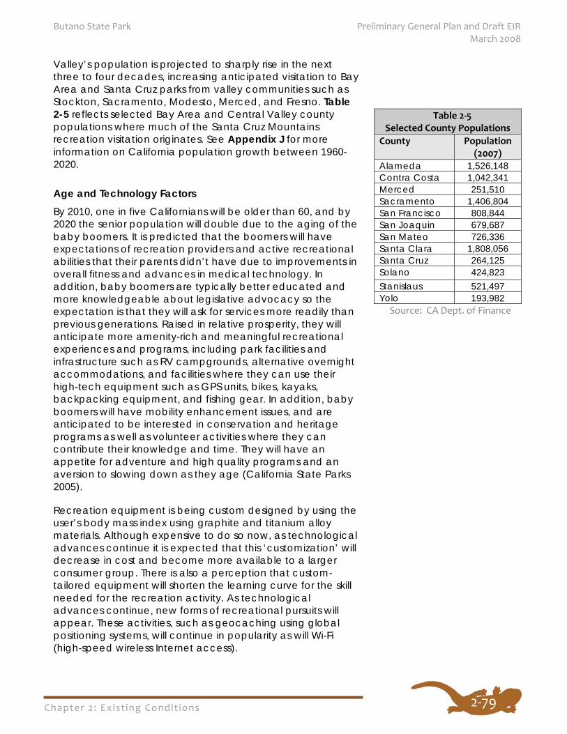
Chapter 2: Exist ing Condit ions
Butano State Park Preliminary General Plan and Draft EIR March 2008
2‐79
Valley’s population is projected to sharply rise in the next three to four decades, increasing anticipated visitation to Bay Area and Santa Cruz parks from valley communities such as Stockton, Sacramento, Modesto, Merced, and Fresno. Table 2-5 reflects selected Bay Area and Central Valley county populations where much of the Santa Cruz Mountains recreation visitation originates. See Appendix J for more information on California population growth between 1960-2020.
Age and Technology Factors By 2010, one in five Californians will be older than 60, and by 2020 the senior population will double due to the aging of the baby boomers. It is predicted that the boomers will have expectations of recreation providers and active recreational abilities that their parents didn’t have due to improvements in overall fitness and advances in medical technology. In addition, baby boomers are typically better educated and more knowledgeable about legislative advocacy so the expectation is that they will ask for services more readily than previous generations. Raised in relative prosperity, they will anticipate more amenity-rich and meaningful recreational experiences and programs, including park facilities and infrastructure such as RV campgrounds, alternative overnight accommodations, and facilities where they can use their high-tech equipment such as GPS units, bikes, kayaks, backpacking equipment, and fishing gear. In addition, baby boomers will have mobility enhancement issues, and are anticipated to be interested in conservation and heritage programs as well as volunteer activities where they can contribute their knowledge and time. They will have an appetite for adventure and high quality programs and an aversion to slowing down as they age (California State Parks 2005).
Recreation equipment is being custom designed by using the user’s body mass index using graphite and titanium alloy materials. Although expensive to do so now, as technological advances continue it is expected that this ‘customization’ will decrease in cost and become more available to a larger consumer group. There is also a perception that custom-tailored equipment will shorten the learning curve for the skill needed for the recreation activity. As technological advances continue, new forms of recreational pursuits will appear. These activities, such as geocaching using global positioning systems, will continue in popularity as will Wi-Fi (high-speed wireless Internet access).
Table 2‐5 Selected County Populations
County Population (2007)
Alameda 1,526,148 Contra Costa 1,042,341 Merced 251,510 Sacramento 1,406,804 San Francisco 808,844 San Joaquin 679,687 San Mateo 726,336 Santa Clara 1,808,056 Santa Cruz 264,125 Solano 424,823 Stanislaus 521,497 Yolo 193,982
Source: CA Dept. of Finance
Chapter 2: Exist ing Condit ions
Preliminary General Plan and Draft EIR Butano State Park March 2008
2‐80
Implications to population changes mean that park service providers will need to expand lands, programs, services, and facilities to accommodate the future influx of anticipated user groups. Lands not acquired now may be unavailable or too costly in the future and programs and opportunities will need to be constantly evaluated and updated to reflect the interest and demands of a rapidly changing California population.
Thirty-seven percent of California’s foreign-born arrived since 1960. With such a diverse group of users, greater emphasis will need to be placed on recreation programs that attract a variety of people. For example, many immigrants to the Bay Area are unfamiliar with the types of facilities and services provided at Butano State Park. Ways to educate and encourage these diverse groups and newcomers to become users of and advocates for parks and recreation should be developed.
In 1960 the baby boom was the largest group in the total population of the state; in 2000, boomers were still a major group but were surpassed in numbers by the 5-9 year old age group. The most populous age groups of California’s youngest citizens are on average two full years younger than the U.S. average, due to recent immigration. By 2020, it is projected that California’s young adult group (ages 18–40) will still be the most populous in the state (California Dept. of Finance 2007), and will be more mobile, dependent on technology, and comfortable with change and cultural diversity than their predecessors. This age group is fueled primarily by recent immigration with families including young children. Unfortunately, these young (and new) Californians are not necessarily connected to outdoor recreation activities and programs of the kind California State Parks typically provides. For recreation they will most often prefer to travel, participate in extreme (at risk) sports, attend movies, and go on day trips, often combining multiple activities and experiences (California State Parks 2005).
The Bay Area’s population age demographics show a typical baby boom aging pattern. However, the proportion of younger age groups in the total Bay Area population is larger than the baby boom generation’s was statewide, and it is larger than the younger age groups in the statewide population. This indicates an even higher potential recreation demand by this young Bay Area age group for nearby relevant recreational facilities and experiences.
Chapter 2: Exist ing Condit ions
Butano State Park Preliminary General Plan and Draft EIR March 2008
2‐81
Latent Demand for Outdoor Recreation A series of surveys of 2,512 representative adults throughout California showed that the trend for all segments of the population during the 1990s was to engage in some form of outdoor recreation. Camping grew in popularity as the decade drew to a close and has continued to be popular into the new century. California State Parks’ 2002 Public Opinions and Attitudes on Outdoor Recreation in California shows that outdoor recreation areas and facilities are still very important to the quality of life for most Californians and that there is a strong public belief that the protection of the natural environment is an important aspect of outdoor recreation (California State Parks 2002a).
Based on unmet demand and public support, Californians believe the following outdoor recreation activities should have top priority for expenditure of public recreation funds (California State Parks 2002a):
Camping in developed sites Trail hiking Walking for fitness and fun Wildlife study Picnicking in developed sites Visiting historic-cultural sites Visiting museums, zoos, etc. Bicycling Beach activities Camping in RV sites
The U.S. Forest Service’s National Survey on Recreation and the Environment – 2000–2003 shows the current top recreation pursuits in the Santa Cruz Mountains area are:
Walking and hiking Family gatherings Viewing/photographing natural scenery Visiting outdoor nature centers Picnicking in developed sites
Campground demand will continue to grow throughout California, particularly for RV and alternative campground facilities. This is for the most part true for aging baby boomers who seek convenience and relaxation and who are still inclined to enjoy camping, may have limited mobility, but have grown weary of the preparatory steps such as setting up tents. Families and single parents with young children who
Chapter 2: Exist ing Condit ions
Preliminary General Plan and Draft EIR Butano State Park March 2008
2‐82
seek quality time with their family and less work, such as single mothers who are concerned about safety and security, are pleased with tent cabins and yurts. During the peak season and holiday weekends many state park campgrounds are full and campers are turned away. California State Parks has been able to add very few campsites during the last ten years, and no coastal campsites. Population growth and demand is so high that if California State Parks were to add 325 campsites a year, it would not keep up with demand (California State Parks 2002a). The situation for day use picnic sites is similar.
The National Survey on Recreation and the Environment 2000-2003 indicates that camping in developed sites was an activity that approximately 37% of the residents of the Bay Area participated in. With the dramatic projected increases in statewide and regional populations, especially of younger, active people interested in family and group recreational experiences, camping will continue to be an important and well-used type of recreation facility in this park in the future.
Changing Ethnic Patterns The relatively large Latino and Asian populations located in the San Francisco Bay Area and Central Valley counties, combined with changing ethnicity patterns in California, will directly affect visitor demographics at Butano SP. A language other than English is spoken in approximately 40% of California households and, approximately 25% of K-12 students are learning English as their primary language. California ethnic facts are impressive – over one-third of Asian Americans live in California and nearly one-third of Hispanic Americans call California home.
California’s total Latino population grew from 20% in 1990 to 32.4% according to the 2000 U.S. Census. Population projections for Santa Clara, Santa Cruz, and San Mateo counties show a 38% increase in the Latino population and a 49% increase in Asian populations by 2020, compared with only moderate increases or slight reductions for other ethnic groups. This increase suggests that the mix of user groups and the corresponding facility needs at parks may be changing. For example, there is a correlation between Latinos recreating in large, often family-based groups and a high demand for developed recreation sites, particularly sites with picnic tables, barbeque grills, and parking lots. Group picnics also tend to be longer in duration than for other ethnic groups, as many food items are prepared on site (California State Parks 2002a). Asian Americans also spend time outdoors with family and friends and like to be near natural areas to view and
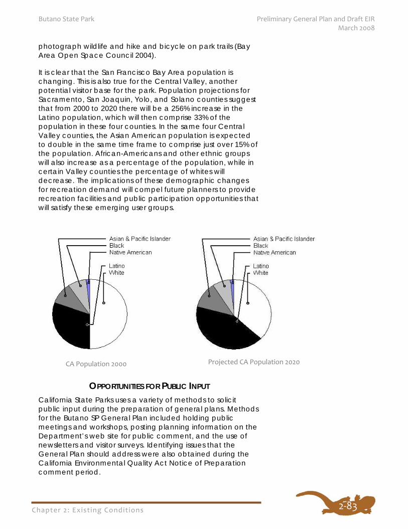
Chapter 2: Exist ing Condit ions
Butano State Park Preliminary General Plan and Draft EIR March 2008
2‐83
photograph wildlife and hike and bicycle on park trails (Bay Area Open Space Council 2004).
It is clear that the San Francisco Bay Area population is changing. This is also true for the Central Valley, another potential visitor base for the park. Population projections for Sacramento, San Joaquin, Yolo, and Solano counties suggest that from 2000 to 2020 there will be a 256% increase in the Latino population, which will then comprise 33% of the population in these four counties. In the same four Central Valley counties, the Asian American population is expected to double in the same time frame to comprise just over 15% of the population. African-Americans and other ethnic groups will also increase as a percentage of the population, while in certain Valley counties the percentage of whites will decrease. The implications of these demographic changes for recreation demand will compel future planners to provide recreation facilities and public participation opportunities that will satisfy these emerging user groups.
OPPORTUNITIES FOR PUBLIC INPUT California State Parks uses a variety of methods to solicit public input during the preparation of general plans. Methods for the Butano SP General Plan included holding public meetings and workshops, posting planning information on the Department’s web site for public comment, and the use of newsletters and visitor surveys. Identifying issues that the General Plan should address were also obtained during the California Environmental Quality Act Notice of Preparation comment period.
Projected CA Population 2020 CA Population 2000
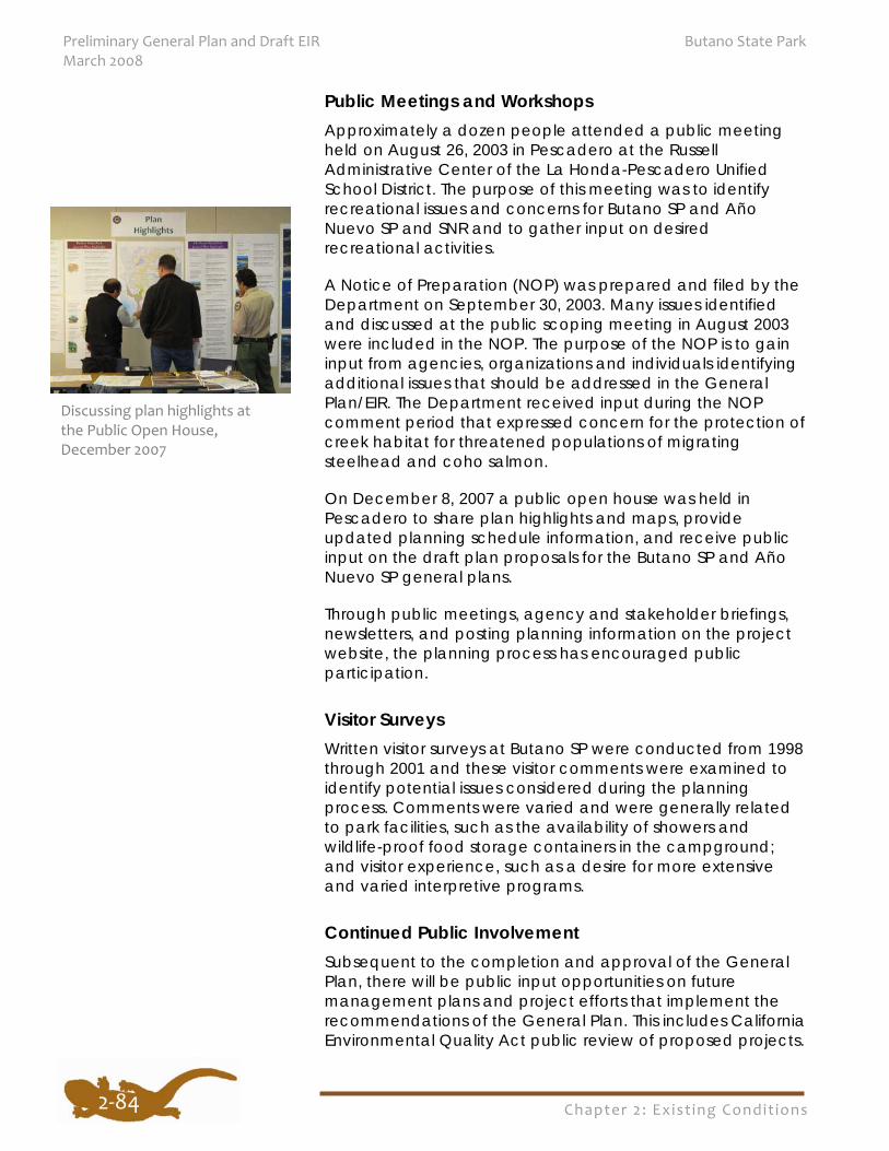
Chapter 2: Exist ing Condit ions
Preliminary General Plan and Draft EIR Butano State Park March 2008
2‐84
Public Meetings and Workshops Approximately a dozen people attended a public meeting held on August 26, 2003 in Pescadero at the Russell Administrative Center of the La Honda-Pescadero Unified School District. The purpose of this meeting was to identify recreational issues and concerns for Butano SP and Año Nuevo SP and SNR and to gather input on desired recreational activities.
A Notice of Preparation (NOP) was prepared and filed by the Department on September 30, 2003. Many issues identified and discussed at the public scoping meeting in August 2003 were included in the NOP. The purpose of the NOP is to gain input from agencies, organizations and individuals identifying additional issues that should be addressed in the General Plan/EIR. The Department received input during the NOP comment period that expressed concern for the protection of creek habitat for threatened populations of migrating steelhead and coho salmon.
On December 8, 2007 a public open house was held in Pescadero to share plan highlights and maps, provide updated planning schedule information, and receive public input on the draft plan proposals for the Butano SP and Año Nuevo SP general plans.
Through public meetings, agency and stakeholder briefings, newsletters, and posting planning information on the project website, the planning process has encouraged public participation.
Visitor Surveys Written visitor surveys at Butano SP were conducted from 1998 through 2001 and these visitor comments were examined to identify potential issues considered during the planning process. Comments were varied and were generally related to park facilities, such as the availability of showers and wildlife-proof food storage containers in the campground; and visitor experience, such as a desire for more extensive and varied interpretive programs.
Continued Public Involvement Subsequent to the completion and approval of the General Plan, there will be public input opportunities on future management plans and project efforts that implement the recommendations of the General Plan. This includes California Environmental Quality Act public review of proposed projects.
Discussing plan highlights at the Public Open House, December 2007

Chapter 2: Exist ing Condit ions
Butano State Park Preliminary General Plan and Draft EIR March 2008
2‐85

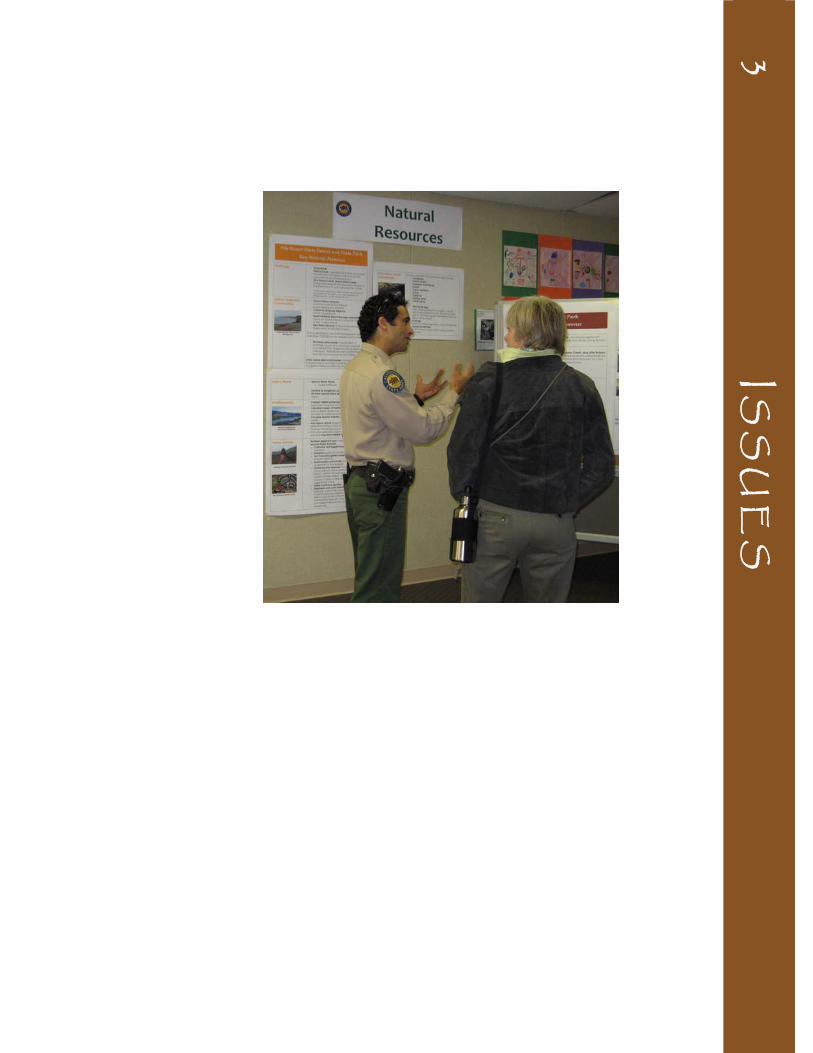
3 IS
SU
ES

Photo on reverse: California State Parks Ranger Ziad Bawarshi talks with a visitor at the Butano SP/Año Nuevo SP General Plan Open House, December 2007
Chapter 3: Issues
Butano State Park Preliminary General Plan and Draft EIR March 2008
3‐1
C H A P T E R 3 : I S S U E S
The Issues section identifies planning assumptions, key parkwide issues, and specific area issues that were identified during the planning process. These issues were identified during the statewide and regional analysis for natural, cultural, and recreational resources, public workshops, stakeholder meetings, and through discussions with state park and district staff.
The following assumptions are based on current state and federal laws, regulations, and Department policy, which formed the basis for planning and set the parameters for addressing general planning issues for Butano SP.
California State Parks will:
Continue to manage Butano SP as a State Park, as defined by Public Resources Code Sec. 5019.53.
Manage park resources as an ecosystem, maintaining the natural processes, abundance, and diversity of plants and animals.
Manage and protect rare, threatened and endangered species and habitats, including old growth redwood, as required by federal and state laws.
Preserve the park’s cultural resources, including historic structures and landscapes, following the Secretary of the Interior’s Standards for the Treatment of Historic Properties.
Maintain and increase, where appropriate, the overall level of recreational opportunities for California State Parks located in the Santa Cruz Mountains region.
Consider the issues and concerns of adjacent landowners and residents during the planning and implementation process; seek input from local, regional, and statewide interests.
Coordinate with planning efforts in adjacent state parks and with other natural lands and open space providers and agencies, to evaluate potential
3.1 PLANNING ASSUMPTIONS
Chapter 3: Issues
Preliminary General Plan and Draft EIR Butano State Park March 2008
3‐2
connectivity and compatibility of state park recreational opportunities and resource management programs with surrounding land uses.
The following are the primary planning issues the General Plan addresses, either through overall parkwide management goals and guidelines or through management goals and guidelines for specific park areas. These goals and guidelines are found in the Park Plan section of this document.
WILDLIFE AND HABITAT PROTECTION Butano SP comprises approximately 4,628 acres of diverse habitats, including grasslands in the western section of the park, second growth redwood and Douglas-fir forests that cover most of the park, and chaparral and knobcone pine forest on drier ridgetop locations. Significant riparian areas border the Little Butano and Gazos creeks and their tributaries. Remnant stands of old growth redwood occur in a few locations of the park, such as in the vicinity of the Ben Ries Campground and near the Gazos Mountain Camp area. Past and present human influences, including logging, fire suppression, wildlife feeding, introduction of non-native plants and animals, visitor activities, and facility development have changed the conditions under which natural ecosystems have developed. These changes have created habitat fragmentation, shifts in species composition, changes in the structure and pattern of plant communities and species populations, and concerns regarding the sustainability of species populations. Sensitive habitats such as riparian areas have been impacted and native plant and wildlife values have declined in some locations. This decline has affected species such as the San Francisco garter snake, coho salmon, steelhead, and California red-legged frog. Global climate change will cause further stresses to sensitive species and habitats.
The park is an important part of a regional mosaic of preserved lands in the Santa Cruz Mountains that provide valuable native habitats for wildlife. Protecting habitats within the park as well as between the park and other surrounding public open space and natural lands is essential for maintaining healthy ecosystems. Habitat linkages with other protected areas are key to long-term sustainability and resource protection. Butano SP shares a common boundary with Año Nuevo SP. A major planning issue is how to protect
3.2 PARKWIDE ISSUES
The mosaic of preserved
lands in the Santa Cruz
Mountains provide
valuable native wildlife
habitats. Butano SP is an
important piece of this
linked habitat.
Chapter 3: Issues
Butano State Park Preliminary General Plan and Draft EIR March 2008
3‐3
sensitive habitats and species while allowing public access to these areas.
RECREATION DEMAND AND VISITOR OPPORTUNITIES The park’s unique resources and its location near the high density urban centers around the Santa Cruz Mountains creates a high demand for recreation at the park, particularly during the peak season months of May through October. Camping, picnicking, and trail use are the most popular activities at the park, and existing recreation demand has been exceeding supply during the peak season. As the population continues to increase and diversify in the Santa Clara Valley, Bay Area, and Central Valley, the demand for outdoor recreation will also grow, both in the numbers of people desiring an outdoor experience and in the types of recreational activities they seek in the Santa Cruz Mountains.
California’s demographic changes are also creating recreation demands that vary from traditional park facilities and programs. Group day use facilities, alternative overnight opportunities such as cabins or yurts, and opportunities for additional trails on flat terrain were evaluated. Butano SP, along with other regional open space and park lands, will be challenged to provide additional recreation facilities and more diversified recreational activities.
PARK PLANNING AND MANAGEMENT IN A REGIONAL CONTEXT
California’s increasing population and changing ethnic mix are placing increasing demands on existing parks, natural lands, and open spaces. Recreation planning on a regional basis can provide a variety of recreation opportunities to attract and satisfy visitors and help minimize resource impacts by providing recreation opportunities in an integrated regional network of outdoor recreation areas. Continued planning and management of Butano SP should consider interagency and regional coordination and partnerships as key elements.
Butano SP shares borders with Año Nuevo SP and is in proximity to Año Nuevo State Natural Reserve, Big Basin Redwoods SP, Portola Redwoods SP, and Pigeon Point Light Station State Historic Park, as well as with several other recreational, natural, and open space lands such as Pescadero Creek County Park, Memorial County Park, and the Cloverdale Coastal Ranches. The proximity of these properties and the similarity of natural, cultural, and
Chapter 3: Issues
Preliminary General Plan and Draft EIR Butano State Park March 2008
3‐4
recreational resources provide opportunities to manage these lands in a coordinated and integrated way to strengthen natural, cultural and scenic resource protection, enhance park operations, and improve recreational, educational, and park access opportunities. Coordinated management, integral planning, and partnerships can better identify the recreation needs and desires and improve the effectiveness of maintenance, administrative, and visitor services on a regional basis.
PUBLIC ACCESS AND CIRCULATION During peak season the day use picnic and trailhead areas along the park entry road are heavily used. There may be opportunities to improve the park’s circulation and parking, provide additional day use facilities, and reduce congestion. Visitors could also benefit from regional mass transit connections to the park. Trail opportunities within the park and those connecting regional open space, natural lands, and park lands are in high demand by multiple user groups. The park’s central location within the Santa Cruz Mountains offers potential as a node for trail connections to adjacent Año Nuevo SP as well as within the region. Improving access to and within the park and enhancing regional connections is a significant aspect of this planning effort. During the planning process, additional access modes, access locations, and appropriate areas for future facility development were evaluated.
ENTRANCE AND FACILITIES This area provides the majority of visitor services in the
park. Visitors can park, check in, pay fees, receive information, camp, picnic, access trailheads, and attend campfire programs in this location. The area also contains administration and maintenance facilities. Planning considerations include the location and amount of visitor parking, day use and overnight facilities, and the location and requirements for visitor services as well as park administrative and maintenance functions.
Wildlife feeding and the availability of food provided by humans has disrupted natural wildlife processes and threatened the health and existence of some native wildlife species, including the marbled murrelet, a state
3.3 SPECIFIC AREA ISSUES
Chapter 3: Issues
Butano State Park Preliminary General Plan and Draft EIR March 2008
and federally listed bird. Redwood habitat in the region is recognized as designated critical habitat for the marbled murrelet. A factor in the decline in marbled murrelet detections and nesting success is related to nest/nestling predation by various corvid species (e.g. Steller’s jay, common raven) and other predators. Planning considerations address the conservation of the marbled murrelet and other sensitive species, the health of the redwood forest habitat, and the effects of existing and proposed development.
The small dam on Little Butano Creek is providing access to creek water for the Peninsula Open Space Trust, which owns water rights for the creek, through an historic wooden flume. Sensitive anadromous fish species migrate from the ocean to spawn in the creek below the dam. There are potential spawning grounds upstream of the dam. Continued planning should address the effects of the dam on fish and the potential for alternative methods of impoundment and/or delivery of creek water to the off-site owner, including potential removal of the dam and the restoration of fish habitat. There may be
opportunities to provide
more trail camps in the
backcountry and connect
to other regional public
lands.
BACKCOUNTRY The backcountry, generally located in the more
rugged terrain and higher elevations of the park, offers expansive vistas and a sense of solitude to the visitor. There may be opportunities to provide additional trail camps and trailheads to provide further access into the backcountry and connect to regional natural areas, open space, and park lands.
GAZOS MOUNTAIN CAMP The Gazos Mountain Camp has supported a variety of
recreation in the past and is currently serving as a research field station that is managed by a private nonprofit organization. The redwood habitat surrounding the Gazos Mountain Camp area is recognized as habitat for the state and federally listed marbled murrelet and the current operating agreement contains restrictions on operations and use. However, there may be additional education, recreation, and interpretive opportunities for park visitors in this area. Ongoing planning considerations must address the conservation of the marbled murrelet and other special status species, the redwood forest ecosystem, and the effects of existing and proposed development.
3‐5


![National Park Service Rock Creek Park · Rock Creek Park GS-5 Ranger (Interpretation) Nature (Largest Urban Park in US) History (CWDW, Georgetown, Park History 3rd oldest NP [1890])](https://img.pdfslide.net/doc/110x75/5fe81a5b36595d12323d8b47/national-park-service-rock-creek-park-rock-creek-park-gs-5-ranger-interpretation.jpg)