Embed Size (px)
Citation preview

CAMA Permitting and
Development on Oak Island
Heather Coats
Field Representative
Tara Macpherson
Field Specialist

CZMA/CAMA
CZMA- Coastal Zone Management Act
passed by US Congress in 1972
CAMA- Coastal Area Management Act
passed by the NC General Assembly in ‘74

Areas of Environmental Concern
• Estuarine and Ocean System
– Public trust waters and submerged lands,
estuarine waters, coastal wetlands, and
coastal (non-ocean) shorelines
• Public Water Supplies
• Natural and Cultural Resource Areas
• Ocean Hazard Areas

CAMA Permits • 3 categories:
– Minor permits issued by local governments consistent w/CRC-established standards (~ 29% CAMA permits)
– General permits issued by DCM field staff - streamlined for routine projects (~ 65% CAMA permits)
– Major permit applications issued by Morehead City office after review by 10 state & 4 fed. agencies (~ 6% of all CAMA permits)

Ocean Hazard Areas
DCM jurisdiction includes:
–Ocean Erodible Area
–High Hazard Flood Areas
– Inlet Hazard Areas
–Unvegetated Beach Area

Inlet Hazard Areas (IHA) • Areas especially
vulnerable to erosion
and flooding due to
proximity to ocean
inlets
• IHA boundaries
designated in 1981
• Structures <4 units
• Density restrictions
• No dune building
Holden Beach
Oak Island

Bear Island Emerald Isle
Figure Eight Island

October 2013
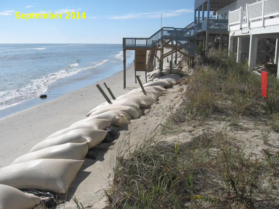
September 2014

January 2013

February 2014

October 2014

Ocean Hazard Area (AECs) • Graduated setbacks depend on building size
– 30 x erosion (if < 5K sf); 90 x (if > 100K sf)
• Protection for frontal dunes, public access
• Prohibition on permanent erosion control
structures
• Temporary Erosion Control/Sandbag rules
• Beach Nourishment, Dune Stabilization
• Building Construction Standards
• Exceptions

The Static Line
• Oak Island has a static line for the majority of its
oceanfront shoreline. This must be used instead
of the actual first line of stable, natural
vegetation.
• There is currently an option for a Static Line
Exception.
• The CRC is currently evaluating the static line
rules. Static Line vs. Development Line?


Exceptions to the Setback
• Campsites
• Parking areas w/
clay, packed sand, gravel
• Elevated decks- 500 sf
• Beach accessways
• Unenclosed, uninhabitable
gazebos- up to 200sf
• Single story sheds <200sf • Temp amusement stands • Sand fencing
• Swimming pools

Sandfencing & dune planting
• Sea Oats (Uniola paniculata) • American Beachgrass
(Ammophila breviligulata) • Bitter Panicum (Panicum
amarum) • Saltmeadow Hay (Spartina
patens)
Recommended dune plant species

Bulldozing • GP 1800 (15A NCAC
7H.1800) allows beach
bulldozing landward of the
MHW mark in the Ocean
Hazard AEC, but does not
apply to IHAs.

Sandbags • If community is actively pursuing inlet relocation or stabilization project,
sandbags may remain in place for up to 8 years from date of approval,
and may be used more than once in Inlet Hazard Areas. Outside the
IHA, sandbags may remain in place 2 years for structures <5,000 sf in
TFA, and 5 years for structures >5,000sf or roads/infrastructure.
• Bags can be used to protect homes, septic systems, & roads.
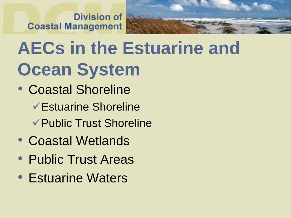
AECs in the Estuarine and
Ocean System • Coastal Shoreline
Estuarine Shoreline
Public Trust Shoreline
• Coastal Wetlands
• Public Trust Areas
• Estuarine Waters

Estuarine Waters
All waters including the
Atlantic Ocean and all bays, sounds, rivers, & tributaries seaward of the dividing line between coastal and inland fishing waters as agreed upon by MFC, DENR and the WRC.


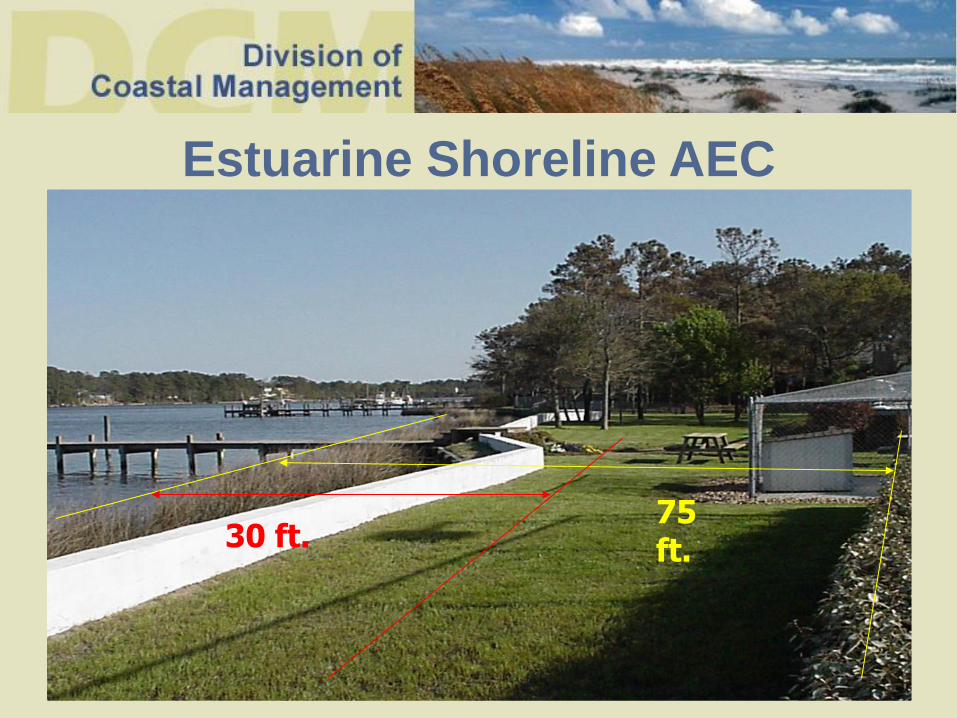
75 ft.
Estuarine Shoreline AEC
30 ft.

Coastal Wetland species


General Permits
• No application form to fill out.
• Prepare a drawing of the proposed work.
• Notify the adjacent riparian property
owners.
• Schedule a site visit.
• Most permits valid for 4 months.
• Permit fee, agent authorization, DMF/ACE?

Major permits
• Most issued within 60-75 days of a
complete application.
• Recommend a scoping meeting with other
agencies prior to application submittal.
• Require plans drawn to scale, a copy of
the deed, a narrative, application forms,
adjacent property owner notification.
• Permits valid for 3 years.

Maintenance & Repairs
• Statutorily exempt from requiring a permit.
• Less than 50% of the structure’s depreciated
value for non-water dependent structures
(e.g. houses).
• Less than 50% of the structural components
for water-dependent structures (e.g. docks,
bulkheads).
• Must submit documentation to substantiate.

CAMA Part II

3rd Party Appeals
• Anyone can appeal a permit.
• Must be submitted within 20 days of permit
issue date.
• Submitted directly to the Director of DCM.
• Decision is made by the Chairman of the
CRC.

Variance Petitions
If a Major or Minor CAMA Permit has been denied.
Or
If a Permittee does not agree with a specific permit
condition.
• Must seek relief from the local requirements restricting use of the
property prior to filing a petition for a variance from a rule of the
CRC.
• Variance petition must be received 6 weeks in advance of a
scheduled CRC meeting.

Compliance with CAMA
Permits
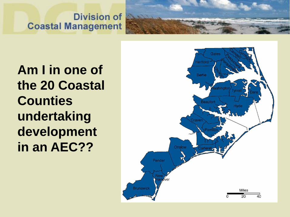
Am I in one of
the 20 Coastal
Counties
undertaking
development
in an AEC??

• Review all permit conditions and approved plans as stated on the face of permit • Varying from approved plans is a violation of the permit

Inter / Intra Agency Coordination Federal Agencies State Agencies
U.S. Army Corps of Engineers Division of Water Quality
U.S. Fish and Wildlife Service Division of Marine Fisheries
Environmental Protection Agency Division of Transportation
National Marine Fisheries Service Division of Land Resources
Wildlife Resources Commission
Department of Cultural Resources
Division of Public Health
State Property Office
+ Local Government Community Assistance

1. Make sure your project complies with the CRC's development standards and all permit conditions. 2. When you are issued a CAMA permit, you should consult with the Coastal Management field representative or local permit
officer before beginning work to make sure that your work will
meet all requirements. 3. A Coastal Management field representative or a local permit officer will periodically monitor work at your project site.
How do I avoid CAMA Permit Violations??

Compliance & Enforcement Program
Prevention of violations:
-Involvement in pre-
construction meetings.
-Educational Seminars
Monitoring:
-onsite inspections
-aerial surveillance flight
program
Issue NOV’s:
-Unauthorized Development
in AEC(s)
-Violation of conditions of
Permit

Compliance Monitoring
Routine Aerial Surveillance
Flights

CAMA VIOLATIONS
~ In all violations, Coastal Management's and local
government's first priority is to seek resource recovery
~Tiered Enforcement Policy

Tiered Enforcement
Tier 1 Violation:
Stop Work Order
Example: Initiating Pier
Construction

Tier 2 Violation
Notice of Violation, Civil Penalty
Example: Permittable Jet ski lift Example: Fill brought into lot- Stabilized no CW impacts.

Tier 3 Violation- Dredge and Fill violation or refusal
to restore an impacted area.
Example: Fill brought in to create a beach filling coastal wetlands and public trust areas.


Example Coastal Wetland Fill Violation with restoration required and completed
Discovered via Surveillance Flight
2 weeks later undergoing restoration
Surveillance Flight over restored area 3 months later
6 months post restoration – species re-established

Example: Restoration Plan for the unauthorized filling of Coastal Wetlands to create more upland yard area.

PENALTIES FOR VIOLATIONS
Permittable Development: Two times the Permit Fee**
Non-Permittable Development: Based on square footage of
restoration area**
Major Violations: Maximum Fine = $10,000**
Willful and Intentional -subject to a minimum penalty of
$2,000 + investigative costs.
Minor Violations: Maximum Fine = $1,000**
Willful and Intentional - subject to a minimum penalty
of $1,000 + investigative costs.
** plus investigative costs

15A NCAC 07J .0409 CIVIL PENALTIES
Schedule A Major Development Violations

Common Compliance Issues


Montgomery Slough- State
Owned
- Cannot span state owned marshland for
water access
Property along the AIWW may
have USACE Easements
- No development in these areas without USACE Consent. Contact USACE Real Estate Office.

Pergolas
**Not allowed within 30 ft. of NHW

Marsh Mowing
• Cut to a height of no less than 2
ft. Leave clippings in place.
• Can be cut to six inches during
the winter (December 1 to
March 31)
• No alteration of substrate (no
bush hogging)
• Access path of 4 ft. or less is
allowed to be maintained at a
height of no less than 6 inches
for waterfront lots without pier
access.

Division of Coastal Management Wilmington District
Field Representative for Oak Island - Heather Coats: 910-796-7424
Field Specialist for Southern Region-
Tara MacPherson: 910-796-7425
127 Cardinal Drive Ext. Wilmington, NC 28405-3845
910-796-7215