Embed Size (px)
Citation preview
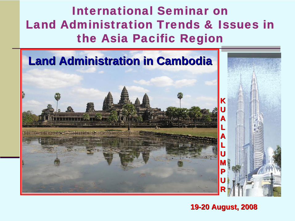
International Seminar on Land Administration Trends & Issues in
the Asia Pacific Region
KKUUAALLAALLUUMMPPUURR
1919--20 August, 200820 August, 2008
Land Administration in CambodiaLand Administration in Cambodia
LAND ADMINISTRATION IN CAMBODIALAND ADMINISTRATION IN CAMBODIA
Present byPresent by
LOR DAVUTHLOR DAVUTHDirector of Technical Dept.Director of Technical Dept.SUON SOPHASUON SOPHADeputy Director of LA Dept.Deputy Director of LA Dept.SENG THANYSENG THANYDeputy Director of Int. Relation Dept.Deputy Director of Int. Relation Dept.
General Department of Cadastre & Geography (GDCG)General Department of Cadastre & Geography (GDCG)Ministry of Land Management, Urban Planning & ConstructionMinistry of Land Management, Urban Planning & Construction
(MLMUPC)(MLMUPC)
CONTENTCONTENT
I. INTRODUCTION
II. LAND ADMINISTRATION ORGANIZATION IN CAMBODIA
III. LAND POLICY
IV. LAND REGISTRATION
V. TECHNICAL MATTERS
VI. CHALLENGES
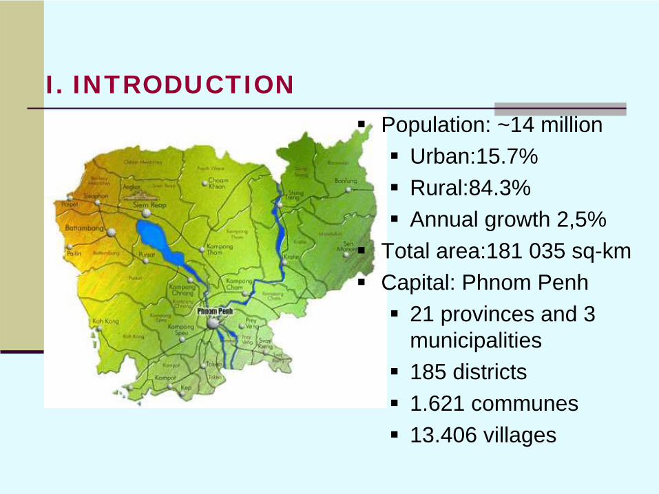
Population: ~14 millionUrban:15.7%Rural:84.3%Annual growth 2,5%
Total area:181 035 sq-kmCapital: Phnom Penh
21 provinces and 3 municipalities185 districts1.621 communes13.406 villages
I. INTRODUCTION
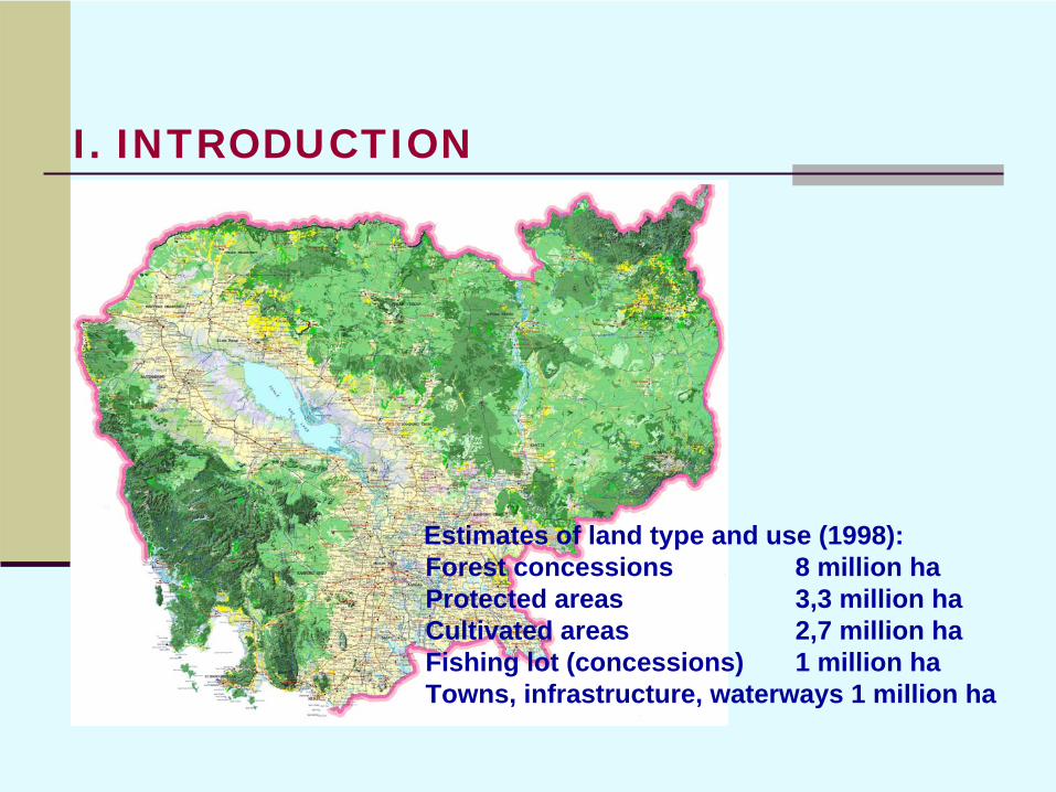
Estimates of land type and use (1998):Forest concessions 8 million haProtected areas 3,3 million haCultivated areas 2,7 million haFishing lot (concessions) 1 million haTowns, infrastructure, waterways 1 million ha
I. INTRODUCTION
Background of the land rights:Before French protectorate: all land belong to sovereign (theoretically), used by people1863-1975: private ownership1975-1979: no private land ownership1979-1989: all land belong to the state1989-2001: ownership right to residential land and possession right to agricultural land2001- : New land law considers full ownership right also for agricultural land
I. INTRODUCTION
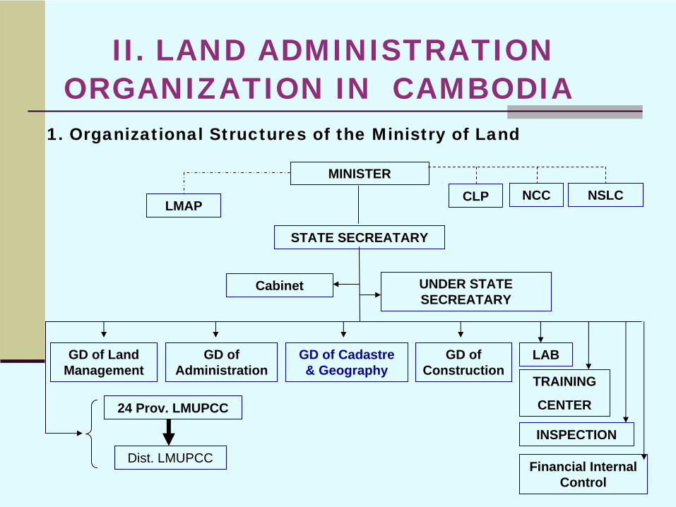
1. Organizational Structures of the Ministry of Land
MINISTER
GD of Administration
GD of Cadastre & Geography
GD of Construction
GD of Land Management
Cabinet
CLP NCC
24 Prov. LMUPCC
Dist. LMUPCC
LMAPNSLC
UNDER STATE SECREATARY
STATE SECREATARY
TRAINING
CENTER
LAB
INSPECTION
Financial Internal Control
II. LAND ADMINISTRATION ORGANIZATION IN CAMBODIA
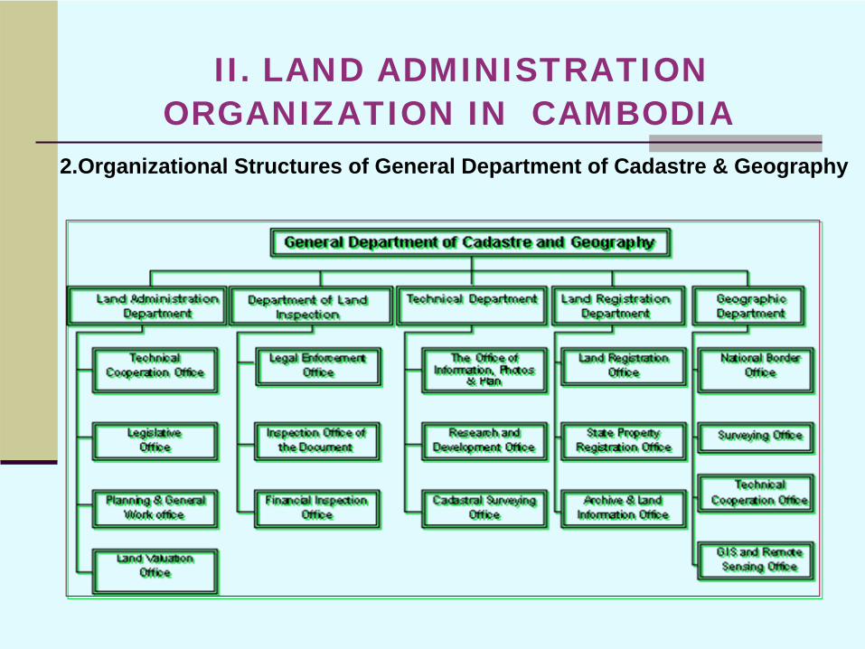
2.Organizational Structures of General Department of Cadastre & Geography
II. LAND ADMINISTRATION ORGANIZATION IN CAMBODIA
The Vision of Cambodia’s Land PolicyThere are 3 pillars of the land policy development :1-Land Administration : focusing on an effective land
titling programs in systematic and sporadic, dispute resolution, land market orientation
2- Land Management : focusing on sustainable development by developing of zoning, land use planning, NSDI….
3-Land Distribution: Designing to provide residential and farming land to the poor landless and land poor households.
III.LAND POLICY
III.LAND POLICYDevelopment of Policies and Regulations Framework Regarding to Land IssuesImplementing through Council for Land Policy (CLP)comprising of 22 governmental institutions, that was established to coordinate with inter-ministerial functions and other concerned stakeholders & donor community relating to land and natural recourses management issues.
CLP implements its duty with supporting by its Secretariat located in the Ministry of Land Management, that focuses on the main tasks regarding to : proposing draft policies, laws, regulations & strategies regarding land and make consultationprocess to all stakeholder to find consensus.
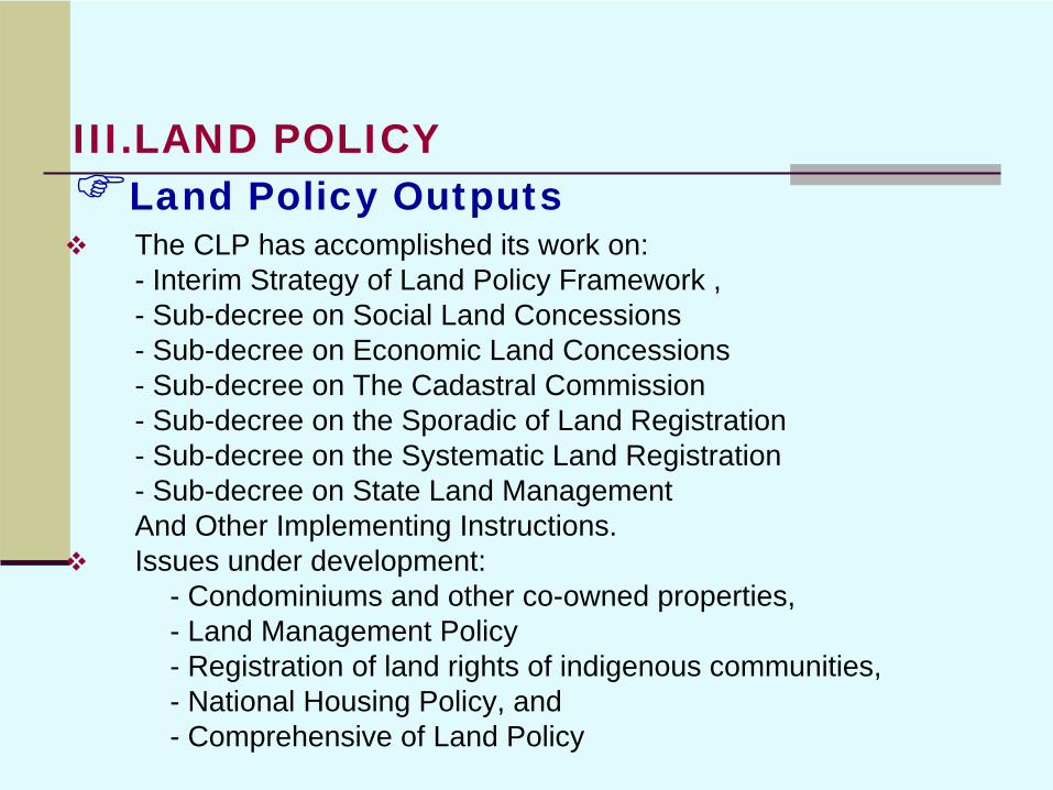
Land Policy OutputsThe CLP has accomplished its work on: - Interim Strategy of Land Policy Framework ,- Sub-decree on Social Land Concessions- Sub-decree on Economic Land Concessions- Sub-decree on The Cadastral Commission- Sub-decree on the Sporadic of Land Registration- Sub-decree on the Systematic Land Registration- Sub-decree on State Land ManagementAnd Other Implementing Instructions.Issues under development:
- Condominiums and other co-owned properties, - Land Management Policy- Registration of land rights of indigenous communities, - National Housing Policy, and - Comprehensive of Land Policy
III.LAND POLICY
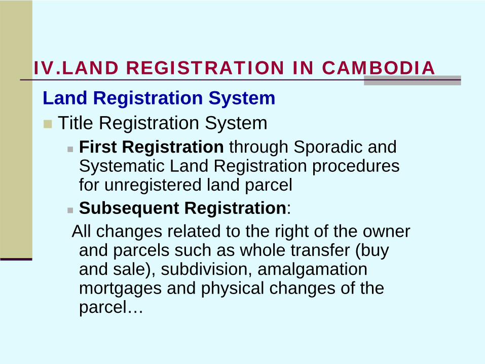
Land Registration SystemTitle Registration System
First Registration through Sporadic and Systematic Land Registration procedures for unregistered land parcelSubsequent Registration:
All changes related to the right of the owner and parcels such as whole transfer (buy and sale), subdivision, amalgamation mortgages and physical changes of the parcel…
IV.LAND REGISTRATION IN CAMBODIA
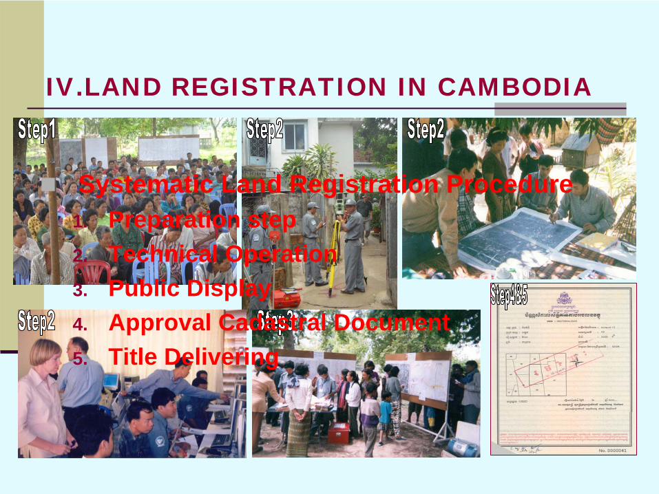
Systematic Land Registration Procedure1. Preparation step2. Technical Operation3. Public Display4. Approval Cadastral Document5. Title Delivering
IV.LAND REGISTRATION IN CAMBODIA
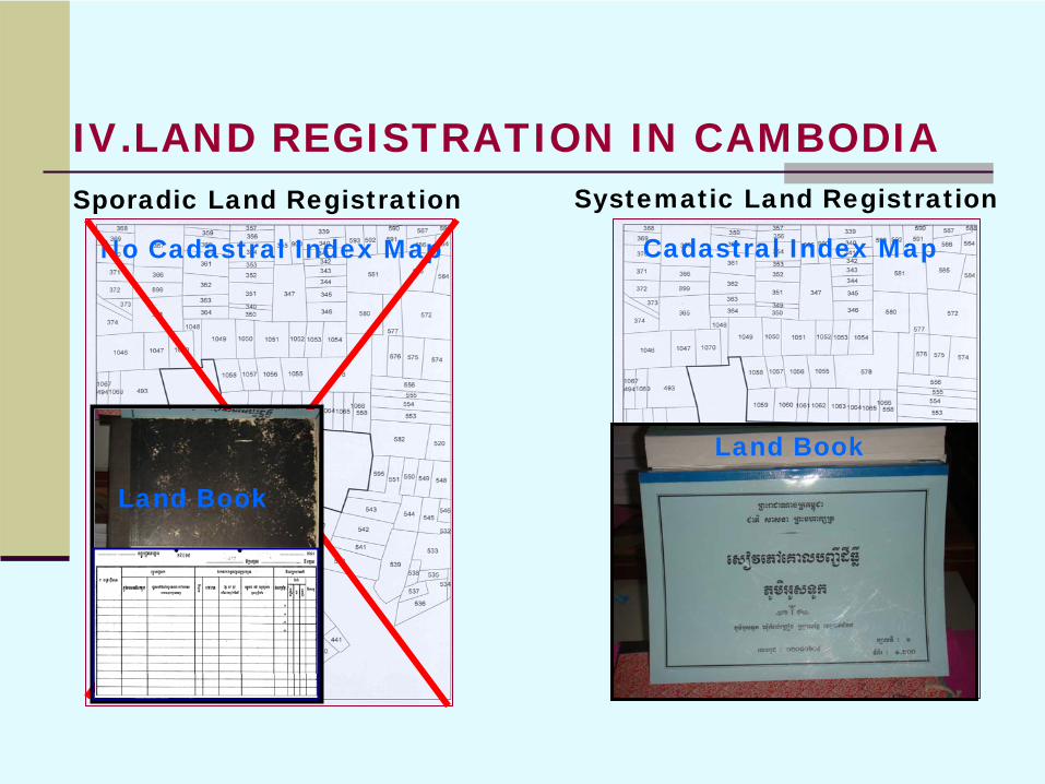
Cadastral Index MapNo Cadastral Index Map
Sporadic Land Registration Systematic Land Registration
Land Book
Land Book
IV.LAND REGISTRATION IN CAMBODIA

Sporadic Land Title Certificate
Systematic Land Title Certificate
Possession &Ownership Title
Ownership Title
IV.LAND REGISTRATION IN CAMBODIA

EXISTING GROUND CONTROL SURVEYSThe Regional Geodetic Working Group of the Permanent Committee on GIS Infrastructure for Asia and the Pacific (PCGIAP), where Cambodia belongs to, decided to adopt International Terrestrial Reference Frame (ITRF) system and GRS80 ellipsoid as the fundamental datum parameters for regional applications. Five stations in Cambodia belonging to APGRP98 have accurate ITRF coordinates on GRS80 (= WGS84) ellipsoid, and they form the Primary National Geodetic Network of Cambodia.
Horizontal Datum:Reference Frame: ITRF2000Epoch: 1998.90Ellipsoid: GRS80Semi-major Axis: 6,378,137.000 metersInverse Flattening: 298.257222101
V. TECHNICAL MATTERS
THE DEVELOPMENT OF GEODETIC NETWORK
In order to support the mapping and survey requirements the plan to provide an accurate and homogeneous horizontal geodetic network over the whole country has been prepared. This network shall further develop the official Cambodian Geodetic Datum based on the results of the Asia Pacific Regional Geodetic Project of 1998.
The Government of Cambodia intends to use resources from different sources for establishment of first order horizontal network and vertical network over the whole Cambodia. The project is called Ground Control Survey Project in Cambodia. The work will be carried out under supervision of the General Department of Cadastre and Geography of MLMUPC according to national standards and specifications of Cambodia.
V. TECHNICAL MATTERS
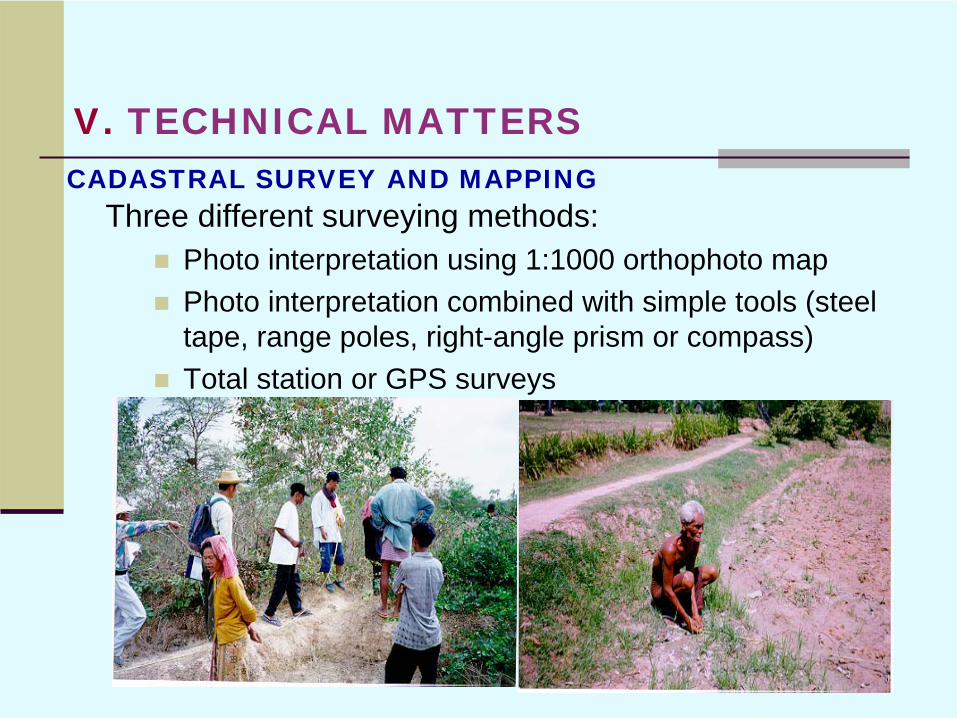
CADASTRAL SURVEY AND MAPPINGThree different surveying methods:
Photo interpretation using 1:1000 orthophoto mapPhoto interpretation combined with simple tools (steel tape, range poles, right-angle prism or compass)Total station or GPS surveys
V. TECHNICAL MATTERS
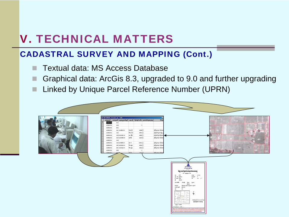
CADASTRAL SURVEY AND MAPPING (Cont.)Textual data: MS Access DatabaseGraphical data: ArcGis 8.3, upgraded to 9.0 and further upgradingLinked by Unique Parcel Reference Number (UPRN)
V. TECHNICAL MATTERS

VI.CHALLENGESUpgrading and increasing the staffMaster plans and official land use planning system still at early stagesLand valuation development still at early stagesNational Spatial Data Infrastructure (NSDI)still at planning stageOne-Window Cadastral Services not yet established, planning started

THANK YOU FOR YOUR ATTENTION