Embed Size (px)
Citation preview

Canberra’s Planning History Some thoughts on Griffin’s planning principles
and other planning legacies
Ed Wensing FPIA PhD Candidate, National Centre for Indigenous Studies
Visiting Lecturer, Urban and Regional Planning Program, University of Canberra
2
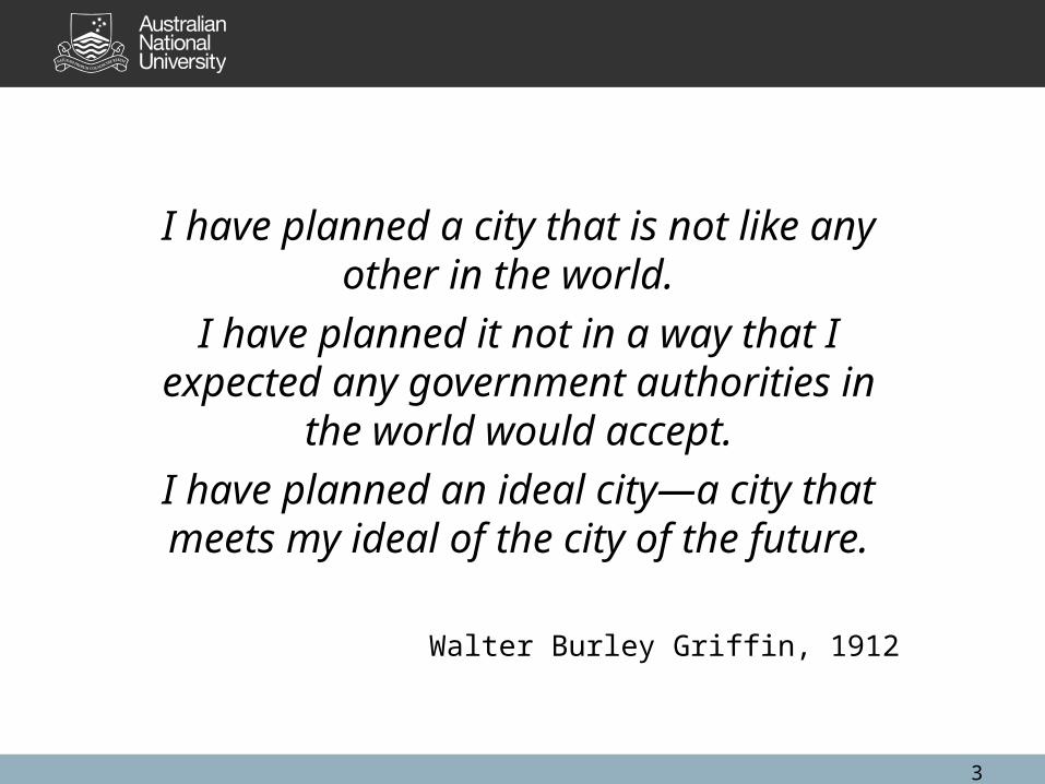
I have planned a city that is not like any other in the world.
I have planned it not in a way that I expected any government authorities in the world
would accept.
I have planned an ideal city—a city that meets my ideal of the city of the future.
Walter Burley Griffin, 1912
3
4
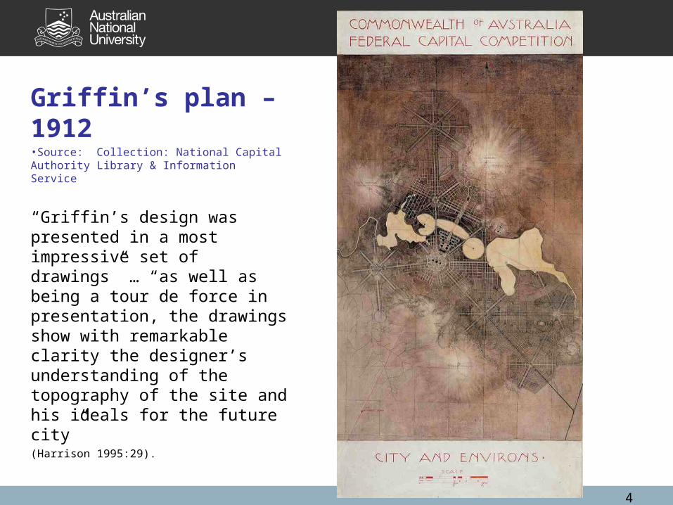
Griffin’s plan – 1912•Source: Collection: National Capital Authority Library & Information Service
“Griffin’s design was presented in a most impressive set of drawings” … “as well as being a tour de force in presentation, the drawings show with remarkable clarity the designer’s understanding of the topography of the site and his ideals for the future city” (Harrison 1995:29).
5
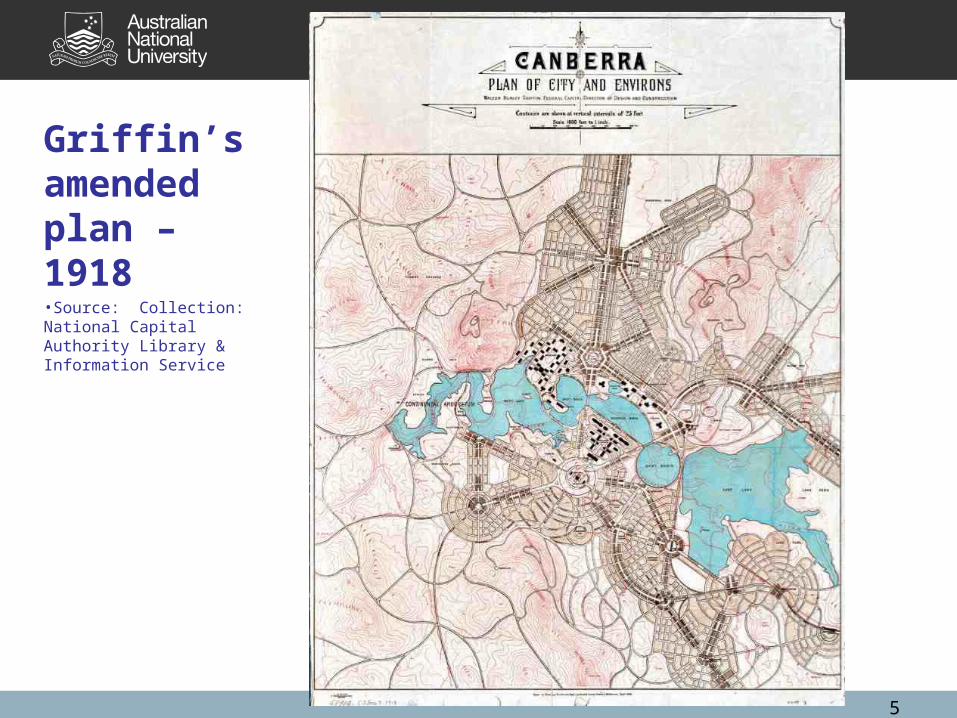
Griffin’s amended plan – 1918•Source: Collection: National Capital Authority Library & Information Service
6
Griffin’s enduring planning idealsIn Griffin’s “Report Explanatory” many planning ideals:•respect for the topography,•grouping of federal government activities in a linear axis (the land axis), •space for recreation and public gardens, •a place for the ‘military group’, •an ‘education group’ for higher education, •a place for the ‘municipal group’, •the need for good transport and communication links between the various ‘groups’ or activity nodes.
7
Two of Griffin’s ideals stand out as still having relevance today.
They were applied by Peter Harrison and his team in developing the Y Plan in the late 1960s and were reaffirmed by John Gilchrist and his team when the NCDC reviewed the Y Plan in the early 1980s.
They are often misunderstood.
8
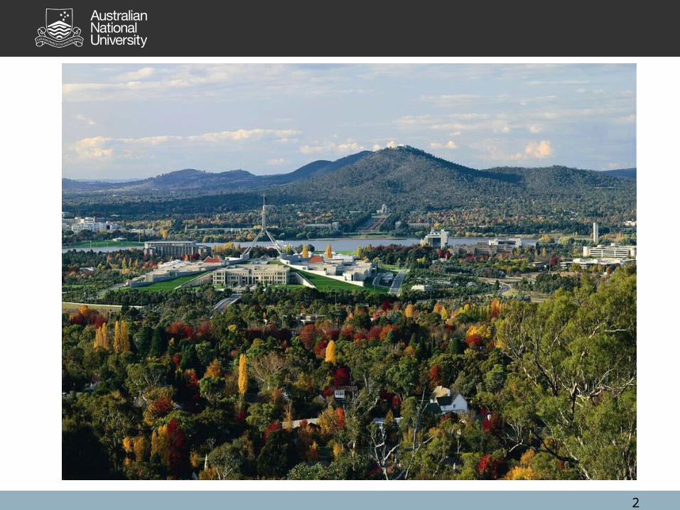
1. Setting the city into the landscape
“Taken as a whole, the site may be considered as an irregular amphitheatre….” (Griffin 1914)
Griffin used the topography as the setting for the city by carefully placing the various functions of the city into the landscape.
“It is the conscious use of space as a design element which has given Canberra a most distinctive character unlike, as Griffin said, any other city in the world”
(Harrison 1995:30).
9
2. Dispersed employment centresIn his Report Explanatory, Griffin explains the various functions of the city and their spatial arrangement around the city based on a land axis and a water axis.
In the Primary Division of functions, Griffin located the government functions and recreation. In the Secondary Division, Griffin located the university, the military, the municipal administration and markets, industry, and the residential sections.
Griffin also expounded the need for efficient internal circulation, suggesting wide boulevards connecting the various centres of activity, and including public transport.
Distinct Planning Layers and Legacies
• The O’Malley legacy (1890 – 1912)
• The post-Griffin legacy (1913 – 1921)
• The bureaucratic legacy (1921 – 1949)
• The Menzies/Holford/NCDC legacy (1950 – 1988)
10
11
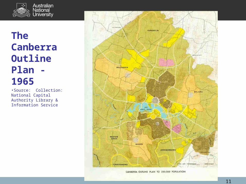
The Canberra Outline Plan - 1965•Source: Collection: National Capital Authority Library & Information Service
12
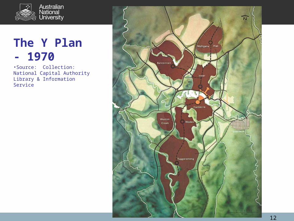
The Y Plan - 1970•Source: Collection: National Capital Authority Library & Information Service
13
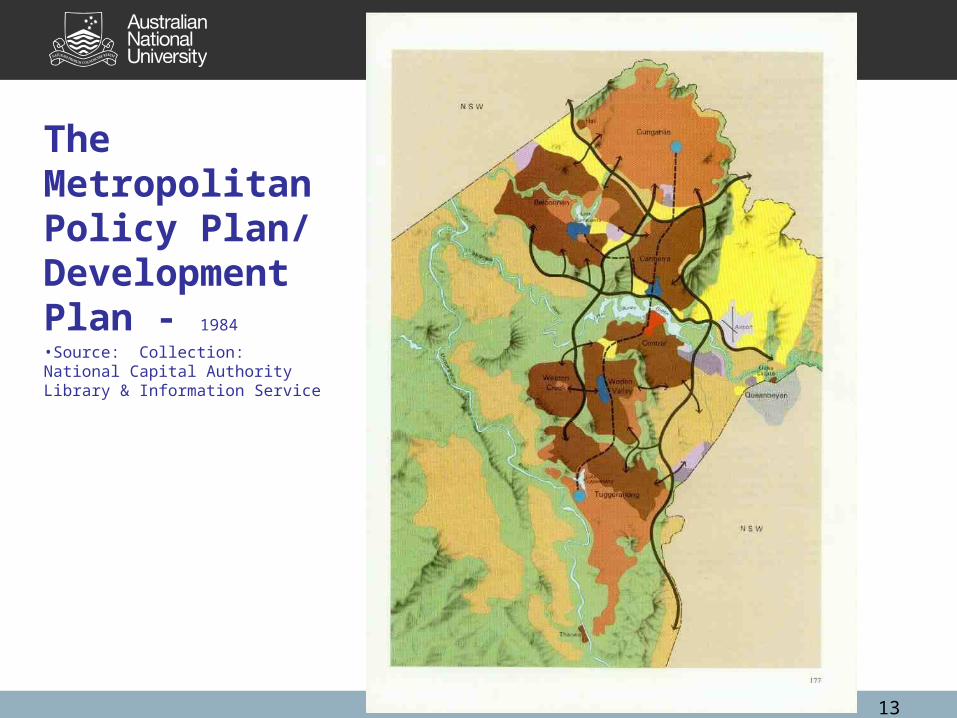
The Metropolitan Policy Plan/ Development Plan - 1984
•Source: Collection: National Capital Authority Library & Information Service
14
The Public Ownership of Land
Public ownership of land allowed successive governments to coordinate planning and development with the provision of services and facilities.
Canberra’s leasehold system is a natural child of the history of Australian land settlement.
A ‘planner’s paradise’ because what the planners decided actually happened.
The leasehold system was an invaluable tool and its objectives continue to have relevance today as they did 100 years ago.
15
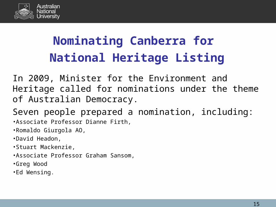
Nominating Canberra for
National Heritage Listing
In 2009, Minister for the Environment and Heritage called for nominations under the theme of Australian Democracy.
Seven people prepared a nomination, including:•Associate Professor Dianne Firth, •Romaldo Giurgola AO, •David Headon, •Stuart Mackenzie, •Associate Professor Graham Sansom, •Greg Wood •Ed Wensing.
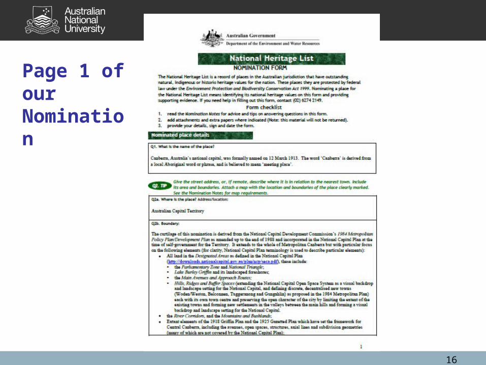
Page 1 of our Nomination
16
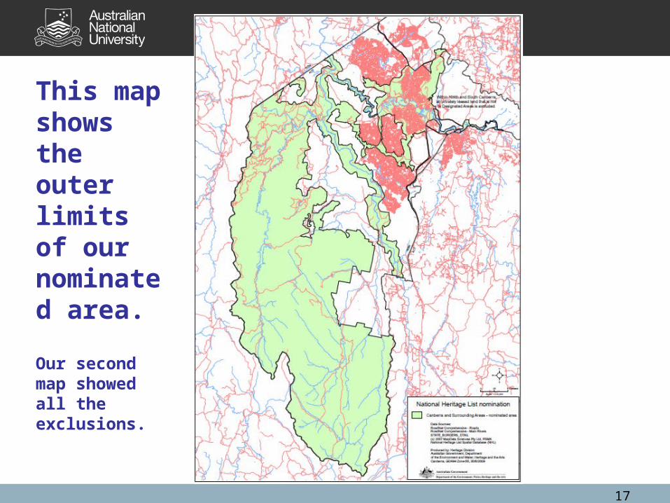
This map shows the outer limits of our nominated area.
Our second map showed all the exclusions.
17

Significant features:• National Triangle & Parliamentary Zone & Land Axis;• Parliament House, The High Court of Australia, the
Governor-General’s Residence in Yarralumla;• Lake Burley Griffin and Water Axis;• Main approach roads & avenues;• National Capital Open Space System; • Broad scale metropolitan structure of new towns/centres;• Extant elements of Griffin’s 1918 plan;• Building height restrictions in Inner Canberra;• Public transport corridors and peripheral parkways; and• River corridors and landscape views to the Brindabellas.
18
Five key documents
• Griffin’s 1912 Plan and accompanying Report Explanatory.
• Griffin’s 1918 amended plan for Canberra.• The Future Canberra – Canberra Outline Plan
1965.• Tomorrow’s Canberra, the Ý’ Plan 1970.• The Metropolitan Canberra Policy
Plan/Development Plan 1984.
19
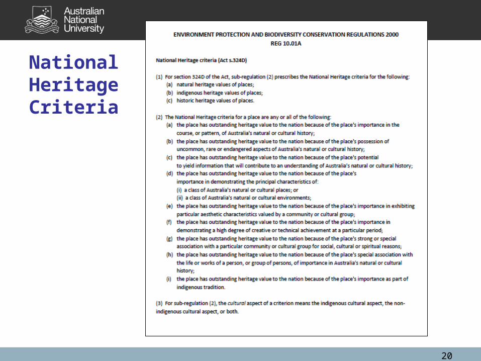
National Heritage Criteria
20
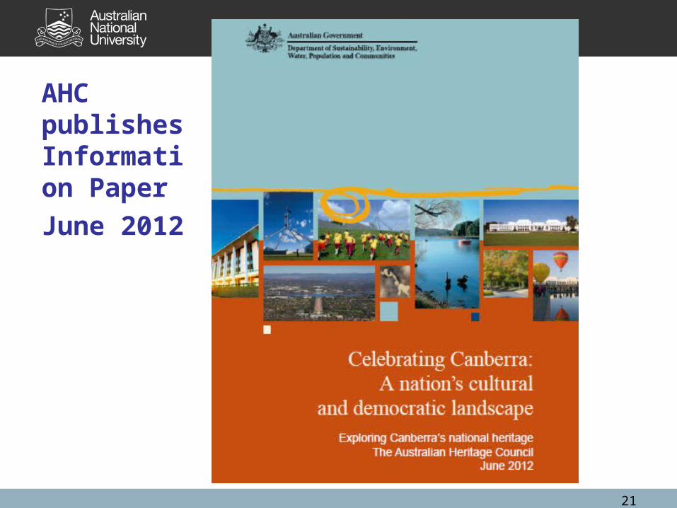
AHC publishes Information Paper
June 2012
21
Show NHL proposed boundary slide here!
22
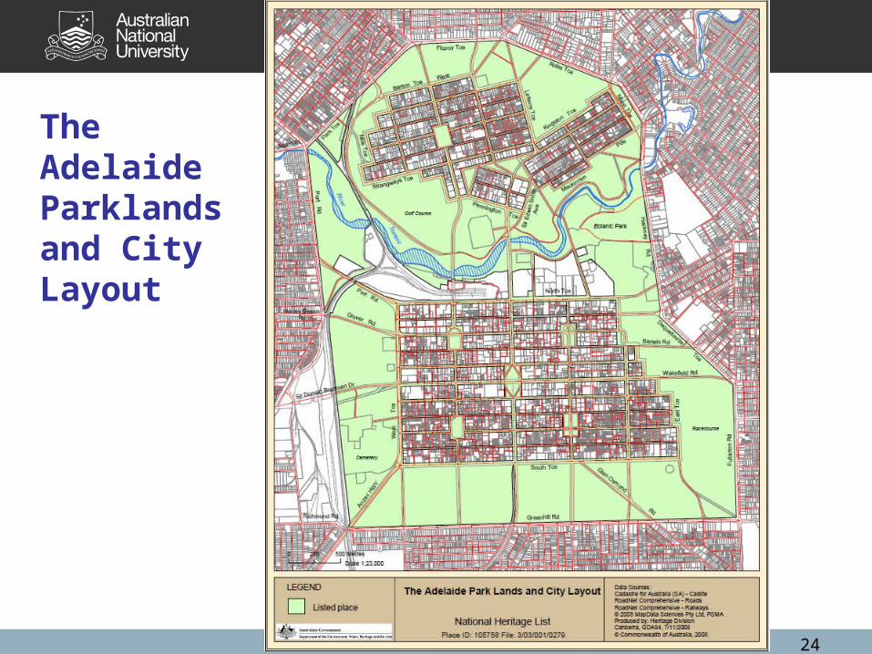
Adelaide Parklands and City Layout•The Adelaide Parklands and city layout were added to the National Heritage List in 2008 for its planning history and other values.•“The Adelaide Park Lands and City Layout is the physical expression of the 1837 Adelaide Plan designed and laid out by Colonel William Light. It has endured as a recognisable historical layout for over 170 years retaining the key elements of the plan; encompassing the layout of the two major city areas separated by the Torrens River, the encircling Park Lands, the six town squares, and the grid pattern of major and minor roads. It is substantially intact and reflects Light's design intentions with high integrity.”•Commonwealth of Australia Gazette No. S238, 7 November 2008.
23
24
The Adelaide Parklands and City Layout
John Reps
• “Griffin himself recognised that his competition design was far from flawless, and he made many significant changes in it as early as 1913. …Modest in size and altered in many respects from Griffin’s vision, it remains an extraordinary achievement deserving recognition and protection as one of the treasures, not only of Australia, but of the entire urban world.”
(Reps 1997:267)
25

Thank You.
26