Embed Size (px)
Citation preview
Footer Text Date
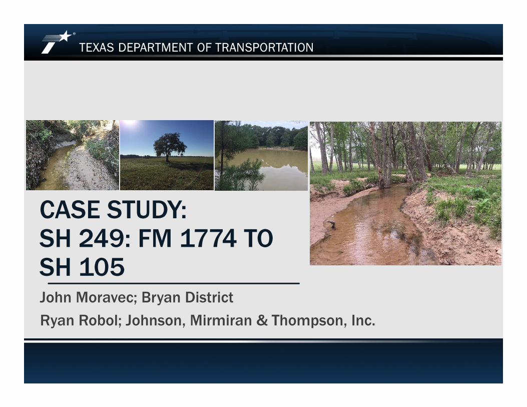
CASE STUDY:SH 249: FM 1774 TO SH 105John Moravec; Bryan District
Ryan Robol; Johnson, Mirmiran & Thompson, Inc.
Footer Text Date
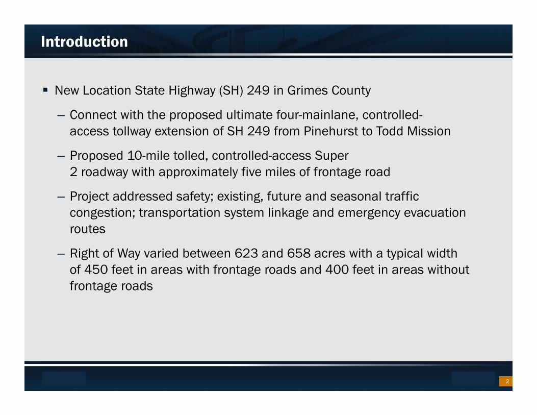
Introduction
New Location State Highway (SH) 249 in Grimes County
– Connect with the proposed ultimate four-mainlane, controlled-access tollway extension of SH 249 from Pinehurst to Todd Mission
– Proposed 10-mile tolled, controlled-access Super 2 roadway with approximately five miles of frontage road
– Project addressed safety; existing, future and seasonal traffic congestion; transportation system linkage and emergency evacuation routes
– Right of Way varied between 623 and 658 acres with a typical width of 450 feet in areas with frontage roads and 400 feet in areas without frontage roads
2
Footer Text Date
Introduction Continued
– State funded Design-Build Project
– Document Classification- Environmental Assessment
– Extensive public involvement with stakeholders, adjacent land owners and public
– FONSI Sept. 9, 2016
– Next Stage of Project Development... with a fraction of ROE obtained
– Project Team meeting every two weeks
– Pre-application meeting with USACE October 3, 2016
3

Footer Text Date
Wetland Fieldwork – “Normal” Process
“Normal” Process for Wetland Fieldwork
– Pre-Task Planning – Desktop Reviews
– Existing ROW – Good to Go… Collect Data!
– Proposed ROW – Obtain ROE… Collect Data!
– Ideally, review existing and proposed concurrently with one mobilization
4
Footer Text Date
Wetland Fieldwork – SH 249 Challenges
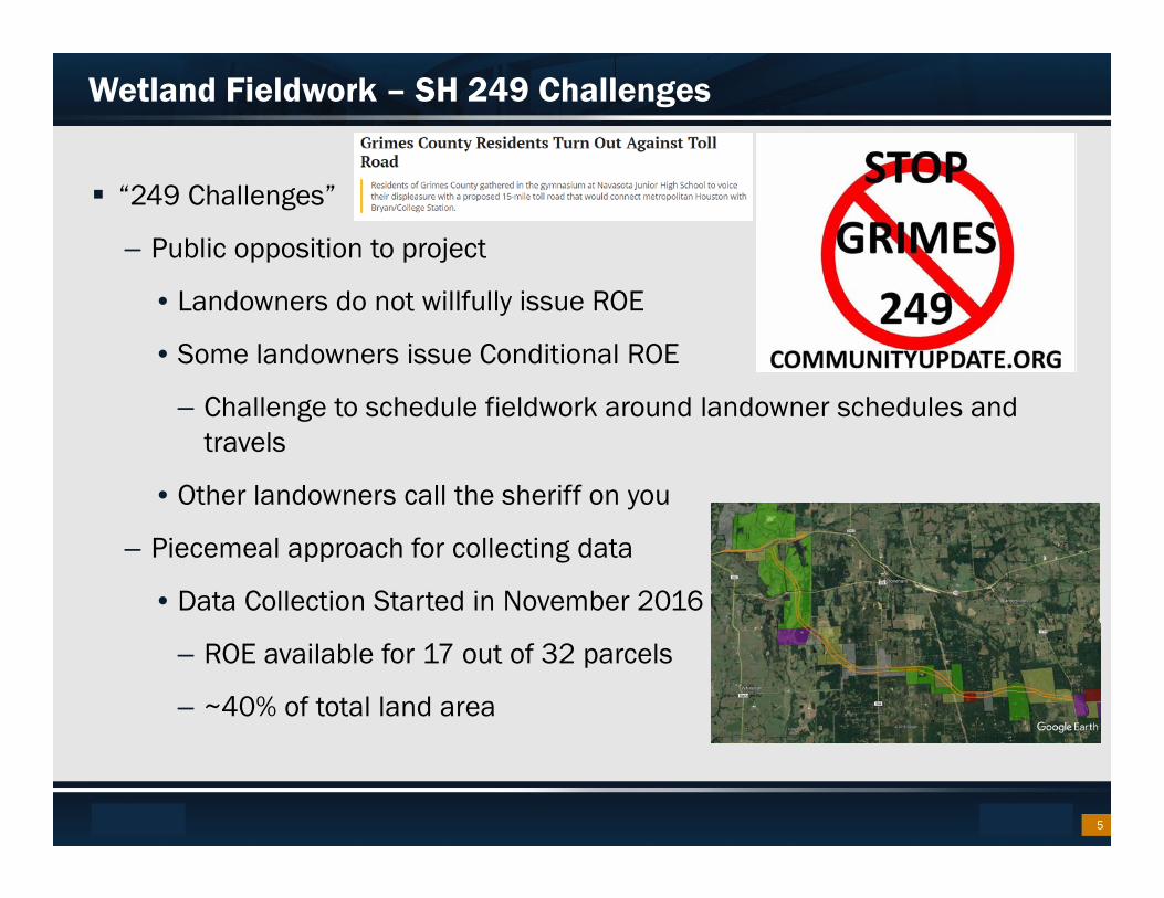
“249 Challenges”
– Public opposition to project
• Landowners do not willfully issue ROE
• Some landowners issue Conditional ROE
– Challenge to schedule fieldwork around landowner schedules and travels
• Other landowners call the sheriff on you
– Piecemeal approach for collecting data
• Data Collection Started in November 2016
– ROE available for 17 out of 32 parcels
– ~40% of total land area
5
Footer Text Date
Assessing Risk
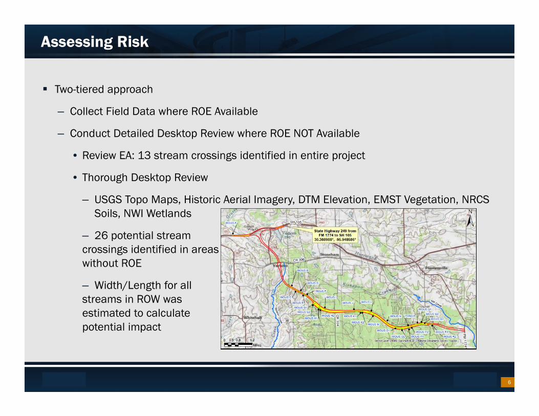
Two-tiered approach
– Collect Field Data where ROE Available
– Conduct Detailed Desktop Review where ROE NOT Available
• Review EA: 13 stream crossings identified in entire project
• Thorough Desktop Review
– USGS Topo Maps, Historic Aerial Imagery, DTM Elevation, EMST Vegetation, NRCS Soils, NWI Wetlands
– 26 potential stream crossings identified in areas without ROE
– Width/Length for allstreams in ROW was estimated to calculate potential impact
6
Footer Text Date
Assessing Risk
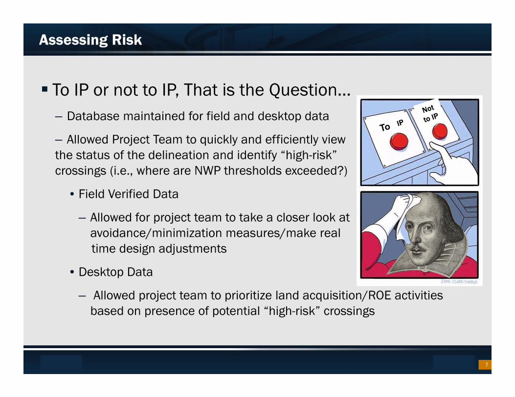
To IP or not to IP, That is the Question…– Database maintained for field and desktop data
– Allowed Project Team to quickly and efficiently view the status of the delineation and identify “high-risk” crossings (i.e., where are NWP thresholds exceeded?)
• Field Verified Data
– Allowed for project team to take a closer look at avoidance/minimization measures/make real time design adjustments
• Desktop Data
– Allowed project team to prioritize land acquisition/ROE activities based on presence of potential “high-risk” crossings
7
Footer Text Date
Assessing Risk – Fieldwork Results
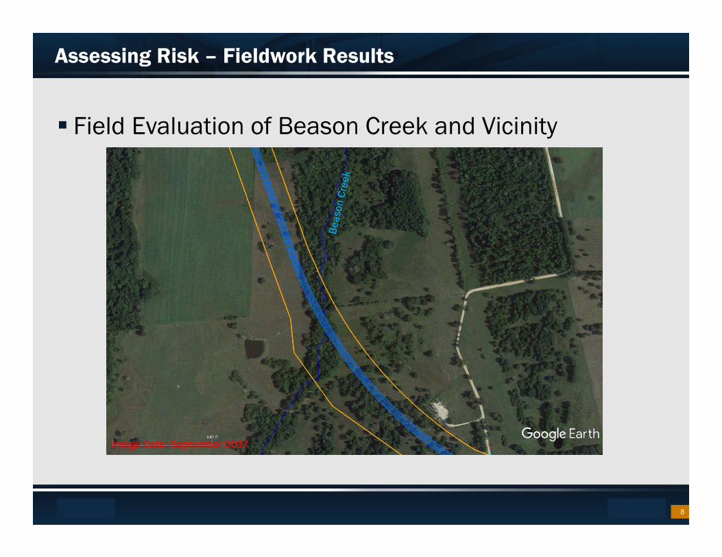
Field Evaluation of Beason Creek and Vicinity
8
Image Date: September 2017
Footer Text Date
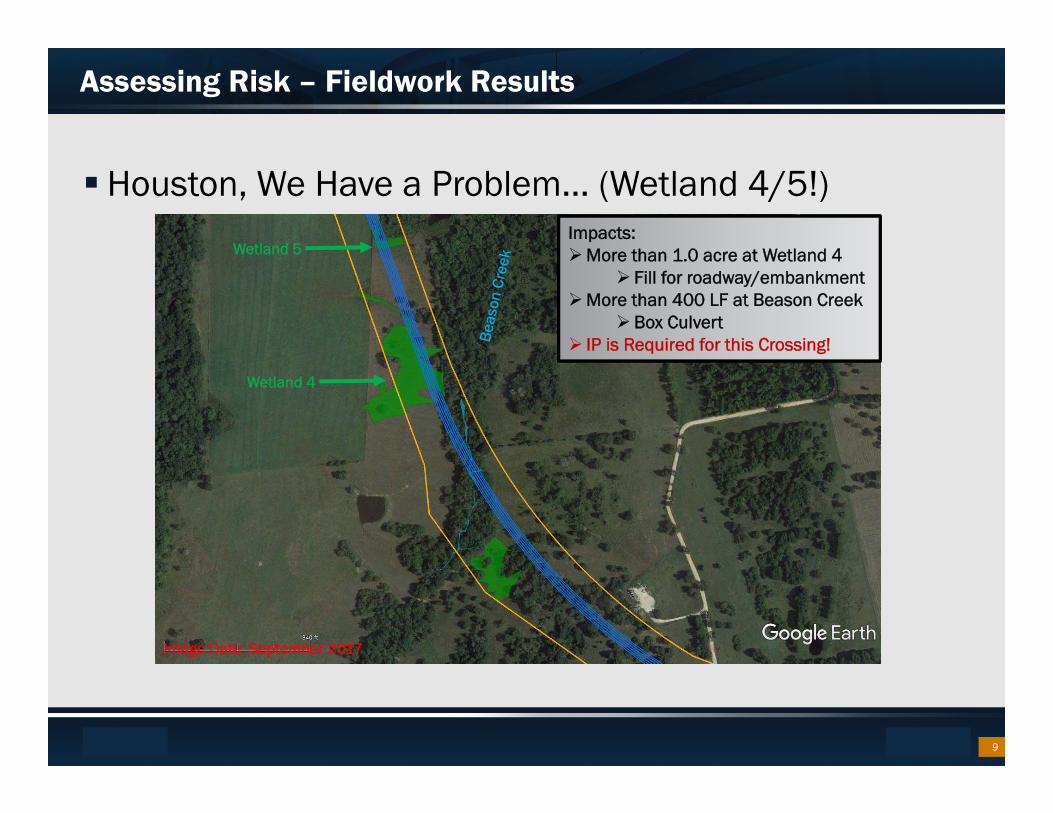
Assessing Risk – Fieldwork Results
Houston, We Have a Problem… (Wetland 4/5!)
Wetland 4
Impacts:More than 1.0 acre at Wetland 4
Fill for roadway/embankmentMore than 400 LF at Beason Creek
Box Culvert IP is Required for this Crossing!
9
Image Date: September 2017
Wetland 5
Footer Text Date
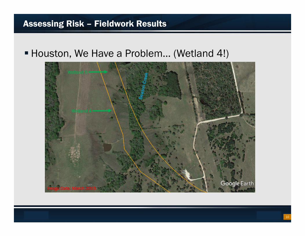
Assessing Risk – Fieldwork Results
Houston, We Have a Problem… (Wetland 4!)
Wetland 4
10
Image Date: March 2015
Wetland 5
Footer Text Date
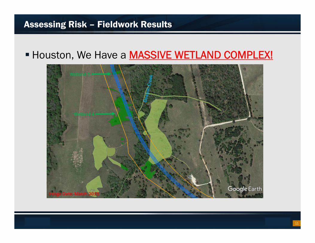
Assessing Risk – Fieldwork Results
Houston, We Have a MASSIVE WETLAND COMPLEX!
Wetland 4
11
Image Date: March 2015
Wetland 5
Footer Text Date
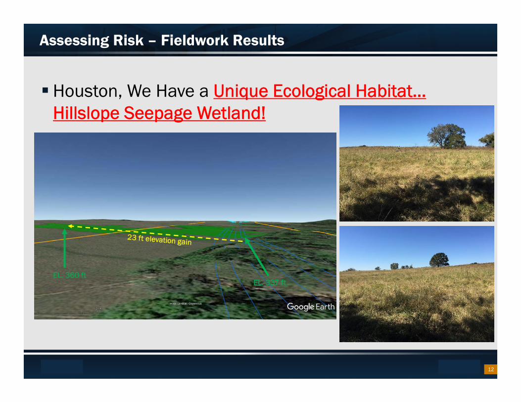
Assessing Risk – Fieldwork Results
Houston, We Have a Unique Ecological Habitat… Hillslope Seepage Wetland!
EL. 360 ftEL. 337 ft
12
Footer Text Date
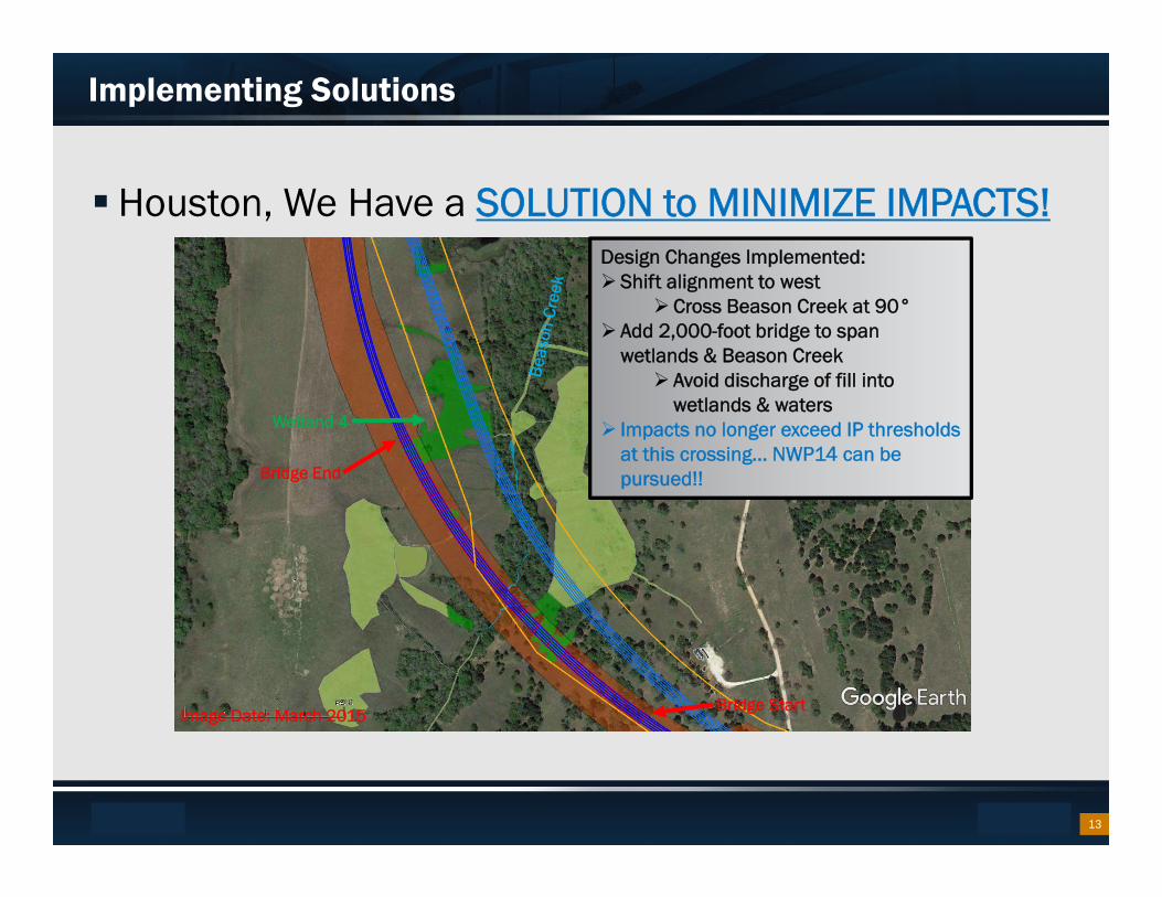
Implementing Solutions
Houston, We Have a SOLUTION to MINIMIZE IMPACTS!
Wetland 4
Bridge Start
Bridge End
Design Changes Implemented: Shift alignment to west
Cross Beason Creek at 90° Add 2,000-foot bridge to span
wetlands & Beason Creek Avoid discharge of fill into
wetlands & waters Impacts no longer exceed IP thresholds
at this crossing… NWP14 can be pursued!!
13
Image Date: March 2015
Footer Text Date
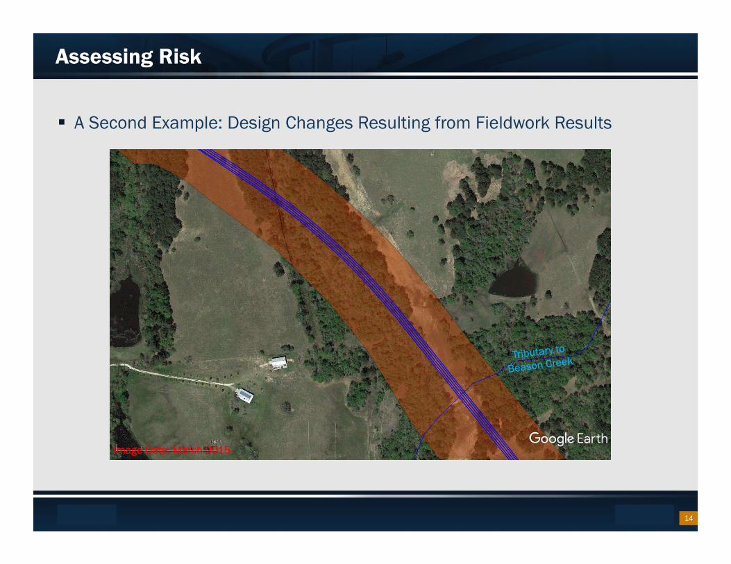
Assessing Risk
A Second Example: Design Changes Resulting from Fieldwork Results
14
Image Date: March 2015
Footer Text Date
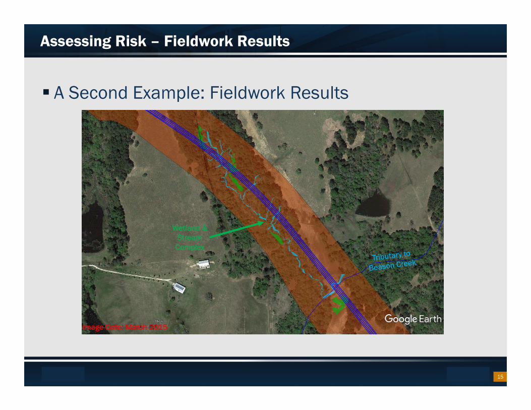
Assessing Risk – Fieldwork Results
A Second Example: Fieldwork Results
Wetland & Stream
Complex
15
Image Date: March 2015
Footer Text Date
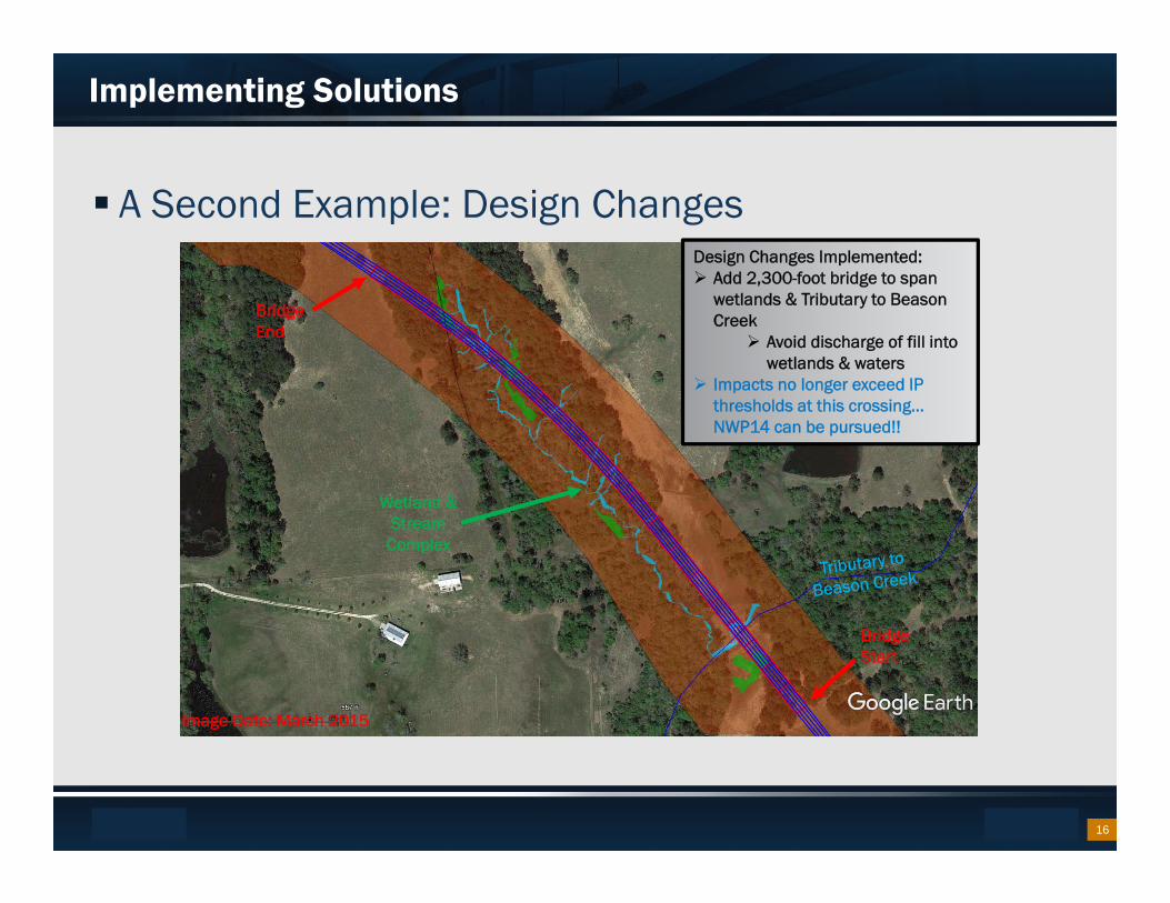
Implementing Solutions
A Second Example: Design Changes
Wetland & Stream
Complex
Bridge Start
Bridge End
Design Changes Implemented: Add 2,300-foot bridge to span
wetlands & Tributary to Beason Creek
Avoid discharge of fill into wetlands & waters
Impacts no longer exceed IP thresholds at this crossing… NWP14 can be pursued!!
16
Image Date: March 2015
Footer Text Date
Takeaways
Adding Bridges INCREASES Construction costs… BUT…
Avoiding & Minimizing Impacts DECREASES Mitigation Costs
Cost – Benefit Analysis! • Adding Bridges/Minimizing Impacts Reduced the total project cost
Benefits Realized– Unique Resources are Protected
– Permit Processing is Streamlined
– Cost savings to the State
17
Footer Text Date
Current SH 249 Grimes County
New Location State Highway (SH) 249 in Grimes County
– Design Build Project to connect with the proposed ultimate four-mainlane, controlled-access tollway extension of SH 249 from Pinehurst to Todd Mission
– Proposed 10-mile non-tolled, controlled-access by design, two-lane roadway with 10ft shoulders and no frontage roads, no grade separated interchanges, no westbound SH 105 Direct Connector (DC) to southbound SH 249 and combined the two DC structures on the west side of the SH 105 intersection into a single bridge structure
– Changes in the alignment occurred to avoid certain ROW impacts, wetlands and other sensitive environmental features
– Right of Way acreage was reduced by approximately 22 acres
– Open House Public Meeting January 25, 2018
18

Footer Text Date
Current SH 249 Grimes County Continued
– Pre-application update meeting February 15, 2018
– ROW acquisition continues for priority parcels
– 404 Permit Delineations to be completed along with Permit Application
– EA Re-evaluation July 27, 2018
– Anticipate permit early 2019
– SH 249 websites:
– https://www.txdot.gov/inside-txdot/projects/studies/bryan/sh249.html
– http://txsh249.com/
19