Embed Size (px)
Citation preview
COUN-91-X-1-b
CATALOGUE OF DATA & DATABASES CURRENTLY
AVAILABLE AT IIASA
Compiled by the Open Access to Data Task Force, October 2017

1. UNCERTAINTY IN AN EMISSIONS-CONSTRAINED WORLD Program: ASA
Format: Database / Excel-File
Contact Person: Matthias Jonas ([email protected])
Documentation: Publication
Availability: Download from IIASA website
How to access: http://www.iiasa.ac.at/web/home/research/researchPrograms/AdvancedSystemsAnalysis/10584_2014
_1103_MOESM2_ESM.xlsx
Description: This web-based database supports the Emissions, Temperature, Uncertainty (ETU) framework described by Jonas et al. The ETU framework allows any country to understand its national and near-term mitigation and adaptation efforts in a more realistic context, where uncertainty is taken into account.
References:
Jonas M, Marland G, Krey V, Wagner F, & Nahorski Z (2014). Uncertainty in an emissions-constrained world. Climatic Change 124 (3): 459-476. DOI:10.1007/s10584-014-1103-6.
Related links:
IIASA NEXUS blog
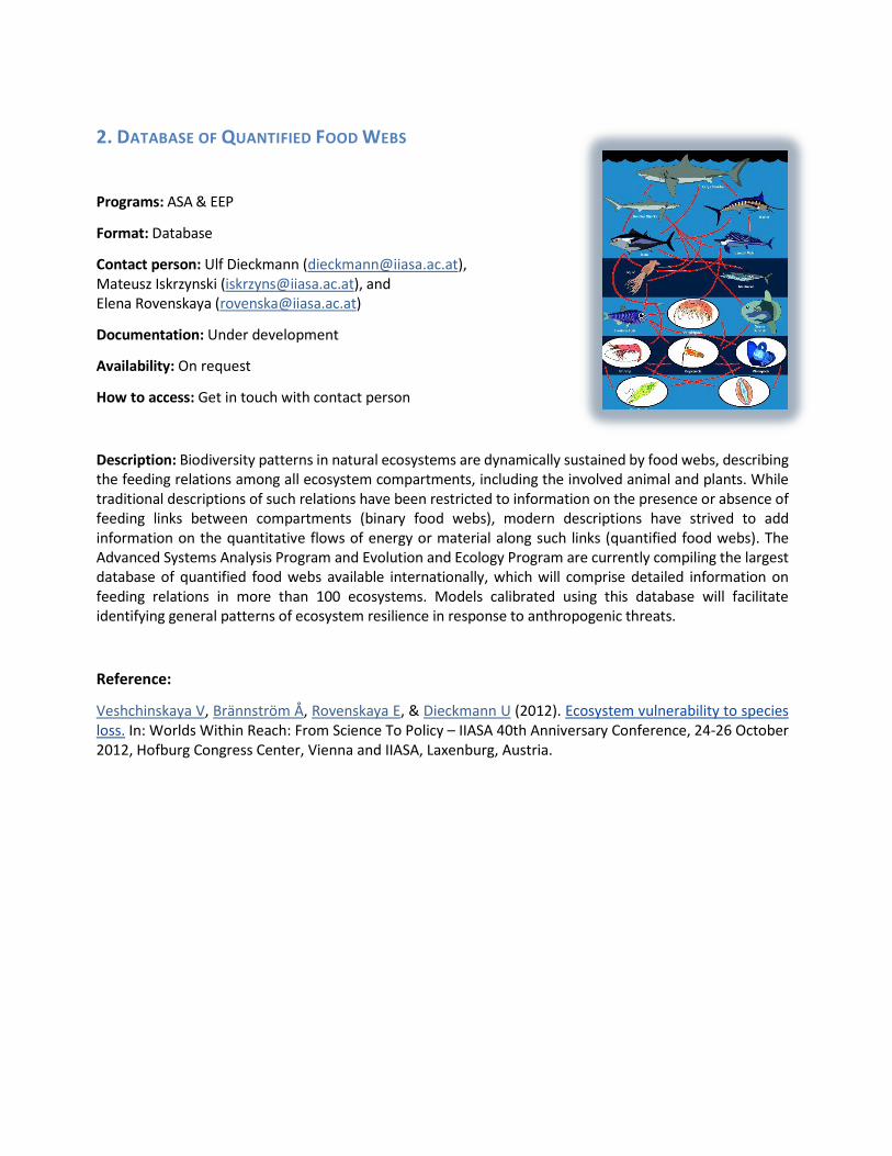
2. DATABASE OF QUANTIFIED FOOD WEBS
Programs: ASA & EEP
Format: Database
Contact person: Ulf Dieckmann ([email protected]), Mateusz Iskrzynski ([email protected]), and Elena Rovenskaya ([email protected])
Documentation: Under development
Availability: On request
How to access: Get in touch with contact person
Description: Biodiversity patterns in natural ecosystems are dynamically sustained by food webs, describing the feeding relations among all ecosystem compartments, including the involved animal and plants. While traditional descriptions of such relations have been restricted to information on the presence or absence of feeding links between compartments (binary food webs), modern descriptions have strived to add information on the quantitative flows of energy or material along such links (quantified food webs). The Advanced Systems Analysis Program and Evolution and Ecology Program are currently compiling the largest database of quantified food webs available internationally, which will comprise detailed information on feeding relations in more than 100 ecosystems. Models calibrated using this database will facilitate identifying general patterns of ecosystem resilience in response to anthropogenic threats.
Reference:
Veshchinskaya V, Brännström Å, Rovenskaya E, & Dieckmann U (2012). Ecosystem vulnerability to species loss. In: Worlds Within Reach: From Science To Policy – IIASA 40th Anniversary Conference, 24-26 October 2012, Hofburg Congress Center, Vienna and IIASA, Laxenburg, Austria.

3. DATABASE OF EXPLOITED FISH STOCKS
Program: EEP
Format: Database
Contact person: Ulf Dieckmann ([email protected]) on behalf of the Working Group on Fisheries-Induced Evolution (WGEVO) of the International Council for the Exploration of the Sea (ICES)
Documentation: See 2017 WGEVO Report
Availability: On request
How to access: Get in touch with contact person
Description: The Working Group on Fisheries-Induced Evolution (WGEVO) of the International Council for the Exploration of the Sea (ICES) has developed a general framework for investigating eco-evolutionary changes in fish stocks and their utilities in terms of ecosystem services and for assessing the management implications of fisheries-induced evolution through Evolutionary Impact Assessments (EvoIAs). On this basis, WGEVO is currently compiling an extensive database describing the life-history parameters and fishing patterns of 60+ exploited fish stocks from around the world, which is expected to be released in 2018.
References:
Laugen AT, Engelhard GH, Whitlock R, Arlinghaus R, Dankel DJ, Dunlop ES, Eikeset AM, Enberg K, Jørgensen C, Matsumura S, Nusslé S, Urbach D, Baulier L, Boukal DS, Ernande B, Johnston FD, Mollet F, Pardoe H, Therkildsen NO, Uusi-Heikkilä S, Vainikka A, Heino M, Rijnsdorp AD & Dieckmann U (2014). Evolutionary impact assessment: Accounting for evolutionary consequences of fishing in an ecosystem approach to fisheries management. Fish and Fisheries 15: 65-96.
2017 Report of the Working Group on Fisheries-Induced Evolution (WGEVO) of the International Council for the Exploration of the Sea (ICES).

4. IPCC AR5 SCENARIOS DATABASE Program: ENE
Format: Database
Contact Person: Keywan Riahi ([email protected]), Volker Krey ([email protected])
Documentation: http://data.ene.iiasa.ac.at/database/
Availability: Link from IIASA website
How to access: https://secure.iiasa.ac.at/web-apps/ene/AR5DB/dsd?Action=htmlpage&page=welcome
Description: The IPCC AR5 Scenarios Database documents the long-term scenarios as reviewed in the Fifth Assessment Report (AR5) of Working Group III of the Intergovernmental Panel on Climate Change (IPCC). comprises 31 models (sometimes in different versions) and in total 1,184 scenarios. To be included in the database, four criteria had to be met. First, only scenarios published in the peer-reviewed literature could be considered, per IPCC protocol. Second, the scenario must contain a minimum set of required variables and some basic model and scenario documentation (meta data) must be provided. Third, only models with at least full energy system representation were considered given that specific sectoral studies were assessed in Chapters 8-11 of the report. Lastly, the scenario must provide data out to at least 2030.
References: Krey V, Luderer G, Clarke L, & Kriegler E (2014). Getting from here to there - Energy technology transformation pathways in the EMF27 scenarios. Climatic Change 123 (3): 369-382. DOI:10.1007/s10584-013-0947-5. Clarke L, Jiang K, Akimoto K, Babiker M, Blanford G, Fisher-Vanden K, Hourcade J-C, Krey V, et al. (2014). Chapter 6 - Assessing transformation pathways. In: Climate Change 2014: Mitigation of Climate Change. IPCC Working Group III Contribution to AR5. Cambridge University Press. Related links: IPCC, 2013: Climate Change 2013: Mitigation of Climate Change. Contribution of Working Group III to the Fifth Assessment Report of the Intergovernmental Panel on Climate Change. Cambridge University Press, Cambridge, United Kingdom and New York, NY, USA
5. SSP SCENARIO DATABASE Program: ENE
Format: Database
Contact Person: Keywan Riahi ([email protected]), Volker Krey ([email protected])
Documentation: http://data.ene.iiasa.ac.at/database/
Availability: Link from IIASA website
How to access: https://secure.iiasa.ac.at/web-apps/ene/SspDb/dsd?Action=htmlpage&page=about
Description: The Shared Socioeconomic Pathways (SSPs) will be used alongside the Representative Concentration Pathways (RCPs) to analyze the feedbacks between climate change and socioeconomic factors, such as world population growth, economic development and technological progress. IIASA began work in 2011 on quantifying one of the five SSPs. The Energy Program has spearheaded the cross- program collaboration with the Population and Ecosystem Services Management programs. The SSP database aims at the documentation of quantitative projections of the so-called Shared Socioeconomic Pathways (SSPs) and related Integrated Assessment scenarios. The SSPs are part of a new framework that the climate change research community has adopted to facilitate the integrated analysis of future climate impacts, vulnerabilities, adaptation, and mitigation.
References:
Riahi K, van Vuuren DP, Kriegler E, Edmonds J, O'Neill B, Fujimori S, Bauer N, Calvin K, et al. (2017). The shared socioeconomic pathways and their energy, land use, and greenhouse gas emissions implications: An overview. Global Environmental Change 42: 153-168. DOI:10.1016/j.gloenvcha.2016.05.009.
van Vuuren DP, Riahi K, Moss R, Edmonds J, Thomson A, Nakicenovic N, Kram T, Berkhout F, et al. (2012). A proposal for a new scenario framework to support research and assessment in different climate research communities. Global Environmental Change 22 (1): 21-35. DOI:10.1016/j.gloenvcha.2011.08.002.
Moss RH, Edmonds J, Hibbard KA, Manning MR, Rose SK, van Vuuren DP, Carter TR, Emori S, et al. (2010). The next generation of scenarios for climate change research and assessment. Nature 463 (7282): 747-756. DOI:10.1038/nature08823.
van Vuuren DP, Edmonds J, Kainuma M, Riahi K, Thomson A, Hibbard K, Hurtt GC, Kram T, et al. (2011). The representative concentration pathways: An overview. Climatic Change 109 (1): 5-31. DOI:10.1007/s10584-011-0148-z.

6. REPRESENTATIVE CONCENTRATION PATHWAYS DATABASE (RCP) Program: ENE
Format: Database
Contact Person: Keywan Riahi ([email protected]), Volker Krey ([email protected]), Peter Kolp ([email protected])
Documentation: van Vuuren et al. 2011
Availability: Link from IIASA website
How to access: http://tntcat.iiasa.ac.at/RcpDb/dsd?Action=htmlpage&page=welcome
Description: A database with scenarios from the integrated assessment community to expedite climate change assessments. In May 2007 the Intergovernmental Panel on Climate Change (IPCC) ask the international scientific community to develop a new set of climate scenarios for the IPCC Fifth Assessment Report (AR5), expected to be published in 2013/2014. The new scenarios are called the Representative Concentration Pathways (RCPs). The different scenarios (RCPs) underpinning the climate simulations of the AR5 can be viewed and compared online at the level of five world regions, 13 sectors, and with 0.5º × 0.5º resolution spatial maps.
References: van Vuuren DP, Edmonds J, Kainuma M, Riahi K, Thomson A, Hibbard K, Hurtt GC, Kram T, et al. (2011). The representative concentration pathways: An overview. Climatic Change 109 (1): 5-31. DOI:10.1007/s10584-011-0148-z. van Vuuren DP, Edmonds J, Kainuma M, Riahi K, Thomson A, Hibbard K, Hurtt GC, Kram T, et al. (2011). Special issue - The representative concentration pathways: An overview. Climatic change 109 (1-2). Related research:
IPCC Fifth Assesment Report
MESSAGE
GAINS

7. GLOBAL ENERGY ASSESSMENT SCENARIO DATABASE
Program: ENE
Format: Database
Contact Person: Keywan Riahi ([email protected]), Volker Krey
Documentation: http://data.ene.iiasa.ac.at/database/
Availability: Link from IIASA website
How to access: http://www.iiasa.ac.at/web-apps/ene/geadb/dsd?Action=htmlpage&page=about
Description: The Global Energy Assessment (GEA) Scenario database documents results and assumptions of the GEA energy transformation pathways that underpin the GEA. The database serves as a central data repository for the dissemination of GEA scenario information. The scenarios of the Global Energy Assessment (GEA) explore the feasibility and costs of global and regional energy transformations towards normative objectives for energy access, environmental impacts of energy conversion and use, and energy security. The GEA database includes detailed quantitative information for 41 pathways that fulfill these objectives by reaching specific and clear targets for:
• Achieving universal energy access for the poor,
• Reducing air pollution,
• Limiting climate change, and
• Improving energy security in all parts of the world.
References: Riahi K, Dentener F, Gielen D, Grubler A, Jewell J, Klimont Z, Krey V, McCollum DL, et al. (2012). Chapter 17: Energy pathways for sustainable development. In: Global Energy Assessment: Toward a Sustainable Future. Eds. Team, GEA Writing, pp.1203-1306 (October 2012): Cambridge University Press and IIASA. ‘ Related links: Global Energy Assessment
8. LIMITS SCENARIO DATABASE
Program: ENE
Format: Database
Contact Person: Keywan Riahi ([email protected]), David McCollum
([email protected]), Jessica Jewell ([email protected])
Documentation: http://data.ene.iiasa.ac.at/database/
Availability: Link from IIASA website
How to access:
https://secure.iiasa.ac.at/web- apps/ene/LIMITSDB/dsd?Action=htmlpage&page=welcome
Description: The LIMITS Scenario database, operated by IIASA for the LIMITS consortium, hosts the results of the LIMITS modeling comparison exercise. The LIMITS project aims at advancing the understanding of the implementation of climate policies consistent with 2 degree Celsius. The main objective of the project is to provide an assessment of the emissions reductions strategies at the level of the world and the major global economies. The LIMITS (Low Climate Impact Scenarios and the Implications of Required Tight Emission Control Strategies) project assesses a series of questions that are critical for developing climate policies that can achieve the stringent two-degree goal. The focus of the project is on technological challenges, economics, required policy regimes, implementation obstacles, and local and national air quality and energy security impacts.
References:
Kriegler E, Edmonds J, Hallegatte S, Ebi KL, Kram T, Riahi K, Winkler H, & van Vuuren DP (2014). A new scenario framework for climate change research: The concept of shared climate policy assumptions. Climatic Change 122 (3): 401-414. DOI:10.1007/s10584-013-0971-5.
Tavoni M, Riahi K, Jewell J, Rao S, & McCollum D (2014). Limiting global warming to 2 degrees C. Policy findings from Durban Platform scenario analysis. LIMITS Publications , FEEM, Milan, Italy.
Jewell J, Vinichenko V, McCollum D, Bauer N, Riahi K, Aboumahboub T, Fricko O, Harmsen M, et al. (2016). Comparison and interactions between the long-term pursuit of energy independence and climate policies. Nature Energy 1: e16073. DOI:10.1038/nenergy.2016.73.

9. AMPERE SCENARIO DATABASE Program: ENE
Format: Database
Contact Person: Keywan Riahi ([email protected]), Volker Krey ([email protected]) Documentation: http://data.ene.iiasa.ac.at/database/
Availability: Link from IIASA website
How to access: https://secure.iiasa.ac.at/web-apps/ene/AMPEREDB/dsd?Action=htmlpage&page=about
Description: The AMPERE database, operated by IIASA for the AMPERE consortium, hosts the model results for work packages 2, 3, and 5, as well as the results from the model diagnostics project. AMPERE scenario data were used in a series of research papers, which were published in a special issue of Technological Forecasting and Social Change as well as other journals. In addition, the results were used in the 5th Assessment Report of Working Group III of the IPCC. The database, operated by IIASA for the AMPERE consortium, hosts the model results for work packages 2, 3, and 5, as well as the results from the model diagnostics project. Definitions of the variables used in the respective work packages are listed here.
References:
Riahi K, Kriegler E, Johnson N, Bertram C, den Elzen M, Schaeffer M, Krey V, Luderer G, et al. (2015). Locked into Copenhagen pledges - Implications of short-term emission targets for the cost and feasibility of long-term climate goals. Technological Forecasting and Social Change 90 (Part A): 8-23. DOI:10.1016/j.techfore.2013.09.016.
Kriegler E, Riahi K, Bosetti V, Capros P, Petermann N, van Vuuren DP, Weyant JP, & Edenhofer O (2015). Introduction to the AMPERE model intercomparison studies on the economics of climate stabilization. Technological Forecasting and Social Change 90 (Part A): 1-7. DOI:10.1016/j.techfore.2014.10.012.
Kriegler E, Riahi K, Bosetti V, Capros P, van Vuuren DP, Weyant JP, & Edenhofer O (2015). Special Section: The AMPERE Intermodel Comparison on the Economics of Climate Stabilization. Technological Forecasting and Social Change 90 (Part A): 1-354.

10. AME SCENARIO DATABASE
Program: ENE
Format: Database
Contact Person: Keywan Riahi ([email protected]), Volker Krey ([email protected]) Documentation: http://data.ene.iiasa.ac.at/database/
Availability: Link from IIASA website
How to access: https://secure.iiasa.ac.at/web-apps/ene/AMEDB
Description: The goal of the Asia Modeling Exercise (AME) was to better articulate the role of Asia in mitigating climate change. The scenario study and the underlying database compare results of 23 energy- economic and integrated assessment models, focusing on results for Asian regions. The Asia Modeling Exercise was a 3-year research project (started in September 2009), with participants from China, India, Japan, Korea, Nepal, Europe, Australia, and the US. IIASA hosts the results of the AME modeling comparison exercise.
References:
Calvin K, Clarke L, Krey V, Blanford GJ, Jiang K, Kainuma M, Kriegler E, Luderer G, et al. (2012). The role of Asia in mitigating climate change: Results from the Asia modeling exercise. Energy Economics 34 (3): S251-S260. DOI:10.1016/j.eneco.2012.09.003. Calvin K, Clarke L, & Krey V (2012). Special Issue: The Asia Modeling Exercise: Exploring the Role of Asia in Mitigating Climate Change. Energy Economics 34 (3): S261-S512.

11. GREENHOUSE GAS INITIATIVE SCENARIO DATABASE Program: ENE
Format: Database
Contact Person: Keywan Riahi ([email protected]), Arnulf Grubler ([email protected]), Fabian Wagner ([email protected]), Gunter Fischer ([email protected]) Documentation: see references
Availability: Link from IIASA website
How to access: http://www.iiasa.ac.at/web-apps/ggi/GgiDb/dsd?Action=htmlpage&page=about
Description: A database of greenhouse gas emission mitigation scenarios, the GGI (Greenhouse Gas Initiative) scenario database documents the results of a set of greenhouse gas emission scenarios that were created using the IIASA Integrated Assessment Modeling Framework and previously documented in a special issue of the Technological Forecasting and Social Change (see below). Together, the database documents three ‘baseline’ scenarios of different socio-economic and technological developments, A2r, B1 and B2, that are assumed not to include any explicit climate policies. In addition to these, this database also documents climate stabilization scenarios, which have been imposed on the baselines. Version 2.0 of the database includes an extended set of stabilization scenarios, including very low scenarios that stabilize CO2-eq concentrations at about 450 ppm CO2-eq. The majority of the scenario data is presented at the level of 11 world regions. For some indicators data is available in a more disaggregated spatial scale than what is shown in this database. If you are interested in acquiring grid level data, it can be downloaded from here.
References:
Riahi K & Nakicenovic N (2007). Special Issue: Greenhouse Gases - Integrated Assessment. Technological Forecasting and Social Change 74 (7): 873-1108.
12. GEO-WIKI Program: ESM
Format: Tools and dataset
Contact Person: Steffen Fritz ([email protected])
Documentation: Technical Background
Availability: Access from IIASA website
How to access: http://www.iiasa.ac.at/web/home/research/researchPrograms/EcosystemsServicesandManagement/G eo_wiki_Data_Sets.en.html ; http://www.geo-wiki.org
Description: Geo-Wiki is an online tool that provides users with access to global environmental spatial datasets, including those related to land cover, forest, agriculture, biomass, and many more, organized in different Geo-Wiki branches. Geo-Wiki allows users to compare different products, and to provide feedback and local expertise. Users can display maps of the spatial disagreement between pairs of land cover maps, along with the overall disagreement in the forest and cropland domains. It is also possible to view a hybrid land cover map, created from existing land cover products and crowdsourced data. Such a portal helps to identify the most suitable datasets and aids in building data products of higher accuracy with users in a participatory fashion. Furthermore, Geo-Wiki can be used to collect reference data sets for validation and calibration activities as well as statistical data about land use information such as extent of forest cover, cropland, etc. Data are compiled via trained experts or volunteers. Gamification and other techniques are used to incentivize volunteers (more Geo-Wiki research).
References:
Laso Bayas JC, Lesiv M, Waldner F, Schucknecht A, Duerauer M, See L, Fritz S, Fraisl D, et al. (2017). A global reference database of crowdsourced cropland data collected using the Geo-Wiki platform. Scientific Data 4: e170136. DOI:10.1038/sdata.2017.136.
Baklanov A, Fritz S, Khachay M, Nurmukhametov O, Salk C, See L, & Shchepashchenko D (2016). Improved Vote Aggregation Techniques for the Geo-Wiki Cropland Capture Crowdsourcing Game. In: European Geosciences Union (EGU) General Assembly 2016, 17–22 April 2016, Vienna, Austria.
See L, Fritz S, Perger C, Schill C, McCallum I, Schepaschenko D, Dürauer M, Sturn T, et al. (2015). Harnessing the power of volunteers, the internet and Google Earth to collect and validate global spatial information using Geo-Wiki. Technological Forecasting and Social Change 98: 324-335. DOI:10.1016/j.techfore.2015.03.002.
Perger C, LeDrew E, See L, & Fritz S (2014). Geography Geo-Wiki in the classroom: Using crowdsourcing to enhance geographical teaching. Future Internet 6 (4): 597-611. DOI:10.3390/fi6040597.

13. GLOBAL FOREST DATABASE Program: ESM
Format: Database
Contact Person: Georg Kindermann ([email protected])
Documentation: No
Availability: Download from IIASA website
How to access: http://www.iiasa.ac.at/web/home/research/researchPrograms/EcosystemsServicesandManagement/Gl obalForestDB.en.html
Description: IIASA's Global Forest Database (GFD) contains information about the growing stock, biomass, and carbon stock in forests for 229 countries and territories at a half-degree global spatial scale. The information was downscaled from the Global Forest Resources Assessment (FRA), which was produced by the Food and Agriculture Organization (FAO) in 2005.
The GFD will produce maps that are useful for current applications related to biomass burning emissions, carbon cycle, or deforestation issues. References: Kraxner F, Schepaschenko D, Fuss S, Lunnan A, Kindermann G, Aoki K, Dürauer M, Shvidenko A, et al. (2017). Mapping certified forests for sustainable management - A global tool for information improvement through participatory and collaborative mapping. Forest Policy and Economics 83: 10-18. DOI:10.1016/j.forpol.2017.04.014. Sung S, Forsell N, Kindermann G, & Lee DK (2016). Estimating Net Primary Productivity under Climate Change by Application of Global Forest Model (G4M). Journal of the Korean Society People, Plants, and Environment 19 (6): 549-558. DOI:10.11628/ksppe.2016.19.6.549. Kindermann G, McCallum I, Fritz S, & Obersteiner M (2008). A global forest growing stock, biomass and carbon map based on FAO statistics. Silva Fennica 42 (3): 387-396. DOI:10.14214/sf.244.

15
14. HYBRID LAND COVER OF RUSSIA
Program: ESM
Format: Dataset
Contact Person: Dmitry Shchepashchenko ([email protected])
Documentation: Publication
Availability: on request
How to access: http://www.iiasa.ac.at/web/home/research/researchPrograms/EcosystemsServicesandManagement/H
ybrid-Land-Cover-of-Russia.en.html
Description: A system integration of ground and remote sensing data that parametrizes Russian territory at a 1km spatial resolution for forests and includes tree species, age, and biomass distribution. Hybrid Land Cover of Russia (HLCR) is a land cover data set for Russia, developed at IIASA, as part of the European Commission FP6 Project GEOBENE and the GEG-2 project with the Global Environmental Forum of Japan. The main idea behind the HLCR project was to systematically integrate all relevant information - in particular, the merging and harmonization of land and forest inventories, ecological monitoring, remote sensing data, and in situ information - and to explore the synergies between them. HLCR is linked to IIASA- based GeoWiki which aims to clarify and validate data of global land cover. References: Schepaschenko D, McCallum I, Shvidenko A, Fritz S, & Obersteiner M (2011). A new hybrid land cover dataset for Russia: A methodology for integrating statistics, remote sensing and in situ information. Land Use Science 6 (4): 245-259. DOI:10.1080/1747423X.2010.511681. Related links:
Land Resources of Russia
Russian Forests
GeoWiki
Verified terrestrial biota full greenhouse gas account

16
15. LAND RESOURCES OF RUSSIA (LRR)
Program: ESM
Format: Database
Contact Person: Ian McCallum ([email protected])
Documentation: See link below
Availability: Link from IIASA website
How to access: http://www.iiasa.ac.at/Research/FOR/russia_cd/guide.htm
Description: Land Resources of Russia (LRR) is a collection of databases centered on three major themes:
• Socioeconomics (statistics and infrastructure);
• Natural conditions (climate, hydrology, permafrost, relief, lithology, vegetation, soils, biodiversity, ecosystems, and land cover); and
• Land endowment (land use, agriculture, forest use, land productivity, desertification, and land degradation).
References:
Schepaschenko D, McCallum I, Shvidenko A, Fritz S, & Obersteiner M (2011). A new hybrid land cover dataset for Russia: A methodology for integrating statistics, remote sensing and in situ information. Land Use Science 6 (4): 245-259. DOI:10.1080/1747423X.2010.511681.
Schepaschenko D, McCallum I, Shvidenko A, Kraxner F, & Fritz S (2009). A hybrid Land Cover Dataset for Russia: A new methodology for merging statistics, remote sensing and in-situ information (Abstract). Geophysical Research Abstracts 11:EGU2009-6977
Shvidenko A, Shchepashchenko DG, McCallum I, & Nilsson S (2008). Land cover of Russia: system integration of remote sensing and ground data. In: Enviromis 2008. International Conference on Environmental Observations, Modeling and Information Systems, 28 June-6 July 2008.

17
16. RUSSIAN FORESTS & FORESTRY DATABASE
Program: ESM
Format: Database
Contact Person: Anatoly Shvidenko ([email protected])
Documentation: See link below
Availability: Link from IIASA website
How to access: http://www.iiasa.ac.at/Research/FOR/forest_cdrom/index.html
Description: IIASA's Russian Forests & Forestry Database (RFFD) contains downloadable data and analysis on multiple aspects of the Russian forestry sector. The RFFD itself contains several huge individual databases, along with analyses of Pan-Russian forest productivity and growth conducted by IIASA within a modeling framework developed since the mid-1990s.
References:
Lappalainen HK, Kerminen V-M, Petäjä T, Kurten T, Baklanov A, Shvidenko A, Bäck J, Vihma T, et al. (2016). Pan-Eurasian Experiment (PEEX): Towards holistic understanding of the feedbacks and interactions in the land-atmosphere-ocean-society continuum in the Northern Eurasian region. Atmospheric Chemistry and Physics Discussions 16: 14421-14461. DOI:10.5194/acp-2016-186.
Schapphoff S, Reyer CPO, Schepaschenko D, Gerten D, & Shvidenko A (2016). Tamm Review: Observed and projected climate change impacts on Russia's forests and its carbon balance. Forest Ecology and Management 361: 432-444. DOI:10.1016/j.foreco.2015.11.043.
Gauthier S, Bernier P, Kuuluvainen T, Shvidenko AZ, & Schepaschenko DG (2015). Boreal forest health and global change. Science 349 (6250): 819-822. DOI:10.1126/science.aaa9092.
Kryazhimskiy A, Rovenskaya E, Shvidenko A, Gusti M, Shchepashchenko D, & Veshchinskaya V (2015). Towards harmonizing competing models: Russian forests' net primary production case study. Technological Forecasting and Social Change 98: 245-254. DOI:10.1016/j.techfore.2015.06.003.
18
17. DECENTRALIZED WATER PRICING AND WATER POLLUTION TAXATION MODEL IN THE PRESENCE OF UNCERTAINTIES, INCOMPLETE AND ASYMMETRIC INFORMATION (WAP) Program: ESM
Format: Model & Data
Contact Person: Tatiana Ermolieva ([email protected]), Yurii Yermoliev ([email protected])
Documentation: No
Availability: Get in touch with contact person
Description: The decentralized water pricing methodology addresses main challenges of sharing a common resource – water - among the competing users in an efficient and fair way and a problem of preserving the water quality. The model has been applied to the agricultural region around the Aral Sea to determine how water policies may affect agricultural production and improve environmental conditions. Then, the model has been advanced and applied for the analysis of pollution abatement strategies and later, the methodology of decentralized pricing under uncertainties, incomplete and asymmetric information has been used for the development of a prototype emission trading model in the framework of a joint GGI project at IIASA. References: Ermolieva T, Ermoliev Y, Fischer G, Jonas M, Makowski M, & Wagner F (2010). Carbon emission trading and carbon taxes under uncertainties. Climatic Change 103 (1): 277-289. DOI:10.1007/s10584-010-9910-x. Godal O, Ermoliev Y, Klaassen G, & Obersteiner M (2003). Carbon trading with imperfectly observable emissions. Environmental and Resource Economics 25 (2): 151-169. DOI:10.1023/A:1023914324084. Ermoliev YM, Michalevich M, & Nentjes A (2000). Markets for tradeable emission and ambient permits: A dynamic approach. Environmental and Resource Economics 15 (1): 39-56. DOI:10.1023/A:100836961137

19
18. TRECO – TROPICAL ECOSYSTEM RESEARCH PLOTS NETWORK
Program: ESM
Format: Data
Contact Person: Stephan Pietsch ([email protected])
Documentation: Yes
Availability: Link from IIASA website
How to access: http://www.iiasa.ac.at/web/home/research/researchPrograms/EcosystemsServicesandManagement/Tr Eco.html Description: The IIASA/ESM based BGC-MAN model was calibrated and validated with TrEco data for the dominant ecosystems and land use forms of the Congo basin, including virgin forests, managed forests, shifting cultivation planatations and forest fallows, agroforestry, orchards and savannahs. The TrEco research plots network contains field data from permanent and non-permanent research plots that were sampled and/or installed by IIASA researchers. It is dedicated to serve scientists within and outside of IIASA to compare model results with field data. References: Pietsch S & Bednar JE (2015). Ergodic to Non-ergodic Behavior Transitions and Hysteresis in Ecosystem Models. In: Systems Analysis 2015 - A Conference in Celebration of Howard Raiffa, 11 -13 November, 2015, Laxenburg, Austria. Pietsch S, Bednar JE, Mosnier A, & Obersteiner M (2015). Probabilistic Spatial and Temporal Resilience Landscapes for the Congo Basin. In: Systems Analysis 2015 - A Conference in Celebration of Howard Raiffa, 11 -13 November, 2015, Laxenburg, Austria. Related links:
FRED
REDD-PAC
CoForTips
TFI

20
19. RECONSTRUCTIONS AND SCENARIOS FOR AGE, SEX AND EDUCATION FOR ALL COUNTRIES
Program: POP
Format: Dataset
Contact Person: Wolfgang Lutz ([email protected])
Documentation: See link below
Availability: Download + Link from Wittgenstein Centre website
How to access: www.wittgensteincentre.org/dataexplorer/
Description: In 2014 the World Population Program (POP) together with the Wittgenstein Centre for Demography and Global Human Capital (IIASA, VID/ÖAW, WU) produced a new set of world population projections. This is based on the broadest ever international review about what we know today about the drivers of fertility, mortality, migration, and education in different parts of the world and what we can assume for the future. It also includes population projections developed for the 5th assessment report of the Intergovernmental Panel on Climate Change (IPCC) according to a set of Shared Socioeconomic Pathways (SSP) scenarios. There are two main areas where the new projections advance the state of the art beyond other existing global population projections (those that cover most world countries): They explicitly and systematically incorporate population heterogeneity by level of education, thereby illustrating how educational attainment can and should be routinely added to age and sex as a third demographic dimension. The assumptions about future trends in fertility, mortality, and migration include the scientific input of more than 500 population experts around the world who responded to an online questionnaire and assessed the validity of alternative arguments as well as the conclusions of intensive discussions at five meta-expert meetings.
References:
Lutz W, Butz WP, & KC S (2014). World Population & Human Capital in the Twenty-first Century: Executive Summary. IIASA, Laxenburg, Austria
Speringer M, Goujon A, KC S, Eder J, Potančoková M, & Bauer R (2015). Validation of the Wittgenstein Centre Back-projections for Populations by Age, Sex, and Six Levels of Education from 2010 to 1970. IIASA Interim Report. IIASA, Laxenburg, Austria: IR-15-008
Related links:
Rethinking Population Policies (IIASA Policy Brief)
Will the world's population stop growing? (infographic)

21
20. SCALING DYNAMICS OF ENERGY TECHNOLOGIES
Program: TNT
Format: Dataset
Contact Person: Arnulf Grubler ([email protected])
Documentation: Link from IIASA website
Availability: Download from IIASA website
How to access:
http://www.iiasa.ac.at/web/home/research/researchPrograms/TransitionstoNewTechnologies/Scaling-
Dynamics-of-Energy-Technologies1.en.html
Description: The SD-ET analysis provides a novel methodological framework of using observed historical patterns of technological change to test the plausibility of future scenarios of technological change to meet climate change mitigation goals. The SD-ET analysis uses historical examples of scaling at the level of both individual technologies and entire industries for a number of key markets and selected energy supply and end-use technologies over the last 100 years. In turn the SD-ET results can be applied to examine future climate mitigation scenarios in terms of their consistency with observed historical technological scaling and market growth dynamics.
References:
Wilson C, Grubler A, Bauer N, Krey V, & Riahi K (2013). Future capacity growth of energy technologies: Are scenarios consistent with historical evidence? Climatic Change 118 (2): 381-395. DOI:10.1007/s10584-012-0618-y.
Wilson C & Grubler A (2011). Lessons from the history of technological change for clean energy scenarios and policies. Natural Resources Forum 35 (3): 165-184. DOI:10.1111/j.1477-8947.2011.01386.x.
Wilson C (2009). Meta-analysis of Unit and Industry Level Scaling Dynamics in Energy Technologies and Climate Change Mitigation Scenarios. IIASA Interim Report. IIASA, Laxenburg, Austria: IR-09-029

22
21. PRIMARY, FINAL AND USEFUL ENERGY DATABASE (PFUDB) Program: TNT
Format: Database
Contact Person: Arnulf Grubler ([email protected])
Documentation: Database Tutorial
Availability: Link from IIASA website
How to access: http://www.iiasa.ac.at/web/home/research/researchPrograms/TransitionstoNewTechnologies/PFUDB.e n.html Description: A historical database of energy use by country or region, energy level, sector, energy carrier, and end-use type. The historical Primary, Final and Useful Energy Database (PFUDB) is a data set on energy use with several dimensions, presented in an accessible way. It has global coverage on the primary, final and useful energy (and exergy) levels, for the period 1900-2010, and it can be disaggregated into 20 countries/regions, 5 sectors, a dozen energy carriers, and 7 energy end-uses types. It is the first data set presenting exergy balances and extending traditional energy systems boundaries to the level of useful energy/exergy. Another unique feature of the dataset is that it enables to disaggregate energy use by economic sector, by energy carrier, and end-use type, across all levels from useful, to final, and up to primary energy use. References: De Stercke S (2014). Dynamics of Energy Systems: A Useful Perspective. IIASA Interim Report. IIASA, Laxenburg, Austria: IR-14-013
23
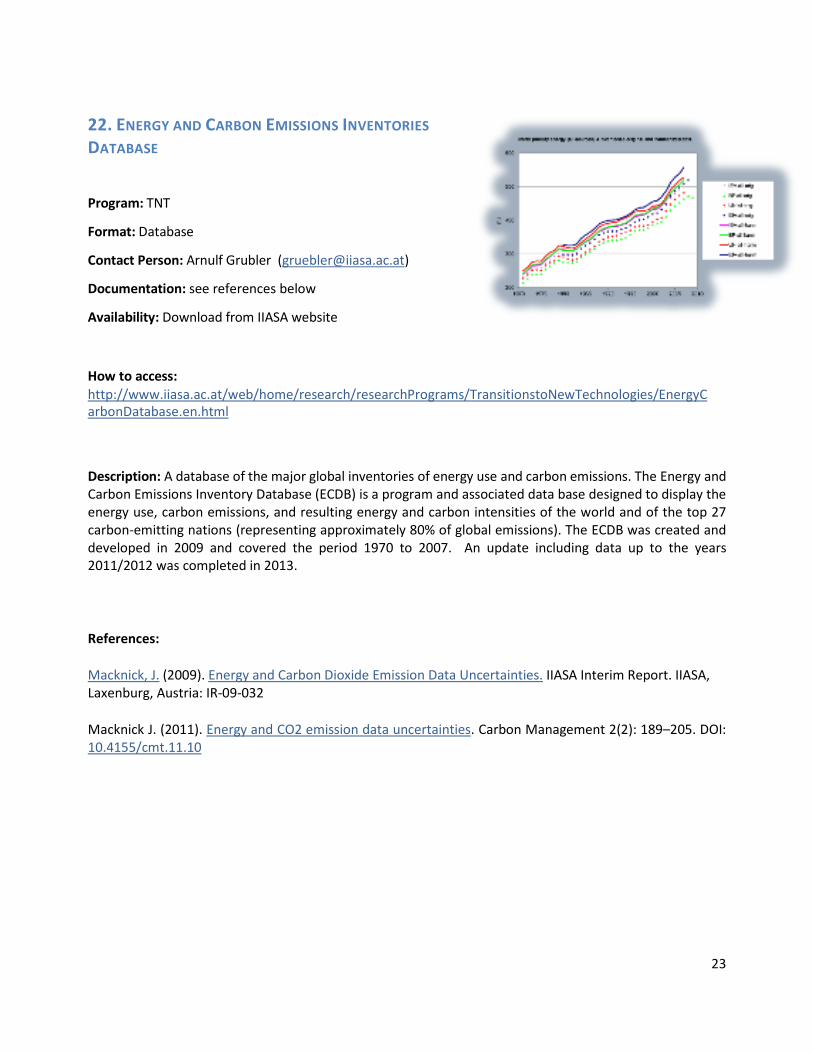
22. ENERGY AND CARBON EMISSIONS INVENTORIES DATABASE Program: TNT
Format: Database
Contact Person: Arnulf Grubler ([email protected])
Documentation: see references below
Availability: Download from IIASA website
How to access: http://www.iiasa.ac.at/web/home/research/researchPrograms/TransitionstoNewTechnologies/EnergyC arbonDatabase.en.html
Description: A database of the major global inventories of energy use and carbon emissions. The Energy and Carbon Emissions Inventory Database (ECDB) is a program and associated data base designed to display the energy use, carbon emissions, and resulting energy and carbon intensities of the world and of the top 27 carbon-emitting nations (representing approximately 80% of global emissions). The ECDB was created and developed in 2009 and covered the period 1970 to 2007. An update including data up to the years 2011/2012 was completed in 2013.
References:
Macknick, J. (2009). Energy and Carbon Dioxide Emission Data Uncertainties. IIASA Interim Report. IIASA, Laxenburg, Austria: IR-09-032
Macknick J. (2011). Energy and CO2 emission data uncertainties. Carbon Management 2(2): 189–205. DOI: 10.4155/cmt.11.10

24
23. THE LANDFLOW MODEL Program: WAT
Format: Model and global database
Contact Person: Guenther Fischer ([email protected]) Documentation: No
Availability: get in touch with contact person
Description: A model that traces land and water use embodied in production, trade and consumption of agricultural commodities. LANDFLOW is a powerful tool for estimating how many hectares of land are directly or indirectly associated with different consumption patterns. A first version was developed during the project, "Modeling Opportunities and Limits for Restructuring Europe towards Sustainability" (MOSUS) to trace embedded land in agriculture and forest sector commodities. LANDFLOW traces commodity flows from primary production, via intermediate products and trade, to final use. LANDFLOW generates a database for 1990 to 2009, which provides a detailed account of the agricultural and forestry products produced and traded by individual countries. The agricultural products included in the database are: crops, livestock, and fisheries, both primary and processed products; forestry commodities including primary roundwood, manufactured wood, and wood products, pulp and paper (but excluding some secondary manufactured products like furniture). References: Cuypers D, Geerken T, Gorissen L, Lust A, Peters G, Karstensen J, Prieler S, Fischer G, et al. (2013). The impact of EU consumption on deforestation: Comprehensive analysis of the impact of EU consumption on deforestation. European Commission, DG ENV Devriendt N, Lust A, Lemeire C, Cuypers D, Prieler S, Fischer G, Hizsnyik E, De Smet L, et al. (2013). The impact of EU consumption on deforestation: Proposal of specific Community policy, legislative measures and other initiatives for further consideration by the Commission. European Commission, DG ENV Devriendt N, Lust A, Lemeire C, Cuypers D, Prieler S, Fischer G, Hizsnyik E, de Smet L, et al. (2013). The impact of EU consumption on deforestation: dentification of critical areas where Community policies and legislation could be reviewed. European Commission, DG ENV Related projects: The impact of EU consumption on deforestation

25
24. HARMONIZED WORLD SOIL DATABASE (HWSD V 1.21)
Program: WAT
Format: Database and Viewer
Contact Person: Harrij van Velthuizen ([email protected])
Documentation: PDF-Manual
Availability: Download from IIASA website
How to access: http://www.iiasa.ac.at/Research/LUC/External-World-soil-database/HTML/
Description: First released in July 2008 and last updated in 2013, HWSD is a global soil database established jointly by IIASA and FAO in partnership with ISRIC-World Soil Information, the European Soil Bureau Network and the Institute of Soil Science, Chinese Academy of Sciences. The HWSD is framed within a Geographic Information System (GIS) and contains up-to-date information on world soil resources. The HWSD constitutes significant improvements for about 60% of the land area in comparison with the FAO/UNESCO Soil Map of the World. Further expansion and update of the HWSD is foreseen to include the soil information available in the USA, Canada, Australia, India, Pakistan, and a number of West African countries. References: Batjes NH, Fischer G, Nachtergaele FO, Stolbovoi V, & van Velthuizen HT (1997). Soil Data Derived from WISE for Use in Global and Regional AEZ Studies (Version 1.0). IIASA Interim Report. IIASA, Laxenburg, Austria: IR-97-025 Nachtergaele FO, van Velthuizen HT, & Verelst L (2009). Harmonized World Soil Database. FAO, Rome, Italy, and IIASA, Laxenburg, Austria

26
25. GLOBAL AGRO-ECOLOGICAL ZONES (GAEZ) Program: WAT
Format: Data Portal
Contact Person: Guenther Fischer ([email protected])
Documentation: PDF-Manual
Availability: Link to IIASA website
How to access: http://webarchive.iiasa.ac.at/Research/LUC/GAEZv3.0/
Description: Global Agro-Ecological Zoning (GAEZ) provides comprehensive information for rational land use planning and decision making for food security and agricultural development on the basis of an inventory of land and water resources and evaluation of the biophysical limitations and production potentials of land. It follows an environmental approach, providing a standardized framework for the characterization of climate, soil, and terrain conditions for analyzing synergies and trade-offs of alternative uses of agro-resources (land, water, technology) for food and energy production, while preserving environmental quality. References: Fischer G, Nachtergaele FO, Prieler S, Teixeira E, Toth G, van Velthuizen H, Verelst L, & Wiberg D (2012). Global Agro-ecological Zones (GAEZ v3.0)- Model Documentation. IIASA, Laxenburg, Austria and FAO, Rome, Italy. , Laxenburg, Austria; Rome, Italy. Fischer G, Shah MM, & van Velthuizen HT (2002). Climate Change and Agricultural Vulnerability. IIASA, Laxenburg, Austria