Embed Size (px)
Citation preview
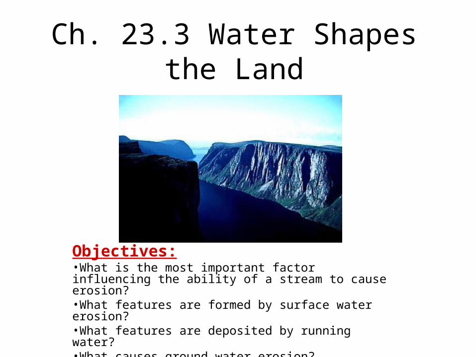
Ch. 23.3 Water Shapes the Land
Objectives:•What is the most important factor influencing the ability of a stream to cause erosion?•What features are formed by surface water erosion?•What features are deposited by running water?•What causes ground water erosion?
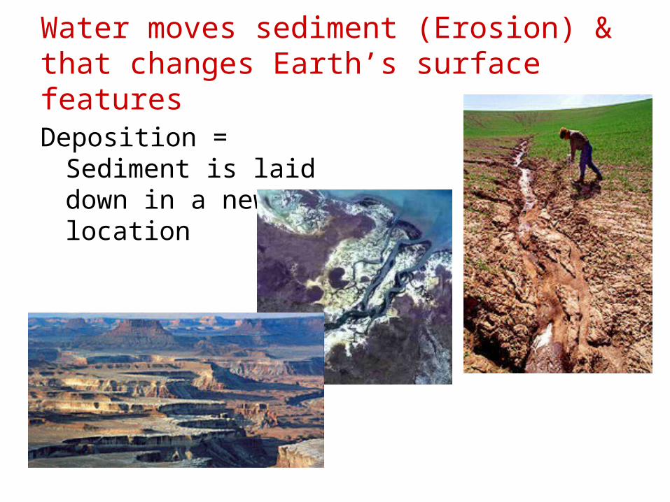
Water moves sediment (Erosion) & that changes Earth’s surface features
Deposition = Sediment is laid down in a new location
Stream Erosion – Depends on…(1) Speed of water: Faster streams – carry more
sediment & carry larger sediments = more erosion
(2) Volume: Floods = More water = more erosion(3) Slope: Steeper slope = more erosion.
Features formed by water erosion:
V shaped Valleys
Waterfalls
Meanders
Oxbow Lakeshttp://www.youtube.com/watch?v=ednXhLcwZz0
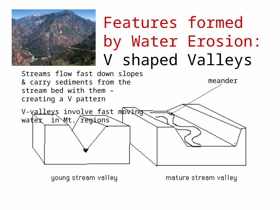
Features formed by Water Erosion:V shaped Valleys
meanderStreams flow fast down slopes & carry sediments from the stream bed with them – creating a V pattern
V-valleys involve fast moving water in Mt. regions
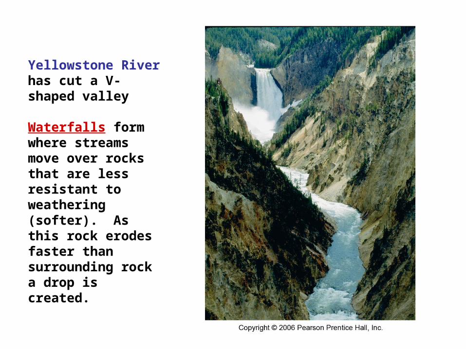
Yellowstone River has cut a V-shaped valley
Waterfalls form where streams move over rocks that are less resistant to weathering (softer). As this rock erodes faster than surrounding rock a drop is created.
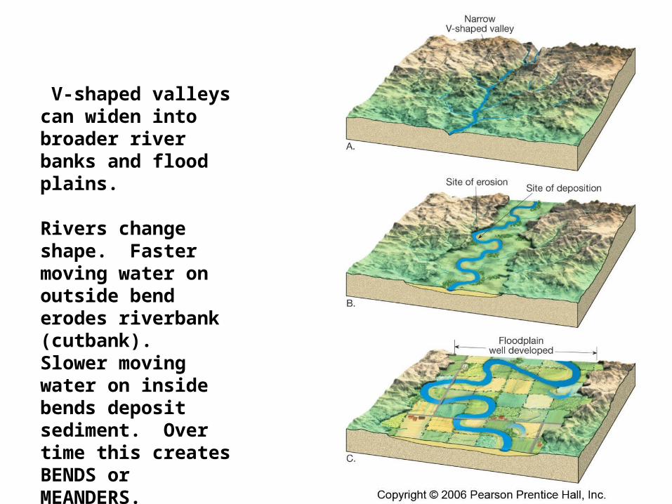
V-shaped valleys can widen into broader river banks and flood plains.
Rivers change shape. Faster moving water on outside bend erodes riverbank (cutbank). Slower moving water on inside bends deposit sediment. Over time this creates BENDS or MEANDERS.
Flooding in a flood plain
Meandering river processes

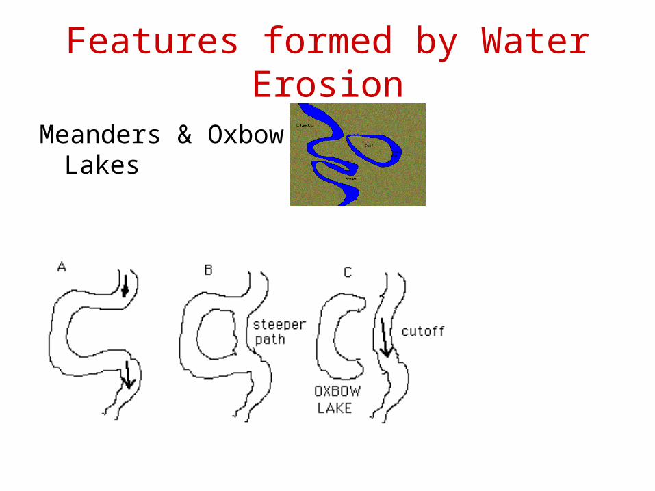
Features formed by Water Erosion
Meanders & Oxbow Lakes
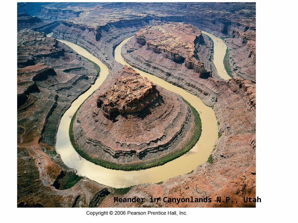
Meander in Canyonlands N.P., Utah
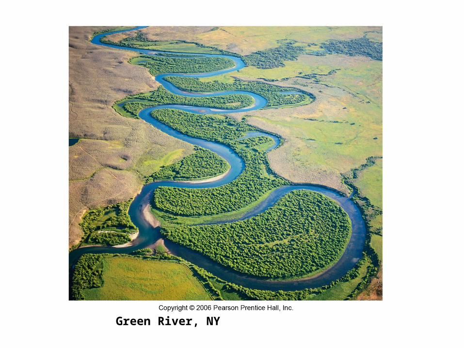
Green River, NY
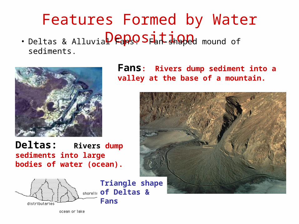
Features Formed by Water Deposition• Deltas & Alluvial Fans: Fan-shaped mound of sediments.
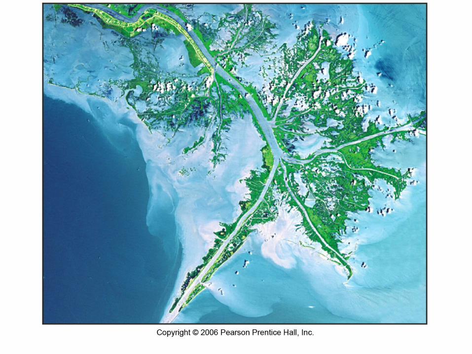
Deltas: Rivers dump sediments into large bodies of water (ocean).
Fans: Rivers dump sediment into a valley at the base of a mountain.
Triangle shape of Deltas & Fans
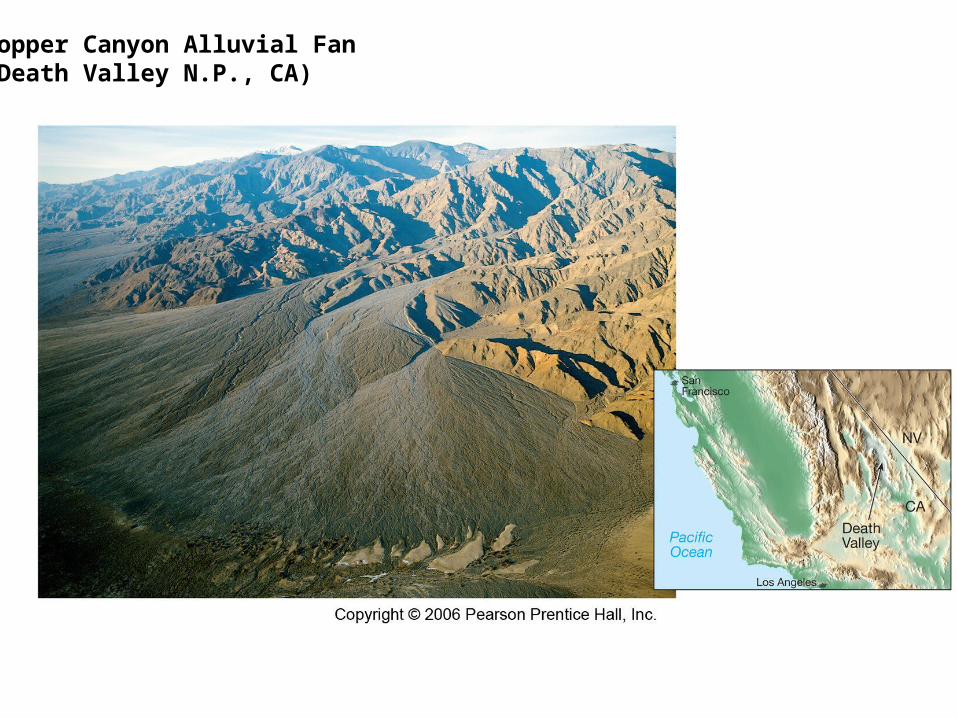
Copper Canyon Alluvial Fan(Death Valley N.P., CA)
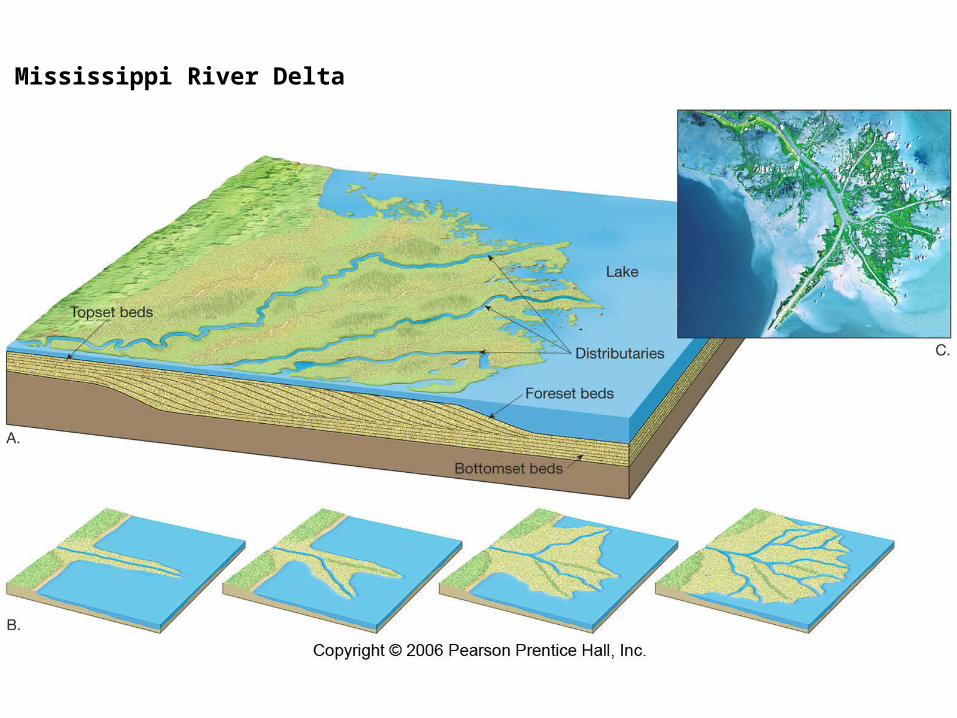
Mississippi River Delta
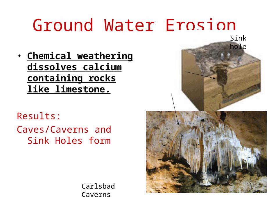
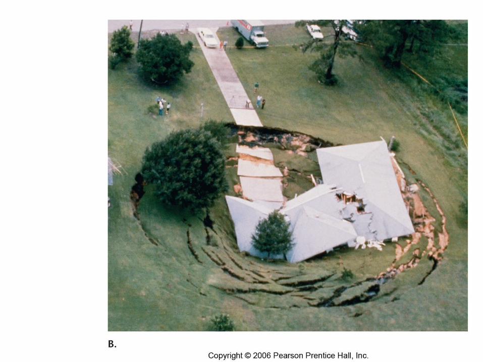
Ground Water Erosion
• Chemical weathering dissolves calcium containing rocks like limestone.
Results:
Caves/Caverns and Sink Holes form
Carlsbad Caverns
Sink hole
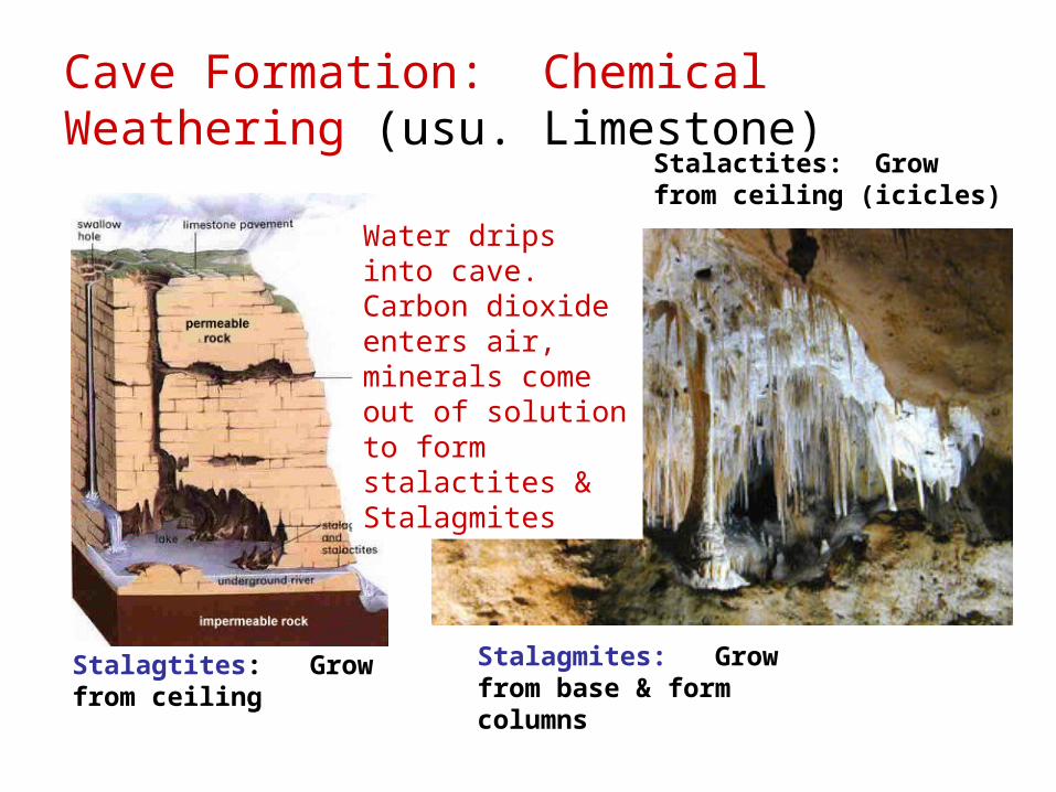
Cave Formation: Chemical Weathering (usu. Limestone)
Stalactites: Grow from ceiling (icicles)
Stalagmites: Grow from base & form columns
Water drips into cave. Carbon dioxide enters air, minerals come out of solution to form stalactites & Stalagmites
Stalagtites: Grow from ceiling
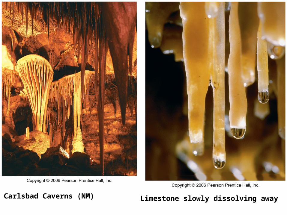
Carlsbad Caverns (NM) Limestone slowly dissolving away
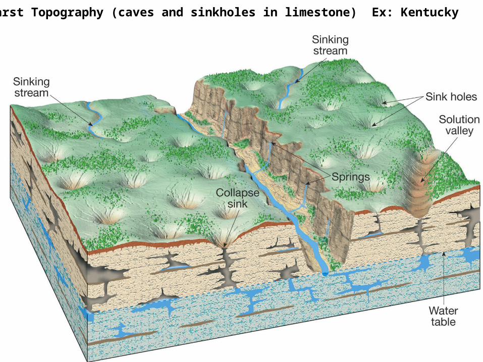
Karst Topography (caves and sinkholes in limestone) Ex: Kentucky
Ch. 23.4 Glaciers & Wind
Objectives:
How do glaciers form?
What landscape features are created by glacial erosion & deposition?
What are the effects of wind erosion & deposition
HW QUIZ
1. Describe 2 features/landforms created by glacial erosion.
2. What’s “Moraine” and how is it created?
1. How are dunes created?
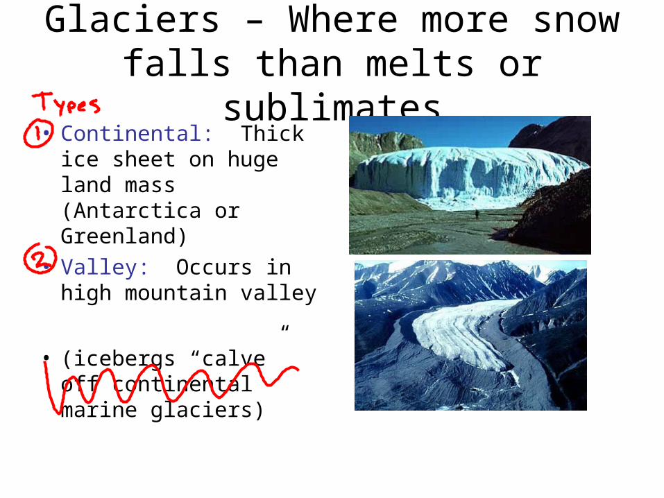
Glaciers – Where more snow falls than melts or sublimates
• Continental: Thick ice sheet on huge land mass (Antarctica or Greenland)
• Valley: Occurs in high mountain valley
• (icebergs “calve” off continental marine glaciers)
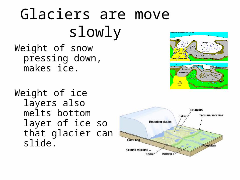
Glaciers are move slowly
Weight of snow pressing down, makes ice.
Weight of ice layers also melts bottom layer of ice so that glacier can slide.
Glacial Erosion1. Abrasion – boulders trapped under glaciers
gouge and scratch our land and rock surfaces (Glacial striations = claw marks)
2. Plucking – frost wedging that occurs at the base of the glacier breaks up rock.
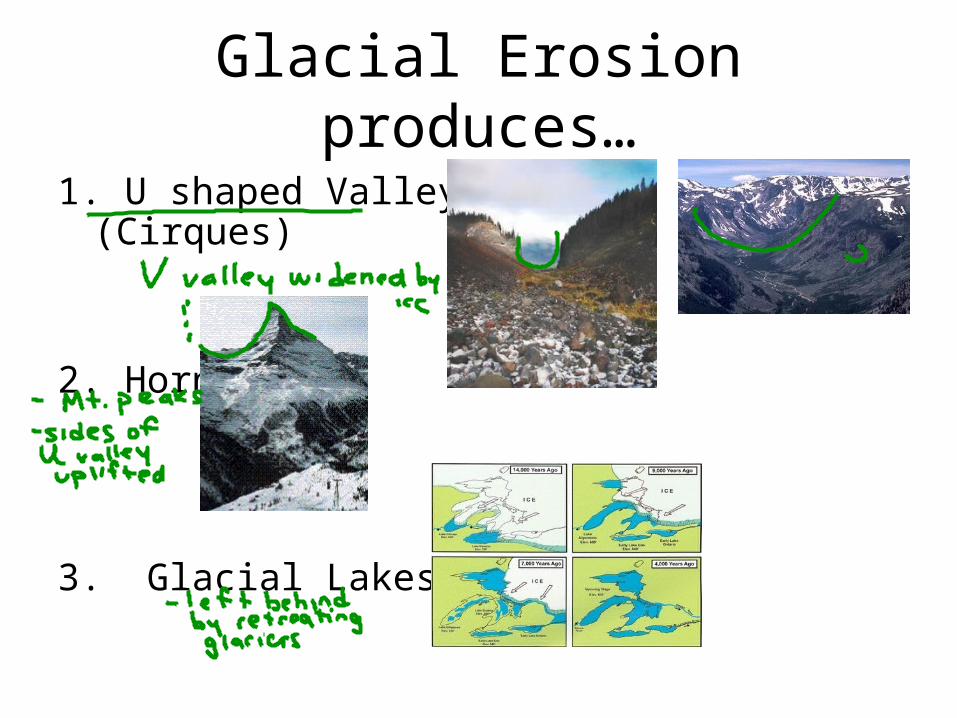
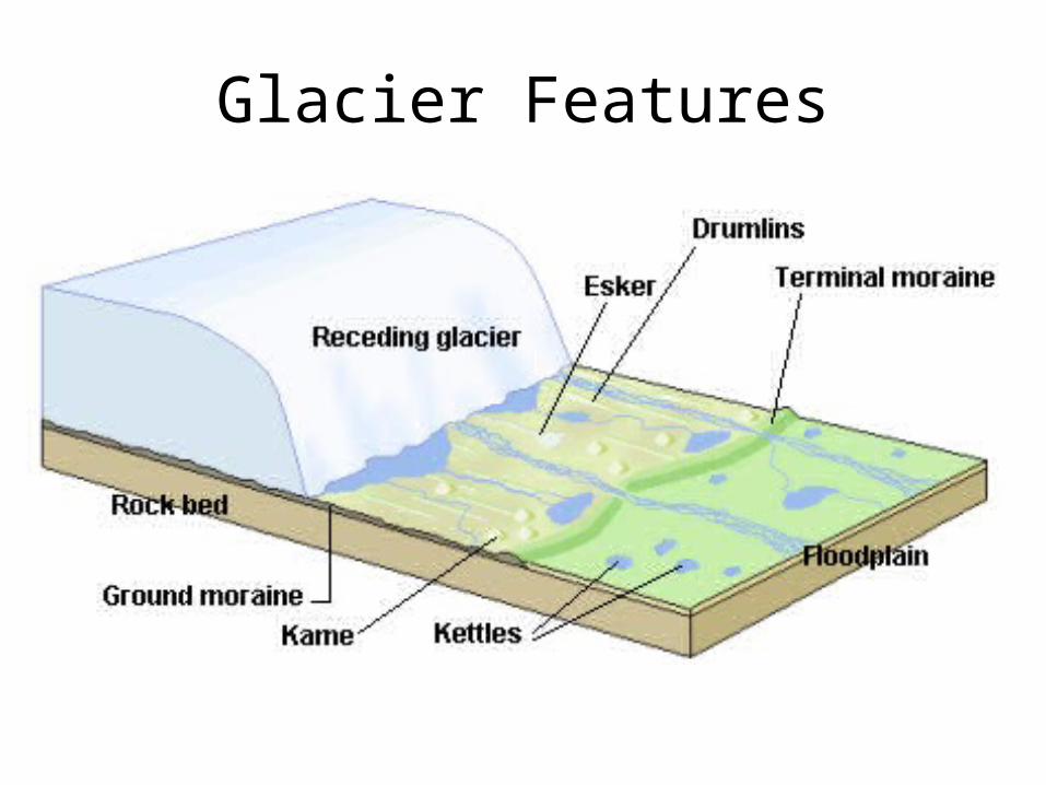
Glacial Erosion produces…
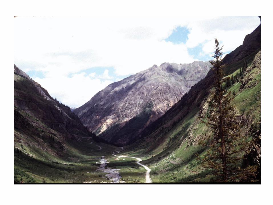
1. U shaped Valley (Cirques)
2. Horns
3. Glacial Lakes
Glacial Signatures…
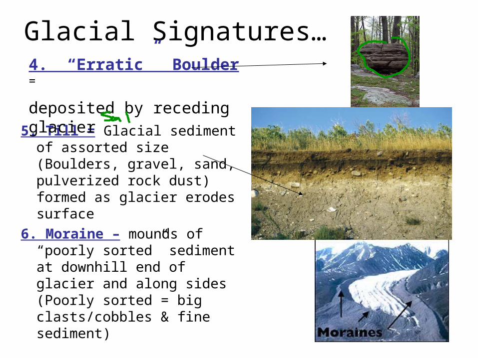
5. Till = Glacial sediment of assorted size (Boulders, gravel, sand, pulverized rock dust) formed as glacier erodes surface
6. Moraine – mounds of “poorly sorted” sediment at downhill end of glacier and along sides (Poorly sorted = big clasts/cobbles & fine sediment)
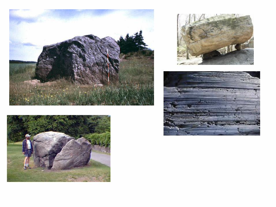
4. “Erratic” Boulder =
deposited by receding glacier
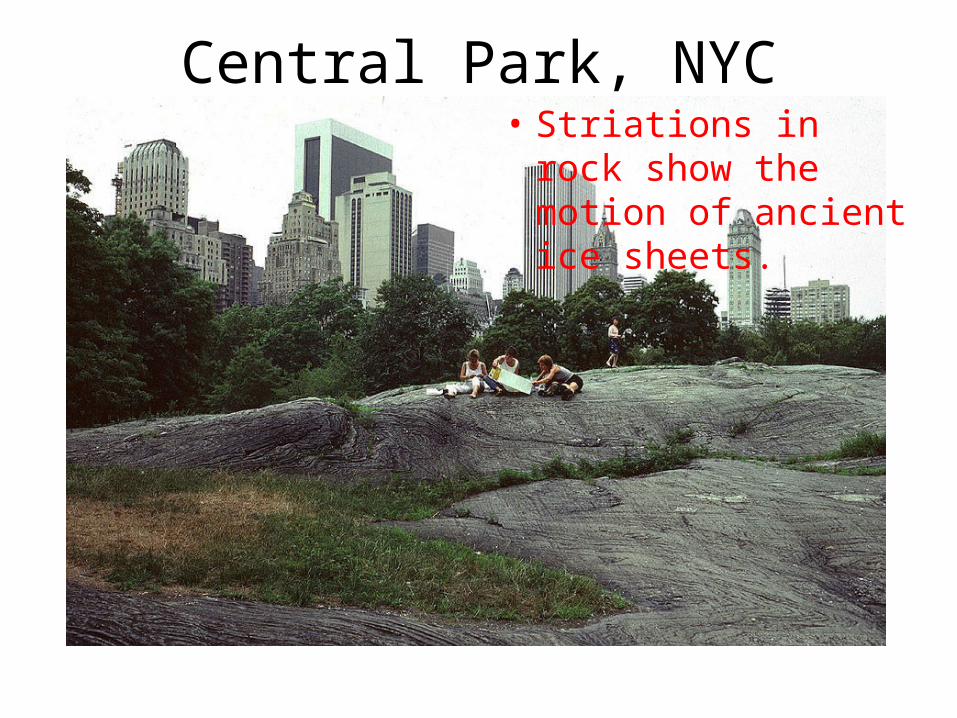
Central Park, NYC• Striations in rock
show the motion of ancient ice sheets.
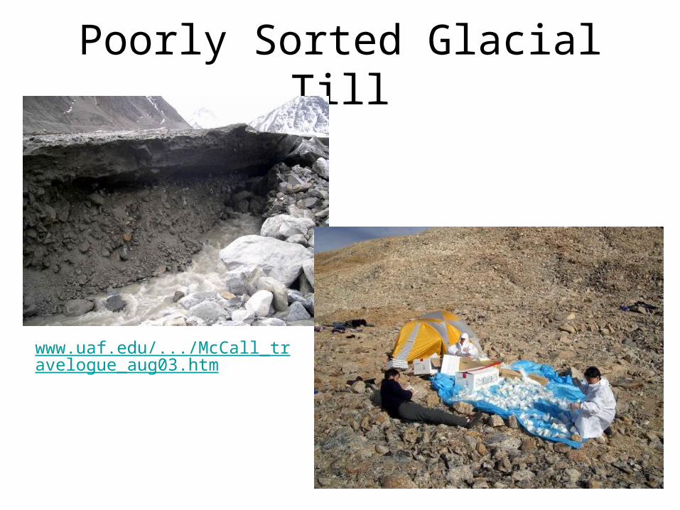
Poorly Sorted Glacial Till
www.uaf.edu/.../McCall_travelogue_aug03.htm
Glacier Features
Glaciation in our Area
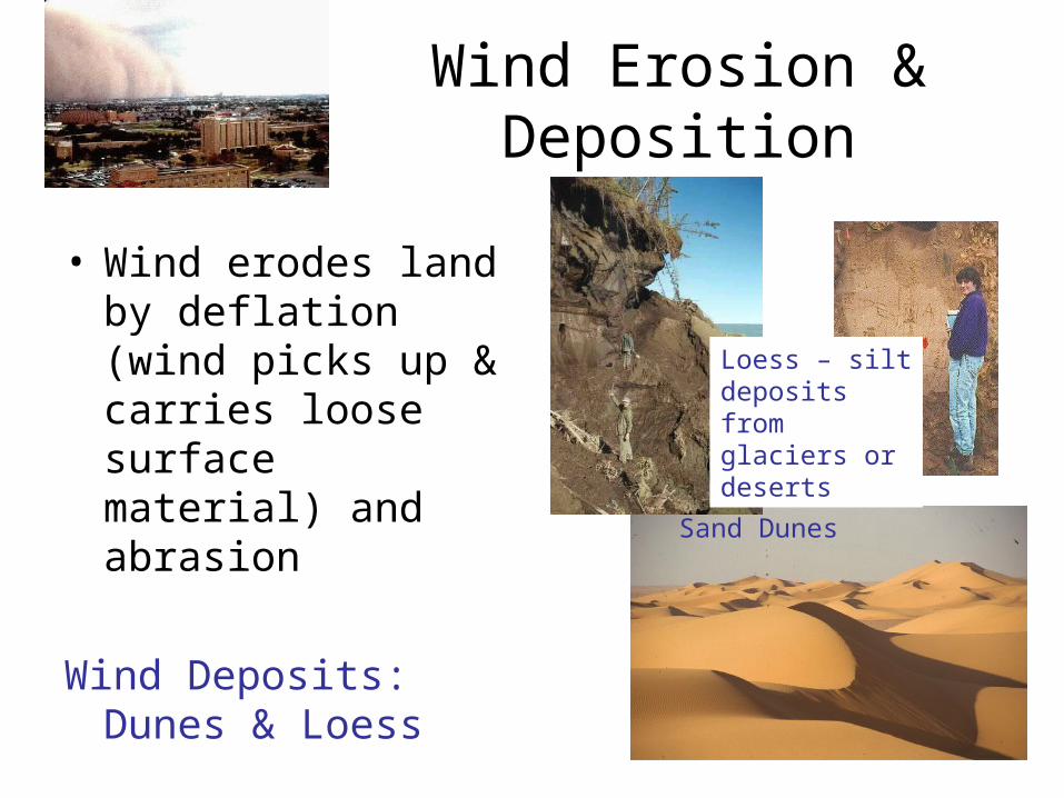
Wind Erosion & Deposition
• Wind erodes land by deflation (wind picks up & carries loose surface material) and abrasion
Wind Deposits: Dunes & Loess
Sand Dunes
Loess – silt deposits from glaciers or deserts