Embed Size (px)
Citation preview

CHANCERY LANE
CONSERVATION AREA CHARACTER SUMMARY
Department of Planning & Transportation
Fro
nt C
over
Pic
ture
: Sou
th a
long
Cha
ncer
y La
ne to
Pub
lic R
ecor
d O
ffice
Opp
osite
: Mon
umen
t to
Dr.
John
You
ng
GU
ILD
HA
LL L
IBR
AR
Y
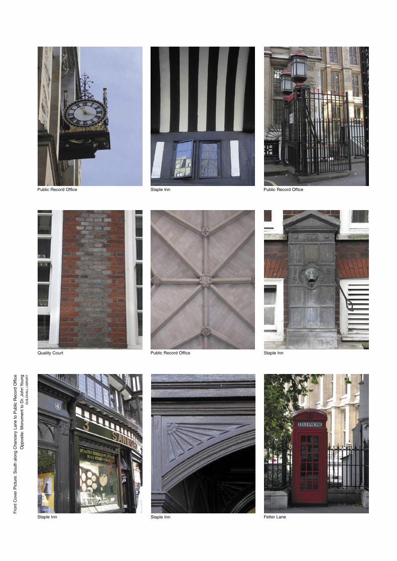
Public Record OfficeStaple InnPublic Record Office
Staple InnPublic Record OfficeQuality Court
Fetter LaneStaple InnStaple Inn
1
Chancery LaneConservation Area Character Summary
This conservation area summary of character identifies key characteristics of the area and particular planning considerations.
In the City of London the present urban form and character has evolved through many centuries and is the product of numerous influences and interventions: the character and sense of place is hence unique to that area, contributing at the same time to the wider character of the City. It is inevitable that the present knowledge and information is incomplete, and in the interests of brevity only the principal characteristics of the area are identified here. A more comprehensive appreciation of history and character of the City of London and the nature of conservation area character (with particular reference to the City) are addressed in Conservation Areas in the City of London, A General Introduction to their Character.
Each conservation area character summary should be read in conjunction with the General Introduction to enable a potential appreciation of any matters of possible importance in relation to any building, site, street or area. The role of such elements in the character and appearance of any area within the City of London will vary, and will be appraised in the light of particular proposals for alteration, extension or development. It is prepared in the light of national legislation, policy and advice provided in particular by the Planning (Listed Buildings and Conservation Areas) Act 1990 and PPG 15 Planning and the Historic Environment 1994, and planning policies for the City of London contained in the City of London Unitary Development Plan 2002.
0 200m 400m
O.S. 1999Chancery Lane Conservation Area
© C
orpo
ratio
n of
Lon
don
2004
ISB
N 0
852
03 0
56 8
2
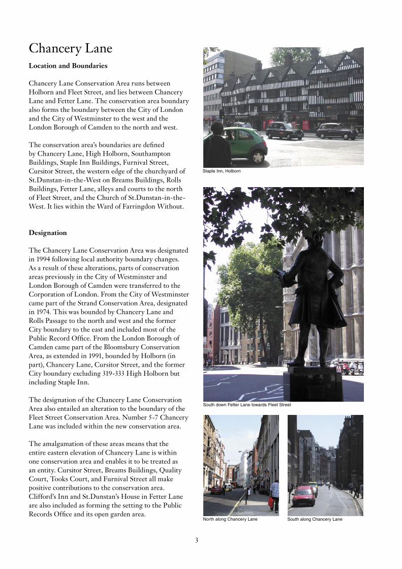
South down Fetter Lane towards Fleet Street
Staple Inn, Holborn
North along Chancery Lane South along Chancery Lane
3
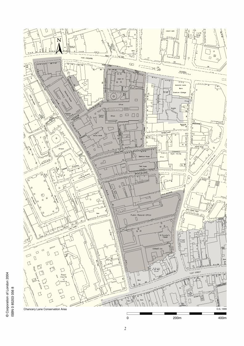
Chancery LaneLocation and Boundaries
Chancery Lane Conservation Area runs between Holborn and Fleet Street, and lies between Chancery Lane and Fetter Lane. The conservation area boundary also forms the boundary between the City of London and the City of Westminster to the west and the London Borough of Camden to the north and west.
The conservation area’s boundaries are defined by Chancery Lane, High Holborn, Southampton Buildings, Staple Inn Buildings, Furnival Street, Cursitor Street, the western edge of the churchyard of St.Dunstan-in-the-West on Breams Buildings, Rolls Buildings, Fetter Lane, alleys and courts to the north of Fleet Street, and the Church of St.Dunstan-in-the-West. It lies within the Ward of Farringdon Without.
Designation
The Chancery Lane Conservation Area was designated in 1994 following local authority boundary changes. As a result of these alterations, parts of conservation areas previously in the City of Westminster and London Borough of Camden were transferred to the Corporation of London. From the City of Westminster came part of the Strand Conservation Area, designated in 1974. This was bounded by Chancery Lane and Rolls Passage to the north and west and the former City boundary to the east and included most of the Public Record Office. From the London Borough of Camden came part of the Bloomsbury Conservation Area, as extended in 1991, bounded by Holborn (in part), Chancery Lane, Cursitor Street, and the former City boundary excluding 319-333 High Holborn but including Staple Inn.
The designation of the Chancery Lane Conservation Area also entailed an alteration to the boundary of the Fleet Street Conservation Area. Number 5-7 Chancery Lane was included within the new conservation area.
The amalgamation of these areas means that the entire eastern elevation of Chancery Lane is within one conservation area and enables it to be treated as an entity. Cursitor Street, Breams Buildings, Quality Court, Tooks Court, and Furnival Street all make positive contributions to the conservation area. Clifford’s Inn and St.Dunstan’s House in Fetter Lane are also included as forming the setting to the Public Records Office and its open garden area.
4
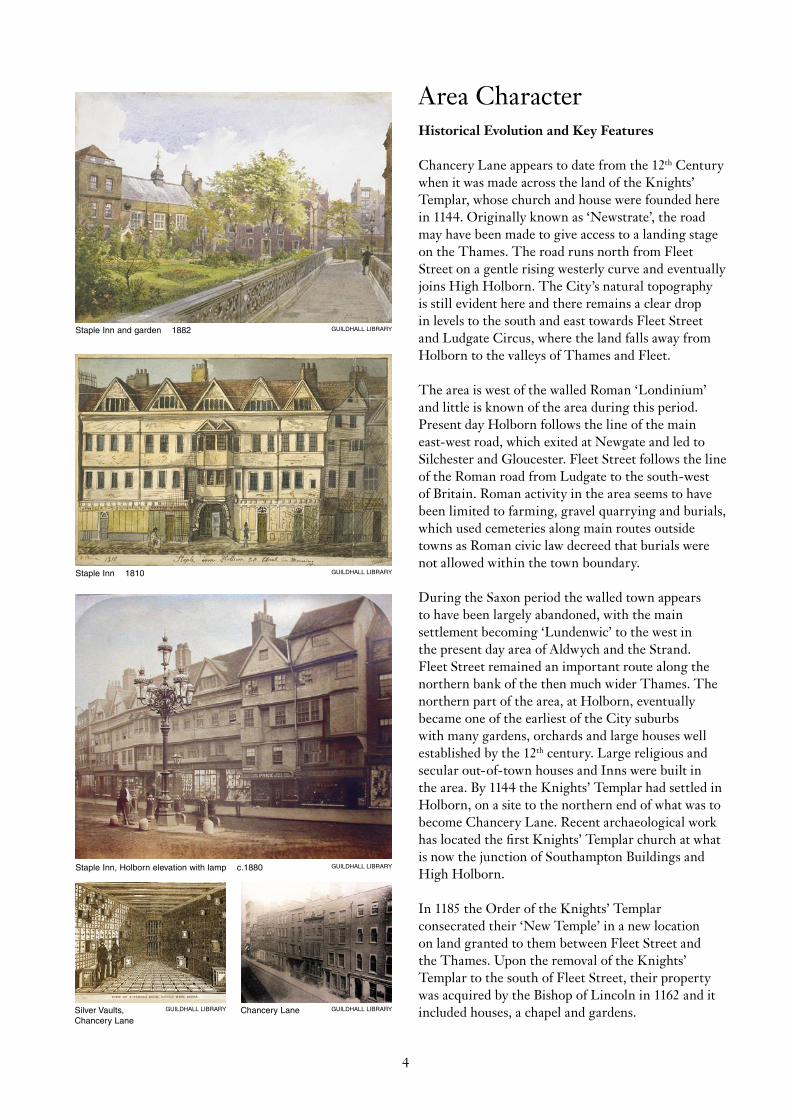
Staple Inn and garden 1882 GUILDHALL LIBRARY
Silver Vaults,Chancery Lane
GUILDHALL LIBRARY
Staple Inn 1810 GUILDHALL LIBRARY
Staple Inn, Holborn elevation with lamp c.1880 GUILDHALL LIBRARY
Chancery Lane GUILDHALL LIBRARY
Area Character Historical Evolution and Key Features
Chancery Lane appears to date from the 12th Century when it was made across the land of the Knights’ Templar, whose church and house were founded here in 1144. Originally known as ‘Newstrate’, the road may have been made to give access to a landing stage on the Thames. The road runs north from Fleet Street on a gentle rising westerly curve and eventually joins High Holborn. The City’s natural topography is still evident here and there remains a clear drop in levels to the south and east towards Fleet Street and Ludgate Circus, where the land falls away from Holborn to the valleys of Thames and Fleet.
The area is west of the walled Roman ‘Londinium’ and little is known of the area during this period. Present day Holborn follows the line of the main east-west road, which exited at Newgate and led to Silchester and Gloucester. Fleet Street follows the line of the Roman road from Ludgate to the south-west of Britain. Roman activity in the area seems to have been limited to farming, gravel quarrying and burials, which used cemeteries along main routes outside towns as Roman civic law decreed that burials were not allowed within the town boundary.
During the Saxon period the walled town appears to have been largely abandoned, with the main settlement becoming ‘Lundenwic’ to the west in the present day area of Aldwych and the Strand. Fleet Street remained an important route along the northern bank of the then much wider Thames. The northern part of the area, at Holborn, eventually became one of the earliest of the City suburbs with many gardens, orchards and large houses well established by the 12th century. Large religious and secular out-of-town houses and Inns were built in the area. By 1144 the Knights’ Templar had settled in Holborn, on a site to the northern end of what was to become Chancery Lane. Recent archaeological work has located the first Knights’ Templar church at what is now the junction of Southampton Buildings and High Holborn.
In 1185 the Order of the Knights’ Templar consecrated their ‘New Temple’ in a new location on land granted to them between Fleet Street and the Thames. Upon the removal of the Knights’ Templar to the south of Fleet Street, their property was acquired by the Bishop of Lincoln in 1162 and it included houses, a chapel and gardens.
5
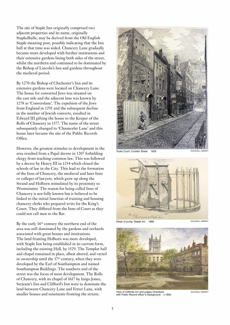
Tooks Court, Cursitor Street 1929 GUILDHALL LIBRARY
Detail of pump, Staple Inn 1880 GUILDHALL LIBRARY
View of Cliffords Inn and judges Chambers with Public Record office in background c.1850
GUILDHALL LIBRARY
The site of Staple Inn originally comprised two adjacent properties and its name, originally Stapledhalle, may be derived from the Old English Staple meaning post, possibly indicating that the Inn hall at that time was aisled. Chancery Lane gradually became more developed with further institutions and their extensive gardens lining both sides of the street, whilst the northern end continued to be dominated by the Bishop of Lincoln’s Inn and gardens throughout the medieval period.
By 1270 the Bishop of Chichester’s Inn and its extensive gardens were located on Chancery Lane. The house for converted Jews was situated on the east side and the adjacent lane was known by 1278 as ‘Converslane’. The expulsion of the Jews from England in 1291 and the subsequent decline in the number of Jewish converts, resulted in Edward III gifting the house to the Keeper of the Rolls of Chancery in 1377. The name of the street subsequently changed to ‘Chaunceler Lane’ and this house later became the site of the Public Records Office.
However, the greatest stimulus to development in the area resulted from a Papal decree in 1207 forbidding clergy from teaching common law. This was followed by a decree by Henry III in 1234 which closed the schools of law in the City. This lead to the formation of the Inns of Chancery, the medieval and later Inns or colleges of lawyers, which grew up along the Strand and Holborn stimulated by its proximity to Westminster. The reason for being called Inns of Chancery is not fully known but is believed to be linked to the initial function of training and housing chancery clerks who prepared writs for the King’s Court. They differed from the Inns of Court as they could not call men to the Bar.
By the early 16th century the northern end of the area was still dominated by the gardens and orchards associated with great houses and institutions. The land fronting Holborn was more developed, with Staple Inn being established in its current form, including the existing Hall, by 1529. The Templar hall and chapel remained in place, albeit altered, and varied in ownership until the 17th century, when they were developed by the Earl of Southampton and named Southampton Buildings. The southern end of the street was the focus of most development. The Rolls of Chancery, with its chapel of 1617 by Inigo Jones, Serjeant’s Inn and Clifford’s Inn were to dominate the land between Chancery Lane and Fetter Lane, with smaller houses and tenements fronting the streets.
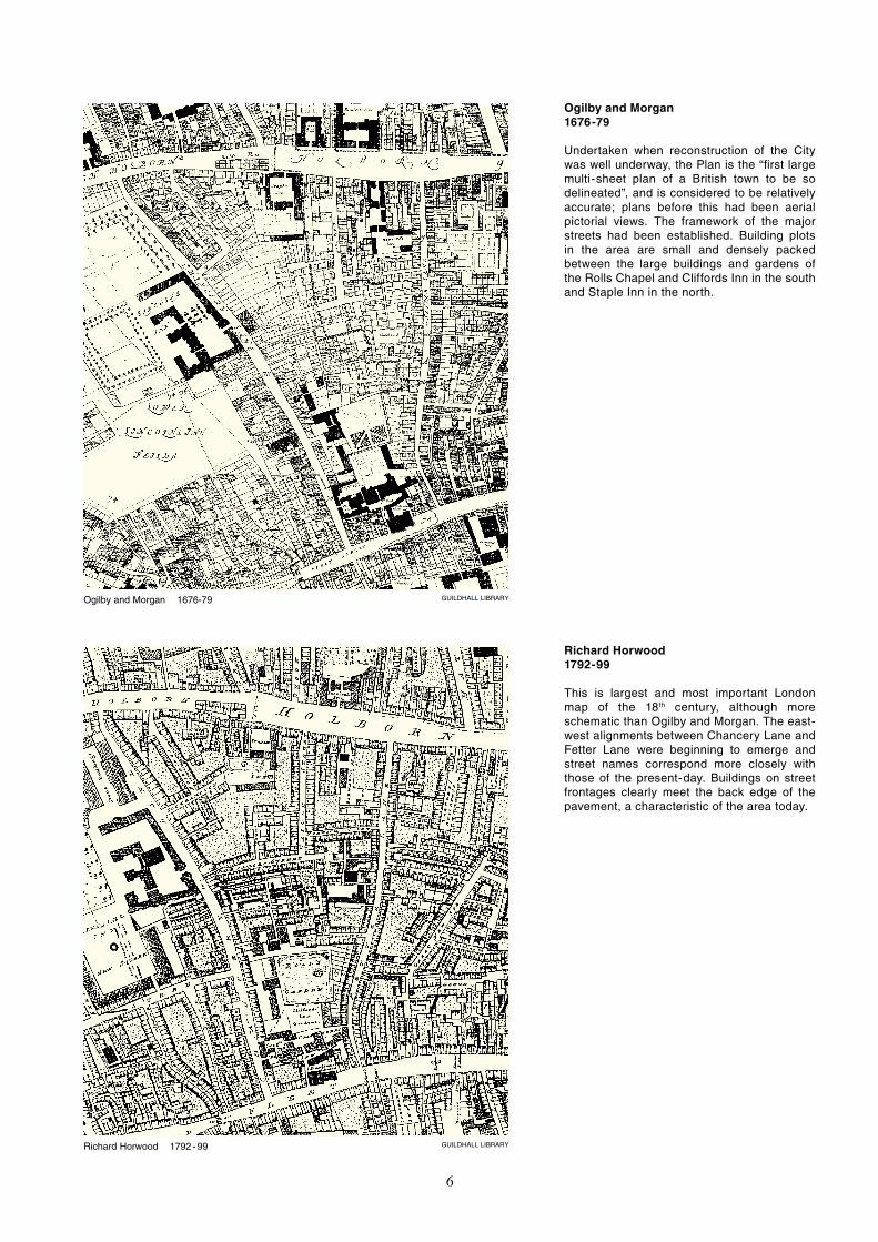
GUILDHALL LIBRARYOgilby and Morgan 1676-79
GUILDHALL LIBRARYRichard Horwood 1792 - 99
6
Ogilby and Morgan 1676-79
Undertaken when reconstruction of the City was well underway, the Plan is the “first large multi-sheet plan of a British town to be so delineated”, and is considered to be relatively accurate; plans before this had been aerial pictorial views. The framework of the major streets had been established. Building plots in the area are small and densely packed between the large buildings and gardens of the Rolls Chapel and Cliffords Inn in the south and Staple Inn in the north.
Richard Horwood 1792-99
This is largest and most important London map of the 18th century, although more schematic than Ogilby and Morgan. The east-west alignments between Chancery Lane and Fetter Lane were beginning to emerge and street names correspond more closely with those of the present-day. Buildings on street frontages clearly meet the back edge of the pavement, a characteristic of the area today.
GUILDHALL LIBRARYOrdnance Survey 1914
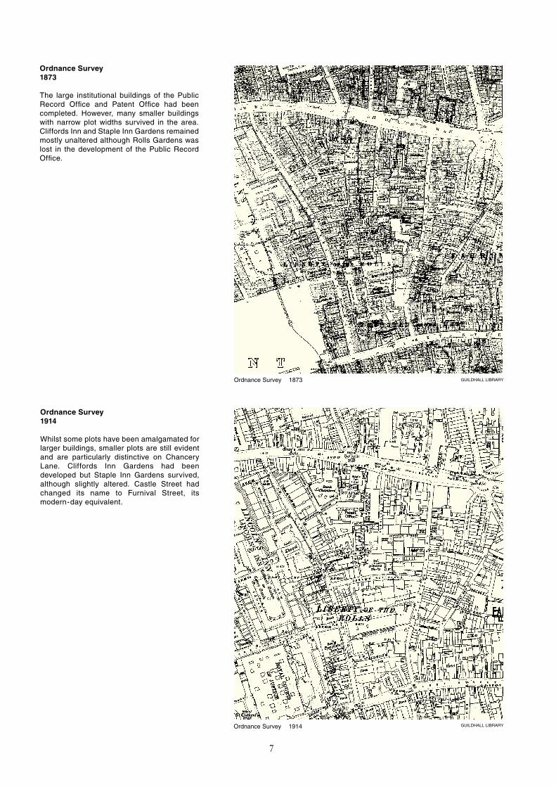
GUILDHALL LIBRARYOrdnance Survey 1873
7
Ordnance Survey1873
The large institutional buildings of the Public Record Office and Patent Office had been completed. However, many smaller buildings with narrow plot widths survived in the area. Cliffords Inn and Staple Inn Gardens remained mostly unaltered although Rolls Gardens was lost in the development of the Public Record Office.
Ordnance Survey1914
Whilst some plots have been amalgamated for larger buildings, smaller plots are still evident and are particularly distinctive on Chancery Lane. Cliffords Inn Gardens had been developed but Staple Inn Gardens survived, although slightly altered. Castle Street had changed its name to Furnival Street, its modern-day equivalent.
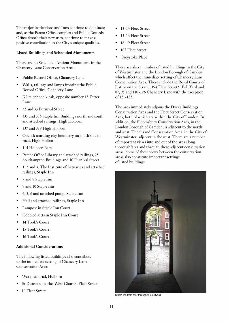
Silver Vaults, Chancery Lane GUILDHALL LIBRARY
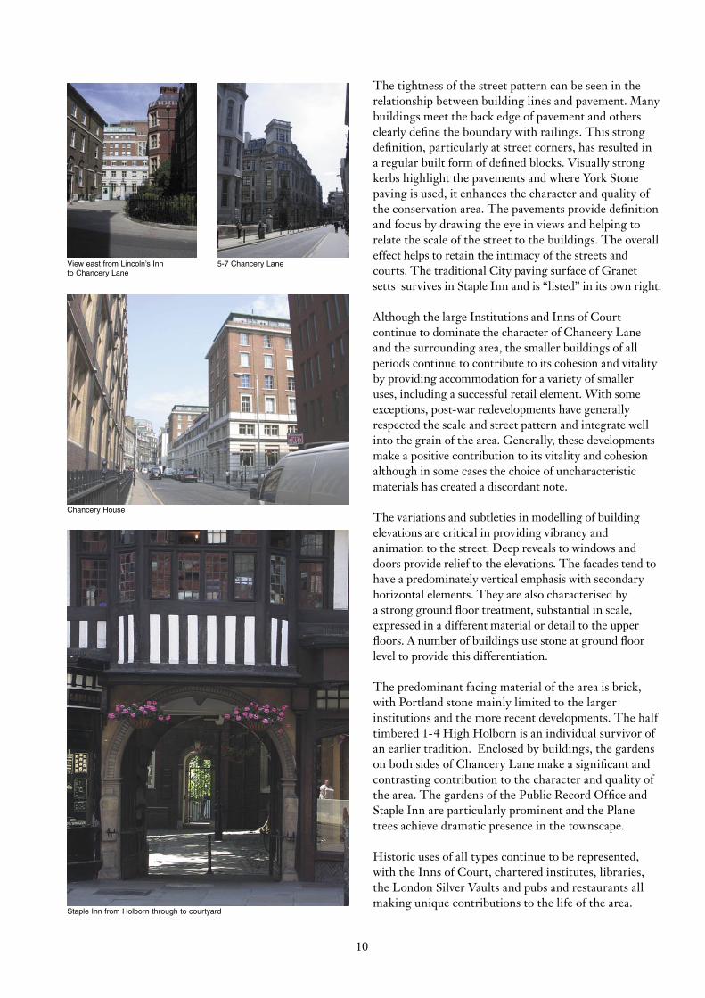
Public Record Office, ariel view GUILDHALL LIBRARY
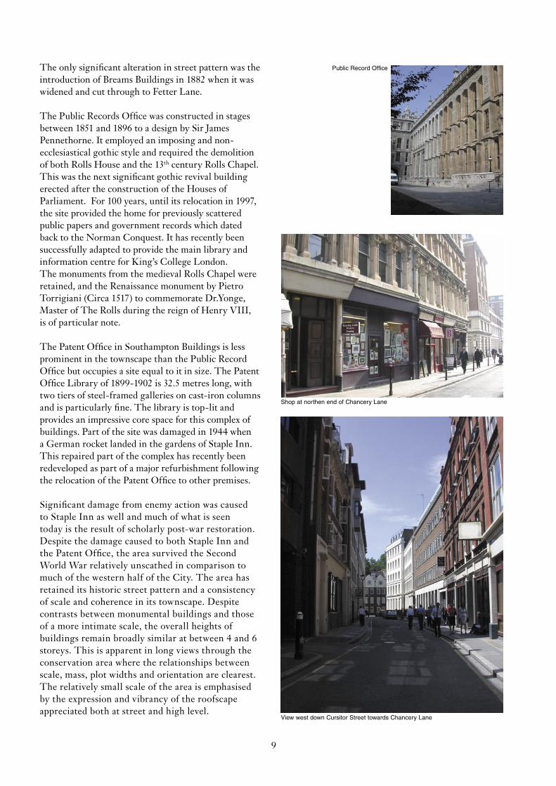
Rolls Chapel c1800 GUILDHALL LIBRARY
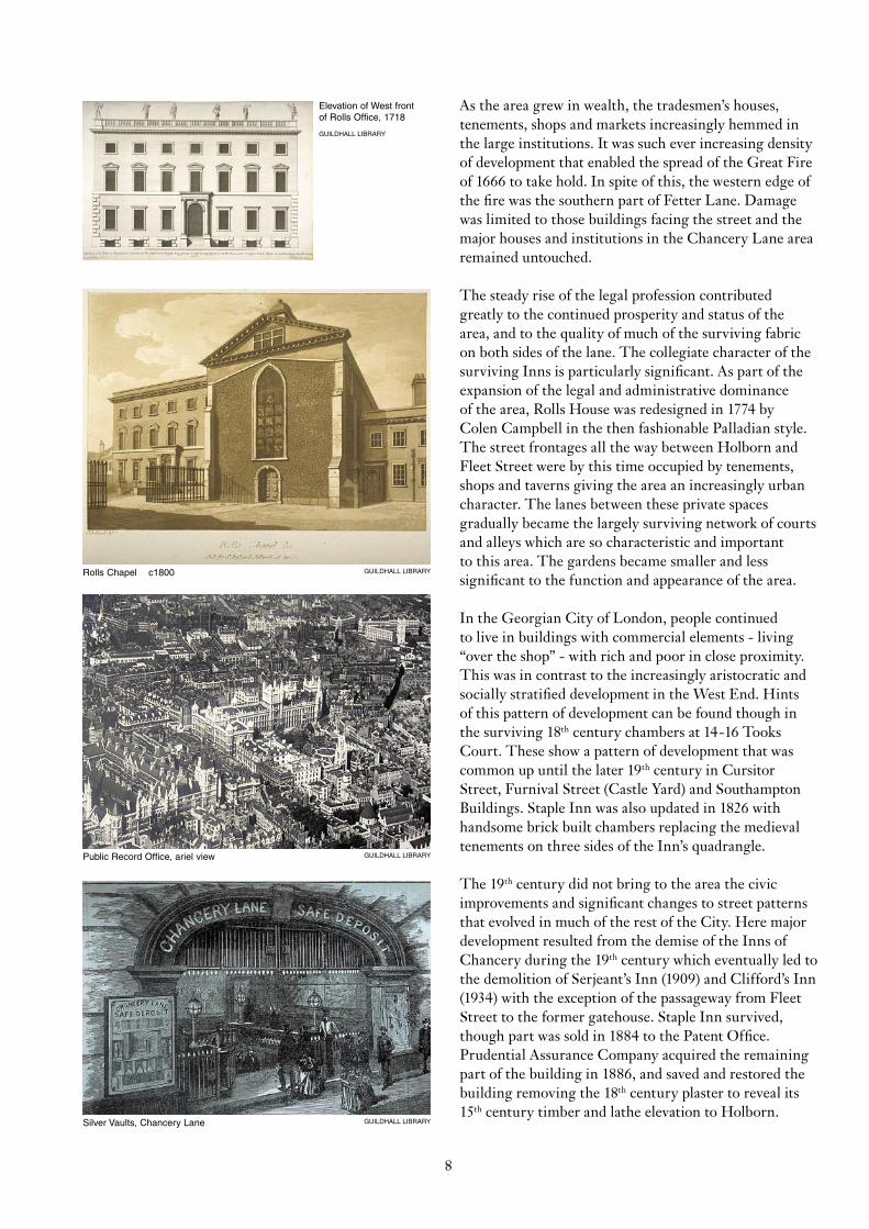
Elevation of West front of Rolls Office, 1718
GUILDHALL LIBRARY
8
As the area grew in wealth, the tradesmen’s houses, tenements, shops and markets increasingly hemmed in the large institutions. It was such ever increasing density of development that enabled the spread of the Great Fire of 1666 to take hold. In spite of this, the western edge of the fire was the southern part of Fetter Lane. Damage was limited to those buildings facing the street and the major houses and institutions in the Chancery Lane area remained untouched.
The steady rise of the legal profession contributed greatly to the continued prosperity and status of the area, and to the quality of much of the surviving fabric on both sides of the lane. The collegiate character of the surviving Inns is particularly significant. As part of the expansion of the legal and administrative dominance of the area, Rolls House was redesigned in 1774 by Colen Campbell in the then fashionable Palladian style. The street frontages all the way between Holborn and Fleet Street were by this time occupied by tenements, shops and taverns giving the area an increasingly urban character. The lanes between these private spaces gradually became the largely surviving network of courts and alleys which are so characteristic and important to this area. The gardens became smaller and less significant to the function and appearance of the area.
In the Georgian City of London, people continued to live in buildings with commercial elements - living “over the shop” - with rich and poor in close proximity. This was in contrast to the increasingly aristocratic and socially stratified development in the West End. Hints of this pattern of development can be found though in the surviving 18th century chambers at 14-16 Tooks Court. These show a pattern of development that was common up until the later 19th century in Cursitor Street, Furnival Street (Castle Yard) and Southampton Buildings. Staple Inn was also updated in 1826 with handsome brick built chambers replacing the medieval tenements on three sides of the Inn’s quadrangle.
The 19th century did not bring to the area the civic improvements and significant changes to street patterns that evolved in much of the rest of the City. Here major development resulted from the demise of the Inns of Chancery during the 19th century which eventually led to the demolition of Serjeant’s Inn (1909) and Clifford’s Inn (1934) with the exception of the passageway from Fleet Street to the former gatehouse. Staple Inn survived, though part was sold in 1884 to the Patent Office. Prudential Assurance Company acquired the remaining part of the building in 1886, and saved and restored the building removing the 18th century plaster to reveal its 15th century timber and lathe elevation to Holborn.
View west down Cursitor Street towards Chancery Lane
Shop at northen end of Chancery Lane
Public Record Office
9
The only significant alteration in street pattern was the introduction of Breams Buildings in 1882 when it was widened and cut through to Fetter Lane.
The Public Records Office was constructed in stages between 1851 and 1896 to a design by Sir James Pennethorne. It employed an imposing and non-ecclesiastical gothic style and required the demolition of both Rolls House and the 13th century Rolls Chapel. This was the next significant gothic revival building erected after the construction of the Houses of Parliament. For 100 years, until its relocation in 1997, the site provided the home for previously scattered public papers and government records which dated back to the Norman Conquest. It has recently been successfully adapted to provide the main library and information centre for King’s College London. The monuments from the medieval Rolls Chapel were retained, and the Renaissance monument by Pietro Torrigiani (Circa 1517) to commemorate Dr.Yonge, Master of The Rolls during the reign of Henry VIII, is of particular note.
The Patent Office in Southampton Buildings is less prominent in the townscape than the Public Record Office but occupies a site equal to it in size. The Patent Office Library of 1899-1902 is 32.5 metres long, with two tiers of steel-framed galleries on cast-iron columns and is particularly fine. The library is top-lit and provides an impressive core space for this complex of buildings. Part of the site was damaged in 1944 when a German rocket landed in the gardens of Staple Inn. This repaired part of the complex has recently been redeveloped as part of a major refurbishment following the relocation of the Patent Office to other premises.
Significant damage from enemy action was caused to Staple Inn as well and much of what is seen today is the result of scholarly post-war restoration. Despite the damage caused to both Staple Inn and the Patent Office, the area survived the Second World War relatively unscathed in comparison to much of the western half of the City. The area has retained its historic street pattern and a consistency of scale and coherence in its townscape. Despite contrasts between monumental buildings and those of a more intimate scale, the overall heights of buildings remain broadly similar at between 4 and 6 storeys. This is apparent in long views through the conservation area where the relationships between scale, mass, plot widths and orientation are clearest. The relatively small scale of the area is emphasised by the expression and vibrancy of the roofscape appreciated both at street and high level.
Staple Inn from Holborn through to courtyard
5-7 Chancery Lane
Chancery House
View east from Lincoln’s Innto Chancery Lane
10
The tightness of the street pattern can be seen in the relationship between building lines and pavement. Many buildings meet the back edge of pavement and others clearly define the boundary with railings. This strong definition, particularly at street corners, has resulted in a regular built form of defined blocks. Visually strong kerbs highlight the pavements and where York Stone paving is used, it enhances the character and quality of the conservation area. The pavements provide definition and focus by drawing the eye in views and helping to relate the scale of the street to the buildings. The overall effect helps to retain the intimacy of the streets and courts. The traditional City paving surface of Granet setts survives in Staple Inn and is “listed” in its own right.
Although the large Institutions and Inns of Court continue to dominate the character of Chancery Lane and the surrounding area, the smaller buildings of all periods continue to contribute to its cohesion and vitality by providing accommodation for a variety of smaller uses, including a successful retail element. With some exceptions, post-war redevelopments have generally respected the scale and street pattern and integrate well into the grain of the area. Generally, these developments make a positive contribution to its vitality and cohesion although in some cases the choice of uncharacteristic materials has created a discordant note.
The variations and subtleties in modelling of building elevations are critical in providing vibrancy and animation to the street. Deep reveals to windows and doors provide relief to the elevations. The facades tend to have a predominately vertical emphasis with secondary horizontal elements. They are also characterised by a strong ground floor treatment, substantial in scale, expressed in a different material or detail to the upper floors. A number of buildings use stone at ground floor level to provide this differentiation.
The predominant facing material of the area is brick, with Portland stone mainly limited to the larger institutions and the more recent developments. The half timbered 1-4 High Holborn is an individual survivor of an earlier tradition. Enclosed by buildings, the gardens on both sides of Chancery Lane make a significant and contrasting contribution to the character and quality of the area. The gardens of the Public Record Office and Staple Inn are particularly prominent and the Plane trees achieve dramatic presence in the townscape.
Historic uses of all types continue to be represented, with the Inns of Court, chartered institutes, libraries, the London Silver Vaults and pubs and restaurants all making unique contributions to the life of the area.
Staple Inn from rear through to courtyard
11
The major institutions and Inns continue to dominate and, as the Patent Office complex and Public Records Office absorb their new uses, continue to make a positive contribution to the City’s unique qualities.
Listed Buildings and Scheduled Monuments
There are no Scheduled Ancient Monuments in the Chancery Lane Conservation Area.
• Public Record Office, Chancery Lane
• Walls, railings and lamps fronting the Public Record Office, Chancery Lane
• K2 telephone kiosk, opposite number 15 Fetter Lane
• 32 and 33 Furnival Street
• 335 and 336 Staple Inn Buildings north and south and attached railings, High Holborn
• 337 and 338 High Holborn
• Obelisk marking city boundary on south side of road, High Holborn
• 1-4 Holborn Bars
• Patent Office Library and attached railings, 25 Southampton Buildings and 10 Furnival Street
• 1, 2 and 3, The Institute of Actuaries and attached railings, Staple Inn
• 7 and 8 Staple Inn
• 9 and 10 Staple Inn
• 4, 5, 6 and attached pump, Staple Inn
• Hall and attached railings, Staple Inn
• Lampost in Staple Inn Court
• Cobbled setts in Staple Inn Court
• 14 Took’s Court
• 15 Took’s Court
• 16 Took’s Court
Additional Considerations
The following listed buildings also contribute to the immediate setting of Chancery Lane Conservation Area:
• War memorial, Holborn
• St Dunstan-in-the-West Church, Fleet Street
• 10 Fleet Street
• 13-14 Fleet Street
• 15-16 Fleet Street
• 18-19 Fleet Street
• 187 Fleet Street
• Greystoke Place
There are also a number of listed buildings in the City of Westminster and the London Borough of Camden which affect the immediate setting of Chancery Lane Conservation Area. These include the Royal Courts of Justice on the Strand, 194 Fleet Street/1 Bell Yard and 87, 95 and 110-126 Chancery Lane with the exception of 121-122.
The area immediately adjoins the Dyer’s Buildings Conservation Area and the Fleet Street Conservation Area, both of which are within the City of London. In addition, the Bloomsbury Conservation Area, in the London Borough of Camden, is adjacent to the north and west. The Strand Conservation Area, in the City of Westminster, adjacent in the west. There are a number of important views into and out of the area along thoroughfares and through these adjacent conservation areas. Some of these views between the conservation areas also constitute important settings of listed buildings.
AcknowledgementsThe Design Section of the Department of Planning & Transportation would like to express its gratitude for the advice and / or assistance provided by the following organisations and individuals in the preparation of this series:
The Guildhall Library - Jeremy Smith, John Fisher.
Illustrations identified below are reproduced with the kind permission of the following:The Guildhall Library: Pages 1, 4, 5 & 8
Several of the maps in this series on Conservation Area Character are based upon Ordnance Survey maps for the City of London with the sanction of the Controller of Her Majesty’s Stationery Office. Crown Copyright Reserved.
All other illustrations were taken by the Design Section, Department of Planning & Transportation, Corporation of London.
ReferencesThe brief quote in the reference to the Ogilby and Morgan plan is taken from the introduction to this series of maps by Ralph Hyde, Guildhall Library. Readers are also referred to the sources mentioned in the General Introduction to this series on the Character of the City’s Conservation Areas, and to: Herber, Mark 1999. Legal London: A Pictorial History (Phillimore), London Encyclopaedia, Lobel M.D. 1991. City of London from Prehistoric Times (OUP), Summerson, John 1988. Georgian London (Barrie and Jenkins), Cruickshank D & Burton N 1990. Life in the Georgian City (Viking), Thornbury W 1986. Old Fleet Street, Bradley S & Pevsner N 1997. The Buildings of England London 1: The City of London (Penguin)
This series on the Conservation Areas of the City of London, is written and designed by the Design Section, Department of Planning & Transportation, Corporation of London.This publication is available on the internet: www.cityoflondon.gov.uk/plans and can be made available, upon request, in other languages, large print, Braille and on tape.
© The Corporation of London 2004. Design by Dom Strickland
Further Information and assistance:Department of Planning & Transportation Corporation of LondonP.O. Box 270, GuildhallLondon EC2P 2EJTel: 020 7332 1716
Produced under the direction of:Peter Wynne Rees B.Sc, BArch, BTP, RIBA, FRTPI, FRSA.The City Planning OfficerCorporation of LondonP.O. Box 270 GuildhallLondon EC2P 2EJ
Price - £2.50 inc.
12
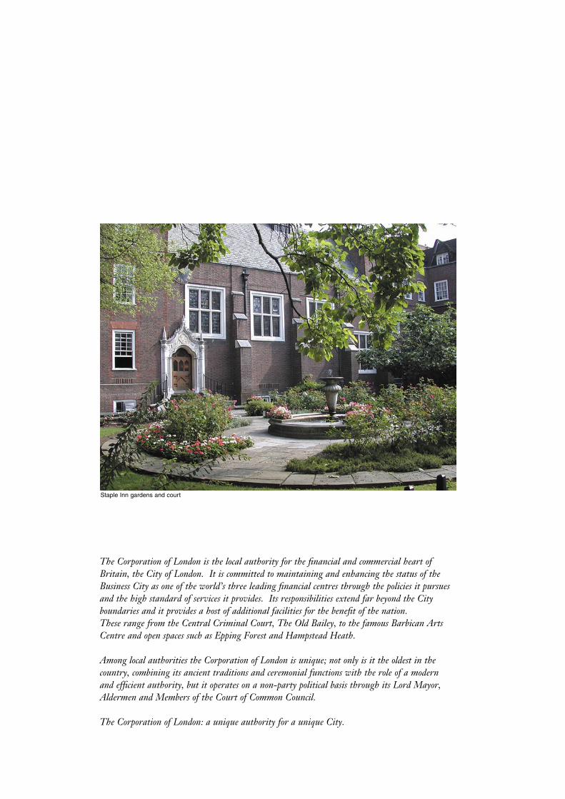
Staple Inn gardens and court
The Corporation of London is the local authority for the financial and commercial heart of Britain, the City of London. It is committed to maintaining and enhancing the status of the Business City as one of the world’s three leading financial centres through the policies it pursues and the high standard of services it provides. Its responsibilities extend far beyond the City boundaries and it provides a host of additional facilities for the benefit of the nation.These range from the Central Criminal Court, The Old Bailey, to the famous Barbican Arts Centre and open spaces such as Epping Forest and Hampstead Heath.
Among local authorities the Corporation of London is unique; not only is it the oldest in the country, combining its ancient traditions and ceremonial functions with the role of a modern and efficient authority, but it operates on a non-party political basis through its Lord Mayor, Aldermen and Members of the Court of Common Council.
The Corporation of London: a unique authority for a unique City.

ISBN 0 85203 056 8