Embed Size (px)
Citation preview

Chapter 6 – ProcessesShaping Planet Earth
Chapter 6 – ProcessesShaping Planet Earth
• In this chapter, you will learnabout Earth’s
• lithosphere (Earth’s crustand landforms),
• hydrosphere (oceans andother bodies of water),
• atmosphere (layers of gasessurrounding Earth) and
• biosphere (plants andminerals).
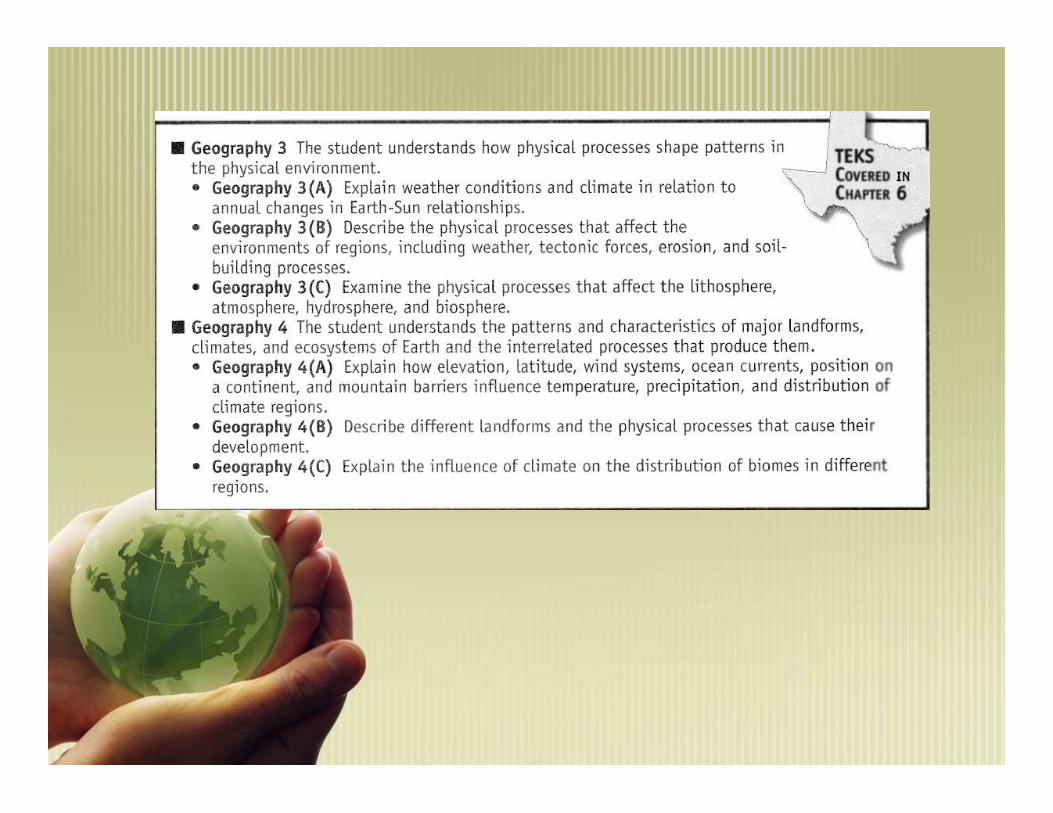
An Essential QuestionAn Essential Question• What forces have helped shape Earth’s landforms,
climate, and plant life?

Chapter 6 TermsChapter 6 Terms
LithosphereLithosphere Earth’smantleEarth’smantle
Plate TectonicMotionPlate TectonicMotion ConvectionConvection TsunamiTsunami
WeatheringWeathering ErosionErosion DepositionDeposition Water CycleWater Cycle Tides andCurrentsTides andCurrents
AtmosphereAtmosphere BiomesBiomes GrasslandsGrasslands SteppesSteppes TundraTundra
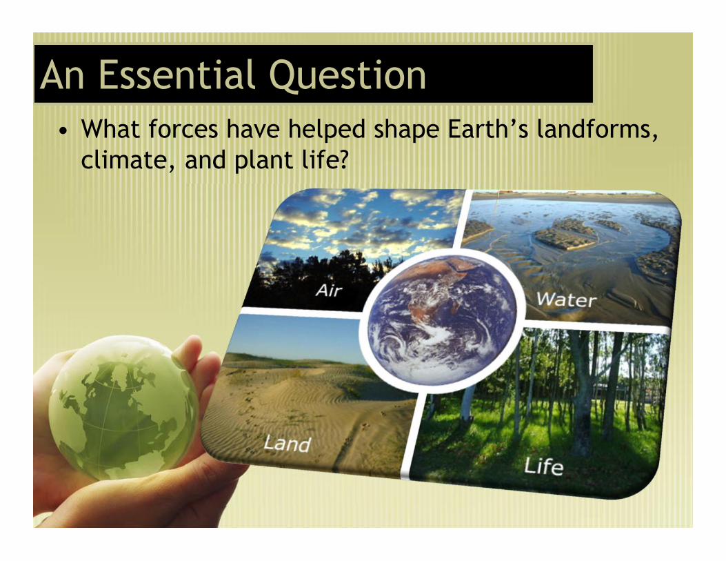
Important ideasImportant ideas• Lithosphere. The lithosphere is made up of the Earth’s crust
and solid upper mantle.• It is broken up into tectonic plates which through their
movement shape the Earth’s surface. As the plates move apartnew crust is made as they collide mountains are formed. Oftenfound along plate boundaries are volcanoes and the occurrenceof Earthquakes.
• Weathering and erosion tear down Earth’s surface. From theseparticles of rock along with decayed plant and animal life theEarth’s soil is formed.
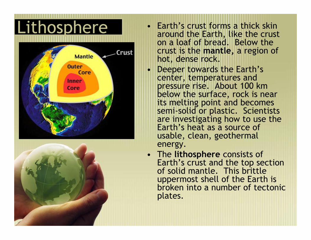
LithosphereLithosphere • Earth’s crust forms a thick skinaround the Earth, like the cruston a loaf of bread. Below thecrust is the mantle, a region ofhot, dense rock.
• Deeper towards the Earth’scenter, temperatures andpressure rise. About 100 kmbelow the surface, rock is nearits melting point and becomessemi-solid or plastic. Scientistsare investigating how to use theEarth’s heat as a source ofusable, clean, geothermalenergy.
• The lithosphere consists ofEarth’s crust and the top sectionof solid mantle. This brittleuppermost shell of the Earth isbroken into a number of tectonicplates.
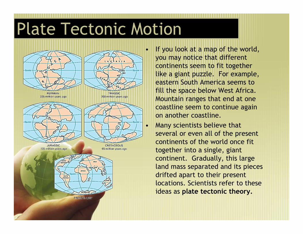
Plate Tectonic MotionPlate Tectonic Motion• If you look at a map of the world,
you may notice that differentcontinents seem to fit togetherlike a giant puzzle. For example,eastern South America seems tofill the space below West Africa.Mountain ranges that end at onecoastline seem to continue againon another coastline.
• Many scientists believe thatseveral or even all of the presentcontinents of the world once fittogether into a single, giantcontinent. Gradually, this largeland mass separated and its piecesdrifted apart to their presentlocations. Scientists refer to theseideas as plate tectonic theory.

Plate Tectonic MotionPlate Tectonic Motion• Earth’s lithosphere is divided into large slabs of rock known as
tectonic plates. Earth’s continents are attached to these plates.Scientists believe that these plates move as solid chunks floating ontop of the more “plastic” part of the mantle.
• The plates move only a few centimeters each year. Despite suchslow movement, over hundreds of millions of years these plates canmove thousands of kilometers.

What causes plate movement?What causes plate movement?• Scientists believe heat and gravity may be responsible for the movement of
tectonic plates.• Convection is the spread of heat through the movement of a fluid substance.
Inside the mantle, semi-solid rock is heated. As it is heated, it expands andbecomes less dense. The lighter rock rises as gravity pulls down cooler, denserrock in its place. After the hotter rock rises, it begins to cool down. Oncecooled, it sinks, creating a circular motion or current. This circular motionpushes the plates above.
• Gravity also contributes to plate movement. When oceanic and land platescollide, the dense oceanic plate is pulled by gravity under the lighter landplate. At one end of the oceanic plate sinks, it pulls on the rest of the plateas well.

Effects of Plate Tectonic Movement
• Mountain Building occurs when two land plates,known as continental plates, slowly push into oneanother, they often fold upwards, creatingmountain chains.
• Mountain Building occurs when two land plates,known as continental plates, slowly push into oneanother, they often fold upwards, creatingmountain chains.

Seafloor spreading and rift valleysSeafloor spreading and rift valleys• Some tectonic plates move apart. Scientists have discovered that in
the middle of the Atlantic Ocean, the separation of plates is actuallycausing the seafloor to spread. As the plates move apart, magmarises up through the cracks in the ocean floor, creating a ridge ofmountains.
• In other areas, the separation of tectonic plates has created riftvalleys – long valleys between parallel ridges of mountains. Thiscreation of new crust would increase the Earth’s size, except that itis balanced by the folding and colliding of plates elsewhere.

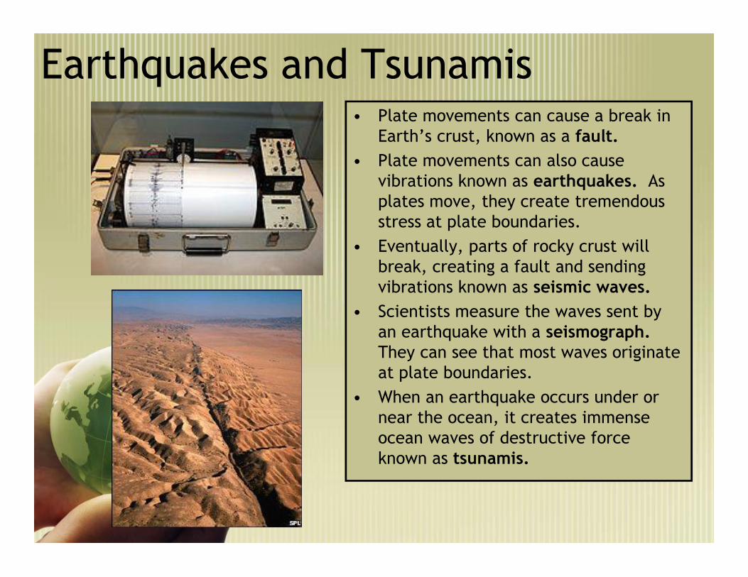
Earthquakes and Tsunamis• Plate movements can cause a break in
Earth’s crust, known as a fault.• Plate movements can also cause
vibrations known as earthquakes. Asplates move, they create tremendousstress at plate boundaries.
• Eventually, parts of rocky crust willbreak, creating a fault and sendingvibrations known as seismic waves.
• Scientists measure the waves sent byan earthquake with a seismograph.They can see that most waves originateat plate boundaries.
• When an earthquake occurs under ornear the ocean, it creates immenseocean waves of destructive forceknown as tsunamis.

Earthquakes and Tsunamis

VolcanoesVolcanoes • In places where tectonic platesdiverge or where one plate divesunder another, pressure in Earth’smantle is reduced and some ofthe hot, solid rock turns to liquid.Any part of the tectonic plate thatsinks into the mantle may alsomelt.
• Pockets of molten rock formbeneath Earth’s surface. Thismagma may break throughweaknesses in Earth’s crust.
• Magma, ashes and gases erupt andform a volcano. Once the magmareaches Earth’s surface, itbecomes known as lava.
• The location of most volcanoesand earthquakes has been shownto be almost identical with thelocation of plate boundaries.

SECTION 17
VOLCANOESVOLCANOES

Volcanoes• The “Ring of Fire” around the Pacific Ocean – a zone of volcanoes
and frequent earthquakes – coincides with the boundaries of thePacific tectonic plate. Many mountains and even islands have beenformed by volcanoes. The Hawaiian islands are actually the tops ofvolcanoes in the Pacific Ocean.

Other forces affecting earth’s lithosphereOther forces affecting earth’s lithosphere
• Tectonic plate movements buildmountains through folding.
• They also create new crust when theyseparate and new magma comes pouringthrough.
• The processes of weathering and erosionreduce the mountains and other landfeatures created by volcanoes,earthquakes, and folding.
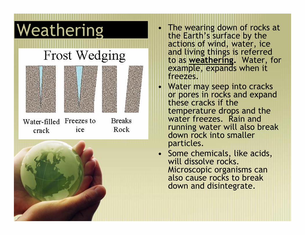
WeatheringWeathering • The wearing down of rocks atthe Earth’s surface by theactions of wind, water, iceand living things is referredto as weathering. Water, forexample, expands when itfreezes.
• Water may seep into cracksor pores in rocks and expandthese cracks if thetemperature drops and thewater freezes. Rain andrunning water will also breakdown rock into smallerparticles.
• Some chemicals, like acids,will dissolve rocks.Microscopic organisms canalso cause rocks to breakdown and disintegrate.

Erosion• The processes by which rock, sand, and soil are broken
down and carried away are known as erosion. Byerosion, a river can cut a canyon, like Grand Canyon,through solid rock. An icy glacier can carve and wearaway a region, leaving behind valleys and lakes, such asthe Great Lakes.
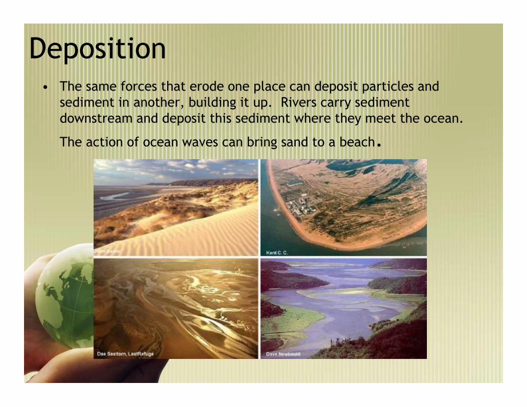
Deposition• The same forces that erode one place can deposit particles and
sediment in another, building it up. Rivers carry sedimentdownstream and deposit this sediment where they meet the ocean.
The action of ocean waves can bring sand to a beach.

Soil: Building Processes• Weathering breaks down rocks on Earth’s surface. The material left from the
rocks mixes with decaying plants and animals to make soil.• Soil is therefore a mixture of several materials, including sand, clay, rocks,
water, fungi, bacteria, and decayed plants and animal material. A layer ofsoil covers much of Earth’s land surface. There are many different types ofsoil, based on different mixtures of its basic ingredients. Each type of soilhas its own texture, ability to hold water, and ability to support plant life.
• For example, clay and dead plant and animal material can hold water. Soilswith a large amount of clay and decayed material will therefore hold morewater than sand soils.
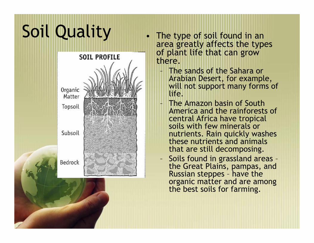
Soil Quality • The type of soil found in anarea greatly affects the typesof plant life that can growthere.– The sands of the Sahara or
Arabian Desert, for example,will not support many forms oflife.
– The Amazon basin of SouthAmerica and the rainforests ofcentral Africa have tropicalsoils with few minerals ornutrients. Rain quickly washesthese nutrients and animalsthat are still decomposing.
– Soils found in grassland areas –the Great Plains, pampas, andRussian steppes – have theorganic matter and are amongthe best soils for farming.
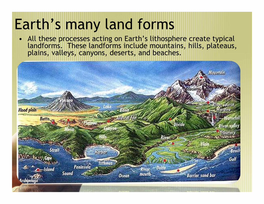
Earth’s many land forms• All these processes acting on Earth’s lithosphere create typical
landforms. These landforms include mountains, hills, plateaus,plains, valleys, canyons, deserts, and beaches.

MountainsMountains
• Mountains, often formed by thecollision of tectonic plates, canbe thousands of feet high inelevation.
Andes Mountains
Himalayas
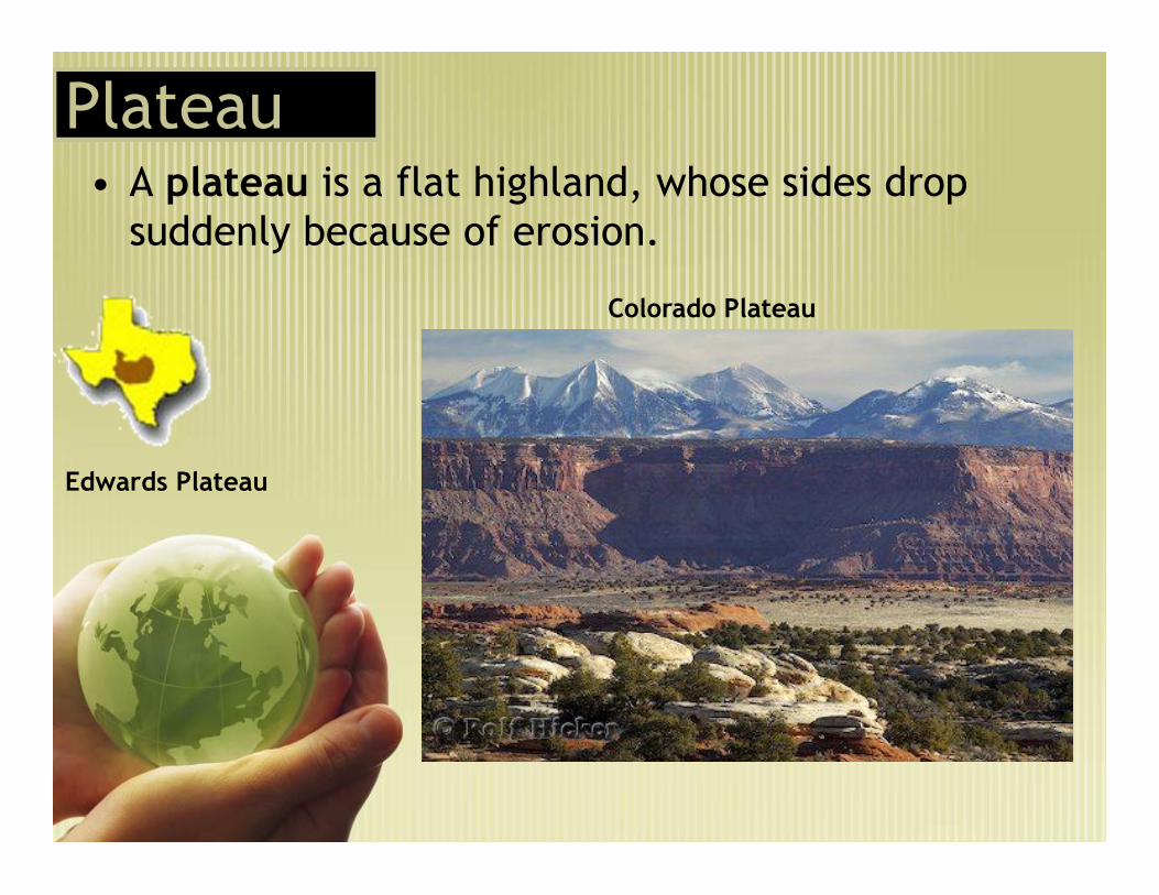
PlateauPlateau• A plateau is a flat highland, whose sides drop
suddenly because of erosion.
Edwards Plateau
Colorado Plateau

Valleys
• Valleys are long, low areas betweenranges of mountains, hills, or uplands.They are often created by erosion, andmay have a river or stream runningalong the bottom.
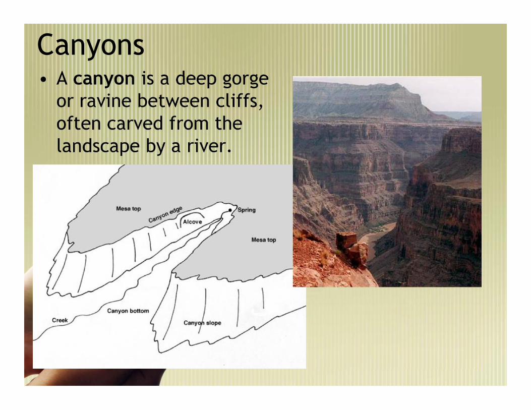
Canyons• A canyon is a deep gorge
or ravine between cliffs,often carved from thelandscape by a river.


Hydrosphere
• Hydrosphere. Oceans cover over 70% of our planet’s surfacearea. Currents, caused by winds and differences in waterdensity, move the ocean’s waters around the planet. Water isalso moved between the atmosphere, oceans, and land surfacesthrough the water cycle.
The Hydrosphere: Earth’s Oceans
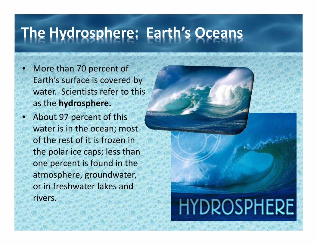
• More than 70 percent ofEarth’s surface is covered bywater. Scientists refer to thisas the hydrosphere.
• About 97 percent of thiswater is in the ocean; mostof the rest of it is frozen inthe polar ice caps; less thanone percent is found in theatmosphere, groundwater,or in freshwater lakes andrivers.
The Water Cycle
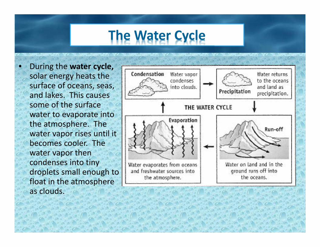
• During the water cycle,solar energy heats thesurface of oceans, seas,and lakes. This causessome of the surfacewater to evaporate intothe atmosphere. Thewater vapor rises until itbecomes cooler. Thewater vapor thencondenses into tinydroplets small enough tofloat in the atmosphereas clouds.

The Water Cycle
• When the droplets growlarger and heavier, they fallback to Earth’s surface asprecipitation – rain, snow,hail. Some precipitationreturns to the ocean, butsome falls on land where it isabsorbed by the ground orforms lakes, streams andrivers. Some of thisprecipitation evaporates, butthe rivers and much of thegroundwater eventuallydrains back into the oceans.
Tides and Currents
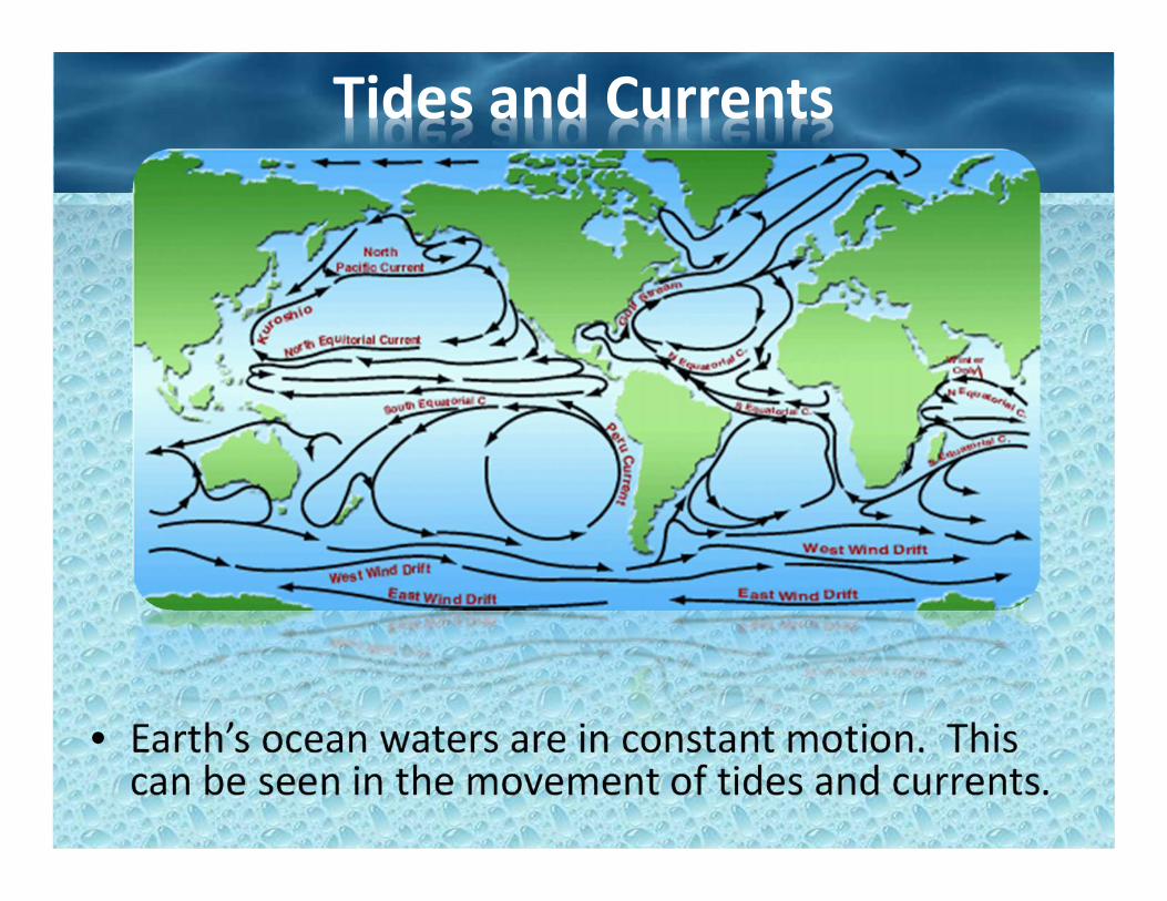
• Earth’s ocean waters are in constant motion. Thiscan be seen in the movement of tides and currents.

Currents
• Ocean currents are movements of the ocean’swaters.
• These currents occur both at the ocean’s surface andbelow. Surface currents are mainly caused by thespinning of Earth and winds.
• At the equator, the spinning of Earth and winds pushsurface water towards the west. This sets in motion largecircular surface currents.
• Water heated by the sun moves away from the equator,carrying heat energy towards the polar regions.
– For example, the Gulf Stream carries warm watertowards Great Britain, making that country warmerthan it would otherwise be. This transfer of energyhelps maintain a balance – carrying warm water fromthe tropics to colder regions, and cold water fromthe polar regions towards the tropics.

Currents• Below the ocean’s surface, its waters actually separate into different layers based on
their density.• Cold, salty water is more dense than warm, less salty water. At the poles, cold, salty
water sinks. It then slowly moves towards the equator, pushing warmer water away.During this process, this cold water gradually warms up as it absorbs heat from thelayers of water above it. This slow buy steady circulation of the ocean’s deep waterstakes hundreds of years.

Tides• Each day, the surface level of
the oceans rises and fallsduring high and low tide.Tides are caused by thegravitational pull of the moonon Earth’s ocean waters.Ocean waters directly facingthe moon bulge towards themoon, creating high tide, atime when sea levels are attheir highest.
• On the opposite side of Earth isanother hide tide, caused by the forceof Earth’s spin where the moon’s pullis weakest.
• Sea levels become highest when themoon and sun are both lined up onthe same side of Earth, and lowestwhen they are on opposite sides.

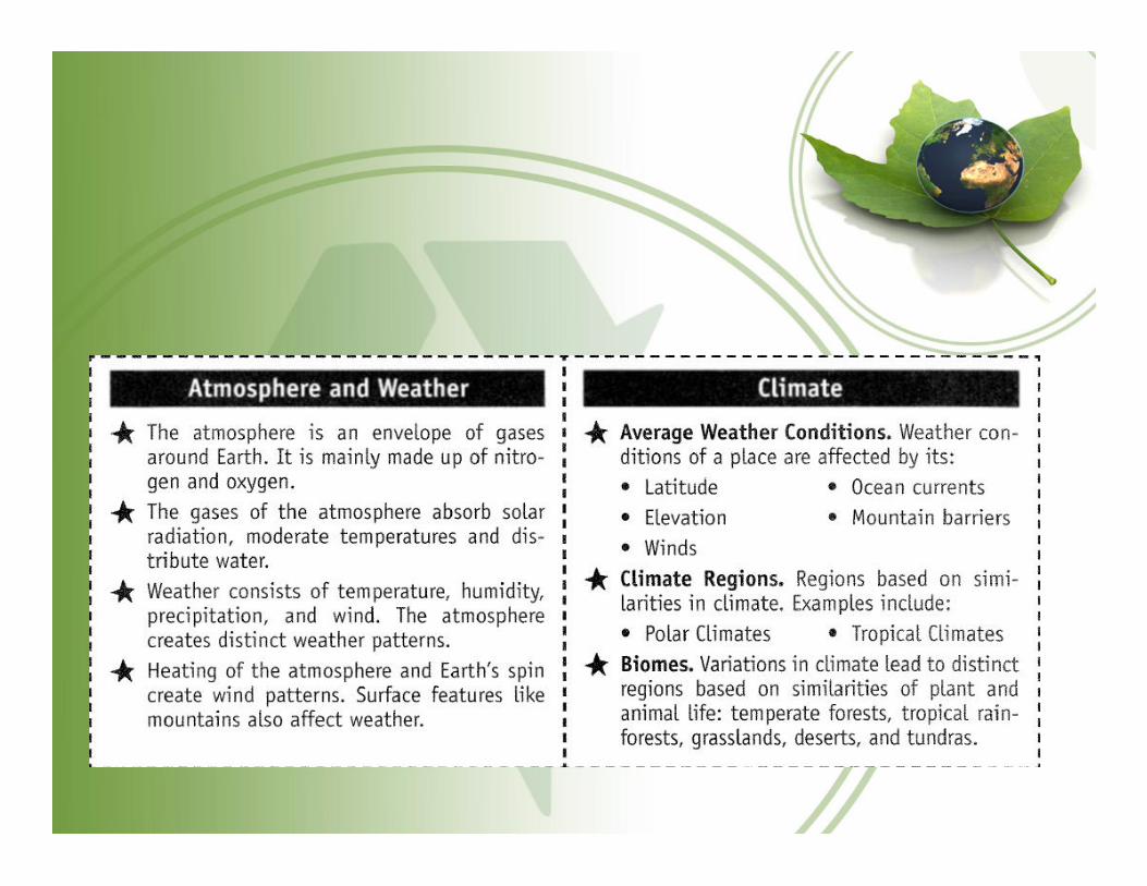
Atmosphere and Biosphere• Atmosphere. The spinning of Earth, the unequal heating of air by the sun,
the evaporation of water, and the effect of various landforms on the air resultin weather or differences in temperature, wind, and precipitation. Climate isan area’s average weather. Earth’s tilt as it orbits the sun causes ourseasons.
• Biosphere. Differences in climate give rise to biomes – geographic regionsthat support different kinds of life – forests, grasslands, deserts and tundra.

The Atmosphere and Climate• Around Earth is an envelope of gases
known as the atmosphere.• It consists mainly of nitrogen (78%)
and oxygen (21%). The atmosphereabsorbs solar radiation, moderatestemperatures, and distributes water.
• Weather refers to conditions in theatmosphere closest to Earth, includinghumidity, winds, and precipitation(rain snow, or hail).
• Different processes in the atmospherelead to differences in climate, theaverage weather conditions of a placeover a long period of time.

The Geography of Weather
• Weather is affected by latitude, elevation (height above sealevel), wind patterns, ocean currents, and mountain barriers.– For example, temperatures are generally warmer the
closer an area is to the equator. Temperatures tend todecrease as you move away from the equator to higherlatitudes. Temperatures are also cooler at higherelevations, such as on mountains or high plateaus.Geographers refer to different climates at differentaltitudes in the same area as vertical climates.
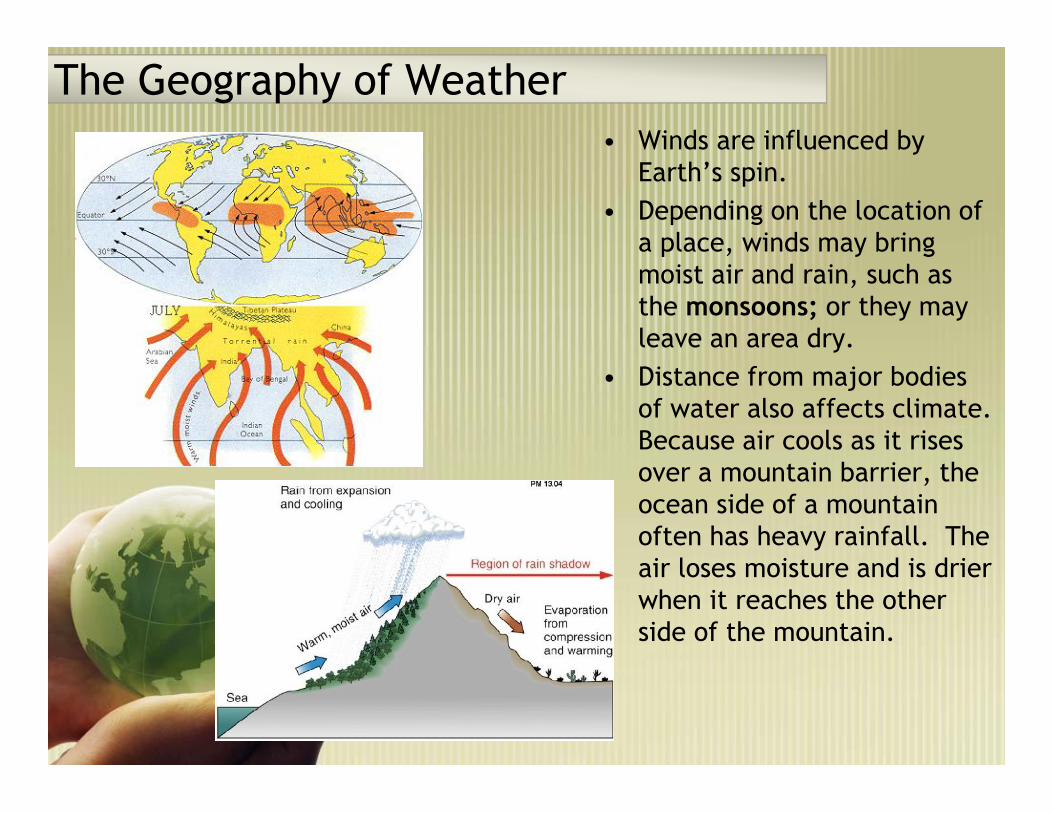
The Geography of Weather• Winds are influenced by
Earth’s spin.• Depending on the location of
a place, winds may bringmoist air and rain, such asthe monsoons; or they mayleave an area dry.
• Distance from major bodiesof water also affects climate.Because air cools as it risesover a mountain barrier, theocean side of a mountainoften has heavy rainfall. Theair loses moisture and is drierwhen it reaches the otherside of the mountain.

The Geography of Weather
• Tropical hurricanes occur intropical regions in late summerand early fall when the oceanwater is very warm.
• The warm ocean waterevaporates so quickly that itcreates an area of lowpressure. Air around a risingair column begins to spiral athigh speeds. The hot air risesuntil it cools and condenses –releasing energy and causingheavy rains, strong winds, anddangerous lightning strikes.
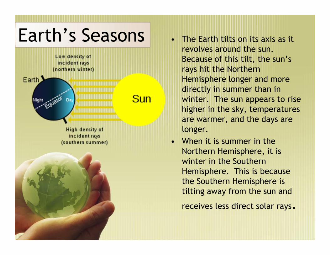
Earth’s SeasonsEarth’s Seasons • The Earth tilts on its axis as itrevolves around the sun.Because of this tilt, the sun’srays hit the NorthernHemisphere longer and moredirectly in summer than inwinter. The sun appears to risehigher in the sky, temperaturesare warmer, and the days arelonger.
• When it is summer in theNorthern Hemisphere, it iswinter in the SouthernHemisphere. This is becausethe Southern Hemisphere istilting away from the sun and
receives less direct solar rays.
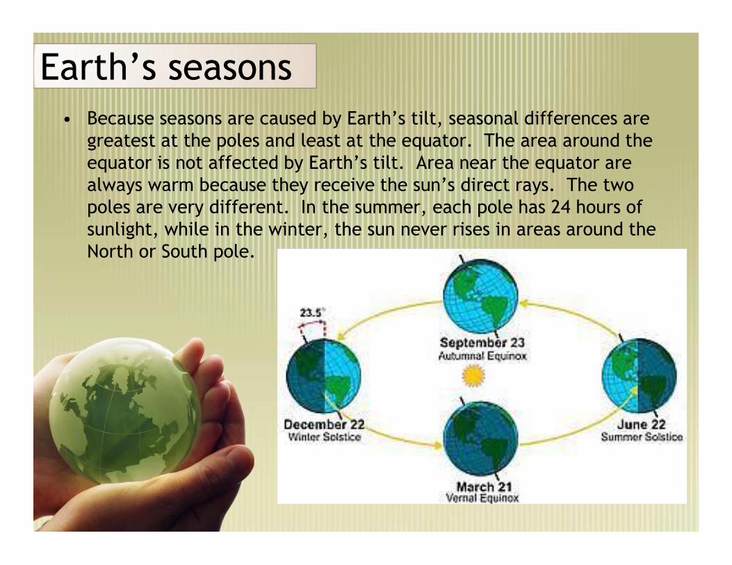
Earth’s seasonsEarth’s seasons• Because seasons are caused by Earth’s tilt, seasonal differences are
greatest at the poles and least at the equator. The area around theequator is not affected by Earth’s tilt. Area near the equator arealways warm because they receive the sun’s direct rays. The twopoles are very different. In the summer, each pole has 24 hours ofsunlight, while in the winter, the sun never rises in areas around theNorth or South pole.
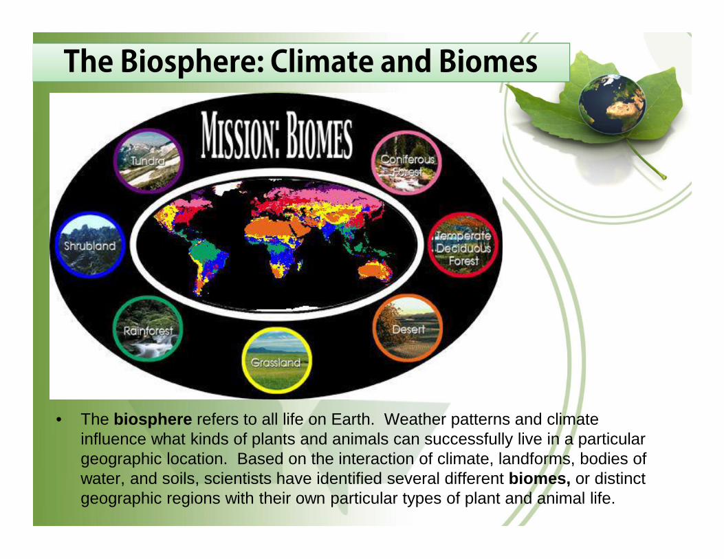
The Biosphere: Climate and BiomesThe Biosphere: Climate and Biomes
• The biosphere refers to all life on Earth. Weather patterns and climateinfluence what kinds of plants and animals can successfully live in a particulargeographic location. Based on the interaction of climate, landforms, bodies ofwater, and soils, scientists have identified several different biomes, or distinctgeographic regions with their own particular types of plant and animal life.

Distribution of Climate RegionsDistribution of Climate Regions
• Our world is home to a variety of climates. Some geographers dividethe world into regions based on similarities in climate, includingaverage temperatures and rainfall. Climate zones are most affectedby latitude and elevation.

• High-Latitude Climates. The North and South Poles have similar “polarclimates” with very cold winter temperatures.
• Mid-Latitude Climates. Places in the middle latitudes with low elevationsgenerally have warm summers and cool winters. These are also known as“moist mid-latitude climates,” with either mild or cold winters, or as “temperateclimates.”
• Low-Latitude Climates. Central Africa, Central America, Northern SouthAmerica, South Asia and Southeast Asia have warm and humid climates.These are sometimes called “tropical moist climates.” North Africa, the MiddleEast, Western Australia, and Asia have warm and dry climates. In theseareas, the evaporation of water can be greater than precipitation.

Temperate Deciduous ForestTemperate Deciduous Forest
• Temperate deciduous forests develop in mid-latitude regions wherethere is ample rain and moderate temperatures with cool winters.Trees change colors in fall and lose their leaves in winter. There is awide range of plant and animal life.

Tropical Rain Forests
• Tropical rainforests develop in tropical areas near the equator where there isample rainfall and warm temperatures year-round. Large trees cover the areawith their leaves, forming a canopy. Despite the rapid growth of trees, thetopsoil is actually very thin. Tropical rainforests are marked by a greatabundance of animal and plant life, displaying greater biological diversity thanany other biome.
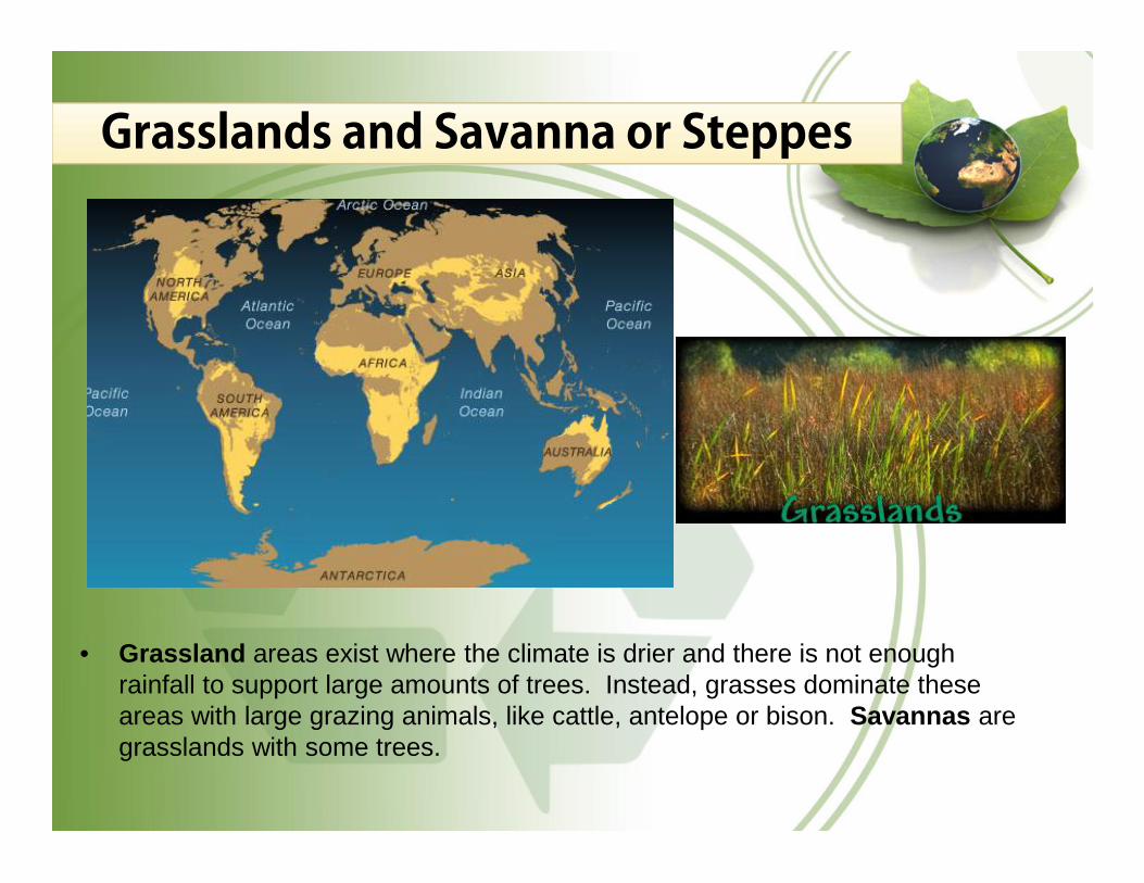
Grasslands and Savanna or SteppesGrasslands and Savanna or Steppes
• Grassland areas exist where the climate is drier and there is not enoughrainfall to support large amounts of trees. Instead, grasses dominate theseareas with large grazing animals, like cattle, antelope or bison. Savannas aregrasslands with some trees.

Deserts
• Deserts are regions that receive less than 10 inches of rainfallannually. Deserts in the tropical latitudes, such as the Sahara desert,have their own special forms of plant and animal life, which haveadapted to the lack of water and extremes of temperature. Cacti, forexample, store water in their stems.

Tundra
• Tundra is found closer to the polar regions. The soil of the tundra isso cold that trees cannot grow. Much of the ground is frozen part ofthe year. Tundras constitute a distinct biome, with their own plant andanimal life, including grasses, small shrubs, large mammals and birdsthat migrate to these regions in the warmer spring and summermonths.