Embed Size (px)
Citation preview

Kelly WrightM.S. Candidate, University of Southern California
Chigoe Flea Eradication Project

• Tunga penetrans, Chigoe Flea, Jigger
Found in tropic and subtropic areas
– Likely introduced to sub-Saharan Africa in 1800s
• Hematophagic insect - parasitizes mammals
• Contributing Factors in Superinfestation
– Social: Poverty, Population Density, WASH strategies, Education, Lack of Beds, Shelter Construction, Lack of Shoes
– Environmental: Bare soil, Sandy Soil, Accessibility of Water, Presence of Livestock, Presence of Rodents, Low Rainfall
• Surgical removal is necessary. Superinfestation can result in permanent disfigurement, gangrene, and even death.
– Disproportionately affects the poorest of the poor.
INTRODUCTION
The Chigoe flea most often affects the feet
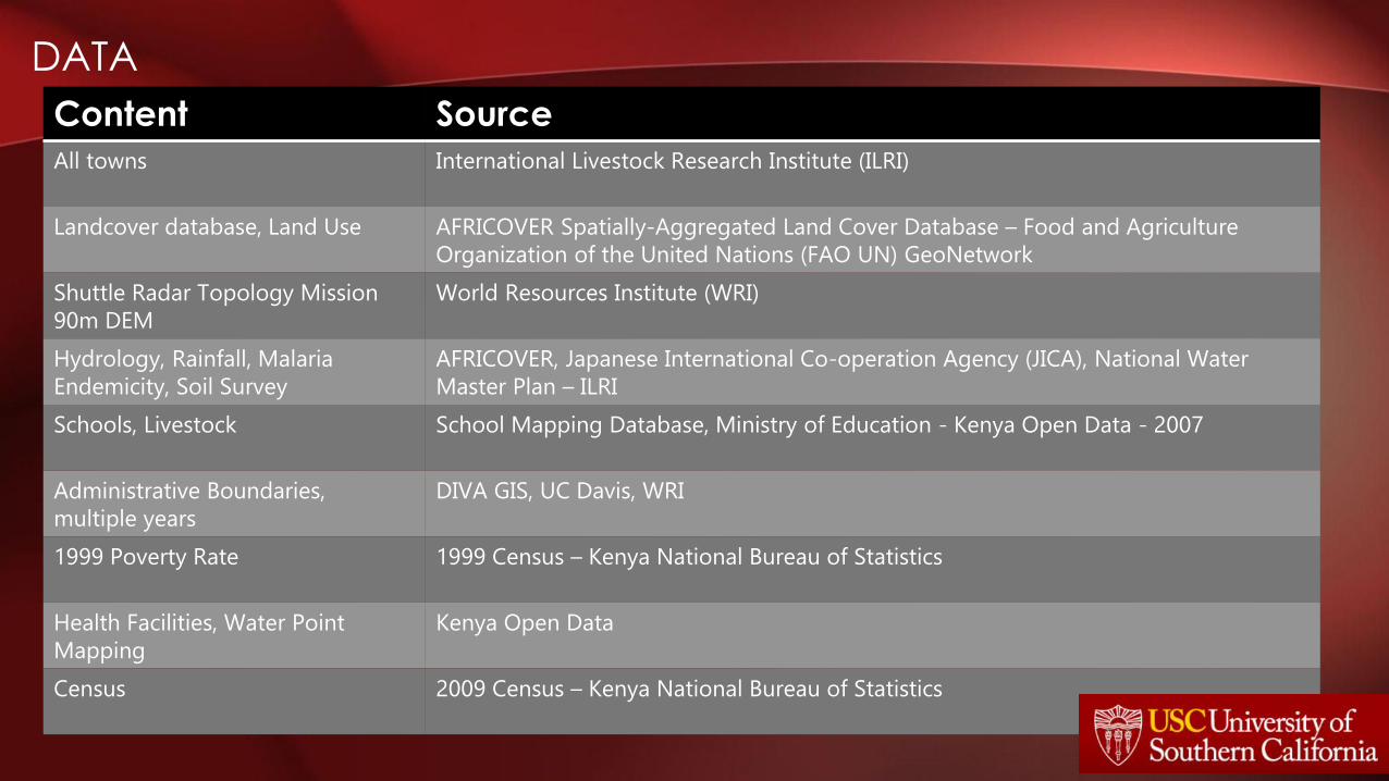
• Enable the exploration of layers of data representing various social and ecological factors that can contribute to the prevalence of the Jigger, or Chigoe Flea (Tunga penetrans) superinfestation in Kenya.
This is the first of a series of apps that will aid scientists, activists, government workers, volunteers, and charities in the eventual eradication
of the Chigoe Flea.
1. Data Exploration
2. Charity/NGO Registry
3. VGI/PPGIS – Georeferenced records of patient characteristics and environmental conditions
4. Routing of aid, volunteers, and supplies
PURPOSE

• ArcGIS Web App Builder
o ArcGIS Desktop
o ArcGIS Server Manager
• Adobe Creative Cloud
Dreamweaver
APPLICATION DEVELOPMENT
Build the Map
Data Discovery
Cartographic Design
Publish Service to
AGO
Analyze Service
Reconcile Errors
Embed in Webpage
Test App
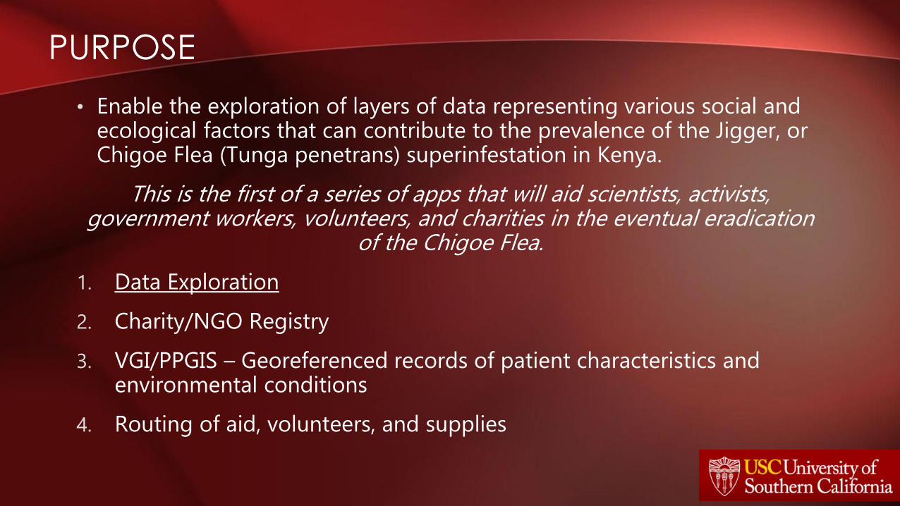
DATA
Content Source
All towns International Livestock Research Institute (ILRI)
Landcover database, Land Use AFRICOVER Spatially-Aggregated Land Cover Database – Food and Agriculture
Organization of the United Nations (FAO UN) GeoNetwork
Shuttle Radar Topology Mission
90m DEM
World Resources Institute (WRI)
Hydrology, Rainfall, Malaria
Endemicity, Soil Survey
AFRICOVER, Japanese International Co-operation Agency (JICA), National Water
Master Plan – ILRI
Schools, Livestock School Mapping Database, Ministry of Education - Kenya Open Data - 2007
Administrative Boundaries,
multiple years
DIVA GIS, UC Davis, WRI
1999 Poverty Rate 1999 Census – Kenya National Bureau of Statistics
Health Facilities, Water Point
Mapping
Kenya Open Data
Census 2009 Census – Kenya National Bureau of Statistics
DESIGN

• Data Discovery in Kenya
– Political Turmoil and Decentralization
• (Province), County, Sub County (District), Constituency (Division), Location, Sub-Location
– 2007-2009, from 14 to 256 districts
– GIS data created with all different enumeration units
• Poor Internet/Data Resources
– Or
• Data Does Not Exist
ISSUES