Embed Size (px)
Citation preview
Recreational Use Attainability Analysis Summary of Findings
Texas Institute for Applied Environmental Research Stephenville, Texas
July 14, 2014
Choctaw and Iron Ore Creeks
1
Project Partners
• Texas State Soil and Water Conservation Board (TSSWCB)
• Texas Institute for Applied Environmental Research (TIAER)
2

TSSWCB
• Provide state oversight
• Management and coordination of project activities
– Project partners
– Texas Commission on Environmental Quality (TCEQ)
• Provide project funding
3

TIAER
• Project administration
• Develop & maintain stakeholder relations
• Perform RUAA survey activities
• GIS inventory
• Facilitate meetings
• Develop final technical reports
4

RUAA Basics
• Collect information that will: 1. Confirm or deny primary contact recreation
2. Document any evidence of recreational uses of Choctaw and Iron Ore Creeks
• Recreational Use Categories: 1. Primary Contact Recreation
2. Secondary Contact Recreation 1
3. Secondary Contact Recreation 2
4. Noncontact Recreation
5
How did we get here?
• Choctaw and Iron Ore Creeks are not meeting the water quality standard for primary contact recreation
• Due to elevated levels of bacteria, E. coli.
• Requires action to meet the standards that are set by the State of Texas and EPA.
6

Texas 303 (d) List
– Requirement of the Clean Water Act
– Developed by TCEQ to summarize the condition of the state’s surface waters, including concerns for public health, fitness for use by aquatic species and other wildlife, and specific pollutants.
7

Why we chose this approach
• Once on the 303(d) List, action is required by the state
• Viable candidate
• Cost Effective
• Non Regulatory approach
• State Led, Not Federal
8

Impaired Stream Segments
• Choctaw Creek (0202F)
– 2010 Texas Water Quality 303(d) List
• Bacteria
• Iron Ore Creek (0202K)
– 2010 Texas Water Quality 303(d) List
• Bacteria
9

RUAA Survey Sites Locations
10

11
TCEQ ID
Site ID
Site Description Latitude Longitude
Distance from
Previous Site (mi)
Distance from
Confluence (mi)
Access
CH01 Choctaw Creek at Carpenters Bluff
33.718920 -96.401853 0.0 2.76 Public
CH02 Choctaw Creek on Private Property
33.718565 -96.424275 1.39 4.15 Private
CH03 Choctaw Creek on Private Property
33.718460 -96.431112 1.59 5.74 Private
16130 CH04 Choctaw Creek at FM 1753
33.719069 -96.454296 2.39 8.13 Public
16123 CH05 Choctaw Creek at Highway 69
33.685629 -96.471763 4.13 12.26 Public
18370 CH06 Choctaw Creek at Highway 82
33.650300 -96.481123 4.50 16.76 Public
10108 CH07 Choctaw Creek at Highway 56
33.633614 -96.498211 3.20 19.96 Public
10109 CH08
Choctaw Creek at Ida Road (also shown as FM 697)
33.607861 -96.525410 5.28 25.24 Public
RUAA Survey Sites Locations- Choctaw Creek
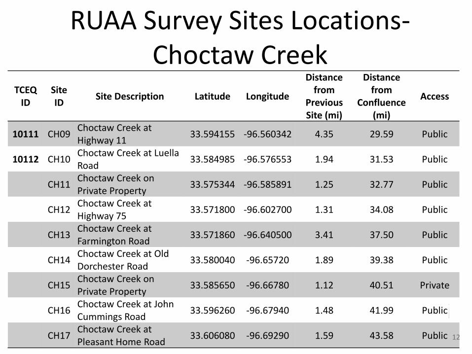
12
TCEQ ID
Site ID
Site Description Latitude Longitude
Distance from
Previous Site (mi)
Distance from
Confluence (mi)
Access
10111 CH09 Choctaw Creek at Highway 11
33.594155 -96.560342 4.35 29.59 Public
10112 CH10 Choctaw Creek at Luella Road
33.584985 -96.576553 1.94 31.53 Public
CH11 Choctaw Creek on Private Property
33.575344 -96.585891 1.25 32.77 Public
CH12 Choctaw Creek at Highway 75
33.571800 -96.602700 1.31 34.08 Public
CH13 Choctaw Creek at Farmington Road
33.571860 -96.640500 3.41 37.50 Public
CH14 Choctaw Creek at Old Dorchester Road
33.580040 -96.65720 1.89 39.38 Public
CH15 Choctaw Creek on Private Property
33.585650 -96.66780 1.12 40.51 Private
CH16 Choctaw Creek at John Cummings Road
33.596260 -96.67940 1.48 41.99 Public
CH17 Choctaw Creek at Pleasant Home Road
33.606080 -96.69290 1.59 43.58 Public
RUAA Survey Sites Locations- Choctaw Creek

13
RUAA Survey Sites Locations- Iron Ore Creek
TCEQ ID
Site ID Site Description Latitude Longitude
Distance from
Previous Site (mi)
Distance from
Confluence (mi)
Access
IO01 Iron Ore Creek at Star road 33.706984 -96.473474 0.0 0.82 Public
IO02 Iron Ore Creek at Hwy 69 33.701114 -96.490502 2.22 3.04 Public
IO03 Iron Ore Creek at Shannon Rd (Tapscot in Google Earth)
33.694519 -96.505514 1.42 4.46 Public
IO04 Iron Ore Creek at Fannin Ave 33.711877 -96.543617 4.63 9.09 Public
18653
IO05 Iron Ore Creek at North Texoma Parkway
33.717374 -96.560224 1.16 10.25 Public
IO06 Iron Ore Creek at Park Avenue 33.717342 -96.569329 0.68 10.93 Public
IO07 Iron Ore Creek at Hwy 75 Northbound Frontage Road
33.717661 -96.584783 1.39 12.32 Public
IO08 Iron Ore Creek at Loy Lake Road 33.718291 -96.601092 1.14 13.46 Public
IO09 Iron Ore Creek at Preston Rd 33.727279 -96.618798 1.57 15.03 Public
IO10 Iron Ore Creek at Davy Ln 33.737145 -96.638322 1.77 16.81 Public
IO11 Iron Ore Creek at Wells Rd/FM996 33.751812 -96.641830 1.36 18.16 Public

Findings for First RUAA Survey
• Choctaw Creek
• Conducted May 16th – 18th, 2014
• Summary
– Limited water for recreation
– No direct recreation observed
– Limited public access, mostly private property
14
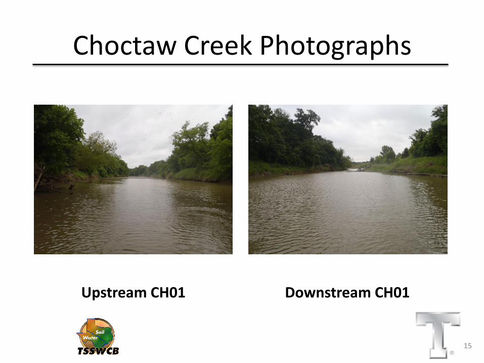
Choctaw Creek Photographs
Upstream CH01 Downstream CH01
15
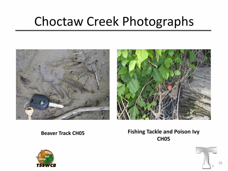
Choctaw Creek Photographs
Beaver Track CH05 Fishing Tackle and Poison Ivy CH05
16

Choctaw Creek Photographs
Left Bank CH10 Right Bank CH10
17

Choctaw Creek Photographs
Steep Left Bank CH15 Steep Right Bank CH15
18

Findings for First RUAA Survey
• Iron Ore Creek
• Conducted May 17th, 2014
• Summary
– Limited water for recreation
– No direct recreation observed
– Limited public access, mostly private property
19

Iron Ore Creek Photographs
Downstream IO_01 Upstream IO_01
20

Iron Ore Creek Photographs
Left Bank IO_04 Right Bank IO_04
21
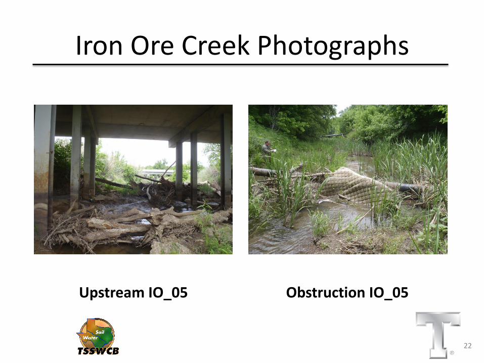
Iron Ore Creek Photographs
Upstream IO_05 Obstruction IO_05
22

Iron Ore Creek Photographs
Downstream IO_06 Upstream IO_06
23
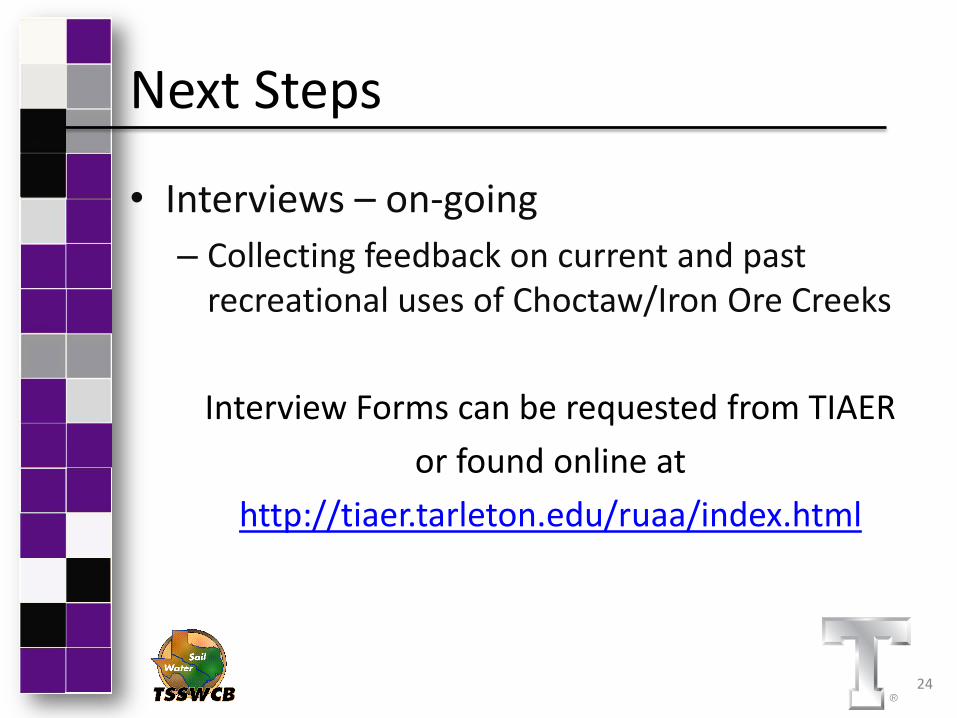
Next Steps
• Interviews – on-going
– Collecting feedback on current and past recreational uses of Choctaw/Iron Ore Creeks
Interview Forms can be requested from TIAER
or found online at
http://tiaer.tarleton.edu/ruaa/index.html
24
Contact Information
Kalyn Brymer
Email: [email protected]
Phone: 254.968.1921
Sarah Robinson
Email: [email protected]
Office Phone: 254.968.1913
25

Questions?
26
Project Website:
http://tiaer.tarleton.edu/ruaa/index.htm
Funding Provided through a State Nonpoint Source grant from Texas State Soil and
Water Conservation Board.
Kalyn Brymer Texas Institute for Applied Environmental Research
[email protected] (254) 968-1921