Embed Size (px)
Citation preview
Chuliang Xiao1 and Brent Lofgren2 1CILER , University of Michigan2NOAA GLERL
A Study of Great Lakes Effects on Synoptic Processes by Using WRF
Comparison Experiments
The Great Lakes Operational Meteorology Workshop 2014
Ann Arbor, MI

Outline
• Synoptic Overviews• Data and Model• Results from Model Comparisons• Conclusions
Outline
• Synoptic Overviews– Low Patterns– Low Tracks
• Data and Model• Results from Model Comparisons• Conclusions
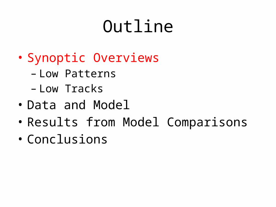
Synoptic Map (Deep Low)17Nov2013 18Nov2013
Midwest Tornados outbreak
Courtesy http://www.hpc.ncep.noaa.gov/dailywxmap/

Synoptic Map (Shallow Low)14Dec2013 15Dec2013
East-coast Snowstorm outbreak
Courtesy http://www.hpc.ncep.noaa.gov/dailywxmap/

Outlines and Centers992 hPa
1012 hPa

Outline
• Synoptic Overviews• Data and Model– Datasets (NCEP Eta, FNL, SST, Station)– Model description– Experimental designs
• Results from Model Comparisons• Conclusions

Datasets
• NCEP Eta (6 hourly, 40 km, North America)• NCEP FNL (6 hourly, ~100 km, Global) (for comparison with NCEP Eta)
• NCEP RTG SST (Daily, HR, ~ 8 Km, Global)• MODIS (20-cat. Land Use; 16-cat. Soil; Collected in 2001)• Gauged Precipitation (Great Lake area)

Datasets (Cont.)Dataset NCEP Eta NCEP FNL RTG SST
Resolution 40 km 1*1 degree 1/12 degree
6 hourly 6 hourly Daily
Format GRIB 2 GRIB 2 GRIB 1
Provider NCEP Eta 212 grid NCEP GFS NCEP MMAB

WRF (Version 3.5.1) Domain
Projection Lambert
True latitudes 30°N, 60°N
Reference Latitude 45°N
Reference Longitude 85°W
Analysis field NCEP Eta (40 km x 40 km)
Domain Resolution 15 km x 15 km
Domain Mesh 100 x 142
Land Surface Model Noah LSM with MODIS 2001 (30”)

WRF Domain (Cont.)
Lakes-mean: Only lake gridsArea-mean: Red rectangle areaDomain-mean: ALL model grids

Experiment Comparison
Cases Deep Low Shallow Low
ExperimentIntegration Period (2013)
00Z16Nov~12Z19Nov 00Z13Dec~12Z16Dec
CONTROL MODIS, NCEP Eta
NOLakes Modifed Landuse+Vegetation+Soil, NCEP Eta
SSTLakes MODIS, NCEP Eta , Updated RTG SST

Landuse ModificationCONTROL NOLakes

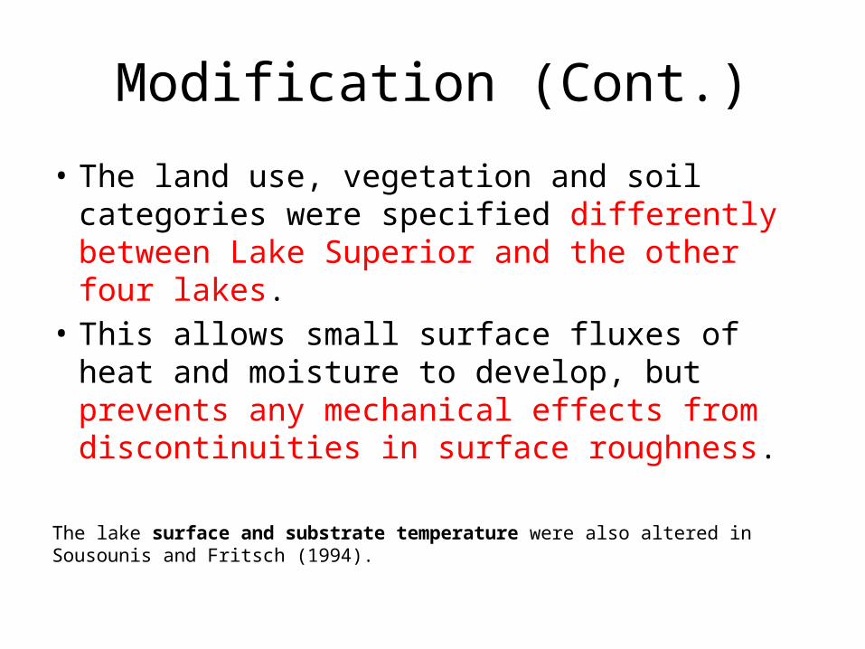
Modification (Cont.)
Variable Description Variable Name CONTROL-
MODIS
NOLakes- Modified
Superior Others
Land use LU_INDEX Water Bodies (17) Mixed Forest (5) Cropland
(12)
Vegetation fraction VEGFRA 0% 20% 25%
Soil category fraction
SOILCTOP Water(14)
Sandy Loam(3)
Silt Loam(4)SOILCBOT
Modification (Cont.)
• The land use, vegetation and soil categories were specified differently between Lake Superior and the other four lakes.
• This allows small surface fluxes of heat and moisture to develop, but prevents any mechanical effects from discontinuities in surface roughness.
The lake surface and substrate temperature were also altered in Sousounis and Fritsch (1994).

Outline
• Synoptic Overviews• Data and Model• Results from Model Comparisons– Validation (Precipitation)– Storm Evolutions (SLP)– Surface process (Temperature, Moisture, Heat flux)– Vertical extent (local circulation)– Local circulation <-> background flow
• Conclusions

Model Validation (Precipitation)
NCEP Eta 40km
NCEP FNL 100km
CONTROL 15km
Observation
Deep Low Shallow Low
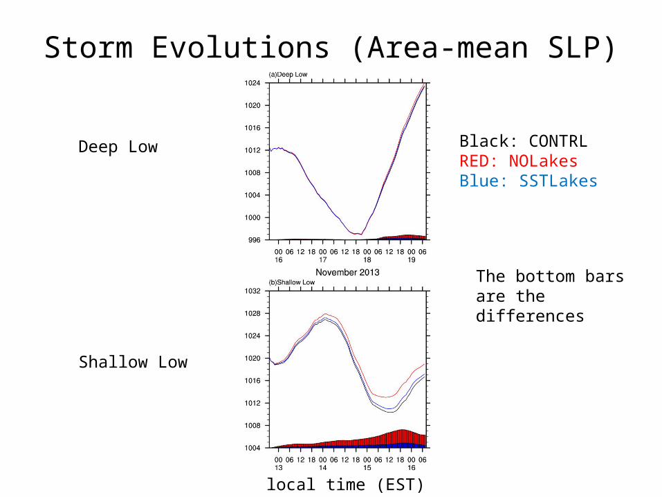
Storm Evolutions (Area-mean SLP)
Black: CONTRLRED: NOLakesBlue: SSTLakes
local time (EST)
The bottom bars are the differences
Deep Low
Shallow Low

Surface process (Temperature)
Lakes-Mean Surface Temp (TSK)
Area-MeanAir Temp at 2 m(T2)
Lakes-Mean TSK-T2
Black: CONTROLRED: NOLakesBlue: SSTLakes
local time (EST)
Lake temperature is not changed in the initial time, but got quick equilibrium in WRF-Noah
ColdLakes

Surface process (Humidity)
CONTROL
CONTROL-NOLakes
CONTROL-SSTLakes
Vector: (qu, qv)Shading: (qu, qv)∇q: mix ratio

Surface process (Sensible Heat)

Cross Sections992 hPa
1012 hPa
Dashed: Southwest-Northeast
Dot: Northwest-Southeast

Cross-sections
Shading: Temperature; Contour: Geopotential Height
NW-SE
SW-NE

Circulation Configuration
Vector: U, V at 10 mShading: T850Contour: Z500
CONTROL
CONTROL-NOLakes
CONTROL-SSTLakes

Conclusions
• WRF performs well in simulating both the deep low and shallow low.
• Lake-air temperature gradient induces vertical heat flux; lake-land roughness contrast contributes to moisture convergence.
• The Great Lakes’ effect generally strengthens the low system near the surface but is sensitive to the background flow.
• This effect becomes much more significant for the development of the shallow low and extends to a higher level, tilting downwind.
• The remote influence of the Great Lakes tends to be subtle in both cases.

THANK YOU