Embed Size (px)
Citation preview

1
CITY OF PATTERSON PLANNING COMMISSION AGENDA
REGULAR MEETING
THURSDAY, AUGUST 12, 2021, AT 7:00 P.M. City Council Chambers
1 Plaza, Patterson, California
NOTICE: THIS MEETING WILL BE HELD IN ACCORDANCE WITH EXECUTIVE ORDER N-29-
20, ISSUED BY CALIFORNIA GOVERNOR GAVIN NEWSOM ON MARCH 17, 2020, THE
RALPH M. BROWN ACT (CALIFORNIA GOVERNMENT CODE SECTION 54950, ET SEQ.),
AND THE FEDERAL AMERICANS WITH DISABILITIES ACT. THIS MEETING WILL NOT BE
PHYSICALLY OPEN TO THE PUBLIC.
ALL MEMBERS OF THE PUBLIC MAY PARTICIPATE IN THE MEETING VIA VIDEO
CONFERENCING AT
https://us02web.zoom.us/j/84997169617?pwd=RWZzVzA1L1ZvNXRlb29YNzF2eFFwQT09
AND VIA ZOOM TELECONFERENCE BY CALLING 1-669-900-9128
MEETING ID: 849 9716 9617, PASSWORD: 172239 AND WILL BE GIVEN THE OPPORTUNITY
TO PROVIDE PUBLIC COMMENT. In compliance with the Americans with Disabilities Act, if you
need special assistance to participate in this meeting, please contact the City Clerk at (209) 895-8014.
Notification 48 hours prior to the meeting will enable the City to make reasonable arrangements to
ensure accessibility to this meeting. [28 CFR 35.102-35.104 ADA Title II] The Planning Commission
agenda and supporting public documents are available for viewing in City Hall, 1 Plaza, 2nd Floor,
Patterson, California, during normal business hours. The Planning Commission agenda and supporting
public documents are also available online on the City web site www.ci.patterson.ca.us listed under
Agenda Center “Planning Commission”
ALL MEMBERS OF THE PUBLIC WILL BE GIVEN THE SAME TIME ALLOTMENT FOR
COMMENTS AS NORMALLY ALLOWED FOR MEETINGS SUBJECT TO THE
PROVISIONS OF EXECUTIVE ORDER N-29-20.
CALL TO ORDER
PLEDGE OF ALLEGIANCE
ROLL CALL
ITEMS FROM THE PUBLIC The public wishing to address the Planning Commission on items that
do not appear on the agenda may do so; however, the Planning Commission will take no action other
than referring the item to Staff for study and analysis and may place the item on a future agenda
[Resolution 92-25].
Any member of the audience desiring to address the Planning Commission regarding a matter on the
agenda, please raise your hand or step to the podium at the time the item is announced by the
Chairperson. In order that all interested parties have an opportunity to speak, any person addressing the
Planning Commission will be limited to a maximum of five (5) minutes unless the Chairperson grants a
longer period of time.
STATEMENT OF CONFLICT BY COMMISSIONERS
2
RIGHT TO APPEAL Any person who is dissatisfied with the decision of the Planning Commission,
may appeal such action to the City Council within ten (10) business days after action.
CORRESPONDENCE None
CONSENT AGENDA
1. Planning Commission Meeting Minutes of June 24, 2021.
2. Planning Commission Meeting Minutes of July 22, 2021.
AGENDA ITEMS
1. Public Hearing: Zacharias and Baldwin Ranch Master Plan A public hearing to consider the Zacharias and Baldwin Ranch Master
Plan. The Master Plan project consists of Annexation, General Plan
Amendments, Pre-Zoning, Master Plan, Development Agreement, and a
Final EIR for two project areas for a total of 1,227.1 acres. The Zacharias
Master Plan consists of 1,158.4-acres and includes up to 5,086 residential
units, 855,000 square feet of retail uses, and 6,910,000 square feet of
business park uses. The Baldwin Ranch consists of 68.7 acres and includes
up to 305 single family dwelling units and five acres of park.
The Zacharias project area is located on the north end of the City of
Patterson bounded by Rogers Road (west), Zacharias Road (north), the
California Northern Railroad tracks and Ward Avenue (east), and existing
residential and business park uses (south). The Baldwin Ranch project
area is located at the south end of Baldwin Road and is contiguous to the
Delta-Mendota Canal (west), the City of Patterson Corporation Yard
(north), and agricultural uses (east and south).
▪ ITEMS FROM STAFF
▪ ITEMS FROM COMMISSION
▪ ADJOURNMENT

Planning Commission Minutes June 24, 2021 - Official
CITY OF PATTERSON PLANNING COMMISSION MINUTES
JUNE 24, 2021 __________________________________________________________________
The Planning Commission regular meeting of June 24, 2021 was called to order by Chairperson West at 7:03 p.m. SHOWN PRESENT (ZOOM TELECONFERENCE): Chairperson West, Vice Chairperson Bendix (arrived late), Commissioner Linares, Commissioner Anderson and Commissioner Lopez. Also shown present were Community Development Director James, City Planner Andrews, City Attorney Nubia Goldstein, IT Manager Kyle Ford, Capital Projects Manager Tiffany Rodriguez and Planning Commission Secretary Melo. ROLL CALL: Chairperson West, Vice Chairperson Bendix (arrived late), Commissioner Linares,
Commissioner Anderson, Commissioner Lopez ITEMS FROM PUBLIC: None STATEMENT OF CONFLICT BY COMMISSIONERS: Chairperson West and Commissioner Linares on
Agenda Item #2 Rogers Road Bridge Project CORRESPONDENCE: None INFORMATIONAL ITEMS: None CONSENT ITEMS: Motion to approve Planning Commission meeting minutes of May 13, 2021: Commissioner Linares Second: Commissioner Lopez Motion passed: 3-0 vote with one abstention ROLL CALL: Chairperson West, Vice Chairperson Bendix, Commissioner Linares, Commissioner Anderson, Commissioner Lopez Ayes: Chairperson West, Commissioner Linares, Commissioner Lopez Noes: None Abstained: Commissioner Anderson Excused: Vice Chairperson Bendix (not present at time of vote) Absent: None Motion to approve Resolution #2021-02 Recognition of Lynn Apland’s Dedicated Service Commissioner Linares Second: Commissioner Anderson Motion passed: 4-0 vote
___
Planning Commission Minutes June 24, 2021 - Official
ROLL CALL: Chairperson West, Vice Chairperson Bendix, Commissioner Linares, Commissioner Anderson, Commissioner Lopez Ayes: Chairperson West, Commissioner Linares, Commissioner Anderson, Commissioner Lopez Noes: None Abstained: None Excused: Vice Chairperson Bendix (not present at time of vote) Absent: None AGENDA ITEMS:
1. Public Hearing: Revision to Conditional Use Permit #20-05, Nucleus Homeopathics, Inc. 240 Park Center Drive, APN #021-095-012 A public hearing to consider a revision to Conditional Use Permit #20-05 for cannabis cultivation and distribution business to be located in a new building. The revision includes a rearrangement of the building space and architecture, as well as the site layout. The revised layout includes approximately 2,000 additional square feet than the original approval, for a total of 42,634 square feet, a more rectangular building, and 60 parking stalls (24 fewer than the original approval).
City Planner Andrews presented the powerpoint and answered questions from the Commission regarding parking and security. Open Public Hearing: 7:30 p.m. Jason Chapman, GDR Engineering, Inc. Mr. Chapman stated he was available for questions. Close Public Hearing: 7:32 p.m. Motion to adopt Resolution #2021-04 approving Conditional Use Permit Revision #20-05 and Architectural & Site Plan Review #20-02 with 5 findings and 110 conditions of approval: Vice Chairperson Bendix Conditions of Approval On-going
1. The project shall comply with all applicable State and Municipal Codes, California Department of Toxic Substance Control, including the most recently adopted California Building Codes and the California Green Code and meet the requirements of the Public Works Department, City Engineer, Building Inspector, Community Development Department and Fire Chief.
2. The applicant shall comply with all conditions of approval and adopted mitigation measures.
3. Development shall occur in substantial conformance with the site plan and elevations as
approved by the Planning Commission.
Planning Commission Minutes June 24, 2021 - Official
4. The applicant shall agree to defend at his/her sole expense any action brought against the City, its present or former agents, officers, or employees because of the issuance of said approval, or in any way relating to the implementation thereof, or in the alternative, to relinquish such approval. The applicant shall reimburse the City, its agents, officers, or employees, for any court costs and attorney's fees which the City, its agents, officers or employees may be required by a court to pay as a result of such action. The City may, at its sole discretion, participate at its own expense in the defense of any such action but such participation shall not relieve applicant of his/her obligations under this condition.
5. That it shall be the applicant/successor in interest's responsibility and obligation to maintain all project
related landscaping, both on site and within the right-of-way in a viable growth condition in perpetuity. It shall not be acceptable to install landscaping in furtherance of an occupancy permit only to subsequently neglect and abandon the landscape elements.
6. That the project shall be subject to the terms of the Development Agreement by and between the City
of Patterson and Nucleus Homeopathics, Inc. and mitigation measures as outlined in the West Patterson Projects Environmental Impact Report and Westridge Business Park Mitigated Negative Declaration, as applicable.
7. That unless otherwise revised in the Municipal Code and under the development agreement, retail
cannabis sales shall not be permitted. 8. That the business shall comply with all State Water Resources Control Board requirements that are in
place to protect water quality. 9. Windows shall remain uncluttered with no advertising to allow for natural surveillance. 10. All dumpsters must be locked at all times. 11. Any graffiti painted or marked upon the premises or on any adjacent area under control of the applicant
shall be removed or painted within 72 hours of it being applied, utilizing the same color to the degree possible.
12. A security guard shall be on-site while the business is in operation. Design Requirements 13. That the building elevations shall incorporate additional articulation to break up the mass of the
building, to the satisfaction of the Community Development Director. 14. All planted areas shall be separated from driveways by concrete curbs. 15. That the applicant shall demolish the existing sidewalk ramp near the southwest corner of the property
and install continuous curb, gutter, and sidewalk. 16. Stop signs shall be provided at all project exits and internally as needed to ensure safety. All exits shall
also include stop bar with legend. 17. That all chain link fencing shall be "black galvanized."
Planning Commission Minutes June 24, 2021 - Official
18. All sight distances for all corners and driveways shall conform to the City's sight distance requirements to the satisfaction of the City Engineer.
19. Developer shall install new frontage improvements on Park Center Drive. 20. All curb ramps (both sides of drive approaches) shall be Type-1 City Standard Detail 3-T, and meet all
updated ADA standards. 21. All existing concrete shall be connected to new concrete with dowels (if applicable). 22. New AC pavement shall be connected to existing pavement with 2" deep and 2' wide grind of existing
pavement with geofabric and tac-coat. 23. All on-site utilities shall be underground and all utility fixtures, transformers, switching boxes and other
installations shall be screened from view. 24. Improvements required for project development shall include street paving, curb, gutter, street lights,
sidewalks, landscaping, the required utilities, grading and drainage. 25. At the time of Public Improvement Plan review, plans shall be submitted to all applicable public utility
companies for review. Comments from the utilities regarding required easements, transformer locations, etc. shall be forwarded to Public Works Department for review and approval.
26. All required public improvements shall be designed and constructed in accordance with the City of
Patterson Standard Specifications and Drawings, including any standards updated prior to approval of the improvement plans, unless otherwise approved by the City Engineer.
27. All signage shall be submitted for a sign permit and shall be in accordance with relevant provisions of
the Patterson Zoning Ordinance and sign program and that any proposed monument sign shall be constructed with design elements and materials reflective of those of the main building.
28. Setbacks shall be verified by a licensed surveyor. 29. All trash enclosures shall be constructed to comply with the latest commercial recycling, Health
Department and Storm Water regulations (located at least 50' from any stormdrain inlet, have covers, have adequate secondary containment, etc.). Trash enclosures shall be sized to comply with commercial and organics recycling requirements. The project shall install 100 percent full trash capturing devices and run through sewer interceptors to comply with Stormwater Regulations and provide the City with a copy of the maintenance plan. A maintenance agreement will be required and devices must be adequately maintained and business must sign up with the City’s FOG program to ensure maintenance. A hot and cold water supply shall be provided to the trash enclosure for grease cleaning purposes. All trash enclosure plans must be reviewed and approved by the City’s Planning Department.
30. Interior vehicle travelways shall be designed to be capable of withstanding loads imposed by trash and
delivery trucks. 31. That all parking areas and interior travelways shall be included with the first phase.

Planning Commission Minutes June 24, 2021 - Official
32. Plans for off-site public improvements and landscape plans must be submitted to the City Engineer for review and approval.
33. Project shall comply with all Stormwater Pollution Prevention and Valley Air Pollution Control District
regulations, including the City’s Post Construction/LID Standards and the Construction Activities Storm Water General Permit (2009- 0009-DWQ Permit.
34. That prior to building permit issuance, the applicant shall provide a plan for parking, including ADA
facilities. All end parking spaces adjacent to raised curbing shall be one foot wider than the normal stall width (10 feet total).
35. Fire apparatus access roads and lanes shall have an unobstructed width of not less than 20 feet and
must be maintained around the perimeter of the building(s). The wrap around road shall be designated, as required, as a fire lane. Applicant shall demonstrate proper turning radius of the wrap around road to meet the requirements of the City of Patterson Fire Department.
36. AC pavement, sidewalk, and driveway approach improvements shall require compaction tests per City
Standards. 37. If the site grading area exceeds one acre or is part of a larger common plan of development, therefore
the applicant must obtain a Construction Activities Storm Water General Permit. In addition, a State's WDID number, SWPPP, and Storm Water Pollution Prevention Manager Information shall be required.
38. For new water service or existing water service, a Reduced Pressure Backflow prevention apparatus
shall be installed per City Standards. 39. Street lighting shall be provided consistent with City standards. Location and material shall be approved
by the Public Works Department. All new street lighting shall be LED. 40. Moisture barrier shall be installed behind sidewalk. 41. Landscaping shall be provided along the frontage of the property. Landscaping plan shall be subject to
review and approval by the Public Works and Community Development Departments. 42. Project shall comply with all applicable stormwater regulations (Federal, State, and Local). The
applicant shall work with the City as it monitors the project during construction activities and perform adequate inspections as required by the City's MS4 Phase II Permit. A deposit account shall be established by the developer/project owner to cover all SWPPP inspections conducted by the City.
43. All permanent basins shall be designed to meet the post-construction stormwater standards and AB
1881 requirements. Storm drainage plans shall be engineered and/or developed by a Qualified Stormwater Designer (QSD). Prior to dedicating any basin/storm drainage facility to the City, they must meet City Standards, stormwater regulations, be set-up with SCADA, and be included in the maintenance district to provide funding for on-going maintenance. Any temporary basin shall have adequate Best Management Practices (BMPs) and shall be monitored and inspected by a QSP to ensure stormwater compliance. The temporary basin shall have a monitoring gauge to monitor the levels as well as have an emergency contingency plan to address high levels during the heavy storm season. Any discharge to the City's storm system is prohibited and requires the City's authorization and lab sampling to ensure water quality meets State requirements. All costs associated with discharge/sampling are the responsibility of the developer/project owner. A secured maintenance
Planning Commission Minutes June 24, 2021 - Official
agreement shall be required to ensure that the basin is monitored, maintained, and completed to satisfy state, local, federal stormwater and FEMA regulations.
44. All facilities shall comply with the Sewer Use Ordinance and the City's waste discharge local limits,
which may result in a pre-treatment plan. 45. Certain practices in cannabis production can lead to high levels of contaminents discharged to the
City's wastewater facility that can lead to unnecessary stress on the facility. The owner may be required to install a reverse osmosis system and water filtration methods to prevent difficulties in processing wastewater to the satisfaction of the Public Works Director.
46. A water recycling system shall be required. Use of non-potable water is highly recommended in areas
where water is applicable. A water purification system may be required. 47. Street trees shall be required along street frontages; the type, size, and location shall be in accordance
with the City's street tree list or relevant Master Development Plan as approved by the Public Works and Planning Departments. Street trees shall be installed per City Standards and a street tree deposit shall be posted with the Public Works Department.
48. Fire hydrants shall be located to the Fire Inspector's specifications. Fire hydrants and fire hydrant flows
shall meet all City of Patterson standards. If any portion of the facility or building protected is in excess of 150 feet from a water supply for fire fighting purposes, as measured by an approved route around the exterior of the facility or building, on-site fire hydrants and mains capable of supplying the required fire flow shall be provided. Fire hydrants shalll be accessible to the Fire Department apparatus by roads meeting the requirements of CA Fire Code.
49. The main electrical service shall be accessible for emergency shutoff from the outside of the building.
This may be accomplished by providing one main disconnect, a Knox disconnect or shunt trip device. If, out of necessity, there is more than one main service disconnect, these disconnects shall be located in close proximity to each other as approved by the Fire Chief. Exception: Electrical control room with a marked door that is directly accessible from the outside of the building.
50. Fire Department connections shall be within 75 feet of a fire hydrant and located at the street. 51. All facilities shall be connected to the City's municipal system for water, sewer, and storm and be
signed up for services prior to operation. 52. The project shall connect to the non-potable water supply system for landscape irrigation and non-
potable water services. Prior to Grading 53. Prior to the approval of grading and public improvement plans, the applicant shall establish a deposit
account for plan check and inspection costs, post bonds as appropriate and obtain an encroachment permit as required.
54. Complete grading and drainage plans shall be submitted to and approved by the City Engineer. 55. At the time of grading/improvement plan submittal, the applicant shall deposit with the City, at time of
plan check submittal, adequate funds to employ a qualified independent engineering consultant selected by the City to review grading and drainage improvement plans and to inspect the site prior to

Planning Commission Minutes June 24, 2021 - Official
and during all major site preparation and grading. A qualified Soils Engineer shall submit tests and reports to certify each parcel as ready for construction prior to starting foundations.
56. Where the difference in average elevations between adjacent lots is in excess of six inches, slope shall
not exceed 2 to 1 grade or a grade found reasonable in the soils report, or a retaining wall shall be required.
57. All grading construction debris materials shall be removed and disposed into an approved dump site
prior to any excavation or fill operations and/or as specified by the Solid Waste Management Plan and/or directed by Public Works. All grading activities must comply with all stormwater regulations including stabilization of any soil disturbed area. All excess dirt must be leveled and/or disposed of correctly and may not be taken to a facility that is not listed in the SWPPP of Solid Waste Management Plan and/or approved by the City.
58. Lots shall drain in such a manner that there will be no undrained depressions. The design of all such
drains shall be subject to the review and approval of the City Engineer. 59. An engineering cost estimate shall be submitted with the grading and improvement plans for public
improvements. The applicant's engineer shall sign and stamp the calculation and cost estimates prior to issuance of building permits.
60. Prior to issuance of the grading permit, final right-of-way width and routes for drainage channels,
pipelines, and service roads needed shall be established. 61. Measures to control erosion during construction shall be incorporated into the grading plans and shall
be subject to review and approval by the City Engineer. 62. Prior to issuance of a grading permit, the applicant shall submit a soils report, prepared by a registered
geologist or qualified civil engineer, concerning soil conditions for grading, excavations, slope stabilization and revegetation, and footing and foundation construction.
63. Prior to concrete pour inspection, compaction tests are required for all footings. 64. The project shall obtain an Industrial Stormwater Permit under the State Water Board and Regional
Water Quality Control Board general permit, if applicable. Construction Phase 65. Construction shall be limited to between the hours of 7:00 a.m. and 6:00 p.m. on non-holiday
weekdays, and on Saturdays to between the hours 8:00 a.m. and 6:00 p.m.; that additional hours may be permitted at the discretion of the Public Works Director. Construction activities may be allowed at any time on the interior of buildings once they are entirely enclosed, in conformance with the City’s noise ordinance.
66. The applicant shall be responsible during construction for cleaning city streets, curbs, gutters and
sidewalks of dirt tracked from the subject site. The flushing of dirt and debris to storm drain or sanitary sewer facilities shall not be permitted. The cleaning shall be done after each day's work or as directed by the Director of Public Works or the Planning Department.

Planning Commission Minutes June 24, 2021 - Official
67. All water, gas, sewer, underground electrical power, cable TV, telephone lines, conduits, or underground drain lines shall be installed before any paving is placed.
Prior to Building Permit Issuance 68. Prior to issuance of a building permit, an exterior lighting plan and site lighting footcandle plan shall be
prepared subject to the review and approval of the Community Development Department. Lighting shall meet City standards, including mounting, aiming, and shielding light fixtures to prevent glare, light trespass, and light pollution.
69. For landscape and irrigation within the public ROW, a deposit shall be required to cover the installation
of irrigation, landscaping, and plant materials (relocation) based upon the estimate of costs to be paid for and provided by the applicant. Project landscape plans must comply with AB1881 (Water Use Efficiency) requirements. Once the landscaping is complete, an audit must be completed and the certificate sent into the City.
70. The developer shall submit a Construction and Demolition Waste Management Plan to the Public
Works Department. 71. The applicant shall annex into all applicable Community Facilities Districts (CFDs) and/or Maintenance
Districts that the City has in place for providing services to the site and/or on-going maintenance of any improvements that the City will take over (CFD 2013-01, Landscape Maintenance Districts (LMDs) Benefit Assessment Districts (BADs), County Service Area (CSA) and pay for all costs associated with this item.
72. The applicant shall submit a mitigation plan for review and approval by the City and the San Joaquin
Valley Air Pollution Control District (SJVAPCD) for construction-related emissions prior to construction. Such a plan shall include provisions for compliance with District Rule VIII and shall include at least the following requirements:
a. All disturbed areas, including storage piles, which are not being actively utilized for construction
purposes, shall be effectively stabilized of dust emissions using water, chemical stabilizer/suppressant, or vegetative ground cover.
b. All on-site unpaved roads and off-site unpaved access roads shall be effectively stabilized of dust emissions using water or chemical stabilizer/suppressant.
c. All land clearing, grubbing, scraping, excavation, land leveling, grading, cut & fill, and demolition activities shall be effectively controlled of fugitive dust emissions utilizing application of water or by presoaking.
d. With the demolition of buildings up to six stories in height, all exterior surfaces of the building shall be wetted during demolition.
e. When materials are transported off-site, all material shall be covered, effectively wetted to limit visible dust emissions, or at least six inches of freeboard space from the top of the container shall be maintained.
f. All operations shall limit or expeditiously remove the accumulation of mud or dirt from adjacent public streets if and as needed when operations are occurring. (The use of dry rotary brushes is expressly prohibited except where preceded or accompanied by sufficient wetting to limit the visible dust emissions.) (Use of blower devices is expressly forbidden.)
g. Following the addition of materials to, or the removal of materials from, the surface of outdoor storage piles, said piles
Planning Commission Minutes June 24, 2021 - Official
h. Limit traffic speeds on unpaved roads to 15 mph; and i. Install sandbags or other erosion control measures to prevent silt runoff to public roadways from
sites with a slope greater than one percent.
73. Public records are to be researched for the location of all possible survey monuments within the scope of the project and report shall be furnished to City Engineer and County Surveyor.
74. Prior to issuance of a building permit, the applicant shall submit a Final Landscape and Irrigation Plan
in compliance with AB 1881. The City of Patterson Post-Construction Stormwater Standards Manual shall be followed for guidance. The landscaping plan shall be consistent with City Standards and shall include at least two of the following low impact development methods:
• bioretention • cisterns and rain barrels • green roofs • roof leader disconnection • permeable and porous paving (must be no less than 20% of walking or patio surface per
Section 18.78.040) • vegetative swell and filter strips • volume retention
75. Prior to issuance of a building permit, sufficient water pressure and capacity to serve the project area
shall be assured. Water mains shall be installed on-site to provide adequate flow and reliability as required by the Public Works Director, City Engineer, and Fire Chief.
76. Design of the proposed project facilities shall include provisions to minimize water requirements,
including the use of the following, to the extent deemed practical by the City:
a. Use of low-flow fixtures, including shower heads and toilets as per the Uniform Building Code. b. Use of drought-tolerant, native landscaping.
77. Separate water meters shall be installed for landscaping and indoor water services. Water meters shall
be placed 1-foot behind the sidewalk with reduced pressure backblows. Backflow prevention devices shall be as close as possible to the water meter box.
78. The project shall comply with City of Patterson Best Management Practices as defined in the City’s
latest Urban Water Management Plan, California Urban Water Conservation Council BMPs, AB 1881, and mandatory water conservation measures defined in the State of California Green Building Code.
79. A Stormwater Pollution Prevention Plan (SWPPP) shall be completed and submitted to the City prior to
any construction activities and must address grading, drainage, erosion control, and Post Construction Best Management Practices (BMPs). In compliance with the City’s Post-Construction Stormwater Standards Manual, an Operations and Maintenance Plan also must be submitted. A SWPPP Inspection Deposit must be posted with the City to cover all SWPPP Inspections for the duration of the project.
80. If using truncated domes, City prefers "Set in Place" domes. 81. Water meters shall be ordered and purchased through the Public Works Department. 82 If construction water will be obtained from the City's Fire Hydrant(s), a Fire Hydrant Use Permit

Planning Commission Minutes June 24, 2021 - Official
Application shall be submitted and approved by the Public Works Department. 83. All pre-existing sewer laterals and storm drain lines shall be video inspected to ensure that the lines are
clear of any debris and that they are not damaged. 84 All landscaping in the Public Right-of-Way shall be subject to review and approval by the Public Works
and Community Development Departments. 85. All pre-existing public improvements adjacent to the project area shall meet the ADA standards. 86. An approved automatic fire sprinkler system shall be installed. 87. All commercial fire alarm systems installed shall be UL listed and to be maintained throughout the life of
the alarmed building. 88. Bicycle parking to accommodate five bicycles shall be designed and installed in accordance with City
Standards, with placement to be approved by the Community Development Department. Prior to Certificate of Occupancy 89. That the applicant shall submit the security plan to the Police Department for review and approval. 90. Prior to operating, the applicant shall contact the Police Department for an inspection. 91. The facility shall be alarmed with a monitored burglary alarm. The monitoring center shall be UL listed. Alarm components shall include contact points on all interior and exterior doors, windows capable of
opening, motion sensors in each room of the facility and glass break sensors on any external windows. The facility alarm shall be equipped with non-emergency notification technology that provides for immediate notification of facility management of any system failures (e.g. power outage, sensor malfunction). Codes employed shall be user-specific. The alarm system shall be equipped with auditing technology providing no less than 90-days of archived system use reporting. The alarm system shall be equipped with cellular backup to provide for notifications in the event of landline disruption. The facility alarm shall be supported by a battery-backup system capable of maintaining uninterrupted system efficacy for up to 24-hours. The facility alarm shall be equipped with automatic arming technology that will automatically arm the system at a designated time each night as a safeguard against failure to arm by an employee. The facility alarm shall be configured to provide for arming exterior access points independent of interior points to provide for an armed perimeter at times that the facility is occupied by employees but not open for business. The entirety of the facility alarms shall be maintained in an armed state during all hours that the facility is vacant. Where the facility is closed for business with employees working inside, the perimeter zone shall be armed. In the event that any component of the facility alarm is inoperable, bypass of faulty equipment to arm the system is not permitted. Where any aspect of the facility alarm system is inoperable, the facility shall be staffed on a consistent basis by an employee or security officer until such time as the facility's alarm is fully functioning.

Planning Commission Minutes June 24, 2021 - Official
92. Recorded closed-circuit color video (CCTV) cameras shall be employed to monitor all aspects of the
facility. Cameras shall be installed no further than 20 feet from any entrance to the facility. Cameras shall be high resolution and capable of providing facial recognition of persons entering the facility and occupying any room thereof. At least two cameras and viewing angles shall exist in each room of the facility (restrooms excepted). The point of sale shall be equipped with a fixed camera focusing on this area. Cameras shall be high-resolution and equipped with auto-focus, auto-iris and day/night functionality. Cameras shall record at no less than 20 frames per second. Video and still frame footage shall be accurately date and time stamped with stamping located in frame in a manner that does not obscure focus areas of images. A color photo printer shall be maintained on the premises and available to print color images no less than 300dpi. Cameras shall record at all times, both during and after business hours, and shall not rely on motion detection to record, although motion tagging by the software is acceptable and encouraged. Cameras shall be installed and maintained by a third party installer. A maintenance contract to ensure the continuous maintenance, firmware upgrade, cleaning, calibrating and testing of surveillance equipment shall be maintained. Maintenance through a licensed vendor shall be conducted at least every six (6) months. Where any aspect of the facility surveillance system is inoperable, the facility shall be closed and staffed by an employee or security officer until such time as the facility is surveillance system is fully functioning. The surveillance system shall be equipped with notification technology that will notify facility management in the event that the surveillance system experiences a malfunction (e.g. power loss, network failure).
93. The recording device shall be a digital video recorder (DVR) capable of storing a minimum of 90 days’
worth of activity. DVR shall have the capability to transfer recorded data to another medium (i.e. External drive or DVD) and shall provide for offloading of data in common format (e.g. MPEG) requiring no proprietary software to view by third parties. Where advised by a regulatory agency that video files may be relevant to an investigation, the facility shall be responsible for maintaining footage from all cameras for the specified focus period identified. Any video files stored on media shall be completely destroyed prior to the discarding of that media.
94. The DVR and any video files stored on media must be kept in a secured area that is accessible only to
management. In the event of a crime on the premises there shall be at least one member of the managerial staff on-site that can assist law enforcement in viewing and harvesting recorded footage. For after-hours requests, a manager shall be available to respond to the location within one hour to assist law enforcement. Video files relative to crimes shall be saved on media in both common format requiring no proprietary software, as well as in the proprietary and unaltered format generated by the video surveillance system (where applicable).
95. Any door used to admit employees or deliveries shall be equipped with a 180 degree viewing device to
screen persons before allowing entry. 96. The applicant shall post the property with No Trespassing/no loitering in accordance with section 602(k)
of the California Penal Code. 97. Exterior LED security lighting shall provide for uniform, white lighting to a level of 1.5 foot candles or
greater throughout the structure perimeter and parking lots. Color temperature shall be between 2700K and 4100K with a color rendering index of 75 of better and a light loss factor of .95 or better. Exterior lighting shall be shielded or otherwise designed to prevent up- lighting and light trespass upon adjacent streets and properties.
Planning Commission Minutes June 24, 2021 - Official
98. Prior to occupancy, the applicant shall provide a Skyhawk Security Map (pre-incident aerial survey for the facility) to the Police Department.
99. That the applicant shall obtain all required State permits and provide a copy to the City and obtain a
business license from the City. 100. Prior to issuance of a certificate of occupancy for each building, all ducts, meters, air conditioning
equipment and all other mechanical equipment, whether on the ground, on the structure or elsewhere, shall be screened from public view with materials architecturally compatible with the main structure. This includes gas and electric meters, electric transformers, and large water piping systems to be completely screened from a standard public viewing height of 6 feet. All roof-mounted equipment which generates noise, solid particles, odors, etcetera, shall cause the objectionable material or effects to be directed away or shielded from adjoining land designated for residential development. A plan for the treatment of roof top equipment shall be submitted to the Planning Department prior to issuance of a building permit.
101. Any street, alley, sidewalk, curb, or gutter, damaged by the applicant or its agents or employees shall
be repaired, prior to final acceptance of tract improvements by the City Council, or sooner, at the discretion of the City Engineer.
102. Prior to issuance of a certificate of occupancy, mail receptacles shall be provided as required by the
Postmaster of the City of Patterson. 103. A Landscape & Stormwater Control Measures (SCMs) Maintenance and Access Agreement with the
City. The agreement shall be reviewed and approved by the City Council and recorded at the County Recorder’s Office.
104. Developer shall enter into a Landscape and Stormwater Control Measures (SCMs) Maintenance and
Access Agreement with the City. 105. Fire Department approved key boxes (Knox Key Box) shall be installed and secured in accordance with
manufacturer's specifications and mounted to the right of the main entrance door (office or at gate) with the top of box no higher than 6' above finished grade. Knox key boxes may be ordered at www.knoxbox.com
106. When manually operated gates cross required fire access lanes, or prevent access to a building, a
Knox padlock or Knox Key Box shall be installed at access gate(s). Electrically operated gates that cross fire access lanes shall be required to be equipped with Knox Key Switch used by the Patterson Fire Department. A dual keyed switch to accommodate law enforcement may be required.
107. Knox locking caps for fire department connections shall be required. 108. Building(s) shall be properly addressed with numerals at least six inches tall, contrasting with
background, illuminated between dusk and dawn daily and be clearly visible from the street. Larger numbers, suite and rear door identification, etc. may be required to facilitate emergency response.
109. Rooms containing controls for sprinkler risers and valves, or other fire detection, suppression, or control
elements shall be identified for the use of the fire department. Approved signs required to identify fire protection equipment and equipment location shall be constructed of durable materials, permanently installed and readily visible.

Planning Commission Minutes June 24, 2021 - Official
110. That the applicant shall implement the outlined odor control measures. Second: Commissioner Linares Motion passed: 5-0 vote ROLL CALL: Chairperson West, Vice Chairperson Bendix, Commissioner Linares, Commissioner
Anderson, Commissioner Lopez Ayes: Chairperson West, Vice Chairperson Bendix, Commissioner Linares, Commissioner
Anderson, Commissioner Lopez Noes: None Abstained: None Excused: None Absent: None
2. Public Hearing: Mitigated Negative Declaration #21-01 – Rogers Road Bridge Replacement over Delta Mendota Canal Project
A public hearing request to adopt a Mitigated Negative Declaration for the Rogers Road Bridge Replacement at Delta Mendota Canal Project. The bridge is located 0.5 miles North of the intersection of Rogers Road and Sperry Avenue. This project would replace the 110-foot-long reinforced concrete T-beam bridge with a new 2-lane, 41-foot wide by 135-foot-long single span bridge. In addition, the bridge substructure (foundations and abutment walls) will be constructed to accommodate an ultimate bridge width of 65-feet (for the future widening of Rogers Road to a four-lane facility). The road approaches to the bridge will not be widened, but right-of-way is required to accommodate new access roads and detention basins to the Delta Mendota Canal.
Capital Projects Manager Tiffany Rodriguez presented the powerpoint. She introduced Carolyn Davis who continued with the presentation. Carolyn Davis introduced Aimee Dour-Smith to talk about the environmental portion of the project. Carolyn Davis spoke about the schedule for the project. Capital Projects Manager Rodriguez spoke about the progress of the project. Open Public Hearing: 8:14 p.m. No public testimony Close Public Hearing: 8:15 p.m. Motion to adopt Resolution #2021-03 adopting a mitigated negative declaration for the Rogers Road Bridge Replacement over Delta Mendota Canal Project: Commissioner Anderson Second: Commissioner Lopez Motion passed: 3-0 vote with two abstentions ROLL CALL: Chairperson West, Vice Chairperson Bendix, Commissioner Linares, Commissioner
Anderson, Commissioner Lopez Ayes: Vice Chairperson Bendix, Commissioner Anderson, Commissioner Lopez Noes: None Abstained: Chairperson West, Commissioner Linares
Planning Commission Minutes June 24, 2021 - Official
Excused: None Absent: None ITEMS FROM STAFF: City Planner Andrews stated that there will be no Planning Commission meeting July 8th but July 22 will be a workshop for an annexation project north of the city. He stated that we’ll have zoom capability still but in August we may be back in the City Council chambers. He also stated that zoom meetings will end at the end of September. City Planner Andrews stated that the first building of S2A complex is up and more homes are on the way in Villages of Patterson. Community Development Director James spoke about the Downtown Revitalization Committee meeting and discussion of Tools for Business Success program that will be discussed at the next meeting on July 12th. He also discussed the future RFP of the downtown master plan and form based codes. ITEMS FROM COMMISSION: Chairperson West stated that he would prefer a master plan instead of a specific plan when the downtown plan is created. Commissioner Anderson agreed with the master plan instead of a specific plan as well. Chairperson West stated that he’d like someone to check on southside of Sperry Avenue where there are trucks, materials and small houses in the area and if it has a zoning issue because there’s no fencing to hide the stacked lumber and everything else that’s there. ADJOURNMENT: The Planning Commission regular meeting of June 24, 2021 was adjourned by Chairperson West at 8:33 p.m. _________________________________________________ Prepared by Denise Melo, Secretary of City of Patterson Planning Commission

Planning Commission Minutes July 22, 2021 - Official
___________________________________________________
CITY OF PATTERSON PLANNING COMMISSION MINUTES
July 22, 2021 __________________________________________________________________
The Planning Commission (study session) meeting of July 22, 2021 was called to order by Chairperson West at 6:10 p.m. SHOWN PRESENT (ZOOM TELECONFERENCE): Chairperson West, Vice Chairperson Bendix, Commissioner Linares, Commissioner Lopez. Also present via teleconference were Community Development Director James, City Planner Andrews, IT Manager Ford, and Planning Commission Secretary Ochoa. Shown excused was Commissioner Anderson. Commissioner Linares joined the zoom meeting at 7:00 p.m. ROLL CALL: Chairperson West, Vice Chairperson Bendix, Commissioner Linares, Commissioner
Lopez ITEMS FROM PUBLIC: None STATEMENT OF CONFLICT BY COMMISSIONERS: None CORRESPONDENCE: None INFORMATIONAL ITEMS: None CONSENT ITEMS:
1. AGENDA ITEMS: Ivy Rose Study Session A study session to consider the Zacharias and Baldwin Ranch Master Plan. The Master Plan project consists of Annexation, General Plan Amendments, Pre-Zoning, Master Plan, Development Agreement, and a Final EIR for two project areas for a total of 1,227.1 acres. The Zacharias Master Plan consists of 1,158.4-acres and includes up to 5,086 residential units, 855,000 square feet of retail uses, and 6,910,000 square feet of business park uses. The Baldwin Ranch consists of 68.7 acres and includes up to 305 single family dwelling units and five acres of park. The Zacharias project area is located on the north end of the City of Patterson bounded by Rogers Road (west), Zacharias Road (north), the California Northern Railroad tracks and Ward Avenue (east), and existing residential and business park uses (south). The Baldwin Ranch project area is located at the south end of Baldwin Road and is contiguous to the Delta-Mendota Canal (west), the City of Patterson Corporation Yard (north), and agricultural uses (east and south).
___
Planning Commission Minutes July 22, 2021 - Official
Development Director James went over the project description and introduced Tricia Stevens of MIG, Project Manager along with Scott Davidson. Commissioners discussed the project with staff and consultants
Grant Gruber was introduced and went over his power point and project information Chairman West asked about the streets, local streets and connecting them better. He is opposed to more drainage basins that take up large areas of land. The public needs more parks instead. He totally objects to any more drainage basins. Tricia Stevens spoke in regards to the basins. This may not be the final design of the drainage basins, more studies may need to be done. As part of this plan they weren’t suitable as parks because of the location. Commissioner Linares asked about bike lanes and if they are connected to parks. Chairman West asked how many jobs this project would create. Is the jobs/housing balance being met. Grant Gruber stated there would be approximately 8670 jobs created. Community Development Director James stated the fiscal impact report hasn’t been released yet. Public Input Open: 7:40 p.m. Guadalupe Villasenor, 428 Rose Avenue, Patterson He had some questions about Rose Avenue. Will it be a dead end street, will there be a walk way near the area. He also asked about being able to keep his goats. Will there be a traffic light at Ward Avenue, as the traffic is quite heavy now during school hours. He also stated this may bring more homelessness to the area. James Fairfield, 741 Rose Avenue, Patterson He asked about the city water connection, is it 100 or 200 feet. City Planner Andrews stated the distance is 200 feet per city policy. If you have a well and it’s functioning well the owners will not have to connect to City right away. There will be timeline and it would eventually happen, just not right away. Tricia Steven stated Page 50 of the master plan has information about the water and septic systems Closed Public Input: 7:50 p.m. ITEMS FROM STAFF: None ITEMS FROM COMMISSION: None ADJOURNMENT: The Planning Commission (study session) meeting of July 22, 2021 was adjourned by Chairperson West at 7:55 p.m. ___________________________________________________________ Prepared by Lisa Ochoa, Secretary, City of Patterson Planning Commission
1
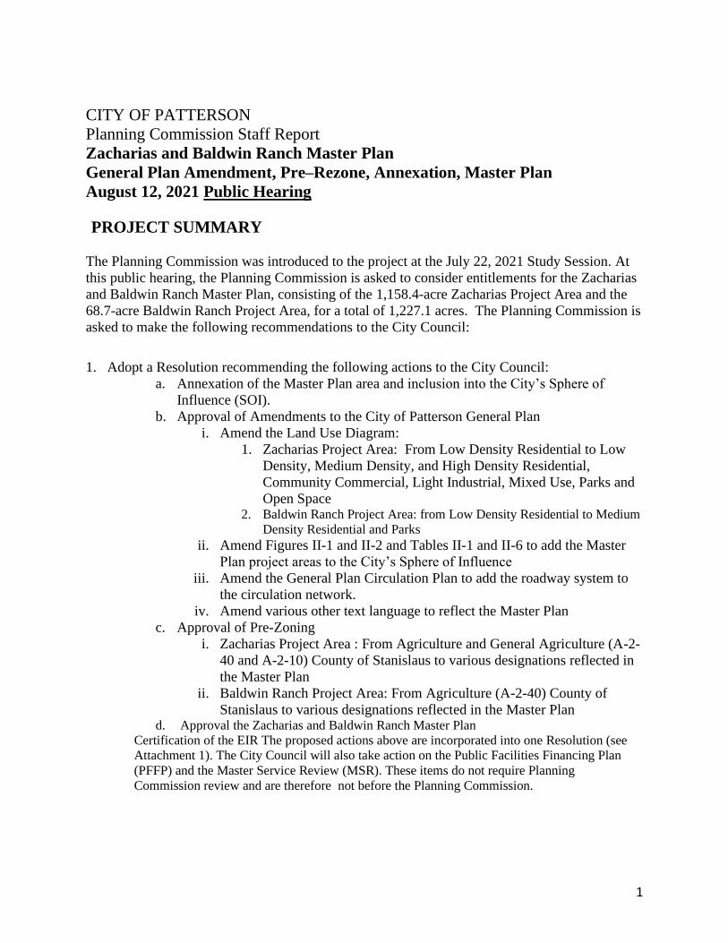
CITY OF PATTERSON
Planning Commission Staff Report
Zacharias and Baldwin Ranch Master Plan
General Plan Amendment, Pre–Rezone, Annexation, Master Plan
August 12, 2021 Public Hearing
PROJECT SUMMARY
The Planning Commission was introduced to the project at the July 22, 2021 Study Session. At
this public hearing, the Planning Commission is asked to consider entitlements for the Zacharias
and Baldwin Ranch Master Plan, consisting of the 1,158.4-acre Zacharias Project Area and the
68.7-acre Baldwin Ranch Project Area, for a total of 1,227.1 acres. The Planning Commission is
asked to make the following recommendations to the City Council:
1. Adopt a Resolution recommending the following actions to the City Council:
a. Annexation of the Master Plan area and inclusion into the City’s Sphere of
Influence (SOI).
b. Approval of Amendments to the City of Patterson General Plan
i. Amend the Land Use Diagram:
1. Zacharias Project Area: From Low Density Residential to Low
Density, Medium Density, and High Density Residential,
Community Commercial, Light Industrial, Mixed Use, Parks and
Open Space 2. Baldwin Ranch Project Area: from Low Density Residential to Medium
Density Residential and Parks
ii. Amend Figures II-1 and II-2 and Tables II-1 and II-6 to add the Master
Plan project areas to the City’s Sphere of Influence
iii. Amend the General Plan Circulation Plan to add the roadway system to
the circulation network.
iv. Amend various other text language to reflect the Master Plan
c. Approval of Pre-Zoning
i. Zacharias Project Area : From Agriculture and General Agriculture (A-2-
40 and A-2-10) County of Stanislaus to various designations reflected in
the Master Plan
ii. Baldwin Ranch Project Area: From Agriculture (A-2-40) County of
Stanislaus to various designations reflected in the Master Plan d. Approval the Zacharias and Baldwin Ranch Master Plan
Certification of the EIR The proposed actions above are incorporated into one Resolution (see
Attachment 1). The City Council will also take action on the Public Facilities Financing Plan
(PFFP) and the Master Service Review (MSR). These items do not require Planning
Commission review and are therefore not before the Planning Commission.
2
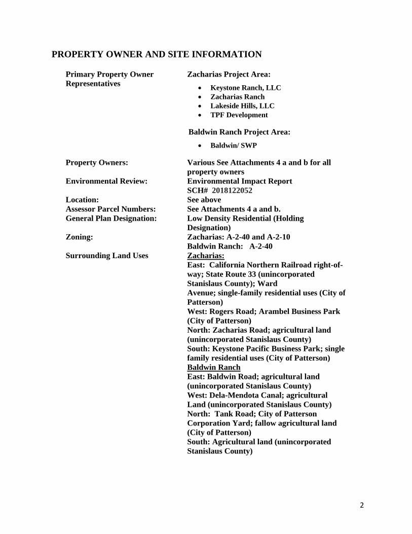
PROPERTY OWNER AND SITE INFORMATION
Primary Property Owner
Representatives
Zacharias Project Area:
• Keystone Ranch, LLC
• Zacharias Ranch
• Lakeside Hills, LLC
• TPF Development
Baldwin Ranch Project Area:
• Baldwin/ SWP
Property Owners: Various See Attachments 4 a and b for all
property owners
Environmental Review: Environmental Impact Report
SCH# 2018122052
Location: See above
Assessor Parcel Numbers: See Attachments 4 a and b.
General Plan Designation: Low Density Residential (Holding
Designation)
Zoning: Zacharias: A-2-40 and A-2-10
Baldwin Ranch: A-2-40
Surrounding Land Uses Zacharias:
East: California Northern Railroad right-of-
way; State Route 33 (unincorporated
Stanislaus County); Ward
Avenue; single-family residential uses (City of
Patterson)
West: Rogers Road; Arambel Business Park
(City of Patterson)
North: Zacharias Road; agricultural land
(unincorporated Stanislaus County)
South: Keystone Pacific Business Park; single
family residential uses (City of Patterson)
Baldwin Ranch
East: Baldwin Road; agricultural land
(unincorporated Stanislaus County)
West: Dela-Mendota Canal; agricultural
Land (unincorporated Stanislaus County)
North: Tank Road; City of Patterson
Corporation Yard; fallow agricultural land
(City of Patterson)
South: Agricultural land (unincorporated
Stanislaus County)

3
PROJECT SITE
The Master Plan is comprised of two project areas. The Zacharias project area is 1,158.4 acres
located on the north end of the City of Patterson bounded by Rogers Road (west), Zacharias Road
(north), the California Northern Railroad tracks and Ward Avenue (east), and existing residential
and business park uses (south). The Baldwin Ranch project area is 68.7 acres located at the south
end of Baldwin Road and is contiguous to the Delta-Mendota Canal (west), the City of Patterson
Corporation Yard (north), and agricultural uses (east and south).
BACKGROUND
Both the Zacharias and Baldwin Ranch areas are included in the 2010 General Plan, adopted on
November 20, 2010, as areas for future urban expansion. Planning for these areas began in
2018. The Planning Commission and City Council held workshops in 2018 to review site
constraints and opportunities. The Planning Commission endorsed a set of Guiding Principles to
set the direction for planning of these areas. These Guiding Principles are summarized below.
In late 2018, the developer stakeholder group submitted development plans for both project
areas; thus, initiating the formal process for consideration of the Master Plan. The goal was for
the developer-initiated plans to serve as the initial basis for the comprehensive Master Plan
under the oversight and direction of the City. Upon review, the City also included the “Ivy-Rose
Ranchette Area” (discussed in further detail below) in the master plan area to prevent the
creation of an unincorporated peninsula, which could pose a potential conflict for the
annexation process through the Local Agency Formation Commission. The Notice of
Preparation for the start of the Environmental Impact Report was issued on December 21, 2018.
Key milestones of project consideration are summarized below:
Event Date
Community Workshop #1 May 1, 2018
Initial workshops at the Planning
Commission and City Council
August 23, 2018 (PC)
November 6, 2018 (CC)
Submittal of development plans
from the stakeholder group
December 2018
Notice of Preparation for the EIR December 21, 2019
Community Workshop #2 January 9, 2019
Community Workshop #3 December 10, 2020
Release of the Draft EIR December 3, 2020
Comments due on the Draft EIR February 4, 2021
Community Workshop #4 July 14, 2021
Planning Commission Study
Session
July 22, 2021
Release of the FEIR July 27, 2021
4
RESPONSE TO COMMENTS MADE AT JULY 22, 2021, STUDY
SESSION
Commissioners and members of the public made a number of comments at the study session.
Following are responses to those comments grouped by topic area. Proposed changes to the
Master Plan can be found in the Errata Sheet (Attachment 2)
Parks:
Overall park acreage. Commissioner West asked why the full 5 acres of park per 1,000
population wasn’t being met on the Zacharias project. After further review, staff would like to
clarify the numbers to illustrate that the project area will fully meet this requirement. The
Zacharias Project Area provides a total of 59.7 acres of neighborhood parks west of the PID
Canal ranging in size from 3.0 – 10 acres. When the Ivy-Rose ranchette area develops, 6.5 acres
of neighborhood parks will be included in this area. These parks are not currently shown in the
Master Plan and may consist of one or two parks depending on the timing and location of
development.
The total neighborhood park acreage for the Zacharias Project Area will be 66.2 acres, slightly
above the required 65.6 acres. Thus, the project meets the required 5 acres of park land per
1,000 population. In addition, the project will contribute towards community parks in the City
as determined by the Development Agreement. The Master Plan will be updated to reflect this
information.
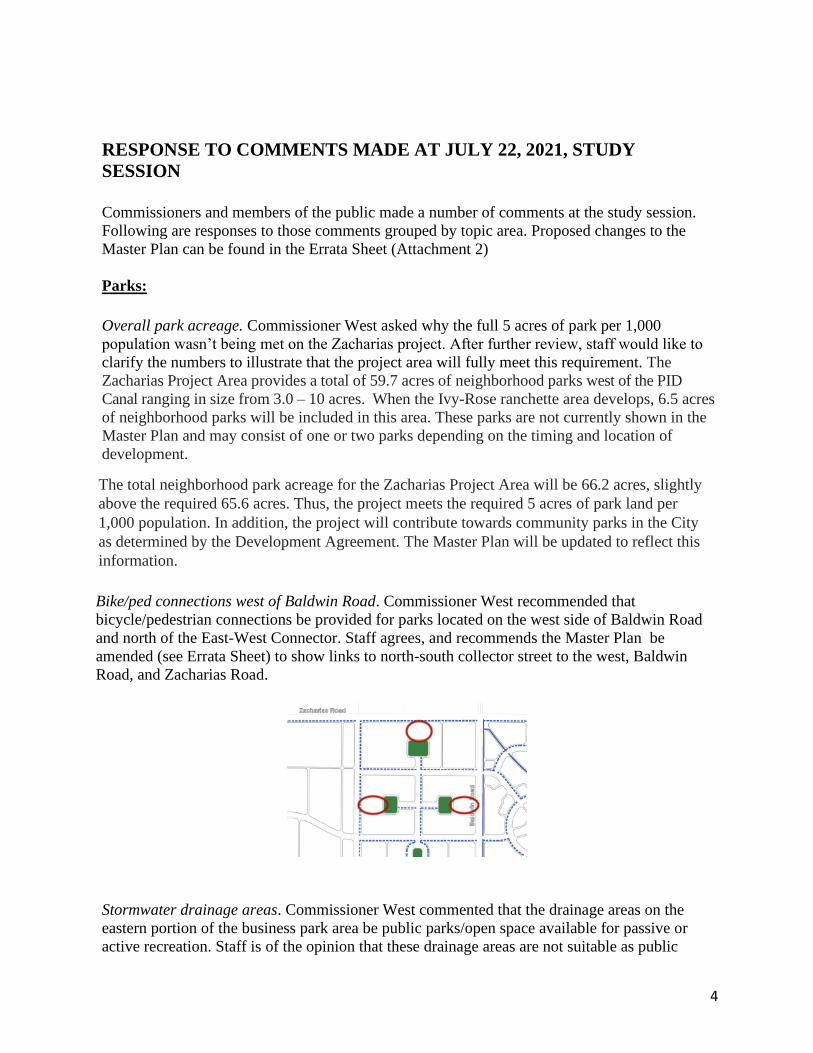
Bike/ped connections west of Baldwin Road. Commissioner West recommended that
bicycle/pedestrian connections be provided for parks located on the west side of Baldwin Road
and north of the East-West Connector. Staff agrees, and recommends the Master Plan be
amended (see Errata Sheet) to show links to north-south collector street to the west, Baldwin
Road, and Zacharias Road.
Stormwater drainage areas. Commissioner West commented that the drainage areas on the
eastern portion of the business park area be public parks/open space available for passive or
active recreation. Staff is of the opinion that these drainage areas are not suitable as public
5
parks/open space due to their location next to industrial uses and unsafe access for users from
the neighborhoods to the east. In addition, these drainage areas are shown conceptually in the
Master Plan and their final size and location is driven by the stormwater retention needs of the
business park and are thus proposed as private facilities. The Master Plan states the following:
"Homes in the vicinity of the business park uses on the west side of the Zacharias Master
Plan will be buffered on the west by a drainage open space area. This drainage open space
area is part of the business park properties to the west with the purpose of providing
sufficient area to meet the stormwater runoff needs of the business park area. It will be
private property and is not intended to be part of the public open space system. The width of
this area will be determined by stormwater detention requirements and the green designation
on the Master Plan is shown for illustrative purposes. The stormwater detention area will be
maintained by the business park, with attractive landscaping and open fencing along the
street frontage. The street frontage will consist of a seven-foot landscaped area separating a
five-foot sidewalk from the street, and a five-foot landscaped area behind the sidewalk. The
open fencing shall consist of either wood rails or wrought-iron fencing. Final details of the
landscaping and fencing will be determined when development plans are submitted for the
business park."
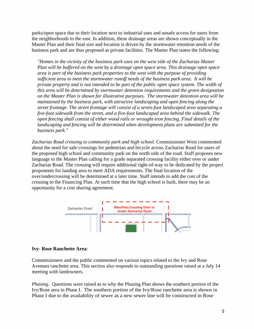
Zacharias Road crossing to community park and high school. Commissioner West commented
about the need for safe crossings for pedestrian and bicycle across Zacharias Road for users of
the proposed high school and community park on the north side of the road. Staff proposes new
language to the Master Plan calling for a grade separated crossing facility either over or under
Zacharias Road. The crossing will require additional right-of-way to be dedicated by the project
proponents for landing area to meet ADA requirements. The final location of the
over/undercrossing will be determined at a later time. Staff intends to add the cost of the
crossing to the Financing Plan. At such time that the high school is built, there may be an
opportunity for a cost sharing agreement.
Ivy- Rose Ranchette Area:
Commissioners and the public commented on various topics related to the Ivy and Rose
Avenues ranchette area. This section also responds to outstanding questions raised at a July 14
meeting with landowners.
Phasing. Questions were raised as to why the Phasing Plan shows the southern portion of the
Ivy/Rose area in Phase I. The southern portion of the Ivy/Rose ranchette area is shown in
Phase I due to the availability of sewer as a new sewer line will be constructed in Rose
6
Avenue in the early stages of the Zacharias project. However, this area will not necessarily
be included in the initial phases of development and, at this time, it is not anticipated that
this area will be developed at the initial stages of the overall project. Staff proposes to
update the Master Plan with this clarification.
Non-conforming uses. One commentor wanted assurances that he can keep his goats upon
annexation. Upon annexation, agricultural uses become non-conforming. The keeping of horses,
cattle, and other livestock may continue in perpetuity unless the use ceases for a six (6) month
period, per Zoning Code Chapter 18.94. Thus, the property owner may continue to have goats
on his property indefinitely as long as the use does not cease or is discontinued for longer than
six months.
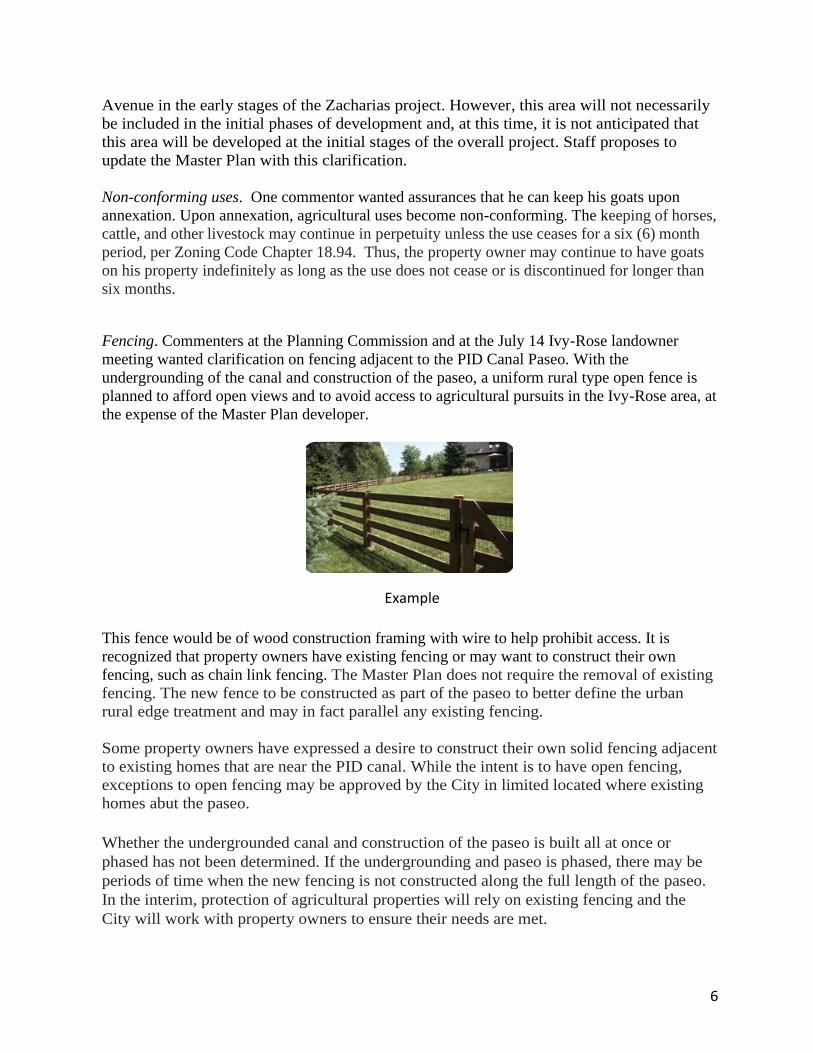
Fencing. Commenters at the Planning Commission and at the July 14 Ivy-Rose landowner
meeting wanted clarification on fencing adjacent to the PID Canal Paseo. With the
undergrounding of the canal and construction of the paseo, a uniform rural type open fence is
planned to afford open views and to avoid access to agricultural pursuits in the Ivy-Rose area, at
the expense of the Master Plan developer.
This fence would be of wood construction framing with wire to help prohibit access. It is
recognized that property owners have existing fencing or may want to construct their own
fencing, such as chain link fencing. The Master Plan does not require the removal of existing
fencing. The new fence to be constructed as part of the paseo to better define the urban
rural edge treatment and may in fact parallel any existing fencing.
Some property owners have expressed a desire to construct their own solid fencing adjacent
to existing homes that are near the PID canal. While the intent is to have open fencing,
exceptions to open fencing may be approved by the City in limited located where existing
homes abut the paseo.
Whether the undergrounded canal and construction of the paseo is built all at once or
phased has not been determined. If the undergrounding and paseo is phased, there may be
periods of time when the new fencing is not constructed along the full length of the paseo.
In the interim, protection of agricultural properties will rely on existing fencing and the
City will work with property owners to ensure their needs are met.
Example
7
As the paseo is constructed, the City will coordinate with property owners on access to the
parkway if desired. The Zacharias Master Plan developers will be responsible for relocating
existing PID connections.
Utilities. One commenter wanted clarification on when a landowner may be required to connect
to public water or sewer, and if the distance from a new line is 100 or 200 feet. For water,
existing private wells may remain but may not be expanded, per City Code Section 13.20.020 or
as amended. Connection to new public water mains is not mandatory until the property is
developed, or unless existing wells fail. Upon annexation, a landowner may connect to City
water at any time. Currently, there is not a requirement to connect to public water even if such
water is available withing 100 or 200 feet (Codes are silent).
For sewer, the Master Plan states that five (5) years after public sewer is provided to within 200
feet of a property, connection to the public sewer may be required within 90 days of the receipt
of an official notice to connect from by the City. A public sewer line will be constructed in Rose
Avenue in the early stages of the Zacharias Master Plan. Construction of this sewer line will
include sewer stub-outs to adjacent properties just outside the right-of- way, at a location
identified by the property owner and at the expense of the master developer.
Street Ends on Ivy and Rose Avenues. Commenters expressed concerns about the ends of Ivy
and Rose Avenues where they abut the canal. The Master Plan illustrates these endings as cul-
de-sacs, and property owner are concerned they will be required to construct cul-de-sacs that
may interfere with existing property improvements. Staff proposes to amend the Master Plan to
characterize these terminus’ as “dead end” streets to reflect their current status, with no intent to
require landowners to construct cul-de-sacs or other street configurations until the properties
develop. When this area develops, appropriate connections to the PID Canal Paseo will be
determined.
PROJECT OVERVIEW
The Master Plan results in a significant expansion of City limits. The Master Plan implements
the vision, goals, and policies of the Patterson General Plan by creating communities with
complete neighborhoods, complete streets, and employment opportunities. The Master Plan
provides land use regulations, development standards and implementation measures to develop
a master planned community. The Master Plan also provides guidelines and standards for
infrastructure, amenities and services needed to serve the development. The Master Plan
ensures that the area develops in a comprehensive and coordinated manner using “smart
growth” principles of mix of land uses, range of housing opportunities and choices, walkable
neighborhoods, a sense of place, preservation of open space, and transportation choices.
The overall vision is to create master-planned communities that provide a quality environment
for work, play, and living as a harmonious and logical extension of the Patterson community.
The Master Plan provides a place for people that work in Patterson to live near their jobs, with
diverse housing types and places to recreate. The Master Plan will have regional benefits to the
community by providing flood and stormwater facilities that extend beyond its boundaries.
The project will maintain sustainable groundwater levels.
8
Master Plan Structure
The Master Plan contains the following sections as described in greater detail below.
Chapter 1: Introduction
Chapter 2: Community Character and Design
Chapter 3: Circulation
Chapter 4: Community Facilities and Services
Chapter 5: Infrastructure and Public Facilities
Chapter 6: Implementation
Chapter 1: Introduction
Chapter 1 describes the project setting, and the overall vision and the guiding principles. The
Guiding Principles for the Master Plan are summarized below:
A. Complete Streets. Create a well-connected network that supports multimodal
transportation within and outside of the Plan Area,
B. Open space. Provide an accessible, high-quality network of multipurpose open spaces that
are connected with a system of bicycle/pedestrian pathways with a goal of every house be
located within 0.25 mile of open space.
C. Land use. Promote land uses that support economic development and City growth.
D. Flexibility. Provide flexibility in land uses and housing densities when suitable.
E. Housing types. Provide a diversity of housing types for different lifestyles, household
sizes, ages, and income levels.
F. Neighborhood hub. Establish a neighborhood hub with a mix of active uses including
commercial, high density residential, schools, parks, and trails
G. Place. Create a distinct sense of place that builds on Patterson’s built and natural heritage.
H. Transition area. Create context-sensitive transition areas that preserve existing and
proposed uses.
I. Infrastructure. Integrate cost-efficient infrastructure systems.
J. Maintenance. Establish long-term maintenance requirements, in particular for the design of
open spaces.
Chapter 2: Community Character and Design
Chapter 2 provides the overall Land Use Plan for each project area and then provides a complete
set of development standards and design guidelines for all aspects of the Master Plan.
9
Land Use
A. Zacharias Project Area (See Figure 5 in the Master Plan)
The Zacharias project area proposes a 1,227.1-acre master-planned community with the
following main components:
▪ Residential neighborhoods with a mix of densities ranging from 3 to 25 dwelling units
per acre
▪ A mixed-use town center with a lake feature as a focal point
▪ A commercial center for local and community retail needs
▪ A business park area to provide for employment opportunities
▪ The Ivy/Rose “ranchette” area with potential for future residential development
▪ A “complete streets” network with bicycle and pedestrian trails connecting the
community
▪ Public schools
▪ An interconnected network of parks and open space for both passive and active
recreation
A total of up to 5,086 residential units, 855,000 square feet of retail uses, and 6,910,000
square feet of business park uses are proposed. See Figure 6 in the Master Plan for a detailed
breakdown).
The eastern portion of the Zacharias Project Area includes the “ranchette” area known as the
Ivy/Rose Avenue area. This 149-acre area consisted of parcels ranging in size from 2-20
acres with agricultural uses and small farms. The Land Use Plan projects this area will
eventually be converted to Low Density residential.
B. Baldwin Ranch Project Area (See Figure 7 in the Master Plan)
The Baldwin Ranch project area proposes a 66-acre residential community in the southern
part of Patterson with 305 single family dwelling units and five acres of park. Low-
medium density residential uses are planned at densities averaging five dwelling units per
acre. The Land Use Plan shows the area with a Medium Density Residential category in
order to allow smaller lot sizes or alternative housing types (alley-loaded, cluster) than what
typically occurs in low-density residential areas. The total unit count would not exceed 305
dwelling units.
Development Standards and Design Guidelines: Chapter 2 provides robust standards and
guideline addressing the following topics:
• Neighborhood housing diversity
• Variety of number of housing plans and styles
• Design of neighborhoods facing open space and adjacent to collector and arterial
streets
• Permitted uses for low, medium, and high-density residential areas
10
• Development guidelines for specific housing types, such as alley-loaded, cluster, and
townhomes
• Mixed use district permitted uses and development standards, including renderings of
mixed-use areas
• Workforce, Affordable and Inclusionary Housing strategies
• Permitted uses and development standards for commercial and business park districts
• Specific guidelines for the Ivy and Rose Avenues ranchette area
• Major and minor gateways/entryways including renderings of major and mixed-use
gateways
• Other community elements including sustainability, walls and fences, lighting, and
signage
More details on key aspects of these design guidelines are provided under Key Issues below.
Chapter 3: Circulation
The purpose of the Circulation Plan of the Master Plan is to establish the general layout and
design standards for road, bicycle and pedestrian facilities in the Plan Area and to implement a
“Complete Streets” network with an integrated roadway and trail system including walking and
bicycling pathways, which extend the City’s existing circulation routes throughout the Plan Area
(See Figures 16 and 25). The concept of a Complete Street is about developing routes for all
transportation modes.
Chapter 3 provides a comprehensive set of standards for development of the mobility system.
The Circulation Plan provides direct and convenient access to all residential, commercial/office
area, and recreational land uses through a safe and efficient network that includes arterial, major
and minor collectors, local streets and bicycle and pedestrian routes. The Master Plan includes a
Bicycle and Pedestrian Network, as well addressing traffic calming measures, transit facilities,
and transportation demand management.
Chapter 4: Community Facilities and Services
Chapter 4 addresses parks and open space, schools, and police and fire services.
Parks and Open Space. The Master Plan includes a comprehensive network of parks and open
space to meet the recreational needs of the community and to connect the Master Plan to the
remainder of the community (See Figure 27). The Zacharias Project Area provides a total of
59.7 acres of neighborhood parks ranging in size from 3.0 – 10 acres. When the Ivy-Rose
ranchette area develops, 6.5 acres of neighborhood parks will be included in this area. These
parks are not currently shown in the Master Plan and may consist of one or two parks depending
on the timing and location of development.
The total neighborhood park acreage for the Zacharias Project Area will be 66.2 acres, slightly
above the required 65.6 acres. Thus, the project meets the required 5 acres of park land per 1,000
population. In addition, the project will contribute towards community parks in the City as
determined by the Development Agreement.

11
The Plan provides a series of small parks and linear parkway to create an interesting focal point
adjacent to the lake feature. The neighborhood parks will be centrally located throughout the
Plan area with a goal of locating them within ¼ mile of every resident.
The Baldwin Ranch Project Area provides a two-acre neighborhood park central to the
neighborhood. In addition, a two-acre detention basin that may also be available for park
purposes is provided at the southwest corner of Tank Road and Baldwin Road. The requirement
for 5 acres per 1,000 population amounts to 4.7 acres. The remainder of the required acreage to
meet 5.0 acres per 1,000 residents will be met by in lieu fees to be used toward community park
facilities.
Schools. Two schools are planned for the Zacharias project area. First, a 14-acre Elementary
School will be constructed east of Baldwin Road adjacent to a planned neighborhood park.
Second, a 14-16 acre middle school is planned west of Baldwin Road. The final location of both
schools will be determined based on a set of school siting guidelines and based on feedback and
requirements of the school district
A new 40-acre High School is planned for the northwest corner of Zacharias Road and Baldwin
Road. Construction of the high school is likely 20 years in the future depending on buildout of
the Zacharias Master Plan and the Villages of Patterson.
A new school site is not planned for the Baldwin Ranch area. The Apricot Valley Elementary
School is located approximately one mile to the north.
Police Services. Buildout of the Master Plan will generate the need for approximately 29
additional police personnel and may create a citywide need for an additional police station or
expansion of the existing police station. The Master Plan will be required to annex to the Police
and Fire Community Services District (CFD) in order to fund the appropriate share of future
public safety personnel and facilities.
Fire Services. Buildout of the Master Plan will generate the need for approximately 21
additional firefighters and may create a citywide need for an additional fire station or expansion
of one of the existing stations. The Master Plan will be required to annex to the Police and Fire
Community Services District (CFD) in order to fund the appropriate share of future public safety
personnel and facilities.
Chapter 5: Infrastructure and Public Facilities
Chapter 5 describes how necessary infrastructure improvements will be provided to comply with
the Infrastructure Master Plans adopted by the City to ensure improvements meet future demand.
Transportation. Buildout of the Master Plans would contribute new trips to intersections,
roadways, and freeways forecast to operate at unacceptable levels. The project is required to
participate in fair share funding programs to address off-site traffic impacts. The Master Plan
will contribute to off-site transportation improvements for a host of intersections throughout the
City and in the unincorporated County as found in Table 6. In addition, the project will
12
contribute toward the construction of the new I-5 interchange. (See more detailed discussion
under Key Issues below).
Water. The City of Patterson derives all of its water supply from groundwater pumping of the
Delta-Mendota Groundwater Subbasin. To meet anticipated water needs, two (2) new additional
wells will need to be completed as part of the water system which will serve the Project Area.
For non-potable supply, the Zacharias Project Area will connect to the existing non-potable
mains on Rogers Road and Baldwin Road.
Implementation of the Master Plan would significantly increase the City’s demands and would
contribute a substantial portion of the City’s anticipated deficiency at buildout. Consequently,
the project is contributing to long-term water supply needs by installing facilities to recharge
both groundwater basins. The project will dedicate land and construct facilities (e.g. collection
ponds, pumping stations, and transmission facilities) to allow for surface waters to be captured
and routed to a basin that will allow for recharge of the lower aquifer. (See discussion on
groundwater under Key Issues).
Stormwater. The storm drainage control facilities will be implemented within the Zacharias
Project Area to address two goals: storm drain recharge, and flood control. The system is
comprised of three main elements:
• Recharge Basin. A storm drain recharge basin facility will be built west of the
annexation area on the north side of Zacharias Road.
• 100-year FEMA Flood Protection. For flood mitigation, the proposed Regional Park to
the West of the future High School site on the north side of Zacharias Road, as shown on
Figure 50, will be designed to store the anticipated 183 acres of flood water runoff for a
100-year, 24-hour storm event.
• Detention and Retention Basins, and Lakes. The storm drainage system will run with
multiple stages of storage and retention within the project site. This system is described
in detail in Chapter 5.4.
The Baldwin Ranch project area will connect to the City’s storm drain detention system and will
include a detention basin at the northeast corner.
Sewer. The Zacharias project area will be phased to coincide with planned expansions of the
City’s Water Quality Control Facility, and with the construction of the North Patterson Trunk
Sewer. The Baldwin Ranch project area will be served by a sewer main in Baldwin Road
connecting to the South Sperry Trunk Line.
Solid Waste. Solid waste will be hauled Fink Road Landfill which has ample capacity. The
project will implement a construction and demolition recycling program.
Chapter 6: Implementation
Chapter 6 provides a roadmap for funding and administration of the Master Plan as the area
develops over a period of 20+ years. The Plan allows for minor adjustments at the staff level, and
major adjustments to be approved by the Planning Commission and City Council.
13
Infrastructure will be funded by a variety of funding sources as outlined in the Public Facilities
Financing Plan (PFFP). The majority of the backbone infrastructure will be funded by a new
Community Facility District (CFD). Funding will also be provided by impact fees, regional fees,
the Maintenance CFD, Police and Fire CFD, and private investment.
GENERAL PLAN CONSISTENCY
The project’s consistency with the General Plan can be summarized by major themes.
Compliance with specific General Plan policies is summarized in Attachment 1.
Complete Neighborhoods. The Master Plan will provide a mix of housing products and
densities. In the Zacharias area, densities range from low to high densities. This Master Plan
provides design guidelines that call for a diversity of housing types. The Zacharias area will
have a mixed-use neighborhood center with a focus on the lake frontage. This center is central to
the project and will serve as an active community gathering place within walking or biking
distance to most of the community.
Baldwin Ranch provides for medium density housing at the southern edge of the City. Because
of its smaller size, a range of densities is not feasible. Similar to Zacharias, the area will have a
mix and variety of housing types and lot sizes.
Comprehensive Mobility Network and Complete Streets. The Master Plan will have a
complete and interconnected mobility system with a hierarchy of arterial, major and minor
collector, and local streets that provide for ease of travel by auto, bicycles and pedestrians. The
arterial and collector street sections will include Class I or Class II bicycle paths and sidewalks
separated from the roadway to encourage alternative modes of travel. A system of Class I
“paseos” will transverse the project, enhancing bicycle and pedestrian activity. The Circulation
Plan includes traffic calming measures, including roundabouts, to enhance safety.
Connected Community Facilities. Parks and schools will be within a short walk or bicycle
ride from every home. The Class I “paseos” connect to the parks and schools.
Connectivity to the Community. The project area will connect to the surrounding
neighborhoods, regional retail centers and employment. The Zacharias area will include a
community shopping center to provide a wide range of grocery, general merchandise and apparel
services to the community. The project area also includes +317.5 acres of business park uses
which were previously designated for residential and are being changed to business park to
enhance the City’s job-housing balance. It is connected to the existing community via Ward
Avenue, Baldwin Road, Rogers Road and a new north-south collector. The PID canal paseo will
provide for bicycle and pedestrian access to the neighborhood to the south and the high school
and will ultimately link to a regional trail system.
Baldwin Ranch is connected to the south end of the community via Baldwin Road. It is located
in close proximity to commercial area and employment.
14
Issues Specific to the Northern Expansion Area. Issues specific to the Northern Expansion
Area are discussed throughout the Master Plan.
• High School Site.
• South County Corridor.
• Land Use Compatibility with Existing Industrial Businesses.
• Timing of I-5 Interchange.
• Flooding Impacts.
Implementation: Infrastructure, Financing and Phasing. Chapters 5 and 6 outline a
comprehensive infrastructure, phasing and financing plan. Infrastructure will comply with the
Infrastructure Master Plans developed by the City.
DISCUSSION OF KEY ISSUES
Land Use and Design
Ivy and Rose Avenues Ranchette Area. The 144-acre Ivy-Rose ranchette Area is a unique area in
the Zacharias Master Plan as it is comprised of small-scale farms and agricultural pursuits. The
Master Plan (Chapter 2.7) addresses these unique elements by outlining the treatment of non-
conforming uses and the maintenance of existing water wells and septic systems. Existing water
wells may remain and connection to public water is not required until the property develops.
Septic systems may remain until five years after public sewer is provided to within 200 feet of a
property. Landowners may maintain access to the PID irrigation water until the property
develops.
The planned infrastructure for the Master Plan will have sufficient capacity to serve the Ivy-Rose
areas once the area develops. The Master Plan includes principles to apply to infrastructure
timing and financing.
City staff and the stakeholder group have met with the Ivy – Rose landowners on several
occasions to hear comments and answer questions. Responses to remaining comments are found
above.
Housing Diversity and Range of Housing Types. A central theme of the Master Plan is to ensure
a wide range of housing types for households of all income levels and needs. Figure 8 of the
Master Plan identifies a “core” area where a greater mix of housing types is most desired. At
least 30 percent of the medium density residential uses must be a “non-standard” housing types,
including small lot, alley-loaded, cluster, townhomes, and duplexes on corners. In non-core
portions of the Plan, at 10 percent of the medium density uses must be non-standard. The Plan
provides “prototypes” for these housing types with examples.
Neighborhood Design. The Plan places an emphasis on neighborhood design adjacent to open
spaces and adjacent to collector street (See Chapter 2.2 A. 4.). For open spaces, the goal is to
enhance safety by providing “eyes on the space” and avoiding homes backing onto the open
space. In most cases, a local street would parallel paseos with home facing toward the paseo.

15
Open cul-de-sacs is also an option to provide design diversity. When homes do back on to the
open space, such as the lake, open fencing is required.
For neighborhoods facing arterial and collector streets, the goal is to avoid a “canyon” effect
while ensuring noise attenuation standards are met. Solutions include:
• Side-on homes with short block lengths.
• Parks and Open space abutting the streets.
• Multi-family and mixed use abutting the streets.
• Open Cul-de-sacs
• Robust landscaping and soundwall design
• Enlarged setbacks
• Frontage street
Transition areas/edge conditions. The Plan focuses on transition areas in two main areas (See
Chapter 2.2 A. 5):
• First, the residential uses in the western portion of the Zacharias project area will be
transition to the business park uses to the west with an intervening drainage open
space/buffer area. This drainage open space area is part of the business park properties to
the west with the purpose of providing sufficient area to meet the stormwater runoff
needs of the business park area. It will be private property and is not intended to be part
of the public open space system. The stormwater detention area will be maintained by
the business park, with attractive landscaping and open fencing along the street frontage.
(See further discussion above under Response to Comments).
• Second, the Plan provides for a buffer area around the City Corporation Yard in the
Baldwin Ranch project area to protect homes from nuisances generated by corporation
yard operations and to protect the long-term viability of the yard as a significant public
investment. Buffering would consist of a masonry wall, 10-15 foot buffer area, and a
street paralleling the landscaped buffer.
PID Canal/Parkway. An open Patterson Irrigation District canal currently runs north- south
through the Zacharias project area. The Plan calls for the canal to be undergrounded and become
a significant 40-foot Class I paseo for recreational use connecting to community facilities to the
south. The paseo would include open fencing with either wrought iron or open wood fencing on
the east side adjacent to the Ivy-Rose area. The landscaped paseo would include bike and
walking trails along with benches, trash receptacles, and lighting. (See also discussion under
Response to Comments above).
Mixed Use Center. The Mixed-Use District provides an exciting focal point for the community.
The “town center” design facing the lake creates opportunities for vibrant gathering places and a
distinct sense of place with public plazas and open spaces, including walking paths along the
waterfront. The mixed-use center contributes to the need for housing diversity, with upper floor
dwelling and ground floor retail and the opportunity for live-work units. (See page 46 for
renderings of the Mixed Use Plaza).

16
Gateways. Entryway features ensure the community has a clear identity and help accentuate key
views into the community. Major gateways into the include the Major Gateway at Baldwin Road
and the east-west connector, and the Mixed Use Gateway at Baldwin and the entrance to the
mixed use area. Zacharias project area. Major Gateways are characterized by iconic monuments,
landscaping, pavement treatments, and signage. (See pages 55-57 for renderings of the major
gateways).
Affordable and Inclusionary Housing. The Master Plan addresses affordability in several
different ways. First, the Plan provides for a diverse spectrum of housing opportunities in terms
of product type and lifestyle choices. This spectrum addresses the concept of “affordable by
design” where smaller homes on smaller lots, townhomes, and apartments provide choices that
are typically less expensive to own or rent than standard-sized homes on larger lots.
Second, the Plan will be subject to the City’s Inclusionary Ordinance that provides a menu of
requirements to address the housing needs of Extremely Low, Very Low-, Low-, and Moderate-
Income households with at least 15 percent of the units provided at an affordable housing cost.
The Inclusionary Ordinance seeks to integrate deed-restricted affordable housing units into all
new housing developments through construction of deed restricted for-sale homes or market-rate
apartments with a percentage of deed-restricted units available for low and very low income
households. Options to on-site affordable housing include land dedication, subsidies to
affordable communities, and payment of in-lieu fees. Chapter 2.3 outlies how this ordinance
would apply to the Master Plan.
While no affordable Tax Credit financed apartment units are inherently incorporated into the
Master Plan design, a Tax Credit apartment builder would also not be precluded from integrating
and constructing a Tax Credit project either. In this regard the Master Plan is intended to
accommodate and not frustrate a Tax Credit opportunity should one present itself.
Inclusionary and affordable housing needs are ever evolving, and the project would be subject to
the Inclusionary Ordinance in effect at the time of individual subdivision or multi-family
submittal.
Infrastructure Issues
Groundwater. Several concerns have been raised about the continued reliance on groundwater
for the water supply with an overall declining trend in groundwater storage in the upper and
lower aquifer. The proposed project would (1) reduce pumping from the aquifer; (2) reduce
recharge to the upper aquifer but at a rate lower than the reduction in pumping; (3) increase
usage of potable water but in a sustainable manner; and (4) increase recharge to the lower aquifer
in a manner that would help offset the increase in pumping. In sum, the proposed project would
be expected to have a positive impact on groundwater recharge because of the net reduction of
groundwater withdrawal and net increase in direct recharge to the lower aquifer.
Transportation. A Traffic Impact Study (TIS) was conducted for the project and is fully
explained in the EIR. Project traffic impacts were analyzed based on the General Plan policy to
maintain at least a Level of Service “D” on all streets and intersections in the City. The TIS also
analyzed streets and intersections outside of the City that would be impacted by the project.

17
Buildout of the Master Plans would contribute new trips to intersections, roadways, and freeways
forecast to operate at unacceptable levels. Twenty-one feasible mitigation measures are proposed
to reduce project impacts, either as a fair share contribution or a project responsibility. For
certain facilities such as portions of Sperry Avenue, the improvements required by the mitigation
measures would not restore operations to acceptable levels based on projected 2040 traffic. In
addition, mitigation measures are proposed for facilities that are outside the jurisdiction of the
City of Patterson and, therefore, uncertainty exists regarding their implementation. The EIR
concluded this impact is significant and unavoidable. The proposed mitigation measures are
robust and provide significant improvements to the transportation system that address traffic
impacts to the extent feasible.
The Stanislaus Council of Governments is studying the development of a South County Corridor
between Interstate 5 near Patterson and SR-99 in Turlock. A Feasibility Study was released in
2016 that considered alignment options and recommended that three of the alternatives be
carried forward for further review, including alignment along Zacharias Road. The Master Plan’s
circulation plan accommodates two alignments of the future South County Corridor and limits
the number of connections along Zacharias Road. If the South County Corridor is not developed
along Zacharias Road, this roadway would still be improved to arterial standards.
As part of the overall South County Corridor, a new I-5 interchange is being planned at I-
5/Zacharias Road. When built, it will provide much relief from traffic congestions along Sperry
Avenue and other major roadways in the City and will lessen this project’s impact on City
Streets. This project will provide a fair share contribution to the interchange.
State Law was modified in 2017 to require traffic evaluations based on Vehicle Miles Traveled
(VMT), instead of traditional LOS evaluations. Because no thresholds have been adopted by a
State or regional agency at the time of Draft EIR release, the City of has elected to conduct a
qualitative analysis. Both Master Plans contemplate residential communities within proximity to
employment, retail, services, schools, and parks. In addition, the Master Plans contemplate a
multi-modal transportation network consisting of roadways, on-street and off-street bicycle
facilities, and pedestrian facilities. Collectively, these attributes create opportunities for shorter
vehicle trips and non-motorized trips. Buildout of the Master Plans would also promote
improving jobs-housing balance in Patterson. New employment opportunities would be located
within 2 miles of most of the proposed Mater Plan residential uses, close enough to enable
workers who live in Patterson to consider alternate modes of transportation, especially bicycling.
The Master Plan also requires Transportation Demand Management measures, in particular for
the business park portion of the project.
Annexation Issues
Fiscal Impact to the City. The Fiscal Impact Analysis analyzed the projected revenues from the
project compared to projected City expenses, assuming the project will annex into existing
Community Facilities Districts for public safety and maintenance. It is projected that the project
will break even and will have no negative fiscal impact on the City.

18
Development Agreement. A Development Agreement (DA) will be part of the entitlement
package. The purpose of the DA is to set forth agreements between the City and developer on a
host of items relating to infrastructure requirements, development timing, contributions to off-
site infrastructure and public facilities, and affordable housing. Conditions of approval and
mitigation measures will be attached to the DA. The DA provides an opportunity for the City to
receive significant community benefits in exchange for granting certain rights to the developer.
The Development Agreement will be presented at a public hearing to the Planning Commission
at a later date, prior to the City Council’s public hearing on this item.
LAFCO Annexation Issues. Both project areas involve the annexation of new territory to the City
of Patterson. Per State Law, the Local Agency Formation Commission (LAFCO) must approve
the annexation after the City Council has taken action. LAFCO policies for annexation focus on
agricultural land mitigation, and assurances that the project is viable and demonstrates orderly
growth.
• Ag Mitigation. The Zacharias project area converts 1,184.9 acres of Important Farmland to urban
development, and the Baldwin Ranch project area converts 61.48 acres. Consistent with LAFCO
policy, Mitigation Measure AG-1 provides two options for mitigating the loss of farmland: (1) the
direct preservation through an irrevocable instrument at no less than a 1:1 ratio or (2) payment of
fees into an adopted fee program that would preserve farmland at no less than a 1:1 ratio. Under
either approach, farmland would be preserved at no less than a 1:1 ratio. The City if of the opinion
that this approach establishes a clear performance standard but also allows flexibility for
implementation.
• Orderly Growth. LAFCO questioned why the entire area needs to be added to the SOI and city limits
if development is not imminent. The City maintains that the entire Baldwin and Zacharias Master
Plan areas are needed to be annexed in order to ensure that urban services and infrastructure can be
provided. The Master Plans propose roadways, water, sewer, storm drainage, schools, parks, and an
off-site flood control basin. Phase 1 would consist of the areas immediately adjacent to the Patterson
city limits and Phase 2 would consist of the outlying areas. However, as a practical matter,
infrastructure needed to serve both phases would be located throughout the Master Plan boundaries.
Thus, annexing the entire area would be consistent with sound planning principles because it would
allow for the timely and efficient development of infrastructure improvements.
ENVIRONMENTAL IMPACT REPORT
A Draft Environmental Impact Report (DEIR) was prepared in accordance with the California
Environmental Quality Act (CEQA) to evaluate the potential environmental impacts associated
with the implementation of the Baldwin Master Plan / Zacharias Master Plan Project (State
Clearinghouse No. 2018122052). The DEIR was released for public review on December 3,
2020 with a 45-day review period, which was extended to February 4, 2021. A total of nine
comments were received. The Final EIR (FEIR) responds to the comments and modifies
language in the DEIR to respond to the comments. The FEIR was released on July 27, 2021. The
City Council must ultimately certify the FEIR after a recommendation from the Planning
Commission.
19
The purpose of the EIR is to inform decision makers, representatives of affected and responsible
agencies, the public, and other interested parties of the potential environmental effects that may
result from implementation of the proposed project. The EIR describes potential impacts relating
to a wide variety of environmental issues and methods by which these impacts can be mitigated
or avoided.
The EIR concludes that several significant project impacts are “Significant Unavoidable Adverse
Impacts” meaning the impact cannot be reduced to less than significance with mitigation. These
significant unavoidable impacts are outlined on page ES-2 of the DEIR and include Important
Farmland, Air Quality, Greenhouse Gas Emissions, and Traffic. The DEIR explains the reasons
these impacts cannot be fully mitigated with proposed mitigation, largely due to the fact that City
or developer doesn’t have the jurisdiction or ability to fully mitigate. In order for a project to be
approved with unavoidable impacts, the City must make findings and statements that there are
overriding economic, legal, social, technological, or other benefits that outweigh the unavoidable
adverse impacts.
The EIR also outlines potentially significant impacts that can be reduced to less than significant
with mitigation. Impacts in this category include:
• Biological Resources
• Cultural Resources and Tribal Cultural Resources
• Geology, Soils, and Seismicity
• Hazards and Hazardous Materials
• Hydrology and Water Quality
• Noise
• Public Services and Recreation
RECOMMENDATION
Staff recommends the Planning Commission:
1. Conduct a public hearing and allow members of the public to testify;
2. Consider the issues discussed in this report; and,
3. Adopt the attached Resolution recommending that the City Council approve the General
Plan Amendment, Annexation, Pre-zoning, Master Plan (with errata sheet), and Final
Environmental Impact Report, subject to the findings in the Resolution and conditions of
approval.
ATTACHMENTS
1. Planning Commission Resolution #2021-05
2. Master Plan Errata Sheet
3. Conditions of Approval
4. General Plan Consistency Analysis

20
5. Zacharias and Baldwin Ranch Master Plan
6. Final EIR with Mitigation Monitoring Program
7. Map with all property owners
Planning Commission Resolution 2021-05
Page 1
{CW106550.6}
RESOLUTION 2021-05
A RESOLUTION OF THE CITY OF PATTERSON PLANNING COMMISSION
RECOMMENDING THAT THE CITY COUNCIL
CERTIFY A FINAL ENVIRONMENTAL IMPACT REPORT,
AND APPROVE A GENERAL PLAN AMENDMENT, ANNEXATION, PRE-ZONING,
AND MASTER PLAN FOR THE 1,158.4 ACRE ZACHARIAS PROJECT AREA AND
THE 68.7 ACRE BALDWIN RANCH PROJECT AREA
WHEREAS, the City of Patterson (“City”) has initiated consideration of a “Master Plan” for
the Zacharias and Baldwin Ranch areas. The purpose of this Resolution is to recommend that
the City Council approve (i) a General Plan Amendment to designate the land uses of the
Zacharias and Baldwin Ranch areas to be consistent with the Master Plan, (ii) an Annexation
application to the Stanislaus Local Agency Formation Commission, (iii) Pre-zoning of the
Master Plan areas, (iv) the Master Plan document that covers approximately 1,227.1 acres in
total, and (v) certification of a Final Environmental Impact Report for the Master Plan; and
WHEREAS, a Final Environmental Impact Report (“Final EIR”) was prepared for the Master
Plan in accordance with the California Environmental Quality Act (“CEQA”) (SCH No.
201822052) to identify environmental impacts associated with the Master Plan, and also to
require mitigation measures to reduce the significance of environmental impacts to the extent
feasible; and
WHEREAS, City Staff conducted a full analysis of the Master Plan project and the Final EIR
to ensure compliance with the City’s General Plan, Municipal Code, CEQA, and other applicable
laws, regulations, and standards; and
WHEREAS, the Planning Commission conducted a duly noticed public hearing on August
12, 2021 to review the Master Plan project and the entitlements connected to the Master Plan;
and
WHEREAS, based on its independent review and analysis, analysis from City Staff, and oral
and written testimony, the Planning Commission finds, after due study, deliberation and public
hearing that the following circumstances exist:
1. That the Master Plan project is consistent with the goals, policies, and standards of the
General Plan. The Master Plan provides for an orderly development strategy, complete
neighborhoods with complementary land uses, an interconnected mobility network, and
connectivity to the community (LU-1.1); efficient roadway patterns and alternative
modes of travel (T-1, T-7.1); new parks and open space providing recreational
opportunities to residents and visitors (PR-1, PR-1.3, PR-1.5); long-term economic
development and sustainability for City businesses and workers (ED-1, ED-2.4, ED-3);
and public services and facilities at the necessary levels of service through

Planning Commission Resolution 2021-05
Page 2
{CW106550.6}
comprehensive infrastructure, financing, and phasing plans (LU-1.15; PS-1 through PS-
7).
2. That the Master Plan project is compatible with surrounding land use designations.
3. That the Master Plan project will zone land for all housing types and assist the City in
meeting its Regional Housing Needs Allocation goals, consistent with the City’s Housing
Element (LU-2; Housing Element Goal 3, Objective 3-2, Objective 3-3).
4. That with implementation of infrastructure and financing plans, there will be adequate
public services and facilities to serve the Master Plan, including but not limited to, fire
protection, police protection, schools, water supply, sewage treatment, stormwater
drainage, and schools.
5. That the Master Plan project will advance the health, safety, comfort, convenience and
general welfare of the community.
6. That the Final EIR adequately addresses all known environmental impacts resulting from
the Master Plan project and provides mitigation measures to address significant impacts
to the extent feasible. The Final EIR discovered that some environmental impacts are
significant and unavoidable. The Planning Commission acknowledges that the City
Council will need to make Findings of Fact and adopt a Statement of Overriding
Considerations for the significant environmental impacts identified in the Final EIR.
NOW, THEREFORE, BE IT RESOLVED by the Planning Commission as follows:
The Planning Commission hereby recommends that the City Council certify the Final EIR,
and approve a General Plan Amendment, Annexation, Pre-zoning, and Master Plan for the
Zacharias and Baldwin Ranch project areas.
The foregoing resolution was introduced at a regular meeting of the Planning Commission, held
on the 12th day of August 2021, by ____________________, who moved its adoption, which
motion was duly seconded by _____________________, and it was upon roll call carried and the
resolution adopted by the following vote:
AYES:
NOES:
EXCUSED:
Planning Commission Resolution 2021-05
Page 3
{CW106550.6}
APPROVED:
__________________________________
Ron West, Chairperson
City of Patterson Planning Commission
ATTEST:
__________________________________
Denise Melo, Secretary
City of Patterson Planning Commission

1
Errata Sheet Zacharias and Baldwin Ranch Master Plan August 12, 2021
I. Bike/Ped Connections for Parks West of Baldwin Road Amend the following exhibits to show a bike/ped connection for parks located on the west side of Baldwin Road and north of the East-West Connector. Show links to north-south collector street, Baldwin Road, and Zacharias Road. Figure 5: Zacharias Land Use Plan Figure 16: Zacharias Circulation Plan Figure 25: Bicycle and Pedestrian Plan
II. Park Acreage
Amend the language on pages 79-80 to clarify park acreages. B. Neighborhood Parks.
Neighborhood parks provide easily accessible open space for local residents. Neighborhood parks
typically offer a range of active and passive activities and are reachable by walking or biking without
crossing major streets.
The Zacharias Project Area provides a total of 59.7 acres of neighborhood parks west of the PID Canal
ranging in size from 3.0 – 10 acres. The smaller “pocket” parks will focus on playgrounds, picnic areas,
and sports fields. The larger parks will be able to accommodate multiple sports fields as well as walking
paths and larger group picnic areas. The Plan provides a series of small parks and linear parkway to
create an interesting focal point adjacent to the lake feature.
When the Ivy-Rose ranchette area develops, 6.5 acres of neighborhood parks will be included in
this area. These parks are not currently shown in the Master Plan and may consist of one or two
parks depending on the timing and location of development.
The total neighborhood park acreage for the Zacharias Project Area will be 66.2 acres, slightly
above the required 65.6 acres. Thus, the project meets the required 5 acres of park land per
1,000 population. In addition, the project will contribute towards community parks in the City as
determined by the Development Agreement.
The 59.7 acres represents 4.5 acres per 1,000 residents. The remainder of the required 65.6 acres to
meet 5.0 acres per 1,000 residents will be met by in lieu fees to be used toward the Community Park.
This required acreage of 65.6 acres includes park acreage triggered by potential residential
development in the Ivy-Rose ranchette area. When this area develops, consideration should be given
to providing one or two neighborhood parks in this area.
III. Grade Separated Bike/Ped Crossing Over Zacharias Road
Amend language on page 83 to read:
2
D. Relationship to Community / Regional Parks
A Community or Regional Park serves a broader segment of the community and is more of a
“destination,” and should be located within 1 – 2 miles of every resident. A North Community Park
is tentatively planned on 20 acres in the vicinity of the high school site at the northwest corner of
Zacharias Road and Baldwin Road, in close proximity to the Zacharias Master Plan, to be
determined based on the update to the Parks Master Plan and on the feasibility of joint use of
flood control and recreation facilities. This park may take advantage of opportunities for joint use
of facilities such as an aquatics facility, indoor gym, or a lighted tennis court complex.
To provide for bicycle and pedestrian access to the high school and potential community park
on the north side of Zacharias Road, a grade separated crossing will be provided over or
under Zacharias Road in proximity to these facilities.
The financing plan and for the Zacharias Master Plan will provide a funding contribution for community or regional park facilities, as determined by the Development Agreement.
Amend Figure 25: Bicycle and Pedestrian Plan to show bicycle/pedestrian grade separated crossing under or over Zacharias Road in proximity to the proposed high school and community park. Add Subsection D. on page 73 to read:
D. Grade Separated Bicycle and Pedestrian Crossing Over Zacharias Road. To provide for bicycle and pedestrian access to the high school and potential community park
on the north side of Zacharias Road, a grade separated crossing will be provided over or under
Zacharias Road in proximity to these facilities. Sufficient right-of-way shall be provided in the
Zacharias Land Use Plan to accommodate this crossing.
IV. Section 2.7 Ivy and Rose Avenues Ranchette Area
C. Circulation
The existing Ivy Avenue and Rose Avenue will remain local streets and will terminate at the west end
with a dead-end street cul-de-sac adjacent to the PID Canal. When this area develops, appropriate
connections to the PID Canal Paseo will be determined. A new arterial street will extend through
this area from Highway 33 westerly as part of the Master Plan east-west connector. The terminus of
this arterial at Highway 33 will replace the intersection of Ward Avenue and Highway 33, which will
have a cul-de-sac terminus.
D. Utilities
1. Water: Existing private wells may remain but may not be expanded, per City Code Section 13.20.020 or as amended. Connection to new public water mains is not mandatory until the property is developed, or unless existing wells fail. Upon annexation, a landowner may connect to City water at any time. Property owners will be responsible for connection and impact fees in effect at the time of connection. 2. Sewer and septic systems: Five (5) years after public sewer is provided to within 200 feet of a
property, connection to the public sewer may be required within 90 days of the receipt of an official
3
notice to connect from by the City. A public sewer line will be constructed in Rose Avenue in the early
stages of the Zacharias Master Plan. Construction of this sewer line will include sewer stub-outs to
adjacent properties just outside the right-of- way, at a location identified by the property owner and
at the expense of the master developer. Property owners will be responsible for connection and
impact fees in effect at the time of connection.
E. PID Canal and Parkway
Per Chapter 3 of this Master Plan, the PID Canal will be undergrounded with a paseo constructed
over the 40-foot easement. A rural type fence (see Chapter 3) will be constructed on the east side
of the paseo in conjunction with the undergrounding of the canal and construction of the
paseo, at the expense of the Master Plan developers. This fence is intended to provide
open views and avoid access to agricultural lands in the Ivy-Rose area. It is recognized the
existing fencing provides access protection to the ranchette properties. The Master Plan
does not require the removal of existing fencing and the new fencing may ultimately
parallel existing fencing, Exceptions to open fencing may be approved by the City in
locations where existing homes abut the paseo.
Whether the undergrounded canal and construction of the paseo is built all at once or
phased has not been determined. If the undergrounding and paseo is phased, there may
be periods of time when the new fencing is not constructed along the full length of the
paseo. In the interim, protection of agricultural properties will rely on existing fencing and
the City will work with property owners to ensure their needs are met.
. On the west side of the parkway, a parallel street to the parkway or other acceptable
configuration will provide an open feel land use interface.
As the paseo is constructed, the City will coordinate with property owners on access to the parkway if
desired. The Zacharias Master Plan developers will be responsible for relocating existing PID
connections.
V. Phasing Plan
6.3 Phasing
The actual pace and sequence of development will be driven by several factors, including:
• Market Demand
• The availability of infrastructure funding
• Availability of private investment
In turn, these factors will dictate the pace of infrastructure improvements not just to serve the Plan
Area, but also to serve existing infill development opportunities in the City of Patterson as well as the
approved development, including Keystone Pacific, Villages of Patterson, and West Patterson
Business Park Expansion (Arambel).
The phasing of the infrastructure will be planned so that initial project construction will not be
burdened with construction of improvements not needed until later in the project build-out.
The scope, timing and location of each phase shall be determined by the developer and may change
at the discretion of the developer, provided all infrastructure improvements necessary to serve that
portion or phase of the project are in place prior to occupancy of that portion or phase of the
project. Proposed infrastructure plans will be reviewed and approved by the City to ensure that sizing
of the infrastructure for each portion or phase of development is appropriate.
4
Development of the Zacharias Project Area is expected to occur over the course of approximately 20
years. The various areas of the Master Plan are anticipated to be developed in two major phases.
Development is anticipated to generally start in the southeast area of the project (Keystone
Ranch) and move west and then north. Although the southern portion of the Ivy/Rose
ranchette area is shown in Phase I due to the availability of sewer, this area will not
necessarily be included in the initial phases of development and, at this time, it is not
anticipated that this area will be developed at the initial stages of the overall project.
The Baldwin Ranch Project Area is expected to develop in a single phase.
(Note: keep map as is)
VI. Undergrounding of Utilities Add Section 5.7 to Chapter 5: 5.7 Undergrounding of Utilities
All on-site utilities shall be underground. All existing overhead utilities adjacent to the property or within the property shall be placed underground by the applicable phase prior to issuance of building permits for that phase. All utility boxes including electrical, telephone, cable T.V., etc., shall be underground.
Conditions of Approval
Draft July 28, 2021
Planning
1. Development of the project shall be in accordance with the approved Master Plan, as modified by these conditions and as may be modified by a development agreement between the City and developer. In the event of any conflict between these conditions and the terms of any development agreement between the City and developer, the terms of the development agreement will control and these conditions will be deemed modified.
2. The project shall be subject to all the mitigation measures found in the Mitigation Monitoring
and Reporting Program (MMRP) of the Zacharias and Baldwin Ranch Final Environmental
Impact Report, as adopted by the City Council.
3. Developer agrees to and shall hold the City, its officers, agents, employees, and representatives harmless from liability for damage or claims for personal injury, including death, and claims for property damage which may arise from the direct operations of the developer or those of its contractors, subcontractors, agents, employees or other persons acting on its behalf with respect to the project. Developer agrees to and shall defend the City and its officers, agents, employees, and representatives from actions for damages caused or alleged to have been caused by reason of developer’s activities in connection with the project. This hold harmless agreement applies to all damages and claims for damages suffered or alleged to have been suffered by reason of the operations referred to above, regardless of whether or not the City prepared, supplied or approved plans or specifications or both for the project. Developer further agrees to indemnify, hold harmless, pay all costs and provide a defense for City in any action challenging the validity of the development agreement. Developer may elect to, but shall not be obligated to, pay for a separate defense for City if City elects to retain independent legal counsel.
4. Development shall conform with the adopted zoning requirements except as otherwise approved by the Master Plan.
5. In the Baldwin Ranch project area, walls shall be included along the interface with the Delta Mendota Canal, as approved by the City Engineer.
Non-Residential (Conditions 6-14)
6. Prior to issuance of a building permit for any non-residential development, an exterior lighting plan and site lighting footcandle plan shall be prepared subject to the review and approval of the Community Development and Police Departments.
7. Prior to issuance of a certificate of occupancy for all non-residential buildings, all ducts, meters, air conditioning equipment and all other mechanical equipment, whether on the ground, on the structure or elsewhere, shall be screened from public view with materials

architecturally compatible with the main structure. It is especially important that gas and electric meters, electric transformers, and large water piping systems be completely screened from public view, subject to utility company guidelines. All roof-mounted equipment which generates noise, solid particles, odors, etcetera, shall cause the objectionable material or effects to be directed away or shielded from adjoining land designated for residential development. A plan for the treatment of roof top equipment shall be submitted to the Community Development Department prior to issuance of a building permit
8. All planted areas shall be separated from driveways by concrete curbs.
9. Prior to issuance of a building permit for each building, a site plan shall be submitted identifying the location of all trash containers, for review and approval by the Community Development Department. Trash enclosures shall be constructed to City standards and shall be architecturally compatible with the design of the project and shall be laid out for easy access by collection trucks.
10. In such cases where trash bin enclosures are to be installed abutting structures, the common wall shall be of a noncombustible masonry type material with no openings for vents or windows.
11. Developer shall provide design details (or vendor specifications) for all streetscape items (planters, waste containers, benches, bicycle racks etc.) with first building permit applications.
12. Project must ensure that there are enough trash receptacles in front of any commercial areas that might be developed as part of this project. The receptacles shall follow the current City Standard for downtown area.
13. A Master Sign Plan shall be submitted and approved by the Community Development Director, for any commercial centers in the Plan area. Stand-alone stores that are not part of a center shall be subject to the City of Patterson sign ordinance.
14. No air conditioning or similar mechanical equipment shall be installed on roofs of dwellings or within any setback area of 5 feet or less.
15. The applicant shall submit for approval by the Community Development Department, a plan for off-site unified directional signage associated with directing buyers to the Master Plan area. For each individual homebuilders, each applicant shall submit for approval by the Community Development Director, an on-site signage plan, along with exterior treatments associated with model homes, including landscaping and sales office prior to issuance of a building permit.
16. Final Development Plan shall be submitted to the City that includes site plans and building elevations that demonstrate compliance with all design guidelines and development
standards in the Master Plan. The Development Plan shall address neighborhood diversity, minimum number of plans and styles, placement of garages, streetscape, landscaping and fencing, four-sided articulation, architectural variation and massing. The Development Plan shall be subject to approval by the Planning Commission either in conjunction with a subdivision map, or via a subsequent submittal to the Planning Commission.
17. The final landscaping plan for all common areas shall be approved by the Community Development Director and City Engineer prior to the recordation of a subdivision map or issuance of a building permit, and shall conform to the guidelines in the Master Plan.
18. Each final map shall include bicycle support infrastructure as outlined in the Master Plan.
Public Works
19. Prior to issuance of any building permit, the applicant shall enter into an agreement with the City of Patterson which shall specify the improvements to be installed to serve the applicable phase of the development or subdivision map, in accordance with the approved improvement phasing plan.
20. The applicant shall pay all applicable AB1600 impact fees including the general government impact fee, the community facilities impact fee, the street improvement impact fee, fees relating to sewer, water and storm drainage, and the public safety impact fee in accordance with applicable provisions of the Patterson Municipal Code except as the payment of required fees may be amended by a development agreement executed between the City and the developer. In addition, the City shall grant credit toward the payment of these fees for projects undertaken by the developer, in accordance with adopted improvement plans and/or the terms identified in a development agreement, to the extent that such projects would otherwise be funded by these fees.
21. Public utilities easements shall be granted to the satisfaction of the Public Works Director and City Engineer.
22. The developer shall obtain an encroachment permit for all work conducted within the public right-of-way.
23. Interior vehicle travelways shall be designed to be capable of withstanding loads imposed by trash and delivery trucks.
24. All on-site utilities and utility fixtures shall be underground.
25. The developer shall be responsible during construction for cleaning city streets, curbs, gutters and sidewalks of dirt tracked from the subject site. The flushing of dirt and debris to storm drain or sanitary sewer facilities shall not be permitted. The cleaning shall be done after each day's work or as directed by the Director of Public Works.

26. All required public improvements shall be designed and constructed in accordance with the City of Patterson Standard Specifications and Drawings, at the time of submittal to the Engineering Department.
27. All construction activities, including the warming of construction vehicle engines, shall be limited to Monday through Saturday only between the hours of 7 A.M. to7 P.M. and on Sunday if construction activities are no closer than 300 feet to occupied residences. The potential for construction activities will be disclosed in writing to all future residents of the project. At the discretion of the Public Works Director, these hours may be extended and these distances may be reduced.
28. All final conditions of approval of this project shall be printed on or attached to the building plans and/or improvement plans. These shall be in the form of a photocopy of the final action letter of the decision maker (preferably printed as a separate numbered sheet) submitted to the City for all applications on the subject property.
29. Self-contained temporary restroom and sanitation facilities shall be on the jobsite and be properly maintained until finish of all construction. Connection to sanitary sewer system for temporary restroom and sanitation facilities is prohibited.
30. All street lighting shall be LED. For further details regarding LED requirements/ specifications, please contact Engineering at (209) 895-8076.
31. Signs shall be located outside the public road right-of-way and shall not interfere with driver sight distance requirements at intersections.
32. Developer shall provide and determine a maintenance program in cooperation with the City of Patterson for landscaped areas between all roads and any approved noise walls, other walls, street trees, and bicycle lanes, subject to review and approval of the City.
33. Landscaping and irrigation shall be installed in compliance with AB 1881 on all front yards, and side yards of lots when visible from public streets to the satisfaction of the City Engineer.
34. Final inspection of the sewer and storm drain system shall be by televised inspection device as approved by the City Engineer at developer’s expense.
35. All sight distances for all corners shall conform to the City’s sight distance requirements to the satisfaction of the City Engineer.
36. The developer shall provide all necessary on-site easements for streets, sewers, water facilities, utilities, drainage facilities, and other facilities as required by the City, prior to or in conjunction with the final map. Said easements shall be subject to the review and approval of the City Engineer and the City Attorney.
37. Project shall comply with all applicable stormwater regulations, including Post Construction Standards/Low Impact Development (LID).
38. Project must comply with the latest edition of the California Green Building Code, including ADA (Americans Disability Act), and City Standards. The City Standards must be detailed out on the plans to ensure compliance.
39. Project must participate/annex into the City’s CFDs (Public Safety/Fire CFD 2003-1, Maintenance CFD 2013-1, West Patterson Business Park CFD 2005-1 and/or Maintenance CFDs 2018-1 and/or 2018-2) and/or form their own CFD for infrastructure and/or maintenance. All costs associated with the annexation/formation must be paid for by the developer. The Unanimous Approvals/Waivers for all CFDs must be signed and recorded prior to permit issuance.
40. The City will require the developer to enter into a Landscape and Stormwater Control Measures (SCMs) & Access Agreement which holds the developer responsible for the ongoing maintenance of all private landscaping and stormwater treatment control measures installed on the project (for example vegetated swales, interceptors, basins, etc.). The agreement must be signed and recorded prior to inspections.
41. Backflow Prevention Device is required on all water services installed. A building permit is required, and the device inspected and approved by the Public Works Department.
42. Landscape plans shall be submitted to the Engineering Department and shall comply with AB1881 (Water Use Efficiency)/MWELO requirements. Once the landscaping is complete an audit must be completed, and the Certificate of Completion/Landscape Document Package sent into the City. The City will require passing audits for the Landscaping.
43. Projects must submit a Construction & Demolition Waste Management Plan to the Public Works Department. The City will require a final package prior to obtaining a final, including disposal tickets, to be submitted to ensure 60% diversion rate has been achieved. For further information regarding this item, please contact Xavier Guluarte at (209) 895-8068 or via email at [email protected]
44. If property is within a Special Flood Hazard Area, developer must pull a floodplain development permit and build according to floodplain standards. Please see Municipal Code, Chapter 17.12 for building standards. For further information, please contact Maria Encinas at (209) 895-8061.
45. Street Trees may need to be installed or replaced. A street tree deposit will be collected by the City at building permit phase. All street tree types shall comply with the City’s Approved Street Tree Plan and species list, approved by the Public Works Director.
46. All street lighting shall be LED. For further details regarding LED requirements/ specifications, please contact Engineering at (209) 895-8076.

47. Any truncated domes installed; City prefers the “Set in Place” domes.
48. Trash Enclosures be designed and constructed to comply with the Department of Health and Storm Water regulations (not located in proximity of a drain inlet, have covers, have adequate secondary containment, etc.). Trash enclosures should be sized to comply with commercial and organics recycling requirements. If the trash enclosure is being shared with another facility, the trash enclosure must be adequately sized to be able to service more than one facility. All trash enclosure plans must be reviewed and approved by the City’s Planning Department. For a copy of the City standard, please contact Engineering at (209) 895-8076.
49. Improvement plans for any off-site public improvements shall be submitted to the Engineering Department for review and approval.
50. If construction water will be obtained from the City’s Fire Hydrant(s), a Fire Hydrant Use Permit Application must be submitted and approved by the Public Works Department. Fees, Deposits, and Water Rates are listed on the permit application.
51. All new construction activities for commercial/industrial development projects require an Encroachment Permit from the Public Works Department.
52. Any pre-existing sewer laterals and storm drain lines should be video inspected to ensure that the lines are clear of any debris and that they are not damaged.
53. All facilities must be connected to the City’s municipal system for water (potable and non-potable), sewer and storm and be signed up for services prior to being in operation. This includes garbage service. This also includes Garbage Services (Commercial Recycling – AB 341). The City currently has a Contract with Bertolotti Disposal which grants an exclusive “Commercial & Residential Solid Waste Franchise” for Garbage Services. Please contact the City’s Finance Department at (209) 895-8040 to sign up for utility services or for any questions.
AB 1826 (Organic & Food Waste Recycling) requires that businesses generating 2 cubic yards of organic waste to arrange for organic waste recycling services. This requirement will extend to businesses generating 2 cubic yards of organic waste to arrange for organic waste recycling services.
For further information about this requirement, please visit the City’s website at www.ci.patterson.ca.us or the State’s Cal-Recycle website http://www.calrecycle.ca.gov/recycle/commercial/organics/ or call Xavier Guluarte at (209) 895-8068.
54. Stormwater quality control devices (SCDs) /Low Impact Development (LID) will be required for this project and must be included as part of the civil improvement plans submitted for the project. This includes having post BMPs to address oil/grease/debris/trash, etc.

Additionally, all gas stations must meet the standards established in the City’s Multi-Agency Post-Construction Stormwater Standards manual by visiting http://www.ci.patterson.ca.us/535/Post-Construction-Standards-Manual
55. Any food establishments installed as part of this project must install grease interceptors, per City Standard 7.17. All grease interceptors must be constructed by the developer on private property on the sewer service lateral for any facility whose operation will result in oil, grease, sand or other solids being discharged into the City’s sanitary sewer system. Interceptors shall conform to the latest California Plumbing Code Standards (minimum size is 750 gallons) and all grease interceptors shall have a sample point and shall be constructed outside the building where they can easily be inspected for proper operation by the City. Per the City’s Municipal Code, any business that has a Grease Interceptor/Trap must be part of the City’s Fats, Oil, and Grease (FOG) Program and plans must be submitted and approved by the City. Please contact Public Works to schedule an on-site FOG Visit once the project is complete.
56. All utilities (storm, water, sewer) should be routed to existing public rights-of-way rather than utility easements. Work with Engineering and Public Works to ensure this is done to the City standards.
57. Project shall pay all applicable impact fees, capacity fees (storm, water, and sewer) at the time of building permit. For a copy of the City’s fees please visit the City’s website or contact Building at (209) 895-8030.
58. Green Building Code Regulations: Project must comply with the latest edition of the California Green Building Code, including sections addressing Water Efficiency & Conservation for indoor and outdoor water use; Construction Waste Reduction, Disposal, and Recycling; Site Development; Construction & Demolition; Irrigation Controllers; Storm Water Drainage and Retention, etc.
Any pre-existing public improvements adjacent to the project area must meet the ADA standards; this includes sidewalks, handicap ramps, etc. Please note that this might require full replacement of the improvements. Any questions, please contact Engineering or Public Works directly.
59. Cross Connection Requirement: Backflow Prevention Device is required on all water services and shall be installed per City Standards 5-D and/or 5-E. A building permit must be obtained from the City’s Building Department and the device inspected and approved by the Public Works Department.
60. Project landscape plans must comply with AB1881 (Water Use Efficiency)/MWELO requirements if landscaping is required. Background Information: Following is a summary listing the projects that are required to comply with this requirement. Further information can be found on the State’s website:

http://www.water.ca.gov/wateruseefficiency/landscapeordinance/
Once the landscaping is complete an audit must be completed, and the Certificate of Completion/Landscape Document Package sent into the City. The City will require passing audits for the Landscaping. Additionally, the irrigation system must be set to comply with the City’s Watering Schedule and SWPPP regulations. For further information regarding this requirement, please contact Maria Encinas at (209) 895-8061.
**Note: The City’s mandated per capita water savings target is 10%. Therefore, the use of the City’s non-potable water system is highly recommended for both construction use, as well as for irrigation purposes and for any other uses where non-potable water can be used.
61. C&D Requirements: Commercial projects must submit a Construction/Demolition Waste Management Plan to the City for review/approval if they meet the threshold. Once the project is complete, all businesses generating 4 cubic yards of waste per week must comply with the AB 939 Commercial Recycling requirements. Please contact Xavier Guluarte in Public Works at (209) 895-8068 or [email protected] for further information regarding this item.
62. Stormwater quality control devices (SCDs) /Low Impact Development (LID) might be required for this project and must be included as part of the civil improvement plans submitted for the project. All devices shall be designed to prevent pollutants from entering the City’s municipal system or basin. Storm Interceptors are designed to remove garbage/debris, settable and suspended solids from stormwater runoff through gravitational setting and trapping of pollutants. A maintenance plan must be developed to ensure proper maintenance of the storm interceptor. A copy of the maintenance plan shall be submitted to Public Works. If your project is required to install the Post-Construction/LID standards, then a storm interceptor might not be required. Please check with the Project Engineer for determination if Post-Construction/LID standards apply to this project.
63. Trash Enclosures be designed and constructed to comply with AB 1383, Commercial Recycling, and Storm Water regulations (not located in proximity of a drain inlet, have covers, have adequate secondary containment, comply with the Health Department requirements, etc.). Trash enclosures should be sized to comply with commercial and organics recycling requirements. If the trash enclosure is being shared with another facility, the trash enclosure must be adequately sized to be able to service more than one facility. All trash enclosure plans must be reviewed and approved by the City. Contact the City to obtain a copy of the City standard.
64. All Commercial and Industrial business who generate 4-cubic yard or more of commercial solid waste per week, are required by state law (AB 341) sign up for commercial solid waste services, as well as implementing its own commercial recycling program. Commonly known as “dumpsters,” front-load containers are the most used waste collection receptacle

throughout the city for non-residential, commercial waste collection. With this service, one or more 2-, 4-, 6- or 8-cubic-yard containers are placed at places of business in a location that is easily accessible and safe for cleanup crews and waste-generation areas, as well as the garbage trucks and its drivers. Waste must be placed within the container and will be serviced at a minimum of once a week. However, if you’re waste generation calls for more frequent visits or a larger container, we will do whatever it takes to service your needs. Please call (209) 895-8040 to sign up for the appropriate service for your business. **Adequate trash enclosure will be required to allow for commercial recycling. All trash enclosures must be constructed to City Standards.
To receive garbage service via Bertolotti Disposal, Inc, the City's franchised garbage collector, please call (209) 895-8040 to sign up. All residential homes are going to receive three (3) 90-gallon toters. The black totter is to be used for regular waste, the blue totter for recyclable materials such as cardboard, cans, plastic bottles, etc. and the green totter for organic and food waste.
65. Submit plans to the City Engineer for off-site public improvements and landscape plans for review and approval. Any work on the City’s right-of-way requires a City Encroachment Permit. Please contact Public Works at (209) 895-8060 for further information regarding this item.
66. If construction water will be obtained from the City’s Fire Hydrant(s), a Fire Hydrant Use Permit Application must be submitted and approved by the Public Works Department. Fees, Deposits, and Water Rates are listed on the application.
67. All construction activities for single family residential, commercial, and industrial projects require an Encroachment Permit from the Public Works Department. The Public Works Department will conduct a pre-inspection/post-inspection to ensure that damage caused during construction activities is addressed. Any damage that occurs will be the sole responsibility of the Developer/Contractor to repair.
68. All pre-existing sewer laterals and storm drain lines should be video inspected to ensure that the lines are clear of any debris and that they are not damaged.
69. Street Trees may need to be installed or replaced per City Standards and a street tree deposit posted with the City of Patterson, per City Standard Detail (Section 3 – Drawing 3-W). All street tree types must comply with the City’s Approved Street Tree Plan. The landscape plan calls for London Plane species, however the City is phasing this species out. Please make sure to contact Public Works at (209) 895-8060 to the species information.
70. All facilities must be connected to the City’s municipal system for water, sewer and storm and be signed up for services prior to being in operation. This also includes Garbage Services. The City currently has a 7-year Contract with Bartolutti Disposal (Effective July 1, 2014) which grants an exclusive “Commercial & Residential Solid Waste Franchise” for Garbage Services. Please contact the City’s Finance Department at (209) 895-8040 to sign

up for utility services or for any questions.
71. A SWPPP Inspection Deposit account shall be established with the City to cover the City’s time to perform SWPPP monitoring/Inspections for the duration of the project. The City’s current Storm Water Management Hourly fee, and every inspection is billed by the hour.
Fire
72. Fire lanes and access roads must be installed prior to construction of the first building to the satisfaction of the Fire Chief and the Public Works Department
73. All fire lanes shall be posted and enforced, per Police Department and Fire Department guidelines.
74. Prior to placement of lumber or other combustible materials on the site, the domestic water system, including fire hydrants, shall be installed and tested and all-weather roads shall allow access to all areas of the site, per Fire Department and Public Works Department standards.
75. Prior to concrete pour inspection, compaction tests are required for all footings.
76. Electrical conduit shall have a separate ground wire installed.
77. Improvements required for project development will include street paving, curb, gutter, streetlights, sidewalks, landscaping, the required utilities, grading and drainage.
78. Prior to approval of grading and improvement plans, the applicant shall enter into an agreement with the City for inspection of said improvements.
79. Fire hydrants shall be installed along all public streets and on site with intervals and placement subject to approval of the Fire Chief.
80. All buildings shall be uniformly numbered with numbers visible from the street and internally illuminated, consistent with California Building and Fire Code requirement
81. All new construction shall meet the requirements of the City Fire Department, as they relate to fire issues.
82. All dwelling units shall utilize non-combustible roofing materials.
Other
83. At the time of Public Improvement Plan review, plans shall be submitted to all applicable public utility companies for review. Comments from the utilities regarding required easements, transformer locations, etc. shall be forwarded to Engineering Department for review and approval.
84. Prior to building permit issuance for any dwelling, the developer shall demonstrate to the City full compliance with the provisions of Government Code Section 65995 et seq. as amended by the Leroy R. Greene School Facilities Act of 1998.
85. The developer shall offer to dedicate to the City land for parks in the size and location as generally illustrated in the Master Plan, as may be amended by these conditions, and as described in the Development Agreement. Said offers of dedication shall be required to be recorded concurrent with the recordation of final tract maps which encompass, or are adjacent to, a park site.
86. Final park plans shall be approved by the City Engineer prior to construction and shall be consistent with the City of Patterson Park Design Guidelines & Standards as amended.
87. All on-site utilities shall be underground. All existing overhead utilities adjacent to the property or within the property shall be placed underground by the applicable phase prior to issuance of building permits for that phase. All utility boxes including electrical, telephone, cable T.V., etc., shall be underground.
88. The developer is to be responsible for all damage to existing and new telephone facilities caused by workers or subcontractors under the direction of the developer.
89. All new telecommunications facilities shall be underground except where indicated by the telephone company upon engineering of the development.
90. All water, gas, sewer, underground electrical power, cable T.V., or telephone lines, or conduits, or underground drain lines shall be installed before any paving is placed. Utility stub connections to property boundaries of each lot may be omitted only with the express and written permission of the City Engineer.
91. The developer shall install adequately sized utility services and laterals, if appropriate, to each lot prior to final acceptance of tract improvements by phase.
92. Except as the utility companies may otherwise agree, the developer shall provide cable T.V., without charge, the reasonable opportunity to utilize and jointly occupy for the same purpose and trench provided by the developer to a utility for the purpose of connecting the utility to service the development.