Embed Size (px)
Citation preview

Climate and Biomes
Adapted by T.Brunetto from:
Developed by Steven Taylor Wichmanowski based in part on
Pearson Environmental Science by Jay Withgott

What is a Biome?Remember that an
ecosystem consists of all
the biotic and abiotic
factors interacting in a
place.
Biomes are regions of the
world with similar abiotic
and biotic factors.

What is a Biome?The different biomes can be spread around the
globe, but similar biomes tend to be located in
areas with similar climate and other abiotic
characteristics.

One of the main abiotic factors that distinguish different biomes is their climate.
Climate: the prevailing weather conditions in an area over an extended period of time.
(temperature, precipitation, seasons)

Climate is different
than weather.
Weather: the day to
day changes in
temperature,
precipitation, wind,
etc.
Weather is hard to
predict, but climates
are generally stable
and predictable.

Why do we have so many different climates around the world?
A region’s climate is determined by many factors including latitude, altitude, topography, the tilt and rotation of the Earth, convection currents in the atmosphere and oceans, and seasonal changes.

One of the main
factors that
determines a region’s
climate is its latitude.
Latitude: a measure
of a place’s distance
North or South of the
Equator.

Latitude ranges from
0o at the equator, to
90o at the poles.
Latitude is actually a
measurement of the
angle from the
center of the Earth to
a point on its surface,
relative to the
Equator.

In general, as latitude
increases
temperature
decreases.
For example, Juneau,
Alaska (58o N) has a
much colder climate
than Miami, Florida
(28o N).

Temperatures differ
between latitudes because
the Earth is a sphere.
Sunlight that strikes the
equator (low latitude) is
very concentrated,
delivering a lot of heat to a
small area.
The same amount of
sunlight striking near the
arctic circle (high latitude) is
spread out over a larger
area and that area
therefore receives less heat.

The climate of an
area is also
influenced by its
topography.
Topography: the
surface features
of an area
(elevation
changes due to
hills, canyons,
cliffs, etc)
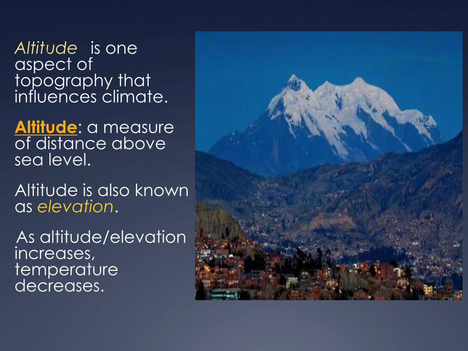
Altitude is one aspect of topography that influences climate.
Altitude: a measure of distance above sea level.
Altitude is also known as elevation.
As altitude/elevation increases, temperature decreases.

Increasing altitude has a similar effect on ecosystems as increasing latitude.
Areas at higher elevations are colder and may have different biomes than lower elevations at the same latitude.
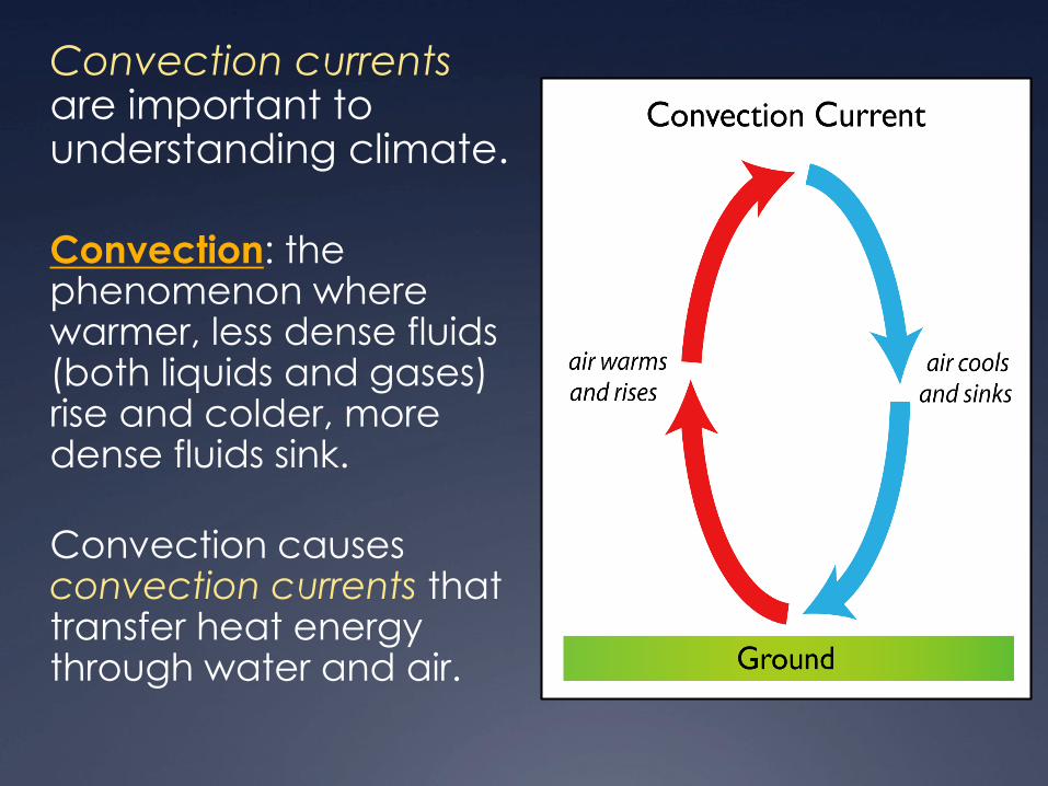
Convection currentsare important to understanding climate.
Convection: the phenomenon where warmer, less dense fluids (both liquids and gases) rise and colder, more dense fluids sink.
Convection causes convection currents that transfer heat energy through water and air.

Warmer air also
spreads out from the
equator towards the
poles as cooler air
from the poles
moves towards the
equator.
This explains why
precipitation occurs
in predictable bands
of latitude.

Near the Equator, masses of warm, moist air continually rise and form abundant precipitation.
Around 30o latitude (the “horse latitudes”), dry air descends, absorbing moisture and resulting in dry conditions and little precipitation. Many of the world’s deserts occur at these latitudes.

On either side of 30o latitude in the subtropics, distinct wet and dry seasons occur.
In the temperate zones, warmer air from the subtropical regions meets cooler air from the polar regions and there
is precipitation in all seasons.

Finally, cool air descends at the polar regions
and they receive little precipitation.

Convection causes ocean currents to form in water as cooler water near the poles sinks and is replaced by warm water flowing from the Equator.
Ocean Currents: are continuous, directed movements of ocean water that can regionally affect climate.

Seasons:
The Earth is not only spherical, it is also tilted on its axis which causes seasons.
Axis: an imaginary line running through the North and South Poles.
The Earth rotates on its axis from West to East.

Seasons change as the
Earth orbits the sun
because of this axial tilt.
Depending on the time
of year, either the
Northern or Southern
Hemisphere will be
tilted in the direction of
the sun and receive
more light.
More sunlight means
longer days and
warmer weather.

Earth can be
divided into 5
climatic zones:
• The North Polar Zone
(The Arctic)
• The North Temperate
Zone
• The Tropics
• The South Temperate
Zone
• The South Polar Zone
(Antarctic)

The Polar zones
range from
66.5o-90o latitude
(both North and
South).
The Polar zones
are the coldest
areas on Earth.

The Temperate zones range from 23.5o-66.5o latitude (both North and South)
The Temperate zones have a high degree of seasonal variation and diverse climates, from relatively warm conditions in the lower latitudes, to sub-arctic conditions in the higher latitudes.

The Subtropics lie within the temperate zones at latitudes below 38o (both North and South)
In general, climate in the subtropics is much warmer and has less seasonal variation than the rest of the temperate zones.
Many of the world’s deserts are located at subtropical latitudes.

The Tropics range
from 23.5o N latitude
(the Tropic of Cancer)
to 23.5o S latitude (the
Tropic of Capricorn)
The tropics are the
warmest areas of
Earth and have little
to no seasonal
variation in
temperature
(although some areas
have wet and dry
seasons).

Tropical regions near
the Equator have
abundant
precipitation year
round, making it
possible for tropical
rainforests to thrive.
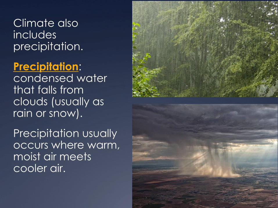
Climate also includes precipitation.
Precipitation: condensed water that falls from clouds (usually as rain or snow).
Precipitation usually occurs where warm, moist air meets cooler air.

Topography can
also affect
precipitation.
When winds blow
moist air up the side
of a mountain, the
air cools as it rises
and releases
precipitation. This
creates a rain
shadow on the
other side of the
mountain.

This effect is most dramatic in the Andes Mountains of South America near the equator.
Here there are tropical rainforests at the lowest elevations and snow capped peaks similar to polar ice at the highest elevations over 6,000 meters.

My Biome Diary
Your Task:
Create a product that identifies the biomes: Tundra,
Temperate Rainforest, Temperate Grassland, Taiga,
Deciduous Forest, Tropical Rainforest, Dessert, and
Savanna. Your ‘product’ will provide the climate: average
temperature range, average rainfall, one dominant plants
and one dominate animal. Your ‘diary’ needs to contain
pictures/illustrations for each biome.
If you do not want to make a ‘Travel Diary’, you can create
a calendar, a scrapbook, flip book, or any other teacher
approved product. Student projects can be paper or digital with teacher approval.
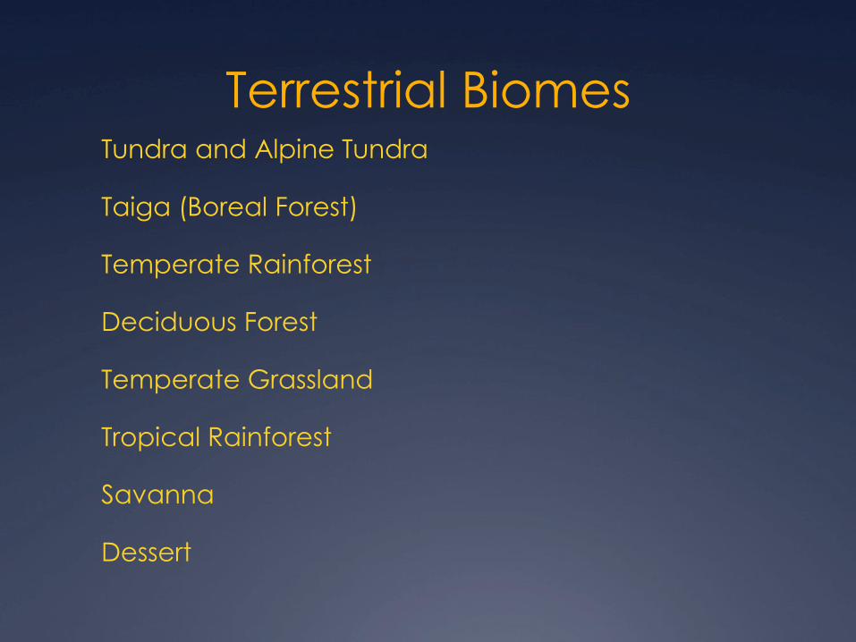
Terrestrial Biomes Tundra and Alpine Tundra
Taiga (Boreal Forest)
Temperate Rainforest
Deciduous Forest
Temperate Grassland
Tropical Rainforest
Savanna
Dessert

Biome Locations