Embed Size (px)
Citation preview

Climate Change Impacts and Spatial Planning
Decision Support Guidance
June 2008
Is the site designated?
Is the site close to the boundary of the
designated site, and potentially vulnerable to a
warmer climate?
Yes
Start
No
Is there potential for the site to be designated in the future?
It is possible that a warmer climate may
result in the site becoming de-designated
CC Impact Level = 5
In the future the site will remain designated, even
in a warmer climate
CC Impact Level = 1
Is it possible that this site maybe de-designated in the future?
Yes No
Check the location of the
site in relation to designated areas. Under a warmer climate might the site become an area of international, national or
local importance?
There is potential for the site to be designated in
the future, in response to a warmer climate
CC Impact Level = 3
There is no possibility of the site being
designated in the future with climate change
CC Impact Level = 1
Yes No
You can check on www.natureonthemap.org.
uk/

Climate Change Impacts and Spatial Planning – Decision Support Guidance
i
Focusing on North West Europe, ESPACE looks at how we manage our water resources and plan for a future with a changing climate.
As part of the project, and in association with the Environment Agency, Halcrow has prepared this decision support guidance document as the final deliverable associated with Key Action 4.
Key action 4 aims to develop and explore the potential of 'Decision Testing Trees’ (or decision pathways) as a tool to assist spatial planners with local decision-making and implementation of adaptation strategies.
This guidance supports the following three of the 14 important recommendations that were made at the end of phase 1 of the ESPACE project:
• Look beyond the lifetime of your plan, understanding your climate risks (ESPACE recommendation 2)
• Combine change and risk management approaches for integrating adaptation into spatial planning (ESPACE recommendation 3)
• Assess the level of climate adaptation provided by the spatial plan as a whole (ESPACE recommendation 9)
Further details of the ESPACE project, including the eleven other recommendations are available at:
www.espace-project.org
The ESPACE project (European Spatial Planning: Adapting to Climate Events) promotes awareness of the importance of adapting to climate change and recommends ways to incorporate adaptation within spatial planning mechanisms at local, regional, national and European levels.

Climate Change Impacts and Spatial Planning – Decision Support Guidance
ii
Executive Summary
Spatial planners are already well practised at balancing social, environmental and economic pressures when they consider options for development. However, climate change presents another very different challenge, one which most planners will be aware of, but may not have sufficient information, time or guidance to consider fully.
Concentrating on climate change adaptation (as opposed to climate change mitigation), this guidance document presents a series of tools which can be used to assist planners in carrying out their own high level climate change risk assessment on development options. Reading this document will also provide a useful overview of the potential longer term impacts of climate change, as well as explaining the importance of working with stakeholders in order to gather evidence on potential climate change impacts.
This guidance document applies the UKCIP decision-making framework and illustrates how it can be
applied to the ‘climate-influenced’ decisions that need to be made by spatial planners at a variety of
different spatial scales (local, regional and national).
We introduce several tools which will help spatial planners consider the potential impacts of climate
change in their options appraisal process. The tools we look at are as follows:
• Constraint mapping
• Tipping points (or threshold analysis)
• A high level risk assessment, or screening tool
• Decision pathways.
The high level screening tool, in particular, will hopefully prove to be a useful tool for planners. It
enables them to carry out their own ‘first pass’ at a climate change risk assessment for each of their
potential future options. By using the tool, planners will either be assured that the impacts of climate
change on their options (at this time) appear to be limited, or they will be alerted to the fact that the
assessment of climate change impacts is something that requires a more detailed analysis.
This document also defines what adaptation could mean for spatial planning, and how the impacts of
climate change could influence typical planning constraints and opportunities.
Looking at the concept of decision pathways and introducing the uncertainties associated with trying
to predict some of the impacts of climate change will illustrate the urgent need for spatial planners to
start thinking beyond the lifetime of their plans.
Climate Change Impacts and Spatial Planning – Decision Support Guidance
iii
Table of contents
Executive Summary.......................................................................................................................ii
1 About this Document ............................................................................................................1 1.1 Purpose of the guidance ............................................................................................................................1 1.2 Content overview.......................................................................................................................................2
2 Climate Change Risk Assessment Framework for Spatial Planning ..............................3 2.1 Introducing the UKCIP decision-making framework.........................................................................3 2.2 Introduction to climate change risk assessment tools ......................................................................4 2.3 Climate change adaptation and spatial planning ..................................................................................5
3 Spatial Planning Objectives and Decision Making Criteria ..............................................7 3.1 Spatial planning objectives and decision-making context..................................................................7
3.1.1 Generic Spatial Planning Objectives.................................................................................................7 3.1.2 An overview of typical spatial planning decision-making criteria .............................................8 3.1.3 Using constraint mapping to identify receptors at risk...............................................................8 3.1.4 Tipping point analysis.........................................................................................................................10
3.2 Case study: Dutch tipping points ..........................................................................................................11
4 High Level Risk Assessment................................................................................................13 4.1 How could climate change influence key spatial planning constraints and opportunities?.....13
4.1.1 Impacts of climate change on flood risk .......................................................................................13 4.1.2 Impacts of climate change on water resources ..........................................................................14 4.1.3 Impacts of climate change on existing environmental designations.......................................15
4.2 High level risk screening tool.................................................................................................................16 4.2.1 Using the risk screening tool ...........................................................................................................17 4.2.2 Interpreting the overall scores from the risk screening tool..................................................20
5 Option Appraisal ..................................................................................................................22 5.1 Option appraisal in spatial planning ......................................................................................................22 5.2 The decision pathways concept.............................................................................................................22
5.2.1 What are decision pathways? ..........................................................................................................22 5.2.2 Applying decision pathways in flood risk management.............................................................22 5.2.3 The decision pathways concept as a tool for spatial planners................................................25
6 Conclusions............................................................................................................................27
Appendix A: Applying tools and techniques to the English planning system......................28

Climate Change Impacts and Spatial Planning – Decision Support Guidance
1
1 About this Document
1.1 Purpose of the guidance
This guidance document introduces a range of tools that will help spatial planners to carry out a high level qualitative climate risk assessment to help answer these questions. The guidance adopts the United Kingdom Climate Impacts Programme (UKCIP) risk, uncertainty and decision-making framework and links this with other tools which will raise understanding and facilitate better decisions under a changing climate.
Spatial planners already have to balance a range of different stakeholder needs and objectives (i.e.
meeting housing targets, redeveloping brownfield sites, preserving landscape character etc). More
recently there has been an increasing focus on the potential long term impacts of climate change. This
presents an additional challenge for spatial planners, who now need to consider how climate change
might effect their development options over the next 100 years or more.
The primary purpose of this guidance document is to make spatial planners aware of a selection of
high level decision tools which could be helpful in considering climate change adaptation in future
plans and strategies.
Throughout the document, the guidance is kept purposely generic. This has been done in order for it
to remain applicable at a variety of different spatial scales (local, regional and national) and across
many different countries in northwest Europe. However, Appendix A has been developed to link the
contents and recommendations of this guidance with planning policies and processes more specific to
England. Further appendices could be developed and added for other countries.
The guidance document should also help spatial planners to:
• Better understand climate change and how it relates to spatial planning processes
• Think beyond the normal plan-led timeframes
By raising awareness in the above areas, this guidance will contribute towards the development of
spatial plans that can be readily adapted to future climates. Planners will be encouraged to look
beyond the lifetime of a plan, and to gain an understanding of the relevant long term climate risks.
A further aim of the guidance is simply to promote thinking about the bigger picture, recognising the
inherent uncertainty associated with trying to predict the future climate and the knock-on effects. For
example, how robust would your option be if the impacts from climate change at the end of the 21st
century are twice as severe as current ‘best estimates’?
As a spatial planner, how can you identify the potential climate change risks associated with your planning decisions? Could decisions that you make significantly constrain the ability of others to adapt to climate change? What does climate change adaptation mean for national, regional and local development planning?
Climate Change Impacts and Spatial Planning – Decision Support Guidance
2
Recognising that both climate change science and the supporting evidence base on impacts is still
evolving (and to some extent, always will be), this guidance does not proclaim to have all the answers
and for some applications, our ideas are recognised as being more aspirational. For example, further
changes may be required to national policy documents, along with further evidence on relevant
climate change impacts.
1.2 Content overview
This guidance document has been structured around the UKCIP decision-making framework (see
Section 2.1 for details). However, the overall focus is on providing planners with a tool that enables
them to carry out their own high level climate risk assessment. The document will guide planners
through this risk assessment process, whilst at the same time broadening understanding of how
decisions on development options might need to be adapted in order to reflect changes in climate risk
(e.g. increased temperature, more intense rainfall, higher frequency of drought etc).
Table 1 outlines the content of each chapter and includes hyperlinks to the relevant pages of this
document.
Chapter Summary Description of Content
Chapter 2 – Climate Change Risk Assessment
Framework for Spatial Planning
Introduces the UKCIP decision-making
framework and how it can be applied to the
spatial planning decision making process to
include consideration of risks emerging from
climate change.
Chapter 3 – Spatial Planning Objectives and
Decision Making Criteria
Considers the common objectives and decision
making criteria of development plans, and then
looks at what adaptation means for spatial
planning. Constraint mapping and tipping point
analysis are introduced, with a case study to
further illustrate the concept of tipping points.
Chapter 4 – High Level Risk Assessment Introduces a high level risk screening tool, which
planners can use to qualitatively assess climate
risks to their development options, indicating
whether or not a more detailed analysis of
climate impacts is required.
Chapter 5 – Option appraisal This chapter summarises the existing option
appraisal process in spatial planning before taking
a look at how the concept of decision pathways
could be applied to the appraisal process.
Chapter 6 - Conclusions A summary of the key findings and points made
by the guidance.
Table 1 – Summary of the contents of this document

Climate Change Impacts and Spatial Planning – Decision Support Guidance
3
2 Climate Change Risk Assessment Framework for Spatial Planning
2.1 Introducing the UKCIP decision-making framework
Shown in Figure 1, the UKCIP decision-making framework1 comprises 8 stages. The framework
provides a flexible and suitably generic approach to decision making under climate change. For this
reason, it could be applied with equal relevance across many countries.
Figure 1 – The UKCIP decision-making framework.
The framework is circular, emphasising the adaptive approach to managing climate change and the
need to revisit decisions in light of new information. Certain stages within the framework are tiered,
which allows the decision maker to identify, screen, prioritise and evaluate climate and non-climate
risks and options, before embarking on more detailed risk assessment and options appraisal.
Whilst the UKCIP decision-making framework covers the entire decision-making process, this
guidance for spatial planners does not refer to the latter stages (6, 7 & 8) of the framework (i.e.
decision-making, implementation of adaptation measures and monitoring decisions against climate
change impacts). Instead, this guidance focuses on the assessment of climate risk, particularly at a high
level (1st tier analysis).
1 Willows, R. I and Connell, R.K. (Eds.). (2003). Climate adaptation: Risk uncertainty and decision making. UKCIP Technical Report. UKCIP, Oxford.

Climate Change Impacts and Spatial Planning – Decision Support Guidance
4
The contents of this guidance have been aligned with the relevant stages in the UKCIP decision-
making framework. This is illustrated in Figure 2. The figure also shows where each of the climate
change risk assessment tools are introduced and the stage at which they are most likely to be of use
in the decision making process.
Figure 2 – Linking the contents of the guidance document to the initial stages of the
UKCIP decision-making framework and proposed climate change risk assessment tools.
2.2 Introduction to climate change risk assessment tools
In total, this guidance document introduces four tools and techniques for assessing climate change
impacts and highlighting the need for adaptation measures. Some of these tools are likely to be more
suitable for use in a detailed 2nd or 3rd tier climate risk assessment, but the high level risk screening
tool has been designed to enable planners to carry out their own high level risk assessment. The four
tools and techniques are introduced as follows:
• Constraint mapping is a technique that is already widely used in spatial planning and should
be familiar to most practitioners. It is a technique that could lend itself very well to
identifying the receptors at potential risk of climate change (stage 2 in the framework),
especially where additional layers are available to spatially map future risks that are
susceptible to climate change (e.g. future flood maps).
• Identifying tipping points (or risk assessment endpoints – stage 2 in the framework) is most
likely to be carried out by other stakeholders in the spatial planning process. For example, in
England & Wales, the Environment Agency and water companies may have information on
national, regional or local water resource tipping points. Natural England and the RSPB may
have information on environmental tipping points (e.g. the RSPB’s climatic atlas). In the
Netherlands, Rijkswaterstaat, the national directorate for public works and water

Climate Change Impacts and Spatial Planning – Decision Support Guidance
5
management, has commissioned a national study of climate tipping points (see case study in
Chapter 3).
• The high level risk screening tool provides a set of flowcharts that guide planners through an
initial set of high level questions about the potential impacts of climate change in three key
areas: flood risk, water resources and the environment. Using the tool presents the planner
with an impact score for each option, and will help them to decide whether or not a more
detailed risk assessment is required to look in more detail at climate impacts, perhaps
requiring involvement from stakeholders or specialist advice from consultants. Where the
high level risk screening suggests an option is not likely to be vulnerable to future impacts of
climate change, then this can be reported in the plan without the need for further detailed
analysis.
• The decision pathways concept is a tool which could help with the appraisal of options (stage
5 in the framework) through bringing in the time dimension. It is a climate change risk
appraisal technique that has been successfully applied in flood risk management. However,
since the spatial planning process presently tends only to identify development options for
the next 10 to 20 years, planners may find it difficult to apply the concept of decision
pathways to the current spatial planning option appraisal process.
2.3 Climate change adaptation and spatial planning
As we will see in Chapter 4, climate change represents a changing source of risk for development
options. Climate adaptation seeks first to identify what these risks are, and to then take decisions that
allow the potential impacts of climate change to be reduced or adequately managed, and at the same
time exploiting any opportunities which a changing climate may present.
This report does not deal with adaptation measures as such, but there are several useful documents
for the reader to refer to if they want to know more about adapting developments to climate change
(e.g. in the UK, the South East Climate Change Partnerships’ document ‘Adapting to climate change
impacts: a good practice guide for sustainable communities’ October 2006).
The reader may also come across the term ‘maladaptation’ – a term coined by the IPCC.
Maladaptations result from decisions that prevent or constrain the ability of others to manage, reduce
or otherwise adapt to the effects of climate change. Spatial planners need to be particularly aware of
how their decisions could lead to maladapations. For example:
• Directing developments into areas potentially at risk of flooding at some point in the next
100 years will constrain the agency responsible for managing flood risk in their ability to
manage and adapt to climate change.
What is adaptation?
In this context, adaptation would involve planners adjusting their development options to minimise the potential future adverse impacts of climate change and to take advantage of opportunities that may arise.

Climate Change Impacts and Spatial Planning – Decision Support Guidance
6
• Allocating areas for development that may be needed in the future to provide compensatory
habitats for species affected by climate change will reduce the opportunity for
conservationists to manage the impacts of climate change on nature.

Climate Change Impacts and Spatial Planning – Decision Support Guidance
7
3 Spatial Planning Objectives and Decision Making Criteria
3.1 Spatial planning objectives and decision-making context
Central to the spatial planning process is the objective to achieve sustainable development. The
World Commission on Environment and Development has drawn up the widely used definition – and
one used by the planning process – that sustainable development is: “development that meets the needs
of the present without compromising the ability of future generations to meet their own needs”.
Stages 1 and 2 of the UKCIP decision-making framework refer to identifying problems and objectives,
and to establishing decision-making criteria. In terms of sustainable development, the range of
problems, and resultant objectives, will determine what is likely to be a sustainable solution – for
example, in some cases regeneration may be seen as key to achieving a sustainable outcome, in others
it may be environmental protection. However, the issue at stake here is that climate change adds a
new dimension and planners need the information and tools to ensure that decisions taken today take
full account of the sensitivity of those decisions to future climate.
3.1.1 Generic Spatial Planning Objectives
The following is a list of generic objectives of the spatial planning process:
• Visionary – setting out a clear, distinctive and realistic vision of how an area will develop
and change;
• Wide-ranging – going beyond a narrow land-use focus to provide a mechanism for
delivering sustainable development objectives by addressing social, environmental and
economic issues and relating them to the use of land;
• Participative – based on strengthened mechanisms for community involvement to consider
the needs, issues and aspirations of communities and stakeholders within an area, to provide
a basis for making difficult choices and to build commitment to delivery;
• Integrating – an integrated approach which informs, takes account of and helps deliver
other strategies and policy;
• Responsive – a flexible approach, informed by monitoring, that can respond to
developments in wider policy, degree of progress with implementation, development
pressures and changes on the ground; and
• Deliverable – focusing on implementation, setting out delivery mechanisms, including
development control, and identifying how the plan will be delivered with and through other
organisations with the powers and resources to make a difference.
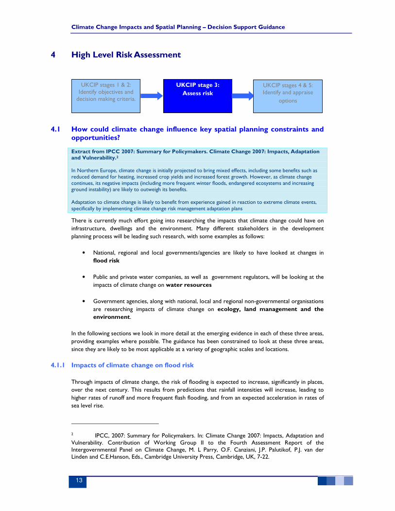
UKCIP stages 1 & 2: Identify objectives and decision making
criteria
UKCIP stage 3:
Assess risk
UKCIP stages 4 & 5: Identify and appraise
options
Climate Change Impacts and Spatial Planning – Decision Support Guidance
8
3.1.2 An overview of typical spatial planning decision-making criteria
As acknowledged in the UKCIP work, the decision making criteria, and the decision making process is
constrained by the existing legislative and regulatory environment (refer to Appendix A for further
details on these legislative and regulatory constraints in England).
In considering climate change impacts, it is important for the decision-making process to take into
consideration relevant climate change thresholds. Identifying such thresholds forms an important link
between the objectives (Stage 1), and the options appraisal process (Stage 3). However, evidence
suggests that a much more robust evidence base is required to ensure that climate change thresholds
are properly taken into consideration through the decision making process.
3.1.3 Using constraint mapping to identify receptors at risk
Constraint mapping (or sieve analysis) is a technique widely used at local authority level to screen
potential development options. Essentially, a number of filters representing a snapshot of current
constraints are layered on top of one and other, in order to build up a picture of land that presents
opportunities for development.
Today, the technique is often carried out by assembling and overlaying constraint layers in a GIS
(Geographic Information System), although paper maps are still occasionally used. Areas determined
to be of environmental, economic, cultural and social importance are mapped as constraints, which in
turn help to establish the most suitable areas for potential land allocations.
By using constraint mapping in support of determining land allocations, spatial planners can readily
demonstrate how they have made their decision against a balanced set of criteria. This serves to
support public consultation and reduce the number of objections. It also ensures that impacts on the
environment are minimized and that the economic wellbeing of the area is preserved.
The following example shows some indicative constraint mapping which is a generic approach
employed to determine potentially appropriate places to accommodate the expansion of an existing
urban area.
When you look at your present day constraint map, think how it
might change under the influence of climate change.
Even without access to future constraint layers, you may still
spot potential future opportunities and constraints. Think what
the potential impacts of climate change might be on different
receptors.

Climate Change Impacts and Spatial Planning – Decision Support Guidance
9
Existing urban area Designated sites: Green Belt, AONB, etc
Indicative flood plain Barriers to movement
Existing allocated sites Composite plan
Figure 3 - An example of some of the layers typically used to map current constraints.

Climate Change Impacts and Spatial Planning – Decision Support Guidance
10
Constraint mapping lends itself very well to long term decision testing in spatial planning, as once the
GIS layers are assembled, they are easy to update and modify. What appears to be missing in many
cases is the long-term evidence base that is needed to enable ‘future years’ constraint layers to be
formally incorporated into the assessment. Spatial planners should work with stakeholders to develop
these types of layer.
3.1.4 Tipping point analysis
Tipping points (also referred to as thresholds or risk assessment end points) can be defined in many
different ways. However, in terms of spatial planning, they should be related back to the criteria used
to assess options.
To define individual tipping points requires judgements concerning tolerable or intolerable levels of
risk posed to receptors. When the level of perceived risk is judged to be intolerable, it marks a
decision point that will require a step change in the management of that risk. Some examples of
relevant tipping points might be as follows:
• Safety against flooding: when will sea level rise reach such a level that it poses an
unacceptable level of risk to a development and its occupants, if unmitigated?
• Impacts on landscape: when might an Area of Outstanding Natural Beauty (AONB) be so
significantly detrimentally changed by increasing temperatures and/or by changing rainfall
patterns, that it is no longer worth preserving its landscape character?
• Impacts on ecology: when might a particular habitat type be lost due to the impacts of
climate change, perhaps requiring an alternative compensatory site to be found, but also
offering up the previously constrained site for a new land use?
• Impacts on water resources: when might annual rainfall decrease, and frequency of drought
increase to such an extent that the existing water supply network can no longer supply
demand from existing local water sources? Climate change may also increase the demand
for water so that supplies cannot cope.
These sorts of questions can (and should) be asked at a variety of scales; national, regional and local.
At a national level, identifying tipping points will help to identify better spatial planning policies and to
target housing and development more strategically – away from the regions and areas most vulnerable
to the impacts of climate change.
At the regional and local scale, planners should identify which of their objectives and decision making
criteria are sensitive to climate change and then consult with relevant stakeholders in order to try and
understand the various tipping points for these objectives and criteria.
An example of a national scale tipping point analysis from the Netherlands is presented in section 3.2.

Climate Change Impacts and Spatial Planning – Decision Support Guidance
11
3.2 Case study: Dutch tipping points
In the Netherlands, a project is underway to answer the question ‘how climate proof is Dutch water
management’? Rijkswaterstaat, the Dutch directorate for public works and water management, is
undertaking a national study of tipping points in water management and are looking at how climate
change impacts on sea level, precipitation, temperature and wind lead to various thresholds being
exceeded.
The study has already made some interesting findings, examples of which are presented below:
Example 1 – Declining numbers of ‘Spiering’ (a species of Duck) in Ijssel Lake and Marker Lake food webs. Critical climate conditions identified as wind speed and temperature. Also vulnerable to changes in winter ice conditions. Research has found that biomass levels have declined to critical levels in recent years
Example 2 - Temperatures in the Rhine have been steadily increasing throughout the past century and are expected to increase even further over this century, with associated impacts on water quality and biodiversity.
Example 3 – The Maeslant Barrier in the Netherlands was designed to close once every 10 years. With 0.75m of sea level rise it will typically need to close once every year. With 1.5m of sea level rise, it would be closing up to 10 times each year. This could have impacts on the reliability of the structure, as well as the environment and the local economy.

Climate Change Impacts and Spatial Planning – Decision Support Guidance
12
Chapter 3 check list
Have you revisited your constraint map to consider which receptors might be
at risk from climate change, and thought about how things could change in
the future?
Have you thought about which decision-making criteria you should define
tipping points for? Have you discussed this with the relevant stakeholders?
Climate Change Impacts and Spatial Planning – Decision Support Guidance
13
4 High Level Risk Assessment
4.1 How could climate change influence key spatial planning constraints and opportunities?
Extract from IPCC 2007: Summary for Policymakers. Climate Change 2007: Impacts, Adaptation and Vulnerability.2 In Northern Europe, climate change is initially projected to bring mixed effects, including some benefits such as reduced demand for heating, increased crop yields and increased forest growth. However, as climate change continues, its negative impacts (including more frequent winter floods, endangered ecosystems and increasing ground instability) are likely to outweigh its benefits. Adaptation to climate change is likely to benefit from experience gained in reaction to extreme climate events, specifically by implementing climate change risk management adaptation plans
There is currently much effort going into researching the impacts that climate change could have on
infrastructure, dwellings and the environment. Many different stakeholders in the development
planning process will be leading such research, with some examples as follows:
• National, regional and local governments/agencies are likely to have looked at changes in
flood risk
• Public and private water companies, as well as government regulators, will be looking at the
impacts of climate change on water resources
• Government agencies, along with national, local and regional non-governmental organisations
are researching impacts of climate change on ecology, land management and the
environment.
In the following sections we look in more detail at the emerging evidence in each of these three areas,
providing examples where possible. The guidance has been constrained to look at these three areas,
since they are likely to be most applicable at a variety of geographic scales and locations.
4.1.1 Impacts of climate change on flood risk
Through impacts of climate change, the risk of flooding is expected to increase, significantly in places,
over the next century. This results from predictions that rainfall intensities will increase, leading to
higher rates of runoff and more frequent flash flooding, and from an expected acceleration in rates of
sea level rise.
2 IPCC, 2007: Summary for Policymakers. In: Climate Change 2007: Impacts, Adaptation and Vulnerability. Contribution of Working Group II to the Fourth Assessment Report of the Intergovernmental Panel on Climate Change, M. L Parry, O.F. Canziani, J.P. Palutikof, P.J. van der Linden and C.E.Hanson, Eds., Cambridge University Press, Cambridge, UK, 7-22.
UKCIP stages 1 & 2: Identify objectives and decision making criteria.
UKCIP stage 3:
Assess risk
UKCIP stages 4 & 5: Identify and appraise
options

Climate Change Impacts and Spatial Planning – Decision Support Guidance
14
In the UK, Defra produced guidance that prescribes climate change sensitivity allowances for use in
studies that aim to model potential future flood events (Defra, 20063). This guidance is now embodied
into PPS25, the planning policy statement for England which looks specifically at development and
flood risk. The allowances for climate change are based on an assessment of the work reported in
UKCIP024.
However, the science of climate change modelling is rapidly evolving, and later in 2008, UKCIP will
publish their next outputs for the UK (UKCIP08). Unlike the previous deterministic outputs, the 2008
outputs will be probabilistic, recognising the high level of uncertainty associated with projecting future
temperature increases and the impact that this will have on rainfall and sea level rise.
Whilst the recommendations made in policy documents such as PPS25 must be welcomed, and were,
at the time, a big step forward, it is equally important that planners remember that only one potential
future scenario is currently prescribed in this planning policy statement.
If an option can be shown to be robust against the projected increase in flood risk, given the
allowances in PPS25 (or other equivalent national policy statements), it does not mean that option is
completely robust against the impacts of climate change. The allowances in PPS25 should be
considered as best estimates, given the available evidence at the time when those estimates were
made. With climate change models developing rapidly, planners must accept that these allowances will
inevitably be revised in the near future and also consider the fact that they include a large degree of
uncertainty.
Thus, where it appears that a potential spatial development option has a low vulnerability to flood risk
under existing climate change allowances, but where it would be at a higher risk if these allowances
were increased at some point in the future, then a planner should also consider the longer term
implications of developing that site/area.
The high level risk assessment tool presented in Section 4.2 will help planners to screen each of their
development options against the potential long term flood risks. Where details of future flood extents
are available (e.g. from a Strategic Flood Risk Assessment), then these should also be included as
additional filters in the constraint mapping process.
4.1.2 Impacts of climate change on water resources
The impact of climate change on is expected to reduce overall summer rainfall and potentially
increase the probability of drought in areas already prone to water stress, e.g. eastern and southern
UK (UKCIP02), even though when rain does fall, it would be likely to do so with greater intensity.
Furthermore, other impacts, such as increase in river temperatures (see case study in Chapter 3),
could have a significant long term impact on water quality. This might be managed in one of two ways:
• Avoid the risk: Direct development to areas that are less likely to become water
stressed (e.g. in the UK, direct development away from the southeast, into
northwest England, central and north Wales, and Scotland).
3 http://www.defra.gov.uk/environ/fcd/pubs/pagn/climatechangeupdate.pdf 4 Hulme, M et al, 2002: Climate Change Scenarios for the United Kingdom: The UKCIP02 Scientific Report, Tyndall Centre for Climate Change Research

Climate Change Impacts and Spatial Planning – Decision Support Guidance
15
• Mitigate the risk: The risk could be mitigated through demand management or by
developing winter storage reservoirs, groundwater recharge schemes or water
transfer schemes, but such large infrastructure projects require land to be banked,
and so planners need to be aware of any potential justifiable future need to develop
water resources in their area\region\country when they consider their options for
development.
Again, planners are encouraged to carry out a risk assessment to consider the impacts of climate
change on water resources in their area\region\country. Where water resources are already deficient,
or in locations where the water undertaker has plans to construct a storage reservoir, further
development should be discouraged or sited so as not to constrain development of future reservoirs.
The high level risk assessment tool presented in Section 4.2 will help planners to complete a first pass
high level risk assessment for each of their development options against the potential longer term
impacts of climate change on water resources.
4.1.3 Impacts of climate change on existing environmental designations
The impacts of climate change on environmental designations could be very significant. For example,
an inter-tidal zone designated under the EU Habitats Directive may be constrained by existing or
future development, including coastal defence measures, meaning the inter-tidal zone cannot migrate
inland as sea levels rise, and therefore their value to nature conservation is reduced. Alternative sites
to replace potential habitat lost would have to be identified by relevant environmental agencies, and
planners may be asked to safeguard areas from development that are not currently designated or
protected.
In other cases, opportunities may be presented, where, for example, the impacts of climate change
are so severe that they alter the landscape character of Areas of Outstanding Natural Beauty.
Evidence of the impacts of climate change on ecology is emerging all the time. Planners should consult
their environmental stakeholders to find out how climate change could change the future picture of
environmental constraints.
In association with Bird Life International, the Royal Society for Protection of Birds (RSPB) has
recently published a climatic atlas of future bird nesting sites across Europe5. Figure 4 presents an
example output from the climatic atlas. In the example, the Dartford Warbler is shown to colonise
further into southern Britain and coastal regions of northwest France and the Netherlands. Planners
should consider whether their environmental stakeholders will require them to safeguard habitats to
accommodate such projected future migration, and whether or not the development options that are
being considered would constrain future environmental adaptation options.
5 http://www.birdlife.org/eu/pdfs/Climatic_Atlas.pdf

Climate Change Impacts and Spatial Planning – Decision Support Guidance
16
Figure 4 – An example from the Bird Life International\RSPB climatic atlas.
Other relevant studies on climate change impacts on the environment include:
• BRANCH (Biodiversity Requires Adaptation in Northwest Europe under a
CHanging climate) advocates the need for change in spatial planning and land use
systems to allow wildlife to adapt to climate change. Partners demonstrated the need
for change based on an evidence base and developed recommendations and tools in
collaboration with planners. For more information see:
http://www.branchproject.org/
• MONARCH (Modelling Natural Resource Responses to Climate Change) was a seven-
year phased programme to assess impacts of projected climate change on wildlife in
Britain and Ireland. The final phase of MONARCH modelled the potential for changes in
the ranges of 120 species selected for nature conservation action in the UK Biodiversity
Action Plan (BAP), and then undertook a more considered analysis of 32 of those
species. For more information see: http://www.defra.gov.uk/wildlife-
countryside/resprog/findings/monarch/monarch-execsummary.pdf
Lastly, it is important to note that whilst we must plan to allow for wildlife to adapt to climate change,
the natural environment can also play an important part in helping communities adapt to climate
change (e.g. trees provide shade and make good wind breaks).
4.2 High level risk screening tool
The high level risk screening tool is designed to support a 1st tier, high level assessment of climate
risks. It does not require large amounts of data to support its use and should not normally require
input from specialists. It is recommended that spatial planners apply the tool to each of their potential
development options as part of their option appraisal process.
Benefits of applying the tool include:
• It provides a convenient and consistent method for a 1st tier risk assessment, often requiring
desk-top studies only.

Climate Change Impacts and Spatial Planning – Decision Support Guidance
17
• The tool will help to identify low climate risk options and will help to justify a decision not to
complete more detailed climate impact analysis for those options
4.2.1 Using the risk screening tool
The high level risk screening tool consists of three flowcharts which are used to generate a ‘Climate
Change Impact Score’ for each of the three factors: flood (Figure 5), water resources (Figure 6) and
environment/landscape (Figure 7). The three component scores are then summed and guidance is
then provided on whether further analysis is required.
Note that the high level screen tool makes reference to the evidence base that exists in England and
Wales – it is likely that similar evidence exists in other countries and the tool should be readily
adaptable for use in other European countries too. Also, in line with this guidance, they are generic in
content and in some cases, it may be advisable for spatial planners to ask a specialist or their key
stakeholders to review the applicability of the screening tool before it is applied.

Climate Change Impacts and Spatial Planning – Decision Support Guidance
18
Is the site within
the present day floodplain shown
on the Environment Agency
web site?
The site would already
appear to be at risk from
flooding, so may not be
appropriate for
development (refer to
PPS25). In the future, it
is likely to be flooded
even more frequently
and\or to a greater
depth.
CC Impact Level = 5
Yes
Start
No
Has a SFRA or RFRA been
completed, providing information
on future flood risk?
Does the SFRA suggest that
the site will be at risk of flooding by
the 2050s?
The site would appear to
be very sensitive to
changes in peak river
flows and\or sea levels
CC Impact Level = 4
Yes
Yes
Does the SFRA suggest that
the proposed site will be at risk of
flooding in the 2100s?
No
No
The site would appear to
be sensitive to longer-
term or more severe
changes in peak river
flows and\or sea levels -
development may need
to be temporary or
include suitable
mitigation
CC Impact Level = 3
Yes
No
Compare site ground levels with expected flood
water levels.
You can request modelled water levels from the
Environment Agency. Lowest and average site ground
levels may be available from topographic survey or
Ordnance Survey maps etc
Site ground levels higher than flood water levels by:
CC Impact
Level = 4
Less than
0.5m0.5 to 1m 1m to 5m
More than
5m
CC Impact
Level = 3
CC Impact
Level = 2
CC Impact
Level = 1
Figure 5 – Flooding high level risk screening flowchart.
(Note: SFRA = Strategic Flood Risk Assessment, RFRA =Regional Flood Risk Assessment)

Climate Change Impacts and Spatial Planning – Decision Support Guidance
19
Figure 6 – Water resources high level risk screening flowchart.

Climate Change Impacts and Spatial Planning – Decision Support Guidance
20
Figure 7 – Environment & landscape high level risk screening flowchart.
4.2.2 Interpreting the overall scores from the risk screening tool
Having applied the risk screening tool to each of their options, planners will have an impact score for
each of the three risk areas. These scores should be summed together to present a total score for
each option. The minimum overall score that any option can achieve is 3. The maximum score is 15.
An example of some scores for a hypothetical set of options is given in the table below:
Option Numbers and Scores
Climate Risk Area 1 2 3 4 5 6 7 8 9 10
Future Flood Risk 2 5 1 1 1 1
Future Water Resources 1 1 1 3 1 1
Future Environment & Landscape 1 3 1 3 3 1
Grand Totals 4 9 3 7 5 3
It is apparent that options 2 and 4 could have a high level of vulnerability to future climate change,
whilst options 1, 3 and 6 would appear to be more robust choices.

Climate Change Impacts and Spatial Planning – Decision Support Guidance
21
The following guidance is offered on interpreting your scores:
• Less than or equal to 4 – The appraisal of the option is unlikely to be significantly altered
through further consideration of climate risks, so pursuing an option that scores <4 is
unlikely to be adaptation constraining. The high level screening should be recorded in the
appropriate documentation and there will normally be no further requirement for a more
detailed assessment of these climate risks.
• Greater than 4 – The appraisal of the option may be significantly altered through further
consideration of climate risks, so pursuing this option could be adaptation constraining. A
more detailed analysis of climate risk should be undertaken for this option if it is not rejected
for other reasons.
Chapter 4 check list
1. Have you applied the high level screening tool to each of your options?
2. Are you satisfied that the high level screening tool has adequately
assessed the potential longer term impacts of climate change?
3. If you answered no to question 2, you should consider undertaking a
more detailed, 2nd tier risk assessment.

Climate Change Impacts and Spatial Planning – Decision Support Guidance
22
5 Option Appraisal
5.1 Option appraisal in spatial planning
In practice, appraising spatial planning options is a complex process, undertaken with various degrees
of transparency. Numerous social, economic and environmental factors all need to be taken into
consideration, and these technical considerations are themselves often set within a complex political
context.
The techniques for appraising options will vary depending upon the relevant spatial scale, but common
criteria would include issues such as: site access, economic viability, and access to services. In
addition, there are likely to be a range of specific constraints which are relevant, such as landscape
designations, flooding, historical importance etc. Moreover, the process of appraising options is rarely
a straightforward comparison of one option against another, and a preferred or final option is very
often derived through a more iterative process.
Appendix A looks further at how the spatial planning process and policy drivers for England can be
linked into the UKCIP decision making framework.
5.2 The decision pathways concept
5.2.1 What are decision pathways?
Decision pathways (or decision trees) represent a concept that can be used to map a series of
options against a timeline. The concept works by assessing options against various appraisal criteria at
different points in the future and identifying thresholds (or tipping points) for each option. It is then
possible to lay these options out in a temporal sequence, mapping the point in time when each tipping
point is expected to be reached.
In this way, a flexible plan is identified, to enable decision makers to respond to changing
circumstances. The eventual pathway to be followed will be determined by monitoring and re-
appraising threshold points throughout the lifetime of a plan. In this way, decision pathways fit very
well with the overall philosophy of the UKCIP decision-making framework which, as we have seen,
advocates a continuous cycle of decision making to accommodate monitoring and re-appraisal.
In this section, the reader will discover how decision pathways can be built up, how they have been
applied as a tool in flood risk management and how the concept at least could be used by planners.
5.2.2 Applying decision pathways in flood risk management
Decision pathways provide a useful decision support tool that can assist in understanding the
robustness and adaptability of each option to a variety of different climate change scenarios. Through
identifying future decision points, it is a tool that can be used to illustrate when a decision or plan will
UKCIP stages 1 & 2: Identify objectives and decision making criteria.
UKCIP stage 3:
Assess risk
UKCIP stages 4 & 5: Identify and appraise
options
Climate Change Impacts and Spatial Planning – Decision Support Guidance
23
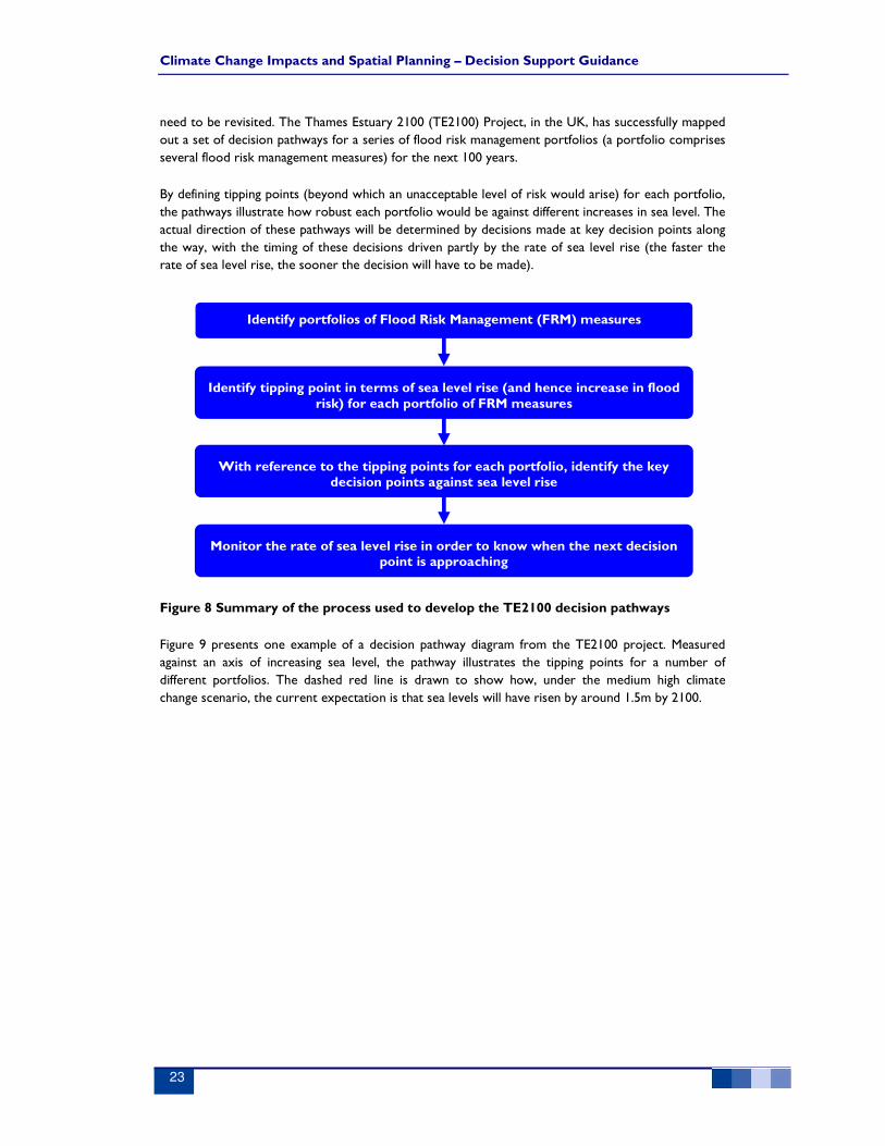
need to be revisited. The Thames Estuary 2100 (TE2100) Project, in the UK, has successfully mapped
out a set of decision pathways for a series of flood risk management portfolios (a portfolio comprises
several flood risk management measures) for the next 100 years.
By defining tipping points (beyond which an unacceptable level of risk would arise) for each portfolio,
the pathways illustrate how robust each portfolio would be against different increases in sea level. The
actual direction of these pathways will be determined by decisions made at key decision points along
the way, with the timing of these decisions driven partly by the rate of sea level rise (the faster the
rate of sea level rise, the sooner the decision will have to be made).
Figure 8 Summary of the process used to develop the TE2100 decision pathways
Figure 9 presents one example of a decision pathway diagram from the TE2100 project. Measured
against an axis of increasing sea level, the pathway illustrates the tipping points for a number of
different portfolios. The dashed red line is drawn to show how, under the medium high climate
change scenario, the current expectation is that sea levels will have risen by around 1.5m by 2100.
Identify portfolios of Flood Risk Management (FRM) measures
Identify tipping point in terms of sea level rise (and hence increase in flood risk) for each portfolio of FRM measures
With reference to the tipping points for each portfolio, identify the key decision points against sea level rise
Monitor the rate of sea level rise in order to know when the next decision point is approaching

Climate Change Impacts and Spatial Planning – Decision Support Guidance
24
1m0m 4m3m2m
Max water level rise:
New barrier, retain Thames Barrier, raise defences
Raise
Defences
New barrier, raise defences
New barrage
2050 2100
Medium High Climate
Change Scenario
Route 1
Route 3a
Route 3b
Route 4
Route 2
All four Routes suitable in 2100
Alternative Routes for achieving the plan
Existing system
Improve Thames Barrier and raise d/s defences
Over-rotate Thames
Barrier and raise d/s
defencesFlood storage, improve Thames
Barrier, raise u/s & d/s defences
Flood storage, over rotate Thames
Barrier, raise d/s defences
Flood storage,
raise d/s defences
Note:
Each box represents one or more portfolios of responses
The arrows indicate paths for adapting options for different sea level ranges
Figure 9 - Alternative pathways through a Flood Risk Management Plan under the
UKCIP02 Medium-High climate change scenario.
Shown in Figure 9, there are four possible routes or pathways through these portfolios of measures.
Under the UKCIP02 medium-high climate change scenario, all four pathways would provide suitable
means of managing flood risk to acceptable levels to 2100.
In Figure 10 the same portfolio of options is illustrated, but this time against the ‘High++’ climate
change scenario. Under this extreme climate change scenario, over 4 metre of sea level rise could be
expected by 2100. As shown in Figure 10, all four options remain favourable up until 2050, but by
2100, only one option or pathway can successfully manage flood risk against a 4m increase in sea level.
By plotting out pathways into the future in this way, it is still possible to pick the intervention that is
most attractive now, whilst at the same time acknowledging that there is a possibility that a new
barrage may eventually be required. In this way, the plan can clearly demonstrate that it is not
constraining any future options. It also supports the case for continuous monitoring against identified
tipping points

Climate Change Impacts and Spatial Planning – Decision Support Guidance
25
1m0m 4m3m2m
Max water level rise:
New barrier, retain Thames Barrier, raise defences
Raise
Defences
New barrier, raise defences
New barrage
Route 1
Route 3a
Route 3b
Route 4
Route 2
High++ Climate
Change Scenario
Only route 4 suitable in 2100
(unless SoP reduced)
21002050
The final plan could be a combination of options
Existing system
Improve Thames Barrier and raise d/s defences
Over-rotate Thames
Barrier and restore
interim defencesFlood storage, improve Thames
Barrier, raise u/s & d/s defences
Flood storage, over rotate Thames
Barrier, raise u/s & d/s defences
Flood storage, restore
interim defences
Note:
Each box represents one or more portfolios of responses
The arrows indicate paths for adapting options for different sea level ranges
Figure 10 - Alternative pathways through a Flood Risk Management Plan under a High++
climate change scenario. (Note that a non structural receptor response option has also
been developed but is not shown in Figure 10.)
5.2.3 The decision pathways concept as a tool for spatial planners
The need to make long-term decisions, and not to constrain future adaptation to climate change, is
common to both flood risk management and spatial planning. However, in spatial planning many
different climate-induced tipping points need to be considered, not just changing flood risk.
Therefore, one of the main factors that will limit the application of the decision pathways tool to
spatial planning will be knowledge of pre-defined tipping points at a variety of spatial scales, for a
variety of receptors. But, as we have seen in section 4, the climate impacts evidence base is constantly
being developed by a number of stakeholders.
With inputs from relevant stakeholders, planners and their consultants should be able to develop
their own decision pathways against various climate impacts. It is perhaps easiest to think of an
individual decision pathway being developed for each of the three areas of flood risk, water resources
and the environment.
For flood risk, the decision pathway could be developed in a similar way to those for the TE2100
project, except that the portfolios of FRM measures would be replaced by development options.
Thresholds would refer to the points in the future at which that development option becomes at risk
of flooding in the absence of any defences. Looking at options in this way could highlight some
developments as requiring conditions pertaining to future mitigation of risk (i.e. flood defences, or
designing the development now to allow for future flood risk by raising finished floor levels etc). In

Climate Change Impacts and Spatial Planning – Decision Support Guidance
26
some cases, mapping options in this way may require an acceptance that, under the most severe
impacts of climate change, the site could essentially be temporary and might eventually need to be
abandoned (e.g. development sites in the more vulnerable coastal areas).
For water resources, a decision pathway could be developed which relates changes in temperature to
decreases in water supply potential for each option. Tipping points relating to surety of supply would
be identified along with decision points denoting the requirement for a step change in the
management of local water resources (i.e. initiatives to reduce demand or to develop new resources).
However, water resources are not finite and demand cannot be reduced beyond a certain point, so in
the more populous areas of NE Europe (e.g. SE England), a water resource decision pipeline could be
stark in illustrating actual end points for some options, particularly if they are being considered against
a more extreme climate change scenario.
For the environment, tipping points are already available from some environmental stakeholders (e.g.
RSPB, Natural England), where impacts such as species tolerance to increases in temperature and
wetland desiccation have been considered. Decision pathways that map environmental tipping points
and decision points could be useful to planners and their environmental stakeholders in two ways:
a) By identify when existing environmental and landscape designations cross critical thresholds,
a planner will know that new compensatory sites will be required to accommodate the
affected species wherever possible. For impacts such as the migration\loss of inter-tidal zones
through rising sea levels, this could be a local issue, whilst for impacts on migratory species
such as birds, it becomes a national or even a European scale issue.
b) Designations which are essentially lost through the impacts of climate change (e.g. a
desiccated wetland) may become available in the future as potential areas for development.
Balancing the needs of the environment to adapt to the impacts of climate change against a human
need to avoid future risks associated with climate change is likely to be one of the biggest challenges
for spatial planners over the next few decades. Considering the bigger picture also requires the
impacts and risks of climate change to be considered consistently, at a variety of spatial scales, from
European to local districts.
Chapter 5 check list
1. Do you feel that you have identified all significant climate risks
associated with implementing your preferred options?
2. Have you spoken to your stakeholders about options that may
constrain their ability to adapt to climate change?
3. Is your plan supported by the information required to show that you
have considered the impacts of climate change beyond the life of the
plan?

Climate Change Impacts and Spatial Planning – Decision Support Guidance
27
6 Conclusions
This guidance document has revisited the UKCIP decision-making framework and shown how it can
be applied to decisions that need to be made by spatial planners at a variety of different scales.
It has introduced several tools which spatial planners can use to help them to consider the potential
impacts of climate change in their options appraisal process. The guidance should provide spatial
planning practitioners with the information and confidence that they need to in order to start
considering some of the longer term impacts of climate change on their decisions.
The high level screening tool will be extremely useful to planners wanting to carry out their own ‘first
pass’ at a climate change risk assessment against their potential options. By using the tool, planners
will either be assured that the impacts of climate change on their options (at this time) appear to be
limited, or they will be alerted to the fact that the assessment of climate change impacts is something
that requires a more detailed analysis, perhaps involving stakeholders and other specialist inputs.
Looking at the concept of decision pathways and introducing the uncertainties associated with trying
to predict some of the impacts of climate change has illustrated the need for spatial planners to start
thinking well beyond the lifetime of their plans and into the next cycle, and the one beyond that, and
the ones beyond that!
At the time of writing this document, the UK’s Department for the Environment, Food and Rural
Affairs (Defra) is commissioning a national climate change risk assessment and in the Netherlands,
there is the ongoing study into water management climate tipping points. Clearly, governments are
now becoming increasingly aware of the need for national scale climate change risk assessments and
over the next few years we are likely to see a lot more evidence presented on the impacts of climate
change.
It is hoped that this guidance document will continue to serve as a useful tool for spatial planners who
are now tasked with using this increasing wealth of evidence.

28
Appendix A: Applying tools and techniques to the English planning system
At the national level, Government sets the planning policy context through legislation (most recently
and most relevant, the Planning & Compulsory Purchase Act 2004) and policy, in particular Planning
Policy Statements (PPSs, formerly Planning Policy Guidance, PPGs), and Circulars. A number of PPSs
are of particular relevance:
• PPS1: Delivering Sustainable Development (sets out the government’s policy as to how spatial
plans should help deliver sustainable development); and its recent Supplement: Planning and
Climate Change (provides guidance on how planning should contribute to stabilising emissions,
as well as how it should take into account the consequences).
• PPS9: Biodiversity and Geological Conservation (sets out that national policy relating to how
biodiversity and geological conservation should be considered in the planning system)
• PPS11: Regional Spatial Strategies (the requirements for, and scope of, Regional Spatial
Strategies)
• PPS12: Local Spatial Planning (the requirements for, preparation and scope of, Local
Development Frameworks)
• PPS25: Development and Flood Risk (how planning should manage flood risk)
At the regional level, Regional Spatial Strategies (RSS) are, at present, prepared by the Regional
Assembly, an unelected partnership of local authority Councillors and representatives from various
sectors within the region. An RSS sets out the future vision for a region over the twenty year plan
period, establishes a regional policy framework, and determines growth targets for the region. The
RSS is a strategic document and as such does not show where, within each local authority, land should
be allocated for development. Instead, they identify broad areas for growth and strategic
infrastructure, and allocate housing growth numbers to local authorities.
Broadly, the process is:
• a Draft is prepared and taken through public consultation.
• comments are addressed and the Draft goes through an Examination in Public before an
independent Panel (appointed by the First Secretary of State).
• following the Panel Report, and subsequent amendments to the plan, the final RSS is issued.
Each RSS must also be subject to a Strategic Environmental Assessment (SEA)/ Sustainability Appraisal
(SA), a process which is aimed at informing the evolution of the plan in an iterative way (see below).
There is also likely to be a wide range of other supporting technical information.
Each local authority then takes these strategic allocations and targets forward through its preparation
of a Local Development Framework (LDF). The LDF allocates an appropriate amount of land to
accommodate the targets set out in the RSS, and through that process (to which, again, the SEA and
SA processes are integral) determines the most appropriate location for those allocations, alongside
policies which, in combination with the policies in the RSS, set the planning framework for how
development will be delivered.

29
The process of preparing an LDF is most usefully set out in the Companion Guide (November ’04) to
the now superseded PPS12: Local Development Frameworks. The following diagram sets out this
process (as taken from the Companion Guide) against the UKCIP framework process and the
Proposed Risk Assessment Tools as identified in Chapter 2. This is intended to demonstrate the
applicability of the tools – through the UKCIP Framework – to the various stages of the England and
Wales planning processes.
In reality, the two processes are not comfortably aligned. This is partly due to the ‘front-loading’ of
the plan-making process, with much of a planners technical work being undertaken during the early
stages, and the more ‘bureaucratic’ elements being undertaken during the latter stages (it is not only
the local authority itself which undertakes the appraisal of options, as consultation and independent
examination also inform the process).
It is also partly because the appraisal of options is assisted by the Sustainability Appraisal (SA) which is
an on-going and iterative process, as shown on the diagram. SA and Strategic Environmental
Appraisal (SEA) are very closely linked6: the requirement to undertake SEA is established in the EU by
European Directive 2001/42/EC, and through the Planning and Compulsory Purchase Act (2004) SA
are mandatory for Regional Spatial Strategies (RSS), Development Plan Documents (DPDs) and
Supplementary Planning Documents (SPDs). There may be opportunities to better link the Proposed
Risk Assessment Tools into the SEA/SA process but this requires further technical consideration.
One critical drawback however, is that (in England at least) this process is not applicable at a national
level, and may also be difficult to apply across borders.
6 Although the requirement to carry out both an SA and an SEA is mandatory, it is possible to satisfy the requirements of both pieces of legislation through a single
appraisal process. The former ODPM’s Guidance on Sustainability Appraisal of Regional Spatial Strategies and Local Development Documents (“Sustainability Appraisal of
Regional Spatial Strategies and Local Development Documents”, ODPM, November 2005) integrates SEA with SA. It describes a single appraisal process that meets the
legal requirements of both the SEA Directive and the Act. While SA is now an established part of our planning system, integrated SEA and SA is still an evolving process,
often representing a significant challenge to plan-makers.

30
As is evident from the illustration, the Proposed Risk Assessment Tools are most applicable during
the Pre-Production and Production stages. In terms of where the national and regional policy drivers
and constraints are applicable, whilst they apply throughout the plan-making process, they are
particularly important during the first two stages of evidence gathering and preparing alternative
options; any options which do not broadly meet such requirements would be scrutinised during the
consultation and Examination stages of the plan-making process.


1