Embed Size (px)
Citation preview
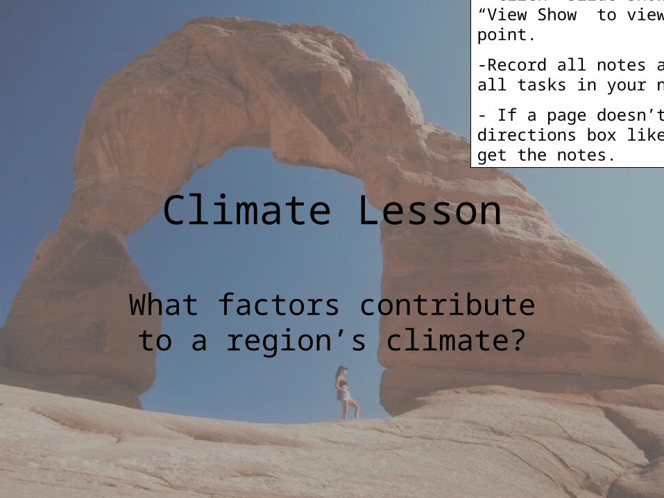
Climate Lesson
What factors contribute to a region’s climate?
Directions:
- Click “Slide Show” then “View Show” to view the power point.
-Record all notes and complete all tasks in your notebook.
- If a page doesn’t have a directions box like this, just get the notes.
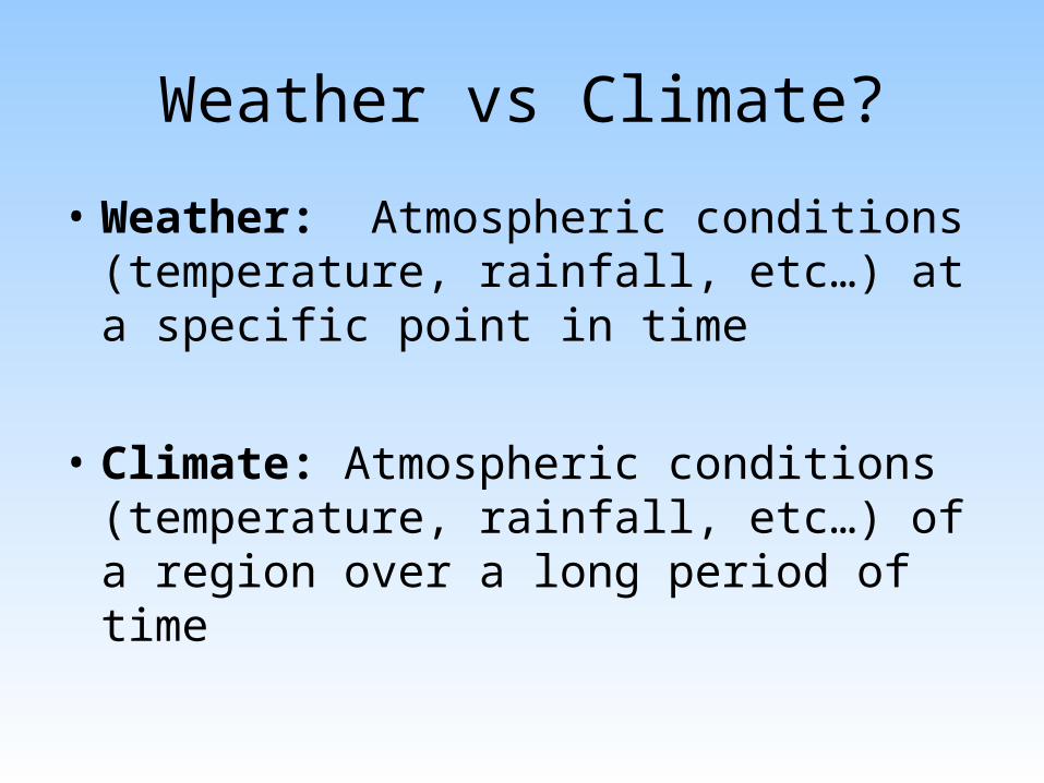
Weather vs Climate?
• Weather: Atmospheric conditions (temperature, rainfall, etc…) at a specific point in time
• Climate: Atmospheric conditions (temperature, rainfall, etc…) of a region over a long period of time
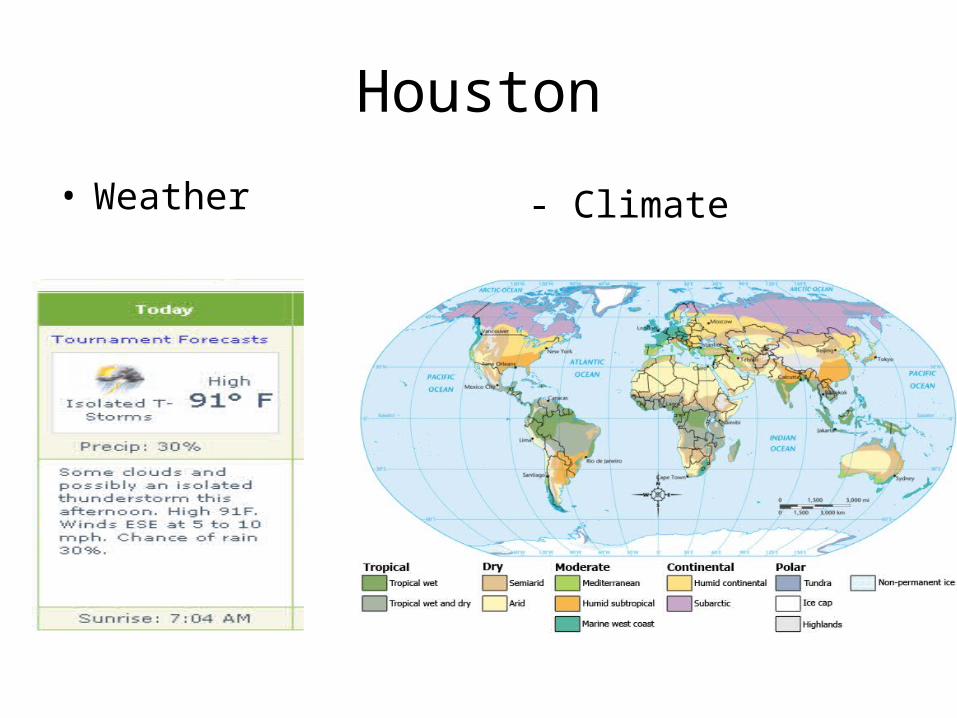
Houston
• Weather - Climate
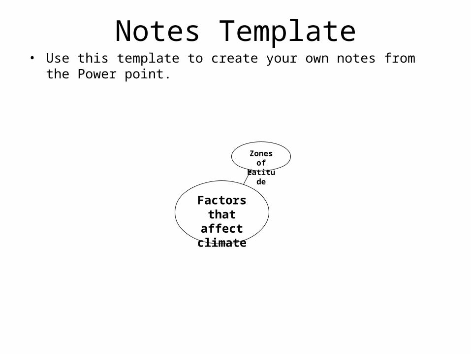
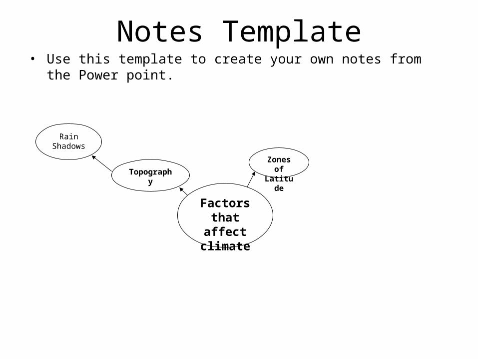
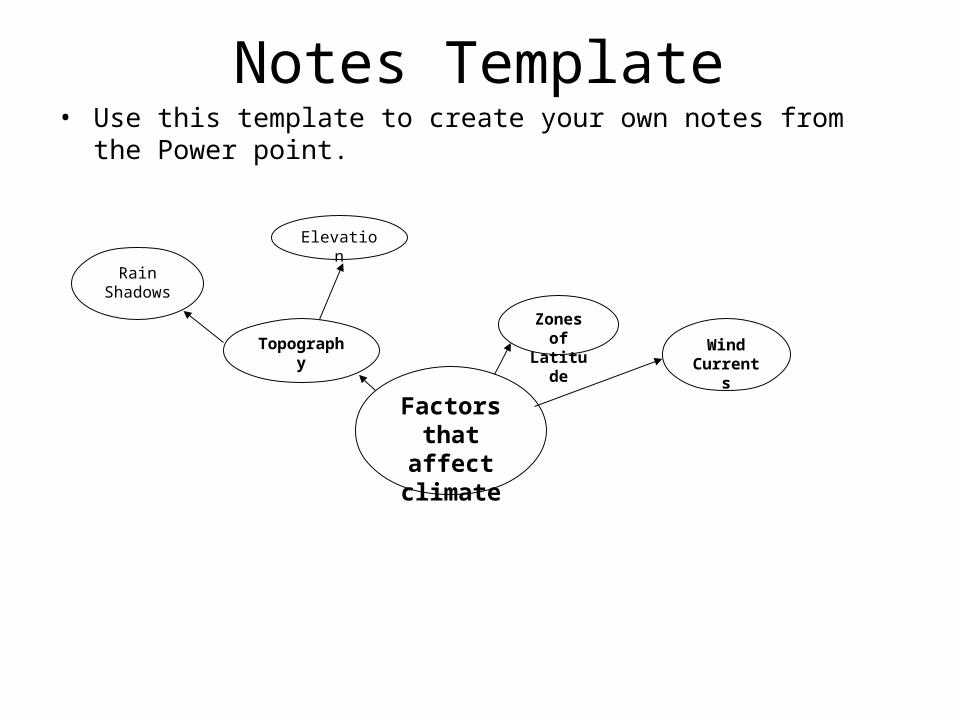
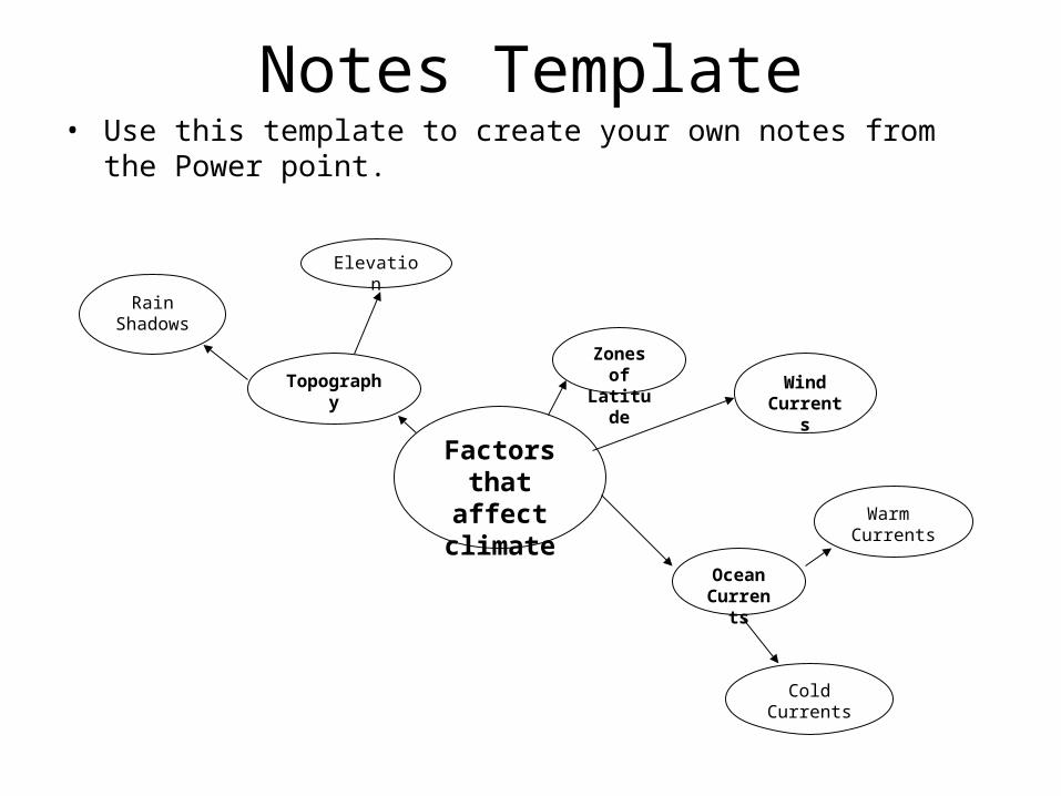
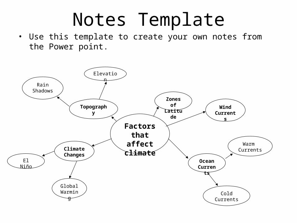
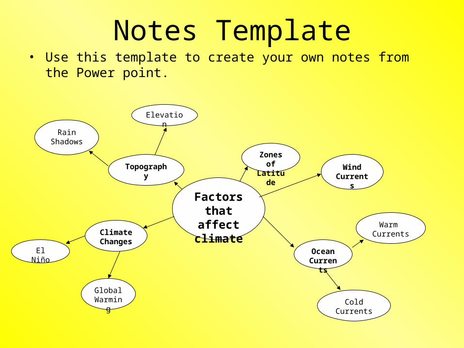
Notes Template• Use this template to create your own notes from the Power point.
Factors that affect
climate
Zones of
Latitude
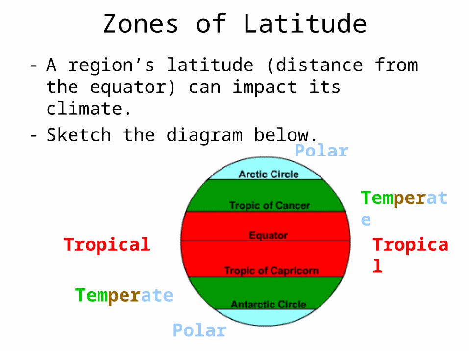
Zones of Latitude
- A region’s latitude (distance from the equator) can impact its climate.
- Sketch the diagram below.
Polar
Polar
Temperate
Tropical Tropical
Temperate
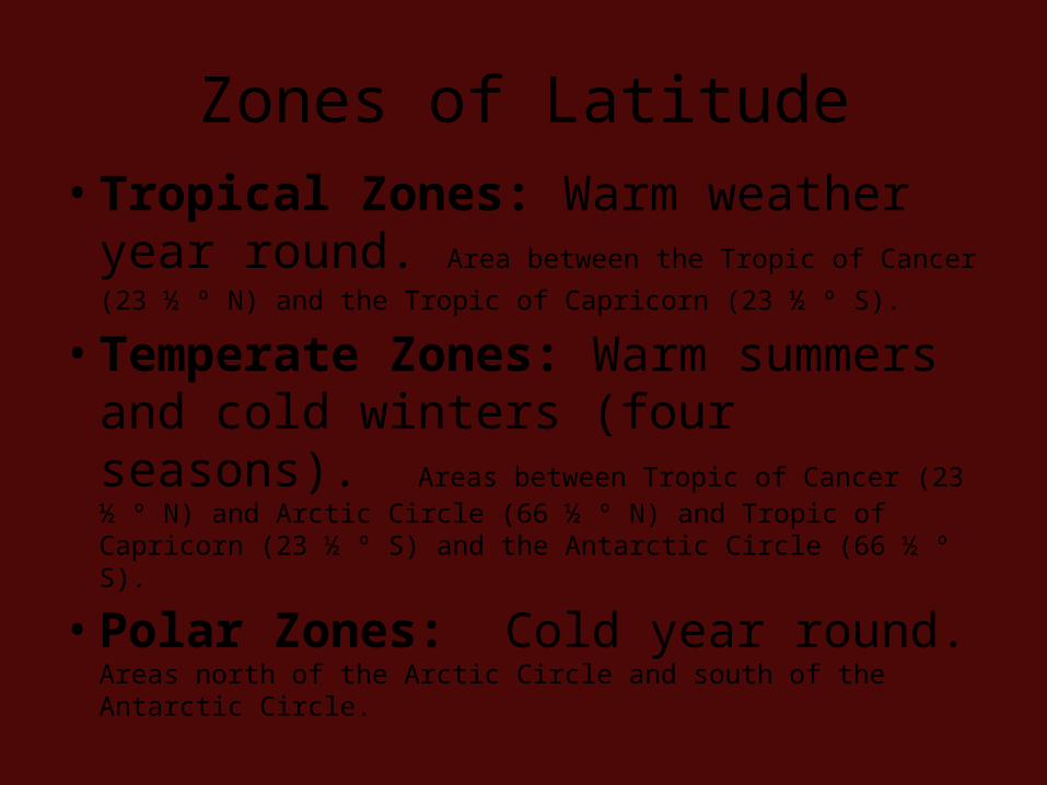
Zones of Latitude
• Tropical Zones: Warm weather year round. Area between the Tropic of Cancer (23 ½ º N) and the
Tropic of Capricorn (23 ½ º S).
• Temperate Zones: Warm summers and cold winters (four seasons). Areas between Tropic of Cancer (23 ½ º N) and Arctic Circle (66 ½ º N) and Tropic of Capricorn (23 ½ º S) and the Antarctic Circle (66 ½ º S).
• Polar Zones: Cold year round. Areas north of the Arctic Circle and south of the Antarctic Circle.
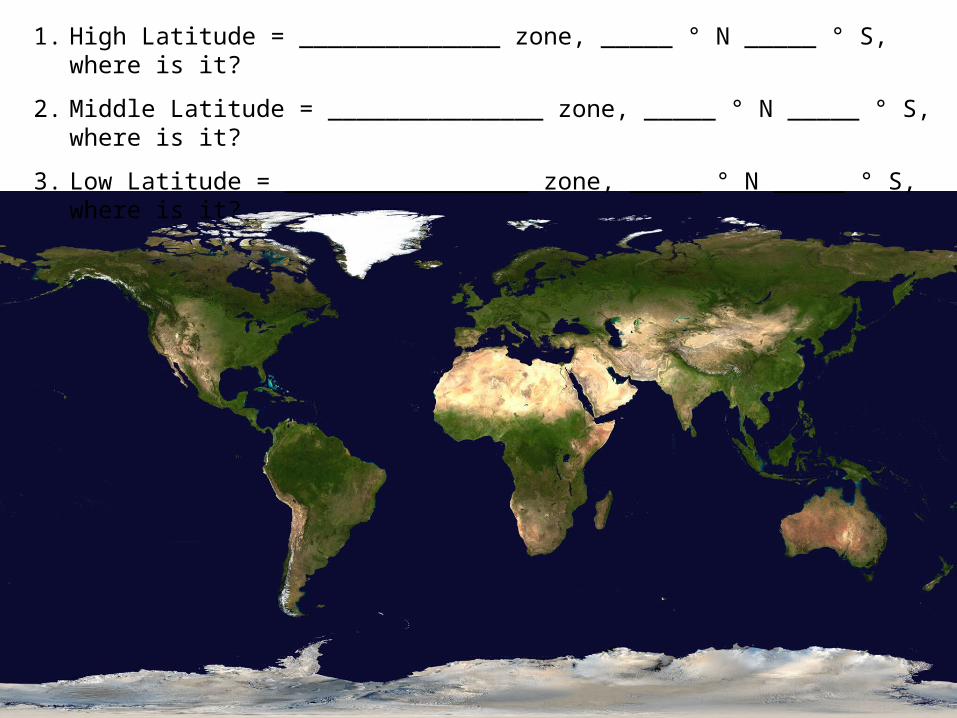
1. High Latitude = ______________ zone, _____ ° N _____ ° S, where is it?
2. Middle Latitude = _______________ zone, _____ ° N _____ ° S, where is it?
3. Low Latitude = _________________ zone, _____ ° N _____ ° S, where is it?
30°N
30°S30°S
30°N
60°S
60°N
60°S
60°N
TROPICAL
TEMPERATE
TEMPERATE
POLAR
POLAR
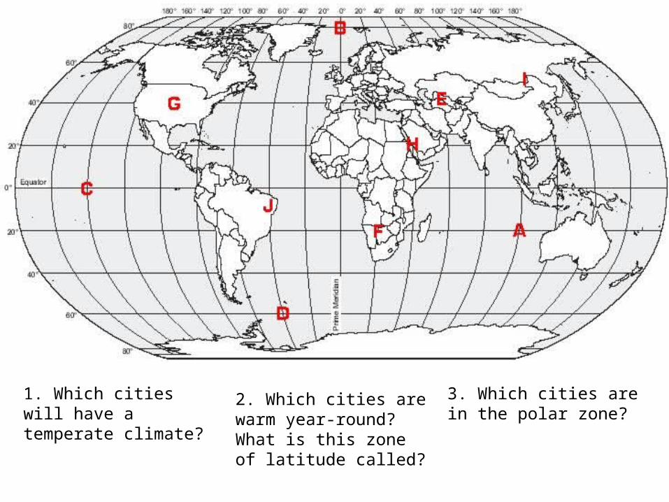
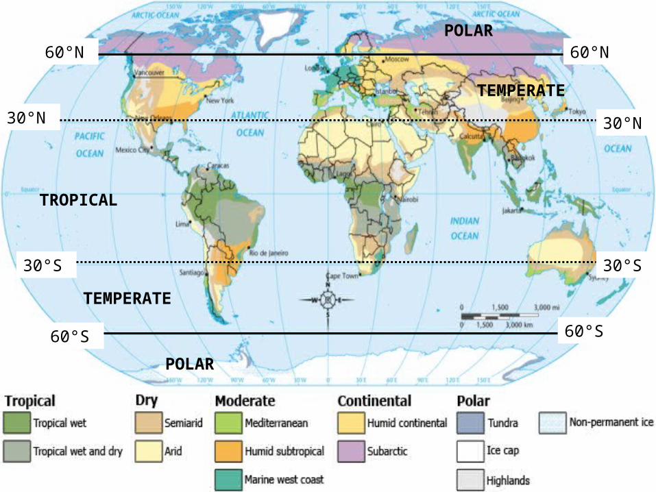
1. Which cities will have a temperate climate?
2. Which cities are warm year-round? What is this zone of latitude called?
3. Which cities are in the polar zone?
Notes Template• Use this template to create your own notes from the Power point.
Factors that affect
climate
Topography
Zones of
Latitude
Rain Shadows
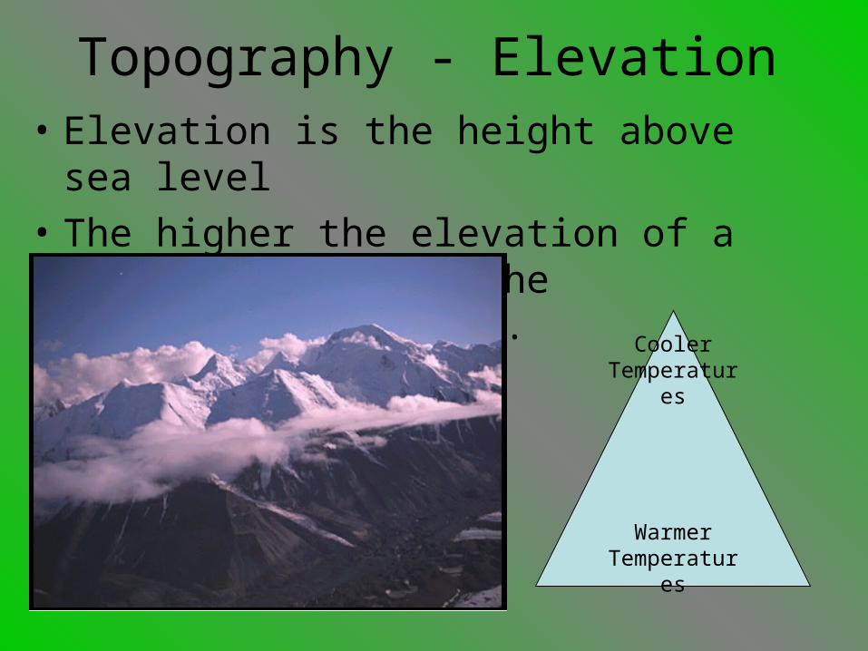
Topography - Elevation• Elevation is the height above sea level
• The higher the elevation of a region the cooler the temperature becomes.
Warmer Temperatures
Cooler Temperatures
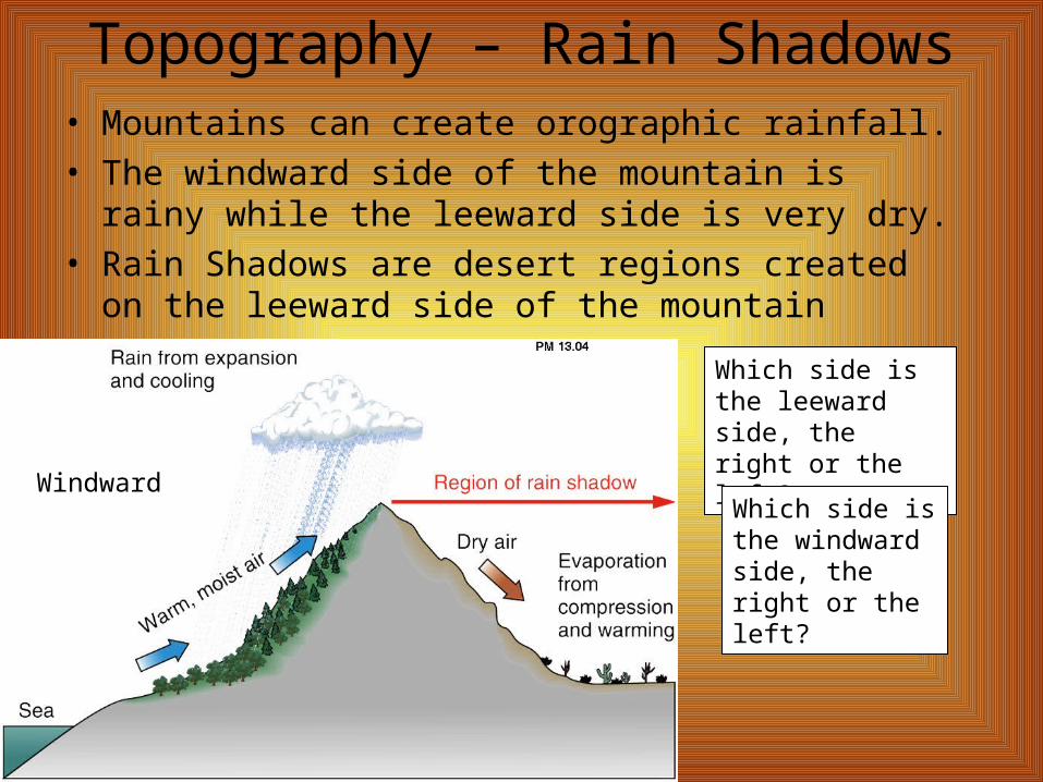
Topography – Rain Shadows• Mountains can create orographic rainfall.• The windward side of the mountain is rainy while the
leeward side is very dry.• Rain Shadows are desert regions created on the
leeward side of the mountain
Windward
Which side is the leeward side, the right or the left?
Which side is the windward side, the right or the left?
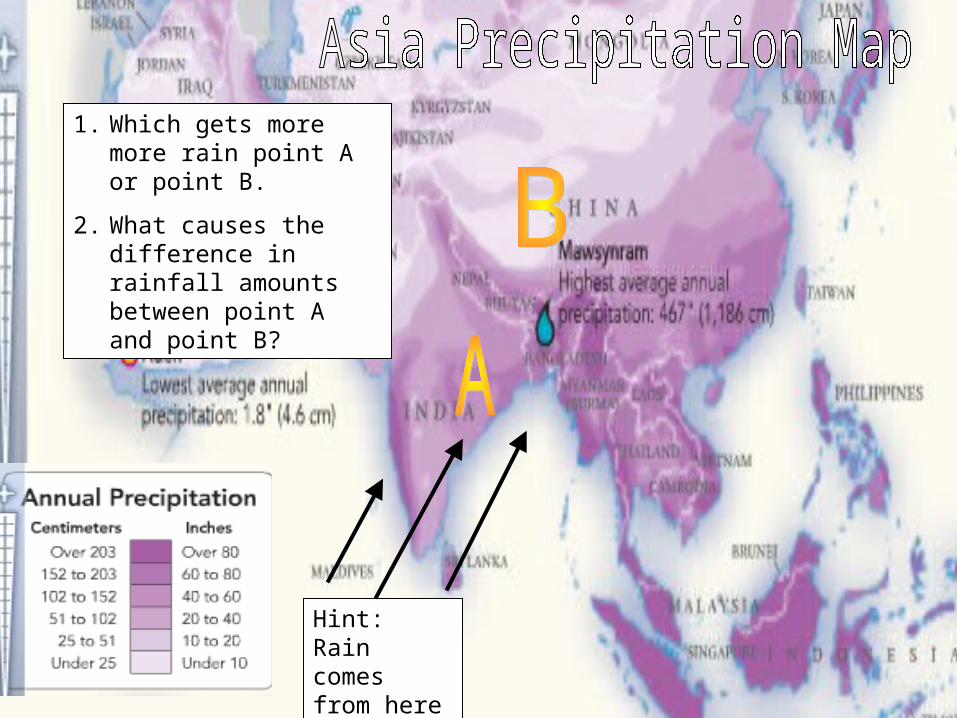
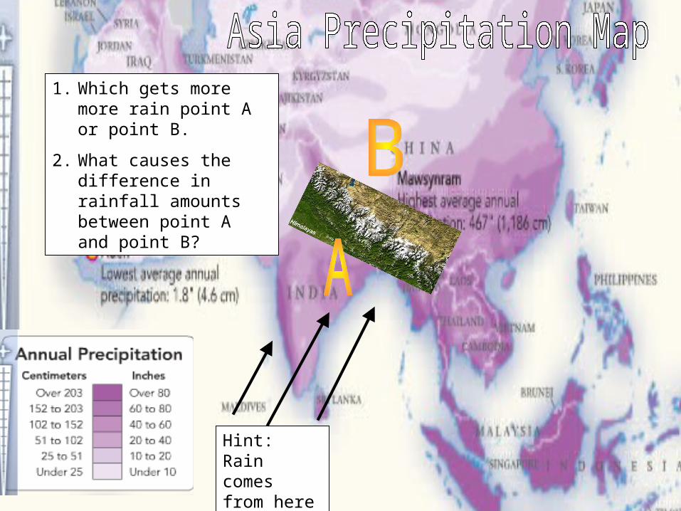
1. Which gets more more rain point A or point B.
2. What causes the difference in rainfall amounts between point A and point B?
Hint: Rain comes from here
1. Which gets more more rain point A or point B.
2. What causes the difference in rainfall amounts between point A and point B?
Hint: Rain comes from here
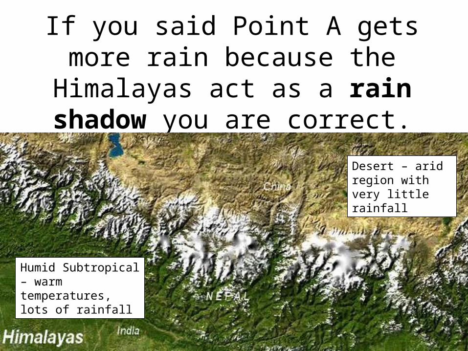
If you said Point A gets more rain because the Himalayas act as a
rain shadow you are correct.
Desert – arid region with very little rainfall
Humid Subtropical – warm temperatures, lots of rainfall
Notes Template• Use this template to create your own notes from the Power point.
Factors that affect
climate
Topography
Zones of
LatitudeWind
Currents
Elevation
Rain Shadows
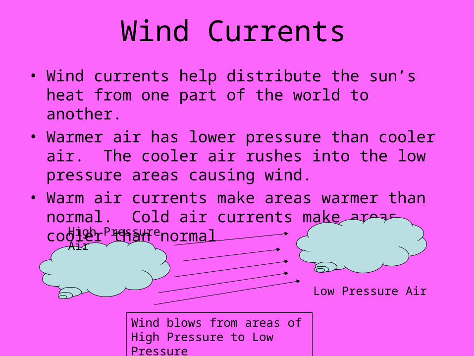
Wind Currents• Wind currents help distribute the sun’s heat from one
part of the world to another.• Warmer air has lower pressure than cooler air. The
cooler air rushes into the low pressure areas causing wind.
• Warm air currents make areas warmer than normal. Cold air currents make areas cooler than normal
High Pressure Air
Low Pressure Air
Wind blows from areas of High Pressure to Low Pressure
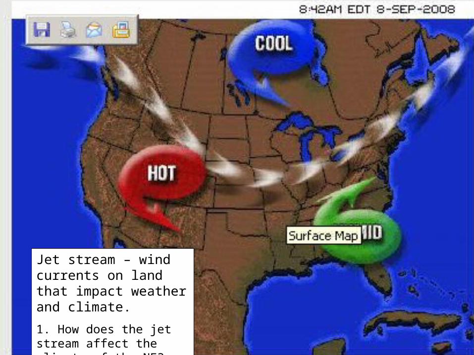
Jet stream – wind currents on land that impact weather and climate.
1. How does the jet stream affect the climate of the NE?
Notes Template• Use this template to create your own notes from the Power point.
Factors that affect
climate
Topography
Zones of
LatitudeWind
Currents
Ocean Current
s
Elevation
Rain Shadows
Warm Currents
Cold Currents
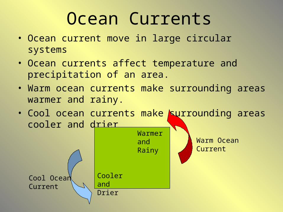
Ocean Currents• Ocean current move in large circular systems• Ocean currents affect temperature and precipitation of
an area.• Warm ocean currents make surrounding areas warmer
and rainy.• Cool ocean currents make surrounding areas cooler and
drier
Warm Ocean Current
Cool Ocean Current
Cooler and Drier
Warmer and Rainy
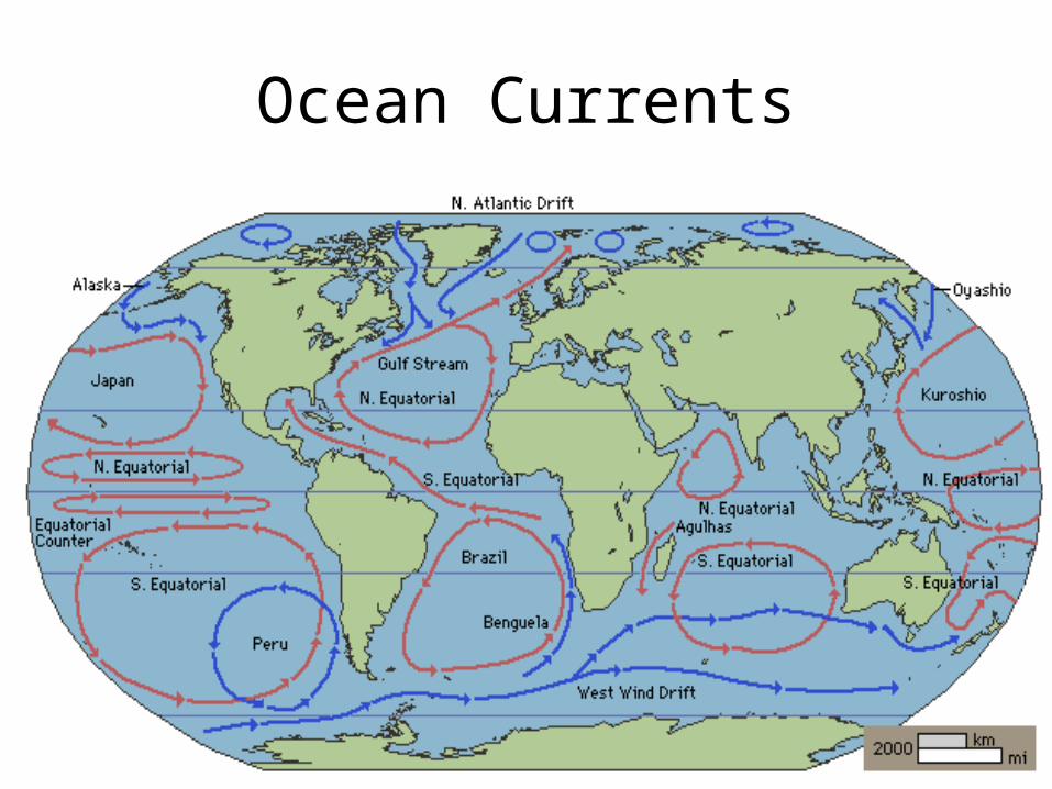
Ocean Currents
Notes Template• Use this template to create your own notes from the Power point.
Factors that affect
climate
Topography
Zones of
LatitudeWind
Currents
Ocean Current
s
Elevation
Rain Shadows
Climate Changes
Warm Currents
Cold Currents
Global Warmin
g
El Niño
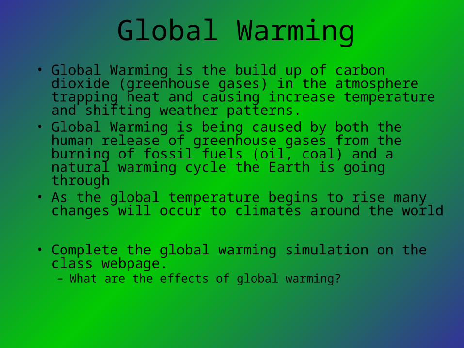
Global Warming• Global Warming is the build up of carbon dioxide
(greenhouse gases) in the atmosphere trapping heat and causing increase temperature and shifting weather patterns.
• Global Warming is being caused by both the human release of greenhouse gases from the burning of fossil fuels (oil, coal) and a natural warming cycle the Earth is going through
• As the global temperature begins to rise many changes will occur to climates around the world
• Complete the global warming simulation on the class webpage. – What are the effects of global warming?
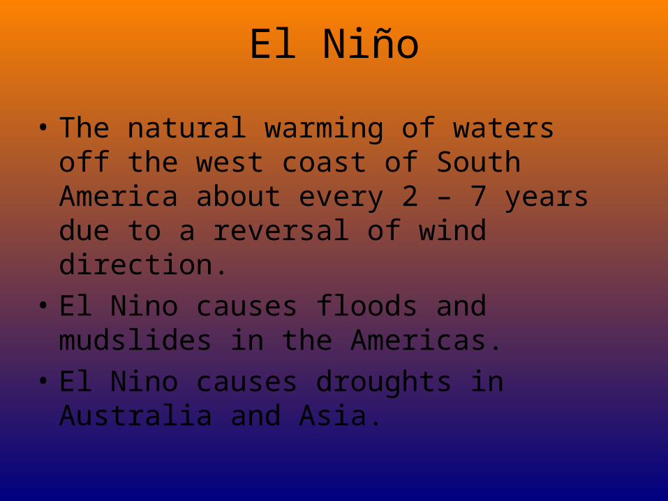
El Niño
• The natural warming of waters off the west coast of South America about every 2 – 7 years due to a reversal of wind direction.
• El Nino causes floods and mudslides in the Americas.
• El Nino causes droughts in Australia and Asia.
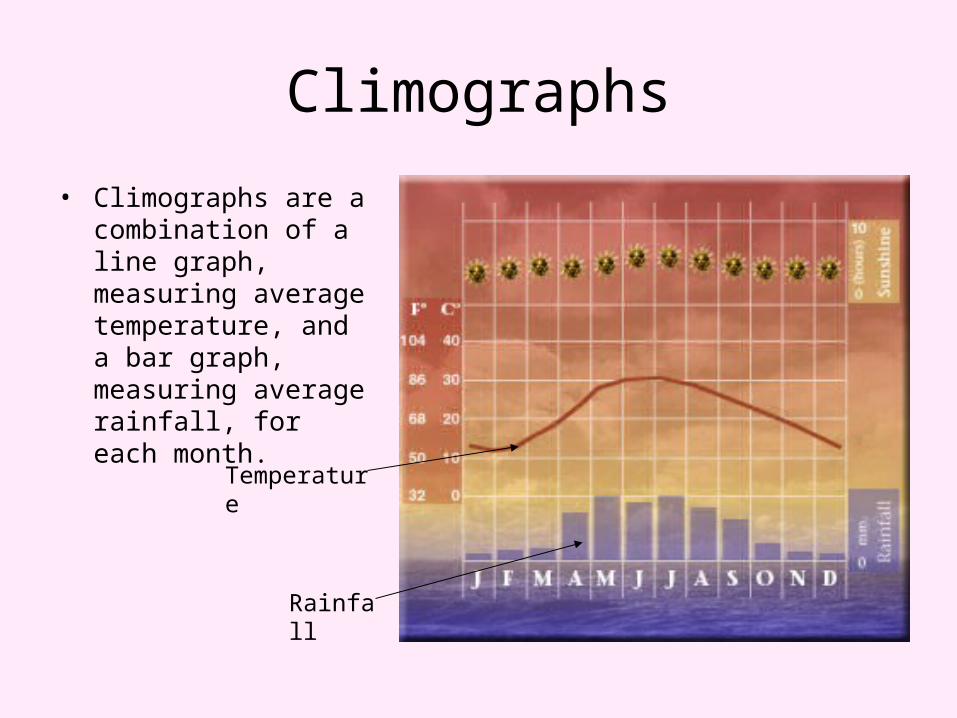
Climographs
• Climographs are a combination of a line graph, measuring average temperature, and a bar graph, measuring average rainfall, for each month.
Rainfall
Temperature
Notes Template• Use this template to create your own notes from the Power point.
Factors that affect
climate
Topography
Zones of
LatitudeWind
Currents
Ocean Current
s
Elevation
Rain Shadows
Climate Changes
Warm Currents
Cold Currents
Global Warmin
g
El Niño
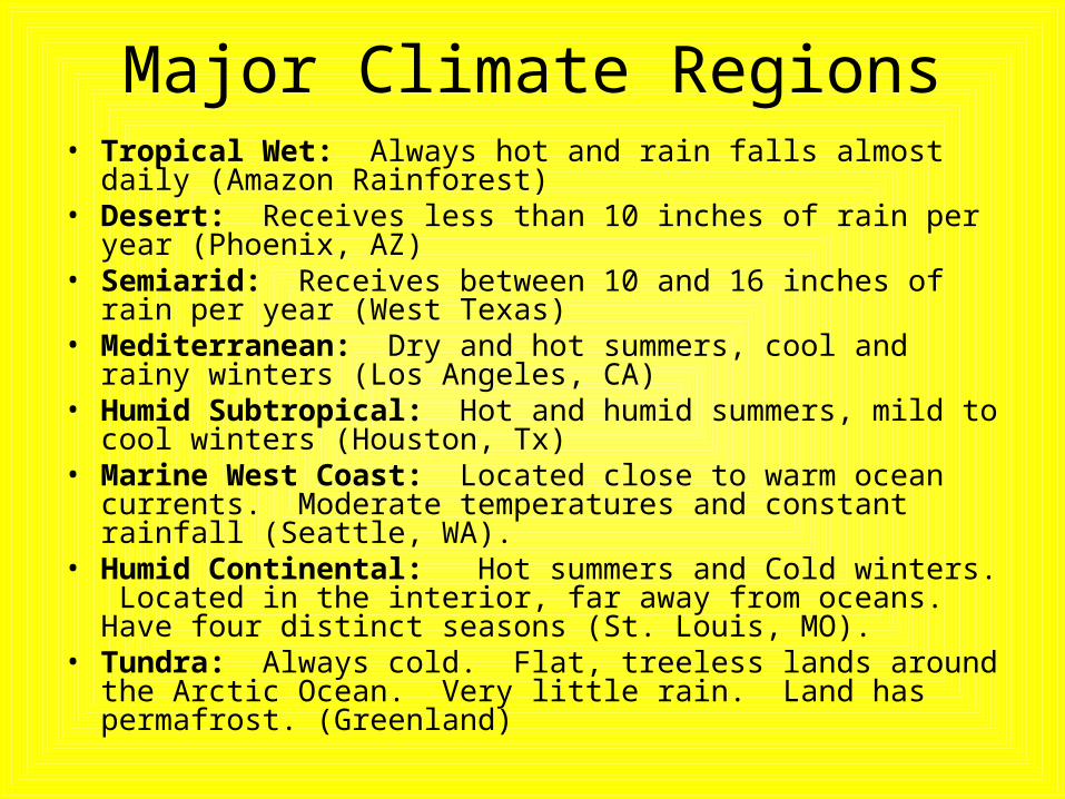
Major Climate Regions• Tropical Wet: Always hot and rain falls almost daily (Amazon
Rainforest)• Desert: Receives less than 10 inches of rain per year
(Phoenix, AZ)• Semiarid: Receives between 10 and 16 inches of rain per
year (West Texas)• Mediterranean: Dry and hot summers, cool and rainy winters
(Los Angeles, CA) • Humid Subtropical: Hot and humid summers, mild to cool
winters (Houston, Tx)• Marine West Coast: Located close to warm ocean currents.
Moderate temperatures and constant rainfall (Seattle, WA).• Humid Continental: Hot summers and Cold winters.
Located in the interior, far away from oceans. Have four distinct seasons (St. Louis, MO).
• Tundra: Always cold. Flat, treeless lands around the Arctic Ocean. Very little rain. Land has permafrost. (Greenland)
Map Questions
• Use the map of the world’s climates and the slide following to answer the questions below.
1. What is the climate of Houston?
2. Which types of climate are present in the tropical zone of latitude?
•http://www.mcwdn.org/MAPS&GLOBES/Climate.html