Embed Size (px)
Citation preview
Coastal GIS Applications andWeb Mapping in Wisconsin
The long and winding road to aCoastal Web Atlas
David HartGIS Specialist
University of Wisconsin Sea Grant Institute
International Coastal Atlas Network MeetingCopenhagen, Denmark
8 July 2008
Presentation Outline
What is Sea Grant?Wisconsin Coastal GIS Applications ProjectSea Grant Thematic Areas
GIS in the Sea Grant Themes
Coastal Web Mapping ProjectsUsing GeoNetwork to Build a Coastal HazardsData CatalogBuilding the Case for a Wisconsin Coastal WebAtlas
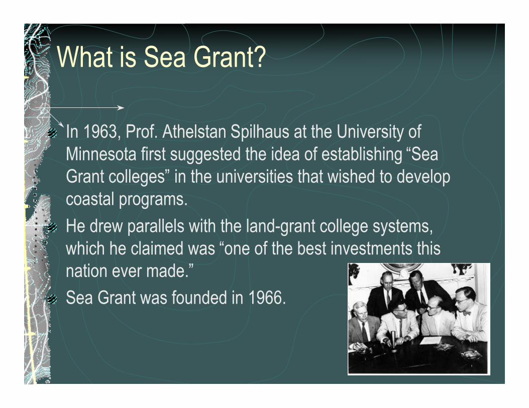
What is Sea Grant?
In 1963, Prof. Athelstan Spilhaus at the University ofMinnesota first suggested the idea of establishing “SeaGrant colleges” in the universities that wished to developcoastal programs.
He drew parallels with the land-grant college systems,which he claimed was “one of the best investments thisnation ever made.”
Sea Grant was founded in 1966.

What is Sea Grant?
32 Sea Grant colleges & institutions conductingintegrated research, education & outreach
A federal/state partnership
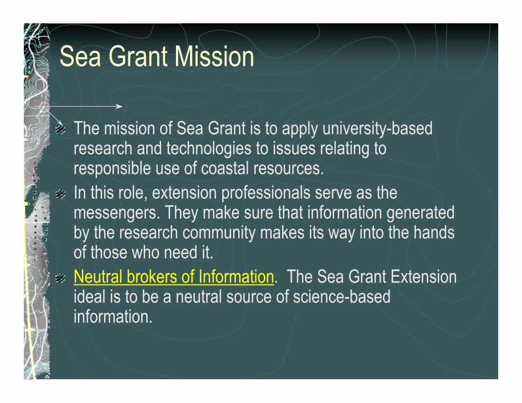
Sea Grant Mission
The mission of Sea Grant is to apply university-basedresearch and technologies to issues relating toresponsible use of coastal resources.In this role, extension professionals serve as themessengers. They make sure that information generatedby the research community makes its way into the handsof those who need it.Neutral brokers of Information. The Sea Grant Extensionideal is to be a neutral source of science-basedinformation.
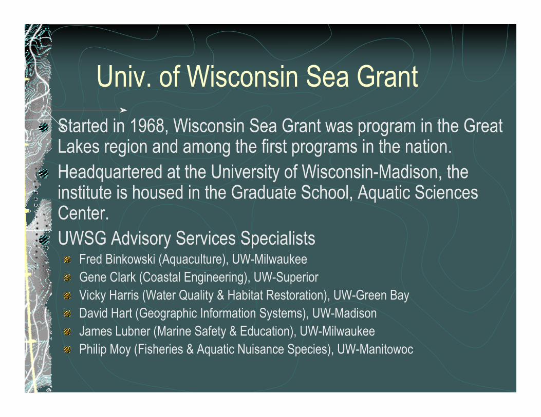
Univ. of Wisconsin Sea Grant
Started in 1968, Wisconsin Sea Grant was program in the GreatLakes region and among the first programs in the nation.Headquartered at the University of Wisconsin-Madison, theinstitute is housed in the Graduate School, Aquatic SciencesCenter.UWSG Advisory Services Specialists
Fred Binkowski (Aquaculture), UW-MilwaukeeGene Clark (Coastal Engineering), UW-SuperiorVicky Harris (Water Quality & Habitat Restoration), UW-Green BayDavid Hart (Geographic Information Systems), UW-MadisonJames Lubner (Marine Safety & Education), UW-MilwaukeePhilip Moy (Fisheries & Aquatic Nuisance Species), UW-Manitowoc
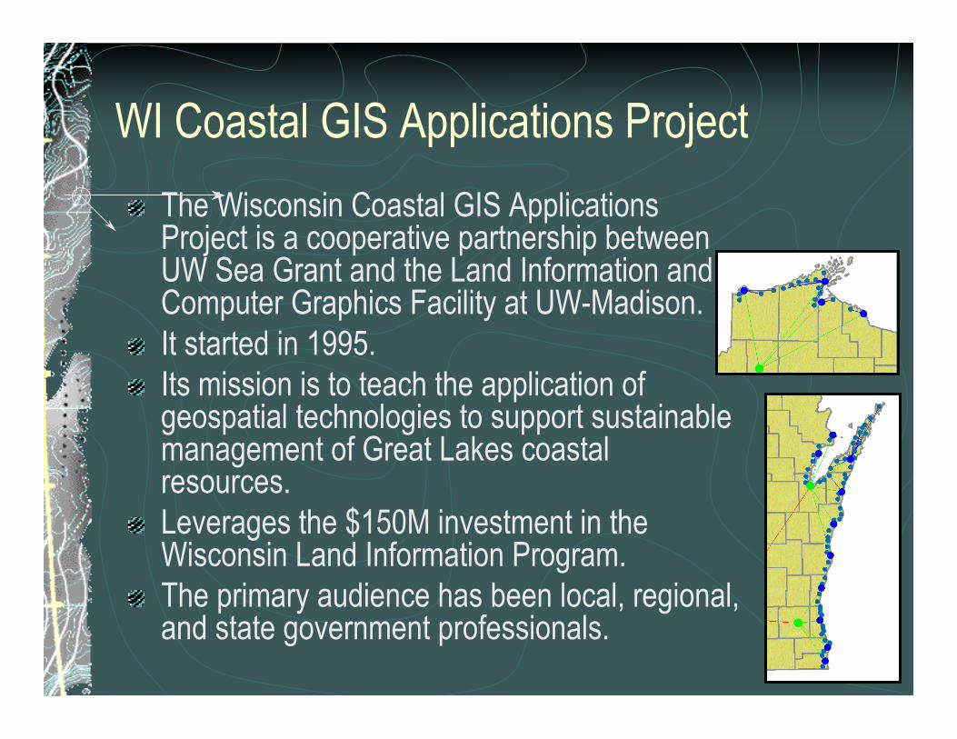
WI Coastal GIS Applications Project
The Wisconsin Coastal GIS ApplicationsProject is a cooperative partnership betweenUW Sea Grant and the Land Information andComputer Graphics Facility at UW-Madison.It started in 1995.Its mission is to teach the application ofgeospatial technologies to support sustainablemanagement of Great Lakes coastalresources.Leverages the $150M investment in theWisconsin Land Information Program.The primary audience has been local, regional,and state government professionals.
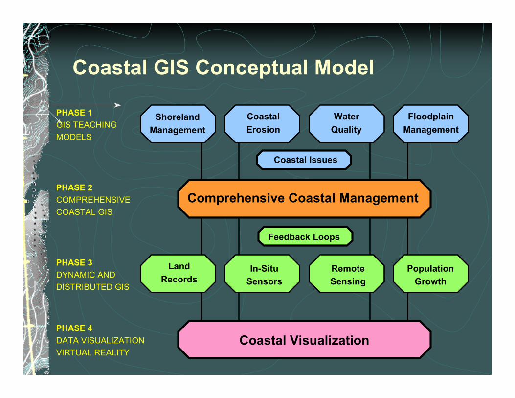
PHASE 1GIS TEACHINGMODELS
PHASE 3DYNAMIC ANDDISTRIBUTED GIS
PHASE 2COMPREHENSIVECOASTAL GIS
Coastal GIS Conceptual Model
PHASE 4DATA VISUALIZATIONVIRTUAL REALITY
Coastal Issues
ShorelandManagement
FloodplainManagement
WaterQuality
CoastalErosion
PopulationGrowth
RemoteSensing
In-SituSensors
LandRecords
Comprehensive Coastal Management
Feedback Loops
Coastal Visualization
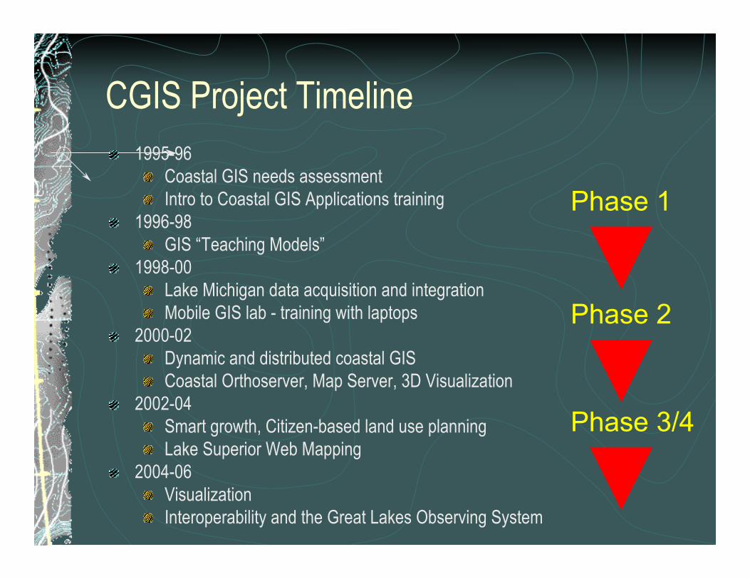
CGIS Project Timeline1995-96
Coastal GIS needs assessmentIntro to Coastal GIS Applications training
1996-98GIS “Teaching Models”
1998-00Lake Michigan data acquisition and integrationMobile GIS lab - training with laptops
2000-02Dynamic and distributed coastal GISCoastal Orthoserver, Map Server, 3D Visualization
2002-04Smart growth, Citizen-based land use planningLake Superior Web Mapping
2004-06VisualizationInteroperability and the Great Lakes Observing System
Phase 1
Phase 2
Phase 3/4
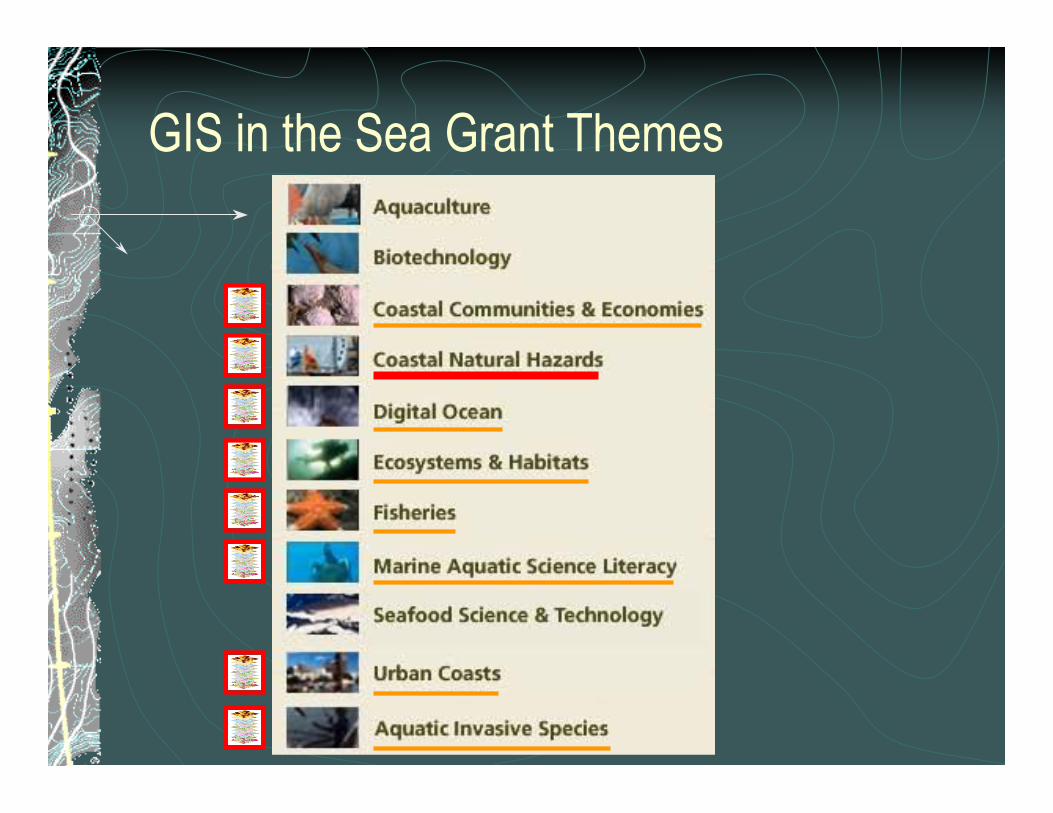
GIS in the Sea Grant Themes
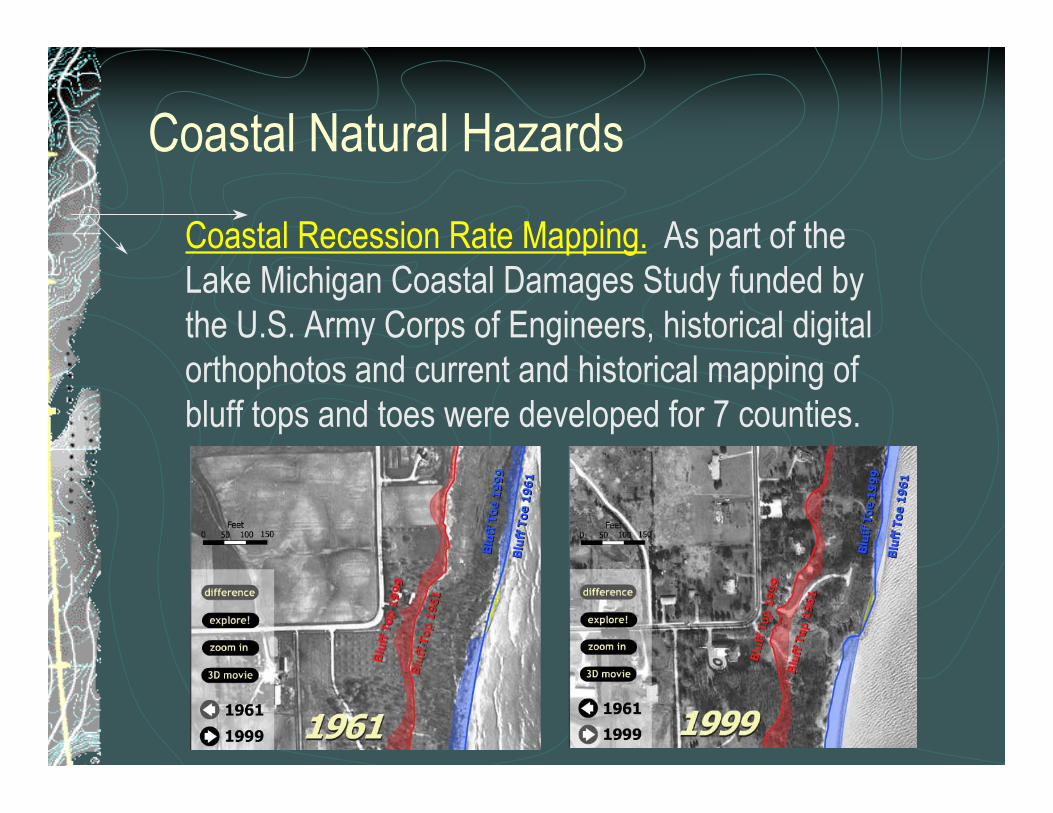
Coastal Natural Hazards
Coastal Recession Rate Mapping. As part of theLake Michigan Coastal Damages Study funded bythe U.S. Army Corps of Engineers, historical digitalorthophotos and current and historical mapping ofbluff tops and toes were developed for 7 counties.
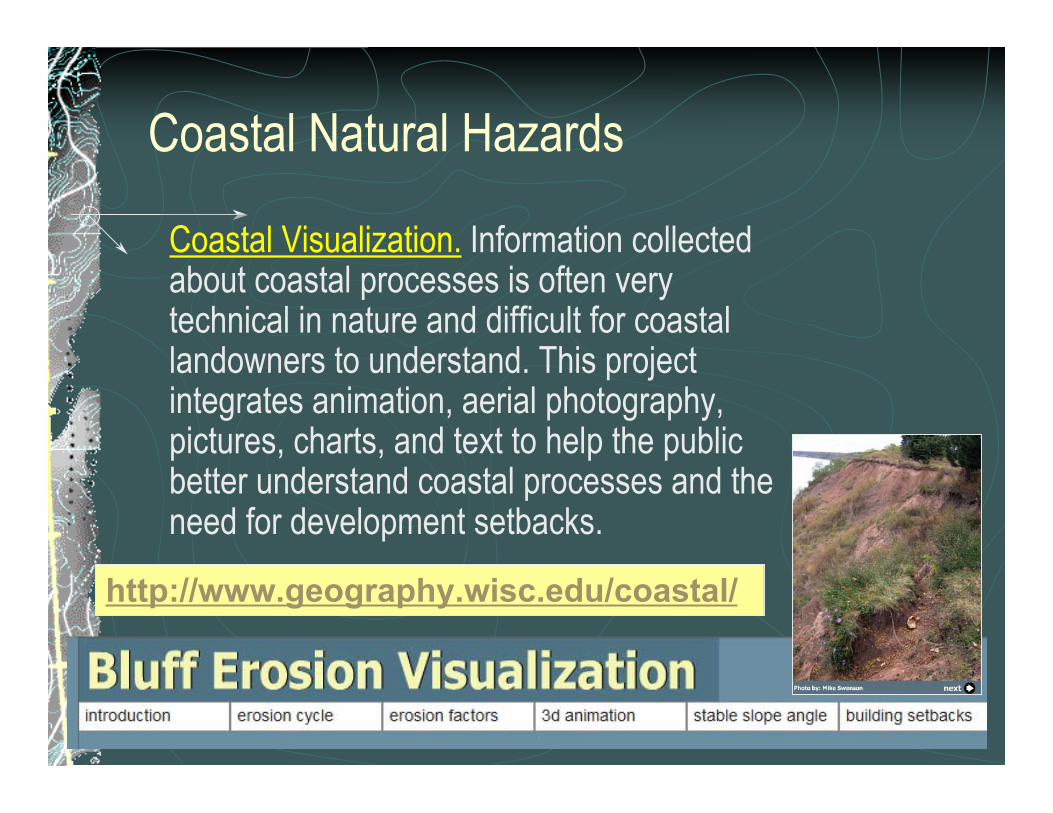
Coastal Natural Hazards
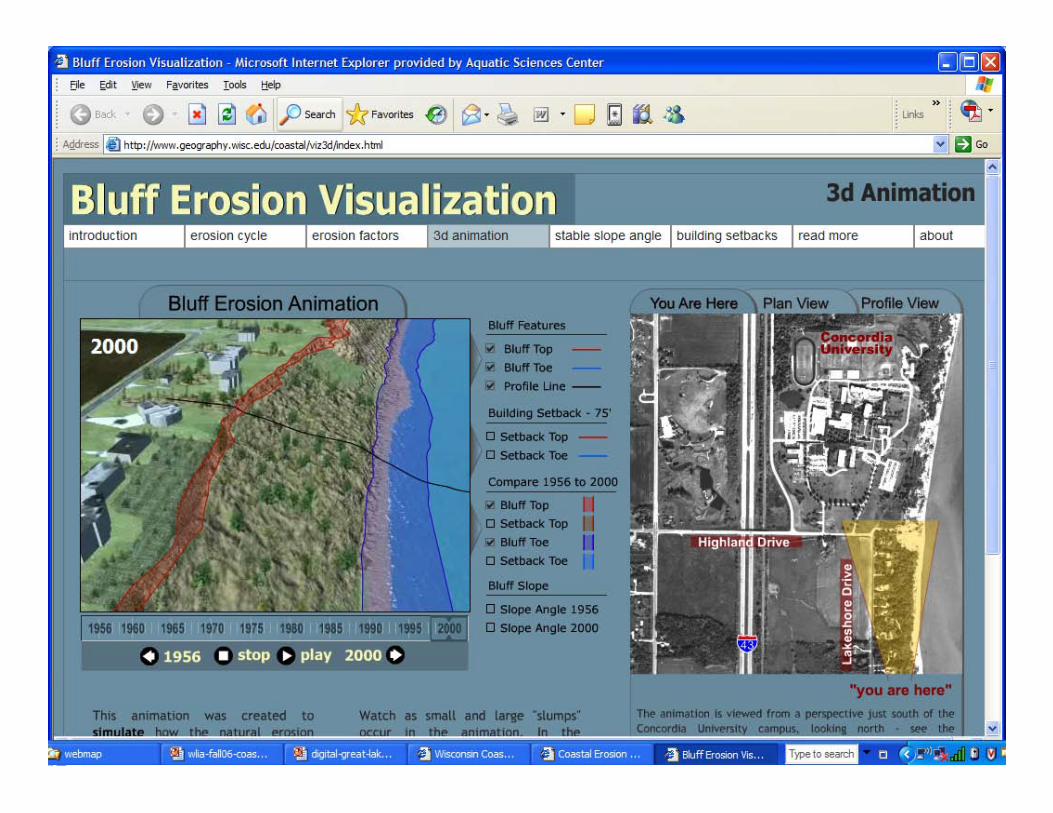
Coastal Visualization. Information collectedabout coastal processes is often verytechnical in nature and difficult for coastallandowners to understand. This projectintegrates animation, aerial photography,pictures, charts, and text to help the publicbetter understand coastal processes and theneed for development setbacks.
http://www.geography.wisc.edu/coastal/
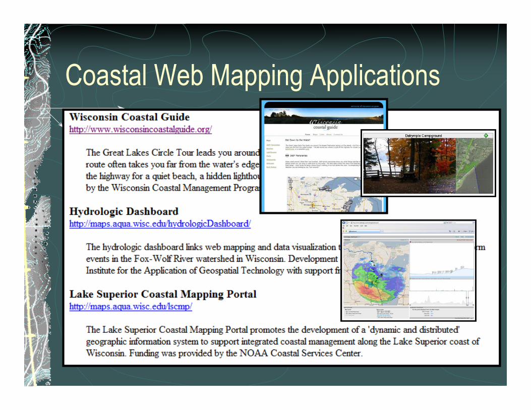
Coastal Web Mapping Applications
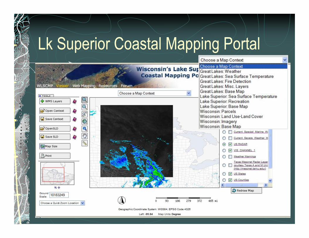
Lk Superior Coastal Mapping Portal
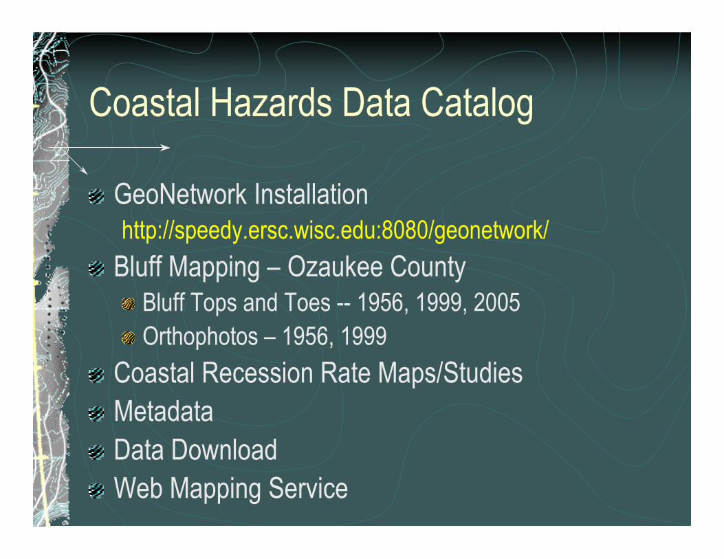
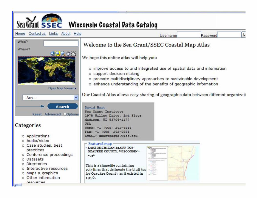
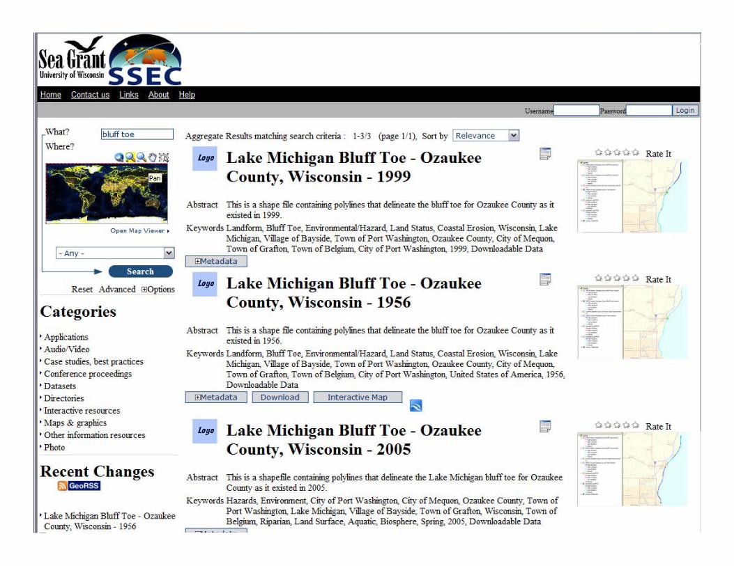
Coastal Hazards Data Catalog
GeoNetwork Installationhttp://speedy.ersc.wisc.edu:8080/geonetwork/
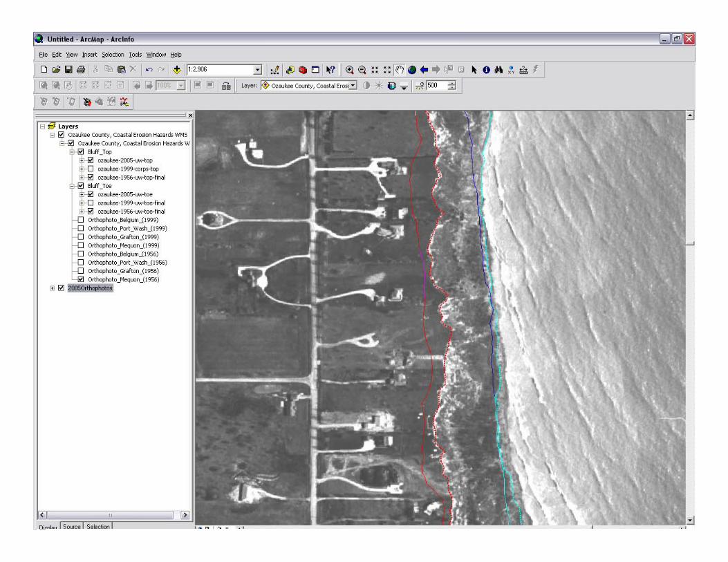
Bluff Mapping – Ozaukee CountyBluff Tops and Toes -- 1956, 1999, 2005Orthophotos – 1956, 1999
Coastal Recession Rate Maps/StudiesMetadataData DownloadWeb Mapping Service
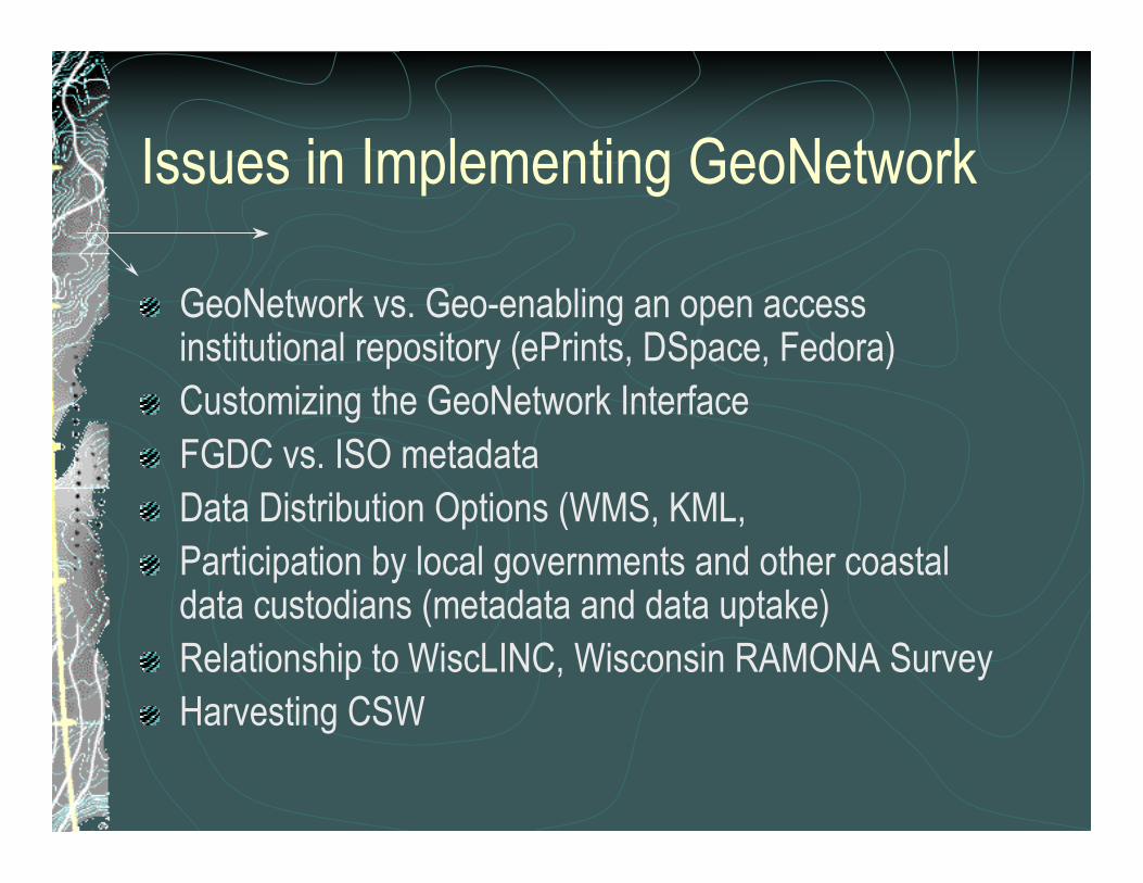
Issues in Implementing GeoNetwork
GeoNetwork vs. Geo-enabling an open accessinstitutional repository (ePrints, DSpace, Fedora)Customizing the GeoNetwork InterfaceFGDC vs. ISO metadataData Distribution Options (WMS, KML,Participation by local governments and other coastaldata custodians (metadata and data uptake)Relationship to WiscLINC, Wisconsin RAMONA SurveyHarvesting CSW
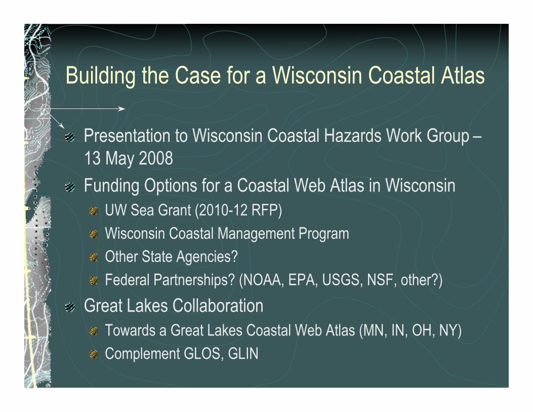
Building the Case for a Wisconsin Coastal Atlas
Presentation to Wisconsin Coastal Hazards Work Group –13 May 2008
Funding Options for a Coastal Web Atlas in WisconsinUW Sea Grant (2010-12 RFP)
Wisconsin Coastal Management Program
Other State Agencies?
Federal Partnerships? (NOAA, EPA, USGS, NSF, other?)
Great Lakes CollaborationTowards a Great Lakes Coastal Web Atlas (MN, IN, OH, NY)
Complement GLOS, GLIN
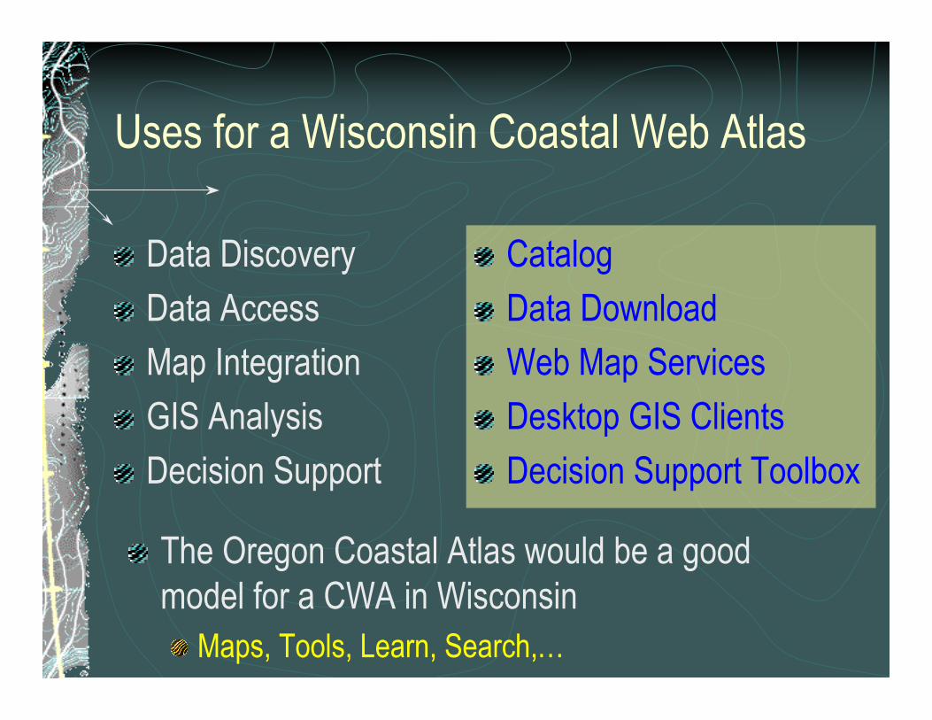
Uses for a Wisconsin Coastal Web Atlas
Data Discovery
Data Access
Map Integration
GIS Analysis
Decision Support
Catalog
Data Download
Web Map Services
Desktop GIS Clients
Decision Support Toolbox
The Oregon Coastal Atlas would be a goodmodel for a CWA in Wisconsin
Maps, Tools, Learn, Search,…


![Carley GIS workshop 20101109 [Read-Only] · GIS in Coastal Management Coastal Engineering Physical Model Testings Coastal Processes Climate Change and Sea Level Rise Foreshore Protection](https://img.pdfslide.net/doc/110x75/5e70b53c54818046d600f219/carley-gis-workshop-20101109-read-only-gis-in-coastal-management-coastal-engineering.jpg)