Embed Size (px)
Citation preview
Coastal Marine Ecological Classification Standard (CMECS) v. 3
Christopher J. Madden, Kathleen Goodin, Dennis Grossman
NatureServe
Rebecca Allee, Mark Finkbeiner
NOAA
NASA Coastal Habitats Workshop August 2008
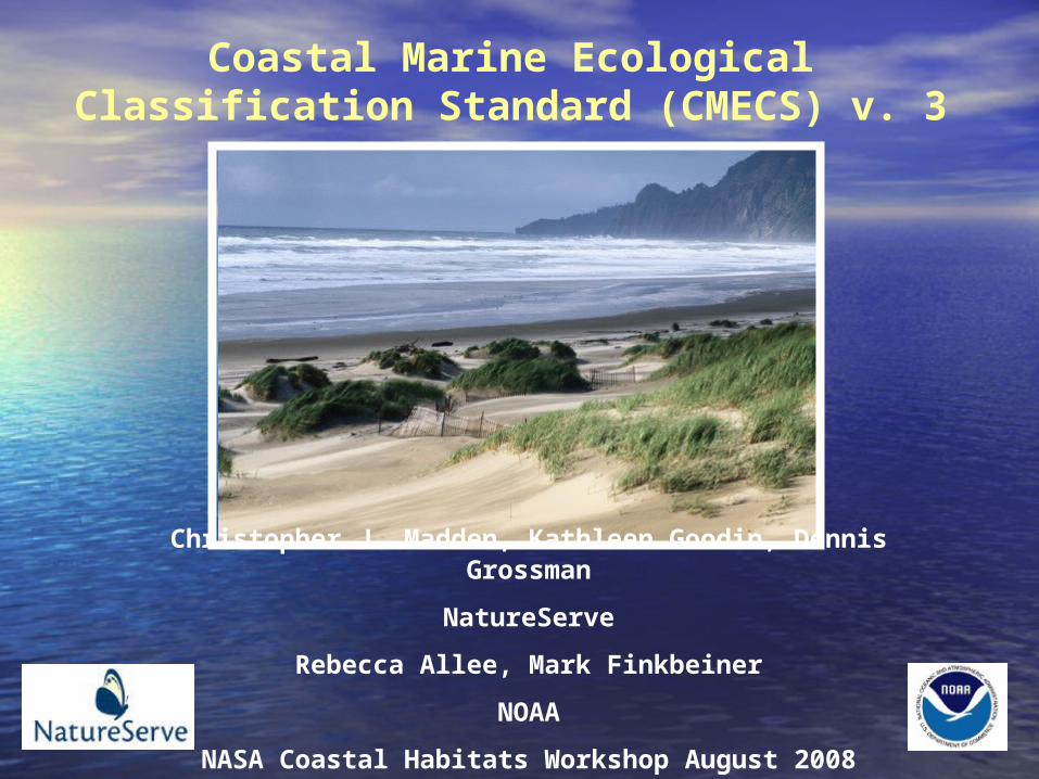
•NOAA-NatureServe partnership
•Six year process (so far)
•FGDC review
•Draws on a consortium of experts
•Integrates other classifications- e.g. SCHEME, Dethier
•Articulates with “adjacent” classifications- e.g. Cowardin, Greene
•Provides umbrella framework and common terminology
•Continental and global perspective
Madden et al. 2008
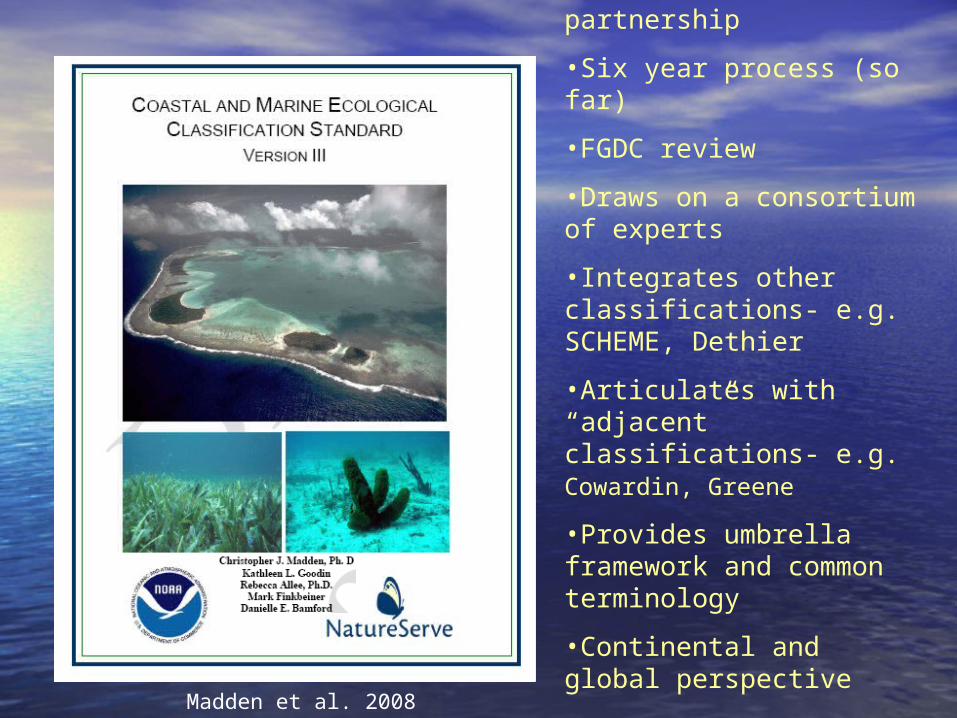
Applications of the StandardApplications of the Standard
• Identification, inventory and mapping of: – Critical Habitat– Endemic species distributions– Threatened species– Biodiversity Hot Spots– Marine Protected Areas– Essential Fish Habitat
• Monitoring thereof
• Facilitation of Ecosystem-Based Management
• Ecological Research Mode
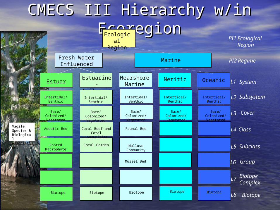
CMECS III Hierarchy w/in CMECS III Hierarchy w/in EcoregionEcoregion
Biotope
L3
L5
L7
L8BiotopeBiotopeBiotope
Estuary
Bare/Colonized/Vegetated
NearshoreMarine L1
Biotope
Estuarine-Influenced
Neritic Oceanic
Biotope
Biotope Complex
Cover
System
Subclass
ClassVagile Species & Biological Associations
L4
PI2MarineFresh Water Influenced
Regime
Ecological Region
Ecological Region PI1
L2Intertidal/Benthic Subsystem
Bare/Colonized/Vegetated
Bare/Colonized/Vegetated
Bare/Colonized/Vegetated
Bare/Colonized/Vegetated
Intertidal/Benthic Intertidal/Benthic Intertidal/Benthic Intertidal/Benthic
L6 Group
Aquatic Bed Faunal Bed
Rooted Macrophyte
Mussel Bed
Mollusc Community
Coral Reef and Coral Communities
Coral Garden
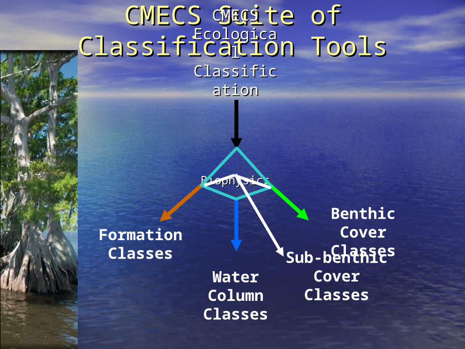
CMECS Suite of Classification CMECS Suite of Classification ToolsTools
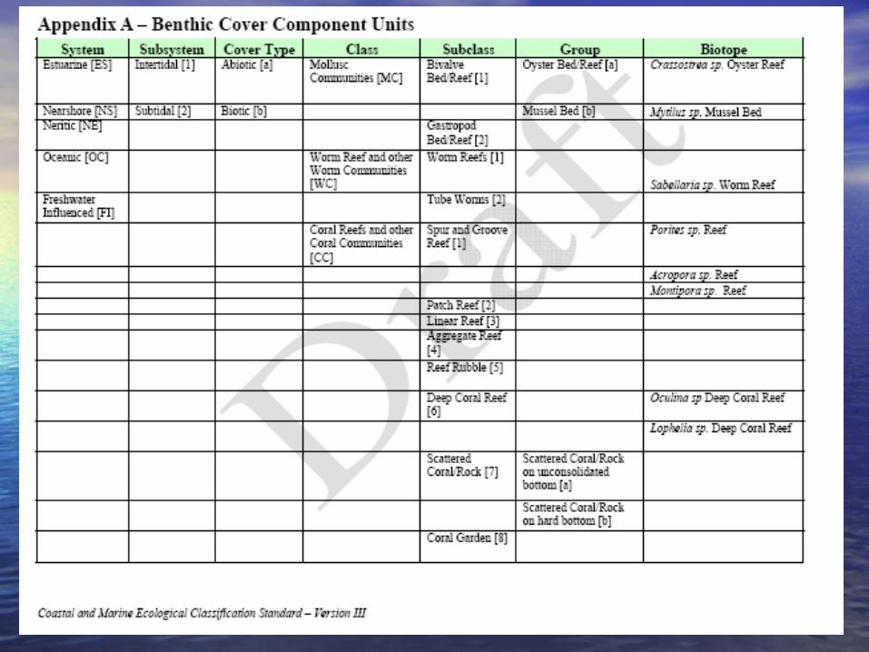
Benthic Cover Classes
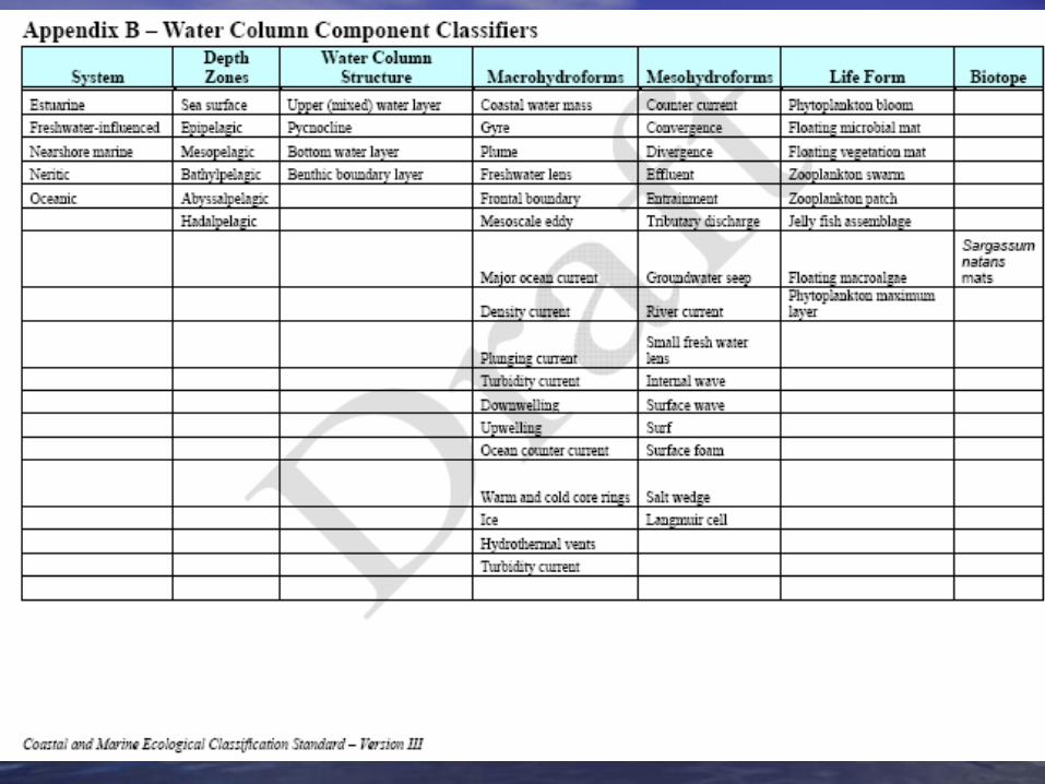
Water Column Classes
Formation Classes
CMECS CMECS Ecological Ecological ClassificatiClassificati
onon
BiophysicsBiophysics
Sub-benthic Cover Classes
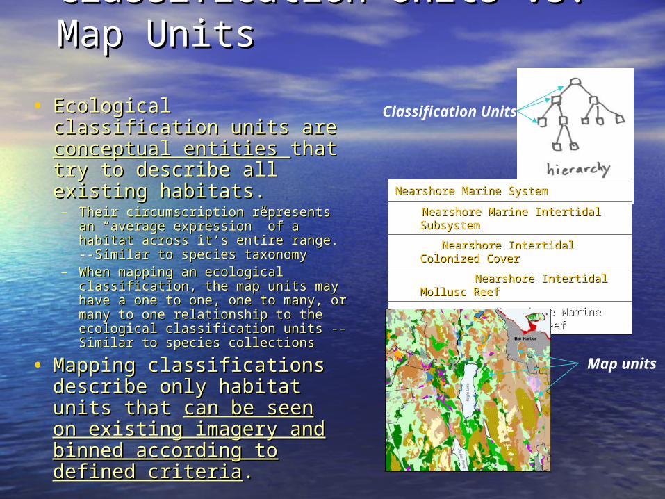
Classification Units vs. Map Classification Units vs. Map UnitsUnits
• Ecological classification Ecological classification units are units are conceptual conceptual entities entities that try to describe that try to describe all existing habitats. all existing habitats. – Their circumscription represents an Their circumscription represents an
“average expression” of a habitat “average expression” of a habitat across it’s entire range. --Similar to across it’s entire range. --Similar to species taxonomyspecies taxonomy
– When mapping an ecological When mapping an ecological classification, the map units may classification, the map units may have a one to one, one to many, or have a one to one, one to many, or many to one relationship to the many to one relationship to the ecological classification units --ecological classification units --Similar to species collections Similar to species collections
• Mapping classifications Mapping classifications describe only habitat units describe only habitat units that that can be seen on can be seen on existing imagery and existing imagery and binned according to binned according to defined criteriadefined criteria..
Nearshore Marine SystemNearshore Marine System
Nearshore Marine Intertidal SubsystemNearshore Marine Intertidal Subsystem
Nearshore Intertidal Colonized CoverNearshore Intertidal Colonized Cover
Nearshore Intertidal Mollusc ReefNearshore Intertidal Mollusc Reef
Nearshore Marine Intertidal Oyster ReefNearshore Marine Intertidal Oyster Reef
Classification Units
Map units
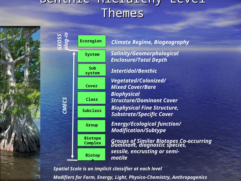
Subclass
Biotope
System
Cover
Biotope Complex
Class
Salinity/Geomorphological Enclosure/Total Depth
Vegetated/Colonized/Mixed Cover/BareBiophysical Structure/Dominant CoverBiophysical Fine Structure, Substrate/Specific Cover
Groups of Similar Biotopes Co-occurring
Dominant, diagnostic species, sessile, encrusting or semi-motile
Benthic Hierarchy Level ThemesBenthic Hierarchy Level Themes
Spatial Scale is an implicit classifier at each level
Modifiers for Form, Energy, Light, Physico-Chemistry, Anthropogenics
Ecoregion Climate Regime, Biogeography
Subsystem Intertidal/Benthic
Group Energy/Ecological function/ Modification/Subtype
CM
EC
SG
EO
SS
pl
ug-
in
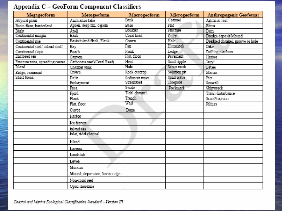
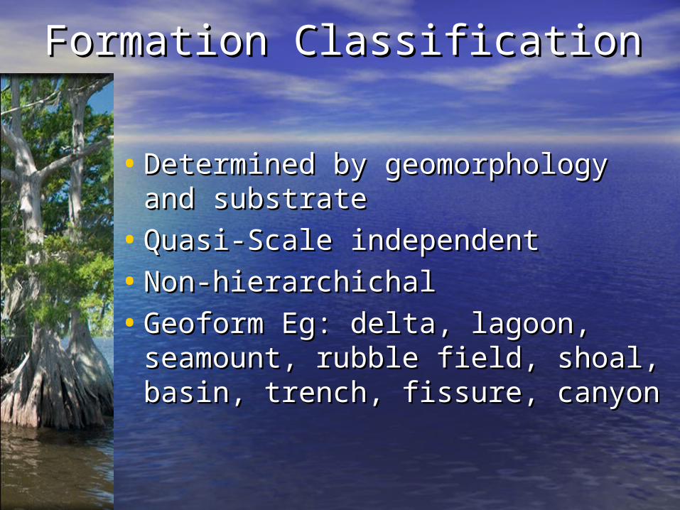
Formation ClassificationFormation Classification
• Determined by geomorphology Determined by geomorphology and substrateand substrate
• Quasi-Scale independentQuasi-Scale independent
• Non-hierarchichalNon-hierarchichal
• Geoform Eg: delta, lagoon, Geoform Eg: delta, lagoon, seamount, rubble field, shoal, seamount, rubble field, shoal, basin, trench, fissure, canyon basin, trench, fissure, canyon
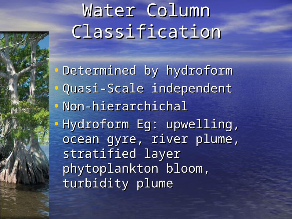
Water Column ClassificationWater Column Classification
• Determined by hydroformDetermined by hydroform
• Quasi-Scale independentQuasi-Scale independent
• Non-hierarchichalNon-hierarchichal
• Hydroform Eg: upwelling, ocean Hydroform Eg: upwelling, ocean gyre, river plume, stratified layer gyre, river plume, stratified layer phytoplankton bloom, turbidity phytoplankton bloom, turbidity plumeplume
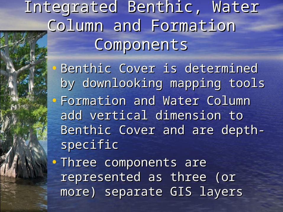
Integrated Benthic, Water Column Integrated Benthic, Water Column and Formation Componentsand Formation Components
• Benthic Cover is determined by Benthic Cover is determined by downlooking mapping toolsdownlooking mapping tools
• Formation and Water Column Formation and Water Column add vertical dimension to add vertical dimension to Benthic Cover and are depth-Benthic Cover and are depth-specificspecific
• Three components are Three components are represented as three (or more) represented as three (or more) separate GIS layersseparate GIS layers
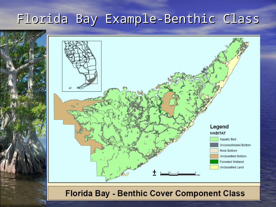
Florida Bay Example-Benthic ClassFlorida Bay Example-Benthic Class
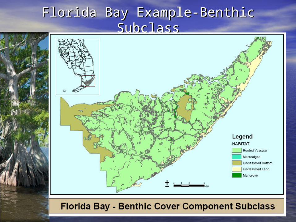
Florida Bay Example-Benthic SubclassFlorida Bay Example-Benthic Subclass
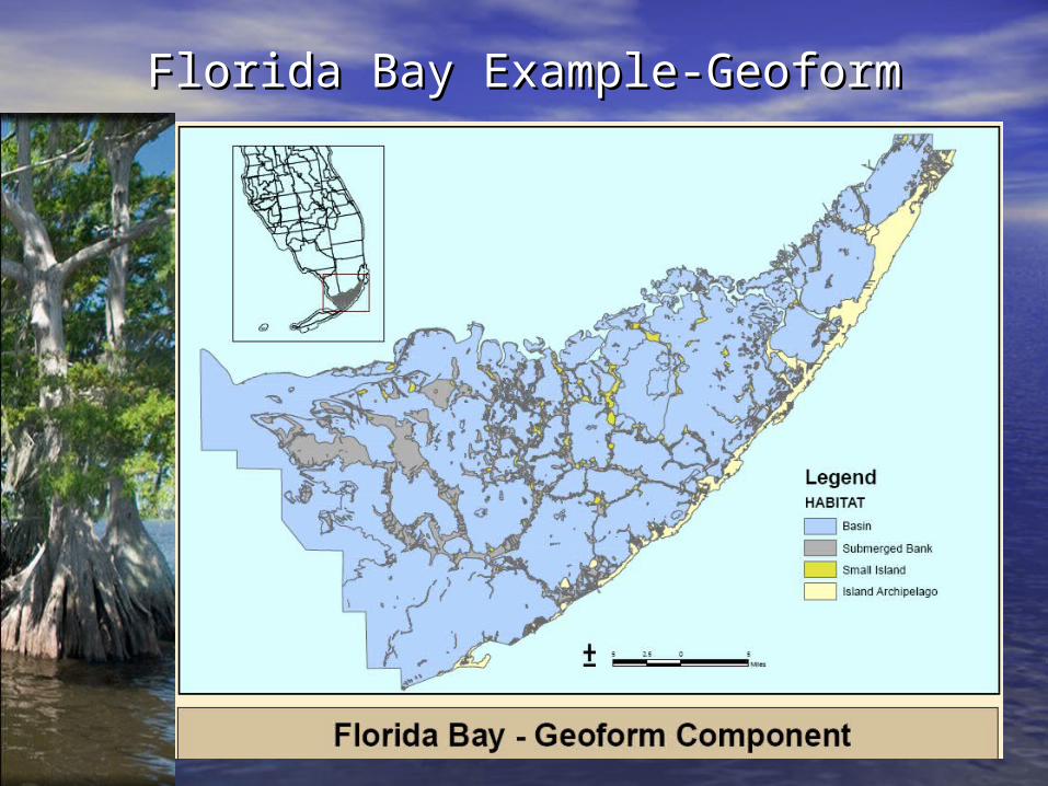
Florida Bay Example-GeoformFlorida Bay Example-Geoform
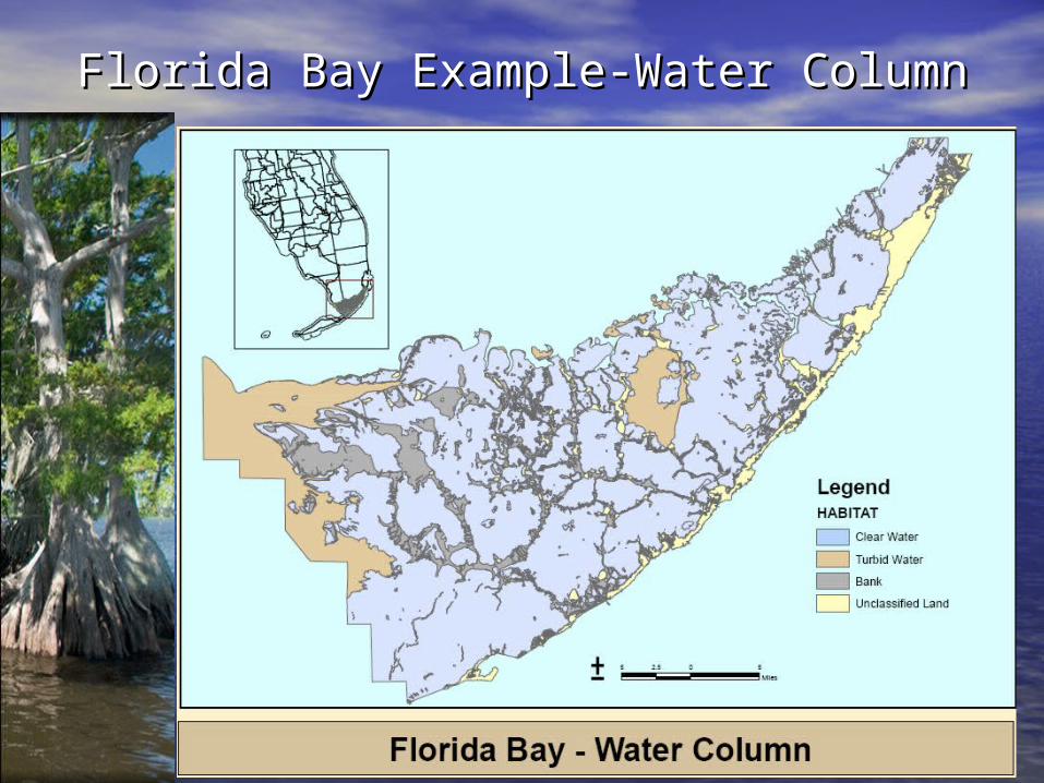
Florida Bay Example-Water ColumnFlorida Bay Example-Water Column
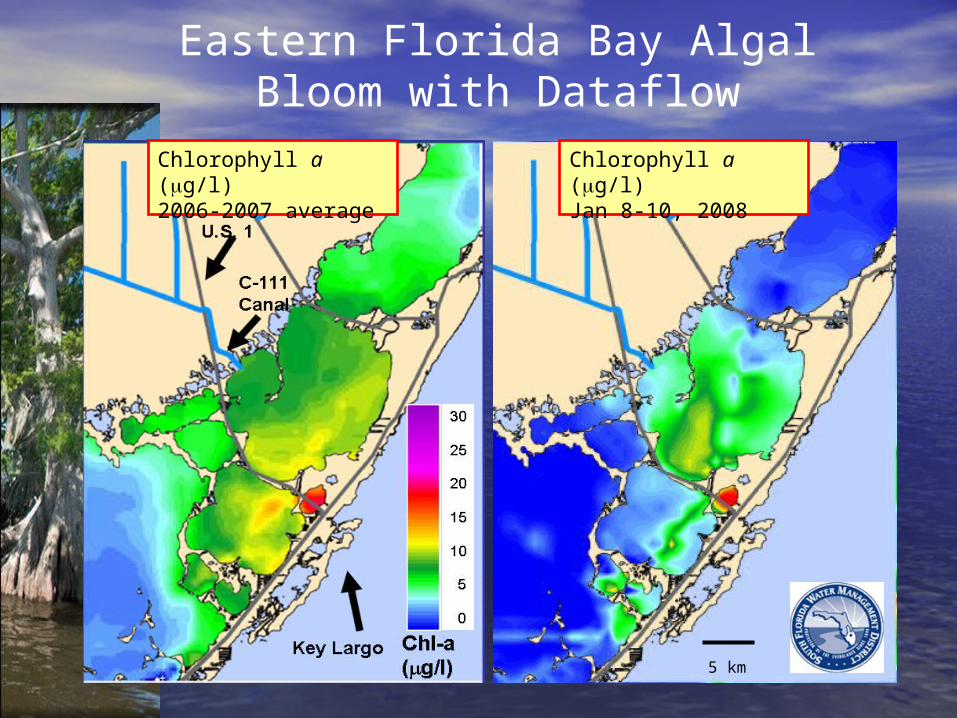
Eastern Florida Bay Algal Bloom with Dataflow
Chlorophyll a (g/l)2006-2007 average
Chlorophyll a (g/l)Jan 8-10, 2008
5 km
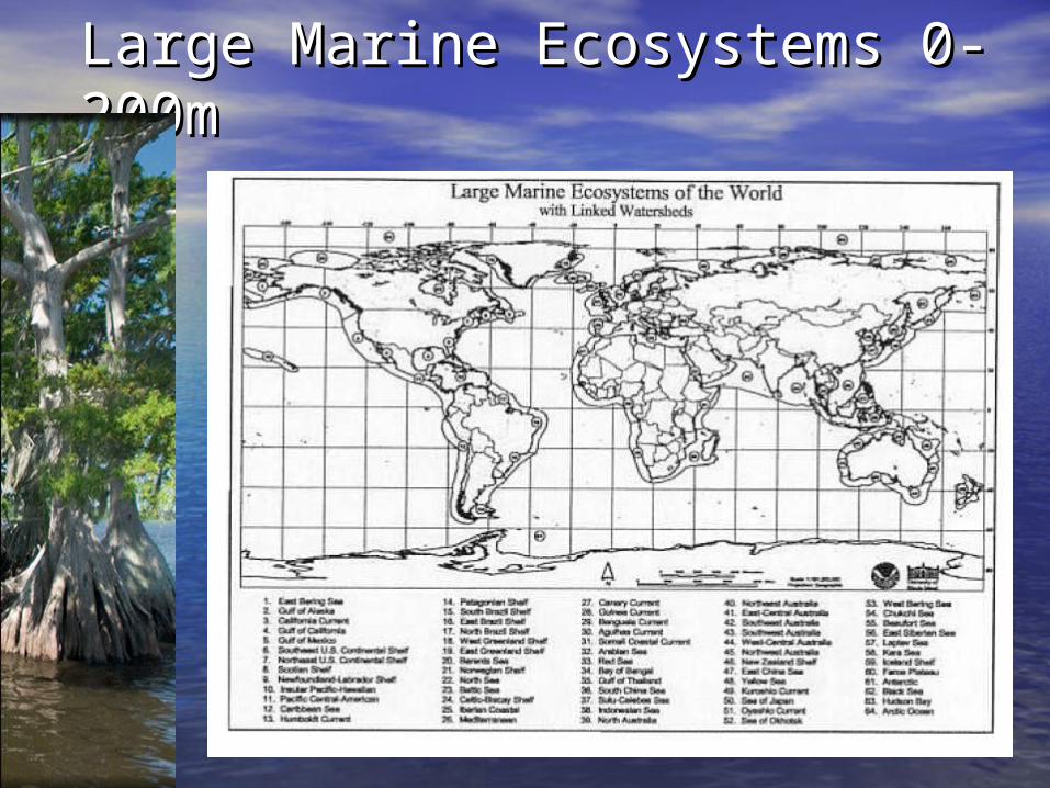
Large Marine Ecosystems 0-Large Marine Ecosystems 0-200m200m
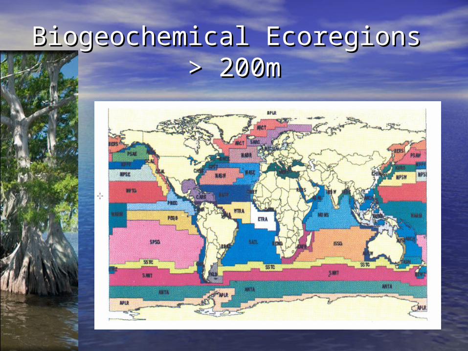
Biogeochemical Ecoregions Biogeochemical Ecoregions > 200m> 200m
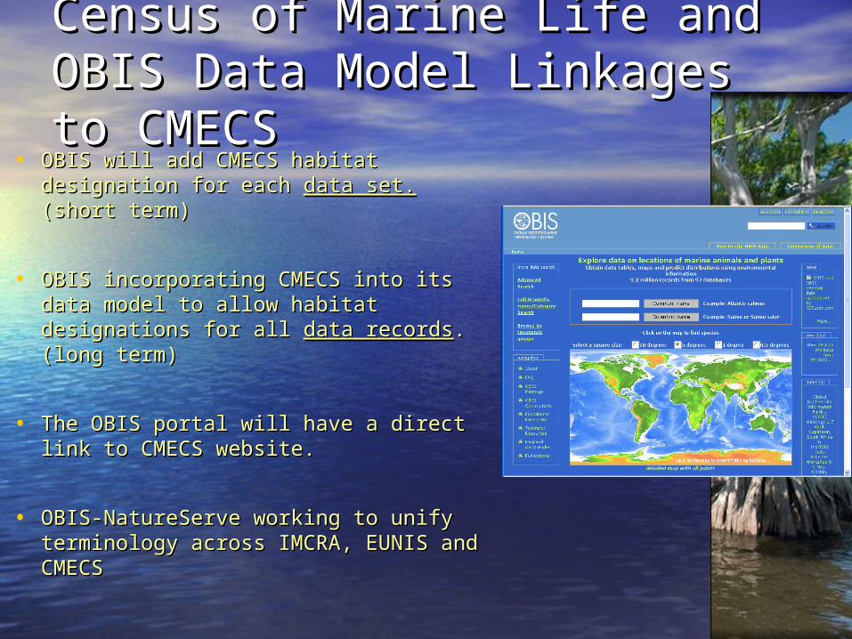
Census of Marine Life and OBIS Census of Marine Life and OBIS Data Model Linkages to CMECSData Model Linkages to CMECS
• OBIS will add CMECS habitat OBIS will add CMECS habitat designation for each designation for each data set.data set. (short (short term)term)
• OBIS incorporating CMECS into its data OBIS incorporating CMECS into its data model to allow habitat designations for all model to allow habitat designations for all data recordsdata records. (long term). (long term)
• The OBIS portal will have a direct link to The OBIS portal will have a direct link to CMECS website.CMECS website.
• OBIS-NatureServe working to unify OBIS-NatureServe working to unify terminology across IMCRA, EUNIS and terminology across IMCRA, EUNIS and CMECSCMECS
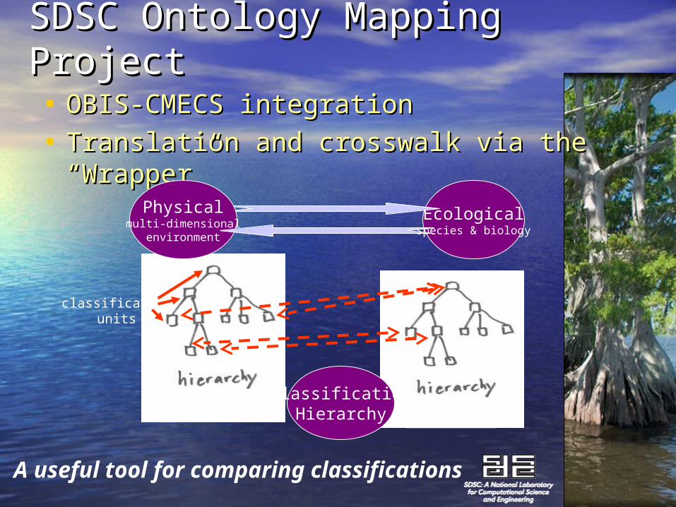
SDSC Ontology Mapping SDSC Ontology Mapping Project Project • OBIS-CMECS integrationOBIS-CMECS integration
• Translation and crosswalk via the Translation and crosswalk via the “Wrapper”“Wrapper”
Ecologicalspecies & biology
ClassificationHierarchy
Physicalmulti-dimensional
environment
classificationunits
A useful tool for comparing classifications
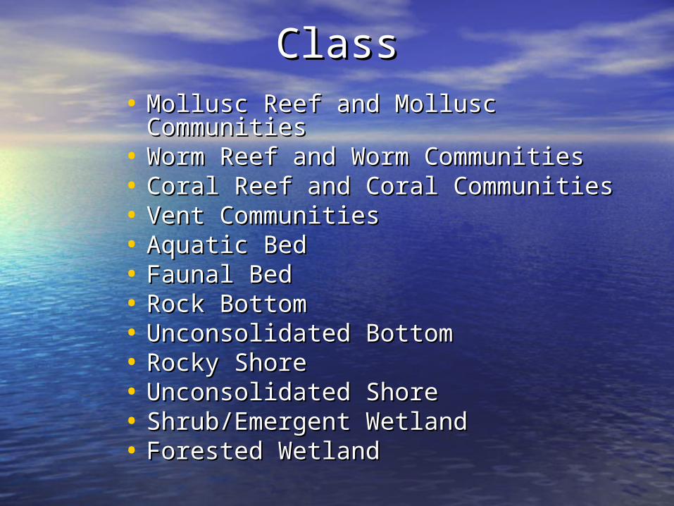
ClassClass• Mollusc Reef and Mollusc Mollusc Reef and Mollusc
CommunitiesCommunities• Worm Reef and Worm CommunitiesWorm Reef and Worm Communities• Coral Reef and Coral CommunitiesCoral Reef and Coral Communities• Vent Communities Vent Communities • Aquatic BedAquatic Bed• Faunal BedFaunal Bed• Rock BottomRock Bottom• Unconsolidated BottomUnconsolidated Bottom• Rocky ShoreRocky Shore• Unconsolidated ShoreUnconsolidated Shore• Shrub/Emergent WetlandShrub/Emergent Wetland• Forested WetlandForested Wetland
SubclassSubclass
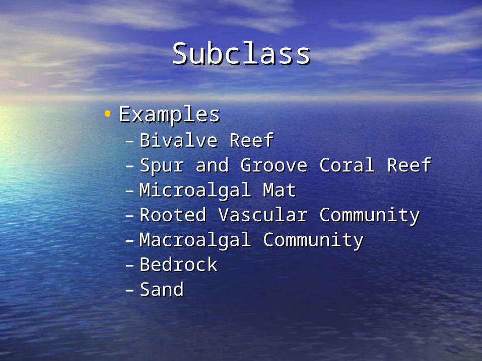
• ExamplesExamples– Bivalve ReefBivalve Reef– Spur and Groove Coral ReefSpur and Groove Coral Reef– Microalgal MatMicroalgal Mat– Rooted Vascular CommunityRooted Vascular Community– Macroalgal CommunityMacroalgal Community– BedrockBedrock– SandSand
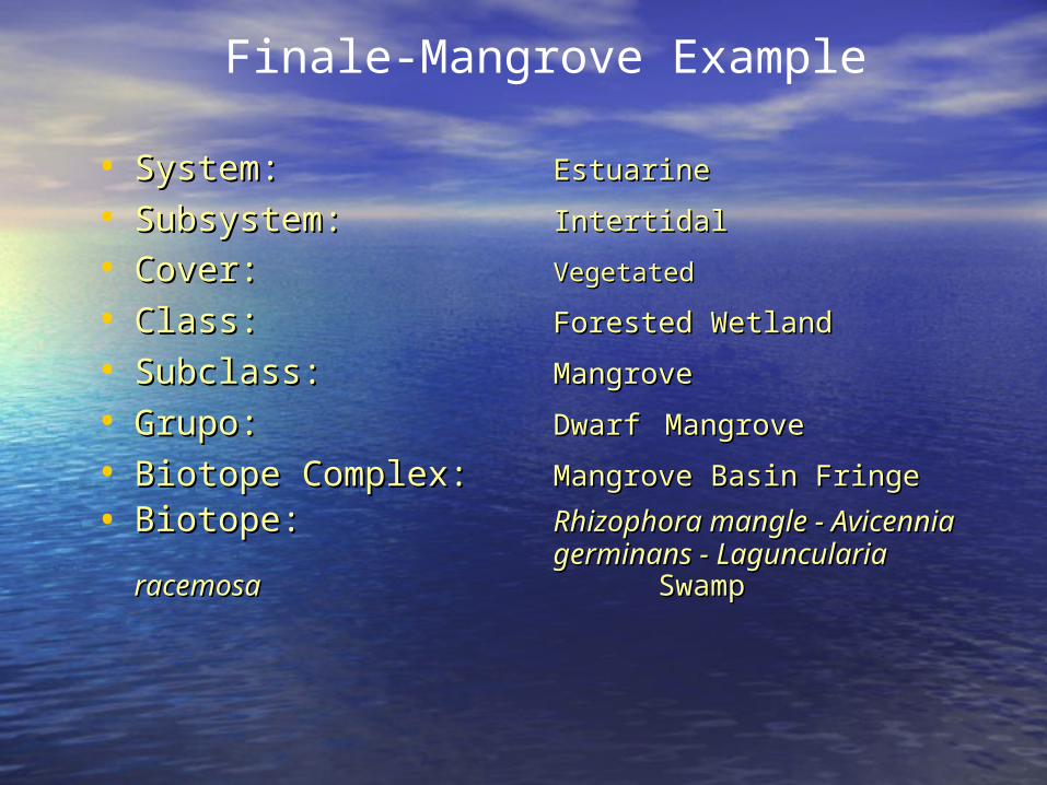
• System:System: EstuarineEstuarine
• Subsystem:Subsystem: IntertidalIntertidal
• Cover:Cover: VegetatedVegetated
• Class:Class: Forested WetlandForested Wetland
• Subclass:Subclass: MangroveMangrove
• Grupo:Grupo: DwarfDwarf MangroveMangrove
• Biotope Complex:Biotope Complex: Mangrove Basin FringeMangrove Basin Fringe
• Biotope:Biotope: Rhizophora mangle - Rhizophora mangle - Avicennia Avicennia germinans - germinans - Laguncularia racemosa Laguncularia racemosa SwampSwamp
Finale-Mangrove Example