Embed Size (px)
Citation preview
(94~/41 rv~~~o." r.>r q.:. :"\
' ..... I ~ ,
I\.
~/q:~~ COMMONWEALTH OF AUSTRALIA.
o <; ~ V
0" ~~ ~ 0' '<t.~ DEPARTMENT -OF SUPPLY AND SHIPPING.
: ,
REPORT No. 19.48/47
(GEOPHYSICAL REPORT NO.6)
1 BUREAU OF MiNERAL RESOlJR()WJ .
1 GEOPHYSICAL lIBR~RY , Ref ...... ......... 1.\................... .
.........
REPORT·
ON
.....
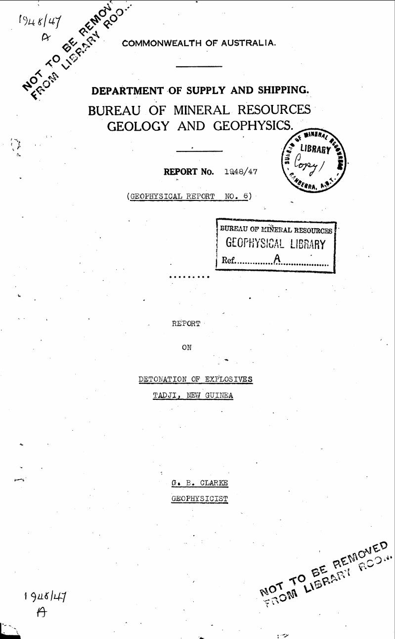
DETONATION OF EXP'LOSIVES
TADJI, l'JEY{ GUINEA
(,} • B. CLARKE
GEOPhySICIST
'. '
"
"
DETONATION OF EXPLOSIVES - TADJ.I,~'7 GUINEA ....
TJ2is ,re'portdisOu.ases the prepesed detonation of surplus R.A.A.F.'be'mbs "at 'radji, New. Guinea.,
'A v4Jsit was mali a tethabemb area; in Maroh. 1948, to. ebserve the preblems'involved in detonating the bombs en masse fe't' the purpose of a seismolegi'cal, study of the c r'us tal layering ef the. isl.and. "
r; various:loc'ali ties in· N~w Guinea,' 'papu8;a,oo' tIl.e 't?eigh-' bouring' i"s'lands were visited to estimate, the pr.actlca'bl.1i ty 01' installing temperar.y: seisniio, 'stations he recerdthe. d$:tonatlen. -K-
1. GENERAL
. (a) PhysiO~raphy~ . 'Tadjl,lles en ,the, ne~the·rn,geast,. of New Guilfea (leng' I4!ae .~ t) ina great triangular area. of alluvial silts and clays, whioh ferms a coast plain in the western half of the :sewani - pual depressiOl1. , Fc>r t.he most part 6t this area 19.·lo~lying, swampy and
, cover,ed byral.n ,:rorest~,' .'
Rising '.abruptly from· the . seuthe),1nl1:ni.its of the coastal. plain, the 'feothi'lls:o,fth~ Torrice·lll'Mt~. ferm. a ,wide belt o£ 'broken and disseoted ceuntry rising 700 ... 900 1 and gragually iho:r;'easlng :in:q.eight .s:6uthward to. the Tor.ricelli Mts.'
",The To,~riceili l~ts .'''f':erm t~e6ent-ralPart of the meuntain sy'stem that separates the western half of the sepi:'k - Markham depressien :fr9m'.the 'n~r:Ch coast. ' ' "."
~ '. ~ -.'~" .. . . ...
. -. ~ ,-.' "" .. " .: ~ ~. . .' ... "
. (b)'. 'Climate. '" Thfj 'av~J:'age, annual raini'all 01' the area is~a.bout . 10011 __ ". Tfie,wetseB.son on the' whole 'coincides wi th the N;.~J. Monsoon Deoember to.' Apr1-1., In:t4~S.E. season there is. appreciable. ra.in, but there is a greater frequency and~ncidence of deWnpours in the 1I1onths of tl?-e tl.\7. winds~' 'The dti>est month ie september (AV. ..4.8") !lith a gta~ila.l ris.e to the Dect;lmber average of 10.8" ...
Th~, area,is not· unduly hot'but the ,high relative ,humidity tends to. produce a lasSitude in unacclimat;tsed ,persens. 11'he best. werking heu):>s are f'r?.m ()500 to. 1000 heurs •
. ic) Heal tl::l.. Thi s 'area lias higher ma~arie.l endemioi ty.than the average for the ter;ri tory of,' New Guipea. 'The1;oc1q,ence of' ·scrub tYEhus i8< believed to ?~ low •
.. , ~ - 1'.
(d) Native: Pepu]"atipn., APproximately 1500 natl,ves live within a radius 91' '7 miles ef' Tadji. The pepula.tion is divided into two. ma.in groups, the insularpeepleon the islands ofT\1!I11ee, Ali, seleo and Angel ',and the coastal peeple in the villa.ges :?re,Volrau' and ' Lemieng.
, (i) '.L'he Insu:+ar <people. The insular peop'le numbs r about 1100wlth All I supperting500<, Tumlee I 400,' Angel, I 120 and Salee I about 75 ·people. These people supplement the feed. grown on .the islands frem mainland gardens and pl;ahatiens. Ola,p 2).
(ii} The Ceastalrrpeople .Of the ces.'stal peeple Lemieng supports about 250 peeple . and 'Pro and Vekau about 140. 'l'hese three, villages, oomprising a.bout IOO,huts, deps71d en near.by gardens and plantation . fer their foed.
-x-
.. ."."
pat:a fer this sectien was obtained f'rem a lecali ty study ef Ai t.9.pe - ~~a,nimo area, 'Terrain study NO.. 77 prepared by the' Allied Geophysical sectl-en, S .• ~'T. p,acific Area ,and published 6th March, 1944. Infemia tien ef tl;le native pepula t1en oame fr.om A.D.O. H. H. Bo.yan, Civil. Admin., N,.G." 'l'his infermatien 1s to. be·revised. . . .
----- -"--- -"------..... -- '/2 ...
......
Apa'rt' from these centrescf nat~ va: pcpulation the rest efthe area within'a 7 mile radiUS of'Tadjiis, vt;rtu,allY unintiabi:t-a (ted. The Chinape:lli natives howev~r, b:s-ve-,mo\l'eA from their cld
. site and' tb,~ir present whereab"outs is 'not: known., . Kapacm. village );~eson ti;le edGe o:(the, 7mtle perimet"er. " :
Ma.P :2shcwsthe' di st1"i bution cf th~nati v~ population, gardens and plantat~o.ns...: ,
2' nOMB DIS:'OSAL
, ta}' Locat!.cn, and di,s:t;ributlon. The .b?w.b,area lies, irtune~iatelY ,ncrtlJ. ef' ,a. 1ar6e elh'E'a;ymen't,~re,a which aJ,.Q~ns the eas,terneno cf the, fiGhter runway. TJ;1a fi-gl:lter' runway is 1200 yds from the ccast and bears 1030 30 r .mag.",', "
(i) Bombs loes. ted., Approx.tm,a:tely 2230 tons ,ofbornbs', contalpine; 8H8 tons ,cfexploslvemateri~l~' aredlstributed in 7, dumps over an area of about ~5/ 4 0.1' a squa~e,Itlile., ~/5 ofthefn concentrated in 5 dUmps, eoverihgan area: cf",'about:', 1/4,01'" a squar$ mcf1~:. M~P- 1., shows
,the d·i.str:ibuticnof bombs,- and, the gross e¥.plosive torttla.ge,in each ", . bf· the 7 du.mps.· '
'" " ,Dumps~ ,2:,' oAI 3 '~~5 iiein 'a s~~Ir'pynrea with' duap 2, 'sh0wing
'fr~e water (Margn 1948). "rfhis lotvl,,;[ing grou.nd WOuld probably befre.e frol11 water . durine tne drier, 'S.:E.' season. ", ,The' dUl1'i.ps are sepa.rated by thick rat,n fore stand open onto.' a' w.('Hl 'pa,yked north, ... south road which qonnects the bomoarea to the fighter ,runway. .' - • ' >
{;ii)., Bo.mbs nct located. Ii .A.A .. F.:stock ,sheets assess the tonnage "of '~mbs at TadJI to be 8,pp;rc;x:imately 2$30 tons. fihe tonna'6e " not e,ccounted .for'amounts t'o 709tbns.' It is' unlikely that tbts; to,nnage was o,ier.looked in tpe, recent 'survey.
(b) De tons ti On.;
(1) Detonatien en ms.,ase wi:thina 'confined a~ea.- 'Map'.1. ,shows the 90Q ,square ya.rd area. wi tninwhi.cF,i tM'bombs couTd be sti3;cked, to satls.l'y the seismolcgical purpos,a: ol\,detcnation. APptQ,x1mately
. 119.Qf;ro,ss tcns o.fpombs ~.qn'tainihg, 427:-~ens .cf explcsi ve materia,l ' are knewll to lie w:i, th';-.n this area, . and 1040., zross tcns COl'lta,lnirig 461 tons 0.1' explosive materi.al haveb~en "obs~,rved" to li'e outside it. The tonna,ge lying outside tl:le are:a is' comprised of the f'cll,ov!ing , bembS ' '. . ,}'
.,. -"',(
, , 1000 10 • • ' •• " ~,149f5J 'bOOlo, •• •• , ' '~655} " .
';a50~260 Ib ... ' •• ' 'l128} -;,. ... -O:-~-;;.." (ll " ,,·100 lb • • ;'.,' 100.1.)'" , ".! '
,< ", ' ,2, 'h_ 23, , 1 b"., .. .'. • 1" " V.'. .):,046),," r " , , ~ •••• }" • .,:.." • ~."" 4
It, i~estimatedthat it: would ta'ke' '6we,eks to..mQve these ,bo!llbS :l,nto tha :Confined e.rfja. ThE( tracks in, the ,'n.~ighbo.urhood
appear to. os ill .f~ir eoncti tlo.n. Table ',r show,a· the di,atribution , 'of these bomos ,among the" dumps. . :
"*'" ~'. 1000 lbs,;oOO',lbs',& ?bO 10 BOfub .' . ;2.,' 100 lb60mbs and.smElll~r (1) E lplllent:' Z",mob).le <zr~es,. 2tra"ctqrs, (~) Equ~pment: X lx, 4 ton truck
, '~. bqrab t,ro leys'j" ,',' '.," .." (ll)c J!e,r,somne.l: l·trtick' ori v;er '&, (il)'J:'e r:son,n.el:,2 crane,'drivers, 2 t.ractor' native '!a'6oul'e:r:a' .. '
drivors., 1 Io.adh?S supe r,vl o or" ·1 Unl~Qi;ngl (;i:U) !temeval: (Assumi,ng truclc p101!J'~,g supervls~r ~, n:Bt~ve labcurers. " 2, tons of b,gmb's. each load:)
(iii) Remcval: (AsB'J.'!l1.1ng t 'tractor -pulling 4 'Jr, , (a) Lcading time-,lhr) " bomb trolleys carrying 1 bcmb load mov~s Unloading time-Ihr) 2~ hrs 16xlOOO Ib er 16x500 Ib ~r 3~xB50 Ib botibs} ~ransport tlms~1hr) .
(a)" Leading ,t+:me - I hr) 'f' ,,(b,) 'as in 1" .unlcading '11 ... 1 hr)2t hra ' (c) tet~l tim.e to move ,1001 x Tr~nspo.rt,' n ' - ~~, hr) ,,100 lb 4- 5046x?O~~\3 Ib bomhs ... ,3 VI
(b) Heurs worke'Q per day ... 6 hi'S' 3 day-a. '" lIol.:trs If, If week - 56 hI'S .
(c) Total time to mote 1495xlOOOlb oJ' " ti5f;ix50Q Ib of 1128.x2bO Ib bombs .. ' evreaka. X - Footnote, on Page a
---,------
"
, '.- ,"" .
..... 't·.
. ' ~ . ",' .,
.' , .' ,'. . ~, .'.
, AcCordlitlg .,to R .A.A.oF ~ stock she:etstne 709 gro~s' tons of bombs not found Qorl'l:prise, .... ,: ' .,
'" " "-'... r'l+c , .. '
. ·1000 lb' 500 "lb': 300 ib .
J~5'b",;'2£O ' Ib ,~ ,.100 Ib
, ,
;, .. .. , ~
.. . .. ~
••
, ' ... , ... . ..
••. 995 ). • ., 684: ) :.. '117)
.' •• , . bo6 ) , , •.• 473)
,(2,) ,
" ~" . . " "": '" - , ,,~ " ....., I '
'" r·r the'se bombs'we'ra found itwoUldtalre., 4 wee'k,s. '.~ days .. " • :to, ,t~~nsportthElm into' tt:Le . confined area .. ,. ,', .
t" '"' " ~ " • -', __ ii-' _:' .
. Detollat,ing' en masse would neeessi ts:pe;the-: temPo'rary , evacuation of nat! ves wi thin. 's. 7m11era.·dius '·of·t:hebOmb~rea; FI1fieduratioilbJ:'svacutati-ontxt' the- insul.ar peppl;e ·to th,e lriainland west of Ai tape m.ay take' UP ~o. 1 morith depen<icing upon the
'nwnber o:t' canoes available.. ,Acco:rmr.6datton tnhuts; or tents , nray, have tabs.: .provid~d f"r', some of, thes~peop1e.<, .Tfecoastal na.ti ves would~-vacu.ate ,eastwards in. the dlrec,ti.on'O't', faup. This ~vac'!1ati0nstt{)uld last li;ia19n.li for the. i.nhabi tap.tsou: Vokau ,and :the' e.astern"ham;ie'ts"·oi :L~mt~ng~ ~r0>a~d .. th.eWe stern. hamlets ot Lemi'eng , however, may ,~us.talnslight damag\3 ~·nd~ tf??Jr eVl;I.c}la~ion J1)ay 'last ~ W*3ek .... th.e nee:rest. ha~~t 'i~, :3/4 '<i\am$J,~~away e,n~ sapar~·te~.fr0m tIt'e'bomb a:rea by . thick rsip: f.6res,~.~, ~Acp.ol111!lo~ation
,m~y:qa,ve ,to oe provl:ded ,in s'ome instano-as. '." , " ., . . . '. ~". ...... . . . ' '. ...
,~' .,. ~ .• , .:f: ,'- _ .;;, '.. .' , ' _ ~ ~ _ _: •
. ~'Jher& 'natives ,are upable to .. gaiIlaCG.ess·· tqthelr gardens they m~y have' to' beratldne.d •.. , <A .. nat1v:e .. rat10n amo'Uhtsabo:ut , . 15 l:Ps:Ot' f-qodst),l..ffs· per~, w.e-ekaJ;ld 1.0~ Ibtons"may be' needed to f·eed, those who can· notobta.in~'tlie~tr own fooc}.Neither nativ~"
. ga,rdens, pla:ntati9ns,:~.nor· M..isifipr).'''proP:erty, should' be damaged by the' explosion. "".' , .,' .
~ , ~. ~ ,;, ,., -.. . ~ ...
'The' Civil Administration lof. l\few Guinea wo~ld De the· Government· n.epa;rtment· c:oncern,ed m,th 1iheeva.cuatlon·~na e~re; of the native s. ·Ftlrth~r· i'.n1'orma j;i<m, an the evaq:uati.on of pa t.1 ves Viill 'be given later. . ',-: ~. ... .. :'.. ,'. '.' .:. "." .
. I .
.( i.1 )P~ tori~t:tn, .in time with the s~ismic W8..v~. . This. mEithod . o~f detona£ISmcotl <X. lye recordeFt s~jJi ~FacJiorlly' b'S",'se.1·smograpb,S. . . . The de:ta.ilsofthe method are, 'not; ·yet tully knoVip. but.! t i a certain . to ihvOlveless laboui In ..Preparation 'for detona>ti~~. than method (ll •
..: .... '. ~ . . . ",' -.
'. The ns. ti.ves'-wQuld . have t<:> be ev~cua bed a'S ~ i'll (2).' ~. . .' ,,,.' ,
(ili)·Det.oilatin'i~~n"m~sse i.n Sltu.,Th~Vlide d:is,t:d.bution.of .the bombs may, not gl -va ,a satistac.tory, se~.$~igrer!ord: if the dumps ,are detonateqoythis', mean~. , .. ' .. ' ';'
The ~v~ac~fit1.o~/ b1' . .nat! ve~ W&~l.d,be it:o.~ .same -as. lri,,'(.l) and (il.) •. : '
" 'f-; :-
(j, v). De.tohe.tirig ':4Ump 'by d-umP. It,i$ .. :considei;>ed pr~c 1ft calby' : R.~.A.F •. personnel, to.disposE;" o:e'the~.bomt)s .bytb.ia means,' wi t1::t:~:rut :<the .nti:za~d.c o;f".s-ympa thej;10.· ct(ttona~io..th. ·.It,is unlikely however tha,tthismetpod . would b~ of.tiny ·use·t.'or seism.ic 1:nve.stigations except '.for:recordinga within a limite-d.', radius of Tadji •.. " .
"' ", ~ • ~~ ".'. 'j " .,' _. ',_>~ , '" ~ .' " ,. . ' .. _ ": 0 _ _," ,
The biggest d1.lIt1p (No .•. 5 )co-ntalns 414.5. tori's of'eJtplosl ve material d1st!'~bute}ialong. 1/2 a mile 'Of ~h east· ... we.stroad.
, ,
X (1) .Equipment .... Page 2.,---' ............ ThIDa equ1pmen~' tV/i.th t~eexee~tion of. bbl!1-?' trolla"ys) CQuldbe had by arrangement W~ th ~~..;R •. Ca:rpenters ~ ·l'iew ·t1~ine,a qompany who ,hold d';tspos-a1 stocks near Tadji. They Vlo\lld~eed'to 'o~supt!rviaed. : They are
" short of eqUipment suc::h as plugs I ~ls~rlbutor' caps j I"<;Icker' 'arms,' . . . batteries, I:!.T • wire , v'Ulcanis~rs a:ndtu,b~s·. The stocks' CB:rpe'nters
hold. ,inclu..dea S.l!. V·.A.elec,trlc welder" batttfry charge/rsanda , ,eol1lpr~ssor fqr:tyres. .. '" ' .
, ." .' ./4 ••
,.-.
~ : "". .
. ,
, , .;,:
.,
"-...... \ a..\
.' ,. :' "
~ " .
'. " . . , . , /
,Natives'witliina. 'radius 'of' 4 mile's of: the;bomb·a"rea 'would have to.oe evacu.ated. Th~s woul:d ~f'.tect the, $00pe61'16 lnhabi ting
, . the'coastal., villages of Fro, vokan and Lem;i.e,ng~ < T~edaniag~ t9 " ,nat:l,.ve,hutswiil'Qe much le-s~K . .that; that expected:: in '(1) ,(11) and, .'(il:l,.) a,nd the' :time: o'f~vacua:tiQri sho~ter~ ~'''''' ~ ~, ", ,
. ',Inth~' n~~~i:'cours~ t:6-.re~eri.ts', th~ R·.AiA.F~~ 'wo'tild d~SPbse ~ 9.fthl?' bombS by. thlsme~ns!: ': " . " : ' . ," .... ,
~ • • of , ' '
,," • ~ '4
,'3;<1 SEISMOLOGICAL ,- . .. '
"
<~:" Ibves-nlgatioti ,of sites f'or seismic st'ati.ons· Js inpompleta ,-and Wi 11 be the subjec.t, qi';a 's,epar.at.e repof"t. to Jl6wrf tten 'at ,8.,.1a tar da "!:i'e .' " . ',,' , , :,
. ~~. i,' , ~,-
\, ~ ~. "
","" .
, "
} .. "
"
, '
. "
, 'F
\,
" .. ' ~ , .
,:
".
<,
"
,t ".
.-
, ~'.
, ..
-,
.!".
.11 ~ .
,0-
;,
" .
''" .
"
.,'
. ,
TAB LEI
B a M B S L 0 0 ATE D I B 0 M B DDWIPI lJ.'-:tPE --r;ross I H:Xp # [ UCnr'8'lDE"SQUARE AKEA I
louol500 Ib Ib
250-260 Ib
100 1b
20-23 Ib
i Ton-I 'i'on- TYPE. na.g's nEl.C"e ' , Gross I .!:;;xp
, 0 lOa, a 1500 1250-26°1100 ;;0-23 I l' on- I T( 1b 1b Ib Ib
,----.-----I ioao
)n- Ilb Ib 1 nage I nage
-r---+----i------f-----+~ ----+----1 ·1 -,--1----+----!----+--.:::--1--~-_I-
130 I I 77 5J~O I - - I 4, 59, I 14 6 ~ I ~ I ~ I - I· -
!----+-I --+-~ -+- I --1 -t- -t--+----+--_~39 :
5881 - . 12"8_~L - - 1~---i--
;.-3:;2! ~16 935 5:1298 11::>8 I 302 I - 416 1 935 I 5646 I 29d I 1;)8
S
- I 588', ... I - I 101 r-:3' - , - I 96b I --+-___ -_ 1-...... " ____ ~ .. _._.~ .. __ ........... i ..... - __ ._,~
029' 160 06 329 160 66 94 17 .. 5
I 1475 5
88 6
326 8058 552 285.5
20
L=--I. - 608
i_I 40
0261
- 970 1414.5
I 40 I 2~-1 88
I-
NOT
TYPE
500 1b
684 117 556 4'73
~ota1 8284 136061 2668 11001 I 5646 12230 888 I 1495 I 655i 1128 11001 5646 11040 461 I 709 tons
I _ 1_-_---------------Total gross tonnage of 'l'adji Dump according to RAAF stock Sheets '= 2939
"*' F'igures are approxima.te.
" . Financial.
Assuming (i) each seismic party weight 1000 lb. with equipment , (ii) R.A.A.F. flies each party from Melbourn using
~ 3 Dakotas, 5 parties in each. Pay load of Dakota _ 5000 lb., cost to run = £30 per hour. Do for Catalina.
\
l5.parties from Melb. to Pt. Moresby and ba.ck
To place
To place
3 Gulf parties in position & back (Kesema, Lake Murray~ Daru) 5 parties at Mudang, Lae, Wabag, Ambunti, Wewak and back
To place 4 parties at Vanimo, Sisaano, Malts, Mormote and back
To pla.ce 3 parties at Abau, Lumi, But and 'back
Hiring equipment to move bombs
Native evacuation (food, compensation etc.) and labour
Cost of detonating bombs in confined Area
• •••••••••• • · ......... . • ••••••••••
• ••••••••••
· .......... . • ••••••••••
• ••••••••••
• ••••••••••
£
2400
200
400
1500
700
400
900
1500
£8000
N.B. It should not cost any more - it may cost £3000 less.
Say Expected cost £5000-8000.
(
ALTERATIONS
lE~I 't ''''~ f,."iIJ,'1
---------~-;~~~~~0~~~~A~----~----------~~~·~-
ALTERATIONS
*=---~=---. _______________ ---1 ____________ = ____ -===L~O~'~ERA TION :
1\1\ AP I.
, , , I
I , I ,
I I I I I I , I I I I I , , I , I I I
I
, , I I I
StJyit"
S(.~l~: i1!!"I!M!L DUWN
TUCID
CH[CK[O-'
'ASUO - I APpaOVIO
SCALE :
..
COMMOHW U I I." Of AUSTUUA ISSUI MINISTaV O' MUNITIONS
GUN AMM UNITION PlooN. DIIUCTO ... TI
EPX-
REfERENCE:
A I f
AliT ROCK • Ainamul
AND
VNINlfA41rfD
1
SWAMPY AND VNINHA61TrD
J ()
A~"L.I I
Se\~~r.LLO
ANGE.L I
(\, /
~~~.
i DIAGRAM \
A - From Oil CO!!,} Survey MI/JJ e, - rrom 1 inch to .I mil" Prov Map"
"'tid Ai,. PhoTO,} C - From t/ncontroll"d Air Photo ..
I ,
\;.:.)/(f. i :' . <
\
\
(
\..
DETONATION OF EXPLOSIVES TADJI I NEW GUINEA (cont.)
3. Seismological.
The localities visited durin~_March and May-June 1948 are conveniently grouped into five areas~ :-
(a) Papuan Gulf area,
(b) Central Highlands area,
(c) Sepik R. area,
( d) North coast area,
(e) Island area.
(a) Papuan Gulf area. West of the Turama River and south from the central highlands to Torres strait, thid:, area is generally a broad flat and low lying region extending into Dutch New Guinea. Two,major relief features lie in this prQvince, the Fly-Digoel depression,and the Torres watershed. in the extreme S.W. Both features form part of a plateau believed to extend almost continuosly over the area as a piedmont alluvial plain formed during pleistocene times by erosion products from the Central Highlands, and pyroclastic material from volcanic activity in the north east. A broad downwarp developed during these times and determined the drainage into two systems, the Fly-Digoel system showing the lower reaches of these rivers flowing along the axis of the downwarp, and the Torres Watershed system with its rivers flowing· south into Torres strait. Sinking of the southern part of the Fly-Digoel depression is still taking place as evidenced by the estuarine nature of its river mouths. The rivers of the Torres WaterShed also indicate subsidence although in the east there may have been some local recent uplift. At Mabaduam and Duaun I there is evidence of intrusive igneous activity.
To the east of the Turama River the south coast of Papua shows little low flat coastal country except for the Kikori-Purari coast which forms a large coastal embayment area of recent alluvium. This coastal area too, shows slow subsidence. Upper Tertiary deposits and recent alluvium embayment areas form the coastline to Pt. Moresby where Lower Tertiary strata outcrops.
The localities visited in this area lie within the following radii from Tadji, between the 200 and 300 mile radii, Lake Murray
300 and 400 mile radii, Kikori . 400 and 500 mile radii, Duaun I, Kerema,
Yule I.
(1) Lake MurratOlies north of the junction of the Fly and Strickland Rivers In he centre of the Fly-Digoel depression. A permanent Civil Administration post lies at the north end of the Lake. It is controlled by a Patrol Officer who spends an aggregate of about 8 months of the year away from the post.
The area in the neighbourhood of the post,is flat, lowlying and swampy. There are no outcrops of consolidated rock. A soil profile shows loam to 18" underlain by a heavy red clay sub-soil. The age of the sediments is thought to be pleistocene.
X Geological discussions of these areas and localities lying in them were prepared from "Explanatory Notes'to·accompany a Geological sketch map of "New Guinealtby J.N. Montgomery, N. Osbome and M.F. Glaessner (A.P.C. Melbourne); information received from Geological personnel A.P.O. Pt. Moresby; field observation.
• Accomodation problems of parties is discussed in an appendix.
Upper
G.
Radio reception good1 no activity? abundant water. This locality is accessible by Catalina only - the catalina alights about 1-2 miles from the post.
(ii) Kikori is situated on the west bank of the Kikori River, about 20 miles from the Gulf of Papua. It lies on deposits of recent alluvium carried down from the Central Highlands to form the large coastal embayment area of the Kikori-Purari coast. There is a large Civil Administration post here with a resident District Officer.
Limestone hills to the north appear from the air to be inaccessible. It was reported however, that i day's launch trip up the river would bring a party to/Tertiary limestone on which it would be practical to pitch a tent and hence probably suitable for setting up seismic equipment.
Inland to the west about 20 minutes walk from the station lies an 18' x 18' concrete slab, the remains of a factory site. It has been in position for about 30 years. This slab rests on recent alluvium with a profile of clay loam overlying heavy clay. It is considered that this may form a suitable seismic site.
The topography of the area is moderately hilly. Radio reception reported to be good; no activity; natives available to transport equipment.
Kikori is accessible only by Catalina which alights close to the station.
(iii) Duaun I lies 5 miles west of Saibai I and about 10 miles off the Papuan coast. There are natives only on the island which is controlled, with Saibai I, by the Directorate of Native Affairs, Queensland State Govt.
DuamI is an island of granite, 2 miles x 1 mile, rugged but can be traversed along the east coast without much difficulty. The northern part of the island is flat and appears to be the best place to set up a seismic station. Native people could be hired to carry equipment from the landing beach to this site. The western half of the island was not visited. Radio reception probably good; slight surf activity; abundant water reported •
. Duaun I is accessible only by native sailing boat from Saibai. I. Saibai I is accessible by Catalina only, the alighting area lying near the settlement. This settlement is run by a Queensland Govt. representative.
(iv) Kerema on the southern Papuan coast west of Long. 1460 , has a large Civil Administration station in charge of an Assistant District Officer. The station lies on an extensive area of/Tertiary sediments. An old jeep road to Cupola plantation (southerly direction from station) shows small outcrops of fine grained Tertiary sandstone. The largest outcrop lies across the track, at the beginning of Cupola plantation and 45 minutes walk from Kerema. - it would be practical to use this outcrop as a site. 10 minutes further on, Tertiary sandstone outcrops on a knoll to right of trade, 50' above track level and 200-300' above the sea. A house woned by a Mr. Rio stands on the knoll. This place overlooks the Gulf and is not sheltered from the wind but may be considered as an alternative site.
Topography hilly to rugged. Radio reception at possible sites unknown. No activity; native po~ters available to carry equipment.
Kerema is accessible by Catalina only which alights near the station.
e No activity -means that seismic recording will not be disturbed by the activities of the civil population etc.
7.
(v) Yule I lies 60 miles N.W. of Pt. Moresby and 2 miles of the coast. The island is composed almost entirely of N.E. dipping Miocene sediments. On the east side limestone outcrops at the sea's edge; these beds overly sandy limestone which is underlain by an argillaceous-calcareous sandstone. The weathered products of the sandstone compose the western beaches. In the centre of the island there is evidence of sub-recent volcan10 activity. The island is small 3 miles x 1 mile, and a suitable seismic site could be found of its eastern side.
good. Moderately hilly topography, radio reception should be
No activity.
Yule I is accessible by Catalina which alights at the S.E. edge of the island.
(b) Central Highlands area.
The central highlands form a continuous mountain system extending the length of the island. It divides the n~from the south flowing drainage by a complexity of ranges of restricted length which are separated in places by broad upland valleys, some 4000-6000' above sea level. The principal units all reach 10,000' or more and vary physiographically according to their geological character. The foothills zones vary along both the northern and southern flanks, with their greatest development in Western Papua to their vistual absence in the Owen-Stanleys. In the north there is a gradual descent from the Schrader and Behrmann Mts. to the Sepik plain. East of these ranges the Bismark Ra. rises steeply from the Markham-Ramu v~lley.
The three biggest rivers in New Guinea have their sources in the Central Highlands near the geographic center of the island. Two flow in British Territory, the Sepik in northern New Guinea and the Fly in Papua.
In this area the localities visited lie between the following radii from Tadji: between the 100 and 200 mile radii, Kelafoman
(Ifitamin), Wabag. 200 and 300 mile radii, Mt. Hagan,
. Chimbu 300 and 400 mile radii, Lae.
(i) Kelafoman, lies at about 6000' in a broad upland valley of the Hindenburg Ra. Now in uncontrolled territory it has been reported certain to come under Civil Administrative control before September, 1948. The locality was flown over only - the strip is in good condition and probably long enough to take a Dakota. Three to four miles and 300~N from the strip Upper Tertiary limestone outcrops -it is probable that the greater part of the valley is river alluvium.
Topography rugged, radio reception unknown. No activity. Many natives in the area who could act as porters. There are no water difficulties in the central highlands.
The locality is accessible by Auster, Dragon and probably Dakota. Austers or Dragons might have to fly in from Wewak rather than Lae.
(ii) waba~, lies about 20 miles north of the geographic centre of the easternalf of the island. A permanent Civil Administration outpost contro15 Wabag and the surrounding district.
In a narrow upland valley about 6000' above sealevel the settlement rests on volcanic sediments showing andesitic pebbles and boulders. The surrounding mountains are of Upper Tertiary age but outcrops are covered by erosion products and dense growth. No outcrops in vicinity have been seen by the present Patrol Officers although limestone is reported to be in the neighbourhood. The seismic party would have to search for a suitable site. About 5
miles S.E. (?) of Wabag a Dakota landing strip is being made at Wabanamunda. Wabanamunda was not visited and no first hand knowledge of it was obtained.
Topography rugged, radio reception unknown; no activity. Native labour available.
Wabag is accessible by Auster and Dragon.
(iii) Nt. Ha~an, about 40 miles S.E. of Wabag, is one of the largest civIl Adm nIstration centres in the Central Highlands. It lies at 5,500' in a broad valley composed of dark volcanic (?) soil of Pleistocene age. To the east Mesezoic rocks characterise the country. Limestone caves reported to lie at 8000', 4t,miles by jeep plus 2 hrs walk from settlement; according to the Geology map there is no limestone outcropping within 20 miles of Mt. Hagan, which indicates sandstone of Mesezoic age.
Topography of country flanking valley, rugged; wireless reception probably good~ no activity; native labour available.
Mt. Hagan is accessible by Auster, Dragon and Dakota.
(iv) Chimbu lying 50 miles east and 10 miles south of Mt. Hagan is controlled by the Civil Administration. This place was not visited but it has been favourably reported. According to the geological information available Chimbu lies on Lower Tertiary, Mesezoic or intrusive igneous rocks. Limestone is said to outcrop at Kundiawa and Kananagau,stations which lie in the district. It should not be difficult to find a suitable site in this area.
Topography rugged, radio reception unknown, no activity. Native labour is available.
Chimbu is accessible by Auster and Dragon - it is not known whether a Dakota is able to land on the strip.
(v) Lae, at the mouth of the Markham River on its east bank, is one of t~principal Civil Administration centres in New Guinea.
Lae lies at the southern tip of the Sepik-Markham depression, on a Pliocene or Pleistocene terrace flanked to the north by rocks of Upper Tertiary age which are covered by dense jungle and unsuitable as· a site for seismic inve stigations. On the west bank of the Markhs.m R., 8 miles from the barge crossing at its mouth, Markham Pt. on the ; Bulolo road shows metamorphic schists (?). The flooding Markham prevented this place from being visited and no reliable information could be learned. Red Hill on the Bulolo road is reported to show consolidated rock (probably metamorphic) under 1 ft. of soil - reported about 13 miles from river mouth.
Topography of Markham pt. hilly; quarry activity - 8 miles from Lae strip where incidence of aircraft 40 per day, planes circle on take off and probably in vicinity of point; radio reception at Lae good. Native labour and jeep transport available.
Lae is accessible by Dakota.
(c) Sepik River area.
The Sepik River flows from its source in the Central Highlands north west to the Dutch border and thence west along the SepikMarkham depression to the Pacific coast. It is bordered on the south by foothills of the Central Highlands and on the north by the foothills zones of the Bewani, Torricelli and Prince Alexander mountains.
The Sepik-Markham depression forms the eastern half of an extensive sunkland that extends from Geelvink Bay, Dutch New Guinea, to Lae on the Huon Gulf, interupted only by the Border Range at the
q. (!>
Dutch border. According to David the great depth of' the Sepik R. sug:3ests that the present day alluviation is unable to keep pace with the subsidence.
In this area the localities visited lie within the following radii f'rom Tadjij between the 30 and 50 mile radii, Lmni,
Maimai 50 and 100 mile radii, :Maprik,
Ambunti, Abau. 100 and 200 mile radii, Angoram
Marienberg.
(i) Lumi, Long.14203', Lat.3029' lies about 30 miles S.W. of
Tadji on Upper Tertiary sediments in the Torricelli foothills zone. There is a Franciscan Mission Station at Lumi but no Civil Administration post.
Mudstone (?) outcrops in rugged countrJ i hrs. walk north of strip. Agglomerate (?) in creek bed immediately north of strip showing sub-angular to round fragments of limestone and basic rock consolidated in sub-angular to angular basic matrix overlying dark greenish bedded mudstone. Geological information received indicates metamorphic rocks outcropping about 2 miles to S .1N.
Topography rugged but not mountainous, radio reception should be good; no activity. Native labour is available.
Lumi is accessible by Auster - the strip is not level and a Dragon is able to land only in a down wind.
(ii) Maimai, Long.142 0 24', Lat. 30 44',about 40 miles south of Tadji on Upper Tertiary sediments in the Torricelli foothills zone. Maimai lies in controlled area but there is no Civil Administration post there.
The area was flown over only - the strip is overgrown with kunai grass and would require cutting for a landing to be made. Many accessible kunai ridges near Maimai but no outcrops of country rock observed. It has been reported that oil search has been conducted at :Maimai.
"Topography low hilly, radio reception should be gOOd; no activity. Native labour should be available.
Maimai would be accessible by Auster when the strip is cut.
(iii) Ma12r~~ lies on the Screw River about 40 miles west of 1Newak in the foothills zone of the Prince Alexander Range. An Assistant District Officer is in charge of Maprik Civil Administration station.
Near the station the Screw River cuts thrOUGh slightly dipping Upper Tertiary mudstone; 2t hrs. walk up the Screw River granite is reported to be outcropping at Bell's mining camp. Granite is also r~ported to be outcropping near Ellis a mining camp on the Parchee R., 1£ hra. walk from Yamil. Yamil is about 12 miles east of Maprik and has a landing ground in serviceable condition. 2 hI'S. walk from Maprik lies a Dakota strip at Hayfield - there are no rocks outcropping at Hayfield. In a W.N.'vV. direction from the Da.kota strip a native mud track to Maprik shows floating water-worn acidic and basic pebbles of igneous and metamorphic origin, limestone modules, granitic and highly felspathic boulders.
Maprik topography hilly, radio reception should be good; no activity. Native labour is available.
Maprik is accessible by Auster and Dragon or by Dakota via Hayfield.
~ "lfotes to Geological map of Australia lt by T. W. edgeworth David published by C.S.I.R. 1932.
- "'
10.
(iv) Ambunti lies on the Sepik R. in the Ambunti Hills, the outermost foothills of the Central Highlands. Here an outlying police post borders uncontrolled territory about 80 miles S.S.W. of Tadji. It is in charge of a Patrol Officer who spends an aggregate of 8 months of the year away from the post patrolling the Ambunti district.
Ambunti station stands 200' above the river on a hill of clay, the weathered product of metamorphic schists. Across the river is an extensive area of recent alluvium with a background of hills of metamorphic origin. Virgin schist outcrops about 1 mile from the station on the north bank of river on a bearing 9So (mag.). This outcro~ is covered by dense growth. At the native village of Marloo, 2 hr. canoe journey downstream
t from Ambunti, metamorphic schist outcrops on the southern bank of the river. Although Marloo village is built on a steep hillside a suitable seismic site could be found in its vicinity.
Topography at Marloo rugged, radio reception unknown; no, activity. Native labour would be available.
Ambunti is accessible by Auster - Marloo by canoe from Ambunti.
(v) Abau lies in the western extremity of the Sepik-Markham depression;-O:n the western end of Pleistocene 'island' in recent alluvium. It is in uncontrolled territory 3 miles north of the Hauser &, tributary of the Sepik, and about 0 miles east of the Dutch border.
Abau was flown over only; the strip is at present unserviceable. The Pleistocene 'island' is a flat denuded quartz-gravel plain 5'x 1 mile which should form a suitable base
, for seismic recording. The Civil Administration does not propose opening up this district yet but private IndivIduals have interests here and it has been reliably 'reported that Abau will be opened up shortly by their resources.
~ . - - ~ - -
Topography flat for a 10 mile radius, radio reception should be 'good; no activity. Local native labour may not be available.
Abau will be accessible by Auster when the strip has been serviced.
(vi) Marienberg, headquarters of the S.V.D. mission in the Sepik district, lies at 1501 on the north bank of the Sepik R. about 40 miles from its mouth.
Upper Tertiary limestone outcrops near Robertson's house about 300yds from the mission. A more substantial outcrop occurs at Boman village 2 miles from the station and accessible by a 'diesal rail trolley. The outcrops near Robertsons however were not fully surveyed and may pro~e suitable for seismic recording.
Topography low hilly, radio reception should be good; no activity. Native labour available.
Marienberg is accessible by launch from ~ngoram.
(vii) Angoram, on the north bank of the sepik R., i day's ' Launch trip upstream from Marienberg, is one of the chief Civil Administrations posts in the Sepik Division. It lies on the northern limit 6f the Sepik-Markham depression dlft an1:'&D8.a of recent alluvium. There are no outcrops of consolidated rock in the vicinity.
Topography flat, 'radio reception good; no activity. Native labour is available.
Angoram is accessible by Auster and Dragon.
/I. Cd) North Coast area.
All the localities in this area lie on the northern coast of New Guinea, from Vanimo near the Dutch border to Finschhat-en on the tip of the Huon peninsu18.'.
In the north west the Oenake and Serra Mts. rise immediately behind the north coast; they are separated from the Southern Bewani Mts. by the Bewani-Pual depression which ranges eastwards from Dutch territory to fan out and meet the coast from Sissano Lagoon to a point about 40 miles east of Tadji. Swampland in the Bewani-Pual depression indicates that it is subject to downward movement.
~ West of the Bewani Mts. the Torricellies follow a west-east alignment until they meet the relatively low Prince Alexander Mts. running parallel to the coast as far as the swamplands of the Lower Sepik and Ramu Rivers; these swamplands also show evidence of subsidence. Farther along the coast the Adelbert Mts. standing little more than 3000', rise abruptly from the surrounding foothill country. On the Huon peninsula_' the high and extremely rugged Finisterre and Saruwaged Mountain chains fall steeply to the sea north and east, and to the Ramu and Markham Rivers in the south west.
The frequency of earthquakes, particularly in the Torricelli and Bewani mountain region, indicates that mountain building movements are still taking place in northern New Guinea, and parts of the coast, for example the raised coral limestone benches between Madang and Finschhafen, suggest uplifting.
The localities visited in this area lie between the following radii from Tadji; between the 30 and 50 mile radii,
Sissano, Suain, But 50 and 100 mile radii,
Dagua, Wewak, Vanimo 100 and 200 mile radii,
Nubia 200 and 300 mile radii,
Alexishafen, Madang 400 and 500 mile radii,
Finschhafen
(i) Sissano, 30 miles SNVv of Tadji, lies in the east of the Bewani-Pual depression about 2 miles NY! of Sissano Lagoon. There is no Civil Administration post at Sissano but the natives here are under the direct influence of two Australian S.V.D. missionaries.
About ~ mile SW of Sissano a knoll of Upper Tertiary limestone stands out from the surrounding recent alluvium, part of the extensive coastal plain including Tadji. It is readily accessible from Sissano village.
activity. Topography flat, radio reception should be good; no
Native labour is available.
Sissano Lagoon is accessible by Catalina; Sissano - ~ is accessible by canoe from Arop village 7 miles to the SEe The
Catalina alights by Arop. It has been reported that an Auster strip is being made at Sissano.
(ii) Suain lies on coast 40 miles SSE of Tadji. no Civii Administration post here.
There is
The locality was flown over only; it lies on a narrow coastal plain (probably of recent alluvium) covered by rain forest. Three parallel ranges of hill rise behind Suain forming the eastern extension of the Torricelli Mts. Native village is reported to be in the vicinity but it was not seen from the air.
ac tivi ty.
12.
Topography flat, radio reception should be good; no Native labour is probably available.
So far as it is known Suain is accessible by boat only from Wewak - this journey would take one day by Launch.
(iii) But, lying on the coast about 50 miles SSE of Tadji, has a Civil Administration post and an &V~.mission station.
A steep 500-700 ft ridge running parallel to the coast rises within 100 yds of the shoreline. A small stream flowine down the ridge behind the Mission station cuts through diorite. A site for a seismograph could be found on this diorite but radio reception might be poor without a high aerial. The narrow coastal plain in front of this ridge shows unconsolidated sediments. It was reported that granite boulders lie at the mouth of the Linihole River, east of Kauk village, and about 4 miles from But, but this location was not visited.
Topography rugged, radio reception might be poor at site on diorite; no activity. Native labour is available.
But is accessible by Auster and Dragon from Viewak. The strip is about Ii miles east of But proper.. But is also accessible by Launch from Wewak.
(iv) Dagua, about 6 miles east of But and 25 miles NW of Wewak. So far as it is known there are no Europeans at Dagua but the locality lies in controlled area.
Dagua was flown over- only; it lies on a much longer and deeper coastal plain than But. This coastal plain too, is formed probably of recent alluvium. Behind Dagua four lines of hills in alignment with the Torricelli Mts rise parallel to the coast 50-500'; either composed of Upper Tertiary sediments or intrusive igneous rocks, they appear easily accessible. The airstrip is about 1 mile north of these hills.
Topography behind Dagua low hilly at edge of coastal plain, radio reception should be good; no activity. Native labour is probably available from some nearby village.
Dagua is accessible by Auster or Dragon, or by Launch from Wewak.
(v) Wewak lies on a point jutting out from the coast about 24 miles SE ~of bagua. It is the Civil Administration centre of the Sepik Division.
The point is flat topped and rises precipitously from the sea to about 100'; it is connected to the mainland by a short, swampy, tidal isbmus. Pleistocene coral limestone characterises the geology of the point; it is not known what underlies the limestone, for instance there may be thick deposits of coral mud. Upper Tertiary limestone outcrops in the mainland hills near Kremendring village (300') and higher, along an old jeep road, which connects with Wewak about 5 miles distant. The road is in good condition.
Topography on point, flat; radio reception goodj little activity. On the Upper Tertiary topography hilly, radio reception -. unknown but should be satisfactory with a high aerial; no activity. Native labour is available at both places.
Wewak is accessible by Dakota; the headquarters of Gibbes Sepik Airways are at Wewak and his Austers were charted during this visit.
(vi) Vanimo. About 85 miles SNW of Tadji and 20 miles east of the Dutch border Vanimo lies on Daumtings Bay at the base of a small promontory connected to the mainland by a short ishmus. This promontory gives Vanimo Harbour protection from south easterly winds.
\
/3.
There is a Civil Administration post and a European trader at Vanimo.
About 3 miles behind the station the Upper Tertia~ Oenake Mts rise in places to 4000' and are accessible by native tracks. South of the Oenake and north of the Bewani Mts the Bewani-Pual depression lies on a west-east alignment. The promontory at Vanimo is formed of coral limestone of pleistocene age but it is not known what underlies it. On the southern shore of Vanimo Harbour Upper Tertiary limestone outcrops about 4 miles east of Vanimo (A.P.C. information). This outcrop was not visited; it is probably covered by dense growth but would be accessible by canoe. This area would be probably the best place for a Seismic si te.
Topography in the vicinity of vanimo, flat to moderately hilly; radio reception should be good; no activity. Native labour is available.
Vanimo is accessible by Catalina which alights in the harbour or by Auster. This Auster strip is being built on the ishmus.
(vii) Nubia lies about 106 miles NN of Madang on the western shore of Hansa Bay. There is a European plantation owner only at Nubia.
Three-quarters of a mile inland from the southern shore of the bay and 6 miles from Nubia, a small outlying hill of the Adelbert mountain system rises to about 100' • According to geological information this hill should be formed of Upper Tertiary sediments, but no outcrops were observed on the short visit. At the base of the hill the vegetation is thick but further up this is displaced by kunai grass where walking is easy. An old jeep road which skirts the shore of the bay runs past the foot of the hill.
Topography moderately hilly, radio reception should be good; no activity. Native labour is available.
Nubia is accessible by Catalina which alights in the lee of Lang I. Lang I stands in the centre of Ransa Bay 3~ miles off the western shore. In the early morning a Catalina is able to alight within a quarter of a mile of the southern shore of the bay.
(viii) A1exishafe~-MadanB. A1exishafen lies near the coast 12 miles north of Madang. There are S.V.D. mission stations at Alexishafen and at Ra10pa, 3 hrs walk to 1200' from A1exishafen. Between A1exishafen and Madang there are Lutheran missions at Nagader, Amron and Nob Nob.
Ha10pa, Amron and Nob Nob lie in the Upper Tertiary of foothills of the Adelbert Mts which run parallel to the coast about 3 miles inland. Between the foothills and the coast recent coral forms a raised coral reef extending northwards from Madang for 60 or 70 miles as a narrow coastal strip of uniform width.
- , Madang and Alexishafen are built on this coas tal s trip and connec ted by a good road. Amron or Nob Nob appear to be the most suitable of these places to set up a seismic station. They were not visited but reported to be accessible from the Madang-A1exishafen road. Nagader is the headquarters of the Lutheran missions and should be visi ted by the sesmic party for discussion.
Topography moderately hilly in the vicinity of Amron and Nob Nob, radio reception should be good; no activity. Native labour is available.
Amron and Nob Nob are accessible by road from Madang. Madang is accessible by Catalina or Dakota.
14- .
(ix) Finschhafen lies on the western extremity of the Huon peninsula 60 miles to the east from Lae. This locality was not visited, but according to geological information it lies on or very near to the Upper Tertiary of the Cromwell Ra, an eastern continuation of the Saruwaged Mts. I t was reported tha t there is a mission station only at Finschhafen.
About 10 miles south of Finschhafen lies Finschhafen air strip, also shown as Finschhafen on R.A.A.F. Navigation charts. Civil Administration and Commonwealth Govt. departments are stationed along a good road 2-3 miles from the air strip, the direction is not known but information can be had from the control tower at the strip. It was reported that a good road connects Finschhafen (air-strip) to Finschhafen proper. Finschhafen (a/s) lies on a recently raised coral reef 3-4 miles east of Upper Tertiary mountains. From a geological viewpoint the best site would be found probably on the Upper Tertiary near Finschhafen proper.
Topography at Finschhafen (air strip), flat - at Finschhafen proper, unknown; radio reception good at Finschhafen (a/s) - at Finschhafen proper, unknown; little activity at Finschhafen (a/s) - aircraft incidence about 5 per week, no activity at Finschhafen proper. Native labour is available at both places.
Finschhafen proper is accessible by road from Finschhafen (a/s) or by road from Finsch Harbour which lies half way between the two Finschhafens. Finschhafen (a/s) is accessible by Dakota. Finsch Harbour is accessible by Catalina -the navy have a Base here and the R.A.A.F. a Catalina refuelling depot.
(e) Island area.
The Island area discussed in this section lies in the Bismark Archipelago off the northern coast of New Guinea.
New Britain is the largest island of the Archipelago and lies south of the inner Volcanic arc (see map). This volcanic arc extends from Rabaul in the east of New Britain to Cape Gloucester in the west and thence along a chain of volcanic islands off the nor~1ern coast of New Guinea, to the Shouten Islands about 35 miles NN of Wewak. Here are several active volcanoes lying along this inner arc. The outeI' volcanic arc of the Bismark Archipelago lies of the northern coast of New Ireland and extends westward to the Admiral ty Is.
The localities visited in this area lie within the following radii from Tadji, between the 100 and 200 mile radii;
Pelluluhu Is 300 and 400 mile radii;
Los Negros I 400 and 500 mile radii;
Cape Gloucester.
(1) Pelluluhu Is. Forming a large atoll about 7 miles across with its islands connected bv Doral reeftha Pelluluhu Islands lie about 190 miles N';V of Tadj1. There are two main islands, Palitolla I in the north and Ahaltin I in the SW. These islands and the southern Ninigo islands are associated with active submarine volcanoes. The Pelluluha Is. were not visited. They are accessible however by Catalina which alights on the large expanse of water in the centre of the atoll.
(ii) Los Negros, a western island of the Admiralty group separated by a narrow channel from the main island, Manus. At present the Civil Administration headquarte~s of this island group lies at Inrin on the north coast of Manus, 16 miles from Momote, but it is proposed to move it to Lorengau, war-time Naval base of Manus. Momote is a R.A.A.F. base in the SW of Los Negros.
There are no known rocks in the Admiralties older than the pleistocene volcanic rocks on the north and south coasts of Manus.
is.
The east and Vlest coasts of and the rest the island groul'J are of recent a,::e and mainly formed of raised coral reel's. 'rhe most sui Ie place for se iD~ uo a seismo~ranh is stri~, ~h1c~ ~Da 8 ha~d com~act cbrai surface.~ torengau has b~en ~~p~;; ~.C> ~la~~~ssible, however it is t centre activity involv.1.ng the removal of allI.ed equipment from I.ianus by Chinese Goverrurent anei s no olo~ical advantage over I;:omote. future of I,lomote is Ob8C1)re, at present the it.A.A.FI
• a station thaI'e but t may not be rriianen t.
Topograpl~ Momota, flat; radio rece tiOD should be zood. Actlvi dejJendant on movements of Chinese are movinG heavy equlpmen t from l',;omote also. Native labour should be available from the s on station at italai (I~ather lly) across Lemendrol cr about :3 ndles S of ::omote.
(iii) end of
Cape Glou.cester. lies on the north coast in the western Dri tain. 30 ::far as it is knovm there are no Europeans
.' 'I res J.C. here.
The locality WB.S flown over only. The a strip lies about 10 les nor of :;U1 active volcano, on an extensive flat area of recent volcanic deposits. These recent volcanic deposits occupy the v,estern end the island. IIiCh mountainolJ.s country ris1nc; to 6600' 1 s imwedicctely behind cape GI01JCeS tel". A sui table seismic site could be found on the air strip.
radio re is unknown.
Topography at strip, fla t, else\rvl1ere hilly to moun tainous; on should be ad. no activity; native labour :potential
Cape Gloucester is accessible by Dakota, by Auster Kadang or by gon Lae.
311.. Further ~eolo(dcal informa tion.
Since the tin~ section :3 some information become available and is discussed
r geolop;ical this sub-sec tion.
Irhe Fly-Dif:';oel depression is now conside as a shallow shelf area, the nortbern areas of which dip into a trouEh or foredeep tha t flanks the ral highlands probably as far eas tvva:cd as Pt. 1'c(oresby. This shelf area is not a geosyncline and is probably no deeper than 6000 ft. in its de s t part. The trOUGh er s tl'ue osynclinal chRracters lies in jnxtaposi tion to the strongly folde southern ranges of Centra1 Highlands. Elsowhere CentI'al Hishlands do no show stronG foldin c
:; -~rani te outcrops many Rces inc.ica tin;-; a shallow basemen t underly the Central I:::L~hland
chain.
Sepik area of to be a mobi shelf overlying Upper 11ertiary (Pliocene) fo va11ey theory, which sup:c!oses a to the lIuon Gulf the. t is formed of the Torricelli-Bewani chain
the Sepik-li:al"khan de11resc:;:Lon is thour';ht shallow basement rock w1 the northern
an old shore line. Thus the Rift sunkl&nd extendinc; frcrn Geelv Bay as a reS1l1 t of the northerly movement
its Dutch New a extensions, Ls not acce)ted 8.S explaininf; this depre3sive area.
North and parallel to the Sepik-I\~arkharn depression, the strongly fo d Dewani-TorT'icelli mountains are believed to lie in the real Geo.- tec tonic area of the island. Here moun tainbuildinc; mo·;ements are probably still eoing on. On the northern flank of this mountain chain lies the Bewani-Pu8.1 depression, now regarded as true e;eosyncline covered by a considerable thickness of sediments.
'rhe maj or mountain bui epoch occurred in Pliocene times when the strong folding of the Bewani-Torricelli rD01.mt and the southern ranges of the Centr'al 8:11ands took place.
16. APPENDIX I
Accommodation of Seismic partias.
In the majority of cases each Seismic party will have to be self-sufficient in most requirements other than actual hut accommodation. At Pt. Moresby mosquito nets can be supplied on loan from the Civil Administration but blankets and camp stretchers are insufficient for their om~ needs. Pt. Moresby, Lae and Madang are the only places in Papua and New Guinea where tinned foods can be bought in quantity.
In most places some sort of hut could be built by natives to shelter the seismic equipment.
The following table shows the available resources in each locality visited; battery chargers, wireless transmitters and receivers were not subject of specific enquiry.
Locality
Port Moresby
Lake Murray
Duaun I
Kikori
Kerema
Yule I
Kelafoman
Wabag
Mt. Hagan
Chimbu
Available
Accommodation in R.A.A.F. Mess by arrangement R.A.A.F. Melbourne; probably Ifml tm. accommoda tion D.C.A. & Civil Admin. Messes. Wireless transmitter & receiver.
X Hut; meat, fish, veget-ables; drinking water; battery charger. Wireless trans. & rec.
Drinking water.
Hut; vegetables, probably meat; drinking water; batt. charg. doubtful. Wireless trans. & rec.
Hut; vegetables, probably meat; drinking water; probably batt. charg. Wireless trans. & rec.
Hut; probably vegetables; drinking water; probably batt. charg. Wireless trans. & rec.
Drinking water
To be supplied by Seismic party
Supplementary tinned food; blankets; mosquito nets.
Everything else to be supplied.
Sup. tin. food; blkts; mos. nets; probably battery charger.
Sup. tin. food; blkts; mos. nets.
Sup. tin. food; blkts; mos. nets.
Everything else to be supplied.
Hut; vegetables; drinking Sup. tin. food; blkts; water; probably batt. charg. mos. nets. Probably wireless trans. & rec.
Hut; vegetables; drinking water; probably batt. charg. Wireless trans. & rec.
Probably hut available; vegetables; drinking water; probably batt.. charg. Probably trans. & rec.
h Hut in this column means living quarters
do
do
,
Locality
Lae
Lumi
Maimai
Maprik
Ambunti
Abau
Marienberg
Angoram
Sissano
Sua in
Dagua
But
Wewak
Vanimo
Nubia
Ale.xishafenMadang
Finschhafen
Pelluluhu I
Momote
Cape Glouces ter
11. Available
Limited Civil Admin. mess accommodation; tinned food; probably vegetables; probably batt. charg. Wireless trans. & rec.
Probably Hut; drinking water; perhaps vegetables; batt. charg. doubtful
" Hut; vegetables; drinking water; probably batt. charg. Uncertain wireless trans. & rec.
Hut; drinking water.
Hut; drinking water; vegetables; battery charger doubtful.
Hut; vegetables; drinking water~ probably batt. charg. Wireless trans. & rec.
Hut; vegetables; fish; drinking water.
Hut; vegetables; drinking water
Hut; vegetables; drinking water; probably batt. charg. Wireless trans. & rec.
Hut; drinking water; perhaps vegetables
Drinking water
Hut; vegetables; meat; tinned food; batt. charg. Wireless ~rans. & rec.
Limited mess accommodation through D.C.A.; probably batt. charg. Wireless trans. & rec.
To be supplied by Seismic party
Blkts; mos. nets; .' probably tent fly
Tin. food; blkts; mos. nets; probably batt. charg.
So far as it is known everything to be supplied
Sup. tin. food; blkts; mos. nets.
Everything else to be supplied.
So far as it is known everything to be supplied
Sup. tin. food; blktsj mos. nets; probably batt. charg.; probably ten fly
Sup. tin. food; blkts; mos. ne ts.
Sup. tin. food; blkts; mos. ne ts; ~a tt. charg.
So far as knovm everything to be supplied.
do
Sup. tin. food; blktsj mos. nets; batt. charg.
Sup. tin. food; blkts; mos. nets; probably tent fly.
Sup. tin. food; blkts; mos. nets; batt. charg.
Everything else to be supplied.
Blkts; mos. nets; probably tent fly.
Blkts; mos. nets; probably tent fly.
So far as known everything to be supplied
do
do • tent fly SU~("1'es d to be part of equipment where difficulty may be
experienced'in - tting buIlt quickIy a hut to shelter seismograph.

•
18. APPENDIX 2.
1. Native evacuation.
Tadji lies in the Civil AdministrationsSepik Division, controlled by a District Officer at 'Newak, N.G. Further information on the evacuation of natives from within a 7 mile radius of the bomb dump was obtained from the District Office, Wewak in June 1948.
The responsibility of evacuating, emergency rationing and housing of the natives would be undertaken by the Civil Administration acting on the authority of the Department of External Territories. Since the resources available at Tadji for the transportation of the 1100 natives living on the islands Tumleo, Seleo, Ali and Angel are limited to canoes, the problems of temporary housing and emergency rationing could be acute.. These would be minimized by chartering the L.C.T. M.V. "Vlewak" which could remove and replace the insular people within one week. The "ViJ'ewak" is owned by '\v.R. Carpenters & Co. Ltd. and their Australian agents have offices at 16 O'Connell St., Sydney. This L.C.T. could be chartered from Wewak for about £50 per day (estimate by D.O., ~ewak) with the total cost approximating £350.
The hamle ts of the coastal natives (Vol,::au, Pro &; Lemieng) may be damaged more than at first thought. According Flo Banks's report on Chartres Towers demolition, shrapnel from 1000 Ib bombs may be hurled as far as l~ miles; this observation brings pro~the western hamlets of Lemieng within the shrapnel area and increases the probability of damase and subsequent rebuilding.
2. Equipment for stacking bombs.
In section 2 of this report it was stated that most of the equipment needed for stacking the bombs could be hired by arrangement with VI.R. Carpenters & Co. who hold disposal stocks near Tadji. Since then it has been learnt that Carpenters equipment will have been removed from Tadji by September 1948. There seems little prospect of hirinG equipment from any other source except perhaps from Carpenters disposal stocks near Wewak. However even if equipment was available from here the hire charge would be probably prohibitive - in the neighbo"irhood of £3-£5 per day per vehicle.
4
L Ii J ,'''I SC .l95il8
MAJOR RELIEF FEATLRES
'" EASTERN NEW GUINEA
"-\ \4
" \ I r
4
Sissano %
T1:\I:'Jl\
Duaun
CAPE
YORK
"ENII'ISULA I
/-
\ , \
153"
C_.
v v v v I V V 3- " ~
I V V V V
'-.. -
~---~
".-' WAKEO I
SCHOUTEN IS
GULF OF
KANIET IS ",0"
HERMIT IS
I'APU.4
Recent .411lH'iOlm, swamp ~_CU§ITITITrpGlelstocene .-- Raised rora/ limestvru:.s
Recent jI,J/ca>w: ,.irprlSl-ts
Pleistocene Marine deposits, lake and rll'(n
depOSIts,
,-,_V, V--V--1 1
.'1 •. · .. ·'1 '8. V .! ," V v- v !
Pleisiocene
Upper Tertiarv Vli/I:mm de/wHits
In barred areas '"'' .• 00'0"" age and type of the rocks are uncertain.
Definite boundary ------
Indefinite boutldary -----
PURDY IS
WK.RKARI
,~~
MANUS
AU'MIt'ALTY
CROWN I 3----Q
IS
l'!e~ro_s T
F. Q ill TONG 1 \
, IJiomo te 0, \ ----- ~RAMBUTYO\I
'~' o s f '"
I
I I I
~MlJRPK lONG I ('II a'1(J ~
~RI5YPK V .@SAKAR I
Lo ..... er Tertiary
Mesozoic
Metamorphic rocks (scilists. etc)
Intrusiv'3 igneous rocks
(gnmif£s. di,m'te.~, ~tr;)
13 OIolcaf'oes (Dormant and Extinct)
14 @Active Vulcanoes
~0 V ~~ERI
11· -.1& V
" V
s M A
c
VITt.:
ACLA_II,'D
GEOLOGICAL SKETCH MAP
EASTERN NEW GUINEA
~ I ~ ST MATTHIAS GROUP
c.">
TINGWQN fRPO
lJ'I o o ~
~ '"
NEW
~EMIAAUI
NEW HANOVER , ~~"
"IV V SV \, \
~;." I' 12
c
/
LUSANCAY IS
, . "
; 2,500,000
EQUATORIAL SCALE
o 20 40 GD 80
-~,~-~~---- ~!--~~
(
MILES
(Mnrcator Project'o'll
Pr"'pared oy
DIRC:CTORATE OF RESEAROH
l..H.Q. Melbour'1e De" 44;
from informatiOn lupplied by
J_N Monlgomerl', N. Osbor .. e. M,I=. Gla .. s~ner
(GenlogiB~ of A.P.C.Melbou~nel
Draw,", & R~pr"duced Ill'
LHQ Cartop;rQph,c Coy, Aust $,,1' Corp~, MQr 45
IRELAND
Q
o
7' fJ) 2.11- TROBRIANO 18
& , ' o
~ o
o
,
'00 ---------j
EGUNI GRP'
o
II ;WSIMA
~ 2',---~2 1..0 ~",
U/''!i I< 12
" ' I~D 0:, (!
TANG/\. IS ~
'~" "" ~ "2
WOO'], ARK I
,-. Q
I AUGH:..Ar" IS
'I
. , I '2
I I;
I
II
II
3
4
5
c
7
8
9
:n

![FA, FB, FC and FD v Commonwealth of Australia (DIBP)€¦ · FA, FB, FC and FD v Commonwealth of Australia (DIBP) • [2014] AusHRC 83 • 1 Australian Human Rights Commission Level](https://img.pdfslide.net/doc/110x75/5f2e49c4a5fec31af14ebcd6/fa-fb-fc-and-fd-v-commonwealth-of-australia-dibp-fa-fb-fc-and-fd-v-commonwealth.jpg)
![Bakhtiari v Commonwealth of Australia (DIBP)...Bakhtiari v Commonwealth of Australia (DIBP) • [2016] AusHRC 109 • 1 October 2016 Senator the Hon. George Brandis QC Attorney-General](https://img.pdfslide.net/doc/110x75/60ab1b80004a9018a70a4176/bakhtiari-v-commonwealth-of-australia-dibp-bakhtiari-v-commonwealth-of-australia.jpg)

![Charlie v Commonwealth of Australia (DIBP) · Charlie v Commonwealth of Australia (DIBP) • [2014] AusHRC 90 • 6 I enclose a copy of my report. Yours sincerely Craig Lenehan Delegate](https://img.pdfslide.net/doc/110x75/5fcc60924beb616e89174507/charlie-v-commonwealth-of-australia-dibp-charlie-v-commonwealth-of-australia-dibp.jpg)


![humanrights.gov.au€¦ · Web viewBW v Commonwealth of Australia (DIBP) • [2017] AusHRC 115 • 1BW v Commonwealth of Australia (DIBP) • [2017] AusHRC 115 • 1 BW v Commonwealth](https://img.pdfslide.net/doc/110x75/5f08788d7e708231d4222c7c/web-view-bw-v-commonwealth-of-australia-dibp-a-2017-aushrc-115-a-1bw-v-commonwealth.jpg)
![KA, KB, KC and KD v Commonwealth of Australia · KA, KB, KC and KD v Commonwealth of Australia • [2014] AusHRC 80 • 3 1 Introduction to this inquiry 1. This is a report of findings](https://img.pdfslide.net/doc/110x75/5f0960047e708231d426894b/ka-kb-kc-and-kd-v-commonwealth-of-australia-ka-kb-kc-and-kd-v-commonwealth-of.jpg)
![Web viewBW v Commonwealth of Australia (DIBP) • [2017] AusHRC 115 • 1. BW v Commonwealth of Australia (DIBP) • [2017] AusHRC 115 • 1. BW v Commonwealth](https://img.pdfslide.net/doc/110x75/5abc69927f8b9a321b8dfe3d/viewbw-v-commonwealth-of-australia-dibp-2017-aushrc-115-1-bw-v-commonwealth.jpg)