Embed Size (px)
Citation preview
Community Demonstration ProjectBaltimore Police Department
June 27, 2000
Regional Crime Analysis GIS (RCAGIS)
Developed by theUnited States Department of Justice
Criminal DivisionGeographic Information Systems Staff
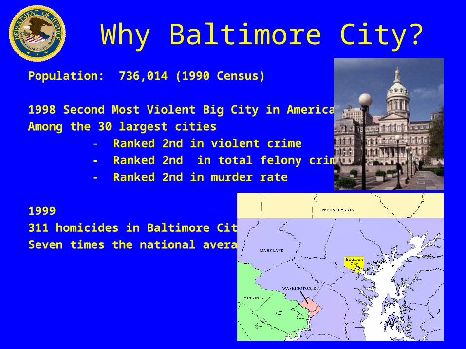
Why Baltimore City?Population: 736,014 (1990 Census)
1998 Second Most Violent Big City in America
Among the 30 largest cities
- Ranked 2nd in violent crime
- Ranked 2nd in total felony crime
- Ranked 2nd in murder rate
1999
311 homicides in Baltimore City
Seven times the national average
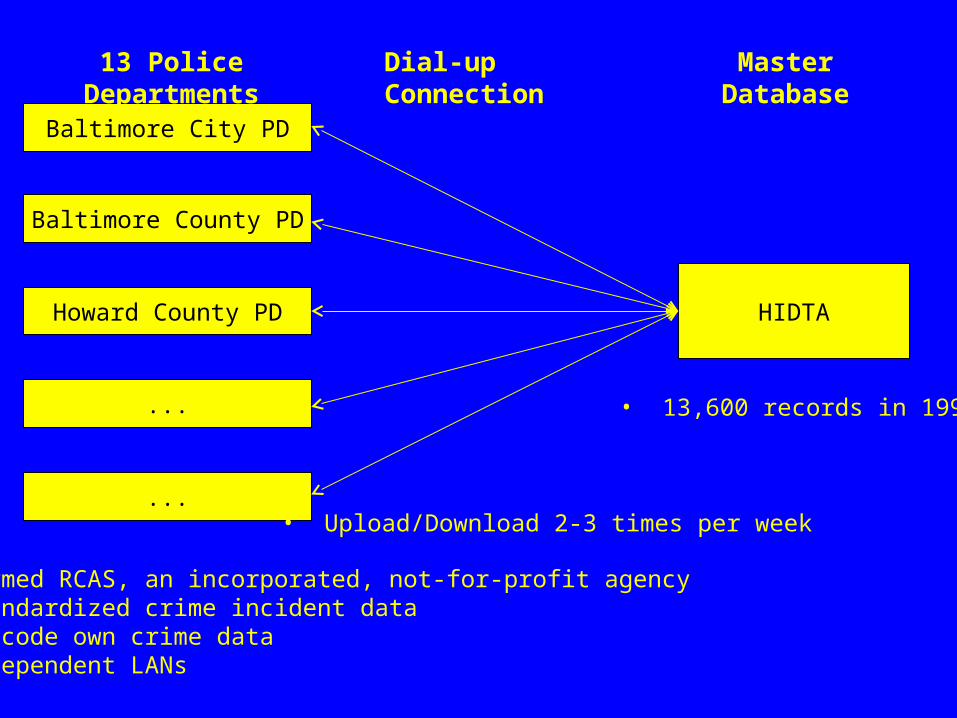
Baltimore City PD
Baltimore County PD
Howard County PD
...
...
HIDTA
13 Police Departments Dial-up Connection Master Database
• Formed RCAS, an incorporated, not-for-profit agency• Standardized crime incident data• Geocode own crime data• Independent LANs
• 13,600 records in 1998
• Upload/Download 2-3 times per week
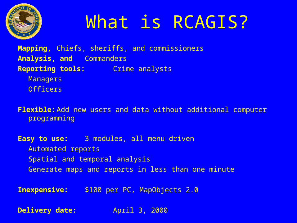
What is RCAGIS?Mapping, Chiefs, sheriffs, and commissioners
Analysis, and Commanders
Reporting tools: Crime analysts
Managers
Officers
Flexible: Add new users and data without additional computer programming
Easy to use: 3 modules, all menu driven
Automated reports
Spatial and temporal analysis
Generate maps and reports in less than one minute
Inexpensive:$100 per PC, MapObjects 2.0
Delivery date: April 3, 2000
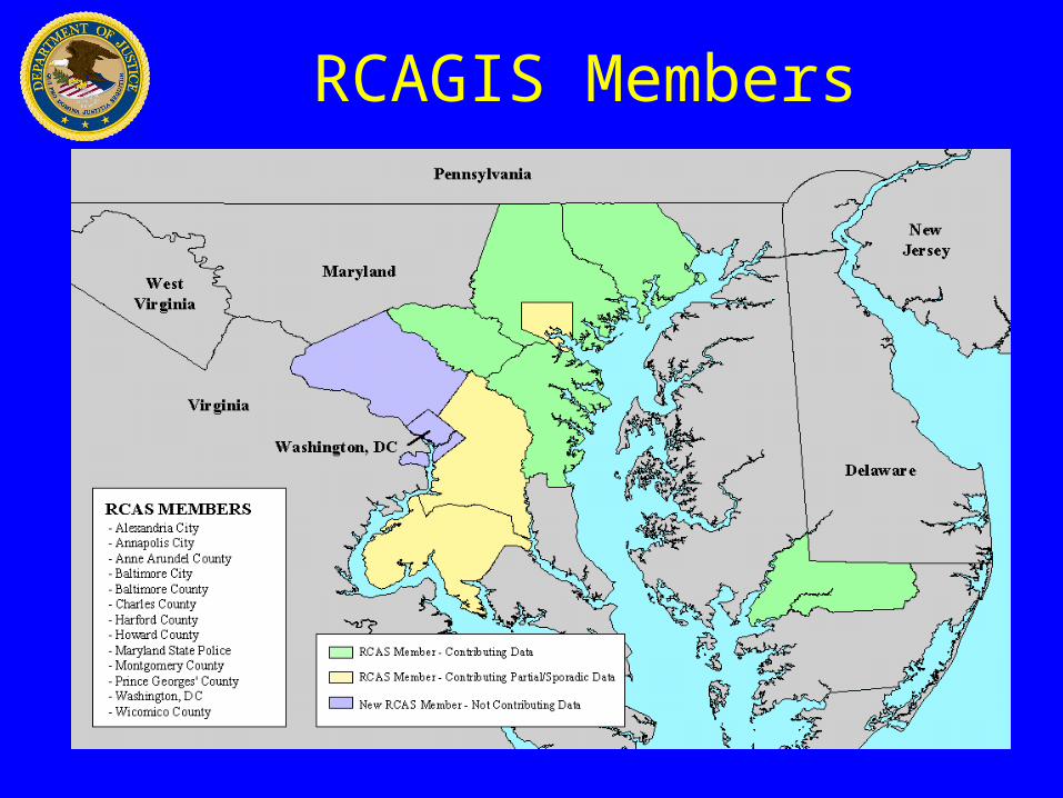
RCAGIS Members
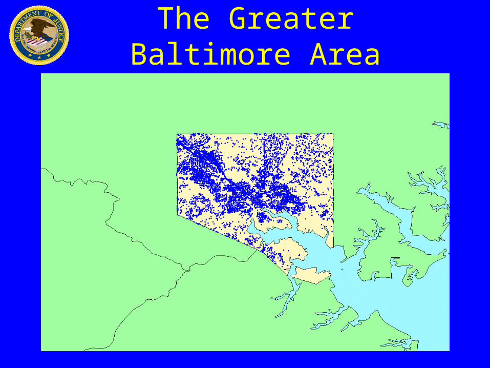
The Greater Baltimore Area
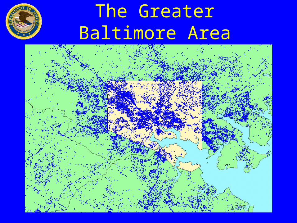
The Greater Baltimore Area
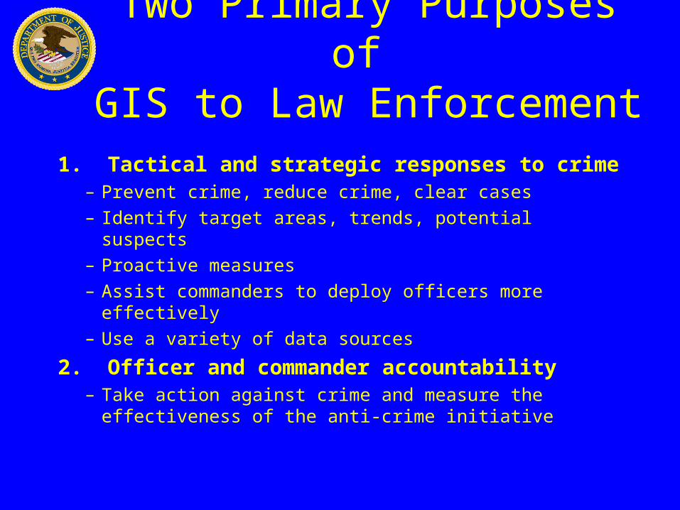
Two Primary Purposes of GIS to Law Enforcement
1. Tactical and strategic responses to crime– Prevent crime, reduce crime, clear cases
– Identify target areas, trends, potential suspects
– Proactive measures
– Assist commanders to deploy officers more effectively
– Use a variety of data sources
2. Officer and commander accountability– Take action against crime and measure the
effectiveness of the anti-crime initiative
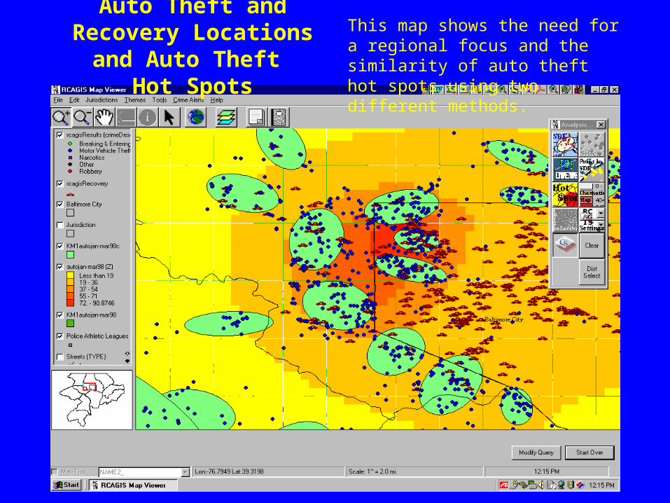
Auto Theft and Recovery Locations and Auto Theft
Hot Spots
This map shows the need for a regional focus and the similarity of auto theft hot spots using two different methods.
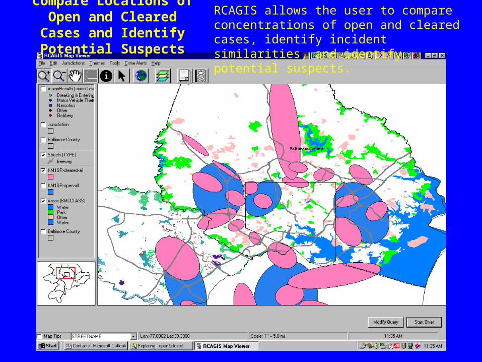
Compare Locations of Open and Cleared Cases and
Identify Potential Suspects
RCAGIS allows the user to compare concentrations of open and cleared cases, identify incident similarities, and identify potential suspects.
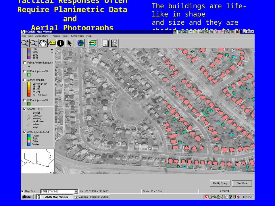
Tactical Responses Often Require Planimetric Data and
Aerial Photographs
The buildings are life-like in shapeand size and they are shaded according to type of use.
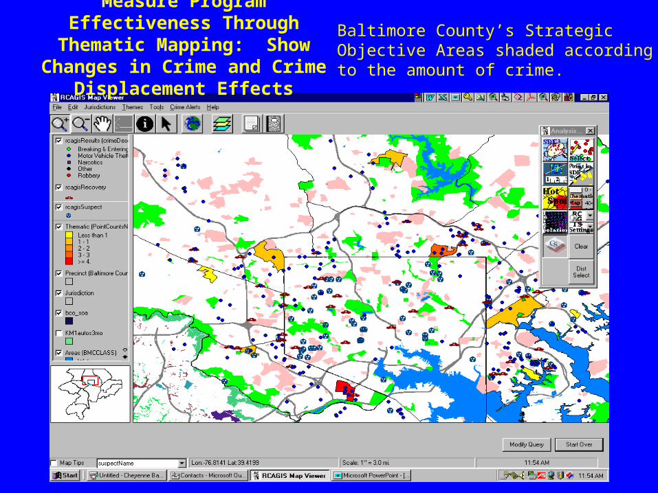
Measure Program Effectiveness Through Thematic Mapping: Show
Changes in Crime and Crime Displacement Effects
Baltimore County’s Strategic Objective Areas shaded according to the amount of crime.
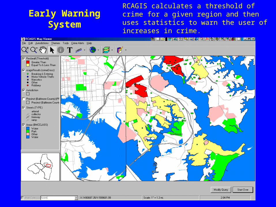
Early Warning System
RCAGIS calculates a threshold of crime for a given region and then uses statistics to warn the user of increases in crime.
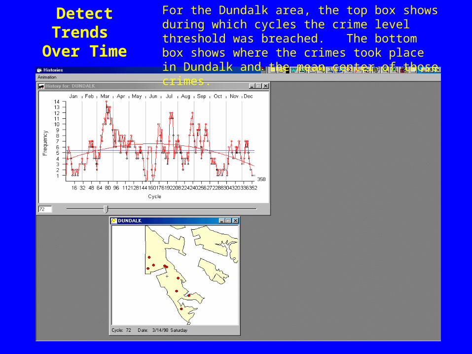
Detect Trends Over Time
For the Dundalk area, the top box shows during which cycles the crime level threshold was breached. The bottom box shows where the crimes took place in Dundalk and the mean center of those crimes.
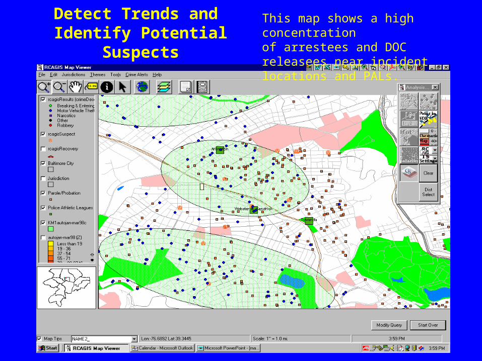
Detect Trends and Identify Potential Suspects
This map shows a high concentrationof arrestees and DOC releasees near incident locations and PALs.
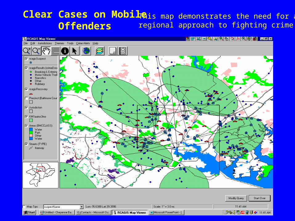
Clear Cases on Mobile Offenders
This map demonstrates the need for aregional approach to fighting crime.
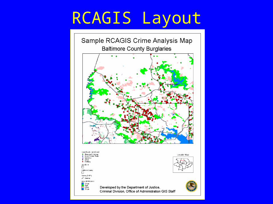
RCAGIS Layout
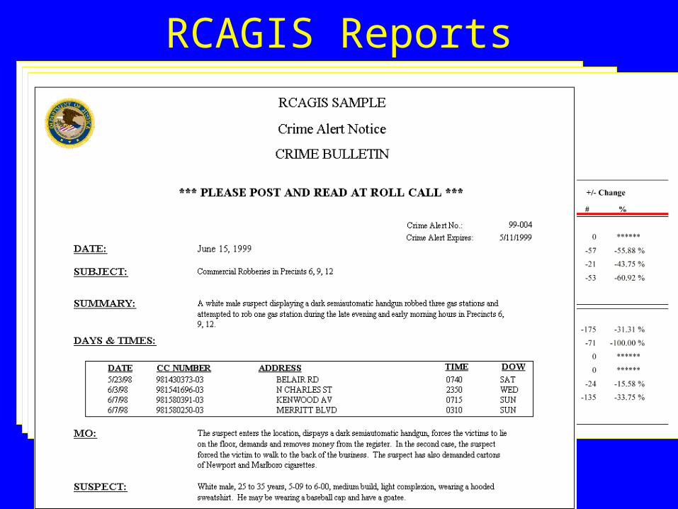
RCAGIS Reports
• Thankful to be a CDP site
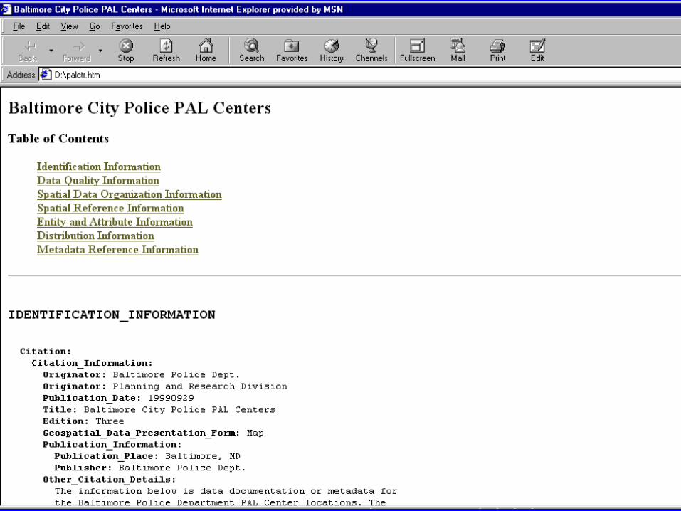
• Metadata is “twice removed” from local law enforcement agencies (LEAs)– Good reason to include an LEA as a site
– Poses new communication challenges
• Resources– Crime Analysis Unit is at half-staff
– Lack of funds, other resources
– Lack of previous knowledge about metadata
Community Demonstration Project Issues for BPD
RCAGIS• April 3 - Delivered RCAGIS 1.0
(we had several alpha and beta versions)– Automated and interactive crime analysis
– Automated and interactive mapping
– Automated reports
• June 5 - Began training Baltimore County Police Department (Baltimore City and Howard County to immediately follow)– Officers
– Crime Analysts
– Police managers and command staff
RCAGIS Status
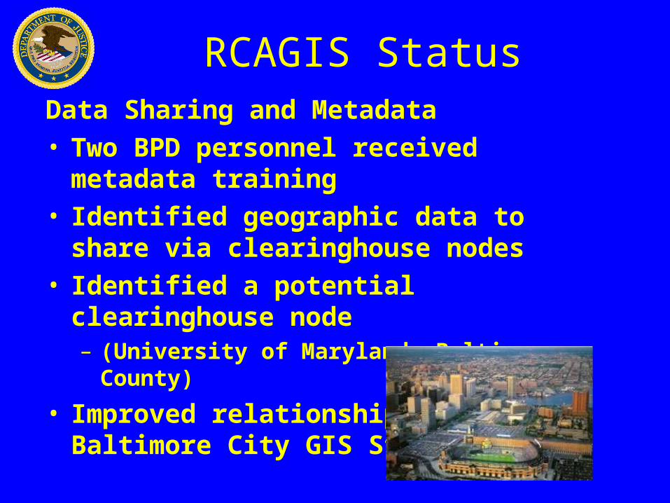
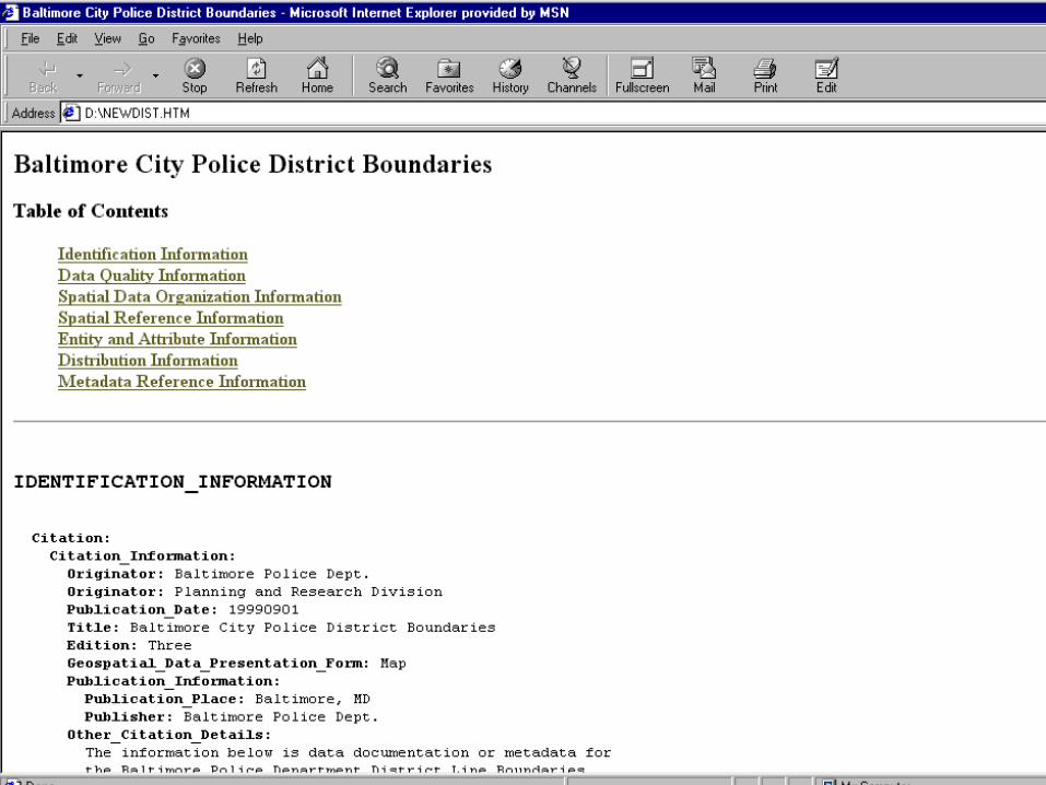
Data Sharing and Metadata• Two BPD personnel received metadata training• Identified geographic data to share via
clearinghouse nodes • Identified a potential clearinghouse node
– (University of Maryland, Baltimore County)
• Improved relationship with Baltimore City GIS Staff
RCAGIS Status
Next Steps
• Find the appropriate NSDI node to serve as a host
• Encourage other RCAGIS police departments to use FGDC metadata standards
• Document and share the success of CDP and RCAGIS
Partners
• Baltimore City Police Department
– Sgt. Paul Herman
• Baltimore County Police Department
– Phil Canter
• Dr. Ned Levine (developer of CrimeStat)
• Our Staff
– USDOJ/Criminal Division
• John E. De Voe
• Alex Mudd
– INDUS Corporation
• David Nulph
• Jeff Burka
• Robert Crump
• Ron Wilson
For additional information please contact:
Alex MuddU.S. Department of Justice, Criminal DivisionGIS Staff
1400 New York Ave., Rm. 7120Washington, DC 20530
Phone: (202) 307-3865E-mail: [email protected]
USDOJ Criminal Division Web Sitewww.usdoj.gov/criminal/gis