Embed Size (px)
Citation preview

Community Planning & Design
Community Framework
0101049
Introduction Community, like any structure, must have a
framework that supports it and gives it physical form.
Circulation system, both vehicular and pedestrian, are
not only essential paths that allow movement, they are
bones, if you will, around which the organism of
community grows. Individuality & character.
However, community planning continues to be
predominantly influenced by the automobiles.
HISTORY(1)
After WWII, a modified or flexible grid system came into
fashion due in part to its successful use at a planned unit
development (PUD)in New York called Levittown. This in itself
was a radical break with the tradition of the times.
In the 1960s and 1970s, PUDs came to be more accepted,
with far-reaching changes for society. Curvilinear roads,
looping collector streets, short, curving cul-de-sacs, and a
reliance on the hierarchical system became commonplace.
This approach worked well until the PUDs in any given area
began to build out and the inevitable traffic congestion
resulted.
HISTORY(2)
In the 1980s, the exclusive community came into vogue.At the beginning of a new century, we are looking back to a
simpler time and place. The neo-traditional town exhibits the traditional values of neighbors, friends and family, with a de-emphasis on automobile by attempting to enhance the pedestrian environment and promote mass transit.
Vehicular circulation consumes an estimate 30% of our developed area. It is the most expensive feature of community development and creates vast expanses of pavement—literally a no-man’-land for the pedestrian.
Is automobile inherently evil and destroying the planet? From a rational standpoint, down deep we all know the real problem lies not with our cars but with the way our towns and cities are structured.
Automobile is such a strong influence and promises to be so for a long time to come, roads and parking must be approached calmly and logically.
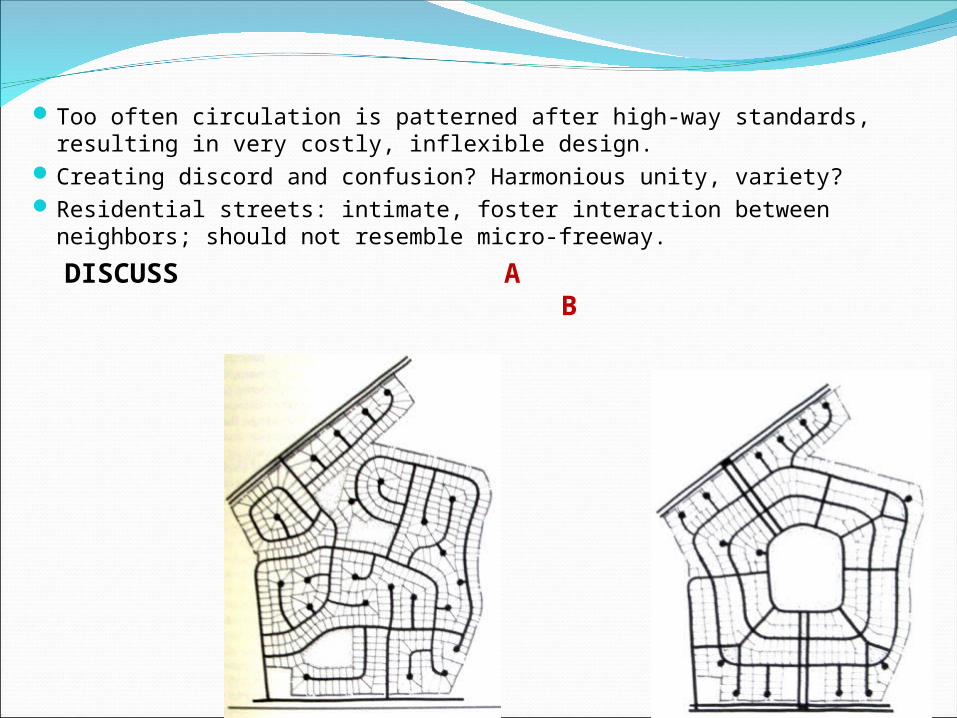
Too often circulation is patterned after high-way standards, resulting in very costly, inflexible design.
Creating discord and confusion? Harmonious unity, variety?Residential streets: intimate, foster interaction between neighbors;
should not resemble micro-freeway.
DISCUSS A B
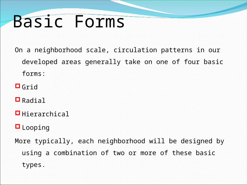
Basic FormsOn a neighborhood scale, circulation patterns in our developed
areas generally take on one of four basic forms:
Grid
Radial
Hierarchical
Looping
More typically, each neighborhood will be designed by using a
combination of two or more of these basic types.
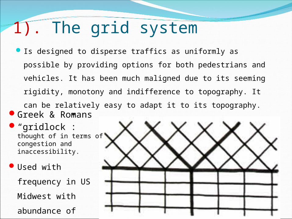
1). The grid system Is designed to disperse traffics as uniformly as possible by
providing options for both pedestrians and vehicles. It has
been much maligned due to its seeming rigidity, monotony
and indifference to topography. It can be relatively easy to
adapt it to its topography.Greek & Romans“gridlock”: thought of
in terms of congestion and inaccessibility.
Used with frequency
in US Midwest with
abundance of level
land.
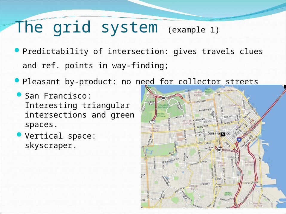
The grid system (example 1)
Predictability of intersection: gives travels clues and ref.
points in way-finding;
Pleasant by-product: no need for collector streets
San Francisco: Interesting triangular intersections and green spaces.
Vertical space: skyscraper.
The grid system (example 2)
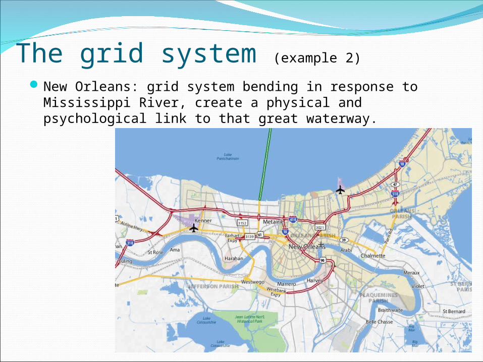
New Orleans: grid system bending in response to Mississippi River, create a physical and psychological link to that great waterway.
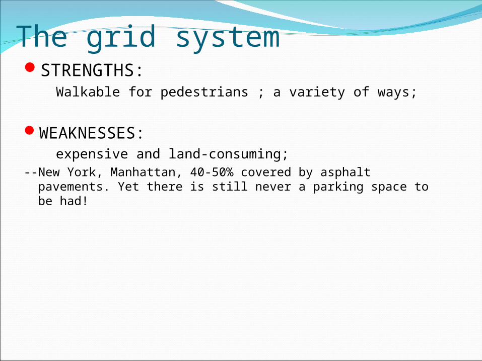
The grid systemSTRENGTHS: Walkable for pedestrians ; a variety of ways;
WEAKNESSES: expensive and land-consuming;--New York, Manhattan, 40-50% covered by asphalt pavements. Yet
there is still never a parking space to be had!
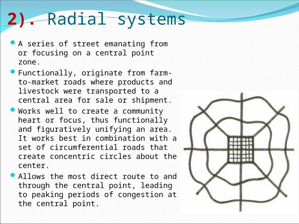
2). Radial systemsA series of street emanating from or
focusing on a central point zone.Functionally, originate from farm-to-
market roads where products and livestock were transported to a central area for sale or shipment.
Works well to create a community heart or focus, thus functionally and figuratively unifying an area. It works best in combination with a set of circumferential roads that create concentric circles about the center.
Allows the most direct route to and through the central point, leading to peaking periods of congestion at the central point.
Radial systems (example 1)
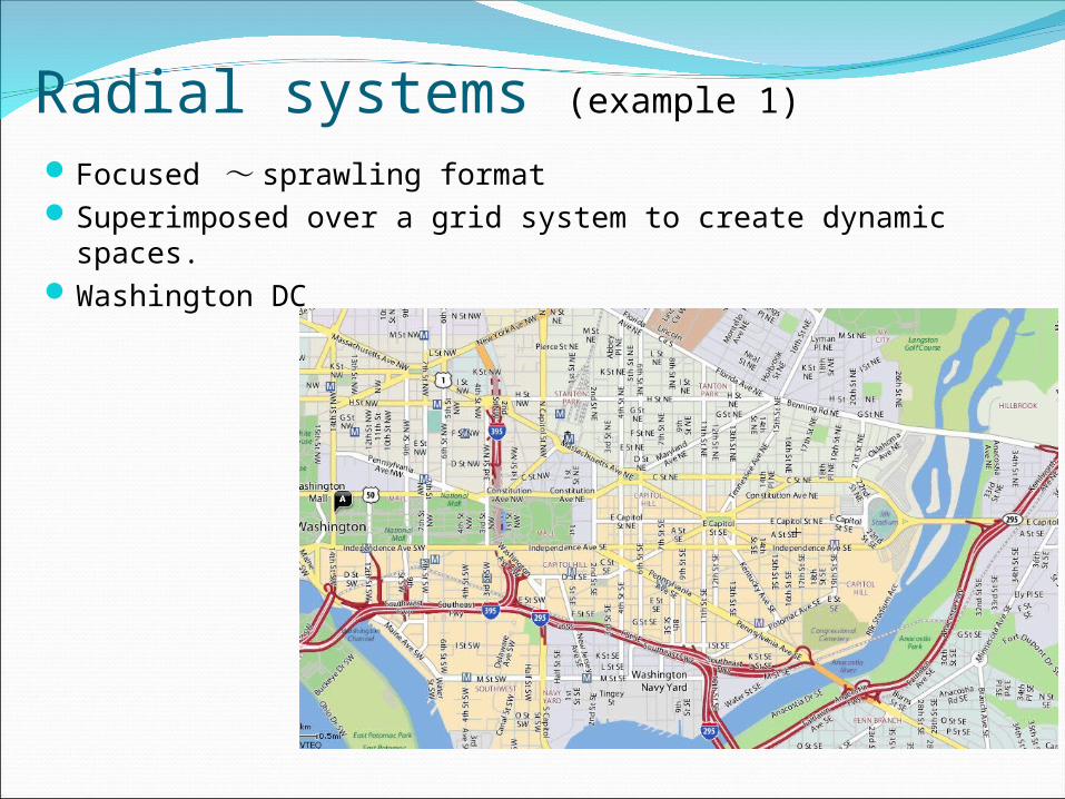
Focused ~ sprawling formatSuperimposed over a grid system to create dynamic spaces.Washington DC
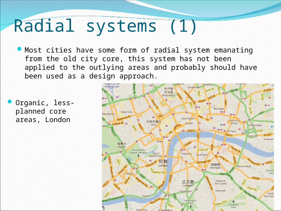
Radial systems (1)Most cities have some form of radial system emanating from
the old city core, this system has not been applied to the outlying areas and probably should have been used as a design approach.
Organic, less- planned core areas, London
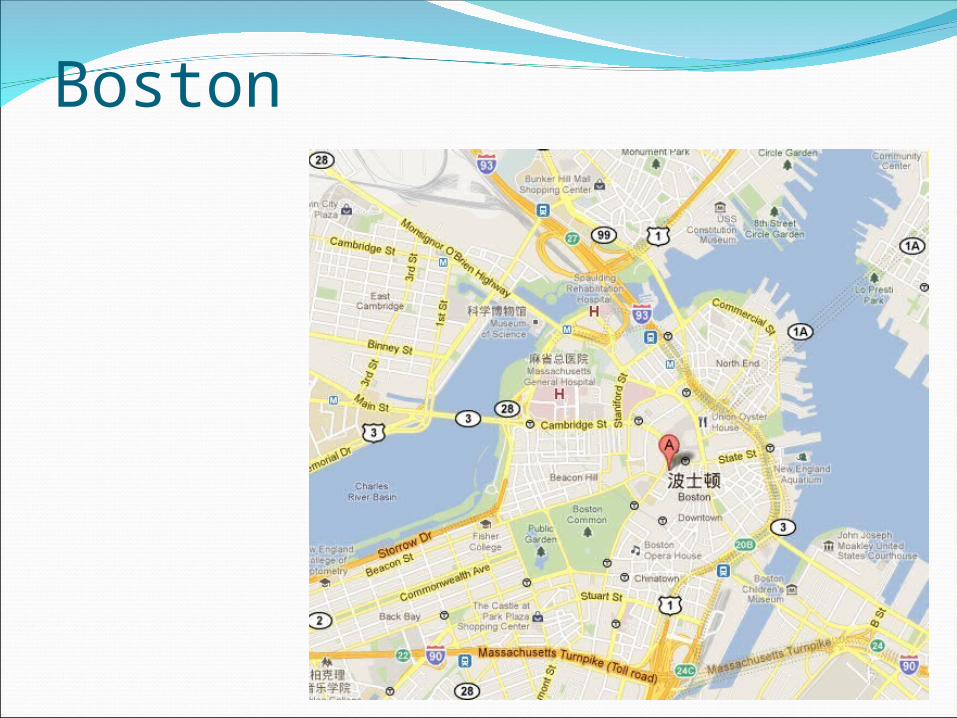
Boston
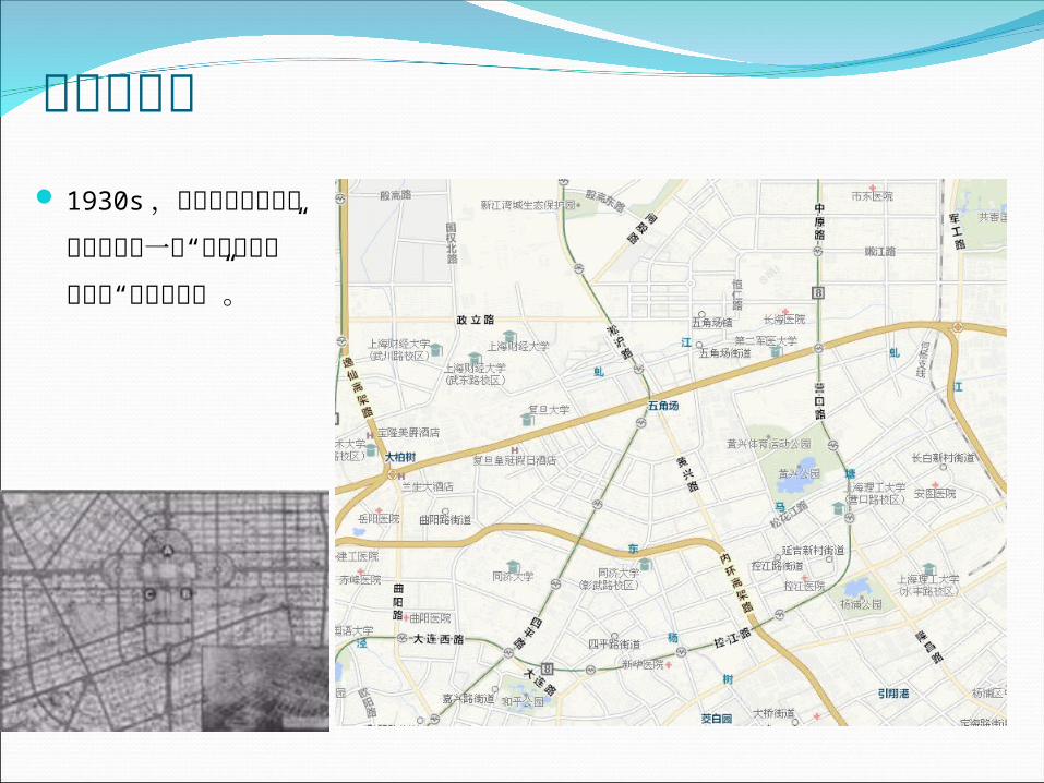
上海五角场 1930s,这片土地上风风火火地进行着一个“大上海计划”或者叫“新上海计划”。
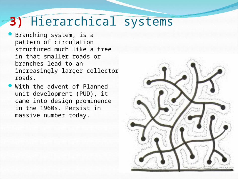
3) Hierarchical systems Branching system, is a pattern of
circulation structured much like a tree in that smaller roads or branches lead to an increasingly larger collector roads.
With the advent of Planned unit development (PUD), it came into design prominence in the 1960s. Persist in massive number today.
Hierarchical circulation system
This concentration of traffic on fewer and fewer roads
ensures an eventual overload of the system because it
creates few, if any, alternative routes of access to a
particular place. Instead, choke points are created, as there
is essentially one way in and one way out of an area.
Direct traffic into one or only a few points of
circumferential movements, navigating around the choke
points is very difficult.
Isolate certain areas from the community at large; Reduce
their psychological link with the community;
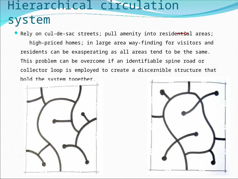
Hierarchical circulation system Rely on cul-de-sac streets; pull amenity into residential areas; high-
priced homes; in large area way-finding for visitors and residents can
be exasperating as all areas tend to be the same. This problem can be
overcome if an identifiable spine road or collector loop is employed to
create a discernible structure that hold the system together.
Function In small-scale residential environments consisting of a limited
number of housing types and housing units.
Also work well for areas adjacent to tidal waters, on lakes or in
areas of substantial topography.
All of these areas are typified by an undulating edge beyond
which no development is possible; therefore, using cul-de-sacs
or closes to branch off a neighborhood street is a typical
solution. By keeping through traffic to a minimum, they help
reduce noises and conflicts between pedestrians and
automobiles at the extreme end of the system.
Economical: allow the maximum amount of development area
per minimum length of street.
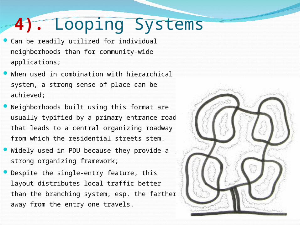
4). Looping Systems Can be readily utilized for individual
neighborhoods than for community-wide
applications;
When used in combination with hierarchical
system, a strong sense of place can be
achieved;
Neighborhoods built using this format are
usually typified by a primary entrance road
that leads to a central organizing roadway
from which the residential streets stem.
Widely used in PDU because they provide a
strong organizing framework;
Despite the single-entry feature, this layout
distributes local traffic better than the
branching system, esp. the farther away from
the entry one travels.
Looping Systems Roadway widths can be smaller than those found in the hierarchical systems.
However, as in the hierarchical system, all traffic is forced to a single point,
with the end result being the same: traffic congestion;
To a limited extent, this system can be applied in a linear fashion, esp. in
areas where large through streets or highway bisect an area, with access to
adjacent areas limited by topography, wetlands, or water.
In these instances, the primary role of such a system is to provide additional
right-of-way frontage for development and to provide for a parallel access
system to the main road; this system has been widely adapted to successfully
create linear office parks along major thoroughfares: exposure to and
visibility from the main road are possible, while access to the office sites are
channeled and controlled at few points. This allows the larger traffic
volumes on the primary roadway to be separated from the traffic around the
office site. The gains from such flexible access are lost by the inability to
identify a center or focus for the development itself.
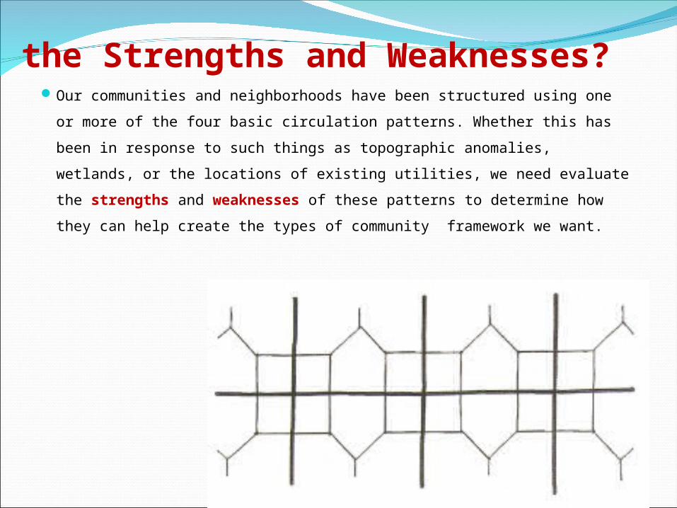
the Strengths and Weaknesses?Our communities and neighborhoods have been structured using
one or more of the four basic circulation patterns. Whether this
has been in response to such things as topographic anomalies,
wetlands, or the locations of existing utilities, we need evaluate the
strengths and weaknesses of these patterns to determine how
they can help create the types of community framework we want.
Classifying Streets
The function of a street dictates its classification, this in
turn dictates its design volume and construction
requirements.
Tight street grids wider streets are the norm;
streets have become solely the domain of automobile,
communities have lost their uniqueness, their sense of
individuality, their sense of place. The grid pattern has
faded from use and the alley has become all but extinct in
suburban realm.
CSD Pattern In conventional suburb development (CSD), street classification has
evolved, and has come to be defined in hierarchical terms, each type
representing a higher volume of vehicular traffic. This has produced
three primary types of streets: minor streets, collector streets and
arterial streets.
Minor streets: 12-16m, 2 lanes, directly serve residential home-sites;
Collector streets: 18- to 32m, 4 lanes, connect residential areas to
arterial streets;
Arterial streets: ≥32 meters, designed for the movement of high
volumes of traffic between nodes with commercial and industrial
functions. Four or more lanes with median in the center. Generally,
no dwellings front directly onto the arterial streets.
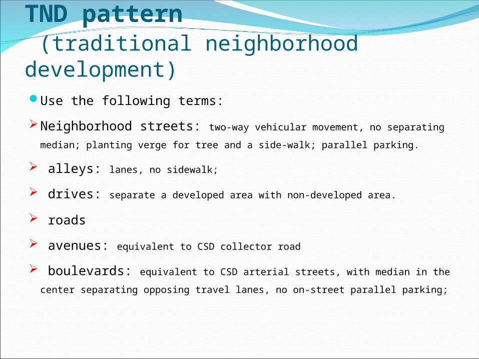
TND pattern (traditional neighborhood development)Use the following terms:
Neighborhood streets: two-way vehicular movement, no
separating median; planting verge for tree and a side-walk; parallel
parking.
alleys: lanes, no sidewalk;
drives: separate a developed area with non-developed area.
roads
avenues: equivalent to CSD collector road
boulevards: equivalent to CSD arterial streets, with median in the
center separating opposing travel lanes, no on-street parallel parking;
Design considerationsPrinciples: not hard and fast rules, they are desirable design
approaches that can lead to better communities. Identify areas where roads cannot be placed; marshes, steep
slops, historic/cultural places of significance, etc. Determine desired points of destination from the site and lay out
internal circulation system accordingly. Promote access and land use integrity within community; Through traffic should be separated from local/residential traffic
but should remain part of the community; It is generally less costly as well as less destructive to the land to
lay out roads parallel to topographic contours or at right angles to them;
Historically, emphasis has been placed on patterns designed to reinforce the separation of uses; however, this leads to further traffic concentrations that rely on only a few through streets.
Conscious effort needs to be made to reinforce, not sever, the ties between residential areas and their supporting commercial and office areas.
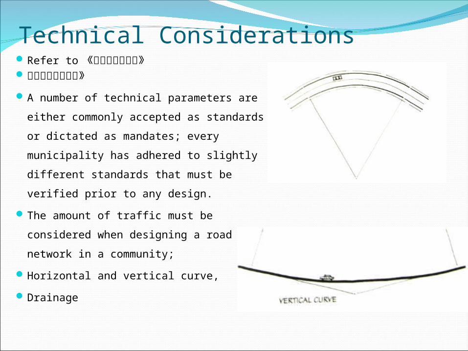
Technical ConsiderationsRefer to 《城市道路与交通》城市道路设计规范》
A number of technical parameters are
either commonly accepted as
standards or dictated as mandates;
every municipality has adhered to
slightly different standards that must
be verified prior to any design.
The amount of traffic must be
considered when designing a road
network in a community;
Horizontal and vertical curve,
Drainage
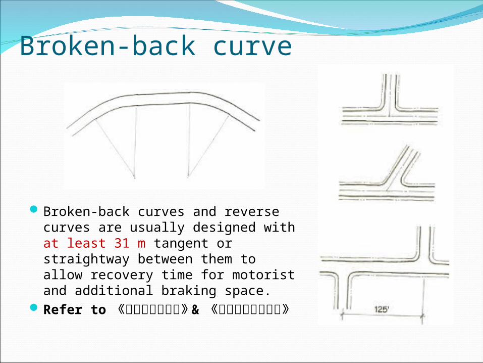
Broken-back curve
Broken-back curves and reverse curves are usually designed with at least 31 m tangent or straightway between them to allow recovery time for motorist and additional braking space.
Refer to 《城市道路与交通》 & 《城市道路设计规范》
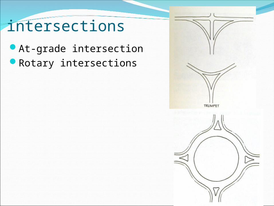
intersectionsAt-grade intersectionRotary intersections
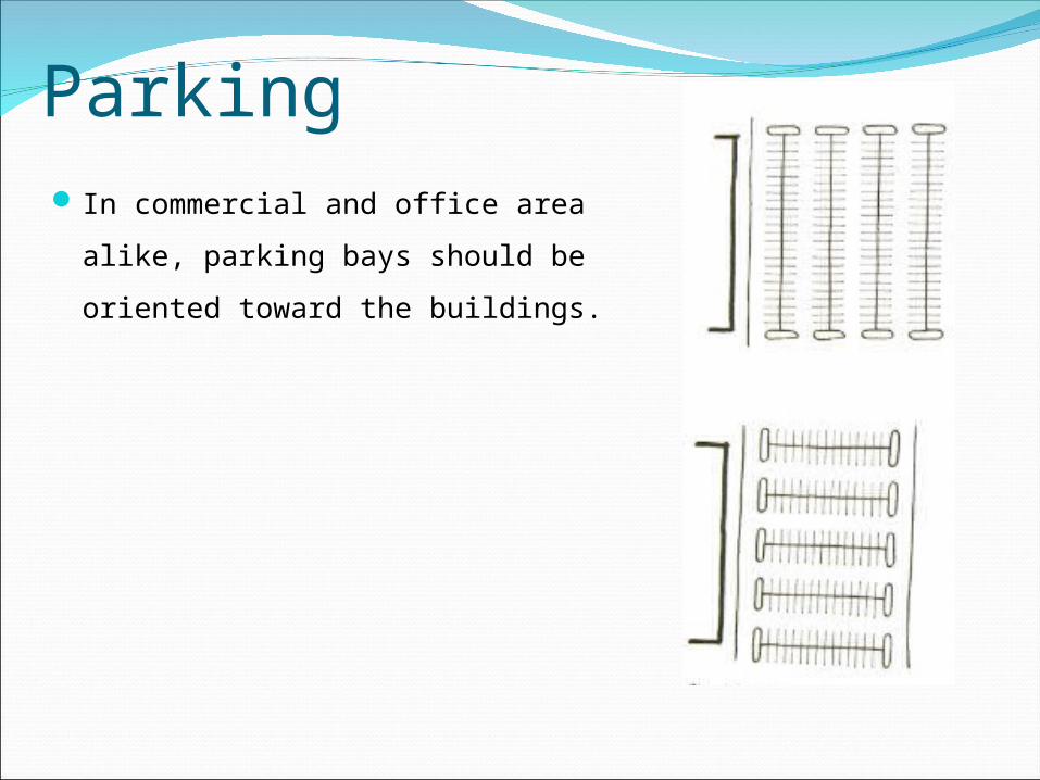
Parking In commercial and office area alike,
parking bays should be oriented
toward the buildings.
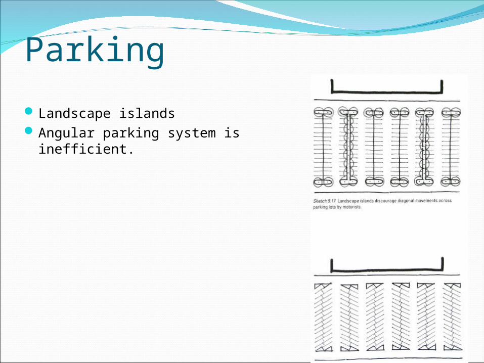
Parking
Landscape islandsAngular parking system is
inefficient.
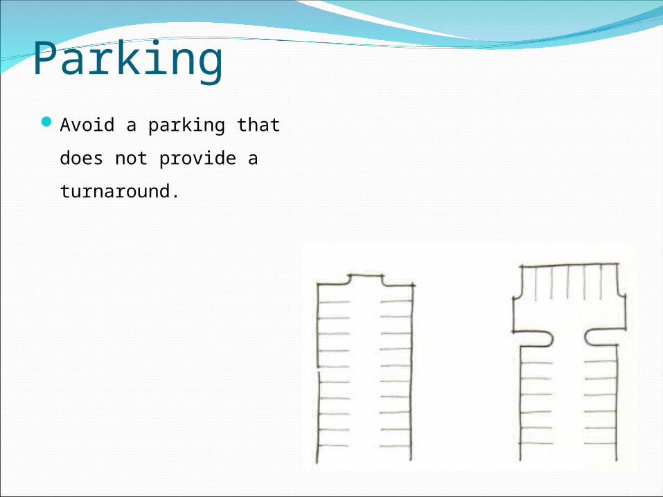
ParkingAvoid a parking that
does not provide a
turnaround.
Public utilities
Service;
Water
Sanitary sewer
Storm water management