Embed Size (px)
Citation preview
ELABORATION OF MAPS FOR CLIMATIC AND SEISMIC ACTIONS FOR STRUCTURAL DESIGN IN THE BALKAN REGION
27-28 October 2015, Zagreb
Compilation of Croatian Earthquake Hazard Maps
prof. dr. sc. Marijan Herak
Department of Geophysics, Faculty of Science, University of Zagreb
ELABORATION OF MAPS FOR CLIMATIC AND SEISMIC ACTIONS FOR STRUCTURAL DESIGN IN THE BALKAN REGION
27-28 October 2015, Zagreb
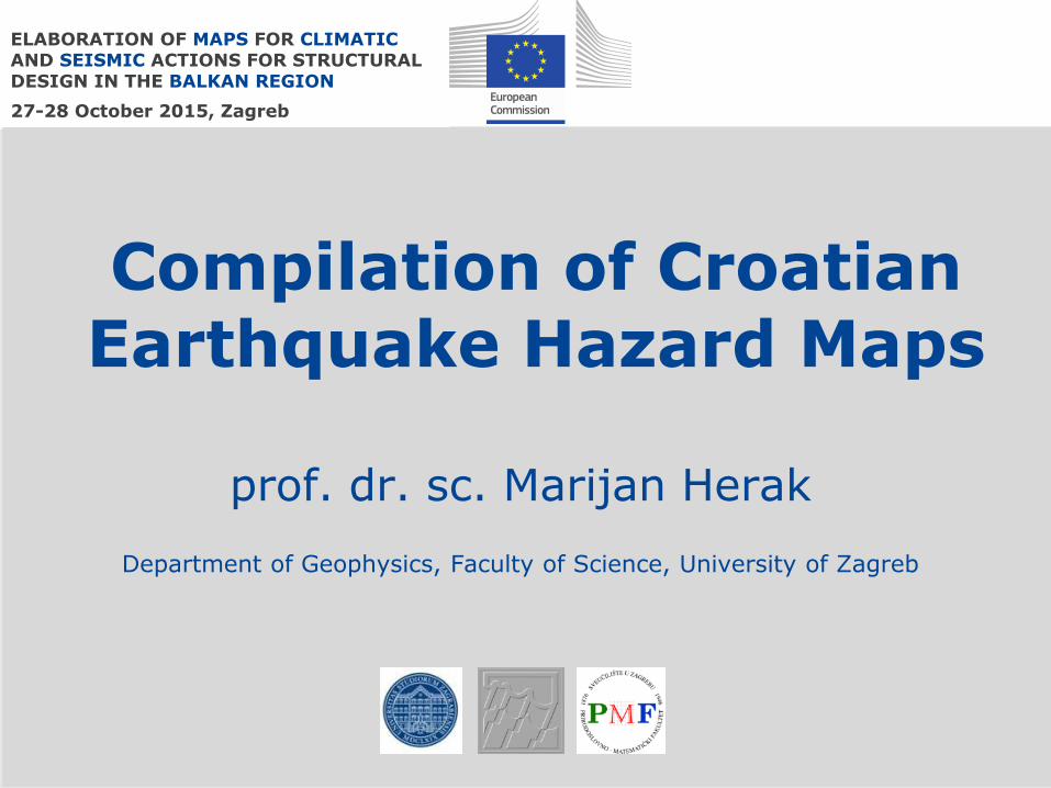
Tret = 500 years
1987.
Croatian seismic hazard map which was still used in 2010...
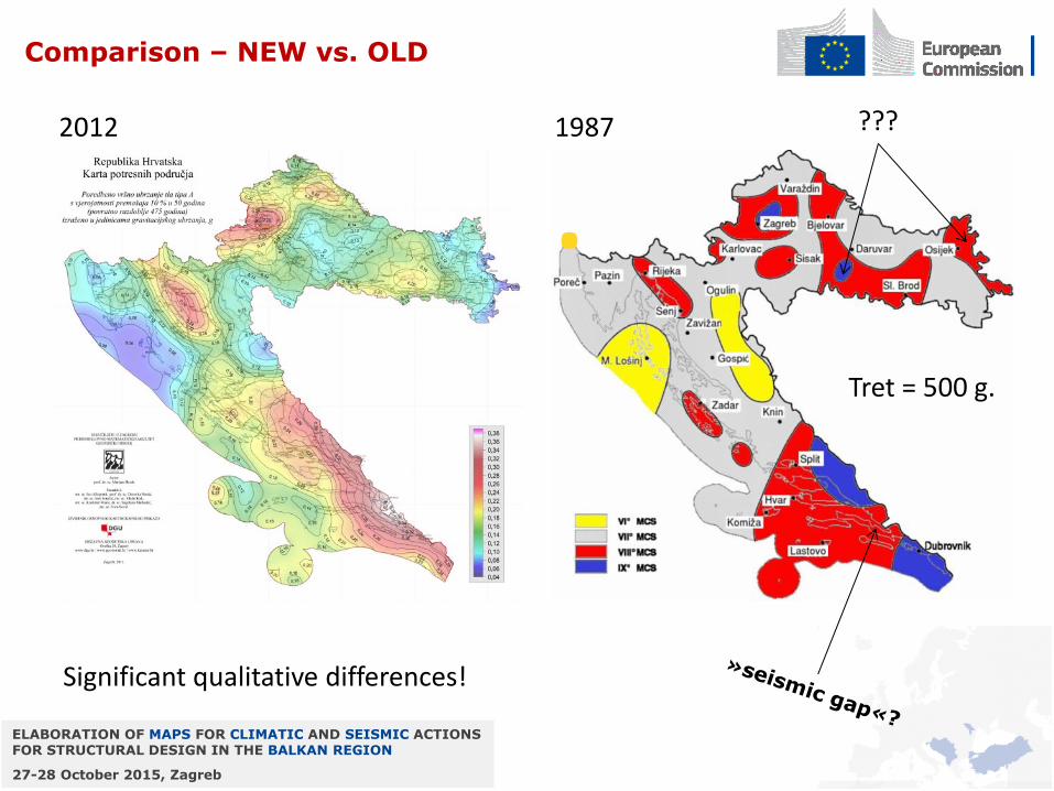
Intensity as the hazard measure. Uncertain origin (based on Kuk et al., 1987 ??)... Based on seismicity as known in mid-80ies of the last century... Some obvious errors! There was a clear and longlasting need to compile a new map, but our initiatives were beeing refused until Croatia reached the EU pre-accession phase...
ELABORATION OF MAPS FOR CLIMATIC AND SEISMIC ACTIONS FOR STRUCTURAL DESIGN IN THE BALKAN REGION
27-28 October 2015, Zagreb
• As our legislation needed to be harmonized with the EU, we had to adopt the Eurocode norms too. But we were not ready!
• The main ingredient was missing – the hazard map!
• The Croatian Standards Institute took the responsibility to translate the Eurocodes and to prepare National Annexes.
• Within this framework, Department of Geophysics was given the task to prepare the base-maps to be used in EC8.
• The time-frame was VERY narrow – everything had to be done from scratch, in about 10 months, with VERY limited funds...
• This task was done in parallel with the translation of the norms, and many decisions which directed the course of the work had to be made ‘on the fly’.
ELABORATION OF MAPS FOR CLIMATIC AND SEISMIC ACTIONS FOR STRUCTURAL DESIGN IN THE BALKAN REGION
27-28 October 2015, Zagreb
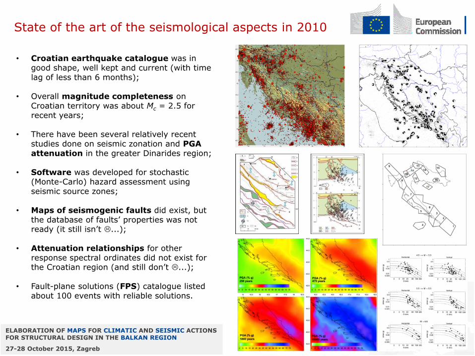
• Croatian earthquake catalogue was in good shape, well kept and current (with time lag of less than 6 months);
• Overall magnitude completeness on Croatian territory was about Mc = 2.5 for recent years;
• There have been several relatively recent studies done on seismic zonation and PGA attenuation in the greater Dinarides region;
• Software was developed for stochastic (Monte-Carlo) hazard assessment using seismic source zones;
• Maps of seismogenic faults did exist, but the database of faults’ properties was not ready (it still isn’t ...);
• Attenuation relationships for other response spectral ordinates did not exist for the Croatian region (and still don’t ...);
• Fault-plane solutions (FPS) catalogue listed about 100 events with reliable solutions.
State of the art of the seismological aspects in 2010
ELABORATION OF MAPS FOR CLIMATIC AND SEISMIC ACTIONS FOR STRUCTURAL DESIGN IN THE BALKAN REGION
27-28 October 2015, Zagreb
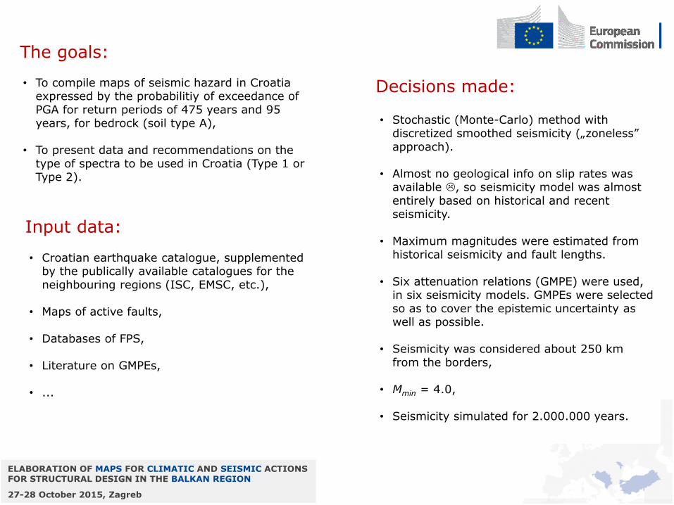
• To compile maps of seismic hazard in Croatia expressed by the probabilitiy of exceedance of PGA for return periods of 475 years and 95 years, for bedrock (soil type A),
• To present data and recommendations on the type of spectra to be used in Croatia (Type 1 or Type 2).
The goals:
• Croatian earthquake catalogue, supplemented by the publically available catalogues for the neighbouring regions (ISC, EMSC, etc.),
• Maps of active faults,
• Databases of FPS,
• Literature on GMPEs,
• ...
Input data:
• Stochastic (Monte-Carlo) method with discretized smoothed seismicity („zoneless” approach).
• Almost no geological info on slip rates was available , so seismicity model was almost entirely based on historical and recent seismicity.
• Maximum magnitudes were estimated from historical seismicity and fault lengths.
• Six attenuation relations (GMPE) were used, in six seismicity models. GMPEs were selected so as to cover the epistemic uncertainty as well as possible.
• Seismicity was considered about 250 km from the borders,
• Mmin = 4.0,
• Seismicity simulated for 2.000.000 years.
Decisions made:
ELABORATION OF MAPS FOR CLIMATIC AND SEISMIC ACTIONS FOR STRUCTURAL DESIGN IN THE BALKAN REGION
27-28 October 2015, Zagreb
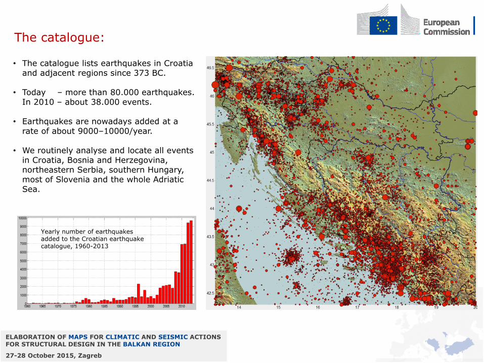
The catalogue:
• The catalogue lists earthquakes in Croatia and adjacent regions since 373 BC.
• Today – more than 80.000 earthquakes. In 2010 – about 38.000 events.
• Earthquakes are nowadays added at a rate of about 9000–10000/year.
• We routinely analyse and locate all events in Croatia, Bosnia and Herzegovina, northeastern Serbia, southern Hungary, most of Slovenia and the whole Adriatic Sea.
Yearly number of earthquakes added to the Croatian earthquake catalogue, 1960-2013
ELABORATION OF MAPS FOR CLIMATIC AND SEISMIC ACTIONS FOR STRUCTURAL DESIGN IN THE BALKAN REGION
27-28 October 2015, Zagreb
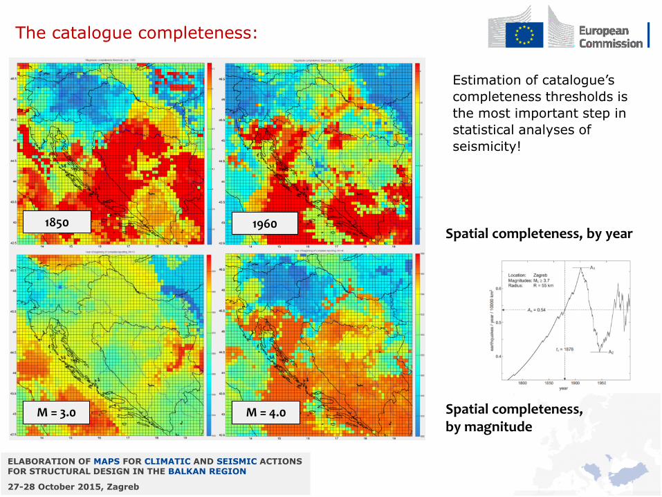
The catalogue completeness:
Estimation of catalogue’s
completeness thresholds is
the most important step in
statistical analyses of
seismicity!
M = 3.0 M = 4.0
1960 1850 Spatial completeness, by year
Spatial completeness, by magnitude
ELABORATION OF MAPS FOR CLIMATIC AND SEISMIC ACTIONS FOR STRUCTURAL DESIGN IN THE BALKAN REGION
27-28 October 2015, Zagreb
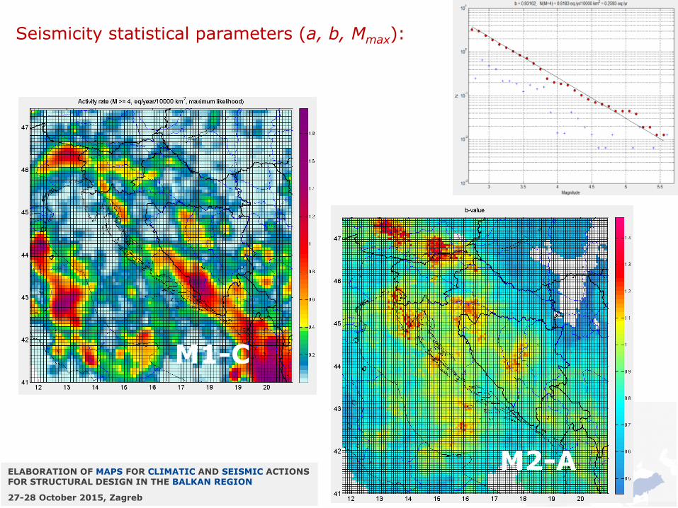
Seismicity statistical parameters (a, b, Mmax):
M1-C
M2-A
ELABORATION OF MAPS FOR CLIMATIC AND SEISMIC ACTIONS FOR STRUCTURAL DESIGN IN THE BALKAN REGION
27-28 October 2015, Zagreb
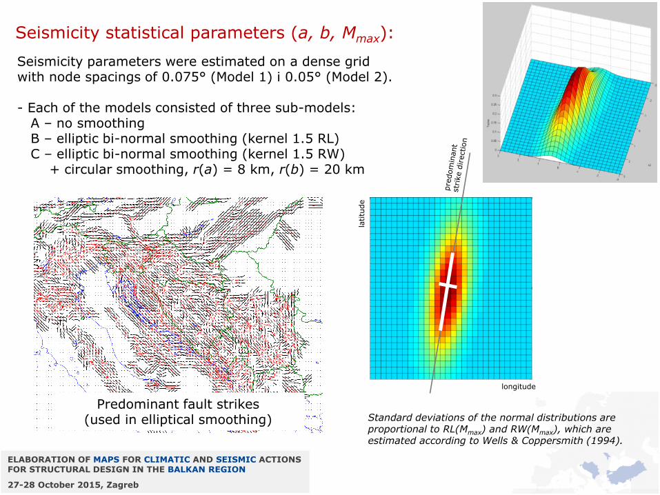
Seismicity statistical parameters (a, b, Mmax):
Seismicity parameters were estimated on a dense grid with node spacings of 0.075° (Model 1) i 0.05° (Model 2). - Each of the models consisted of three sub-models: A – no smoothing B – elliptic bi-normal smoothing (kernel 1.5 RL) C – elliptic bi-normal smoothing (kernel 1.5 RW) + circular smoothing, r(a) = 8 km, r(b) = 20 km
Standard deviations of the normal distributions are proportional to RL(Mmax) and RW(Mmax), which are estimated according to Wells & Coppersmith (1994).
longitude
latitu
de
Predominant fault strikes (used in elliptical smoothing)
ELABORATION OF MAPS FOR CLIMATIC AND SEISMIC ACTIONS FOR STRUCTURAL DESIGN IN THE BALKAN REGION
27-28 October 2015, Zagreb
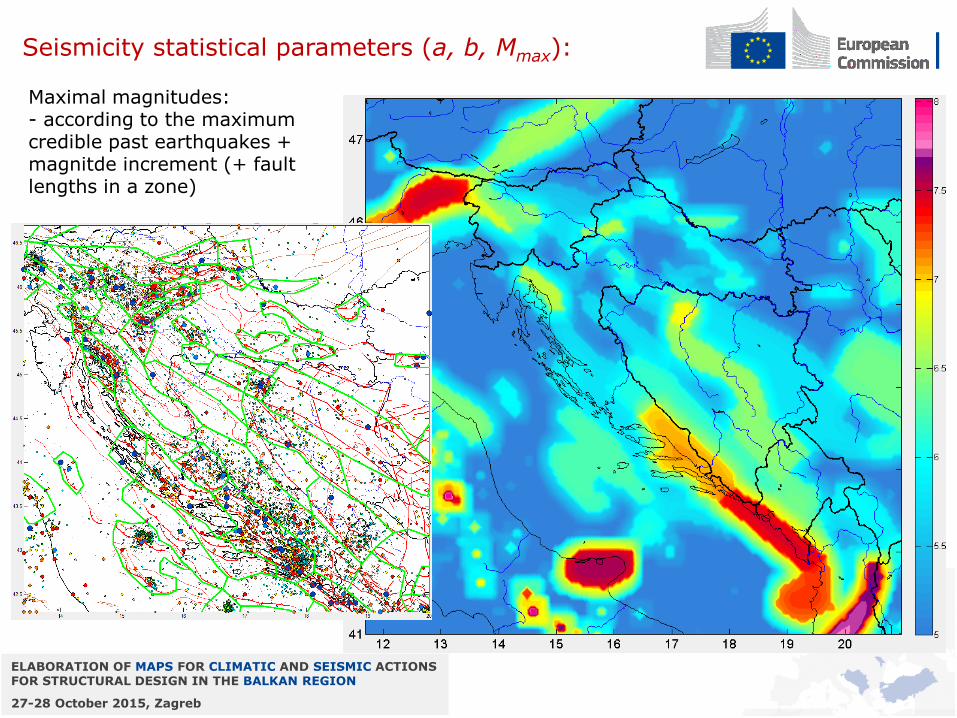
Seismicity statistical parameters (a, b, Mmax):
Maximal magnitudes: - according to the maximum credible past earthquakes + magnitde increment (+ fault lengths in a zone)
ELABORATION OF MAPS FOR CLIMATIC AND SEISMIC ACTIONS FOR STRUCTURAL DESIGN IN THE BALKAN REGION
27-28 October 2015, Zagreb
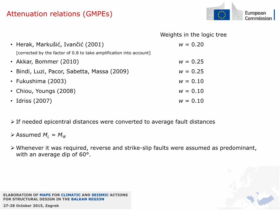
Attenuation relations (GMPEs)
Weights in the logic tree
• Herak, Markušić, Ivančić (2001) w = 0.20
[corrected by the factor of 0.8 to take amplification into account]
• Akkar, Bommer (2010) w = 0.25
• Bindi, Luzi, Pacor, Sabetta, Massa (2009) w = 0.25
• Fukushima (2003) w = 0.10
• Chiou, Youngs (2008) w = 0.10
• Idriss (2007) w = 0.10
If needed epicentral distances were converted to average fault distances
Assumed ML = MW
Whenever it was required, reverse and strike-slip faults were assumed as predominant,
with an average dip of 60°.
ELABORATION OF MAPS FOR CLIMATIC AND SEISMIC ACTIONS FOR STRUCTURAL DESIGN IN THE BALKAN REGION
27-28 October 2015, Zagreb
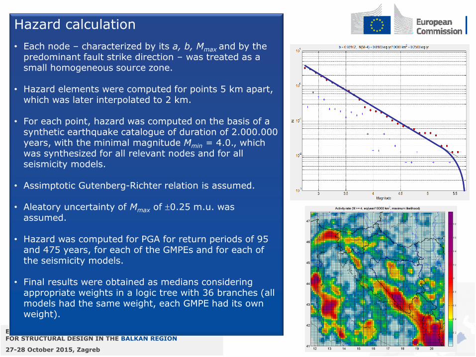
Hazard calculation
• Each node – characterized by its a, b, Mmax and by the predominant fault strike direction – was treated as a small homogeneous source zone.
• Hazard elements were computed for points 5 km apart, which was later interpolated to 2 km.
• For each point, hazard was computed on the basis of a synthetic earthquake catalogue of duration of 2.000.000 years, with the minimal magnitude Mmin = 4.0., which was synthesized for all relevant nodes and for all seismicity models.
• Assimptotic Gutenberg-Richter relation is assumed.
• Aleatory uncertainty of Mmax of 0.25 m.u. was assumed.
• Hazard was computed for PGA for return periods of 95 and 475 years, for each of the GMPEs and for each of the seismicity models.
• Final results were obtained as medians considering appropriate weights in a logic tree with 36 branches (all models had the same weight, each GMPE had its own weight).
ELABORATION OF MAPS FOR CLIMATIC AND SEISMIC ACTIONS FOR STRUCTURAL DESIGN IN THE BALKAN REGION
27-28 October 2015, Zagreb
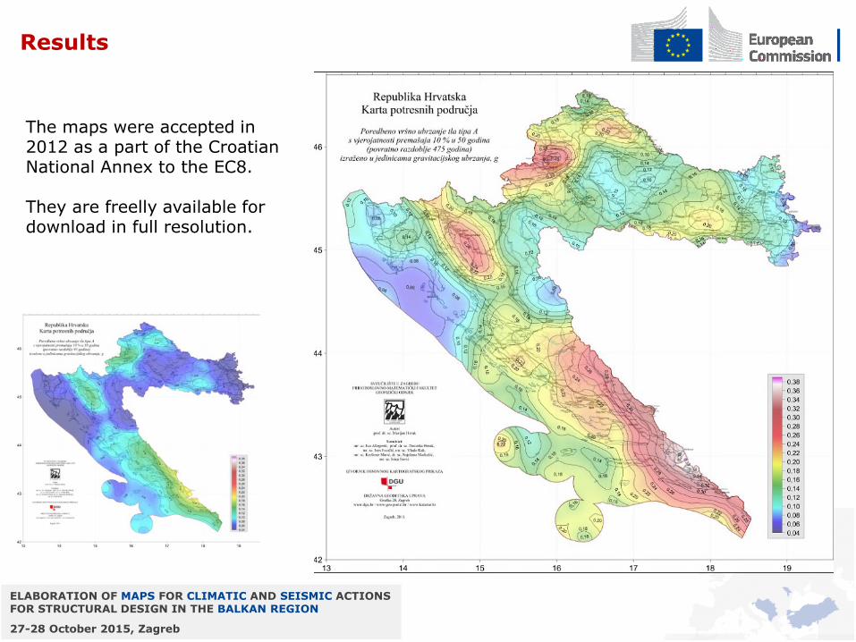
Results
The maps were accepted in 2012 as a part of the Croatian National Annex to the EC8. They are freelly available for download in full resolution.
ELABORATION OF MAPS FOR CLIMATIC AND SEISMIC ACTIONS FOR STRUCTURAL DESIGN IN THE BALKAN REGION
27-28 October 2015, Zagreb
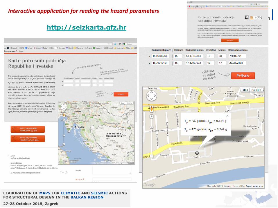
Interactive appplication for reading the hazard parameters
http://seizkarta.gfz.hr
ELABORATION OF MAPS FOR CLIMATIC AND SEISMIC ACTIONS FOR STRUCTURAL DESIGN IN THE BALKAN REGION
27-28 October 2015, Zagreb
Comparison – NEW vs. OLD
Tret = 500 g.
Significant qualitative differences!
??? 2012 1987
.
ELABORATION OF MAPS FOR CLIMATIC AND SEISMIC ACTIONS FOR STRUCTURAL DESIGN IN THE BALKAN REGION
27-28 October 2015, Zagreb
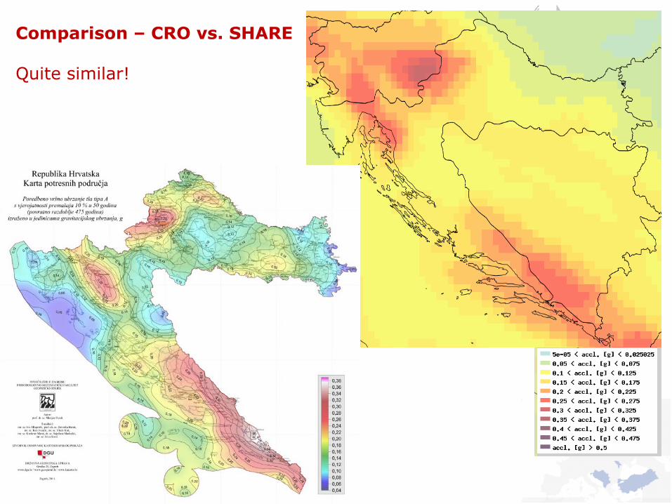
Comparison – CRO vs. SHARE Quite similar!
ELABORATION OF MAPS FOR CLIMATIC AND SEISMIC ACTIONS FOR STRUCTURAL DESIGN IN THE BALKAN REGION
27-28 October 2015, Zagreb
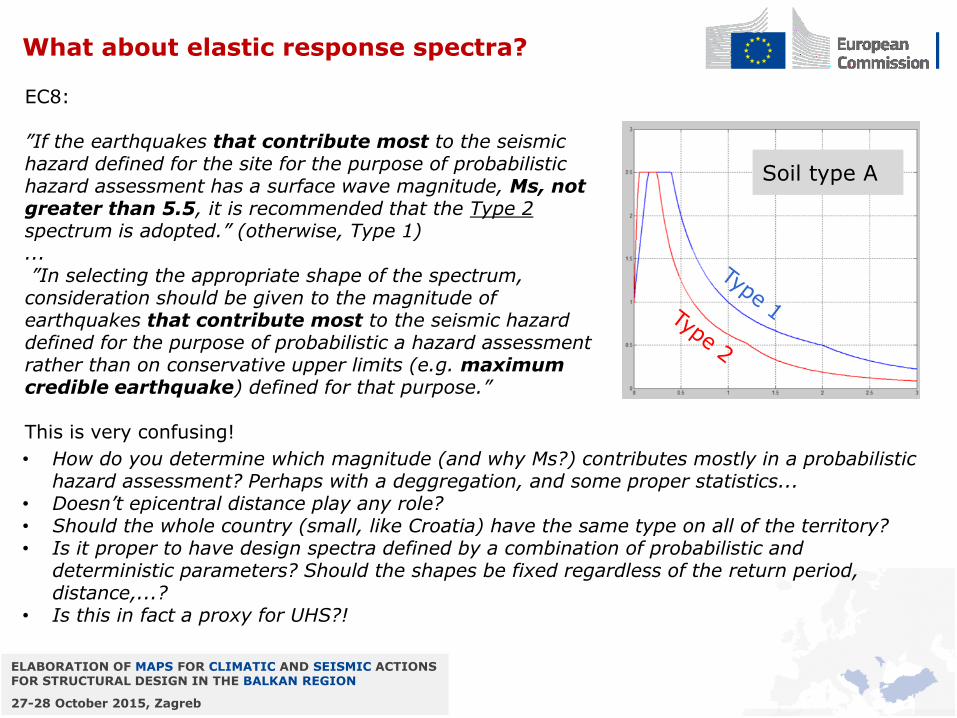
What about elastic response spectra?
EC8: ”If the earthquakes that contribute most to the seismic hazard defined for the site for the purpose of probabilistic hazard assessment has a surface wave magnitude, Ms, not greater than 5.5, it is recommended that the Type 2 spectrum is adopted.” (otherwise, Type 1) ... ”In selecting the appropriate shape of the spectrum, consideration should be given to the magnitude of earthquakes that contribute most to the seismic hazard defined for the purpose of probabilistic a hazard assessment rather than on conservative upper limits (e.g. maximum credible earthquake) defined for that purpose.” This is very confusing!
Soil type A
• How do you determine which magnitude (and why Ms?) contributes mostly in a probabilistic hazard assessment? Perhaps with a deggregation, and some proper statistics...
• Doesn’t epicentral distance play any role? • Should the whole country (small, like Croatia) have the same type on all of the territory? • Is it proper to have design spectra defined by a combination of probabilistic and
deterministic parameters? Should the shapes be fixed regardless of the return period, distance,...?
• Is this in fact a proxy for UHS?!
ELABORATION OF MAPS FOR CLIMATIC AND SEISMIC ACTIONS FOR STRUCTURAL DESIGN IN THE BALKAN REGION
27-28 October 2015, Zagreb
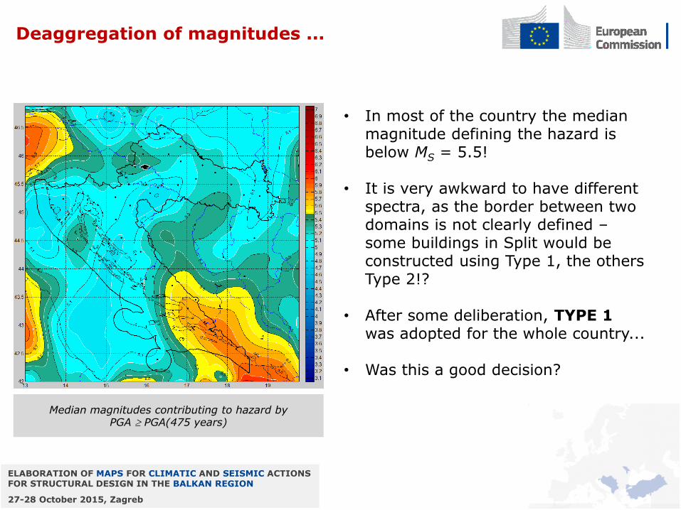
Deaggregation of magnitudes ...
• In most of the country the median magnitude defining the hazard is below MS = 5.5!
• It is very awkward to have different
spectra, as the border between two domains is not clearly defined – some buildings in Split would be constructed using Type 1, the others Type 2!?
• After some deliberation, TYPE 1 was adopted for the whole country...
• Was this a good decision?
Median magnitudes contributing to hazard by PGA PGA(475 years)
ELABORATION OF MAPS FOR CLIMATIC AND SEISMIC ACTIONS FOR STRUCTURAL DESIGN IN THE BALKAN REGION
27-28 October 2015, Zagreb
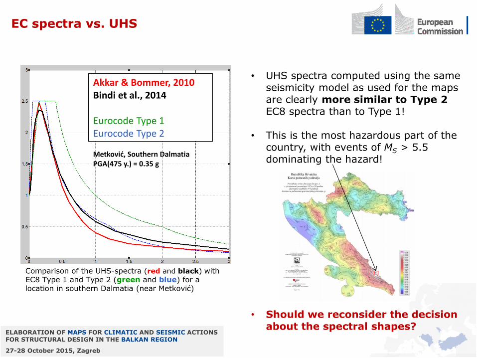
EC spectra vs. UHS
• UHS spectra computed using the same
seismicity model as used for the maps are clearly more similar to Type 2 EC8 spectra than to Type 1!
• This is the most hazardous part of the country, with events of MS > 5.5 dominating the hazard!
• Should we reconsider the decision about the spectral shapes?
Akkar & Bommer, 2010 Bindi et al., 2014 Eurocode Type 1 Eurocode Type 2
Metković, Southern Dalmatia PGA(475 y.) = 0.35 g
Comparison of the UHS-spectra (red and black) with EC8 Type 1 and Type 2 (green and blue) for a location in southern Dalmatia (near Metković)
ELABORATION OF MAPS FOR CLIMATIC AND SEISMIC ACTIONS FOR STRUCTURAL DESIGN IN THE BALKAN REGION
27-28 October 2015, Zagreb
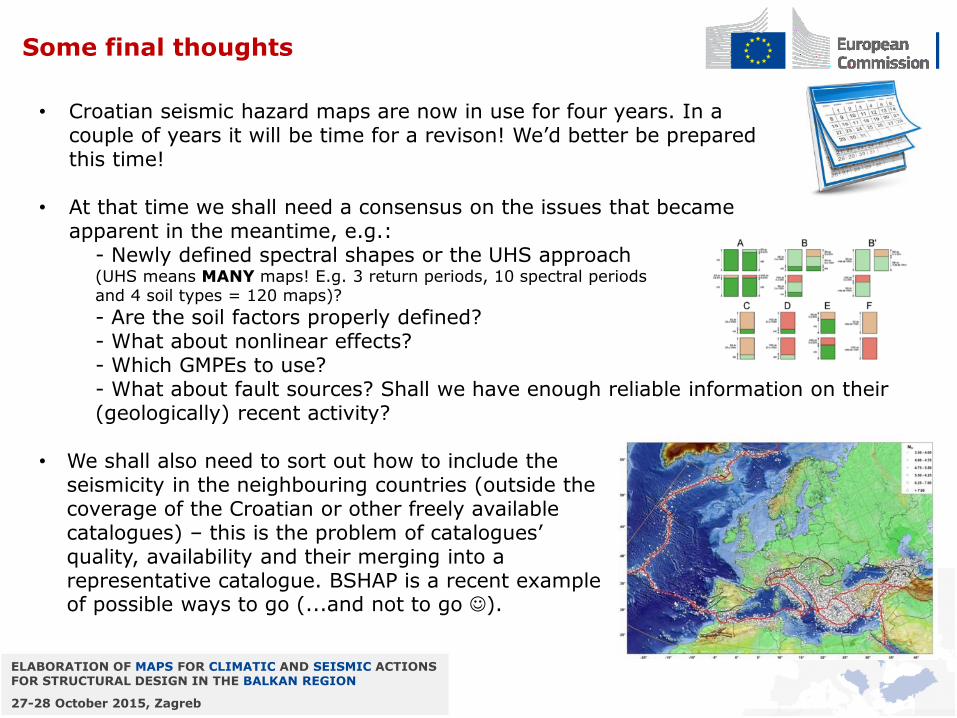
Some final thoughts
• Croatian seismic hazard maps are now in use for four years. In a couple of years it will be time for a revison! We’d better be prepared this time!
• At that time we shall need a consensus on the issues that became apparent in the meantime, e.g.:
- Newly defined spectral shapes or the UHS approach (UHS means MANY maps! E.g. 3 return periods, 10 spectral periods and 4 soil types = 120 maps)?
- Are the soil factors properly defined? - What about nonlinear effects? - Which GMPEs to use? - What about fault sources? Shall we have enough reliable information on their
(geologically) recent activity? • We shall also need to sort out how to include the
seismicity in the neighbouring countries (outside the coverage of the Croatian or other freely available catalogues) – this is the problem of catalogues’ quality, availability and their merging into a representative catalogue. BSHAP is a recent example of possible ways to go (...and not to go ).
ELABORATION OF MAPS FOR CLIMATIC AND SEISMIC ACTIONS FOR STRUCTURAL DESIGN IN THE BALKAN REGION
27-28 October 2015, Zagreb
Thank you for the attention!


![Improvement and Harmonization of BSHAP Earthquake Catalogue [ Compilation of data, comparison with SHARE-GEM catalog ] Ines Ivančić Croatian Seismological](https://img.pdfslide.net/doc/110x75/56649cf55503460f949c34c0/improvement-and-harmonization-of-bshap-earthquake-catalogue-compilation-of.jpg)