Embed Size (px)
Citation preview
Comprehensive Geostatistical Technology on PC Platform
C. Stevenson ([email protected]) 505-838-1910 Correlations Company
112 Manzanares St. Socorro, NM 87801
Abstract
Geostatistics has attracted the attention of many earth scientist and engineers who need bettermodeling tools for natural gas reservoirs. Two years ago Correlations Company responded to thisneed through the peer reviewed, DOE Small Business Innovative Research program to develop afractal algorithm for interpolating between measurements and mapping the consequences. Duringthe two years research period Correlations Company has combined geostatistical modeling with highquality graphics to produce Gviz. This software provides accurate 3D reservoir modeling tools andhigh quality 3D graphics for PC platforms enabling engineers and geologists to better comprehendreservoirs and consequently improve their decisions. Until recently geostatistical modeling was onlyavailable to the limited number of earth scientist familiar with UNIX based platforms. Gviz runs onany PC with Windows 95 or Windows NT operating system.
The Gviz pre-processing module reads LAS and ASCII files. The pre-processing modulefacilitates selection of the stratigraphic units prior to processing by a nearest neighbor, kriging andco-kriging, conditional simulation, or fractal module. A user friendly GUI simplifies theexamination of the statistical data and the geostatistical analyses using isotropic and anisotropicvariograms. After completing the analyses, the post-processing unit can generate 1D models of welllogs, 2D models such as cross-sections, or a 3D model of any petrophysical property. Post-processing includes the display of reservoir slices, multiple cross-sections, rotation along any axis,and identification of geobodies (visually inspect the effect of porosity cutoffs on connected porevolume). The post-processor includes an up-scaling module to transform a fine scale grid into areservoir simulation grid which can then be exported in an Eclipse format.
Gviz emphasizes a self-explanatory GUI and visually oriented help pages which guides evena novice through the process of generating realistic, two to five million cell, 3D reservoir models.Beta testing of Gviz will finish in April 1997 and a working version of the PC software package,at one fifth of the cost of a comparable UNIX system, will be available to domestic gas and oilproducers in mid-1997.
Acknowledgments
Royal Watts was the initial FETC Contracting Officer’s Representative during the Phase I and PhaseII performance period ( 33 months ending in March 1997). Following Mr. Watts’ retirement, Mr.William J. Gwilliam has assisted Correlations Company in completing the contract.
________________________Research sponsored by the U.S. Department of Energy’s Federal Energy Technology Center under contract DE-FG05-94ER81821 with Correlations Company, 112 Manzanares St. Socorro, NM 87801; 505-838-1910
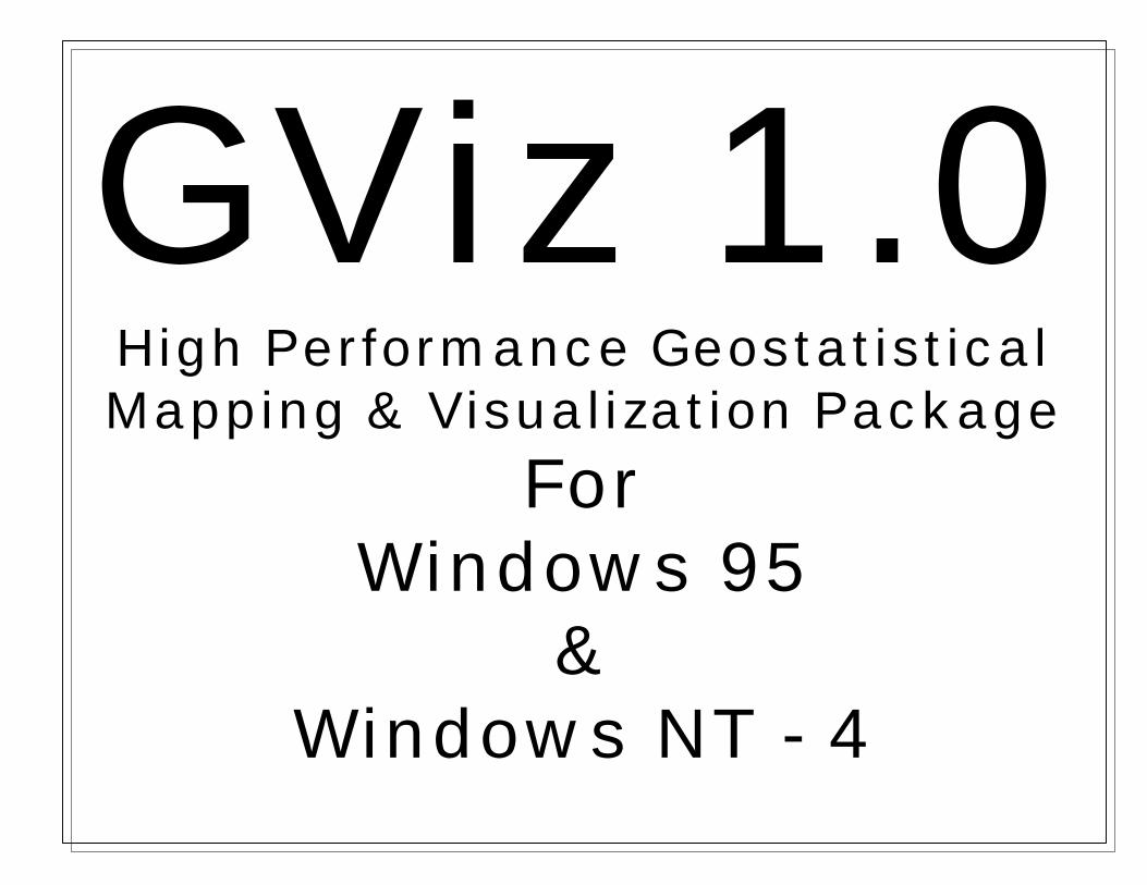
GViz 1.0High Performance GeostatisticalMapping & Visualization Package
ForWindows 95
&Windows NT - 4
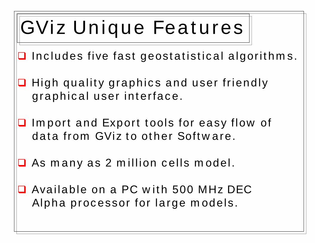
q Includes five fast geostatistical algorithms.
q High quality graphics and user friendly graphical user interface.
q Import and Export tools for easy flow of data from GViz to other Software.
q As many as 2 million cells model.
q Available on a PC with 500 MHz DEC Alpha processor for large models.
GViz Unique Features

Correlations CompanyProvides Full Reservoir Description Services.
The Company’s Expertise is:
q Geostatistical modeling using GViz.
q Software development for Windows 95 and Windows NT – 4.
q Special reservoir description problems:ü Modeling fractured reservoirs with limited data.ü Modeling old fields with limited data.

q Deterministic/ Nearest Neighbor methodsq Kriging/Co-Krigingq Unconditional/Conditional Simulationq Fractal Simulation
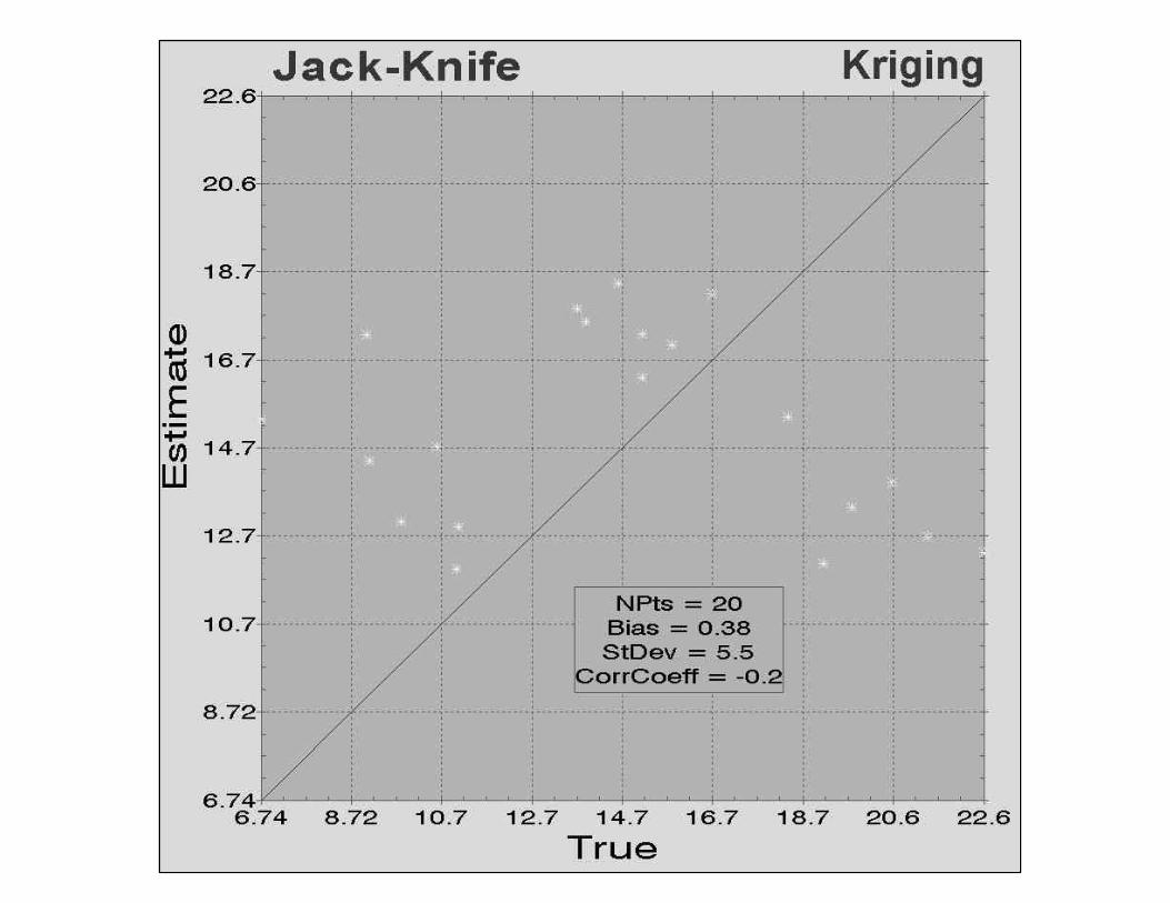
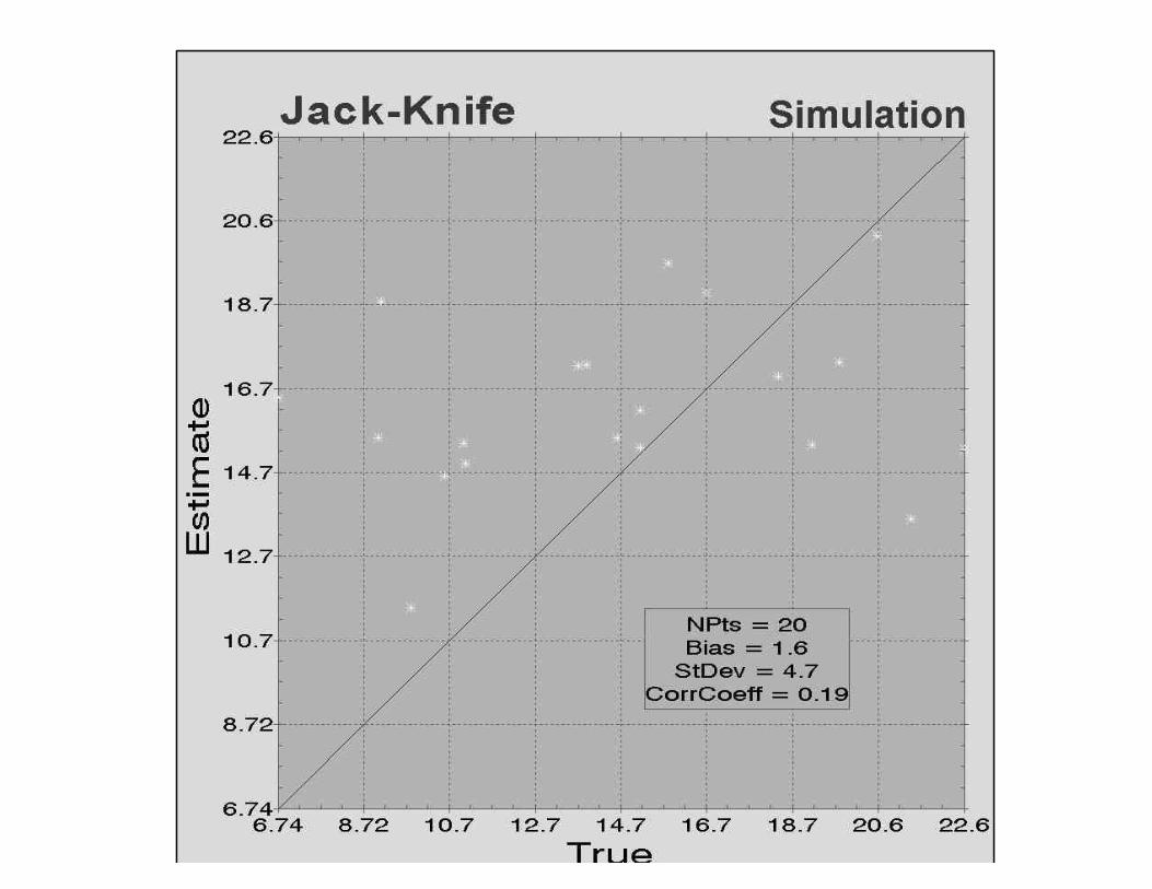
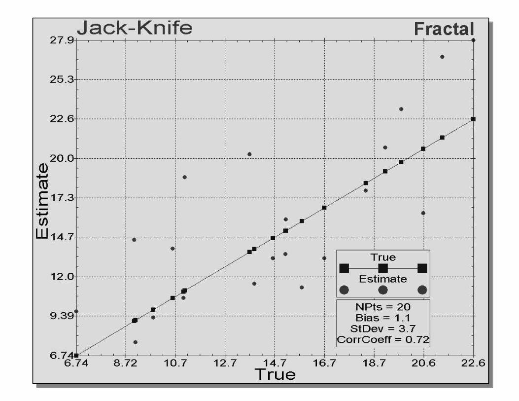
q Boolean Mapsq Additive Combinationq Multiplicative Combinationq Map Conditioningq Jack-Knife/Map Validation
Mapping Methods
Map Post Processing

q LAS Well Log files.q Import ASCII files.q Selection of stratigraphic markers within GViz.
Importing
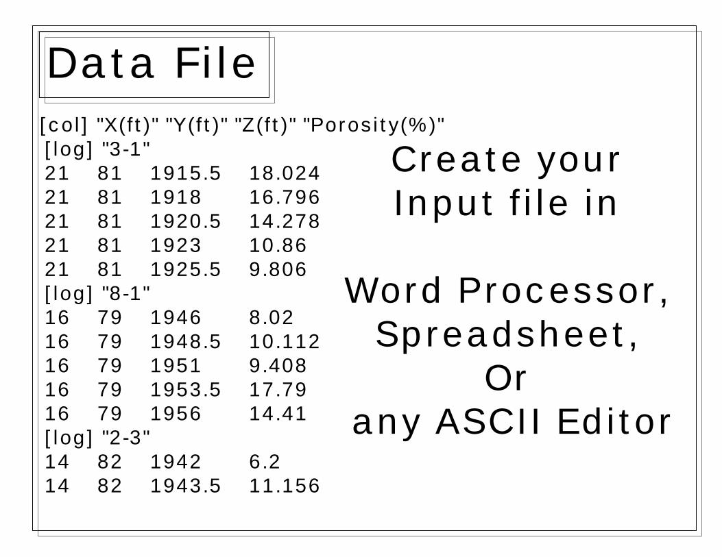
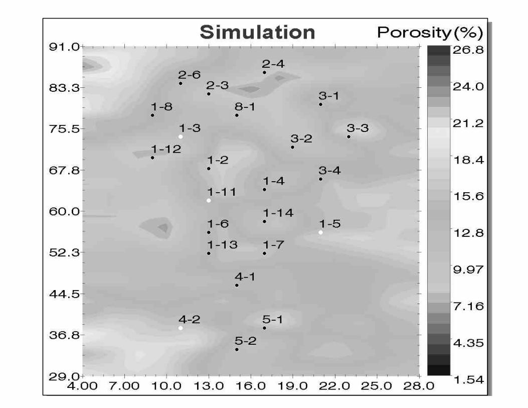
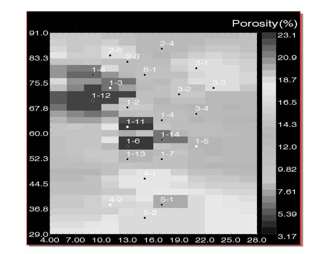
[col] "X(ft)" "Y(ft)" "Z(ft)" "Porosity(%)"[log] "3-1"21 81 1915.5 18.02421 81 1918 16.79621 81 1920.5 14.27821 81 1923 10.8621 81 1925.5 9.806[log] "8-1"16 79 1946 8.0216 79 1948.5 10.11216 79 1951 9.40816 79 1953.5 17.7916 79 1956 14.41[log] "2-3"14 82 1942 6.214 82 1943.5 11.156
Create yourInput file in
Word Processor,Spreadsheet,
Or any ASCII Editor
Data File

ü Single Integrated Environment
ü Create, Modify and View Maps and Plots
ü Easy to use Graphical User Interface
GViz Project Manager


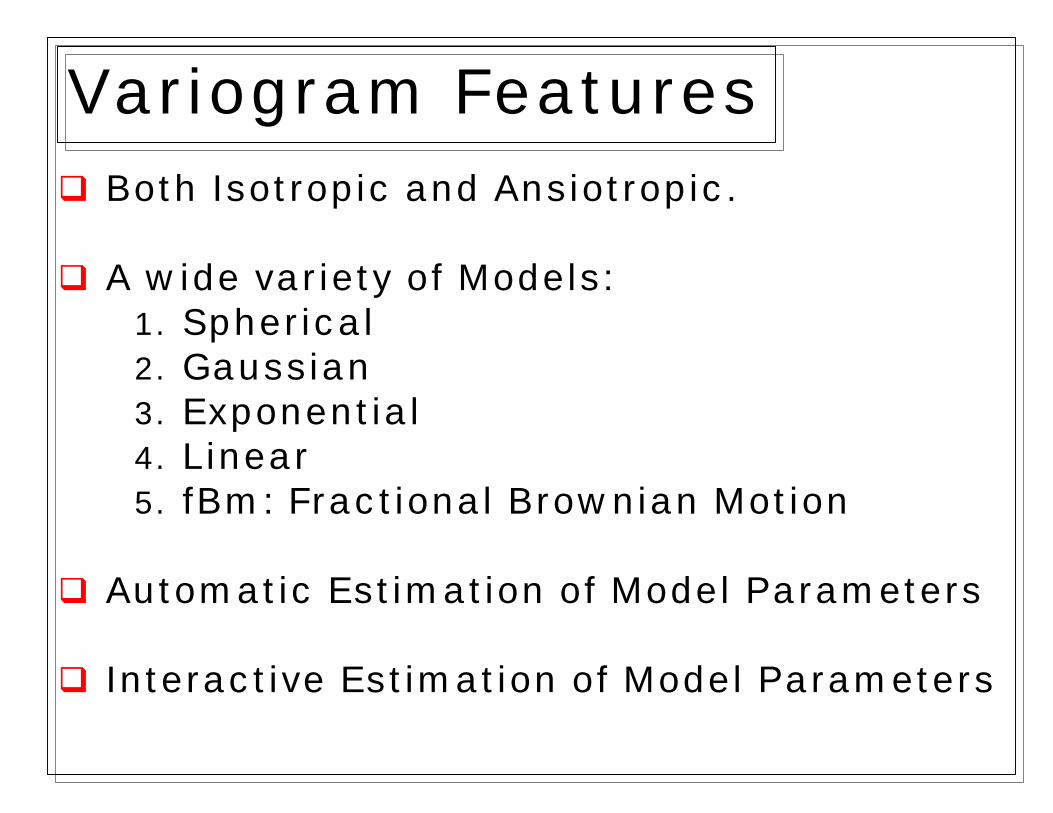
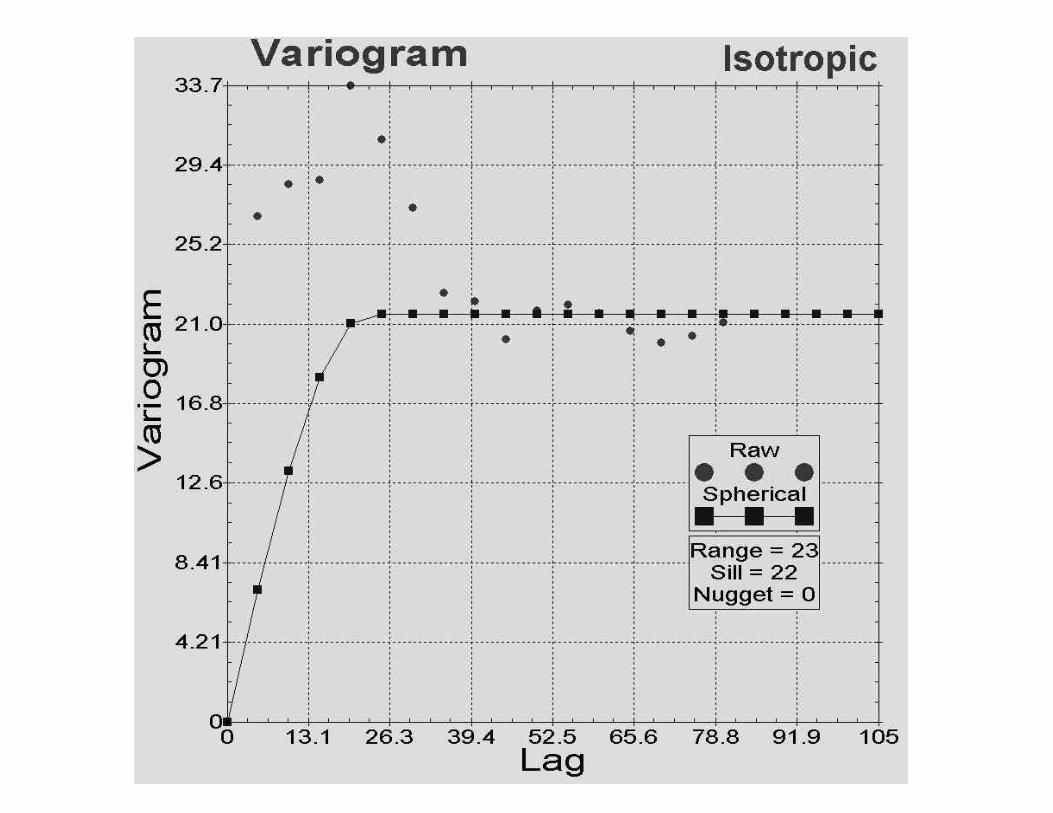
q Both Isotropic and Ansiotropic.
q A wide variety of Models:1. Spherical2. Gaussian3. Exponential4. Linear5. fBm: Fractional Brownian Motion
q Automatic Estimation of Model Parameters
q Interactive Estimation of Model Parameters
Variogram Features

Interactive Variogram


ü Reservoir Continuity (10% Cutoff)
ü Sand Bodies Where Porosity is Higher than 10%
ü Boolean Map

q Areal/Vertical Upscaling
q Export Models to Reservoir Simulations1. ECLIPSE2. VIP3. CMG4. SABRE5. ASCII FILES: Row, Column & XYZ.
q Export Map & Plot to JPEG & BMP format.
q Export Map & Plot to Microsoft Word and Microsoft PowerPoint for presentation.
Exporting
GViz 1.03D Reservoir Modeling on PCs
ü 3D Reservoir Modelsü 2D XY Plane Problemsü 2D Cross Section Problemsü 1D Problems