Embed Size (px)
Citation preview
Comprehensive Plan Transportation Element
Proposed Amendments
April 2020 Page 1 of 77
DELETIONS ADDITIONS 400 Overview 400 400.1 The Transportation Element provides policies and actions to maintain and
improve the District’s transportation system and enhance the travel choices of current and future residents, visitors, and workers. These policies are complemented by policies in the Land Use, Urban Design, and Environmental Protection Elements on related topics, such as air quality and the management of public space. Recognizing the interplay between transportation and these related topics is critical to improving safety, mobility, and accessibility in the cityWashington, DC. 400.1
400.2 The critical transportation issues facing the Districtof Columbia are addressed in
this element. These include: • Eliminating fatalities and serious injuries on the transportation
network; • Expanding the city's transitDistrict’s transportation system to provide
alternatives to the use of single-occupant autos.; • Enhancing the city'sDistrict’s corridors for all modes of transportation.; • Increasing bicycle and pedestrian connections, routes, and facilities.; • Improving the efficiency of the existing transportation system.; • Investing in bridge and roadway maintenance and repair.; • Investing in transit network maintenance and repair.; • Reducing pollution and negative health and environmental effects
resulting from transportation; and • Promoting transportation demand management (TDM). 400.2
400.3 A safe, well-balanced, and multi-modal transportation system is integral to the
city’sDistrict’s efforts to sustain and enhance the residents quality of life. and It is also key to the District’s its future economic growth and its role as the nation’s capital. Achieving Creating such a system requires integrating land use and transportation, and implementing a range of improvements that enhance safety, connectivity, livability, equity, health, sustainability, resiliency, and vitality. 400.3
400.4 As the nation’s capital and the center of one of the country’s fastest-growing
metropolitan areas, the DistrictWashington, DC faces increasingly complex mobility challenges as it plans for its future. While tThe cityDistrict stillretains

Comprehensive Plan Transportation Element
Proposed Amendments
April 2020 Page 2 of 77
ahas the largest share of the region’s jobs; however, the region itselfcontinues to decentralize to grow, creating longer commutes, increased peak period congestion, and poor air quality. Within the District, the major surface transportation arteries are highly congested during morning and evening commuting, and Metrorail has faced safety and reliability issues related to deferred maintenance. periods and the Metrorail system in Central Washington is expected to reach capacity in the near futureFunding to maintain the existing transportation system, let alone expand the system to meet increased demand, is severely constrained. 400.4
400.5 However, these challenges also present opportunities. The District has one of
the most extensive mass transit systems in the country, densities that support and promote transit use, a growing network of bicycle and pedestrian trails, and a unique system of radial boulevards that distinguish it from all other American cities. Washington, DC’s gracious avenues, bridges, and parkways are part of its history and are a defining elements of its urban form and character. With appropriate strategies in place, these transportation assets can enhance the quality of life in the cityWashington, DC and increase the District’s attractiveness while still performing their essential function to move people and goods in and around the cityDistrict. 400.5
400.6 The cityDistrict is also taking steps to augmenting and sustaining its existing
transportation network. It is expanding transit via bus rapid transit and light raillimited-stop bus routes to areas not served by Metrorail and has established streetcar service on a major commercial corridor. It is replacing the Anacostia River bridges, including the South Capitol and 11th Street bridges, to improve mobility and roadway operations and to support economic development and urban beautification goals. It is improving sidewalks and bicycle routes across the District. It has instituted a highly successful bikeshare system and has supported private sector innovations in car sharing, ride-hailing services, and dockless bicycle and scooter sharing. The on-demand ride-hailing services offered by transportation network companies (TNCs) have created new opportunities and challenges for mobility in the District. They provide individuals with new transportation options but increase demands on the District’s limited roadway capacity. Table Figure 4.1 summarizes the transportation assets of the District. 400.6
400.7 Emerging smart-city technologies—such as dynamic parking meters,
connected signals, and digital sensors—provide new opportunities to meet many of the transportation challenges facing the District. These technologies build on existing transportation infrastructure, including the

Comprehensive Plan Transportation Element
Proposed Amendments
April 2020 Page 3 of 77
signal network, transit and vehicle technologies, and user tools and applications. The District aims to employ these technologies in an integrated, accessible, and equitable fashion, encouraging coordination among the District, regional agencies, smart infrastructure providers, and users. Data exchange will be a critical part of the process—as will feedback and adaptation—to encourage greater safety within, equity regarding, and accessibility to the transportation network. 400.7
400.8 Table Figure 4.1: Transportation Assets of the District 400.78 Transportation Asset Description Roadway System 1,171 miles Rail Mass Transit (Metrorail)
38 miles (total for region = 117 miles) 40 stations (total for region = 91 stations)
Bus Mass Transit MetrobusMetroBus DC Circulator
Service on 281 miles of road Service on 52 miles of road
Sidewalks 1,808 miles Bicycle Routes
Protected bicycle lanes On-road bicycle lanes Signed routes Off-road trails
9 miles 75 miles 100 miles 60 miles
Capital Bikeshare Bikes Stations
2,300 Capital Bikeshare bikes (total for region = 3,600 bikes) 300 Capital Bikeshare stations (total for region = 525 stations)
Parking Meters 11,166 parking meters serving 18,903 spaces Street Lights 70,263 sStreet lLights Airports* Two international airports (Washington Dulles International and
Baltimore/-Washington International) and one domestic (Reagan National)
Railroads 27.2 miles of rail line (serving Amtrak passenger rail, Maryland Area Regional Commuter (MARC) and Virginia Rail Expressway (VRE) commuter rail, and CSX and Norfolk Southern freight rail). Union Station, within walking distance of the Capitol, provides connections to bus and rail transit, and toalong with shared cars, rental cars, and sightseeing services.
Source: DC Office of Planning, 2017 * Facilities serving Washington, DC, located outside of its boundaries 400.89 The District’s Department of Transportation (DDOT) manages and maintains
the city’s transportation infrastructure. In 2006, DDOT will complete its federally mandated state transportation plan, known as the 2030 Transportation Vision Plan. The Plan directs transportation policies and investments for the
Comprehensive Plan Transportation Element
Proposed Amendments
April 2020 Page 4 of 77
District and will serve as a guiding document for DDOT in the coming years. This Element incorporates planning and policy guidance from the Transportation Vision Plan.In the District, the transportation system should strike a careful balance between serving the needs of its residents—a large workforce that arrives and departs Washington, DC each day—and serving the many people who visit. The system must meet residents’ needs, which should be coordinated with regional infrastructure and policy. In 2014, the District Department of Transportation (DDOT) produced moveDC, a multimodal transportation vision plan that addresses these challenges. 400.89
400.910 The 2030 Transportation Vision Plan includes an Action Plan, which identifies
a number of transportation investments across the District. Many of the action items described in the plan are already in the project development process and many have been studied at least through the preliminary feasibility study stage. Table 4.2 summarizes some of the major transportation investments envisioned in the Transportation Vision Plan. These and other ongoing and planned transportation investments are discussed in more detail later in this Element. moveDC, the District’s multimodal long-range transportation plan, presents a transportation infrastructure model and District-wide multimodal policies that will guide the District’s transportation vision for the next two decades. The plan describes the recommended networks of facilities, services, and policies to achieve the District’s transportation goals. The Comprehensive Plan accepts moveDC’s policies and recommendations as the basis for transportation planning and policy in the District and integrates them within the broader policy framework laid out in the Comprehensive Plan. 400.910
400.10 Table 4.2: Summary of Major Action Projects in the 2030 Transportation Vision
Plan 400.10 401 Transportation Goal 401 401.1 The overarching goal for transportation in the District is:
Create a safe, sustainable, equitable, efficient, and multi-modal transportation system that meets the access and mobility needs of District residents, the regional workforce, and visitors; supports local and regional economic prosperity; and enhances the quality of life for District residents. 401.1
402 T-1 Linking Land Use and Transportation 402 402.1 Transportation and land use are thefundamental components of development
and are inextricably linked to each other and to the formation of our cities. The construction of a new transportation facility, such as a Metrorail station or a light rail orstreetcar line, influences the nature and location of new development
Comprehensive Plan Transportation Element
Proposed Amendments
April 2020 Page 5 of 77
in that area. The nature and location of development, in turn, influence patterns of travel for residents. 402.1
402.2 Transportation facilities themselves are a significant element of the built environment, creating connections but at times also creating barriers. They can spur economic development and help attract private investment, but they can also create land use conflicts and environmental problemsand health issues if land use and environmental concerns are not considered in the planning process. 402.12
403 T-1.1 Land Use: Transportation Coordination 403 403.1 As laid out in the Framework Element of thethis Comprehensive Plan, the
cityDistrict and region are expected to continue to gain jobs and households over the next 20 years. Coordination of Coordinatingtransportation and land use decisions is is are critical to making the best use of the infrastructure and finite land resources as these gains occur. The balance between housing and jobs plays a clear role in travel patterns. In general, the demands on our the transportation system are reduced when homes are located close to places of employment, and shopping, and leisure.. PPpeople spend less time traveling, and overall quality of life may be improved. The transportation system as a whole benefits when more compact mixed-use residential and employment areas are situated along major transit routes. Travel times are reduced, and there is better use of public transportation investments. 403.1
403.2 Although the District has already developed walkable, transit-oriented
neighborhoods, future opportunities will arise to strengthen the linkage between land use and transportation as new development takes place. Design features play an important role in this equation. Residential communities should be developed so that services, such as shopping, are accessible byon footwalking, taking transit, or riding a bicycle—, and not just by driving a car. The design of transportation infrastructure can also have a major impact on travel behavior and system performance. For example, the redesigns of the Anacostia River crossings that are planned, under construction, and implemented to be implemented in the coming years willprovide for pedestrian and bicycle access across the river, while the currentimproving the historical bridge crossings, which discouraged or prohibited it access. There are also opportunities to enhance bike and pedestrian connectivity with the redesign of the Long Bridge across the Potomac River. 403.2
403.3 The space needs of transportation support facilities—, including space for bus
garages, service yards, and motor vehicle inspection facilities—, also call for stronger coordination between of land use and transportation planning. The Washington Metropolitan Area Transit Authority (WMATA) already has a critical need for additional and improved bus storage and service yards

Comprehensive Plan Transportation Element
Proposed Amendments
April 2020 Page 6 of 77
and anticipates a need for greater rail yard space when the Metrorail fleet adds more eight-car trains. The lack of modern bus garages in the District severely impedes better bus service. As new transit lines are developed for the Circulator and DC Streetcar, additional land will be needed for new support facilities. Just as corridor preservation efforts anticipate the future need for transportation facilities, there is a need for land use planning to preserve opportunities for transportation support facilities, such as vehicle maintenance and storage. Failure to preserve areas for this use forces the location of facilities at great distances from service areas, increasing costs and limiting vehicle availability in emergencies. In some cases, as with rail facilities, location of vehicle maintenance and storage with operation service is essential. As service needs grow, transportation support facilities are needed to support existing services and future growth across the District. The Washington Metropolitan Area Transit Authority already reports a need for additional bus storage and service yards. As new transit lines are developed, additional land will be needed for new support facilities. 403.3
403.4 Closer coordination between of transportation and land use planning can result
in better congestion management, more efficient use of transit and parking, and transportation infrastructure that is sensitive and complementary to its surrounding context. 403.4
403.5 Assessing and measuring the transportation impacts of land use decisions is are
also an important steps in part of integrated land use and transportation planning. New development generates new trips—be they auto trips, transit trips, or pedestrian trips, and or bicycle trips. Major land use changes, such as the development of large housing complexes or office buildings, must should be evaluated for their impacts on existing and planned transportation infrastructure to ensure that the network can function adequately when the projects are completed. New methods of managing transportation impacts—,such as transportation demand managementTDM (discussed later inadditional information can be found in Section T-3.1 of this chapter)—must should be pursued in lieu of simply building more roads. Additionally, as new technologies—such as TNCs and connected and autonomous vehicles (AVs)—emerge, the District will evaluate potential land use impacts and continue to encourage mixed-use and accessible development patterns. 403.5
403.6 In the past, the traditional way of measuring traffic impacts was to use a series
of lettered grades (A through F) based on factors such as vehicle speed, the volume of cars that pass along a street compared to the street’s capacity, andor the length of time for a car to pass through an intersection. These Llevel of Sservice (LOS) standards continue to be widely used in the suburbs, where most trips are made by car. But traditional LOS measures are not appropriate in a built-out city District, where widening streets to increase capacity is rarely an
Comprehensive Plan Transportation Element
Proposed Amendments
April 2020 Page 7 of 77
option (or a desired outcome). In the District, level of serviceLOS measures must should integrate vehicular, bicycle, pedestrian, and transit travel. The benchmark should be the number of people thatwho can pass along a corridor or through an intersection rather than just the number of cars. 403.6
403.7 Policy T-1.1.1: Transportation Impact Assessment
Require full environmental impact statementsanalysis for major transportation projects, including new roadways, bridges, transit systems, road design changes, and rerouting of traffic from roads classified as principal arterials or higher onto minor arterials or neighborhood streets with lesser volumes. 403.7
403.8 Policy T-1.1.2: Land Use Impact Assessment
Assess the transportation impacts of development projects using multi-modal standards rather than traditional vehicle standards to more accurately measure and more effectively mitigate development impacts on the transportation network. Environmental and climate change impacts, including that of carbon dioxide, should be included in the assessment to of land use impacts. 403.8
403.9 Policy T-1.1.3: Context-Sensitive Transportation
Design transportation infrastructure to support current land uses as well as land use goals for compact mixed-use, accessible neighborhoods. Make the design and scale of transportation facilities compatible with planned land uses. Facilities should comply with the District’s Complete Streets policy, adopted in October 2010, with an emphasis on pedestrian and bicycle-friendly design. 403.9
403.10 Policy T-1.1.4: Transit-Oriented Development
Support transit-oriented development by investing in pedestrian-oriented transportation improvements at or around transit stations, major bus corridors, and transfer points. Encourage development projects to build or upgrade the pedestrian and bicycle infrastructure leading to the nearest transit stop to create last-mile connections. Pedestrian movements and safety should be prioritized around transit stations. 403.10
See also Section LU-1.34 of the Land Use Element for transit-oriented development policies.
403.11 Policy T-1.1.5: Joint Development
Attract new riders to the transit system by fostering transit-supportive commercial and residential joint development projects on Washington Metropolitan Area Transit Authority (WMATA) owned or controlled land and on private properties adjacent to Metrorail stations.Maximize ridership

Comprehensive Plan Transportation Element
Proposed Amendments
April 2020 Page 8 of 77
potential, housing, and economic development opportunities by fostering transit-supportive commercial and residential joint development projects on WMATA-owned or -controlled land, public land, and private properties adjacent to Metrorail stations. 403.11
403.12 Policy T-1.1.6: Transportation Support Facilities
Preserve existing transportation infrastructure support facilities where feasible and locate new, efficient support facility locations for storage and/ or maintenance for Metrobus, commuter bus, tour bus, Metrorail, streetcar, commuter rail, and intercity rail.Prioritize in place preservation and rehabilitation for existing transportation infrastructure support facilities and prioritize new, efficient support facility locations for storage and/or maintenance for Metrobus, DC Circulator, commuter bus, motor coach, Metrorail, streetcar, commuter rail, and intercity rail throughout the District to equitably distribute access to these services throughout all wards. Existing transit support facilities should be redeveloped for other uses only if the transit facility can be maintained on-site with the new use, if a new facility is created, or if an existing one is expanded. Agencies should work to integrate transit facilities in the urban form and development program. 403.12
403.13 Policy T-1.1.7: Equitable Transportation Access Transportation within the District should be accessible and serve all users. Residents, workers and visitors should have access to safe, affordable and reliable transportation options regardless of age, race, income, geography or physical ability. Transportation should not be a barrier to economic opportunity for District residents. 403.13
403.14 Policy T-1.1.8: Minimize Off-Street Parking
An increase in vehicle parking has been shown to add vehicle trips to the transportation network. In light of this, excessive off-street vehicle parking should be discouraged. 403.14
403.1315 Action T-1.1.A: Transportation Measures of Effectiveness
Develop new measures of effectiveness such as a multi-modal level of service standard Implement moveDC performance measures and the District Mobility Project to quantify transportation service and assess land use impacts on the transportation system. Priority performance measures include mode share, access to transportation options, person-carrying capacity or throughput, travel time reliability, and accessibility and equity for potentially vulnerable populations. 403.1315
Comprehensive Plan Transportation Element
Proposed Amendments
April 2020 Page 9 of 77
403.1416 Action T-1.1.B: Transportation Improvements
Require transportation demand managementTDM measures and transportation support facilities—, such as crosswalks, bus shelters, transit resource and information kiosks, Capital Bikeshare stations, and bicycle facilities—within large development projects and major trip generators, including projects that go through the Planned Unit Development (PUD) Pprocess. Consider improvements to transit stations—,such as additional stairs, escalators, and in some cases new entrances—with large developments. 403.1416
403.17 Action T-1.1.C: Create Regional Network of Transportation Support
Facilities Work with WMATA and regional jurisdictions and partners to strategically locate new transportation infrastructure support facilities for the greater Washington metropolitan area where they best serve the transportation network and complement nearby land uses. 403.17
403.18 Action T-1.1.D: Land Use—Transportation Coordination
Establish regular meetings with neighboring jurisdictions to discuss planned transportation projects and transportation needs. Encourage all jurisdictions to engage in agenda development so that projects that occur near borders are considered by all those impacted. 403.18
Please consult the Land Use and Economic Development Elements for additional policies and actions on transit-oriented development. Policies on parking are included in Section T3.2 of this eElement and in the Land Use Element. Please see Section T-3.1 for additional policies on transportation demand management.
404 T-1.2 Transforming Corridors 404 404.1 Our aAvenues and boulevards are much more than simple transportation routes.
They are a legacy of the 1791 L’Enfant Plan and are still one of the city’sWashington, DC’s most distinctive features. They were designed to be beautiful corridors lined with distinctive buildings, affording dramatic vistas for those passing by. Today, these corridors handle hundreds of thousands of private vehicles each day, as well as pedestrians, bicycles, trucks, and buses. 404.1
404.2 Different corridors in the cityWashington, DC serve different functions. Some,
like New York Avenue, carry heavy truck and commuter traffic. Others have wide sidewalks that provide a safe and pleasant environment for pedestrians.
Comprehensive Plan Transportation Element
Proposed Amendments
April 2020 Page 10 of 77
Still others were once vital shopping streets or streetcar lines that today have lost their neighborhood-serving activities and are checkered by drive-through and auto-oriented uses. As the gateways to our Washington, DC’s communities, the District’s corridors should once again become the centers of civic and economic life for surrounding neighborhoods and serve as vital transportation corridors. Major avenues will also serve as focus areas for future smart-city investments that support these goals through enhancements in safety, transit service, and public amenities. The challenges facing the District as it plans for and reinvests in its corridors is toinclude balance balancing the various transportation modes, providing provide diverse and accessible transit options for all users, and tailoring its transportation strategies to recognize the function of each major street, and foster economic growth. 404.2
404.3 Transit and non-auto travel have become major travel modes in the
District, yet these modes have little roadway space dedicated to their exclusive use. One of the key moveDC strategies to enhance the District’s multimodal system is to establish modal priorities on District streets. Per moveDC, every non-local street should prioritize pedestrians, accommodate driving and local deliveries, and support one of the following modes:
• Protected bicycle facilities; • Dedicated high-capacity surface transit lane(s); • Dedicated freight routes; or • A combination of these modes in a simpler form.
Decisions on which modes will be prioritized on streets are illustrated in the moveDC plan and are based on network connectivity, land use, and travel demand. 404.3
404.3 Improvement of the city’s corridors—particularly public space along city
streets—is an important part of the ongoing “Great Streets” initiative. Great Streets applies a multidisciplinary approach to corridor improvement, comprised of public realm investments, land use plans, public safety strategies, and economic development assistance. Among other things, the initiative includes the construction of new sidewalks, lighting, signage and crosswalks. Such improvements are being used to leverage further investment in landscaping and public space by the private sector. 404.3
404.4 The Great Streets Initiative is a partnership of the District Department of
Transportation (DDOT), the Deputy Mayor for Planning and Economic

Comprehensive Plan Transportation Element
Proposed Amendments
April 2020 Page 11 of 77
Development (DMPED), the Office of Planning (OP), the Department of Parks and Recreation (DPR), and Neighborhood Services Coordinators (NSC), among many others. In its first phase the program concentrates on six designated corridors. These corridors are identified in the Land Use Element and include:
• Georgia Avenue NW and 7th Street NW from Eastern Avenue to Mt. Vernon Square
• H Street NE and Benning Road NE from North Capitol Street to Southern Avenue
• Nannie Helen Burroughs Avenue NE from Kenilworth Avenue to Eastern Avenue
• Minnesota Avenue NE/SE from Sheriff Road NE to Good Hope Road SE
• Pennsylvania Avenue SE from the Capitol complex to Southern Avenue • Martin Luther King Jr. Avenue SE and South Capitol Street from Good
Hope Road to Southern Avenue. 404.4 404.5 New corridors may be added to the Great Streets program in the future. 404.5 404.64 Policy T-1.2.1: BoulevardMajor Thoroughfare Improvements
Continue to work across District agencies to bBeautify and stabilize selected boulevards gateways and major thoroughfares by implementing coordinated multimodal transportation, economic development, and urban design improvements. 404.64
404.75 Policy T-1.2.2: Targeted Investment
Target planning and public investment toward the specific corridors with the greatest potential to foster neighborhood improvements, create equitable outcomes, and enhance connectivity across the city Washington, DC and corridors that serve as gateways to the District, welcoming visitors, residents, and workers. 404.75
404.86 Policy T-1.2.3: Discouraging Auto-Oriented Uses
Discourage certain uses, like “drive-through” businesses or stores with large surface parking lots , along key boulevards and pedestrian streets, and minimize the number of curb cuts in new developments. Curb cuts and multiple vehicle access points break -up the sidewalk, reduce pedestrian safety, and detract from pedestrian-oriented retail and residential areas. 404.86

Comprehensive Plan Transportation Element
Proposed Amendments
April 2020 Page 12 of 77
404.7 Policy T-1.2.4: Providing Roadway Space for All Modes Roadway space should be determined by the potential person-carrying capacity of the lane; modes with the ability to move the most people should be prioritized. These changes should be informed by the modal priorities identified in moveDC. 404.7
404.98 Action T-1.2.A: CrosstownCross-Town BoulevardsCorridors
Evaluate the cross-town boulevards that link the east and west sides of the city including Florida Avenue, Michigan Avenue, and Military Road/Missouri Avenue, to determine improvements that will facilitate cross-town movement. Implement the recommendations of the Crosstown Multimodal Transportation Study and the Florida Avenue Multimodal Transportation Study to improve mobility across town for all users of those corridors. 404.98
Please consult the Urban Design Element for additional policies and actions on streetscape and design standards for corridors.
405 T-1.3 Regional Smart Growth Solutions 405 405.1 While this Transportation Element is focused on the District, transportation
issues do not stop at jurisdictional boundaries. As the core of the Washington metropolitan region, the District has a high level of interest in transportation issues being addressed at a regional level. Consistently ranked among the top three most congested areas in the nation, and one with very high levels of auto-related air pollution, the Washington metropolitan region must should work cooperatively to promote more environmentally responsible transportation. Continued strong regional action on expanding transit, and smart-growth land use policies, are critical for both ourthe transportation system and the environment. 405.1
405.2 In 20062014, the Metropolitan Washington Council of Governments
(MWCOG) COGreleased its Regional Mobility and Accessibility StudyTransportation Priorities Plan, examining the impacts of projected regional growth between 20002010 and 20302040 on the metropolitan transportation system—and exploring alternatives to reduce future congestion. The study found that daily vehicle miles traveled in the region are projected to grow by 3725 percent by 20302040, while freeway and arterial lane miles are projected to grow by only 16seven percent. As a result,, most of the beltway will reach “stop and go” conditions (with average speeds less than 30 MPH) and
Comprehensive Plan Transportation Element
Proposed Amendments
April 2020 Page 13 of 77
metro trains and platforms will be packed many transportation facilities will be congested. The key finding of the MWCOG study is that long-term increases in congestion can be reduced by adjusting local land use plans to better match the transportation system, shifting jobs to the east side of the region and encouraging housing closer to the region’s job centers. 405.2
405.3 A regional strategy of promoting infill, mixed-use, and transit-oriented
development in urbanized areas is needed to ensure encourage transportation efficiency both in the District and the region. A robust and meaningful dialogue that involves federal, state, and local leaders is absolutely essential. This dialogue should focus on improving the jobs/housing balance, investing in transit, and limiting urban sprawl on the region’s frontier edge. Among other things, the District should establish direct avenues of communication with the planning, zoning, transportation, and economic development agencies of immediately surrounding jurisdictions. 405.3
405.4 Existing trip patterns reflect the District’s role as the region’s major
employment destination. When moveDC was adopted Iin 20002016, approximately 750 67 percent of persons working in the District commuted infrom the suburbs. Of these, some 39 percent drove alone, 21 percent carpooled or vanpooled, and 40 percent used transit.Of the daily trips to and from the District, 66 percent are driven, 24 percent are taken on transit, and 10 percent are pedestrians or cyclists. Daily trips to and from the District can be seen in Figure 4.2 Moreover, a recent Council of Governments study found that approximately 25 percent of the traffic entering the District at key points from Maryland and Virginia is using the District as “short cut” and does not have a destination within District boundaries. 405.4
405.5 The Technical Report on Transportation developed as part of the revision of the
Comprehensive Plan includes an analysis of the origins and destinations of work trips between each of the District’s ten planning areas and the region’s major employment centers, including Downtown Washington. Figure 4.1 compares the percentages of work trips from each of the city’s 10 planning areas that stay within that planning area, go to Central Washington, go to other areas within the District, or leave the District each day. 405.5
405.65 Approximately 2935 percent of the District’s residents commute to suburban
destinations, with about 10 percent of many of these trips going to large “regional activity centers,” such as Tysons and Rosslyn, Virginia, and CornerSilver Spring, and Bethesda, Marylandand Rosslyn. The majority of District residents work within the District, with a significant portion of those jobs in the downtown core. Within the District, 39 percent of daily trips are driven; 33 percent are taken on transit; and 28 percent are taken

Comprehensive Plan Transportation Element
Proposed Amendments
April 2020 Page 14 of 77
on foot, by bike, or on personal mobility devices. Near Northwest had the highest percentage of resident work trips remaining within the District, at 77 percent. However, this was not markedly different from other planning areas; Far Southeast/Southwest had the lowest percentage of resident work trips that remained within the District, at 66 percent. 405.65
405.6 Figure 4.2 Destination of Work Trips Originating in Each of the District’s 10
Planning Areas2040 Daily Person Trip Flows for Regional Trips 405.76
Source: moveDC, 2014
405.8 Figure 4.2: Origin of Work Trips in Each of the District’s 10 Planning Areas
405.8 405.9 Figure 4.2 illustrates the origins of daily work trips to each Planning Area of the
District, comparing trips by District workers with trips from outlying

Comprehensive Plan Transportation Element
Proposed Amendments
April 2020 Page 15 of 77
jurisdictions. The figure indicates that the vast majority of both resident and non-resident commuters are traveling to Central Washington. In fact, Central Washington is the destination for approximately 61 percent of the work trips that come from outside the District. Table 4.3 reflects the existing levels of demand for each mode of transportation for commuters working in the District. More than 50 percent of the commuters to Central Washington use transit or carpool. 405.9
405.10 Table 4.3: Mode Choice for Inbound Trips to the District’s 10 Planning Areas* 405.10
405.117 Policy T-1.3.1: Transit-Accessible Employment
Support more efficient use of the region’s transit infrastructure with land use strategies that encourage employment locations near underused transit stations. Work closely with the federal government and suburban jurisdictions to support transit-oriented and transit-accessible employment throughout the region. This would maximizeexpand the use of major transit investments such as Metrorail, and enhance the efficiency of the regional transportation system. 405.117
405.128 Policy T-1.3.2: Reverse Commuting
Utilize data on the travel patterns of District workers as the basis for programs to improve transit service, particularly programs that increase reverse commuting options for District workers employed in major suburban employment centers. 405.128
405.139 Policy T-1.3.3: Regional Transportation Planning Initiatives
Advocate for large-scale regional transportation planning initiatives that involve local, regional, state, and federal governments. Such initiatives are essential given the long lead times lead-times and high expense of increasing regional transportation capacity. 405.139
405.1410 Action T-1.3.A: Regional Jobs/Housing Balance
Continue the efforts to ensure that the concepts of promote infill, mixed-use, and transit-oriented development are promoted at the regional level;, to design transportation systems that connect District residents to local jobs;, and to provide opportunities for non-resident workers to also live in Washington, DC. 405.1410
405.1511 Action T-1.3.B: Regional Transportation Infrastructure Study
Actively participate in efforts by the Metropolitan Washington Council of

Comprehensive Plan Transportation Element
Proposed Amendments
April 2020 Page 16 of 77
GovernmentsMWCOG and other regional organizations that address long-term transportation infrastructure needs in Ggreater Washington, DC. Advocate for—and take a leadership role in—Participate in the preparation of a 50the 30-year Regional Long-Range Transportation Plan, which Infrastructure Studythat takes a broad-based look at these needs, taking into account expected growth patterns and emerging technologies. 405.1511
406 T-1.4 Placemaking in Public Space 406
406.1 In addition to the transportation function of streets, associated features—
such as medians, curbsides, edges, and sidewalks—provide opportunities to make the District more active and livable. Some corridors have more space than is needed for transportation. This excess space may be found on wide avenues or in triangular spaces where the grid is intersected by diagonal streets. Currently, there are hundreds of small non-transportation areas of land that exist within the public right-of-way, offering opportunities to establish spaces for cultural presentation and exchange in the District. 406.1
406.2 Policy T-1.4.1: Street Design for Placemaking Design streets, sidewalks, and transportation infrastructure—such as bike racks and other public places in the right-of-way—to support public life, in addition to their transportation functions. This includes incorporating seating, plantings, and the design of spaces for gathering, lingering, and engaging in commerce and social or cultural activities. 406.2
406.3 Policy T-1.4.2: Cultural Use of Public Space Support social, cultural, and commercial activities in public spaces through permitting and other government functions. Reduce permitting and other barriers to cultural use of streets and the adjoining public right-of-way. 406.3
406.4 Action T-1.4.A: Develop a Placemaking in Public Space Program Develop a placemaking in public space program within DDOT. DDOT should encourage and actively promote opportunities for enhancement in ineffective and under-used spaces District-wide. Any enhancements within the public realm should prioritize the safety and functionality of the space and carefully consider the impacts of the change to the space prior to any modifications being made. 406.4 Please consult the Urban Design Element for additional policies and actions on placemaking in public space, and the Environmental Protection Element for guidance on tree canopy and green infrastructure.
Comprehensive Plan Transportation Element
Proposed Amendments
April 2020 Page 17 of 77
406.5 Action T-1.4.B: Tree Planting and Removal Develop further guidance on tree planting and removal. 406.5
4067 T-2 Multi-modal Transportation Choices 4067 406.1407.1 As of 2017, tThe District has one of the most balanced transportation systems in
the country. Of the 50 largest cities in the U.S., the District it is has the highest percentage of residents who walk or bike to work and ranksedsecond only fourth to following New York, Boston, and San Francisco interms of the percentage of residents the percentage who take public transportation, and second only to Boston in the percentage who walk to work. Approximately Thirty-seven25 percent of the District’s households have no automobile. Providing transportation choices that are more efficient and environmentally friendly than driving— such as walking, bicycling, commuter rail, passenger rail, and public transit— is a key goal of the Comprehensive Plan. 406.1407.1
4078 T-2.1 Transit Accessibility 4078 407.1408.1 The District and itsthe surrounding region are served by the second largest rail
transit system and the fifth sixth largest bus network in the United States. The bus and rail systems are operated by the Washington Metropolitan Area Transit Authority (WMATA), which provides service throughout the Washington metropolitan region. 407.1408.1
407.2408.2 WMATA was created in 1967 by an iInterstate cCompact to plan, develop,
build, finance, and operate a balanced regional transportation system in the Nnational Ccapital area. Construction of the planned 103-mile Metrorail system began in 1969 and was largely funded by the federal government. The first phase of Metrorail began operation in 1976 and was completed in early 2001. In 2004, three new stations opened—two extended the Blue Line east of the Beltway and the first infill station (NoMa-Gallaudet UNew York Avenue) opened on the Red Line. With the opening of the first phase of the Silver Line in 2014, Tthe system now totals 106117 miles, 38.3 miles of which are located within the District itself. Close to half of the stations on the system—40 of 86 91—are located in the District. The Metrorail system is shown in Map 4.1. While much of the cityDistrict is within ½ a half -mile of a station, some areas— such as Georgetown, the New York Avenue corridor, and Bolling Air Force Base,—are not. 407.2408.2

Comprehensive Plan Transportation Element
Proposed Amendments
April 2020 Page 18 of 77
407.3408.3 As the core of the region and the hub of the Metrorail system, much of
WMATA’s transit usage centers on in the District. In 2016May 2005, the total average weekday boardings at all Metrorail stations was 639,000687,000. Nearly 5760 percent of these boardings occurred at District stations. 407.3408.3
407.4408.4 Metrorail trains often fill to capacity in the suburbs in peak periods, leaving
little space for District residents by the time trains arrive in the city. Downtown station platforms are congested. The District and WMATA are studying the feasibility of underground pedestrian connections between Gallery Place/Metro Center and Farragut North/Farragut West to relieve overcrowdingDowntown station platforms are often congested in the peak period. The District and WMATA continue to coordinate on opportunities to relieve overcrowding and improve safety through short- and long-term design modifications of platforms and station access points. 407.4408.4
407.5408.5 The WMATA Core Capacity Study investigated options to increase capacity of
the system, but there are several obstacles to making long-term, large- scale improvements. For instance, the Orange and Blue Lines share a track through downtown Washington, greatly limiting the capacity of both lines. Likewise, the interlinking of the Green and Yellow Lines between L’Enfant Plaza and the Convention Center discourages capacity increases on either of those lines. Adding tracks in these areas would require extraordinary costs and service disruption.The capacity of the core of the Metrorail system—in particular the Blue, Orange, and Silver Lines—is constrained because various lines share tracks. WMATA will continue to work with partner jurisdictions to advance capacity solutions, such as moving to eight-car trains and expanding core stations to accommodate more passengers. Long-term solutions to core capacity constraints are needed and should be considered, including the potential for new stations and lines in the District. 407.5408.5
407.6408.6 Because of the very high cost of building entirely new Metrorail subway lines
within the DistrictWashington, DC, the cityDistrict is insteadproposing better connections, to and among, the various spokes of the Metrorail system, with investments in surface transit. These improvements includebus rapid transit limited-stop bus service and dedicated transit lanes, streetcars, and improvements to local bus service through the use of new technologies, including, real-time bus arrival information and transit signal priority. In addition, the cityDistrict is working with WMATA to make more efficient use of existing infrastructure through measures such as increasing train lengths from six cars to eight cars. The increased train length would add about one-third more capacity to each train, greatly helping to alleviate short- termcongestion
Comprehensive Plan Transportation Element
Proposed Amendments
April 2020 Page 19 of 77
problems on some lines in the system. This technique woulddoes not require any changes to railroad or station infrastructure, althoughbut does require the power delivery infrastructure would needto be upgraded. The District and other jurisdictions are currently working toward upgrading the power system to support eight-car trains and working to procure new rail carsand new rail cars would need to be acquired. 407.6408.6

Comprehensive Plan Transportation Element
Proposed Amendments
April 2020 Page 20 of 77
408.7 Map 4.1: Metrorail System 407.7408.7
Source: DC Office of Planning, 2018

Comprehensive Plan Transportation Element
Proposed Amendments
April 2020 Page 21 of 77
407.8408.8 WMATA also operates the Metrobus regional bus service. The buses run
approximately 163,500160,020 miles on an average weekday, making carrying431,000422,000 trips. Approximately 55 percent of these trips are within the District. Metrobus operates 157 major171 lines and 270 routes on 1,4421,184 miles of roadway throughout the metropolitan area. Within the District, Metrobus operates 58 major71 bus lines and 105 routes on 298261 miles of roadway, or 27 22 percent of the roadway system. Average weekday ridership on these District-based lines ranges from about 200 persons to over 22,00019,000 persons. Some of the high-volume bus routes corridors include Wisconsin/Pennsylvania Avenue (routes 30,30N, 30S, 32, 33, 34, 36, 37), 14th Street NW (routes 52, 53, 54, 59), 16th Street NW (S1, S2, S4, S9), and Georgia Avenue—7th Street (routes 70, 74, 7971). 407.8408.8
407.9408.9 WMATA faces complex and unique funding and budgetary challenges to
maintain and operate the transit system. Research shows that over half of the total capital spending for other transit systems in other cities comes from dedicated sources of one kind or another. However, until recently, WMATA receivesd no funding from such sources. For operations spending, other transit systems obtain about one-third of their total funding from dedicated sources. For WMATA, it is less than two percent. Most of WMATA’s operating budget comes from direct subsidy payments from cities and counties in the region, including the District. The amounts vary from year to year. A historic funding agreement for WMATA was reached in May 2018, with the District, Maryland, and Virginia officially agreeing to $500 million in annual dedicated funding for Metro’s capital program. The Dedicated Funding for the Washington Metropolitan Area Transit Authority Emergency Act of 2018 commits the District to $178.5 million per year in capital funding through fiscal year 2059, as part of the WMATA Dedicated Funding Fund. This agreement creates the first stable funding source for WMATA since its creation in 1967. 407.9408.9
408.10 The Washington Metrorail Safety Commission met for the first time in
February 2018. The commission was established through an interstate compact and requires funding from the District, Maryland, Virginia, and the federal government. As an independent legal entity, the commission is empowered to review, approve, oversee, and enforce the safety plan of the Metrorail system. The commission is responsible for publishing an annual safety report and submitting it to the Federal Transit Administration (FTA), and publishing an annual report of operations (detailing its programs, operations, and finances) and an annual independent audit of its finances. 408.10

Comprehensive Plan Transportation Element
Proposed Amendments
April 2020 Page 22 of 77
407.10408.11 WMATA needsnow has a stable, reliable, and dedicated revenuesource to take the pressure off passenger fares and the local governments’ annual subsidyof capital funding. The District will continue to actively collaborate with jurisdictions throughout the region and with the federal government to pursue a dedicated and more stable revenue stream, such as a sales tax encourage the success of the WMATA Dedicated Funding Fund. 407.10408.11
407.11408.12 The District is served by a number ofmany regional bus carriers in addition to
Metrobus. In Maryland, these include Maryland Transit Administration (MTA) Commuter Bus, Dillon, Eyre, and Keller Transportation. In Virginia, these include Lee Coaches, National Coach, Quick’s, Martz National Coach, Loudoun County Commuter Bus, Fairfax Connector, and Potomac and Rappahannock Transportation Commission (PRTC) OmniRide. A number ofSome private bus services also provide circulation within the District for schools, hospitals, universities, and other areas or attractions. The District is also served by regional commuter rail (discussed found in the next section). 407.11408.12
407.12408.13 In addition to the regional WMATA bus service, the District began the DC
Circulator service in July 2005. Circulator, a District-operated service that connects people to business, culture, and entertainment throughout Washington, DC, has grown to have six routes, providing more than 16,000 trips on the average weekday. In addition to the regional WMATA bus service, the District began the DC Circulator service in July 2005 with 29 new buses on two routes linking Union Station with the Washington Convention Center and Georgetown via K Street, as well as connecting the Convention Center to the Southwest Waterfront through Downtown and the National Mall. A third route was added in March 2006 to expand circulator service around the National Mall. 407.12408.13
407.13408.14 Ongoing and Planned Transit Improvements
The District is working to increase transit options for intra-District trips. These options will include a variety of transit technologies, including neighborhood circulators, streetcars, limited-stop bus service, and Capital Bikesharebus rapid transit, and rapid bus. The intra-District system will beis designed to be cohesive, supplement and complement existing Metro services, and support District land use objectives. 407.13408.14
407.14408.15 Map 4.2 illustrates the High-Capacity Transit (HCT) Corridors
recommended in WMATA's Priority Corridor Network (PCN) Plan and the eight-mile streetcar corridor currently moving through planning and implementation. Further analysis will be necessary on each corridor to
Comprehensive Plan Transportation Element
Proposed Amendments
April 2020 Page 23 of 77
specify the mode and operational characteristics. the corridors recommended in the 2005 District of Columbia Alternatives Analysis (DCAA). The DCAA examined the major travel corridors in the District and provided analysis of their propensity to support premium transit service. Recommended transit technologies were also provided. As the DCAA is refined, a system plan will be developed that reflects a timeline for its implementation 407.14408.15
407.15408.16 Phase 1 of the DC Streetcar began service in 2016, connecting Oklahoma
Avenue/Benning Road NE to Union Station. Plans for extending the line east to Benning Road Metrorail station are underway. Some aspects of the DCAA are already being implemented. Planning for “Phase 1 DC Streetcar” has begun and service is expected to begin in Summer 2007. Plans for integrating the rail construction with the streetscape project on H Street NE are also underway. Bus Rapid Transit (BRT) is currently being planned for the K Street corridor and rapid bus service is scheduled to be implemented on Georgia and Pennsylvania Avenues in 2007. 407.15408.16
407.16408.17 As of 2019, Oother ongoing transit improvement initiatives include:
• K Street BuswayTransitway: The buswaytransitway willould provide two travel lanes for exclusive use by buses between 21st Street NW and 12th Street NW. Washington Circle and Mount Vernon Square, with further extensions to Georgetown in the west and Union Station in the east. The busway is scheduled to open in 2008
• Circulator: The Transit Development Plan for the DC Circulator is being updated with a focus on the performance of the six current routes. Projects are also underway for the replacement of more than half of the bus fleet as well as acquisition of a site for a maintenance and storage facility. There are two to three additional planned Circulator routes. One route would likely provide service to major points of interest along the western portion of the National Mall, such as the Lincoln Memorial, Washington Monument, and Jefferson Memorial. A second, larger loop route would likely connect Union Station with the US Capitol Building, the White House, Metro Center, and Foggy Bottom.
• 16th Street NW Bus Lanes: The design phase is underway for a suite of bus improvements on the 16th Street NW corridor, which provides more than 20,000 bus trips each weekday. Improvements include peak-period, peak-direction bus lanes; transit signal priority; real-time passenger information displays; off-board fare collection; and operational changes, such as additional limited-stop service and route simplification. Water Taxis: Water taxis are proposed to extend from the mouth of Rock Creek on the Potomac River to Children’s Island on the
Comprehensive Plan Transportation Element
Proposed Amendments
April 2020 Page 24 of 77
Anacostia River, and to Ronald Reagan Washington National Airport and Old Town Alexandria, Virginia. Privately owned and operated, water taxis would load and unload passengers at docks built with public-private funding. 407.16408.17
407.17408.18 Policy T-2.1.1: Transit Accessibility
Work with transit providers to develop transit service that is fast, frequent, and reliable and that is accessible to the city’s residences and businessesDistrict’s residents, workers, and visitors, including during late-night hours. Pursue strategies that make transit safe, equitable, secure, comfortable, accessible, and affordable. 407.17408.18
407.18408.19 Policy T-2.1.2: BusSurface Transit Improvements
Enhance bussurface transit service by implementing Information Technology Systems (ITS) to improveimproving scheduling and reliability, providing timed transfers, reducing travel time, providing relief for overcrowding, increasing frequency and service hours, and improving both local access and crosstown cross-town connections. Key strategies in support of this policy may include roadway priority treatments, including dedicated transit lanes and transit signal priority, proof-of-payment systems, and larger vehicles capable of carrying more riders. 407.18408.19
407.19408.20 Policy T-2.1.3: WMATA Funding
Support the continuation of the WMATA Dedicated Funding Fund, which provides the District’s share of the regional creation ofdedicated, reliable capital funding sourcesfor Metro, and work with Virginia and Maryland to ensure the funding continues beyond fiscal year 2059. generated through the equitable participation of all jurisdictions in the region that benefit from the system. 407.19408.20
407.20408.21 Policy T-2.1.4: Maintenance of Transit Facilities
Facilitate coordination among WMATA, DDOT, and the Department of Public Works (DPW) to program and prioritize safety and state-of-good-repair investments for WMATA-owned, District-owned, and other transportation infrastructure and facilities. Work with the WMATA Board to ensure that necessary investments to the transit system are made to keep it operating safely and to maximize its useful life. 407.20408.21

Comprehensive Plan Transportation Element
Proposed Amendments
April 2020 Page 25 of 77
407.22 Map 4.2: Proposed BT/LRTHigh-Capacity Transit Corridors 407.21408.22
Source: DC Office of Planning, 2018

Comprehensive Plan Transportation Element
Proposed Amendments
April 2020 Page 26 of 77
407.22 Figure 4.3: Mass Transit Under Consideration 407.22 407.22a408.23 Policy T-2.1.5: District Streetcar System
Expand transit options for District residents by developing a citywidestreetcar linesystem. Create a streetcar networkline that will connect neighborhoods and key destinations, and create walkable, amenity-rich, and diverse communities along the streetcar routes. Explore various value-capture strategies to obtain private and other financial support for the construction and ongoing operation of streetcars. 407.22a408.23
408.24 Policy T-2.1.6: First- and Last-Mile Connections
The District should advance the planning and implementation processes to consider last-mile travel between major transit or commercial nodes to and from nearby residential areas. 408.24
407.29408.25 Action T-2.1.G:Policy T-2.1.7: Water Taxis
Explore public-Support privately funded ventures and regional partnership opportunities to provide water taxis and support facilities on the Potomac and Anacostia Rivers to serve close- in areas around the District as well as longer-distance routes from points south, such as Indian Head on the east side of the Potomac and Woodbridge onto the south. west. In addition to improving mobility and access, water taxis and ferries provide a safe alternative for commuters and an alternate mode of transit in the event Metro service or bridge traffic is disrupted. 407.29408.25
407.23408.26 Action T-2.1.A: New Streetcar or Bus Rapid Transit Lines High-Capacity
Transit Corridors Develop transportation and land use plans to construct a network of new premium transit infrastructure, including bus rapid transit (BRT) and streetcar linespriority bus corridors to provide travel options, better connect the cityDistrict, andimprove surface-level public transportation, and stimulate economic development. As needed, replace existing travel and parking lanes along selected major corridors with new transit services—, such as the streetcar, BRT, and DC Circulatorlimited-stop bus service, dedicated bus lanes, and transit signal priority,—to improve mobility within the cityWashington, DC. 407.23408.26
407.24408.27 Action T-2.1.B: Eight-Car Trains
Increase Metrorail train lengths from six cars to eight cars for rush hour commuting and other peak periodswhen justified by demand to meet service guidelines and passenger levels. 407.24408.27
Comprehensive Plan Transportation Element
Proposed Amendments
April 2020 Page 27 of 77
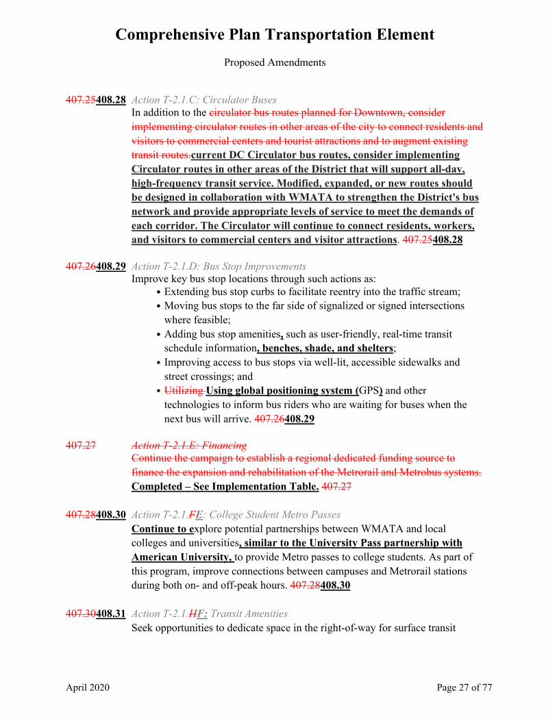
407.25408.28 Action T-2.1.C: Circulator Buses
In addition to the circulator bus routes planned for Downtown, consider implementing circulator routes in other areas of the city to connect residents and visitors to commercial centers and tourist attractions and to augment existing transit routes.current DC Circulator bus routes, consider implementing Circulator routes in other areas of the District that will support all-day, high-frequency transit service. Modified, expanded, or new routes should be designed in collaboration with WMATA to strengthen the District's bus network and provide appropriate levels of service to meet the demands of each corridor. The Circulator will continue to connect residents, workers, and visitors to commercial centers and visitor attractions. 407.25408.28
407.26408.29 Action T-2.1.D: Bus Stop Improvements
Improve key bus stop locations through such actions as: • Extending bus stop curbs to facilitate reentry into the traffic stream; • Moving bus stops to the far side of signalized or signed intersections
where feasible; • Adding bus stop amenities, such as user-friendly, real-time transit
schedule information, benches, shade, and shelters; • Improving access to bus stops via well-lit, accessible sidewalks and
street crossings; and • Utilizing Using global positioning system (GPS) and other
technologies to inform bus riders who are waiting for buses when the next bus will arrive. 407.26408.29
407.27 Action T-2.1.E: Financing
Continue the campaign to establish a regional dedicated funding source to finance the expansion and rehabilitation of the Metrorail and Metrobus systems. Completed – See Implementation Table. 407.27
407.28408.30 Action T-2.1.FE: College Student Metro Passes
Continue to explore potential partnerships between WMATA and local colleges and universities, similar to the University Pass partnership with American University, to provide Metro passes to college students. As part of this program, improve connections between campuses and Metrorail stations during both on- and off-peak hours. 407.28408.30
407.30408.31 Action T-2.1.HF: Transit Amenities
Seek opportunities to dedicate space in the right-of-way for surface transit

Comprehensive Plan Transportation Element
Proposed Amendments
April 2020 Page 28 of 77
amenities, such as bus stops, signage, and shelters, passenger information, and off-board fare collection. Follow best practices in bus-stop siting (most often on the far side of an intersection), yet evaluate each case on an individual basisseparately. Consider opportunities for enhanced stops and amenities with large-scale developments and redevelopments. 407.30408.31
407.31408.32 Action T-2.1.IG: Performance Measures
Develop, apply, and report on transit performance measures to identify strengths, deficiencies, and potential improvements and to support the development of new and innovative facilities and programs. 407.31408.32
4089 T-2.2 Making Multi-Mmodal Connections 4089 408.1409.1 Multi-modal connections refer to the links between different modes of travel,
such as Metrorail, buses, bicycles, and private cars. These connections can be improved by expanding Metrorail stations to allow for more effective bus and streetcar transfers., particularly as streetcars, RapidBus, and Bus Rapid Transit services become more common. Similarly, better pedestrian amenities, increased bicycle parking, more Capital Bikeshare stations, and more visible parking for carshare vehicles at Metrorail stations can enhance connections. 408.1409.1
408.2409.2 Intercity and commuter rail and bus connections are also critical to creating an
efficient multimodal transportation system. Amtrak regularly runs trains into and out offrom Union Station, providing service along the northeastern rail corridorNortheast Corridor, as well as to and from points west and south. The District ranks secondthird in Amtrak station passenger volume, after Philadelphia andNew York City. The District is currently served by two commuter rail systems—Maryland Area Regional Commuter Rail (MARC), which provides service from Maryland, and the Virginia Rail Expressway (VRE), which provides service from Virginia. These systems provide up to 30,000 trips up to 37 million trips annually into and fromout of Union Station on a typical weekday on 96 trains per day. MARC also provides daily service to Baltimore/Washington International Thurgood Marshall Airport (BWI), including on weekends. Commuter ridership has increased substantially during recent years, and continued growth of both systems is expected. Union Station is also served by intercity bus providers, including Greyhound, Bolt Bus, and Megabus. 408.2409.2
Comprehensive Plan Transportation Element
Proposed Amendments
April 2020 Page 29 of 77
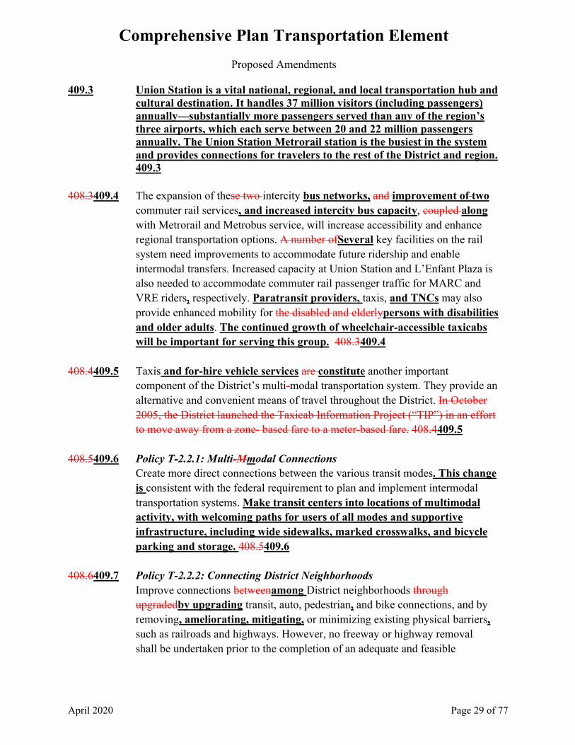
409.3 Union Station is a vital national, regional, and local transportation hub and cultural destination. It handles 37 million visitors (including passengers) annually—substantially more passengers served than any of the region’s three airports, which each serve between 20 and 22 million passengers annually. The Union Station Metrorail station is the busiest in the system and provides connections for travelers to the rest of the District and region. 409.3
408.3409.4 The expansion of these two intercity bus networks, and improvement of two
commuter rail services, and increased intercity bus capacity, coupled along with Metrorail and Metrobus service, will increase accessibility and enhance regional transportation options. A number ofSeveral key facilities on the rail system need improvements to accommodate future ridership and enable intermodal transfers. Increased capacity at Union Station and L’Enfant Plaza is also needed to accommodate commuter rail passenger traffic for MARC and VRE riders, respectively. Paratransit providers, taxis, and TNCs may also provide enhanced mobility for the disabled and elderlypersons with disabilities and older adults. The continued growth of wheelchair-accessible taxicabs will be important for serving this group. 408.3409.4
408.4409.5 Taxis and for-hire vehicle services are constitute another important
component of the District’s multi-modal transportation system. They provide an alternative and convenient means of travel throughout the District. In October 2005, the District launched the Taxicab Information Project (“TIP”) in an effort to move away from a zone- based fare to a meter-based fare. 408.4409.5
408.5409.6 Policy T-2.2.1: Multi-Mmodal Connections
Create more direct connections between the various transit modes. This change is consistent with the federal requirement to plan and implement intermodal transportation systems. Make transit centers into locations of multimodal activity, with welcoming paths for users of all modes and supportive infrastructure, including wide sidewalks, marked crosswalks, and bicycle parking and storage. 408.5409.6
408.6409.7 Policy T-2.2.2: Connecting District Neighborhoods
Improve connections betweenamong District neighborhoods through upgradedby upgrading transit, auto, pedestrian, and bike connections, and by removing, ameliorating, mitigating, or minimizing existing physical barriers, such as railroads and highways. However, no freeway or highway removal shall be undertaken prior to the completion of an adequate and feasible

Comprehensive Plan Transportation Element
Proposed Amendments
April 2020 Page 30 of 77
alternative traffic plan and that plan’s approval has been approved by the District government. 408.6409.7
408.7409.8 Policy T-2.2.3: Airport Connections
Work with other local governments in the Washington metropolitan region to maintain intermodal transportation services that ensure provide more efficient and convenient connections between the District and the Reagan Washington National (DCA), Baltimore/Washington Thurgood Marshall International (BWI), and Washington Dulles International (IAD) airports. 408.7409.8
409.9 Policy T-2.2.4: Union Station Expansion Ensure that expansion and modernization of Union Station supports its
role as a major, intermodal, transit-focused transportation center. Changes to Union Station should improve intermodal connections and amenities; facilitate connections with local transportation infrastructure with an emphasis on transit, pedestrian and bicycle mobility; enhance integration with adjacent neighborhoods; minimize private and for-hire vehicle trips; reduce on-site parking; and provide a continued high quality of life for District residents and visitors. 409.9
408.8409.10 Policy T-2.2.45: Commuter and Intercity Rail
Support the expansion of commuter and intercity rail by investing in existing infrastructure and facilities, supporting emerging transportation technologies that Intercity rail could include magnetic levitation (MAGLEV) encourage faster travel on the Northeast Corridor and high-speed trains that could provide access to New York in 90 minutes and to Boston in three hoursenhancing the rail south of the District. 408.8409.10
408.9409.11 Policy T-2.256: Taxi and For-Hire Vehicle Enhancements
Promote and incentivize upgrades to the city’s District’s taxi fleet, including conversion to hybrid or electric vehicles (EVs), installation of time and distance meters, improvements in tracking and dispatching, and implementation of handicap-accessible vehicles. Particular attention should be given to improving taxi and for-hire vehicle service to neighborhoods east of the Anacostia Riverunderserved communities. Incorporate TNCs into the District’s mobility planning, with an emphasis on shared vehicles. 408.9409.11
409.12 Policy T-2.2.7: TNCs
Monitor the impacts of TNCs on the District’s transportation network, encourage companies to reach underserved areas of Washington, DC and incentivize shared rides. TNCs should complement existing mobility

Comprehensive Plan Transportation Element
Proposed Amendments
April 2020 Page 31 of 77
services, including public transit, bikeshare, and car-sharing services. 409.12
408.10409.13 Action T-2.2.A: Intermodal Centers
Plan, fund, and implement the development of intermodal activity centers both at the periphery of the city and closer to Downtown. These intermodal centers should provide a so-called “park-once service” service where travelers, including tour buses, can park their vehicles in one location and then travel efficiently and safely around the District by other modes of travel. The activity intermodal centers surrounding the District’s Downtown should be located at Union Station, the Kennedy Center, and Banneker Overlook, and other locations that support parking for motor vehicles, including tour buses Support the role of Washington Union Station as an intermodal hub with regional importance. Identify other locations with the potential to serve as intermodal hubs within the District. 408.10409.13
408.11409.14 Action T-2.2.B: Pedestrian Connections
Work in concert with WMATA to undertake pedestrian capacity and connection improvements at selectedtransit stations and stops and at major transfer facilities to enhance efficiency, operations, and pedestrian safety, comfort, and flow, efficiency, and operations. 408.11409.14
408.12409.15 Action T-2.2.C: Bicycle and Car-Ppool Parking
Increase investment in bicycle parking and provide more visible parking for car-sharing operations at Metrorail stations, key transit stops, and future streetcar stations. 408.12409.15
408.13409.16 Action T-2.2.D: Commuter Rail and Bus Connections
Increase capacity and connectivity at Union Station and at the L’Enfant Plaza VRE station to accommodate additional commuter rail passenger traffic and direct through-train connections between Maryland and Virginia. Support the projects and initiatives identified in the State Rail Plan developed by DDOT, which calls for increased investment in the District’s rail network. This will include investments at both Union Station and L'Enfant Plaza station to increase capacity for passengers and trains and improve circulation. This investment will accommodate growth for intercity rail and commuter rail traffic and could accommodate future through-running rail service by MARC or VRE. Exploration of an additional infill rail station could further leverage the District’s rail system. In addition, support continued investment in commuter bus service and in Metrorail feeder bus service throughout the region. 408.13409.16
Comprehensive Plan Transportation Element
Proposed Amendments
April 2020 Page 32 of 77
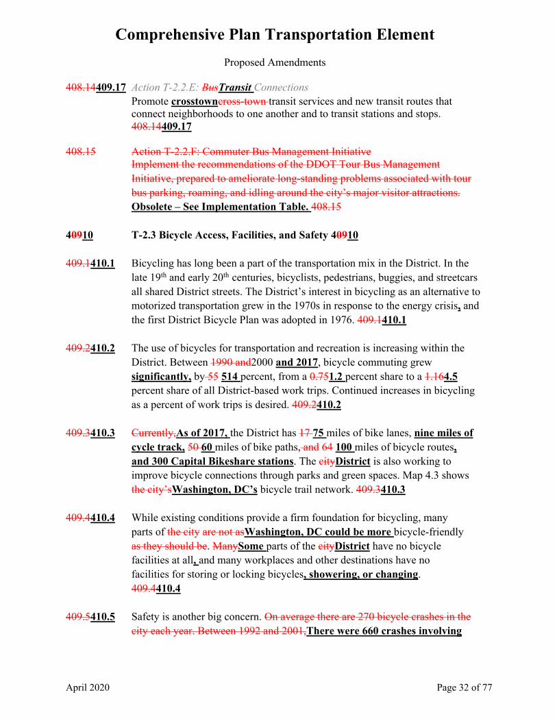
408.14409.17 Action T-2.2.E: BusTransit Connections Promote crosstowncross-town transit services and new transit routes that connect neighborhoods to one another and to transit stations and stops. 408.14409.17
408.15 Action T-2.2.F: Commuter Bus Management Initiative
Implement the recommendations of the DDOT Tour Bus Management Initiative, prepared to ameliorate long-standing problems associated with tour bus parking, roaming, and idling around the city’s major visitor attractions. Obsolete – See Implementation Table. 408.15
40910 T-2.3 Bicycle Access, Facilities, and Safety 40910 409.1410.1 Bicycling has long been a part of the transportation mix in the District. In the
late 19th and early 20th centuries, bicyclists, pedestrians, buggies, and streetcars all shared District streets. The District’s interest in bicycling as an alternative to motorized transportation grew in the 1970s in response to the energy crisis, and the first District Bicycle Plan was adopted in 1976. 409.1410.1
409.2410.2 The use of bicycles for transportation and recreation is increasing within the
District. Between 1990 and2000 and 2017, bicycle commuting grew significantly, by 55 514 percent, from a 0.751.2 percent share to a 1.164.5 percent share of all District-based work trips. Continued increases in bicycling as a percent of work trips is desired. 409.2410.2
409.3410.3 Currently,As of 2017, the District has 17 75 miles of bike lanes, nine miles of
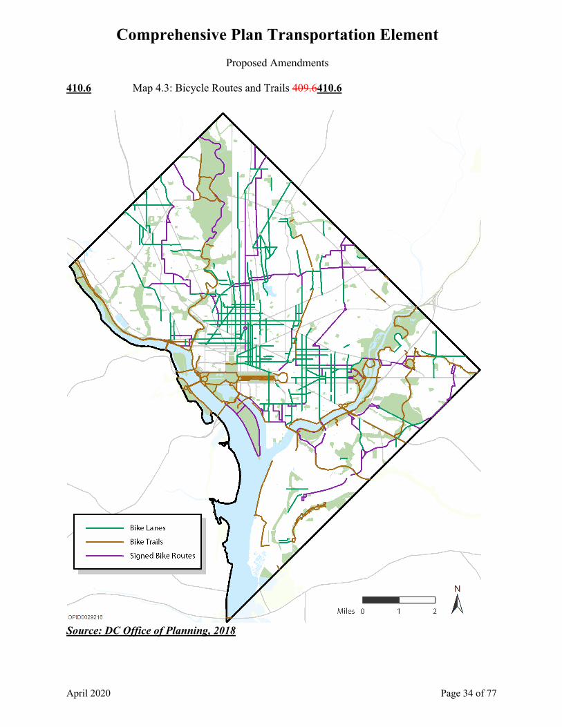
cycle track, 50 60 miles of bike paths, and 64 100 miles of bicycle routes, and 300 Capital Bikeshare stations. The cityDistrict is also working to improve bicycle connections through parks and green spaces. Map 4.3 shows the city’sWashington, DC’s bicycle trail network. 409.3410.3
409.4410.4 While existing conditions provide a firm foundation for bicycling, many
parts of the city are not asWashington, DC could be more bicycle-friendly as they should be. ManySome parts of the cityDistrict have no bicycle facilities at all, and many workplaces and other destinations have no facilities for storing or locking bicycles, showering, or changing. 409.4410.4
409.5410.5 Safety is another big concern. On average there are 270 bicycle crashes in the
city each year. Between 1992 and 2001,There were 660 crashes involving

Comprehensive Plan Transportation Element
Proposed Amendments
April 2020 Page 33 of 77
bicycles in 2016. Close to one-third of all fatalities from motor vehicle crashes in the District were pedestrians or bicyclists, as compared to about 20 percent nationally and 27 percent for other large urban areas. 409.5410.5
Comprehensive Plan Transportation Element
Proposed Amendments
April 2020 Page 34 of 77
410.6 Map 4.3: Bicycle Routes and Trails 409.6410.6
Source: DC Office of Planning, 2018
Comprehensive Plan Transportation Element
Proposed Amendments
April 2020 Page 35 of 77
409.7410.7 In 2003 2014, the District Department of TransportationDDOT estimated the Bbicycle Level of Services (Bicycle LOS) along 400on all 1,171 miles of major collector and arterial streets in the District streets. The Department of TransportationDDOT evaluated roadway lane and shoulder width, speed limit, pavement condition, and on-street parking data. The analysis found that about70 46 percent of the study network received below-average Bbicycle LOS grades, a 23 percent improvement from 2003, when 70 percent of the network was below average. The recently completed Bicycle Master Plan Bicycle Element of moveDC includes many recommendations to improve bicycle facilities and infrastructure and should be consulted for more detail. When all requirements of the Bicycle Element of moveDC are fully implemented in 2040, the percentage of below-average streets will drop to 32 percent. 409.7410.7
Please refer to the Parks, Recreation, and Open Space Element for additional policies and actions related to bicycle and pedestrian trails.
410.8 DDOT has established a Capital Bikeshare station expansion policy that
balances stations by location type. The DDOT development plan breaks the District down into three market areas: High Ridership, High Revenue, and Accessibility. Stations located in each of these three areas are expected to have different ridership characteristics and revenue-generating potential. The expansion policy will help the District diversify the program’s ridership base and use Capital Bikeshare to connect residents to new opportunities. 410.8
409.8410.9 Policy T-2.3.1: Better Integration of Bicycle and Pedestrian Planning
Integrate bicycle and pedestrian planning and safety considerations more fully into the planning and design of District roads, transit facilities, public buildings, and parks such that residents of each of the District’s wards have access to high-quality bicycling and pedestrian facilities. 409.8410.9
409.9410.10 Policy T-2.3.2: Bicycle Network
Provide and maintain a safe, direct, and comprehensive bicycle network connecting neighborhoods, employment locations, public facilities, transit stations, parks, and other key destinations. Eliminate system gaps to provide continuous bicycle facilities. Increase dedicated bike-use infrastructure, such as bike-sharing programs like Capital Bikeshare, and identify bike boulevards or bike-only rights of waythe amount of protected bike lanes, wayfinding signage, and Capital Bikeshare stations. 409.9410.10

Comprehensive Plan Transportation Element
Proposed Amendments
April 2020 Page 36 of 77
409.10410.11 Policy T-2.3.3: Bicycle Safety
Increase bicycle safety through continued expansion of protected bike lanes (cycle tracks) and other separated facilities, traffic-calming measures, provision of public bicycle parking, enforcement of regulations requiring private bicycle parking, and improving improved bicycle access where barriers to bicycle travel now exist. 409.10410.11
410.12 Policy T-2.3.4: Capital Bikeshare Expansion
Continue the expansion of Capital Bikeshare stations throughout the District to develop a complete bicycle-sharing network and encourage bicycling. Expansion of the system should balance service provisions, system costs, public input, and revenue-generation concerns. The cost of a Capital Bikeshare membership or the technology used to become a member should not be a barrier to using the system. 410.12
410.13 Policy T-2.3.5: Capital Bikeshare Access Continue to increase utility of the system for users by locating stations so that 65 percent of residents and 90 percent of employees are within a quarter mile of a Capital Bikeshare station. Expand user access to destinations, including jobs and services; promote retail and entertainment access; and expand access to residential neighborhoods to encourage annual ridership increases. 410.13
410.14 Policy T-2.3.6: Dockless Programs
Dockless bike-share, scooter and other mobility systems should supplement and be compatible with the multimodal and accessibility priorities of the District through the permitting of private vendor-provided services. These systems should complement existing mobility services in the District, including Capital Bikeshare, Metrorail, Metrobus, and the DC Circulator. 410.14
409.14410.15 Action T-2.3.DA: Bicycle Sharing Capital Bikeshare Community Partners
Support the expansion of bicycle sharing kiosks throughout the District to develop a complete bicycle-sharing network and encourage bicyclingContinue investment in the Community Partners Program to reach unemployed persons, underemployed persons, and persons experiencing homelessness with subsidized Capital Bikeshare memberships to increase access to transportation. 409.14410.15
Comprehensive Plan Transportation Element
Proposed Amendments
April 2020 Page 37 of 77
409.11410.16 Action T-2.3.AB: Bicycle Facilities Wherever feasible, require large, new commercial and residential buildings to be designed with features such as secure bicycle parking and lockers, bike racks, shower facilities, and other amenities that accommodate bicycle users. Residential buildings with eight or more units should comply with regulations that require secure bicycle parking spaces. 409.116
409.12410.17 Action T-2.3.BC: Bicycle Master PlamoveDC Bicycle Element
Implement the recommendations of the Bicycle Master Plan Vision Zero DC Action Plan and the Bicycle Element of moveDC to: • Build more and better bicycle facilities; • Enact more bicycle-friendly policies; and • Provide more bicycle-related education, promotion, and enforcement. • Improve and expand the bike route system and provide functional and
distinctive signs for the system; • Provide additional bike facilities on roadways; • Complete ongoing trail development and improvement projects to close
gaps in the system; • Improve bridge access for bicyclists; • Provide bicycle parking in public space and encourage bicycle parking in
private space; • Update the District laws, regulations and policy documents to address
bicycle accommodation; • Review District projects to accommodate bicycles; • Educate motorists and bicyclists about safe operating behavior; • Enforce traffic laws related to bicycling; • Establish a Youth Bicycle and Pedestrian Safety Education Program; • Distribute the District Bicycle Map to a wide audience; and • Set standards for safe bicycle operation, especially where bikes and
pedestrians share the same space 409.12410.17 409.13410.18 Action T-2.3.CD: Performance Measures
Develop, apply, and report on walking and bicycle transportation performance measures to identify strengths, deficiencies, and potential improvements and to support the development of new and innovative facilities and programs. 409.13410.18
410.19 Action T-2.3.E: Dockless Sharing Programs
Monitor dockless programs closely so that public benefits outweigh any negative impacts to the public right-of-way, equity of service, or the ability of

Comprehensive Plan Transportation Element
Proposed Amendments
April 2020 Page 38 of 77
the Capital Bikeshare system to provide cost-effective and equitable service. Work with providers to promote equitable access to the increased mobility options these dockless programs provide. 410.19
41011 T-2.4 Pedestrian Access, Facilities, and Safety 41011 410.1411.1 The District’s population density, interconnected grid of streets, wide sidewalks,
and renowned park system have long contributed to a favorable environment for walking. In 2000 nearly 31,000 District residents (12 percent of the city’s labor force) walked to work. In 2017 approximately 47,624 District residents (12.7 percent of Washington, DC’s labor force) walked to work. DDOT works to develop and maintain a cohesive, sustainable transportation system that is safe, affordable, and convenient, while preserving and enhancing the natural, environmental, and cultural resources of the District. Whenever DDOT substantially paves, repaves, resurfaces, or engages in construction of a roadway, bridge, or tunnel, it will bring that facility into compliance with the most current accessible guidelines. 410.1411.1
410.2411.2 The District has more than 1,6001,800 miles of sidewalks. However, there are
still approximately 100 miles of District streets without sidewalks and a backlog of sidewalks needing repair. When a street is fully reconstructed or when a curb and gutter are installed or rebuilt, DDOT is required to install a sidewalk on at least one side of the street if none are present. Pedestrian safety is also a big challenge. There are roughly 550 collisions between cars and pedestrians in the city each year. 410.2411.2
410.3411.3 Improvements to pedestrian facilities can enhance the quality of the walking and
public transit environments, and foster greater use of both modes. Improvements should focus on reductions in the number and severity of pedestrian-vehicle conflict points, clarified pedestrian routing, widened sidewalks, and improved aesthetic features, such as landscaping. 410.3411.3
410.4411.4 Encouraging walking will bring many benefits to the District. It will provide convenient and affordable transportation options, reduce vehicular-travel and related pollution, and improve the health and fitness of District residents. 410.4411.4
410.5411.5 Policy T-2.4.1: Pedestrian Network
Develop, maintain, and improve pedestrian facilities. Improve the city’sDistrict’s sidewalk system to form a safe and accessible network that

Comprehensive Plan Transportation Element
Proposed Amendments
April 2020 Page 39 of 77
links residents across the city Washington, DC. 410.5411.5 410.6411.6 Policy T-2.4.2: Pedestrian Safety
Improve safety and security at key pedestrian nodes throughout the cityDistrict. Use a variety of techniques to improve pedestrian safety, including textured or clearly marked and raised pedestrian crossings, pedestrian-actuated signal push buttons, high-intensity activated crosswalk pedestrian signals, rectangular rapid flashing beacons, accessible pedestrian signal hardware, leading pedestrian interval timing, and pedestrian countdown signals. 410.6411.6
See also Action T-1.1.A on developing multimodal transportation measures of effectiveness, and the Educational Facilities Element for recommendations on the Safe Routes to School program.
410.7411.7 Policy T-2.4.3: Traffic Calming
Continue to address traffic-related safety issues through carefully considered traffic-calming traffic calming measures. 410.7411.7
410.8411.8 Policy T-2.4.4: Sidewalk Obstructions
Locate sidewalk cafes and other intrusions into the sidewalk so that they do not present impediments to safe and efficient pedestrian passage. Maintain sidewalk surfaces and elevations so that disabledpersons with disabilities or elderlyolder adult pedestrians can safely use them. 410.8411.8
410.9411.9 Action T-2.4.A: Pedestrian Signal Timings
Review timing on pedestrian signals to ensure that adequate time is provided for crossing, in particular for locations with a large elderly older adult population. 410.9411.9
410.10411.10 Action T-2.4.B: Sidewalks
Install sidewalks on streets throughout the District to improve pedestrian safety, access, and connectivity. Continue to monitor the sidewalk network for needed improvements. Consult with Advisory Neighborhood Commissions (ANCs) and community organizations as plans for sidewalk construction are developed. Coordinate with the National Park Service (NPS) to complete local sidewalk networks that overlap with NPS land. All sidewalks shall be constructed in conformance with the Americans with Disabilities Act (ADA) Accessibility Guidelines. 410.10411.10
Comprehensive Plan Transportation Element
Proposed Amendments
April 2020 Page 40 of 77
410.11411.11 Action T-2.4.C: Innovative Technologies for Pedestrian Movement Explore the use of innovative technology to improve pedestrian movement and safety for all users, such as personal transportation systems and enhanced sidewalk materials. 410.11411.11
410.12411.12 Action T-2.4.D: Pedestrian Access on Bridges and Underpasses
Ensure that tThe redesign and/or reconstruction of bridges, particularly those crossing the Anacostia River, should includes improved provisions for pedestrians, including wider sidewalks, adequate separation between vehicle traffic and sidewalks, guardrailsguard rails, pedestrian-scaled lighting, and easy grade transitions. Maintain sidewalk segments under and over rail tracks and provide adequate lighting in these locations. 410.12411.12
410.13411.13 Action T-2.4.E: Pedestrian Master Plan
Implement the recommendations of the Pedestrian Master Plan, the Vision Zero Action Plan, and moveDC Pedestrian Element to improve accessibility, connectivity, and safety for pedestrians throughout the District. 410.13411.13
411.14 Action T-2.4.F: Pedestrian and Bike Events
Support events in public spaces and streets that encourage bicycling and walking. 411.14
41112 T-2.5 Roadway System and Auto Movement 41112 411.1412.1 The District’s roadway system consists of 1,153 1,171 miles of roadway,
229241 vehicular and pedestrian bridges, and approximately 7,7007,774 intersections. Approximately 1722 percent of these intersections are signalized, with about one in three signalized intersections located within the downtown area. 411.1412.1
411.2412.2 The roadways in the District are categorized by function, ranging from
interstates and other freeways, which provide the highest degree of travel mobilitycarry the largest volumes of motor vehicle traffic, to local streets, which provide the highest level of access to land uses. Map 4.4 shows the existing roadway system based on a Ffunctional Cclassification Ssystem described in Table 4.4Figure 4.3. 411.2412.2

Comprehensive Plan Transportation Element
Proposed Amendments
April 2020 Page 41 of 77
412.3 Map 4.4: Roadway System by Functional Classification 412.3
Source: DC Office of Planning, 2018

Comprehensive Plan Transportation Element
Proposed Amendments
April 2020 Page 42 of 77
411.4412.4 Increases in funding for street maintenance since the mid-1990s have has allowed the District to continually improve the condition of its roadway pavement. The District continually monitors and rates the condition of its roadways and bridges. 411.4412.4
411.5412.5 Table 4.4 Figure 4.3: Existing Roadway System Functional Classification 412.5 Road Type Description Freeways and Expressways These roadways, which comprise 54 miles or approximately five
percent of the total roadway miles in the District, are controlled access facilities. Access is via interchange ramps and these roadways typically do not provide direct access to adjacent land uses
Principal Arterials These roadways, comprising 92 miles or approximately eight percent of the District’s roadway system, typically serve major activity centers and serve longer trip lengths than roadways types listed below. The freeways and principal arterials the overall roadway system. Freeways and principal arterials typically carry between 40 and 60 percent of the city’s total traffic volumes.
Minor Arterials Minor arterials account for 173 miles, approximately 15 percent of the total roadway system. These roadways serve short to medium length trips, with a greater emphasis on mobility than direct access. In a typical network, minor arterials make up 15 to 25 percent of the mileage and carry 15 to 40 percent of total traffic.
Collectors The role of collectors is to move traffic from local streets to the arterials. Collectors will often intersect with arterials at signalized intersections. Local roads will intersect collectors at stop signs. Collectors make up 152 miles, or 13 percent, of the District’s roadway system.
Local Roads These roads typically make up the majority of the transportation network as measured by road miles. They carry between 10 and 30 percent of all traffic. The primary role of local roads is to provide access to adjacent land uses, with ideally a very limited role in terms of traffic mobility. Approximately 60 percent, or 682 miles, of the District’s roadway system is classified local.
411.6412.6 Traffic congestion on the District’s roadway network occurs primarily on the
radial principal arterial roadways. Map 4.5 illustrates motor vehicle traffic volumes on major streets and highways. The flow of motor vehicle traffic is greatly influenced by north-south movements along the I-95 corridor feeding into I-295 and I-395. These highways carry the heaviest daily motor vehicle traffic volumes in the District, with an average of approximately 193,000168,000 daily trips on I-395 and 80,000108,000 on I-295 in 2017. In
Comprehensive Plan Transportation Element
Proposed Amendments
April 2020 Page 43 of 77
addition, the limited number of crossings over the Potomac and Anacostia Riversrivers generates higher volumes of motor vehicle traffic at these gateways than their counterparts in the northern portion of the District. 411.6412.6
411.7412.7 Examples of heavy volumes in 2017 from the south include 93,00038,000 daily
motor vehicle trips across the Anacostia River on the Pennsylvania Avenue Bridge, 64,00052,000 motor vehicle trips across the Potomac on the Francis Scott Key Bridge, and 100,00094,000 motor vehicle trips across the Theodore Roosevelt Bridge, and 241,000 motor vehicle trips across the 14th Street Bridge and I-395 bridge complex, also over the Potomac. These volumes can be contrasted with volumes coming into the the city District from the north and northeast, which include 41,00029,000 daily motor vehicle trips on Connecticut Avenue, 21,000 motor vehicle trips on Massachusetts Avenue, 18,00024,000 daily motor vehicle trips on Georgia Avenue, 33,000 daily motor vehicle trips on 16th Street NW, 37,00048,000 daily motor vehicle trips on North Capitol Street, and more than 100,000132,000 daily motor vehicle trips on New York Avenue. 411.7412.7
411.18 412.7a Text Box: The Concept of Induced Demand 411.18
Research shows that urban traffic congestion tends to maintain a self-limiting equilibrium: vehicle traffic volumes increase to fill available capacity until congestion limits further growth. Any time a consumer makes a travel decision based on congestion (“Should I run that errand now? No, I’ll wait until later when traffic will be lighter.”), they contribute to this self-limiting equilibrium. Travel that would not occur if roads are congested, but willthat would occur if roads become less congested is called induced travel demand. Increasing road capacity, or reducing vehicle use by a small group, creates additional road space that is filled with induced demand. 412.7a
412.8 Map 4.5: Existing District Traffic Volumes, 2003 2017 411.8412.8

Comprehensive Plan Transportation Element
Proposed Amendments
April 2020 Page 44 of 77
Source: DC Office of Planning, 2019

Comprehensive Plan Transportation Element
Proposed Amendments
April 2020 Page 45 of 77
411.9412.9 As theDistrictWashington, DC is a densely developed cityDistrict with an historic built environment, the cityDistrict does not foresee making significant investments in road widening to accommodate more autosmotor vehicles. Instead, the District will continue to manage existing roadway resources and provide for viable transportation choices throughout the cityWashington, DC. Some of the roadway and bridge investments the city is planning to make within the next five to eight years include:
A. Rehabilitating the existing Frederick Douglass Memorial Bridge through structural steel repairs, lighting improvements, and preventive maintenance;
B. Creating a traffic circle at the intersection of Potomac Avenue and C. Extending Potomac Avenue to 2nd Street SE on the east and to Fort
McNair on the west; D. Reconfiguring the underpass arrangement at the intersection of M and
South Capitol Streets; E. Redesigning South Capitol Street for a continuous, at-grade 130-foot
street section as originally specified in the L’Enfant Plan, with a narrow median;
F. Constructing an island to channelize traffic onto and off of Fairlawn Avenue at Pennsylvania Avenue;
G. Placing a directional ramp on the northwestern quadrant of the Pennsylvania Avenue, SE/Anacostia Freeway (I-295) interchange; and
H. Placing a single point diamond interchange at Pennsylvania Avenue, SE/Anacostia Freeway (I-295). 411.9412.9
411.10412.10 As part of the Comprehensive Plan revisionmoveDC, an analysis of the
transportation impacts of anticipated 20-year land use and transportation changes was conducted. The analysis projected that if the recommendations in moveDC are implemented, there will be a 20 to 2539 percent increase in the total number of transit trips by 2025 2040, and about an 11a 16 percent increase in the total number of motor vehicle trips, and a 52 percent increase in non-motorized trips (walk and bike). Much of the increase is associated with off-peak travel and a “spreading” of the commute period over additional hours of the day.Motor vehicle congestion will increase on several corridors. The analysis concluded that new transportation demand managementTDM measures, bike and pedestrian improvements, and transit improvements will be needed, both in the city and in the region, to keep the system functioning adequately. 411.10412.10
411.11412.11 Policy T-2.5.1: Creating Multi-Mmodal Corridors

Comprehensive Plan Transportation Element
Proposed Amendments
April 2020 Page 46 of 77
Transform key District arterials into multi-modal corridors that incorporate and balance a variety of mode choices, including bus, or streetcar, bicycle, pedestrian, and automobiles. 411.11412.11
411.12412.12 Policy T-2.5.2: Managing Roadway Capacity
Manage the capacity of principal arterials within existing limits rather than increasing roadway capacity to meet induced demand for travel by car (sSee text box entitled The Concept of Induced Demandon page 32). Prioritize improvements based on their multimodal person-carrying capacity. Increase auto capacity on roadways only if needed to improve the safety of all travelers, improve connectivity of the multi- modal transportation network, or improve targeted connections to regional roadways. 411.12412.12
411.13412.13 Policy T-2.5.3: Road and Bridge Maintenance
Maintain the road and bridge system to keep it operating safely and efficiently and to maximize its useful life. 411.13412.13
411.14412.14 Policy T-2.5.4: Traffic Management
Establish traffic management strategies that prioritize the safety of pedestrians over vehicular traffic; separate local traffic from commuter or through-traffic; and reduce the intrusion of trucks, commuter traffic, and “cut-through” traffic on residential streets. Prioritize public transit solutions, including bus lanes and signal priority, to reduce commuter traffic. 411.14412.14
412.15 Policy T-2.5.5: Natural Landscaping
Work with other District and federal agencies to identify, plant, and manage wildflower meadow areas along highways, traffic circles, bike paths, and sidewalks. 412.15
411.15412.16 Action T-2.5.A: Maintenance Funds
Provide sufficient funding sources to maintain and repair the District’s system of sidewalks, streets, and alleys, including its street lights and traffic control systems, bridges, street trees, and other streetscape improvements. 411.15412.16
411.16412.17 Action T-2.5.B: Signal Timing Adjustments
Regularly evaluate the need for adjustments to traffic signal timing to minimize unnecessary automobile idling prioritize pedestrians, surface transit, and bicyclists. 411.16412.17
411.17412.18 Action T-2.5.C: Update the Functional Classification System
Continue to update the Functional Classification System on a two-year cycle. The Functional Classification System is a tool developed by the Federal Highway Administration (FHWA) and used by DDOT to help

Comprehensive Plan Transportation Element
Proposed Amendments
April 2020 Page 47 of 77
describe and generally assign the vehicular transportation purpose of a street within the street network. Update the functional classification of the city’s roadways to reflect a multi- modal approach that better integrates pedestrians, bicyclists, and transit vehicles. Ensure that the updated system complies with federal laws and that changes will not reduce available funding. 411.17412.18
412413 T-2.6 Addressing Special Needs Accessibility for All Residents 412413 412.1413.1 Multi-modal transportation options are critical for special needs populations
who cannot drive or do not have access to a car. Special needs transportation can be a lifeline for a senior citizen who needs to go to aAccess to transportation is essential for residents across the income spectrum, older adults who may need transportation to a medical appointment, for a and persons with a disability who needs to go to work, or a low-income workers who needs to get his or her children to child care or go grocery shopping. Without alternatives to cars, a significant portion of the population may be unable to lead independent lives. 412.1413.1
412.2413.2 Policy T-2.6.1: Special Needs Transportation Access
Address the transportation needs of all District residents, including those with special physical requirements and trip needs, such as access to medical centers or seniorwellness centers. 412.2413.2
412.3413.3 Policy T-2.6.2: Transit Needs
Establish, expand, or continue assistance for transit-dependent groups in the District, including the elderly older adults, students, school-age children, and persons whose situations require special services, including the homelessthose experiencing homelessness. 412.3413.3
412.4413.4 Action T-2.6.A: Public Improvements
Invest in public improvements, such as curb inclines, aimed at increasing pedestrian mobility, particularly for the elderly older adults and peoplepersons with disabilities. 412.4413.4
412.5413.5 Action T-2.6.B: Shuttle Services
Through public services, private services, or public-private partnerships, Ssupplement basic public transit services with shuttle and minibuses to provide service for transit-dependent groups, including the elderlyolder adults, people with disabilities, school-age children, and residents in areas that cannot viably be served by conventional buses. 412.5413.5
413.6 Action T-2.6.C: Transportation Access and Service

Comprehensive Plan Transportation Element
Proposed Amendments
April 2020 Page 48 of 77
Conduct an analysis of the impacts transportation access and service has on underserved and low-income communities. 413.6
413414 T-3 Transportation System Efficiency and Management 413414 413.1414.1 With the costs of providing new transportation facilities on the rise, the District
must constantly look for ways to reduce travel demand and as well as to more effectively use its existing and future transportation systems. This section of the eElement addresses Transportation Demand Management (TDM), curbside management and parking, truck and tour busmotor coach movement, and travel information. 413.1414.1
414415 T-3.1 Transportation Demand Management 414415 414.1415.1 Transportation Demand Management (TDM) refers to a series of transportation
strategies that are designed to maximize the people-moving capability of the transportation system by increasing the number of persons in a vehicle, increasing transit ridership, or influencing the time of (or need to) travel. To accomplish such changes, TDM programs rely on incentives or disincentives to make shifts in travel behavior more attractive. The TDM Strategic Plan , which includes strategies to increase the non-Single Occupant Vehicle (SOV) rate and to streamline TDM in the project review process. It Pprovides, supports, and promotes programs and strategies aimed at reducing the number of car trips and miles driven (for work and non-work purposes) to increase the efficiency of the transportation system. 414.1415.1
414.2415.2 The primary purpose of TDM is to reduce the number of motor vehicles using the road system while providing a variety of mobility options to those who wish to travel. Typical TDM programs include:
• Carpooling and vanpooling, employee shuttles, and improvements whichthat encourage bicycling and walking;
• Financial incentives, such as preferential parking for ride sharers, parking cash-outs, and transit subsidies;
• Congestion avoidance strategies, such as compressed work weeks, flexible work schedules, and telecommuting in circumstances where workplace productivity is not impaired; and
• Education and outreach regarding which transportation options are available, how to use transit, safety tips for bicycling, and how to join a carpool or vanpool. 414.2415.2
414.3415.3 TDM strategies are particularly useful during peak period travel times, when
demand is the greatest. The Washington, DC metropolitan region is a leader in developing and implementing such strategies. Some of the regional TDM

Comprehensive Plan Transportation Element
Proposed Amendments
April 2020 Page 49 of 77
strategies already in place include telework centers, vanpool programs, guaranteed ride home programs, and transit incentive programs. 414.3415.3
414.4415.4 In 2013, Tthe federal government employsed approximately 370,000437,000
people in the National Capital Region. As the region’s largest employer, the federal government has a strong interest in improving the quality of transportation services and infrastructure. It is in a unique position to provide leadership in TDM programs that can accommodate the travel needs of its workforce while simultaneously setting the standard for the region as a whole. Through Its mandatory regional transit subsidy program is an effective form of TDM: the federal government provided more than $72 million in transit subsidies for federal employees in 2001 in 2012, 42 percent of peak period Metrorail riders were federal employees. 414.4415.4
414.5415.5 The District supports all these initiatives and also has a numbermany of its own
TDM measures in place. For instance, it is helping to educate the public about car-sharing—a service that allows members to rent cars at an hourly rate, rather than the traditional daily rate charged by rental companies. Car-sharing vehicles are scattered throughout the city for quick and easy access. In this manner, car-sharing allows people who do not own a vehicle to rent one on an occasional basis. This reduces the need to own and drive vehicles within the District.various shared mobility options in the District, including point-to-point and traditional carsharing services. The District’s ultimate goal is to reduce reliance on single-occupancy vehicles and reduce vehicle miles traveled (VMT). To incentivize the use of shared cars and encourage the private sector to expand car-sharing programs, the District has designated strategic curbside parking spaces for these vehicles, accompanied with by educational brochures to help explain this service to the public. The District is also implementing TDM initiatives through a pilot program that focuses on the District government, public schools, and major employers throughout the city. 414.5415.5
414.6415.6 Roadway pricing is another strategy to manage transportation demand. Research
indicates that 75 to 80 percent or more of the costs of driving are “external” costs, such as noise and air pollution. Over the long term, recovering these costs will serve to level the playing field for all modes of travel. The region’s motorists and residents currently pay the full cost of transportation through a variety of indirect means, including their time and health. Distributing these costs among transportation users and m Making these costs more apparent to motorists will ultimately help to shift travel both in the District and throughout the region to modes that are most efficient in terms of lowest overall costs. The District is investigating how to implement roadway pricing, particularly strategies targeting those drivers who “cut through” the District with neither a starting nor an ending point within District boundaries. 414.6415.6

Comprehensive Plan Transportation Element
Proposed Amendments
April 2020 Page 50 of 77
414.7415.7 Roadway Pricing Approaches 414.7 New technologies are making roadway pricing more feasible and economical. The range of roadway pricing approaches includes a congestion pricing cordon fees (used most notably in London and Singapore), which involves where motorists are being charged via electronically read debit cards for entering the central portion of the cityDistrict via electronically read debit cards. Other options include methods to measuringe miles traveled on particular roads (again using electronic means) and assessing per-mile charges based on such variables as wear-and-tear on the roadway system, air and noise pollution, and imposition of congestion, etcamong others. Pricing strategies can also vary depending on the time of day, the level of congestion, and other parameters. 415.7
415.8 moveDC has a tiered strategy for future implementation of managed lanes
and a congestion pricing cordon for downtown. It identifies key facilities where managed lanes are appropriate entering the District, including:
• I-66 on the Theodore Roosevelt Bridge; • I-295 between the District line and the 11th Street Bridge; • I-395 on the 14th Street Bridge; • I-395/I-695 between the 11th and 14th Street Bridges; • Canal Road between the Chain Bridge and the Whitehurst Freeway;
and • New York Avenue between I-395 and the District line. 415.8
415.9 The District Mobility Project leverages transportation data for multiple
modes (walking, bicycling, taking transit, and driving) to inform DDOT’s short- and long-term investment strategies. It builds on national advances in transportation system performance management to track District-wide trends in congestion and travel-time reliability, among other key system performance metrics. By highlighting areas with high congestion, low reliability, and poor accessibility, the District Mobility Project shows where DDOT will target near-term investments to improve multimodal mobility. 415.9
414.8415.10 Policy T-3.1.1: Transportation Demand Management (TDM)Programs
Provide, support, and promote programs and strategies aimed at reducing the number of car trips and miles driven (for work and non-work purposes), to increase the efficiency of the transportation system. 414.8415.10
414.9415.11 Policy T-3.1.2: Regional TDM Efforts
Continue to pursue TDM strategies at the regional level and work with regional and federal partners to promote a coordinated, integrated transportation system. These strategies include setting commuter benefits program participation rates for employers, developing corridor-level TDM plans to educate the
Comprehensive Plan Transportation Element
Proposed Amendments
April 2020 Page 51 of 77
public on DDOT and regional lanes initiatives (i.e., bus only, high-occupancy toll, high-occupancy vehicle, and road diets), and adopting emerging technologies to promote carpooling. 414.9415.11
414.10415.12 Policy T-3.1.3: Car-Ssharing
Encourage the expansion of car-sharing services as an alternative to private vehicle ownership by removing barriers to access private carsharing systems. 414.10415.12
415.13 Policy T-3.1.4: Special Event TDM
Encourage event organizers to provide transportation amenities for large events. These measures can include the TDM initiatives developed through the hospitality and tourism program to promote the use of transit options to hotels, lodging providers, District-wide events, and museums through advocacy and outreach in hopes of influencing event attendees. 415.13
414.11415.14 Action T-3.1.A: TDM Strategies
Develop strategies and requirements that reduce rush hour traffic by promoting flextime, carpooling, and transit use encouraging the formation of Transportation Management Associations; and undertaking other measures that reduce vehicular trips where consistent with maintaining workplace productivity, to reduce vehicular trips particularly during peak travel periods. Identify TDM measures and plans as appropriate vital conditions for large development approval. Transportation Management Plans should identify quantifiable reductions in motor vehicle trips and commit to measures to achieve those reductions. Encourage the federal and District governments to explore the creation of a staggered workday, for particular departments and agencieswhere appropriate, in an effort to reduce congestion, and implement TDM initiatives through a pilot program that focuses on the District government and public schools. Assist employers in the District with implementation of TDM programs at their worksites, to reduce drive-alone commute trips. Through outreach and education, inform developers and District residents of available transportation alternatives and the benefits these opportunities provide. 414.11415.14
414.12415.15 Action T-3.1.B: Roadway Pricing and Management
The recommendations in moveDC should be explored and implemented, where feasible, roadway pricing between now and the year 2030in three phases: • Phase 1: Continually Continuously monitor direct and external roadway
costs to gain a more accurate estimate of the true cost of driving for motorists;
• Phase 2: Develop a system to identify those who drive entirely through the

Comprehensive Plan Transportation Element
Proposed Amendments
April 2020 Page 52 of 77
District without stopping (i.e., those who are not living in, working in, or visiting the cityWashington, DC), as well as a mechanism to charge these motorists for the external costs that they are imposing on the District’s transportation system; and
• Phase 3: Continually Continuously monitor state-of-the-art roadway pricing techniques and technologies, and work with neighboring jurisdictions to implement roadway pricing programs that better transfer the full costs of driving to motorists. This could include higher costs for heavier and higher-emission vehicles. 414.12415.15
414.13415.16 Action T-3.1.C: Private Shuttle Services
Develop a database of private shuttle services and coordinate with shuttle operators to help reduce the number of single-occupant trips. Encourage shuttle operators to provide real-time transit data, and create a layer in goDCgo’s interactive map to show all shuttles. Motivate companies to implement a shuttle service. 414.13415.16
414.14415.17 Action T-3.1.D: Transit Ridership Programs
Support employers in implementing the DC Commuter Benefits Law. Continue to support employer-sponsored transit ridership programs, such as those under the federal Metrocheck tTransit Bbenefits Pprogram, which stipulates thatwhere, pursuant to federal legislation, public and private employers may subsidize employee travel by mass transit each month.. Continue to support employer-sponsored bicycle commuter benefit programs for public and private employers. 414.14415.17
415.18 Action T-4.1.E: Implement the TDM Strategic Plan
Provide, support, and promote programs and strategies aimed at reducing the number of car trips and miles driven (for work and non-work purposes), to increase the efficiency of the transportation system. Smart-city technologies promise to enhance and transform TDM as more data becomes available. TDM practitioners such as goDCgo should determine platforms for delivering practical travel and routing information to improve mobility. 415.18
415.19 Action T-4.1.F: Analytic Tools to Measure Performance
Plan and implement the development of advanced analytic tools to measure the performance of the transportation network in support of the District Mobility Project. 415.19
415416 T-3.2 Curbside Management and Parking 415416

Comprehensive Plan Transportation Element
Proposed Amendments
April 2020 Page 53 of 77
415.1416.1 Long- or short-term parking is part of almost every car trip, and parking—
especially when free—is a key factor in the mode choice for a trip. The availability and price of parking can influence people’s choices about how to travel to work, shop, and conduct personal business. The District’s challenge, like that of many other major cities, is to manage limited curbside space to accommodate ever increasing parking demand.
The public curbside, the space along the street between travel lanes and sidewalk, is limited real estate. Within this space, many essential activities of urban life occur: buses pull in and out, delivering thousands of passengers a day; residents and visitors come and go; and shoppers and diners arrive and depart. It is an active place, the use and management of which affects adjacent businesses and local neighborhoods. Demands on the public curbside space are diverse and come from residents, workers, visitors, patrons, deliverers, and travelers of all means and modes. The needs and desires for curbside use are not uniform throughout the District. In some areas, competition for curbside space is fierce, while in other areas, demand is comparatively light. As new vehicle technologies develop and become commercially available, the District will explore ways to receive parking data from them, enhancing the District’s parking management system. DDOT’s District Mobility Project includes a tool to visualize multimodal transportation system performance. 415.1416.1
415.2416.2 There are approximately 400,000 parking spaces in the District of Columbia.
The majority of these parking spaces (260,000) are on-street parallel-parking type spaces. About 6 percent of these on-street spaces (16,000) have parking meters. Another 140,000 parking spaces are located off-street in parking lots and garages. The majority of the off-street spaces are located in Downtown parking garages.DDOT manages 1,392 miles of public curbside. Curbside space is generally available for anyone to use, at least for short durations, except in areas with curbside restrictions due to traffic safety and specific, reserved uses, such as residential permit parking, commercial loading zones, diplomatic parking, motorcycle parking, metered parking, motor coach parking, and valet staging zones. The District does not own or operate off-street garages and lots for public use. 415.2416.2
415.3416.3 Policy T-3.2.1: Parking Duration in Commercial Areas
Encourage the supply and management of public parking in commercial areas to afford priority to customers and others on business errands, and discourage the use of these spaces by all-day parkers, including establishment employees Using pricing, time limits, and curbside regulations, encourage motorists to use public curbside parking for short-term needs, and promote curbside
Comprehensive Plan Transportation Element
Proposed Amendments
April 2020 Page 54 of 77
turnover and use while pushing longer-term parking needs to private, off-street parking facilities. 415.3416.3
415.4416.4 Policy T-3.2.2: Employing Innovations in Parking
Consider and implement new, asset-light technologies and approaches to increase the efficiency, management, and ease of use of parkingcustomer use of curb space. These include consolidated meters, changeable parking meter fees by time of day or day of the week, shared-use parking, vertical/stacked parking, electronic ticketing of parking offenders and other innovationspay-by-cell parking metering, digitizing the curbside management permit distribution system, and multimodal dynamic demand-based parking pricing. 415.4416.4
416.5 Policy T-3.2.3: Repurposing Parking
Consider the potential reuse of parking facilities at the outset of their design to future-proof them. These uses could include housing, office, retail, and/or other non-vehicle-storage-related uses. Future-proofing considerations could include the design and configuration of ramps, column spacing, ceiling heights, natural light exposure, ventilation, and elevators in ways that could support other uses. 416.5
415.5416.6 Action T-3.2.A: Short-Term Parking
Continue to work with existing private parking facilities to encourage and provide incentives to convert a portion of the spaces now designated for all-day commuter parking to shorter-term parking. The purpose of this action is to meet the demand for retail, entertainment, and mid-day parking. 415.5416.6
415.6416.7 Action T-3.2.B: Car-Sshare Parking
Continue to provide strategically placed and well-defined curbside parking for carshare vehicles, particularly near Metrorail stations, major transit nodes, and major employment destinations, and in medium- and high-density neighborhoods. 415.6416.7
415.7416.8 Action T-3.2.C: Curbside Management Techniques
Revise curbside management and on-street parking policies to: • aAdjust parking pricing to reflect the demand for, and value of, curb space; • aAdjust the boundaries for residential parking zones; • eEstablish parking policies that respond to the different parking needs of
different types of areas; • eExpand the times and days for meter parking enforcement in commercial
areas; • pPromote management of parking facilities that serve multiple uses (e.g.,
commuters, shoppers, recreation, entertainment, churches, special events, etc.);

Comprehensive Plan Transportation Element
Proposed Amendments
April 2020 Page 55 of 77
• iImprove the flexibility and management of parking through mid-block meters, provided that such meters are reasonably spaced and located to accommodate disabled and special needs populationspersons with disabilities;
• pPreserve, manage, and increase alley space or similar off-street loading space; and
• iIncrease enforcement of parking limits, double-parking, bike lane obstruction, and other curbside violations, including graduated fines for repeat offenses and towing for violations on key designated arterials.; and
• Explore increasing curbside access for EV supply equipment. 415.7416.8
415.8416.9 Action T-3.2.D: Unbundle Parking Cost
Find ways to “unbundle” the cost of parking. from For residential units, this means allowing those purchasing or renting property to opt out of buying or renting parking spaces. “Unbundling” should be required for District-owned or subsidized development and encouraged for other developments. Employers should provide a parking cash-out option, allowing employees who are offered subsidized parking the choice of taking the cash equivalent if they use other travel modes. , and the amount of parking in such development should not exceed that required by Zoning. Further measures to reduce housing costs associated with off-street parking requirements, including waived or reduced parking requirements in the vicinity of Metrorail stations and along major transit corridors, should be pursued. during the revision of the Zoning Regulations. These efforts should be coupled with programs to better manage residential street parking in neighborhoods of high parking demand, including adjustments to the costs of residential parking permits. 415.8416.9
415.9 Mayor’s Parking Taskforce Report 415.9 416.10 Action T-3.2.E: Manage Off-Street Parking Supply
Continue to waive or reduce parking requirements in the vicinity of Metrorail stations and along major transit corridors, as implemented during the recent revision of the zoning regulations. Explore further reductions in requirements as the demand for parking is reduced through changes in market preferences, technological innovation, and the provision of alternatives to car ownership. Update the Mayor’s Parking Taskforce Report with more recent parking data, and monitor parking supply on an ongoing basis. 416.10
416.11 Action T-3.2.F: Encourage Shared-Use Parking
Comprehensive Plan Transportation Element
Proposed Amendments
April 2020 Page 56 of 77
Collaborate with private, off-street parking facilities to encourage shared-use parking arrangements with nearby adjacent uses to maximize the use of off-street parking facilities. 416.11
416417 T-3.3 Goods Movement 416417 416.1417.1 Trucks
In addition to moving customers and employees to the District’s businesses, the transportation system moves goods to and from many of these same businesses. Trucks constitute about five percent of total vehicle traffic in the District. This is small compared to the 10 to 15 percent of traffic represented by trucks in most major cities in the United States. Truck traffic bound for the District originates primarily in Maryland east of the District. Many trucks enter the District via New York Avenue, where a majority of industrial activity and goods warehousing is concentrated. The District is a dense urban environment with a diverse mixture of land uses that place significant demand on the District’s transportation infrastructure. Washington, DC’s role as an employment center for the region creates a high volume of commuter traffic in peak hours, while the consumer-driven economy generates significant demand for freight movement. 416.1417.1
417.2 The District has experienced a substantial population increase and
sustained economic development over the past decade, generating a growing demand for freight activity and increasing pressure on the District’s transportation network. In May 2013, DDOT initiated the first District Freight Plan to outline freight strategies and recommendations for the District to support economic growth while maintaining livability and addressing community needs and concerns. Research for the District Freight Plan found that in 2011, the District moved 16.8 billion tons, worth $21.7 billion, of domestic goods to and from the District. District freight shipments are expected to grow 75 percent in terms of tons from 2011 to 2040, and 159 percent during that same period in terms of value. The majority of the truck traffic in the District has an origin or a destination in the District. 417.2
417.3 Trucks are critical for the District’s economy to function. The District is a
net consumer, rather than producer, of goods. By weight and value, more freight comes into the District than leaves the District. However, in terms of the average value per ton, freight leaving the District has a higher value

Comprehensive Plan Transportation Element
Proposed Amendments
April 2020 Page 57 of 77
($2,571/ton) than freight coming into the District ($1,269/ton). Nearly 99 percent of goods destined for the District arrive by truck. Many businesses in the District rely heavily or solely on truck service to receive and/or ship freight. In doing so, they generate freight-related economic activity as well. Truck access is often instrumental to major business location decisions, as feasible options for alternative modes are limited. 417.3
417.4 If trucks did not accommodate demand, very few shippers could use other
modes—such as rail, water, air, or pipeline—to transport freight. Moreover, the use of other modes would likely entail higher transport costs due to longer transport distances, price, logistics, and accessibility, which could increase overall demand for all users of other modes. The long-term result could be a migration of businesses that can move away from the District to other locations with better truck accessibility and modal options. Truck-based freight deliveries create jobs; 129,500 jobs in the District can be traced back to organizations that ship and/or receive freight via truck in Washington, DC. 417.4
417.5 While trucks are not the main cause of congestion, they are a contributor.
Their size and operating characteristics, including being slower to accelerate and to stop, make them less nimble in traffic. In addition, the District has limited curbside loading space, a limited number of alleys (and many of these are too narrow to facilitate access by larger vehicles), and inconsistent availability of on-site loading docks. These factors often result in trucks loading and unloading curbside, creating congestion and mobility issues in the roadway, bike lanes, and sidewalks. 417.5
417.6 District law sets a maximum weight for trucks by axle group to protect
infrastructure. Overweight trucks have a significant negative impact on bridge and roadway pavement life. To assess whether and ensure that the potential effects of overweight vehicles are accounted for, DDOT conducts additional inspections of structures and bridges. Depending on the outcomes of inspections, bridge and structure improvements may be programmed ahead of or outside of normal maintenance cycles, and/or DDOT may put special weight and use restrictions of a structure in place. 417.6
416.2 Small trucks such as courier vans and pickup trucks dominate truck traffic in the
District. Almost 90 percent of the truck traffic in the downtown area consists of these smaller trucks. The most significant problem with these vehicles is the

Comprehensive Plan Transportation Element
Proposed Amendments
April 2020 Page 58 of 77
lack of parking spaces for loading and unloading. Large tractor-trailers constitute approximately 10 percent of truck traffic on the corridors with significant truck traffic. They constitute only about five percent of truck traffic in the downtown area. 416.2
416.3417.7 Construction-related truck traffic continues to be a has become an
increasingconcern for cityDistrict residents. ConstructionThese vehicles frequently have to travel through residential neighborhoods to get to and from construction sites, creating air pollution, noise, and vibration on these streets. While there are no officially designated truck routes in the city, there are many de facto truck routes because of roadway geometry, traffic conditions, and location relative to trip origins and destinations.Passenger vehicles are also heavy users of these same routes, leading to congestion for both passenger vehicles and trucks. 416.3417.7
416.4 In 2004, DDOT prepared a Motor Carrier Management and Threat Assess- ment
Study to address truck-related concerns, including truck traffic on residential streets, congestion associated with truck loading and unloading, information and services for truck operators, and security issues. Two major recommendations were made: first, to create a single, exclusive DDOT office to coordinate motor-carrier transactions; and second, to develop a set of designated truck routes. 416.4
416.5417.8 Freight Rail
There are several freight rail lines traversing the city. CSX Transportation operates about 40 trains daily running north and south using the combination of its Capital and Landover lines to get through the District. Other activity on the Landover line includes several coal trains per day. Approximately 30 freight trains per day operate on the Metropolitan line, as well as 20 MARC trains and two Amtrak trains. There are also approximately 30 freight trains per day on the Capital line. Although the District’s freight rail network is small in terms of rail infrastructure mileage and the amount of freight currently originating and terminating in the District, it plays a key role in the regional freight network and local and regional rail passenger operations. Over 90 intercity or commuter passenger rail trains operate on the CSX network daily. 416.5417.8
417.9 The District does not own any railroads but is served by two Class I and
Comprehensive Plan Transportation Element
Proposed Amendments
April 2020 Page 59 of 77
one Class III (switching or terminal) railroads, including CSX’s major north-south freight rail line. CSX and Norfolk Southern own, operate, and maintain nearly seven miles of freight rail line and right-of-way in the District and carried approximately 370,000 carloads of freight in 2012. The two freight rail yards located in the District are Washington Terminal Rail Yard, which is adjacent to Union Station, and the Benning Rail Yard. 417.9
417.10 Ongoing improvements to the rail freight network will further enhance the
importance of the District’s network by providing a key to the double-stack intermodal container freight route from the East Coast to Midwest markets. Although these improvements will not likely result in the District becoming an intermodal hub, they will enhance the operational capabilities of both rail freight and passenger operations by removing existing bottlenecks and clearance restrictions, and they will possibly expand rail service to District markets by reducing rail transportation costs. These actions would not only benefit existing or potential rail users, but also result in a reduction of the number of trucks traveling through the region, creating safety and environmental benefits for the area. 417.10
416.6417.11 The Virginia Avenue railroad tunnel provides freight access into the District and
is also owned by CSX Transportation. Although there have been proposals to remove this railroad line from freight usage, no plans have been formally adopted to do so. One recent study, the Mid-Atlantic Rail Operations Study (see text box), assumes its continued use. The study, which was sponsored by a coalition of five states and three railroads, recommended a public-private program that would expand and upgrade the CSX line. The proposed improvements include reconstructing the Virginia Avenue tunnel and adding railroad capacity by either adding additional tracks and/or increasing the height of the tunnel to allow for double-stacked containers. Such plans need to be carefully coordinated with ongoing plans by the District, as they may not be entirely consistent with the city’s plans to redesign the I-395 freeway and relocate the CSX line.
Continued support for the freight rail projects within the State Rail Plan is needed. The Virginia Avenue Tunnel is a major endeavor for the freight rail network. The project was expanded to include two tracks; this will increase the clearance, allowing for double-stack intermodal trains that can accommodate high-capacity containers. Construction began in 2015 and was completed in 2018. Additional opportunities presented by the presence

Comprehensive Plan Transportation Element
Proposed Amendments
April 2020 Page 60 of 77
of freight rail in the District should be explored, including the potential for an intermodal or transload facility. 416.6417.11
416.7 The Mid Atlantic Rail Operations Study 416.7 The Mid-Atlantic Rail Operations (MAROP) Study is an initiative of the I-95
Corridor Coalition to examine the deteriorating performance of the Mid-Atlantic’s highway, aviation and rail systems. A consortium of five states and three railroads undertook this study: Delaware, Maryland, New Jersey, Pennsylvania, Virginia, Amtrak, CSX and Norfolk Southern. The study identifies opportunities to improve the region’s existing rail assets, formulates a program of system wide rail investments in all five states; and recommends a public-private partnership to fund and implement the improvements. The study identifies necessary improvements totaling $6.2 billion across these five states over the next 20 years to relieve various choke points, requiring a cooperative effort among all levels of government and the railroads to plan, finance and deliver projects that alleviate rail system choke points. Source: Cross Harbor Freight Movement Project
416.8417.12 Policy T-3.3.1: Balancing Good Delivery Needs
Balance the need for goods delivery with concerns about roadway congestion, hazardous materials exposure, quality of life, and security. 416.8417.12
416.9417.13 Policy T-3.3.2: Freight Safety
Continue to work with the federal government and the rail owners and operators to protect the city’sDistrict’s residents and workforce by working to eliminate the rail shipment of hazardous materials through the Districtof Columbia. Continually evaluate truck crash data and address issues as identified. 416.9417.13
416.10417.14 Policy T-3.3.3: Rail and Waterways as an Alternative to Trucking
Encourage the use of rail for long-distancerather than trucks for the movement of goodscargo, and continue to expand goods movement strategies to better manage truck traffic within the District. Preserve and enhance rail infrastructure throughout Washington, DC and preserve existing maritime freight infrastructure. as a means of reducing the amount of truck traffic and the size of trucks in the district 416.10417.14
416.11417.15 Policy T-3.3.4: Truck Management
Manage truck circulation in the cityDistrict to balance access and mobility of all users. Goods movement needs to be incorporated into transportation
Comprehensive Plan Transportation Element
Proposed Amendments
April 2020 Page 61 of 77
planning to balance the need for fostering economic growth and development with managing congestion and safety, avoid which will minimize negative impacts on residential streets and reduce the volume of truck traffic on major commuter routes during peak travel hours. 416.11417.15
417.16 Policy T-3.3.5: Enhance Freight Routing
Enhance freight routing and preserve key District-wide freight routes. Consider establishing a freight corridor traffic signalization program, install weight-in-motion sensors at key locations, further enhance dynamic truck routing, implement truck route signage, improve data collection on truck movements, and conduct a location-aware device-based study of truck movements in the District. 417.16
417.17 Policy T-3.3.6: Oversized and Overweight Trucks
Manage construction and oversize and overweight vehicles in Washington, DC to promote the safety of all users. Fees for oversized and overweight trucks should be assessed to ensure they are offsetting their impact to the District, and construction vehicle permits should be enforced. 417.17
417.18 Policy T-3.3.7: Truck Routing and Parking
Enhance truck route enforcement to encourage the use of appropriate routes, which will minimize travel on local roads. Delivery vehicles should park in suitable locations for loading and unloading and should not block travel lanes, transit stops, crosswalks, or bike lanes. 417.18
416.12 Action T-3.3.A: New Office for Trucking and Goods Movement
Create a single, exclusive office within the Department of Transportation to coordinate motor vehicle transactions, as well as coordination with trucking companies and other stakeholders. This office should also work with other District agencies, to enhance curbside management policies and ensure that delivery regulations serve the needs of customers and the general public. Completed – See Implementation Table. 416.12
416.13 Action T-3.3.B: Tiered Truck Route System
Develop a tiered truck route system to serve the delivery and movement of goods while protecting residential areas and other sensitive land uses. Completed – See Implementation Table. 416.13
417.19 Action T-3.3.A: Enhance the Loading Zone Program
Comprehensive Plan Transportation Element
Proposed Amendments
April 2020 Page 62 of 77
Enhance the loading zone program with policies and programs including automated and more targeted enforcement, complete user data collection, data evaluation to inform enforcement and future program decisions, and dynamic loading zone pricing. Provide freight zones on streets in office districts, and expanded curbside space available for loading. 417.19
417.20 Action T-3.3.B: Freight Trip Generation Study
Complete the freight trip generation study and develop an off-peak delivery program. 417.20
417.21 Action T-3.3.C: Implement Last-Mile Delivery/Pickup
Develop a strategy to allow for the implementation of last-mile delivery/pickup using bikes and other small mobility devices. 417.21
417.22 Action T-3.3.D: Improve Truck Safety
Implement a truck safety campaign aimed at pedestrian, cyclists, and truck drivers that focuses on the need to share the road and identifies potential truck conflict locations with bike lanes, transit stops, and streetcars. 417.22
417.23 Action T-3.3.E: Address Personal Goods Delivery Devices Develop policies to address small goods delivery through autonomous
devices on sidewalks to promote the safety of pedestrians on sidewalks as these services are deployed. 417.23
417.24 Action T-3.3.F: Freight Advisory Committee Establish a freight advisory committee to provide advice on policies related
to the movement of goods in the District. This group could help communicate truck information to elected officials and the public. 417.24
417418 T-3.4 Traveler Information 417418 417.1418.1 Traveler information plays a key role in transportation system efficiency, and
new technologies provide an increasing number of options for providing timely information to travelers across all modes. A state-of-the-art traveler information system can enhance transportation quality, safety, cost-effectiveness, and efficiency. 417.1418.1
417.2418.2 For visitors, wayfinding signage—that is, signage that helps travelers reach their
destinations—is one of the most important components of the District’s transportation infrastructure. Much of the existing wayfinding signage in the
Comprehensive Plan Transportation Element
Proposed Amendments
April 2020 Page 63 of 77
District is effective and appropriate for motorists, but gaps exist in the network of signs. High- quality and carefully -designed wayfinding signs for pedestrians can also help orient touristsvisitors, Metrotransit riders, and others, so they can easily find their intended destinations. 417.2418.2
417.3418.3 Policy T-3.4.1: Traveler Information Systems
Promote user-friendly, accurate, and timely traveler information systems for highways and transit—such as variable message signs, Global Positioning System (GPS) traffic information, and real-time bus arrival information—to improve traffic flow and customer satisfaction. 417.3418.3
417.4418.4 Action T-3.4.A: Transit Directional Signs
Establish a joint city District, WMATA, and private sector tTask fForce to improve and augment pedestrian directional signs and system maps for transit riders, especially at transit station exits and at various locations throughout the District. 417.4418.4
417.5418.5 Action T-3.4.B: Regional Efforts
Through a regionally coordinated effort, continue to explore and implement travel information options, fromsuch as the provision of printed and electronic maps and iInternet-based information to tour busmotor coach operators, travel agents, and trucking companies. 417.5418.5
418419 T-3.5 Tour Bus Motor Coach Operations 418419 418.1419.1 As a major tourist destination, the District is host to over 100,000 tour buses
every year, an average of almost 300 per day. The District receives approximately 21-25 million visitors to the National Mall each year. These visitors arrive by different transportation means, including personal occupancy vehicles, airplanes, rail, and motor coaches. Motor coaches are the third most used form of transportation by visitors. As many as 1,100 buses per day bring visitors to the National Mall, accounting for over 200,000 motor coaches and eight million visitors annually. This volume makes parking for motor coaches a challenge and creates pollution from idling vehicles. Currently, Due to the limited supply of curbside space, only a limited number of areas are available for tour busesmotor coaches to load and unload passengers or park, and. In addition, buses are restricted to a motor coaches are expected to follow the District’s three-minute anti-idling law and obey curbside and traffic restrictions. time limit, which includes loading/unloading passengers. These conditions and regulations create
Comprehensive Plan Transportation Element
Proposed Amendments
April 2020 Page 64 of 77
difficulties for tour bus operators. As a result, tour buses motor coaches tend to stop or park on neighborhood streets and circle the blocks near the touristvisitor loading areas to avoid exceeding the limits on idling times. Many tour bus operators remain in the District only long enough to take touristsvisitors to major attractions and but then leave, resulting in loss of revenues as touristsvisitors shop, dine, and spend the night in suburban jurisdictions. There is a need to identify clearly defined parking areas and loading zones for tour buses motor coaches. 418.1419.1
420 T-3.6 Shuttle Bus and Sightseeing Operations 420 420.1 Shuttle bus operators transport employees and organizational members
across multiple sites or destinations. Examples include universities that provide shuttle service for students between buildings or different campuses and hospitals that provide shuttle service from hospital campuses to Metrorail or Metrobus stations. 420.1
420.2 There are many shuttle bus service providers. Some are owned by the
organization that uses the service, while others may be contracted to provide service to an organization. Since shuttle buses serve different areas. Some may be required to have a permit if they are operating on a public street, and others may not need them if they are operating on private property. This difference creates challenges for curbside management, as some shuttle services use the public curbside without a bus stop permit and others with permits may double-park to load and unload passengers if the permitted loading zone is blocked. 420.2
420.3 Sightseeing operators are similar to shuttle buses in that they provide
scheduled service. However, sightseeing operators focus on visitors and serve major attractions, including the National Mall. These routes are traditionally hop on/hop off. Multiple sightseeing operators share stops around the National Mall, where they are supposed to spend no longer than 15 minutes at the curbside for loading and unloading. However, some may stage and layover in the permitted space due to a lack of parking options in areas around the main attractions. This causes other sightseeing providers to load and unload in the street or circle the block until the space becomes available. 420.3
421 T-3.7 Commuter Bus Operations 421

Comprehensive Plan Transportation Element
Proposed Amendments
April 2020 Page 65 of 77
421.1 Commuter buses provide bus service for workers traveling from Virginia
and Maryland into the District. The providers of commuter bus operations include MTA, PRTC, Loudoun County, and Martz. 421.1
421.2 Commuter bus service is focused on the morning and afternoon rush hour
peak times. Commuter buses operate on a set schedule and require mid-day parking, bus staging, and layovers for routes. However, given the high demand at the curbside, finding parking is a challenge for commuter bus operators, leading many to find illegal staging and parking on residential streets. Due to these constraints, some operators make the less economically viable decision of sending their buses back to the home jurisdiction during mid-day and return empty buses to pick up riders during afternoon service. 421.2
422 T-3.8 Intercity Bus Operations 422 422.1 Intercity bus operators provide service for the District to and from New
York City, Philadelphia, Richmond, and other locations. Intercity buses operate from the early morning to the late evening, with staging times in between. Many intercity buses are centrally located at the transportation hub, Union Station. The list of specific companies includes Greyhound, Bolt Bus, and Megabus. However, some intercity buses still operate at the curbside in highly congested areas. This presents a challenge as conflicts with other uses at the curbside arise. Passenger safety is a concern at these locations. Business and building owners also have concerns due to buses blocking highly trafficked curb areas while waiting to disembark on their next trip. 422.1
418.2422.2 Policy T-3.58.1: Tour BusMotor Coach Facilities
Develop carefully planned carefully-planned parking areas, loading zones, and dedicated routes for tour busesmotor coaches and commuter busesto prevent tour and commuter bus motor coach parking in residential neighborhoods. Enforce and apply fines and penalties when tour and commuter busmotor coach parking and route regulations are violated. 418.2422.2
422.3 Policy T-3.8.2: Commuter Bus Facilities
Develop a commuter bus off-street parking facility plan that identifies solutions to the challenge of limited curbside space and eliminates parking in residential neighborhoods. 422.3
422.4 Policy T-3.8.3: Intercity Bus Relocation

Comprehensive Plan Transportation Element
Proposed Amendments
April 2020 Page 66 of 77
Develop a plan for intercity buses to operate at off-street locations, and restrict the permits for intercity bus on-street locations. Enforce and implement fines when intercity bus on-street regulations are violated. 422.4
418.3422.5 Action T-3.58.1.A: Tour BusMotor Coach Management Initiative Implement the recommendations of the DDOT Tour Bus Management Initiative, prepared to ameliorate long-standing problems associated with tour bus motor coach parking, roaming, and idling around the city’sDistrict’s major visitor attractions. 418.3422.5
422.6 Action T-3.8.B: Manage Layover and Staging Zones
Maximize the efficiency of existing layover and staging zones. Coordinate with WMATA and District agencies to identify areas of shared use for on-street and off-street layover and staging zones. 422.6
422.7 Action T-3.8.C: Shuttle and Sightseeing Bus Staging Develop carefully planned staging zones for shuttle and sightseeing buses to prevent them from double-parking or circling the block, which adds to congestion. Enforce and apply fines and penalties when sightseeing and shuttle bus permit regulations are violated. 422.7
422.8 Action T-3.8.D: Motor Coach Off-Street Parking Initiative
Coordinate with District and federal agencies and stakeholders to create a plan to build an off-street bus parking facility for short-term, long-term, and staging needs of all motor coaches. 422.8
422.9 Action T-3.8.E: Consolidate Intercity Buses at Union Station
Coordinate with the Federal Transit Administration (FTA), Federal Railway Administration (FRA), Amtrak and the Union Station Redevelopment Corporation to promote the inclusion of intercity buses in the transportation hub expansion plan. 422.9
419423 T-4 Safety, and Security, and Resiliency 419423 419.1423.1 Transportation has always played an important role in Washington, DC’s
security by providing a means of evacuation, as well as routes for emergency and relief services; and by connecting residents to critical services and essential workers to their job sites. The cityDistrict must continue to plan for and safeguard its transportation system, protecting its value as a major component of ourWashington, DC’s urban infrastructure and economy. Transportation safety is also critical not only in the sense of preparing for and responding to major incidents, but also in protecting the lives of

Comprehensive Plan Transportation Element
Proposed Amendments
April 2020 Page 67 of 77
residents, workers, and visitors as they travel around the District. All users of the transportation system should have safe access in the District. 419.1423.1
420424 T-4.1 Emergency Preparedness, Transportation, and Security 420424 420.1424.1 In light of the events of September 11, 2001terrorist attacks, public health
emergencies, and major weather events, every major American city has embarked on emergency preparedness and traveler information systems designed to inform citizens how to respond in the event of an emergency. As the nNation’s cCapital, the District considersthis emergency preparedness is a critically important issue for the District. 420.1424.1
420.2424.2 Should the District face an emergency situation, the transportation system
provides the critical means to evacuate residents, workers, and visitors; to,as well as support the movement of emergency service response teams; and/or to connect residents to critical services and essential workers to their job sites. Depending on the nature of an incident, persons may need to rely on car, train, bus, bike, and/or walking. It is essential that the District mMaintaining and planning for a well-functioning, coordinated system that can adapt to the needs of an incident is essential. Given the District’s reliance on the regional transportation network in the event of an evacuation, close coordination with partners in Maryland and Virginia and at WMATA is would also be needed to respond to the event. 420.2424.2
420.3424.3 The District’s Department of TransportationDDOT is the lead District agency
for all regional and federal emergency transportation coordination and activities that affect the District. Another key agency is the District’s Emergency Management Agency (DCEMA)the Homeland Security and Emergency Management Agency (HSEMA), which partners with District agencies, businesses, and communities to help plan for the management of an emergency event. There is also increasing coordination between among regional departments of transportation, the federal government, and other agencies, primarily through the Metropolitan Washington Council of Governments MWCOG. 420.3424.3
420.4424.4 The region has identified 25 corridors radiating from dDowntown Washington,
DC as emergency event/evacuation routes. Each of the routes extends to the Capital Beltway (I-495) and beyond. Customized roadway signs allow for easy identification of direction; outbound signs direct motorists to I-495 in Maryland
Comprehensive Plan Transportation Element
Proposed Amendments
April 2020 Page 68 of 77
and Virginia, and inbound signs show images of monuments. Evacuation routes are also identified by street name signs, which include the red and white District flag. 420.4424.4
420.5424.5 If directions are given to evacuate the Ccentral Bbusiness Ddistrict,
Pennsylvania Avenue, NW, between Rock Creek Park and the U.S. Capitol, serves as the dividing line for routes. None of the evacuation routes cross each other, and no vehicles would be permitted to cross Pennsylvania Avenue. Traffic signals would be timed to move traffic away from the incident area. In addition, police officers would be present at 70 critical intersections on the evacuation routes within the District to expedite the flow of traffic and prevent bottlenecks. There are also six bBike trails identified that could also be used by cyclists or pedestrians in the event of an evacuation. 420.5424.5
420.6 DCEMA HSEMA has produced several sets of plans relating to emergency
preparedness. Its Emergency Response Plan includes a transportation section, which details District policies, actions and responsibilities related to traffic management, the coordination of transportation logistics, and the status and/or restoration of the transportation infrastructure. In addition, DCEMA HSEMA drafted 39 Community Emergency Preparedness Plans for neighborhood clusters throughout the District to help residents prepare for emergencies. However, these plans do not contain cluster-specific information regarding neighborhood evacuation routes, modes of travel and other transportation-related issues. 420.6
420.7424.6 Although the District is more equipped now than it has been in the past to
respond to emergencies, additional planning is needed in order to better prepare the region’s transportation network and emergency management agencies systems to respond to and rapidly recover from disruptions. The District should Nnot only should the District continue to plan for evacuations at the local level and provide the necessary information to the public, it must should also improve coordination with its regional partners and take advantage of new technologies and, as well as federal support, in preparing for the transportation needs resulting from a wide range of potential emergencies. 420.7424.6
420.8424.7 As home to the largest concentration of federal agencies and facilities in the
Ccountry, the District and the federal governments must should continue to coordinate extensively to ensure address the District’s security and mobility needs. Over the past decade, several of the District’s streets have been closed by

Comprehensive Plan Transportation Element
Proposed Amendments
April 2020 Page 69 of 77
the federal government to protect the White House and the U.S. Capitol Building. These street closures have disrupted mobility for pedestrians and vehicles, requiring extensive re-routing of Metrobus and vehicular travel through downtown and Capitol Hill. This has led to delays for residents, workers, touristsvisitors, and emergency service providers. 420.8424.7
Please refer to the Community Services and Facilities Element for additional policies and actions related to Eemergency Ppreparedness, and to the Urban Design Element for policies on Ssecurity and Ddesign.
420.9424.8 Policy T-4.1.1: Balancing Security Measures and Desires for an Open City
District Balance and mitigate security requirements against the daily mobility, efficiency, and quality of life concerns of District residents and visitors, and the potential for negative economic, environmental, and historic impacts. The trade-offs associated with potential street closures or changes to transportation access must should be adequately assessed. 420.9424.8
420.10424.9 Policy T-4.1.2: Coordination with the Federal Government
Work closely with federal agencies to find alternative security solutions and to avoid street closings to the greatest extent possibleextent. 420.10424.9
420.11424.10 Policy T-4.1.3: Providing Redundancies
Provide alternate routes and modes of travel (“, or redundancies,”) across the District to promote the security of District residents and visitors and reduce the effects on non-routine incidents. 420.11424.10
424.11 Policy T-4.1.4: Accommodating Evacuation Needs
Ensure that older adults and persons with disabilities are considered in emergency evacuation planning. 424.11
420.12424.12 Action T-4.1.A: Pennsylvania Avenue Closure
Advocate for the re-opening of Pennsylvania Avenue and E Street in the vicinity of the White House as conditions allow, and pursue federal funding to mitigate the effects of the closure of these streets on District circulation Work with federal agency partners to implement the Presidents Park South project along E Street NW near the White House to provide an excellent public space as well as a key east-west bicycle and pedestrian connection. Use the security requirements for closing the street to vehicles to create a space for bicycles and pedestrians. 420.12424.12

Comprehensive Plan Transportation Element
Proposed Amendments
April 2020 Page 70 of 77
420.13424.13 Action T-4.1.B: Coordination with the Federal Government
Continue to work with the Ffederal government to assess the impacts of security measures on the quality of life of District residents and businesses. 420.13424.13
420.14424.14 Action T-4.1.C: Emergency Evacuation Plan
Continue to refine an emergency evacuation plan that not only describes not only evacuation procedures and routes, but thatalso defines the modes of transportation to use in casethe event that certain modes, such as the Metrorail system,, becomes unavailable. Increase public education and awareness of local emergency management plans,, and make information on evacuation routes and procedures more accessible and understandable to residents, employees, and visitors. 420.14424.14
425 T-4.2 Safety for All Travelers 425 425.1 The District is committed to a Vision Zero philosophy, with the goal of
eliminating fatalities and serious injuries from the transportation network. Under Vision Zero, the network will be designed and operated to support the safe and efficient movement of people and goods, while also taking into account that travelers inevitably make mistakes resulting in crashes. However, there is no need to accept that those crashes will inevitably lead to fatalities. The number of deaths and serious injuries on the District’s transportation network has been steadily decreasing for many years, even as the District’s population grew. In 1995, the District suffered 62 traffic fatalities. In 2005, there were 49, and by 2014, there were 26 traffic fatalities. Unfortunately, the number of fatalities has been increasing in recent years. In 2016, there were 28 traffic fatalities in the District, and in 2017, there were 30 fatalities. This loss of life on District streets is unacceptable. 425.1
425.2 Policy T-4.2.1: Vision Zero
Incorporate the disciplines of engineering, evaluation, law enforcement, and education to achieve the District’s goal of zero transportation-related deaths and serious injuries by 2024. 425.2
425.3 Action T-4.2.A: Vision Zero Action Plan
Implement the strategies recommended in the District’s Vision Zero Action Plan. 425.3

Comprehensive Plan Transportation Element
Proposed Amendments
April 2020 Page 71 of 77
426 T-4.3 Rail Safety 426 426.1 The DC Council enacted the Rail Safety and Security Amendment Act of
2016, establishing an Emergency Response and Rail Safety Division. In addition to carrying out emergency response activities, this division would coordinate with the FRA and other federal and state agencies as appropriate to carry out inspection, investigation, enforcement, and surveillance activities for railroads operating in the District. The act also transferred the functions of the State Safety Oversight (SSO) agency, which oversees the safety of the DC Streetcar, from the District’s Fire and Emergency Medical Services Department (FEMS) to the Emergency Response and Rail Safety Division. The act established a Railroad Advisory Board to provide consultation to the mayor, DC Council, and District agencies on matters pertaining to the investigation and surveillance of federal railroad safety laws. 426.1
426.2 Policy T-4.3.1: Coordination with the Federal Government The District will work closely with the FRA to obtain the necessary
certifications and approvals for the District to be accepted into the FRA’s State Safety Participation Program (SSPP), to guide matters relating to the safety of railroad operations in the District. The District will also work with the FTA to maintain the necessary certifications of an SSO regarding the oversight of the DC Streetcar. 426.2
427 T-4.4 Climate Resiliency 427 427.1 Climate change will have serious impacts on transportation infrastructure
as temperatures rise, precipitation rates increase, and sea levels rise. These changes will cause transportation infrastructure to flood more frequently, roads to buckle, rails to bend and warp, and an increased maintenance burden in the District for transportation facilities. These impacts require special consideration in the planning, design, and maintenance of transportation infrastructure. The District has experienced several extreme weather events in recent years, which have caused extensive disruption to the District’s transportation system. 427.1
427.2 Policy T-4.4.1: DDOT Climate Change Adaptation Plan
Continue to implement and update the DDOT Climate Change Adaptation Plan so that the District’s transportation network will withstand future climate conditions. DDOT’s Climate Change Adaptation Plan provides the

Comprehensive Plan Transportation Element
Proposed Amendments
April 2020 Page 72 of 77
foundation to better understand, anticipate, and prepare transportation assets for changing future conditions. 427.2
427.3 Policy T-4.4.2: Climate-Adaptive and Resilient Transportation Improvements
Promote the integration of climate-adaptive, resilient design, and operational and maintenance protocols for transportation systems serving the District. 427.3
427.4 Policy T-4.4.3: Mitigation Measures for Flood-Prone Transportation
Facilities Develop, prioritize, and implement flood mitigation measures for existing flood-prone transportation facilities based on vulnerability assessments and consideration of extreme precipitation events and sea level rise. 427.4
427.5 Action T-4.4.A: Climate Adaptation Guidelines for Transportation Projects Develop and implement climate adaptation guidelines while designing transportation projects. The guidelines may include evaluating the effectiveness of stormwater management, urban heat island mitigation, and other technical components to better buffer transportation infrastructure from the impacts of climate change. 427.5
427.6 Action T-4.4.B: Research Resilient Transportation Design Best Practices
Research and leverage existing best practices from other metropolitan transportation departments as DDOT continues to make future adjustments to its design parameters that incorporate hazard mitigation and climate change adaptation. Consider updating design standards to account for projected extreme temperatures and precipitation. 427.6
427.7 Action T-4.4.C: Climate-Ready Evacuation Routes
Identify alternate evacuation routes for roads and bridges identified as vulnerable to flooding and/or sea level rise. 427.7
428 T-5 Technology and Innovation 428 428.1 New transportation technologies have the potential to dramatically change
the way people move in cities. As new technologies develop, they will impact people’s transportation decisions, possibly increasing the accessibility of different areas of the District. This change in access will have economic and land use impacts, as areas previously disconnected from the public transportation system are made more accessible. Transportation

Comprehensive Plan Transportation Element
Proposed Amendments
April 2020 Page 73 of 77
technology’s effect on the District can be seen through two examples. The first is the historic streetcar systems that operated between 1862 and 1962. The system reinforced and extended the original L’Enfant Plan street grid and supported linear forms of commercial development. The second example features the change in land use patterns with the introduction of Metrorail, which has supported nodal patterns of development and, in some cases, shifted the centers of gravity of neighborhoods subtly away from the former linear corridors. 428.1
428.2 It is important to leverage new technologies that support the vision of an
inclusive District and to enhance safety, mobility, access, and equity in the District for residents, workers, and visitors. 428.2
429 T-5.1 Autonomous Vehicles 429 429.1 AVs have the potential to significantly impact transportation and land use
patterns over the next 10 to 30 years. These impacts need to be understood to ensure they are well managed, to avoid unintended disruptions, and to provide benefits for District residents, visitors, and workers. 429.1
429.1a Text Box: Autonomous Vehicles (AVs)
With AV technology, vehicles need varying levels of driver engagement to safely navigate a roadway. A scale system has been created by the National Highway Traffic Safety Administration to understand the sophistication of the technology and the necessary level of driver engagement. 429.1a
• Level 0 – No Automation: Zero autonomy; the driver performs all
driving tasks. • Level 1 – Driver Assistance: Vehicle is controlled by the driver, but
some driving assistance features may be included in the vehicle design. • Level 2 – Partial Automation: Vehicle has combined automated
functions, such as acceleration and steering, but the driver must remain engaged with the driving task and monitor the environment at all times.
• Level 3 – Conditional Automation: Driver is a necessity but is not required to monitor the environment. The driver must be ready to take control of the vehicle at all times, with notice.
• Level 4 – High Automation: The vehicle is capable of performing all driving functions under certain conditions. The driver may have the option to control the vehicle.
• Level 5 – Full Automation: The vehicle is capable of performing all driving functions under all conditions. The driver may have the option to control the vehicle. 429.1a

Comprehensive Plan Transportation Element
Proposed Amendments
April 2020 Page 74 of 77
429.2 The District of Columbia Autonomous Vehicle Act of 2012 authorized operation of AVs on District roadways. While these vehicles are allowed to operate on District roadways, it remains important for the District to continue to support the transportation policies laid out in existing municipal guidance, with the goal of maintaining equitable access to transportation and mobility within the District. moveDC recommends that the District serve as an urban test bed for AVs through policy and legal support. In addition, the Vision Zero Action Plan calls for the evaluation of ways to improve safety through data integration among AVs, District-wide traffic signals, and other infrastructure. 429.2
429.3 AVs have the potential to improve safety, efficiency, and mobility and to
potentially reduce the need for on- and off-street parking. AVs raise several important issues about the future of transportation, including:
● Potential impact on VMT; ● Future demand for curbside access; ● Distance and frequency of trips made; ● Character of future transit ridership; and ● Nature of future mobility, including for persons with disabilities.
429.3 429.4 The degree to which AVs are personally owned or are operated as fleet
vehicles will have major ramifications for the transportation system. Sharing AVs for trips has the potential to increase the efficiency of the transportation network, while a system that allows increases in vehicle trips that serve only one—or zero—passengers could greatly exacerbate congestion. 429.4
429.5 As the proliferation of autonomous vehicles increases and the underlying
technology becomes more sophisticated, understanding the intended and unintended impacts of automation on land use, transportation patterns, safety, environmental sustainability, cybersecurity, and the regional and national economy will be critical to avoiding negative impacts to District residents. The District also has an opportunity to harness the potential positive impacts of autonomous vehicles through a transparent, adaptable, and comprehensive policy approach. 429.5
429.6 Policy T-5.1.1: AVs and Safety
Autonomous vehicles operating within the District should account for human error and unpredictability to support the Vision Zero goal of reducing, and ultimately eliminating, serious injuries and fatalities. Use street design principles and speed limitations to promote the safety of all roadway users, with a particular focus on the most vulnerable users. 429.6

Comprehensive Plan Transportation Element
Proposed Amendments
April 2020 Page 75 of 77
429.7 Policy T-5.1.2: Shared-Use AVs Incentivize the shared use of AVs. The District currently hosts many shared-use services, such as public transit, informal carpooling, carsharing, ride hailing, and bikeshare. Shared AVs should complement and integrate with these existing services. 429.7
429.8 Policy T-5.1.3: Traffic Congestion and VMT
Minimize future increases in VMT and congestion created by AVs. 429.8
429.9 Policy T-5.1.4: Equitable Access
Adoption of autonomous vehicles in the District should be equitable. Autonomous vehicle fleet services should be made accessible and available to all users throughout the District. 429.9
429.10 Policy T-5.1.5: Person Throughput
Continue to monitor the person-carrying capacity of vehicle lanes, and prioritize modes that carry the most people per lane mile. As AVs begin to operate on District roadways, travel lanes may face increased pressure. AVs should complement and not displace other sustainable and healthy modes of transportation, such as walking and cycling. 429.10
429.11 Policy T-5.1.6: AV Impacts
Monitor, evaluate, and address, as appropriate, the short- and long-term effects that AVs may have on mobility and transportation networks; infrastructure, including the electrical grid, roadways, and data networks; goods movement; economic development; the design of the built environment; and configuration of land uses. 429.11
429.12 Action T-5.1.A: AV Working Group
The Autonomous Vehicle Working Group—an interagency working group comprised of agencies focused on transportation, rights of persons with disabilities, environmental issues, and public safety—should continue to meet and monitor AVs and their impact on the District. The group should work to develop policy and regulatory guidance to ensure AVs enhance the District by improving safety, efficiency, equity, and sustainability while minimizing negative impacts on residents, workers, and visitors. 429.12
429.13 Action T-5.1.B: Continued Research
Examine and monitor the latest research on AVs to inform policy development. Review publications from universities, think tanks, foundations, and other jurisdictions to better understand the potential implications in the District. Research should be comprehensive and focus on direct impacts on the transportation network and the indirect impacts
Comprehensive Plan Transportation Element
Proposed Amendments
April 2020 Page 76 of 77
on land use, as well as economic and job market disruption, public revenue, environmental sustainability, and social equity. 429.13
429.14 Action T-5.1.C: Data Sharing
Encourage AV manufacturers and operators to share data to support responsive research efforts and inform public policy making. Data sharing will need to have a level of accuracy and detail for specific research needs and respect the privacy of individuals. 429.14
429.15 Action T-5.1.D: Enhance Access to Transit
Explore strategies to make autonomous vehicles complement rather than replace existing transit service, such as through dedicated curbside access, transit alternatives for seniors and people with disabilities, and shared mobility solutions to provide first-mile/last-mile connections. 429.15
429.16 Action T-5.1.E: Parking and Curbside Access
Monitor the shifts that AVs will create in the use of parking facilities and curbside lanes. Explore regulatory and technological tools for dynamically adapting to these shifts in usage, to allow for and incentivize more efficient and productive uses of these urban spaces. 429.16
430 T-5.2 Electric Vehicles 430 430.1 EVs have the potential to minimize the negative environmental impacts
associated with current internal combustion engine vehicles. EVs create fewer emissions, including fewer greenhouse gas emissions, which make them an important part of achieving the region’s air quality goals. They are also quieter than traditional vehicles. 430.1
430.2 Charging infrastructure is an important component in the success of EV
deployment. The production of electricity that serves the District has fewer greenhouse emissions than traditional combustion engines. 430.2
430.3 Policy T-5.2.1: Deployment of EVs
Support the deployment of EVs in place of traditional gasoline-powered vehicles to help the District achieve its sustainability goals. 430.3
430.4 Policy T-5.2.2: Charging Infrastructure Consider the integration of EV charging stations in new residential and
commercial developments. Consideration should also be given to locations where EV charging stations can be retrofitted into parking garages. As EVs become more popular, there will be increased demand for on-street
Comprehensive Plan Transportation Element
Proposed Amendments
April 2020 Page 77 of 77
charging stations, which will need to be balanced with other curbside needs and uses. 430.4
430.5 Policy T-5.2.3: EV Transit Encourage the use of EVs for the DC Circulator, WMATA buses, and, if
available, trucks used by DPW. The implementation of a fully electric fleet will reduce tailpipe emissions and reduce noise pollution in neighborhoods. 430.5
430.6 Action T-5.2.A: Expand Charging Infrastructure Install electric charging stations throughout the District to expand EV
infrastructure, in keeping with demand for and encouraging the conversion to EVs. 430.6