Embed Size (px)
Citation preview
Connecting the West: Historic Railroad Stops
and Stage Stations of Elko County, Nevada
University of Nevada PressReno & Las Vegas
SHAWN HALL

Connecting theWest
B O O K S B Y T H E A U T H O R
Old Heart of Nevada: Ghost Towns and Mining Camps of Elko County
Preserving the Glory Days: Ghost Towns and Mining Camps of Nye County, Nevada
Romancing Nevada’s Past: Ghost Towns and Historic Sites of Eureka, Lander, and White Pine Counties
Connecting theWestHistoric Railroad Stops and Stage Stations
of Elko County, Nevada
S H A W N H A L L
University of Nevada Press, Reno & Las Vegas
University of Nevada Press, Reno, Nevada 89557
Copyright © 2002 by University of Nevada Press
All rights reserved
Manufactured in the United States of America
Library of Congress Cataloging-in-Publication Data
Hall, Shawn, 1960–
Connecting the West : historic railroad stops and stage stations of
Elko County, Nevada / Shawn Hall.
p. cm.
Includes bibliographical references and index.
ISBN 0-87417-499-6 (alk. paper)
1. Railroad stations—Nevada—Elko County—Guidebooks.
2. Historic sites—Nevada—Elko County—Guidebooks.
3. Elko County (Nev.)—History, Local. I. Title.
TF302.N3 H35 2002
385.3'14'1979316—dc21
2001008689
The paper used in this book meets the requirements of American
National Standard for Information Sciences—Permanence of
Paper for Printed Library Materials, 39.48–1984. Binding
materials were selected for strength and durability.
First Printing
09 08 07 06 05 04 03 02 5 4 3 2 1
To
H O W A R D H I C K S O N
A dear friend and mentor
A Museum Expert Extra-Ordinaire

Contents
Preface ix
Acknowledgments xi
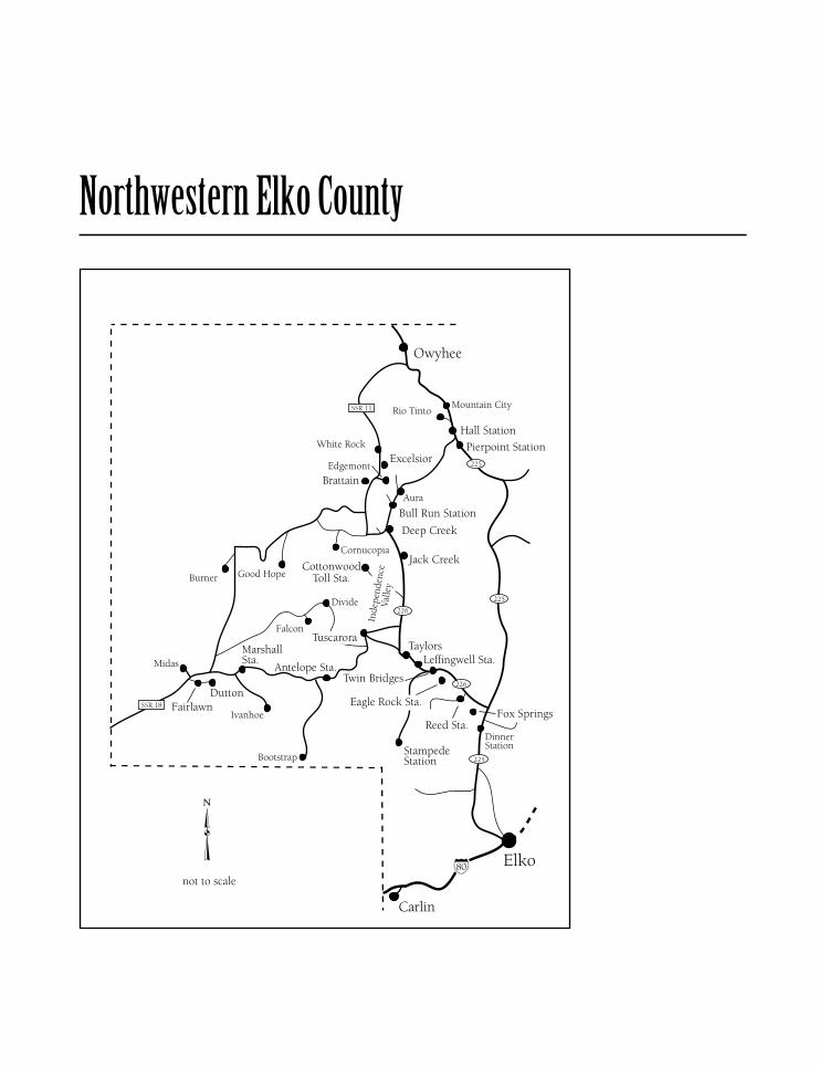
Northwestern Elko County 1
North Central Elko County 19
Northeastern Elko County 55
Southwestern Elko County 89
Southeastern Elko County 181
Notes 199
Bibliography 201
Index 209
Preface
When I first started research on this book in 1986, I never envisioned the
depth and breadth of the undertaking. Many times over the past years, I had
felt I was finally done with the research and ready to start writing, only to find
additional sources of information. Once the writing phase began, the fun of
whittling down and organizing well over one thousand pages of notes into a
readable and understandable format began. Finally, after eight years of work,
the final product has arrived. Although I have written other books, the two
books on Elko County have been the most challenging of my career because
of the huge scope they encompass. Almost three hundred historic sites, ghost
towns, stage stations, railroad towns, ranches, mining camps, and forts were
covered. This meant that for the book to be publishable, it would have to
be divided into two sections. The first part contained only ghost towns and
mining camps, while this subsequent volume covers railroad stops, stage sta-
tions, valleys, and other historical sites not covered in the first volume. Some
sections are duplicated in this volume because they satisfied criteria for both
books. This volume basically covers the historic sites not covered in the first
volume but some have been completely eliminated.
It has been an enjoyable experience traveling around the county, meeting
and talking with residents, and visiting each and every site. This has involved
almost fifteen thousand miles of travel to reach and investigate every corner
of the county. Being a camper at heart, I found the beauty of Elko County to
be overwhelming at times. While I had visited different areas over the years,
it wasn’t until I moved to Elko that I had the time to truly enjoy all of the
wonders that the county has to offer.
I have tried to present as accurately as possible a history of each historic
ix
site in Elko County. However, with any book this size, and with all of the his-
torical information presented, errors can appear despite the intensive scrutiny
that the script has undergone by me and local history buffs. If the reader finds
something questionable, please don’t get upset; rather, contact the author so
corrections can be made in future reprints.
There are a couple format changes from my previous books. Endnotes
have been added so interested readers can find additional information in the
sources cited.
One disappointment is the amount of vandalism to the historic sites cov-
ered firsthand. Buildings have been destroyed to see if anything is in the walls.
Foundations and sites ruined by overzealous bottle hunters. This is inexcus-
able and shouldn’t be tolerated by anyone who witnesses such vandalism. Let
the proper authorities know when our historic sites are being threatened. I
hope that my children will have the opportunity to enjoy the historic sites of
this county as much as I have, but unless some respect is shown by local resi-
dents, visitors, and federal agencies, there won’t be anything left for anyone
to see.
Many of the historical sites discussed in this book are on private property.
Please respect all private-property signs and contact the owner. Most of the
time, a simple request for permission is all the property owner is looking for.
I hope everyone enjoys visiting the many places in Elko County as much as I
have. While I no longer live in Elko, I treasure the memories acquired during
my four years there. While some remembrances are tainted, the ones I chose
to keep strong in my mind are the good ones. Enjoy the book and get out
and visit Elko County, one of the most beautiful areas in the western United
States.
x Preface
Acknowledgments
First and foremost, I have to thank my daughter, Heather. It was very special
to have her share my travels visiting the many historic sites in Elko County.
I would also like to offer my special thanks to my parents, Albert and
Lorraine Hall. They continue to be supportive of my endeavors and it is very
difficult being almost three thousand miles away from them.
Special thanks to Howard and Terry Hickson. Through Howard’s guid-
ance, I was able to learn the intricacies of museum management. He and
Terry, more important, are close and dear friends and I am deeply indebted
to them for their friendship. I also thank my friends in the history field
for their assistance and support: Bob and Dorothy Nylen, Wally Cuchine,
Bill Metscher, Gloria Harjes, Phillip Earl, and Doug and Cindy Sutherland.
My best friend, Bruce Franchini, continues to be an important part of my
life. While we see each other a lot less these days, our times together play-
ing mountain Frisbee golf and camping are among my most enjoyable and
memorable moments.
Many other people and groups have been instrumental in making this
book a reality, through their ‘‘true’’ friendship and/or assistance with his-
toric information: BeBe Adams, Matilde Griswold Allen, Delmo Andreozzi,
the Barrick II basketball team, Robin Boies, Louise Walther Botsford, Robley
Burns, Llee and Mary Chapman, Arthur Clawson, the late William E. Claw-
son Jr., P. J. Connolly, the Desert Sunrise Rotary, the Elko Chamber of Com-
merce and its board of directors, Rick Fleishmann, Fred Frampton, Helen
Fullenwider, Cliff Gardner, Meg Glaser, Norman and Nelda Glaser, Steve
Glaser, Lee Hoffman, Art and Cora Holling, Thomas and Irene Hood, Lori
Kocinski, Gregg Lawrence, Irene Davis Linder, Lorry Lipparelli, Peter Marble,
xi
Carole and Frank Martin, Joe McDaniel, the late Dr. Leslie Moren, Joe Nar-
done, Dan and Karen O’Connor, Dennis Parks, Edna Patterson, Jim Polking-
horne, Tony and Ellen Primeaux, Elizabeth Pruitt, Jerry Reynolds, Diane
Beitia Rice, Pauline Riordan, Billy Robb, Jane and Ray Schuckman, Gertrude
Sharp, Paul and Carol Siegel, Ed Strickland, Lanny and Terry Tron, Christina
Ulm, Paul Walther, Jack and Francis Wanamaker, Barbara Wellington, Helen
Wilson, and Bob Wright.
I will always treasure the ‘‘true’’ friendships that I forged during my four
years at Elko, and thank you for making me feel welcome.
xii Acknowledgments
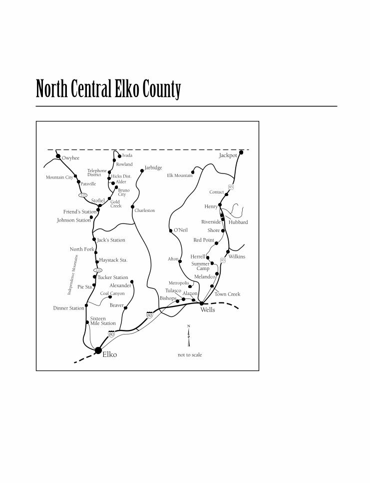
Northwestern Elko County
Antelope StationDIRECTIONS : 14 miles southwest of Tuscarora, via old Nevada 18.
Antelope Station was a horse-exchange stop on the Tuscarora to
Battle Mountain Road during the 1870s and early 1880s. Jack Gaston ran the
stagecoach line, and W. S. Freeman served as stationmaster. Freeman, a native
of Massachusetts, died of consumption at Tuscarora in December 1880. The
stagecoach line was unable to compete with the Elko to Tuscarora stage and
folded in1882.The station was torn down later that year, and nothing remains
at the site.
BrattainDIRECTIONS : Located on the SN Ranch, 3 miles southwest of Edgemont.
Brattain was a short-lived post office that opened on July 16, 1904,
with Lee Faison as postmaster. The office served local ranches but did not
produce enough revenue to justify its continued existence and closed on
March 14, 1906, forcing local ranchers to travel to Edgemont for their mail.
Bull Run Station(Golden City)
DIRECTIONS : Located 2½ miles south of Aura on Nevada 226.
Bull Run Station was a station and horse-changing stop on the
Mountain City branch of the Northern Stage Company, which ran from Tus-
carora to Mountain City. Bull Run was the first stop north of Deep Creek;
the fare from Tuscarora was $2.50. During the 1870s, Benjamin Haws and his
family built and ran a small hotel here.
With the mining revival that created Aura and the formation of the camp
at Bull Run, the station became an important one. It was the drop-off point
for supplies destined for Bull Run, and a small settlement developed around
the station. In the belief that Bull Run would continue to boom, a townsite,
named Golden City, was laid out at the confluence of Bull Run and Deer
Creek, near the station. However, before any actual construction began, the
project was given up.
When Bull Run faded during 1907 and 1908, the need for the station van-
ished. Combined with the end of the Aura boom, the Mountain City branch
of the stagecoach line was abandoned. Only a couple of cabin logs mark the
site, located where the road to Bull Run heads west.
2 Connecting the West
Cottonwood Toll Station(Golconda)
DIRECTIONS : From Spanish Ranch, go west on a gravel road for 8½miles to Cottonwood Toll Station.
Cottonwood Toll Station was a horse-exchange stop and fare col-
lection point on the toll road built by William Ford in 1873 around the west
slope of Silver Peak to Cornucopia. The road ran from Taylor Canyon to the
boomtown of Cornucopia; Cottonwood was the last stop before the rugged
climb to Cornucopia. Ford later built a branch of this road connecting to the
Deep Creek road on the east side of Cornucopia.Woodruff and Ennor bought
the toll road in1874. Cottonwood was known as Golconda during this period.
While the town of Cornucopia prospered, Cottonwood was in operation
as a stage stop. The stagecoach line was taken over by Smith Van Dreillen in
1875, but when the Cornucopia boom ended in the late1870s, the stage route
was moved to run through Deep Creek rather than Cottonwood and Cornu-
copia. The station was not used after that, and now only the stone walls of the
station and horse barn mark the site.
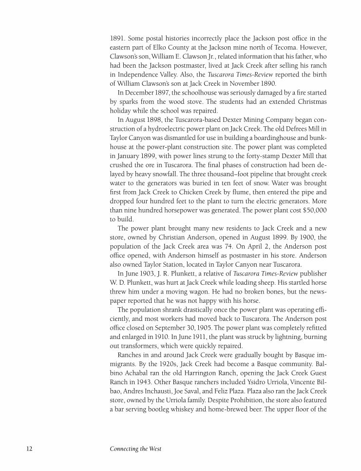
Deep CreekDIRECTIONS : From Jack Creek, on Nevada 226 go north 5.8 miles toDeep Creek.
Deep Creek served as a stagecoach station from the 1870s to the
1890s. Mining activity at Cornucopia, Bull Run, Columbia, and Blue Jacket
kept a constant flow of goods going through Deep Creek. The main stage-
coach line through Deep Creek Station, located at the confluence of Deep
Creek and Chicken Creek, was the Northern Stage Company, which ran the
Mountain City–White Rock Road. Deep Creek was where the road from Tus-
carora split, one branch running to White Rock and the other to Mountain
City. Fare from Tuscarora to Deep Creek was $2.50. The station, which served
both as a stage and freight stop, was run for many years by Dick and Lena
Young.
After the stage stop ended in the 1890s due to lack of business, a couple
of small ranches operated along Deep Creek. A small school was built in the
1920s at the Ken Reed Ranch. Mary Myers served as schoolteacher, but by
1934, there were only three students and the school closed in1935.Today, one
old ranch house remains, but only foundations mark the station site. Most of
the Deep Creek area is now part of the IL Ranch.
Northwestern Elko County 3
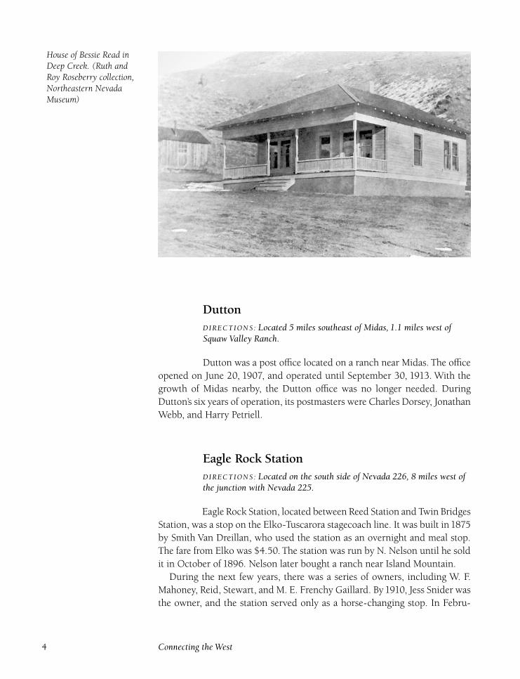
House of Bessie Read inDeep Creek. (Ruth andRoy Roseberry collection,Northeastern NevadaMuseum)
DuttonDIRECTIONS : Located 5 miles southeast of Midas, 1.1 miles west ofSquaw Valley Ranch.
Dutton was a post office located on a ranch near Midas. The office
opened on June 20, 1907, and operated until September 30, 1913. With the
growth of Midas nearby, the Dutton office was no longer needed. During
Dutton’s six years of operation, its postmasters were Charles Dorsey, Jonathan
Webb, and Harry Petriell.
Eagle Rock StationDIRECTIONS : Located on the south side of Nevada 226, 8 miles west ofthe junction with Nevada 225.
Eagle Rock Station, located between Reed Station and Twin Bridges
Station, was a stop on the Elko-Tuscarora stagecoach line. It was built in1875
by Smith Van Dreillan, who used the station as an overnight and meal stop.
The fare from Elko was $4.50. The station was run by N. Nelson until he sold
it in October of 1896. Nelson later bought a ranch near Island Mountain.
During the next few years, there was a series of owners, including W. F.
Mahoney, Reid, Stewart, and M. E. Frenchy Gaillard. By1910, Jess Snider was
the owner, and the station served only as a horse-changing stop. In Febru-
4 Connecting the West
ary 1916, snow around Eagle Rock Station was so deep that mailman Roy
Primeaux had to haul the mail wearing snowshoes. With the arrival of auto-
mobiles and trucks in the1920s, there was no longer any need for the station,
which fell into disuse. Today, a foundation marks the site.
ExcelsiorDIRECTIONS : From Deep Creek, take road west for 5.8 miles. Take aright turn and follow the road for approximately 10½ miles to WhiteRock Creek. Hike along the creek to the east to find remnants.
Excelsior was a post office that operated from July 18, 1871, to
March 12, 1872, with Aaron Van Ulick as the only postmaster. Van Ulick later
served as the Tuscarora Mining District recorder and later as the Elko County
recorder.
The post office was on White Rock Creek where placer deposits were being
worked. A camp of about twenty men formed around the mines, but only a
couple frame buildings were built before being abandoned. Once the placer
mining stopped, the post office closed, and mail for prospectors was received
at the White Rock Post Office. A couple of collapsed dugouts mark the site.
Fairlawn(Squaw Valley)
DIRECTIONS : From Midas, go southeast on old Nevada 18 for ½ mile.Bear right and follow for 1 mile to Fairlawn.
Fairlawn was a post office in Squaw Valley on the home ranch of
the Nevada Land and Cattle Company. The post office, housed in the com-
pany store, opened on June 14, 1888, with Thomas Parkinson as postmaster.
The company had been grazing cattle in the area since the early 1880s, and
built the Willow Creek dam and reservoir in 1884. In addition, a ten-mile
telegraph line was strung to the ranch.
In 1887, Nevada Land and Cattle built a two-story ranch house, complete
with furniture imported from England. A store opened at the ranch under the
management of E. G. Weth, who also served as the Nevada Land and Cattle
Company’s accountant. Weth, a native of England, served the company and
lived in Squaw Valley for many years. The post office remained open until
June 30, 1904, when it was moved to North Ranch in Humboldt County.
Herbert Guernsey and Richard Richie also served as postmasters.
The Golconda Cattle Company bought the ranch and nearby Kelley Creek
Ranch in 1905. Shortly afterwards, the ranch house burned. In 1948, E. G.
Northwestern Elko County 5
Weth died in England at the age of eighty-five. His daughter honored his final
wish, scattering his ashes in his beloved Squaw Valley. The ranch is still active
today and is part of the Ellison Ranching Company’s holdings.
Fox Springs(Oldham Station) (Fox Station)
DIRECTIONS : From Dinner Station, go north on Nevada 225 for 1 mile.Turn left and follow for 2½ miles to Fox Springs.
Fox Springs, located between Dinner Station and Reed Station,
was an overnight and meal stop on Smith Van Dreillen’s Elko to Tuscarora
stagecoach line. A man named Fox built an eight-team barn and a small house
to serve as the station.
Fox Springs also became the assembling point for cattle roundups along
the Lone Mountain range. Cattle were driven to Fox Springs, and sorted be-
fore winter. In the1880s, D. E. Hooten bought Fox Springs and ran the station
until 1911.
Ed Oldham, who had sold Dinner Station, took the station over from
Hooten and homesteaded 160 acres to start the Fox Springs Ranch. He built a
seven-room house, covered with redwood shingles, to house his large family.
In addition, a building was moved from Dinner Station to serve as a store-
house. Edward and Kate Oldham’s son, Charles, was killed during World
War I when his ship, the Lake Moor, was torpedoed and sunk.
With the arrival of the automobile, the need for stations along the Elko-
Tuscarora road ended. The Fox Springs Ranch has continued to operate and
is still in the Oldham family, now owned by John Oldham. Original buildings
remain amid newer structures. The site is on fenced private property.
Hall StationDIRECTIONS : Located ½ mile south of Mountain City on Nevada 225.
Hall Station was a stagecoach station active during the1860s in the
early days of the Cope rush and was located just south of Mountain City. The
station was run by Joe Hall, who also owned a store in Mountain City. Once
Mountain City became well established, the station was abandoned. Nothing
remains of the station today.
6 Connecting the West
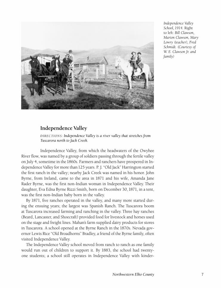
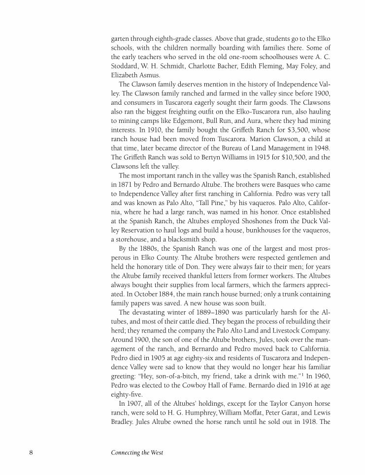
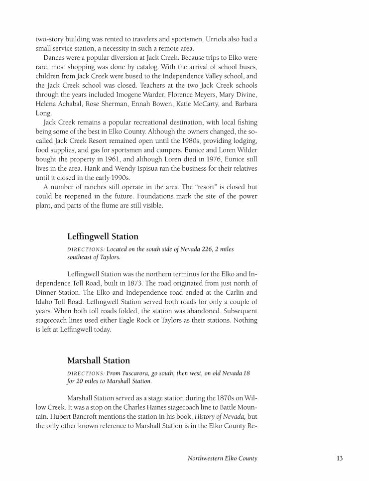
Independence ValleySchool, 1914. Rightto left: Bill Clawson,Marion Clawson, MaryLowry (teacher), FredSchmidt. (Courtesy ofW. E. Clawson Jr. andfamily)
Independence ValleyDIRECTIONS : Independence Valley is a river valley that stretches fromTuscarora north to Jack Creek.
Independence Valley, from which the headwaters of the Owyhee
River flow, was named by a group of soldiers passing through the fertile valley
on July 4, sometime in the1860s. Farmers and ranchers have prospered in In-
dependence Valley for more than125 years. P. J. ‘‘Old Jack’’ Harrington started
the first ranch in the valley; nearby Jack Creek was named in his honor. John
Byrne, from Ireland, came to the area in 1871 and his wife, Amanda Jane
Rader Byrne, was the first non-Indian woman in Independence Valley. Their
daughter, Eva Edna Byrne Rizzi Smith, born on December 30, 1871, in a tent,
was the first non-Indian baby born in the valley.
By 1871, five ranches operated in the valley, and many more started dur-
ing the ensuing years; the largest was Spanish Ranch. The Tuscarora boom
at Tuscarora increased farming and ranching in the valley. Three hay ranches
(Beard, Lancaster, and Shoecraft) provided food for livestock and horses used
on the stage and freight lines. Mahan’s farm supplied dairy products for stores
in Tuscarora. A school opened at the Byrne Ranch in the 1870s. Nevada gov-
ernor Lewis Rice ‘‘Old Broadhorns’’ Bradley, a friend of the Byrne family, often
visited Independence Valley.
The Independence Valley school moved from ranch to ranch as one family
would run out of children to support it. By 1883, the school had twenty-
one students; a school still operates in Independence Valley with kinder-
Northwestern Elko County 7
garten through eighth-grade classes. Above that grade, students go to the Elko
schools, with the children normally boarding with families there. Some of
the early teachers who served in the old one-room schoolhouses were A. C.
Stoddard, W. H. Schmidt, Charlotte Bacher, Edith Fleming, May Foley, and
Elizabeth Asmus.
The Clawson family deserves mention in the history of Independence Val-
ley. The Clawson family ranched and farmed in the valley since before 1900,
and consumers in Tuscarora eagerly sought their farm goods. The Clawsons
also ran the biggest freighting outfit on the Elko-Tuscarora run, also hauling
to mining camps like Edgemont, Bull Run, and Aura, where they had mining
interests. In 1910, the family bought the Griffeth Ranch for $3,500, whose
ranch house had been moved from Tuscarora. Marion Clawson, a child at
that time, later became director of the Bureau of Land Management in 1948.
The Griffeth Ranch was sold to Bertyn Williams in 1915 for $10,500, and the
Clawsons left the valley.
The most important ranch in the valley was the Spanish Ranch, established
in 1871 by Pedro and Bernardo Altube. The brothers were Basques who came
to Independence Valley after first ranching in California. Pedro was very tall
and was known as Palo Alto, ‘‘Tall Pine,’’ by his vaqueros. Palo Alto, Califor-
nia, where he had a large ranch, was named in his honor. Once established
at the Spanish Ranch, the Altubes employed Shoshones from the Duck Val-
ley Reservation to haul logs and build a house, bunkhouses for the vaqueros,
a storehouse, and a blacksmith shop.
By the 1880s, the Spanish Ranch was one of the largest and most pros-
perous in Elko County. The Altube brothers were respected gentlemen and
held the honorary title of Don. They were always fair to their men; for years
the Altube family received thankful letters from former workers. The Altubes
always bought their supplies from local farmers, which the farmers appreci-
ated. In October1884, the main ranch house burned; only a trunk containing
family papers was saved. A new house was soon built.
The devastating winter of 1889–1890 was particularly harsh for the Al-
tubes, and most of their cattle died. They began the process of rebuilding their
herd; they renamed the company the Palo Alto Land and Livestock Company.
Around 1900, the son of one of the Altube brothers, Jules, took over the man-
agement of the ranch, and Bernardo and Pedro moved back to California.
Pedro died in 1905 at age eighty-six and residents of Tuscarora and Indepen-
dence Valley were sad to know that they would no longer hear his familiar
greeting: ‘‘Hey, son-of-a-bitch, my friend, take a drink with me.’’1 In 1960,
Pedro was elected to the Cowboy Hall of Fame. Bernardo died in 1916 at age
eighty-five.
In 1907, all of the Altubes’ holdings, except for the Taylor Canyon horse
ranch, were sold to H. G. Humphrey, William Moffat, Peter Garat, and Lewis
Bradley. Jules Altube owned the horse ranch until he sold out in 1918. The
8 Connecting the West
estate, sold in 1907, consisted of twenty thousand sheep, twenty thousand
head of cattle, two thousand horses, and four hundred thousand acres of land.
In 1913, the Union Land and Cattle Company was organized, adding the
Spanish Ranch to their vast holdings. The ranch was used to raise hay for all
of the operations, which consisted of forty-five thousand head of cattle run-
ning all the way to Lovelock. During the summers, five hundred men were
employed haying one hundred thousand acres between Jack Creek and the
ranch, using fifty mowing machines and twenty-five hay rakes. The superin-
tendent of operations was George Calligan, a huge man more than six feet tall
and weighing 350 pounds, whom few workers questioned.
The Spanish Ranch was a stop on the Northern Stage Company’s daily
route, with a fare of $1.50 from Tuscarora. In 1915, A. W. Sewell relocated
his grocery store from Tuscarora to the Spanish Ranch. The store was run
by Ben Trembath, and Robert ‘‘Doby Doc’’ Caudill was hired as bookkeeper.
Eventually, Sewell’s grocery store chain grew to seventy-three stores.
In 1920, Doby Doc was arrested and charged with misappropriating funds
from the Union Land and Cattle Company. Doby Doc had been keeping a
second set of company books, but these books were written in a cryptic back-
ward fashion that no one could decipher, and so the charges were dropped.
Caudill was released and the shortages thereafter ended. The Sewell store
burned in August 1923 at a loss of $40,000 and was not rebuilt.
The Union Land and Cattle Company went bankrupt in 1925, at which
time John G. Taylor and E. P. Ellison bought the Spanish Ranch division. The
property was divided, Taylor taking the northern Allied ranches and Ellison
taking the Spanish Ranch. The Ellison Ranching Company became the parent
company. Claude Barkdull was hired as foreman in1929, and he and his wife,
Frankie, stayed at the ranch until retiring in 1962.
A one-room schoolhouse was built in 1932; the first teacher was Edna
Garralda. Other teachers included Ruth Roseberry, Helena Archibald, Sadie
Andrae, Dorothy Gavin, and Anna Reed. The school operated until 1962; the
school building was restored by the Ellisons and friends in 1977. Other old
buildings still at the ranch include the cookhouse, originally a drugstore in
Tuscarora, the original blacksmith shop, and the main ranch house. The Elli-
son Ranching Company still operates the ranch and many other ranches in
the area.
Independence Valley continues to be a prosperous ranching area. In addi-
tion, many clear creeks tumble down from the surrounding mountains to
flow into the Owyhee River. Before the advent of downstream dams, it was a
common sight to see spawning salmon swimming through the valley. A drive
up the valley provides historic sites and many scenic views.
Northwestern Elko County 9
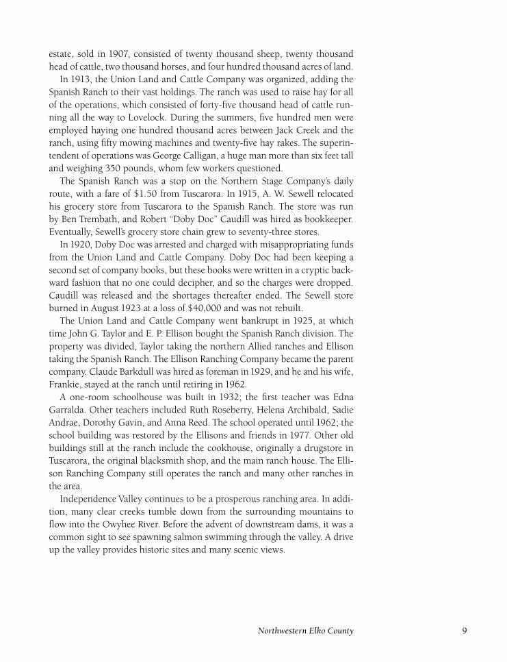
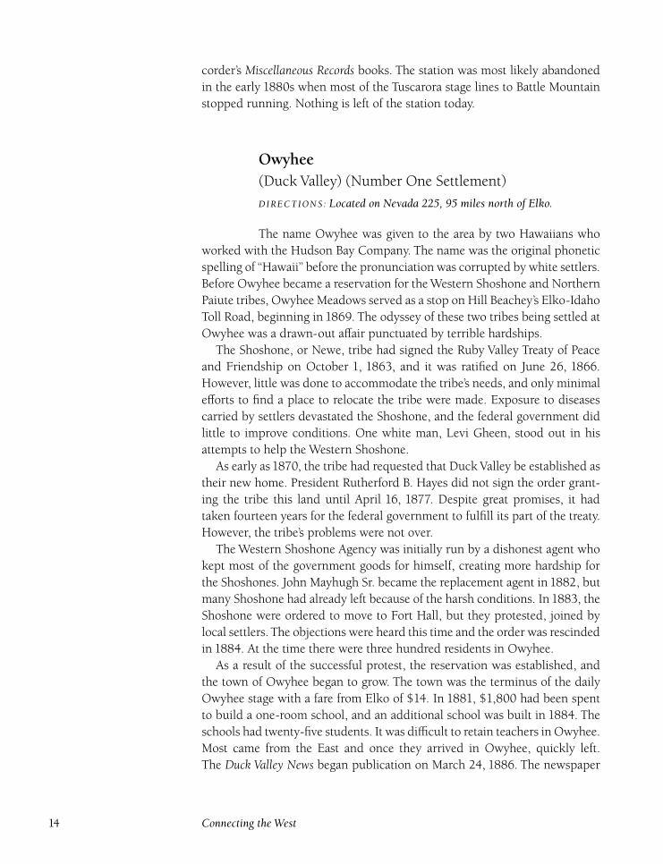
The Woodward family infront of their house andhotel, 1890s. (North-eastern NevadaMuseum)
Jack Creek(Anderson) (Jackson)
DIRECTIONS : Located 15½ miles north of Taylors on Nevada 226.
Jack Creek was named in honor of its original settler, Jack Harring-
ton, who homesteaded in the area in 1868 and spent the rest of his life ranch-
ing at Jack Creek. Jack Creek was soon added as a stop on the Northern Stage
Company’s line from Tuscarora to Mountain City, with a fare of $2 from Tus-
carora.
The Jack Creek area was the prime source of wood for Tuscarora for fire-
wood and mine timbers. From 1877 to 1892, an average of twelve thousand
linear feet of firewood and two hundred thousand feet of mine timber were
harvested each year. Some limited mining interest in the Jack Creek area oc-
curred during the 1870s when a local rancher, Chesley Woodward, who had
settled at Jack Creek in 1869, staked a number of claims and formed the
Woodward Mining District in May 1877. However, nothing was ever pro-
duced, and Woodward abandoned the claims in 1878. Woodward and his
family operated a ranch, store, restaurant, and rooming house at Jack Creek
for many years.
In June 1879, the Jack Creek School District was organized and Nevada
Hardesty Griswold, then seventeen years old, taught ten students. A settle-
ment of about twenty people had formed at Jack Creek, and a few other
ranches were homesteaded in Jack Creek Canyon and nearby areas to the
10 Connecting the West
north and south. For many years, there were two schools in the Jack Creek
area, each with about ten students.
Because of the number of families in the area and the lack of a proper
gathering place, Harrington built the Jack Creek Opera House in Novem-
ber 1880. Despite its elegant name, the building was more of a barn with a
stage rather than an actual opera house, but the local residents enjoyed the
entertainment and camaraderie shared there.
In 1884, the Jack Creek population had grown sufficiently that Harring-
ton was named justice of the peace, Clay Hardesty was selected constable,
and R. D. Lamham was chosen as road superintendent. A voting precinct
was established and local resident Charles Woodward served as the voters’
registry agent. Jack Harrington died in 1886, and his ranch and stage stop
were purchased by Frank Culver in April. Culver built a lodge for travelers
and fishing parties, promising, ‘‘Clean beds and good meals will be the rule.’’2
Many people from Tuscarora and Elko came to Jack Creek to fish and hunt
on weekends.
In 1889, the era of two schools ended at Jack Creek when Jack Creek
School District Number 22 was abolished in May, and the Jackson School
District Number 40 was formed. The residents turned the abandoned Jack
Creek School into a dance hall.
In 1890, the townspeople applied for a post office named Jackson. On
June 25, the post office, with William Clawson as postmaster, was established
there. However, the postal establishment order was rescinded on March 10,
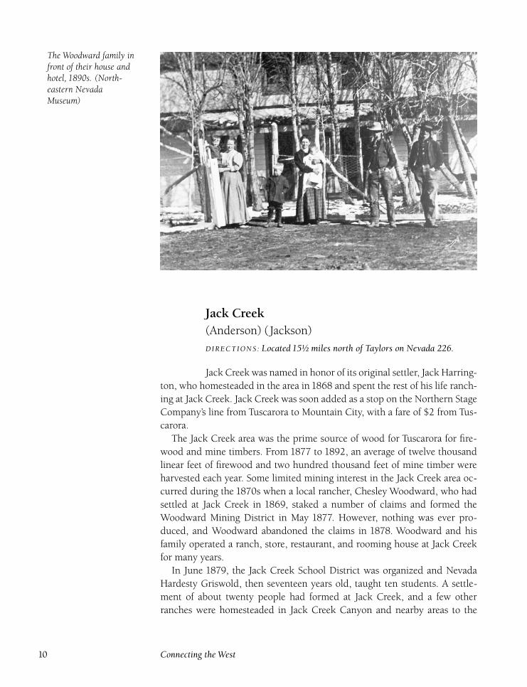
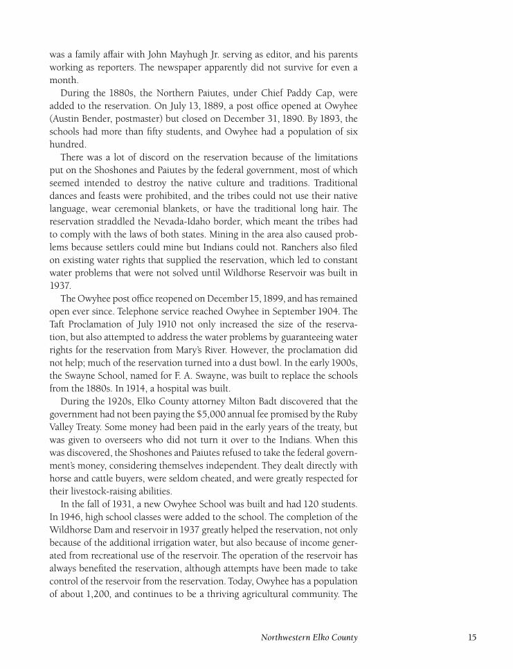
The Jack Creek GuestRanch in 1960. Thebuilding is the originalWoodward house. (Tonyand Ellen Primeauxcollection, NortheasternNevada Museum)
Northwestern Elko County 11
1891. Some postal histories incorrectly place the Jackson post office in the
eastern part of Elko County at the Jackson mine north of Tecoma. However,
Clawson’s son,William E. Clawson Jr., related information that his father, who
had been the Jackson postmaster, lived at Jack Creek after selling his ranch
in Independence Valley. Also, the Tuscarora Times-Review reported the birth
of William Clawson’s son at Jack Creek in November 1890.
In December1897, the schoolhouse was seriously damaged by a fire started
by sparks from the wood stove. The students had an extended Christmas
holiday while the school was repaired.
In August 1898, the Tuscarora-based Dexter Mining Company began con-
struction of a hydroelectric power plant on Jack Creek. The old Defrees Mill in
Taylor Canyon was dismantled for use in building a boardinghouse and bunk-
house at the power-plant construction site. The power plant was completed
in January 1899, with power lines strung to the forty-stamp Dexter Mill that
crushed the ore in Tuscarora. The final phases of construction had been de-
layed by heavy snowfall. The three thousand–foot pipeline that brought creek
water to the generators was buried in ten feet of snow. Water was brought
first from Jack Creek to Chicken Creek by flume, then entered the pipe and
dropped four hundred feet to the plant to turn the electric generators. More
than nine hundred horsepower was generated. The power plant cost $50,000
to build.
The power plant brought many new residents to Jack Creek and a new
store, owned by Christian Anderson, opened in August 1899. By 1900, the
population of the Jack Creek area was 74. On April 2, the Anderson post
office opened, with Anderson himself as postmaster in his store. Anderson
also owned Taylor Station, located in Taylor Canyon near Tuscarora.
In June 1903, J. R. Plunkett, a relative of Tuscarora Times-Review publisher
W. D. Plunkett, was hurt at Jack Creek while loading sheep. His startled horse
threw him under a moving wagon. He had no broken bones, but the news-
paper reported that he was not happy with his horse.
The population shrank drastically once the power plant was operating effi-
ciently, and most workers had moved back to Tuscarora. The Anderson post
office closed on September 30,1905. The power plant was completely refitted
and enlarged in1910. In June1911, the plant was struck by lightning, burning
out transformers, which were quickly repaired.
Ranches in and around Jack Creek were gradually bought by Basque im-
migrants. By the 1920s, Jack Creek had become a Basque community. Bal-
bino Achabal ran the old Harrington Ranch, opening the Jack Creek Guest
Ranch in 1943. Other Basque ranchers included Ysidro Urriola, Vincente Bil-
bao, Andres Inchausti, Joe Saval, and Feliz Plaza. Plaza also ran the Jack Creek
store, owned by the Urriola family. Despite Prohibition, the store also featured
a bar serving bootleg whiskey and home-brewed beer. The upper floor of the
12 Connecting the West
two-story building was rented to travelers and sportsmen. Urriola also had a
small service station, a necessity in such a remote area.
Dances were a popular diversion at Jack Creek. Because trips to Elko were
rare, most shopping was done by catalog. With the arrival of school buses,
children from Jack Creek were bused to the Independence Valley school, and
the Jack Creek school was closed. Teachers at the two Jack Creek schools
through the years included Imogene Warder, Florence Meyers, Mary Divine,
Helena Achabal, Rose Sherman, Ennah Bowen, Katie McCarty, and Barbara
Long.
Jack Creek remains a popular recreational destination, with local fishing
being some of the best in Elko County. Although the owners changed, the so-
called Jack Creek Resort remained open until the 1980s, providing lodging,
food supplies, and gas for sportsmen and campers. Eunice and Loren Wilder
bought the property in 1961, and although Loren died in 1976, Eunice still
lives in the area. Hank and Wendy Ispisua ran the business for their relatives
until it closed in the early 1990s.
A number of ranches still operate in the area. The ‘‘resort’’ is closed but
could be reopened in the future. Foundations mark the site of the power
plant, and parts of the flume are still visible.
Leffingwell StationDIRECTIONS : Located on the south side of Nevada 226, 2 milessoutheast of Taylors.
Leffingwell Station was the northern terminus for the Elko and In-
dependence Toll Road, built in 1873. The road originated from just north of
Dinner Station. The Elko and Independence road ended at the Carlin and
Idaho Toll Road. Leffingwell Station served both roads for only a couple of
years. When both toll roads folded, the station was abandoned. Subsequent
stagecoach lines used either Eagle Rock or Taylors as their stations. Nothing
is left at Leffingwell today.
Marshall StationDIRECTIONS : From Tuscarora, go south, then west, on old Nevada 18for 20 miles to Marshall Station.
Marshall Station served as a stage station during the1870s on Wil-
low Creek. It was a stop on the Charles Haines stagecoach line to Battle Moun-
tain. Hubert Bancroft mentions the station in his book, History of Nevada, but
the only other known reference to Marshall Station is in the Elko County Re-
Northwestern Elko County 13
corder’s Miscellaneous Records books. The station was most likely abandoned
in the early 1880s when most of the Tuscarora stage lines to Battle Mountain
stopped running. Nothing is left of the station today.
Owyhee(Duck Valley) (Number One Settlement)
DIRECTIONS : Located on Nevada 225, 95 miles north of Elko.
The name Owyhee was given to the area by two Hawaiians who
worked with the Hudson Bay Company. The name was the original phonetic
spelling of ‘‘Hawaii’’ before the pronunciation was corrupted by white settlers.
Before Owyhee became a reservation for the Western Shoshone and Northern
Paiute tribes, Owyhee Meadows served as a stop on Hill Beachey’s Elko-Idaho
Toll Road, beginning in 1869. The odyssey of these two tribes being settled at
Owyhee was a drawn-out affair punctuated by terrible hardships.
The Shoshone, or Newe, tribe had signed the Ruby Valley Treaty of Peace
and Friendship on October 1, 1863, and it was ratified on June 26, 1866.
However, little was done to accommodate the tribe’s needs, and only minimal
efforts to find a place to relocate the tribe were made. Exposure to diseases
carried by settlers devastated the Shoshone, and the federal government did
little to improve conditions. One white man, Levi Gheen, stood out in his
attempts to help the Western Shoshone.
As early as 1870, the tribe had requested that Duck Valley be established as
their new home. President Rutherford B. Hayes did not sign the order grant-
ing the tribe this land until April 16, 1877. Despite great promises, it had
taken fourteen years for the federal government to fulfill its part of the treaty.
However, the tribe’s problems were not over.
The Western Shoshone Agency was initially run by a dishonest agent who
kept most of the government goods for himself, creating more hardship for
the Shoshones. John Mayhugh Sr. became the replacement agent in 1882, but
many Shoshone had already left because of the harsh conditions. In 1883, the
Shoshone were ordered to move to Fort Hall, but they protested, joined by
local settlers. The objections were heard this time and the order was rescinded
in 1884. At the time there were three hundred residents in Owyhee.
As a result of the successful protest, the reservation was established, and
the town of Owyhee began to grow. The town was the terminus of the daily
Owyhee stage with a fare from Elko of $14. In 1881, $1,800 had been spent
to build a one-room school, and an additional school was built in 1884. The
schools had twenty-five students. It was difficult to retain teachers in Owyhee.
Most came from the East and once they arrived in Owyhee, quickly left.
The Duck Valley News began publication on March 24, 1886. The newspaper
14 Connecting the West
was a family affair with John Mayhugh Jr. serving as editor, and his parents
working as reporters. The newspaper apparently did not survive for even a
month.
During the 1880s, the Northern Paiutes, under Chief Paddy Cap, were
added to the reservation. On July 13, 1889, a post office opened at Owyhee
(Austin Bender, postmaster) but closed on December 31, 1890. By 1893, the
schools had more than fifty students, and Owyhee had a population of six
hundred.
There was a lot of discord on the reservation because of the limitations
put on the Shoshones and Paiutes by the federal government, most of which
seemed intended to destroy the native culture and traditions. Traditional
dances and feasts were prohibited, and the tribes could not use their native
language, wear ceremonial blankets, or have the traditional long hair. The
reservation straddled the Nevada-Idaho border, which meant the tribes had
to comply with the laws of both states. Mining in the area also caused prob-
lems because settlers could mine but Indians could not. Ranchers also filed
on existing water rights that supplied the reservation, which led to constant
water problems that were not solved until Wildhorse Reservoir was built in
1937.
The Owyhee post office reopened on December15,1899, and has remained
open ever since. Telephone service reached Owyhee in September 1904. The
Taft Proclamation of July 1910 not only increased the size of the reserva-
tion, but also attempted to address the water problems by guaranteeing water
rights for the reservation from Mary’s River. However, the proclamation did
not help; much of the reservation turned into a dust bowl. In the early 1900s,
the Swayne School, named for F. A. Swayne, was built to replace the schools
from the 1880s. In 1914, a hospital was built.
During the 1920s, Elko County attorney Milton Badt discovered that the
government had not been paying the $5,000 annual fee promised by the Ruby
Valley Treaty. Some money had been paid in the early years of the treaty, but
was given to overseers who did not turn it over to the Indians. When this
was discovered, the Shoshones and Paiutes refused to take the federal govern-
ment’s money, considering themselves independent. They dealt directly with
horse and cattle buyers, were seldom cheated, and were greatly respected for
their livestock-raising abilities.
In the fall of 1931, a new Owyhee School was built and had 120 students.
In 1946, high school classes were added to the school. The completion of the
Wildhorse Dam and reservoir in1937 greatly helped the reservation, not only
because of the additional irrigation water, but also because of income gener-
ated from recreational use of the reservoir. The operation of the reservoir has
always benefited the reservation, although attempts have been made to take
control of the reservoir from the reservation. Today, Owyhee has a population
of about 1,200, and continues to be a thriving agricultural community. The
Northwestern Elko County 15
high school’s sports teams have been successful, winning a number of state
titles.
Pierpoint StationDIRECTIONS : From Mountain City, go south on Nevada 225 for 5½miles to Pierpoint Station.
Pierpoint Station, located south of Mountain City, was a short-
lived stop on the Elko and Idaho Toll Road. In 1870, it also served as the
northern terminus for the short-lived Johnson Toll Road, which ran to Bruno
City, ending at Friend’s Station. However, the station was abandoned when
the Elko and Idaho Toll Road ceased operations. Subsequent stage lines did
not use the station and nothing remains at the site.
Reed Station(Stewart Station) (Willow Creek Station)
DIRECTIONS : From Dinner Station, go north on Nevada 225 for 4.2miles. Turn left onto Nevada 226 and follow for 4 miles. Take a left exitand follow for 2 miles to Reed Station.
In 1875, Willow Creek Station was established to serve Smith Van
Dreillan’s Elko to Tuscarora stagecoach line as a meal and overnight stop, but
Dinner Station received the majority of the business. Henry Reed, who had
originally come to Elko County in 1865 after serving in the Civil War, pur-
chased the Willow Creek Ranch in 1879 after leaving Pleasant Valley to start
his own ranch.
After Reed bought the ranch, the stop became known as Reed Station.
Some historical sources list Reed Station and Eagle Rock Station as being the
same, but Eagle Rock was a separate station a few miles west of Reed Station.
After Van Dreillan folded his line, Reed Station continued as a stop for other
stagecoach lines, and it was common for two hundred horses and twenty-five
teamsters to stay at the station overnight.
A school operated at Reed Station during the 1880s. The station was the
main shipping point for years for all supplies heading to the mines on Lone
Mountain a couple of miles away.
Reed was known for his fast trips in his wagon with his horses, Dynamite
and Danger. No one would travel with him when he was in a hurry. In 1888,
the Reeds built a large white house at the station. Reed later served as an
Elko County commissioner. In June 1900, in a double wedding, Reed’s sons
Marshall and Addison got married at the ranch.
16 Connecting the West
Reed died in1906, and soon afterward Robert Stewart and his half brother,
John Carter, bought the ranch and station. In1910, the partnership dissolved.
Stewart took over Reed Station, and Carter moved to the other part of the
property at South Fork. The stage was still running to Tuscarora. The fare to
Elko from Reed Station, now called Stewart Station, was $3.50.
With the emergence of the automobile, the station declined until it was
no longer needed. Stewart lived at the ranch until 1919, when he moved to
Pleasant Valley. Stewart continued to run the property until he sold it in 1947
to M. E. Gaillard. In September 1938, a water pipeline was built from Stewart
Spring to the new mill being constructed at the Rip Van Winkle Mine on
Lone Mountain. Stewart was paid $25,000 for half of the water flow from the
spring.
Since the 1960s, Reed Station has had many different owners and con-
tinues as an active ranch today. However, most of the buildings on the ranch
are modern, with only a couple from the early days of Reed Station.
Stampede StationDIRECTIONS : From Nevada 226 at Twin Bridges, take a gravel roadsouth 14 miles to Stampede Station.
Stampede Station was used as a horse-changing stop on the Tus-
carora to Carlin road during the 1870s. Its exact location is unknown except
that it was near a good-flowing spring on the west side of Lone Mountain. The
facility was also used as a drop-off point for supplies heading to the miners
scattered around Lone Mountain.
Taylors(Taylor Canyon)
DIRECTIONS : From Dinner Station, go north on Nevada 225 for 4.2miles, then go west on Nevada 226 for 17.6 miles to Taylors.
Taylors, named in honor of Taylor Postlethwaite, was a stop on the
Van Dreillan stage. A bed and two meals at Taylors cost $2.50. During the
Cornucopia boom of the early 1870s, a new stagecoach line joined the Tusca-
rora stage line at Taylors. The DeFrees Mill, built in 1875 to treat ore from the
Tuscarora mines, was located at Taylors. The mill was sold in August 1880 at
a sheriff’s sale to W. J. Urton for $971 but was little used.
In 1898, the Dexter Mining Company of Tuscarora built a power plant
using water from Niagra Creek. The plant generated ten thousand volts, and
Northwestern Elko County 17
a power line was strung to the Dexter Mill. The old DeFrees Mill was dis-
mantled for use as a boardinghouse and bunkhouse next to the power plant.
These facilities were used until a more efficient facility was built at Jack Creek,
where the water supply was more reliable.
A number of ranches are located at the mouth of Taylor Canyon, owners
including Ben and Nona Trembath, Rube Kilfoyle, Bing Crosby, and Willis
Packer. Today, a bar and some cabins cater to both local residents and sports-
men. The remains of the DeFrees Mill are east of the cabins.
Twin BridgesDIRECTIONS : Located 5 miles east of Taylors on Nevada 226.
Twin Bridges was located between Taylors and Eagle Rock. It was
not a stop itself, but rather the point where the Carlin-Tuscarora stagecoach
line joined the road used by the Elko-Tuscarora stage. Twin Bridges was also
the name for the area where the Denver-Shepherd Toll Road crossed the South
Fork of the Humboldt River.
18 Connecting the West
North Central Elko County
AlazonDIRECTIONS : 3.3 miles west of Wells and 1.1 miles north of I-80.
Alazon was established in1909 when the Southern Pacific Railroad
realigned its route between Deeth and Wells. Alazon became the junction of
the Western Pacific and Southern Pacific Railroads; the railroad built a section
house and workers’ houses here. As many as twenty people lived at Alazon at
times, and a small school opened during the1910s, which remained in opera-
tion until 1938 when the Alazon school district consolidated with the Wells
school district. Alazon also served as a telegraph station; it was the first rail-
road stop west of Wells. During the spring of 1942, floods plagued all of Elko
County including Alazon. Residents in the small town were completely cut
off for a few weeks after the only road to Alazon washed out.
Murder struck the little town in October 1948 when Richard Stewart, a
section worker, was shot to death by Richard Boudreau at Mineral Springs,
north of Wells. John Moschetti, manager of the Thousand Springs Trading
Post at Wilkins, discovered Stewart’s abandoned, bloody car and his body
nearby. Circumstances surrounding the murder remain murky. Stewart and
Boudreau had been friends, and no motive was ever established. Boudreau,
also known as Dick Days, was found guilty and sentenced to death on Decem-
ber 17, 1942. His sentence was reduced to life imprisonment when Stewart’s
mother pleaded for mercy on Boudreau’s behalf.
Alazon continued to serve the Southern Pacific until August1956. The rail-
road moved its offices to Wells as part of an economic consolidation. At the
time, three telegraph operators and their families were living in company
houses at Alazon. This was the end of Alazon, and all remaining structures
were removed during track reconstruction. Nothing is left of Alazon.
AlexanderDIRECTIONS : From the Devil’s Gate interchange on I-80, 15 miles eastof Elko, head north on a gravel road for 19½ miles to Alexander.
Alexander is incorrectly described as being in the Tuscarora area
in some sources. Although there was an Alexander family in the area for a
time, the Alexander post office was located about twenty miles northwest of
Deeth. The office opened at the ranch of Charles Alexander, five miles north
of Devil’s Gate Ranch on the north fork of the Humboldt River on May 25,
1895. Alexander served as postmaster. The mail arrived by stage in Alexan-
der via Deeth and Beaver on Monday and Friday and left on Tuesday and
Saturday. The carrier for the route was paid $1,500 per year. The post office
served more than twenty ranches over a thirty-mile radius. The next-nearest
20 Connecting the West
post office was in Deeth, a day’s horse ride away. However, Alexander grew
tired of running the post office. In December 1900, the office was moved five
miles east to another ranch near the headwaters of Pole Creek. Julia Hardesty
was postmaster until the office closed on July 31, 1901.
Beaver(Devil’s Gate Ranch)
DIRECTIONS : From Elko, go east on I-80 for 15 miles to the Devil’sGate interchange. Go north on a gravel road for 12 miles to Beaver.
Beaver was a post office established to serve ranches in the Devil’s
Gate area. The office opened at the Bello Ranch on January 10, 1896, and
was on the Deeth-Alexander mail route. John Burns was the first postmaster
but was replaced by Louis Bello in 1898 after Burns left the area. Felippe Ca-
rillo took over as postmaster in 1906 and worked until the office closed on
April 15, 1908.
In addition to the demand for mail service, there was a local need for a
school because the nearest school was in Deeth. In1903, the North Humboldt
School District was established, and a one-room school was built with Annie
Dewar as the first teacher. The school was active through the 1910s, when
declining enrollment and the rise of car and bus use made it more efficient
to bus students to Deeth. Other North Humboldt teachers included Agnes
Brown, Jessie McIntosh, and Lola Slater.
A number of ranches are still in operation in the area, including the Devil’s
Gate Ranch, established by Dan Murphy, a prominent Elko County rancher,
in the 1870s. Murphy had already built a ranching empire in the North Fork
area with its headquarters at Rancho Grande. After Murphy’s death in 1882,
his daughter Diana and her husband, Morgan Hill, took over the ranch. The
ranch was sold in 1922 to J. J. Hylton, a popular businessman from Hylton
(Jiggs), who had a vast empire of cattle, sheep, and flour mills throughout
the West. However, the empire eventually collapsed and Hylton declared
bankruptcy in1925. A receivership company, the Hylton Ranching Company,
ran Devil’s Gate until 1943. The ranch has passed through many subsequent
owners and is still in operation.
Many nineteenth-century buildings remain on area ranches. One structure
near the Bello Ranch may be the old schoolhouse.
North Central Elko County 21
BishopsDIRECTIONS : From Welcome interchange on I-80, go north 4 miles,crossing the railroad tracks.
Located about ten miles west of Wells, Bishops was one of the
original construction camps for the Central Pacific Railroad, established in
1869, and a section house and boardinghouse were built. However, once this
initial phase of construction was completed, the camp moved east and Bish-
ops became a siding on the railroad. In March of 1872, Frank Hunter was
killed in Bishops when he was crushed by the wheels of a caboose after having
fallen off a freight train.
More violence occurred in June 1881 when two section men had a heated
argument. Arthur Malvin tried to shoot Thomas Lovejoy. Lovejoy crushed
Malvin’s head with an iron wedge. The killing was ruled justifiable homicide.
Although there was no post office at Bishops, mail was brought from Deeth
twice a week. During the early 1880s, Bishops’s population was about thirty-
five. In 1882, the first ranch in the Bishops area was organized by a man
named Flannigan. The Hardesty family bought out Flannigan in 1887. Morris
Badt, a prominent Wells businessman, purchased the ranch in 1900 and
established the U7 brand.
The Bishops School District was organized around 1900. The Bishops
school was at the Franklin Ranch and had students from the Cory and Cazier
Ranches on Trout Creek. Birdie Drown Winchell was the first teacher, and
the school was used until the 1920s when the district was combined with the
Wells district.Wells teachers included Effie Johns, John Cazier, Dollie Blevins,
and Delia Webb.
These ranches are still active today, but the Bishops railroad siding is gone.
When the track was realigned, what little was left of Bishops was destroyed.
Dinner Station(Coryell’s) (Dorsey’s) (Weiland’s) (Winters’s) (Oldham’s)
(Parks’s)
DIRECTIONS : Located on Nevada 225, 23 miles north of Elko.
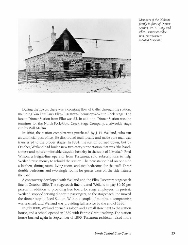
Dinner Station, known by many names during its history, was the
most important stop on the Elko to Tuscarora stage road; the station also
served stages heading to Mountain City. The first station was a wood frame
building built by Alex Coryell in the late 1860s to serve as a stop on Hill
Beachey’s Elko to Idaho route. The property was sold in May1870 at a sheriff’s
sale to John Dorsey for $12.70.
22 Connecting the West
Members of the Oldhamfamily in front of DinnerStation, 1907. (Tony andEllen Primeaux collec-tion, NortheasternNevada Museum)
During the 1870s, there was a constant flow of traffic through the station,
including Van Dreillan’s Elko-Tuscarora-Cornucopia-White Rock stage. The
fare to Dinner Station from Elko was $3. In addition, Dinner Station was the
terminus for the North Fork-Gold Creek Stage Company, a triweekly stage
run by Will Martin.
In 1880, the station complex was purchased by J. H. Weiland, who ran
an unofficial post office. He distributed mail locally and made sure mail was
transferred to the proper stages. In 1884, the station burned down, but by
October, Weiland had built a new two-story stone station that was ‘‘the hand-
somest and most comfortable wayside hostelry in the state of Nevada.’’1 Fred
Wilson, a freight-line operator from Tuscarora, sold subscriptions to help
Weiland raise money to rebuild the station. The new station had on one side
a kitchen, dining room, living room, and two bedrooms for the staff. Three
double bedrooms and two single rooms for guests were on the side nearest
the road.
A controversy developed with Weiland and the Elko-Tuscarora stagecoach
line in October 1886. The stagecoach line ordered Weiland to pay $0.50 per
person in addition to providing free board for stage employees. In protest,
Weiland stopped serving dinner to passengers, so the stagecoach line moved
the dinner stop to Reed Station. Within a couple of months, a compromise
was reached, and Weiland was providing full service by the end of 1886.
In July 1888, Weiland opened a saloon and a small store next to the station
house, and a school opened in 1889 with Fannie Grant teaching. The station
house burned again in September of 1890. Tuscarora residents raised more
North Central Elko County 23
than $500 to help Weiland refurbish the station. Because the stone structure
was undamaged, reconstruction was quickly completed. While the station
was closed, operations were run out of other buildings at Dinner Station.
There is an interesting story about foreign visitors stopping at Dinner Sta-
tion for a meal: ‘‘It was the custom during summer for the plates to be set out
on the table upside down so flies couldn’t walk on the side where food was to
be served. The serving dishes were passed, and the foreigners piled the food
onto their plates, which were still upside down. They apparently believed that
upside down plates were a western table custom.’’2
Weiland became ill in May 1900 and died of influenza. He had been born
in Pittsburgh, Pennsylvania, had first come to Elko in 1876, and served in the
Nevada Assembly in 1894. He left a wife, four sons, and four daughters. One
son, Alex, took over operation of the station. In 1900, forty-five people lived
around the station. Mrs. Weiland sold the station to Frank Winters in Octo-
ber 1901. The new boom at Jarbidge led to an increase of traffic, and Winters
hired two Chinese cooks to handle the additional travelers.
Winters had a reputation for helping unfortunate travelers.Walt Davidson,
a Swede, was traveling to Mountain City from Minnesota to join his brother,
Jack, and had run out of money when he boarded the stage at Elko. He had
only cheese and crackers to eat, and during the stopover at Dinner Station,
he went behind the corrals to eat his lunch. Winters saw this and invited him
inside to eat. He asked Walt if he was Jack Davidson’s brother. On hearing
that he was, Winters shook his hand and squeezed a $5 bill into Walt’s hand,
saying, ‘‘You can pay me back when you have it.’’ Davidson never forgot this
generosity and cried whenever he told the story.
Ed Oldham bought Dinner Station in 1905. The station could serve as
many as seventy-five travelers for lunch, and could house twenty people over-
night. The barn held seventy-five horses. Oldham charged $0.50 per person
for meals and lodging and continued to run the store and saloon. The Old-
ham family eventually sold Dinner Station to Tom Parks and moved to Fox
Springs, also a stop on the Elko-Tuscarora stage line.
A substantial ranch had grown up around Dinner Station.With the coming
of the automobile, the need for the station diminished. In1915, Joe and Frank
Yraguen bought the ranch and station. From 1918 to 1924, the complex was
managed by Gertrude and Tom Eager, who also ran a stagecoach line from
Dinner Station to Gold Creek, carrying passengers, mail, and freight. Ninety
horses were housed in the big barn. The school at Dinner Station was active
into the 1920s and teachers included Mattie Keith, Mayme Delaney, Irene
Suttle, Lila Welshows, and Adolphine Finck.
The Moffat Company bought Dinner Station in the 1940s. E. L. Cord
bought it in1960. David and Marion Secrist purchased the station in1972 and
extensively renovated the station house. The station was later sold to Frank
and Phyllis Hooper, the current owners. In October 1991, the station again
24 Connecting the West
burned, resulting in extensive damage. The Hoopers restored the building,
completing the project in 1994.
Friend’s StationDIRECTIONS : Located 2 miles south of the junction of Nevada 225 andGold Creek Road.
Friend’s Station was established in 1869 as a stop on the Elko and
Idaho Toll Road. It also served as a terminus in the early 1870s for the short-
lived Johnson Toll Road, which ran to Bruno City and rejoined the Elko and
Idaho Toll Road at Pierpoint’s Station. The station was run by Samuel Friend,
who also ran the Bruno Toll Road in the early 1870s.
Friend’s Station was also a stop on the Island Mountain stage road, part
of a Smith Van Dreillen–operated stagecoach line. Van Dreillen built a large
stable during the early1870s that held thirty horses. The stable burned in July
1875 and was not rebuilt. At that time, Friend’s Station ceased to exist, and
nothing is left to mark the site.
Haystack StationDIRECTIONS : From North Fork, go south on Nevada 225 for 9 miles toHaystack Station.
Haystack Station was one of the original stops on Hill Beachey’s
Elko-Idaho Toll Road during the 1860s. The station was an overnight and
dinner stop. A small station house was built along with a stable for twenty
horses.
When Beachey’s empire collapsed in the1870s, the toll road closed, and the
station was abandoned. A ranch was founded at the site in 1873 and became
part of the extensive Morgan Hill holdings. The ranch is still active today. A
couple of buildings remain, but the station house has long since disappeared.
HenryDIRECTIONS : From Contact, go south on U.S. 93 for 5 miles to Henry.
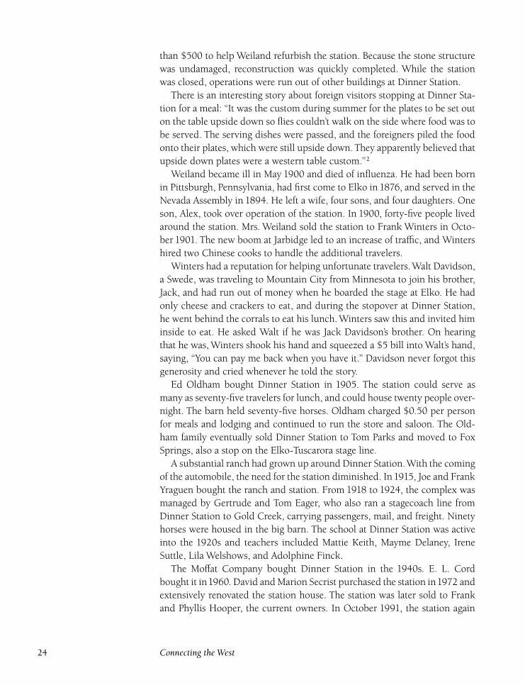
Henry was a depot and water station on the Oregon Short Line.
The railroad established the station in1925, named for Henry Harris, a popu-
lar black foreman for the Sparks-Harrell cattle empire. Harris had come from
Texas where he served as a cook for Nevada Governor John Sparks. After mov-
North Central Elko County 25
Oregon Short Line depotand water-tank structureat Henry. (Photo byShawn Hall)
ing to Elko County, he became respected and admired for his knowledge of
the cattle industry.
A couple of ranches operated near Henry, using the depot for shipping
cattle. Because of the many children on nearby ranches, a school operated at
Henry during the 1930s and 1940s. By the time the Oregon Short Line was
abandoned in 1978, the area had been deserted. The small depot, joined by
the water pump and tower, remains today amid a stand of trees.
Herrell(Harrell)
DIRECTIONS : From Wilkins, follow the former railroad grade southeastfor 6 miles to Herrell.
Herrell, as it is usually incorrectly listed (it was intended to be
named Harrell), was a signal station and switching yard for the Oregon Short
26 Connecting the West
Line. The station was named for Jasper and Hardy Harrell, partners in the
Sparks-Harrell cattle outfit. Jasper Harrell sold his partnership in 1883 and
purchased mining property at Spruce Mountain.
Because of a cartographer’s typographical error, the station has always ap-
peared as Herrell, rather than Harrell, which was intended. The station was
established in1925. In addition to the common railroad buildings, Herrell in-
cluded a triangular sidetrack, or wye, for turning and storing helper engines
needed to assist trains up the grade from the valley below. The buildings were
dismantled when the railroad was abandoned in 1978. Concrete foundations
and the roadbed of the wye today mark Herrell’s location.
HubbardDIRECTIONS : From Contact, go south on U.S. 93 for 10 miles toHubbard.
Hubbard was a stop and signal station on the Oregon Short Line
Railroad beginning in 1925. The stop was named for Smith Hubbard, who
had established a nearby ranch in the 1870s. In 1933, the Civilian Conserva-
tion Corps, or , a government program that gave people work during the
Depression, built Camp Hubbard here. By 1938, fifteen buildings had been
constructed including a large mess hall for the two hundred men, aged eigh-
teen to twenty-three, assigned to the camp, most of whom had come from
a similar camp in Sparta, Illinois. U. S. Army First Lieutenant Edward Clark
was the camp’s commanding officer. Dr. Olif Hoffman, also the doctor at the
Warm Creek camp, provided medical services.
The Wells Progress supplied the camp with complimentary newspapers. The
Camp Hubbard Ranch baseball team formed in 1933, playing games against
other camps. Home games were played in Wells. The men of Camp Hub-
bard accomplished much, including extensive road building and paving in
the region. The buildings were removed after the camp closed in the early
1940s. The Hubbard railroad stop was abandoned when the Oregon Short
Line was abandoned in 1978. Only foundations today mark the railroad stop
and camp. Hubbard Ranch is still operating and is owned by the Boies
family.
North Central Elko County 27
Jack’s Station(Vega Ranch)
DIRECTIONS : From North Fork, go north on Nevada 225 for 8 miles toJack’s Station.
Jack’s Station was established as a stop on the Hill Beachey stage-
coach line in the 1870s. Later, the station was used as a stop for the North
Fork-Gold Creek Stage Company. The driver was Will Martin of North Fork;
the fare from Elko to Jack’s Station was $7. During the mining activity at Gold
Creek, Jack’s Station enjoyed a lot of business and a saloon was opened, com-
plete with gaming tables.
A. M. McAfee and his wife bought Jack’s Station in the late 1880s and
built a large house. McAfee was a prominent resident of Tuscarora, served as
a county commissioner, and had substantial mining interests at Bullion. In
August 1899, the McAfees sold the ranch and station consisting of four hun-
dred acres of land, a stable for twenty-six horses, a two-story house, a lumber
house, and a well. The sale advertisement mentions, ‘‘the house is pretty well
furnished. One can always make a few dollars for meals, hay and pasturage
for horses.’’3 The selling price was $800, $400 less than the McAfees had paid
for it.
After the stagecoach line stopped running, the stable was moved to another
ranch on Spring Creek. Jack’s Station was purchased by Manuel Vega in 1903
and has been known as the Vega Ranch ever since. During the 1920s, the
Island Mountain School operated at the ranch in a small building known as
‘‘the Hut.’’ The teacher was Leona Gilbertson Harris, and her students were
mainly the Vega children.
Manuel Vega and his wife, Anna, ran the ranch for many years. Manuel
died in 1954; Anna died in 1978. The Vegas had many children: Guy, Jule,
Aldo, Manuel ‘‘Dude,’’ Aldo Lee, Diana, Evelyn, Anna, and Della. Manuel is
owner of Vega Construction in Elko. The ranch is still in the Vega family, and
a number of original buildings remain.
Johnson StationDIRECTIONS : From Wild Horse, go south on Nevada 225 for 4 miles.Turn right and follow the dirt road for 1 mile to Johnson Station.
Johnson Station was first a way station on the Cope Road and later
a stop on Will Martin’s North Fork-Gold Creek stage line. This station should
not be confused with another station located on the Johnson Ranch, north
of Wells, which was run by Bues Johnson. Fare to the Cope Road station
28 Connecting the West
from Elko was $7.50. The station, the last stop before Gold Creek, was run
by William Johnson.
The initial Johnson Station was located on Walker Creek in 1869, but the
Cope Road was later moved. Johnson and his wife, Catherine, relocated eight
miles south and established a new ranch and station at the present site of
North Fork. Most information available concerns the Johnson Station located
at North Fork.
At the Walker Creek station, Johnson built a couple of log buildings for the
station itself and for stables. These buildings were removed when the Johnson
family relocated. Today, the original site on Walker Creek is part of an active
ranch, but nothing remains to mark the station.
MelandcoDIRECTIONS : From Wells, go north on U.S. 93 for 13 miles. Turn left onthe road and follow it for ½ mile to Melandco.
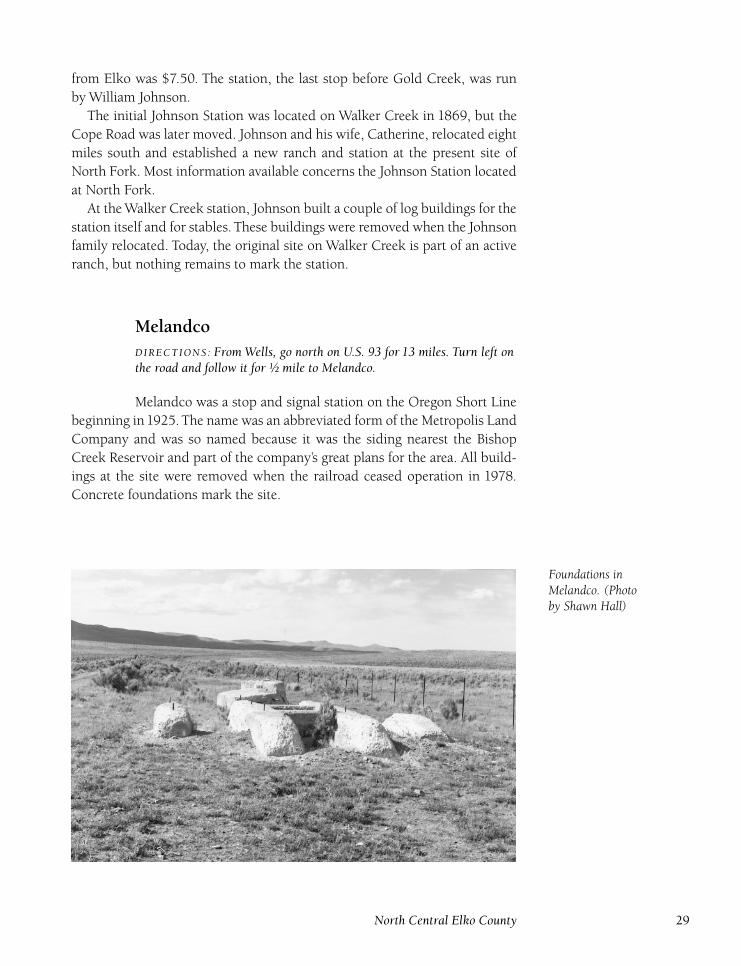
Melandco was a stop and signal station on the Oregon Short Line
beginning in1925. The name was an abbreviated form of the Metropolis Land
Company and was so named because it was the siding nearest the Bishop
Creek Reservoir and part of the company’s great plans for the area. All build-
ings at the site were removed when the railroad ceased operation in 1978.
Concrete foundations mark the site.
Foundations inMelandco. (Photoby Shawn Hall)
North Central Elko County 29
The Johnson Ranch atNorth Fork in 1948,owned at that time byBing Crosby. ( James andLarry Monroe collection,Northeastern NevadaMuseum)
North Fork( Johnson Station)
DIRECTIONS : From Dinner Station, go north on Nevada 225 for 28miles to North Fork.
The first signs of a settlement at North Fork began in 1870 when
William and Catherine Johnson moved from the original Johnson Station,
located on Walker Creek, and reestablished the station at North Fork on the
newly completed Cope Road. A daily stagecoach passed through Johnson Sta-
tion, which had a thriving business feeding and lodging travelers. The John-
sons had eight children, five of whom were born at the ranch in North Fork.
One child, William, died in December 1877, a few months before their last
child, Lillian, was born. A couple of other families came to the North Fork
area during the late 1870s, including the John Walker family. North Fork’s
population in 1880 was thirteen, which included Catherine Johnson and her
six surviving children, all under the age of twelve.
A number of ranches formed, and large cattle outfits like the Morgan
Hill Company and the Murphy Cattle Company used the range. The larger
ranches were created by consolidating the many smaller ranches throughout
the North Fork Valley.
A small town formed at North Fork, which became the social center for the
scattered ranches. George Pratt moved to North Fork, and later his brother-
in-law, Richard Morse, joined him; the pair established a freight business to
Tuscarora and Midas. Morse, with his wife and five children, settled on Morse
30 Connecting the West
Creek where he built a sawmill, producing mine timbers for Tuscarora. The
ranch stayed in the Morse family until 1948.
By the time a post office opened at North Fork on January 17, 1889 (Dollie
Shearer was the first postmaster), a hotel, saloon, grocery store, stage station,
and school already existed, and seventy-five people were living in and around
North Fork.
In the 1890s, Manuel Larios built a new stage station that offered good
meals, lodging, and a stable. A small store featured wine, liquor, and cigars.
Henry Van Dreillan began running a stage from Elko to Gold Creek in 1897,
which passed through North Fork. The stage also carried mail; the fare from
Elko was $4. In March1897, the Bowles Lumber Mill opened to provide lum-
ber for the boomtown of Gold Creek to the northeast.
In June 1900, J. D. Franklin began operating the triweekly North Fork-
Gold Creek Stageline, with North Fork as the home base for the line. This
stage connected with the Tuscarora-Elko Stage at Dinner Station. Because of
the extensive ranching industry in North Fork Valley, the North Fork Cattle
Association formed; meetings were held in the Domingo Hall at North Fork.
The population in North Fork Valley was 122 in 1900.
At the Johnson Ranch, across the road from the businesses at North Fork,
a family built a new two-story house. Until completion of the house in 1901,
the family had lived in log buildings from the 1870s. In 1906, Bill Mahoney
built a large stone building containing a store, saloon, and stagecoach stop.
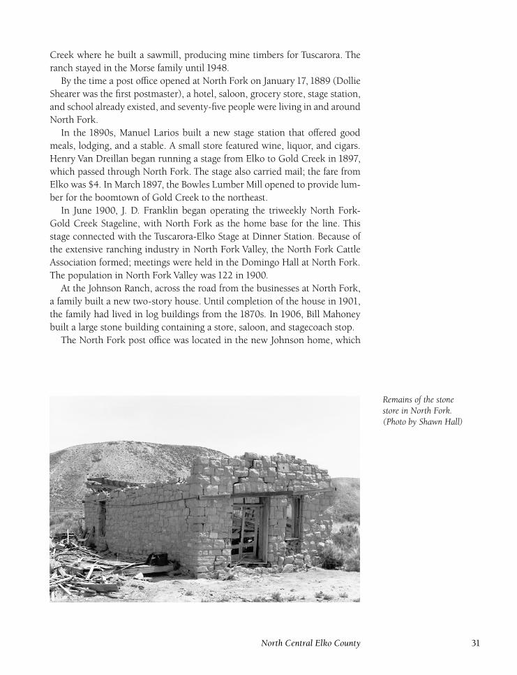
The North Fork post office was located in the new Johnson home, which
Remains of the stonestore in North Fork.(Photo by Shawn Hall)
North Central Elko County 31
also served as the lunch stop for the Elko-Mountain City stagecoach. After
Catherine Johnson died in 1908, two of her children, Lillian and Emery, took
over the ranch and other operations, and Lillian became the North Fork post-
master in 1909, a position she held for thirty-five years until the post office
closed on June 30, 1944.
In 1912, Lillian married Chester Laing, and the couple bought out Emery’s
interest in the ranch and businesses. Percy Royals and Chester Laing then
ran the store and built a dance hall next door. The North Fork School, some-
times called the Harrison School, was initially in a log cabin on the Johnson
Ranch; it later moved to a room of the new Johnson ranch house. The origi-
nal school later became part of the Robert ‘‘Doby Doc’’ Caudill collection that
was featured at the Last Frontier Village in Las Vegas, a tourist attraction con-
sisting of a collection of buildings and artifacts. The location of the school
has been a mystery since its sale after Caudill’s death. Teachers who taught at
the school included Mattie Keith, Blanche Plumb, Martha Gee, Mabel Mason,
Merle Mues, and Edith Billings.
Two other schools served other parts of the North Fork Valley. The North
Humboldt School, where teacher Flo Reed received $120 a month to teach
seven students, was located at the McKnight Ranch during the 1920s. The
school was a twelve-foot-by-twelve-foot adobe building with very thick walls.
In 1932, the Mahala School opened at the Tremewan ranch and was active for
a number of years.
As the years passed, the stagecoach lines stopped running, but the store
and saloon survived because of increased automobile traffic. In the 1930s,
Chester and Lillian Laing built a new store, the North Fork Mercantile, next
to their ranch. In August 1934, Wallace Frost and Earl McCullough robbed
the store of clothes, whiskey, bacon, and saddles and were later arrested for
the crime. The store, which was the last business in North Fork, burned to the
ground while leased to Joe and Alice LeGarza and was not rebuilt.
Despite the decline of the town of North Fork, ranching continued to be
important in the North Fork Valley. During the early 1940s, Newt Crum-
ley Sr. bought many of the ranches in the valley including the Kearns, Evans,
Bellinger, Saval, Truett, and Tremewan ranches. In July 1947, he sold all the
ranches except the Saval ranch to Bing Crosby, who had been named hon-
orary mayor of Elko in 1948. Crosby combined the ranches into one large
ranch, the Bing Crosby, or , Ranch, and spent as much time as possible at
the ranch with his family. John and Doris Eacret managed the Crosby ranch.
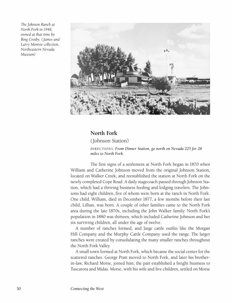
In June 1948, Crosby also purchased the Johnson, or Laing, ranch from
Chester and Lillian Laing, who had retired to Elko. In September1949, Crum-
ley sold the Saval ranch and retired from the cattle business. In December
1953, the Johnson ranch house was destroyed by fire. Crosby ran the
Ranch until November 1958 when he sold his holdings in North Fork to
Edward and William Johnson, and Earl Presnell, for more than $1 million.
32 Connecting the West
Although the ranches have changed hands over the years, the area con-
tinues to be a prosperous ranching district. At North Fork, the stone store still
stands, but the dance hall has collapsed. For years, a house made of bottles
stood at North Fork, but it is now gone. A huge barn marks the location of the
old Johnson Ranch. A number of foundations and other ruins remain at North
Fork, next to a Nevada Department of Transportation maintenance station.
O’Neil(O’Neill)
DIRECTIONS : From Wells, take Metropolis Road north for 13 miles. Gopast the Metropolis turnoff and continue north for 24 miles to O’Neil.
Although O’Neil referred to the specific location of a post office,
the name generally refers to the entire area in the O’Neil Basin. The O’Neil
family first came to Elko County in the mid-1880s after being run out of
White Pine County because of their illegal ranching practices. Initially the
family continued these illegal practices in their new home.
Four O’Neil brothers (James, William, Richard, and Charles) carried on
the family tradition of expanding their own cattle herd by taking cattle from
other ranchers’ herds. This practice had led to their father’s death at the hands
of a mob in White Pine County. The O’Neil family was known for its ornery
disposition. Not long after their arrival in Elko County, the four brothers were
caught killing cattle from the Mason and Bradley outfit:
There was considerable excitement last Friday over the arrest of W. T. and
R. C. O’Neil on a charge of killing cattle belonging to Mason and Bradley.
Deputy Sheriff Gleason was in the act of locking the two brothers in the
branch jail when a man rushed out of the rear of a group of buildings and,
raising a shotgun, fired at the boys. A sister of the O’Neils who saw the man
coming with the gun, rushed in front of her brother, Will, and received a
bad wound in the ankle. The front of Dick O’Neil’s coat has a number of
buck shot holes in it. As soon as the man fired, the boys left the officer and
went home for their rifles, saying they would protect themselves. The man
who fired at them got on a horse and left the country.4
The entire family, regardless of gender or age, was so intimidating
and dangerous that juries and judges were continually intimidated into ac-
quitting the O’Neils of rustling, brand alteration, and the attempted murder
of a constable. Nobody wanted to stand in their way and become an enemy of
the O’Neil clan. They were ruthless, and hired many gunmen to protect their
range; there was no tolerance of anyone trespassing in the O’Neil Basin. Over
North Central Elko County 33
time, however, the O’Neil family changed and eventually became a family of
respected ranchers.
A post office opened at the O’Neil ranch on August 17, 1894, with Richard
O’Neil as postmaster. The office closed on February 8, 1897, but reopened
on May 17, 1898, and remained in operation until January 25, 1925. James
O’Neil was postmaster the entire time. Occasional problems arose for the post
office because of its isolation. One example occurred in February 1903 when
Edward Burrows, a mail carrier employed by the O’Neils, lost one foot and
the toes on the other foot due to frostbite after becoming stranded in a snow-
storm.
By 1900, forty-eight people lived in the O’Neil area. In 1904, William,
James, and Charles O’Neil and William and James Capell formed the O’Neil-
Capell Land and Cattle Company. William Capell had married the O’Neils’
sister. By 1910, the company’s herds had grown to ten thousand cattle and
one hundred and fifty sheep. Ironically, the O’Neil family, who earlier drove
sheepherders off their range, was now one of the largest sheep outfits in the
state.
Some of the southern O’Neil holdings, including the old Hardesty Ranch,
were acquired by Horace Agee in 1910. Agee and the O’Neils had been at
odds for years, and the O’Neils had hired men to injure or kill Agee, without
success. Agee organized the Ox Yoke Livestock Company, which later consoli-
dated with the Steptoe Livestock Company in1915. The original O’Neil ranch
was made the company’s base, which the O’Neil family did not like. The com-
pany went out of business in 1932 due to the Depression. A telephone line to
Tobar was completed in1914; why the line went to Tobar instead of the closer
town of Wells is unknown. In April 1915, the O’Neil brothers bought out the
Capells for $250,000 and became sole owners of the O’Neil Company.
Cattle and sheep prices dropped dramatically in the early 1920s, which
spelled doom for the O’Neil empire. Another blow was the death of William
O’Neil in January 1920. In April 1925, Sheriff Joe Harris sold the ranch and
holdings to Wells Fargo for $248,000 to pay off the family’s debts.
The O’Neils then moved to California. Richard, a former president of the
cattle company, died in May 1926 and was remembered as ‘‘A great friend to
all, who never turned away a plea for a grubstake for miners and was always
a friend of the sheepherder and cattleman.’’5 James died in August 1926. The
O’Neil brothers had succeeded in turning their bad reputation into one of
high respect among residents of Elko County.
A school opened in 1932 near the old Helsley Ranch and operated for a
number of years. The O’Neil Basin continues today as an important ranching
area and numerous pre-1900 buildings are left on the scattered ranches in the
basin.
34 Connecting the West
Pie Station(Pie Creek) (Milk Station)
DIRECTIONS : From Dinner Station, go north on Nevada 225 for 8 milesto Pie Station.
Pie Station, or Milk Station as it was first called, was a stop on Hill
Beachey’s Elko-Idaho toll road beginning in 1869. A German baker ran the
station; hanging in front was a sign with ‘‘Piecake’’ written on it. Gradually
the station became known as Pie Station.
Once the Beachey line had folded, the station was abandoned, but was re-
established by J. H. Weiland in 1897 to serve the Gold Creek stagecoach line.
After Weiland’s death in 1900, his son Aleck took over the station, which was
permanently abandoned in 1907 when the Weiland family left the area.
Well-weathered, low adobe-type walls are all that is left of Pie Station. A
horse barn located nearby is of more recent origin.
Red PointDIRECTIONS : Located 3 miles north of Wilkins on the former OregonShort Line right-of-way.
Red Point, situated between Herrell and Shores, was a stop and
signal station on the Oregon Short Line beginning in 1925. Archie Bowman
named the location for a prominent red formation located on an adjacent hill.
Because of its location, Red Point was a busy cattle-shipping point. When the
Oregon Short Line ceased operations in 1978, the buildings and tracks at Red
Point were removed. Today, concrete foundations and wood rubble mark the
site.
RiversideDIRECTIONS : From Hubbard, go south on U.S. 93 for three miles toRiverside.
Riverside, located near the present-day Boies Ranch, was a siding
and depot for the Oregon Short Line from1925 to1978. During the construc-
tion of the railroad, a small temporary town was built at Riverside to accom-
modate construction crews. Once the line was completed, the buildings were
removed and only concrete foundations remain.
North Central Elko County 35
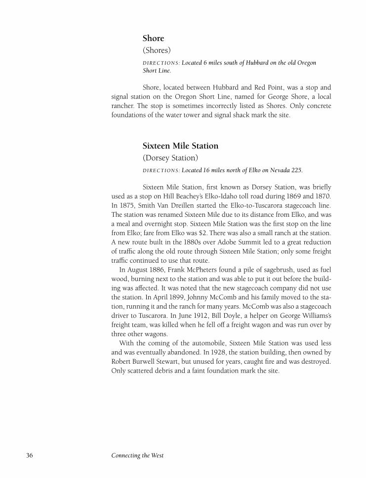
Shore(Shores)
DIRECTIONS : Located 6 miles south of Hubbard on the old OregonShort Line.
Shore, located between Hubbard and Red Point, was a stop and
signal station on the Oregon Short Line, named for George Shore, a local
rancher. The stop is sometimes incorrectly listed as Shores. Only concrete
foundations of the water tower and signal shack mark the site.
Sixteen Mile Station(Dorsey Station)
DIRECTIONS : Located 16 miles north of Elko on Nevada 225.
Sixteen Mile Station, first known as Dorsey Station, was briefly
used as a stop on Hill Beachey’s Elko-Idaho toll road during 1869 and 1870.
In 1875, Smith Van Dreillen started the Elko-to-Tuscarora stagecoach line.
The station was renamed Sixteen Mile due to its distance from Elko, and was
a meal and overnight stop. Sixteen Mile Station was the first stop on the line
from Elko; fare from Elko was $2. There was also a small ranch at the station.
A new route built in the 1880s over Adobe Summit led to a great reduction
of traffic along the old route through Sixteen Mile Station; only some freight
traffic continued to use that route.
In August 1886, Frank McPheters found a pile of sagebrush, used as fuel
wood, burning next to the station and was able to put it out before the build-
ing was affected. It was noted that the new stagecoach company did not use
the station. In April 1899, Johnny McComb and his family moved to the sta-
tion, running it and the ranch for many years. McComb was also a stagecoach
driver to Tuscarora. In June 1912, Bill Doyle, a helper on George Williams’s
freight team, was killed when he fell off a freight wagon and was run over by
three other wagons.
With the coming of the automobile, Sixteen Mile Station was used less
and was eventually abandoned. In 1928, the station building, then owned by
Robert Burwell Stewart, but unused for years, caught fire and was destroyed.
Only scattered debris and a faint foundation mark the site.
36 Connecting the West
Stofiel(Butlers) (Wildhorse)
DIRECTIONS : Located 19 miles south of Mountain City on Nevada 225.
Stofiel was named for Walter Stofiel. He first came to the area in
the 1870s and got involved in mining at Island Mountain with Emmanuel
Penrod, one of the original locators of the Comstock Lode. Stofiel married
Penrod’s daughter, Lydia, in 1877. In 1880, the Stofiel family moved to Belle-
vue, Idaho, but returned a couple of years later, establishing a small ranch
and stage station near the future site of Wildhorse Reservoir.
The boom in Gold Creek turned the Stofiel stop into an important ship-
ping point for supplies heading to the mining camp. A post office opened
at Stofiel on June 11, 1891, and remained open until July 15, 1897. Lydia
Stofiel served as postmaster until she died of pneumonia in January 1897.
After Lydia’s death, Walter Stofiel raised their three children.
In 1897, Henry Van Dreillan began a stagecoach line from Elko to Gold
Creek with a fare from Elko of $5. Stofiel moved away after 1900, and died in
Los Angeles in May 1905. The Butler family ran the stage station until it was
no longer needed in the 1910s.
Construction of the Wildhorse Dam in 1936 brought many workers to the
area. The dam was completed in January 1937 and dedicated on Septem-
ber 6, 1937. Besides providing irrigation water for ranchers and farmers, the
reservoir was a recreation site, and a couple of businesses opened near the
reservoir. The Wildhorse post office operated from July 3, 1945, to Febru-
ary 28, 1948, with Josephine Ford as postmaster. Wildhorse Reservoir con-
tinues today as a popular destination for water recreation and fishing. A store
and gas station are located nearby.
Summer CampDIRECTIONS : Located 4 miles northwest of Melandco on the formerOregon Short Line right-of-way.
Summer Camp, located between Melandco and Herrell, was a stop
and signal station on the Oregon Short Line from 1925 to 1978, used mainly
to ship cattle. Only concrete foundations of the small depot and water tower
remain.
North Central Elko County 37
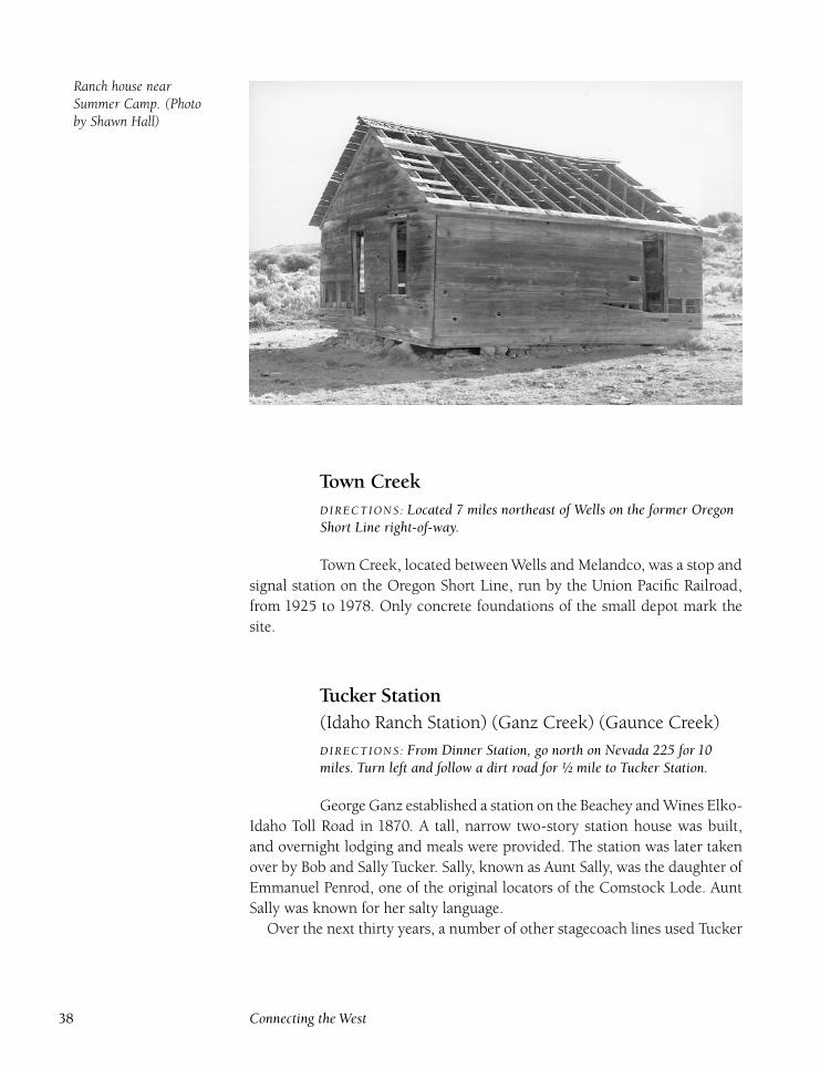
Ranch house nearSummer Camp. (Photoby Shawn Hall)
Town CreekDIRECTIONS : Located 7 miles northeast of Wells on the former OregonShort Line right-of-way.
Town Creek, located between Wells and Melandco, was a stop and
signal station on the Oregon Short Line, run by the Union Pacific Railroad,
from 1925 to 1978. Only concrete foundations of the small depot mark the
site.
Tucker Station(Idaho Ranch Station) (Ganz Creek) (Gaunce Creek)
DIRECTIONS : From Dinner Station, go north on Nevada 225 for 10miles. Turn left and follow a dirt road for ½ mile to Tucker Station.
George Ganz established a station on the Beachey and Wines Elko-
Idaho Toll Road in 1870. A tall, narrow two-story station house was built,
and overnight lodging and meals were provided. The station was later taken
over by Bob and Sally Tucker. Sally, known as Aunt Sally, was the daughter of
Emmanuel Penrod, one of the original locators of the Comstock Lode. Aunt
Sally was known for her salty language.
Over the next thirty years, a number of other stagecoach lines used Tucker
38 Connecting the West
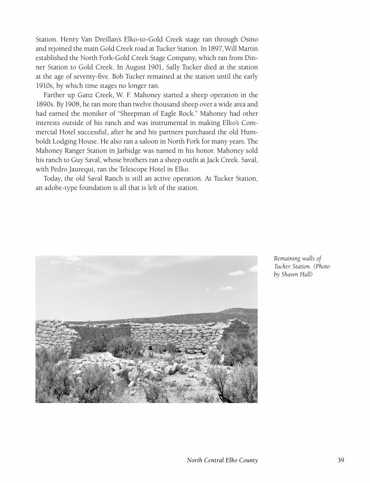
Station. Henry Van Dreillan’s Elko-to-Gold Creek stage ran through Osino
and rejoined the main Gold Creek road at Tucker Station. In1897,Will Martin
established the North Fork-Gold Creek Stage Company, which ran from Din-
ner Station to Gold Creek. In August 1901, Sally Tucker died at the station
at the age of seventy-five. Bob Tucker remained at the station until the early
1910s, by which time stages no longer ran.
Farther up Ganz Creek, W. F. Mahoney started a sheep operation in the
1890s. By1908, he ran more than twelve thousand sheep over a wide area and
had earned the moniker of ‘‘Sheepman of Eagle Rock.’’ Mahoney had other
interests outside of his ranch and was instrumental in making Elko’s Com-
mercial Hotel successful, after he and his partners purchased the old Hum-
boldt Lodging House. He also ran a saloon in North Fork for many years. The
Mahoney Ranger Station in Jarbidge was named in his honor. Mahoney sold
his ranch to Guy Saval, whose brothers ran a sheep outfit at Jack Creek. Saval,
with Pedro Jaurequi, ran the Telescope Hotel in Elko.
Today, the old Saval Ranch is still an active operation. At Tucker Station,
an adobe-type foundation is all that is left of the station.
Remaining walls ofTucker Station. (Photoby Shawn Hall)
North Central Elko County 39
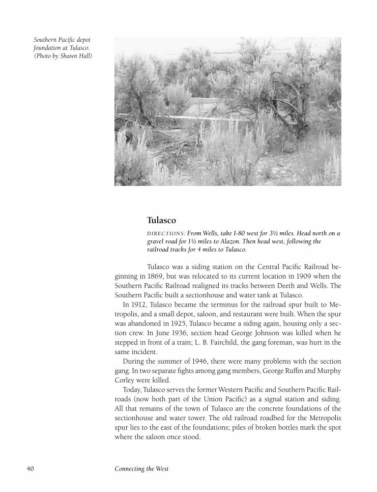
Southern Pacific depotfoundation at Tulasco.(Photo by Shawn Hall)
TulascoDIRECTIONS : From Wells, take I-80 west for 3½ miles. Head north on agravel road for 1½ miles to Alazon. Then head west, following therailroad tracks for 4 miles to Tulasco.
Tulasco was a siding station on the Central Pacific Railroad be-
ginning in 1869, but was relocated to its current location in 1909 when the
Southern Pacific Railroad realigned its tracks between Deeth and Wells. The
Southern Pacific built a sectionhouse and water tank at Tulasco.
In 1912, Tulasco became the terminus for the railroad spur built to Me-
tropolis, and a small depot, saloon, and restaurant were built. When the spur
was abandoned in 1925, Tulasco became a siding again, housing only a sec-
tion crew. In June 1936, section head George Johnson was killed when he
stepped in front of a train; L. B. Fairchild, the gang foreman, was hurt in the
same incident.
During the summer of 1946, there were many problems with the section
gang. In two separate fights among gang members, George Ruffin and Murphy
Corley were killed.
Today, Tulasco serves the former Western Pacific and Southern Pacific Rail-
roads (now both part of the Union Pacific) as a signal station and siding.
All that remains of the town of Tulasco are the concrete foundations of the
sectionhouse and water tower. The old railroad roadbed for the Metropolis
spur lies to the east of the foundations; piles of broken bottles mark the spot
where the saloon once stood.
40 Connecting the West
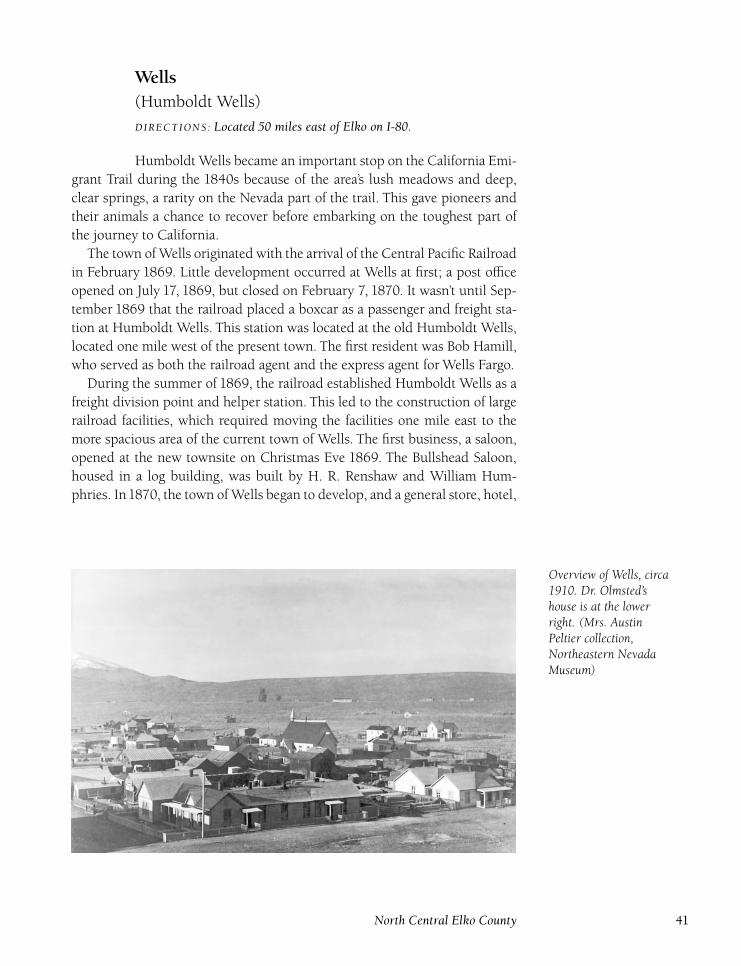
Wells(Humboldt Wells)
DIRECTIONS : Located 50 miles east of Elko on I-80.
Humboldt Wells became an important stop on the California Emi-
grant Trail during the 1840s because of the area’s lush meadows and deep,
clear springs, a rarity on the Nevada part of the trail. This gave pioneers and
their animals a chance to recover before embarking on the toughest part of
the journey to California.
The town of Wells originated with the arrival of the Central Pacific Railroad
in February 1869. Little development occurred at Wells at first; a post office
opened on July 17, 1869, but closed on February 7, 1870. It wasn’t until Sep-
tember 1869 that the railroad placed a boxcar as a passenger and freight sta-
tion at Humboldt Wells. This station was located at the old Humboldt Wells,
located one mile west of the present town. The first resident was Bob Hamill,
who served as both the railroad agent and the express agent for Wells Fargo.
During the summer of 1869, the railroad established Humboldt Wells as a
freight division point and helper station. This led to the construction of large
railroad facilities, which required moving the facilities one mile east to the
more spacious area of the current town of Wells. The first business, a saloon,
opened at the new townsite on Christmas Eve 1869. The Bullshead Saloon,
housed in a log building, was built by H. R. Renshaw and William Hum-
phries. In1870, the town of Wells began to develop, and a general store, hotel,
Overview of Wells, circa1910. Dr. Olmsted’shouse is at the lowerright. (Mrs. AustinPeltier collection,Northeastern NevadaMuseum)
North Central Elko County 41
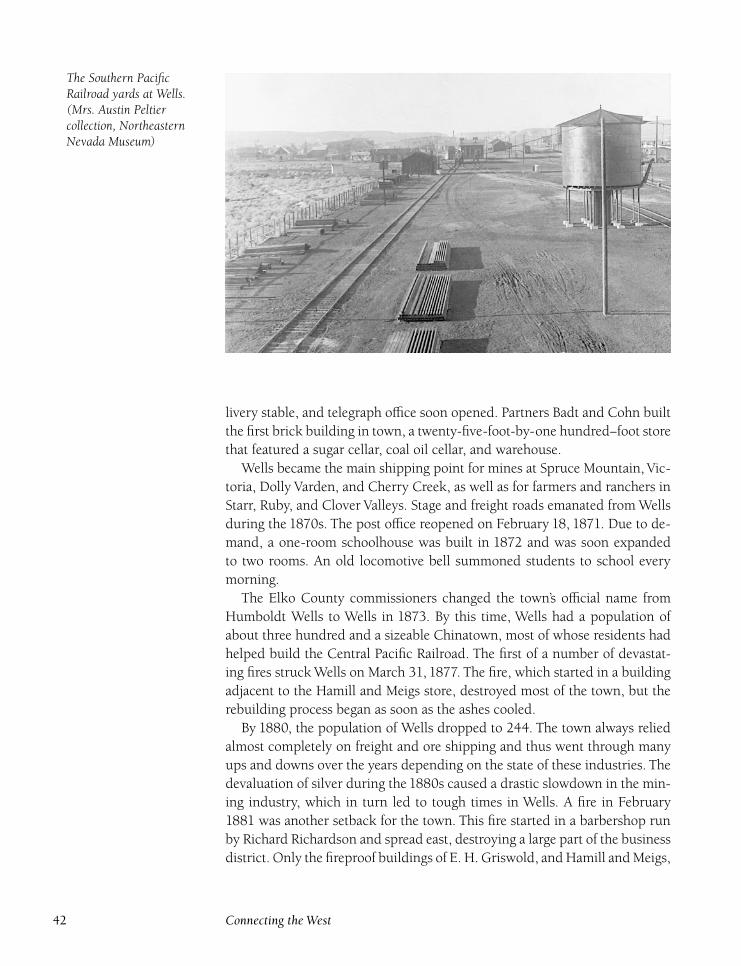
The Southern PacificRailroad yards at Wells.(Mrs. Austin Peltiercollection, NortheasternNevada Museum)
livery stable, and telegraph office soon opened. Partners Badt and Cohn built
the first brick building in town, a twenty-five-foot-by-one hundred–foot store
that featured a sugar cellar, coal oil cellar, and warehouse.
Wells became the main shipping point for mines at Spruce Mountain, Vic-
toria, Dolly Varden, and Cherry Creek, as well as for farmers and ranchers in
Starr, Ruby, and Clover Valleys. Stage and freight roads emanated from Wells
during the 1870s. The post office reopened on February 18, 1871. Due to de-
mand, a one-room schoolhouse was built in 1872 and was soon expanded
to two rooms. An old locomotive bell summoned students to school every
morning.
The Elko County commissioners changed the town’s official name from
Humboldt Wells to Wells in 1873. By this time, Wells had a population of
about three hundred and a sizeable Chinatown, most of whose residents had
helped build the Central Pacific Railroad. The first of a number of devastat-
ing fires struck Wells on March 31, 1877. The fire, which started in a building
adjacent to the Hamill and Meigs store, destroyed most of the town, but the
rebuilding process began as soon as the ashes cooled.
By 1880, the population of Wells dropped to 244. The town always relied
almost completely on freight and ore shipping and thus went through many
ups and downs over the years depending on the state of these industries. The
devaluation of silver during the 1880s caused a drastic slowdown in the min-
ing industry, which in turn led to tough times in Wells. A fire in February
1881 was another setback for the town. This fire started in a barbershop run
by Richard Richardson and spread east, destroying a large part of the business
district. Only the fireproof buildings of E. H. Griswold, and Hamill and Meigs,
42 Connecting the West
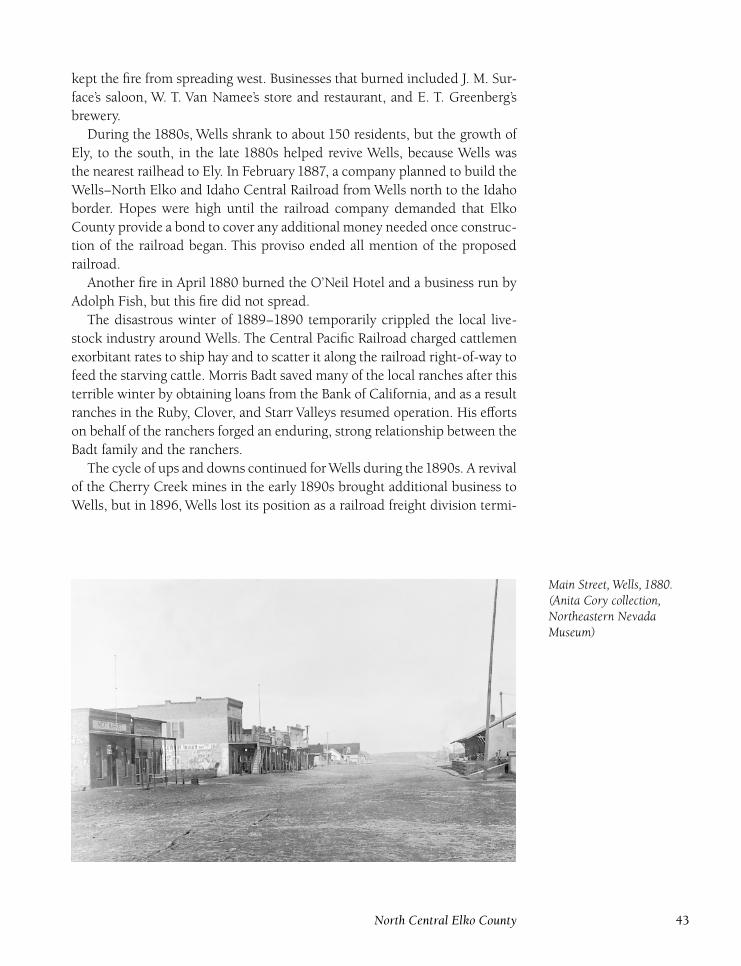
kept the fire from spreading west. Businesses that burned included J. M. Sur-
face’s saloon, W. T. Van Namee’s store and restaurant, and E. T. Greenberg’s
brewery.
During the 1880s, Wells shrank to about 150 residents, but the growth of
Ely, to the south, in the late 1880s helped revive Wells, because Wells was
the nearest railhead to Ely. In February 1887, a company planned to build the
Wells–North Elko and Idaho Central Railroad from Wells north to the Idaho
border. Hopes were high until the railroad company demanded that Elko
County provide a bond to cover any additional money needed once construc-
tion of the railroad began. This proviso ended all mention of the proposed
railroad.
Another fire in April 1880 burned the O’Neil Hotel and a business run by
Adolph Fish, but this fire did not spread.
The disastrous winter of 1889–1890 temporarily crippled the local live-
stock industry around Wells. The Central Pacific Railroad charged cattlemen
exorbitant rates to ship hay and to scatter it along the railroad right-of-way to
feed the starving cattle. Morris Badt saved many of the local ranches after this
terrible winter by obtaining loans from the Bank of California, and as a result
ranches in the Ruby, Clover, and Starr Valleys resumed operation. His efforts
on behalf of the ranchers forged an enduring, strong relationship between the
Badt family and the ranchers.
The cycle of ups and downs continued forWells during the1890s. A revival
of the Cherry Creek mines in the early 1890s brought additional business to
Wells, but in 1896, Wells lost its position as a railroad freight division termi-
Main Street, Wells, 1880.(Anita Cory collection,Northeastern NevadaMuseum)
North Central Elko County 43
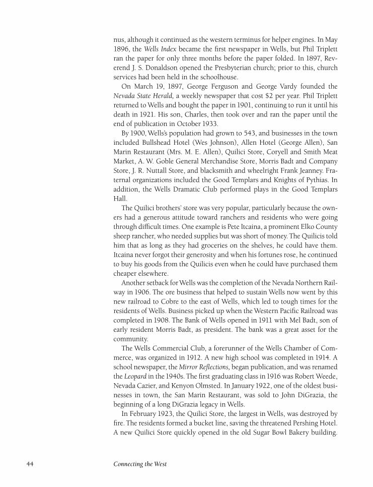
nus, although it continued as the western terminus for helper engines. In May
1896, the Wells Index became the first newspaper in Wells, but Phil Triplett
ran the paper for only three months before the paper folded. In 1897, Rev-
erend J. S. Donaldson opened the Presbyterian church; prior to this, church
services had been held in the schoolhouse.
On March 19, 1897, George Ferguson and George Vardy founded the
Nevada State Herald, a weekly newspaper that cost $2 per year. Phil Triplett
returned to Wells and bought the paper in 1901, continuing to run it until his
death in 1921. His son, Charles, then took over and ran the paper until the
end of publication in October 1933.
By 1900, Wells’s population had grown to 543, and businesses in the town
included Bullshead Hotel (Wes Johnson), Allen Hotel (George Allen), San
Marin Restaurant (Mrs. M. E. Allen), Quilici Store, Coryell and Smith Meat
Market, A. W. Goble General Merchandise Store, Morris Badt and Company
Store, J. R. Nuttall Store, and blacksmith and wheelright Frank Jeanney. Fra-
ternal organizations included the Good Templars and Knights of Pythias. In
addition, the Wells Dramatic Club performed plays in the Good Templars
Hall.
The Quilici brothers’ store was very popular, particularly because the own-
ers had a generous attitude toward ranchers and residents who were going
through difficult times. One example is Pete Itcaina, a prominent Elko County
sheep rancher, who needed supplies but was short of money. The Quilicis told
him that as long as they had groceries on the shelves, he could have them.
Itcaina never forgot their generosity and when his fortunes rose, he continued
to buy his goods from the Quilicis even when he could have purchased them
cheaper elsewhere.
Another setback forWells was the completion of the Nevada Northern Rail-
way in 1906. The ore business that helped to sustain Wells now went by this
new railroad to Cobre to the east of Wells, which led to tough times for the
residents of Wells. Business picked up when the Western Pacific Railroad was
completed in 1908. The Bank of Wells opened in 1911 with Mel Badt, son of
early resident Morris Badt, as president. The bank was a great asset for the
community.
The Wells Commercial Club, a forerunner of the Wells Chamber of Com-
merce, was organized in 1912. A new high school was completed in 1914. A
school newspaper, the Mirror Reflections, began publication, and was renamed
the Leopard in the1940s. The first graduating class in1916 was Robert Weede,
Nevada Cazier, and Kenyon Olmsted. In January1922, one of the oldest busi-
nesses in town, the San Marin Restaurant, was sold to John DiGrazia, the
beginning of a long DiGrazia legacy in Wells.
In February 1923, the Quilici Store, the largest in Wells, was destroyed by
fire. The residents formed a bucket line, saving the threatened Pershing Hotel.
A new Quilici Store quickly opened in the old Sugar Bowl Bakery building.
44 Connecting the West
Wells Meat Market inthe early 1900s. (ZeldaWiseman collection,Northeastern NevadaMuseum)
During the 1920s, a Wells baseball team competed in the professional Hum-
boldt Valley League.
One of the biggest days in Wells history was February 15, 1926, when the
Oregon Short Line () Railroad, owned by the Union Pacific Railroad, offi-
cially arrived at Wells. The railroad right-of-way had actually been completed
a couple of months earlier. Fifteen hundred people attended the celebration of
the railroad’s arrival. The first train had two engines, a baggage car, seven
Pullman cars, and two private cars, containing many dignitaries. To cap off a
great day, the Wells High School basketball team beat its rival, Metropolis, for
the first time in three years.
Another big event was the municipal incorporation of Wells in May 1927.
The vote was very close, and the measure passed by only nine votes. The first
city council consisted of George Toombs, J. W. Felts, and Albert Supp. H. H.
Coryell, a longtime resident, was elected the first mayor, but died in April
1928. Before becoming mayor, Coryell had served as president pro tem of the
Nevada Senate for forty-four years. Coryell had formerly owned Dinner Sta-
tion, located north of Elko. After his death, his wife became the first female
member of the city council.
In December 1927, Wells received special honor when the town became a
part of the first rural electrification system in Nevada. The power was supplied
by a hydroelectric plant at Trout Creek, built by H. H. Cazier. He established
the Wells Power Company, later purchased by the Wells Rural Electrification
Company. Wells’s fortunes were kept alive by its reliance on the railroad and
North Central Elko County 45
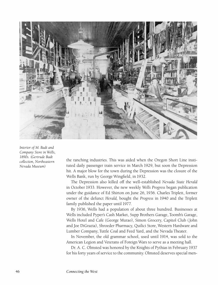
Interior of M. Badt andCompany Store in Wells,1890s. (Gertrude Badtcollection, NortheasternNevada Museum)
the ranching industries. This was aided when the Oregon Short Line insti-
tuted daily passenger train service in March 1929, but soon the Depression
hit. A major blow for the town during the Depression was the closure of the
Wells Bank, run by George Wingfield, in 1932.
The Depression also killed off the well-established Nevada State Heraldin October 1933. However, the new weekly Wells Progress began publication
under the guidance of Ed Shirton on June 26, 1936. Charles Triplett, former
owner of the defunct Herald, bought the Progress in 1940 and the Triplett
family published the paper until 1977.
By 1936, Wells had a population of about three hundred. Businesses at
Wells included Pyper’s Cash Market, Supp Brothers Garage, Toomb’s Garage,
Wells Hotel and Cafe (George Murao), Simon Grocery, Capitol Club (John
and Joe DiGrazia), Shroeder Pharmacy, Quilici Store, Western Hardware and
Lumber Company, Tuttle Coal and Feed Yard, and the Nevada Theater.
In November, the old grammar school, used until 1914, was sold to the
American Legion and Veterans of Foreign Wars to serve as a meeting hall.
Dr. A. C. Olmsted was honored by the Knights of Pythias in February1937
for his forty years of service to the community. Olmsted deserves special men-
46 Connecting the West
tion because he had a great impact on Wells and its citizens. He came to Wells
in 1897 and set up a private medical practice, but also served as the company
doctor for the railroads served by Wells.
Olmsted, also the town veterinarian, was often called late at night to travel
to places like Wendover, Montello, Cobre, and Shafter. Olmsted’s passion,
however, was baseball, and he managed the Wells team in the Humboldt
Baseball League. Olmsted had a kidney condition during the last years of his
life but never refused to see a patient. Olmsted died on June 14, 1943, at the
age of seventy-two, a valued member of the Wells community.
Another fire struck Wells in March 1937, destroying the Western Lumber
and Hardware building and its lumber. Only a great effort and a favorable
wind kept the main business district from burning. The cause of the fire was
arson, following an unsuccessful attempt a few days earlier. In May 1937 a
volunteer fire department was organized in Wells with Carl Supp as the first
fire chief. During the same month, a new Catholic church was completed.
In 1938 and 1939, a movement began to split Elko County into two coun-
ties, with Wells intended to be the county seat of new Ruby County. Wells
residents had felt slighted by rival city Elko for years and finally formed a
Committee on County Division. Proponents believed that if a new county
was formed, property taxes would drop 46 percent. The Elko newspapers
responded with fury, referring to the taxpayers in the eastern part of the
county as ‘‘the south end of an Equus Caballus going north,’’ stating that the
new county should be called Shirttail County. Eventually, the furor died out,
mainly because of Elko County legislation that required a two-thirds vote of
the county’s residents to split the county.
In March 1940, the property of the defunct Wells Bank (which included
the bank building, grazing lands, and twenty-two thousand shares of the
Missouri-Monarch Consolidated Mining Company at Spruce Mountain) was
sold to Leo Quilici for $2,000. In 1943, Quilici also purchased the Wells
Hotel. The Ely-Wells bus line began operating in July 1941 on the same day
that the Nevada Northern Railway discontinued passenger service from Cobre
to Ely.
The economy of Wells slowly turned to tourism for survival. Fires con-
tinued to plague Wells. In August 1943, the Western Pacific depot was de-
stroyed at a loss of $20,000. A temporary station was set up in an outfit
car until a new station was completed. In September, J. A. Donelly bought
the Overland Hotel from J. H. Wein for $20,000, and W. C. Wilson sold the
Golden Rule Store to Harry Bradley in 1945.
During World War a number of young men from Wells were killed
in action, including Norvin Davis, Daniel Remick, Clarence Collins, Louis
Simon, and Robert Curtiss. Returning veterans Carl and Matt Smith opened
Smith’s Grocery Store, and Charles Nannini opened the Eagle Club in 1946.
The local Lions Club was organized in 1946. The same year, the federal
North Central Elko County 47
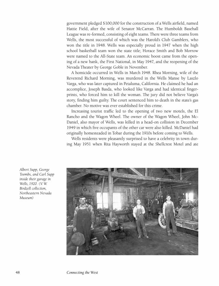
government pledged $100,000 for the construction of a Wells airfield, named
Hattie Field, after the wife of Senator McCarran. The Humboldt Baseball
League was re-formed, consisting of eight teams. There were three teams from
Wells, the most successful of which was the Harold’s Club Gamblers, who
won the title in 1948. Wells was especially proud in 1947 when the high
school basketball team won the state title; Horace Smith and Bob Morrow
were named to the All-State team. An economic boost came from the open-
ing of a new bank, the First National, in May 1947, and the reopening of the
Nevada Theater by George Goble in November.
A homicide occurred in Wells in March 1948. Rhea Morning, wife of the
Reverend Richard Morning, was murdered in the Wells Manse by Laszlo
Varga, who was later captured in Petaluma, California. He claimed he had an
accomplice, Joseph Basda, who looked like Varga and had identical finger-
prints, who forced him to kill the woman. The jury did not believe Varga’s
story, finding him guilty. The court sentenced him to death in the state’s gas
chamber. No motive was ever established for this crime.
Increasing tourist traffic led to the opening of two new motels, the El
Rancho and the Wagon Wheel. The owner of the Wagon Wheel, John Mc-
Daniel, also mayor of Wells, was killed in a head-on collision in December
1949 in which five occupants of the other car were also killed. McDaniel had
originally homesteaded in Tobar during the 1910s before coming to Wells.
Wells residents were pleasantly surprised to have a celebrity in town dur-
ing May 1951 when Rita Hayworth stayed at the Shellcrest Motel and ate
Albert Supp, GeorgeToombs, and Carl Suppinside their garage inWells, 1920. (V. W.Birdzell collection,Northeastern NevadaMuseum)
48 Connecting the West
breakfast at the Skyway Cafe before continuing on her trip. In July, the Golden
Rule Store was sold, this time to H. E. and Charles Read of Mountain City,
who also had stores in Mountain City, Owyhee, and Eureka.
As elsewhere, a setback for the Wells economy came with the arrival of
diesel locomotives, which eliminated the need for the helper engines for
mountain grades that Wells provided. Fortunately for its economy, Wells no
longer relied as heavily on the railroads as it had in the past, and the impact
was minimal. A political surprise took place in 1952 when local resident Tom
Mechling upset Alan Bible for the Democratic Party nomination for the U.S.
Senate. Although Mechling lost to George Malone in the general election, his
surprise defeat of Bible in the primary made him a local hero.
In January 1955, the Hinds Shell Station was completely destroyed by an
explosion and resulting fire. Part of an adjacent motel also burned, and the
concussion from the blast broke $15,000 worth of glass in nearby businesses.
Many remnants of Wells’s early days were torn down over the next twenty
years. The Southern Pacific’s 65,000-gallon water tank was dismantled and
moved to Myers Station, south of Lake Tahoe, in 1959. The old high school,
which had been replaced in 1953, was sold for $1,950 to Thomas McCrary,
who tore it down and used the materials to build a new house. The school’s
cornerstone, laid in1914, contained many relics, including a copy of the legis-
lative act issuing bonds for the school’s construction, and copies of the NevadaState Herald, Elko Free Press, and Elko Independent. The first eight students in
1914 were Bert Brandis, Nevada Cazier, Zanzie Connolly, Glen Firth, Edwin
Lambert, Kenyon Olmsted, Jesse Turner, and Dolly Woolverton. Gerald Kerr
was principal.
The Allen Hotel, a stately two-story stone and brick structure, was torn
down in 1973. The Presbyterian church, built in 1897, was completely re-
stored in 1966. The Wagon Wheel Motel and Restaurant were torn down in
1978. The Wells Grammar School, built in 1931, was demolished in 1978 to
make way for a new school. The Ranch House Casino and Restaurant burned
in 1980, killing four patrons and resulting in a loss of $1 million.
The closure of the Oregon Short Line railroad in 1978 ended Wells’s di-
rect association with railroading, although Union Pacific trains on the former
Western Pacific and Southern Pacific mainlines still rumble through town
without stopping.
The venerable Wells Progress ended publication in September 1989. Dur-
ing the last few years of publication, the newspaper tried many different ap-
proaches and local editions in an effort to increase subscriptions. During
1985, there were four different papers: Wells Progress, Jackpot Progress, Wen-dover Progress, and Carlin-Eureka Progress. Later, the number shrank to two:
Wells Progress and the Carlin-Eureka-Jackpot-Spring Creek-Lamoille-Wendoveredition. By 1986, only the Wells Progress was left, although the Elko CountyProgress was produced briefly in 1987.
North Central Elko County 49
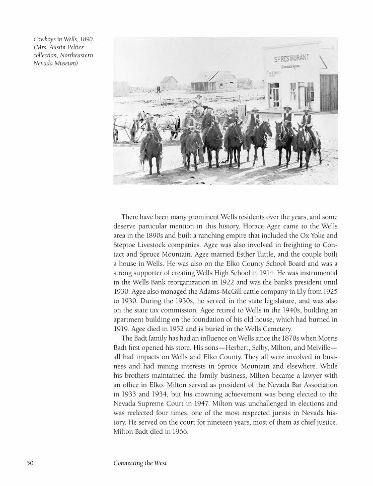
Cowboys in Wells, 1890.(Mrs. Austin Peltiercollection, NortheasternNevada Museum)
There have been many prominent Wells residents over the years, and some
deserve particular mention in this history. Horace Agee came to the Wells
area in the 1890s and built a ranching empire that included the Ox Yoke and
Steptoe Livestock companies. Agee was also involved in freighting to Con-
tact and Spruce Mountain. Agee married Esther Tuttle, and the couple built
a house in Wells. He was also on the Elko County School Board and was a
strong supporter of creating Wells High School in 1914. He was instrumental
in the Wells Bank reorganization in 1922 and was the bank’s president until
1930. Agee also managed the Adams-McGill cattle company in Ely from1925
to 1930. During the 1930s, he served in the state legislature, and was also
on the state tax commission. Agee retired to Wells in the 1940s, building an
apartment building on the foundation of his old house, which had burned in
1919. Agee died in 1952 and is buried in the Wells Cemetery.
The Badt family has had an influence on Wells since the1870s when Morris
Badt first opened his store. His sons—Herbert, Selby, Milton, and Melville—
all had impacts on Wells and Elko County. They all were involved in busi-
ness and had mining interests in Spruce Mountain and elsewhere. While
his brothers maintained the family business, Milton became a lawyer with
an office in Elko. Milton served as president of the Nevada Bar Association
in 1933 and 1934, but his crowning achievement was being elected to the
Nevada Supreme Court in 1947. Milton was unchallenged in elections and
was reelected four times, one of the most respected jurists in Nevada his-
tory. He served on the court for nineteen years, most of them as chief justice.
Milton Badt died in 1966.
50 Connecting the West
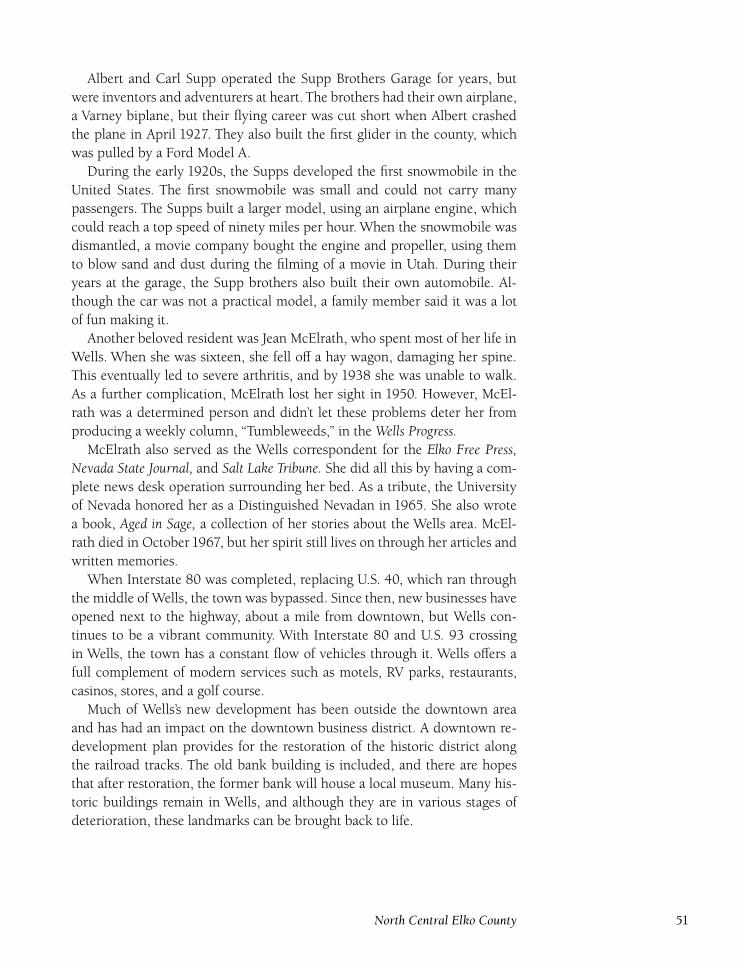
Albert and Carl Supp operated the Supp Brothers Garage for years, but
were inventors and adventurers at heart. The brothers had their own airplane,
a Varney biplane, but their flying career was cut short when Albert crashed
the plane in April 1927. They also built the first glider in the county, which
was pulled by a Ford Model A.
During the early 1920s, the Supps developed the first snowmobile in the
United States. The first snowmobile was small and could not carry many
passengers. The Supps built a larger model, using an airplane engine, which
could reach a top speed of ninety miles per hour. When the snowmobile was
dismantled, a movie company bought the engine and propeller, using them
to blow sand and dust during the filming of a movie in Utah. During their
years at the garage, the Supp brothers also built their own automobile. Al-
though the car was not a practical model, a family member said it was a lot
of fun making it.
Another beloved resident was Jean McElrath, who spent most of her life in
Wells. When she was sixteen, she fell off a hay wagon, damaging her spine.
This eventually led to severe arthritis, and by 1938 she was unable to walk.
As a further complication, McElrath lost her sight in 1950. However, McEl-
rath was a determined person and didn’t let these problems deter her from
producing a weekly column, ‘‘Tumbleweeds,’’ in the Wells Progress.McElrath also served as the Wells correspondent for the Elko Free Press,
Nevada State Journal, and Salt Lake Tribune. She did all this by having a com-
plete news desk operation surrounding her bed. As a tribute, the University
of Nevada honored her as a Distinguished Nevadan in 1965. She also wrote
a book, Aged in Sage, a collection of her stories about the Wells area. McEl-
rath died in October 1967, but her spirit still lives on through her articles and
written memories.
When Interstate 80 was completed, replacing U.S. 40, which ran through
the middle of Wells, the town was bypassed. Since then, new businesses have
opened next to the highway, about a mile from downtown, but Wells con-
tinues to be a vibrant community. With Interstate 80 and U.S. 93 crossing
in Wells, the town has a constant flow of vehicles through it. Wells offers a
full complement of modern services such as motels, RV parks, restaurants,
casinos, stores, and a golf course.
Much of Wells’s new development has been outside the downtown area
and has had an impact on the downtown business district. A downtown re-
development plan provides for the restoration of the historic district along
the railroad tracks. The old bank building is included, and there are hopes
that after restoration, the former bank will house a local museum. Many his-
toric buildings remain in Wells, and although they are in various stages of
deterioration, these landmarks can be brought back to life.
North Central Elko County 51
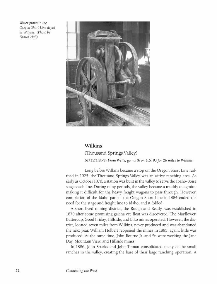
Water pump in theOregon Short Line depotat Wilkins. (Photo byShawn Hall)
Wilkins(Thousand Springs Valley)
DIRECTIONS : From Wells, go north on U.S. 93 for 26 miles to Wilkins.
Long before Wilkins became a stop on the Oregon Short Line rail-
road in 1925, the Thousand Springs Valley was an active ranching area. As
early as October1870, a station was built in the valley to serve the Toano-Boise
stagecoach line. During rainy periods, the valley became a muddy quagmire,
making it difficult for the heavy freight wagons to pass through. However,
completion of the Idaho part of the Oregon Short Line in 1884 ended the
need for the stage and freight line to Idaho, and it folded.
A short-lived mining district, the Rough and Ready, was established in
1870 after some promising galena ore float was discovered. The Mayflower,
Buttercup, Good Friday, Hillside, and Elko mines operated. However, the dis-
trict, located seven miles from Wilkins, never produced and was abandoned
the next year. William Holbert reopened the mines in 1885; again, little was
produced. At the same time, John Bourne Jr. and Sr. were working the Jane
Day, Mountain View, and Hillside mines.
In 1886, John Sparks and John Tinnan consolidated many of the small
ranches in the valley, creating the base of their large ranching operation. A
52 Connecting the West
few years earlier, Jasper Harrell started the Winecup and HD Ranches, but
Harrell sold his holdings to Sparks and Tinnan in 1886 for $950,000. Harrell
used the money to open several mines on Spruce Mountain. In1891, after the
disastrous winter of 1890–1891, Tinnan sold his part of the cattle company to
Andrew Harrell, son of Jasper. The Sparks-Harrell Company now controlled
virtually all of the ranches in the valley. Sparks later sold his share to Harrell
so he could begin a career in politics. Sparks was elected governor of Nevada
in 1902, serving until his death in 1908. Harrell died in 1907; ownership of
the cattle company passed to the Vineyard Land and Livestock Company in
1908.
At the same time, B. B. ‘‘Bush’’ Wilkins, a former bartender at Wells, began
a ranch in the Thousand Springs Valley. In February 1911, Wilkins was sick in
bed when a drunken Joe Ford broke into the house and confronted Wilkins.
Wilkins shot and killed Ford; the homicide was ruled self-defense.
The Utah Construction Company took over the Vineyard Company in
1921. In 1925, the Oregon Short Line branch to Wells was completed, and
the railroad built a small depot and water station near the Wilkins Ranch.
The branch line became an important cattle-shipping point for the valley. A
school periodically operated at the HD and Winecup Ranches from the 1910s
through the1930s. After the Utah Construction Company folded, its holdings
were bought by Russell Wilkins and Martin Wunderlich.
Oregon Short Linewater station and depotat Wilkins. (Photo byShawn Hall)
North Central Elko County 53
In the 1940s, a hotel, store, and service station opened on U.S. 93 near the
Winecup Ranch. It was owned by the ranch and managed by John Moschetti.
The gas station was the first Phillips 66 station in Nevada, which Wilkins de-
veloped into a full-service truck stop, with a mechanic on duty twenty-four
hours a day and twelve employees in all. The Wilkins post office opened on
July 1, 1948, with Moschetti as postmaster. Tom Bowers took over the Thou-
sand Springs Garage in 1950, enlarging the facility. In 1952, Russell Wilkins
died while riding a train to Salt Lake City. Much of his property was broken
up. The Winecup Ranch and the complex at Wilkins were sold to actor Jimmy
Stewart and his partners Kirk Johnson, Arn Ehrheat, R. E. Harding, and Sue
Harding Knott for $700,000.
The Wilkins post office closed on April 12, 1963, when Moschetti left the
Thousand Springs Trading Post. Over the years, Moschetti had operated the
Wilkins businesses under a percentage agreement with the current owner
of the Winecup Ranch. However, when Bill Addington bought the ranch in
1962, this arrangement did not work. The operation deteriorated without
Moschetti’s supervision after he left Wilkins. The motel burned down a few
years later, and some of the other buildings were damaged in another fire
shortly afterward.
Today, only the heavily vandalized shells of the buildings are left. At the
Wilkins siding, which was abandoned in 1978 when the Oregon Short Line
ceased operation, the depot and water station still stand amid old corrals. The
siding is a couple of miles west of U.S. 93. The Winecup Ranch and other
ranches still thrive in the area. A kiosk commemorating the California Emi-
grant Trail, which ran through the valley, stands next to the road to Winecup
Ranch, giving a short history of the trail in the local area.
54 Connecting the West
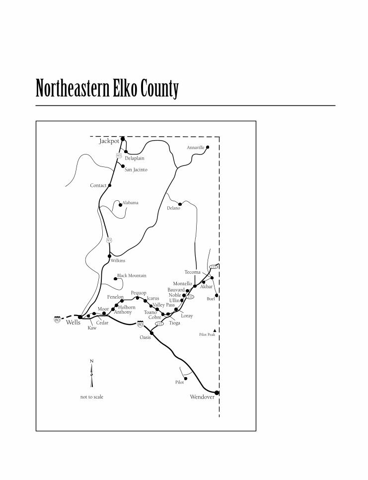
Northeastern Elko County
AkbarDIRECTIONS : 3 miles northeast of Montello on Nevada 233.
Akbar was a Southern Pacific Railroad signal station, the first sta-
tion east of Montello. A signal station was not a scheduled stop on a railroad,
but just a maintenance station manned by a crew member who took care of
the signal lights. A small sectionhouse was the only structure built at the site,
and is long since torn down.
AnthonyDIRECTIONS : From Moor, just north of I-80 east of Wells, take a gravelroad northeast 3 miles to Anthony.
Anthony is a signal station on the Union Pacific Railroad (formerly
Southern Pacific Railroad) and also a nonagency (not associated with one par-
ticular railroad company) siding on the Salt Lake Division, located between
Holborn and Moor. The only known mention of Anthony in historical docu-
ments is in November 1939 when Lawrence Bishop, a transient, was found
dead in a Southern Pacific ice car. No one was ever arrested for the crime.
Only a signal shack and small sectionhouse were built at Anthony, both of
which are gone, and only a concrete foundation marks the site.
Bauvard(Banvard) (Old Montello)
DIRECTIONS : From Nevada 233 in Montello, take a gravel roadparalleling the railroad track southwest 3 miles to Bauvard.
Bauvard, shown incorrectly on some early maps as Banvard, was
established by the Southern Pacific Railroad in 1904. The town was an en-
gine terminal for trains traveling on the newly completed Lucin Cutoff, built
by the Southern Pacific Railroad across the Great Salt Lake in Utah east of
Montello. The railroad built a number of buildings to house railroad workers
and shops for engine repairs. In addition, the railroad constructed a depot,
sectionhouse, and water tanks. Houses were brought by train from Terrace,
Utah, which had been cut off from the Southern Pacific mainline by the Lucin
Cutoff. A post office opened on June 4,1904, withWes Johnson as postmaster.
Within a couple years, the Southern Pacific moved the facilities at Bau-
vard to Montello, where it had built a new division point complete with a
seven-stall roundhouse. All buildings were removed, and the town of Bau-
56 Connecting the West
vard ceased to exist. The name lived on for a while because, despite being in
Montello, the post office retained the Bauvard name until it was changed on
February 27, 1912. Once the town was moved, local residents referred to the
site as Old Montello, and only cellars and scattered lumber now remain.
CedarDIRECTIONS : Located 5 miles east of Wells.
Cedar was a small depot and signal station on the Central Pacific
Railroad (later the Southern Pacific Railroad and now the Union Pacific Rail-
road). It was primarily a fueling station for wood-fired steam locomotives,
but also had a winter telegraph station and sectionhouse. John Dorsey oper-
ated woodcutting crews here during the 1870s, and also ran a small store and
Wells, Fargo & Company office. Tempers sometimes flared on the crews. In
February 1879, two men, John Dempsey and Allen Bickford, were attacked
and killed by Noley Campbell, who turned himself in and claimed he killed
the men with an ax in self-defense because Dempsey and Bickford had shot
at him. At trial, the jury believed Campbell, and he was found not guilty.
By the 1880s, Cedar had lost its importance. Dorsey closed his store, and
the Wells Fargo office was moved. The small depot remained open but served
few passengers and was primarily used as a livestock shipping point. In May
1906, tragedy struck Cedar when Southern Pacific engine 2402 was climbing
the grade at Cedar. The engine exploded, killing the engineer, L. F. Zimmer-
man, and fireman, M. S. Irwin. The engine’s boiler was blown two hundred
feet away, but the trucks of the engine stayed on the tracks. During an earlier
stop in Montello, Irwin had complained that the engine seemed faulty. South-
ern Pacific investigators believed that Zimmerman was already dead by the
time the engine exploded, because when rescuers reached the accident site,
Zimmerman’s body was cold while Irwin’s was warm. The investigators con-
cluded that Zimmerman had been killed when he hit his head on a water
pipe when leaving Montello. However, they couldn’t explain why Irwin, the
fireman, didn’t then operate the locomotive.
Cedar later served as a water stop and not much else. With the coming
of diesel locomotives in the 1940s, Cedar’s valuable function as a water and
wood fuel stop ended. The station was abandoned by the Southern Pacific
in 1948, because Cedar no longer had sufficient passenger or freight traffic.
The station was dismantled, and today only scattered rubble and a couple
woodcutter dugouts mark the site.
Northeastern Elko County 57
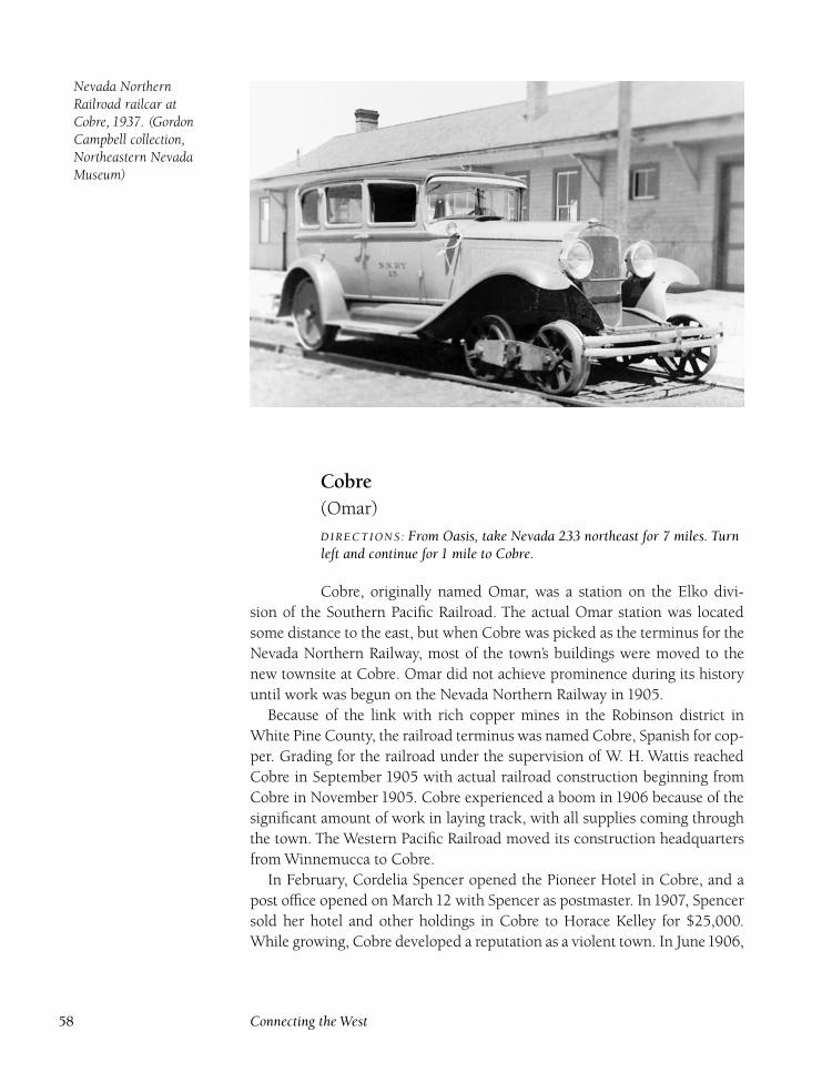
Nevada NorthernRailroad railcar atCobre, 1937. (GordonCampbell collection,Northeastern NevadaMuseum)
Cobre(Omar)
DIRECTIONS : From Oasis, take Nevada 233 northeast for 7 miles. Turnleft and continue for 1 mile to Cobre.
Cobre, originally named Omar, was a station on the Elko divi-
sion of the Southern Pacific Railroad. The actual Omar station was located
some distance to the east, but when Cobre was picked as the terminus for the
Nevada Northern Railway, most of the town’s buildings were moved to the
new townsite at Cobre. Omar did not achieve prominence during its history
until work was begun on the Nevada Northern Railway in 1905.
Because of the link with rich copper mines in the Robinson district in
White Pine County, the railroad terminus was named Cobre, Spanish for cop-
per. Grading for the railroad under the supervision of W. H. Wattis reached
Cobre in September 1905 with actual railroad construction beginning from
Cobre in November 1905. Cobre experienced a boom in 1906 because of the
significant amount of work in laying track, with all supplies coming through
the town. The Western Pacific Railroad moved its construction headquarters
from Winnemucca to Cobre.
In February, Cordelia Spencer opened the Pioneer Hotel in Cobre, and a
post office opened on March 12 with Spencer as postmaster. In 1907, Spencer
sold her hotel and other holdings in Cobre to Horace Kelley for $25,000.
While growing, Cobre developed a reputation as a violent town. In June1906,
58 Connecting the West
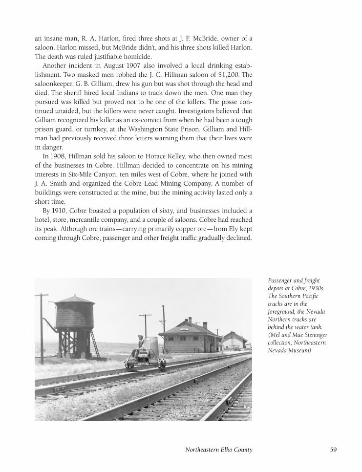
an insane man, R. A. Harlon, fired three shots at J. F. McBride, owner of a
saloon. Harlon missed, but McBride didn’t, and his three shots killed Harlon.
The death was ruled justifiable homicide.
Another incident in August 1907 also involved a local drinking estab-
lishment. Two masked men robbed the J. C. Hillman saloon of $1,200. The
saloonkeeper, G. B. Gilliam, drew his gun but was shot through the head and
died. The sheriff hired local Indians to track down the men. One man they
pursued was killed but proved not to be one of the killers. The posse con-
tinued unaided, but the killers were never caught. Investigators believed that
Gilliam recognized his killer as an ex-convict from when he had been a tough
prison guard, or turnkey, at the Washington State Prison. Gilliam and Hill-
man had previously received three letters warning them that their lives were
in danger.
In 1908, Hillman sold his saloon to Horace Kelley, who then owned most
of the businesses in Cobre. Hillman decided to concentrate on his mining
interests in Six-Mile Canyon, ten miles west of Cobre, where he joined with
J. A. Smith and organized the Cobre Lead Mining Company. A number of
buildings were constructed at the mine, but the mining activity lasted only a
short time.
By 1910, Cobre boasted a population of sixty, and businesses included a
hotel, store, mercantile company, and a couple of saloons. Cobre had reached
its peak. Although ore trains—carrying primarily copper ore—from Ely kept
coming through Cobre, passenger and other freight traffic gradually declined.
Passenger and freightdepots at Cobre, 1930s.The Southern Pacifictracks are in theforeground; the NevadaNorthern tracks arebehind the water tank.(Mel and Mae Steningercollection, NortheasternNevada Museum)
Northeastern Elko County 59
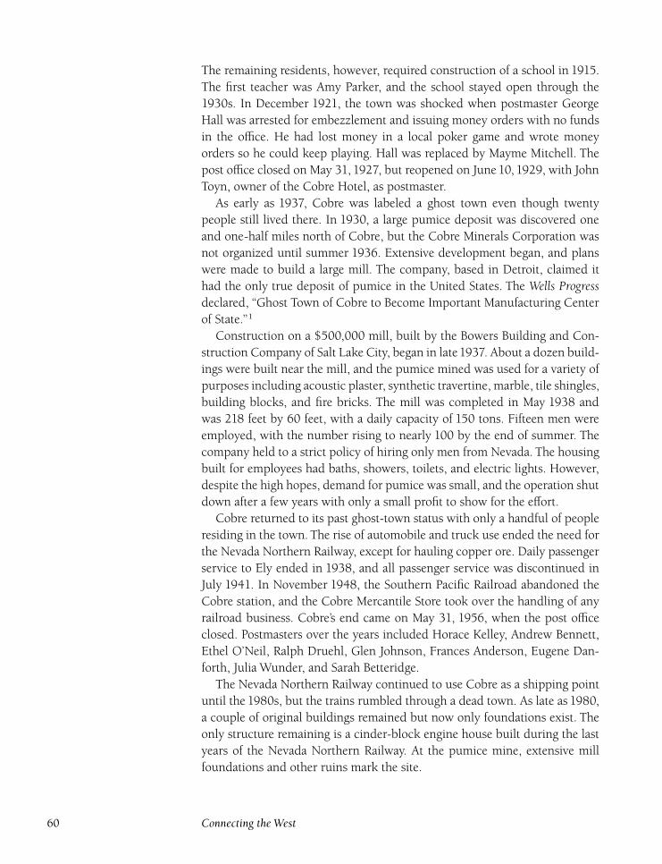
The remaining residents, however, required construction of a school in 1915.
The first teacher was Amy Parker, and the school stayed open through the
1930s. In December 1921, the town was shocked when postmaster George
Hall was arrested for embezzlement and issuing money orders with no funds
in the office. He had lost money in a local poker game and wrote money
orders so he could keep playing. Hall was replaced by Mayme Mitchell. The
post office closed on May 31, 1927, but reopened on June 10, 1929, with John
Toyn, owner of the Cobre Hotel, as postmaster.
As early as 1937, Cobre was labeled a ghost town even though twenty
people still lived there. In 1930, a large pumice deposit was discovered one
and one-half miles north of Cobre, but the Cobre Minerals Corporation was
not organized until summer 1936. Extensive development began, and plans
were made to build a large mill. The company, based in Detroit, claimed it
had the only true deposit of pumice in the United States. The Wells Progressdeclared, ‘‘Ghost Town of Cobre to Become Important Manufacturing Center
of State.’’1
Construction on a $500,000 mill, built by the Bowers Building and Con-
struction Company of Salt Lake City, began in late1937. About a dozen build-
ings were built near the mill, and the pumice mined was used for a variety of
purposes including acoustic plaster, synthetic travertine, marble, tile shingles,
building blocks, and fire bricks. The mill was completed in May 1938 and
was 218 feet by 60 feet, with a daily capacity of 150 tons. Fifteen men were
employed, with the number rising to nearly 100 by the end of summer. The
company held to a strict policy of hiring only men from Nevada. The housing
built for employees had baths, showers, toilets, and electric lights. However,
despite the high hopes, demand for pumice was small, and the operation shut
down after a few years with only a small profit to show for the effort.
Cobre returned to its past ghost-town status with only a handful of people
residing in the town. The rise of automobile and truck use ended the need for
the Nevada Northern Railway, except for hauling copper ore. Daily passenger
service to Ely ended in 1938, and all passenger service was discontinued in
July 1941. In November 1948, the Southern Pacific Railroad abandoned the
Cobre station, and the Cobre Mercantile Store took over the handling of any
railroad business. Cobre’s end came on May 31, 1956, when the post office
closed. Postmasters over the years included Horace Kelley, Andrew Bennett,
Ethel O’Neil, Ralph Druehl, Glen Johnson, Frances Anderson, Eugene Dan-
forth, Julia Wunder, and Sarah Betteridge.
The Nevada Northern Railway continued to use Cobre as a shipping point
until the 1980s, but the trains rumbled through a dead town. As late as 1980,
a couple of original buildings remained but now only foundations exist. The
only structure remaining is a cinder-block engine house built during the last
years of the Nevada Northern Railway. At the pumice mine, extensive mill
foundations and other ruins mark the site.
60 Connecting the West
Contact Inn, whichincluded a hotel, bar,and store, 1961. (Tonyand Ellen Primeauxcollection, NortheasternNevada Museum)
Contact(Contact City) (Salmon City) (Salmon River)
(Kit Carson) (Porter) (Portis) (Alabama)
DIRECTIONS : From Wells, take U.S. 93 north for 51½ miles to Contact.
Although Contact did not achieve major significance until after
the turn of the century, the first discoveries took place in 1870 when James
Moran found gold in Contact. However, no production took place at this
time. In 1872, a prospecting party of three men (Hanks, Lews, and Noll)
located a number of new deposits on China Mountain, which led to the
opening of other mines by the end of 1872 including the Pocohantas (Henry
Prosser), Golconda (J. H. Means, J. A. Hicks, and S. W. Wessels), Dunder-
berg (Means, Hicks, and Wessels), and Virgin (B. J. Virgin). Four separate but
adjacent mining districts were organized: Salmon, Kit Carson, Porter (Por-
tis), and Alabama. Mines in the Kit Carson district were the Juniper (A. C.
Minear, H. A. Noll), Montezuma (Robert Parsons), Edith (W. J. Hanks, C. W.
Servis), Morningstar (Parsons, Noll, Minear), Polar Star (Servis, Hanks), and
Sioux (Servis, Hanks). Servis also served as district recorder. All of the mining
districts were later consolidated into the Contact Mining District.
Although a town did not develop at this location, a small hotel was com-
pleted in April 1874 that served as a stop on the Toano and Idaho Fast Freight
Line. In 1876, a Southern Pacific Railroad official found other deposits on
China Mountain, and many Chinese workers were hired to work the mines
Northeastern Elko County 61
on a commission basis. The most prominent of the early mines, the Boston,
shipped copper ore to Swansea, Wales, until 1880.
During the early 1880s, new mines continued to open but had little sus-
tained production. In the Kit Carson district, the Reverend Goode and Exche-
quer Goode were opened by Thomas Cochran and John Mitchell, and L. F.
Wrinkle worked the Cedar, Nevada, and Stormy mines. In the Porter dis-
trict, W. J. Hanks and P. H. Jackson opened the Arizona mine, and relocated
the Boston, Albany, and Harper mines. The Porter (H. A. Noll), Utah (W. J.
Hanks), Dividend (E. D. Boyle), California (Boyle), and Juniper (Boyle) mines
were also active. The Stevens Gold and Copper Mining Company owned the
Ontario, Michigan, Erie and Elko mines. In the Alabama district, the Lizzie
(Dwight Thourot) and Emily (P. A. Dwight) were being worked. The Salmon
River district mines were the Domingo, Blue Jay, Manhattan, and Riverside
(Cochran and Mitchell), Chester (Dwight), and Wonder (C. O. Akin). De-
spite this flurry of activity, little was produced, and most mines had given up
by the end of 1883. The area remained essentially abandoned until 1887.
In 1888, the Delano group of claims, which eventually became one of the
most productive in the Contact district, was located by Hickey, Delano, Ayres,
and Hechathin. In 1889, two men, Warwick and English, located the Brook-
lyn mine, and by1891, two other mines (Empire and Copper Queen) had also
begun production. By 1895, Contact mines employed seventy miners, and
the extensive prospecting around Contact continued to be rewarded by new
discoveries. In 1896, David Bourne, later known as the ‘‘Father of Jarbidge,’’
located the Mammoth mine, and the Bonanza mine was discovered by Cole-
men, Moore, and Thompson. Coleman later became rich after discovering the
Father De Sinet property in the Black Hills.
In January1897,100 men were employed in the Contact area, and by April
1897, the number of workers had grown to two hundred. A post office, with
Eugene Shields as postmaster, opened in Contact on February 6, 1897. There
were a number of mines being worked, including the Blue Bird, Jackrabbit,
Reliance, Yellow Girl, and Delano. The Salmon River Mining Company (S. P.
Kemper, president) was formed by twenty miners who contributed $100 each
for the purpose of building a fifty-ton smelter, which proved unsuccessful and
processed only fourteen tons from the Bluebird mine before closing. This was
a heavy blow to the area, and many people left soon afterward. In February
1898, the Delano property was bonded to an English syndicate for $65,000,
but nothing came of it. By 1900, population had dropped to eighty-five and
only five residents were left by 1905.
A slow revival began in late 1905, which led to Contact’s first real boom.
A new town formed just south of the original townsite, which had contained
only a few buildings, including a school, with Flora Vincent as teacher. A
stagecoach line to Twin Falls, Idaho, began service in September 1906. The
new town was named Contact, a mining term meaning the contact zone be-
62 Connecting the West
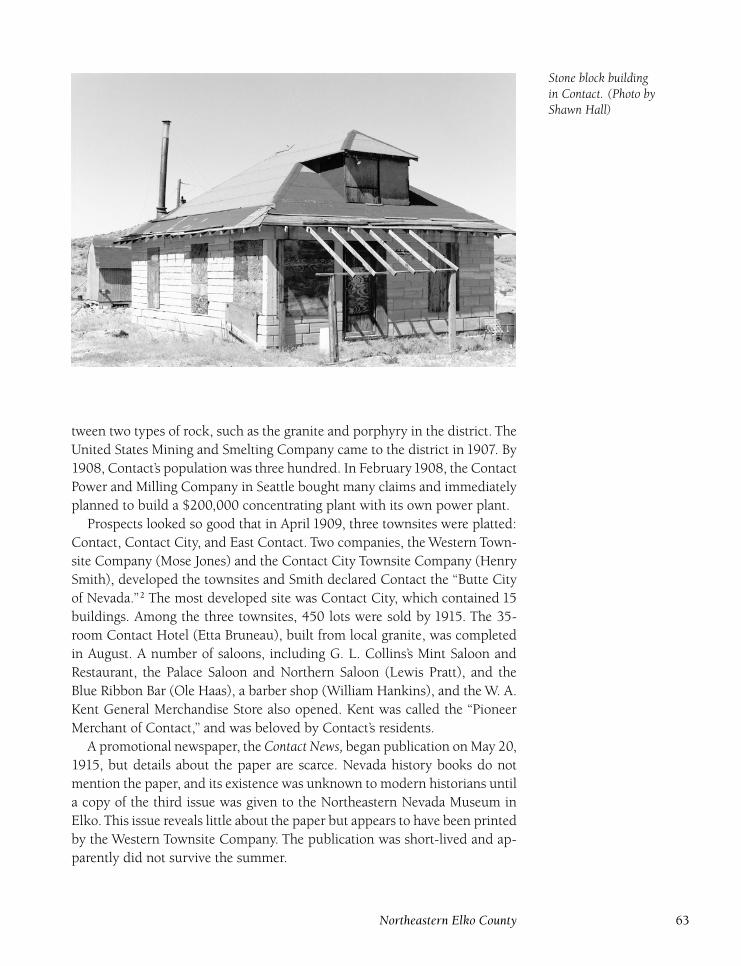
Stone block buildingin Contact. (Photo byShawn Hall)
tween two types of rock, such as the granite and porphyry in the district. The
United States Mining and Smelting Company came to the district in 1907. By
1908, Contact’s population was three hundred. In February1908, the Contact
Power and Milling Company in Seattle bought many claims and immediately
planned to build a $200,000 concentrating plant with its own power plant.
Prospects looked so good that in April 1909, three townsites were platted:
Contact, Contact City, and East Contact. Two companies, the Western Town-
site Company (Mose Jones) and the Contact City Townsite Company (Henry
Smith), developed the townsites and Smith declared Contact the ‘‘Butte City
of Nevada.’’2 The most developed site was Contact City, which contained 15
buildings. Among the three townsites, 450 lots were sold by 1915. The 35-
room Contact Hotel (Etta Bruneau), built from local granite, was completed
in August. A number of saloons, including G. L. Collins’s Mint Saloon and
Restaurant, the Palace Saloon and Northern Saloon (Lewis Pratt), and the
Blue Ribbon Bar (Ole Haas), a barber shop (William Hankins), and the W. A.
Kent General Merchandise Store also opened. Kent was called the ‘‘Pioneer
Merchant of Contact,’’ and was beloved by Contact’s residents.
A promotional newspaper, the Contact News, began publication on May 20,
1915, but details about the paper are scarce. Nevada history books do not
mention the paper, and its existence was unknown to modern historians until
a copy of the third issue was given to the Northeastern Nevada Museum in
Elko. This issue reveals little about the paper but appears to have been printed
by the Western Townsite Company. The publication was short-lived and ap-
parently did not survive the summer.
Northeastern Elko County 63
In 1910, the Nevada Copper Mining, Milling, and Power Company, based
in Tecoma, bought out the United States Smelting Company. The Contact
Company was renamed the Contact-Seattle Copper Mining Company, and
the two organizations controlled virtually all the mines in the district.
Due to demand, a triweekly stage to Rogerson, Idaho, began in April 1910.
Another newspaper, the Contact Miner, began publication on March 20, 1913.
J. V. Marshall served as editor and owner of the Miner Publishing Company.
The paper, which was staunchly Democratic, cost $2.50 per year. In Decem-
ber 1915, Marshall sold out to E. H. Childs, who printed only a couple of
issues before ending publication.
In August 1914, the Nevada Copper Company began construction of a
100-ton copper-leaching plant, with Henry Smith as manager. Coinciden-
tally, Smith had sold the land for the plant, which was completed in late
1915. Most of 1915 was spent developing four mines (Delano, Champ Clark,
High Ore, and Copper Shield), and only $2,300 was produced. In 1916, the
Contact-Seattle company’s Delano mine produced almost all of the $181,000
mined, keeping the operation solvent.
Mines in Contact produced ore, primarily copper ore, from 1916 to 1958,
a tremendous record of consistency. In 1918, the Vivian Tunnel Company
began work on a new mine, a Sutro-type tunnel to help drain water from the
Contact mines and provide an easier method of ore removal. However, this
proved too expensive and was abandoned before completion.
Although there was consistent production from 1916 to 1919, the 1920s
proved to be the decade that put Contact on the map. In September 1922,
the Three in One Mining Company announced plans to build a $2.5 million
smelter fifteen miles south of Contact. However, the plan was an investor
scam, and the smelter was never built.
Despite this, Contact continued to prosper. In 1923, H. A. DeVaux, head
of the Contact Sewerage Company, constructed a number of new buildings,
including a two-story, thirty-room office building, built from Contact granite.
By 1924, the town was abuzz when construction on the Union Pacific Rail-
road’s Oregon Short Line, which ran from Rogerson, Idaho, to Wells, Nevada.
A jail was completed in March and was full every weekend.
With great fanfare, the $110,000 three-story, fifty-room Fairview Hotel
opened on May 24, 1924. One of the owners, H. A. DeVaux, provided fire-
works, and W. G. Greathouse, Nevada secretary of state, was guest of honor.
The hotel was owned by the Contact Construction and Investment Company,
with Robert Weir as president. In July, the Gray Mining Company, of which
theVivian Tunnel Company was a subsidiary, began to work theVivian Tunnel
once again and hoped to quickly complete the twenty thousand–foot tunnel.
A new newspaper, the Nevada-Contact Mining Review, began publication
on November 22, 1924, and was operated by Mark Musgrove, former min-
ing editor of the Nevada State Journal. The newspaper was published by the
64 Connecting the West
Nevada State Herald in Wells, but Musgrove never paid the Herald for the
printing, changing Herald editorials from praise for the Contact paper to re-
ports on how the paper was a blight on the newspaper business. Musgrove
moved the printing job to a plant at Filer, Idaho, in January 1925, but the
paper was taken over in June by Leslie Fox, who also ran the Kimberly (Idaho)Tribune. Despite the new ownership, the paper folded in September.
On March 11, 1925, the first construction train of the Oregon Short Line
arrived in Contact, and a depot was built below the town next to the Salmon
River Falls. Regular service began within a month. Meanwhile, the Fairview
Hotel had suffered hard times and went into receivership in September. It
was initially sold at a tax sale for $1,525 to Robert Weir Jr. (the owner’s son),
but this ruse was discovered and the sale was disallowed. At another tax sale
in October, the hotel was purchased by J. L. Newland for $2,700. The hotel
burned on May 31, 1926, in only thirty minutes.
The chief business in Contact by the end of 1926 was the Fred Johnson
Merchandise Store, with branch stores in Wells and Montello. A new two-
room school was built in 1927 for forty students. Flo Reed, who taught at
many Elko County schools, served as teacher of the Contact school from1927
to 1930. Marguerite Patterson Evans was the school’s last principal and the
only teacher in the high school, which closed in 1934, although it was spo-
radically used during Contact’s revival periods. In the 1920s and 1930s, two
separate schools operated. The grammar school was in the original building
from 1927, while the high school occupied a former pool hall.
The advent of Prohibition in 1917 did little to lessen the thirst of Contact’s
populace. Bootleg activity was prominent in the mountains of the area. It was
said that more people bootlegged than lived in the town during the 1920s.
The biggest operation was a place called Heaven’s Delight. In town, the prod-
ucts were sold at a speakeasy named Hell’s Delight. Virgil Church recalled,
‘‘There were six major moonshine operations in Contact from 1917 until the
repeal of Prohibition in 1932. Those were just the big outfits. I was a moon-
shiner. Hell, everybody in town was a moonshiner, making grain whiskey in
their cellars.’’3
John Detweiler echoed these sentiments: ‘‘My father was justice of the
peace here for years. He was never a bootlegger or moonshiner. Said he
couldn’t risk the chance; said they’d throw away the keys to the jailhouse
if the judge was ever arrested. But hell, he was the No. 1 supplier of every-
thing needed to make the whiskey. Dad hauled in all the coal, barrels, wheat,
and sugar to supply the moonshiners. Dad had the slot machine conces-
sion in town and would always take me with him when he collected the
money from the slots at Hard Rock Tilly’s sporting house at the south end of
town. As long as I was with him, mother figured dad would not get in any
trouble.’’4
In 1930, a new Contact townsite was laid out. Power for the town came
Northeastern Elko County 65
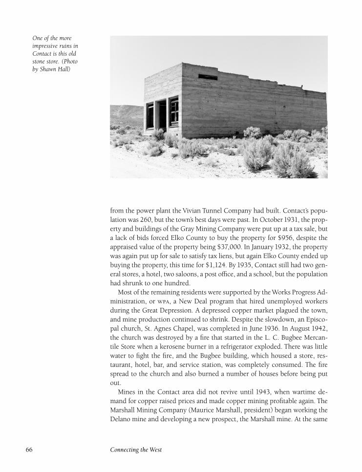
One of the moreimpressive ruins inContact is this oldstone store. (Photoby Shawn Hall)
from the power plant the Vivian Tunnel Company had built. Contact’s popu-
lation was 260, but the town’s best days were past. In October1931, the prop-
erty and buildings of the Gray Mining Company were put up at a tax sale, but
a lack of bids forced Elko County to buy the property for $956, despite the
appraised value of the property being $37,000. In January 1932, the property
was again put up for sale to satisfy tax liens, but again Elko County ended up
buying the property, this time for $1,124. By 1935, Contact still had two gen-
eral stores, a hotel, two saloons, a post office, and a school, but the population
had shrunk to one hundred.
Most of the remaining residents were supported by the Works Progress Ad-
ministration, or , a New Deal program that hired unemployed workers
during the Great Depression. A depressed copper market plagued the town,
and mine production continued to shrink. Despite the slowdown, an Episco-
pal church, St. Agnes Chapel, was completed in June 1936. In August 1942,
the church was destroyed by a fire that started in the L. C. Bugbee Mercan-
tile Store when a kerosene burner in a refrigerator exploded. There was little
water to fight the fire, and the Bugbee building, which housed a store, res-
taurant, hotel, bar, and service station, was completely consumed. The fire
spread to the church and also burned a number of houses before being put
out.
Mines in the Contact area did not revive until 1943, when wartime de-
mand for copper raised prices and made copper mining profitable again. The
Marshall Mining Company (Maurice Marshall, president) began working the
Delano mine and developing a new prospect, the Marshall mine. At the same
66 Connecting the West
time, W. C. Lewis and Charles Whitcomb began development of their land,
named the Bonanza Property. Fire affected Contact again in May 1947 when
a service station, bar, store, and dance hall, all owned by Ed Henzinger, were
completely destroyed at a loss of $40,000. In November1947, Contact elected
a mayor for the first time, Ray King. Despite renewed optimism, the Contact
revival had faded completely by1947. From1943 to1946, Contact mines pro-
duced eight hundred thousand pounds of copper, but from1947 to1951, only
seven thousand pounds were mined. Another fire in August 1951 destroyed
the last hotel, formerly owned by Contact Mayor Ray King.
Contact’s last revival began in 1952 when the Marshall mine was renamed
the Nevada-Bellvue mine, and extensive work began. However, this activity
was insufficient to maintain Contact as a passenger stop on the Oregon Short
Line route, and the station closed in December 1952. The depot building was
later moved to Lee, southwest of Lamoille, where it still stands.
A strange occurrence took place in March 1953 when seventy-year-old
ThomasWilliams shot and killed seventy-two-year-old J. R. ‘‘Tex’’ Hazelwood.
The two men had feuded for years. Since the 1920s, Tex had developed a
reputation around Contact and nearby ranches of the Union Cattle Company,
where he was labeled as ‘‘one stave short of being round.’’ He roamed the area,
living in caves or crude willow shelters, and his reputation for being strange
prevented him from working for any of the local ranches. He achieved the
height of his notoriety when he developed a new way to rustle cattle. Hazel-
wood fashioned shoes that had cow hooves on the bottom. Puzzled cattlemen
couldn’t figure out how, even in deep snow, their cattle were disappearing
without any human footprints nearby. Tex was finally caught and spent a
couple of years in prison. After his release, Hazelwood returned to the Con-
tact area where he continued to be a problem. It was because of his orneriness
and shenanigans that Hazelwood eventually was killed while sitting in his
pickup truck in Contact. The shoes used in his cattle rustling are on display
at the Northeastern Nevada Museum in Elko.
The Nevada-Bellvue mine, still owned by Maurice Marshall but leased to
the American West Exploration Company, produced substantial amounts of
copper between 1952 and 1957. Copper ore, which was still shipped by rail
from the Contact siding despite the railroad depot closure, was sent to the
smelters at Garfield, Utah. The revival ended abruptly in 1957 when the price
of copper collapsed. The Nevada-Bellvue had produced virtually all of the two
million pounds of copper mined in Contact from1952 to1957. No significant
production has taken place since. In total, the Contact district produced 5.8
million pounds of copper, 360,000 pounds of lead, 127,000 ounces of silver,
18,000 pounds of zinc, and 1,200 ounces of gold.
By the time the Contact post office closed on August 31, 1962, the town
was virtually empty. Postmasters who served included James Dwight, Mary
Reed, Albert Carpenter, Adam Schmidt, Isaac Reed, Wyatt Kent, James Mar-
Northeastern Elko County 67
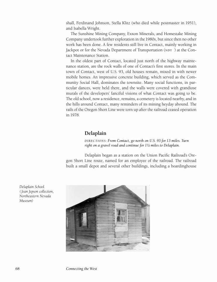
shall, Ferdinand Johnson, Stella Klitz (who died while postmaster in 1951),
and Isabella Wright.
The Sunshine Mining Company, Exxon Minerals, and Homestake Mining
Company undertook further exploration in the1980s, but since then no other
work has been done. A few residents still live in Contact, mainly working in
Jackpot or for the Nevada Department of Transportation () at the Con-
tact Maintenance Station.
In the oldest part of Contact, located just north of the highway mainte-
nance station, are the rock walls of one of Contact’s first stores. In the main
town of Contact, west of U.S. 93, old houses remain, mixed in with newer
mobile homes. An impressive concrete building, which served as the Com-
munity Social Hall, dominates the townsite. Many social functions, in par-
ticular dances, were held there, and the walls were covered with grandiose
murals of the developers’ fanciful visions of what Contact was going to be.
The old school, now a residence, remains, a cemetery is located nearby, and in
the hills around Contact, many reminders of its mining heyday abound. The
rails of the Oregon Short Line were torn up after the railroad ceased operation
in 1978.
DelaplainDIRECTIONS : From Contact, go north on U.S. 93 for 13 miles. Turnright on a gravel road and continue for 1½ miles to Delaplain.
Delaplain began as a station on the Union Pacific Railroad’s Ore-
gon Short Line route, named for an employee of the railroad. The railroad
built a small depot and several other buildings, including a boardinghouse
Delaplain School.( Jean Jepson collection,Northeastern NevadaMuseum)
68 Connecting the West
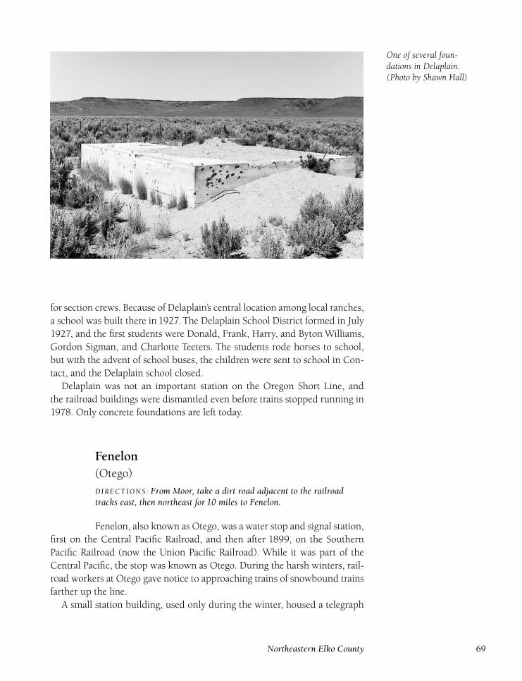
One of several foun-dations in Delaplain.(Photo by Shawn Hall)
for section crews. Because of Delaplain’s central location among local ranches,
a school was built there in 1927. The Delaplain School District formed in July
1927, and the first students were Donald, Frank, Harry, and Byton Williams,
Gordon Sigman, and Charlotte Teeters. The students rode horses to school,
but with the advent of school buses, the children were sent to school in Con-
tact, and the Delaplain school closed.
Delaplain was not an important station on the Oregon Short Line, and
the railroad buildings were dismantled even before trains stopped running in
1978. Only concrete foundations are left today.
Fenelon(Otego)
DIRECTIONS : From Moor, take a dirt road adjacent to the railroadtracks east, then northeast for 10 miles to Fenelon.
Fenelon, also known as Otego, was a water stop and signal station,
first on the Central Pacific Railroad, and then after 1899, on the Southern
Pacific Railroad (now the Union Pacific Railroad). While it was part of the
Central Pacific, the stop was known as Otego. During the harsh winters, rail-
road workers at Otego gave notice to approaching trains of snowbound trains
farther up the line.
A small station building, used only during the winter, housed a telegraph
Northeastern Elko County 69
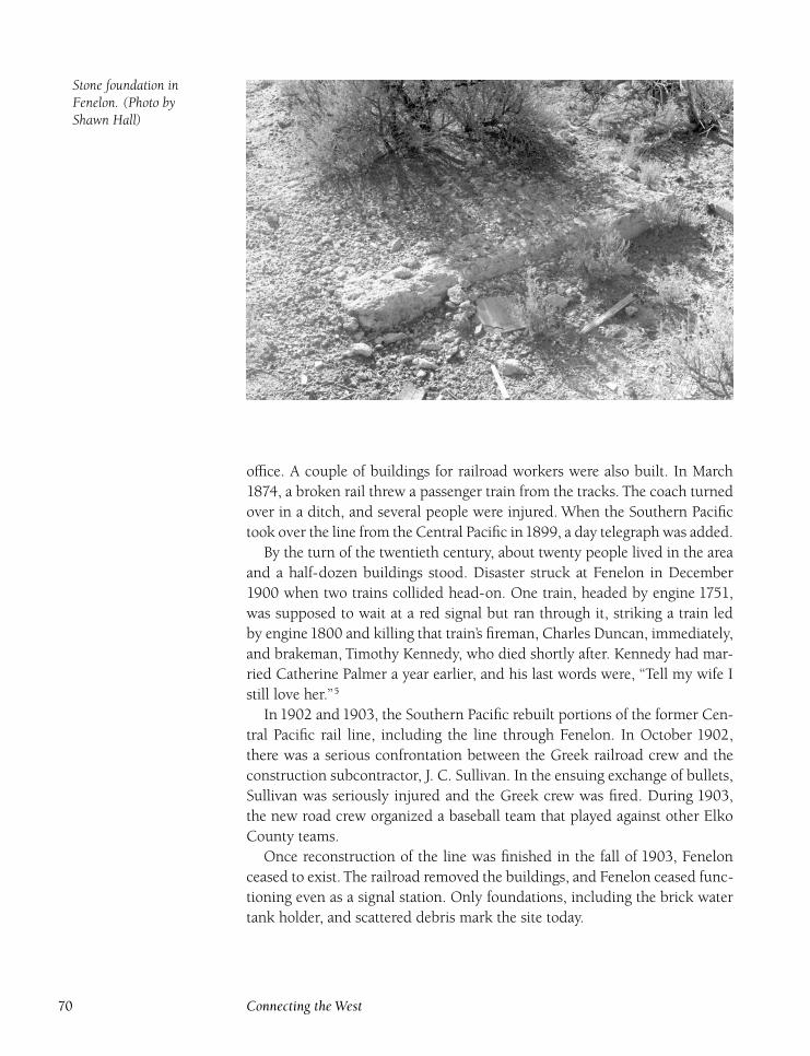
Stone foundation inFenelon. (Photo byShawn Hall)
office. A couple of buildings for railroad workers were also built. In March
1874, a broken rail threw a passenger train from the tracks. The coach turned
over in a ditch, and several people were injured. When the Southern Pacific
took over the line from the Central Pacific in1899, a day telegraph was added.
By the turn of the twentieth century, about twenty people lived in the area
and a half-dozen buildings stood. Disaster struck at Fenelon in December
1900 when two trains collided head-on. One train, headed by engine 1751,
was supposed to wait at a red signal but ran through it, striking a train led
by engine1800 and killing that train’s fireman, Charles Duncan, immediately,
and brakeman, Timothy Kennedy, who died shortly after. Kennedy had mar-
ried Catherine Palmer a year earlier, and his last words were, ‘‘Tell my wife I
still love her.’’5
In 1902 and 1903, the Southern Pacific rebuilt portions of the former Cen-
tral Pacific rail line, including the line through Fenelon. In October 1902,
there was a serious confrontation between the Greek railroad crew and the
construction subcontractor, J. C. Sullivan. In the ensuing exchange of bullets,
Sullivan was seriously injured and the Greek crew was fired. During 1903,
the new road crew organized a baseball team that played against other Elko
County teams.
Once reconstruction of the line was finished in the fall of 1903, Fenelon
ceased to exist. The railroad removed the buildings, and Fenelon ceased func-
tioning even as a signal station. Only foundations, including the brick water
tank holder, and scattered debris mark the site today.
70 Connecting the West
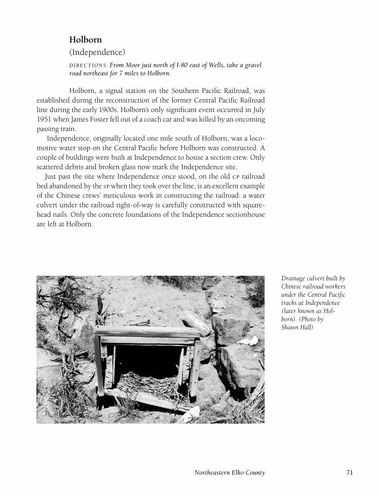
Holborn(Independence)
DIRECTIONS : From Moor just north of I-80 east of Wells, take a gravelroad northeast for 7 miles to Holborn.
Holborn, a signal station on the Southern Pacific Railroad, was
established during the reconstruction of the former Central Pacific Railroad
line during the early 1900s. Holborn’s only significant event occurred in July
1951 when James Foster fell out of a coach car and was killed by an oncoming
passing train.
Independence, originally located one mile south of Holborn, was a loco-
motive water stop on the Central Pacific before Holborn was constructed. A
couple of buildings were built at Independence to house a section crew. Only
scattered debris and broken glass now mark the Independence site.
Just past the site where Independence once stood, on the old railroad
bed abandoned by the when they took over the line, is an excellent example
of the Chinese crews’ meticulous work in constructing the railroad: a water
culvert under the railroad right-of-way is carefully constructed with square-
head nails. Only the concrete foundations of the Independence sectionhouse
are left at Holborn.
Drainage culvert built byChinese railroad workersunder the Central Pacifictracks at Independence( later known as Hol-born). (Photo byShawn Hall)
Northeastern Elko County 71

Remaining foundation ofHolborn Central Pacificstation building. (Photoby Shawn Hall)
IcarusDIRECTIONS : From Cobre, go northwest on a gravel road for 10 miles toIcarus.
Icarus was a signal station on the Southern Pacific Railroad, named
for an imaginary country where perfect communism existed, not for the
Greek myth of the same name. In February 1903, a train wreck killed South-
ern Pacific engineer Fred Stokes. One train struck a broken rail, and its last
two cars derailed. Then, a following train slammed into the derailed cars. Two
engines, a dynamo, or power plant, and two mail cars were thrown into the
ditch. Stokes’s body was found crushed under the locomotive’s tender. No
structures were ever built at Icarus.
KawDIRECTIONS : Located 2 miles east of Wells.
Kaw, located between Wells and Cedar, served both the Southern
Pacific Railroad and Western Pacific Railroad (both now part of the Union
Pacific Railroad) as a signal station. At one time, a water tank and section-
house were built, but only foundations are left today.
72 Connecting the West
Loray(Luray) (Leroy)
DIRECTIONS : From Cobre, return Nevada 233 north 4 miles to Loray.
Loray was a station on the Central Pacific Railroad and later on
the Southern Pacific Railroad. However, the station had few passengers and
was used mainly to ship wood cut nearby for railroad use.Woodcutting crews
lived in housing next to the tracks. In May1875, a near tragedy occurred near
the station when two freight trains collided, wrecking three engines. Twenty-
five cars were thrown off the tracks, and brakeman William Cassin and con-
ductor Snyder were seriously injured.
Copper ore was discovered in the early 1880s about three miles south of
the railroad, and in 1883, A. P. Shively (also the district recorder) organized
the Loray Mining District. During the next few years, the Shively and Wil-
son (Shively, James Wilson), Castle Park (Shively), Stokes (William Stokes,
Wilson), Queen of Sheba (Shively, David Kay) Birthday (Wilson), Ruby Chief
(Wilson), and King Fisher (Wilson) mines were worked, although little was
produced until after the turn of the century.
In March1907, twenty tons of copper ore were shipped from the Anderson
property, where R. P. Christian was in charge of operations and eight men
were employed. A copper and silver strike was made on the Will Porter claim
in May1908, and Kellough and Lang discovered the Lillian mine in July1908,
but only intermittent ore was produced from the district’s mines until 1958.
From 1908 to 1958, producing mines included the Alabama, Jay Bird,
Pickup, Maybelle, Castle Peak, Lost Hope, Silver Bell, Silver Star, and New
Deal. The Delno Mining and Milling Company worked a few of the mines
from 1928 to 1936, producing $62,215. The two biggest production years
were 1945 and 1946, when Charles Roberts reworked old tailings and recov-
ered more than $69,000, primarily from the Maybelle mine discovered by
Walter Long in 1934.
During the 1930s and 1940s, most of the miners lived at the Loray railroad
siding, where a school operated for a number of years. Total value of min-
ing in the Loray district is $191,000, which includes 480,018 pounds of lead,
28,802 ounces of silver, and 25,883 pounds of copper.
Mining remnants abound on both sides of the mountain east of Loray, in-
cluding gallows frames, shafts, and a converted Ford Model T used as a hoist.
At the Loray siding, where at one time a dozen buildings stood, only founda-
tions and scattered debris are left.
Northeastern Elko County 73
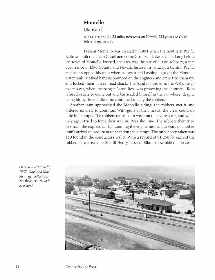
Montello(Bauvard)
DIRECTIONS : Go 23 miles northeast on Nevada 233 from the Oasisinterchange on I-80.
Present Montello was created in 1904 when the Southern Pacific
Railroad built the Lucin Cutoff across the Great Salt Lake of Utah. Long before
the town of Montello formed, the area was the site of a train robbery, a rare
occurrence in Elko County and Nevada history. In January, a Central Pacific
engineer stopped his train when he saw a red flashing light on the Montello
water tank. Masked bandits pounced on the engineer and crew, tied them up,
and locked them in a railroad shack. The bandits headed to the Wells Fargo
express car, where messenger Aaron Ross was protecting the shipment. Ross
refused orders to come out and barricaded himself in the car where, despite
being hit by three bullets, he continued to defy the robbers.
Another train approached the Montello siding; the robbers met it and
ordered its crew to continue. With guns at their heads, the crew could do
little but comply. The robbers returned to work on the express car, and when
they again tried to force their way in, Ross shot one. The robbers then tried
to smash the express car by ramming the engine into it, but fears of another
train’s arrival caused them to abandon the attempt. The only booty taken was
$10 found in the conductor’s wallet. With a reward of $1,250 for each of the
robbers, it was easy for Sheriff Henry Taber of Elko to assemble the posse.
Overview of Montello,1937. (Mel and MaeSteninger collection,Northeastern NevadaMuseum)
74 Connecting the West
The first two robbers, Orris Nay and Frank Hawley, were wounded and
captured in Utah County after a shootout on January 28, 1883, and the pair
told the posse where the rest of the gang was hiding. The other three rob-
bers, Sylvester Earl, Erastus Anderson, and Frank Francis, surrendered with-
out incident when confronted by the posse, which was armed with dynamite
and a small cannon. All five captured robbers were taken to Salt Lake City.
The prisoners were returned to Elko in February and all pleaded guilty.
Nay, Hawley, and Francis received fourteen years in prison, while the two
teenagers, Earl and Anderson, received twelve-year sentences. The express
car messenger, Aaron Ross, was treated as a hero for refusing to surrender to
the robbers and received rewards from the Central Pacific Railroad and Wells
Fargo. The rewards for capture were divided among the seventeen men of the
posse, each receiving $350.
The town of Montello was later created in 1904 by the Southern Pacific
Railroad during the construction of the Lucin Cutoff, east of Montello, in
Utah. The first train came through the town on March 4, 1904, and houses
were moved to Montello from Kelton and Terrace, Utah. Montello replaced
Terrace as the main railroad division point, plunging the town of Terrace into
oblivion.
Montello was initially known as Bauvard, the same name of the old siding
located three miles to the southwest. Bauvard’s post office was transferred to
the new town, but the name was not changed to Montello, which in Sho-
shone means ‘‘rest,’’ until February 27, 1912. The railroad built a large hotel,
which burned down in 1908, and complete railroad facilities at Montello. A
small Chinatown developed because many of the Chinese crews were based
at Montello, and the forty Chinese residents supported a store and joss house,
or Chinese house of worship.
In July 1904, O. T. Hill finished construction on an eight-room house,
storeroom, and lodging house for Wes Johnson, who also opened a general
merchandise store. In October 1904, part of the new library was used as a
school, with Ethelyn Allen teaching ten students the first year. A separate
schoolhouse was built in 1906. In 1907, the Utah Construction Company
() purchased the Vineyard Land and Livestock Company’s vast holdings.
Montello, because of its convenient location to the railroad and their ranches,
was made the headquarters. The company ran a store in Montello for many
years, and the original store, with the logo on it, still stands in Montello.
From 1904 to 1929, Montello’s population approached eight hundred. The
town also served as a supply point for the mining camp of Delano, located
to the north. The Southern Pacific’s monthly payroll reached as high as $1
million in 1915. A new school was built in 1910. Teachers serving the school
during the next decade included C. I. Bonham, M. D. Hunter, Helen English,
Matilde McQuisiton, Olive Burgess, and Alma Nichol. The old school was
moved downtown and converted into the town’s amusement hall, run by the
Northeastern Elko County 75
Montello Amusement Corporation. The Montello Mercantile Company was
incorporated in July 1912. A new jail was built by A. C. McGinty during the
spring of 1916, replacing the original jail, made of railroad ties, from which a
prisoner could escape by removing a tie or two.
During the 1920s, Montello began to decline. A major blow struck the
town in October 1925 when a large fire, started by an exploding coffee urn
in the Nelson Cafe, burned the business district, destroying the Wes Johnson
store, the Nelson Cafe, the Bryant Pool Hall, the post office, and the home
of A. R. Cave. In addition, the Utah Construction Company was broken up
and sold. One part of the holdings, the Gamble Ranch, continues to operate
as one of the largest ranches in Elko County. The ranch was sold in 1950 for
$3 million.
Montello received national attention in November1928 when future presi-
dent Herbert Hoover gave a campaign speech in the town. In 1929, the local
doctor, J. D. Sherrod, was elected vice president of the American Chiroprac-
tors Association. The Montello Consolidated School Orchestra was featured
on a radio broadcast, out of Salt Lake City, in March 1936.
The introduction of diesel locomotives in the 1940s spelled the end of
Montello’s importance to the railroad as a water and fuel stop and repair
facility for steam locomotives. The roundhouses and shops were removed
during the 1950s, and only the huge water tower was left behind. Some im-
provement came to Montello in 1960 when a paved highway was completed
from Oasis. Today, Montello is a quiet town with a population of about 75.
Many of the houses moved from Utah in 1904 remain today, and the origi-
nal depot has been moved and converted into a house. The school, jail, and
other old buildings are also standing, and the cemetery is located just north
of the main street. The water tower dominates the old railroad yards, and
trains continue to pass through Montello. A store, gas station, post office, and
a couple of saloons still operate.
Moor(Moors)
DIRECTIONS : Located 8 miles east of Wells just north of I-80.
Moor was established in 1869 by the Central Pacific Railroad as
a stop and base for a wood-cutting crew, and later served as a nonagency
telegraph station and siding for the Southern Pacific Railroad. Named for the
foreman of the wood-cutting crew, the small camp consisted of a number of
crude houses and a small store. Once the railroad was completed, the wood
crew moved elsewhere.
Tragedy struck Moor early in its history. In June 1870, railroad worker
76 Connecting the West
Robert Warrock was killed when a defective coupler broke, crushing him
between the cars. Some minor mining activity took place near Moor during
the 1870s and 1880s. The Last Chance (Jeremiah Crabb) and Emma Rencker
(J. H.Wood,William O’Neil) mines had short lives and produced little.When
Frederick Shearer, a traveler who mentioned Moor in his journals, visited
Moor in 1884, the stop was merely a siding, and only stakes and posts were
left of the buildings. The nationwide flu epidemic struck Moor in 1918. Both
operators for the Southern Pacific Railroad, Alice Louise Sumwalt and W. N.
McBride, died of the flu in December 1918.
Another Moor tragedy occurred in March1941, when section foreman Sam
Kawaguchi was struck and killed by Southern Pacific mail train 9. In Septem-
ber1943, telegrapher LaVerne Price was killed when she accidentally stepped
in front of a passenger train. She and her husband, Harold, had lived at Moor
for two years. Today, all of the buildings in Moor are gone, and only wood
scraps, cellars, and concrete foundations mark the site.
NobleDIRECTIONS : Located 2 miles southwest of Bauvard. From Nevada 233in Montello, take a gravel road paralleling the railroad track southwest5 miles to Noble.
Noble was a signal station on the Southern Pacific Railroad be-
tween Ullin and Bauvard. Only a signal shed was built and nothing remains
at Noble today.
OasisDIRECTIONS : Located at the junction of I-80 and Nevada 233.
Oasis was first settled in the early1880s by E. C. Hardy, who raised
horses. In1884, the Big Springs Ranch was created by consolidating the older
ranches in the area: the Oasis, Johnson, and Warm Springs ranches. Later,
H. A. and H. F. Leach bought the ranch, which was purchased by the Utah
Construction Company in 1917. Other owners of the Oasis ranch over the
years included Russell Wilkins and Martin Wunderlich, Fred West, Oscar and
Sam Rudnick, Cluster Valley Cattle Company, Big Springs Land and Cattle
Company, Jack Taylor, and David Buntliff. In 1969, R. J. Beaumont bought
the ranch for $1.8 million.
Oasis was also a popular stopping point for highway travelers. A gas sta-
tion, small motel, and now an park are in operation. An interesting point
of history took place at Oasis in 1947 when a suspect in the Black Dahlia
Northeastern Elko County 77
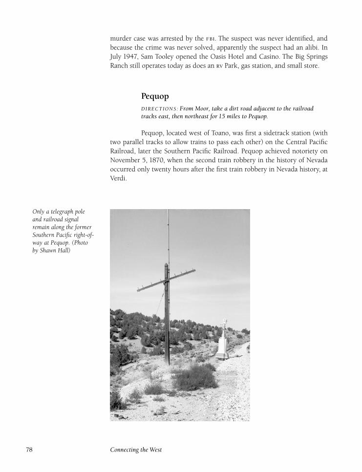
murder case was arrested by the . The suspect was never identified, and
because the crime was never solved, apparently the suspect had an alibi. In
July 1947, Sam Tooley opened the Oasis Hotel and Casino. The Big Springs
Ranch still operates today as does an Park, gas station, and small store.
PequopDIRECTIONS : From Moor, take a dirt road adjacent to the railroadtracks east, then northeast for 15 miles to Pequop.
Pequop, located west of Toano, was first a sidetrack station (with
two parallel tracks to allow trains to pass each other) on the Central Pacific
Railroad, later the Southern Pacific Railroad. Pequop achieved notoriety on
November 5, 1870, when the second train robbery in the history of Nevada
occurred only twenty hours after the first train robbery in Nevada history, at
Verdi.
Only a telegraph poleand railroad signalremain along the formerSouthern Pacific right-of-way at Pequop. (Photoby Shawn Hall)
78 Connecting the West
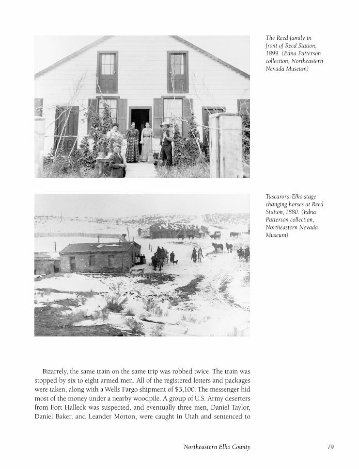
The Reed family infront of Reed Station,1899. (Edna Pattersoncollection, NortheasternNevada Museum)
Tuscarora-Elko stagechanging horses at ReedStation, 1880. (EdnaPatterson collection,Northeastern NevadaMuseum)
Bizarrely, the same train on the same trip was robbed twice. The train was
stopped by six to eight armed men. All of the registered letters and packages
were taken, along with a Wells Fargo shipment of $3,100. The messenger hid
most of the money under a nearby woodpile. A group of U.S. Army deserters
from Fort Halleck was suspected, and eventually three men, Daniel Taylor,
Daniel Baker, and Leander Morton, were caught in Utah and sentenced to
Northeastern Elko County 79
thirty years. However, none of these men were the army deserters from the
fort, but one of the robbers had items obviously taken from a soldier. Noth-
ing was ever heard from the deserters, and some people believe that the train
robbers attacked and killed the soldiers before robbing the train.
This was the extent of the excitement at Pequop. The railroad built a couple
of buildings to house section crews. Pequop is located high in the mountains,
and snowplows were constantly needed to keep the tracks clear of snow. In
February1890, a snowplow driven by three engines derailed; the fireman was
killed, and the engineer was scalded in the accident.
During the 1930s, enough people lived in Pequop to warrant the opening
of a school for five students. In1937, Mrs. M.V. Murray, wife of a railroad fore-
man, won a Ford V8 sedan in a contest sponsored by the American Legion
and the Veterans of Foreign Wars.
The coming of diesel locomotives to the railroad in the 1940s reduced
Pequop’s usefulness. By the end of the1940s, only a couple of railroad workers
were left. All of the buildings are gone, and only foundations and scattered
debris are left. The former right-of-way of the Central Pacific Railroad is easily
visible, coming in at almost a right angle to the later Southern Pacific (now
Union Pacific) tracks.
San JacintoDIRECTIONS : From Contact, go north on U.S. 93 for 13 miles. Turnright on a gravel road and continue for 2½ miles. Turn right and followthe dirt road for 4 miles to San Jacinto, located on the abandonedrailroad bed. San Jacinto Ranch is one more mile to the west.
San Jacinto was one of the many ranches in the ranching empire of
Governor John Sparks and Jasper Harrell. Sparks named the ranch for a town
in his home state of Texas. The San Jacinto post office opened on Novem-
ber 17, 1898, with Eliza Hewitt serving as postmaster. A school opened in
1903 with Edith Plumb serving as teacher.
The San Jacinto ranch was sold to the Vineyard Land and Stock Company
in 1908. The Utah Construction Company took over in 1914 and built houses
for company officials and bunkhouses for the men. Archie Bowman, already
a fourteen-year veteran of the company, was named superintendent of the
company’s large Elko County operation. San Jacinto was his headquarters,
and Bowman and his wife, Nora, lived at the ranch until 1946.
In April 1916, the Shoshone-Hailey-Twin Falls and Wells Auto Stage began
operations with a stop in San Jacinto. The stage line featured Packards, and
was run by M. Silva. In 1925, the Oregon Short Line railroad was completed
and just east of the ranch established a passenger and freight stop and siding,
which was used extensively by the ranch for shipping cattle.
80 Connecting the West

Auto repair shop in SanJacinto, 1961. (Tonyand Ellen Primeauxcollection, NortheasternNevada Museum)
The San Jacinto post office closed on April 15, 1938. Although other post-
masters served through the years, including Chandler Holmes,William Bitter-
ridge, Moses Jones, Alex Patterson, James Parmley, and Thomas Grounsell,
Archie Bowman had the longest tenure, from 1922 to 1938. During the 1920s
and 1930s, a store, Bugbee’s, served the area. The ranch is still operated today
by the Secrist family, who formerly owned Dinner Station. Old buildings are
mixed with the new. Not much is left at the location of the Oregon Short Line
railroad siding, because all of the buildings were removed when the tracks
were torn up in 1978.
TecomaDIRECTIONS : From Montello, take Nevada 233 northeast for 6 miles.Turn right, crossing the railroad tracks, for 1 mile to Tecoma.
Tecoma was born with the arrival of the Central Pacific Railroad
in 1869. A town, with a small Chinatown, soon formed. A post office opened
on December 1, 1871, closed on June 7, 1872, and reopened on May 2, 1873.
Tecoma soon had a hotel, restaurant, cafe, and two saloons, and by 1880, a
population of sixty people. A store (owned by J. C. Lee) and a school opened
in the 1880s.
Tecoma became the major railhead for the mining activity in the area, par-
ticularly Buel, and for the Sparks-Harrell Cattle Company. In April 1886,
Northeastern Elko County 81
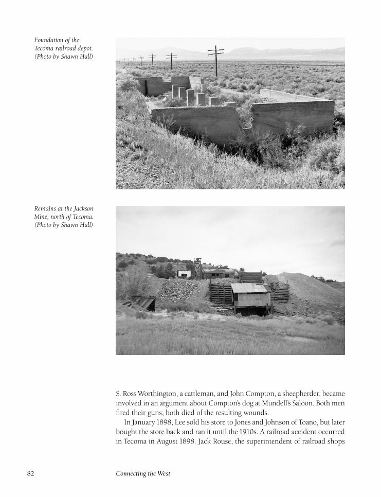
Foundation of theTecoma railroad depot.(Photo by Shawn Hall)
Remains at the JacksonMine, north of Tecoma.(Photo by Shawn Hall)
S. Ross Worthington, a cattleman, and John Compton, a sheepherder, became
involved in an argument about Compton’s dog at Mundell’s Saloon. Both men
fired their guns; both died of the resulting wounds.
In January1898, Lee sold his store to Jones and Johnson of Toano, but later
bought the store back and ran it until the 1910s. A railroad accident occurred
in Tecoma in August 1898. Jack Rouse, the superintendent of railroad shops
82 Connecting the West
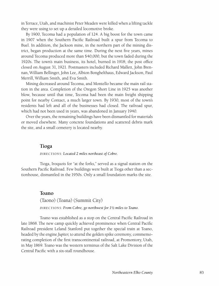
in Terrace, Utah, and machinist Peter Meaden were killed when a lifting tackle
they were using to set up a derailed locomotive broke.
By 1900, Tecoma had a population of 124. A big boost for the town came
in 1907 when the Southern Pacific Railroad built a spur from Tecoma to
Buel. In addition, the Jackson mine, in the northern part of the mining dis-
trict, began production at the same time. During the next five years, mines
around Tecoma produced more than $40,000, but the town faded during the
1920s. The town’s main business, its hotel, burned in 1918; the post office
closed on August 31, 1921. Postmasters included Richard Mallett, John Bren-
nan,William Bellinger, John Lee, Albion Bonghelthaus, Edward Jackson, Paul
Merrill, William Smith, and Eva Smith.
Mining decreased around Tecoma, and Montello became the main rail sta-
tion in the area. Completion of the Oregon Short Line in 1925 was another
blow, because until that time, Tecoma had been the main freight shipping
point for nearby Contact, a much larger town. By 1930, most of the town’s
residents had left and all of the businesses had closed. The railroad spur,
which had not been used in years, was abandoned in January 1940.
Over the years, the remaining buildings have been dismantled for materials
or moved elsewhere. Many concrete foundations and scattered debris mark
the site, and a small cemetery is located nearby.
TiogaDIRECTIONS : Located 2 miles northeast of Cobre.
Tioga, Iroquois for ‘‘at the forks,’’ served as a signal station on the
Southern Pacific Railroad. Few buildings were built at Tioga other than a sec-
tionhouse, dismantled in the 1950s. Only a small foundation marks the site.
Toano(Taono) (Toana) (Summit City)
DIRECTIONS : From Cobre, go northwest for 1½ miles to Toano.
Toano was established as a stop on the Central Pacific Railroad in
late 1868. The new camp quickly achieved prominence when Central Pacific
Railroad president Leland Stanford put together the special train at Toano,
headed by the engine Jupiter, to attend the golden spike ceremony, commemo-
rating completion of the first transcontinental railroad, at Promontory, Utah,
in May 1869. Toano was the western terminus of the Salt Lake Division of the
Central Pacific with a six-stall roundhouse.
Northeastern Elko County 83
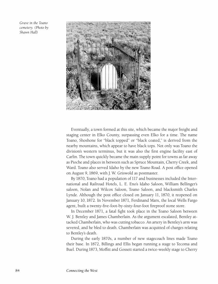
Grave in the Toanocemetery. (Photo byShawn Hall)
Eventually, a town formed at this site, which became the major freight and
staging center in Elko County, surpassing even Elko for a time. The name
Toano, Shoshone for ‘‘black topped’’ or ‘‘black coated,’’ is derived from the
nearby mountains, which appear to have black tops. Not only was Toano the
division’s western terminus, but it was also the first engine facility east of
Carlin. The town quickly became the main supply point for towns as far away
as Pioche and places in between such as Spruce Mountain, Cherry Creek, and
Ward. Toano also served Idaho by the new Toano Road. A post office opened
on August 9, 1869, with J. W. Griswold as postmaster.
By 1870, Toano had a population of 117 and businesses included the Inter-
national and Railroad Hotels, L. E. Eno’s Idaho Saloon, William Bellinger’s
saloon, Nolan and Wilcox Saloon, Toano Saloon, and blacksmith Charles
Lynde. Although the post office closed on January 11, 1870, it reopened on
January 10, 1872. In November 1871, Ferdinand Marx, the local Wells Fargo
agent, built a twenty-five-foot-by-sixty-four-foot fireproof stone store.
In December 1871, a fatal fight took place in the Toano Saloon between
W. J. Bentley and James Chamberlain. As the argument escalated, Bentley at-
tacked Chamberlain, who was cutting tobacco. An artery in Bentley’s arm was
severed, and he bled to death. Chamberlain was acquitted of charges relating
to Bentley’s death.
During the early 1870s, a number of new stagecoach lines made Toano
their base. In 1872, Billings and Ellis began running a stage to Tecoma and
Buel. During1873, Moffitt and Gossett started a twice-weekly stage to Cherry
84 Connecting the West
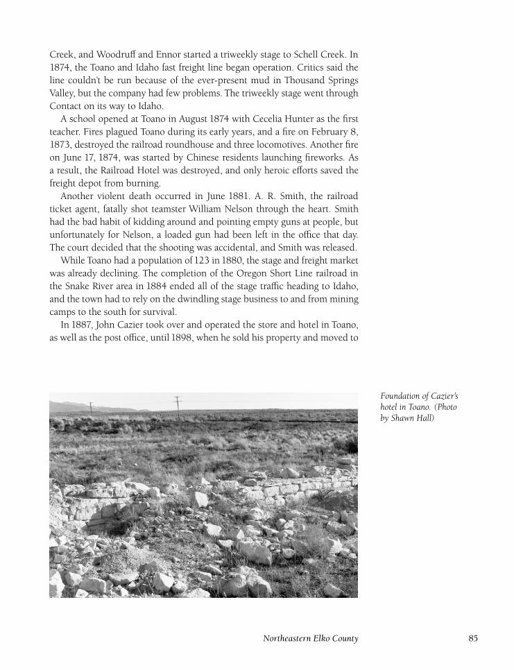
Creek, and Woodruff and Ennor started a triweekly stage to Schell Creek. In
1874, the Toano and Idaho fast freight line began operation. Critics said the
line couldn’t be run because of the ever-present mud in Thousand Springs
Valley, but the company had few problems. The triweekly stage went through
Contact on its way to Idaho.
A school opened at Toano in August 1874 with Cecelia Hunter as the first
teacher. Fires plagued Toano during its early years, and a fire on February 8,
1873, destroyed the railroad roundhouse and three locomotives. Another fire
on June 17, 1874, was started by Chinese residents launching fireworks. As
a result, the Railroad Hotel was destroyed, and only heroic efforts saved the
freight depot from burning.
Another violent death occurred in June 1881. A. R. Smith, the railroad
ticket agent, fatally shot teamster William Nelson through the heart. Smith
had the bad habit of kidding around and pointing empty guns at people, but
unfortunately for Nelson, a loaded gun had been left in the office that day.
The court decided that the shooting was accidental, and Smith was released.
While Toano had a population of 123 in 1880, the stage and freight market
was already declining. The completion of the Oregon Short Line railroad in
the Snake River area in 1884 ended all of the stage traffic heading to Idaho,
and the town had to rely on the dwindling stage business to and from mining
camps to the south for survival.
In 1887, John Cazier took over and operated the store and hotel in Toano,
as well as the post office, until 1898, when he sold his property and moved to
Foundation of Cazier’shotel in Toano. (Photoby Shawn Hall)
Northeastern Elko County 85
Trout Creek in Starr Valley. In 1888, the Oasis Ranch Company was founded
nearby. E. C. Hardy was the manager of an operation that raised Norman-
Percheron stallions, Spanish merino sheep, and Angus and Galloway cattle.
When the Lucin Cutoff, to the east in Utah, was completed in 1904, the
town was abandoned as a terminal point, and the repair depot closed. The
Southern Pacific Railroad moved some of its buildings to the new division
point at Bauvard, later Montello, and other buildings were torn down. Most
of the town’s businesses and residents moved, and the few that were left in
1906 moved to the new town of Cobre, a mile to the southeast, on the newly
completed Nevada Northern Railway.
The post office closed on March 12 and reopened in Cobre. Postmasters at
Toano included James Grant, Ferdinand Marx, Albert Spencer, Albert Gobbel,
John Cazier, William Probert, Henry Ferstermaker, Leon Bednark, and Cor-
delia Spencer. Spencer was named the last postmaster when her predecessor,
Bednark, quit in August 1905 and left the mail lying in the street.
The Toano school also closed and was moved to Cobre. Teachers at the
school included Ermie Robinson, Bertha Smith, Mattie Gleason, and Lucy
McDermot. The town of Toano was dead by the summer of 1906. Structures
that were left were razed when the Southern Pacific rebuilt the tracks away
from Toano and added a second set of tracks.
Today, though no buildings remain, there is plenty of evidence of the town.
Huge stone foundations of the Marx store and the hotel are surrounded by
many other foundations. Broken glass from the many saloons is everywhere,
and a cemetery of more than thirty graves is located on the hill above town.
However, vandalism and occasional cloudbursts have left only a few graves
with legible markers, all of young children.
UllinDIRECTIONS : Located 8 miles southwest of Montello on Nevada 233.
Ullin is a signal station on the former Southern Pacific Railroad
(now the Union Pacific). Nothing of consequence was ever built here, and
only the foundations of a water tank mark the site.
Valley PassDIRECTIONS : Located 5 miles northwest of Cobre.
Valley Pass is a signal station on the former Southern Pacific Rail-
road (now the Union Pacific), created when the Lucin Cutoff, to the east in
Utah, was completed in1904. The Toano depot was moved to Valley Pass, and
86 Connecting the West
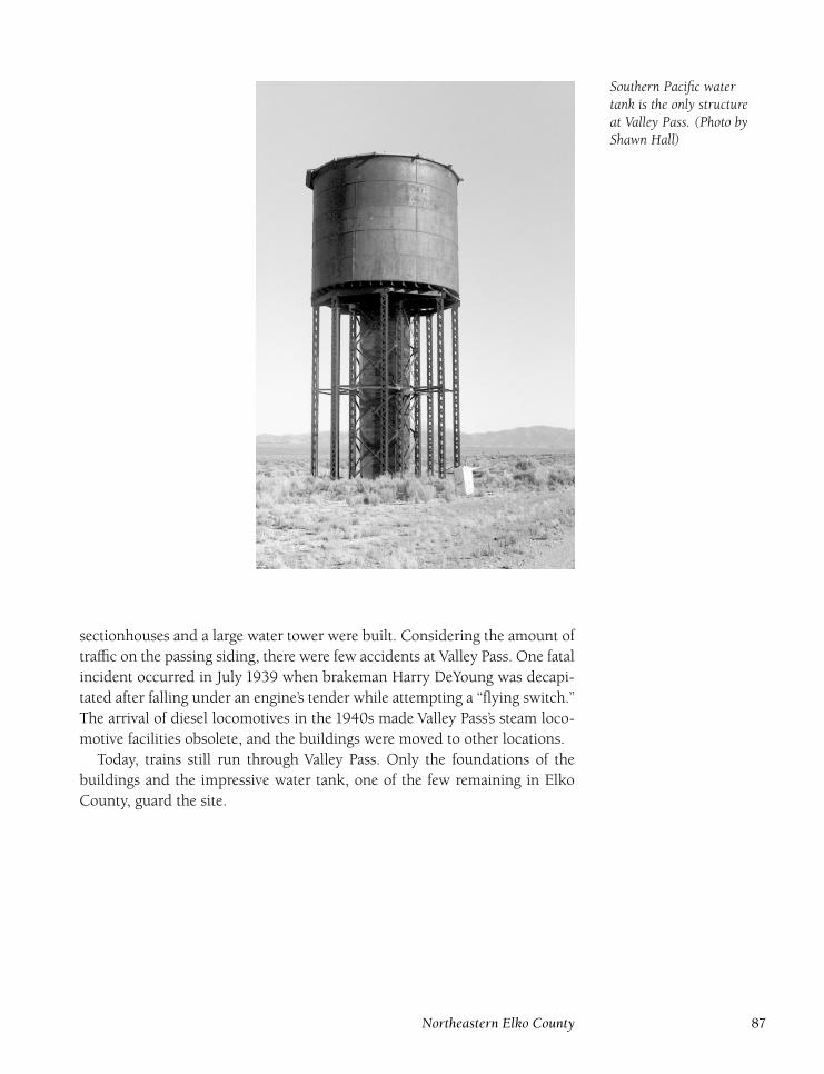
Southern Pacific watertank is the only structureat Valley Pass. (Photo byShawn Hall)
sectionhouses and a large water tower were built. Considering the amount of
traffic on the passing siding, there were few accidents at Valley Pass. One fatal
incident occurred in July 1939 when brakeman Harry DeYoung was decapi-
tated after falling under an engine’s tender while attempting a ‘‘flying switch.’’
The arrival of diesel locomotives in the 1940s made Valley Pass’s steam loco-
motive facilities obsolete, and the buildings were moved to other locations.
Today, trains still run through Valley Pass. Only the foundations of the
buildings and the impressive water tank, one of the few remaining in Elko
County, guard the site.
Northeastern Elko County 87

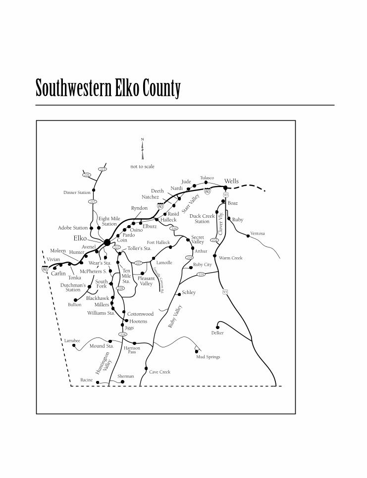
Southwestern Elko County
Adobe StationDIRECTIONS : Located 7½ miles north of Elko on Nevada 225.
Adobe Station served as a stop for a number of stagecoach com-
panies. Besides being a horse-changing stop for many years on the Elko-
Tuscarora stage, Adobe was also a stop on Beachey’s Elko-Idaho Toll Road
beginning in 1869 until the toll road folded in 1871. With the boom at Cor-
nucopia, a stage line and fast freight were operated from Elko by Woodruff
and Ennor; unfortunately, the staging empire, once one of the largest in the
West, was struggling at this time. The Elko-Cornucopia run was Woodruff
and Ennor’s last Nevada stagecoach line and was later sold to Smith Van
Dreillan. He charged ten cents a head to feed and house horses. However,
when the Cornucopia boom turned to bust, the local need for the stagecoach
line ended and Van Dreillan moved on to run other stages.
Tragedy struck near Adobe in 1874. Deputy Sheriff John Ellis traveled,
probably by horse, to Cornucopia to pick up a prisoner in February. However,
the prisoner had escaped and Ellis headed back to Elko alone. Unfortunately,
a blizzard began as he passed through Taylor Canyon. He was spotted by a
stagecoach driver who encouraged Ellis to stay with him at his campfire, but
Ellis was determined to get back to Elko and continued on alone. That was
the last time he was seen alive. Search parties were dispatched, but his body
was not found until May after the snow had melted. Ellis had apparently lost
his way in the snowstorm and was found three miles west of Adobe. Vari-
ous campsites Ellis had used were found, but there was no evidence of fire.
Apparently Ellis’s hands were too cold to use his matches to start a fire.
After Smith Van Dreillan abandoned the Elko-Cornucopia stage line, the
Elko-Tuscarora Stage Company exclusively served Adobe. Fred Wilson,
owner and operator of the line, built a new station after purchasing a 220-
acre ranch for $2,600, which provided hay for stage horses. Adobe was the
headquarters for the line, and rooms and meals were available there. How-
ever, an alternate route for the stagecoach line was established to the east
through Eight Mile Station. In poor weather, this latter route was preferred,
and travel through Adobe Station dropped off dramatically.
In 1886, Wilson sold the ranch to Emilio Dotta and his family, who ran the
station. Dave Dotta, longtime mayor of Elko, was born here on April 1, 1887.
The Dotta family sold the property in 1892 to John Paleni, who was born in
Italy, who ran Adobe Ranch until 1910 when ‘‘Adobe John’’ Piccolo took over.
By this time, the Elko-Tuscarora Stage was only a memory and the station
had ceased to exist; only the ranch continued to operate. The Pattani family
took over Adobe after Piccolo’s death in the 1920s, and the land is still used
for cattle grazing.
Not much remains of Adobe Ranch. Only crumbled buildings and scat-
90 Connecting the West
tered debris are left. It is impossible to determine which might be the ruins
of the stage station.
AvenelDIRECTIONS : Located 3 miles southwest of Elko on the Union Pacific.
Avenel, named after Avenel, New Jersey, is a nonagency siding on
the former Southern Pacific Railroad (now the Union Pacific) west of Elko.
Only a switching shed was constructed at Avenel. Nothing is left today.
BlackhawkDIRECTIONS : From Elko, take the Spring Creek road southeast for 6.9miles. Turn right and go 11 miles. Turn right and follow a gravel roadwest for 1 mile and then south along Huntington Creek for 4 miles toBlackhawk.
Blackhawk was a stop and horse-changing station on the Elko-
White Pine Toll Road. The station, located four miles south of Shepherd’s
Station, was active for only a few years in the early 1870s. After that station
became the main stop in the area, there was no need for Blackhawk, which
was abandoned. Only a couple of rotted logs mark the site.
BoazDIRECTIONS : Located 5 miles south of Wells on the Union Pacific.
Boaz is a signal station on the former Western Pacific Railroad
(now the Union Pacific) at the top of Clover Valley. However, when Boaz
was established during Western Pacific construction in 1910, there was much
more activity, Boaz having been the main shipping point for Clover Valley.
Local residents gave the town a biblical name, Boaz, who was married to Ruth.
A couple of buildings were built to house a section crew and by the 1930s,
a couple of families lived at Boaz. The residents at Boaz, Tobar, and Ventosa
were all railroad workers, and considered each other family. They often got
together for picnics; dances were held at the Tobar schoolhouse. However, the
rise of truck use and improvement of the railroad reduced the need for sec-
tion crews. By the late 1940s, Boaz had become just a siding. The buildings
were moved or torn down, and not much remains at Boaz today.
Southwestern Elko County 91
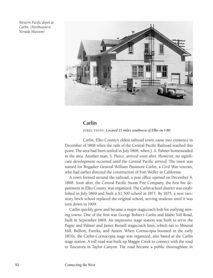
Western Pacific depot atCarlin. (NortheasternNevada Museum)
CarlinDIRECTIONS : Located 21 miles southwest of Elko on I-80.
Carlin, Elko County’s oldest railroad town, came into existence in
December of 1868 when the rails of the Central Pacific Railroad reached this
point. The area had been settled in July1868, when J. A. Palmer homesteaded
in the area. Another man, S. Pierce, arrived soon after. However, no signifi-
cant development occurred until the Central Pacific arrived. The town was
named for Brigadier General William Passmore Carlin, a Civil War veteran,
who had earlier directed the construction of Fort Weller in California.
A town formed around the railroad; a post office opened on December 4,
1868. Soon after, the Central Pacific Steam Fire Company, the first fire de-
partment in Elko County, was organized. The Carlin school district was estab-
lished in July 1869 and built a $1,500 school in 1871. By 1875, a new two-
story brick school replaced the original school, serving students until it was
torn down in 1909.
Carlin quickly grew and became a major stagecoach hub for outlying min-
ing towns. One of the first was George Bobier’s Carlin and Idaho Toll Road,
built in September 1869. An impressive stage station was built to serve the
Pagne and Palmer and James Russell stagecoach lines, which ran to Mineral
Hill, Bullion, Eureka, and Austin. When Cornucopia boomed in the early
1870s, the Carlin-Cornucopia stage was organized, also based at the Carlin
stage station. A toll road was built up Maggie Creek to connect with the road
to Tuscarora in Taylor Canyon. The road became a public thoroughfare in
92 Connecting the West
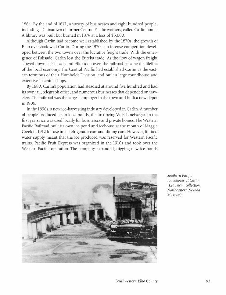
1884. By the end of 1871, a variety of businesses and eight hundred people,
including a Chinatown of former Central Pacific workers, called Carlin home.
A library was built but burned in 1879 at a loss of $3,000.
Although Carlin had become well established by the 1870s, the growth of
Elko overshadowed Carlin. During the 1870s, an intense competition devel-
oped between the two towns over the lucrative freight trade. With the emer-
gence of Palisade, Carlin lost the Eureka trade. As the flow of wagon freight
slowed down as Palisade and Elko took over, the railroad became the lifeline
of the local economy. The Central Pacific had established Carlin as the east-
ern terminus of their Humboldt Division, and built a large roundhouse and
extensive machine shops.
By 1880, Carlin’s population had steadied at around five hundred and had
its own jail, telegraph office, and numerous businesses that depended on trav-
elers. The railroad was the largest employer in the town and built a new depot
in 1906.
In the1890s, a new ice-harvesting industry developed in Carlin. A number
of people produced ice in local ponds, the first being W. F. Linebarger. In the
first years, ice was used locally for businesses and private homes. The Western
Pacific Railroad built its own ice pond and icehouse at the mouth of Maggie
Creek in1912 for use in its refrigerator cars and dining cars. However, limited
water supply meant that the ice produced was reserved for Western Pacific
trains. Pacific Fruit Express was organized in the 1910s and took over the
Western Pacific operation. The company expanded, digging new ice ponds
Southern Pacificroundhouse at Carlin.(Leo Pacini collection,Northeastern NevadaMuseum)
Southwestern Elko County 93
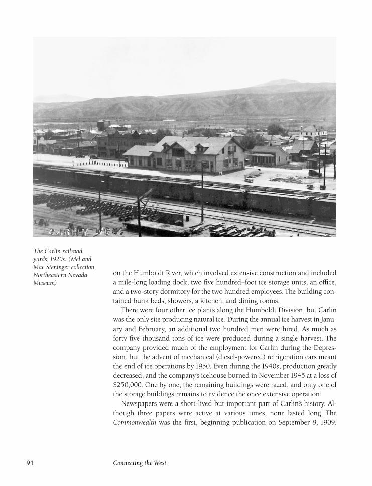
The Carlin railroadyards, 1920s. (Mel andMae Steninger collection,Northeastern NevadaMuseum)
on the Humboldt River, which involved extensive construction and included
a mile-long loading dock, two five hundred–foot ice storage units, an office,
and a two-story dormitory for the two hundred employees. The building con-
tained bunk beds, showers, a kitchen, and dining rooms.
There were four other ice plants along the Humboldt Division, but Carlin
was the only site producing natural ice. During the annual ice harvest in Janu-
ary and February, an additional two hundred men were hired. As much as
forty-five thousand tons of ice were produced during a single harvest. The
company provided much of the employment for Carlin during the Depres-
sion, but the advent of mechanical (diesel-powered) refrigeration cars meant
the end of ice operations by 1950. Even during the 1940s, production greatly
decreased, and the company’s icehouse burned in November 1945 at a loss of
$250,000. One by one, the remaining buildings were razed, and only one of
the storage buildings remains to evidence the once extensive operation.
Newspapers were a short-lived but important part of Carlin’s history. Al-
though three papers were active at various times, none lasted long. The
Commonwealth was the first, beginning publication on September 8, 1909.
94 Connecting the West
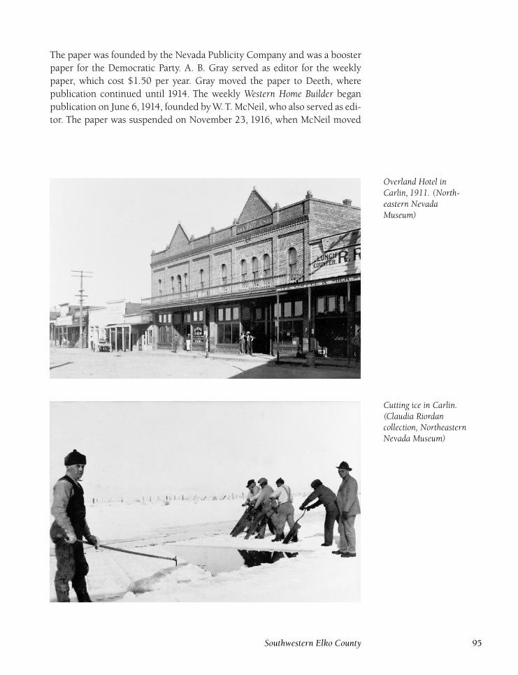
The paper was founded by the Nevada Publicity Company and was a booster
paper for the Democratic Party. A. B. Gray served as editor for the weekly
paper, which cost $1.50 per year. Gray moved the paper to Deeth, where
publication continued until 1914. The weekly Western Home Builder began
publication on June 6,1914, founded by W. T. McNeil, who also served as edi-
tor. The paper was suspended on November 23, 1916, when McNeil moved
Overland Hotel inCarlin, 1911. (North-eastern NevadaMuseum)
Cutting ice in Carlin.(Claudia Riordancollection, NortheasternNevada Museum)
Southwestern Elko County 95
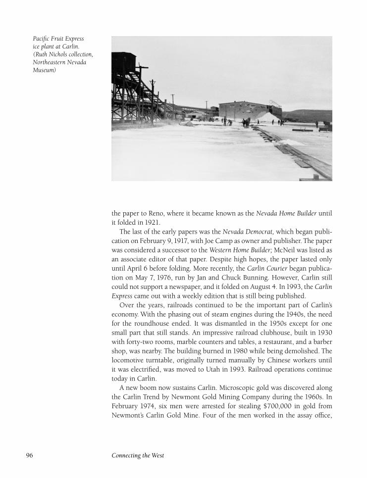
Pacific Fruit Expressice plant at Carlin.(Ruth Nichols collection,Northeastern NevadaMuseum)
the paper to Reno, where it became known as the Nevada Home Builder until
it folded in 1921.
The last of the early papers was the Nevada Democrat, which began publi-
cation on February 9,1917, with Joe Camp as owner and publisher. The paper
was considered a successor to the Western Home Builder; McNeil was listed as
an associate editor of that paper. Despite high hopes, the paper lasted only
until April 6 before folding. More recently, the Carlin Courier began publica-
tion on May 7, 1976, run by Jan and Chuck Bunning. However, Carlin still
could not support a newspaper, and it folded on August 4. In1993, the CarlinExpress came out with a weekly edition that is still being published.
Over the years, railroads continued to be the important part of Carlin’s
economy. With the phasing out of steam engines during the 1940s, the need
for the roundhouse ended. It was dismantled in the 1950s except for one
small part that still stands. An impressive railroad clubhouse, built in 1930
with forty-two rooms, marble counters and tables, a restaurant, and a barber
shop, was nearby. The building burned in 1980 while being demolished. The
locomotive turntable, originally turned manually by Chinese workers until
it was electrified, was moved to Utah in 1993. Railroad operations continue
today in Carlin.
A new boom now sustains Carlin. Microscopic gold was discovered along
the Carlin Trend by Newmont Gold Mining Company during the 1960s. In
February 1974, six men were arrested for stealing $700,000 in gold from
Newmont’s Carlin Gold Mine. Four of the men worked in the assay office,
96 Connecting the West
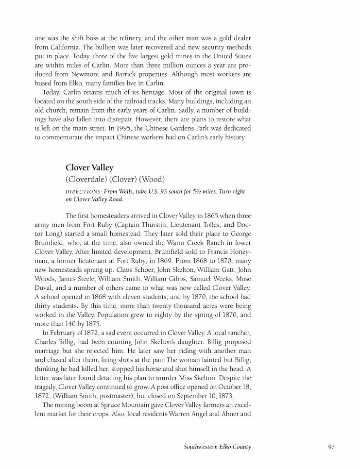
one was the shift boss at the refinery, and the other man was a gold dealer
from California. The bullion was later recovered and new security methods
put in place. Today, three of the five largest gold mines in the United States
are within miles of Carlin. More than three million ounces a year are pro-
duced from Newmont and Barrick properties. Although most workers are
bused from Elko, many families live in Carlin.
Today, Carlin retains much of its heritage. Most of the original town is
located on the south side of the railroad tracks. Many buildings, including an
old church, remain from the early years of Carlin. Sadly, a number of build-
ings have also fallen into disrepair. However, there are plans to restore what
is left on the main street. In 1995, the Chinese Gardens Park was dedicated
to commemorate the impact Chinese workers had on Carlin’s early history.
Clover Valley(Cloverdale) (Clover) (Wood)
DIRECTIONS : From Wells, take U.S. 93 south for 5½ miles. Turn righton Clover Valley Road.
The first homesteaders arrived in Clover Valley in1865 when three
army men from Fort Ruby (Captain Thurstin, Lieutenant Tolles, and Doc-
tor Long) started a small homestead. They later sold their place to George
Brumfield, who, at the time, also owned the Warm Creek Ranch in lower
Clover Valley. After limited development, Brumfield sold to Francis Honey-
man, a former lieutenant at Fort Ruby, in 1869. From 1868 to 1870, many
new homesteads sprang up. Claus Schoer, John Skelton, William Gatt, John
Woods, James Steele, William Smith, William Gibbs, Samuel Weeks, Mose
Duval, and a number of others came to what was now called Clover Valley.
A school opened in 1868 with eleven students, and by 1870, the school had
thirty students. By this time, more than twenty thousand acres were being
worked in the Valley. Population grew to eighty by the spring of 1870, and
more than 140 by 1875.
In February of 1872, a sad event occurred in Clover Valley. A local rancher,
Charles Billig, had been courting John Skelton’s daughter. Billig proposed
marriage but she rejected him. He later saw her riding with another man
and chased after them, firing shots at the pair. The woman fainted but Billig,
thinking he had killed her, stopped his horse and shot himself in the head. A
letter was later found detailing his plan to murder Miss Skelton. Despite the
tragedy, Clover Valley continued to grow. A post office opened on October18,
1872, (William Smith, postmaster), but closed on September 10, 1873.
The mining boom at Spruce Mountain gave Clover Valley farmers an excel-
lent market for their crops. Also, local residents Warren Angel and Abner and
Southwestern Elko County 97
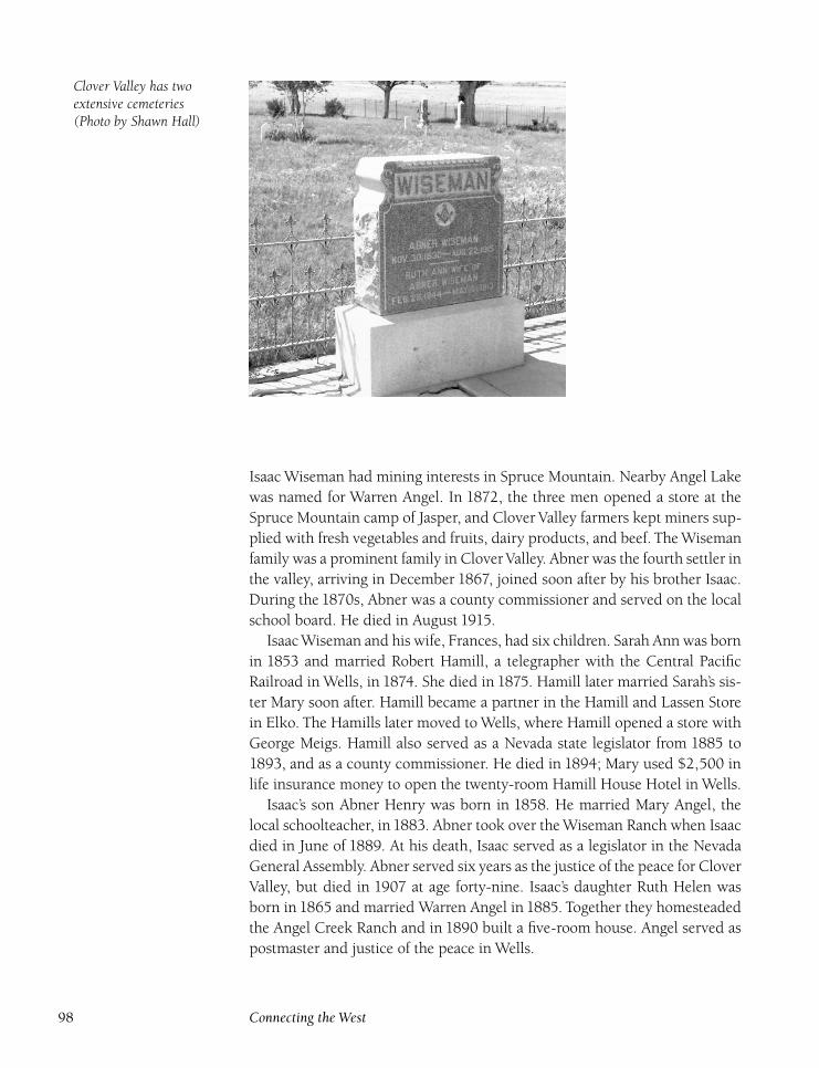
Clover Valley has twoextensive cemeteries(Photo by Shawn Hall)
Isaac Wiseman had mining interests in Spruce Mountain. Nearby Angel Lake
was named for Warren Angel. In 1872, the three men opened a store at the
Spruce Mountain camp of Jasper, and Clover Valley farmers kept miners sup-
plied with fresh vegetables and fruits, dairy products, and beef. The Wiseman
family was a prominent family in Clover Valley. Abner was the fourth settler in
the valley, arriving in December 1867, joined soon after by his brother Isaac.
During the 1870s, Abner was a county commissioner and served on the local
school board. He died in August 1915.
Isaac Wiseman and his wife, Frances, had six children. Sarah Ann was born
in 1853 and married Robert Hamill, a telegrapher with the Central Pacific
Railroad in Wells, in 1874. She died in 1875. Hamill later married Sarah’s sis-
ter Mary soon after. Hamill became a partner in the Hamill and Lassen Store
in Elko. The Hamills later moved to Wells, where Hamill opened a store with
George Meigs. Hamill also served as a Nevada state legislator from 1885 to
1893, and as a county commissioner. He died in 1894; Mary used $2,500 in
life insurance money to open the twenty-room Hamill House Hotel in Wells.
Isaac’s son Abner Henry was born in 1858. He married Mary Angel, the
local schoolteacher, in1883. Abner took over the Wiseman Ranch when Isaac
died in June of 1889. At his death, Isaac served as a legislator in the Nevada
General Assembly. Abner served six years as the justice of the peace for Clover
Valley, but died in 1907 at age forty-nine. Isaac’s daughter Ruth Helen was
born in 1865 and married Warren Angel in 1885. Together they homesteaded
the Angel Creek Ranch and in 1890 built a five-room house. Angel served as
postmaster and justice of the peace in Wells.
98 Connecting the West
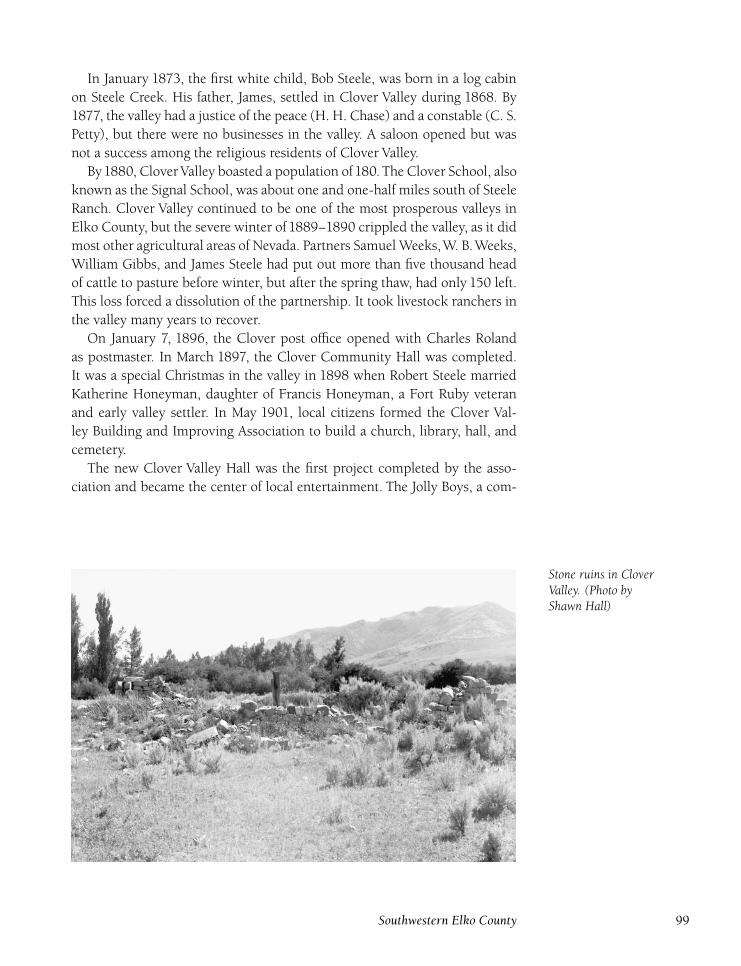
In January 1873, the first white child, Bob Steele, was born in a log cabin
on Steele Creek. His father, James, settled in Clover Valley during 1868. By
1877, the valley had a justice of the peace (H. H. Chase) and a constable (C. S.
Petty), but there were no businesses in the valley. A saloon opened but was
not a success among the religious residents of Clover Valley.
By1880, Clover Valley boasted a population of180. The Clover School, also
known as the Signal School, was about one and one-half miles south of Steele
Ranch. Clover Valley continued to be one of the most prosperous valleys in
Elko County, but the severe winter of 1889–1890 crippled the valley, as it did
most other agricultural areas of Nevada. Partners Samuel Weeks,W. B.Weeks,
William Gibbs, and James Steele had put out more than five thousand head
of cattle to pasture before winter, but after the spring thaw, had only 150 left.
This loss forced a dissolution of the partnership. It took livestock ranchers in
the valley many years to recover.
On January 7, 1896, the Clover post office opened with Charles Roland
as postmaster. In March 1897, the Clover Community Hall was completed.
It was a special Christmas in the valley in 1898 when Robert Steele married
Katherine Honeyman, daughter of Francis Honeyman, a Fort Ruby veteran
and early valley settler. In May 1901, local citizens formed the Clover Val-
ley Building and Improving Association to build a church, library, hall, and
cemetery.
The new Clover Valley Hall was the first project completed by the asso-
ciation and became the center of local entertainment. The Jolly Boys, a com-
Stone ruins in CloverValley. (Photo byShawn Hall)
Southwestern Elko County 99
edy troupe made up of local actors, was a popular attraction. In November
1901, an International Order of Good Templars lodge formed with eighteen
members, Robert Steele serving as chief templar. Charles Roberts and Frank
Winchell Sr. began manufacturing bricks, which were used to build many of
the buildings in the valley. Another post office, named Wood, opened on the
present-day Goodwin Ranch with Malinda Wood as postmaster. The office
closed on December 15, 1902, and the Clover post office followed suit on
March 14, 1903.
In 1905, William Gibbs, Samuel Weeks, James Steele, Horace Agee, and
William Johnson formed the Clover Valley Land and Livestock Company,
known locally as the Ox-Yoke outfit because of their ox-yoke brand. In 1910,
the group purchased the Hardesty holdings, and became the largest opera-
tors in the valley. In 1914, some Clover Valley ranchers formed the Steptoe
Company with Horace Agee as president. The company ran more than twenty
thousand sheep and later merged with the Ox-Yoke Company. Agee moved to
Wells, where he reorganized the Wells Bank and served as its president until
1932, when the Depression forced closure of the bank. The Depression also
forced the Ox Yoke-Steptoe Company into receivership in 1933; the hold-
ings were eventually broken up. The Western Pacific Railroad was completed
through northern Clover Valley in 1908. A siding, named Clover, was con-
structed to feed livestock in transit. The presence of the siding made it easier
for local ranchers and farmers to ship their goods.
The local ranching industry boom led to civic improvements for the resi-
dents. Although most residents were religious, a church wasn’t organized
until 1912 when the Wiseman, Agee, Honeyman, Weeks, and Steele families
organized members of the community and built St. Luke’s Episcopal Church.
The church was active until the building was moved to Wells in the 1950s to
serve as a sanctuary for St. Barnabas Church. Also, thanks to Samuel Weeks
and the Leach Brothers, a large park was built.
A fire broke out in November 1914 on the Wiseman Ranch. Strong winds
swept across the valley, devastating crops, livestock, buildings, and fences,
although the valley’s houses were spared. Damage was estimated at $35,000.
Despite this setback, the valley rebounded and continued to be successful.
The Clover Valley post office reopened on July 12, 1921, with Dessa Gibbs
as postmaster until replaced by Horace Agee in 1922. The office permanently
closed on October 31, 1924. The Depression caused many hardships in the
valley, but did not have the dramatic impact it had elsewhere. In 1933, a
Civilian Conservation Corps () camp opened in the valley.
A ‘‘geological treasure’’ discovered on the Weeks Ranch brought news
coverage to Clover Valley during the1930s. A number of fossils were found in
the Elephant ToothWell, a large natural hog hole on the ranch.While scraping
out the hole to make a stock watering hole in 1930, the diggers found a num-
ber of white rocks. The rocks turned out to be fossilized teeth, but the well
100 Connecting the West
was not seriously explored until 1936 when the Nevada Department of High-
ways contracted with the Utah Construction Company to clean out the well
to provide water for the construction of U.S. 93. During the cleaning, many
more specimens were discovered and sent to Dr. Harry Wheeler at the Mac-
Kay School of Mines in Reno. Dr. Wheeler asked that work on the water hole
stop so he could examine the site. In the summer of 1937, the S. Frank Hunt
Foundation funded an expedition to the site by University of Nevada at Reno
mining students. Hundreds of fossilized teeth from thirty different species
were unearthed. One tooth was thirteen inches long and eight inches thick.
The hole was examined further before most of the specimens were removed.
In May 1938, longtime resident Samuel Weeks died at age ninety-four. The
Weeks family had a long legacy in Clover Valley.Weeks had come to the valley
in March of 1869, and his first year was spent living in a dugout. He mar-
ried Martha Ann Wood in 1874, and they had seven children. After his death,
Weeks’s holdings were sold to the Utah Construction Company. In 1949, due
to a drop in school attendance, the Signal School consolidated with the Wells
School District. Over the years, teachers at the Signal School included Mary
Benson, Edna Sullivan, Kireta Portlock, Alice Van Leer, Nellie Anderson, and
Jessie Ware.
In the early 1950s, local resident Ula Van Diver organized the Wells Chap-
ter of the Nevada Association for the United Nations. News of her activities
reached Washington, D.C. In October 1954, she received a personal letter
on United Nations Day from President Eisenhower praising her efforts in
‘‘strongly advancing the cause of world peace.’’1
Clover Valley continues as a prosperous agricultural area. A number of pre-
1900 homes and buildings still stand, and two cemeteries are located in the
valley. The Wiseman Cemetery contains more than seventy graves. More than
twenty graves are of infants, including six from the Duval family. The Clover
Valley-Lampman Cemetery also has more than seventy graves. Clover Valley
is one of the most beautiful areas in Elko County, nestled at the base of the
East Humboldt Range mountains.
CoinDIRECTIONS : Located 3 miles northeast of Elko just south of I-80.
Coin has served as a side track and signal station for the Western
Pacific and Southern Pacific Railroads for many years. Coin’s only claim to
fame is that a small temporary camp formed here during the construction of
the Central Pacific Railroad in 1869. However, nothing permanent was con-
structed because the construction camp moved with the advancement of the
rails and nothing is left at Coin today.
Southwestern Elko County 101
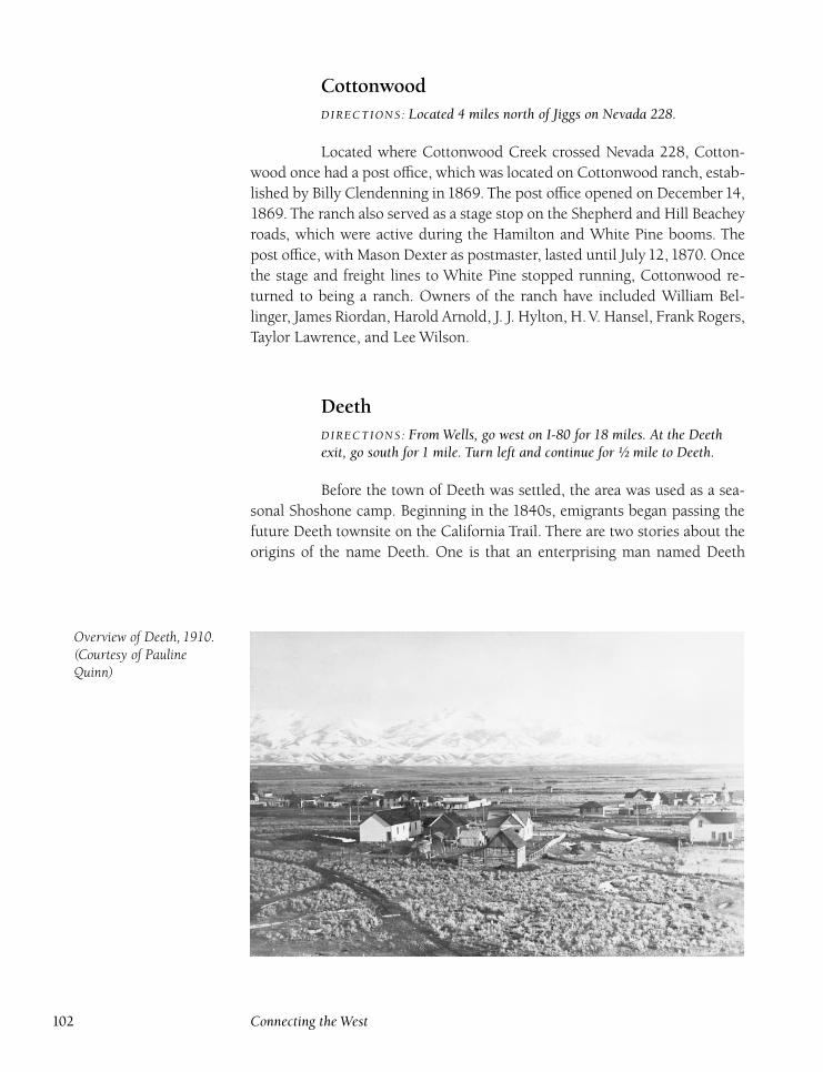
CottonwoodDIRECTIONS : Located 4 miles north of Jiggs on Nevada 228.
Located where Cottonwood Creek crossed Nevada 228, Cotton-
wood once had a post office, which was located on Cottonwood ranch, estab-
lished by Billy Clendenning in 1869. The post office opened on December 14,
1869. The ranch also served as a stage stop on the Shepherd and Hill Beachey
roads, which were active during the Hamilton and White Pine booms. The
post office, with Mason Dexter as postmaster, lasted until July 12, 1870. Once
the stage and freight lines to White Pine stopped running, Cottonwood re-
turned to being a ranch. Owners of the ranch have included William Bel-
linger, James Riordan, Harold Arnold, J. J. Hylton, H.V. Hansel, Frank Rogers,
Taylor Lawrence, and Lee Wilson.
DeethDIRECTIONS : From Wells, go west on I-80 for 18 miles. At the Deethexit, go south for 1 mile. Turn left and continue for ½ mile to Deeth.
Before the town of Deeth was settled, the area was used as a sea-
sonal Shoshone camp. Beginning in the 1840s, emigrants began passing the
future Deeth townsite on the California Trail. There are two stories about the
origins of the name Deeth. One is that an enterprising man named Deeth
Overview of Deeth, 1910.(Courtesy of PaulineQuinn)
102 Connecting the West
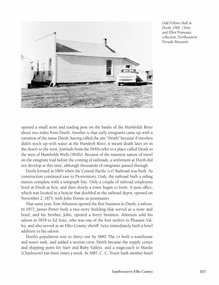
Odd Fellows Hall inDeeth, 1960. (Tonyand Ellen Primeauxcollection, NortheasternNevada Museum)
opened a small store and trading post on the banks of the Humboldt River
about two miles from Deeth. Another is that early emigrants came up with a
variation of the name Deeth, having called the site ‘‘Death’’ because if travelers
didn’t stock up with water at the Humbolt River, it meant death later on in
the desert to the west. Journals from the1840s refer to a place called Death to
the west of Humboldt Wells (Wells). Because of the transient nature of travel
on the emigrant trail before the coming of railroads, a settlement at Deeth did
not develop at this time, although thousands of emigrants passed through.
Deeth formed in 1869 when the Central Pacific () Railroad was built. As
construction continued east to Promontory, Utah, the railroad built a siding
station complete with a telegraph line. Only a couple of railroad employees
lived at Deeth at first, and then slowly a town began to form. A post office,
which was located in a boxcar that doubled as the railroad depot, opened on
November 2, 1875, with John Donne as postmaster.
That same year, Tom Atkinson opened the first business in Deeth, a saloon.
In 1877, James Porter built a two-story building that served as a store and
hotel, and his brother, John, opened a livery business. Atkinson sold his
saloon in 1879 to Ed Seitz, who was one of the first settlers in Pleasant Val-
ley, and also served as an Elko County sheriff. Seitz immediately built a hotel
addition to his saloon.
Deeth’s population rose to thirty-one by 1880. The built a warehouse
and water tank, and added a section crew. Deeth became the supply center
and shipping point for Starr and Ruby Valleys, and a stagecoach to Mardis
(Charleston) ran three times a week. In 1887, C. C. Truett built another hotel
Southwestern Elko County 103
in Deeth, which was later purchased byWilliam Mayer, who would eventually
run the Mayer Hotel in Elko.
The Bradley cattle company was a boost to Deeth’s economy and in par-
ticular, J. R. Bradley, who opened a store in Deeth, and later another at Mar-
dis. His company competed directly with Porter; Bradley’s newspaper ads
listed Porter’s prices and Bradley’s lower prices. This spirited competition had
Deeth residents smiling because the price wars led to prices as low as those
in nearby Elko. In 1899, Porter gave up the battle with Bradley, and sold his
store, eight-room hotel, house, corrals, and stables to A. C. Dorsey.
The Reverend Merchant Riddle organized the Deeth Tidings in January
1896. Riddle used the paper to promote the Free Silver Party platform. The
newspaper was an eight-page weekly, with a subscription rate of $2 per year,
edited by members of the local Good Templars lodge. Residents of Deeth
relished their local paper, but there were too few subscriptions to make the
paper viable. In September, Riddle moved his newspaper plant to Elko, and
started the Nevada Silver Tidings, published until July 1899.
A school was also built in1899; Isora Stevens taught thirty students during
the first year. By 1902, the Dorsey Store and Hotel was run by William Mayer
and Oliver McCall. In September 1903, Seitz’s former hotel, then owned by
Charles Standley, was set on fire by a cook smoking opium in his room. The
hotel was destroyed.
By1910, Deeth was approaching its peak, with new gold strikes at Jarbidge
leading to a great revival of the stage and freighting business. Local business-
men and ranchers, along with financial backing from the Southern Pacific
Railroad, raised $10,000 to construct a stage road to Jarbidge in an attempt to
lure business away from Jarbidge’s other source of supplies, Twin Falls, Idaho.
The effort paid off and, except for when snow closed the road, Deeth enjoyed
a lucrative trade. The fare to Jarbidge was $10; ten-horse teams left daily for
Jarbidge.
In 1910, construction was completed on the Western Pacific Railroad
through Deeth and a large depot. The town was surveyed by C. M. Haws in
December 1910 and the township of Deeth was established. The town suf-
fered a flood in 1910 when an ice jam piled up against the Western Pacific
bridge east of town. This caused the Humboldt River to overrun its banks and
flow through town. Luckily, damage was slight.
New businesses continued to open, including the Deeth Mercantile Com-
pany (Forbes and Hobson), housed in a four thousand–square-foot build-
ing, and the Deeth Creamery, built by A. B. Gray and E. C. Riddell in May
1912. The creamery produced two hundred pounds of butter per week, but
closed within a year. The creamery building was later moved to Trout Creek
at Welcome, and was used as a fish hatchery until abandoned when the Ruby
Marsh hatchery opened. Gray brought other interests in Deeth, including
his Commonwealth newspaper, which moved from Carlin to Deeth in Febru-
104 Connecting the West
ary 1912. The paper was a Democratic weekly, published until October 1914
when Gray moved to Carson City, purchasing the Carson Weekly.In 1912, Oliver McCall, part owner of a local store and hotel, won the
mail contract to Jarbidge. He set up stations at Pole Canyon and Hank Creek.
McCall developed a strong reputation, maintaining his twice-weekly delivery
schedule even during tough winters. During the early 1910s, Deeth’s popula-
tion peaked at 250.There were two stores, two hotels, a dance hall, the Bradley
Opera House (Lew Bradley), five saloons (Truett, Stanley, Mahoney Brothers,
Nichols, and Parker), a slaughterhouse (Frank Orr), a red-light district, the
Cannon Pool Hall, and twenty-five houses.
In July1913, the Mahoney Brothers and Nichols Saloons burned at a loss of
$10,000. This was the first in a series of devastating fires in Deeth. A huge fire,
which started in the Mayer Hotel, struck Deeth in October of 1915. Before it
had burned out, two-thirds of the business district was destroyed. Businesses
burned included the Nicely Store, the Truett Saloon, the post office, and the
rebuilt Mahoney Saloon. Although the exact cause of the fire was never estab-
lished, inspectors labeled it suspicious, possibly to collect insurance money.
This fire effectively ended Deeth’s prosperous times.
The Southern Pacific and Western Pacific Railroads both had large depots
in town, but the opera house was the pride of the town. Many touring troupes
as well as the Deeth Orchestra performed there. Although religious services
were occasionally held by Elko preachers in Deeth, no church was ever built
in Deeth.
In January 1915, John Seabury started a new weekly newspaper, the DeethDivide. However, no further mention is ever made of the paper, which appar-
ently folded shortly after it began.
The arrival of the automobile lessened the importance of Deeth’s remaining
businesses. Many buildings and houses were later moved to Wells, Elko, and
other locations. Another fire in the 1930s claimed the Bradley Opera House,
since converted to a hotel, and the old Smiley store, home of the post office.
The Deeth school closed in1957 after it consolidated with the Wells School
District. The Western Pacific depot was moved to Crested Acres in the 1950s,
where it is still used as a restaurant and bar. Deeth has a population of about
twenty, but only a handful of original buildings survive. The Deeth post office
remains open in a cinder-block building.
Through its years, Deeth had a number of prominent citizens. Two Nevada
governors, Bradley and Russell, came from Deeth. State legislators included
James Riddell, Ebenezar Riddell, David Johnston, Joseph Johnston, Jim Rus-
sell, Edward Murphy, Morley Murphy, and Hugh McMullen. Stanford Weath-
ers was a West Point graduate, and Arthur St. Clair a Rhodes Scholar.
Southwestern Elko County 105
Duck Creek StationDIRECTIONS : Located on Wiseman Creek in northern Clover Valley, 2½miles south of the junction of Clover Valley Road and U.S. 93.
Duck Creek Station, located on Wiseman Creek in Clover Valley,
was a stage stop on the Wells-Hamilton road beginning in the late 1860s.
Martin Rush initially ran the station, but he left in 1879 after the Hamilton
boom had ended and there was no further need for the station. A stone foun-
dation marks the site.
Dutchman’s StationDIRECTIONS : Located 6 miles northeast of Bullion on Bullion Road.
Dutchman’s Station was a horse-changing stop on the Bullion
road, serving both George Shepherd’s stagecoach line and J. F. Ray’s Railroad
Canyon Toll Road in the early 1870s. The station was abandoned by 1875 and
not used again. Nothing remains of the station today.
Eight Mile Station(The Barrels) (Pudjeau’s)
DIRECTIONS : From Elko, go north on Eight Mile Creek road for 8 milesto Eight Mile Station.
Although not an official railroad stop, Eight Mile Station served an
important purpose. The station was originally run by a Frenchman named
Pudjeau, later mayor of Carson City, who collected tolls from travelers. Later,
it was incorporated into the Smith Van Dreillan stagecoach line to Tuscarora.
It was not a regular stop, but rather an emergency horse-changing station
used primarily during winter when the alternate route over Adobe Summit
was snowed in. Originally, three fifty-gallon whiskey barrels were sunk in
the ground at the springs to provide water for horses and travelers. Only the
springs remain today.
106 Connecting the West
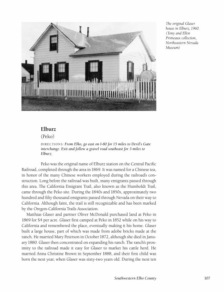
The original Glaserhouse in Elburz, 1960.(Tony and EllenPrimeaux collection,Northeastern NevadaMuseum)
Elburz(Peko)
DIRECTIONS : From Elko, go east on I-80 for 15 miles to Devil’s Gateinterchange. Exit and follow a gravel road southeast for 3 miles toElburz.
Peko was the original name of Elburz station on the Central Pacific
Railroad, completed through the area in1869. It was named for a Chinese tea,
in honor of the many Chinese workers employed during the railroad’s con-
struction. Long before the railroad was built, many emigrants passed through
this area. The California Emigrant Trail, also known as the Humboldt Trail,
came through the Peko site. During the 1840s and 1850s, approximately two
hundred and fifty thousand emigrants passed through Nevada on their way to
California. Although faint, the trail is still recognizable and has been marked
by the Oregon-California Trails Association.
Matthias Glaser and partner Oliver McDonald purchased land at Peko in
1869 for $4 per acre. Glaser first camped at Peko in 1852 while on his way to
California and remembered the place, eventually making it his home. Glaser
built a large house, part of which was made from adobe bricks made at the
ranch. He married Mary Peterson in October1872, although she died in Janu-
ary1880. Glaser then concentrated on expanding his ranch. The ranch’s prox-
imity to the railroad made it easy for Glaser to market his cattle herd. He
married Anna Christine Brown in September 1888, and their first child was
born the next year, when Glaser was sixty-two years old. During the next ten
Southwestern Elko County 107
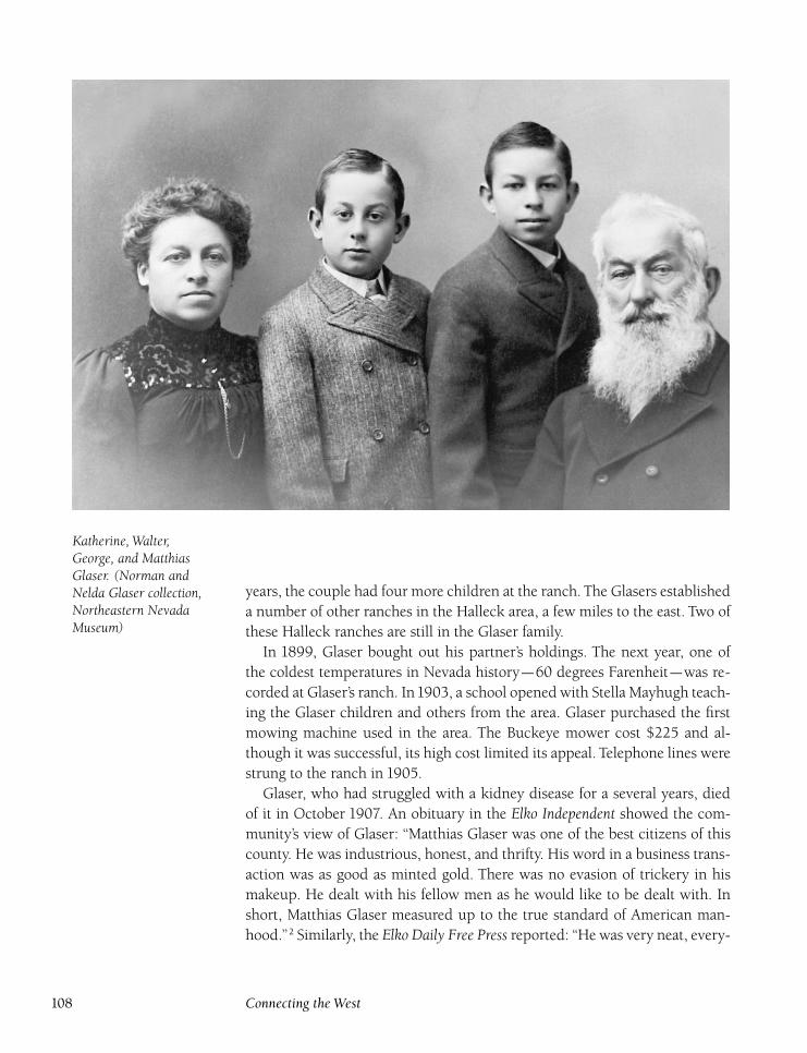
Katherine, Walter,George, and MatthiasGlaser. (Norman andNelda Glaser collection,Northeastern NevadaMuseum)
years, the couple had four more children at the ranch. The Glasers established
a number of other ranches in the Halleck area, a few miles to the east. Two of
these Halleck ranches are still in the Glaser family.
In 1899, Glaser bought out his partner’s holdings. The next year, one of
the coldest temperatures in Nevada history—60 degrees Farenheit—was re-
corded at Glaser’s ranch. In1903, a school opened with Stella Mayhugh teach-
ing the Glaser children and others from the area. Glaser purchased the first
mowing machine used in the area. The Buckeye mower cost $225 and al-
though it was successful, its high cost limited its appeal. Telephone lines were
strung to the ranch in 1905.
Glaser, who had struggled with a kidney disease for a several years, died
of it in October 1907. An obituary in the Elko Independent showed the com-
munity’s view of Glaser: ‘‘Matthias Glaser was one of the best citizens of this
county. He was industrious, honest, and thrifty. His word in a business trans-
action was as good as minted gold. There was no evasion of trickery in his
makeup. He dealt with his fellow men as he would like to be dealt with. In
short, Matthias Glaser measured up to the true standard of American man-
hood.’’2 Similarly, the Elko Daily Free Press reported: ‘‘He was very neat, every-
108 Connecting the West
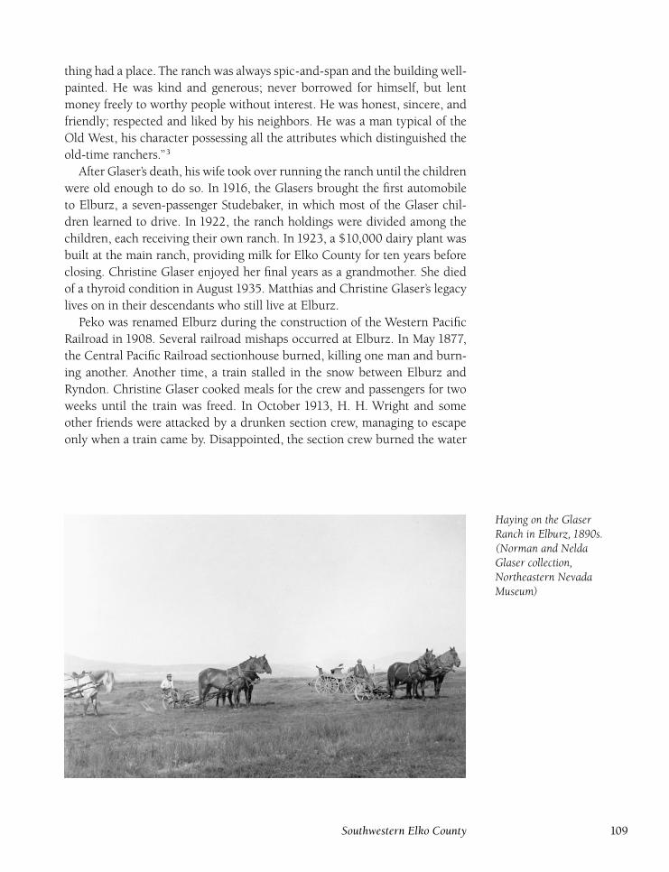
thing had a place. The ranch was always spic-and-span and the building well-
painted. He was kind and generous; never borrowed for himself, but lent
money freely to worthy people without interest. He was honest, sincere, and
friendly; respected and liked by his neighbors. He was a man typical of the
Old West, his character possessing all the attributes which distinguished the
old-time ranchers.’’3
After Glaser’s death, his wife took over running the ranch until the children
were old enough to do so. In 1916, the Glasers brought the first automobile
to Elburz, a seven-passenger Studebaker, in which most of the Glaser chil-
dren learned to drive. In 1922, the ranch holdings were divided among the
children, each receiving their own ranch. In 1923, a $10,000 dairy plant was
built at the main ranch, providing milk for Elko County for ten years before
closing. Christine Glaser enjoyed her final years as a grandmother. She died
of a thyroid condition in August 1935. Matthias and Christine Glaser’s legacy
lives on in their descendants who still live at Elburz.
Peko was renamed Elburz during the construction of the Western Pacific
Railroad in 1908. Several railroad mishaps occurred at Elburz. In May 1877,
the Central Pacific Railroad sectionhouse burned, killing one man and burn-
ing another. Another time, a train stalled in the snow between Elburz and
Ryndon. Christine Glaser cooked meals for the crew and passengers for two
weeks until the train was freed. In October 1913, H. H. Wright and some
other friends were attacked by a drunken section crew, managing to escape
only when a train came by. Disappointed, the section crew burned the water
Haying on the GlaserRanch in Elburz, 1890s.(Norman and NeldaGlaser collection,Northeastern NevadaMuseum)
Southwestern Elko County 109
tank. Two Western Pacific Railroad trains collided at Elburz in June 1928. A
cook was hurt, and locomotive engines sustained $8,000 in damage.
Today, a number of ranches still operate at Elburz. Many original build-
ings, including Matthias Glaser’s house, survive. In addition, railroad building
foundations and other railroad equipment remain between the tracks.
ElkoDIRECTIONS : Located on I-80, 289 miles east of Reno.
Long before a town was established here, thousands of emigrants
passed by the California Emigrant Trail, or Humboldt Trail, during the1840s–
1860s. Many stopped at the Hot Hole, located just west of the future townsite.
Elko, the heartbeat of Elko County, came into existence in December 1868
when the Central Pacific Railroad arrived. The central location of the town to
mining camps and ranches ensured its permanence. Officials of the railroad
began laying out lots on December 29. A number of stories explain the nam-
ing of Elko. However, the most commonly accepted version is that Charles
Crocker, one of the Central Pacific’s owners, having a strong fondness for ani-
mal names for railroad stops and engines, simply added an O to Elk. However,
this notion seems incorrect since a number of other towns in the eastern states
are named Elko and predate Elko’s establishment.
On January 1, 1869, there were four canvas tents on the townsite selected
by Len Wines and Frank Denver. Within another month, a tent town had
sprung up and quickly became the center of an immense stage and freight
system. A post office opened on January 29. Booms at Tuscarora and Hamil-
ton (White Pine County) used Elko as the nearest and most easily accessible
railhead. D. H. Haskell, Central Pacific land agent, began selling lots in Elko
on January 15, 1869. The lots measured twenty-five feet by one hundred feet.
The lots were $300 for inside and $500 for corner lots.
Within the first six weeks of 1869, six stage lines had been organized to
run to the White Pine district, using the Denver-Shepherd Toll Road and
the Gilson Turnpike, both running through Huntington Valley. By March 8,
eight were active: Len Wines’ Pacific Union Express, Hill Beachey, Wood-
ruff and Ennor, Wells Fargo, Hughes and Middleton (former employees of
Hill Beachey who ran numerous stage lines in Elko County and throughout
Nevada), Thomas and Hall, Leander Swasey, and Payne and Palmer, who ran
a stage line from Boise to Hamilton and used Elko as its hub. Beachey also had
stage lines running to the north via the Elko-and-Idaho and Idaho Central
Toll Roads.
Competition for freight and passengers to Hamilton was intense. At first,
it cost a passenger $40 for the twenty-four-hour trip, but competition cut the
110 Connecting the West
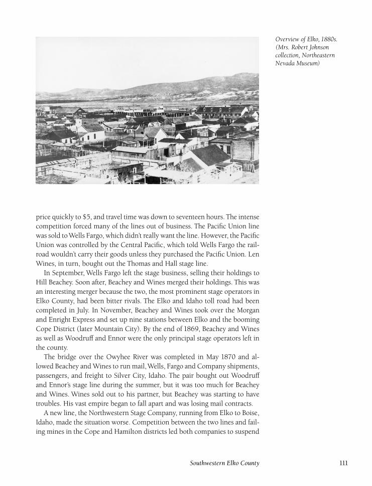
Overview of Elko, 1880s.(Mrs. Robert Johnsoncollection, NortheasternNevada Museum)
price quickly to $5, and travel time was down to seventeen hours. The intense
competition forced many of the lines out of business. The Pacific Union line
was sold toWells Fargo, which didn’t really want the line. However, the Pacific
Union was controlled by the Central Pacific, which told Wells Fargo the rail-
road wouldn’t carry their goods unless they purchased the Pacific Union. Len
Wines, in turn, bought out the Thomas and Hall stage line.
In September, Wells Fargo left the stage business, selling their holdings to
Hill Beachey. Soon after, Beachey and Wines merged their holdings. This was
an interesting merger because the two, the most prominent stage operators in
Elko County, had been bitter rivals. The Elko and Idaho toll road had been
completed in July. In November, Beachey and Wines took over the Morgan
and Enright Express and set up nine stations between Elko and the booming
Cope District (later Mountain City). By the end of 1869, Beachey and Wines
as well as Woodruff and Ennor were the only principal stage operators left in
the county.
The bridge over the Owyhee River was completed in May 1870 and al-
lowed Beachey and Wines to run mail,Wells, Fargo and Company shipments,
passengers, and freight to Silver City, Idaho. The pair bought out Woodruff
and Ennor’s stage line during the summer, but it was too much for Beachey
and Wines. Wines sold out to his partner, but Beachey was starting to have
troubles. His vast empire began to fall apart and was losing mail contracts.
A new line, the Northwestern Stage Company, running from Elko to Boise,
Idaho, made the situation worse. Competition between the two lines and fail-
ing mines in the Cope and Hamilton districts led both companies to suspend
Southwestern Elko County 111
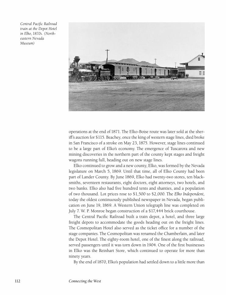
Central Pacific Railroadtrain at the Depot Hotelin Elko, 1870s. (North-eastern NevadaMuseum)
operations at the end of 1871. The Elko-Boise route was later sold at the sher-
iff’s auction for $115. Beachey, once the king of western stage lines, died broke
in San Francisco of a stroke on May 23, 1875. However, stage lines continued
to be a large part of Elko’s economy. The emergence of Tuscarora and new
mining discoveries in the northern part of the county kept stages and freight
wagons running full, heading out on new stage lines.
Elko continued to grow and a new county, Elko, was formed by the Nevada
legislature on March 5, 1869. Until that time, all of Elko County had been
part of Lander County. By June 1869, Elko had twenty-two stores, ten black-
smiths, seventeen restaurants, eight doctors, eight attorneys, two hotels, and
two banks. Elko also had five hundred tents and shanties, and a population
of two thousand. Lot prices rose to $1,500 to $2,000. The Elko Independent,today the oldest continuously published newspaper in Nevada, began publi-
cation on June 19, 1869. A Western Union telegraph line was completed on
July 7. W. P. Monroe began construction of a $17,444 brick courthouse.
The Central Pacific Railroad built a train depot, a hotel, and three large
freight depots to accommodate the goods heading out on the freight lines.
The Cosmopolitan Hotel also served as the ticket office for a number of the
stage companies. The Cosmopolitan was renamed the Chamberlain, and later
the Depot Hotel. The eighty-room hotel, one of the finest along the railroad,
served passengers until it was torn down in 1904. One of the first businesses
in Elko was the Reinhart Store, which continued to operate for more than
ninety years.
By the end of1870, Elko’s population had settled down to a little more than
112 Connecting the West
one thousand. More than 120 businesses were in operation. The courthouse,
at a final cost of $25,000, had been completed, as had a brick schoolhouse
which accommodated one hundred students. In addition, the Presbyterian
church was finished.
In October 1871, fire swept through Elko after starting in the Elko Hotel.
High winds fanned the flames which burned everything from Third to Sixth
Streets and wiped out Elko’s Chinatown. Only four buildings were left after
the fire, which caused $75,000 in damage. However, the fire did little to slow
Elko’s growth. The town continued to be the important shipping center for
huge numbers of cattle. Extensive stockyards were constructed near today’s
site of Franklin Building Supply, near the junction of Idaho Street and the
Mountain City Highway. Although mining booms came and went, the cattle
industry was a mainstay of Elko’s economy. Ranchers, with their consistent
businesses, have helped many Elko companies survive when otherwise they
might not.
In 1871, plans were made for the building of the Eastern Nevada Railroad.
The line was planned to run along the old Elko-White Pine toll road, going
from Elko to Eureka, then Hamilton, and finally, Pioche. The Eastern Nevada
Railroad Company was incorporated on January 21. Incorporators were Vol-
ney Spaulding, John Mott, William Hendrie, Herman Sadler, Frank Wheeler,
D. J. Elmore, John Treat, M. P. Freeman, L. Wilsey, N. Wescott, J. B. Fitch, and
M. Lake. Treat was owner of the Cosmopolitan Hotel, Freeman was an Elko
banker, Wilsey was owner of Elko Lumber Company, and Fitch was an Elko
County Sheriff.
To facilitate the railroad’s construction, the railroad company issued
$150,000 in bonds in 1871. The company, however, made a big mistake. A
petition signed by two-thirds of the taxpayers was needed to pass an ordi-
nance authorizing the issuance of bonds, but hundreds of people had left Elko
since the 1870 census. It became apparent that even if everyone voted, two-
thirds still wouldn’t be achieved. A reevaluation of the lists, however, allowed
passage of the ordinance. In addition, White Pine County passed a similar
ordinance for $200,000. Grading for the railroad started in Elko in August
with Judge J. S. Mayhugh as superintendent of construction.
Unfortunately, the steam went out of the project, especially when a new
railroad was planned from Palisade to Eureka and then Pioche. In January
1873, Salisbury and Gilmer of Salt Lake City revived the Eastern Nevada Rail-
road plans and organized the Elko and Hamilton Narrow Gauge Railroad
Company. In February, the company reportedly bought 1,100 tons of rails,
and a ball was held at the Cosmopolitan Hotel in April for the railroad ex-
ecutives. However, the plans were just a smoke screen for construction of
another Gilmer and Salisbury railroad, the Salt Lake, Sevier Valley, and Pioche
Railroad.
Local residents were outraged when the scam was revealed. Then, to make
Southwestern Elko County 113
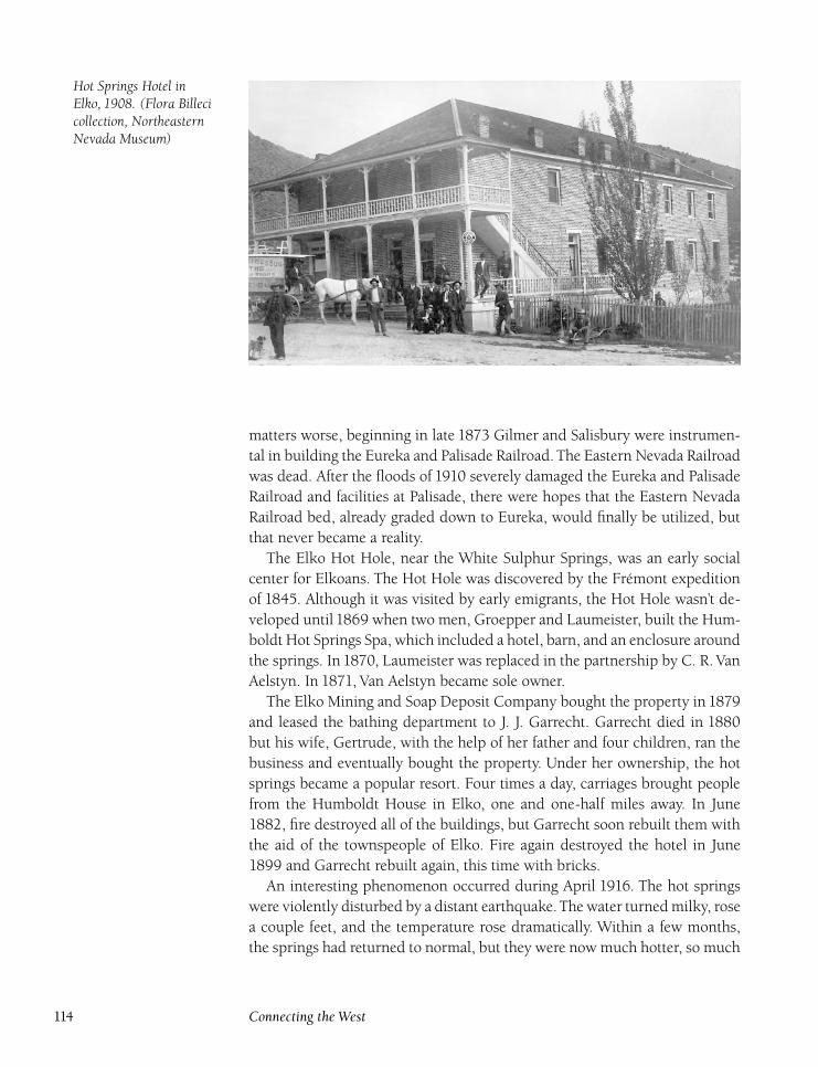
Hot Springs Hotel inElko, 1908. (Flora Billecicollection, NortheasternNevada Museum)
matters worse, beginning in late 1873 Gilmer and Salisbury were instrumen-
tal in building the Eureka and Palisade Railroad. The Eastern Nevada Railroad
was dead. After the floods of 1910 severely damaged the Eureka and Palisade
Railroad and facilities at Palisade, there were hopes that the Eastern Nevada
Railroad bed, already graded down to Eureka, would finally be utilized, but
that never became a reality.
The Elko Hot Hole, near the White Sulphur Springs, was an early social
center for Elkoans. The Hot Hole was discovered by the Frémont expedition
of 1845. Although it was visited by early emigrants, the Hot Hole wasn’t de-
veloped until 1869 when two men, Groepper and Laumeister, built the Hum-
boldt Hot Springs Spa, which included a hotel, barn, and an enclosure around
the springs. In 1870, Laumeister was replaced in the partnership by C. R. Van
Aelstyn. In 1871, Van Aelstyn became sole owner.
The Elko Mining and Soap Deposit Company bought the property in 1879
and leased the bathing department to J. J. Garrecht. Garrecht died in 1880
but his wife, Gertrude, with the help of her father and four children, ran the
business and eventually bought the property. Under her ownership, the hot
springs became a popular resort. Four times a day, carriages brought people
from the Humboldt House in Elko, one and one-half miles away. In June
1882, fire destroyed all of the buildings, but Garrecht soon rebuilt them with
the aid of the townspeople of Elko. Fire again destroyed the hotel in June
1899 and Garrecht rebuilt again, this time with bricks.
An interesting phenomenon occurred during April 1916. The hot springs
were violently disturbed by a distant earthquake.The water turned milky, rose
a couple feet, and the temperature rose dramatically. Within a few months,
the springs had returned to normal, but they were now much hotter, so much
114 Connecting the West
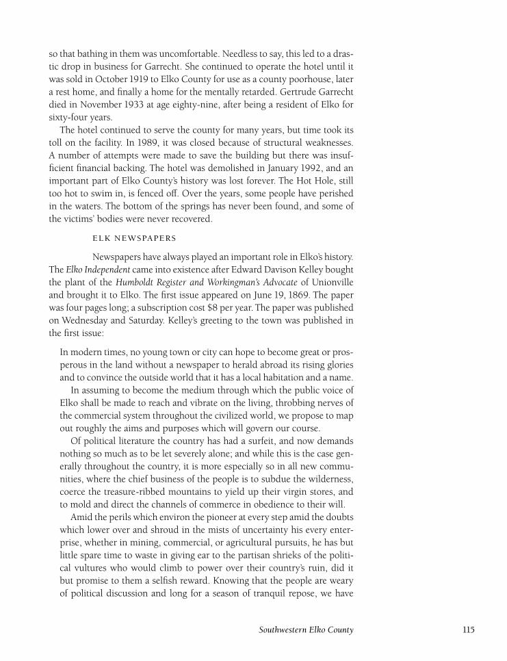
so that bathing in them was uncomfortable. Needless to say, this led to a dras-
tic drop in business for Garrecht. She continued to operate the hotel until it
was sold in October 1919 to Elko County for use as a county poorhouse, later
a rest home, and finally a home for the mentally retarded. Gertrude Garrecht
died in November 1933 at age eighty-nine, after being a resident of Elko for
sixty-four years.
The hotel continued to serve the county for many years, but time took its
toll on the facility. In 1989, it was closed because of structural weaknesses.
A number of attempts were made to save the building but there was insuf-
ficient financial backing. The hotel was demolished in January 1992, and an
important part of Elko County’s history was lost forever. The Hot Hole, still
too hot to swim in, is fenced off. Over the years, some people have perished
in the waters. The bottom of the springs has never been found, and some of
the victims’ bodies were never recovered.
Newspapers have always played an important role in Elko’s history.
The Elko Independent came into existence after Edward Davison Kelley bought
the plant of the Humboldt Register and Workingman’s Advocate of Unionville
and brought it to Elko. The first issue appeared on June 19, 1869. The paper
was four pages long; a subscription cost $8 per year. The paper was published
on Wednesday and Saturday. Kelley’s greeting to the town was published in
the first issue:
In modern times, no young town or city can hope to become great or pros-
perous in the land without a newspaper to herald abroad its rising glories
and to convince the outside world that it has a local habitation and a name.
In assuming to become the medium through which the public voice of
Elko shall be made to reach and vibrate on the living, throbbing nerves of
the commercial system throughout the civilized world, we propose to map
out roughly the aims and purposes which will govern our course.
Of political literature the country has had a surfeit, and now demands
nothing so much as to be let severely alone; and while this is the case gen-
erally throughout the country, it is more especially so in all new commu-
nities, where the chief business of the people is to subdue the wilderness,
coerce the treasure-ribbed mountains to yield up their virgin stores, and
to mold and direct the channels of commerce in obedience to their will.
Amid the perils which environ the pioneer at every step amid the doubts
which lower over and shroud in the mists of uncertainty his every enter-
prise, whether in mining, commercial, or agricultural pursuits, he has but
little spare time to waste in giving ear to the partisan shrieks of the politi-
cal vultures who would climb to power over their country’s ruin, did it
but promise to them a selfish reward. Knowing that the people are weary
of political discussion and long for a season of tranquil repose, we have
Southwestern Elko County 115
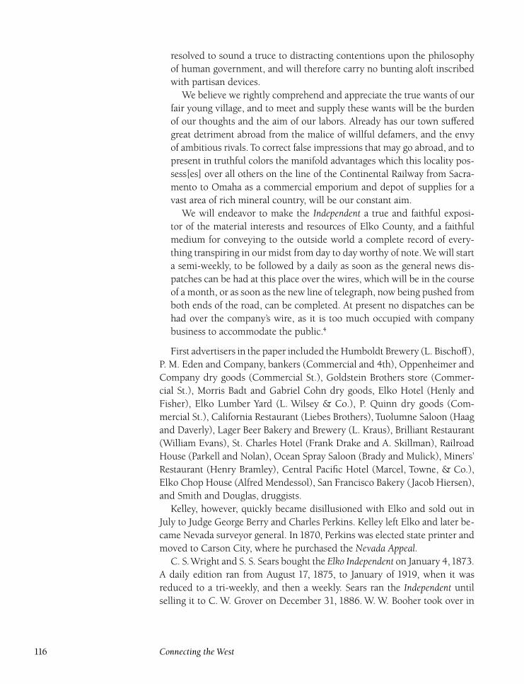
resolved to sound a truce to distracting contentions upon the philosophy
of human government, and will therefore carry no bunting aloft inscribed
with partisan devices.
We believe we rightly comprehend and appreciate the true wants of our
fair young village, and to meet and supply these wants will be the burden
of our thoughts and the aim of our labors. Already has our town suffered
great detriment abroad from the malice of willful defamers, and the envy
of ambitious rivals. To correct false impressions that may go abroad, and to
present in truthful colors the manifold advantages which this locality pos-
sess[es] over all others on the line of the Continental Railway from Sacra-
mento to Omaha as a commercial emporium and depot of supplies for a
vast area of rich mineral country, will be our constant aim.
We will endeavor to make the Independent a true and faithful exposi-
tor of the material interests and resources of Elko County, and a faithful
medium for conveying to the outside world a complete record of every-
thing transpiring in our midst from day to day worthy of note.We will start
a semi-weekly, to be followed by a daily as soon as the general news dis-
patches can be had at this place over the wires, which will be in the course
of a month, or as soon as the new line of telegraph, now being pushed from
both ends of the road, can be completed. At present no dispatches can be
had over the company’s wire, as it is too much occupied with company
business to accommodate the public.4
First advertisers in the paper included the Humboldt Brewery (L. Bischoff),
P. M. Eden and Company, bankers (Commercial and 4th), Oppenheimer and
Company dry goods (Commercial St.), Goldstein Brothers store (Commer-
cial St.), Morris Badt and Gabriel Cohn dry goods, Elko Hotel (Henly and
Fisher), Elko Lumber Yard (L. Wilsey & Co.), P. Quinn dry goods (Com-
mercial St.), California Restaurant (Liebes Brothers), Tuolumne Saloon (Haag
and Daverly), Lager Beer Bakery and Brewery (L. Kraus), Brilliant Restaurant
(William Evans), St. Charles Hotel (Frank Drake and A. Skillman), Railroad
House (Parkell and Nolan), Ocean Spray Saloon (Brady and Mulick), Miners’
Restaurant (Henry Bramley), Central Pacific Hotel (Marcel, Towne, & Co.),
Elko Chop House (Alfred Mendessol), San Francisco Bakery (Jacob Hiersen),
and Smith and Douglas, druggists.
Kelley, however, quickly became disillusioned with Elko and sold out in
July to Judge George Berry and Charles Perkins. Kelley left Elko and later be-
came Nevada surveyor general. In 1870, Perkins was elected state printer and
moved to Carson City, where he purchased the Nevada Appeal.C. S.Wright and S. S. Sears bought the Elko Independent on January 4,1873.
A daily edition ran from August 17, 1875, to January of 1919, when it was
reduced to a tri-weekly, and then a weekly. Sears ran the Independent until
selling it to C. W. Grover on December 31, 1886. W. W. Booher took over in
116 Connecting the West
1892 and ran the Independent until he retired in September 1914. A number
of other owners ran the paper for short periods until Harold Hale purchased
it in September1920. Hale’s tenure continued until his death in January1931.
Warren ‘‘Snowy’’ Monroe bought the Independent on March1,1937. His tenure
was the longest, lasting until 1975, when longtime employee Max Wignall
took over. He sold the paper in January 1994 to the Sam McMullen family.
The Elko Chronicle was first published on January 5, 1870, and was orga-
nized primarily to promote Republican candidates in the 1870 election. This,
of course, put it in direct competition with the staunchly Democratic Inde-pendent. The paper was run by the Chronicle Publishing Company and was
edited by T. J. Butler. After the election, the paper was sold to William Tay-
lor. However, the owner of the Independent, Charles Perkins, had left to serve
as state printer. He offered the running of the Independent to Taylor, who ac-
cepted. Taylor closed down the Chronicle after two issues. The paper’s equip-
ment was moved to Pioche and used to publish the Pioche Review and later
the Pioche Record.The Elko Leader is a mystery. The first issue appeared on January 1, 1873,
but it apparently folded soon after. No copies of the paper have ever been
located and additional information as to ownership is unknown.
The Elko Post came into being on September 11, 1875, and was owned by
C. C. Powning and E. A. Littlefield. Littlefield became sole owner on Octo-
ber 7, 1876, but his biggest claim to fame was that he established the Times, a
forerunner of the Tuscarora Times-Review, in Tuscarora in March of 1877. The
weekly Post continued to April 30, 1881. Littlefield then moved the presses to
Ogden, Utah, to start up the Ogden Pilot.The Elko Free Press came into being on January 5, 1883. Charles Sproule,
who had been running the Lander Free Press at Battle Mountain, moved his
press to Elko and organized the Free Press as a Republican weekly, with a
subscription rate of $5 per year. For more than one hundred years now, the
Republican Free Press and Democratic Independent have carried on a lively
banter and friendly competition. During election years, Sproule would in-
crease the paper’s publication to a daily to help spread the Republican word.
He fell ill in September 1904 and had to retire after twenty-one years.
The paper was purchased by a group of Elko businessmen who formed the
Free Press Publishing Company and began producing a daily edition in addi-
tion to the weekly. On November 14, 1910, E. M. Steninger bought the Free
Press Publishing Company, and began a Steninger tradition that continues
today. The weekly edition ended in February1917. Chris Sheerin, a prominent
Elko resident, joined the Free Press as editor in 1941. E. M. Steninger retired
in 1945 and sold the paper to his son, Eber, and Chris Sheerin. After their
retirement in 1969, Mel Steninger and Earl Frantzen took over the publishing
of the paper. Both have since retired, but the Steninger family still owns the
paper.
Southwestern Elko County 117
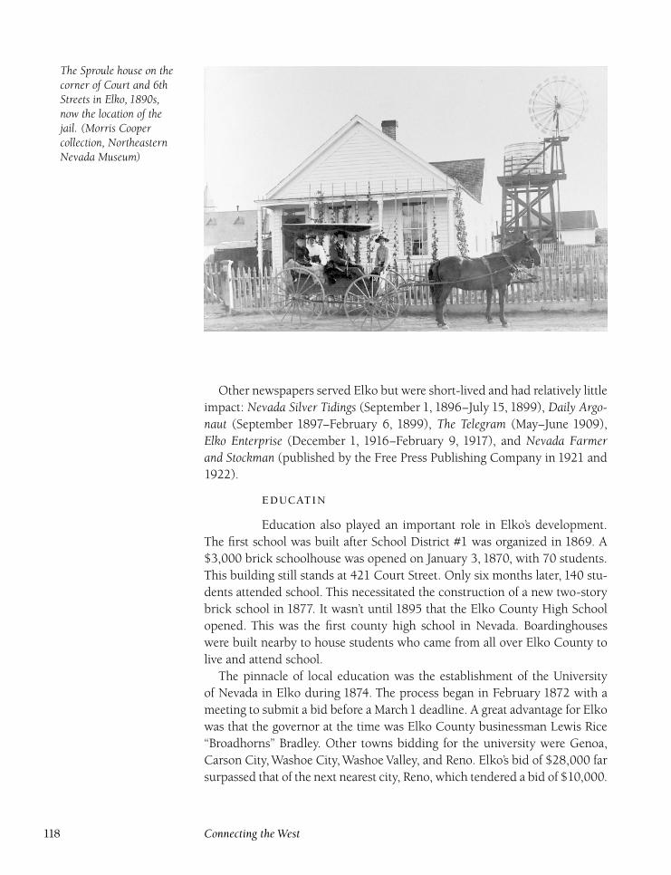
The Sproule house on thecorner of Court and 6thStreets in Elko, 1890s,now the location of thejail. (Morris Coopercollection, NortheasternNevada Museum)
Other newspapers served Elko but were short-lived and had relatively little
impact: Nevada Silver Tidings (September 1, 1896–July 15, 1899), Daily Argo-naut (September 1897–February 6, 1899), The Telegram (May–June 1909),
Elko Enterprise (December 1, 1916–February 9, 1917), and Nevada Farmerand Stockman (published by the Free Press Publishing Company in 1921 and
1922).
Education also played an important role in Elko’s development.
The first school was built after School District #1 was organized in 1869. A
$3,000 brick schoolhouse was opened on January 3, 1870, with 70 students.
This building still stands at 421 Court Street. Only six months later, 140 stu-
dents attended school. This necessitated the construction of a new two-story
brick school in 1877. It wasn’t until 1895 that the Elko County High School
opened. This was the first county high school in Nevada. Boardinghouses
were built nearby to house students who came from all over Elko County to
live and attend school.
The pinnacle of local education was the establishment of the University
of Nevada in Elko during 1874. The process began in February 1872 with a
meeting to submit a bid before a March1 deadline. A great advantage for Elko
was that the governor at the time was Elko County businessman Lewis Rice
‘‘Broadhorns’’ Bradley. Other towns bidding for the university were Genoa,
Carson City, Washoe City, Washoe Valley, and Reno. Elko’s bid of $28,000 far
surpassed that of the next nearest city, Reno, which tendered a bid of $10,000.
118 Connecting the West
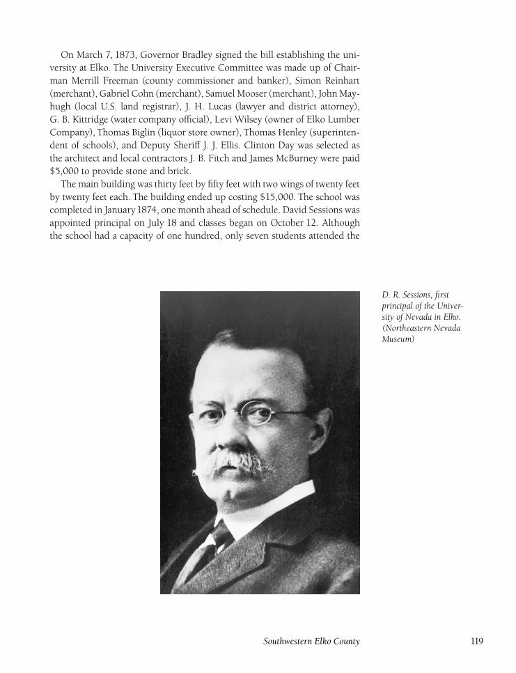
On March 7, 1873, Governor Bradley signed the bill establishing the uni-
versity at Elko. The University Executive Committee was made up of Chair-
man Merrill Freeman (county commissioner and banker), Simon Reinhart
(merchant), Gabriel Cohn (merchant), Samuel Mooser (merchant), John May-
hugh (local U.S. land registrar), J. H. Lucas (lawyer and district attorney),
G. B. Kittridge (water company official), Levi Wilsey (owner of Elko Lumber
Company), Thomas Biglin (liquor store owner), Thomas Henley (superinten-
dent of schools), and Deputy Sheriff J. J. Ellis. Clinton Day was selected as
the architect and local contractors J. B. Fitch and James McBurney were paid
$5,000 to provide stone and brick.
The main building was thirty feet by fifty feet with two wings of twenty feet
by twenty feet each. The building ended up costing $15,000. The school was
completed in January1874, one month ahead of schedule. David Sessions was
appointed principal on July 18 and classes began on October 12. Although
the school had a capacity of one hundred, only seven students attended the
D. R. Sessions, firstprincipal of the Univer-sity of Nevada in Elko.(Northeastern NevadaMuseum)
Southwestern Elko County 119
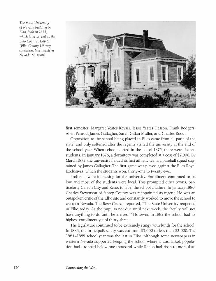
The main Universityof Nevada building inElko, built in 1873,which later served as theElko County Hospital.(Elko County Librarycollection, NortheasternNevada Museum)
first semester: Margaret Yeates Keyser, Jessie Yeates Hesson, Frank Rodgers,
Allen Penrod, James Gallagher, Sarah Gillan Muller, and Charles Rood.
Opposition to the school being placed in Elko came from all parts of the
state, and only softened after the regents visited the university at the end of
the school year. When school started in the fall of 1875, there were sixteen
students. In January 1876, a dormitory was completed at a cost of $7,000. By
March1877, the university fielded its first athletic team, a baseball squad cap-
tained by James Gallagher. The first game was played against the Elko Royal
Exclusives, which the students won, thirty-one to twenty-two.
Problems were increasing for the university. Enrollment continued to be
low and most of the students were local. This prompted other towns, par-
ticularly Carson City and Reno, to label the school a failure. In January 1880,
Charles Stevenson of Storey County was reappointed as regent. He was an
outspoken critic of the Elko site and constantly worked to move the school to
western Nevada. The Reno Gazette reported, ‘‘The State University reopened
in Elko today. As the pupil is not due until next week, the faculty will not
have anything to do until he arrives.’’5 However, in 1882 the school had its
highest enrollment yet of thirty-three.
The legislature continued to be extremely stingy with funds for the school.
In 1883, the principal’s salary was cut from $5,000 to less than $2,000. The
1884–1885 school year was the last in Elko. Although some newspapers in
western Nevada supported keeping the school where it was, Elko’s popula-
tion had dropped below one thousand while Reno’s had risen to more than
120 Connecting the West
four thousand. The university in Elko closed on July 10, 1885, and moved to
Reno. The university building was converted into a county hospital until it
was demolished in March 1920 to make room for the Elko High School gym-
nasium. The building was torn down by George Bowers of Lamoille. He paid
$300 for the structure and used the wood to build a barn on his property in
Lamoille.
In 1967, a group of Elkoans, including Bob Burns Jr., Mark Chilton, Hugh
Collett, Fred Harris, Al Huber, Mike Marfisi, Les Moren, Paul Sawyer, Carl
Shuck, and Bill Wunderlich, spearheaded the drive to form the Elko Com-
munity College. This was the first community college in the state. The group
raised $46,000 and in September the school opened.
When the Nevada State Legislature refused to provide funds for Elko Com-
munity College in 1968, an unlikely benefactor, Howard Hughes, saved the
school by donating $125,000 for operating costs. In 1969, the state began
providing funds for the school and later made it the cornerstone of the Nevada
community college system. For six years, the college was run in Elko High
School and Grammar School #1, later called the Kate St. Clair Elementary
School. The school’s name was changed to Northern Nevada Community Col-
lege. It was moved to its present campus in 1973 and continues to grow and
expand with a new name, Great Basin College. There are plans to make it a
four-year institution.
Another important educational facility for Elko began to be organized in
1919. The Elko County Library was formed by women members of the Twen-
tieth Century Club. The first official library was opened on the second floor of
the old Elko County High School building. The first librarian was Rae Caine.
Disaster struck the library in April 1942 when fire completely burned out the
second floor, which housed the library. Some books were saved, but most
were lost.
The library was temporarily housed in the Knights of Pythias Hall until
the first floor of the original building was refurbished. Ruthe Gedney Gal-
lagher was extremely dedicated to the library and, beginning in 1941, served
more than forty years on its board of directors. Thanks to the Max Fleisch-
mann Foundation and other donors, a new library, built at a cost of more than
$550,000, was dedicated in April 1974. Under the guidance of recently re-
tired library director Hailie Gunn, who served for twenty-five years, the Elko
County Library has continued to be a progressive organization, providing the
best for both students and residents.
The town of Elko was incorporated by a special act of the Nevada
legislature. In May 1917, a city council was formed and John Alexander
McBride was selected the first mayor. McBride and his wife, Emily Bonnifield,
moved to Elko in1886. He managed the W. T. Smith Company, served as Elko
Southwestern Elko County 121
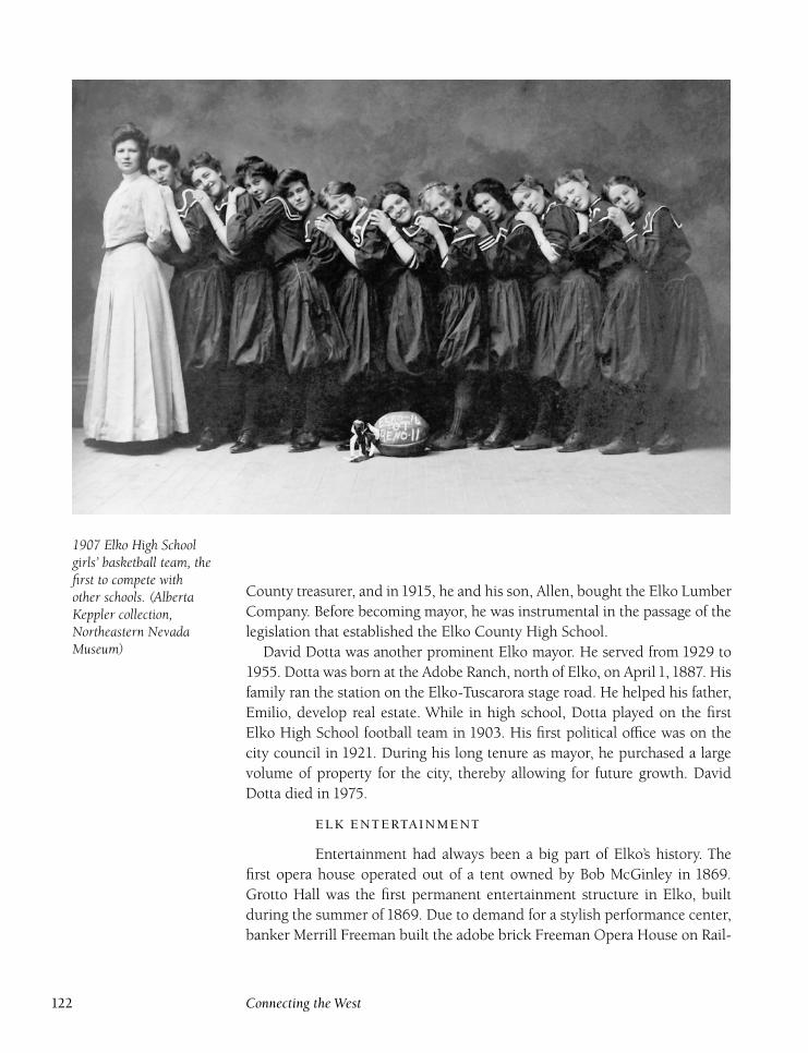
1907 Elko High Schoolgirls’ basketball team, thefirst to compete withother schools. (AlbertaKeppler collection,Northeastern NevadaMuseum)
County treasurer, and in1915, he and his son, Allen, bought the Elko Lumber
Company. Before becoming mayor, he was instrumental in the passage of the
legislation that established the Elko County High School.
David Dotta was another prominent Elko mayor. He served from 1929 to
1955. Dotta was born at the Adobe Ranch, north of Elko, on April 1, 1887. His
family ran the station on the Elko-Tuscarora stage road. He helped his father,
Emilio, develop real estate. While in high school, Dotta played on the first
Elko High School football team in 1903. His first political office was on the
city council in 1921. During his long tenure as mayor, he purchased a large
volume of property for the city, thereby allowing for future growth. David
Dotta died in 1975.
Entertainment had always been a big part of Elko’s history. The
first opera house operated out of a tent owned by Bob McGinley in 1869.
Grotto Hall was the first permanent entertainment structure in Elko, built
during the summer of 1869. Due to demand for a stylish performance center,
banker Merrill Freeman built the adobe brick Freeman Opera House on Rail-
122 Connecting the West
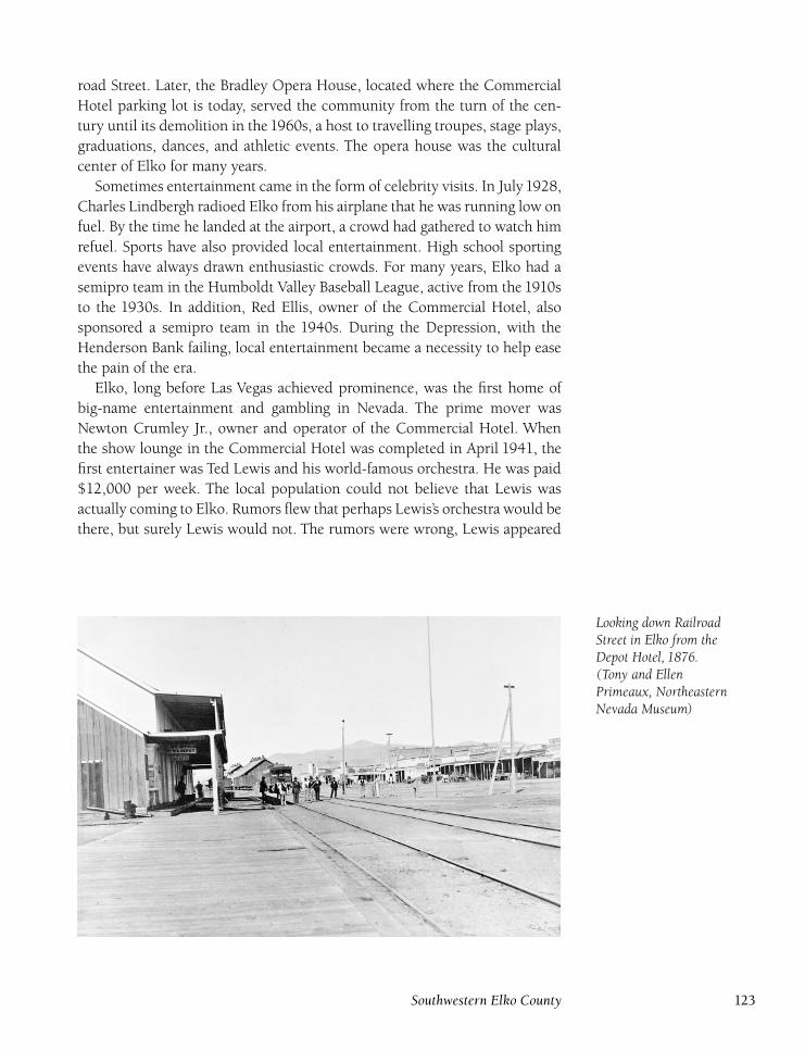
road Street. Later, the Bradley Opera House, located where the Commercial
Hotel parking lot is today, served the community from the turn of the cen-
tury until its demolition in the 1960s, a host to travelling troupes, stage plays,
graduations, dances, and athletic events. The opera house was the cultural
center of Elko for many years.
Sometimes entertainment came in the form of celebrity visits. In July1928,
Charles Lindbergh radioed Elko from his airplane that he was running low on
fuel. By the time he landed at the airport, a crowd had gathered to watch him
refuel. Sports have also provided local entertainment. High school sporting
events have always drawn enthusiastic crowds. For many years, Elko had a
semipro team in the Humboldt Valley Baseball League, active from the 1910s
to the 1930s. In addition, Red Ellis, owner of the Commercial Hotel, also
sponsored a semipro team in the 1940s. During the Depression, with the
Henderson Bank failing, local entertainment became a necessity to help ease
the pain of the era.
Elko, long before Las Vegas achieved prominence, was the first home of
big-name entertainment and gambling in Nevada. The prime mover was
Newton Crumley Jr., owner and operator of the Commercial Hotel. When
the show lounge in the Commercial Hotel was completed in April 1941, the
first entertainer was Ted Lewis and his world-famous orchestra. He was paid
$12,000 per week. The local population could not believe that Lewis was
actually coming to Elko. Rumors flew that perhaps Lewis’s orchestra would be
there, but surely Lewis would not. The rumors were wrong, Lewis appeared
Looking down RailroadStreet in Elko from theDepot Hotel, 1876.(Tony and EllenPrimeaux, NortheasternNevada Museum)
Southwestern Elko County 123

Elko’s Humbolt ValleyBaseball League semiproteam, 1897. ( Jack Smalescollection, NortheasternNevada Museum)
with his orchestra, and soon a parade of stars followed. Casino owners found
that having big-name entertainment raised gambling revenues by a substan-
tial amount. In fact, Lewis spent all he earned and more at the Commercial
tables and had to sign an promising a return engagement.
Over the next few years, huge crowds showed up at the Commercial Hotel
to see entertainers such as Sophie Tucker, Paul Whiteman, Ray Noble, Chico
Marx, Ted Fio Rito, Gertrude Miesen, and Donald Novis. In every contract
signed, there was a clause which required each performer to give a free perfor-
mance to the children of Elko. The children’s shows were held in the Hunter
Theater. Crumley also brought the shows to theWendover Army Air Base dur-
ing World War II. The Stockmen’s Hotel also got into the act when its Round-
up Room opened. The opening act in August 1946 was Hi Davis, Ann Triola,
and the Andrini Brothers. Other stars such as Burl Ives, Margaret Whiting,
Rex Allen, and Tennessee Ernie Ford followed.
With the Crumleys and Red Ellis in competition, Elko residents were
treated to only the best entertainment. Upon completion of the Ranchinn,
which had a large showroom, more entertainers made the trek to Elko. The
124 Connecting the West
Ranchinn’s grand-opening celebration in the late 1940s featured Tex Ritter
and Henry Busse. Other stars such as Bing Crosby, Spike Jones, Nelson Eddie
and Jeanette McDonald, Rudy Vallee, Tommy Dorsey, the Sons of the Pio-
neers, Vikki Carr, and Wayne Newton (then twelve years old) also performed
in Elko. At the peak of Elko’s entertainment boom during the 1950s and
1960s, the Commercial Hotel had a budget for entertainment of $600,000.
However, the emergence of Las Vegas and Reno, with their fabulous facilities
and higher wages, brought an end to big-name entertainment in Elko. How-
ever, the Stockmen’s, Commercial, and Red Lion Hotels continue to bring live
shows to Elko, which will always be remembered as the first home of Nevada’s
entertainment industry.
Hotels played a major role in Elko. Among the early facilities were
the Humboldt Lodging House and Depot Hotel, both built in the early1870s.
The Humboldt Lodging House evolved into the Commercial Hotel, while
the Depot Hotel closed in 1904 and was razed by the Southern Pacific Rail-
road. Charles Mayer, the Depot Hotel’s last manager, built the Mayer Hotel
on the site of the old Gem Hotel. Years later, the hotel was remodeled and
renamed the Stockmen’s. Other post–turn-of-the-century hotels included the
Star Hotel (built by Pete and Matilda Jauregui in 1910), the Overland Hotel
(built in 1908 by Domingo Sabala and Eulalie Onandia), the Clifton (1915),
the Pioneer (1913), and the impressive Ranchinn (1946).
The Stockmen’s Hotel opened on July 24,1944, after William Mayer, son of
Charles, sold the old Mayer Hotel to Red Ellis and A. C. Bigham. The two men
opened the Roundup Room, which hosted some of the biggest names in show
business at that time. Red Ellis sold the hotel in 1952 to Dan Bilbao Sr., J. B.
Dollard, and V. J. McGee, and then temporarily retired. In1955, he bought the
Commercial Hotel and Ranchinn for more than $1 million. The Stockmen’s
Hotel burned in a spectacular fire in March 1957. Local people wept as they
watched the flames destroy the hotel and its centerpiece, a $5,000 stuffed
Kodiak bear. The building was rebuilt quickly and had a grand reopening in
October 1958. A million-dollar expansion was completed in 1968.
The Commercial Hotel grew from the Humboldt Lodging House. It was
built by John Krattinger in 1871 and was purchased in 1873 by J. J. Garrecht.
Joseph Lang entered into a partnership with him in 1877. Lang took over sole
ownership in 1879 and ran the lodging house until he sold out and retired in
June 1893. J. B. Abel remodeled, added livery and feed stables, and renamed
it the Commercial Hotel. Newton Crumley Sr. bought the Commercial from
William Doyle in October 1925 for $70,000. His son, Newton Crumley Jr.,
began to work with his father in improving the hotel, including the addition
of The Lounge, which brought in top name entertainers for the first time to
Nevada.
Southwestern Elko County 125
Newton Crumley Jr. took over operation of the Commercial when he re-
turned from serving as a pilot in World War II. He immediately built the
Ranchinn Motor Hotel, the first state-of-the-art casino resort built after the
war, which had its grand opening on December 21, 1946. In 1949, Life maga-
zine ran a story on Elko County and named Crumley Elko’s number one
businessman-impresario, with links to Hollywood and Broadway. Crumley
sold the Commercial and Ranchinn in June 1955. He then bought the Holi-
day Hotel in Reno. Crumley died in a plane crash in Monitor Valley (Nye
County) in February 1962. The military flying ace lost control of his plane
after it iced up heavily and then plunged to the ground. Also killed was E. J.
Questa, president of the First National Bank of Nevada.
Red Ellis and Dick Warren bought the Commercial in October 1955. They
added a new lounge and purchased Lee McCarty’s famous Gunfighter Col-
lection of paintings. The trademark Kodiak bear, White King, was installed
above a new entrance in 1970. Ellis continued to run the Commercial until
his death in 1991. He also developed a number of shopping centers and the
Red Lion and Holiday Inn properties. Ellis was also one of the founders of the
Silver State Stampede and sponsored a semipro baseball team in Elko, which
was affiliated with the Boston Red Sox. The Commercial Hotel and Casino,
which underwent a complete renovation in 1994, and the Stockmen’s have
been owned since 1995 by Marcie and Jack Simon and Pete Lusich.
The Pioneer Hotel has Elko roots back to 1868 when the Pioneer Saloon
opened in a tent on the present site of the hotel. The impressive three-story
brick hotel was completed in March 1913. The Pioneer Saloon was incorpo-
rated into the new building. The saloon’s original mirrored back bar is still
at the Pioneer Hotel today. The hotel, originally owned by Frank Robinson
and George Ouderkirk, cost $50,000 and was one of the town’s first fireproof
structures, and the first building in Elko to be electrically lighted. The hotel
had thirty-four rooms. Kenneth Scott, who purchased the hotel at a county
auction in August1945, obtained a gaming license, and for the first time, legal
gambling took place at the Pioneer Hotel.
In 1950, Scott added a penthouse as living quarters for himself and his
wife, Jeanette. The bar also had an odd attraction, a stuffed two-headed calf.
The calf was born on the W. W. Kane and Sons ranch in South Fork and lived
only a short time. The calf served as a strange conversation piece for many
years. Scott sold the hotel to the Chilton and Trounday families in April 1981.
It was the first time the saloon had closed in 112 years.
Over the years, the Pioneer Hotel building had greatly deteriorated and
had to be completely gutted. After $2 million was spent, the hotel re-opened
in September 1983 but closed in December when backing from a Florida
partnership ended. However, the building, after years of being empty, was
reopened in 1992 to serve as the Western Folklife Center, sponsor of the
126 Connecting the West
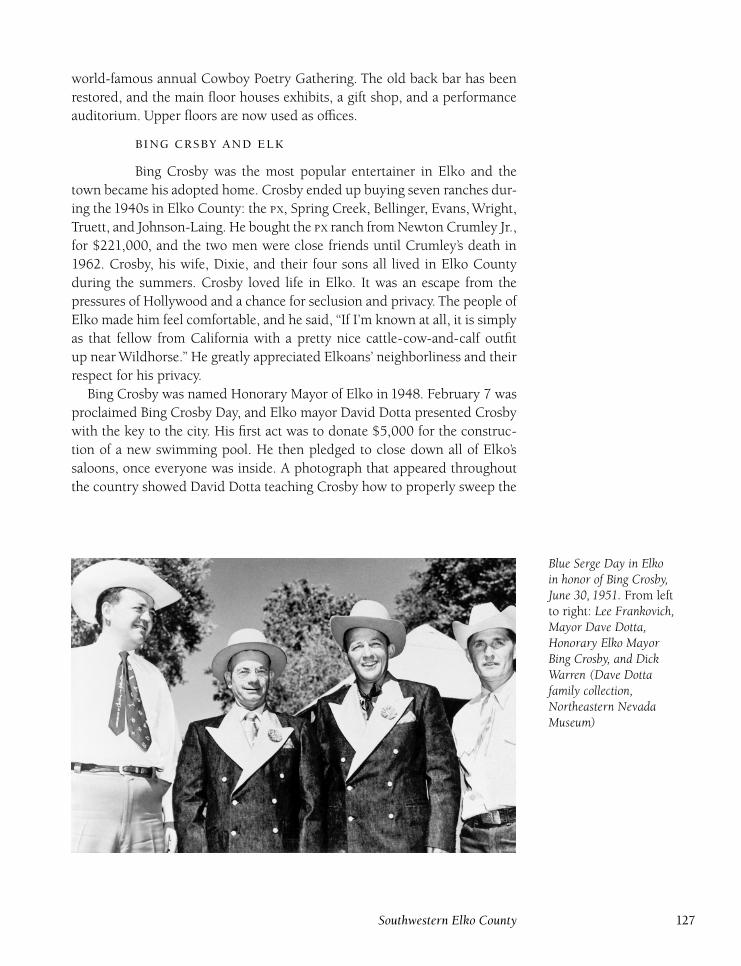
world-famous annual Cowboy Poetry Gathering. The old back bar has been
restored, and the main floor houses exhibits, a gift shop, and a performance
auditorium. Upper floors are now used as offices.
Bing Crosby was the most popular entertainer in Elko and the
town became his adopted home. Crosby ended up buying seven ranches dur-
ing the 1940s in Elko County: the , Spring Creek, Bellinger, Evans, Wright,
Truett, and Johnson-Laing. He bought the ranch from Newton Crumley Jr.,
for $221,000, and the two men were close friends until Crumley’s death in
1962. Crosby, his wife, Dixie, and their four sons all lived in Elko County
during the summers. Crosby loved life in Elko. It was an escape from the
pressures of Hollywood and a chance for seclusion and privacy. The people of
Elko made him feel comfortable, and he said, ‘‘If I’m known at all, it is simply
as that fellow from California with a pretty nice cattle-cow-and-calf outfit
up near Wildhorse.’’ He greatly appreciated Elkoans’ neighborliness and their
respect for his privacy.
Bing Crosby was named Honorary Mayor of Elko in 1948. February 7 was
proclaimed Bing Crosby Day, and Elko mayor David Dotta presented Crosby
with the key to the city. His first act was to donate $5,000 for the construc-
tion of a new swimming pool. He then pledged to close down all of Elko’s
saloons, once everyone was inside. A photograph that appeared throughout
the country showed David Dotta teaching Crosby how to properly sweep the
Blue Serge Day in Elkoin honor of Bing Crosby,June 30, 1951. From leftto right: Lee Frankovich,Mayor Dave Dotta,Honorary Elko MayorBing Crosby, and DickWarren (Dave Dottafamily collection,Northeastern NevadaMuseum)
Southwestern Elko County 127
streets with a broom. In 1950, Crosby was adopted into the Western Sho-
shone Paiute tribe at Owyhee. A big celebration was held, and he was given
the Indian name Sond-Hoo-Vi-A-Gund, ‘‘Man of Many Songs.’’
Bing dressed casually when away from Hollywood, favoring jeans and a
straw hat. In 1951, a hotel clerk in Vancouver, British Columbia, refused to
allow Crosby to register because he looked like a bum. Hearing this, mem-
bers of the Elko Silver State Stampede made arrangements with Levi Strauss
to make a pair of Levi Tuxedos. Blue Serge Day was held on June 30, 1951,
and the tuxedos were presented to Bing and Dotta. The label on the inside,
signed by Levi-Strauss president D. J. O’Brien, read: ‘‘Notice to Hotel Men
Everywhere. This label entitles the wearer to be duly received and registered
with cordial hospitality at any time and under any conditions. Presented to
Bing Crosby, on Elko Blue Serge Day, Silver State Stampede, June 30, 1951.’’
Because of Bing’s appreciation of the Elko residents, he hosted a num-
ber of benefits for local causes. In July 1951, Elko was the scene of a world
premiere of the Bing Crosby movie Here Comes the Groom. Money raised
during the three-day celebration went to the Elko County Hospital Build-
ing Fund. Celebrities from all over the country were in Elko that day: Utah
governor J. Bracken Lee, Nevada governor Charles Russell, Nevada congress-
man Walter Baring, Alexis Smith, Dorothy Lamour, the Cass County Boys,
Ray Evans, Jay Livingston, and Ted Husing. hosted a live radio coast-to-
coast broadcast. Nearly $10,000 was raised for the hospital building fund.
Bing later helped raise funds for a new city swimming pool, even bringing his
friend Roy Rogers to attend a fund-raising box social hosted by the Tuscarora
Homemakers Club.
Crosby also wrote a song titled ‘‘Comin’ to Elko,’’ as a tribute to the friends
he made while living here:
Well, we moved to Elko County about a dozen years ago.
We bought a ranch on the river when the river was nice and low.
But when things started melting, the river it began to swell.
And all the cattle went swimming and the haystacks went to hell.
Oh, this was pretty badda but we wouldn’t leave Nevada, oh, no.
While the buckaroos went boating and the privy went a floating, we
refused to go.
We even stood for old Bill Moffat when he spit in our beer.
So no matter how you pushed us, we stayed right here.
We thought we would try and find a little higher piece of soil.
We thought we found just what we wanted when we ran into old
Howard Doyle.
A place he owned in partners with the Democratic leader Flynn.
It seems they’re gonna be subpoenaed so they thought they’d get us in.
So sure and begora, we took off for Tuscarora where it’s nice and dry.
128 Connecting the West
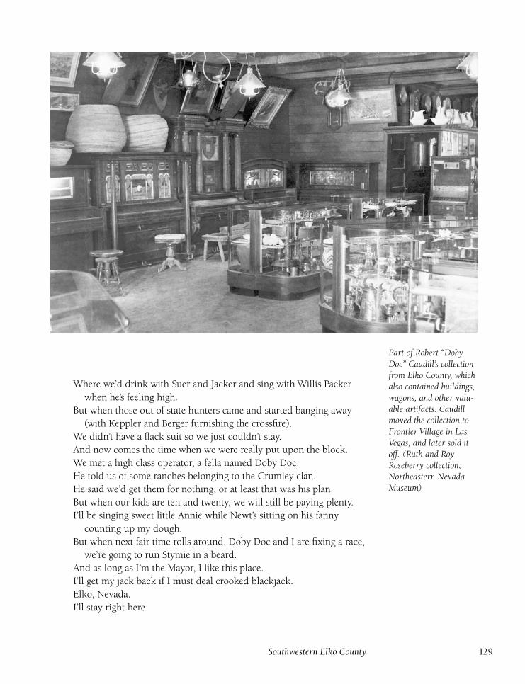
Part of Robert ‘‘DobyDoc’’ Caudill’s collectionfrom Elko County, whichalso contained buildings,wagons, and other valu-able artifacts. Caudillmoved the collection toFrontier Village in LasVegas, and later sold itoff. (Ruth and RoyRoseberry collection,Northeastern NevadaMuseum)
Where we’d drink with Suer and Jacker and sing with Willis Packer
when he’s feeling high.
But when those out of state hunters came and started banging away
(with Keppler and Berger furnishing the crossfire).
We didn’t have a flack suit so we just couldn’t stay.
And now comes the time when we were really put upon the block.
We met a high class operator, a fella named Doby Doc.
He told us of some ranches belonging to the Crumley clan.
He said we’d get them for nothing, or at least that was his plan.
But when our kids are ten and twenty, we will still be paying plenty.
I’ll be singing sweet little Annie while Newt’s sitting on his fanny
counting up my dough.
But when next fair time rolls around, Doby Doc and I are fixing a race,
we’re going to run Stymie in a beard.
And as long as I’m the Mayor, I like this place.
I’ll get my jack back if I must deal crooked blackjack.
Elko, Nevada.
I’ll stay right here.
Southwestern Elko County 129
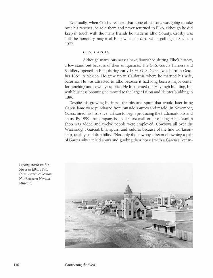
Eventually, when Crosby realized that none of his sons was going to take
over his ranches, he sold them and never returned to Elko, although he did
keep in touch with the many friends he made in Elko County. Crosby was
still the honorary mayor of Elko when he died while golfing in Spain in
1977.
. .
Although many businesses have flourished during Elko’s history,
a few stand out because of their uniqueness. The G. S. Garcia Harness and
Saddlery opened in Elko during early 1894. G. S. Garcia was born in Octo-
ber 1864 in Mexico. He grew up in California where he married his wife,
Saturnia. He was attracted to Elko because it had long been a major center
for ranching and cowboy supplies. He first rented the Mayhugh building, but
with business booming,he moved to the larger Litton and Hunter building in
1896.
Despite his growing business, the bits and spurs that would later bring
Garcia fame were purchased from outside sources and resold. In November,
Garcia hired his first silver artisan to begin producing the trademark bits and
spurs. By 1899, the company issued its first mail-order catalog. A blacksmith
shop was added and twelve people were employed. Cowboys all over the
West sought Garcia’s bits, spurs, and saddles because of the fine workman-
ship, quality, and durability: ‘‘Not only did cowboys dream of owning a pair
of Garcia silver inlaid spurs and guiding their horses with a Garcia silver in-
Looking north up 5thStreet in Elko, 1896.(Mrs. Brown collection,Northeastern NevadaMuseum)
130 Connecting the West
laid bit, but owning a Garcia saddle really separated the ordinary cowpoke
from the high ridin’ roughneck.’’6
One of Garcia’s crowning achievements took place in 1904, when he and
his workers made an ornate saddle that won the gold medal at the St. Louis
Exposition in St. Louis. The production of this saddle was a major under-
taking. Garcia hired eight more workers just for this saddle, including one
woman. He was ahead of his time because he hired for ability and didn’t worry
about gender. The saddle was dyed black and ornately decorated with carved
roses. In addition, gold and silver were used all over the saddle, including $20
gold pieces with the portraits of President Theodore Roosevelt and Nevada
Governors William Nye and John Sparks. When other saddle makers arrived
at the exposition and saw Garcia’s saddle, they turned around and left, know-
ing there was no way they could compete with Garcia’s saddle. Following the
exposition, the saddle made numerous tours across the United States and was
used by a host of famous people, including Roosevelt. The saddle is now part
of the Nevada State Museum collection. Garcia repeated the award in 1905
at the Lewis and Clark Exposition in Portland, Oregon. He is the only saddle
maker ever to achieve this.
In1912, Garcia started his own rodeo, which soon became one of the most
popular and famous rodeos in the West. Garcia owned a ranch in Diamond
Valley where he brought purchased rodeo stock and raised his own stock.
His horses had the reputation of being some of the meanest ever seen. Garcia
took great pride in his rodeo because it was a chance to proudly promote
his hometown of Elko and also showcased the talents of the cowboys and
ranchers who had been so important in the development and economy of
northeastern Nevada. However, during the1920s, Garcia’s health began to fail
and he had to spend an increasing amount of time in California in hopes of
improving his health.
In1924, a former Garcia employee, Joe Capriola, opened the J. M. Capriola
Company, a saddle and leather. Like Garcia’s business, Capriola’s shop
boomed. In 1929, he moved his shop to an adobe building, one of the town’s
oldest structures, at 500 Commercial Street. Although competition developed
between Garcia and Capriola, it was friendly. Garcia’s health continued to de-
teriorate. In 1932, he and his wife moved permanently to California and left
his shop in the hands of his sons, Leslie and Henry. G. S. Garcia died in 1932.
His sons ran the store until 1938 when the shop was relocated to Salinas,
California. The shop remained open there until 1957. Leslie maintained the
Garcia Bit and Spur Company name with a new shop in Reno.
Meanwhile, the J. M. Capriola Company became the main saddle supplier
in northern Nevada. Capriola continued to run the store until the1950s when
he sold it to Frank Jayo. When Jayo died in 1958, Capriola, at the age of
seventy-four, had to take the store back. In July 1958, Capriola sold the store
to Paul and Betty Bear. Fire struck in October and, although much of the mer-
Southwestern Elko County 131
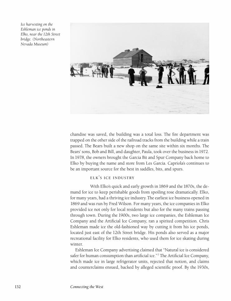
Ice harvesting on theEshleman ice ponds inElko, near the 12th Streetbridge. (NortheasternNevada Museum)
chandise was saved, the building was a total loss. The fire department was
trapped on the other side of the railroad tracks from the building while a train
passed. The Bears built a new shop on the same site within six months. The
Bears’ sons, Bob and Bill, and daughter, Paula, took over the business in1972.
In 1978, the owners brought the Garcia Bit and Spur Company back home to
Elko by buying the name and store from Les Garcia. Capriola’s continues to
be an important source for the best in saddles, bits, and spurs.
’
With Elko’s quick and early growth in 1869 and the 1870s, the de-
mand for ice to keep perishable goods from spoiling rose dramatically. Elko,
for many years, had a thriving ice industry. The earliest ice business opened in
1869 and was run by Fred Wilson. For many years, the ice companies in Elko
provided ice not only for local residents but also for the many trains passing
through town. During the 1900s, two large ice companies, the Eshleman Ice
Company and the Artificial Ice Company, ran a spirited competition. Chris
Eshleman made ice the old-fashioned way by cutting it from his ice ponds,
located just east of the 12th Street bridge. His ponds also served as a major
recreational facility for Elko residents, who used them for ice skating during
winter.
Eshleman Ice Company advertising claimed that ‘‘Natural ice is considered
safer for human consumption than artificial ice.’’7 The Artificial Ice Company,
which made ice in large refrigerator units, rejected that notion, and claims
and counterclaims ensued, backed by alleged scientific proof. By the 1930s,
132 Connecting the West
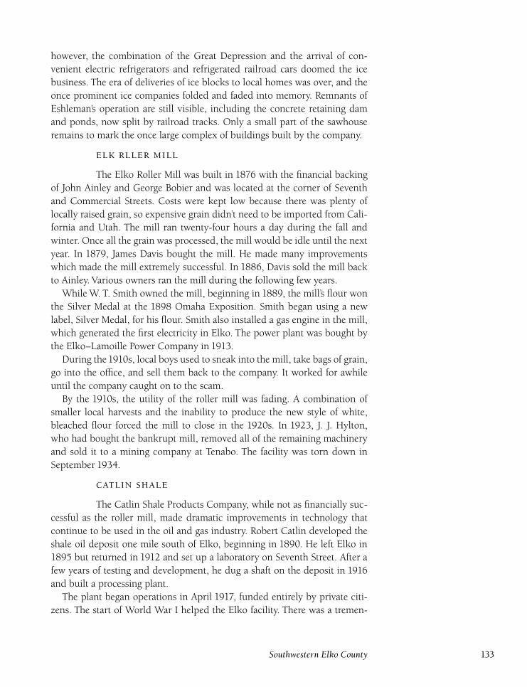
however, the combination of the Great Depression and the arrival of con-
venient electric refrigerators and refrigerated railroad cars doomed the ice
business. The era of deliveries of ice blocks to local homes was over, and the
once prominent ice companies folded and faded into memory. Remnants of
Eshleman’s operation are still visible, including the concrete retaining dam
and ponds, now split by railroad tracks. Only a small part of the sawhouse
remains to mark the once large complex of buildings built by the company.
The Elko Roller Mill was built in 1876 with the financial backing
of John Ainley and George Bobier and was located at the corner of Seventh
and Commercial Streets. Costs were kept low because there was plenty of
locally raised grain, so expensive grain didn’t need to be imported from Cali-
fornia and Utah. The mill ran twenty-four hours a day during the fall and
winter. Once all the grain was processed, the mill would be idle until the next
year. In 1879, James Davis bought the mill. He made many improvements
which made the mill extremely successful. In 1886, Davis sold the mill back
to Ainley. Various owners ran the mill during the following few years.
While W. T. Smith owned the mill, beginning in 1889, the mill’s flour won
the Silver Medal at the 1898 Omaha Exposition. Smith began using a new
label, Silver Medal, for his flour. Smith also installed a gas engine in the mill,
which generated the first electricity in Elko. The power plant was bought by
the Elko–Lamoille Power Company in 1913.
During the1910s, local boys used to sneak into the mill, take bags of grain,
go into the office, and sell them back to the company. It worked for awhile
until the company caught on to the scam.
By the 1910s, the utility of the roller mill was fading. A combination of
smaller local harvests and the inability to produce the new style of white,
bleached flour forced the mill to close in the 1920s. In 1923, J. J. Hylton,
who had bought the bankrupt mill, removed all of the remaining machinery
and sold it to a mining company at Tenabo. The facility was torn down in
September 1934.
The Catlin Shale Products Company, while not as financially suc-
cessful as the roller mill, made dramatic improvements in technology that
continue to be used in the oil and gas industry. Robert Catlin developed the
shale oil deposit one mile south of Elko, beginning in 1890. He left Elko in
1895 but returned in 1912 and set up a laboratory on Seventh Street. After a
few years of testing and development, he dug a shaft on the deposit in 1916
and built a processing plant.
The plant began operations in April 1917, funded entirely by private citi-
zens. The start of World War I helped the Elko facility. There was a tremen-
Southwestern Elko County 133
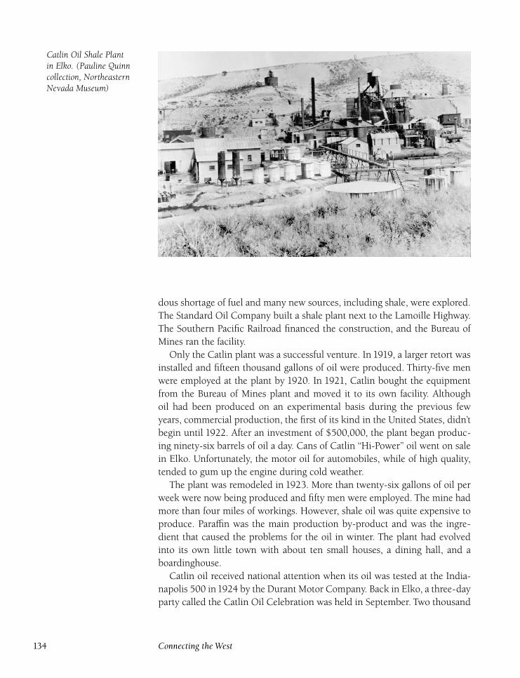
Catlin Oil Shale Plantin Elko. (Pauline Quinncollection, NortheasternNevada Museum)
dous shortage of fuel and many new sources, including shale, were explored.
The Standard Oil Company built a shale plant next to the Lamoille Highway.
The Southern Pacific Railroad financed the construction, and the Bureau of
Mines ran the facility.
Only the Catlin plant was a successful venture. In 1919, a larger retort was
installed and fifteen thousand gallons of oil were produced. Thirty-five men
were employed at the plant by 1920. In 1921, Catlin bought the equipment
from the Bureau of Mines plant and moved it to its own facility. Although
oil had been produced on an experimental basis during the previous few
years, commercial production, the first of its kind in the United States, didn’t
begin until 1922. After an investment of $500,000, the plant began produc-
ing ninety-six barrels of oil a day. Cans of Catlin ‘‘Hi-Power’’ oil went on sale
in Elko. Unfortunately, the motor oil for automobiles, while of high quality,
tended to gum up the engine during cold weather.
The plant was remodeled in 1923. More than twenty-six gallons of oil per
week were now being produced and fifty men were employed. The mine had
more than four miles of workings. However, shale oil was quite expensive to
produce. Paraffin was the main production by-product and was the ingre-
dient that caused the problems for the oil in winter. The plant had evolved
into its own little town with about ten small houses, a dining hall, and a
boardinghouse.
Catlin oil received national attention when its oil was tested at the India-
napolis 500 in1924 by the Durant Motor Company. Back in Elko, a three-day
party called the Catlin Oil Celebration was held in September. Two thousand
134 Connecting the West
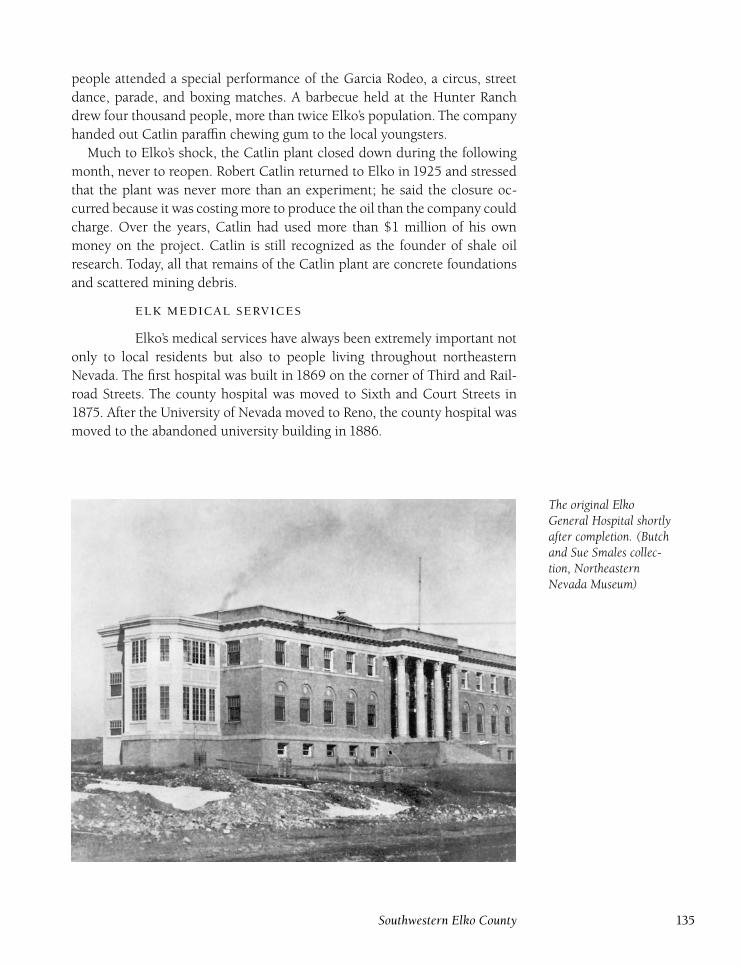
people attended a special performance of the Garcia Rodeo, a circus, street
dance, parade, and boxing matches. A barbecue held at the Hunter Ranch
drew four thousand people, more than twice Elko’s population. The company
handed out Catlin paraffin chewing gum to the local youngsters.
Much to Elko’s shock, the Catlin plant closed down during the following
month, never to reopen. Robert Catlin returned to Elko in 1925 and stressed
that the plant was never more than an experiment; he said the closure oc-
curred because it was costing more to produce the oil than the company could
charge. Over the years, Catlin had used more than $1 million of his own
money on the project. Catlin is still recognized as the founder of shale oil
research. Today, all that remains of the Catlin plant are concrete foundations
and scattered mining debris.
Elko’s medical services have always been extremely important not
only to local residents but also to people living throughout northeastern
Nevada. The first hospital was built in 1869 on the corner of Third and Rail-
road Streets. The county hospital was moved to Sixth and Court Streets in
1875. After the University of Nevada moved to Reno, the county hospital was
moved to the abandoned university building in 1886.
The original ElkoGeneral Hospital shortlyafter completion. (Butchand Sue Smales collec-tion, NortheasternNevada Museum)
Southwestern Elko County 135

In 1919, thanks in part to the efforts of Dr. A. J. Hood, the Nevada Legisla-
ture passed legislation that allowed Elko to create the Elko General Hospital.
The thirty-four-bed, $130,000 building was completed in 1920. A $1.1 mil-
lion addition built in 1957–58 increased it to seventy-four beds and led to
the hospital’s accreditation. Another addition was constructed in 1974. The
original hospital building was used for storage for a while and was later de-
molished.
Another important part of Elko’s medical history was the organization of
the Elko Clinic in 1948 by Doctors George Collett, R. P. Roantree, A. J. Hood,
Leslie Moren, Dale Hadfield, and Charles Secor. Dr. John Read joined the
clinic’s staff the following year, and A. J. Hood’s son, Thomas, in 1954. Many
doctors have served over the years and all have contributed to building the
positive reputation the clinic now enjoys. The present Elko Clinic facility was
built in1967 and continues to provide top-level care for Elko’s growing popu-
lation.
Potts Case
Elko has been the scene of a number of sensational murder trials,
the most famous of which was the Potts case. Josiah and Elizabeth Potts lived
in Carlin until they moved to Rock Springs, Wyoming, in September 1888.
On January 1, Carlin resident Miles Faucett disappeared after being invited
to the Potts home for New Year’s. That was the last anyone saw of him. Fau-
cett, Elizabeth’s ex-husband, and the Pottses were old acquaintances from En-
gland. Elizabeth Potts did Faucett’s wash and cooked for him while in Carlin.
At the end of 1888, the Brewer family moved into the house where the Pottses
formerly resided and made a gruesome discovery. In January 1889, Brewer
found in his basement a dismembered body that was missing its head. At-
tempts had been made to burn the pieces, but a knife found was recognized
as belonging to Faucett.
Elko County Sheriffs L. R. Barnard and Constable Triplett traveled to Rock
Springs and arrested Josiah and Elizabeth Potts. On the trip back, Josiah
claimed that Faucett had committed suicide, and, fearing that he would be
under suspicion for murder, Potts had cut up and buried the body. The Pottses
were indicted on February 15, 1889, and the trial was filled with wild accusa-
tions and countercharges. The Pottses claimed that Faucett had tried to rape
their daughter. The prosecution pointed out that when Faucett had disap-
peared, Potts claimed that Faucett had left on the train and sold all his be-
longings to Potts. Potts claimed he confronted Faucett about the attempted
rape. Faucett then pulled a gun, put it to his head, said, ‘‘You folks will be
blamed for this,’’ and pulled the trigger.
The trial, which started on March12, ended on March15 with a conviction
136 Connecting the West
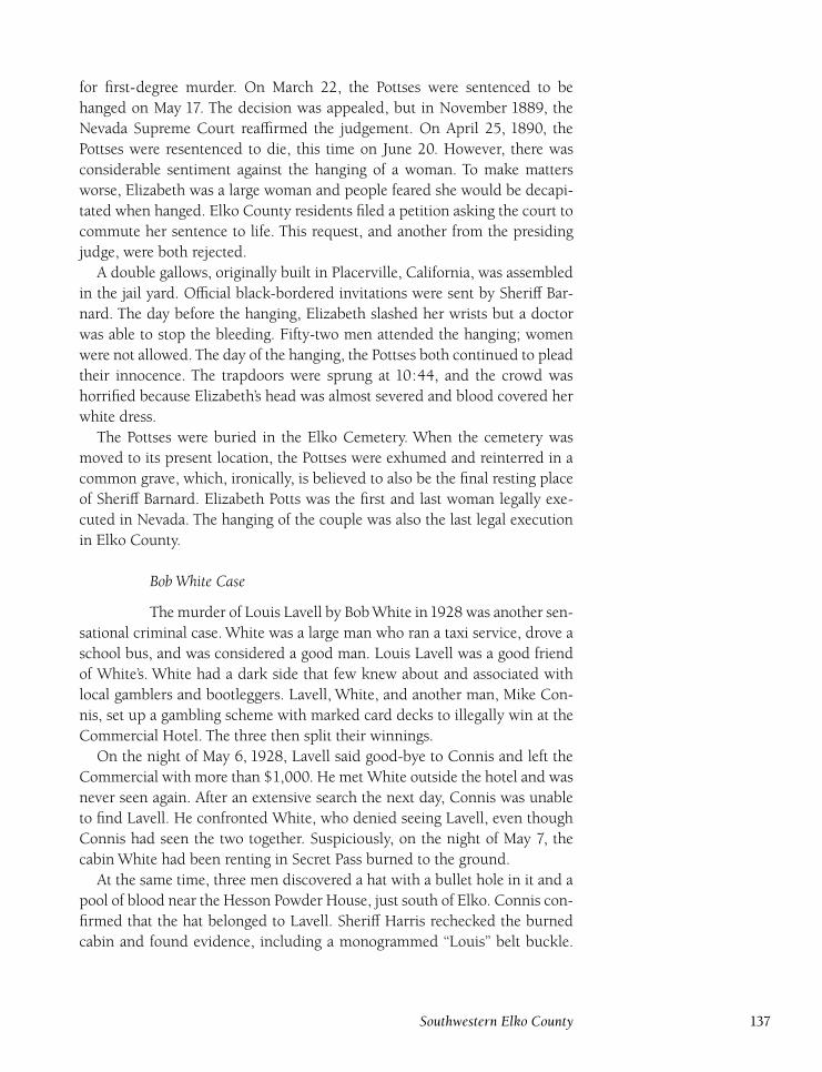
for first-degree murder. On March 22, the Pottses were sentenced to be
hanged on May 17. The decision was appealed, but in November 1889, the
Nevada Supreme Court reaffirmed the judgement. On April 25, 1890, the
Pottses were resentenced to die, this time on June 20. However, there was
considerable sentiment against the hanging of a woman. To make matters
worse, Elizabeth was a large woman and people feared she would be decapi-
tated when hanged. Elko County residents filed a petition asking the court to
commute her sentence to life. This request, and another from the presiding
judge, were both rejected.
A double gallows, originally built in Placerville, California, was assembled
in the jail yard. Official black-bordered invitations were sent by Sheriff Bar-
nard. The day before the hanging, Elizabeth slashed her wrists but a doctor
was able to stop the bleeding. Fifty-two men attended the hanging; women
were not allowed. The day of the hanging, the Pottses both continued to plead
their innocence. The trapdoors were sprung at 10:44, and the crowd was
horrified because Elizabeth’s head was almost severed and blood covered her
white dress.
The Pottses were buried in the Elko Cemetery. When the cemetery was
moved to its present location, the Pottses were exhumed and reinterred in a
common grave, which, ironically, is believed to also be the final resting place
of Sheriff Barnard. Elizabeth Potts was the first and last woman legally exe-
cuted in Nevada. The hanging of the couple was also the last legal execution
in Elko County.
Bob White Case
The murder of Louis Lavell by Bob White in1928 was another sen-
sational criminal case. White was a large man who ran a taxi service, drove a
school bus, and was considered a good man. Louis Lavell was a good friend
of White’s. White had a dark side that few knew about and associated with
local gamblers and bootleggers. Lavell, White, and another man, Mike Con-
nis, set up a gambling scheme with marked card decks to illegally win at the
Commercial Hotel. The three then split their winnings.
On the night of May 6, 1928, Lavell said good-bye to Connis and left the
Commercial with more than $1,000. He met White outside the hotel and was
never seen again. After an extensive search the next day, Connis was unable
to find Lavell. He confronted White, who denied seeing Lavell, even though
Connis had seen the two together. Suspiciously, on the night of May 7, the
cabin White had been renting in Secret Pass burned to the ground.
At the same time, three men discovered a hat with a bullet hole in it and a
pool of blood near the Hesson Powder House, just south of Elko. Connis con-
firmed that the hat belonged to Lavell. Sheriff Harris rechecked the burned
cabin and found evidence, including a monogrammed ‘‘Louis’’ belt buckle.
Southwestern Elko County 137
A murder warrant was issued for White. A nationwide manhunt took place
and a week later, White was arrested at a farmhouse near Arlington, Illinois.
White was returned to Elko, and his trial began on October 8.
The evidence was compelling enough that the jury convicted White of first-
degree murder on October18.White was sentenced to die in the gas chamber.
Sixteen months of appeals ensued. White was executed on June 2, 1930, in
the Nevada State Prison’s gas chamber. When asked if he had any last words,
White replied, ‘‘Yes, would you please bring me a gas mask?’’
Luther Jones Case
The Luther Jones murder case shocked Elko residents because of
the gruesome nature of the crime. Three men, Manuel Arrascada, Walter Go-
decke, and Otto Heitman, disappeared after last being seen at the Southern
Pacific stockyards on October16, 1936. A day later, Luther Jones was arrested
in Carlin for resisting arrest after a gun fell out of his pocket at the Sperlich
Saloon. At the time, Elko authorities were looking for Jones because he had
been seen with the three missing men. Although Jones had cashed a bogus
check in Elko, he had much more money with him when he was arrested
subsequently than the amount of the check cashed.
When brought back to Elko, Jones confessed. Apparently, Jones had gone
to the stockyards to rob Godecke and Heitman. Arrascada showed up and
was also robbed by Jones. The total taken was only $40. He forced the three
men into a nearby shack owned by Johnny Elias. Including Elias, four men
were now imprisoned in the cabin. Jones forced Elias to tie up the others.
When Elias tried to disarm Jones, Jones shot and killed him. Jones then fatally
shot the other three men. Once the bodies were discovered, a large crowd
of angry people gathered at the courthouse. Fears of a lynch mob grew, but
friends and relatives of the victims were able to calm the crowd.
Jones later withdrew his confession and blamed a friend, Bert Wilson, for
the murders. However, an investigation proved that Jones acted alone. Jones
then changed his plea to not guilty by reason of insanity. Jones himself was
the only defense witness. It took the jury only thirty-five minutes to find him
guilty on November 18. He was executed on January 26, 1937, in the gas
chamber. Jones hated the Elko law officers to the end. His last words were, ‘‘I
would like to take the sheriff with me.’’8
. .
The Elko Airport provides a vital transportation link for Elko, with
Skywest scheduled flights and charter flights for the Red Lion Casino. The
airport’s early beginnings provide another facet of Elko’s unique history of
firsts in the country. The airport, initially called Rickenbacker Field, was con-
structed in 1919; the first plane landed on May 8. The airport came about
138 Connecting the West
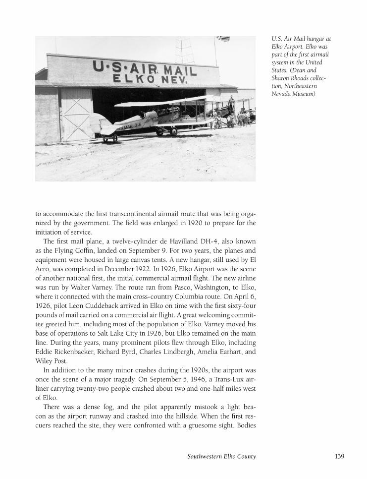
U.S. Air Mail hangar atElko Airport. Elko waspart of the first airmailsystem in the UnitedStates. (Dean andSharon Rhoads collec-tion, NortheasternNevada Museum)
to accommodate the first transcontinental airmail route that was being orga-
nized by the government. The field was enlarged in 1920 to prepare for the
initiation of service.
The first mail plane, a twelve-cylinder de Havilland DH-4, also known
as the Flying Coffin, landed on September 9. For two years, the planes and
equipment were housed in large canvas tents. A new hangar, still used by El
Aero, was completed in December 1922. In 1926, Elko Airport was the scene
of another national first, the initial commercial airmail flight. The new airline
was run by Walter Varney. The route ran from Pasco, Washington, to Elko,
where it connected with the main cross-country Columbia route. On April 6,
1926, pilot Leon Cuddeback arrived in Elko on time with the first sixty-four
pounds of mail carried on a commercial air flight. A great welcoming commit-
tee greeted him, including most of the population of Elko. Varney moved his
base of operations to Salt Lake City in 1926, but Elko remained on the main
line. During the years, many prominent pilots flew through Elko, including
Eddie Rickenbacker, Richard Byrd, Charles Lindbergh, Amelia Earhart, and
Wiley Post.
In addition to the many minor crashes during the 1920s, the airport was
once the scene of a major tragedy. On September 5, 1946, a Trans-Lux air-
liner carrying twenty-two people crashed about two and one-half miles west
of Elko.
There was a dense fog, and the pilot apparently mistook a light bea-
con as the airport runway and crashed into the hillside. When the first res-
cuers reached the site, they were confronted with a gruesome sight. Bodies
Southwestern Elko County 139
were strewn all over the area, and it appeared that everyone was dead. Then
Robley Burns, a local mortician, heard a baby crying. A two-year-old child,
Peter Link, had been thrown from the plane and was lying in the sagebrush.
Another person, Irene Baralus, was still alive when removed from the wreck-
age but died soon after. Link was the lone survivor. His parents and infant
sister died in the crash.
United Airlines served Elko for many years, but ended flights to and from
Elko in 1981. However, the airport remains busy today and besides the jet
flights, Elko is a popular stop for many small planes.
Throughout Elko’s history, the railroads played an important role.
However, because the railroads passed through town, they were also a source
of numerous tragedies. Many deaths and injuries occurred because of pedes-
trians and automobiles being hit on the tracks. There were twenty downtown
crossings.
The Federal Highway Act of 1973 included the Rail-Highway Demonstra-
tion Project, which provided federal funding for railroad track relocation. In
Elko, this provided the opportunity to move the tracks to the south, away
from the busy part of town. ‘‘Operation Lifesaver’’ was born. It wasn’t until
1976 that Elko’s plan was approved by the federal government. Construction
began in September 1978.
The operation was an immense undertaking because not only did the
tracks have to be moved, but also the switchyards had to be moved from west
of Elko to the east side. After five years of work and $43.5 million, the reloca-
tion was completed. On November 12, 1983, Elko had a ‘‘Last Train Through
Town’’ celebration. Although the celebration went off without a hitch, it was a
little premature. The Southern Pacific Railroad main track wasn’t completed,
and trains continued to come through town until early December, when the
last freight train, #8374, actually went through the town.
While a number of other towns around the country also applied for reloca-
tion programs, Elko was the only project funded and completed. The main-
line relocation not only increased the safety of downtown, but also proved to
be a boon for downtown businesses because a business corridor between Rail-
road and Commercial Streets was created, providing a large area for parking,
something that had always been in short supply.
When the call to arms has come, Elko residents have always re-
sponded. Many local soldiers have given the ultimate sacrifice in the country’s
wars. As a response to European tension with the start of World War I, some
residents of Elko formed the Elko Home Guard in 1915. G. C. Jensen was
elected captain of the group, which had 107 members. The group was instru-
140 Connecting the West
mental in organizing support for Liberty Loan drives to help the war effort.
The home guard also trained as a band and performed in parades and bene-
fit functions. Once World War I ended, the home guard was disbanded, its
honorable work completed.
Many Elko residents again volunteered, or were drafted, during World
War II, including participants in D-day and Pearl Harbor. The town received
a special honor when a new victory ship, the Elko Victory, was launched on
December 8, 1944. Marilyn Patterson christened the ship, which was named
for Elko thanks to the efforts of Nevada Senator Patrick McCarran. More than
one hundred Elko residents attended the christening at the Kaiser Perma-
nente Metal Corporation Shipyard in Richmond, Virginia. The ship served
both the military and the Maritime Administration until it was mothballed on
Christmas Eve 1971.
Contrary to some written accounts, the Elko Victory was not scrapped but
still floats with a mothball fleet in Virginia. Brigadier General David Henley
visited the ship in the late 1980s and was able to obtain the original wood
nameplate, which he donated to the Northeastern Nevada Museum in Elko.
While 10 of the 531 victory ships carried Nevada-related names, the ElkoVictory is the only surviving vessel.
Throughout Elko’s history, its varied ethnic groups have always
had a profound influence on the city. The first people to live in the area were
the Native Americans. When the Central Pacific Railroad was completed in
1869, many Chinese and Irish railroad workers settled in and around Elko.
Later, the Basques immigrated to the area and heavily impacted the local
ranching industry and opened many successful businesses, including restau-
rants that are a must stop for visitors and residents. Today, while the Chinese
and Irish influence has greatly decreased over the years, the Native American
and Basque communities still have a vibrant impact on Elko.
Elko’s population has ebbed and flowed throughout its history. With the
emergence of microscopic gold along the Carlin Trend in the late 1960s, Elko
has undergone the biggest boom in its long history. Barrick, Newmont, Inde-
pendence, and Dee, among others, have paved the way for this new gold rush.
Three of the five largest gold mines in the world are located near Elko and
produce more than three million ounces of gold a year. Most of the employees
live in Elko and are bused to work.
The influx of mining money has been a boon for businesses in Elko. The
mining companies have assisted schools and nonprofit groups with donations
that have made impossible dreams realities. For example, Barrick donated
$10,000 to the museum in Elko during 1993 to initiate an oral history pro-
gram. In addition, the companies have lent their support to the Northern
Nevada Community College. The population of Elko, as a result of the influx
Southwestern Elko County 141
of miners and their families, has climbed to about thirty thousand. Many new
businesses have opened, and services have greatly improved.
This history has provided an overview of Elko’s past, but it is impossible to
present a complete history of the town in a few pages of text. More informa-
tion is available from the museum’s archives. The museum, founded in 1968,
is a national award-winning facility that has complete newspaper records, a
manuscript collection, oral histories, and research and photograph files. The
museum is also worth a visit to see the extensive displays that give a complete
history of Elko County and northeastern Nevada.
Elko remains the supply and social center for ranches scattered over thirty
thousand square miles. It also serves as a transportation hub, tourist stop, and
hunters’ paradise. Elko’s citizens take great pride in their town that still man-
ages to preserve the flavor of the old West. This makes it an enjoyable place to
live. Elko was recently selected the ‘‘Best Small Town in America,’’ in Norman
Crampton’s book, The 100 Best Small Towns in America, based on government
statistics and surveys. The town is also known as the City of Festivals. Annual
events include the National Basque Festival (held every 4th of July weekend),
Silver State Stampede, Cowboy Poetry Gathering, Elko County Fair, Indian
powwows, Mining Expo, and many others. A historic walking tour of the
town is available at the Northeastern Nevada Museum.
’
1868 December 29, Elko founded by the Central Pacific Railroad. Town-
site laid out.
1869 March 5, Elko County formed by Nevada legislature and Elko
named county seat. Courthouse built at Sixth and Idaho Streets.
Humboldt Lodging House constructed. Pioneer Saloon began busi-
ness on the northeast corner of Fifth and Railroad. Elko’s first
newspaper, the Elko Independent, began publication. A resort, White
Sulphur Springs, was built near the Hot Hole off Bullion Road. Elko’s
forty-five saloons outnumbered other businesses in town.
1870 Presbyterian church built at Sixth and Pine Streets. First school
opened at 421 Court Street. Population estimated at forty-five hun-
dred.
1871 Fire destroyed most of the business district. Elko cattleman Lewis
‘‘Broadhorns’’ Bradley elected second governor of Nevada (1871–
1878).
1872 Ben Fitch started a brickyard and turned out twenty-eight thousand
to thirty-five thousand bricks daily.
1873 Cosmopolitan Hotel renamed the Chamberlain Hotel.
1874 Elko became the first site of the University of Nevada. Population
estimated at five thousand.
1875 Elko Flour Mill began operations and provided the first water sys-
142 Connecting the West
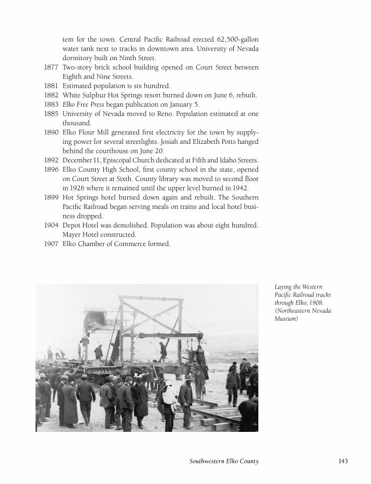
tem for the town. Central Pacific Railroad erected 62,500-gallon
water tank next to tracks in downtown area. University of Nevada
dormitory built on Ninth Street.
1877 Two-story brick school building opened on Court Street between
Eighth and Nine Streets.
1881 Estimated population is six hundred.
1882 White Sulphur Hot Springs resort burned down on June 6, rebuilt.
1883 Elko Free Press began publication on January 5.
1885 University of Nevada moved to Reno. Population estimated at one
thousand.
1890 Elko Flour Mill generated first electricity for the town by supply-
ing power for several streetlights. Josiah and Elizabeth Potts hanged
behind the courthouse on June 20.
1892 December11, Episcopal Church dedicated at Fifth and Idaho Streets.
1896 Elko County High School, first county school in the state, opened
on Court Street at Sixth. County library was moved to second floor
in 1926 where it remained until the upper level burned in 1942.
1899 Hot Springs hotel burned down again and rebuilt. The Southern
Pacific Railroad began serving meals on trains and local hotel busi-
ness dropped.
1904 Depot Hotel was demolished. Population was about eight hundred.
Mayer Hotel constructed.
1907 Elko Chamber of Commerce formed.
Laying the WesternPacific Railroad tracksthrough Elko, 1908.(Northeastern NevadaMuseum)
Southwestern Elko County 143
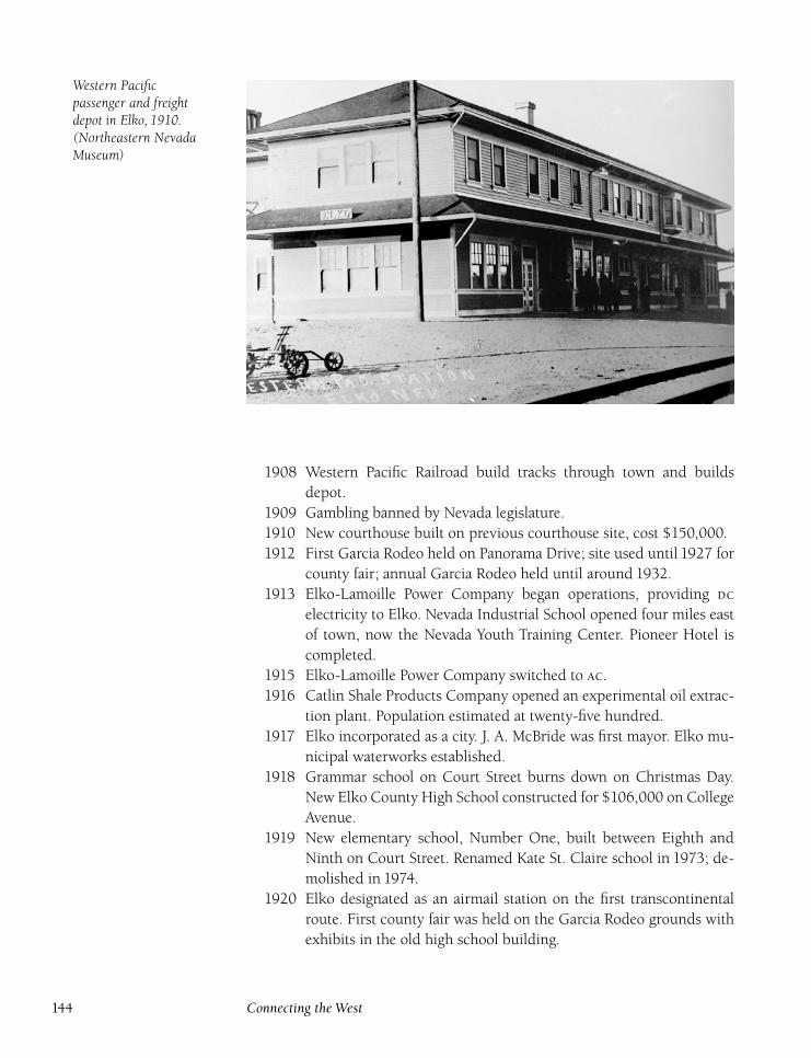
Western Pacificpassenger and freightdepot in Elko, 1910.(Northeastern NevadaMuseum)
1908 Western Pacific Railroad build tracks through town and builds
depot.
1909 Gambling banned by Nevada legislature.
1910 New courthouse built on previous courthouse site, cost $150,000.
1912 First Garcia Rodeo held on Panorama Drive; site used until 1927 for
county fair; annual Garcia Rodeo held until around 1932.
1913 Elko-Lamoille Power Company began operations, providing
electricity to Elko. Nevada Industrial School opened four miles east
of town, now the Nevada Youth Training Center. Pioneer Hotel is
completed.
1915 Elko-Lamoille Power Company switched to .
1916 Catlin Shale Products Company opened an experimental oil extrac-
tion plant. Population estimated at twenty-five hundred.
1917 Elko incorporated as a city. J. A. McBride was first mayor. Elko mu-
nicipal waterworks established.
1918 Grammar school on Court Street burns down on Christmas Day.
New Elko County High School constructed for $106,000 on College
Avenue.
1919 New elementary school, Number One, built between Eighth and
Ninth on Court Street. Renamed Kate St. Claire school in 1973; de-
molished in 1974.
1920 Elko designated as an airmail station on the first transcontinental
route. First county fair was held on the Garcia Rodeo grounds with
exhibits in the old high school building.
144 Connecting the West
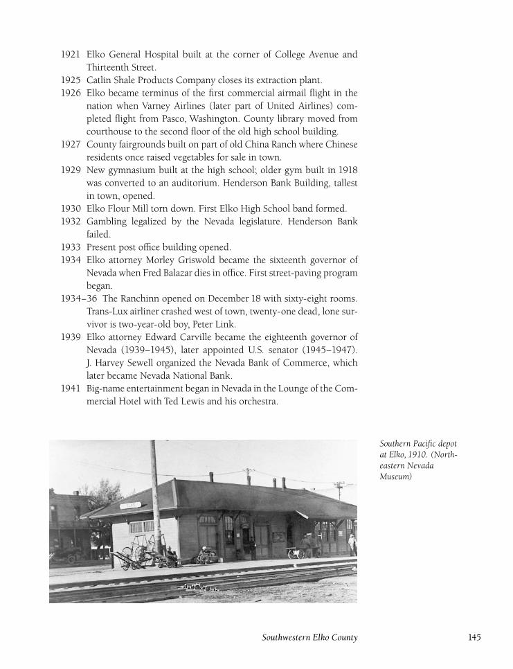
1921 Elko General Hospital built at the corner of College Avenue and
Thirteenth Street.
1925 Catlin Shale Products Company closes its extraction plant.
1926 Elko became terminus of the first commercial airmail flight in the
nation when Varney Airlines (later part of United Airlines) com-
pleted flight from Pasco, Washington. County library moved from
courthouse to the second floor of the old high school building.
1927 County fairgrounds built on part of old China Ranch where Chinese
residents once raised vegetables for sale in town.
1929 New gymnasium built at the high school; older gym built in 1918
was converted to an auditorium. Henderson Bank Building, tallest
in town, opened.
1930 Elko Flour Mill torn down. First Elko High School band formed.
1932 Gambling legalized by the Nevada legislature. Henderson Bank
failed.
1933 Present post office building opened.
1934 Elko attorney Morley Griswold became the sixteenth governor of
Nevada when Fred Balazar dies in office. First street-paving program
began.
1934–36 The Ranchinn opened on December 18 with sixty-eight rooms.
Trans-Lux airliner crashed west of town, twenty-one dead, lone sur-
vivor is two-year-old boy, Peter Link.
1939 Elko attorney Edward Carville became the eighteenth governor of
Nevada (1939–1945), later appointed U.S. senator (1945–1947).
J. Harvey Sewell organized the Nevada Bank of Commerce, which
later became Nevada National Bank.
1941 Big-name entertainment began in Nevada in the Lounge of the Com-
mercial Hotel with Ted Lewis and his orchestra.
Southern Pacific depotat Elko, 1910. (North-eastern NevadaMuseum)
Southwestern Elko County 145
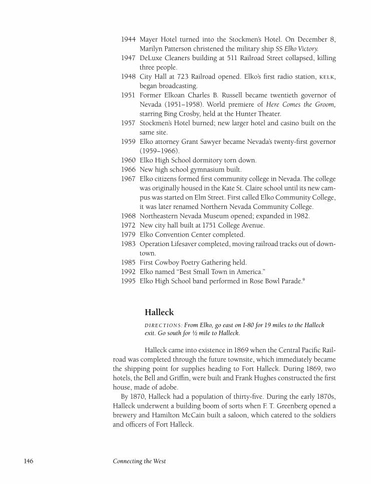
1944 Mayer Hotel turned into the Stockmen’s Hotel. On December 8,
Marilyn Patterson christened the military ship SS Elko Victory.1947 DeLuxe Cleaners building at 511 Railroad Street collapsed, killing
three people.
1948 City Hall at 723 Railroad opened. Elko’s first radio station, ,
began broadcasting.
1951 Former Elkoan Charles B. Russell became twentieth governor of
Nevada (1951–1958). World premiere of Here Comes the Groom,starring Bing Crosby, held at the Hunter Theater.
1957 Stockmen’s Hotel burned; new larger hotel and casino built on the
same site.
1959 Elko attorney Grant Sawyer became Nevada’s twenty-first governor
(1959–1966).
1960 Elko High School dormitory torn down.
1966 New high school gymnasium built.
1967 Elko citizens formed first community college in Nevada. The college
was originally housed in the Kate St. Claire school until its new cam-
pus was started on Elm Street. First called Elko Community College,
it was later renamed Northern Nevada Community College.
1968 Northeastern Nevada Museum opened; expanded in 1982.
1972 New city hall built at 1751 College Avenue.
1979 Elko Convention Center completed.
1983 Operation Lifesaver completed, moving railroad tracks out of down-
town.
1985 First Cowboy Poetry Gathering held.
1992 Elko named ‘‘Best Small Town in America.’’
1995 Elko High School band performed in Rose Bowl Parade.9
HalleckDIRECTIONS : From Elko, go east on I-80 for 19 miles to the Halleckexit. Go south for ½ mile to Halleck.
Halleck came into existence in1869 when the Central Pacific Rail-
road was completed through the future townsite, which immediately became
the shipping point for supplies heading to Fort Halleck. During 1869, two
hotels, the Bell and Griffin, were built and Frank Hughes constructed the first
house, made of adobe.
By 1870, Halleck had a population of thirty-five. During the early 1870s,
Halleck underwent a building boom of sorts when F. T. Greenberg opened a
brewery and Hamilton McCain built a saloon, which catered to the soldiers
and officers of Fort Halleck.
146 Connecting the West
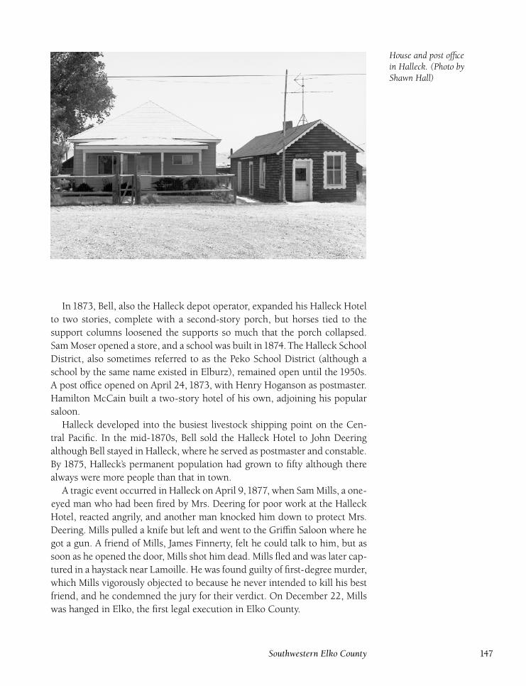
House and post officein Halleck. (Photo byShawn Hall)
In 1873, Bell, also the Halleck depot operator, expanded his Halleck Hotel
to two stories, complete with a second-story porch, but horses tied to the
support columns loosened the supports so much that the porch collapsed.
Sam Moser opened a store, and a school was built in1874. The Halleck School
District, also sometimes referred to as the Peko School District (although a
school by the same name existed in Elburz), remained open until the 1950s.
A post office opened on April 24, 1873, with Henry Hoganson as postmaster.
Hamilton McCain built a two-story hotel of his own, adjoining his popular
saloon.
Halleck developed into the busiest livestock shipping point on the Cen-
tral Pacific. In the mid-1870s, Bell sold the Halleck Hotel to John Deering
although Bell stayed in Halleck, where he served as postmaster and constable.
By 1875, Halleck’s permanent population had grown to fifty although there
always were more people than that in town.
A tragic event occurred in Halleck on April 9,1877, when Sam Mills, a one-
eyed man who had been fired by Mrs. Deering for poor work at the Halleck
Hotel, reacted angrily, and another man knocked him down to protect Mrs.
Deering. Mills pulled a knife but left and went to the Griffin Saloon where he
got a gun. A friend of Mills, James Finnerty, felt he could talk to him, but as
soon as he opened the door, Mills shot him dead. Mills fled and was later cap-
tured in a haystack near Lamoille. He was found guilty of first-degree murder,
which Mills vigorously objected to because he never intended to kill his best
friend, and he condemned the jury for their verdict. On December 22, Mills
was hanged in Elko, the first legal execution in Elko County.
Southwestern Elko County 147
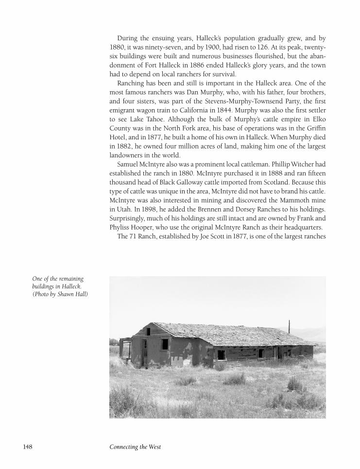
During the ensuing years, Halleck’s population gradually grew, and by
1880, it was ninety-seven, and by 1900, had risen to 126. At its peak, twenty-
six buildings were built and numerous businesses flourished, but the aban-
donment of Fort Halleck in 1886 ended Halleck’s glory years, and the town
had to depend on local ranchers for survival.
Ranching has been and still is important in the Halleck area. One of the
most famous ranchers was Dan Murphy, who, with his father, four brothers,
and four sisters, was part of the Stevens-Murphy-Townsend Party, the first
emigrant wagon train to California in 1844. Murphy was also the first settler
to see Lake Tahoe. Although the bulk of Murphy’s cattle empire in Elko
County was in the North Fork area, his base of operations was in the Griffin
Hotel, and in1877, he built a home of his own in Halleck.When Murphy died
in 1882, he owned four million acres of land, making him one of the largest
landowners in the world.
Samuel McIntyre also was a prominent local cattleman. PhillipWitcher had
established the ranch in 1880. McIntyre purchased it in 1888 and ran fifteen
thousand head of Black Galloway cattle imported from Scotland. Because this
type of cattle was unique in the area, McIntyre did not have to brand his cattle.
McIntyre was also interested in mining and discovered the Mammoth mine
in Utah. In 1898, he added the Brennen and Dorsey Ranches to his holdings.
Surprisingly, much of his holdings are still intact and are owned by Frank and
Phyliss Hooper, who use the original McIntyre Ranch as their headquarters.
The 71 Ranch, established by Joe Scott in1877, is one of the largest ranches
One of the remainingbuildings in Halleck.(Photo by Shawn Hall)
148 Connecting the West
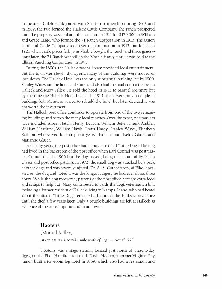
in the area. Caleb Hank joined with Scott in partnership during 1879, and
in 1889, the two formed the Halleck Cattle Company. The ranch prospered
until the property was sold at public auction in 1911 for $170,000 to William
and Grace Large, who formed the 71 Ranch Corporation in 1913. The Union
Land and Cattle Company took over the corporation in 1917, but folded in
1921 when cattle prices fell. John Marble bought the ranch and three genera-
tions later, the 71 Ranch was still in the Marble family, until it was sold to the
Ellison Ranching Corporation in 1995.
During the1890s, the Halleck baseball team provided local entertainment.
But the town was slowly dying, and many of the buildings were moved or
torn down. The Halleck Hotel was the only substantial building left by 1900.
Stanley Wines ran the hotel and store, and also had the mail contract between
Halleck and Ruby Valley. He sold the hotel in 1913 to Samuel McIntyre but
by the time the Halleck Hotel burned in 1915, there were only a couple of
buildings left. McIntyre vowed to rebuild the hotel but later decided it was
not worth the investment.
The Halleck post office continues to operate from one of the two remain-
ing buildings and serves the many local ranches. Over the years, postmasters
have included Albert Hatch, Henry Deacon, William Better, Frank Ambler,
William Haseltine, William Hawk, Louis Hardy, Stanley Wines, Elizabeth
Rathfon (who served for thirty-four years), Earl Conrad, Nelda Glaser, and
Marianne Glaser.
For many years, the post office had a mascot named ‘‘Little Dog.’’ The dog
had lived in the backroom of the post office when Earl Conrad was postmas-
ter. Conrad died in 1966 but the dog stayed, being taken care of by Nelda
Glaser and post office patrons. In 1972, the small dog was attacked by a pack
of other dogs and was severely injured. Dr. A. A. Cuthbertson, of Elko, oper-
ated on the dog and noted it was the longest surgery he had ever done, three
hours. While the dog recovered, patrons of the post office brought extra food
and scraps to help out. Many contributed towards the dog’s veterinarian bill,
including a former resident of Halleck living in Nampa, Idaho, who had heard
about the attack. ‘‘Little Dog’’ remained a fixture at the Halleck post office
until she died a few years later. Only a couple buildings are left at Halleck as
evidence of the once important railroad town.
Hootens(Mound Valley)
DIRECTIONS : Located 1 mile north of Jiggs on Nevada 228.
Hootens was a stage station, located just north of present-day
Jiggs, on the Elko-Hamilton toll road. David Hooten, a former Virginia City
miner, built a ten-room log hotel in 1869, which also had a restaurant and
Southwestern Elko County 149
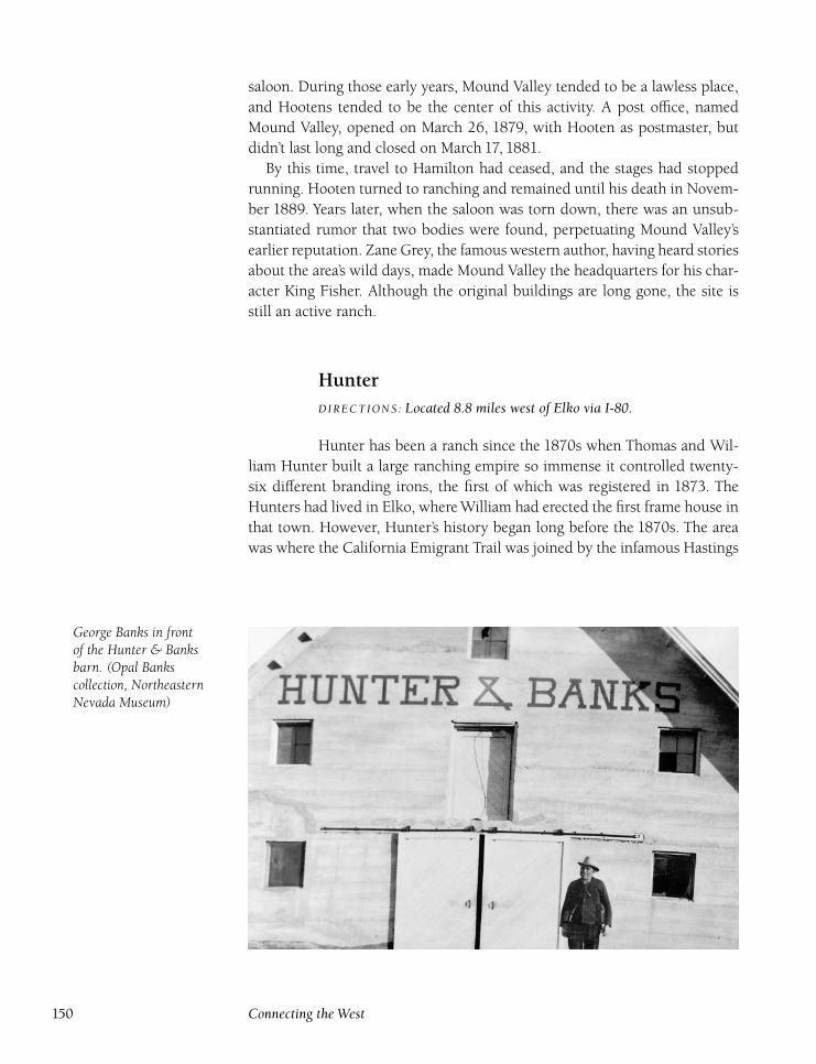
saloon. During those early years, Mound Valley tended to be a lawless place,
and Hootens tended to be the center of this activity. A post office, named
Mound Valley, opened on March 26, 1879, with Hooten as postmaster, but
didn’t last long and closed on March 17, 1881.
By this time, travel to Hamilton had ceased, and the stages had stopped
running. Hooten turned to ranching and remained until his death in Novem-
ber 1889. Years later, when the saloon was torn down, there was an unsub-
stantiated rumor that two bodies were found, perpetuating Mound Valley’s
earlier reputation. Zane Grey, the famous western author, having heard stories
about the area’s wild days, made Mound Valley the headquarters for his char-
acter King Fisher. Although the original buildings are long gone, the site is
still an active ranch.
HunterDIRECTIONS : Located 8.8 miles west of Elko via I-80.
Hunter has been a ranch since the 1870s when Thomas and Wil-
liam Hunter built a large ranching empire so immense it controlled twenty-
six different branding irons, the first of which was registered in 1873. The
Hunters had lived in Elko, where William had erected the first frame house in
that town. However, Hunter’s history began long before the 1870s. The area
was where the California Emigrant Trail was joined by the infamous Hastings
George Banks in frontof the Hunter & Banksbarn. (Opal Bankscollection, NortheasternNevada Museum)
150 Connecting the West
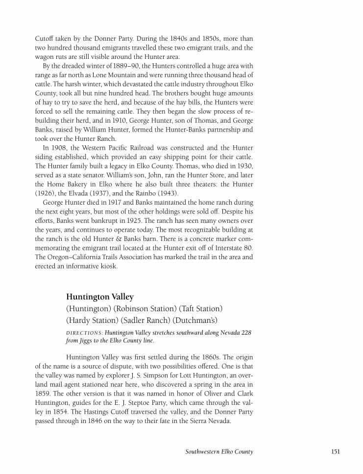
Cutoff taken by the Donner Party. During the 1840s and 1850s, more than
two hundred thousand emigrants travelled these two emigrant trails, and the
wagon ruts are still visible around the Hunter area.
By the dreaded winter of1889–90, the Hunters controlled a huge area with
range as far north as Lone Mountain and were running three thousand head of
cattle. The harsh winter, which devastated the cattle industry throughout Elko
County, took all but nine hundred head. The brothers bought huge amounts
of hay to try to save the herd, and because of the hay bills, the Hunters were
forced to sell the remaining cattle. They then began the slow process of re-
building their herd, and in 1910, George Hunter, son of Thomas, and George
Banks, raised by William Hunter, formed the Hunter-Banks partnership and
took over the Hunter Ranch.
In 1908, the Western Pacific Railroad was constructed and the Hunter
siding established, which provided an easy shipping point for their cattle.
The Hunter family built a legacy in Elko County. Thomas, who died in 1930,
served as a state senator. William’s son, John, ran the Hunter Store, and later
the Home Bakery in Elko where he also built three theaters: the Hunter
(1926), the Elvada (1937), and the Rainbo (1943).
George Hunter died in 1917 and Banks maintained the home ranch during
the next eight years, but most of the other holdings were sold off. Despite his
efforts, Banks went bankrupt in 1925. The ranch has seen many owners over
the years, and continues to operate today. The most recognizable building at
the ranch is the old Hunter & Banks barn. There is a concrete marker com-
memorating the emigrant trail located at the Hunter exit off of Interstate 80.
The Oregon–California Trails Association has marked the trail in the area and
erected an informative kiosk.
Huntington Valley(Huntington) (Robinson Station) (Taft Station)
(Hardy Station) (Sadler Ranch) (Dutchman’s)
DIRECTIONS : Huntington Valley stretches southward along Nevada 228from Jiggs to the Elko County line.
Huntington Valley was first settled during the 1860s. The origin
of the name is a source of dispute, with two possibilities offered. One is that
the valley was named by explorer J. S. Simpson for Lott Huntington, an over-
land mail agent stationed near here, who discovered a spring in the area in
1859. The other version is that it was named in honor of Oliver and Clark
Huntington, guides for the E. J. Steptoe Party, which came through the val-
ley in 1854. The Hastings Cutoff traversed the valley, and the Donner Party
passed through in 1846 on the way to their fate in the Sierra Nevada.
Southwestern Elko County 151
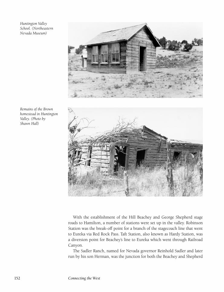
Huntington ValleySchool. (NortheasternNevada Museum)
Remains of the Brownhomestead in HuntingtonValley. (Photo byShawn Hall)
With the establishment of the Hill Beachey and George Shepherd stage
roads to Hamilton, a number of stations were set up in the valley. Robinson
Station was the break-off point for a branch of the stagecoach line that went
to Eureka via Red Rock Pass. Taft Station, also known as Hardy Station, was
a diversion point for Beachey’s line to Eureka which went through Railroad
Canyon.
The Sadler Ranch, named for Nevada governor Reinhold Sadler and later
run by his son Herman, was the junction for both the Beachey and Shepherd
152 Connecting the West
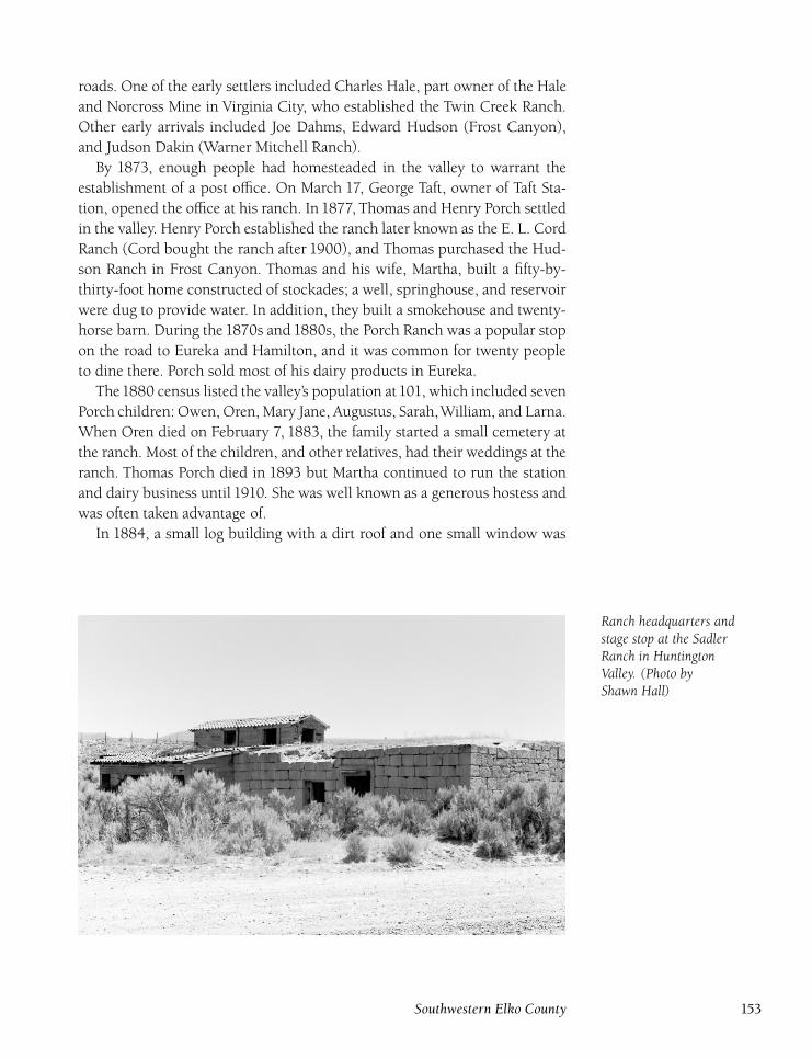
roads. One of the early settlers included Charles Hale, part owner of the Hale
and Norcross Mine in Virginia City, who established the Twin Creek Ranch.
Other early arrivals included Joe Dahms, Edward Hudson (Frost Canyon),
and Judson Dakin (Warner Mitchell Ranch).
By 1873, enough people had homesteaded in the valley to warrant the
establishment of a post office. On March 17, George Taft, owner of Taft Sta-
tion, opened the office at his ranch. In 1877, Thomas and Henry Porch settled
in the valley. Henry Porch established the ranch later known as the E. L. Cord
Ranch (Cord bought the ranch after 1900), and Thomas purchased the Hud-
son Ranch in Frost Canyon. Thomas and his wife, Martha, built a fifty-by-
thirty-foot home constructed of stockades; a well, springhouse, and reservoir
were dug to provide water. In addition, they built a smokehouse and twenty-
horse barn. During the 1870s and 1880s, the Porch Ranch was a popular stop
on the road to Eureka and Hamilton, and it was common for twenty people
to dine there. Porch sold most of his dairy products in Eureka.
The1880 census listed the valley’s population at101, which included seven
Porch children: Owen, Oren, Mary Jane, Augustus, Sarah,William, and Larna.
When Oren died on February 7, 1883, the family started a small cemetery at
the ranch. Most of the children, and other relatives, had their weddings at the
ranch. Thomas Porch died in 1893 but Martha continued to run the station
and dairy business until 1910. She was well known as a generous hostess and
was often taken advantage of.
In 1884, a small log building with a dirt roof and one small window was
Ranch headquarters andstage stop at the SadlerRanch in HuntingtonValley. (Photo byShawn Hall)
Southwestern Elko County 153
built to serve as the valley school, located at the Ed Hudson Ranch. Amenities
included a wood heater and plank table. The teacher, Pearl Lindsay, had the
only chair. Another school, the Liberty School, opened at the Porch Ranch
and was in operation until around the turn of the century.
A new school, the Huntington School, was built by Charlie Mitchell in
1925 near the Brown Ranch. The school was later moved to the Sestanovich
Ranch in Frost Canyon. It closed in 1932, moved to Lee, and was later torn
down. Teachers in the three schools included Aloysia O’Leary, Hattie Finegan,
Pansay Stuart, Lou Craighead, Marion Stone, Annie Grant, Georgia Pollard,
Belle Lindsay, Emma Scherff, Annie Toyn, Pearl Lindsay, Clara Mather, Flora
Wittenberg, Jennie Gleason, Ella Crosson, Belle Butler, Alice Decker, Lizzie
Wilkerson, Edna Mills, and Elsidora Brinck.
The post office closed on July 15, 1904. Postmasters from 1873 to 1904
included Joe Crawford, David Lindsay, Augustine Brown (also served as
Huntington justice of the peace), John Fitzmaurice, and Seraphine Lani. The
office reopened from December 7, 1923, to January 31, 1931, and Ruby Hin-
ton, Tex Smith, and Edna Howard served as postmasters.
Many ranches are still active in Huntington Valley, and most include pre-
1900 buildings. The quarried stone building built at the Sadler Ranch re-
mains. Although the Porch homestead is long gone, foundations are left, as is
the small family cemetery containing a few graves. The old stage roads and
wagon ruts of the Hastings Cutoff trail are also visible.
JudeDIRECTIONS : Located 10 miles west of Wells on the Union Pacific.
Jude was a signal station located between Deeth and Wells and
served the Southern Pacific Railroad. Only a small sectionhouse was built at
Jude, and only scattered wood scraps are left.
McPheters Station(McPeters’ Station)
DIRECTIONS : From Elko, go southeast on the Spring Creek road for 6.9miles. Turn right and go south for 5 miles. Turn right and follow gravelroad for 4 miles to McPheters Station.
McPheters Station was a stop on the old White Pine Road, located
on Frank McPheters ranch. McPheters and his wife, Emma, established the
ranch and station in 1869 where the old telegraph road crossed the South
154 Connecting the West
Fork of the Humboldt River, between the Crane and Griswold Ranches. A fire
destroyed the property in September 1870 while everyone was out threshing
in the fields. The fire was believed to be a coverup for a robbery because $600
in gold coins was missing and never found.
McPheters never rebuilt the station and it faded into history. He and his
wife moved to Osino where she drowned in the Humboldt River in August
1876. McPheters ranched for many years in Elko County and became a highly
respected member of the community. He died in May 1918. Nothing at all
remains of McPheters Station.
MillersDIRECTIONS : From Elko, take the Spring Creek road southeast for 6.9miles. Turn right and go for 11 miles. Turn right and follow a gravelroad west for 1 mile and then south along Huntington Creek for 6 milesto Millers.
Millers was a stop on the Elko-Hamilton road. Used primarily as a
horse-changing stop during the late 1860s and early 1870s, Millers was aban-
doned once use of the road to Hamilton diminished. Only a depression marks
the site, located on a private ranch. Millers was also the name of a stop on
the short-lived Railroad Canyon toll road run by J. F. Ray. The road opened
in 1870 but was abandoned a couple of years later. Only a cabin and small
corrals were built, and nothing is left at that site.
MoleenDIRECTIONS : Located 2½ miles southwest of Hunter, 11½ milessouthwest of Elko. Located on the south side of railroad tracks, adjacentto I-80.
Moleen was first a sidetrack and signal station on the Central
Pacific Railroad and now on the Southern Pacific Railroad. The into and eight
blankets and $22 were stolen. In 1900, S first historic mention of Moleen was
on May 20, 1874, when the sectionhouse was broken. G. Weston, prominent
mining man at Lone Mountain, worked some claims in Moleen Canyon. He
sold them for $5,000 but soon after had to take the mine back. After a few
years, he gave up and concentrated on his holdings at Lone Mountain.
In April 1901, the Moleen sectionhouse was destroyed by a fire that was
started by a spark from a passing locomotive. A boxcar was brought up from
Carlin to serve as a replacement until the building was rebuilt. The telegraph
station burned in June 1907 when the operator fell asleep and kicked over
Southwestern Elko County 155
a lamp. In March 1916, Weston’s old mine was relocated by Ike Cowling,
Bert Hammer, and Frank Smith. Small amounts of silver and copper were re-
moved during the next few years before the trio gave up. All of the buildings
at Moleen have long since disappeared and only concrete foundations are left.
Mound StationDIRECTIONS : From Jiggs, go south on Nevada 228 for 6½ miles. Turnright and follow for 4 miles to Mound Station.
Mound Station, not to be confused with the station at the present
town of Jiggs, was a stop and horse-changing station on Denver and Shep-
herd’s Elko–White Pine Road in the late 1860s and early 1870s. The station,
which consisted of a log cabin and corrals, was located two miles south of
Robinson Station. Nothing remains at the site today.
NardiDIRECTIONS : Located 4 miles east of Deeth on the Union Pacific.
Nardi served as a signal station on both the Southern Pacific and
Western Pacific Railroads (now both part of the Union Pacific). The only men-
tion of Nardi in historical records occurred in June 1946 when Omer Shep-
pard, a Western Pacific Railroad assistant foreman, was killed by a passing
train when the suction pulled him in. Sheppard had just been released from
a chain gang. Only a signal shack was built at Nardi and nothing remains.
NatchezDIRECTIONS : Located 4 miles southwest of Deeth on the Union Pacific.
Natchez served as a signal station on the Southern Pacific Railroad.
The station was named for the son of Winnemucca, a chief of the Paiutes.
There were a couple of tragedies that took place here early in the century.
In August 1907, twenty-one-year-old signalman James Urton was struck and
killed by a passing train. Another twenty-one year old, Alfonso D’Olivo, a sec-
tion worker, was killed by a train in October1915. Only concrete foundations
are left at Natchez.
156 Connecting the West
OsinoDIRECTIONS : From Elko, go northeast on I-80 for 8.7 miles to Osino.
Osino came into being as a sidetrack station for the Central Pacific
Railroad in1869 and later served as a stop and signal station for the Southern
Pacific Railroad. A train accident on January 4, 1879, created excitement in
Elko. A passenger train and freight train collided in heavy fog and although
the locomotives were smashed and several cars were destroyed, no one was
injured. A tragedy took place in October 1881 when brakeman Elmer Jones
was killed by a railroad car that jumped the switch and crushed him.
During the 1880s, a small settlement developed, mainly due to the forma-
tion of the Arthur Lowe and Company cattle partnership. Lowe, from Derby-
shire, England, was a partner with Judge Bigelow; the two men had one of
the largest cattle companies in the county. The company was listed in the first
brand book issued by the Nevada Livestock Association in 1884. Lowe died
at age thirty-nine, but his wife and daughter continued to run the operation
until it was sold to Charles Clubine. William Moffatt also later owned the
property.
As with many of the railroad stops in Elko County, tragedy struck with a
death on the tracks. In August 1899, David Tobin of Butte City was found
mangled on the tracks. Apparently he had been knocked from the train when
it started, fell onto the tracks, and was killed by an oncoming train. In Novem-
ber 1901, the few residents left were modernized when a telephone line to
Osino was completed from Elko. The original ranch house, built in 1882, still
stands at Osino. Almost all of the other buildings in the area are new, part of
the expansion of the Elko boom.
PardoDIRECTIONS : Located 10 miles west of Elburz near Ryndon on theUnion Pacific.
Pardo has served the former Western Pacific Railroad as a siding
and the former Southern Pacific Railroad (now both Union Pacific) as a sig-
nal station. The only structure built at Pardo was a sectionhouse and that
disappeared long ago.
Southwestern Elko County 157
Pleasant Valley(Blaine)
DIRECTIONS : From Elko, go south on Nevada 227 for 17 miles. Turnright and continue for 4 miles to Blaine, which is in the middle ofPleasant Valley.
The first settlers of Pleasant Valley, Frank Williams and George
and Edward Seitz, arrived in 1868. The valley was named by George and
Edward. A list of early settlers reads like a ‘‘Who’s Who’’ of Elko County:
George Ogilvie, Henry Butterfield, Joseph Hennen, H. A. Young, John Ainley,
Evan Jones, N. F. Peterson, George Williamson, George Taylor, J. P. Hough,
James Mitchell, Bob Skaggs, and Amos Roach.
There was excitement in the valley in 1870 when robbers of the Central
Pacific Railroad hid out at the Young Ranch while the owner was away. Sol-
diers from Fort Halleck finally located the thieves, and they were arrested
without incident.
A school opened in 1873 with Lizzie Hough, daughter of J. P. Hough, as
the first schoolteacher. A new school was built in 1875 and had twelve stu-
dents. By 1881, Pleasant Valley had a population of eighty-eight, which in-
cluded fifty-nine registered voters. Besides the many ranches in operation,
Evan Jones ran a large dairy. Milk sold for fifty cents a gallon, and Jones sup-
plied a large area, including Tuscarora. A variety of other produce was raised
in the valley and sold at markets in Austin, Eureka, Hamilton, Tuscarora, and
Elko.
Blaine post office opened at the Brennen Ranch on May 26, 1884, with
Frank Hough as postmaster. The office was named for James Blaine, Republi-
can candidate for president. Evan Jones became postmaster in 1887, and his
son, Thomas, took over in 1899. Thomas Brennen ran the office from 1900
until it closed on December 31, 1914.
Even though Pleasant Valley is a relatively small valley, a number of ranches
were based there, and many stayed in the same families for generations. For
example, Hennen Ranch was in the family from 1873 to 1959. Thomas Bren-
nen moved to Blaine in 1896 and combined the Grant, Peterson, and Ainley
Ranches.
Realizing the need for a new and roomier schoolhouse, Brennen donated a
building on his ranch for use as a school. It was used until the Pleasant Valley
School District was abolished in 1918. Teachers who taught at this school in-
cluded May Foley, Effie Madson, and Sadie Wright (her sister, Maggie, taught
at Lamoille).
Around the turn of the century, a new school was established at Rabbit
Creek on the Skaggs Ranch. Although it has been reported that the Pleas-
ant Valley School was moved there, this is now known to be wrong because
158 Connecting the West
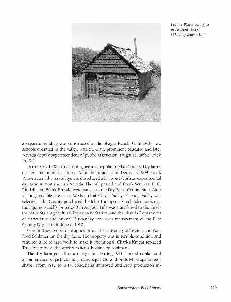
Former Blaine post officein Pleasant Valley.(Photo by Shawn Hall)
a separate building was constructed at the Skaggs Ranch. Until 1918, two
schools operated in the valley. Kate St. Clair, prominent educator and later
Nevada deputy superintendent of public instruction, taught at Rabbit Creek
in 1912.
In the early 1900s, dry farming became popular in Elko County. Dry farms
created communities at Tobar, Afton, Metropolis, and Decoy. In 1909, Frank
Winters, an Elko assemblyman, introduced a bill to establish an experimental
dry farm in northeastern Nevada. The bill passed and Frank Winters, E. C.
Riddell, and Frank Fernald were named to the Dry Farm Commission. After
visiting possible sites near Wells and at Clover Valley, Pleasant Valley was
selected. Elko County purchased the John Thompson Ranch (also known as
the Squires Ranch) for $2,000 in August. Title was transferred to the direc-
tor of the State Agricultural Experiment Station, and the Nevada Department
of Agriculture and Animal Husbandry took over management of the Elko
County Dry Farm in June of 1910.
Gordon True, professor of agriculture at the University of Nevada, and Wal-
fried Sohlman ran the dry farm. The property was in terrible condition and
required a lot of hard work to make it operational. Charles Knight replaced
True, but most of the work was actually done by Sohlman.
The dry farm got off to a rocky start. During 1911, limited rainfall and
a combination of jackrabbits, ground squirrels, and birds left crops in poor
shape. From 1912 to 1914, conditions improved and crop production in-
Southwestern Elko County 159
creased. In 1914, the farm began a program of seed distribution and more
than one-half ton of wheat seed was sold to Elko County dry farmers.
Although 1915 proved to be the dry farm’s best year, attempts were al-
ready being made in Carson City to close the farm. A bill for closure passed
the Senate but was defeated by the assembly, and $8,000 was appropriated
for operations in 1915 and 1916. However, Governor Emmet Boyle surprised
everyone by vetoing the appropriation, which caused outrage in Elko County.
Sohlman tried to get Boyle to reconsider the closure, but the governor
stated that the farm would be closed at the end of the 1915 farming season.
Sohlman, not wanting to see all of his hard work go down the drain, defied
the closure order. He harvested a fall grain crop and planted a new crop. The
Dry Farm Commission was reactivated by Governor Boyle because it was the
only authority that could dismiss Sohlman. He was formerly discharged in
March of 1916 and given one month to vacate the farm.
The farm was officially abolished by the legislature in 1917, and records,
equipment, and property were returned to Elko County. Although dry farm-
ing was still done elsewhere in Elko County for a couple of years, its days
were over in Pleasant Valley. The farm was sold at public auction in July of
1920 to F. J. Brennen for $600 and was incorporated into the Brennen Ranch.
Thomas Brennen died in July 1932. Not only had he been an influential
Pleasant Valley rancher, but he had also been active in county and state poli-
tics. He served three terms as a member of the first Elko City Council and
three terms as an assemblyman in the Nevada legislature. Brennen was born
in 1855 in London and married Mary Killeen of Virginia City in 1890. They
had eight children, most of whom stayed in the Pleasant Valley area.
Over the years, most of the small, separate ranches in the valley have been
consolidated. Today, most of the smaller ranches are operated by the larger
ranches. Some ranch land has become part of the Spring Creek housing de-
velopment. A number of old buildings remain in the valley and the Blaine
post office and Pleasant Valley School still stand on the Brennen Ranch.
RasidDIRECTIONS : From the Halleck interchange on I-80, go southeast for2 miles. Turn left onto the road paralleling the railroad tracks. Continuefor 4 miles to Rasid.
Rasid served the former Western Pacific and Southern Pacific Rail-
roads (now both Union Pacific) as a signal station. For a time, there was a
sectionhouse at Rasid, but it was removed in the 1950s. Only the foundation
of the sectionhouse remains.
160 Connecting the West
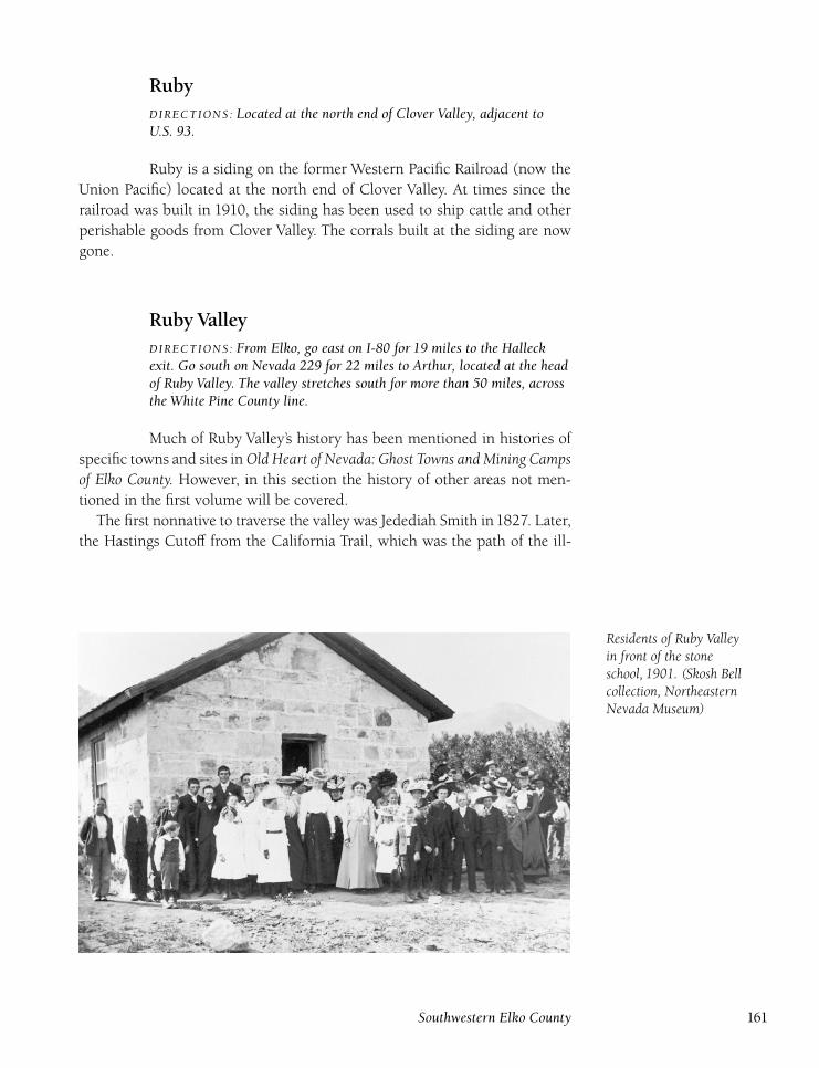
RubyDIRECTIONS : Located at the north end of Clover Valley, adjacent toU.S. 93.
Ruby is a siding on the former Western Pacific Railroad (now the
Union Pacific) located at the north end of Clover Valley. At times since the
railroad was built in 1910, the siding has been used to ship cattle and other
perishable goods from Clover Valley. The corrals built at the siding are now
gone.
Ruby ValleyDIRECTIONS : From Elko, go east on I-80 for 19 miles to the Halleckexit. Go south on Nevada 229 for 22 miles to Arthur, located at the headof Ruby Valley. The valley stretches south for more than 50 miles, acrossthe White Pine County line.
Much of Ruby Valley’s history has been mentioned in histories of
specific towns and sites in Old Heart of Nevada: Ghost Towns and Mining Campsof Elko County. However, in this section the history of other areas not men-
tioned in the first volume will be covered.
The first nonnative to traverse the valley was Jedediah Smith in1827. Later,
the Hastings Cutoff from the California Trail, which was the path of the ill-
Residents of Ruby Valleyin front of the stoneschool, 1901. (Skosh Bellcollection, NortheasternNevada Museum)
Southwestern Elko County 161
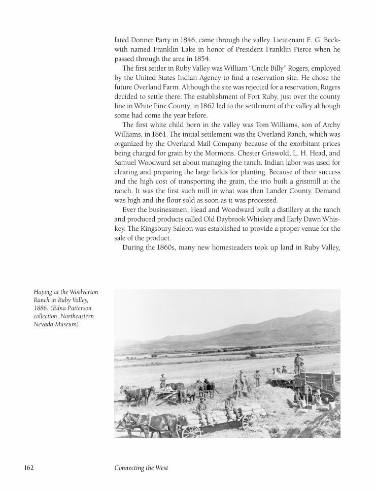
fated Donner Party in 1846, came through the valley. Lieutenant E. G. Beck-
with named Franklin Lake in honor of President Franklin Pierce when he
passed through the area in 1854.
The first settler in Ruby Valley was William ‘‘Uncle Billy’’ Rogers, employed
by the United States Indian Agency to find a reservation site. He chose the
future Overland Farm. Although the site was rejected for a reservation, Rogers
decided to settle there. The establishment of Fort Ruby, just over the county
line in White Pine County, in1862 led to the settlement of the valley although
some had come the year before.
The first white child born in the valley was Tom Williams, son of Archy
Williams, in 1861. The initial settlement was the Overland Ranch, which was
organized by the Overland Mail Company because of the exorbitant prices
being charged for grain by the Mormons. Chester Griswold, L. H. Head, and
Samuel Woodward set about managing the ranch. Indian labor was used for
clearing and preparing the large fields for planting. Because of their success
and the high cost of transporting the grain, the trio built a gristmill at the
ranch. It was the first such mill in what was then Lander County. Demand
was high and the flour sold as soon as it was processed.
Ever the businessmen, Head and Woodward built a distillery at the ranch
and produced products called Old Daybrook Whiskey and Early Dawn Whis-
key. The Kingsbury Saloon was established to provide a proper venue for the
sale of the product.
During the 1860s, many new homesteaders took up land in Ruby Valley,
Haying at the WoolvertonRanch in Ruby Valley,1886. (Edna Pattersoncollection, NortheasternNevada Museum)
162 Connecting the West
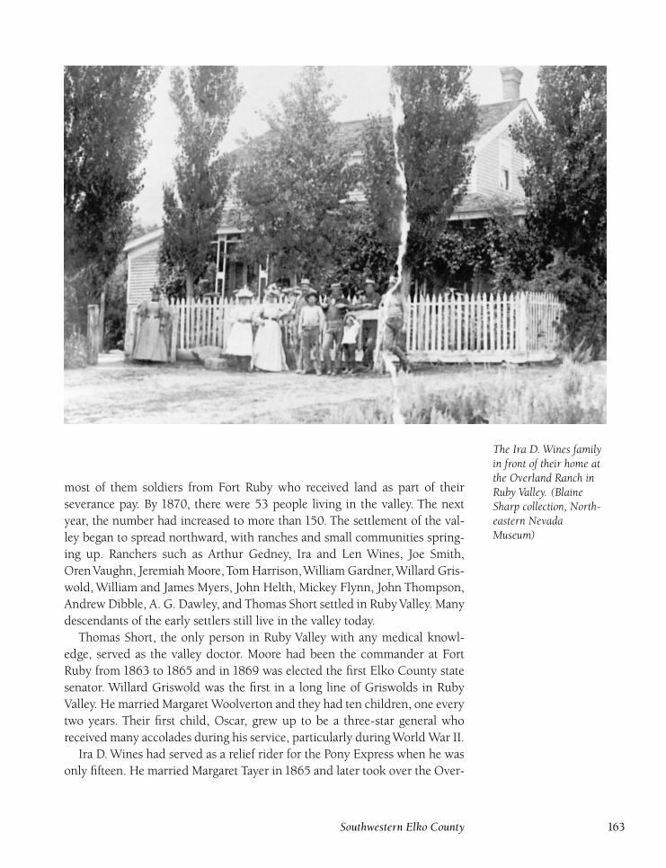
The Ira D. Wines familyin front of their home atthe Overland Ranch inRuby Valley. (BlaineSharp collection, North-eastern NevadaMuseum)
most of them soldiers from Fort Ruby who received land as part of their
severance pay. By 1870, there were 53 people living in the valley. The next
year, the number had increased to more than 150. The settlement of the val-
ley began to spread northward, with ranches and small communities spring-
ing up. Ranchers such as Arthur Gedney, Ira and Len Wines, Joe Smith,
Oren Vaughn, Jeremiah Moore, Tom Harrison,William Gardner,Willard Gris-
wold, William and James Myers, John Helth, Mickey Flynn, John Thompson,
Andrew Dibble, A. G. Dawley, and Thomas Short settled in Ruby Valley. Many
descendants of the early settlers still live in the valley today.
Thomas Short, the only person in Ruby Valley with any medical knowl-
edge, served as the valley doctor. Moore had been the commander at Fort
Ruby from 1863 to 1865 and in 1869 was elected the first Elko County state
senator. Willard Griswold was the first in a long line of Griswolds in Ruby
Valley. He married Margaret Woolverton and they had ten children, one every
two years. Their first child, Oscar, grew up to be a three-star general who
received many accolades during his service, particularly during World War II.
Ira D. Wines had served as a relief rider for the Pony Express when he was
only fifteen. He married Margaret Tayer in 1865 and later took over the Over-
Southwestern Elko County 163
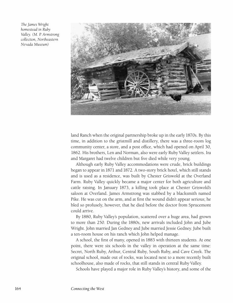
The James Wrighthomestead in RubyValley. (M. P. Armstrongcollection, NortheasternNevada Museum)
land Ranch when the original partnership broke up in the early1870s. By this
time, in addition to the gristmill and distillery, there was a three-room log
community center, a store, and a post office, which had opened on April 30,
1862. His brothers, Len and Norman, also were early Ruby Valley settlers. Ira
and Margaret had twelve children but five died while very young.
Although early Ruby Valley accommodations were crude, brick buildings
began to appear in 1871 and 1872. A two-story brick hotel, which still stands
and is used as a residence, was built by Chester Griswold at the Overland
Farm. Ruby Valley quickly became a major center for both agriculture and
cattle raising. In January 1873, a killing took place at Chester Griswold’s
saloon at Overland. James Armstrong was stabbed by a blacksmith named
Pike. He was cut on the arm, and at first the wound didn’t appear serious; he
bled so profusely, however, that he died before the doctor from Sprucemont
could arrive.
By 1880, Ruby Valley’s population, scattered over a huge area, had grown
to more than 250. During the 1880s, new arrivals included John and Jube
Wright. John married Jan Gedney and Jube married Jessie Gedney. Jube built
a ten-room house on his ranch which John helped manage.
A school, the first of many, opened in 1883 with thirteen students. At one
point, there were six schools in the valley in operation at the same time:
Secret, North Ruby, Arthur, Central Ruby, South Ruby, and Cave Creek. The
original school, made out of rocks, was located next to a more recently built
schoolhouse, also made of rocks, that still stands in central Ruby Valley.
Schools have played a major role in Ruby Valley’s history, and some of the
164 Connecting the West
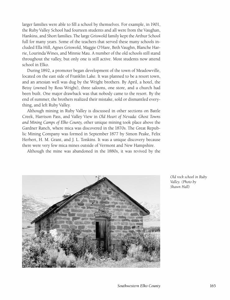
larger families were able to fill a school by themselves. For example, in 1901,
the Ruby Valley School had fourteen students and all were from the Vaughan,
Hankins, and Short families. The large Griswold family kept the Arthur School
full for many years. Some of the teachers that served these many schools in-
cluded Ella Hill, Agnes Griswold, Maggie O’Hare, Beth Vaughn, Blanche Har-
rie, Lourinda Wines, and Minnie Mau. A number of the old schools still stand
throughout the valley, but only one is still active. Most students now attend
school in Elko.
During 1892, a promoter began development of the town of Meadowville,
located on the east side of Franklin Lake. It was planned to be a resort town,
and an artesian well was dug by the Wright brothers. By April, a hotel, the
Betsy (owned by Ross Wright), three saloons, one store, and a church had
been built. One major drawback was that nobody came to the resort. By the
end of summer, the brothers realized their mistake, sold or dismantled every-
thing, and left Ruby Valley.
Although mining in Ruby Valley is discussed in other sections on Battle
Creek, Harrison Pass, and Valley View in Old Heart of Nevada: Ghost Townsand Mining Camps of Elko County, other unique mining took place above the
Gardner Ranch, where mica was discovered in the 1870s. The Great Repub-
lic Mining Company was formed in September 1877 by Simon Peake, Felix
Herbert, H. M. Grant, and J. L. Tonkins. It was a unique discovery because
there were very few mica mines outside of Vermont and New Hampshire.
Although the mine was abandoned in the 1880s, it was revived by the
Old rock school in RubyValley. (Photo byShawn Hall)
Southwestern Elko County 165
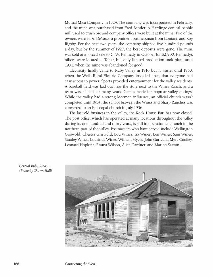
Mutual Mica Company in 1924. The company was incorporated in February,
and the mine was purchased from Fred Bender. A Hardinge conical pebble
mill used to crush ore and company offices were built at the mine. Two of the
owners were H. A. DeVaux, a prominent businessman from Contact, and Roy
Rigsby. For the next two years, the company shipped five hundred pounds
a day, but by the summer of 1927, the best deposits were gone. The mine
was sold at a forced sale to C. W. Kennedy in October for $2,900. Kennedy’s
offices were located at Tobar, but only limited production took place until
1931, when the mine was abandoned for good.
Electricity finally came to Ruby Valley in 1916 but it wasn’t until 1960,
when the Wells Rural Electric Company installed lines, that everyone had
easy access to power. Sports provided entertainment for the valley residents.
A baseball field was laid out near the store next to the Wines Ranch, and a
team was fielded for many years. Games made for popular valley outings.
While the valley had a strong Mormon influence, an official church wasn’t
completed until 1954; the school between the Wines and Sharp Ranches was
converted to an Episcopal church in July 1936.
The last old business in the valley, the Rock House Bar, has now closed.
The post office, which has operated at many locations throughout the valley
during its one hundred and thirty years, is still in operation at a ranch in the
northern part of the valley. Postmasters who have served include Wellington
Griswold, Chester Griswold, Lou Wines, Ira Wines, Len Wines, Sam Wines,
Stanley Wines, Lourinda Wines,William Myers, John Garrecht, Myra Coolley,
Leonard Hopkins, Emma Wilson, Alice Gardner, and Marion Saxton.
Central Ruby School.(Photo by Shawn Hall)
166 Connecting the West
During the 1960s, Ruby Valley had some celebrity ranch owners. Actors
Joel McCrea and ‘‘Wild’’ Bill Elliott bought ranches in the valley. Elliott, who
starred in ninety westerns, bought the Lutts and Smith Ranches for more than
$500,000, and commented that ‘‘it’s so neat and compact in a setting under
the Ruby Mountains. It’s just plain beautiful.’’10 Elliott hired George Smiraldo
as his ranch foreman. Elliott greatly enjoyed the companionship of his neigh-
bors (Roger Smith, Blaine Sharp, and Lourinda Wines), saying, ‘‘These won-
derful people have made me, a stranger, feel right at home. They have been a
guiding hand to me from the first day I came on my ranch.’’11
Ranching is still the lifeblood of Ruby Valley, and the fertile and beautiful
valley continues to be a prosperous area. Ruby Valley is a spectacular place
to visit, not only for the history but for the scenery as well. Old buildings of
stone, brick, and wood abound throughout the valley. One building of par-
ticular interest is an old rock structure at the Wines Ranch that served as the
ranch refrigerator. The building had a stream running through it to keep its
contents cold.
The old stone schoolhouse stands near the ranch. TheWines ranch house is
built of brick, and there are a number of other beautiful brick ranch houses in
the valley. There are at least five cemeteries in the valley, at Cave Creek, Gard-
ner Ranch, Wright Ranch, upper Ruby Valley, and at the Mormon church.
Other family plots exist on some of the older ranches. For more information
on Ruby Valley, please see other sections in Old Heart of Nevada: Ghost Townsand Mining Camps of Elko County: Arthur, Secret, Battle Creek, Cave Creek,
Harrison Pass, and Valley View.
RyndonDIRECTIONS : From Elko, go east on I-80 for 12.8 miles to Ryndon.
Ryndon first served as a grading camp during the construction of
the Central Pacific Railroad in 1869. Later, a siding was added by the South-
ern Pacific Railroad. In 1902, the Southern Pacific established Ryndon as a
construction camp during the digging of the Ryndon tunnel. The camp was
established by Erickson and Peterson, and, in addition to the many boarding-
houses, a powerhouse and telegraph station were built. The camp was a wild
and dangerous place that quickly earned a reputation as one of the most law-
less towns in Nevada, where shootings and knifings were commonplace.
A post office opened at Ryndon on January 22, 1903, with Louis Orstad
as postmaster. The Ryndon tunnel was completed in 1903 but a terrible price
had been paid. During construction, five men were killed by premature ex-
plosions in separate incidents. Once the tunnel was completed, the camp was
Southwestern Elko County 167
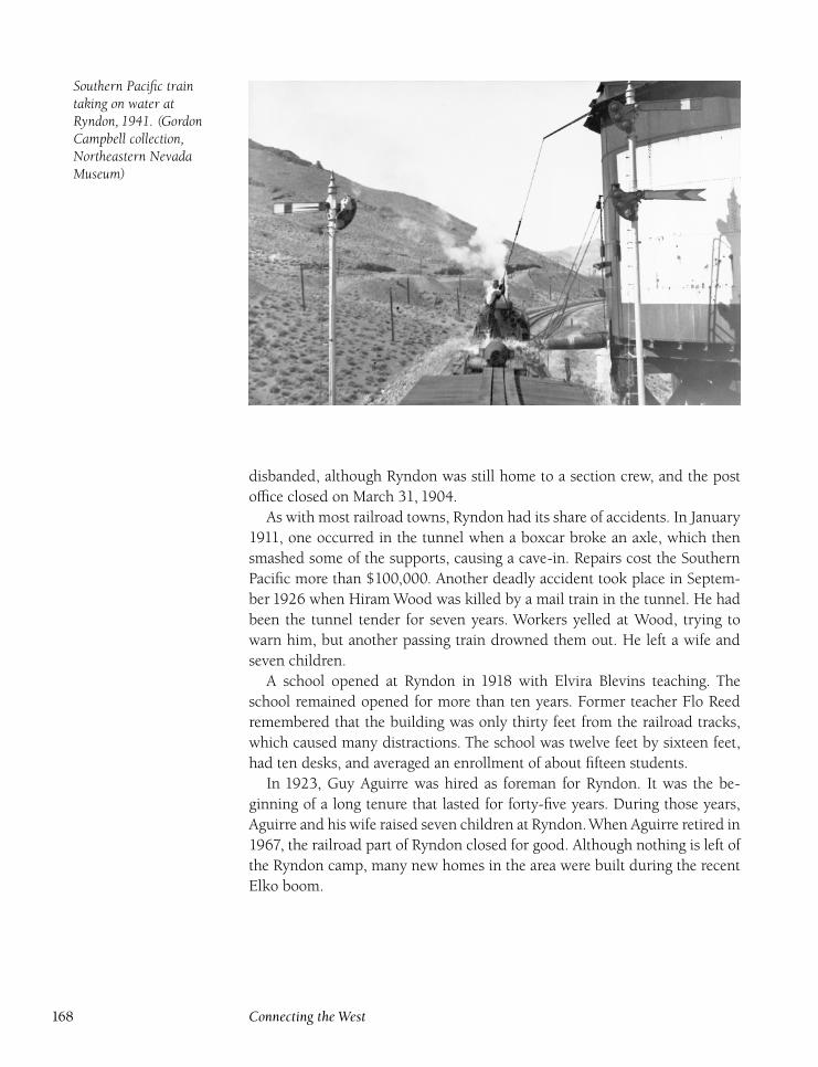
Southern Pacific traintaking on water atRyndon, 1941. (GordonCampbell collection,Northeastern NevadaMuseum)
disbanded, although Ryndon was still home to a section crew, and the post
office closed on March 31, 1904.
As with most railroad towns, Ryndon had its share of accidents. In January
1911, one occurred in the tunnel when a boxcar broke an axle, which then
smashed some of the supports, causing a cave-in. Repairs cost the Southern
Pacific more than $100,000. Another deadly accident took place in Septem-
ber 1926 when Hiram Wood was killed by a mail train in the tunnel. He had
been the tunnel tender for seven years. Workers yelled at Wood, trying to
warn him, but another passing train drowned them out. He left a wife and
seven children.
A school opened at Ryndon in 1918 with Elvira Blevins teaching. The
school remained opened for more than ten years. Former teacher Flo Reed
remembered that the building was only thirty feet from the railroad tracks,
which caused many distractions. The school was twelve feet by sixteen feet,
had ten desks, and averaged an enrollment of about fifteen students.
In 1923, Guy Aguirre was hired as foreman for Ryndon. It was the be-
ginning of a long tenure that lasted for forty-five years. During those years,
Aguirre and his wife raised seven children at Ryndon.When Aguirre retired in
1967, the railroad part of Ryndon closed for good. Although nothing is left of
the Ryndon camp, many new homes in the area were built during the recent
Elko boom.
168 Connecting the West
Schley(Schly)
DIRECTIONS : From Wells, go south on U.S. 93 for 28 miles. Turn righton Nevada 229 and go 14 miles. Turn left and go 3½ miles. Turn leftonto a poor road and continue for 2 miles to Schley. Located 4 milessouth of the Ruby Valley maintenance station.
Schley was a post office on the Tom Short Ranch in north Ruby
Valley from September 26, 1898, to July 15, 1903. Tom Short served as post-
master during the entire time the office was active. The office was named in
honor of Admiral Winfield Scott Schley, commander of the American fleet
who defeated the Spanish navy at Santiago de Cuba on July 3, 1898.
The creation of the post office was the result of a dispute between Short and
Ira D.Wines, who brought the mail from Halleck to the RubyValley post office
at the Overland Ranch. Despite repeated requests, Wines refused to drop off
Short’s mail on his way. Short filed for his own post office and named it not
only for Admiral Schley, but also because his name was pronounced ‘‘sly.’’
Short was a Civil War veteran who had served with General William T. Sher-
man. He and his wife, Mary Ann, came to Ruby Valley in the1870s, originally
settling at Cave Creek, and then moving to the old R. B. Thompson Ranch in
1875.
More information on the Short family is found in the Ruby Valley section
of this book. However, one item bears mention here. In May 1900, due to
problems with his son, Tom Short was forced to place the following classified
ad: ‘‘I hereby warn all persons not to trust my son, Emmet Short, in my name
for any purpose.’’12 Short had problems with his sons until he died in 1918.
However, he was the cause of some of these disagreements. The ranch stayed
in the Short family, under Bill Short’s ownership, until his death in 1941. The
ranch is now owned by Jack and Brenda Gardner. The old two-story brick
house and rock barn still stand at the ranch.
Secret ValleyDIRECTIONS : From Arthur, go north on Nevada 229 for 3 miles to themiddle of Secret Valley.
Secret Pass was so named because it was a hard-to-find short cut
through the Ruby Mountains. Peter Skene Ogden was the first nonnative
through the pass, in December1828. In1841, the Barleson-Bidwell Party used
the pass, as did the Murphy-Stevens-Townsend Party in 1844.
The first actual settlers didn’t arrive in Secret Valley until 1874. Besides
new ranching ventures, a short-lived attempt was made at mining. During
Southwestern Elko County 169
1878, J. A. Stone and A. J. Shorey worked some placer claims along Cotton-
wood Creek. Two lode mines, Adeline Nelson and Maggie Mitchell, were also
worked. However, the pair abandoned their mines by the fall of 1879.
In 1880, a public road was built through the pass. A school opened in
Secret Valley in 1883 with thirteen students, mostly from the Gardner and
Wright families who had ranches in the valley.
In1904, A. S. Coleman discovered a mineral spring alongside Secret Creek
and formed the Ruby Mineral Springs Company. The spring provided
seventy-five thousand gallons of water a day, bottled as Ruby Mineral Spring
Water. Coleman planned to build a health resort and sanitarium at the spring,
but the plan didn’t come to anything, and the company folded in a couple of
years.
In March 1900, Ed Murphy Sr. and his wife, Emma Gardner, bought
the Lemon Creek Ranch from William Gardner. Murphy purchased more of
Gardner’s property in 1903. He also bought the Anderson Ranch, which had
originally been owned by Charles Grover, in 1907. Murphy was the first per-
son in the area to own a threshing machine.
In 1914, the United States Forest Service built a new road through Secret
Pass that cost $10,000. This road was paved in 1957 and is still used today. A
post office opened at the Murphy Ranch on October 27, 1916, but remained
in operation until October 15, 1918. Pollie Murphy served as postmaster for
those two years. In 1918, James Ryan purchased a small ranch in Secret Pass,
later leased to Bob White. In 1928, White killed Louis Lavell in Elko and
brought Lavell’s body to the ranch, burning the house with the body inside
to destroy the evidence. For a complete account of the White murder, see the
Elko section of this book.
In 1935, Eddie Murphy Jr. bought the ranch from his father. Murphy had
married Ellen O’Rourke in 1929, and the Murphys hired teachers, includ-
ing Blawnie Mae Fairchild and Fay Guldager, to educate their children. The
Secret School finally closed in 1951, and the only student, Morlene Murphy,
then attended the Pole Canyon School, located a couple of miles to the east.
Murphy finally retired and sold the ranch to Loyd and Von Sorenson in 1958.
The Sorensons still own the ranch today. Two other ranches, the Sharp and
Wright, also are active in the valley.
170 Connecting the West
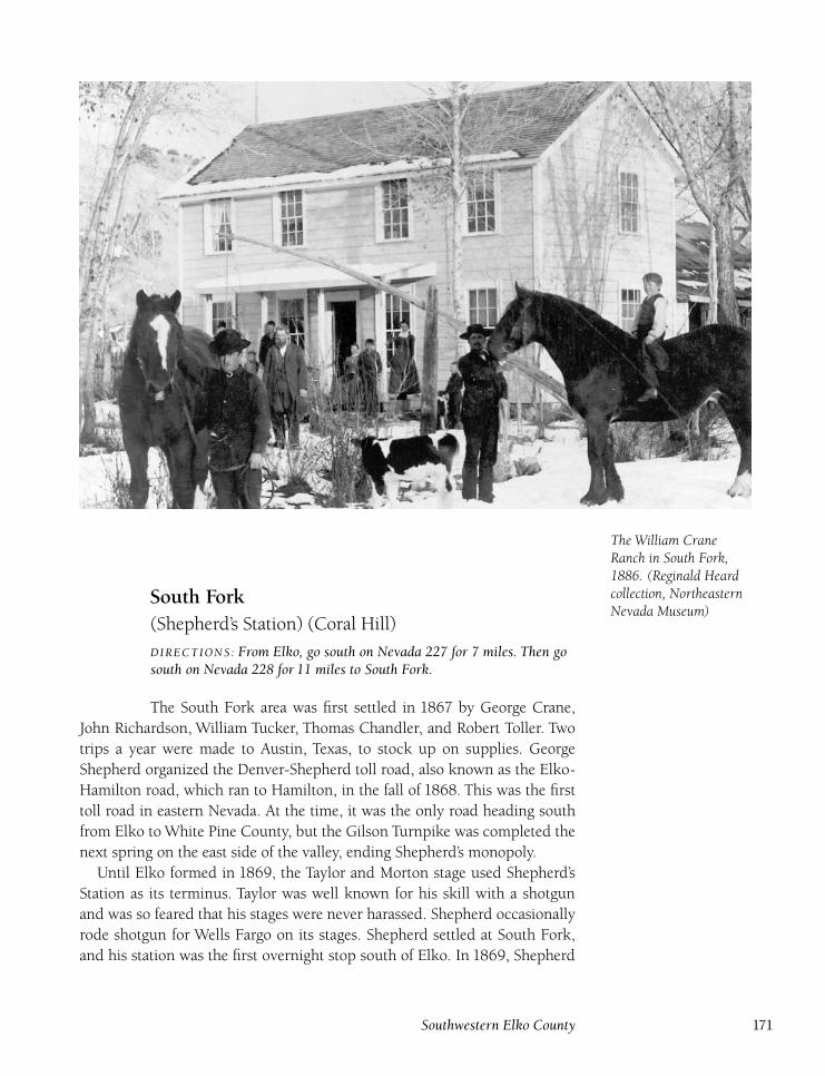
The William CraneRanch in South Fork,1886. (Reginald Heardcollection, NortheasternNevada Museum)
South Fork(Shepherd’s Station) (Coral Hill)
DIRECTIONS : From Elko, go south on Nevada 227 for 7 miles. Then gosouth on Nevada 228 for 11 miles to South Fork.
The South Fork area was first settled in 1867 by George Crane,
John Richardson, William Tucker, Thomas Chandler, and Robert Toller. Two
trips a year were made to Austin, Texas, to stock up on supplies. George
Shepherd organized the Denver-Shepherd toll road, also known as the Elko-
Hamilton road, which ran to Hamilton, in the fall of 1868. This was the first
toll road in eastern Nevada. At the time, it was the only road heading south
from Elko to White Pine County, but the Gilson Turnpike was completed the
next spring on the east side of the valley, ending Shepherd’s monopoly.
Until Elko formed in 1869, the Taylor and Morton stage used Shepherd’s
Station as its terminus. Taylor was well known for his skill with a shotgun
and was so feared that his stages were never harassed. Shepherd occasionally
rode shotgun for Wells Fargo on its stages. Shepherd settled at South Fork,
and his station was the first overnight stop south of Elko. In 1869, Shepherd
Southwestern Elko County 171
built a larger stage station and a hotel, which contained a bar, dining room,
and large wine cellar featuring French wines. A post office, named Coral Hill,
opened on March 25, 1870, but closed on July 19, 1871.
Shepherd’s toll road fell victim to the vicious stagecoach wars that occurred
during the 1870s. When Hill Beachey took over the Gilson road, his lower
prices and faster route hurt Shepherd. In1870, when the Woodruff and Ennor
line was changed to run on the Gilson road, Shepherd’s route was virtually
abandoned. Not one to give up, Shepherd opened a new toll road from Elko
to Bullion in 1870. On February 24, 1874, the post office reopened, named
South Fork although the name was changed back to Coral Hill on May 1, and
remained in operation until March 14, 1877. Shepherd was postmaster the
entire time.
Shepherd eventually quit the stage business and returned to ranching, but
his hotel remained open and was the ‘‘in’’ place for Elkoans to go for dances,
parties, holiday gatherings, and weddings. He always promised that ‘‘the table
would be full and the bar stocked.’’13 Elko County bought Shepherd’s old toll
road in 1882 and made it into a public road. Shepherd later served as Elko
County treasurer, followed by two terms as state senator.
In 1875, Shepherd founded the Mineral Soap mine. The soap was mar-
keted by the Elko Mineral Soap Company and was shipped to a soap factory
in Oakland, California. The Shoshone word ‘‘San-Too-Gah-Choi,’’ meaning
good soap, was printed on the wrapper. Sheperd’s soap won an award at the
World’s Fair at Chicago in 1894 because it was the only natural soap product
displayed. The soap was marketed until 1900.
In April 1885, Elko County mourned when George Shepherd died. Over
the years, memories of Shepherd’s Station have faded, but the area continues
to be the home of many ranches.With the completion of the South Fork Dam,
the area is now a popular recreation area. Not much remains at Shepherd’s
Station except some foundations and scattered debris.
Starr ValleyDIRECTIONS : Located generally south and east of Deeth. Nevada 230from Deeth to Welcome is in Starr Valley.
Starr Valley was named in honor of Lieutenant Augustus Washing-
ton Starr, who first settled in the valley in 1868 and was one of the original
establishers of Fort Halleck. While Starr left the valley in 1870 after being
discharged from the fort, many other settlers had come into the area in the
meantime and the population of the valley stood at sixty-nine in 1870.
Early settlers included George and John Ackler, Sam Davis, Samuel Mc-
Mullen, Lee St. Clair, Joseph Scott, John Crosson, David Johnston, Archy Wil-
172 Connecting the West
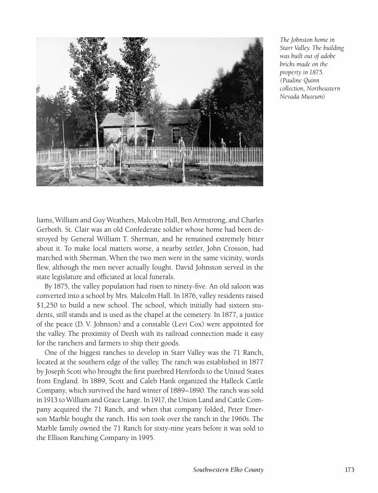
The Johnston home inStarr Valley. The buildingwas built out of adobebricks made on theproperty in 1875.(Pauline Quinncollection, NortheasternNevada Museum)
liams,William and Guy Weathers, Malcolm Hall, Ben Armstrong, and Charles
Gerboth. St. Clair was an old Confederate soldier whose home had been de-
stroyed by General William T. Sherman, and he remained extremely bitter
about it. To make local matters worse, a nearby settler, John Crosson, had
marched with Sherman. When the two men were in the same vicinity, words
flew, although the men never actually fought. David Johnston served in the
state legislature and officiated at local funerals.
By 1875, the valley population had risen to ninety-five. An old saloon was
converted into a school by Mrs. Malcolm Hall. In1876, valley residents raised
$1,250 to build a new school. The school, which initially had sixteen stu-
dents, still stands and is used as the chapel at the cemetery. In 1877, a justice
of the peace (D. V. Johnson) and a constable (Levi Cox) were appointed for
the valley. The proximity of Deeth with its railroad connection made it easy
for the ranchers and farmers to ship their goods.
One of the biggest ranches to develop in Starr Valley was the 71 Ranch,
located at the southern edge of the valley. The ranch was established in 1877
by Joseph Scott who brought the first purebred Herefords to the United States
from England. In 1889, Scott and Caleb Hank organized the Halleck Cattle
Company, which survived the hard winter of 1889–1890. The ranch was sold
in1913 toWilliam and Grace Lange. In1917, the Union Land and Cattle Com-
pany acquired the 71 Ranch, and when that company folded, Peter Emer-
son Marble bought the ranch. His son took over the ranch in the 1960s. The
Marble family owned the 71 Ranch for sixty-nine years before it was sold to
the Ellison Ranching Company in 1995.
Southwestern Elko County 173
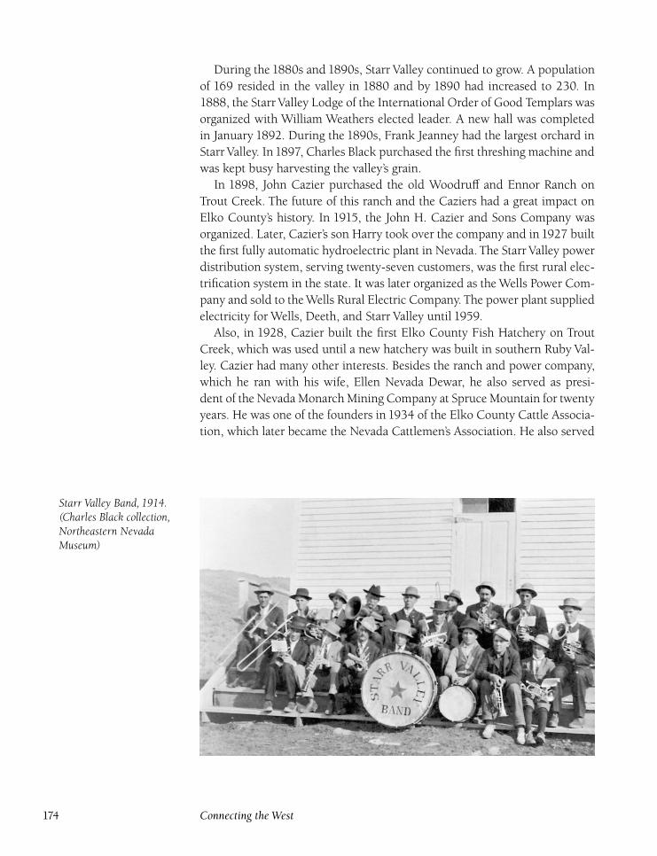
During the 1880s and 1890s, Starr Valley continued to grow. A population
of 169 resided in the valley in 1880 and by 1890 had increased to 230. In
1888, the Starr Valley Lodge of the International Order of Good Templars was
organized with William Weathers elected leader. A new hall was completed
in January 1892. During the 1890s, Frank Jeanney had the largest orchard in
Starr Valley. In1897, Charles Black purchased the first threshing machine and
was kept busy harvesting the valley’s grain.
In 1898, John Cazier purchased the old Woodruff and Ennor Ranch on
Trout Creek. The future of this ranch and the Caziers had a great impact on
Elko County’s history. In 1915, the John H. Cazier and Sons Company was
organized. Later, Cazier’s son Harry took over the company and in 1927 built
the first fully automatic hydroelectric plant in Nevada. The Starr Valley power
distribution system, serving twenty-seven customers, was the first rural elec-
trification system in the state. It was later organized as the Wells Power Com-
pany and sold to the Wells Rural Electric Company. The power plant supplied
electricity for Wells, Deeth, and Starr Valley until 1959.
Also, in 1928, Cazier built the first Elko County Fish Hatchery on Trout
Creek, which was used until a new hatchery was built in southern Ruby Val-
ley. Cazier had many other interests. Besides the ranch and power company,
which he ran with his wife, Ellen Nevada Dewar, he also served as presi-
dent of the Nevada Monarch Mining Company at Spruce Mountain for twenty
years. He was one of the founders in 1934 of the Elko County Cattle Associa-
tion, which later became the Nevada Cattlemen’s Association. He also served
Starr Valley Band, 1914.(Charles Black collection,Northeastern NevadaMuseum)
174 Connecting the West
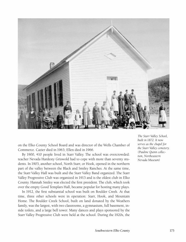
The Starr Valley School,built in 1872. It nowserves as the chapel forthe Starr Valley cemetery.(Pauline Quinn collec-tion, NortheasternNevada Museum)
on the Elko County School Board and was director of the Wells Chamber of
Commerce. Cazier died in 1963; Ellen died in 1966.
By 1900, 410 people lived in Starr Valley. The school was overcrowded:
teacher Nevada Hardesty Griswold had to cope with more than seventy stu-
dents. In 1903, another school, North Starr, or Hook, opened in the northern
part of the valley between the Black and Smiley Ranches. At the same time,
the Starr Valley Hall was built and the Starr Valley Band organized. The Starr
Valley Progressive Club was organized in 1913 and is the oldest club in Elko
County. Hannah Smiley was elected the first president. The club, which took
over the empty Good Templars Hall, became popular for hosting many plays.
In 1912, the first substantial school was built on Boulder Creek. At that
time, three other schools were in operation: Starr, Hook, and Mountain
Home. The Boulder Creek School, built on land donated by the Weathers
family, was the largest, with two classrooms, a gymnasium, full basement, in-
side toilets, and a large bell tower. Many dances and plays sponsored by the
Starr Valley Progressive Club were held at the school. During the 1920s, the
Southwestern Elko County 175
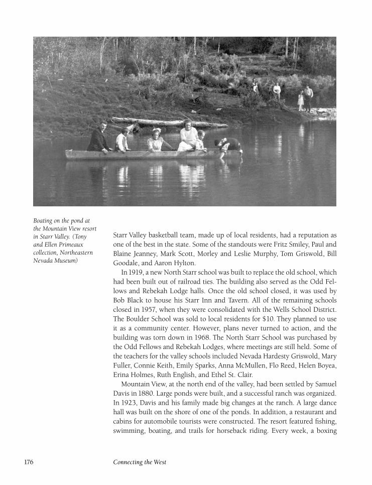
Boating on the pond atthe Mountain View resortin Starr Valley. (Tonyand Ellen Primeauxcollection, NortheasternNevada Museum)
Starr Valley basketball team, made up of local residents, had a reputation as
one of the best in the state. Some of the standouts were Fritz Smiley, Paul and
Blaine Jeanney, Mark Scott, Morley and Leslie Murphy, Tom Griswold, Bill
Goodale, and Aaron Hylton.
In1919, a new North Starr school was built to replace the old school, which
had been built out of railroad ties. The building also served as the Odd Fel-
lows and Rebekah Lodge halls. Once the old school closed, it was used by
Bob Black to house his Starr Inn and Tavern. All of the remaining schools
closed in 1957, when they were consolidated with the Wells School District.
The Boulder School was sold to local residents for $10. They planned to use
it as a community center. However, plans never turned to action, and the
building was torn down in 1968. The North Starr School was purchased by
the Odd Fellows and Rebekah Lodges, where meetings are still held. Some of
the teachers for the valley schools included Nevada Hardesty Griswold, Mary
Fuller, Connie Keith, Emily Sparks, Anna McMullen, Flo Reed, Helen Boyea,
Erina Holmes, Ruth English, and Ethel St. Clair.
Mountain View, at the north end of the valley, had been settled by Samuel
Davis in 1880. Large ponds were built, and a successful ranch was organized.
In 1923, Davis and his family made big changes at the ranch. A large dance
hall was built on the shore of one of the ponds. In addition, a restaurant and
cabins for automobile tourists were constructed. The resort featured fishing,
swimming, boating, and trails for horseback riding. Every week, a boxing
176 Connecting the West
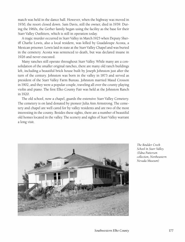
match was held in the dance hall. However, when the highway was moved in
1930, the resort closed down. Sam Davis, still the owner, died in 1939. Dur-
ing the 1960s, the Gerber family began using the facility as the base for their
Starr Valley Outfitters, which is still in operation today.
A tragic murder occurred in Starr Valley in March1925 when Deputy Sher-
iff Charlie Lewis, also a local resident, was killed by Guadaloupe Acosta, a
Mexican prisoner. Lewis laid in state at the StarrValley Chapel and was buried
in the cemetery. Acosta was sentenced to death, but was declared insane in
1926 and never executed.
Many ranches still operate throughout Starr Valley. While many are a con-
solidation of the smaller original ranches, there are many old ranch buildings
left, including a beautiful brick house built by Joseph Johnston just after the
turn of the century. Johnston was born in the valley in 1873 and served as
president of the Starr Valley Farm Bureau. Johnston married Maud Crosson
in1902, and they were a popular couple, traveling all over the county playing
violin and piano. The first Elko County Fair was held at the Johnston Ranch
in 1920.
The old school, now a chapel, guards the extensive Starr Valley Cemetery.
The cemetery is on land donated by pioneer Julia Ann Armstrong. The ceme-
tery and chapel are well cared for by valley residents and are two of the most
interesting in the county. Besides these sights, there are a number of beautiful
old homes located in the valley. The scenery and sights of Starr Valley warrant
a long visit.
The Boulder CreekSchool in Starr Valley.(Edna Pattersoncollection, NortheasternNevada Museum)
Southwestern Elko County 177
Ten Mile Station(Beachey Station) (Clayton Station)
DIRECTIONS : From Elko, go east on Nevada 227 for 6.9 miles. Gosouth on Nevada 228 for 3 miles to Ten Mile Station.
Ten Mile Station was established as a stop on the Elko-Hamilton
road, or Gilson Turnpike, in 1869. The station was located on the south bank
of Ten Mile Creek and was run by George Clayton. During the 1890s, John
Yowell took over the ranch and station.
A school opened at the ranch in1903 and was in operation off and on until
the early 1920s. By this time, the stages had long since stopped running. Dur-
ing the1920s, the old Ten Mile Station was used as a speakeasy, run by Evelyn
‘‘Little Eva’’ Mason. Federal agents closed the operation in 1929. A ranch is
still in operation at the station site today, and a couple old stone buildings
remain.
Toller’s StationDIRECTIONS : Located near the junction of Nevada 227 and Nevada228.
Toller’s Station was the first stop south of Elko on the Gilson Turn-
pike, a toll road established in 1869. The station was the entrance to the toll
road. Fees were collected by proprietor George Toller. Once the toll road be-
came a public road, the need for the station ended, and it was abandoned by
the mid-1870s. Nothing is left at the site today.
TonkaDIRECTIONS : Located 5 miles east of Carlin on the Union Pacific, justsouth of I-80.
Tonka now serves as a signal station for the Union Pacific (on the
former Western Pacific and Southern Pacific main lines), located where
the two railroads join just east of Carlin. Tonka was named for the seed of the
cucimana plant, which was used to flavor snuff and came into being during
the construction of Tunnel 1 on the Southern Pacific, completed in February
1903, between here and Vivian. In addition to serving as a siding, section-
houses and cattle pens were built.
In February 1939, local rancher Manuel Machado was killed at Tonka
while he was herding cattle to be loaded on the train. An automobile skidded
178 Connecting the West
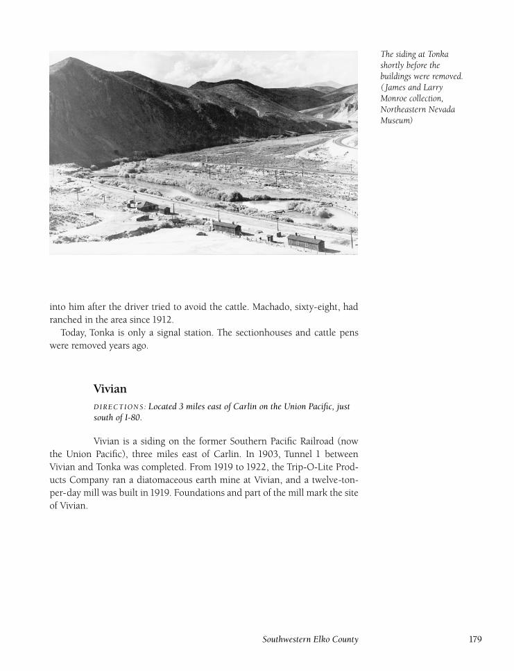
The siding at Tonkashortly before thebuildings were removed.( James and LarryMonroe collection,Northeastern NevadaMuseum)
into him after the driver tried to avoid the cattle. Machado, sixty-eight, had
ranched in the area since 1912.
Today, Tonka is only a signal station. The sectionhouses and cattle pens
were removed years ago.
VivianDIRECTIONS : Located 3 miles east of Carlin on the Union Pacific, justsouth of I-80.
Vivian is a siding on the former Southern Pacific Railroad (now
the Union Pacific), three miles east of Carlin. In 1903, Tunnel 1 between
Vivian and Tonka was completed. From 1919 to 1922, the Trip-O-Lite Prod-
ucts Company ran a diatomaceous earth mine at Vivian, and a twelve-ton-
per-day mill was built in 1919. Foundations and part of the mill mark the site
of Vivian.
Southwestern Elko County 179
Wear’s Station(Four Mile Station)
DIRECTIONS : Located 4 miles south of Elko on the old White Pine road.
Wear’s Station was a station on the old White Pine road. The toll
station, run by R. G. Wear, was the beginning of the Denver-Shepherd Toll
Road and George Shepherd’s toll road to Bullion, built in 1870.
The station was abandoned when the Gilson Turnpike, on the east side
of the valley, became the major thoroughfare to White Pine County. Shep-
herd’s Bullion road became a public road, and the need for the toll station was
eliminated. Nothing remains at the station site.
Williams StationDIRECTIONS : Located 4 miles northwest of Jiggs on the Twin Bridgesroad.
Williams Station, located near where Smith Creek joins Hunting-
ton Creek, was a stop on the Denver-Shepherd White Pine Toll Road begin-
ning in 1869. The station was run by Warren Williams, but was abandoned
once the Gilson road on the east side of the valley became the preferred route
to White Pine. Williams continued to ranch in the area for a number of years
before leaving. Nothing remains of the stage station today.
180 Connecting the West
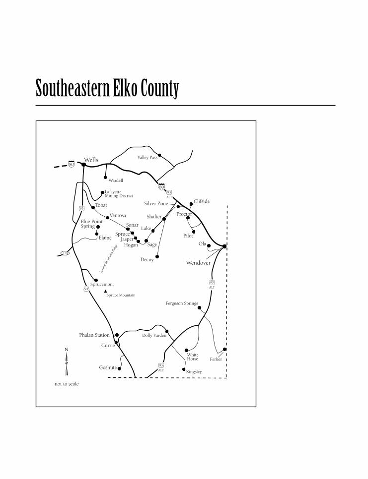
Southeastern Elko County
Blue Point SpringDIRECTIONS : From Tobar, take a gravel road southeast for 4 miles toElaine. Located 2 miles north of Elaine.
Blue Point Spring was originally a small ranch incorporated into
the Wells-Spruce Mountain stagecoach stop. The stop was located two miles
north of Elaine, and was used as a horse-changing point with limited over-
night accommodations and meals available. Once the boom at Spruce Moun-
tain faded in the late 1870s, the stagecoach line folded, and Blue Point Spring
returned to ranching. The ranch was abandoned in the 1890s. Today only a
couple of log buildings struggle against the elements to remain standing.
Clifside(Cliffside)
DIRECTIONS : Located 3 miles east of Silver Zone Pass, just north ofI-80.
Clifside, as it is listed today, started as a small station on the main
line of the Western Pacific Railroad (now the Union Pacific Railroad), but
saw very little use and was soon demoted to signal-station status. The small
platform and house that served as the station were dismantled in the 1920s.
Currie(Bellinger’s Spring)
DIRECTIONS : Located 62 miles south of Wells, on U.S. 93.
The springs at Currie were used as a stop on the Toano and Cherry
Creek roads long before the town existed. The town of Currie formed in 1906
when the Nevada Northern Railway was constructed. Tracks were built to
Currie on May 18. The first passenger train arrived on May 22, although the
railroad was not completed to Ely until September 1906. Triweekly service
began on June 2. The Nevada Northern built a depot that served passengers,
shipped freight and livestock, and was the home of the railway agent.
The town was named for Joseph Currie, who had been owner of a ranch
on nearby Nelson Creek since the 1880s. The first substantial building con-
structed was the two-story Currie Hotel, owned by Currie. A post office,
housed in the hotel, opened on August 8 with Currie as postmaster. Another
hotel, the Steptoe, was soon built by Henry Phalan, a local rancher.
182 Connecting the West
Currie developed into the transportation and livestock center for south-
eastern Elko County with a consistent population of twenty. However, a diph-
theria epidemic in July 1907 caused the entire station to be quarantined, but
luckily, prompt action prevented any deaths. In 1908, Earl and Leona Rey-
nolds moved to Currie to open a new telegraph office and railroad agency
station. They also opened a store with Jim Byron. A one-room schoolhouse
was built in 1908 near the Phalan Ranch. Two years later, due to increased
demand, two more rooms were added to the school, one of which was used
by Monroe, the teacher, for her home. The school also served as the Currie
civic center, and was the scene of the local dances.
By 1910, Currie was in its heyday. Besides the depot, hotels, and school,
a store and saloon also opened. In addition, the railroad constructed a sec-
tionhouse and turntable. Many jackrabbits lived in the Currie area, and the
Nevada Northern ran special Sunday trains from Ely for rabbit and rattlesnake
hunting. Joseph Currie died in October of 1912 and was buried in Cherry
Creek.
The Reynolds soon bought out Byron and quit working for the railroad to
build a new store. The post office was moved to the store, with Leona Rey-
nolds as assistant postmaster to her husband. The Steptoe Hotel was taken
down in the 1910s, and the Currie Merchandise Store, which housed the post
office, was built on the site. Currie continued to serve the railroad, and when
the road from Wells to Ely was paved, a gas station and store were built. In
1941, the Nevada Northern Railway discontinued passenger and mail service
at Currie, due to slow business and the departure from Currie of the depot
agent, Jerry Cormer. The limited business did not justify finding a replace-
ment agent.
Freight and ore trains continued to rumble through Currie until the1980s,
and the post office remained open until May 28, 1971. In sixty-five years
of operation, postmasters included Earl Reynolds, Alice Fappiano, Samuel
Hagans, Manuel Edo, and Louise Lear. Edo had the longest tenure, from1926
to1961. The original Currie depot still stands, as does the Currie Hotel. Other
buildings from Currie’s early years also survive. A gas station and store are
in operation, and Currie has a highway maintenance station. The town has a
current population of about twenty.
Southeastern Elko County 183
DecoyDIRECTIONS : From the Shafter interchange on I-80, 28 miles northwestof Wendover, head southwest along the railroad for 6 miles to Shafter. AtShafter, head south on a rough road along Nevada Northern Railwayline for 12 miles to Decoy.
Decoy came into being with the construction of the Nevada North-
ern Railway in1906, first as a siding until the Decoy Mining District was orga-
nized and began producing manganese ore from mines located eight miles
east. At that time, loading platforms were built for loading the ore.
Before mining, the area around Decoy was used for dry farming, a farming
method that was popular during the 1910s. By 1915, as many as twenty dry
farms were located around Decoy, but a combination of drought and an ex-
cess of rabbits caused the failure of 70 percent of the crops. Although more
established dry-farming communities like Metropolis and Tobar kept going,
the relatively new farms at Decoy had a high failure rate. The year 1916 was
even more devastating, and of the seven farms left, five failed completely. By
1917, all dry farming around Decoy had ended.
In 1917, the Darky (Black Rock) mine, owned by Holmquist and Johnson,
began producing manganese, shipping 4,500 tons of ore in 1917 and 1918
through the Decoy siding. However, this was the only significant production
from the district. Duval International (now known as Battle Mountain Gold
Company) did some exploratory drilling in the1980s, and a microscopic gold
deposit was outlined but has not been mined yet.
Ruins of the loading ramps and sectionhouse mark the Decoy siding. A
number of old farming homesteads dot the area west of the railroad tracks.
At the Darky mine, collapsed shafts, an open pit, and mine dumps remain.
ElaineDIRECTIONS : From Ventosa, take a gravel road southwest for 3 miles toElaine.
Elaine was a stop on the Wells-Sprucemont stagecoach line dur-
ing the 1870s and 1880s. Located on a small ranch on the east side of Snow
Water Lake, the station was used as a horse-changing stop and for meals for
stage passengers. A short-lived post office operated at Elaine from May 10 to
December 9, 1880, with Frank Heattman and William Scott as postmasters.
When Sprucemont died in the early 1880s, the stage stopped running, and
the small ranch was unable to keep operating. More than one hundred years
after abandonment, only some scattered debris remains at the Elaine site.
184 Connecting the West
Goshute(Gosiute) (Goshiute)
DIRECTIONS : From Currie, go south on U.S. 93 for 6 miles. Turn rightand continue for 2 miles to Goshute.
Named for a local Indian tribe, Goshute was a stop and siding on
the Nevada Northern Railway. During the railroad’s construction in 1906, a
small stationhouse and boardinghouse were built. Nearby Goshute Lake was
named by E. G. Beckwith during the surveying of a Pacific railroad route
in 1855. A post office, spelled Gosiute, opened on January 22, 1907, with
Charles Harlow as postmaster. The office closed on September 30 of the same
year. Only a couple of foundations are left today.
HoganDIRECTIONS : From Wells, take U.S. 93 south 14 miles to the Tobarturnoff. Turn left and go 4 miles to Tobar. At the Tobar site, take theroad parallel to the tracks southeast for 17 miles to Hogan.
Hogan is a siding on the former Western Pacific Railroad (now the
Union Pacific) southeast of Ventosa and southwest of Shafter. Nothing sub-
stantial was ever built at the site and only the concrete footings of a water
tower remain.
JasperDIRECTIONS : Located 2 miles northwest of Hogan (see above).
Jasper was established in 1910 as a signal station on the Western
Pacific Railroad (now the Union Pacific), serving for many years as a shipping
point for Spruce Mountain ore. It was named for Jasper Harrell, a mining man
at Spruce Mountain. Mail for Spruce Mountain was shipped through Jasper.
In April 1926, due to increased demand from a revival at the Spruce Moun-
tain mines, the Western Pacific built a telegraph office, an express and freight
warehouse, and a couple of small houses for railroad employees.
In January 1932, eight cars from a trail derailed inside the Jasper Tunnel,
and Western Pacific trains had to be detoured on the Southern Pacific tracks
via Cobre until repairs were made. A tragedy occurred in the tunnel in Sep-
tember 1936 when a young boy, John Stocks of Moab, Utah, was thrown off a
train and killed. He was buried in potter’s field in Elko, and his identity took
several months to establish because he had been traveling alone.
When the Spruce Mountain revival faded in the late 1930s, the Western
Southeastern Elko County 185
Pacific closed the telegraph office and warehouse, and all of the buildings
were dismantled.When theWestern Pacific rebuilt its rails in the1970s, Jasper
siding was eliminated. Only concrete foundations mark the site.
Lake(Luke)
DIRECTIONS : Located 4 miles southwest of Shafter on the Union Pacific.
Lake, listed as Luke on some maps, was a former siding between
Shafter and Hogan on theWestern Pacific Railroad (now the Union Pacific). In
March 1902, helper engine 2618’s boiler exploded while moving cars on the
siding, killing William Wilton, the engineer, Leroy Munsee, the fireman, and
William Myers, a soldier. Another tragedy occurred in February 1951 when a
section worker, Regino Tabarez, was found frozen to death between Lake and
Shafter. He was stationed at Lake, and had hiked to the store in Shafter but
was caught in a snowstorm on his way back and died.
Lake siding was eliminated when the Union Pacific rebuilt their line during
the 1980s. Only the concrete foundations of the water tank and sectionhouse
mark the site.
OlaDIRECTIONS : Located 5 miles west of Wendover on the Union Pacific.
Ola is a signal station and siding on the former Western Pacific
Railroad (now the Union Pacific). Ola was established in1910, and is still used
today. The original signal shack still stands at the site.
Phalan StationDIRECTIONS : From Currie, go north on U.S. 93 for 4 miles. Turn rightand continue for 1 mile to Phalan Station.
Phalan Station was a stop on the Cherry Creek road beginning
in the 1880s. The station was established by John Phalan, a former miner at
Cherry Creek, who bought the ranch from Eddie Lichlyter. The Wells-Cherry
Creek stagecoach line ran for many years and was extended to Ely in the
1890s.
During the 1890s, Phalan ran covered coaches on the line. At the same
time, his ranch grew, and at its peak he had more than 1,400 head of cattle
186 Connecting the West
on his range. However, once interest in Cherry Creek and Ely faded, Phalan
sold the ranch and moved away. The Phalan Creek Ranch is still in operation
today, although not much remains from the early days. Some books and maps
incorrectly list the name of the ranch and creek as Phalen.
Pilot(Pilot Peak) (Pilot Peak Mining District)
DIRECTIONS : Pilot Peak is 18 miles north of Wendover east of PilotRoad. Pilot is located 10 miles northwest of Wendover on the UnionPacific.
Pilot Peak was a landmark for emigrants crossing the salt flats of
Utah on their way to California. The peak was named by John C. Frémont
in 1845, after the first emigrant group, the Bartleson-Bidwell Party, came
through in 1841.
The first mine on Pilot Peak was the Pilot Peak mine, owned by F. H. Dar-
ling. In July 1878, Walter Brown discovered small silver deposits and orga-
nized the Pilot Peak Mining District. Darling owned the Thistle and American
Flag mines.With extreme confidence, Brown also filed for a mill site, but little
activity ensued, and if there was any production during the1870s, it was very
small. Mining interest did not return until 1908 when J. C. Hillman, a saloon
owner in Cobre, began working some claims, as did William Porter. However,
little was produced.
With the completion of the Western Pacific () Railroad in 1907, a stop
and signal station named Pilot opened. The railroad built a couple of build-
ings to house section crews and their families. A school opened in 1910, with
Edna Ross serving as the first teacher. The school operated until the 1920s.
Other teachers included Alice Watkins, L. G. Hodges, and Margaret North-
rup. The Pilot station was phased out in the 1920s, and the section crews
moved elsewhere. The dismantled the buildings and moved them to other
stations on the railroad.
From 1934 to 1938, a number of small mines in the area were worked, in-
cluding the Badger, Crazy Dutchman, American Flag, and Western Star. Total
production from this activity amounted to 636 ounces of silver, 22 ounces of
gold, and 833 pounds of copper. There was no other mining activity until the
1980s, when the Pilot Limestone Quarry, which had been discovered in 1960
but not mined by the Utah Construction and Mining Company, was taken
over by Continental Lime, Inc. A 400-ton (daily capacity) lime plant, still in
operation, was completed in 1989. It produced 103,000 tons of quicklime in
1990.
There is not much left at the various sites. At Pilot, on the railroad, only a
Southeastern Elko County 187
couple of concrete foundations and scattered debris mark the site. Only small
ore dumps and collapsed workings are left at the mines in Miners Canyon.
Evidence of the California Trail exists nearby; wagon ruts and rust marks on
the rocks show sections of the trail, which have been marked by members of
the Oregon-California Trails Association.
ProctorDIRECTIONS : From Wendover, head east on I-80 for 16 miles to theProctor turnoff. Head south for ½ mile to Proctor, adjacent to railroadtracks.
Proctor first appeared in 1872 when Frank Proctor (for whom the
place is named) discovered silver ore here, leading to the formation of the
Proctor Mining district. After a brief rush to the area, the mines were aban-
doned when the veins ran out. When the Western Pacific Railroad was com-
pleted in 1909, Proctor became a stop and signal station for the railroad,
leading to a revival of mining interest.
The Silver Standard and Star mines, four miles south of the Proctor siding,
were later discovered. The railroad’s proximity to the mines led to extensive
exploration. The Western Pacific Railroad began construction on the Arnold
Loop, with the small town of Proctor as the base for construction workers,
but the new route on the loop bypassed Proctor’s location. In March 1910,
John Cardron announced plans to build a forty-room hotel at Proctor. When
he realized that Proctor would not survive after Arnold Loop was completed
and the town was bypassed, he quietly cancelled his plans.
The Arnold Loop was completed in 1914, and Proctor was abandoned.
Interest in mining faded. The only recorded production from the Proctor
district took place from 1917 to 1921, with 38 pounds of copper and 304
ounces of silver produced from the Silver Hoard and Nick Del Duke (Key-
stone) Mines. Only mine dumps are left, and nothing remains at the Proctor
station.
SageDIRECTIONS : From Wells, take U.S. 93 south for 14 miles to the Tobarturnoff. Turn left and travel 4 miles to Tobar. At the Tobar site, take theroad parallel to the tracks southeast, then north, for 22 miles to Sage.
Sage was a siding on the Western Pacific Railroad (now the Union
Pacific) between Shafter and Spruce. A small sectionhouse and water tank
were built at Sage and only their concrete foundations are left.
188 Connecting the West
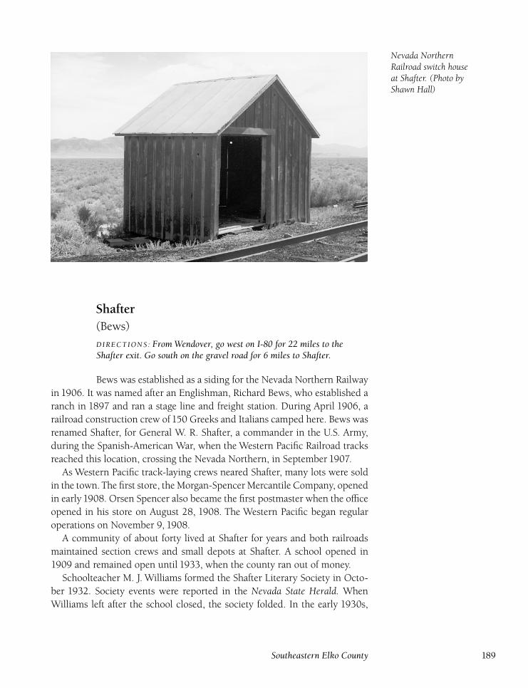
Nevada NorthernRailroad switch houseat Shafter. (Photo byShawn Hall)
Shafter(Bews)
DIRECTIONS : From Wendover, go west on I-80 for 22 miles to theShafter exit. Go south on the gravel road for 6 miles to Shafter.
Bews was established as a siding for the Nevada Northern Railway
in 1906. It was named after an Englishman, Richard Bews, who established a
ranch in 1897 and ran a stage line and freight station. During April 1906, a
railroad construction crew of 150 Greeks and Italians camped here. Bews was
renamed Shafter, for General W. R. Shafter, a commander in the U.S. Army,
during the Spanish-American War, when the Western Pacific Railroad tracks
reached this location, crossing the Nevada Northern, in September 1907.
As Western Pacific track-laying crews neared Shafter, many lots were sold
in the town.The first store, the Morgan-Spencer Mercantile Company, opened
in early 1908. Orsen Spencer also became the first postmaster when the office
opened in his store on August 28, 1908. The Western Pacific began regular
operations on November 9, 1908.
A community of about forty lived at Shafter for years and both railroads
maintained section crews and small depots at Shafter. A school opened in
1909 and remained open until 1933, when the county ran out of money.
Schoolteacher M. J. Williams formed the Shafter Literary Society in Octo-
ber 1932. Society events were reported in the Nevada State Herald. When
Williams left after the school closed, the society folded. In the early 1930s,
Southeastern Elko County 189
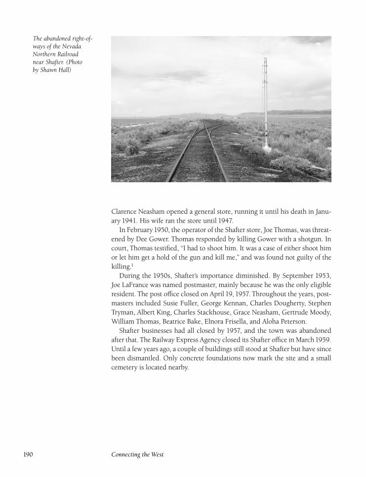
The abandoned right-of-ways of the NevadaNorthern Railroadnear Shafter. (Photoby Shawn Hall)
Clarence Neasham opened a general store, running it until his death in Janu-
ary 1941. His wife ran the store until 1947.
In February1950, the operator of the Shafter store, Joe Thomas, was threat-
ened by Dee Gower. Thomas responded by killing Gower with a shotgun. In
court, Thomas testified, ‘‘I had to shoot him. It was a case of either shoot him
or let him get a hold of the gun and kill me,’’ and was found not guilty of the
killing.1
During the 1950s, Shafter’s importance diminished. By September 1953,
Joe LaFrance was named postmaster, mainly because he was the only eligible
resident. The post office closed on April 19, 1957. Throughout the years, post-
masters included Susie Fuller, George Kennan, Charles Dougherty, Stephen
Tryman, Albert King, Charles Stackhouse, Grace Neasham, Gertrude Moody,
William Thomas, Beatrice Bake, Elnora Frisella, and Aloha Peterson.
Shafter businesses had all closed by 1957, and the town was abandoned
after that. The Railway Express Agency closed its Shafter office in March1959.
Until a few years ago, a couple of buildings still stood at Shafter but have since
been dismantled. Only concrete foundations now mark the site and a small
cemetery is located nearby.
190 Connecting the West
Silver ZoneDIRECTIONS : Silver Zone Pass is located 2 miles southeast of theShafter exit on I-80. Silver Zone siding (on the Union Pacific) is ½ milesouth of the highway.
Silver Zone Pass was part of the Hastings Cutoff of the California
Emigrant Trail. The Donner Party passed through in 1846 on the way to their
deaths in the Sierra. Signs of the trail are still visible in the area. The name
Silver Zone came about after Major Robert Goldman discovered silver nearby
in May 1872. In the summer of 1872, a small boom camp formed, and Moffitt
and Gassett began running a stage and freight line from Toano.
Active mines included the Silver Zone, Wilson, Currier and Goldman,
Poor Men’s, Star of the West, Governor Bradley, and Delmonico. A post office
opened on August 27, 1872, with Charles Toyer as postmaster. However, the
boom went bust by the next summer, and the camp was empty by fall, forc-
ing the post office to close on September 10, 1873. Some mines were worked
again in the mid-1880s, including the Golden King (A. P. Shively), Ledger
(Shively and Peter Blair), Golden Prize (Lizzie Shively), and Little Treasure
(William Riley, N. M. Pratt, and Don Wickizen).
Silver Zone enjoyed a revival in 1907 when a work camp formed for the
construction of the Western Pacific Railroad through the pass. T. J. Connelly
built a saloon a short distance away from the camp, but it violated the three-
mile limit for alcohol consumption set by the Western Pacific. Many workers
were arrested, and finally Connelly’s license was revoked. When the railroad
was completed, the camp was disbanded, and Silver Zone became a siding
and section-crew location.
Silver Zone Pass is the highest point on the former Western Pacific (now
the Union Pacific) between Oakland and Salt Lake City at 5,875 feet. The pass
has been the scene of many railroad accidents. The most serious took place
in March 1936 when the boiler of helper engine 19 exploded, killing brake-
men Bud Howell and C. E. Dickerdorff. The men were in a caboose just ahead
of the locomotive, and were thrown through the roof. The conductor, Fred
Black, also in the caboose, was scalded by steam, dying five days later. Three
men in the nearby sectionhouse were also scalded, but survived.
In 1942, tungsten was discovered at the Silver Zone and Great Western
mines, owned by Lester Hice, Robert Hice, and O. T. McVey. The mines were
later sold to the Rare Metals Company of Lovelock, and Robert Hice was hired
as foreman. About two hundred units of tungsten were produced before the
company left the district. While trains still traverse Silver Zone Pass, there is
little left of the settlement except concrete ruins at the railroad siding. At the
old mines, a few signs of the short-lived boom camp remain.
Southeastern Elko County 191
SonarDIRECTIONS : From Wells, take U.S. 93 south for 14 miles to the Tobarturnoff. Turn left and travel for 4 miles to Tobar. At the Tobar site, takethe road parallel to the tracks southeast for 11 miles to Sonar.
Sonar, a signal station on the former Western Pacific Railroad (now
the Union Pacific), is located between Ventosa and Spruce. The only known
mention of Sonar in historical sources is that Robert Anderson was killed by
a train at the station in June 1947. No structures were built at Sonar.
Tobar(Clover City)
DIRECTIONS : From Wells, go south on U.S. 93 for 14 miles. Turn leftand continue for 4 miles to Tobar.
In 1908, Tobar was established as a construction camp for the
Western Pacific Railroad. A substantial depot was built, and a small town
began to form. During construction, the owner of the Rag Saloon, which was
housed in a canvas tent, put up a sign that simply said ‘‘To Bar.’’ The two
words were put together, and the new town had a name, Tobar.
Although Tobar was essentially a railroad town, it also was the center of a
planned dry-farming community. The first dry farmers were Gover, Fred, and
Ernest Wood, and Sidney Curtiss. By 1910, there were sixteen homesteads
around Tobar. By 1911, there were about seventy-five people and twenty
dwellings in the town and surrounding area. Due to demand, a school, later
moved to Tobar in 1913, was built at the Munson Ranch near Tobar. A post
office opened on December 20, 1911, with Mack Backstead as postmaster.
In 1912, the railroad began selling land at Tobar for $4 to $11 per acre;
these prices attracted even more people to Tobar. In June 1912, the Tobar Eye-Opener was supposed to begin publication under the guidance of local attor-
ney Frank Spear. However, no issues have ever been located, and it seems
likely that the newspaper was never actually published.
Tobar, besides becoming a dry-farming area, also became the main ship-
ping point for ore from mines at Warm Creek and Spruce Mountain and pro-
duce from Clover Valley. During 1913, the Tobar settlement greatly expanded
with A. B. Hoaglin promoting the local farming area. Hoaglin also platted a
townsite and built a two-story hotel, called the ‘‘White Elephant’’ by local
residents.
Advertisements in newspapers throughout the country attracted many
people to Tobar, but the promotional material contained false information.
The brochures heralded Tobar as the home of the ‘‘big red apple,’’ even though
192 Connecting the West
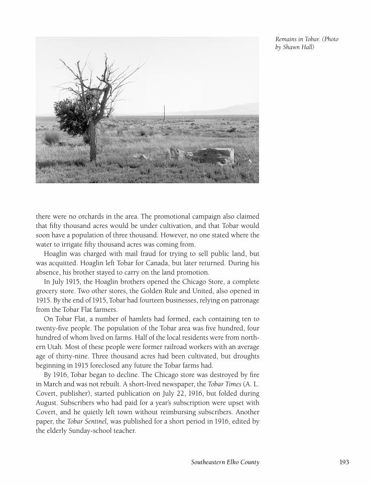
Remains in Tobar. (Photoby Shawn Hall)
there were no orchards in the area. The promotional campaign also claimed
that fifty thousand acres would be under cultivation, and that Tobar would
soon have a population of three thousand. However, no one stated where the
water to irrigate fifty thousand acres was coming from.
Hoaglin was charged with mail fraud for trying to sell public land, but
was acquitted. Hoaglin left Tobar for Canada, but later returned. During his
absence, his brother stayed to carry on the land promotion.
In July 1915, the Hoaglin brothers opened the Chicago Store, a complete
grocery store. Two other stores, the Golden Rule and United, also opened in
1915. By the end of1915, Tobar had fourteen businesses, relying on patronage
from the Tobar Flat farmers.
On Tobar Flat, a number of hamlets had formed, each containing ten to
twenty-five people. The population of the Tobar area was five hundred, four
hundred of whom lived on farms. Half of the local residents were from north-
ern Utah. Most of these people were former railroad workers with an average
age of thirty-nine. Three thousand acres had been cultivated, but droughts
beginning in 1915 foreclosed any future the Tobar farms had.
By 1916, Tobar began to decline. The Chicago store was destroyed by fire
in March and was not rebuilt. A short-lived newspaper, the Tobar Times (A. L.
Covert, publisher), started publication on July 22, 1916, but folded during
August. Subscribers who had paid for a year’s subscription were upset with
Covert, and he quietly left town without reimbursing subscribers. Another
paper, the Tobar Sentinel, was published for a short period in 1916, edited by
the elderly Sunday-school teacher.
Southeastern Elko County 193
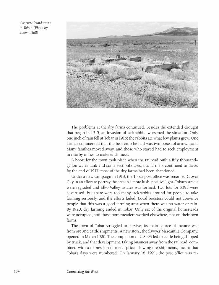
Concrete foundationsin Tobar. (Photo byShawn Hall)
The problems at the dry farms continued. Besides the extended drought
that began in 1915, an invasion of jackrabbits worsened the situation. Only
one inch of rain fell at Tobar in1916; the rabbits ate what few plants grew. One
farmer commented that the best crop he had was two boxes of arrowheads.
Many families moved away, and those who stayed had to seek employment
in nearby mines to make ends meet.
A boost for the town took place when the railroad built a fifty thousand–
gallon water tank and some sectionhouses, but farmers continued to leave.
By the end of 1917, most of the dry farms had been abandoned.
Under a new campaign in 1918, the Tobar post office was renamed Clover
City in an effort to portray the area in a more lush, positive light. Tobar’s streets
were regraded and Elko Valley Estates was formed. Two lots for $395 were
advertised, but there were too many jackrabbits around for people to take
farming seriously, and the efforts failed. Local boosters could not convince
people that this was a good farming area when there was no water or rain.
By 1920, dry farming ended in Tobar. Only six of the original homesteads
were occupied, and those homesteaders worked elsewhere, not on their own
farms.
The town of Tobar struggled to survive; its main source of income was
from ore and cattle shipments. A new store, the Sawyer Mercantile Company,
opened in March 1920. The completion of U.S. 93 led to cattle being shipped
by truck, and that development, taking business away from the railroad, com-
bined with a depression of metal prices slowing ore shipments, meant that
Tobar’s days were numbered. On January 18, 1921, the post office was re-
194 Connecting the West
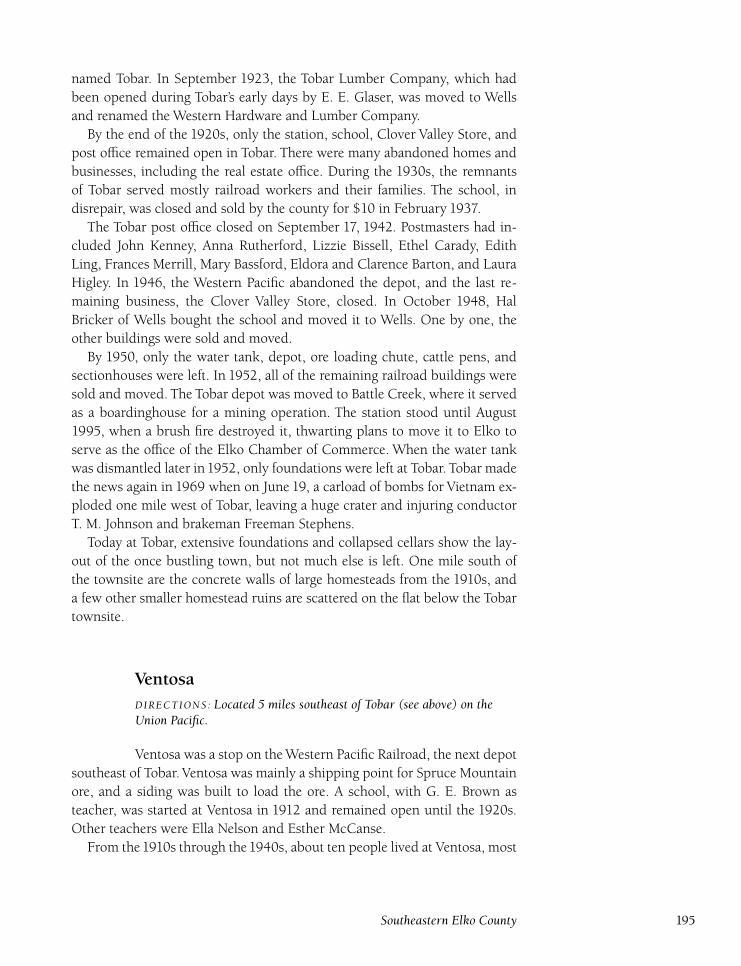
named Tobar. In September 1923, the Tobar Lumber Company, which had
been opened during Tobar’s early days by E. E. Glaser, was moved to Wells
and renamed the Western Hardware and Lumber Company.
By the end of the 1920s, only the station, school, Clover Valley Store, and
post office remained open in Tobar. There were many abandoned homes and
businesses, including the real estate office. During the 1930s, the remnants
of Tobar served mostly railroad workers and their families. The school, in
disrepair, was closed and sold by the county for $10 in February 1937.
The Tobar post office closed on September 17, 1942. Postmasters had in-
cluded John Kenney, Anna Rutherford, Lizzie Bissell, Ethel Carady, Edith
Ling, Frances Merrill, Mary Bassford, Eldora and Clarence Barton, and Laura
Higley. In 1946, the Western Pacific abandoned the depot, and the last re-
maining business, the Clover Valley Store, closed. In October 1948, Hal
Bricker of Wells bought the school and moved it to Wells. One by one, the
other buildings were sold and moved.
By 1950, only the water tank, depot, ore loading chute, cattle pens, and
sectionhouses were left. In 1952, all of the remaining railroad buildings were
sold and moved. The Tobar depot was moved to Battle Creek, where it served
as a boardinghouse for a mining operation. The station stood until August
1995, when a brush fire destroyed it, thwarting plans to move it to Elko to
serve as the office of the Elko Chamber of Commerce. When the water tank
was dismantled later in1952, only foundations were left at Tobar. Tobar made
the news again in 1969 when on June 19, a carload of bombs for Vietnam ex-
ploded one mile west of Tobar, leaving a huge crater and injuring conductor
T. M. Johnson and brakeman Freeman Stephens.
Today at Tobar, extensive foundations and collapsed cellars show the lay-
out of the once bustling town, but not much else is left. One mile south of
the townsite are the concrete walls of large homesteads from the 1910s, and
a few other smaller homestead ruins are scattered on the flat below the Tobar
townsite.
VentosaDIRECTIONS : Located 5 miles southeast of Tobar (see above) on theUnion Pacific.
Ventosa was a stop on the Western Pacific Railroad, the next depot
southeast of Tobar. Ventosa was mainly a shipping point for Spruce Mountain
ore, and a siding was built to load the ore. A school, with G. E. Brown as
teacher, was started at Ventosa in 1912 and remained open until the 1920s.
Other teachers were Ella Nelson and Esther McCanse.
From the1910s through the1940s, about ten people lived at Ventosa, most
Southeastern Elko County 195
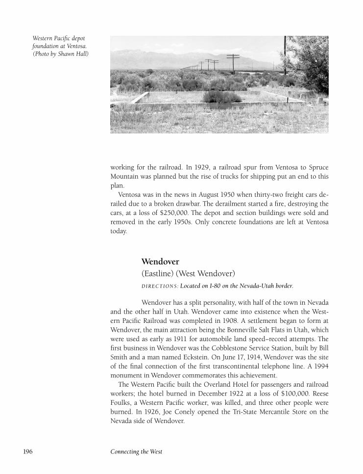
Western Pacific depotfoundation at Ventosa.(Photo by Shawn Hall)
working for the railroad. In 1929, a railroad spur from Ventosa to Spruce
Mountain was planned but the rise of trucks for shipping put an end to this
plan.
Ventosa was in the news in August 1950 when thirty-two freight cars de-
railed due to a broken drawbar. The derailment started a fire, destroying the
cars, at a loss of $250,000. The depot and section buildings were sold and
removed in the early 1950s. Only concrete foundations are left at Ventosa
today.
Wendover(Eastline) (West Wendover)
DIRECTIONS : Located on I-80 on the Nevada-Utah border.
Wendover has a split personality, with half of the town in Nevada
and the other half in Utah. Wendover came into existence when the West-
ern Pacific Railroad was completed in 1908. A settlement began to form at
Wendover, the main attraction being the Bonneville Salt Flats in Utah, which
were used as early as 1911 for automobile land speed–record attempts. The
first business in Wendover was the Cobblestone Service Station, built by Bill
Smith and a man named Eckstein. On June 17, 1914, Wendover was the site
of the final connection of the first transcontinental telephone line. A 1994
monument in Wendover commemorates this achievement.
The Western Pacific built the Overland Hotel for passengers and railroad
workers; the hotel burned in December 1922 at a loss of $100,000. Reese
Foulks, a Western Pacific worker, was killed, and three other people were
burned. In 1926, Joe Conely opened the Tri-State Mercantile Store on the
Nevada side of Wendover.
196 Connecting the West
Gambling was legalized in Nevada in 1931, creating an economic opportu-
nity for the Nevada side of Wendover. Bill Smith’s Stateline Hotel was the first
legal casino in Wendover. The Smith family still runs casinos in Wendover,
making it the oldest family-owned gaming operation in Nevada. Contrary to
public misconception, West Wendover is not named West because of its geo-
graphical location, but instead in honor of Fred West, who came to the town
in1936, bought out Joe Conely, and opened the A-1 Service and Motel. These
were the only two businesses located on the Nevada side of Wendover.
During World War II,Wendover boomed. The population went from about
125 to as high as 20,000 due to the formation of the Wendover Air Base, a
training base for bomber pilots. Bob Hope visited the base and called it a
‘‘leftover Alcatraz with tents.’’ At its peak, the base had 250 barracks, a three
hundred–bed hospital, service clubs, two theaters, a gymnasium, a chapel, a
band, and a camp newspaper, the Salt Tablet. Because of the pressure to train
new pilots as quickly as possible, accidents were common, with as many as
twenty men being killed in a day.
While thousands of men received training at Wendover, the most famous
group to train at Wendover was the 509th Composite Group, commanded
by Paul Tibbets Jr., which dropped two atomic bombs on Japan in August
1945 to end World War II. The base was deactivated in 1948, and the town of
Wendover shrank to less than one hundred people, although the base is still
occasionally used by the military.
By 1960, only the A-1 Service and Motel, Stateline Hotel, and Hide-a-
Way Club were in business on the Nevada side of Wendover. During the
1970s, developers turned Wendover into a gambling spot for tourists and
Utah residents. Today, Wendover is a substantial town. A number of casi-
nos have joined the older ones, and Wendover Will, a sixty-four-foot neon
cowboy, looks over the town. West Wendover became Elko County’s fourth
incorporated city in 1991, and the town continues to grow, as does the casino
business.
The boom on the Nevada side of Wendover, compared to the slump on
the Utah side, has created friction between residents of the two sides of town.
This is particularly true with regard to the public schools, but the problems
are being worked out. There is an interesting museum at the air force base on
the Utah side, but it is open only occasionally.
Southeastern Elko County 197

Notes
Northwestern Elko County
1. Edna Patterson, Louise Ulph, and Victor Goodwin, Nevada’s Northeast Frontier(Reno, Nevada: University of Nevada Press, 1969).
2. Tuscarora Times-Review, April 24, 1886.
North Central Elko County
1. Tuscarora Times-Review, October 1, 1884.
2. Carol Hendershot, ‘‘Dinner Station,’’ Northeastern Nevada Historical Society Quar-terly 3 (summer 1985): 67.
3. Elko Independent, August 5, 1899.
4. Elko Free Press, November 5, 1887.
5. Wells Progress, May 23, 1926.
Northeastern Elko County
1. Wells Progress, November 30, 1936.
2. Ibid., April 2, 1909.
3. Marguerite Patterson Evans, ‘‘Letters from Contact,’’ Northeastern Nevada HistoricalSociety Quarterly (winter 1988): 12.
4. Ibid.
5. Nevada State Herald, December 21, 1900.
Southwestern Elko County
1. Nevada State Herald, October 23, 1954.
2. Elko Independent, October 15, 1907.
199
3. Elko Daily Free Press, October 11, 1952.
4. Elko Independent, June 19, 1869.
5. Elko Weekly Post, September 4, 1880.
6. Bill Nelson, ‘‘J. M. Capriola Company,’’ Northeastern Nevada Historical Society Quar-terly (summer 1983): 81.
7. C. I. Walther, ‘‘Ice Harvesting in Elko,’’ Northeastern Nevada Historical Society Quar-terly (spring 1992): 11.
8. Gayle Puccinelli, ‘‘The Luther Jones Murder Case,’’ Northeastern Nevada HistoricalSociety Quarterly (winter 1975): 9.
9. Compiled by Howard Hickson, with additions by author.
10. Wells Progress, June 23, 1960.
11. Ibid.
12. Elko Independent, May 12, 1900.
13. Elko Chronicle, advertisements appearing during 1870.
Southeastern Elko County
1. Elko Daily Free Press, February 16, 1950.
200 Notes
Bibliography
Books
Aitchison, Pat Morse. Morse Family Treasures. Salt Lake City, Utah: Circulation Ser-
vice, Inc., 1990.
Anderson, Ruth. Memoirs of Leona Reynolds. Carson City, Nevada: Bicentennial Com-
mission, 1976.
Angel, Myron, ed. Thompson and West’s History of Nevada, 1881. Berkeley: Howell-
North Books, 1958.
Armstrong, Robert. Nevada Printing History, A Bibliography of Imprints and Publications,1881–1890. Reno, Nevada: University of Nevada Press, 1981.
�. A Preliminary Union Catalog of Nevada Manuscripts. Reno, Nevada: University
of Nevada Library Association, 1967.
Asay, Jeff. Western Pacific Timetables and Operations, A History and Compendium. Crete,
Nebraska: J-B Publishing Company, 1983.
Ashbaugh, Don. Nevada’s Turbulent Yesterday. Los Angeles: Westernlore Press, 1963.
Bancroft, Hubert. History of Nevada, Colorado and Wyoming, 1540–1888. San Fran-
cisco: The History Company, 1890.
Bartlett, R. A. Great Surveyors of the American West. Norman, Oklahoma: University
of Oklahoma Press, 1962.
Basso, Dave. Nevada Historical Marker Guidebook. Boise, Idaho: Falcon Hill Press,
1979.
�. Nevada Lost Mines and Hidden Treasures. Sparks, Nevada: Dave’s Printing and
Publishing, 1974.
Beebe, Lucius. The Central Pacific & the Southern Pacific Railroads. Berkeley: Howell-
North Books, 1962.
Beebe, Lucius, and Charles Clegg. U.S. West: The Saga of Wells Fargo. New York: E. P.
Dutton and Company, 1949.
201
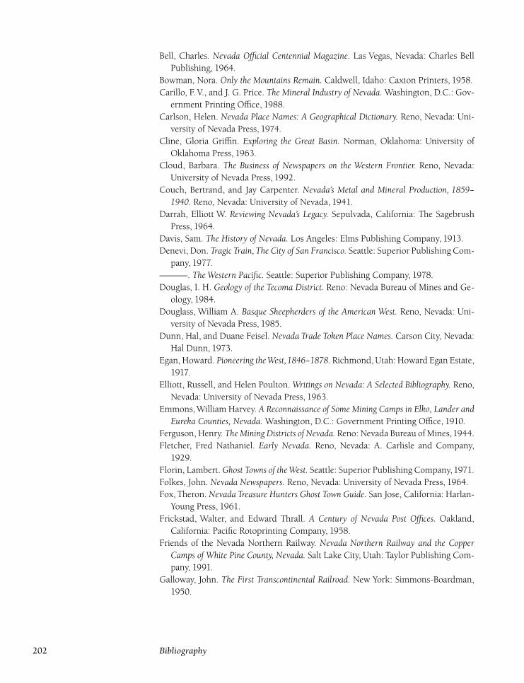
Bell, Charles. Nevada Official Centennial Magazine. Las Vegas, Nevada: Charles Bell
Publishing, 1964.
Bowman, Nora. Only the Mountains Remain. Caldwell, Idaho: Caxton Printers, 1958.
Carillo, F. V., and J. G. Price. The Mineral Industry of Nevada. Washington, D.C.: Gov-
ernment Printing Office, 1988.
Carlson, Helen. Nevada Place Names: A Geographical Dictionary. Reno, Nevada: Uni-
versity of Nevada Press, 1974.
Cline, Gloria Griffin. Exploring the Great Basin. Norman, Oklahoma: University of
Oklahoma Press, 1963.
Cloud, Barbara. The Business of Newspapers on the Western Frontier. Reno, Nevada:
University of Nevada Press, 1992.
Couch, Bertrand, and Jay Carpenter. Nevada’s Metal and Mineral Production, 1859–1940. Reno, Nevada: University of Nevada, 1941.
Darrah, Elliott W. Reviewing Nevada’s Legacy. Sepulvada, California: The Sagebrush
Press, 1964.
Davis, Sam. The History of Nevada. Los Angeles: Elms Publishing Company, 1913.
Denevi, Don. Tragic Train, The City of San Francisco. Seattle: Superior Publishing Com-
pany, 1977.
�. The Western Pacific. Seattle: Superior Publishing Company, 1978.
Douglas, I. H. Geology of the Tecoma District. Reno: Nevada Bureau of Mines and Ge-
ology, 1984.
Douglass, William A. Basque Sheepherders of the American West. Reno, Nevada: Uni-
versity of Nevada Press, 1985.
Dunn, Hal, and Duane Feisel. Nevada Trade Token Place Names. Carson City, Nevada:
Hal Dunn, 1973.
Egan, Howard. Pioneering theWest,1846–1878. Richmond, Utah: Howard Egan Estate,
1917.
Elliott, Russell, and Helen Poulton. Writings on Nevada: A Selected Bibliography. Reno,
Nevada: University of Nevada Press, 1963.
Emmons,William Harvey. A Reconnaissance of Some Mining Camps in Elko, Lander andEureka Counties, Nevada. Washington, D.C.: Government Printing Office, 1910.
Ferguson, Henry. The Mining Districts of Nevada. Reno: Nevada Bureau of Mines,1944.
Fletcher, Fred Nathaniel. Early Nevada. Reno, Nevada: A. Carlisle and Company,
1929.
Florin, Lambert. Ghost Towns of the West. Seattle: Superior Publishing Company,1971.
Folkes, John. Nevada Newspapers. Reno, Nevada: University of Nevada Press, 1964.
Fox, Theron. Nevada Treasure Hunters Ghost Town Guide. San Jose, California: Harlan-
Young Press, 1961.
Frickstad, Walter, and Edward Thrall. A Century of Nevada Post Offices. Oakland,
California: Pacific Rotoprinting Company, 1958.
Friends of the Nevada Northern Railway. Nevada Northern Railway and the CopperCamps of White Pine County, Nevada. Salt Lake City, Utah: Taylor Publishing Com-
pany, 1991.
Galloway, John. The First Transcontinental Railroad. New York: Simmons-Boardman,
1950.
202 Bibliography
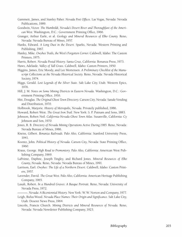
Gammett, James, and Stanley Paher. Nevada Post Offices. Las Vegas, Nevada: Nevada
Publications, 1989.
Goodwin, Victor. The Humboldt, Nevada’s Desert River and Thoroughfare of the Ameri-can West. Washington, D.C.: Government Printing Office, 1966.
Granger, Arthur Earle, et al. Geology and Mineral Resources of Elko County. Reno,
Nevada: Nevada Bureau of Mines, 1957.
Hanks, Edward. A Long Dust in the Desert. Sparks, Nevada: Western Printing and
Publishing, 1967.
Hanley, Mike. Owyhee Trails, the West’s Forgotten Corner. Caldwell, Idaho: The Caxton
Printers, 1975.
Harris, Robert. Nevada Postal History. Santa Cruz, California: Bonanza Press, 1973.
Haws, Adelaide. Valley of Tall Grass. Caldwell, Idaho: Caxton Printers, 1950.
Higgins, James, Eric Moody, and Lee Mortensen. A Preliminary Checklist of the Manu-script Collections at the Nevada Historical Society. Reno, Nevada: Nevada Historical
Society, 1974.
Higgs, Gerald. Lost Legends of the Silver State. Salt Lake City, Utah: Western Epics,
1976.
Hill, J. M. Notes on Some Mining Districts in Eastern Nevada. Washington, D.C.: Gov-
ernment Printing Office, 1916.
Hitt, Douglas. The Original Ghost Town Directory. Carson City, Nevada: SanaleVending
and Distribution, 1970.
Holbrook, Marjorie. History of Metropolis, Nevada. Privately published, 1986.
Howard, Robert West. The Great Iron Trail. New York: S. P. Putnam and Sons, 1883.
Johnson, Robert Neil. California-Nevada Ghost Town Atlas. Susanville, California: Cy
Johnson and Son, 1970.
Jones, R. B. Directory of Nevada Mining Operations Active During 1985. Reno, Nevada:
Nevada Bureau of Mines, 1986.
Kneiss, Gilbert. Bonanza Railroads. Palo Alto, California: Stanford University Press,
1941.
Koontz, John. Political History of Nevada. Carson City, Nevada: State Printing Office,
1960.
Kraus, George. High Road to Promontory. Palo Alto, California: American West Pub-
lishing Company, 1969.
LaPointe, Daphne, Joseph Tingley, and Richard Jones. Mineral Resources of ElkoCounty, Nevada. Reno, Nevada: Nevada Bureau of Mines, 1991.
Larrison, Earl. Owyhee: The Life of a Northern Desert. Caldwell, Idaho: Caxton Print-
ers, 1957.
Lavender, David. The Great West. Palo Alto, California: American Heritage Publishing
Company, 1965.
Laxalt, Robert. In a Hundred Graves: A Basque Portrait. Reno, Nevada: University of
Nevada Press, 1972.
�. Nevada: A Bicentennial History. New York: W.W. Norton and Company,1977.
Leigh, Rufus Wood. Nevada Place Names: Their Origin and Significance. Salt Lake City,
Utah: Deseret News Press, 1964.
Lincoln, Francis Church. Mining Districts and Mineral Resources of Nevada. Reno,
Nevada: Nevada Newsletter Publishing Company, 1923.
Bibliography 203
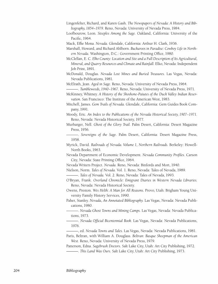
Lingenfelter, Richard, and Karen Gash. The Newspapers of Nevada: A History and Bib-liography, 1854–1979. Reno, Nevada: University of Nevada Press, 1984.
Loofbourow, Leon. Steeples Among the Sage. Oakland, California: University of the
Pacific, 1964.
Mack, Effie Mona. Nevada. Glendale, California: Arthur H. Clark, 1936.
Marshall, Howard, and Richard Ahlborn. Buckaroos in Paradise: Cowboy Life in North-ern Nevada. Washington, D.C.: Government Printing Office, 1980.
McClellan, E. C. Elko County: Location and Site and a Full Description of Its Agricultural,Mineral, and Quarry Resources and Climate and Rainfall. Elko, Nevada: Independent
Job Print, 1891.
McDonald, Douglas. Nevada Lost Mines and Buried Treasures. Las Vegas, Nevada:
Nevada Publications, 1981.
McElrath, Jean. Aged in Sage. Reno, Nevada: University of Nevada Press, 1964.
�. Tumbleweeds, 1940–1967. Reno, Nevada: University of Nevada Press, 1971.
McKinney, Whitney. A History of the Shoshone-Paiutes of the Duck Valley Indian Reser-vation. San Francisco: The Institute of the American West, 1983.
Mitchell, James. Gem Trails of Nevada. Glendale, California: Gem Guides Book Com-
pany, 1991.
Moody, Eric. An Index to the Publications of the Nevada Historical Society, 1907–1971.Reno, Nevada: Nevada Historical Society, 1977.
Murbarger, Nell. Ghost of the Glory Trail. Palm Desert, California: Desert Magazine
Press, 1956.
�. Sovereigns of the Sage. Palm Desert, California: Desert Magazine Press,
1958.
Myrick, David. Railroads of Nevada. Volume 1, Northern Railroads. Berkeley: Howell-
North Books, 1963.
Nevada Department of Economic Development. Nevada Community Profiles. Carson
City, Nevada: State Printing Office, 1964.
Nevada Writers Project. Nevada. Reno, Nevada: Binfords and Mort, 1940.
Nielson, Norm. Tales of Nevada. Vol. 1. Reno, Nevada: Tales of Nevada, 1989.
�. Tales of Nevada. Vol. 2. Reno, Nevada: Tales of Nevada, 1993.
O’Bryan, Frank. Overland Chronicle: Emigrant Diaries in Western Nevada Libraries.Reno, Nevada: Nevada Historical Society.
Owens, Preston. Wes Helth: A Man for All Reasons. Provo, Utah: Brigham Young Uni-
versity Family History Services, 1990.
Paher, Stanley. Nevada, An Annotated Bibliography. Las Vegas, Nevada: Nevada Publi-
cations, 1980.
�. Nevada Ghost Towns and Mining Camps. Las Vegas, Nevada: Nevada Publica-
tions, 1973.
�. Nevada Official Bicentennial Book. Las Vegas, Nevada: Nevada Publications,
1976.
�, ed. Nevada Towns and Tales. Las Vegas, Nevada: Nevada Publications, 1981.
Paris, Beltran, with William A. Douglass. Beltran: Basque Sheepman of the AmericanWest. Reno, Nevada: University of Nevada Press, 1979.
Patterson, Edna. Sagebrush Doctors. Salt Lake City, Utah: Art City Publishing, 1972.
�. This Land Was Ours. Salt Lake City, Utah: Art City Publishing, 1973.
204 Bibliography
�. Who Named It? Elko, Nevada: Elko Independent, 1965.
Patterson, Edna, Louise Ulph, and Victor Goodwin. Nevada’s Northeast Frontier. Reno,
Nevada: University of Nevada Press, 1969.
Penfield, Thomas. A Guide to Treasure in Nevada. Carson City, Nevada: Carson Enter-
prises, 1974.
Reed, Flo. Bygone Days of Nevada Schools. Privately published, 1991.
Ruby Valley Memories. Privately published, n.d.
Sawyer, Byrd. Gold and Silver Rushes of Nevada. San Jose, California: Harlan-Young
Press, 1971.
Schilling, John. The Nevada Mineral Industry, 1980. Reno, Nevada: Nevada Bureau of
Mines and Geology, 1980.
�. The Nevada Mineral Industry, 1981. Reno, Nevada: Nevada Bureau of Mines
and Geology, 1981.
�. The Nevada Mineral Industry, 1985. Reno, Nevada: Nevada Bureau of Mines
and Geology, 1985.
�. The Nevada Mineral Industry, 1990. Reno, Nevada: Nevada Bureau of Mines
and Geology, 1990.
Scott, Kenneth. Calvacade of Time. Elko, Nevada: Elko Independent, 1982.
Scrugham, James. Nevada, a Narrative of the Conquest of a Frontier Land: Comprisingthe Story of Her People from the Dawn of History to the Present Time. Chicago: The
American Historical Society, 1935.
Shawe, F. R., R. G. Reeves, and V. E. Kral. Iron Deposits of Nevada. Part C, Iron OreDeposits of Northern Nevada. Reno, Nevada: Nevada Bureau of Mines and Geology,
1962.
Smith, Raymond. Saloons of Old and New Nevada. Reno, Nevada: Silver State Printing,
1992.
Stapley, Linda. Together in My Name: A Centennial Tribute to the Little Church of theCrossroads, Lamoille, Nevada. Elko: Elko Independent, 1990.
Stevens, Horace. The Copper Handbook. Vols. 2–10. Washington, D.C.: Government
Printing Office, 1908.
Truett, Velma. On the Hoof in Nevada. Los Angeles: Gehrett-Truett-Hall, 1950.
University of Nevada. Metal and Non-metal Occurences in Nevada. Reno, Nevada: Uni-
versity of Nevada, 1932.
Vanderbilt, Paul. Guide to the Special Collections of Prints and Photographs in the Libraryof Congress. Washington, D.C.: Government Printing Office, 1955.
Vanderburg, William O. Placer Mining in Nevada. University of Nevada Bulletin 30,
no. 4. Reno: University of Nevada, 1936.
Vanderburg, William O., and Alfred Smith. Placer Mining in Nevada. Reno, Nevada:
University of Nevada, 1932.
Van Meter, David. G. S. Garcia: A History of the World Famous Saddlemaker. Reno,
Nevada: Avail Publishing, 1984.
Weed, Walter. The Copper Handbook. Vol. 2. Washington, D.C.: Government Printing
Office, 1912.
�. The Mines Handbook and Copper Handbook, 1916–1926. Washington, D.C.:
Government Printing Office, 1927.
Bibliography 205
Western States Historical Publishers. Nevada, the Silver State. Carson City, Nevada:
Western States Historical Publishing, 1970.
Winchell, Bessie. Now and Then. San Francisco: Bonanza Publishing, 1986.
Works Progress Administration. Inventory of the County Archives of Nevada, No. 4 ElkoCounty. Washington, D.C.: Works Progress Administration, 1938.
Wren, Thomas. The State of Nevada: Its Resources and People. New York: Lewis Pub-
lishing Company, 1904.
Articles
Aguirre, Angela. ‘‘It Began in Elko.’’ Northeastern Nevada Historical Society Quarterly(fall 1982): 43–62.
Aldrich, Ethel. ‘‘Elko County’s First Courthouse.’’ Northeastern Nevada Historical So-ciety Quarterly (winter 1977): 3–15.
Badt, Gertrude. ‘‘Milton Benjamin Badt.’’ Northeastern Nevada Historical Society Quar-terly (summer 1978): 90–114.
Bowen, Marshall. ‘‘Bitter Times: The Summers of1915 and1916 on Northeast Nevada’s
Dry Farms.’’ Northeastern Nevada Historical Society Quarterly (winter 1993): 3–26.
�. ‘‘Elko County’s Dry Farming Experimental Station.’’ Northeastern NevadaHistorical Society Quarterly (spring 1979): 36–41.
Braithwaite, Debra. ‘‘Double Gallows.’’ Northeastern Nevada Historical Society Quar-terly (fall 1973): 3–17.
Branscomb, Mary. ‘‘Tom Short: Ruby Valley.’’ Northeastern Nevada Historical SocietyQuarterly (summer 1995): 59–81.
Earl, Phillip. ‘‘The Montello Robbery.’’ Northeastern Nevada Historical Society Quarterly(summer): 3–20.
Edgar, Bob. ‘‘Case 945.’’ Northeastern Nevada Historical Society Quarterly (fall 1973):
19–28.
Evans, Marguerite Patterson. ‘‘Letters from Contact.’’ Northeastern Nevada HistoricalSociety Quarterly (winter 1988): 3–15.
Goodwin, Victor. ‘‘Beachey: Nevada-California-Idaho Stagecoach King.’’ Nevada His-torical Society Quarterly (spring 1967).
Harper, Doug. ‘‘Fifty Years Too Soon.’’ Northeastern Nevada Historical Society Quarterly(fall 1974): 3–19.
Harris, Leona Gilbertson. ‘‘Journey into the Past: Island Mountain School, 1926.’’
Northeastern Nevada Historical Society Quarterly (spring 1989): 31–56.
Hendershot, Carol. ‘‘Bing Crosby and Elko: A Mutual Admiration Society.’’ Northeast-ern Nevada Historical Society Quarterly (summer 1984): 67–93.
�. ‘‘Dinner Station.’’ Northeastern Nevada Historical Society Quarterly (summer
1985): 63–81.
Henley, Brigadier General David. ‘‘Elko County’s ‘Navy.’ ’’ Northeastern Nevada His-torical Society Quarterly (fall 1989): 87–105.
Hickson, Howard. ‘‘Dirt Runways.’’ Northeastern Nevada Historical Society Quarterly(summer 1970): 1–3.
�. ‘‘Hardly a High School.’’ Northeastern Nevada Historical Society Quarterly(winter 1974): 3–26.
206 Bibliography
�. ‘‘Jiggs and Mound Valley.’’ Northeastern Nevada Historical Society Quarterly(summer 1988): 59–73.
�. ‘‘Wells, Nevada: A Pictorial History.’’ Northeastern Nevada Historical SocietyQuarterly (winter 1986): 3–21.
�. ‘‘Where’s the Beef.’’ Northeastern Nevada Historical Society Quarterly (fall
1990): 81–83.
Meade, Sharon. ‘‘Elko Independent.’’ Northeastern Nevada Historical Society Quarterly(winter 1985): 3–12.
Morandi, David. ‘‘The Old Elko County Library.’’ Northeastern Nevada HistoricalSociety Quarterly (summer 1986): 83–85.
Murphy, E. C., Jr. ‘‘The Murphy Story: Starr and Secret Valley.’’ Northeastern NevadaHistorical Society Quarterly (fall 1992): 73–94.
Nelson, Bill. ‘‘J.M. Capriola Company.’’ Northeastern Nevada Historical Society Quar-terly (summer 1983): 79–90.
Nelson, George. ‘‘Grandpa Nelson: Nathan Nelson, 1816–1903.’’ Northeastern NevadaHistorical Society Quarterly (spring/summer 1982): 3–25.
Oakberg, Helen Olmsted, and Suverkrup, Annette Leighton. ‘‘Dr. A.C. Olmsted Fam-
ily.’’ Northeastern Nevada Historical Society Quarterly (winter 1994): 28–35.
Patterson, Edna. ‘‘Kate St. Clair: One of Nevada’s Great Women.’’ Northeastern NevadaHistorical Society Quarterly (fall 1992): 137–144.
Powell, Charles Stewart. ‘‘Depression Days in Tobar.’’ Northeastern Nevada HistoricalSociety Quarterly (fall 1978): 126–141.
Puchinelli, Gayle. ‘‘The Luther Jones Murder Case.’’ Northeastern Nevada HistoricalSociety Quarterly (winter 1975): 3–11.
Reynolds, Leona. ‘‘Memories of Currie, Nevada.’’ Northeastern Nevada Historical So-ciety Quarterly (spring 1975): 3–16.
Robertson, Opal Curieux. ‘‘William and Catherine Johnson Family, North Fork Pio-
neers: Lillian M. Johson.’’ Northeastern Nevada Historical Society Quarterly (sum-
mer 1991): 51–75.
Sheerin, Chris. ‘‘Newton Hunt Crumley.’’ Northeastern Nevada Historical Society Quar-terly (winter 1979): 3–15.
Smith, Mary Urriola. ‘‘Memories of Jack Creek,1925–1935.’’ Northeastern Nevada His-torical Society Quarterly (spring 1990): 31–44.
Steninger, Dan. ‘‘Elko Daily Free Press.’’ Northeastern Nevada Historical Society Quar-terly (spring 1981): 47–59.
Strode, Nevada Boies. ‘‘Horace and Etta Agee.’’ Northeastern Nevada Historical SocietyQuarterly (winter 1972): 17–32.
Tatomer, William. ‘‘Tobar.’’ Northeastern Nevada Historical Society Quarterly (winter
1978): 3–12.
Walther, C. I. ‘‘Ice Harvesting in Elko.’’ Northeastern Nevada Historical Society Quar-terly (winter 1992): 3–19.
Wetzel, Barbi. ‘‘Pioneer Hotel.’’ Northeastern Nevada Historical Society Quarterly(spring 1985): 35–45.
Whittaker, Leslie. ‘‘Elko Flouring Mill.’’ Northeastern Nevada Historical Society Quar-terly (spring 1981): 61–67.
Bibliography 207
Wright, Christy. ‘‘Carlin’s Ice Harvest.’’ Northeastern Nevada Historical Society Quar-terly (winter 1978): 14–22.
Newspapers and Periodicals
Business Talks, Tuscarora (September 1908–November 1908).
Commonwealth, Carlin (September 8, 1909–February 21, 1912).
Commonwealth, Deeth (February 28, 1912–October 28, 1914).
Daily Argonaut, Elko (January 3, 1898–February 6, 1899).
Elko Chronicle ( January 5, 1870–December 4, 1870).
Elko Enterprise (December 1, 1916–February 9, 1917).
Elko Free Press ( January 5, 1883–December 31, 1994).
Elko Independent ( June 19, 1869–December 31, 1994).
Elko Weekly Post (September 11, 1875–April 30, 1881).
Gold Circle Miner, Midas (April 11, 1908).
Gold Circle News, Midas (September 26, 1908).
Gold Circle Porcupine, Midas (May 20, 1914).
Gold Creek News (December 24, 1896–December 10, 1897).
Metropolis Chronicle (September 15, 1911–December 15, 1913).
Mountain City Mail (November 17, 1938–February 23, 1939).
Mountain City Times ( January 21, 1898–May 13, 1898).
Nevada Democrat, Carlin (February 23, 1917–April 13, 1917).
Nevada Silver Tidings, Elko (January 2, 1897–July 15, 1899).
Nevada State Herald, Wells (March 19, 1897–April 14, 1933).
Northeastern Nevada Historical Society Quarterly (1971–1996).
Rio Tinto News.Ruby Valley News (1975–1992).
Tobar Times ( July 22, 1916).
Tuscarora Mining News (September 21, 1907–December 7, 1907).
Tuscarora Mining Review (May 23, 1877–December 30, 1877).
Tuscarora Times (March 24, 1877–December 1877).
Tuscarora Times-Review ( January 3, 1878–December 26, 1903).
Wells Progress ( June 26, 1936–December 31, 1980).
Dates of newspapers are not necessarily actual publication dates but rather dates of
available issues that were reviewed.
208 Bibliography
Index
Abel, J. B., 125
Achabal, Balbino, 12
Achabal, Helena, 13
Ackler, George, 172
Ackler, John, 172
Acosta, Guadaloupe, 177
Addington, Bill, 54
Adobe Station, 90–91
Afton, 159
Agee, Horace, 34, 50, 100
Aguirre, Guy, 168
Ainley, John, 133, 158
Ainley ranch, 158
Akbar, 56
Alabama mine, 73
Alazon, 20
Albany mine, 62
Alexander, 20–21
Alexander, Charles, 20
Allen, Ethelyn, 75
Allen, George, 44
Allen, M. E., 44
Allen, Rex, 124
Altube, Bernardo, 8
Altube, Jules, 8
Altube, Pedro, 8
Ambler, Frank, 149
Anderson, 10, 12
Anderson, Christian, 12
Anderson, Erastus, 75
Anderson, Frances, 60
Anderson, Nellie, 101
Anderson, Robert, 192
Anderson ranch, 170
Andrae, Sadie, 9
Angel, Mary, 98
Angel, Warren, 97–98
Angel Creek Ranch, 98
Angel Lake, 97
Antelope Station, 2
Anthony, 56
Archibald, Helena, 9
Arizona mine, 62
Armstrong, Ben, 173
Armstrong, James, 164
Armstrong, Julia Ann, 177
Arnold, Harold, 102
Arrascada, Manuel, 138
Arthur, 167
Asmus, Elizabeth, 8
Atkinson, Tom, 103
Aura, 2, 8
Austin, 92, 158
Avenel, 91
Bacher, Charlotte, 8
Backstead, Mack, 192
Badt, Mel, 44
Badt, Milton, 15, 50
Badt, Morris, 22, 43–44,
50
Bake, Beatrice, 190
Baker, Daniel, 79
Bancroft, Hubert, 13
Banks, George, 151
Banvard, 56
Baralus, Irene, 140
Baring, Walter, 128
Barkdull, Claude, 9
Barkdull, Frankie, 9
Barnard, L. R., 136
Barton, Clarence, 195
Barton, Eldora, 195
Basda, Joseph, 48
Bassford, Mary, 195
Battle Creek, 165, 167,
195
Battle Mountain, 2, 13–14
Bauvard, 56–57, 74, 77,
86
Beachey, Hill, 14, 22, 25,
35–36, 102, 110, 152,
172
Beachey Station, 178
Bear, Betty, 131
Bear, Paul, 131
Beaumont, R. J., 77
Beaver, 20–21
Beckwith, E. G., 162, 185
Bednark, Leon, 86
Bellinger, William, 83,
102
Bellinger Ranch, 32, 127
Bello Ranch, 21
Bender, Austin, 15
Bender, Fred, 166
Bennett, Andrew, 60
Benson, Mary, 101
Bentley, W. J., 84
Berry, George, 116
Better, William, 149
Betteridge, Sarah, 60
Bews, 189
Bews, Richard, 189
Bible, Alan, 49
Bickford, Allen, 57
Bigham, A. C., 125
Biglin, Thomas, 119
Big Springs Land and
Cattle Company, 77
Big Springs Ranch, 77–78
Bilbao, Dan, Sr., 125
Bilbao, Vincente, 12
Billig, Charles, 97
Billings, Edith, 32
Bishop Creek Reservoir,
29
Bishop, Lawrence, 56
Bishops, 22
Bissell, Lizzie, 195
Bitterridge, William, 81
Black, Bob, 176
Black, Charles, 174
Black, Fred, 191
Blackhawk, 91
Blaine, 158, 160
Blaine, James, 158
Blevins, Dollie, 22
209
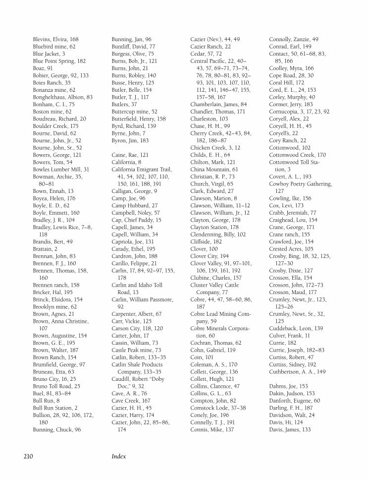
Blevins, Elvira, 168
Bluebird mine, 62
Blue Jacket, 3
Blue Point Spring, 182
Boaz, 91
Bobier, George, 92, 133
Boies Ranch, 35
Bonanza mine, 62
Bonghelthaus, Albion, 83
Bonham, C. I., 75
Boston mine, 62
Boudreau, Richard, 20
Boulder Creek, 175
Bourne, David, 62
Bourne, John, Jr., 52
Bourne, John, Sr., 52
Bowers, George, 121
Bowers, Tom, 54
Bowles Lumber Mill, 31
Bowman, Archie, 35,
80–81
Bown, Ennah, 13
Boyea, Helen, 176
Boyle, E. D., 62
Boyle, Emmett, 160
Bradley, J. R., 104
Bradley, Lewis Rice, 7–8,
118
Brandis, Bert, 49
Brattain, 2
Brennan, John, 83
Brennen, F. J., 160
Brennen, Thomas, 158,
160
Brennen ranch, 158
Bricker, Hal, 195
Brinck, Elsidora, 154
Brooklyn mine, 62
Brown, Agnes, 21
Brown, Anna Christine,
107
Brown, Augustine, 154
Brown, G. E., 195
Brown, Walter, 187
Brown Ranch, 154
Brumfield, George, 97
Bruneau, Etta, 63
Bruno City, 16, 25
Bruno Toll Road, 25
Buel, 81, 83–84
Bull Run, 8
Bull Run Station, 2
Bullion, 28, 92, 106, 172,
180
Bunning, Chuck, 96
Bunning, Jan, 96
Buntliff, David, 77
Burgess, Olive, 75
Burns, Bob, Jr., 121
Burns, John, 21
Burns, Robley, 140
Busse, Henry, 125
Butler, Belle, 154
Butler, T. J., 117
Butlers, 37
Buttercup mine, 52
Butterfield, Henry, 158
Byrd, Richard, 139
Byrne, John, 7
Byron, Jim, 183
Caine, Rae, 121
California, 8
California Emigrant Trail,
41, 54, 102, 107, 110,
150, 161, 188, 191
Calligan, George, 9
Camp, Joe, 96
Camp Hubbard, 27
Campbell, Noley, 57
Cap, Chief Paddy, 15
Capell, James, 34
Capell, William, 34
Capriola, Joe, 131
Carady, Ethel, 195
Cardron, John, 188
Carillo, Felippe, 21
Carlin, 17, 84, 92–97, 155,
178
Carlin and Idaho Toll
Road, 13
Carlin, William Passmore,
92
Carpenter, Albert, 67
Carr, Vickie, 125
Carson City, 118, 120
Carter, John, 17
Cassin, William, 73
Castle Peak mine, 73
Catlin, Robert, 133–35
Catlin Shale Products
Company, 133–35
Caudill, Robert ‘‘Doby
Doc,’’ 9, 32
Cave, A. R., 76
Cave Creek, 167
Cazier, H. H., 45
Cazier, Harry, 174
Cazier, John, 22, 85–86,
174
Cazier (Nev.), 44, 49
Cazier Ranch, 22
Cedar, 57, 72
Central Pacific, 22, 40–
43, 57, 69–71, 73–74,
76, 78, 80–81, 83, 92–
93, 101, 103, 107, 110,
112, 141, 146–47, 155,
157–58, 167
Chamberlain, James, 84
Chandler, Thomas, 171
Charleston, 103
Chase, H. H., 99
Cherry Creek, 42–43, 84,
182, 186–87
Chicken Creek, 3, 12
Childs, E. H., 64
Chilton, Mark, 121
China Mountain, 61
Christian, R. P., 73
Church, Virgil, 65
Clark, Edward, 27
Clawson, Marion, 8
Clawson, William, 11–12
Clawson, William, Jr., 12
Clayton, George, 178
Clayton Station, 178
Clendenning, Billy, 102
Cliffside, 182
Clover, 100
Clover City, 194
Clover Valley, 91, 97–101,
106, 159, 161, 192
Clubine, Charles, 157
Cluster Valley Cattle
Company, 77
Cobre, 44, 47, 58–60, 86,
187
Cobre Lead Mining Com-
pany, 59
Cobre Minerals Corpora-
tion, 60
Cochran, Thomas, 62
Cohn, Gabriel, 119
Coin, 101
Coleman, A. S., 170
Collett, George, 136
Collett, Hugh, 121
Collins, Clarence, 47
Collins, G. L., 63
Compton, John, 82
Comstock Lode, 37–38
Conely, Joe, 196
Connelly, T. J., 191
Connis, Mike, 137
Connolly, Zanzie, 49
Conrad, Earl, 149
Contact, 50, 61–68, 83,
85, 166
Coolley, Myra, 166
Cope Road, 28, 30
Coral Hill, 172
Cord, E. L., 24, 153
Corley, Murphy, 40
Cormer, Jerry, 183
Cornucopia, 3, 17, 23, 92
Coryell, Alex, 22
Coryell, H. H., 45
Coryell’s, 22
Cory Ranch, 22
Cottonwood, 102
Cottonwood Creek, 170
Cottonwood Toll Sta-
tion, 3
Covert, A. L., 193
Cowboy Poetry Gathering,
127
Cowling, Ike, 156
Cox, Levi, 173
Crabb, Jeremiah, 77
Craighead, Lou, 154
Crane, George, 171
Crane ranch, 155
Crawford, Joe, 154
Crested Acres, 105
Crosby, Bing, 18, 32, 125,
127–30
Crosby, Dixie, 127
Crosson, Ella, 154
Crosson, John, 172–73
Crosson, Maud, 177
Crumley, Newt, Jr., 123,
125–26
Crumley, Newt, Sr., 32,
125
Cuddeback, Leon, 139
Culver, Frank, 11
Currie, 182
Currie, Joseph, 182–83
Curtiss, Robert, 47
Curtiss, Sidney, 192
Cuthbertson, A. A., 149
Dahms, Joe, 153
Dakin, Judson, 153
Danforth, Eugene, 60
Darling, F. H., 187
Davidson, Walt, 24
Davis, Hi, 124
Davis, James, 133
210 Index
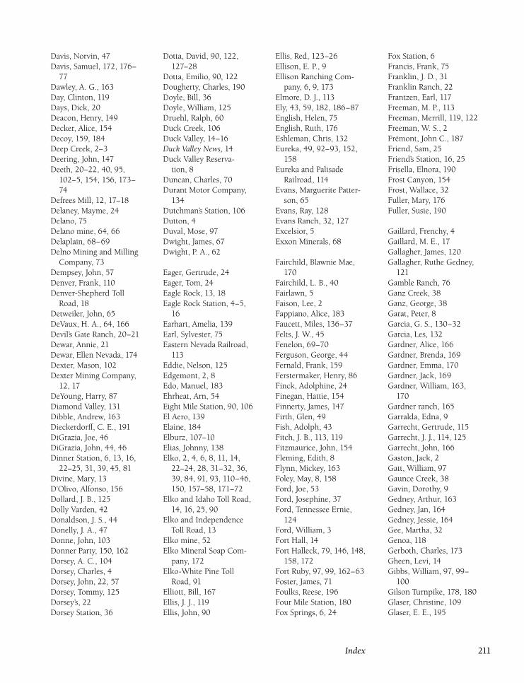
Davis, Norvin, 47
Davis, Samuel, 172, 176–
77
Dawley, A. G., 163
Day, Clinton, 119
Days, Dick, 20
Deacon, Henry, 149
Decker, Alice, 154
Decoy, 159, 184
Deep Creek, 2–3
Deering, John, 147
Deeth, 20–22, 40, 95,
102–5, 154, 156, 173–
74
Defrees Mill, 12, 17–18
Delaney, Mayme, 24
Delano, 75
Delano mine, 64, 66
Delaplain, 68–69
Delno Mining and Milling
Company, 73
Dempsey, John, 57
Denver, Frank, 110
Denver-Shepherd Toll
Road, 18
Detweiler, John, 65
DeVaux, H. A., 64, 166
Devil’s Gate Ranch, 20–21
Dewar, Annie, 21
Dewar, Ellen Nevada, 174
Dexter, Mason, 102
Dexter Mining Company,
12, 17
DeYoung, Harry, 87
Diamond Valley, 131
Dibble, Andrew, 163
Dieckerdorff, C. E., 191
DiGrazia, Joe, 46
DiGrazia, John, 44, 46
Dinner Station, 6, 13, 16,
22–25, 31, 39, 45, 81
Divine, Mary, 13
D’Olivo, Alfonso, 156
Dollard, J. B., 125
Dolly Varden, 42
Donaldson, J. S., 44
Donelly, J. A., 47
Donne, John, 103
Donner Party, 150, 162
Dorsey, A. C., 104
Dorsey, Charles, 4
Dorsey, John, 22, 57
Dorsey, Tommy, 125
Dorsey’s, 22
Dorsey Station, 36
Dotta, David, 90, 122,
127–28
Dotta, Emilio, 90, 122
Dougherty, Charles, 190
Doyle, Bill, 36
Doyle, William, 125
Druehl, Ralph, 60
Duck Creek, 106
Duck Valley, 14–16
Duck Valley News, 14
Duck Valley Reserva-
tion, 8
Duncan, Charles, 70
Durant Motor Company,
134
Dutchman’s Station, 106
Dutton, 4
Duval, Mose, 97
Dwight, James, 67
Dwight, P. A., 62
Eager, Gertrude, 24
Eager, Tom, 24
Eagle Rock, 13, 18
Eagle Rock Station, 4–5,
16
Earhart, Amelia, 139
Earl, Sylvester, 75
Eastern Nevada Railroad,
113
Eddie, Nelson, 125
Edgemont, 2, 8
Edo, Manuel, 183
Ehrheat, Arn, 54
Eight Mile Station, 90, 106
El Aero, 139
Elaine, 184
Elburz, 107–10
Elias, Johnny, 138
Elko, 2, 4, 6, 8, 11, 14,
22–24, 28, 31–32, 36,
39, 84, 91, 93, 110–46,
150, 157–58, 171–72
Elko and Idaho Toll Road,
14, 16, 25, 90
Elko and Independence
Toll Road, 13
Elko mine, 52
Elko Mineral Soap Com-
pany, 172
Elko-White Pine Toll
Road, 91
Elliott, Bill, 167
Ellis, J. J., 119
Ellis, John, 90
Ellis, Red, 123–26
Ellison, E. P., 9
Ellison Ranching Com-
pany, 6, 9, 173
Elmore, D. J., 113
Ely, 43, 59, 182, 186–87
English, Helen, 75
English, Ruth, 176
Eshleman, Chris, 132
Eureka, 49, 92–93, 152,
158
Eureka and Palisade
Railroad, 114
Evans, Marguerite Patter-
son, 65
Evans, Ray, 128
Evans Ranch, 32, 127
Excelsior, 5
Exxon Minerals, 68
Fairchild, Blawnie Mae,
170
Fairchild, L. B., 40
Fairlawn, 5
Faison, Lee, 2
Fappiano, Alice, 183
Faucett, Miles, 136–37
Felts, J. W., 45
Fenelon, 69–70
Ferguson, George, 44
Fernald, Frank, 159
Ferstermaker, Henry, 86
Finck, Adolphine, 24
Finegan, Hattie, 154
Finnerty, James, 147
Firth, Glen, 49
Fish, Adolph, 43
Fitch, J. B., 113, 119
Fitzmaurice, John, 154
Fleming, Edith, 8
Flynn, Mickey, 163
Foley, May, 8, 158
Ford, Joe, 53
Ford, Josephine, 37
Ford, Tennessee Ernie,
124
Ford, William, 3
Fort Hall, 14
Fort Halleck, 79, 146, 148,
158, 172
Fort Ruby, 97, 99, 162–63
Foster, James, 71
Foulks, Reese, 196
Four Mile Station, 180
Fox Springs, 6, 24
Fox Station, 6
Francis, Frank, 75
Franklin, J. D., 31
Franklin Ranch, 22
Frantzen, Earl, 117
Freeman, M. P., 113
Freeman, Merrill, 119, 122
Freeman, W. S., 2
Frémont, John C., 187
Friend, Sam, 25
Friend’s Station, 16, 25
Frisella, Elnora, 190
Frost Canyon, 154
Frost, Wallace, 32
Fuller, Mary, 176
Fuller, Susie, 190
Gaillard, Frenchy, 4
Gaillard, M. E., 17
Gallagher, James, 120
Gallagher, Ruthe Gedney,
121
Gamble Ranch, 76
Ganz Creek, 38
Ganz, George, 38
Garat, Peter, 8
Garcia, G. S., 130–32
Garcia, Les, 132
Gardner, Alice, 166
Gardner, Brenda, 169
Gardner, Emma, 170
Gardner, Jack, 169
Gardner, William, 163,
170
Gardner ranch, 165
Garralda, Edna, 9
Garrecht, Gertrude, 115
Garrecht, J. J., 114, 125
Garrecht, John, 166
Gaston, Jack, 2
Gatt, William, 97
Gaunce Creek, 38
Gavin, Dorothy, 9
Gedney, Arthur, 163
Gedney, Jan, 164
Gedney, Jessie, 164
Gee, Martha, 32
Genoa, 118
Gerboth, Charles, 173
Gheen, Levi, 14
Gibbs, William, 97, 99–
100
Gilson Turnpike, 178, 180
Glaser, Christine, 109
Glaser, E. E., 195
Index 211
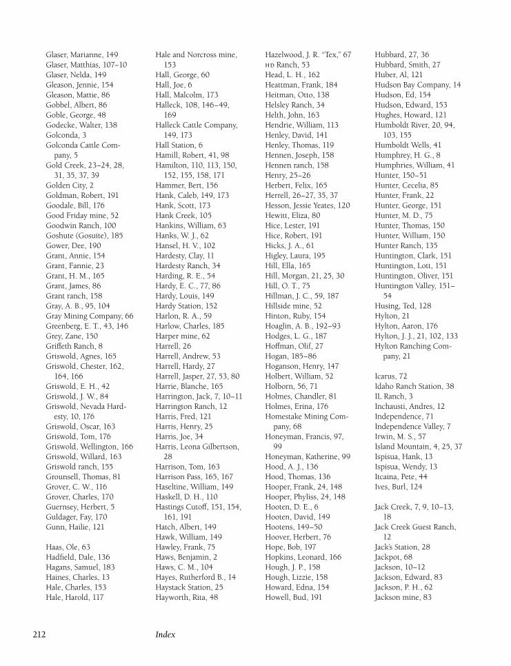
Glaser, Marianne, 149
Glaser, Matthias, 107–10
Glaser, Nelda, 149
Gleason, Jennie, 154
Gleason, Mattie, 86
Gobbel, Albert, 86
Goble, George, 48
Godecke, Walter, 138
Golconda, 3
Golconda Cattle Com-
pany, 5
Gold Creek, 23–24, 28,
31, 35, 37, 39
Golden City, 2
Goldman, Robert, 191
Goodale, Bill, 176
Good Friday mine, 52
Goodwin Ranch, 100
Goshute (Gosuite), 185
Gower, Dee, 190
Grant, Annie, 154
Grant, Fannie, 23
Grant, H. M., 165
Grant, James, 86
Grant ranch, 158
Gray, A. B., 95, 104
Gray Mining Company, 66
Greenberg, E. T., 43, 146
Grey, Zane, 150
Griffeth Ranch, 8
Griswold, Agnes, 165
Griswold, Chester, 162,
164, 166
Griswold, E. H., 42
Griswold, J. W., 84
Griswold, Nevada Hard-
esty, 10, 176
Griswold, Oscar, 163
Griswold, Tom, 176
Griswold, Wellington, 166
Griswold, Willard, 163
Griswold ranch, 155
Grounsell, Thomas, 81
Grover, C. W., 116
Grover, Charles, 170
Guernsey, Herbert, 5
Guldager, Fay, 170
Gunn, Hailie, 121
Haas, Ole, 63
Hadfield, Dale, 136
Hagans, Samuel, 183
Haines, Charles, 13
Hale, Charles, 153
Hale, Harold, 117
Hale and Norcross mine,
153
Hall, George, 60
Hall, Joe, 6
Hall, Malcolm, 173
Halleck, 108, 146–49,
169
Halleck Cattle Company,
149, 173
Hall Station, 6
Hamill, Robert, 41, 98
Hamilton, 110, 113, 150,
152, 155, 158, 171
Hammer, Bert, 156
Hank, Caleb, 149, 173
Hank, Scott, 173
Hank Creek, 105
Hankins, William, 63
Hanks, W. J., 62
Hansel, H. V., 102
Hardesty, Clay, 11
Hardesty Ranch, 34
Harding, R. E., 54
Hardy, E. C., 77, 86
Hardy, Louis, 149
Hardy Station, 152
Harlon, R. A., 59
Harlow, Charles, 185
Harper mine, 62
Harrell, 26
Harrell, Andrew, 53
Harrell, Hardy, 27
Harrell, Jasper, 27, 53, 80
Harrie, Blanche, 165
Harrington, Jack, 7, 10–11
Harrington Ranch, 12
Harris, Fred, 121
Harris, Henry, 25
Harris, Joe, 34
Harris, Leona Gilbertson,
28
Harrison, Tom, 163
Harrison Pass, 165, 167
Haseltine, William, 149
Haskell, D. H., 110
Hastings Cutoff, 151, 154,
161, 191
Hatch, Albert, 149
Hawk, William, 149
Hawley, Frank, 75
Haws, Benjamin, 2
Haws, C. M., 104
Hayes, Rutherford B., 14
Haystack Station, 25
Hayworth, Rita, 48
Hazelwood, J. R. ‘‘Tex,’’ 67
Ranch, 53
Head, L. H., 162
Heattman, Frank, 184
Heitman, Otto, 138
Helsley Ranch, 34
Helth, John, 163
Hendrie, William, 113
Henley, David, 141
Henley, Thomas, 119
Hennen, Joseph, 158
Hennen ranch, 158
Henry, 25–26
Herbert, Felix, 165
Herrell, 26–27, 35, 37
Hesson, Jessie Yeates, 120
Hewitt, Eliza, 80
Hice, Lester, 191
Hice, Robert, 191
Hicks, J. A., 61
Higley, Laura, 195
Hill, Ella, 165
Hill, Morgan, 21, 25, 30
Hill, O. T., 75
Hillman, J. C., 59, 187
Hillside mine, 52
Hinton, Ruby, 154
Hoaglin, A. B., 192–93
Hodges, L. G., 187
Hoffman, Olif, 27
Hogan, 185–86
Hoganson, Henry, 147
Holbert, William, 52
Holborn, 56, 71
Holmes, Chandler, 81
Holmes, Erina, 176
Homestake Mining Com-
pany, 68
Honeyman, Francis, 97,
99
Honeyman, Katherine, 99
Hood, A. J., 136
Hood, Thomas, 136
Hooper, Frank, 24, 148
Hooper, Phyliss, 24, 148
Hooten, D. E., 6
Hooten, David, 149
Hootens, 149–50
Hoover, Herbert, 76
Hope, Bob, 197
Hopkins, Leonard, 166
Hough, J. P., 158
Hough, Lizzie, 158
Howard, Edna, 154
Howell, Bud, 191
Hubbard, 27, 36
Hubbard, Smith, 27
Huber, Al, 121
Hudson Bay Company, 14
Hudson, Ed, 154
Hudson, Edward, 153
Hughes, Howard, 121
Humboldt River, 20, 94,
103, 155
Humboldt Wells, 41
Humphrey, H. G., 8
Humphries, William, 41
Hunter, 150–51
Hunter, Cecelia, 85
Hunter, Frank, 22
Hunter, George, 151
Hunter, M. D., 75
Hunter, Thomas, 150
Hunter, William, 150
Hunter Ranch, 135
Huntington, Clark, 151
Huntington, Lott, 151
Huntington, Oliver, 151
Huntington Valley, 151–
54
Husing, Ted, 128
Hylton, 21
Hylton, Aaron, 176
Hylton, J. J., 21, 102, 133
Hylton Ranching Com-
pany, 21
Icarus, 72
Idaho Ranch Station, 38
IL Ranch, 3
Inchausti, Andres, 12
Independence, 71
Independence Valley, 7
Irwin, M. S., 57
Island Mountain, 4, 25, 37
Ispisua, Hank, 13
Ispisua, Wendy, 13
Itcaina, Pete, 44
Ives, Burl, 124
Jack Creek, 7, 9, 10–13,
18
Jack Creek Guest Ranch,
12
Jack’s Station, 28
Jackpot, 68
Jackson, 10–12
Jackson, Edward, 83
Jackson, P. H., 62
Jackson mine, 83
212 Index
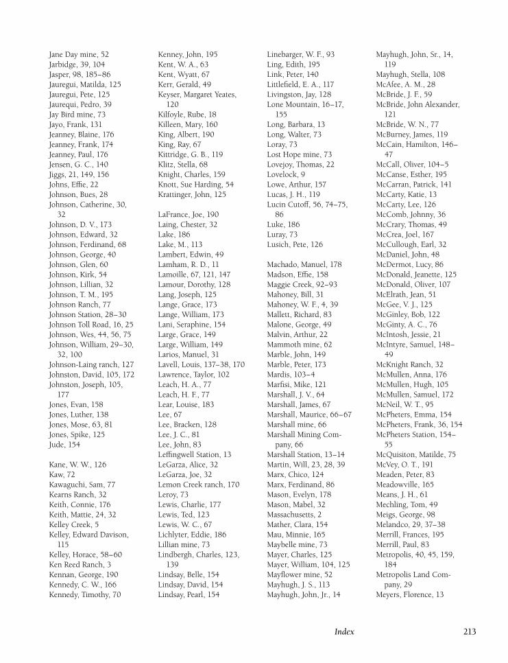
Jane Day mine, 52
Jarbidge, 39, 104
Jasper, 98, 185–86
Jauregui, Matilda, 125
Jauregui, Pete, 125
Jaurequi, Pedro, 39
Jay Bird mine, 73
Jayo, Frank, 131
Jeanney, Blaine, 176
Jeanney, Frank, 174
Jeanney, Paul, 176
Jensen, G. C., 140
Jiggs, 21, 149, 156
Johns, Effie, 22
Johnson, Bues, 28
Johnson, Catherine, 30,
32
Johnson, D. V., 173
Johnson, Edward, 32
Johnson, Ferdinand, 68
Johnson, George, 40
Johnson, Glen, 60
Johnson, Kirk, 54
Johnson, Lillian, 32
Johnson, T. M., 195
Johnson Ranch, 77
Johnson Station, 28–30
Johnson Toll Road, 16, 25
Johnson, Wes, 44, 56, 75
Johnson, William, 29–30,
32, 100
Johnson-Laing ranch, 127
Johnston, David, 105, 172
Johnston, Joseph, 105,
177
Jones, Evan, 158
Jones, Luther, 138
Jones, Mose, 63, 81
Jones, Spike, 125
Jude, 154
Kane, W. W., 126
Kaw, 72
Kawaguchi, Sam, 77
Kearns Ranch, 32
Keith, Connie, 176
Keith, Mattie, 24, 32
Kelley Creek, 5
Kelley, Edward Davison,
115
Kelley, Horace, 58–60
Ken Reed Ranch, 3
Kennan, George, 190
Kennedy, C. W., 166
Kennedy, Timothy, 70
Kenney, John, 195
Kent, W. A., 63
Kent, Wyatt, 67
Kerr, Gerald, 49
Keyser, Margaret Yeates,
120
Kilfoyle, Rube, 18
Killeen, Mary, 160
King, Albert, 190
King, Ray, 67
Kittridge, G. B., 119
Klitz, Stella, 68
Knight, Charles, 159
Knott, Sue Harding, 54
Krattinger, John, 125
LaFrance, Joe, 190
Laing, Chester, 32
Lake, 186
Lake, M., 113
Lambert, Edwin, 49
Lamham, R. D., 11
Lamoille, 67, 121, 147
Lamour, Dorothy, 128
Lang, Joseph, 125
Lange, Grace, 173
Lange, William, 173
Lani, Seraphine, 154
Large, Grace, 149
Large, William, 149
Larios, Manuel, 31
Lavell, Louis, 137–38, 170
Lawrence, Taylor, 102
Leach, H. A., 77
Leach, H. F., 77
Lear, Louise, 183
Lee, 67
Lee, Bracken, 128
Lee, J. C., 81
Lee, John, 83
Leffingwell Station, 13
LeGarza, Alice, 32
LeGarza, Joe, 32
Lemon Creek ranch, 170
Leroy, 73
Lewis, Charlie, 177
Lewis, Ted, 123
Lewis, W. C., 67
Lichlyter, Eddie, 186
Lillian mine, 73
Lindbergh, Charles, 123,
139
Lindsay, Belle, 154
Lindsay, David, 154
Lindsay, Pearl, 154
Linebarger, W. F., 93
Ling, Edith, 195
Link, Peter, 140
Littlefield, E. A., 117
Livingston, Jay, 128
Lone Mountain, 16–17,
155
Long, Barbara, 13
Long, Walter, 73
Loray, 73
Lost Hope mine, 73
Lovejoy, Thomas, 22
Lovelock, 9
Lowe, Arthur, 157
Lucas, J. H., 119
Lucin Cutoff, 56, 74–75,
86
Luke, 186
Luray, 73
Lusich, Pete, 126
Machado, Manuel, 178
Madson, Effie, 158
Maggie Creek, 92–93
Mahoney, Bill, 31
Mahoney, W. F., 4, 39
Mallett, Richard, 83
Malone, George, 49
Malvin, Arthur, 22
Mammoth mine, 62
Marble, John, 149
Marble, Peter, 173
Mardis, 103–4
Marfisi, Mike, 121
Marshall, J. V., 64
Marshall, James, 67
Marshall, Maurice, 66–67
Marshall mine, 66
Marshall Mining Com-
pany, 66
Marshall Station, 13–14
Martin, Will, 23, 28, 39
Marx, Chico, 124
Marx, Ferdinand, 86
Mason, Evelyn, 178
Mason, Mabel, 32
Massachusetts, 2
Mather, Clara, 154
Mau, Minnie, 165
Maybelle mine, 73
Mayer, Charles, 125
Mayer, William, 104, 125
Mayflower mine, 52
Mayhugh, J. S., 113
Mayhugh, John, Jr., 14
Mayhugh, John, Sr., 14,
119
Mayhugh, Stella, 108
McAfee, A. M., 28
McBride, J. F., 59
McBride, John Alexander,
121
McBride, W. N., 77
McBurney, James, 119
McCain, Hamilton, 146–
47
McCall, Oliver, 104–5
McCanse, Esther, 195
McCarran, Patrick, 141
McCarty, Katie, 13
McCarty, Lee, 126
McComb, Johnny, 36
McCrary, Thomas, 49
McCrea, Joel, 167
McCullough, Earl, 32
McDaniel, John, 48
McDermot, Lucy, 86
McDonald, Jeanette, 125
McDonald, Oliver, 107
McElrath, Jean, 51
McGee, V. J., 125
McGinley, Bob, 122
McGinty, A. C., 76
McIntosh, Jessie, 21
McIntyre, Samuel, 148–
49
McKnight Ranch, 32
McMullen, Anna, 176
McMullen, Hugh, 105
McMullen, Samuel, 172
McNeil, W. T., 95
McPheters, Emma, 154
McPheters, Frank, 36, 154
McPheters Station, 154–
55
McQuisiton, Matilde, 75
McVey, O. T., 191
Meaden, Peter, 83
Meadowville, 165
Means, J. H., 61
Mechling, Tom, 49
Meigs, George, 98
Melandco, 29, 37–38
Merrill, Frances, 195
Merrill, Paul, 83
Metropolis, 40, 45, 159,
184
Metropolis Land Com-
pany, 29
Meyers, Florence, 13
Index 213
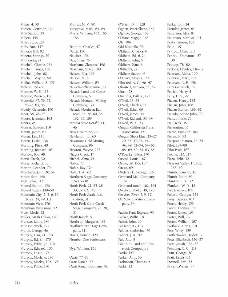
Midas, 4, 30
Miesen, Gertrude, 124
Milk Station, 35
Millers, 155
Mills, Edna, 154
Mills, Sam, 147
Mineral Hill, 92
Mineral Springs, 20
Minnesota, 24
Mitchell, Charlie, 154
Mitchell, James, 158
Mitchell, John, 62
Mitchell, Mayme, 60
Moffat, William, 8, 157
Moleen, 155–56
Monroe, W. P., 112
Monroe, Warren, 117
Montello, 47, 56, 65,
74–76, 83, 86
Moody, Gertrude, 190
Moor, 56, 76–77
Moore, Jeremiah, 163
Moors, 76
Mooser, Samuel, 119
Moran, James, 61
Moren, Les, 121
Moren, Leslie, 136
Morning, Rhea, 48
Morning, Richard, 48
Morrow, Bob, 48
Morse Creek, 30
Morse, Richard, 30
Morton, Leander, 79
Moschetti, John, 20, 54
Moser, Sam, 146
Mott, John, 113
Mound Station, 156
Mound Valley, 149–50
Mountain City, 2, 3, 6, 10,
16, 22, 24, 49, 111
Mountain View, 176
Mountain View mine, 52
Mues, Merle, 32
Muller, Sarah Gillan, 120
Munsee, Leroy, 186
Munson ranch, 192
Murao, George, 46
Murphy, Dan, 21, 148
Murphy, Ed, Sr., 170
Murphy, Eddie, Jr., 170
Murphy, Edward, 105
Murphy, Leslie, 176
Murphy, Morlene, 170
Murphy, Morley, 105, 176
Murphy, Pollie, 170
Murray, M. V., 80
Musgrove, Mark, 64–65
Myers, William, 163, 166,
186
Nannini, Charles, 47
Nardi, 156
Natchez, 156
Nay, Orris, 75
Neasham, Clarence, 190
Neasham, Grace, 190
Nelson, Ella, 195
Nelson, N., 4
Nelson, William, 85
Nevada-Bellvue mine, 67
Nevada Land and Cattle
Company, 5
Nevada Monarch Mining
Company, 174
Nevada Northern Rail-
road, 44, 58, 60, 86,
182–85, 189
Nevada State Herald, 44,
46
New Deal mine, 73
Newland, J. L., 65
Newmont Gold Mining
Company, 96
Newton, Wayne, 125
Niagra Creek, 17
Nichol, Alma, 75
Noble, 77
Noble, Ray, 124
Noll, H. A., 62
Northern Stage Company,
2–3, 9–10
North Fork, 21, 23, 28–
33, 39, 62, 148
North Fork Cattle Asso-
ciation, 31
North Fork-Gold Creek
Stage Company, 23, 28,
31
North Ranch, 5
Northrup, Margaret, 187
Northwestern Stage Com-
pany, 111
Novis, Donald, 124
Number One Settlement,
14
Nye, William, 131
Oasis, 77–78
Oasis Ranch, 77
Oasis Ranch Company, 86
O’Brien, D. J., 128
Ogden, Peter Skene, 169
Ogilvie, George, 158
O’Hare, Maggie, 165
Ola, 186
Old Montello, 56
Oldham, Charles, 6
Oldham, Ed, 6, 24
Oldham, John, 6
Oldham, Kate, 6
Oldham’s, 22
Oldham Station, 6
O’Leary, Aloysia, 154
Olmsted, A. C., 46–47
Olmsted, Kenyon, 44, 49
Omar, 58
Onandia, Eulalie, 125
O’Neil, 33–34
O’Neil, Charles, 34
O’Neil, Ethel, 60
O’Neil, James, 34
O’Neil, Richard, 33–34
O’Neil, W. T., 33
Oregon California Trails
Association, 151
Oregon Short Line, 25–27,
29, 35, 37–38, 45–
46, 49, 52–54, 64–65,
68–69, 80–81, 83, 85
O’Rourke, Ellen, 170
Orstad, Louis, 167
Osino, 39, 155, 157
Otego, 69
Ouderkirk, George, 126
Overland Mail Company,
162
Overland ranch, 162, 164
Owyhee, 14–16, 49, 128
Owyhee River, 7, 9, 111
Ox Yoke Livestock Com-
pany, 34
Pacific Fruit Express, 93
Packer, Willis, 18
Paleni, John, 90
Palisade, 93, 113
Palmer, Catherine, 70
Palmer, J. A., 92
Palo Alto, 8
Palo Alto Land and Live-
stock Company, 8
Pardo, 157
Parker, Amy, 60
Parkinson, Thomas, 5
Park’s, 22
Parks, Tom, 24
Parmley, James, 81
Patterson, Alex, 81
Patterson, Marilyn, 141
Peake, Simon, 165
Peko, 107
Penrod, Allen, 120
Penrod, Emmanuel, 37–
38
Pequop, 78–80
Perkins, Charles, 116–17
Peterson, Aloha, 190
Peterson, Mary, 107
Peterson, N. F., 158
Peterson ranch, 158
Petriell, Harry, 4
Petty, C. S., 99
Phalan, Henry, 182
Phalan, John, 186
Phalan Station, 186–87
Piccolo, Adobe John, 90
Pickup mine, 73
Pie Creek, 35
Pie Station, 35
Pierce, Franklin, 162
Pierce, S., 92
Pierpoint Station, 16, 25
Pilot, 187–88
Pilot Peak, 187
Pioche, 113, 117
Plaza, Feliz, 12
Pleasant Valley, 17, 103,
158–60
Plumb, Blanche, 32
Plumb, Edith, 80
Plunkett, J. R., 12
Plunkett, W. D., 12
Pole Canyon, 105
Pollard, Georgia, 154
Pony Express, 163
Porch, Henry, 153
Porch, Thomas, 153
Porter, James, 103
Porter, Will, 73
Porter, William, 187
Portlock, Kireta, 101
Post, Wiley, 139
Postlethwaite, Taylor, 17
Potts, Elizabeth, 136–37
Potts, Josiah, 136–37
Powning, C. C., 117
Pratt, George, 30
Pratt, Lewis, 63
Presnell, Earl, 32
Price, LaVerne, 77
214 Index
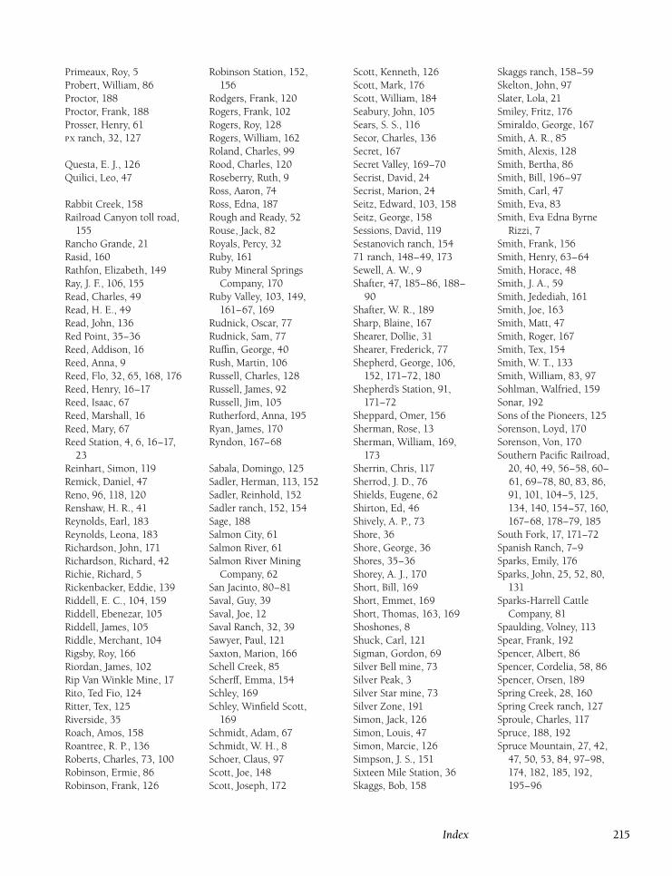
Primeaux, Roy, 5
Probert, William, 86
Proctor, 188
Proctor, Frank, 188
Prosser, Henry, 61
ranch, 32, 127
Questa, E. J., 126
Quilici, Leo, 47
Rabbit Creek, 158
Railroad Canyon toll road,
155
Rancho Grande, 21
Rasid, 160
Rathfon, Elizabeth, 149
Ray, J. F., 106, 155
Read, Charles, 49
Read, H. E., 49
Read, John, 136
Red Point, 35–36
Reed, Addison, 16
Reed, Anna, 9
Reed, Flo, 32, 65, 168, 176
Reed, Henry, 16–17
Reed, Isaac, 67
Reed, Marshall, 16
Reed, Mary, 67
Reed Station, 4, 6, 16–17,
23
Reinhart, Simon, 119
Remick, Daniel, 47
Reno, 96, 118, 120
Renshaw, H. R., 41
Reynolds, Earl, 183
Reynolds, Leona, 183
Richardson, John, 171
Richardson, Richard, 42
Richie, Richard, 5
Rickenbacker, Eddie, 139
Riddell, E. C., 104, 159
Riddell, Ebenezar, 105
Riddell, James, 105
Riddle, Merchant, 104
Rigsby, Roy, 166
Riordan, James, 102
Rip Van Winkle Mine, 17
Rito, Ted Fio, 124
Ritter, Tex, 125
Riverside, 35
Roach, Amos, 158
Roantree, R. P., 136
Roberts, Charles, 73, 100
Robinson, Ermie, 86
Robinson, Frank, 126
Robinson Station, 152,
156
Rodgers, Frank, 120
Rogers, Frank, 102
Rogers, Roy, 128
Rogers, William, 162
Roland, Charles, 99
Rood, Charles, 120
Roseberry, Ruth, 9
Ross, Aaron, 74
Ross, Edna, 187
Rough and Ready, 52
Rouse, Jack, 82
Royals, Percy, 32
Ruby, 161
Ruby Mineral Springs
Company, 170
Ruby Valley, 103, 149,
161–67, 169
Rudnick, Oscar, 77
Rudnick, Sam, 77
Ruffin, George, 40
Rush, Martin, 106
Russell, Charles, 128
Russell, James, 92
Russell, Jim, 105
Rutherford, Anna, 195
Ryan, James, 170
Ryndon, 167–68
Sabala, Domingo, 125
Sadler, Herman, 113, 152
Sadler, Reinhold, 152
Sadler ranch, 152, 154
Sage, 188
Salmon City, 61
Salmon River, 61
Salmon River Mining
Company, 62
San Jacinto, 80–81
Saval, Guy, 39
Saval, Joe, 12
Saval Ranch, 32, 39
Sawyer, Paul, 121
Saxton, Marion, 166
Schell Creek, 85
Scherff, Emma, 154
Schley, 169
Schley, Winfield Scott,
169
Schmidt, Adam, 67
Schmidt, W. H., 8
Schoer, Claus, 97
Scott, Joe, 148
Scott, Joseph, 172
Scott, Kenneth, 126
Scott, Mark, 176
Scott, William, 184
Seabury, John, 105
Sears, S. S., 116
Secor, Charles, 136
Secret, 167
Secret Valley, 169–70
Secrist, David, 24
Secrist, Marion, 24
Seitz, Edward, 103, 158
Seitz, George, 158
Sessions, David, 119
Sestanovich ranch, 154
71 ranch, 148–49, 173
Sewell, A. W., 9
Shafter, 47, 185–86, 188–
90
Shafter, W. R., 189
Sharp, Blaine, 167
Shearer, Dollie, 31
Shearer, Frederick, 77
Shepherd, George, 106,
152, 171–72, 180
Shepherd’s Station, 91,
171–72
Sheppard, Omer, 156
Sherman, Rose, 13
Sherman, William, 169,
173
Sherrin, Chris, 117
Sherrod, J. D., 76
Shields, Eugene, 62
Shirton, Ed, 46
Shively, A. P., 73
Shore, 36
Shore, George, 36
Shores, 35–36
Shorey, A. J., 170
Short, Bill, 169
Short, Emmet, 169
Short, Thomas, 163, 169
Shoshones, 8
Shuck, Carl, 121
Sigman, Gordon, 69
Silver Bell mine, 73
Silver Peak, 3
Silver Star mine, 73
Silver Zone, 191
Simon, Jack, 126
Simon, Louis, 47
Simon, Marcie, 126
Simpson, J. S., 151
Sixteen Mile Station, 36
Skaggs, Bob, 158
Skaggs ranch, 158–59
Skelton, John, 97
Slater, Lola, 21
Smiley, Fritz, 176
Smiraldo, George, 167
Smith, A. R., 85
Smith, Alexis, 128
Smith, Bertha, 86
Smith, Bill, 196–97
Smith, Carl, 47
Smith, Eva, 83
Smith, Eva Edna Byrne
Rizzi, 7
Smith, Frank, 156
Smith, Henry, 63–64
Smith, Horace, 48
Smith, J. A., 59
Smith, Jedediah, 161
Smith, Joe, 163
Smith, Matt, 47
Smith, Roger, 167
Smith, Tex, 154
Smith, W. T., 133
Smith, William, 83, 97
Sohlman, Walfried, 159
Sonar, 192
Sons of the Pioneers, 125
Sorenson, Loyd, 170
Sorenson, Von, 170
Southern Pacific Railroad,
20, 40, 49, 56–58, 60–
61, 69–78, 80, 83, 86,
91, 101, 104–5, 125,
134, 140, 154–57, 160,
167–68, 178–79, 185
South Fork, 17, 171–72
Spanish Ranch, 7–9
Sparks, Emily, 176
Sparks, John, 25, 52, 80,
131
Sparks-Harrell Cattle
Company, 81
Spaulding, Volney, 113
Spear, Frank, 192
Spencer, Albert, 86
Spencer, Cordelia, 58, 86
Spencer, Orsen, 189
Spring Creek, 28, 160
Spring Creek ranch, 127
Sproule, Charles, 117
Spruce, 188, 192
Spruce Mountain, 27, 42,
47, 50, 53, 84, 97–98,
174, 182, 185, 192,
195–96
Index 215
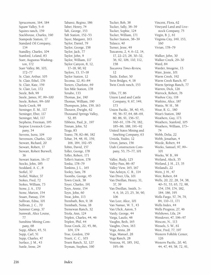
Sprucemont, 164, 184
Squaw Valley, 5–6
Squires ranch, 159
Stackhouse, Charles, 190
Stampede Station, 17
Standard Oil Company,
134
Standley, Charles, 104
Stanford, Leland, 83
Starr, Augustus Washing-
ton, 172
Starr Valley, 86, 103,
172–77
St. Clair, Arthur, 105
St. Clair, Ethel, 176
St. Clair, Kate, 159
St. Clair, Lee, 172
Steele, Bob, 99
Steele, James, 97, 99–100
Steele, Robert, 99–100
Steele Creek, 99
Steninger, E. M., 117
Steninger, Eber, 117
Steninger, Mel, 117
Stephens, Freeman, 195
Steptoe Livestock Com-
pany, 34
Stevens, Isora, 104
Stevenson, Charles, 120
Stewart, Richard, 20
Stewart, Robert, 17
Stewart, Robert Burwell,
36
Stewart Station, 16–17
Stocks, John, 185
Stoddard, A. C., 8
Stofiel, 37
Stofiel, Walter, 37
Stokes, Fred, 72
Stokes, William, 73
Stone, J. A., 170
Stone, Marion, 154
Stuart, Pansay, 154
Sullivan, Edna, 101
Sullivan, J. C., 70
Summer Camp, 37
Sumwalt, Alice Louise,
77
Sunshine Mining Com-
pany, 68
Supp, Albert, 45, 51
Supp, Carl, 51
Supp, Charles, 47
Surface, J. M., 43
Suttle, Irene, 24
Tabarez, Regino, 186
Taber, Henry, 74
Taft, George, 153
Taft Station, 152–53
Tayer, Margaret, 163
Taylor, Daniel, 79
Taylor, George, 158
Taylor, Jack, 77
Taylor, John, 9
Taylor, William, 117
Taylor Canyon, 8, 12,
17–18, 90, 92
Taylors, 13, 17–18
Taylor Station, 12
Tecoma, 12, 81–84
Teeters, Charlotte, 69
Ten Mile Station, 178
Tenabo, 133
Thomas, Joe, 190
Thomas, William, 190
Thompson, John, 159, 163
Thourot, Dwight, 62
Thousand Springs Valley,
52, 85
Tibbetts, Paul, Jr., 197
Tinnan, John, 52
Tioga, 83
Toano, 78, 82–86, 182
Tobar, 34, 48, 91, 159,
166, 184, 192–95
Tobin, David, 157
Toller, George, 178
Toller, Robert, 171
Toller’s Station, 178
Tonka, 178–79
Tonkins, J. L., 165
Tooley, Sam, 78
Toombs, George, 45
Town Creek, 38
Toyer, Charles, 191
Toyn, Annie, 154
Toyn, John, 60
Treat, John, 113
Trembath, Ben, 9, 18
Trembath, Nona, 18
Tremewan Ranch, 32
Triola, Ann, 124
Triplett, Charles, 44, 46
Triplett, Phil, 44
Trout Creek, 22, 45, 86,
104, 174
True, Gordon, 159
Truett, C. C., 103
Truett Ranch, 32, 127
Tryman, Stephen, 190
Tucker, Bob, 38
Tucker, Sally, 38–39
Tucker, Sophie, 124
Tucker, William, 171
Tucker Station, 38–39
Tulasco, 40
Turner, Jesse, 49
Tuscarora, 2, 4, 6–12, 14,
17, 22–23, 28, 30–32,
36, 92, 106, 110, 112,
158
Tuscarora Times-Review,12
Tuttle, Esther, 50
Twin Bridges, 4, 18
Twin Creek ranch, 153
Ullin, 77, 86
Union Land and Cattle
Company, 9, 67, 149,
173
Union Pacific, 38, 40, 45,
49, 56–57, 64, 68–69,
80, 86, 91, 156–57,
160–61, 178–79, 182,
185–86, 188, 191–92
United States Mining and
Smelting Company, 63
Urriola, Ysidro, 12
Urton, James, 156
Utah Construction Com-
pany, 53, 75–77, 101
Vallee, Rudy, 125
Valley Pass, 86–87
Valley View, 165, 167
Van Aelstyn, C. R., 114
Van Diver, Ula, 101
Van Dreillan, Henry, 31,
37, 39
Van Dreillan, Smith, 3–
4, 6, 16, 23, 25, 36, 90,
106
Van Leer, Alice, 101
Van Namee, W. T., 43
Van Ulick, Aaron, 5
Vardy, George, 44
Varga, Laszlo, 48
Vaughn, Beth, 165
Vaughn, Oren, 163
Vega, Anna, 28
Vega, Manuel, 28
Vega Ranch, 28
Ventosa, 91, 185, 192,
195–96
Vincent, Flora, 62
Vineyard Land and Live-
stock Company, 75
Virgin, B. J., 61
Virginia City, 149, 153,
160
Vivian, 178–79
Walker, John, 30
Walker Creek, 29–30
Ward, 84
Warder, Imogene, 13
Ware, Jessie, 101
Warm Creek, 192
Warm Creek Ranch, 97
Warm Springs Ranch, 77
Warren, Dick, 126
Warrock, Robert, 76
Washoe City, 118
Watkins, Alice, 187
Wattis, W. H., 58
Wear, R. G., 180
Wear’s Station, 180
Weathers, Guy, 173
Weathers, Stanford, 105
Weathers, William, 173–
74
Webb, Delia, 22
Webb, Jonathan, 4
Weede, Robert, 44
Weeks, Samuel, 97, 99–
101
Weeks, W. B., 99
Weiland, Aleck, 35
Weiland, J. H., 23, 35
Weiland’s, 22
Wein, J. H., 47
Weir, Robert, 64
Wells, 20, 22, 28, 34, 38,
40–51, 53, 65, 72, 98,
154, 159, 174, 182,
184, 186, 195
Wells Fargo, 57, 74, 79,
84, 110–11, 171
Wells Index, 44
Wells Progress, 27, 46
Welshows, Lila, 24
Wendover, 47, 196–97
Wescott, N., 113
Wessels, S. W., 61
West, Fred, 77, 197
Western Folklife Center,
126
Western Pacific, 20, 40,
44, 47, 49, 58, 72, 91,
216 Index
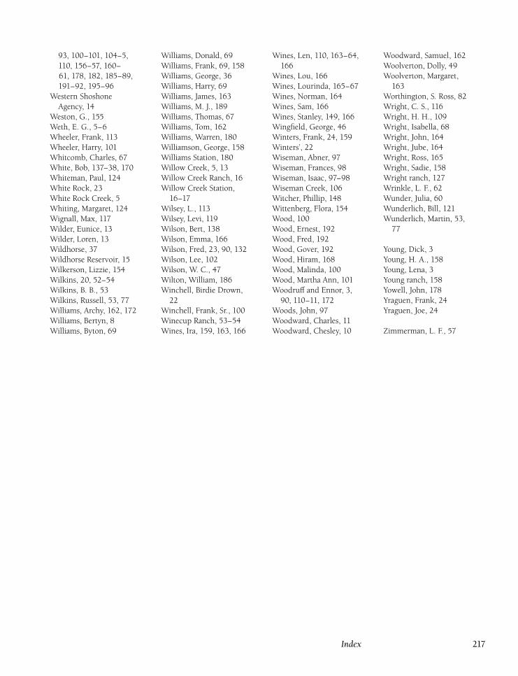
93, 100–101, 104–5,
110, 156–57, 160–
61, 178, 182, 185–89,
191–92, 195–96
Western Shoshone
Agency, 14
Weston, G., 155
Weth, E. G., 5–6
Wheeler, Frank, 113
Wheeler, Harry, 101
Whitcomb, Charles, 67
White, Bob, 137–38, 170
Whiteman, Paul, 124
White Rock, 23
White Rock Creek, 5
Whiting, Margaret, 124
Wignall, Max, 117
Wilder, Eunice, 13
Wilder, Loren, 13
Wildhorse, 37
Wildhorse Reservoir, 15
Wilkerson, Lizzie, 154
Wilkins, 20, 52–54
Wilkins, B. B., 53
Wilkins, Russell, 53, 77
Williams, Archy, 162, 172
Williams, Bertyn, 8
Williams, Byton, 69
Williams, Donald, 69
Williams, Frank, 69, 158
Williams, George, 36
Williams, Harry, 69
Williams, James, 163
Williams, M. J., 189
Williams, Thomas, 67
Williams, Tom, 162
Williams, Warren, 180
Williamson, George, 158
Williams Station, 180
Willow Creek, 5, 13
Willow Creek Ranch, 16
Willow Creek Station,
16–17
Wilsey, L., 113
Wilsey, Levi, 119
Wilson, Bert, 138
Wilson, Emma, 166
Wilson, Fred, 23, 90, 132
Wilson, Lee, 102
Wilson, W. C., 47
Wilton, William, 186
Winchell, Birdie Drown,
22
Winchell, Frank, Sr., 100
Winecup Ranch, 53–54
Wines, Ira, 159, 163, 166
Wines, Len, 110, 163–64,
166
Wines, Lou, 166
Wines, Lourinda, 165–67
Wines, Norman, 164
Wines, Sam, 166
Wines, Stanley, 149, 166
Wingfield, George, 46
Winters, Frank, 24, 159
Winters’, 22
Wiseman, Abner, 97
Wiseman, Frances, 98
Wiseman, Isaac, 97–98
Wiseman Creek, 106
Witcher, Phillip, 148
Wittenberg, Flora, 154
Wood, 100
Wood, Ernest, 192
Wood, Fred, 192
Wood, Gover, 192
Wood, Hiram, 168
Wood, Malinda, 100
Wood, Martha Ann, 101
Woodruff and Ennor, 3,
90, 110–11, 172
Woods, John, 97
Woodward, Charles, 11
Woodward, Chesley, 10
Woodward, Samuel, 162
Woolverton, Dolly, 49
Woolverton, Margaret,
163
Worthington, S. Ross, 82
Wright, C. S., 116
Wright, H. H., 109
Wright, Isabella, 68
Wright, John, 164
Wright, Jube, 164
Wright, Ross, 165
Wright, Sadie, 158
Wright ranch, 127
Wrinkle, L. F., 62
Wunder, Julia, 60
Wunderlich, Bill, 121
Wunderlich, Martin, 53,
77
Young, Dick, 3
Young, H. A., 158
Young, Lena, 3
Young ranch, 158
Yowell, John, 178
Yraguen, Frank, 24
Yraguen, Joe, 24
Zimmerman, L. F., 57
Index 217