Embed Size (px)
DESCRIPTION
Conservation Design for Sustainable Avian Populations in the Eastern United States. a cooperative project by: NC Cooperative Fish & Wildlife Research Unit, NCSU AL Cooperative Fish & Wildlife Research Unit, Auburn University Atlantic Coast Joint Venture. DSL Workshop. Funding. - PowerPoint PPT Presentation
Citation preview
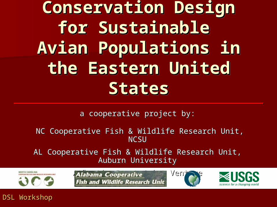
Conservation Design Conservation Design for Sustainable for Sustainable
Avian Populations in Avian Populations in the Eastern United the Eastern United
StatesStates
Conservation Design Conservation Design for Sustainable for Sustainable
Avian Populations in Avian Populations in the Eastern United the Eastern United
StatesStatesa cooperative project by:a cooperative project by:
NC Cooperative Fish & Wildlife Research Unit, NCSUNC Cooperative Fish & Wildlife Research Unit, NCSU
AL Cooperative Fish & Wildlife Research Unit, Auburn AL Cooperative Fish & Wildlife Research Unit, Auburn UniversityUniversity
Atlantic Coast Joint VentureAtlantic Coast Joint Venture
a cooperative project by:a cooperative project by:
NC Cooperative Fish & Wildlife Research Unit, NCSUNC Cooperative Fish & Wildlife Research Unit, NCSU
AL Cooperative Fish & Wildlife Research Unit, Auburn AL Cooperative Fish & Wildlife Research Unit, Auburn UniversityUniversity
Atlantic Coast Joint VentureAtlantic Coast Joint Venture
DSL WorkshopDSL Workshop
Key CooperatorsKey CooperatorsKey CooperatorsKey Cooperators NC and AL Cooperative Fish & Wildlife Research NC and AL Cooperative Fish & Wildlife Research
UnitsUnits
– Key participants in state and regional GAP datasetsKey participants in state and regional GAP datasets
Atlantic Coast Joint VentureAtlantic Coast Joint Venture
– Regional coordinationRegional coordination
NC and AL Cooperative Fish & Wildlife Research NC and AL Cooperative Fish & Wildlife Research UnitsUnits
– Key participants in state and regional GAP datasetsKey participants in state and regional GAP datasets
Atlantic Coast Joint VentureAtlantic Coast Joint Venture
– Regional coordinationRegional coordination
FundingFundingFundingFunding Multistate Conservation Grant Multistate Conservation Grant
Program administered through Program administered through the Association for Fish and the Association for Fish and Wildlife AgenciesWildlife Agencies
Multistate Conservation Grant Multistate Conservation Grant Program administered through Program administered through the Association for Fish and the Association for Fish and Wildlife AgenciesWildlife Agencies
Project GoalProject GoalProject GoalProject Goal
The overall goal of this proposal is to The overall goal of this proposal is to develop a consistent methodology develop a consistent methodology and to enhance the capacity of and to enhance the capacity of states, joint ventures and other states, joint ventures and other partners to formulate conservation partners to formulate conservation design schemes at landscape levels design schemes at landscape levels to sustain bird populations and other to sustain bird populations and other wildlife in the eastern United States. wildlife in the eastern United States.
The overall goal of this proposal is to The overall goal of this proposal is to develop a consistent methodology develop a consistent methodology and to enhance the capacity of and to enhance the capacity of states, joint ventures and other states, joint ventures and other partners to formulate conservation partners to formulate conservation design schemes at landscape levels design schemes at landscape levels to sustain bird populations and other to sustain bird populations and other wildlife in the eastern United States. wildlife in the eastern United States.
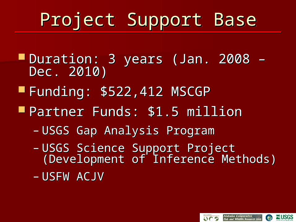
Project Support BaseProject Support BaseProject Support BaseProject Support Base
Duration: 3 years (Jan. 2008 – Dec. Duration: 3 years (Jan. 2008 – Dec. 2010)2010)
Funding: $522,412 MSCGPFunding: $522,412 MSCGP Partner Funds: $1.5 millionPartner Funds: $1.5 million
– USGS Gap Analysis ProgramUSGS Gap Analysis Program
– USGS Science Support Project USGS Science Support Project (Development of Inference Methods)(Development of Inference Methods)
– USFW ACJV USFW ACJV
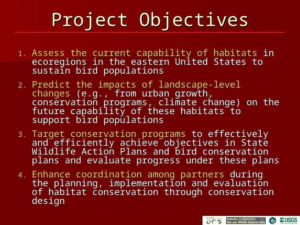
Project ObjectivesProject ObjectivesProject ObjectivesProject Objectives
1.1. Assess the current capability of habitatsAssess the current capability of habitats in in ecoregions in the eastern United States to ecoregions in the eastern United States to sustain bird populations sustain bird populations
2.2. Predict the impacts of landscape-level changesPredict the impacts of landscape-level changes (e.g., from urban growth, conservation programs, (e.g., from urban growth, conservation programs, climate change) on the future capability of these climate change) on the future capability of these habitats to support bird populations habitats to support bird populations
3.3. Target conservation programsTarget conservation programs to effectively and to effectively and efficiently achieve objectives in State Wildlife efficiently achieve objectives in State Wildlife Action Plans and bird conservation plans and Action Plans and bird conservation plans and evaluate progress under these plans evaluate progress under these plans
4.4. Enhance coordination among partnersEnhance coordination among partners during the during the planning, implementation and evaluation of planning, implementation and evaluation of habitat conservation through conservation habitat conservation through conservation design design
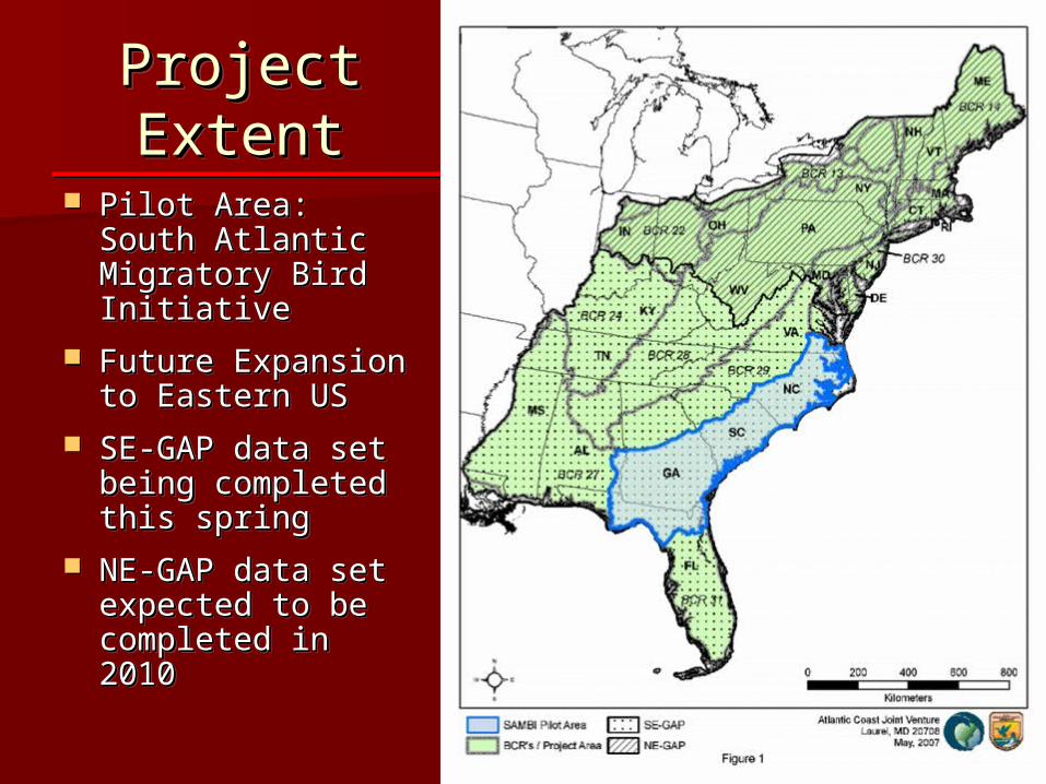
Project Project ExtentExtentProject Project ExtentExtent
Pilot Area: South Pilot Area: South Atlantic Migratory Atlantic Migratory Bird InitiativeBird Initiative
Future Expansion Future Expansion to Eastern USto Eastern US
SE-GAP data set SE-GAP data set being completed being completed this springthis spring
NE-GAP data set NE-GAP data set expected to be expected to be completed in completed in 20102010
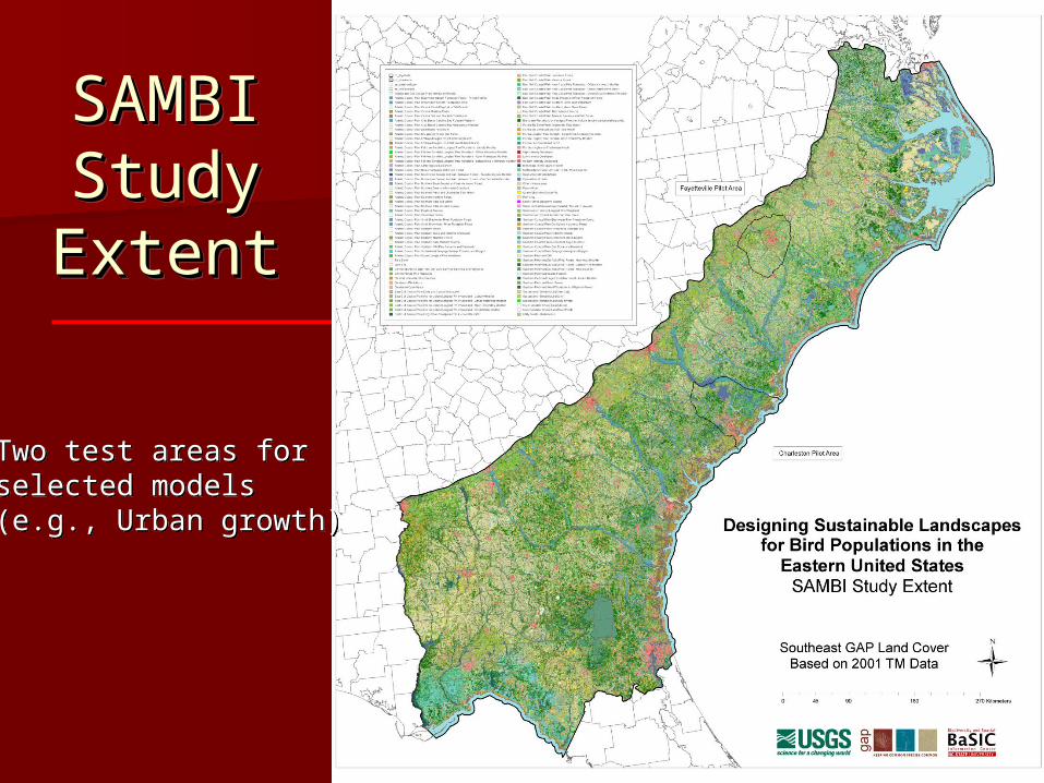
SAMBI SAMBI Study Study ExtentExtent
SAMBI SAMBI Study Study ExtentExtent
Two test areas forselected models(e.g., Urban growth)
Two test areas forselected models(e.g., Urban growth)
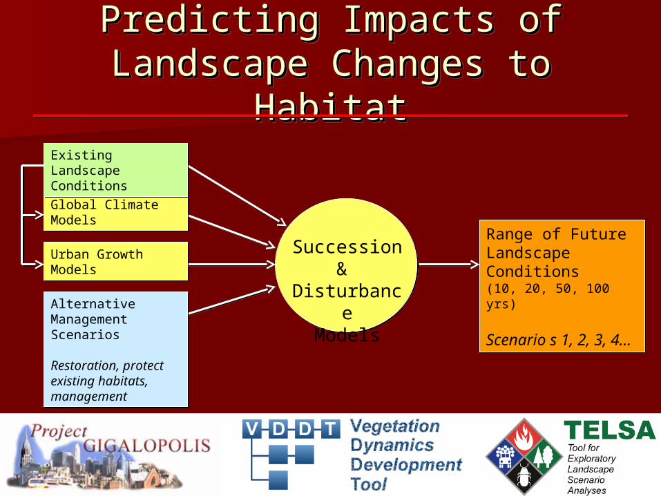
Urban GrowthModelsUrban GrowthModels
Global Climate ModelsGlobal Climate Models
Existing LandscapeConditionsExisting LandscapeConditions
Range of Future Landscape Conditions(10, 20, 50, 100 yrs)
Scenario s 1, 2, 3, 4…
Range of Future Landscape Conditions(10, 20, 50, 100 yrs)
Scenario s 1, 2, 3, 4…
Alternative Management Scenarios
Restoration, protect existing habitats, management
Alternative Management Scenarios
Restoration, protect existing habitats, management
Succession &
DisturbanceModels
Predicting Impacts of Predicting Impacts of Landscape Changes to HabitatLandscape Changes to Habitat
Predicting Impacts of Predicting Impacts of Landscape Changes to HabitatLandscape Changes to Habitat
Initial list of potential species to Initial list of potential species to model derived from SAMBI model derived from SAMBI conservation planconservation plan
Workshops and/or consultation Workshops and/or consultation with regional biologists to finalize with regional biologists to finalize the list of species/habitat-suites the list of species/habitat-suites through Structured Decision through Structured Decision Making ProcessMaking Process
Avian ModelingAvian ModelingAvian ModelingAvian Modeling
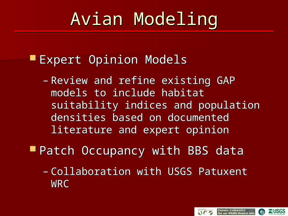
Expert Opinion ModelsExpert Opinion Models
– Review and refine existing GAP models Review and refine existing GAP models to include habitat suitability indices to include habitat suitability indices and population densities based on and population densities based on documented literature and expert documented literature and expert opinionopinion
Patch Occupancy with BBS dataPatch Occupancy with BBS data
– Collaboration with USGS Patuxent WRCCollaboration with USGS Patuxent WRC
Avian ModelingAvian ModelingAvian ModelingAvian Modeling
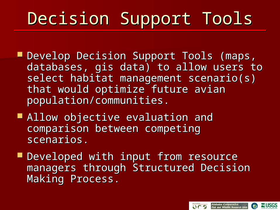
Decision Support ToolsDecision Support ToolsDecision Support ToolsDecision Support Tools
Develop Decision Support Tools (maps, Develop Decision Support Tools (maps, databases, gis data) to allow users to databases, gis data) to allow users to select habitat management scenario(s) select habitat management scenario(s) that would optimize future avian that would optimize future avian population/communities.population/communities.
Allow objective evaluation and comparison Allow objective evaluation and comparison between competing scenarios.between competing scenarios.
Developed with input from resource Developed with input from resource managers through Structured Decision managers through Structured Decision Making Process.Making Process.
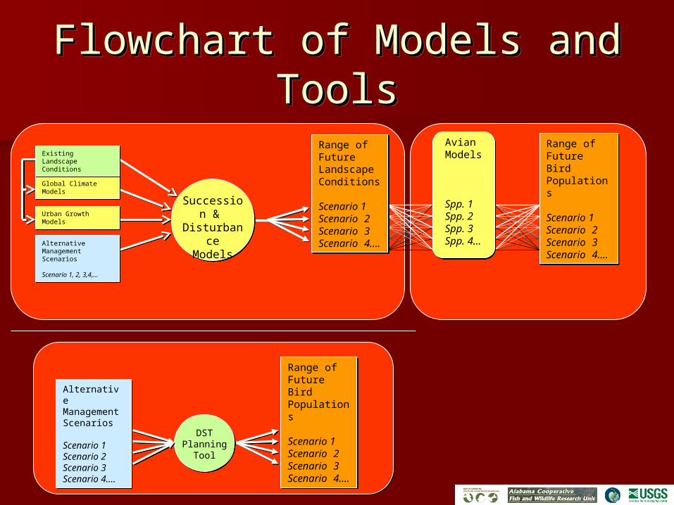
Urban GrowthModelsUrban GrowthModels
Global Climate ModelsGlobal Climate Models
Existing LandscapeConditionsExisting LandscapeConditions
Alternative Management Scenarios
Scenario 1, 2, 3,4,…
Alternative Management Scenarios
Scenario 1, 2, 3,4,…
Succession &
Disturbance
Models
Flowchart of Models and Flowchart of Models and ToolsTools
Flowchart of Models and Flowchart of Models and ToolsTools
Range of Future Landscape Conditions
Scenario 1Scenario 2Scenario 3Scenario 4….
Range of Future Landscape Conditions
Scenario 1Scenario 2Scenario 3Scenario 4….
DSTPlanning
Tool
Range of FutureBirdPopulations
Scenario 1Scenario 2Scenario 3Scenario 4….
Range of FutureBirdPopulations
Scenario 1Scenario 2Scenario 3Scenario 4….
AvianModels
Spp. 1Spp. 2Spp. 3Spp. 4…
Alternative Management Scenarios
Scenario 1Scenario 2Scenario 3Scenario 4….
Alternative Management Scenarios
Scenario 1Scenario 2Scenario 3Scenario 4….
Range of FutureBird Populations
Scenario 1Scenario 2Scenario 3Scenario 4….
Range of FutureBird Populations
Scenario 1Scenario 2Scenario 3Scenario 4….