Embed Size (px)
Citation preview

1
Case study GIS mapping of peer group incidents
February 2019 Pete Allen (Contextual Safeguarding Researcher) with the London Borough of Hackney’s First Access & Screening Team
2
This anonymised case study is based on a case received by the First Access & Screening Team (FAST) in the London Borough of Hackney, which is the front door of Hackney’s Children and Families Service. The use of peer mapping and the creation of an incident map using GIS enabled a visual representation of risks related to gang-involvement in a particular area and helped to safeguard a young person by reducing their exposure to gang-related criminal activity.
A referral was received from the Police concerning a 12-year-old male reporting that he and a friend had been threatened with a knife at a playground in Hackney. The Research Assistant who loaded the referral onto Mosaic noticed, while looking into the child’s social care history, that there was a concerning escalation of his anti-social and criminal behaviour which also involved his brother (15 years old) and their uncle (16).
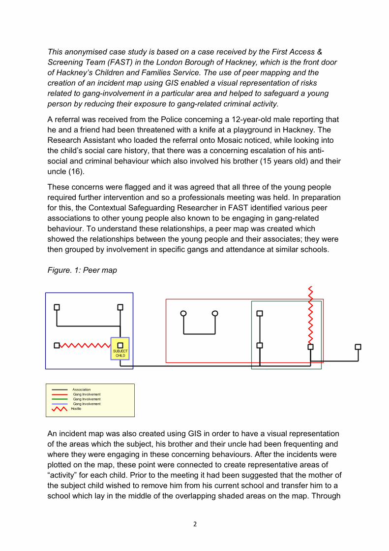
These concerns were flagged and it was agreed that all three of the young people required further intervention and so a professionals meeting was held. In preparation for this, the Contextual Safeguarding Researcher in FAST identified various peer associations to other young people also known to be engaging in gang-related behaviour. To understand these relationships, a peer map was created which showed the relationships between the young people and their associates; they were then grouped by involvement in specific gangs and attendance at similar schools. Figure. 1: Peer map
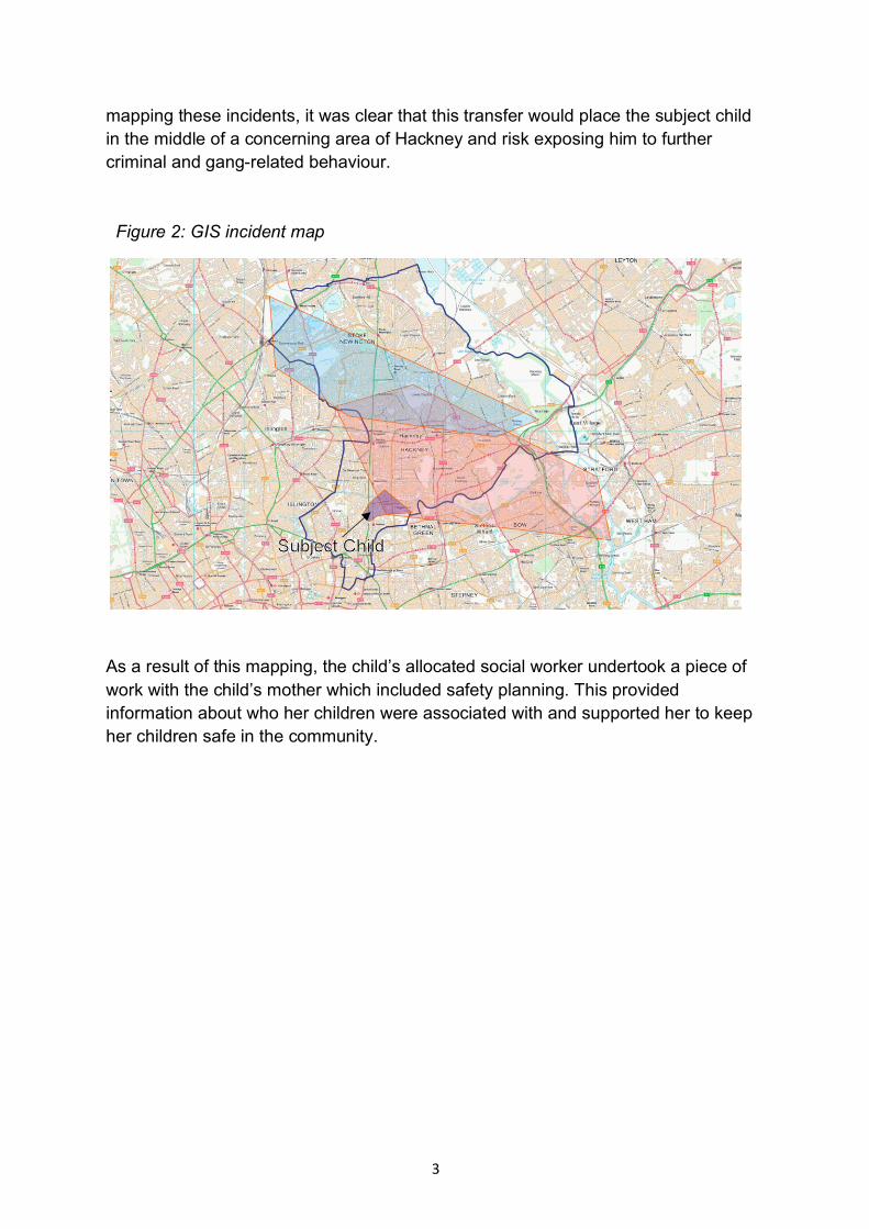
An incident map was also created using GIS in order to have a visual representation of the areas which the subject, his brother and their uncle had been frequenting and where they were engaging in these concerning behaviours. After the incidents were plotted on the map, these point were connected to create representative areas of “activity” for each child. Prior to the meeting it had been suggested that the mother of the subject child wished to remove him from his current school and transfer him to a school which lay in the middle of the overlapping shaded areas on the map. Through
Association
Hostile
SUBJECTCHILD
Gang InvolvementGang InvolvementGang Involvement
3
mapping these incidents, it was clear that this transfer would place the subject child in the middle of a concerning area of Hackney and risk exposing him to further criminal and gang-related behaviour. Figure 2: GIS incident map
As a result of this mapping, the child’s allocated social worker undertook a piece of work with the child’s mother which included safety planning. This provided information about who her children were associated with and supported her to keep her children safe in the community.