Embed Size (px)
Citation preview
Convection Currents
Copyright 2015 Red Glasses Learning
• Students will be able to explore and explain the theory of Continental Drift. • Students will be able to list evidence that the super continent once existed. • Students will recreate a model of Pangaea showing how the continents were once
connected.
• Students will explore the types of boundaries and the landforms that they create
Objective
Copyright 2015 Red Glasses Learning
Try it out!
Take the following picture and cut it into 10-15 random pieces. Be sure not to make the pieces too small. They should be at least one inch by one inch. Repeat the above procedure using a blank sheet of paper. Trade with another group and put the pieces of each puzzle together again. Answer the following questions. 1. Which puzzle was easier to put together? Why do you think this is?
2. What clues did you use to put the puzzles back together?
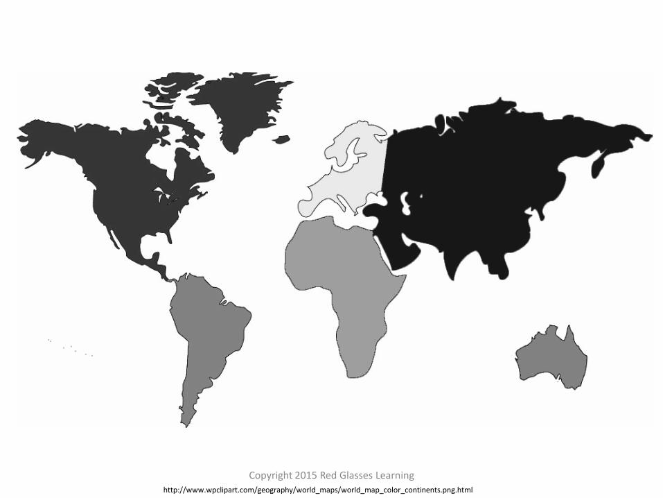
3. Observe the picture of the Earth’s continents. What do you notice about the
continents?
4. Explain your observations.

Copyright 2015 Red Glasses Learning Desert landscape on the Cabeza prieta national wildlife refuge free stock picture
Copyright 2015 Red Glasses Learning http://www.wpclipart.com/geography/world_maps/world_map_color_continents.png.html
Copyright 2015 Red Glasses Learning
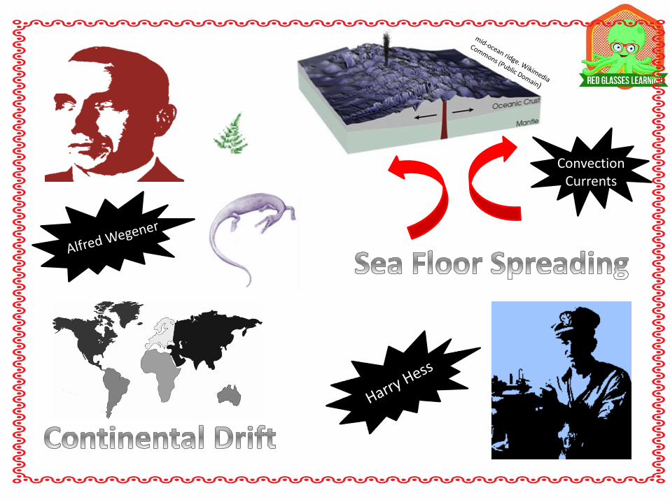
Alfred Wegener and
his theory of
Continental Drift
Continental Drift Pangaea
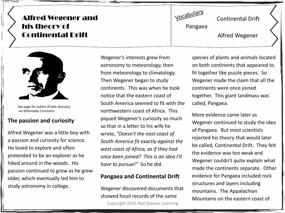
See page for author [Public domain], via Wikimedia Commons
The passion and curiosity
Alfred Wegener was a little boy with
a passion and curiosity for science.
He loved to explore and often
pretended to be an explorer as he
hiked around in the woods. His
passion continued to grow as he grew
older, which eventually led him to
study astronomy in college.
Wegener’s interests grew from
astronomy to meteorology, then
from meteorology to climatology.
Then Wegener began to study
continents. This was when he took
notice that the eastern coast of
South America seemed to fit with the
northwestern coast of Africa. This
piqued Wegener’s curiosity so much
so that in a letter to his wife he
wrote, "Doesn't the east coast of
South America fit exactly against the
west coast of Africa, as if they had
once been joined? This is an idea I’ll
have to pursue!” So he did.
Pangaea and Continental Drift
Wegener discovered documents that
showed fossil records of the same
species of plants and animals located
on both continents that appeared to
fit together like puzzle pieces. So
Wegener made the claim that all the
continents were once joined
together. This giant landmass was
called, Pangaea.
More evidence came later as
Wegener continued to study the idea
of Pangaea. But most scientists
rejected his theory that would later
be called, Continental Drift. They felt
the evidence was too weak and
Wegener couldn’t quite explain what
made the continents separate. Other
evidence for Pangaea included rock
structures and layers including
mountains. The Appalachian
Mountains on the eastern coast of
Alfred Wegener
Copyright 2015 Red Glasses Learning
Alfred Wegener and
his theory of
Continental Drift
Continental Drift Pangaea
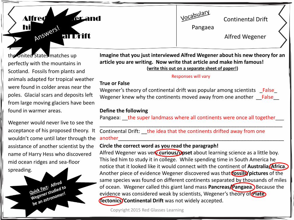
the United States matches up
perfectly with the mountains in
Scotland. Fossils from plants and
animals adapted for tropical weather
were found in colder areas near the
poles. Glacial scars and deposits left
from large moving glaciers have been
found in warmer areas.
Wegener would never live to see the
acceptance of his proposed theory. It
wouldn’t come until later through the
assistance of another scientist by the
name of Harry Hess who discovered
mid ocean ridges and sea-floor
spreading.
Alfred Wegener
Imagine that you just interviewed Alfred Wegener about his new theory for an article you are writing. Now write that article and make him famous!
(write this out on a separate sheet of paper!)
True or False Wegener’s theory of continental drift was popular among scientists ________ Wegener knew why the continents moved away from one another _________ Define the following Pangaea: ________________________________________________________ ________________________________________________________________ Continental Drift: _________________________________________________ ________________________________________________________________
Circle the correct word as you read the paragraph! Alfred Wegener was very curious/upset about learning science as a little boy. This led him to study it in college. While spending time in South America he notice that it looked like it would connect with the continent of Australia/Africa. Another piece of evidence Wegener discovered was that fossils/pictures of the same species was found on different continents separated by thousands of miles of ocean. Wegener called this giant land mass Pancreas/Pangaea. Because the evidence was considered weak by scientists, Wegener’s theory of Plate Tectonics/Continental Drift was not widely accepted.
Copyright 2015 Red Glasses Learning
Become the Scientist!
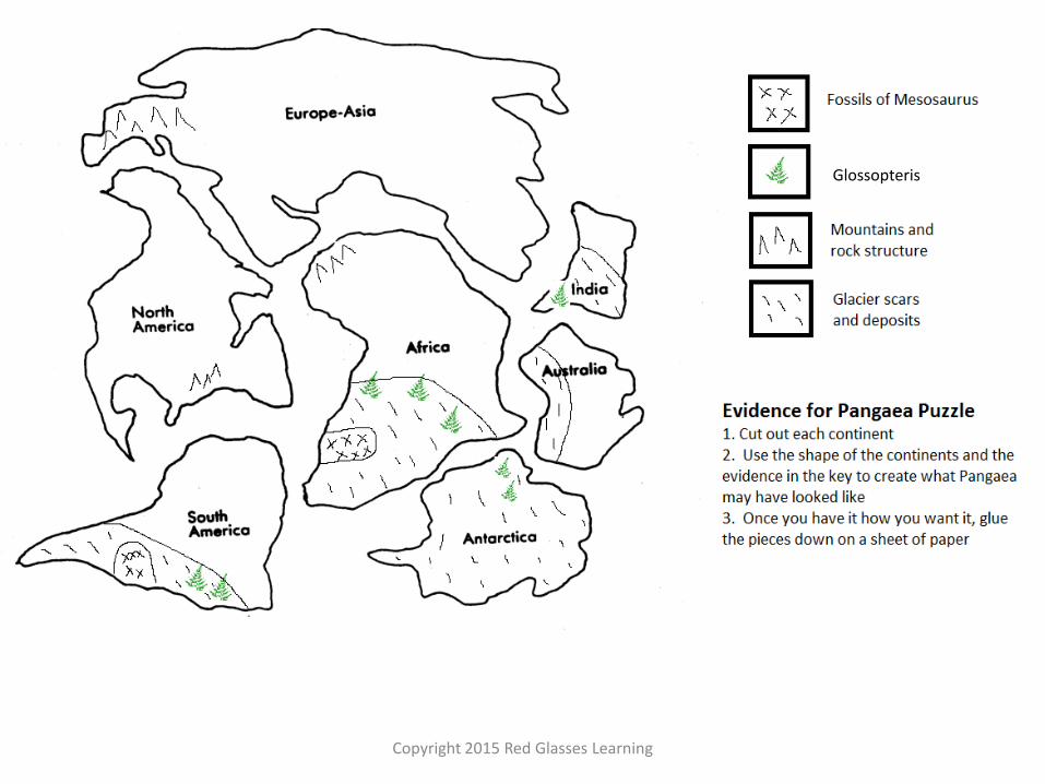
Just like Alfred Wegener made observations and came to the conclusion that he believed the continents were once together, you will observe the evidence and the shapes of the continents and try to match them up. Answer the following after creating Pangaea 1. Why don’t the continents match up perfectly? Explain what might have happened.
2. Suppose the continents were not together in one giant land mass. Come up with your own theory as to why a certain species were found on separate continents.
3. Predict what you think might happen in another few million years. Illustrate it!
4. This puzzle is a model of Pangaea. All models have limitations. Describe some limitations to this model.
Copyright 2015 Red Glasses Learning
Glossopteris
Copyright 2015 Red Glasses Learning
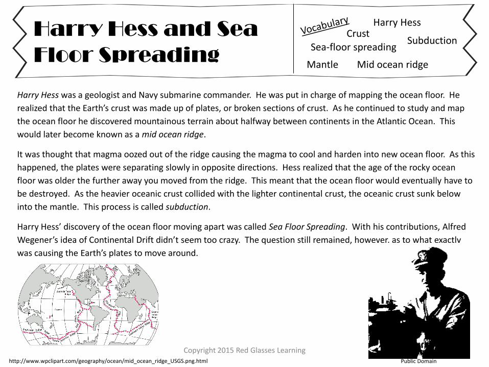
Harry Hess was a geologist and Navy submarine commander. He was put in charge of mapping the ocean floor. He
realized that the Earth’s crust was made up of plates, or broken sections of crust. As he continued to study and map
the ocean floor he discovered mountainous terrain about halfway between continents in the Atlantic Ocean. This
would later become known as a mid ocean ridge.
It was thought that magma oozed out of the ridge causing the magma to cool and harden into new ocean floor. As this
happened, the plates were separating slowly in opposite directions. Hess realized that the age of the rocky ocean
floor was older the further away you moved from the ridge. This meant that the ocean floor would eventually have to
be destroyed. As the heavier oceanic crust collided with the lighter continental crust, the oceanic crust sunk below
into the mantle. This process is called subduction.
Harry Hess’ discovery of the ocean floor moving apart was called Sea Floor Spreading. With his contributions, Alfred
Wegener’s idea of Continental Drift didn’t seem too crazy. The question still remained, however, as to what exactly
was causing the Earth’s plates to move around.
Harry Hess and Sea
Floor Spreading
Harry Hess
Sea-floor spreading
Mid ocean ridge
Subduction
Public Domain http://www.wpclipart.com/geography/ocean/mid_ocean_ridge_USGS.png.html
Mantle
Crust
Copyright 2015 Red Glasses Learning
Harry Hess and Sea
Floor Spreading
Harry Hess
Sea-floor spreading
Mid ocean ridge
Subduction
Mantle
Crust
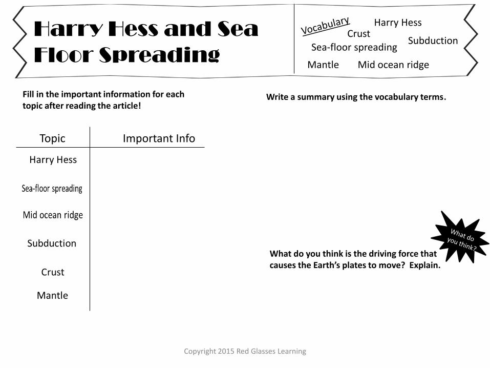
Write a summary using the vocabulary terms.
Topic Important Info
Fill in the important information for each topic after reading the article!
What do you think is the driving force that causes the Earth’s plates to move? Explain.
Copyright 2015 Red Glasses Learning
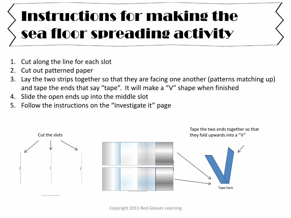
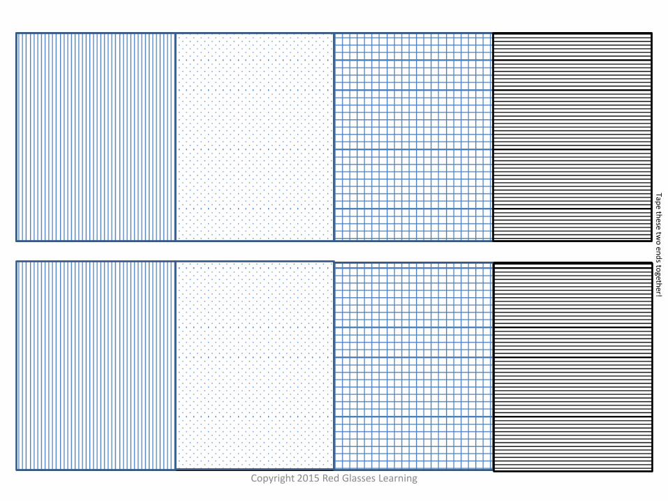
Instructions for making the
sea floor spreading activity
1. Cut along the line for each slot 2. Cut out patterned paper 3. Lay the two strips together so that they are facing one another (patterns matching up)
and tape the ends that say “tape”. It will make a “V” shape when finished 4. Slide the open ends up into the middle slot 5. Follow the instructions on the “Investigate it” page
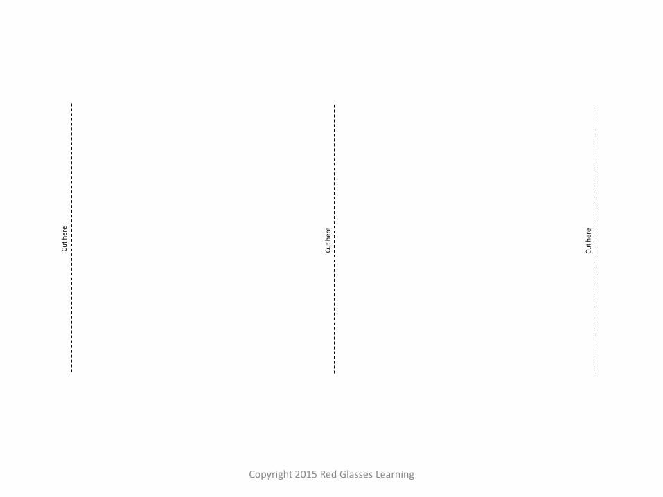
Cut the slots Tape the two ends together so that they fold upwards into a “V”
Tape here
Copyright 2015 Red Glasses Learning
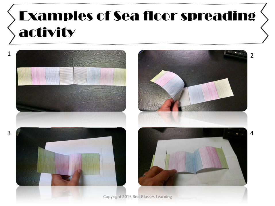
Examples of Sea floor spreading
activity
1 2
3 4
Copyright 2015 Red Glasses Learning
Cu
t h
ere
Cu
t h
ere
Cu
t h
ere
Copyright 2015 Red Glasses Learning
Tape th
ese two
end
s togeth
er!
Copyright 2015 Red Glasses Learning
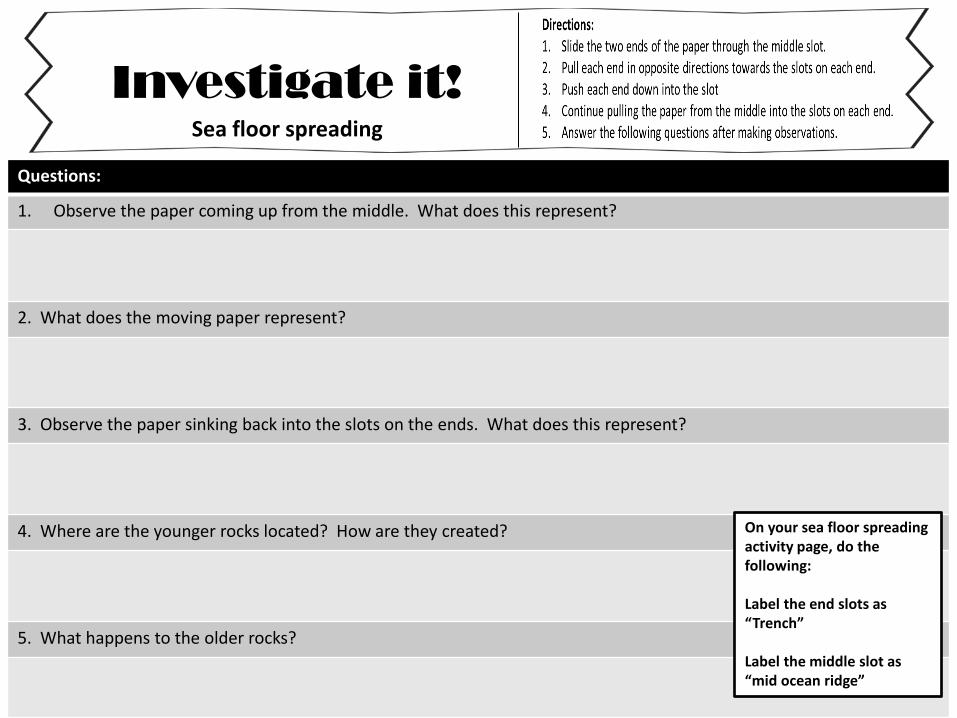
Investigate it!
Questions:
1. Observe the paper coming up from the middle. What does this represent?
2. What does the moving paper represent?
3. Observe the paper sinking back into the slots on the ends. What does this represent?
4. Where are the younger rocks located? How are they created?
5. What happens to the older rocks?
Sea floor spreading
On your sea floor spreading activity page, do the following: Label the end slots as “Trench” Label the middle slot as “mid ocean ridge”
Copyright 2015 Red Glasses Learning
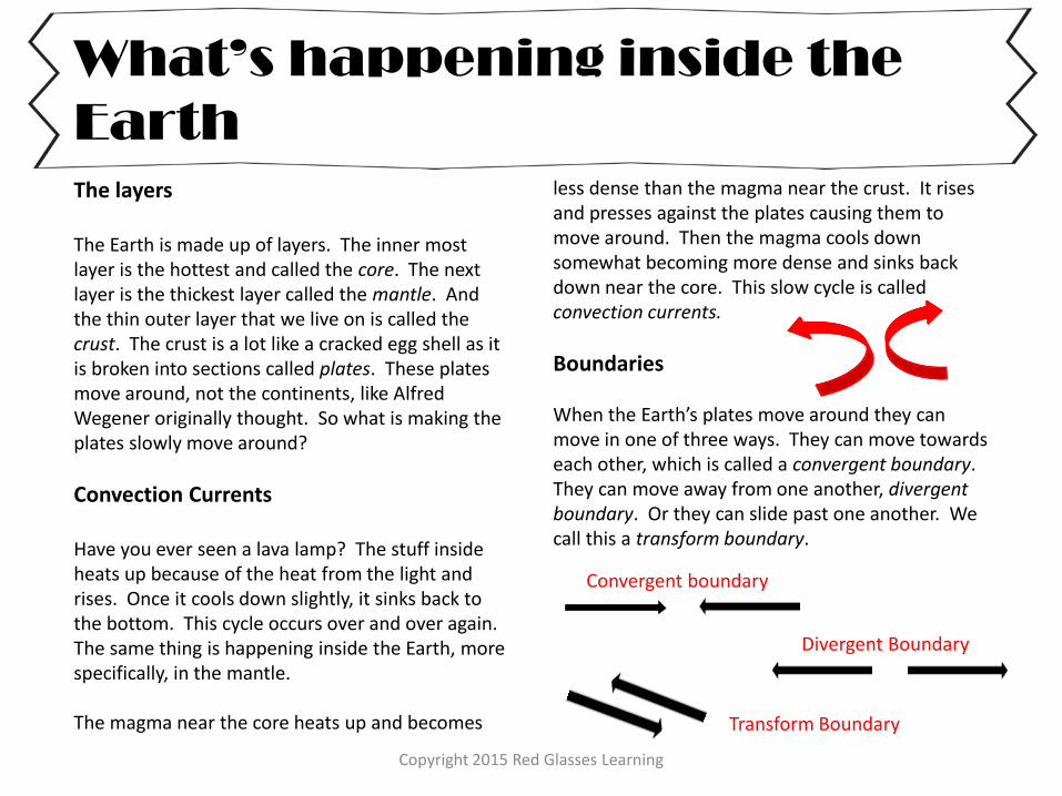
What’s happening inside the
Earth
The layers The Earth is made up of layers. The inner most layer is the hottest and called the core. The next layer is the thickest layer called the mantle. And the thin outer layer that we live on is called the crust. The crust is a lot like a cracked egg shell as it is broken into sections called plates. These plates move around, not the continents, like Alfred Wegener originally thought. So what is making the plates slowly move around?
Convection Currents Have you ever seen a lava lamp? The stuff inside heats up because of the heat from the light and rises. Once it cools down slightly, it sinks back to the bottom. This cycle occurs over and over again. The same thing is happening inside the Earth, more specifically, in the mantle. The magma near the core heats up and becomes
less dense than the magma near the crust. It rises and presses against the plates causing them to move around. Then the magma cools down somewhat becoming more dense and sinks back down near the core. This slow cycle is called convection currents.
Boundaries When the Earth’s plates move around they can move in one of three ways. They can move towards each other, which is called a convergent boundary. They can move away from one another, divergent boundary. Or they can slide past one another. We call this a transform boundary.
Convergent boundary
Divergent Boundary
Transform Boundary
Copyright 2015 Red Glasses Learning
Boundaries and Landforms
Convergent
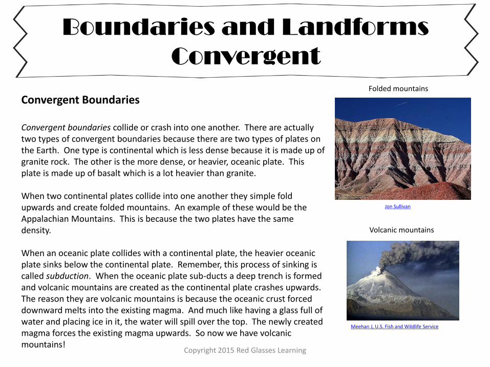
Convergent Boundaries Convergent boundaries collide or crash into one another. There are actually two types of convergent boundaries because there are two types of plates on the Earth. One type is continental which is less dense because it is made up of granite rock. The other is the more dense, or heavier, oceanic plate. This plate is made up of basalt which is a lot heavier than granite. When two continental plates collide into one another they simple fold upwards and create folded mountains. An example of these would be the Appalachian Mountains. This is because the two plates have the same density. When an oceanic plate collides with a continental plate, the heavier oceanic plate sinks below the continental plate. Remember, this process of sinking is called subduction. When the oceanic plate sub-ducts a deep trench is formed and volcanic mountains are created as the continental plate crashes upwards. The reason they are volcanic mountains is because the oceanic crust forced downward melts into the existing magma. And much like having a glass full of water and placing ice in it, the water will spill over the top. The newly created magma forces the existing magma upwards. So now we have volcanic mountains!
Jon Sullivan
Folded mountains
Meehan J, U.S. Fish and Wildlife Service
Volcanic mountains
Copyright 2015 Red Glasses Learning
Boundaries and Landforms
Divergent and Transform
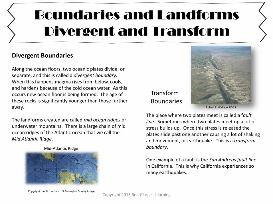
Divergent Boundaries Along the ocean floors, two oceanic plates divide, or separate, and this is called a divergent boundary. When this happens magma rises from below, cools, and hardens because of the cold ocean water. As this occurs new ocean floor is being formed. The age of these rocks is significantly younger than those further away. The landforms created are called mid ocean ridges or underwater mountains. There is a large chain of mid ocean ridges of the Atlantic ocean that we call the Mid Atlantic Ridge.
The place where two plates meet is called a fault line. Sometimes where two plates meet up a lot of stress builds up. Once this stress is released the plates slide past one another causing a lot of shaking and movement, or earthquake. This is a transform boundary. One example of a fault is the San Andreas fault line in California. This is why California experiences so many earthquakes.
Copyright: public domain. US Geological Survey image
Mid-Atlantic Ridge
Transform Boundaries
Robert E. Wallace, USGS
Copyright 2015 Red Glasses Learning
Directions for the graphic
organizer and diagram
Graphic organizer There are two graphic organizers based on the readings and material that the students have learned so far. One contains a word bank for assistance. The second one does not. The second one can be used for your higher performing students.
Diagram There are two diagrams provided. One contains questions about different landforms and processes happening. The other can be used for your higher performing students as it asks them to write and explain as much as they can remember. Another option is to give them the blank one first to see what they can recall. Then give them the diagram with the specific questions.
Copyright 2015 Red Glasses Learning
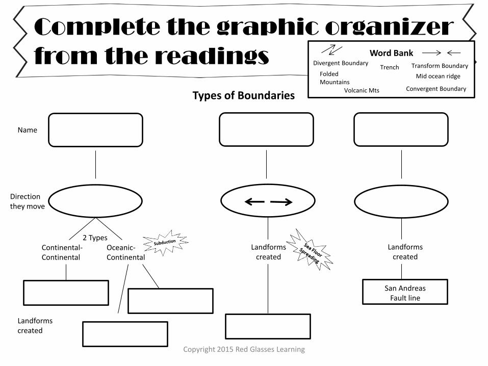
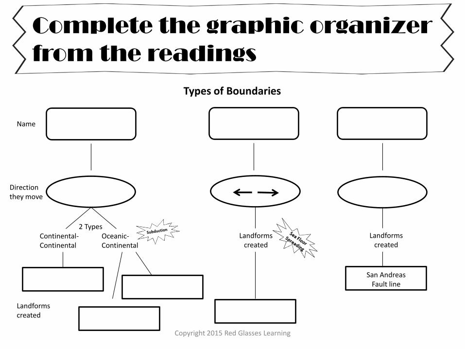
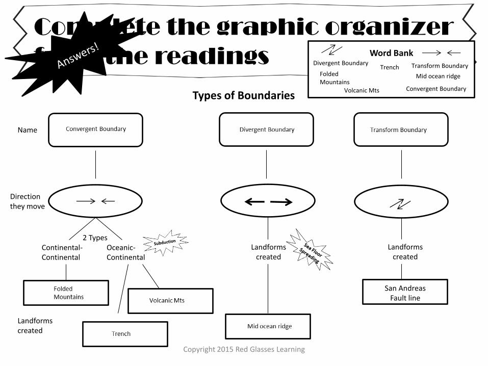
Types of Boundaries
Complete the graphic organizer
from the readings
Name
Direction they move
2 Types Continental- Continental
Oceanic- Continental
Landforms created
Landforms created
Landforms created
San Andreas Fault line
Word Bank
Convergent Boundary
Divergent Boundary Transform Boundary Folded Mountains
Trench
Volcanic Mts
Mid ocean ridge
Copyright 2015 Red Glasses Learning
Types of Boundaries
Complete the graphic organizer
from the readings
Name
Direction they move
2 Types Continental- Continental
Oceanic- Continental
Landforms created
Landforms created
Landforms created
San Andreas Fault line
Copyright 2015 Red Glasses Learning
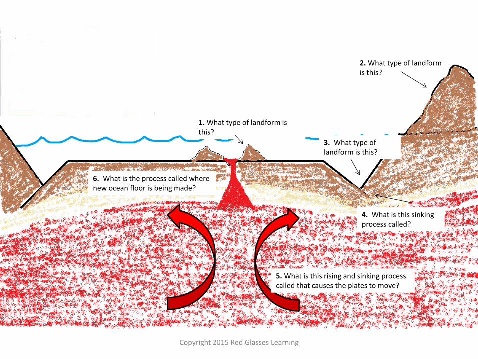
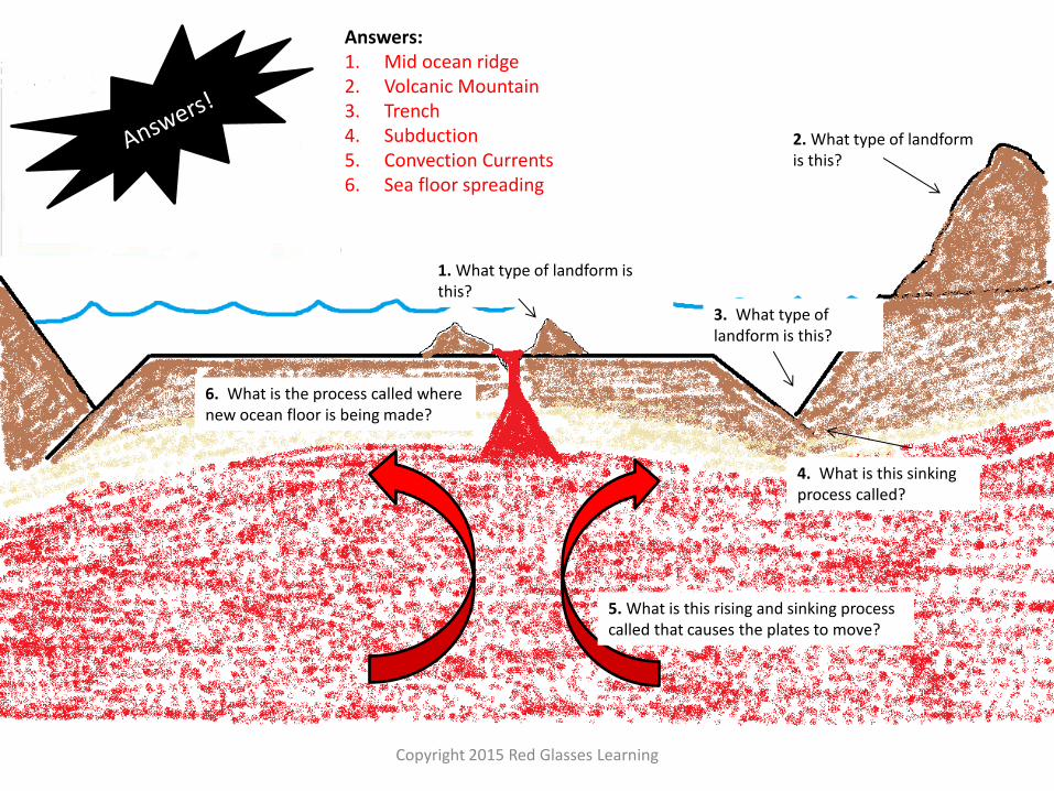
1. What type of landform is this?
2. What type of landform is this?
3. What type of landform is this?
4. What is this sinking process called?
5. What is this rising and sinking process called that causes the plates to move?
6. What is the process called where new ocean floor is being made?
Copyright 2015 Red Glasses Learning
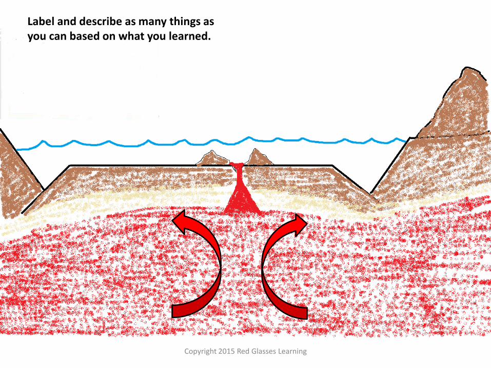
Label and describe as many things as you can based on what you learned.
Copyright 2015 Red Glasses Learning
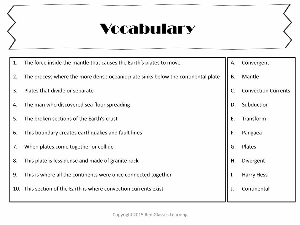
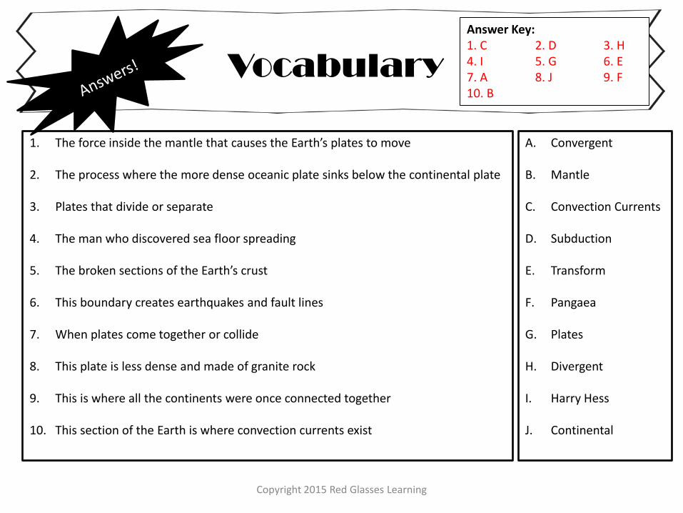
Vocabulary
1. The force inside the mantle that causes the Earth’s plates to move
2. The process where the more dense oceanic plate sinks below the continental plate
3. Plates that divide or separate
4. The man who discovered sea floor spreading
5. The broken sections of the Earth’s crust
6. This boundary creates earthquakes and fault lines
7. When plates come together or collide
8. This plate is less dense and made of granite rock
9. This is where all the continents were once connected together
10. This section of the Earth is where convection currents exist
A. Convergent
B. Mantle
C. Convection Currents
D. Subduction
E. Transform
F. Pangaea
G. Plates
H. Divergent
I. Harry Hess
J. Continental
Copyright 2015 Red Glasses Learning
Answer Key For possible answers given
Teachers: Provided are the answer keys that give possible answers. Answers will vary by student!
Copyright 2015 Red Glasses Learning
Alfred Wegener and
his theory of
Continental Drift
Continental Drift Pangaea
the United States matches up
perfectly with the mountains in
Scotland. Fossils from plants and
animals adapted for tropical weather
were found in colder areas near the
poles. Glacial scars and deposits left
from large moving glaciers have been
found in warmer areas.
Wegener would never live to see the
acceptance of his proposed theory. It
wouldn’t come until later through the
assistance of another scientist by the
name of Harry Hess who discovered
mid ocean ridges and sea-floor
spreading.
Alfred Wegener
Imagine that you just interviewed Alfred Wegener about his new theory for an article you are writing. Now write that article and make him famous!
(write this out on a separate sheet of paper!)
True or False Wegener’s theory of continental drift was popular among scientists _False_ Wegener knew why the continents moved away from one another __False__ Define the following Pangaea: __the super landmass where all continents were once all together___ ________________________________________________________________ Continental Drift: __the idea that the continents drifted away from one another__________________________________________________________
Circle the correct word as you read the paragraph! Alfred Wegener was very curious/upset about learning science as a little boy. This led him to study it in college. While spending time in South America he notice that it looked like it would connect with the continent of Australia/Africa. Another piece of evidence Wegener discovered was that fossils/pictures of the same species was found on different continents separated by thousands of miles of ocean. Wegener called this giant land mass Pancreas/Pangaea. Because the evidence was considered weak by scientists, Wegener’s theory of Plate Tectonics/Continental Drift was not widely accepted.
Responses will vary
Copyright 2015 Red Glasses Learning
Become the Scientist!
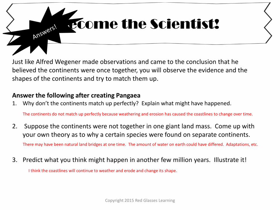
Just like Alfred Wegener made observations and came to the conclusion that he believed the continents were once together, you will observe the evidence and the shapes of the continents and try to match them up. Answer the following after creating Pangaea 1. Why don’t the continents match up perfectly? Explain what might have happened.
2. Suppose the continents were not together in one giant land mass. Come up with your own theory as to why a certain species were found on separate continents.
3. Predict what you think might happen in another few million years. Illustrate it!
The continents do not match up perfectly because weathering and erosion has caused the coastlines to change over time.
There may have been natural land bridges at one time. The amount of water on earth could have differed. Adaptations, etc.
I think the coastlines will continue to weather and erode and change its shape.
Copyright 2015 Red Glasses Learning
Investigate it!
Questions:
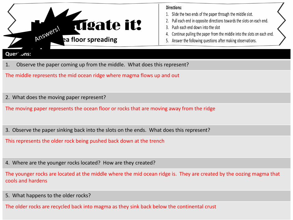
1. Observe the paper coming up from the middle. What does this represent?
The middle represents the mid ocean ridge where magma flows up and out
2. What does the moving paper represent?
The moving paper represents the ocean floor or rocks that are moving away from the ridge
3. Observe the paper sinking back into the slots on the ends. What does this represent?
This represents the older rock being pushed back down at the trench
4. Where are the younger rocks located? How are they created?
The younger rocks are located at the middle where the mid ocean ridge is. They are created by the oozing magma that cools and hardens
5. What happens to the older rocks?
The older rocks are recycled back into magma as they sink back below the continental crust
Sea floor spreading
Copyright 2015 Red Glasses Learning
Types of Boundaries
Complete the graphic organizer
from the readings
Name
Direction they move
2 Types Continental- Continental
Oceanic- Continental
Landforms created
Landforms created
Landforms created
San Andreas Fault line
Word Bank
Convergent Boundary
Divergent Boundary Transform Boundary Folded Mountains
Trench
Volcanic Mts
Mid ocean ridge
Copyright 2015 Red Glasses Learning
1. What type of landform is this?
2. What type of landform is this?
3. What type of landform is this?
4. What is this sinking process called?
5. What is this rising and sinking process called that causes the plates to move?
6. What is the process called where new ocean floor is being made?
Answers: 1. Mid ocean ridge 2. Volcanic Mountain 3. Trench 4. Subduction 5. Convection Currents 6. Sea floor spreading
Copyright 2015 Red Glasses Learning
Vocabulary
1. The force inside the mantle that causes the Earth’s plates to move
2. The process where the more dense oceanic plate sinks below the continental plate
3. Plates that divide or separate
4. The man who discovered sea floor spreading
5. The broken sections of the Earth’s crust
6. This boundary creates earthquakes and fault lines
7. When plates come together or collide
8. This plate is less dense and made of granite rock
9. This is where all the continents were once connected together
10. This section of the Earth is where convection currents exist
A. Convergent
B. Mantle
C. Convection Currents
D. Subduction
E. Transform
F. Pangaea
G. Plates
H. Divergent
I. Harry Hess
J. Continental
Answer Key: 1. C 2. D 3. H 4. I 5. G 6. E 7. A 8. J 9. F 10. B
Thank you and credits!
Folded mountains picture in public domain by Jon Sullivan
http://www.public-domain-image.com/full-image/nature-landscapes-public-domain-images-pictures/deserts-public-domain-images-pictures/desert-mountains.jpg-royalty-free-stock-image.html
Volcano picture in public domain Meehan J, U.S. Fish and Wildlife Service
http://www.public-domain-image.com/full-image/nature-landscapes-public-domain-images-pictures/volcanoes-public-domain-images-pictures/kanaga-volcano-eruption-kanaga-island-aleutians.jpg-royalty-free-stock-photograph.html
Mid Atlantic Ridge October 2003 . . JamesDay
Copyright: public domain. US Geological Survey image
San Andreas Fault Line
Original author: Robert E. Wallace, USGS
http://en.wikipedia.org/wiki/Image:San_Andreas_Fault_-_Carrizo_Plains.jpg
Copyright 2015 Red Glasses Learning