Embed Size (px)
Citation preview
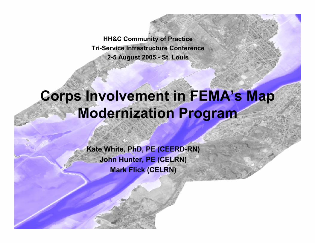
Corps Involvement in FEMA’s MapModernization Program
HH&C Community of PracticeTri-Service Infrastructure Conference
2-5 August 2005 - St. Louis
Kate White, PhD, PE (CEERD-RN)John Hunter, PE (CELRN)
Mark Flick (CELRN)
Hydraulics, Hydrology, and CoastalCommunity of PracticeUS Army Corps
of Engineers
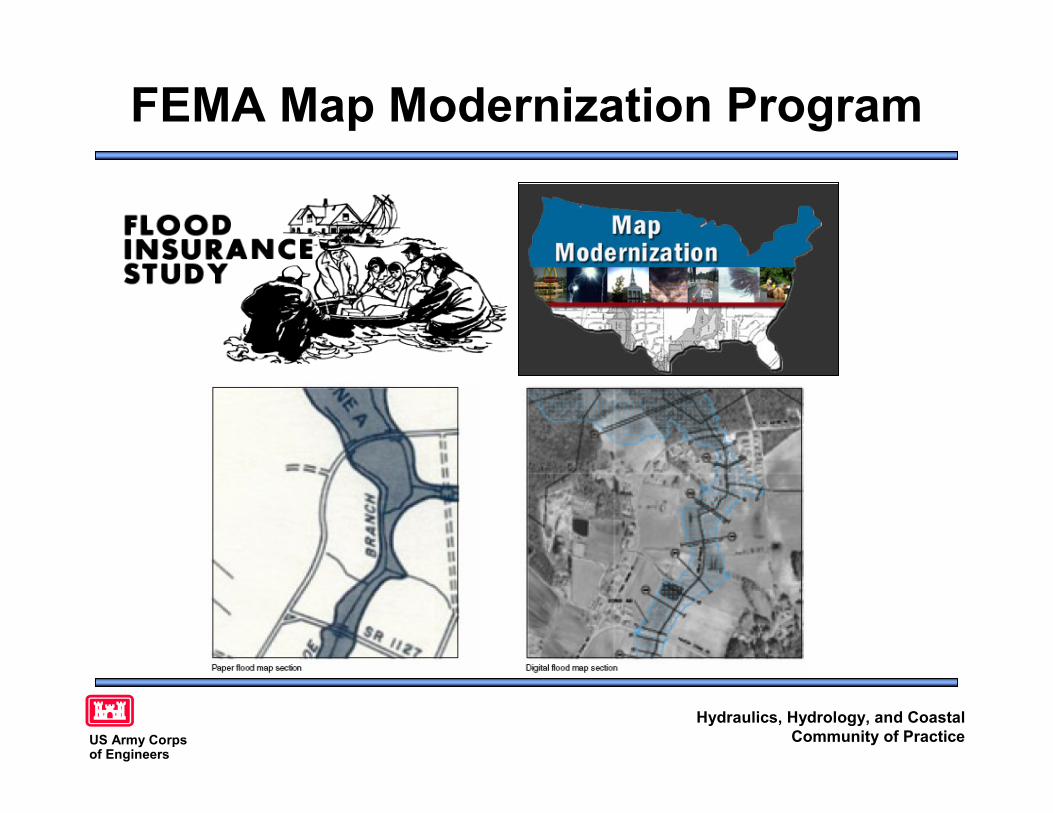
FEMA Map Modernization Program
Hydraulics, Hydrology, and CoastalCommunity of PracticeUS Army Corps
of Engineers
FEMA Map Modernization Program• >90K Flood Insurance Rate Map panels• ~70% FIRM > 10 years old by 2005• GAO recommended FEMA align funding to flood risk• MMP details in Multi-year flood Hazard Identification
Plan (MHIP) - living document– Studies for > 1/3 of counties started by FY05– ~ 40% of population will have digital maps by FY05– MHIP FY02-05 →08 with completion by FY10– FY05-09 sequence for DFIRM production– Dynamic scheduling for projects scheduled through FY08
(completion through FY10)– Risk-based method to establish appropriate level of detail,
accuracy, and analysis for reliable maps
Source: FEMA Multi-year flood Hazard Identification Plan
Hydraulics, Hydrology, and CoastalCommunity of PracticeUS Army Corps
of Engineers
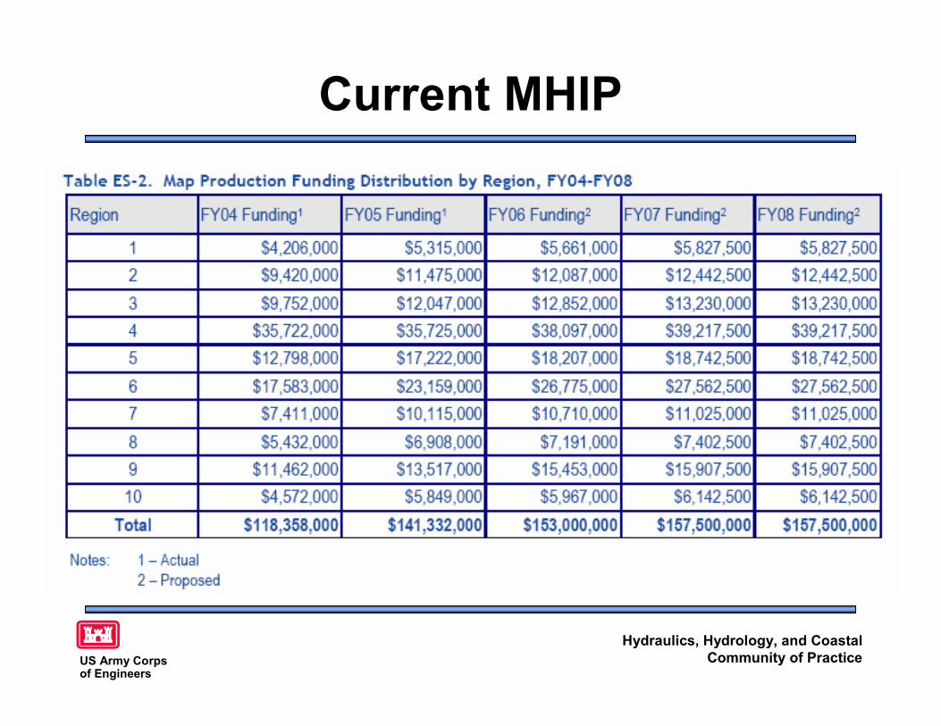
Current MHIP
Hydraulics, Hydrology, and CoastalCommunity of PracticeUS Army Corps
of Engineers
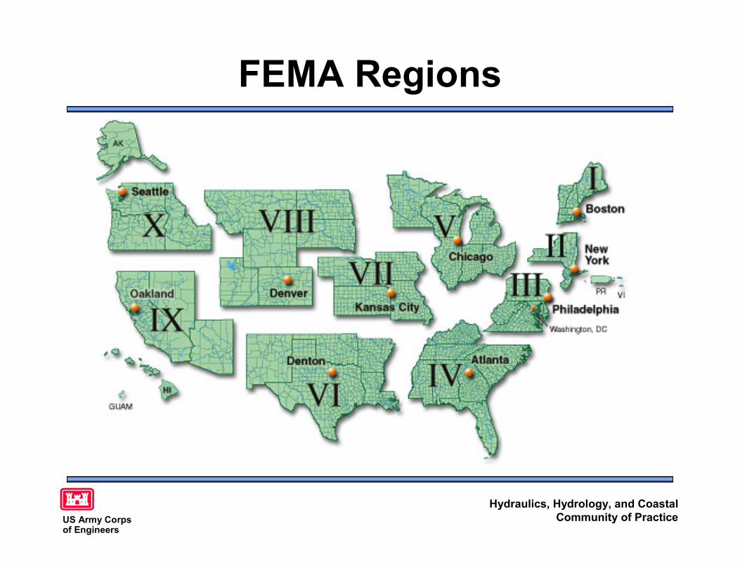
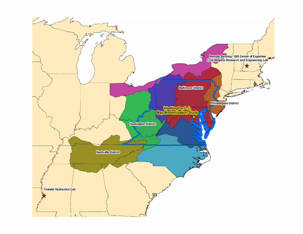
FEMA Regions
Hydraulics, Hydrology, and CoastalCommunity of PracticeUS Army Corps
of Engineers
Corps Support to FEMA• The US Army Corps of Engineers has played a
vital role in the development of Flood InsuranceStudies for the FEMA since the 1970’s
• Local Corps Districts– Local knowledge of rivers, flooding, development
patterns, regulatory permits, updated hydrology, bridges• National Corps Districts
– Experience with latest methods, use β version of HEC andCHL models first
– One Door to the Corps enables flexible and time-sensitivescheduling
Hydraulics, Hydrology, and CoastalCommunity of PracticeUS Army Corps
of Engineers
Corps Support to FEMA• Corps Centers
– Hydrologic EngineeringCenter
• Develops the HEC-RAS,GeoHEC-RAS, HMS,GeoHMS, and floodfrequency analysis modelsused by Districts andothers
– Remote Sensing/GIS Centerof Expertise
• Develops local, regional,and national geospatialdatabases and supportsCorps AIS for EmergencyManagement, O&M, andregulatory (in process)
• Corps Laboratories– Coastal and Hydraulics
Laboratory• Develops the coastal models for
local and regional wave andsurge modeling (STWAVE,ADCIRC, WISWAVE)
• Has access to LIDAR bathymetry,soundings, and other datacollected for coastal studies
– Cold Regions Research andEngineering Laboratory
• Supports HEC in snowmelt andice jam code for models
• Develops geospatially enabledlocal and regional hydrology
Hydraulics, Hydrology, and CoastalCommunity of PracticeUS Army Corps
of Engineers
Corps Support for FEMA• Regional Efforts Developing
– National PDT (RS/GIS CX)– Gulf Coast (CEMVN)– Upper Mississippi (CEMVR)– Policy and Corporate Issues (IWR)– Hydrologic Studies (HQUSACE)– National-level MOU (HQUSACE)
• Corps expertise in the watersheds bringsunique perspective to FEMA partners– Evaluating level of detail required for updates– Leveraging updates with other floodplain
management outcomes (e.g. cumulative impacts)
Hydraulics, Hydrology, and CoastalCommunity of PracticeUS Army Corps
of Engineers
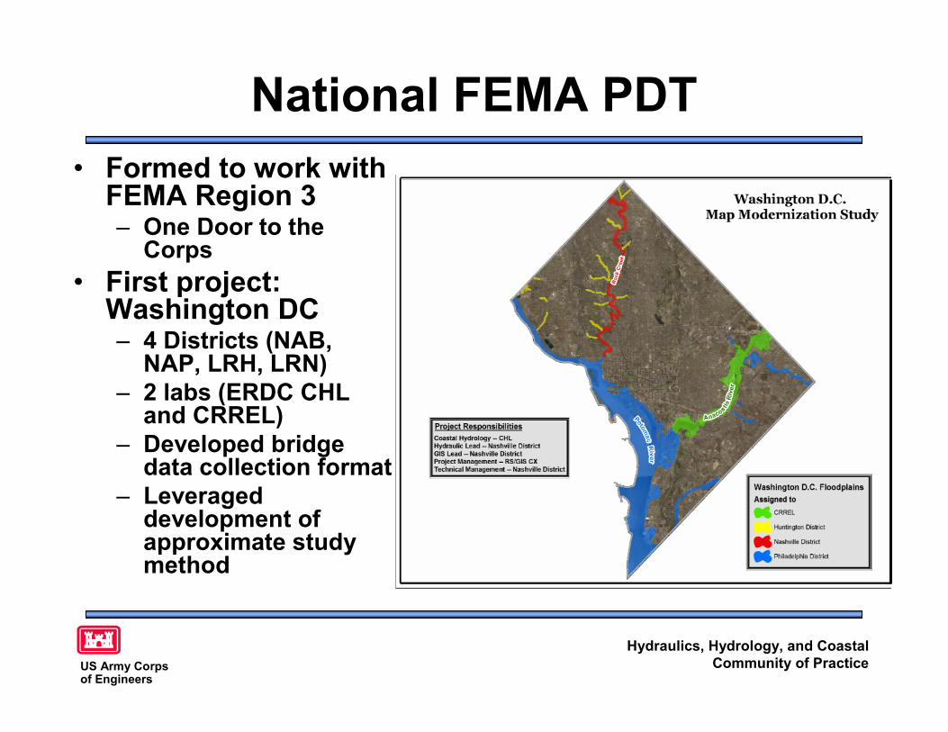
National FEMA PDT• Formed to work with
FEMA Region 3– One Door to the
Corps• First project:
Washington DC– 4 Districts (NAB,
NAP, LRH, LRN)– 2 labs (ERDC CHL
and CRREL)– Developed bridge
data collection format– Leveraged
development ofapproximate studymethod
Hydraulics, Hydrology, and CoastalCommunity of PracticeUS Army Corps
of Engineers
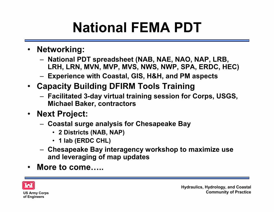
National FEMA PDT• Networking:
– National PDT spreadsheet (NAB, NAE, NAO, NAP, LRB,LRH, LRN, MVN, MVP, MVS, NWS, NWP, SPA, ERDC, HEC)
– Experience with Coastal, GIS, H&H, and PM aspects• Capacity Building DFIRM Tools Training
– Facilitated 3-day virtual training session for Corps, USGS,Michael Baker, contractors
• Next Project:– Coastal surge analysis for Chesapeake Bay
• 2 Districts (NAB, NAP)• 1 lab (ERDC CHL)
– Chesapeake Bay interagency workshop to maximize useand leveraging of map updates
• More to come…..
Hydraulics, Hydrology, and CoastalCommunity of PracticeUS Army Corps
of Engineers
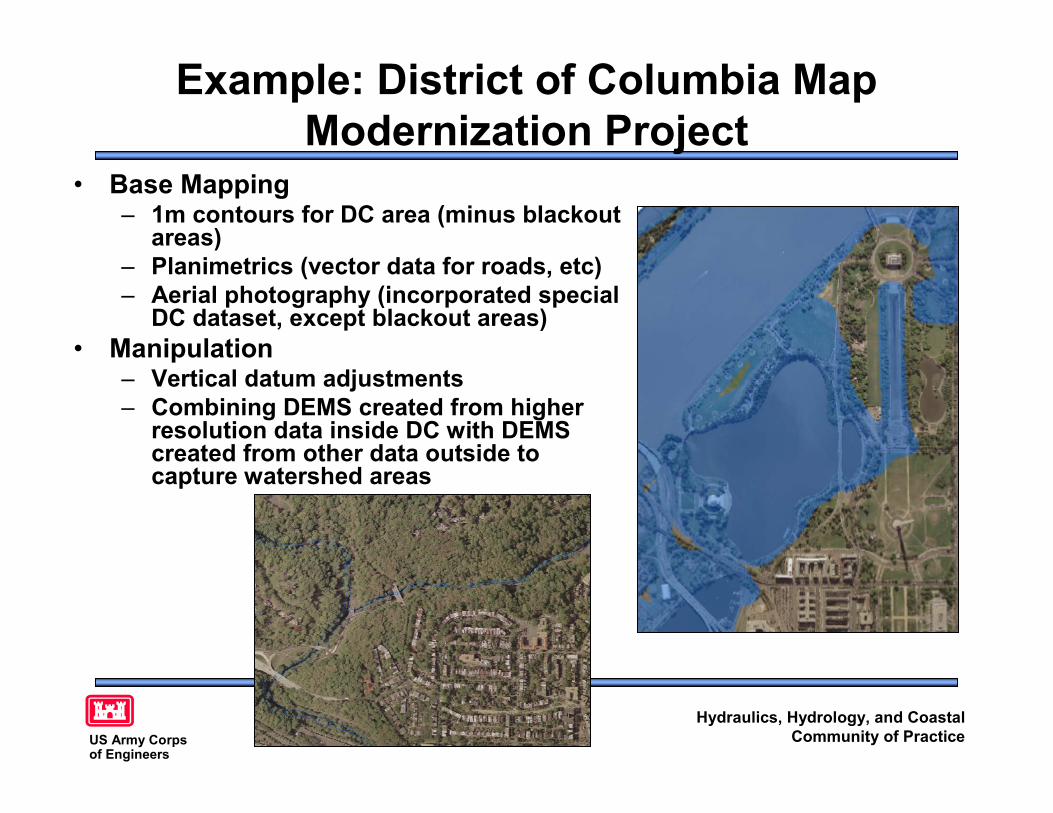
Example: District of Columbia MapModernization Project
• Base Mapping– 1m contours for DC area (minus blackout
areas)– Planimetrics (vector data for roads, etc)– Aerial photography (incorporated special
DC dataset, except blackout areas)• Manipulation
– Vertical datum adjustments– Combining DEMS created from higher
resolution data inside DC with DEMScreated from other data outside tocapture watershed areas
Hydraulics, Hydrology, and CoastalCommunity of PracticeUS Army Corps
of Engineers
Example: District of Columbia MapModernization Project
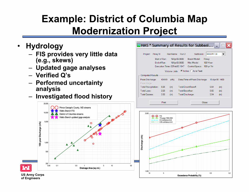
• Hydrology– FIS provides very little data
(e.g., skews)– Updated gage analyses– Verified Q’s– Performed uncertainty
analysis– Investigated flood history
Exceedance Probability (%)
Disc
harg
e (c
fs)
g
0.20.515101,000
5,000FIS17bgage1992-20020.5confidencelimit0.95confidencelimit
Drainage Area (sq mi.)
100-
year
Dis
char
ge (c
fs)
0.05 0.1 0.5 1 5 10 50200
500
1,000
5,000
10,000
20,000
Prince George's County, MD streamsWatts Branch FISDistrict of Columbia streamsWatts Branch updated gageanalysis
Hydraulics, Hydrology, and CoastalCommunity of PracticeUS Army Corps
of Engineers
Example: District of Columbia MapModernization Project
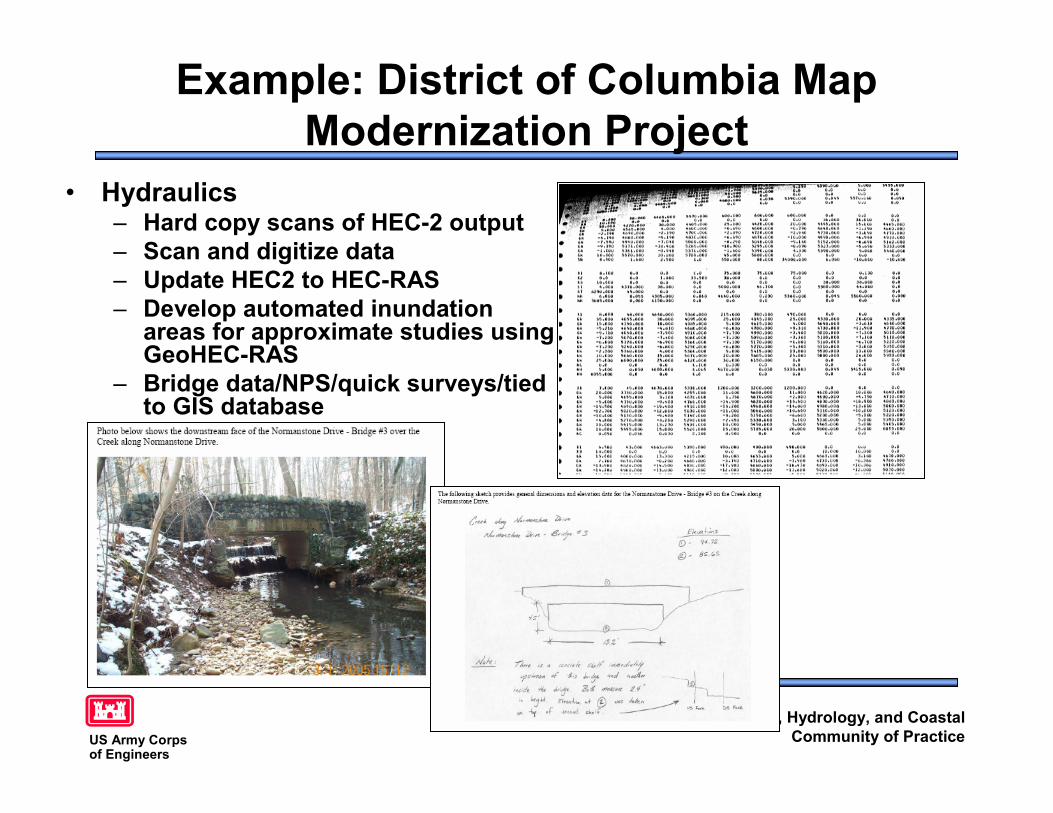
• Hydraulics– Hard copy scans of HEC-2 output– Scan and digitize data– Update HEC2 to HEC-RAS– Develop automated inundation
areas for approximate studies usingGeoHEC-RAS
– Bridge data/NPS/quick surveys/tiedto GIS database
Hydraulics, Hydrology, and CoastalCommunity of PracticeUS Army Corps
of Engineers
Example: District of Columbia MapModernization Project
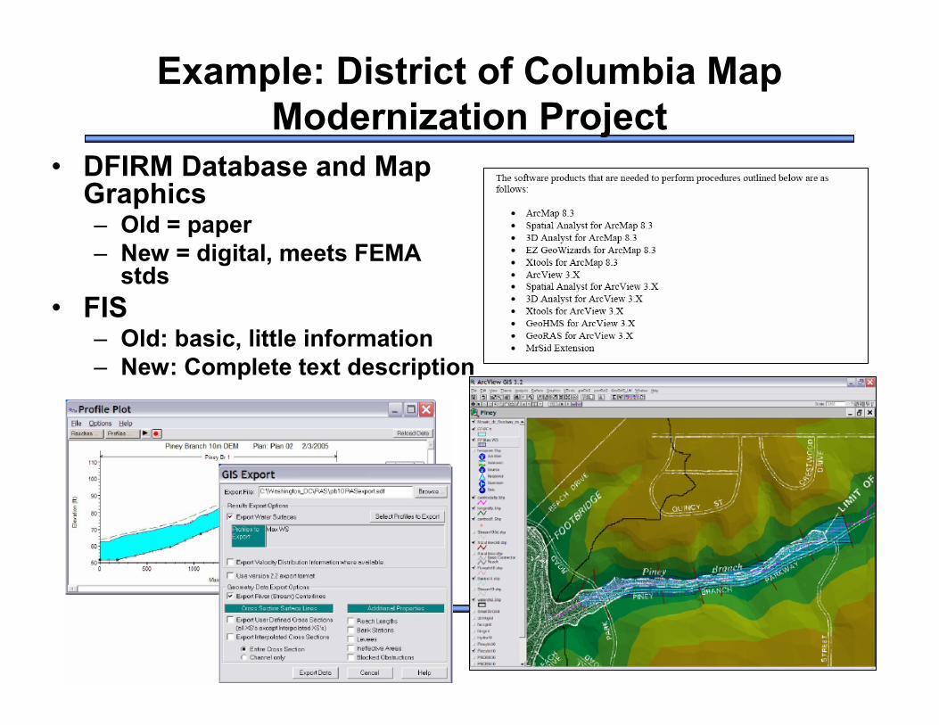
• DFIRM Database and MapGraphics– Old = paper– New = digital, meets FEMA
stds• FIS
– Old: basic, little information– New: Complete text description
Hydraulics, Hydrology, and CoastalCommunity of PracticeUS Army Corps
of Engineers
Lessons Learned• P2 structure for project management not necessarily
optimal for financial management• Bridges, bridges, bridges!• National PDT is great example of 2012 in action:
– Grassroots efforts lead to interested, energetic participants– Cross-District and cross-Division partnering enhanced
• Other efforts aligned with regional business centerapproach
• Thanks to:– GIS Lead: Mark Flick, LRN– Hydraulics Lead: John Hunter, LRN– Jerry Webb: HQUSACE support and encouragement