Embed Size (px)
Citation preview
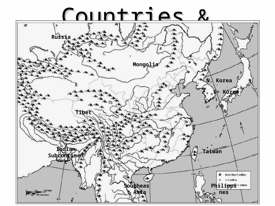
CountriesCountries & & RegionsRegions
CountriesCountries & & RegionsRegions
Tibet
Mongolia
Southeast Asia
Indian Subcontine
nt
Russia
N. Korea
S> Korea
Taiwan
Philippines
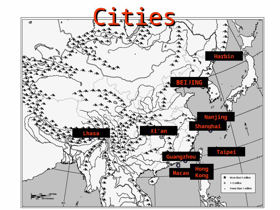
CitiesCitiesCitiesCities
BEIJING
Harbin
Nanjing
Guangzhou
Xi’anShanghai
Taipei
Lhasa
HongKongMaca
o
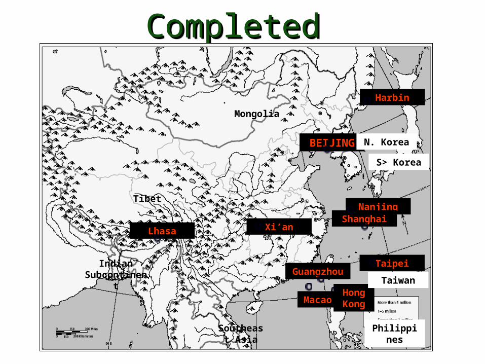
Completed Political Completed Political MapMap
Completed Political Completed Political MapMap
BEIJING
Harbin
Nanjing
Guangzhou
Xi’anShanghai
Taipei
Lhasa
HongKongMaca
o
Tibet
Mongolia
Southeast Asia
Indian Subcontine
nt
N. Korea
S> Korea
Taiwan
Philippines

North, South , East, WestNatural barriers isolated China from all other civilizations.
Pacific OceanPlateau of Tibet
Gobi DesertTaklimakan Desert
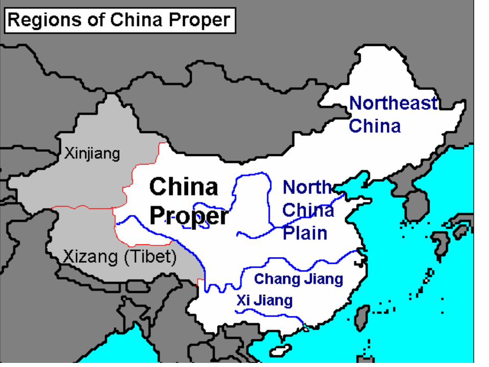
Himalaya Mountains
Mongolian Plateau
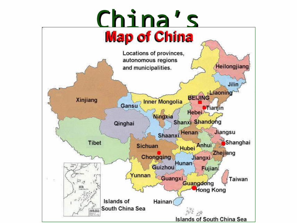
China’sChina’s ProvincesProvincesChina’sChina’s ProvincesProvinces
Globalization & Diversity: Rowntree, Lewis, Price, Wyckoff
7
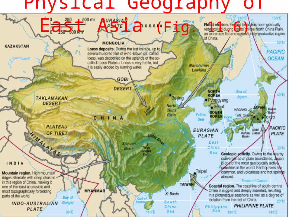
Physical Geography of East Asia (Fig. 11.6)
Globalization & Diversity: Rowntree, Lewis, Price, Wyckoff
8
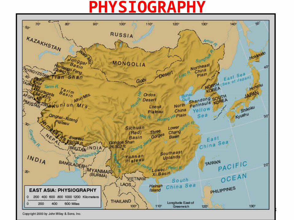
PHYSIOGRAPHY
Globalization & Diversity: Rowntree, Lewis, Price, Wyckoff
9
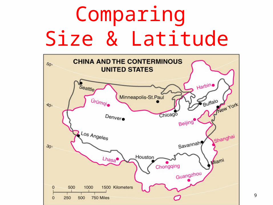
Comparing Size & Latitude

Free Powerpoint template from www.brainybetty.com
10
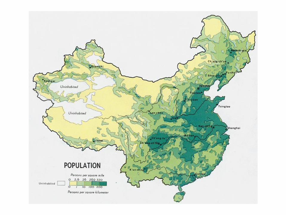
PopulationPopulation

Globalization & Diversity: Rowntree, Lewis, Price, Wyckoff
11
CLIMATE COMPARISON
Globalization & Diversity: Rowntree, Lewis, Price, Wyckoff
12
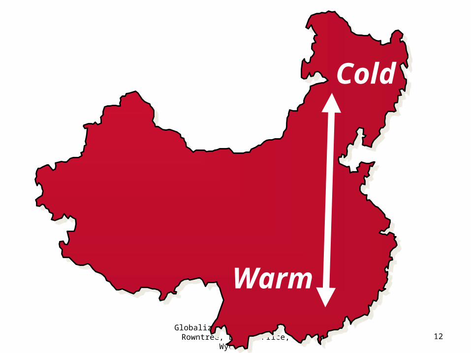
Warm
Cold
Globalization & Diversity: Rowntree, Lewis, Price, Wyckoff
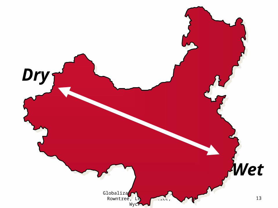
13
Dry
Wet
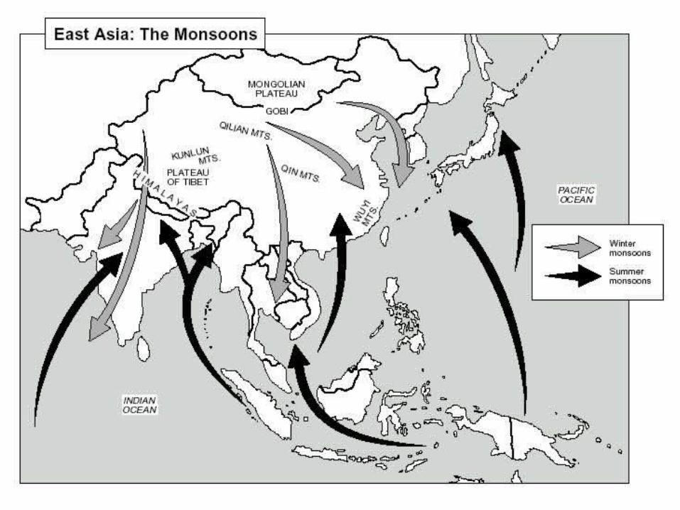
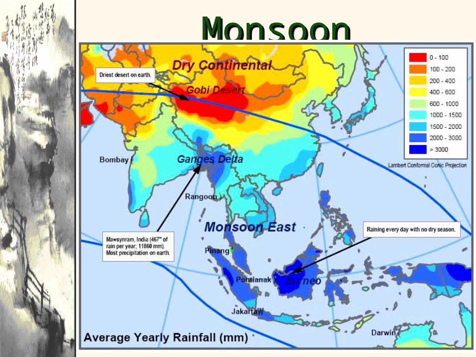
Monsoon Monsoon Precipitation Precipitation
PatternsPatterns
Monsoon Monsoon Precipitation Precipitation
PatternsPatterns
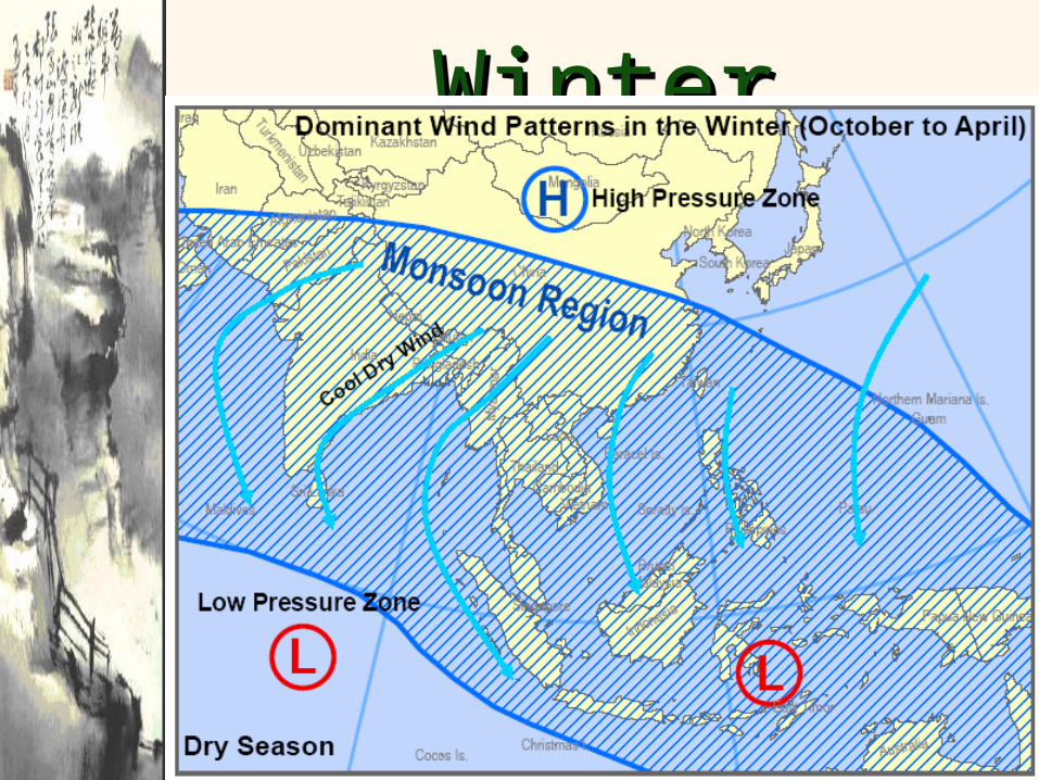
Winter Winter MonsoonsMonsoons
Winter Winter MonsoonsMonsoons
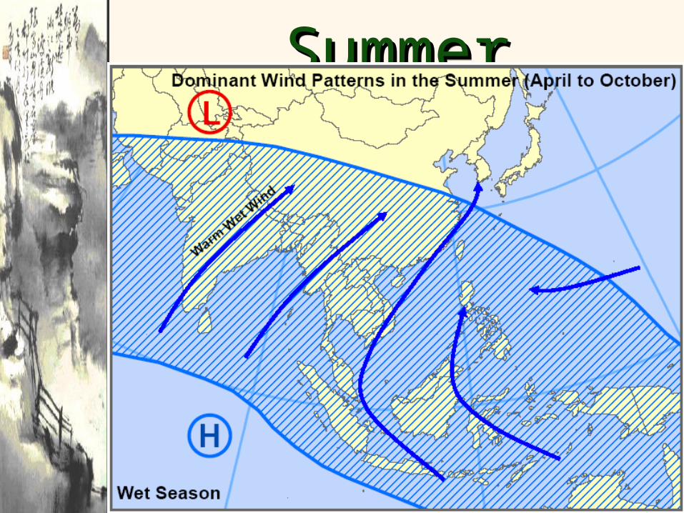
Summer Summer MonsoonsMonsoonsSummer Summer
MonsoonsMonsoons
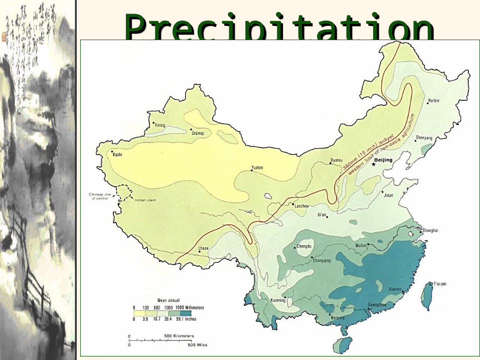
Precipitation in Precipitation in ChinaChina
Precipitation in Precipitation in ChinaChina
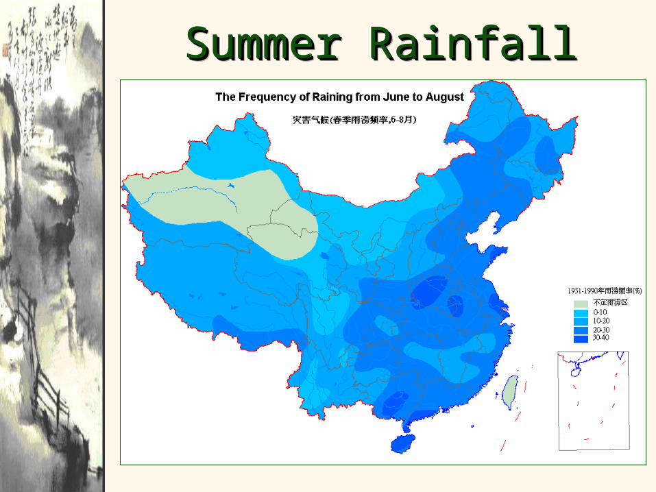
Summer RainfallSummer RainfallSummer RainfallSummer Rainfall
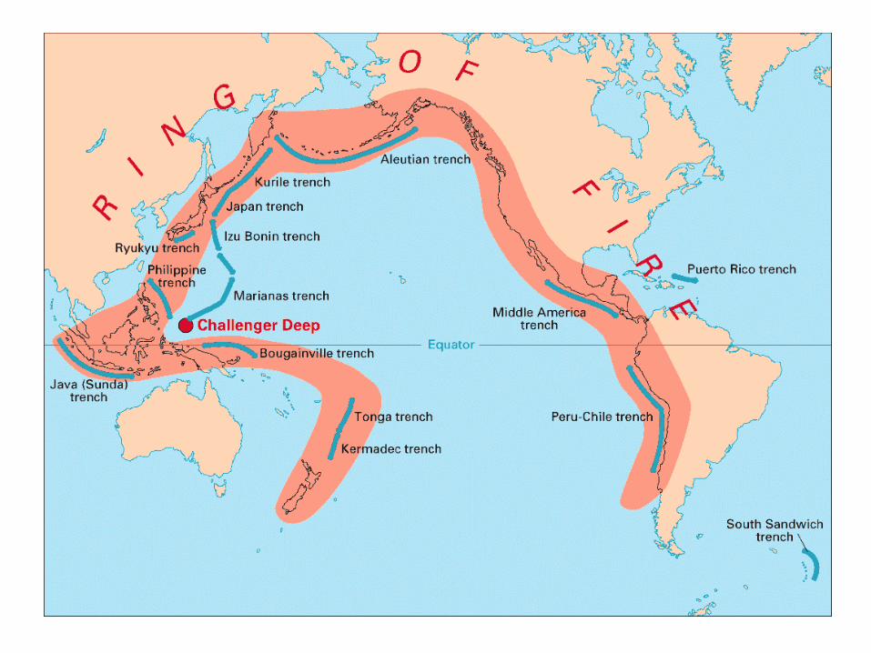

Pacific “Rim of Fire”Pacific “Rim of Fire”Pacific “Rim of Fire”Pacific “Rim of Fire”
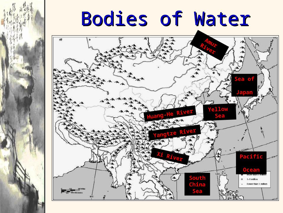
Bodies of WaterBodies of WaterBodies of WaterBodies of Water
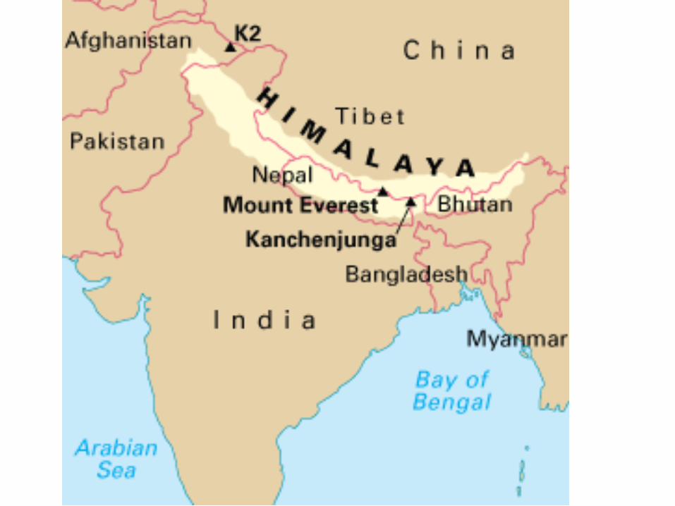
Huang-He
River
Yellow Sea
Yangtze River
Pacific Ocean
Amur River
Xi River
SouthChinaSea
Sea of
Japan
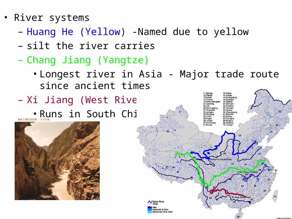
• River systems– Huang He (Yellow) -Named due to yellow – silt the river carries– Chang Jiang (Yangtze)
• Longest river in Asia - Major trade route since ancient times– Xi Jiang (West River)
• Runs in South China
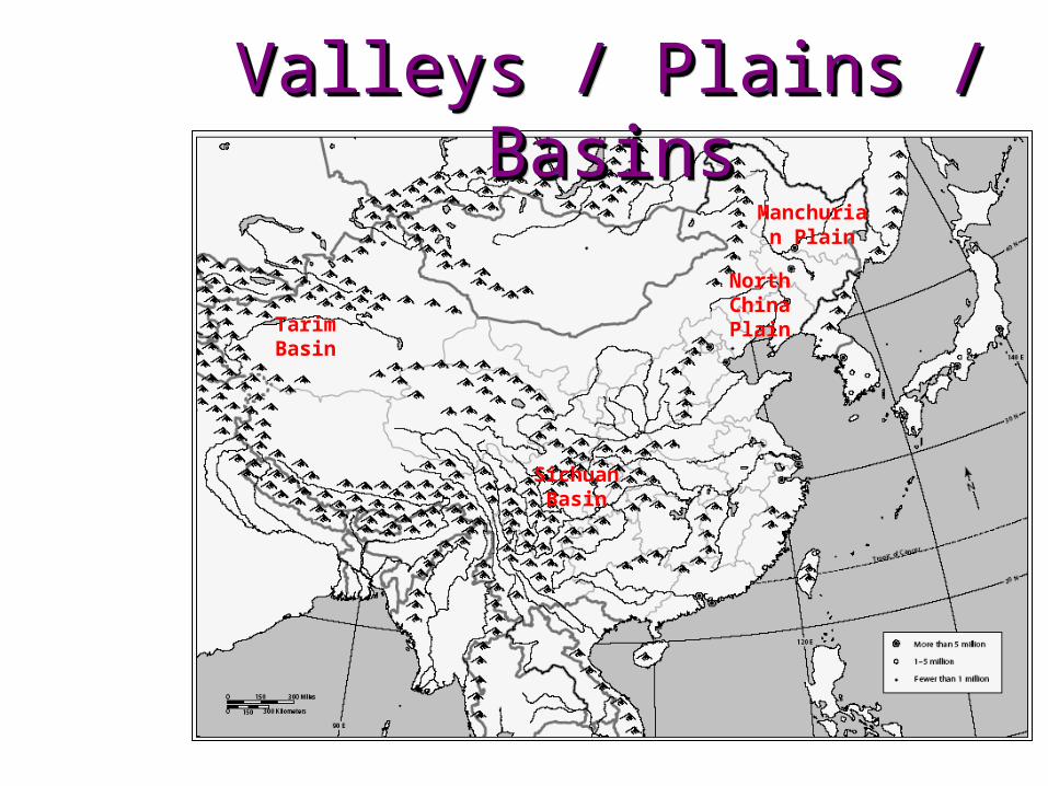
Valleys / Plains / Valleys / Plains / BasinsBasins
Valleys / Plains / Valleys / Plains / BasinsBasins
Manchurian Plain
North China PlainTarim
Basin
Sichuan Basin
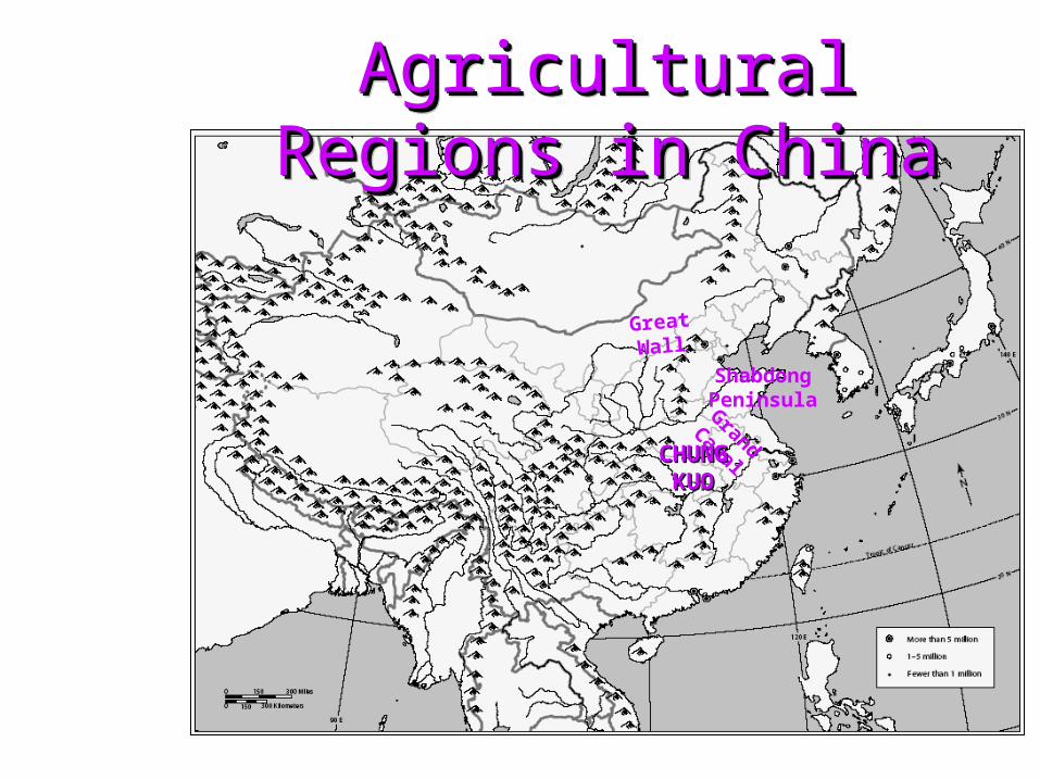
Agricultural Regions in Agricultural Regions in ChinaChina
Agricultural Regions in Agricultural Regions in ChinaChina
Shabdong PeninsulaGrand
Canal
Great Wall
CHUNG CHUNG KUOKUO

Agricultural Regions in Agricultural Regions in ChinaChina
Agricultural Regions in Agricultural Regions in ChinaChina
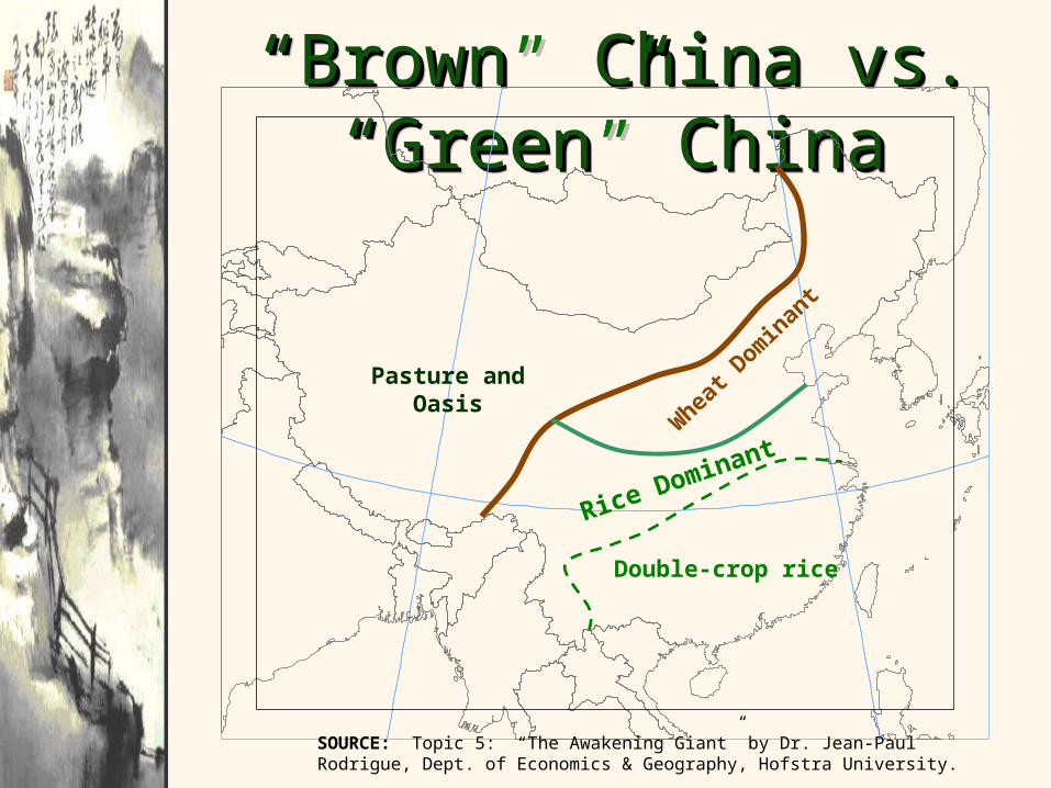
““Brown” China vs. Brown” China vs. “Green” China“Green” China
““Brown” China vs. Brown” China vs. “Green” China“Green” China
Rice DominantW
heat
Dom
inan
t
Pasture and Oasis
Double-crop rice
SOURCE: Topic 5: “The Awakening Giant” by Dr. Jean-Paul Rodrigue, Dept. of Economics & Geography, Hofstra University.
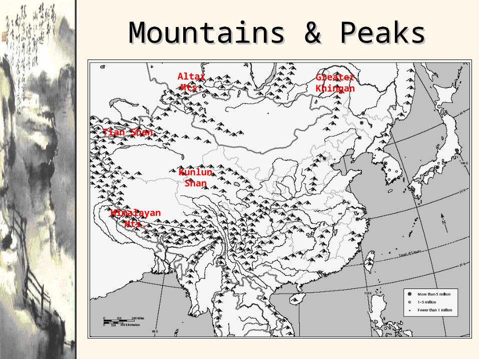
Mountains & PeaksMountains & PeaksMountains & PeaksMountains & Peaks
Tian Shan
Altai Mts. Greater Khingan
Kunlun Shan
Himalayan Mts.

Even Even though though much of much of China is China is covered covered with with mountainmountains, much s, much of the of the land is land is inhabitedinhabited. .
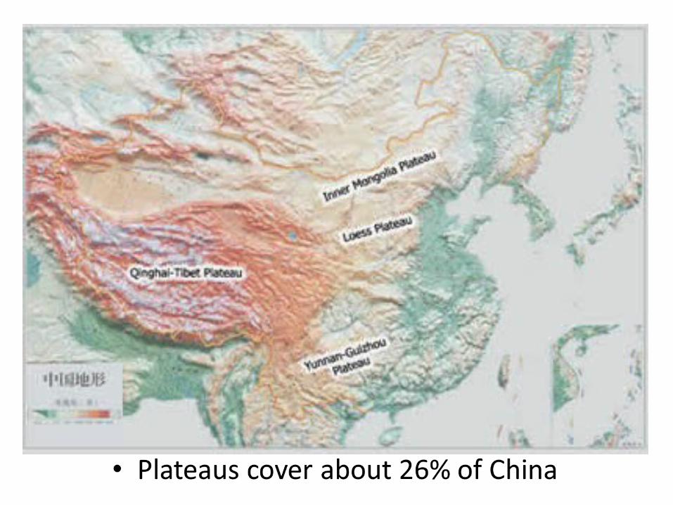
38Globalization & Diversity:
Rowntree, Lewis, Price, Wyckoff
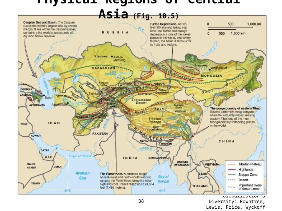
Physical Regions of Central Asia (Fig. 10.5)
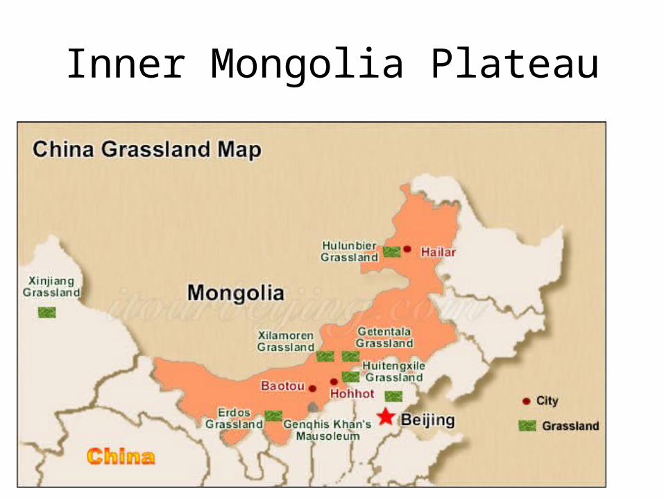
Inner Mongolia Plateau
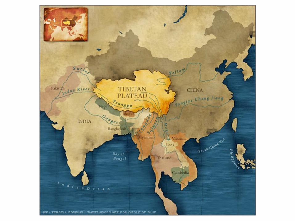

Tibetan Plateau
• In the southwestern part of Outer China• Also known as the Tibet-Qinghai Plateau• Covers about ¼ of China• Rocky land surrounded by towering mountains• Since it’s so high, the climate is very cold and the air
is thin and dry• Natural vegetation consists of sparse scrubs and
grasses• Antelopes and yaks roam the area
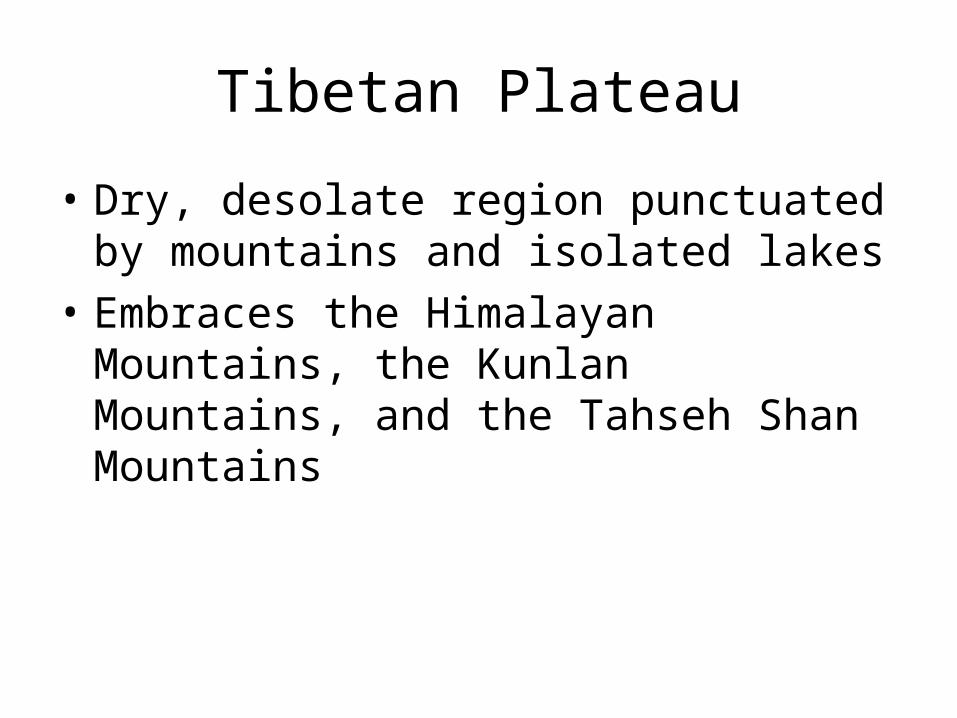
Tibetan Plateau
• Dry, desolate region punctuated by mountains and isolated lakes
• Embraces the Himalayan Mountains, the Kunlan Mountains, and the Tahseh Shan Mountains
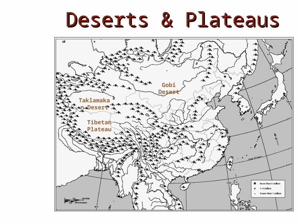
Deserts & PlateausDeserts & PlateausDeserts & PlateausDeserts & Plateaus
Tibetan Plateau
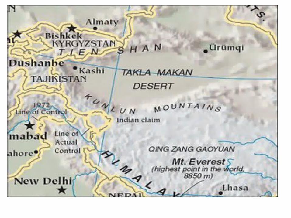
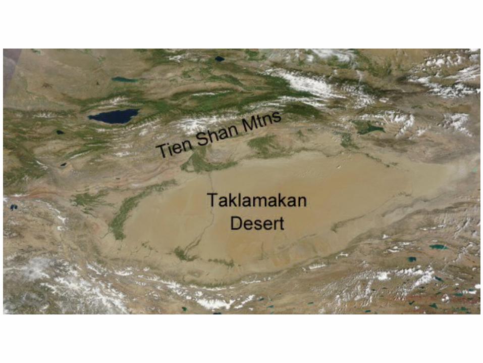
Taklamakan Desert
Gobi Desert
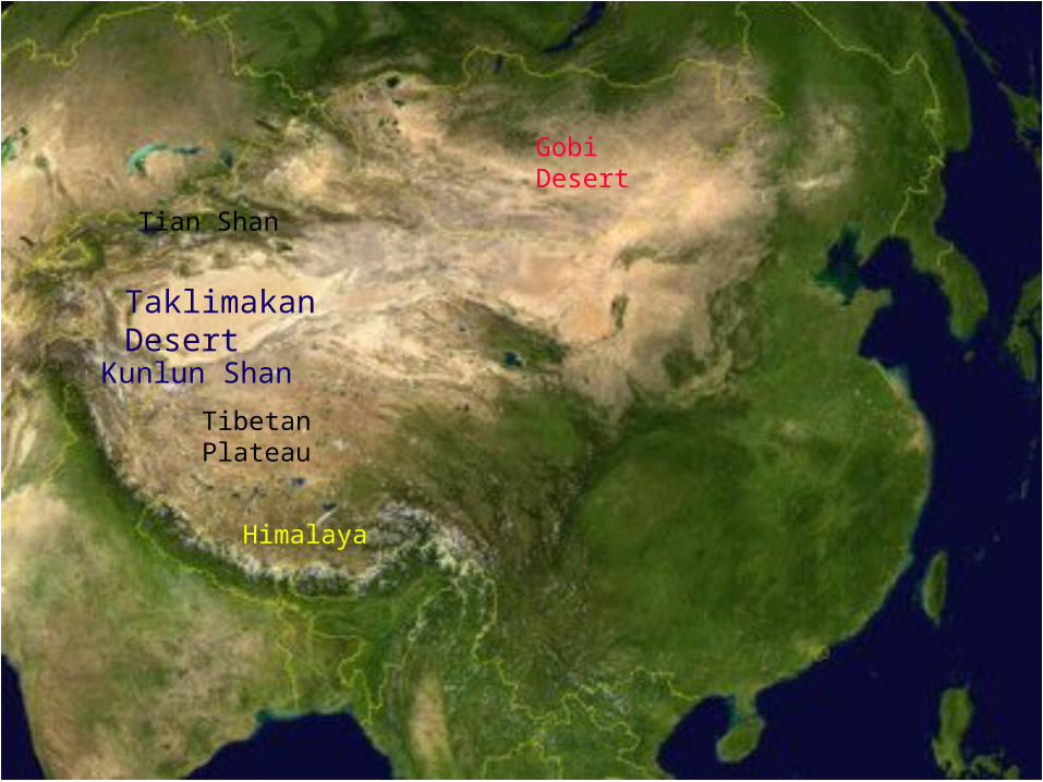
China Satellite View
TaklimakanDesert
Tian Shan
Tibetan Plateau
Kunlun Shan
GobiDesert
Himalaya
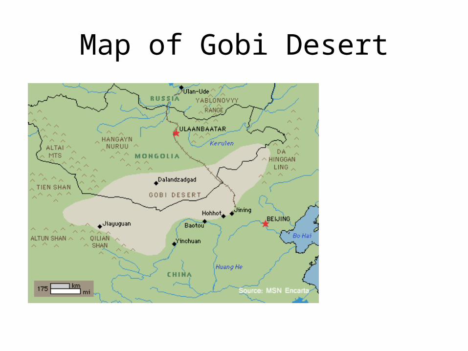
Map of Gobi Desert
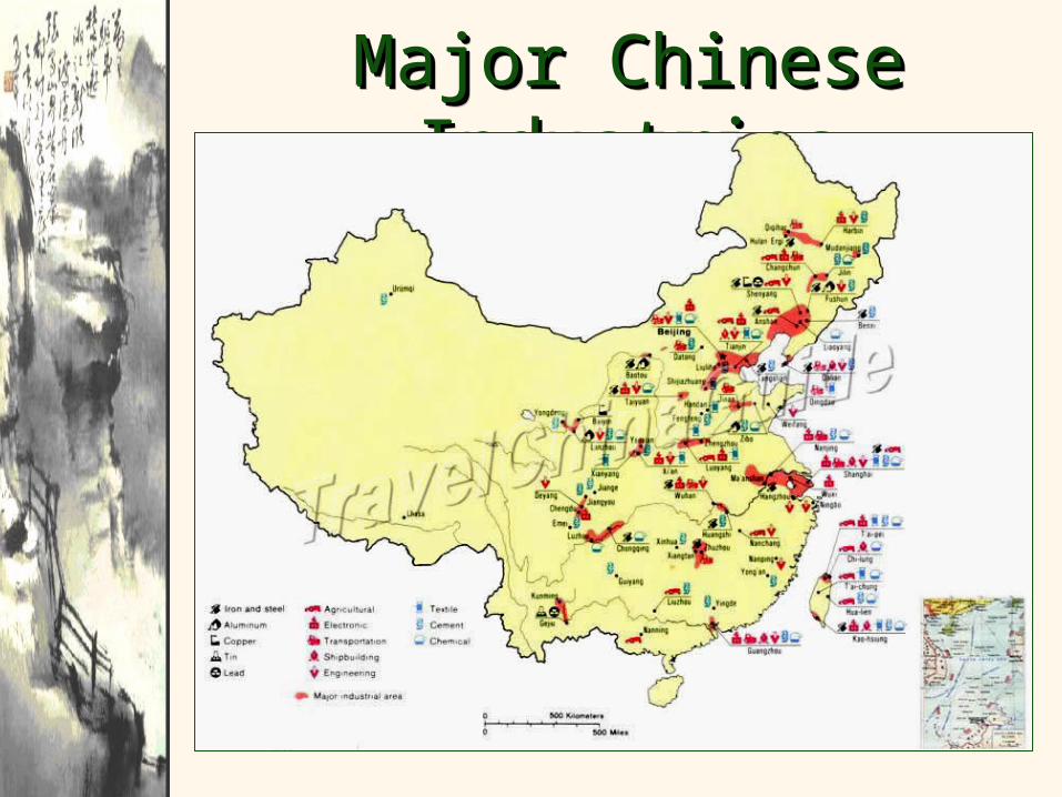
Major Chinese Major Chinese IndustriesIndustries
Major Chinese Major Chinese IndustriesIndustries
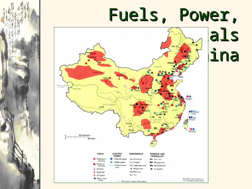
Fuels, Power, Fuels, Power, Minerals, & Metals in Minerals, & Metals in
ChinaChina
Fuels, Power, Fuels, Power, Minerals, & Metals in Minerals, & Metals in
ChinaChina