Embed Size (px)
Citation preview
Current Use Handbook
This section of the booklet, known as the Current Use Handbook, includes best practices and answers to frequently asked questions for both landowners and municipalities in regard to current use application procedures, land classification, maps, and explanation of topics such as the 20% recreational discount, the soil potential index, and the land use change tax. Readers should take into consideration that each of the following topics provide a more thorough explanation of the Current Use Law and Administrative Rules that were provided in the preceding sections. The current use board uses the laws and rules, as well as historical current use discussions, Board of Land and Tax Appeal, Superior and Supreme Court decisions, and professional experience to provide the following information as factual and accurate. After reviewing the handbook, if you still have questions please contact the Department of Revenue Administration at [email protected] or by calling 603-230-5096.
Application Procedures
Landowner Responsibilities
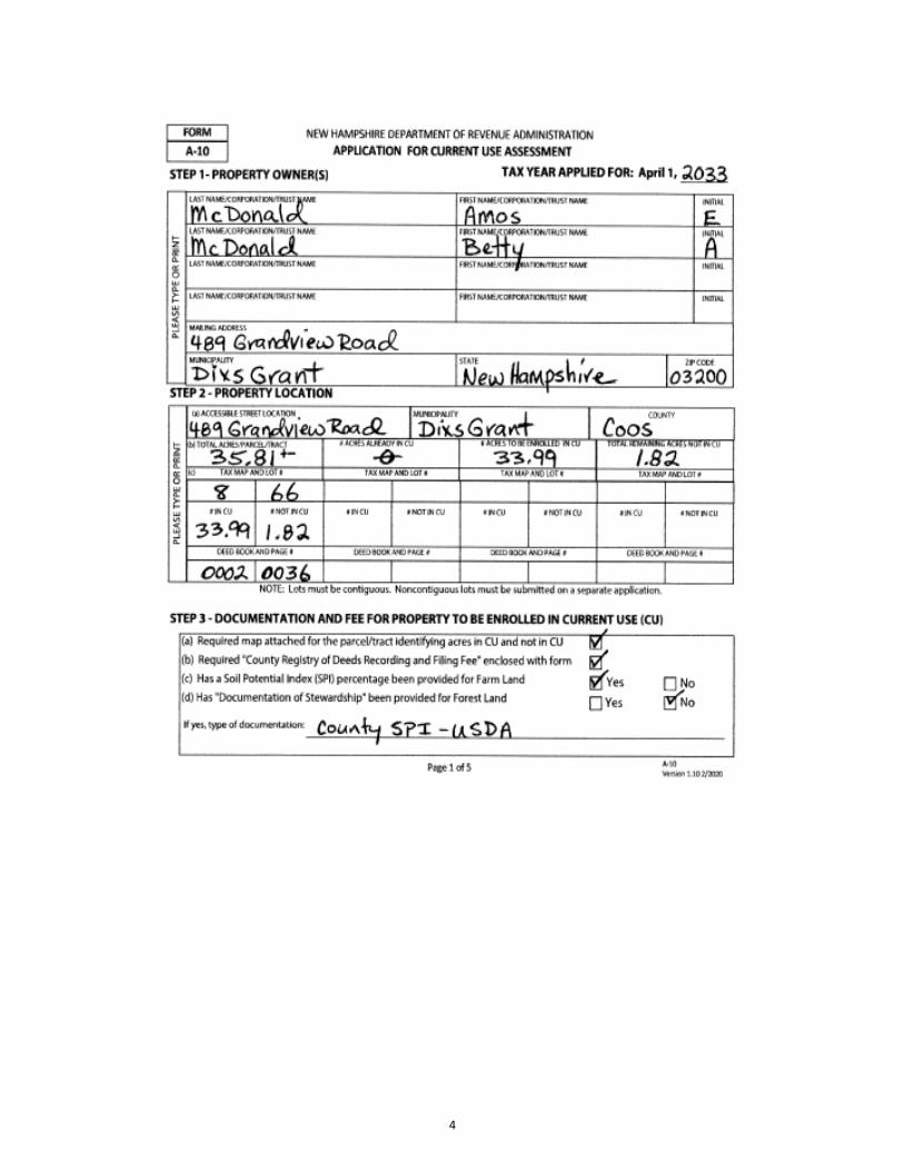
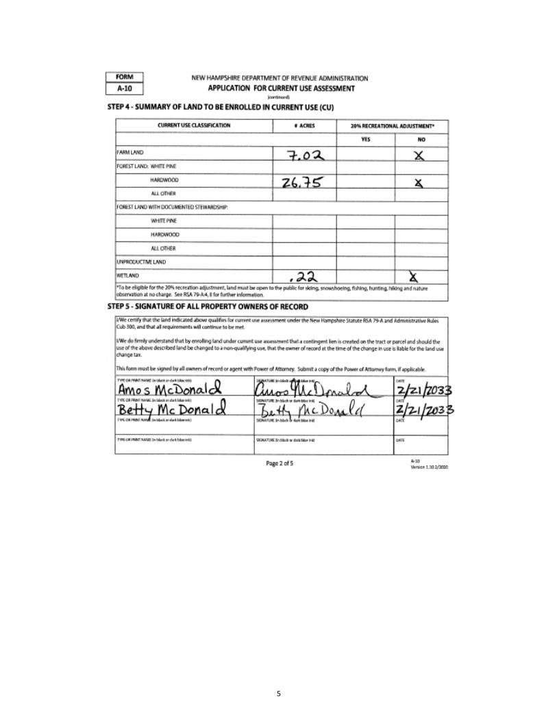
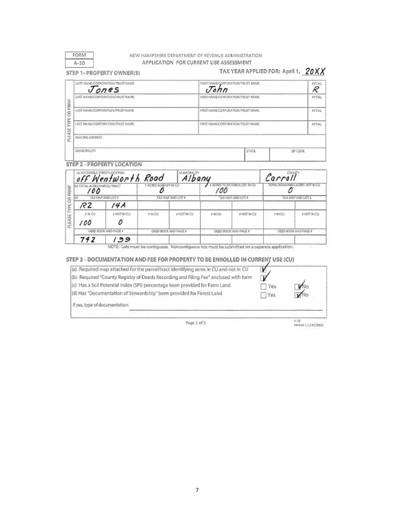
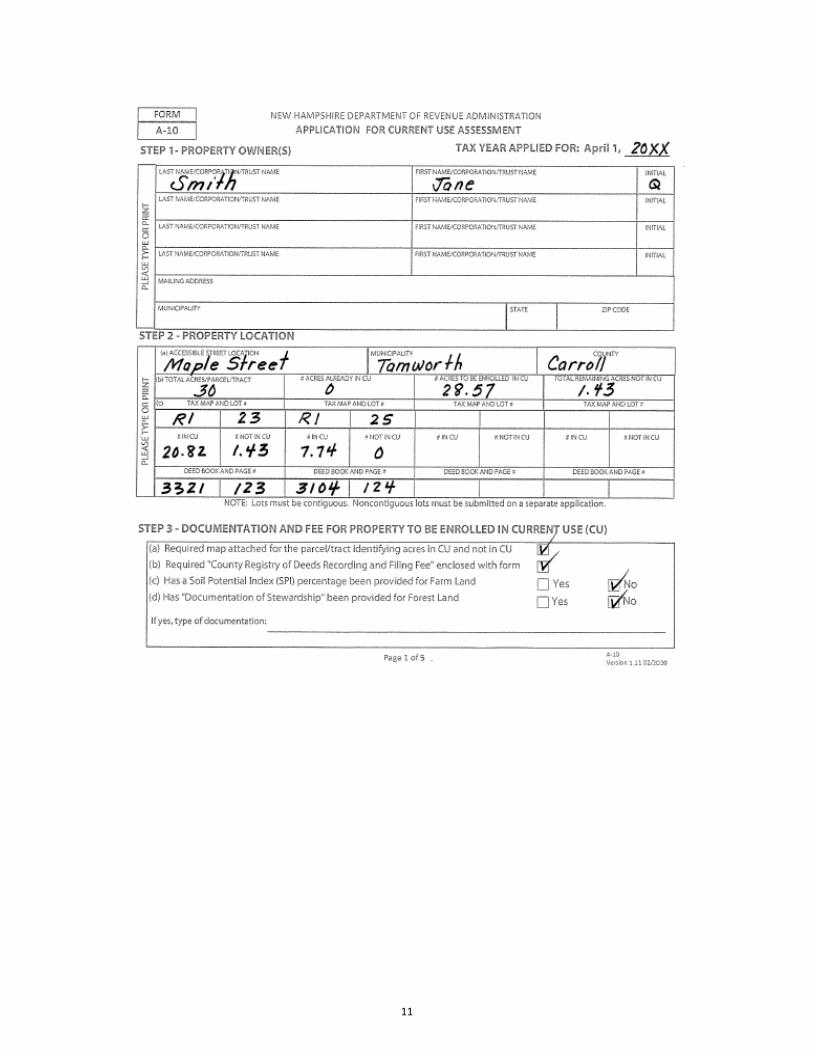
1. To apply for current use assessment, the landowner must complete Form A-10, for Current Application Use Assessment, and submit it to the municipal assessing officials by April 15th. The Form A-10 is available from the municipal assessing officials, at the www.revenue.nh.gov website, or by contacting the Department of Revenue Administration, PO Box 487, Concord, NH 03302-0487. Refer to Cub 302.01 and Cub 309.03 for more information in regard to completion of the application.
2. The landowner must submit with the application: a. The filing fee in accordance with Cub 302.02 (which will be refunded if the application is
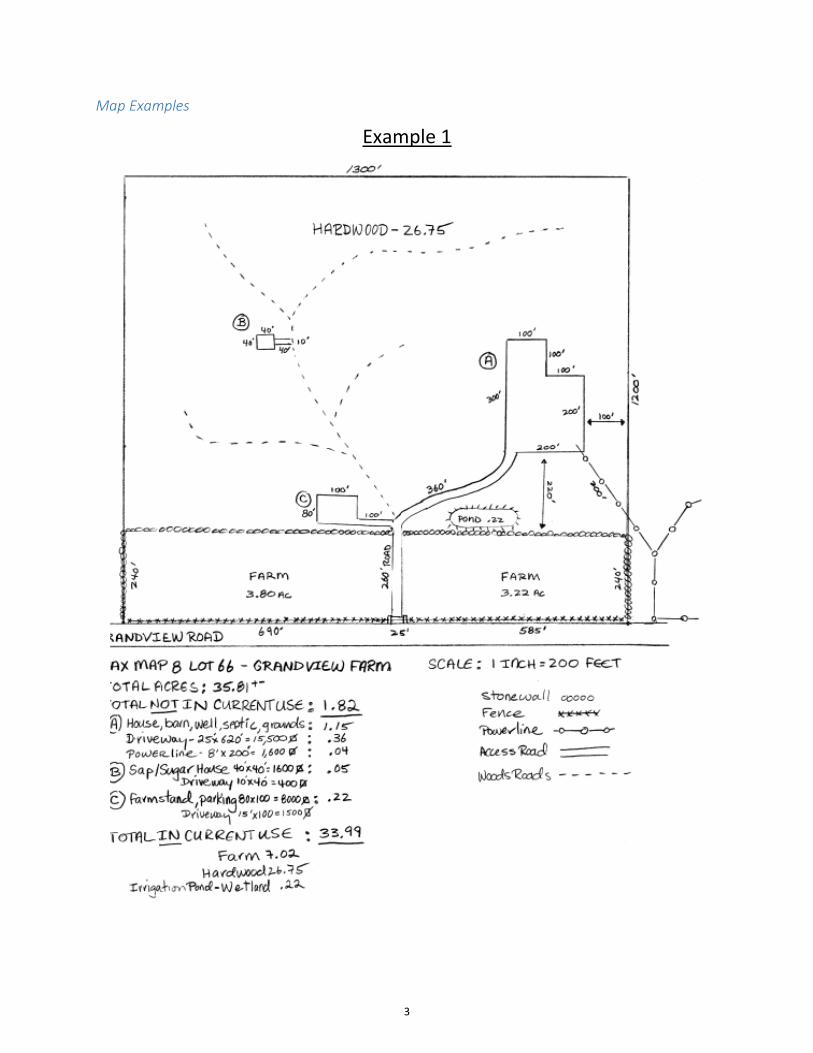
denied or withdrawn); and b. A map of each parcel of land going into current use. The map does not need to be an
actual survey of the property. Examples of maps are on the following pages. The map must include the following information pursuant to Cub 301.11:
i. Identification of the entire parcel, or tract, showing the location, map and lot of each parcel, access, and total acreage of the parcel or total acreage of each contiguous parcel. Specific location of all not in current use land for each parcel by including boundary dimensions, acreage calculations, and identifiable landmarks.
ii. Identification of the different current use land classification, location and acreage for each parcel.
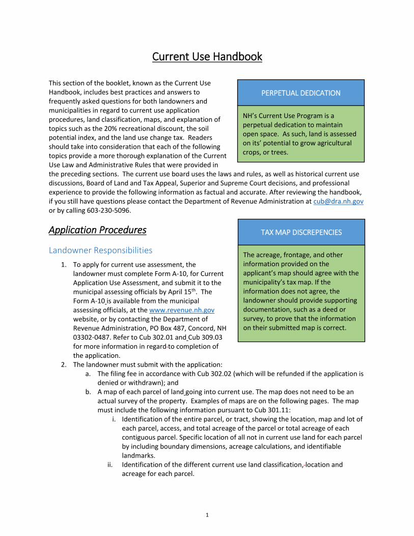
PERPETUAL DEDICATION
NH’s Current Use Program is a perpetual dedication to maintain open space. As such, land is assessed on its’ potential to grow agricultural crops, or trees.
TAX MAP DISCREPENCIES
The acreage, frontage, and other information provided on the applicant’s map should agree with the municipality’s tax map. If the information does not agree, the landowner should provide supporting documentation, such as a deed or survey, to prove that the information on their submitted map is correct.
1
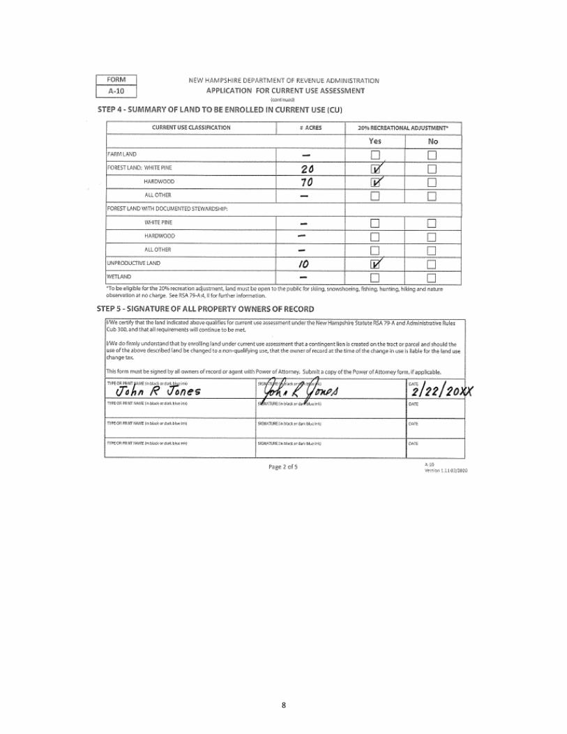
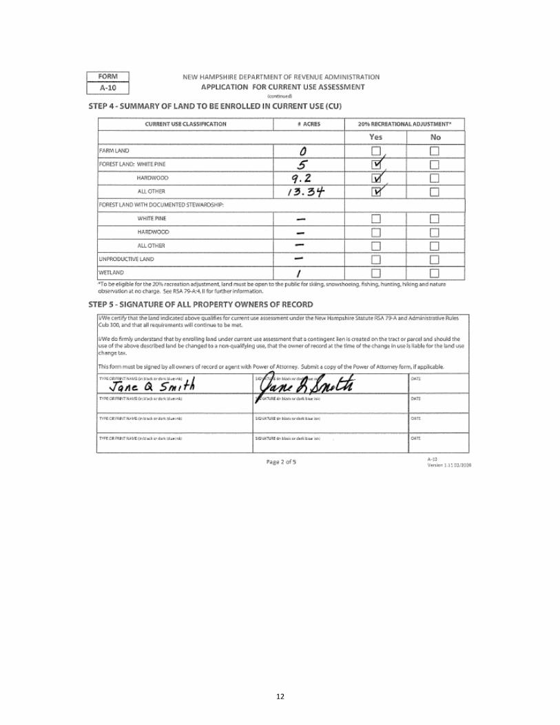
iii. A table containing the summary of The acreage of land and forest type categories for which the applicant is seeking current use assessment and the acreage of the land not in current use;
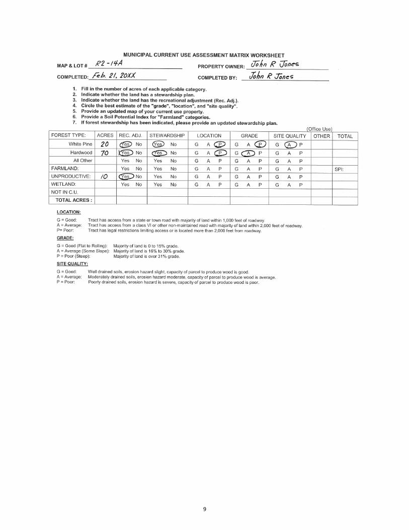
c. Current Use Assessment Matrix (see form found on page 57).
3. For farmland, if the landowner is going to require the assessing officials to use the Soil Potential Index in the assessment calculation, the landowner must supply the Soil Potential Index. See RSA 79-A:5,1, Cub 301.17 and Cub 304.04 for further details.
4. For forest land, which is under the “Forest Land with Documented Stewardship” category, the landowner must submit the items listed under Cub 304.07. In lieu of a forest stewardship plan, the landowner may submit a completed Form CU-12 “Summary of Forest Stewardship Plan for Current Use Assessment” as described in Cub 309.06.
5. An applicant may withdraw the application in the same year in which it was submitted, provided the municipality has not recorded the application with the County Registry of Deeds (Cub 302.06).
NOT IN CURRENT USE LAND
Land not in current use does not float around the property. Not in current use land (NICU) must be identified on the application map.
What tax rate do current use owners pay? Current use landowners pay the same municipal, county, local school and state education tax rate as all other properties.
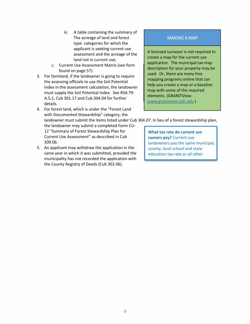
MAKING A MAP
A licensed surveyor is not required to create a map for the current use application. The municipal tax map description for your property may be used. Or, there are many free mapping programs online that can help you create a map or a baseline map with some of the required elements. (GRANITView: www.granitview.unh.edu )
2
Map Examples
Example 1
3
4
5

Example 2
6
7
8
9

Example 3
10
11
12
Assessing Officials’ Responsibilities
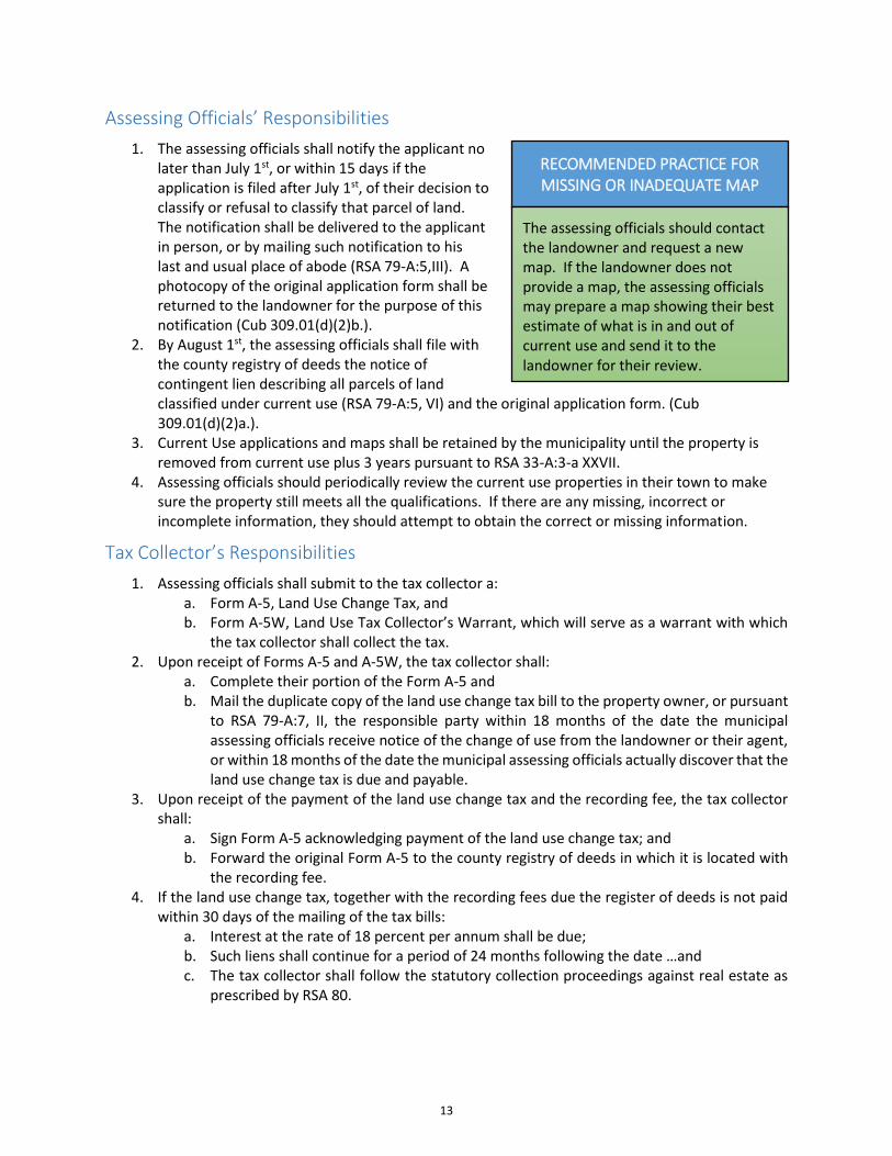
1. The assessing officials shall notify the applicant no later than July 1st, or within 15 days if the application is filed after July 1st, of their decision to classify or refusal to classify that parcel of land. The notification shall be delivered to the applicant in person, or by mailing such notification to his last and usual place of abode (RSA 79-A:5,III). A photocopy of the original application form shall be returned to the landowner for the purpose of this notification (Cub 309.01(d)(2)b.).
2. By August 1st, the assessing officials shall file with the county registry of deeds the notice of contingent lien describing all parcels of land classified under current use (RSA 79-A:5, VI) and the original application form. (Cub 309.01(d)(2)a.).
3. Current Use applications and maps shall be retained by the municipality until the property is removed from current use plus 3 years pursuant to RSA 33-A:3-a XXVII.
4. Assessing officials should periodically review the current use properties in their town to make sure the property still meets all the qualifications. If there are any missing, incorrect or incomplete information, they should attempt to obtain the correct or missing information.
Tax Collector’s Responsibilities
1. Assessing officials shall submit to the tax collector a: a. Form A-5, Land Use Change Tax, and b. Form A-5W, Land Use Tax Collector’s Warrant, which will serve as a warrant with which
the tax collector shall collect the tax. 2. Upon receipt of Forms A-5 and A-5W, the tax collector shall:
a. Complete their portion of the Form A-5 and b. Mail the duplicate copy of the land use change tax bill to the property owner, or pursuant
to RSA 79-A:7, II, the responsible party within 18 months of the date the municipal assessing officials receive notice of the change of use from the landowner or their agent, or within 18 months of the date the municipal assessing officials actually discover that the land use change tax is due and payable.
3. Upon receipt of the payment of the land use change tax and the recording fee, the tax collector shall:
a. Sign Form A-5 acknowledging payment of the land use change tax; and b. Forward the original Form A-5 to the county registry of deeds in which it is located with
the recording fee. 4. If the land use change tax, together with the recording fees due the register of deeds is not paid
within 30 days of the mailing of the tax bills: a. Interest at the rate of 18 percent per annum shall be due; b. Such liens shall continue for a period of 24 months following the date …and c. The tax collector shall follow the statutory collection proceedings against real estate as
prescribed by RSA 80.
RECOMMENDED PRACTICE FOR MISSING OR INADEQUATE MAP
The assessing officials should contact the landowner and request a new map. If the landowner does not provide a map, the assessing officials may prepare a map showing their best estimate of what is in and out of current use and send it to the landowner for their review.
13

Contingent Lien
The notice of contingent lien serves as a notice to all interested parties that a lien on the land will be created if and when the land is changed to a non-qualifying use.
Land Classifications
Farmland
Soil Potential Index (SPI) Definition The Soil Potential Index (SPI) is a tool to be used by the assessing officials to determine where in the farmland range of values, a specific property should be assessed. The SPI is a numerical rating of a soil's relative suitability for growing corn silage and grass legume hay in New Hampshire. These two crops were selected by agricultural specialists as being the two most representative crops grown in the state, from North to South and would be the best crops to use as indicators of a soil's ability to be farmed. Whether or not the soils in a particular region of the state are currently being used to grow such crops, all soil is evaluated equally on their agricultural potential if the soils were planted to these crops.
How to get your Soil Potential Index
1. The SPI may be obtained from the landowner’s County Conservation District Office. Conservation Districts may charge a small fee for calculating the SPI. Landowners should first determine from their assessing officials where within the range of assessments their property is placed, then get an SPI, and then determine if using an SPI is beneficial to them. To find your County Office go to http://www.nhacd.net/member-districts.html. If the County Conservation District Office is unable to immediately provide the SPI for a particular parcel of land, they will provide a letter to the landowner stating that the SPI will be forthcoming. The landowner should give this letter to the assessing officials as notification that an SPI will be provided for this land. When the landowner receives the SPI, he should forward it to the assessing official so it may be applied in the farmland assessment calculation.
2. Once the landowner has provided the SPI, the assessing officials will apply the SPI to the assessment calculation until such time as a revised SPI is provided.
3. Cub 304.04(b) provides the formula for assessing farmland. Assuming an SPI of .60, the formula would calculate as follows:
High end of farmland range $425 Low end of farmland range - $25 Difference $400 Sample SPI of .60 x .60 Subtotal $240 Low end of range added back +$25 Per acre assessed value $265
4. The landowner must provide the SPI to the assessing officials in order for the assessors to apply it. Otherwise, the assessing officials may use their own discretion when assigning a valuation within the farmland assessment range.
WHERE TO GET YOUR SPI
Farmland owners should reach out to their County Conservation District Office. To find your County Office go to http://www.nhacd.net/member-districts.html.
14
Agricultural Buildings
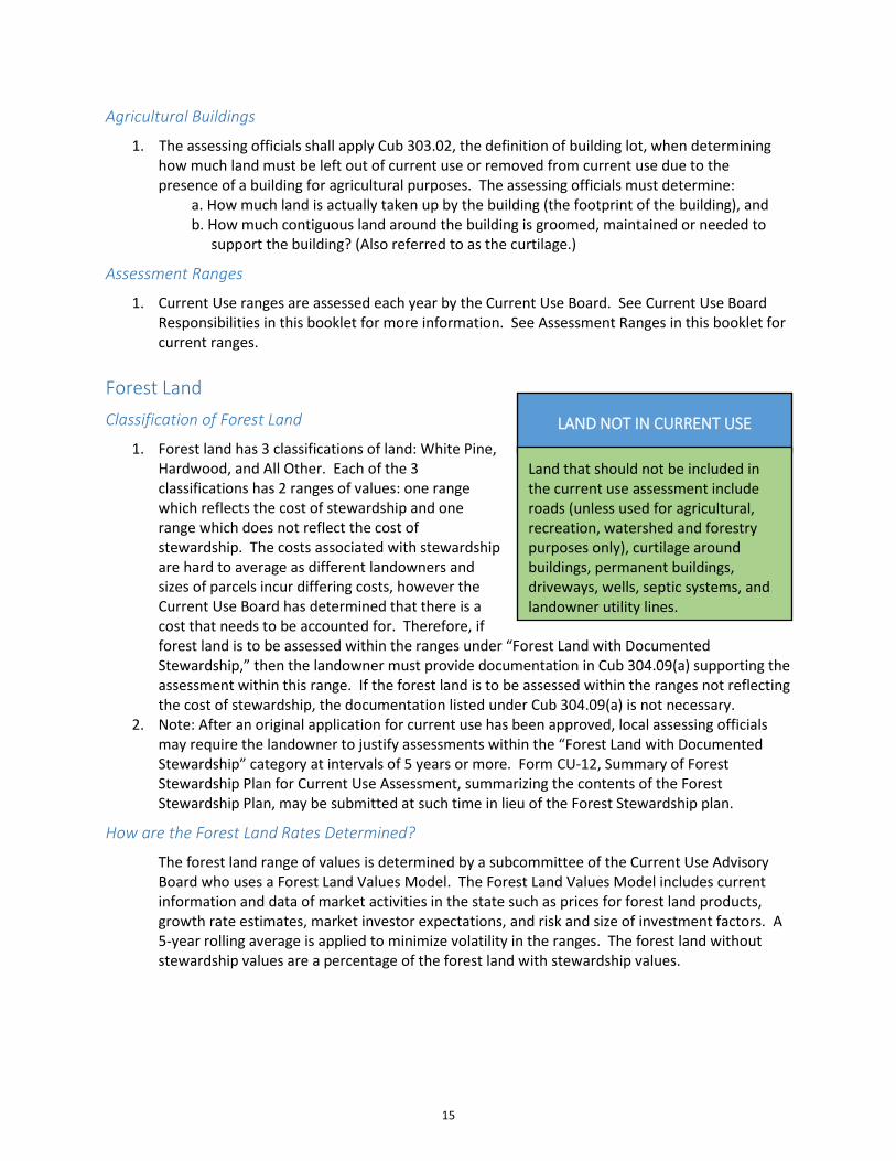
1. The assessing officials shall apply Cub 303.02, the definition of building lot, when determining how much land must be left out of current use or removed from current use due to the presence of a building for agricultural purposes. The assessing officials must determine:
a. How much land is actually taken up by the building (the footprint of the building), and b. How much contiguous land around the building is groomed, maintained or needed to
support the building? (Also referred to as the curtilage.)
Assessment Ranges
1. Current Use ranges are assessed each year by the Current Use Board. See Current Use Board Responsibilities in this booklet for more information. See Assessment Ranges in this booklet for current ranges.
Forest Land
Classification of Forest Land
1. Forest land has 3 classifications of land: White Pine, Hardwood, and All Other. Each of the 3 classifications has 2 ranges of values: one range which reflects the cost of stewardship and one range which does not reflect the cost of stewardship. The costs associated with stewardship are hard to average as different landowners and sizes of parcels incur differing costs, however the Current Use Board has determined that there is a cost that needs to be accounted for. Therefore, if forest land is to be assessed within the ranges under “Forest Land with Documented Stewardship,” then the landowner must provide documentation in Cub 304.09(a) supporting the assessment within this range. If the forest land is to be assessed within the ranges not reflecting the cost of stewardship, the documentation listed under Cub 304.09(a) is not necessary.
2. Note: After an original application for current use has been approved, local assessing officials may require the landowner to justify assessments within the “Forest Land with Documented Stewardship” category at intervals of 5 years or more. Form CU-12, Summary of Forest Stewardship Plan for Current Use Assessment, summarizing the contents of the Forest Stewardship Plan, may be submitted at such time in lieu of the Forest Stewardship plan.
How are the Forest Land Rates Determined?
The forest land range of values is determined by a subcommittee of the Current Use Advisory Board who uses a Forest Land Values Model. The Forest Land Values Model includes current information and data of market activities in the state such as prices for forest land products, growth rate estimates, market investor expectations, and risk and size of investment factors. A 5-year rolling average is applied to minimize volatility in the ranges. The forest land without stewardship values are a percentage of the forest land with stewardship values.
LAND NOT IN CURRENT USE
Land that should not be included in the current use assessment include roads (unless used for agricultural, recreation, watershed and forestry purposes only), curtilage around buildings, permanent buildings, driveways, wells, septic systems, and landowner utility lines.
15
Assessment within the Range
1. Each of the forest land classifications has a per acre range of value. Not all forest land should be assessed at the high end of the range, or at the low end. Factors that influence the value of forest land include, but are not limited to:
a. Location of the land b. Accessibility of the forest products, and c. The severity of the terrain.
Under the definition of “current use value,” the assessor is required to determine the valuation in accordance with the “class, grade, type and location of the land” (RSA 79-A:2,V). Cub 304.05 provides definitions of these terms, and a definition of “site quality.” The assessor must consider all these factors when determining where, within the forest land range of values, a particular parcel of land falls (Cub 304.10(a)).
2. In the Board of Tax and Land Appeals (BTLA) decision with the Town of Marlow (2001, Docket No. 18478-01RA) the BTLA specifically addressed the requirement that municipal officials consider the characteristics listed above to justify the assessment within the forest land ranges. In their decision, the BTLA suggested several methods to justify these assessments including the use of a simple matrix or the use of county soil and topographical maps. A version of a matrix is included in this booklet in the Forms section.
3. If a landowner is dissatisfied with the assessor’s determination and wishes to challenge the forest land assessment, Cub 304.11 (a) provides two methods of providing additional information to support their challenge to the assessors. If the landowner is still dissatisfied with their assessment, the property tax appeal procedures under RSA 76:16, 76:16-a, 76:16-d, II, and 76:17 should be followed.
Clear Cutting
1. Forest land that has been subjected to clear cutting still qualifies as forest land (Cub 304.05 (d)).
Unproductive Land
Assessment
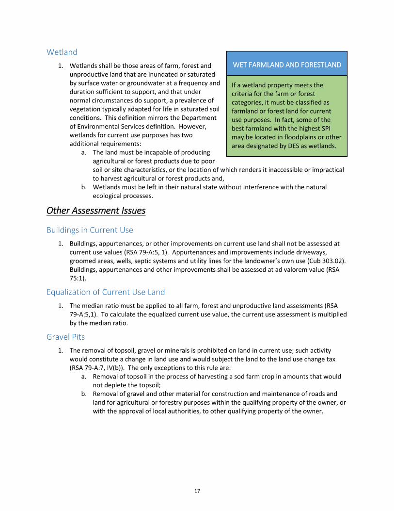
1. Unproductive land is land that does not meet the definition of forest land or farmland. Unproductive land is “incapable of producing agricultural or forest products due to poor soil or site characteristics, or the location of which renders it inaccessible or impractical to harvest agricultural or forest products.” Wetland is included in the unproductive land classification.
Reclassification
1. Land classified as unproductive land must be reclassified to forest and/or farmland if the land becomes accessible or practical to harvest (Cub 305.02(a)).
EXAMPLES OF UNPRODUCTIVE LAND
Wetlands, cliffs, ledges, or totally inaccessible land.
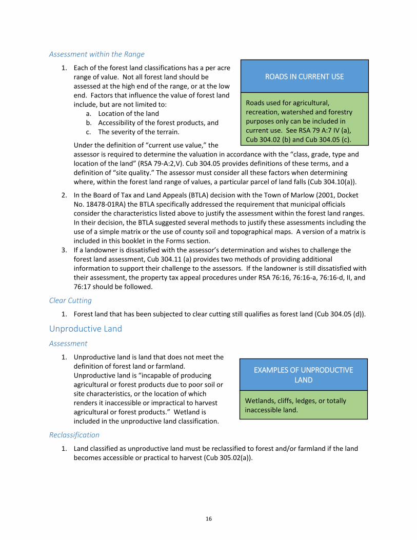
ROADS IN CURRENT USE
Roads used for agricultural, recreation, watershed and forestry purposes only can be included in current use. See RSA 79 A:7 IV (a), Cub 304.02 (b) and Cub 304.05 (c).
16
Wetland
1. Wetlands shall be those areas of farm, forest and unproductive land that are inundated or saturated by surface water or groundwater at a frequency and duration sufficient to support, and that under normal circumstances do support, a prevalence of vegetation typically adapted for life in saturated soil conditions. This definition mirrors the Department of Environmental Services definition. However, wetlands for current use purposes has two additional requirements:
a. The land must be incapable of producing agricultural or forest products due to poor soil or site characteristics, or the location of which renders it inaccessible or impractical to harvest agricultural or forest products and,
b. Wetlands must be left in their natural state without interference with the natural ecological processes.
Other Assessment Issues
Buildings in Current Use
1. Buildings, appurtenances, or other improvements on current use land shall not be assessed at current use values (RSA 79-A:5, 1). Appurtenances and improvements include driveways, groomed areas, wells, septic systems and utility lines for the landowner’s own use (Cub 303.02). Buildings, appurtenances and other improvements shall be assessed at ad valorem value (RSA 75:1).
Equalization of Current Use Land
1. The median ratio must be applied to all farm, forest and unproductive land assessments (RSA 79-A:5,1). To calculate the equalized current use value, the current use assessment is multiplied by the median ratio.
Gravel Pits
1. The removal of topsoil, gravel or minerals is prohibited on land in current use; such activity would constitute a change in land use and would subject the land to the land use change tax (RSA 79-A:7, IV(b)). The only exceptions to this rule are:
a. Removal of topsoil in the process of harvesting a sod farm crop in amounts that would not deplete the topsoil;
b. Removal of gravel and other material for construction and maintenance of roads and land for agricultural or forestry purposes within the qualifying property of the owner, or with the approval of local authorities, to other qualifying property of the owner.
WET FARMLAND AND FORESTLAND
If a wetland property meets the criteria for the farm or forest categories, it must be classified as farmland or forest land for current use purposes. In fact, some of the best farmland with the highest SPI may be located in floodplains or other area designated by DES as wetlands.
17
Posting of Current Use Land
1. Land assessed under current use may be posted “No Trespassing” or other signs, unless landowner applies for the 20% recreational adjustment. Receiving current use assessment does not require a landowner to open the property to public use, unless landowner also receives the 20% recreational adjustment.
20% Recreational Adjustment
1. If a landowner decides not to post “No Trespassing” and opens the property to public use without an entrance fee for 12 months a year, the land is entitled to a 20% reduction in the current use assessment of the acres opened to public recreational use. To receive the 20% recreation adjustment, the landowner must allow all of the following activities:
a. Hunting, b. Skiing, c. Fishing, d. Snowshoeing, e. Hiking, and f. Nature Observation.
2. If any of these activities are detrimental to a specific agricultural or forest crop, that activity may be prohibited. If the 20% recreational adjustment has been granted, posting to prohibit any activity listed above requires approval of the local assessing officials. See Cub 305.03 for further explanation.
3. The landowner may prohibit trespass upon his property for all other activities, including use of mechanized and off-highway vehicles (such as snowmobiles and all-terrain vehicles-ATV), camping, cutting down trees, etc. Posting land to prohibit these activities will not affect the 20% recreation adjustment.
Zoning Requirements
1. For all classifications of current use land, the dimensions of a building lot shall not be governed by any local or planning ordinances. For example, an 11-acre parcel of forest land in a municipality that requires a minimum of 2 acres for a building lot, may still qualify for current use assessment. If the building lot, as defined under Cub 303.02, occupies ½ an acre, then 10 ½ acres would qualify for current use assessment regardless of the 2-acre zoning requirement.
EXCEPTIONS
The municipal assessing officials may make an exception to the 20% recreational adjustment for landowners who have a temporary safety concern. Examples of these exceptions include, but are not limited to, a pesticide application or large timber harvest. Landowners who repeatedly need to request exceptions should consider removing the land from the recreational category.
NH FISH & GAME SIGN PROGRAM
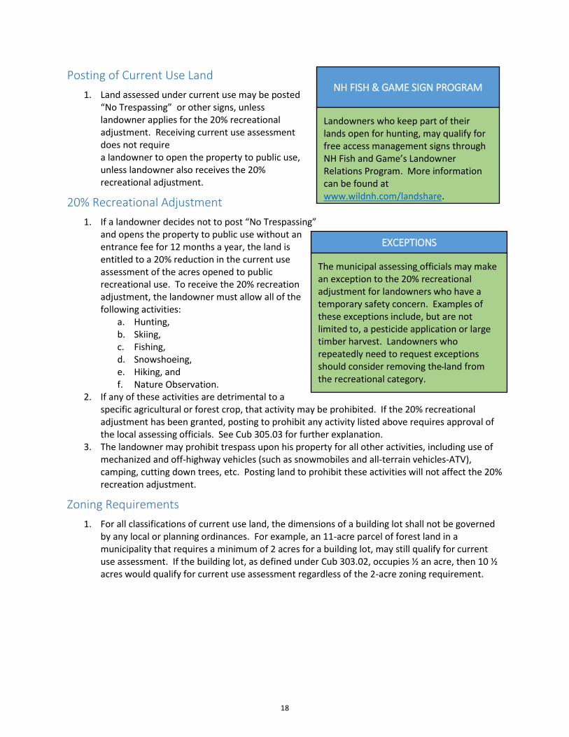
Landowners who keep part of their lands open for hunting, may qualify for free access management signs through NH Fish and Game’s Landowner Relations Program. More information can be found at www.wildnh.com/landshare.
18
The Land Use Change Tax
Rate
1. The land use change tax is “10% of the full and true value” of the land that no longer qualifies for current use (RSA 79-A:7). The 10% land use change tax is not based upon the amount of taxes saved over the years in which the property was in current use. As with all ad valorem assessments, “full and true value” may or may not be the same as the selling price of the property.
2. The “full and true value” of the land is based on the highest and best use of the land as of the date and actual physical change was begun, as long as the requirements of RSA 79-A:7 V (a) are met. Otherwise, the local assessing officials may wait and base the land use change tax upon the land’s full and true value at a later time after the requirements of RSA 79-A:7 V (a) have been met, regardless of the date of the actual physical change.
3. In the April 12, 2000, decision of the Appeal of the Estate of Richard Van Lunen, the New Hampshire Supreme Court interpreted Cub 308.02 to require that “…the value of any betterment to the land not be included in determining the lands full and true value when it is removed from current use.” Because this interpretation was contrary to the intent of the rule, the Current Use Board amended Cub 308.02 to clarify that “The full and true value of the land being disqualified pursuant to RSA 79-A:7, shall be based upon the highest and best use of the land, including the value of all betterments serving the land.” The Board also defined “betterment” to mean “the installation or construction of improvements which influence the value of the land such as roads, water lines, utility lines or other physical improvements” (Cub 301.01).
Assessment
1. Land may only be removed from current use for the reasons described in RSA 79-A:7 III, IV, and V and Cub 307.01. Otherwise, land remains in current use. There are no buy-out options.
Amount of Land to be Taxed
1. When a parcel of land is being developed, only the amount of land that has been physically changed shall be removed from current use as long as the landowner retains enough land to meet the current use minimum acreage requirements in Cub 304.01. For land that is developed as condominiums and planned unit/cluster developments where common land is used to satisfy density requirements, other specific rules apply. See RSA 79-A:7, V(b), Cub 307.02, and Cub 307.03.
Land Use Change Tax Bill
1. The land use change tax bill shall be assessed and mailed within 18 months of the date the local assessing officials are either notified by the landowner of a change in use or they discover that a change in use has occurred.
2. The assessment of the land use change tax creates a lien per RSA 79-A:7 II (e) upon the landowner’s
CHANGE IN OWNERSHIP
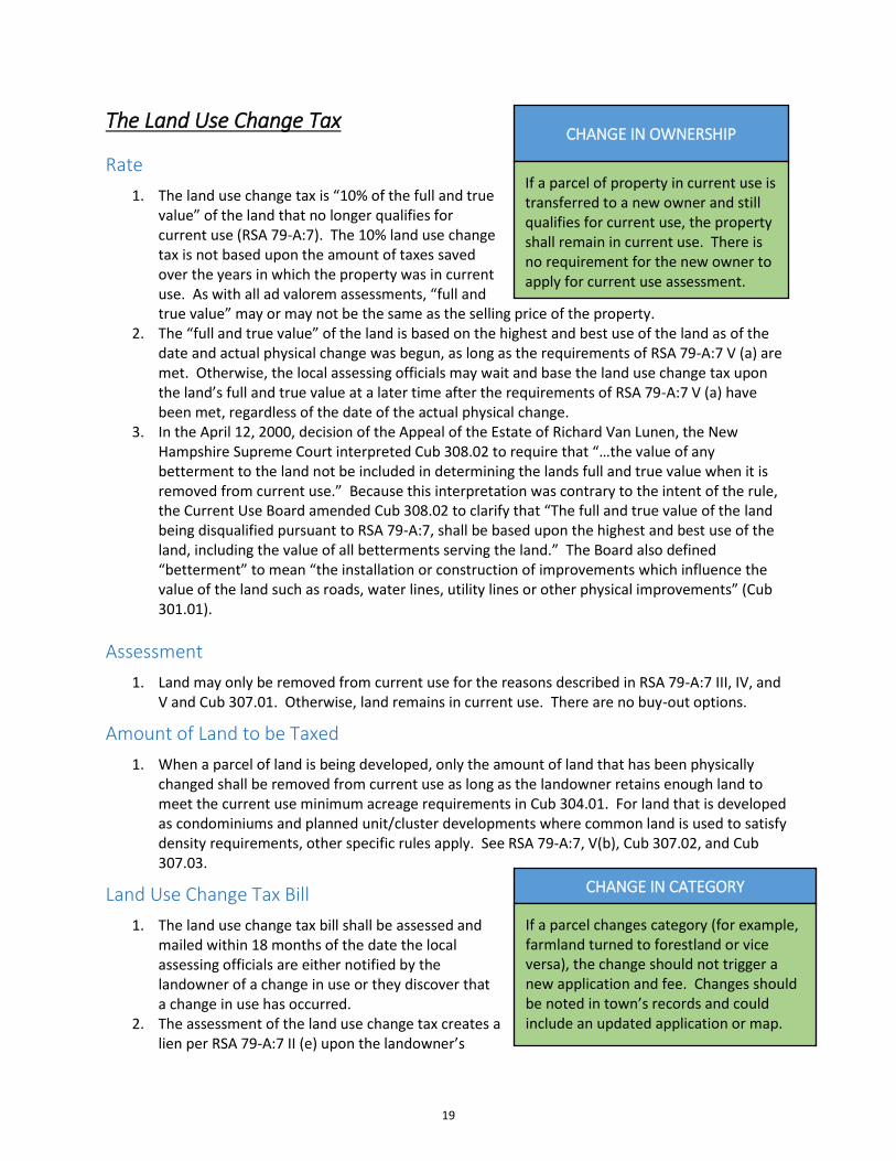
If a parcel of property in current use is transferred to a new owner and still qualifies for current use, the property shall remain in current use. There is no requirement for the new owner to apply for current use assessment.
CHANGE IN CATEGORY
If a parcel changes category (for example, farmland turned to forestland or vice versa), the change should not trigger a new application and fee. Changes should be noted in town’s records and could include an updated application or map.
19

property and is subject to statutory collection proceedings against real estate as prescribed in RSA 80. Therefore, it is imperative that the land use change tax be paid in full even if the landowner intends to request an abatement of the tax. The tax is due 30 days from the date the bill was mailed. Interest of 18% per annum shall be due on any tax not paid within the 30-day period.
3. Upon payment of the land use change tax, the bill is forwarded to the county registry of deeds for recording. This recording releases the contingent lien placed upon the property when the current use application was recorded. The landowner is responsible for the recording fee as prescribed by RSA 478:17-g in addition to the land use change tax.
4. Current use release forms shall be retained by the municipality permanently pursuant to RSA 33-A:XXIX.
Appeal Procedures
1. Any landowner who disagrees with the assessment of the land use change tax has the same rights of appeal as for real property taxes pursuant to RSA 76:16, 76:16-a, 76:16-d, II and 76:17. The landowner must apply in writing to the assessors within 2 months of the date of notice of the tax, for an abatement of the tax. If the assessors refuse or neglect to abate the tax, the landowner may apply for abatement to either, the Board of Tax and Land Appeals or to the County Superior Court. This appeal must be filed within 8 months of the tax.
2. Land use change tax abatement forms for appealing to the municipality or to the Board of Tax and Land Appeals are available from the BTLA at https://www.nh.gov/btla/forms/index.htm. For forms or further information concerning appeal of the Land Use Change Tax, contact the Department of Revenue Administration, Municipal and Property Division by mail at PO Box 487, Concord, NH 03302-0487, or by phone at (603)230-5950. Forms can also be obtained by visiting the website: www.revenue.nh.gov/forms.
RECOMMENDED PRACTICE FOR WRONG CLASSIFICATION
If a property was incorrectly classified, it is recommended that Form CU-18 be completed by either the municipal assessing officials or the landowner that discovered the change needed. Adjustments should be made to correct the map and make corrections to the assessment records. Unintentional errors by landowners or municipal assessing officials should not trigger land use change tax.
20