Embed Size (px)
Citation preview

Geography ~ Rivers 1
©Nadene of http://practicalpages.wordpress.com 08/2010
Cut and fold as accordion. Write your notes about the river’s course:
River’s Lower Course
River’s Middle Course
River’s Upper Course
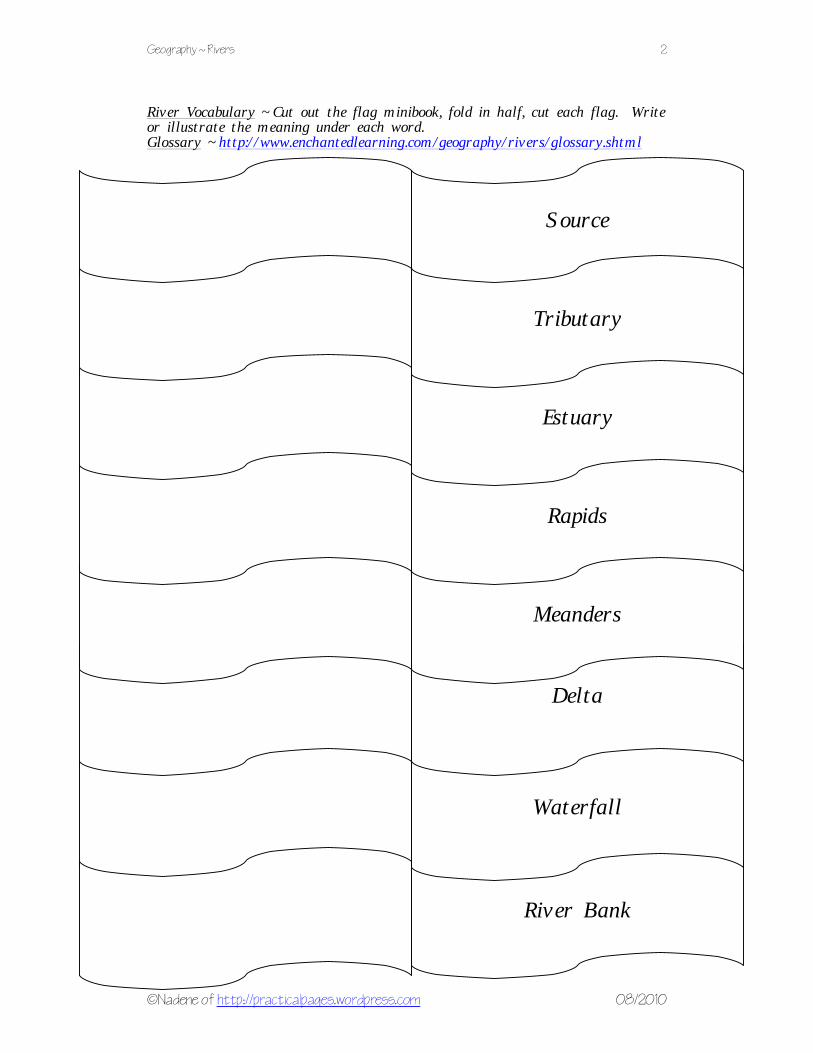
Geography ~ Rivers 2
©Nadene of http://practicalpages.wordpress.com 08/2010
River Vocabulary ~ Cut out the flag minibook, fold in half, cut each flag. Write or illustrate the meaning under each word. Glossary ~ http://www.enchantedlearning.com/geography/rivers/glossary.shtml
Delta
Source
River Bank
Waterfall
Meanders
Rapids
Estuary
Tributary
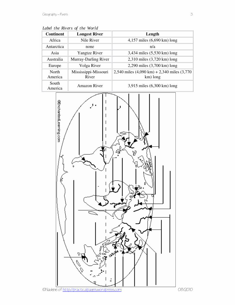
Geography ~ Rivers 3
©Nadene of http://practicalpages.wordpress.com 08/2010
Label the Rivers of the World
Continent Longest River Length
Africa Nile River 4,157 miles (6,690 km) long
Antarctica none n/a
Asia Yangtze River 3,434 miles (5,530 km) long
Australia Murray-Darling River 2,310 miles (3,720 km) long
Europe Volga River 2,290 miles (3,700 km) long
North
America
Mississippi-Missouri
River
2,540 miles (4,090 km) + 2,340 miles (3,770
km) long
South
America Amazon River 3,915 miles (6,300 km) long

Geography ~ Rivers 4
©Nadene of http://practicalpages.wordpress.com 08/2010
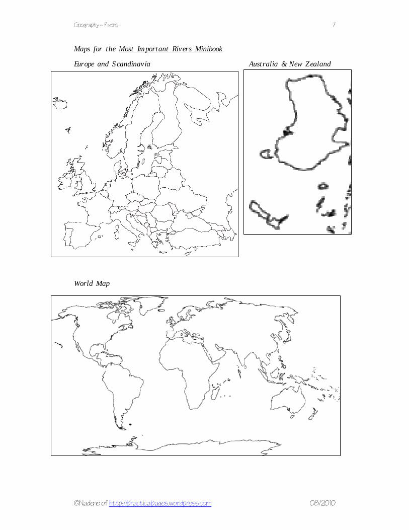
Country’s Country’s Country’s Country’s MMMMost Important Riversost Important Riversost Important Riversost Important Rivers You can make a river flap book for each part of the world, the world map or just your country. Paste an outline map of the country inside the flap minibook. Draw blue crayon lines to show where the rivers flow. On the outside of the flaps write the source, dams, lakes, rapids, waterfalls and estuaries of each major river.

Geography ~ Rivers 5
©Nadene of http://practicalpages.wordpress.com 08/2010
Maps for the Most Important Rivers Minibook Africa Southern Africa

Geography ~ Rivers 6
©Nadene of http://practicalpages.wordpress.com 08/2010
Maps for the Most Important Rivers Minibook Canada and Northern America Central and South America
Geography ~ Rivers 7
©Nadene of http://practicalpages.wordpress.com 08/2010
Maps for the Most Important Rivers Minibook Europe and Scandinavia Australia & New Zealand World Map
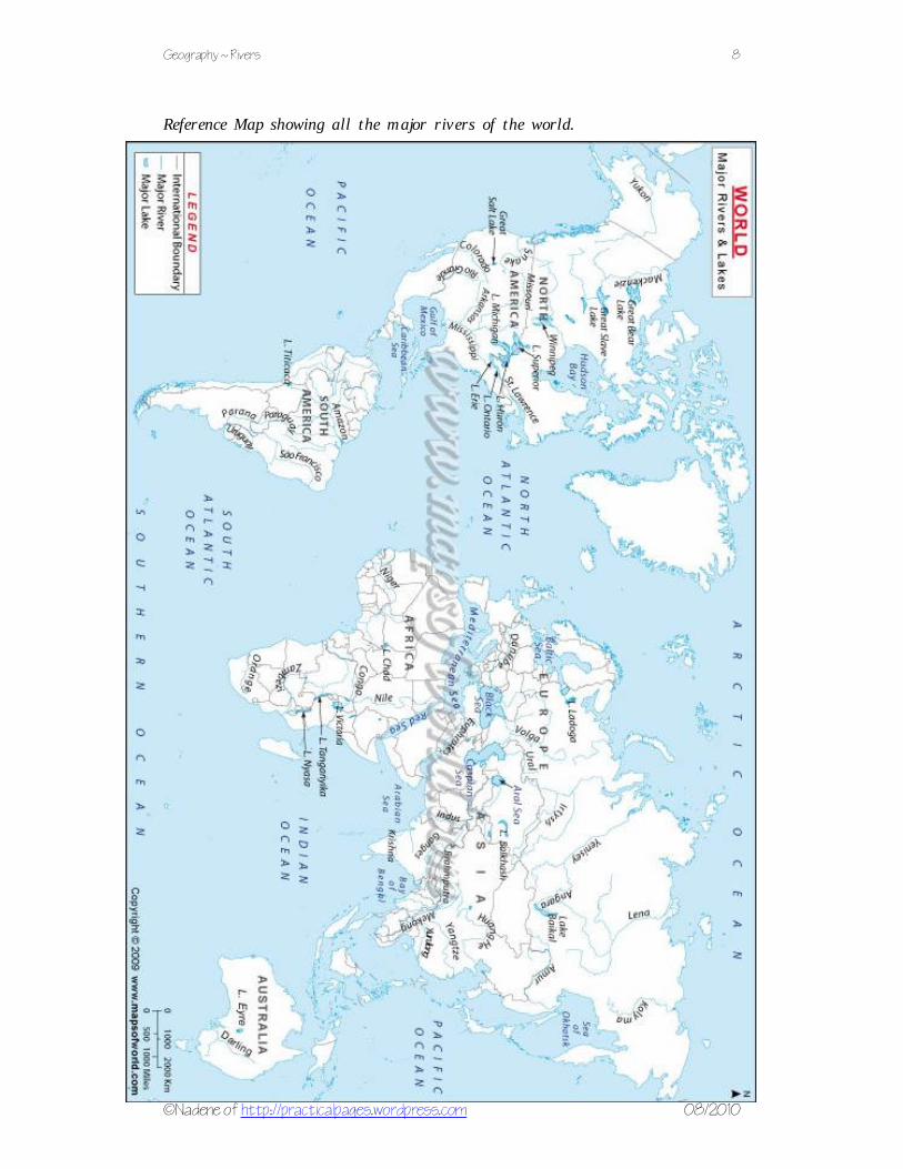
Geography ~ Rivers 8
©Nadene of http://practicalpages.wordpress.com 08/2010
Reference Map showing all the major rivers of the world.
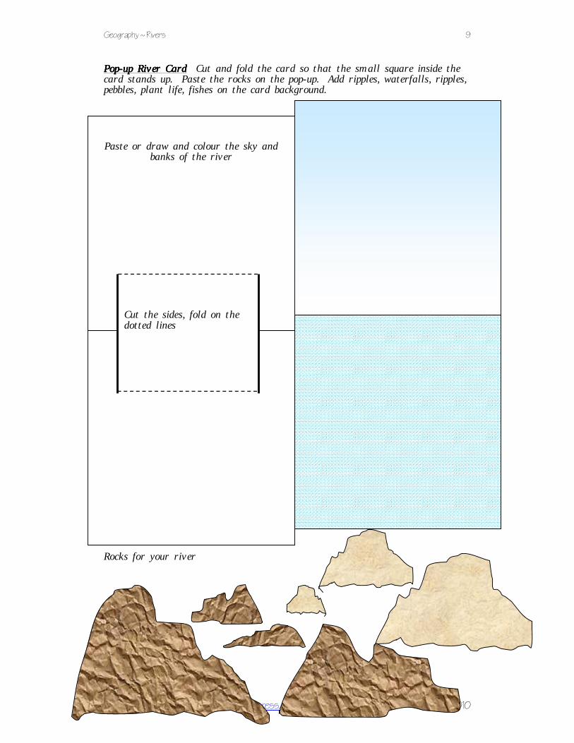
Geography ~ Rivers 9
©Nadene of http://practicalpages.wordpress.com 08/2010
PopPopPopPop----up River Cardup River Cardup River Cardup River Card Cut and fold the card so that the small square inside the card stands up. Paste the rocks on the pop-up. Add ripples, waterfalls, ripples, pebbles, plant life, fishes on the card background. Rocks for your river
Paste or draw and colour the sky and banks of the river
Cut the sides, fold on the dotted lines

Geography ~ Rivers 10
©Nadene of http://practicalpages.wordpress.com 08/2010
RiversRiversRiversRivers Date: ____________________
Geography ~ Rivers 11
©Nadene of http://practicalpages.wordpress.com 08/2010
RiversRiversRiversRivers Date: ____________________
Geography ~ Rivers 12
©Nadene of http://practicalpages.wordpress.com 08/2010
RiversRiversRiversRivers References: References: References: References:
Learn all about rivers at enchantedlearning.com
Label the rivers of the world
World river map
River Quiz
Glossary of river terminology